
Search Constraints
You searched for:
State/Province
Украинская ССР (Ukrainian Soviet Socialist Republic)
Remove constraint State/Province: Украинская ССР (Ukrainian Soviet Socialist Republic)
« Previous |
1 - 100 of 566
|
Next »
Search Results
-

- Description:
- 1926
- Subject:
- Geographic Subject: Balky, Topical Subject: Soviet Union, and Topical Subject: Maps
- Publisher:
- Генеральный штаб Красной Армии
- Language:
- Russian
- Date Created:
- 1941
- Identifier:
- VAC9619-001868
- Genre:
- Topographic Maps and Military Maps
- Geographic Location:
- Coordinates: 47.3333, 34.5, 47.6667, 35
- Related URL:
- Catalog URL: https://iucat.iu.edu/catalog/5020129 and Download GeoTIFF: https://drive.google.com/open?id=1V7PHm7Dg5ABV8yybrFeMKAmxM9f2EO27
- Abstract:
- Modern area represented: Balky, Zaporizhia oblast, Ukraine
- Call Number:
- G7000 s100 .S7 sheet L-36-22
- Caption:
- Для служебного пользования
- City:
- Балки (Balky)
- Copyright Holder:
- No Copyright - United States
- Country:
- СССР (USSR)
- State/Province:
- Украинская ССР (Ukrainian Soviet Socialist Republic)
- Physical Description:
- Scale: 1:100,000
- Persistent URL:
- http://purl.dlib.indiana.edu/iudl/images/VAC9619/VAC9619-001868
- Provenance:
- CIA Map Library
-
- Description:
- 1930
- Subject:
- Topical Subject: Maps, Geographic Subject: Novyy Buh, and Topical Subject: Soviet Union
- Publisher:
- Генеральный штаб Красной Армии
- Language:
- Russian
- Date Created:
- 1941
- Identifier:
- VAC9619-001863
- Genre:
- Military Maps and Topographic Maps
- Geographic Location:
- Coordinates: 47.6667, 32.5, 48, 33
- Related URL:
- Download GeoTIFF: https://drive.google.com/open?id=1T0wPHo0RpDwORrKZXGfpt1IyrZgBA6b4 and Catalog URL: https://iucat.iu.edu/catalog/5020129
- Abstract:
- Modern area represented: Novyy Buh, Mykolaiv, Ukraine
- Call Number:
- G7000 s100 .S7 sheet L-36-6
- Caption:
- Для служебного пользования
- City:
- Новый Буг (Novyy Buh)
- Copyright Holder:
- No Copyright - United States
- Country:
- СССР (USSR)
- State/Province:
- Украинская ССР (Ukrainian Soviet Socialist Republic)
- Physical Description:
- Scale: 1:100,000
- Persistent URL:
- http://purl.dlib.indiana.edu/iudl/images/VAC9619/VAC9619-001863
- Provenance:
- CIA Map Library
-
- Description:
- 1929
- Subject:
- Topical Subject: Soviet Union, Topical Subject: Maps, and Geographic Subject: Kuvechichi
- Publisher:
- Военно-топографическое управление
- Language:
- Russian
- Identifier:
- VAC9619-000920
- Genre:
- Military Maps and Topographic Maps
- Geographic Location:
- Coordinates: 51.5, 30.75, 51.666667, 31.0
- Related URL:
- Catalog URL: http://iucat.iu.edu/catalog/5020131 and Download GeoTIFF: https://drive.google.com/open?id=18vl201YR0RtrebxwBjWTwtKji74iJryK
- Abstract:
- Modern area represented: Kuvechichi, Chernihiv oblast, Ukraine
- Call Number:
- G7000 s50 .S68 М-36-14-Б
- Caption:
- Секретно,Для служебного пользования
- City:
- Кувечичи (Kuvechichi)
- Copyright Holder:
- No Copyright - United States
- Country:
- СССР (USSR)
- State/Province:
- Украинская ССР (Ukrainian Soviet Socialist Republic)
- Physical Description:
- Scale: 1:50,000
- Persistent URL:
- http://purl.dlib.indiana.edu/iudl/images/VAC9619/VAC9619-000920
- Provenance:
- DMA Topographic Center, Army Map Service Library, OMAHA, Library of Congress Geography & Map Division
-
- Description:
- 1921
- Subject:
- Topical Subject: Maps, Geographic Subject: Askania-Nova, and Topical Subject: Soviet Union
- Publisher:
- Генеральный штаб Красной Армии
- Language:
- Russian
- Date Created:
- 1941
- Identifier:
- VAC9619-001908
- Genre:
- Topographic Maps and Military Maps
- Geographic Location:
- Coordinates: 46.3333, 33.5, 46.6667, 34
- Related URL:
- Download GeoTIFF: https://drive.google.com/open?id=1X2zli5lz_FZwB19KYsJ72lmGfakR0GSR and Catalog URL: https://iucat.iu.edu/catalog/5020129
- Abstract:
- Modern area represented: Askania-Nova, Kherson oblast, Ukraine
- Call Number:
- G7000 s100 .S7 sheet L-36-56
- Caption:
- Для служебного пользования
- City:
- Аскания Нова (Askania-Nova)
- Copyright Holder:
- No Copyright - United States
- Country:
- СССР (USSR)
- State/Province:
- Запорожская область (Zaporizhia oblast), Украинская ССР (Ukrainian Soviet Socialist Republic), and Николаевская область (Mykolaiv oblast)
- Physical Description:
- Scale: 1:100,000
- Persistent URL:
- http://purl.dlib.indiana.edu/iudl/images/VAC9619/VAC9619-001908
- Provenance:
- CIA Map Library, Army Map Service Library
-
- Description:
- 1939
- Subject:
- Geographic Subject: Donetsk, Topical Subject: Soviet Union, Geographic Subject: Platonovka, and Topical Subject: Maps
- Publisher:
- Генеральный штаб Красной Армии
- Language:
- Russian
- Date Created:
- 1941
- Identifier:
- VAC9619-002002
- Genre:
- Topographic Maps and Military Maps
- Geographic Location:
- Coordinates: 47.3333, 37.5, 47.6667, 37.5
- Related URL:
- Catalog URL: https://iucat.iu.edu/catalog/5020129 and Download GeoTIFF: https://drive.google.com/open?id=1rcAVudLKQYH89ByRQ8FaN6st2evLxa46
- Abstract:
- Modern area represented: Платоновка (Platonovka), Donetsk, Ukraine
- Call Number:
- G7000 s100 .S7 sheet L-37-16
- Caption:
- Для cлужебного пользования
- City:
- Платоновка (Platonovka)
- Copyright Holder:
- No Copyright - United States
- Country:
- СССР (USSR)
- State/Province:
- Украинская ССР (Ukrainian Soviet Socialist Republic) and Сталинская область (Stalino oblast)
- Physical Description:
- Scale: 1:100,000
- Persistent URL:
- http://purl.dlib.indiana.edu/iudl/images/VAC9619/VAC9619-002002
- Provenance:
- Geographic Names Branch
-
- Description:
- 1929
- Subject:
- Geographic Subject: Moshny, Topical Subject: Soviet Union, and Topical Subject: Maps
- Publisher:
- Управление военных топографов
- Language:
- Russian
- Date Created:
- 1932
- Identifier:
- VAC9619-001027
- Genre:
- Military Maps and Topographic Maps
- Geographic Location:
- Coordinates: 49.5, 31.5, 49.6667, 31.75
- Related URL:
- Catalog URL: http://iucat.iu.edu/catalog/5020131 and Download GeoTIFF: https://drive.google.com/open?id=1YDdnSgfHB6iMpwwVJPx9zoDfBiEx-g7S
- Abstract:
- Modern area represented: Мошни (Moshny), Cherkasy oblast, Ukraine
- Call Number:
- G7000 s50 .S68 sheet M-36-88-A
- Caption:
- Рассекречено and Не подлежит оглашению
- City:
- Мошны (Moshny)
- Copyright Holder:
- No Copyright - United States
- Country:
- СССР (USSR)
- State/Province:
- Украинская ССР (Ukrainian Soviet Socialist Republic)
- Physical Description:
- Scale: 1:50,000
- Persistent URL:
- http://purl.dlib.indiana.edu/iudl/images/VAC9619/VAC9619-001027
- Provenance:
- M. I. Map Library, Library of Congress Geography & Map Division
-
- Description:
- 1928
- Subject:
- Geographic Subject: Kairy, Topical Subject: Maps, and Topical Subject: Soviet Union
- Publisher:
- Генеральный штаб Красной Армии
- Language:
- Russian
- Date Created:
- 1941
- Identifier:
- VAC9619-001889
- Genre:
- Topographic Maps and Military Maps
- Geographic Location:
- Coordinates: 46.6667, 33.5, 47, 34
- Related URL:
- Catalog URL: https://iucat.iu.edu/catalog/5020129 and Download GeoTIFF: https://drive.google.com/file/d/1osSsR-E4nP09v5-wiUbmEixGdIeS0X75/view?usp=sharing
- Abstract:
- Modern area represented: Kayiry, Kherson oblast, Ukraine
- Call Number:
- G7000 s100 .S7 sheet L-36-44
- Caption:
- Для служебного пользования
- City:
- Западные Каиры (Zapadnye Kairy)
- Copyright Holder:
- No Copyright - United States
- Country:
- СССР (USSR)
- State/Province:
- Николаевская область (Mykolaiv oblast) and Украинская ССР (Ukrainian Soviet Socialist Republic)
- Physical Description:
- Scale: 1:100,000
- Persistent URL:
- http://purl.dlib.indiana.edu/iudl/images/VAC9619/VAC9619-001889
- Provenance:
- CIA Map Library, Atlasblatt
-
- Description:
- 1939
- Subject:
- Geographic Subject: Бугове (Buhove), Topical Subject: Soviet Union, and Topical Subject: Maps
- Publisher:
- Геологическое управление УССР
- Language:
- Russian
- Identifier:
- VAC9619-000893
- Genre:
- Topographic Maps and Military Maps
- Geographic Location:
- Coordinates: 48.1667, 29.75, 48.3333, 30
- Related URL:
- Download GeoTIFF: https://drive.google.com/open?id=1QFgfODqrkNeA2pXdlkziZ6Cfew_LYlfj and Catalog URL: http://iucat.iu.edu/catalog/5020131
- Abstract:
- Modern area represented: Бугове (Buhove), former Юзефполь (Yuzefpol'), Kirovohrad Oblast, Ukraine
- Call Number:
- G7000 s50 .S68 sheet M-35-144-B
- Caption:
- Для служебного пользования
- Copyright Holder:
- No Copyright - United States
- Country:
- СССР (USSR)
- State/Province:
- Винницкая область (Vinnytsia oblast), Песчанский район (Peschansky district), Одесская область (Odessa oblast), Бершадский район (Bershadsky district), Молда...
- Physical Description:
- Scale: 1:50,000
- Persistent URL:
- http://purl.dlib.indiana.edu/iudl/images/VAC9619/VAC9619-000893
- Provenance:
- CIA Map Library
-
- Subject:
- Topical Subject: Maps, Topical Subject: Soviet Union, and Geographic Subject: Pavoloch
- Publisher:
- Управление военных топографов
- Language:
- Russian
- Identifier:
- VAC9619-000848
- Genre:
- Military Maps and Topographic Maps
- Geographic Location:
- Coordinates: 49.8333, 29.25, 50, 29.5
- Related URL:
- Download GeoTIFF: https://drive.google.com/open?id=1rClY9QwrPg534wZKiLiyAW-wSoq55sEd and Catalog URL: http://iucat.iu.edu/catalog/5020131
- Abstract:
- Modern area represented: Pavoloch, Zhytomyr oblast, Ukraine
- Call Number:
- G7000 s50 .S68 sheet M-35-83-B
- Caption:
- Не подлежит оглашению
- City:
- Паволочь (Pavoloch)
- Copyright Holder:
- No Copyright - United States
- Country:
- СССР (USSR)
- State/Province:
- Украинская ССР (Ukrainian Soviet Socialist Republic) and Киевская область (Kyiv oblast)
- Physical Description:
- Scale: 1:50,000
- Persistent URL:
- http://purl.dlib.indiana.edu/iudl/images/VAC9619/VAC9619-000848
- Provenance:
- CIA Map Branch -- Received
-
- Description:
- 1928
- Subject:
- Topical Subject: Maps, Geographic Subject: Odessa, and Topical Subject: Soviet Union
- Publisher:
- Генеральный штаб РККА
- Language:
- Russian
- Date Created:
- 1930
- Identifier:
- VAC9619-001903
- Genre:
- Topographic Maps and Military Maps
- Geographic Location:
- Coordinates: 46.3333, 30.5, 46.6667, 31
- Related URL:
- Download GeoTIFF: https://drive.google.com/open?id=1gLL-JxmNGbuz-u1gNxeqgZ8NbWRxc8g2 and Catalog URL: https://iucat.iu.edu/catalog/5020129
- Abstract:
- Modern area represented: Odessa, Odessa oblast, Ukraine
- Call Number:
- G7000 s100 .S7 sheet L-36-50
- Caption:
- Не подлежит оглашению
- City:
- Одесса (Odessa)
- Copyright Holder:
- No Copyright - United States
- Country:
- СССР (USSR)
- State/Province:
- Одесская область (Odessa oblast) and Украинская ССР (Ukrainian Soviet Socialist Republic)
- Physical Description:
- Scale: 1:100,000
- Persistent URL:
- http://purl.dlib.indiana.edu/iudl/images/VAC9619/VAC9619-001903
- Provenance:
- CIA Map Library
-
- Subject:
- Geographic Subject: Рудківці (Rudkivtsi), Topical Subject: Soviet Union, and Topical Subject: Maps
- Publisher:
- Управление военных топографов РККА
- Language:
- Russian
- Identifier:
- VAC9619-000884
- Genre:
- Topographic Maps and Military Maps
- Geographic Location:
- Coordinates: 48.5, 27.25, 48.6667, 27.5
- Related URL:
- Download GeoTIFF: https://drive.google.com/open?id=1WiFQHZLNIdmuyAdOYqXPFxWqaP2WSMB9 and Catalog URL: http://iucat.iu.edu/catalog/5020131
- Abstract:
- Modern area represented: the place was flooded by the Dniester Reservoir due to the construction of the Dniester Hydroelectric Power Plant. The nearest popul...
- Call Number:
- G7000 s50 .S68 sheet M-35-127-B
- Caption:
- Не подлежит оглашению
- City:
- Калюс (Kalyus)
- Copyright Holder:
- No Copyright - United States
- Country:
- СССР (USSR)
- State/Province:
- Украинская ССР (Ukrainian Soviet Socialist Republic), Бессарабия (Bessarabia), and Винницкая область (Vinnytsia oblast)
- Physical Description:
- Scale: 1:50,000
- Persistent URL:
- http://purl.dlib.indiana.edu/iudl/images/VAC9619/VAC9619-000884
- Provenance:
- M. I. Map Library, CIA Map Library, Library of Congress Geography & Map Division
-
- Description:
- 1933
- Subject:
- Geographic Subject: Hromivka, Topical Subject: Soviet Union, and Topical Subject: Maps
- Publisher:
- Генеральный штаб Красной Армии
- Language:
- Russian
- Date Created:
- 1941
- Identifier:
- VAC9619-001923
- Genre:
- Topographic Maps and Military Maps
- Geographic Location:
- Coordinates: 46, 34, 46.3333, 34.5
- Related URL:
- Download GeoTIFF: https://drive.google.com/open?id=1sOMPSRT5vHzGSJy5FqPqnkWmkwqYR5YH and Catalog URL: https://iucat.iu.edu/catalog/5020129
- Abstract:
- Modern area represented: Hromivka, Kherson oblast, Ukraine
- Call Number:
- G7000 s100 .S7 sheet L-36-69
- Caption:
- Для служебного пользования
- City:
- Громовка (Gromovka)
- Copyright Holder:
- No Copyright - United States
- Country:
- СССР (USSR)
- State/Province:
- Украинская ССР (Ukrainian Soviet Socialist Republic), Крымская АССР (Crimean Autonomous Soviet Socialist Republic), Запорожская область (Zaporizhia oblast), ...
- Physical Description:
- Scale: 1:100,000
- Persistent URL:
- http://purl.dlib.indiana.edu/iudl/images/VAC9619/VAC9619-001923
- Provenance:
- CIA Map Library
-
- Subject:
- Topical Subject: Maps, Geographic Subject: Камянець-Подільський (Kamianets-Podilskyi), and Topical Subject: Soviet Union
- Publisher:
- Управление военных топографов
- Language:
- Russian
- Identifier:
- VAC9619-000878
- Genre:
- Military Maps and Topographic Maps
- Geographic Location:
- Coordinates: 48.6667, 26.5, 48.8333, 26.75
- Related URL:
- Download GeoTIFF: https://drive.google.com/open?id=1d9zmDF1aOMAqfbDt_Z1j4-1yPA9Wetkx and Catalog URL: http://iucat.iu.edu/catalog/5020131
- Abstract:
- Modern area represented: Камянець-Подільський (Kamianets-Podilskyi), Khmelnytskyi Oblast, Ukraine
- Call Number:
- G7000 s50 .S68 sheet M-35-114-C
- Caption:
- Не подлежит оглашению
- City:
- Каменец-Подольск (Kamenets-Podol’sk)
- Copyright Holder:
- No Copyright - United States
- Country:
- СССР (USSR)
- State/Province:
- Украинская ССР (Ukrainian Soviet Socialist Republic) and Винницкая область (Vinnytsia oblast)
- Physical Description:
- Scale: 1:50,000
- Persistent URL:
- http://purl.dlib.indiana.edu/iudl/images/VAC9619/VAC9619-000878
- Provenance:
- CIA Map Branch -- Received
-
- Description:
- 1927
- Subject:
- Geographic Subject: Hvozdavka Druha, Topical Subject: Maps, Geographic Subject: Hvozdavka Persha, and Topical Subject: Soviet Union
- Publisher:
- Управление военных топографов
- Language:
- Russian
- Identifier:
- VAC9619-000118
- Genre:
- Military Maps and Topographic Maps
- Geographic Location:
- Coordinates: 47.8333, 30, 48, 30.25
- Related URL:
- Download GeoTIFF: https://drive.google.com/open?id=1SO72YG1VGyq5w1BQaBhlf1XJy0bjJxuu and Catalog URL: http://iucat.iu.edu/catalog/5020131
- Abstract:
- Modern area represented: Hvozdavka Persha and Hvozdavka Druha, Odessa oblast, Ukraine
- Call Number:
- G7000 s50 .S68 sheet L-36-1-A
- Caption:
- Не подлежит оглашению
- City:
- Гвоздавка (Gvozdavka)
- Copyright Holder:
- No Copyright - United States
- Country:
- СССР (USSR)
- State/Province:
- Одесская область (Odessa oblast) and Украинская ССР (Ukrainian Soviet Socialist Republic)
- Physical Description:
- Scale: 1:50,000
- Persistent URL:
- http://purl.dlib.indiana.edu/iudl/images/VAC9619/VAC9619-000118
- Provenance:
- M. I. Map Library, G000-30, GS, RA, Atlasblatt
-
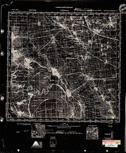
- Description:
- 1926
- Subject:
- Topical Subject: Soviet Union, Topical Subject: Maps, and Geographic Subject: Apostolove
- Publisher:
- Генеральный штаб Красной Армии
- Language:
- Russian
- Date Created:
- 1941
- Identifier:
- VAC9619-001866
- Genre:
- Military Maps and Topographic Maps
- Geographic Location:
- Coordinates: 47.3333, 33.5, 47.6667, 34
- Related URL:
- Catalog URL: https://iucat.iu.edu/catalog/5020129 and Download GeoTIFF: https://drive.google.com/file/d/19vU-7kd0gBkHRSMRDc-_C2Jsbp5EDO89/view?usp=sharing
- Abstract:
- Modern area represented: Apostolove, Dnipropetrovsk oblast, Ukraine
- Call Number:
- G7000 s100 .S7 sheet L-36-20
- Caption:
- Для служебного пользования
- City:
- Апостолово (Apostolovo)
- Copyright Holder:
- No Copyright - United States
- Country:
- СССР (USSR)
- State/Province:
- Украинская ССР (Ukrainian Soviet Socialist Republic)
- Physical Description:
- Scale: 1:100,000
- Persistent URL:
- http://purl.dlib.indiana.edu/iudl/images/VAC9619/VAC9619-001866
- Provenance:
- CIA Map Library, Atlasblatt
-
- Description:
- 1903
- Subject:
- Geographic Subject: Dzhankoi, Topical Subject: Soviet Union, and Topical Subject: Maps
- Publisher:
- Генеральный штаб Красной Армии
- Language:
- Russian
- Date Created:
- 1941
- Identifier:
- VAC9619-001943
- Genre:
- Topographic Maps and Military Maps
- Geographic Location:
- Coordinates: 45.6667, 34, 46, 34.5
- Related URL:
- Download GeoTIFF: https://drive.google.com/open?id=1Uezem1DTHm_K_ar57W6lultAdVkJlsj1 and Catalog URL: https://iucat.iu.edu/catalog/5020129
- Abstract:
- Modern area represented: Dzhankoi, Republic of Crimea, Ukraine
- Call Number:
- G7000 s100 .S7 sheet L-36-81
- Caption:
- Для cлужебного пользования
- City:
- Джанкой (Dzhankoi)
- Copyright Holder:
- No Copyright - United States
- Country:
- СССР (USSR)
- State/Province:
- Крымская АССР (Crimean Autonomous Soviet Socialist Republic), РСФСР (RSFSR), and Украинская ССР (Ukrainian Soviet Socialist Republic)
- Physical Description:
- Scale: 1:100,000
- Persistent URL:
- http://purl.dlib.indiana.edu/iudl/images/VAC9619/VAC9619-001943
- Provenance:
- G000-30
-
- Description:
- 1921
- Subject:
- Geographic Subject: Svobodnyy Port, Topical Subject: Maps, and Topical Subject: Soviet Union
- Publisher:
- Генеральный штаб Красной Армии
- Language:
- Russian
- Date Created:
- 1941
- Identifier:
- VAC9619-001917
- Genre:
- Military Maps and Topographic Maps
- Geographic Location:
- Coordinates: 46, 31.5, 46.3333, 32
- Related URL:
- Download GeoTIFF: https://drive.google.com/open?id=1Sb_dGRMg0HfrO5ItVnTYcnwkLVx7criG and Catalog URL: https://iucat.iu.edu/catalog/5020129
- Abstract:
- Modern area represented: Svobodnyy Port, Kherson oblast, Ukraine
- Call Number:
- G7000 s100 .S7 sheet L-36-64
- Caption:
- Для служебного пользования
- City:
- Свободный Порт (Svobodnyy Port)
- Copyright Holder:
- No Copyright - United States
- Country:
- СССР (USSR)
- State/Province:
- Украинская ССР (Ukrainian Soviet Socialist Republic)
- Physical Description:
- Scale: 1:100,000
- Persistent URL:
- http://purl.dlib.indiana.edu/iudl/images/VAC9619/VAC9619-001917
- Provenance:
- CIA Map Library
-
- Description:
- 1921
- Subject:
- Topical Subject: Maps, Topical Subject: Soviet Union, and Geographic Subject: Dolmativka
- Publisher:
- Генеральный штаб Красной Армии
- Language:
- Russian
- Date Created:
- 1941
- Identifier:
- VAC9619-001918
- Genre:
- Topographic Maps and Military Maps
- Geographic Location:
- Coordinates: 46, 32, 46.3333, 32.5
- Related URL:
- Download GeoTIFF: https://drive.google.com/open?id=1Sq-sWBnP30l2i0xJ6VXjO7JpXmW85bcn and Catalog URL: https://iucat.iu.edu/catalog/5020129
- Abstract:
- Modern area represented: Dolmativka, Kherson oblast, Ukraine
- Call Number:
- G7000 s100 .S7 sheet L-36-65
- Caption:
- Для служебного пользования
- City:
- Долматовка (Dolmativka)
- Copyright Holder:
- No Copyright - United States
- Country:
- СССР (USSR)
- State/Province:
- Украинская ССР (Ukrainian Soviet Socialist Republic)
- Physical Description:
- Scale: 1:100,000
- Persistent URL:
- http://purl.dlib.indiana.edu/iudl/images/VAC9619/VAC9619-001918
- Provenance:
- CIA Map Library, Library of Congress Geography & Map Division
-
- Description:
- 1929
- Subject:
- Topical Subject: Maps, Geographic Subject: Rus'ka Polyana, and Topical Subject: Soviet Union
- Publisher:
- Военно-топографическое управление
- Language:
- Russian
- Identifier:
- VAC9619-001030
- Genre:
- Topographic Maps and Military Maps
- Geographic Location:
- Coordinates: 49.3333, 31.75, 49.5, 32
- Related URL:
- Catalog URL: http://iucat.iu.edu/catalog/5020131 and Download GeoTIFF: https://drive.google.com/open?id=108WMIp9ytlRzYQrRA6s08SRq3Vc1FLc4
- Abstract:
- Modern area represented: Руська Поляна (Rus'ka Polyana), Cherkasy oblast, Ukraine
- Call Number:
- G7000 s50 .S68 sheet M-36-88-D
- Caption:
- Секретно (crossed out) and Рассекречено
- City:
- Русская Поляна (Russkaya Polyana)
- Copyright Holder:
- No Copyright - United States
- Country:
- СССР (USSR)
- State/Province:
- Шевченковский округ (Shevchenko district) and Украинская ССР (Ukrainian Soviet Socialist Republic)
- Physical Description:
- Scale: 1:50,000
- Persistent URL:
- http://purl.dlib.indiana.edu/iudl/images/VAC9619/VAC9619-001030
- Provenance:
- CIA Map Branch -- Received
-
- Description:
- 1932
- Subject:
- Geographic Subject: Mykhaylivka, Topical Subject: Maps, and Topical Subject: Soviet Union
- Publisher:
- Управление военных топографов
- Language:
- Russian
- Identifier:
- VAC9619-000214
- Genre:
- Military Maps and Topographic Maps
- Geographic Location:
- Coordinates: 51, 28.5, 51.167, 28.75
- Related URL:
- Catalog URL: http://iucat.iu.edu/catalog/5020131 and Download GeoTIFF: https://drive.google.com/open?id=1cMFudbbQW6FGbl0T2Tc0MBTovoarSPSG
- Abstract:
- Modern area represented: Mykhaylivka, Zhytomyr oblast, Ukraine
- Call Number:
- G7000 s50 .S68 sheet M-35-34-C
- Caption:
- Не подлежит оглашению
- City:
- Михайловка (Mikhaylovka)
- Copyright Holder:
- No Copyright - United States
- Country:
- СССР (USSR)
- State/Province:
- Украинская ССР (Ukrainian Soviet Socialist Republic) and Киевская область (Kyiv oblast)
- Physical Description:
- Scale: 1:50,000
- Persistent URL:
- http://purl.dlib.indiana.edu/iudl/images/VAC9619/VAC9619-000214
- Provenance:
- M. I. Map Library, G000-30, GS, RA, Atlasblatt
-
- Description:
- 1911
- Subject:
- Topical Subject: Maps, Topical Subject: Soviet Union, and Geographic Subject: Бабчинці (Babchyntsi)
- Publisher:
- Управление военных топографов
- Language:
- Russian
- Identifier:
- VAC9619-000890
- Genre:
- Military Maps and Topographic Maps
- Geographic Location:
- Coordinates: 48.3333, 28, 48.5, 28.25
- Related URL:
- Download GeoTIFF: https://drive.google.com/open?id=19RSOubtjQ7S45xpYEkG8stHLKAO50TEe and Catalog URL: http://iucat.iu.edu/catalog/5020131
- Abstract:
- Modern area represented: Бабчинці (Babchyntsi), Vinnytsia Oblast, Ukraine
- Call Number:
- G7000 s50 .S68 sheet M-35-129-C
- Caption:
- Не подлежит оглашению
- City:
- Бабчинцы (Babchintsy)
- Copyright Holder:
- No Copyright - United States
- Country:
- СССР (USSR)
- State/Province:
- Винницкая область (Vinnytsia oblast) and Украинская ССР (Ukrainian Soviet Socialist Republic)
- Physical Description:
- Scale: 1:50,000
- Persistent URL:
- http://purl.dlib.indiana.edu/iudl/images/VAC9619/VAC9619-000890
- Provenance:
- M. I. Map Library, Library of Congress Geography & Map Division
-
- Description:
- 1910
- Subject:
- Geographic Subject: Snovydovychi, Topical Subject: Soviet Union, and Topical Subject: Maps
- Publisher:
- Управление военных топографов
- Language:
- Russian
- Identifier:
- VAC9619-000212
- Genre:
- Topographic Maps and Military Maps
- Geographic Location:
- Coordinates: 51.167, 27.25, 51.333, 27.5
- Related URL:
- Catalog URL: http://iucat.iu.edu/catalog/5020131 and Download GeoTIFF: https://drive.google.com/open?id=119iC6vnRf3MNfTmkdpSaKFieKrg6AoF-
- Abstract:
- Modern area represented: Snovydovychi, Rivne oblast, Ukraine
- Call Number:
- G7000 s50 .S68 sheet M-35-31-B
- Caption:
- Не подлежит оглашению
- City:
- Сновидовичэ (Snovidoviche)
- Copyright Holder:
- No Copyright - United States
- Country:
- Польша (Poland) and СССР (USSR)
- State/Province:
- Киевская область (Kyiv oblast) and Украинская ССР (Ukrainian Soviet Socialist Republic)
- Physical Description:
- Scale: 1:50,000
- Persistent URL:
- http://purl.dlib.indiana.edu/iudl/images/VAC9619/VAC9619-000212
- Provenance:
- G000-30, GS, RA
-
- Description:
- 1933
- Subject:
- Topical Subject: Maps, Geographic Subject: Nyzhni Sirohozy, and Topical Subject: Soviet Union
- Publisher:
- Генеральный штаб Красной Армии
- Language:
- Russian
- Date Created:
- 1941
- Identifier:
- VAC9619-001890
- Genre:
- Topographic Maps and Military Maps
- Geographic Location:
- Coordinates: 46.6667, 34, 47, 34.5
- Related URL:
- Download GeoTIFF: https://drive.google.com/open?id=1Z449zsz78QYAyHVx2ON5W62vEmhcjUFK and Catalog URL: https://iucat.iu.edu/catalog/5020129
- Abstract:
- Modern area represented: Nyzhni Sirohozy, Kherson oblast, Ukraine
- Call Number:
- G7000 s100 .S7 sheet L-36-45
- Caption:
- Для служебного пользования
- City:
- Ниж. Серогозы (Nyzhni Sirohozy)
- Copyright Holder:
- No Copyright - United States
- Country:
- СССР (USSR)
- State/Province:
- Запорожская область (Zaporizhia oblast), Николаевская область (Mykolaiv oblast), and Украинская ССР (Ukrainian Soviet Socialist Republic)
- Physical Description:
- Scale: 1:100,000
- Persistent URL:
- http://purl.dlib.indiana.edu/iudl/images/VAC9619/VAC9619-001890
- Provenance:
- CIA Map Library, Atlasblatt, Heeresplankammer Gruppe Archive Auslandskartenarchiv
-
- Description:
- 1934
- Subject:
- Topical Subject: Maps, Topical Subject: Soviet Union, and Geographic Subject: Ivanivka
- Publisher:
- Генеральный штаб Красной Армии
- Language:
- Russian
- Date Created:
- 1941
- Identifier:
- VAC9619-001891
- Genre:
- Topographic Maps and Military Maps
- Geographic Location:
- Coordinates: 46.6667, 34.5, 47, 35
- Related URL:
- Download GeoTIFF: https://drive.google.com/open?id=14Er3699FOVffHRqDS10Xc_-qDDv9uQcf and Catalog URL: https://iucat.iu.edu/catalog/5020129
- Abstract:
- Modern area represented: Ivanivka, Zaporizhia oblast, Ukraine
- Call Number:
- G7000 s100 .S7 sheet L-36-46
- Caption:
- Для служебного пользования
- City:
- Ивановка (Ivanivka)
- Copyright Holder:
- No Copyright - United States
- Country:
- СССР (USSR)
- State/Province:
- Украинская ССР (Ukrainian Soviet Socialist Republic) and Запорожская область (Zaporizhia oblast)
- Physical Description:
- Scale: 1:100,000
- Persistent URL:
- http://purl.dlib.indiana.edu/iudl/images/VAC9619/VAC9619-001891
- Provenance:
- CIA Map Library
-
- Subject:
- Geographic Subject: Мар'янське (Maryanske), Topical Subject: Maps, and Topical Subject: Soviet Union
- Publisher:
- Управление военных топографов
- Language:
- Russian
- Identifier:
- VAC9619-000690
- Genre:
- Topographic Maps and Military Maps
- Geographic Location:
- Coordinates: 47.5, 33.75, 47.6667, 34
- Related URL:
- Download GeoTIFF: https://drive.google.com/open?id=1iR_LYVqkEr5q39HLAwAWrkQc9tSHzQd1 and Catalog URL: http://iucat.iu.edu/catalog/5020131
- Abstract:
- Modern area represented: Maryanske, Dnipropetrovsk oblast, Ukraine
- Call Number:
- G7000 s50 .S68 sheet L-36-20-B
- Caption:
- Не подлежит оглашению
- City:
- Марьинское (Marinskoye)
- Copyright Holder:
- No Copyright - United States
- Country:
- СССР (USSR)
- State/Province:
- Украинская ССР (Ukrainian Soviet Socialist Republic)
- Physical Description:
- Scale: 1:50,000
- Persistent URL:
- http://purl.dlib.indiana.edu/iudl/images/VAC9619/VAC9619-000690
-
- Description:
- 1875
- Subject:
- Topical Subject: Soviet Union, Geographic Subject: Drohobych, and Topical Subject: Maps
- Publisher:
- Генеральный штаб Красной Армии
- Language:
- Russian
- Date Created:
- 1940
- Identifier:
- VAC9619-003027
- Genre:
- Military Maps and Topographic Maps
- Geographic Location:
- Coordinates: 49.333, 23.5, 49.667, 24
- Related URL:
- Catalog URL: https://iucat.iu.edu/catalog/5020129 and Download GeoTIFF: https://drive.google.com/file/d/10E4Z3oRj75pa2_d4MwidMWMnRE09xm2x/view?usp=sharing
- Abstract:
- Modern area represented: Drohobych, Lviv oblast, Ukraine
- Call Number:
- G7000 s100 .S7 sheet M-34-96
- City:
- Дрогобыч (Drohobych)
- Copyright Holder:
- No Copyright - United States
- Country:
- СССР (USSR)
- State/Province:
- Украинская ССР (Ukrainian Soviet Socialist Republic), Дрогобычская область (Drohobych oblast), and Львовская область (Lviv oblast)
- Physical Description:
- Scale: 1:100,000
- Persistent URL:
- http://purl.dlib.indiana.edu/iudl/images/VAC9619/VAC9619-003027
- Provenance:
- CIA Map Library
-
- Description:
- 1927
- Subject:
- Topical Subject: Maps, Geographic Subject: Andreyevka, and Topical Subject: Soviet Union
- Publisher:
- Генеральный штаб Красной Армии
- Language:
- Russian
- Date Created:
- 1941
- Identifier:
- VAC9619-002283
- Genre:
- Topographic Maps and Military Maps
- Geographic Location:
- Coordinates: 47, 36.5, 47.3333, 37
- Related URL:
- Download GeoTIFF: https://drive.google.com/file/d/1UF1XjcNneuyF1a5XhDK--2BjtXxrLfsl/view?usp=sharing and Catalog URL: https://iucat.iu.edu/catalog/5020129
- Abstract:
- Modern area represented: Andreyevka, Zaporizhia oblast, Ukraine
- Call Number:
- G7000 s100 .S7 sheet L-37-26
- Caption:
- Для служебного пользования
- City:
- Андреевка (Andreyevka)
- Copyright Holder:
- No Copyright - United States
- Country:
- СССР (USSR)
- State/Province:
- Украинская ССР (Ukrainian Soviet Socialist Republic)
- Physical Description:
- Scale: 1:100,000
- Persistent URL:
- http://purl.dlib.indiana.edu/iudl/images/VAC9619/VAC9619-002283
- Provenance:
- CIA Map Library
-
- Subject:
- Geographic Subject: Ivanopil, Topical Subject: Soviet Union, and Topical Subject: Maps
- Publisher:
- Управление военных топографов
- Language:
- Russian
- Identifier:
- VAC9619-000839
- Genre:
- Military Maps and Topographic Maps
- Geographic Location:
- Coordinates: 49.833, 28, 50, 28.25
- Related URL:
- Download GeoTIFF: https://drive.google.com/open?id=1CiMk3HAazIA-AFJoqSslEVrKJky-eByi and Catalog URL: http://iucat.iu.edu/catalog/5020131
- Abstract:
- Modern area represented: Ivanopil, Zhytomyr oblast, Ukraine
- Call Number:
- G7000 s50 .S68 sheet M-35-81-A
- Caption:
- Не подлежит оглашению
- City:
- Янушпиль (Yanushpil)
- Copyright Holder:
- No Copyright - United States
- Country:
- СССР (USSR)
- State/Province:
- Украинская ССР (Ukrainian Soviet Socialist Republic) and Винницкая область (Vinnytsia oblast)
- Physical Description:
- Scale: 1:50,000
- Persistent URL:
- http://purl.dlib.indiana.edu/iudl/images/VAC9619/VAC9619-000839
- Provenance:
- M. I. Map Library, G000-30, GS, RA
-
- Description:
- 1928
- Subject:
- Geographic Subject: Voznesensk, Topical Subject: Maps, and Topical Subject: Soviet Union
- Publisher:
- Генеральный штаб Красной Армии
- Language:
- Russian
- Date Created:
- 1941
- Identifier:
- VAC9619-001853
- Genre:
- Topographic Maps and Military Maps
- Geographic Location:
- Coordinates: 47.3333, 31, 47.6667, 31.5
- Related URL:
- Catalog URL: https://iucat.iu.edu/catalog/5020129 and Download GeoTIFF: https://drive.google.com/open?id=1bR3CKUW57AtZTkAsFZhGcwe6LzRifVDw
- Abstract:
- Modern area represented: Voznesensk, Mykolaiv oblast, Ukraine
- Call Number:
- G7000 s100 .S7 sheet L-36-15
- Caption:
- Для служебного пользования
- City:
- Вознесенск (Voznesensk)
- Copyright Holder:
- No Copyright - United States
- Country:
- СССР (USSR)
- State/Province:
- Украинская ССР (Ukrainian Soviet Socialist Republic)
- Physical Description:
- Scale: 1:100,000
- Persistent URL:
- http://purl.dlib.indiana.edu/iudl/images/VAC9619/VAC9619-001853
- Provenance:
- CIA Map Library
-
- Description:
- 1926
- Subject:
- Topical Subject: Maps, Geographic Subject: Tomakivka, and Topical Subject: Soviet Union
- Publisher:
- Генеральный штаб Красной Армии
- Language:
- Russian
- Date Created:
- 1941
- Identifier:
- VAC9619-001823
- Genre:
- Topographic Maps and Military Maps
- Geographic Location:
- Coordinates: 47.6667, 34.5, 48, 35
- Related URL:
- Download GeoTIFF: https://drive.google.com/file/d/14Nyu2PujbMSA_GYJjeQF3P2MPNH2zV-g/view?usp=sharing and Catalog URL: https://iucat.iu.edu/catalog/5020129
- Abstract:
- Modern area represented: Tomakivka, Dnipropetrovsk oblast, Ukraine
- Call Number:
- G7000 s100 .S7 sheet L-36-10
- Caption:
- Для служебного пользования
- City:
- Томаковка (Tomakivka)
- Copyright Holder:
- No Copyright - United States
- Country:
- СССР (USSR)
- State/Province:
- Запорожская область (Zaporizhia oblast) and Украинская ССР (Ukrainian Soviet Socialist Republic)
- Physical Description:
- Scale: 1:100,000
- Persistent URL:
- http://purl.dlib.indiana.edu/iudl/images/VAC9619/VAC9619-001823
- Provenance:
- CIA Map Library
-
- Description:
- 1932
- Subject:
- Topical Subject: Maps, Topical Subject: Soviet Union, and Geographic Subject: Кривошиї (Kryvoshyi)
- Publisher:
- Управление военных топографов
- Language:
- Russian
- Identifier:
- VAC9619-000873
- Genre:
- Military Maps and Topographic Maps
- Geographic Location:
- Coordinates: 49.5, 28, 49.6667, 28.25
- Related URL:
- Download GeoTIFF: https://drive.google.com/open?id=1iXd2e7CJC-StqVAALuCUAVTEqjBY81zp and Catalog URL: http://iucat.iu.edu/catalog/5020131
- Abstract:
- Modern area represented: Кривошиї (Kryvoshyi), Vinnytsia Oblast, Ukraine
- Call Number:
- G7000 s50 .S68 sheet M-35-93-A
- Caption:
- Не подлежит оглашению
- City:
- Кривошеинцы (Krivosheintsy)
- Copyright Holder:
- No Copyright - United States
- Country:
- СССР (USSR)
- State/Province:
- Украинская ССР (Ukrainian Soviet Socialist Republic) and Винницкая область (Vinnytsia oblast)
- Physical Description:
- Scale: 1:50,000
- Persistent URL:
- http://purl.dlib.indiana.edu/iudl/images/VAC9619/VAC9619-000873
- Provenance:
- M. I. Map Library, CIA Map Library, Library of Congress Geography & Map Division
-
- Description:
- 1921
- Subject:
- Topical Subject: Maps, Geographic Subject: Dolmativka, and Topical Subject: Soviet Union
- Publisher:
- Генеральный штаб Красной Армии
- Language:
- Russian
- Date Created:
- 1941
- Identifier:
- VAC9619-001919
- Genre:
- Military Maps and Topographic Maps
- Geographic Location:
- Coordinates: 46, 32, 46.3333, 32.5
- Related URL:
- Download GeoTIFF: https://drive.google.com/file/d/1L4fNjU1brQervVVFn9QL3UE2i87J8NuW/view?usp=sharing and Catalog URL: https://iucat.iu.edu/catalog/5020129
- Abstract:
- Modern area represented: Dolmativka, Kherson oblast, Ukraine
- Call Number:
- G7000 s100 .S7 sheet L-36-65
- Caption:
- Для служебного пользования
- City:
- Долматовка (Dolmativka)
- Copyright Holder:
- No Copyright - United States
- Country:
- СССР (USSR)
- State/Province:
- Украинская ССР (Ukrainian Soviet Socialist Republic)
- Physical Description:
- Scale: 1:100,000
- Persistent URL:
- http://purl.dlib.indiana.edu/iudl/images/VAC9619/VAC9619-001919
- Provenance:
- CIA Map Library
-
- Subject:
- Topical Subject: Soviet Union, Geographic Subject: Rayhorodok, and Topical Subject: Maps
- Publisher:
- Управление военных топографов
- Language:
- Russian
- Identifier:
- VAC9619-000842
- Genre:
- Topographic Maps and Military Maps
- Geographic Location:
- Coordinates: 49.667, 28.25, 49.833, 28.5
- Related URL:
- Download GeoTIFF: https://drive.google.com/open?id=1Dsi0rsRl7vB4bWeuY5BVr5MX3aKLR53v and Catalog URL: http://iucat.iu.edu/catalog/5020131
- Abstract:
- Modern area represented: Rayhorodok, Zhytomyr oblast, Ukraine
- Call Number:
- G7000 s50 .S68 sheet M-35-81-D
- Caption:
- Не подлежит оглашению
- City:
- Райгородок (Raygorodok)
- Copyright Holder:
- No Copyright - United States
- Country:
- СССР (USSR)
- State/Province:
- Украинская ССР (Ukrainian Soviet Socialist Republic) and Винницкая область (Vinnytsia oblast)
- Physical Description:
- Scale: 1:50,000
- Persistent URL:
- http://purl.dlib.indiana.edu/iudl/images/VAC9619/VAC9619-000842
- Provenance:
- M. I. Map Library, G000-30, GS, RA
-
- Description:
- 1936
- Subject:
- Topical Subject: Soviet Union, Topical Subject: Maps, and Geographic Subject: Tokmak
- Publisher:
- Генеральный штаб Красной Армии
- Language:
- Russian
- Date Created:
- 1941
- Identifier:
- VAC9619-001879
- Genre:
- Topographic Maps and Military Maps
- Geographic Location:
- Coordinates: 47, 35.5, 47.3333, 36
- Related URL:
- Download GeoTIFF: https://drive.google.com/open?id=1OoowFREJfGMpfVna6ycm9h6wt5I1ph15 and Catalog URL: https://iucat.iu.edu/catalog/5020129
- Abstract:
- Modern area represented: Tokmak, Zaporizhia oblast, Ukraine
- Call Number:
- G7000 s100 .S7 sheet L-36-36
- Caption:
- Для служебного пользования
- City:
- Бол. Токмак (Bolshoy Tokmak)
- Copyright Holder:
- No Copyright - United States
- Country:
- СССР (USSR)
- State/Province:
- Запорожская область (Zaporizhia oblast) and Украинская ССР (Ukrainian Soviet Socialist Republic)
- Physical Description:
- Scale: 1:100,000
- Persistent URL:
- http://purl.dlib.indiana.edu/iudl/images/VAC9619/VAC9619-001879
- Provenance:
- CIA Map Library
-
- Subject:
- Topical Subject: Soviet Union, Geographic Subject: Makhnivka, and Topical Subject: Maps
- Publisher:
- Управление военных топографов
- Language:
- Russian
- Identifier:
- VAC9619-000845
- Genre:
- Military Maps and Topographic Maps
- Geographic Location:
- Coordinates: 49.667, 28.5, 49.833, 28.75
- Related URL:
- Catalog URL: http://iucat.iu.edu/catalog/5020131 and Download GeoTIFF: https://drive.google.com/open?id=1LtKwitovX_hqhBFQP5WVeTqumHv92gre
- Abstract:
- Modern area represented: Makhnivka, Vinnytsia oblast, Ukraine
- Call Number:
- G7000 s50 .S68 sheet M-35-82-C
- Caption:
- Не подлежит оглашению
- City:
- Махновка (Mahnovka)
- Copyright Holder:
- No Copyright - United States
- Country:
- СССР (USSR)
- State/Province:
- Украинская ССР (Ukrainian Soviet Socialist Republic) and Винницкая область (Vinnytsia oblast)
- Physical Description:
- Scale: 1:50,000
- Persistent URL:
- http://purl.dlib.indiana.edu/iudl/images/VAC9619/VAC9619-000845
- Provenance:
- M. I. Map Library, G000-30, GS, RA
-
- Description:
- 1929
- Subject:
- Topical Subject: Soviet Union, Geographic Subject: Kremenchuk, and Topical Subject: Maps
- Publisher:
- Управление военных топографов РККА
- Language:
- Russian
- Identifier:
- VAC9619-001071
- Genre:
- Military Maps and Topographic Maps
- Geographic Location:
- Coordinates: 49, 33.25, 49.167, 33.5
- Related URL:
- Catalog URL: http://iucat.iu.edu/catalog/5020131 and Download GeoTIFF: https://drive.google.com/open?id=1ao-7mQnPTYMkXncReR9axvv-49vFgqYX
- Abstract:
- Modern area represented: Kremenchuk, Poltava oblast, Ukraine
- Call Number:
- G7000 s50 .S68 М-36-103-Г
- Caption:
- Не подлежит оглашению
- City:
- Кременчуг (Kremenchuk)
- Copyright Holder:
- No Copyright - United States
- Country:
- СССР (USSR)
- State/Province:
- Харьковская область (Kharkiv oblast) and Украинская ССР (Ukrainian Soviet Socialist Republic)
- Physical Description:
- Scale: 1:50,000
- Persistent URL:
- http://purl.dlib.indiana.edu/iudl/images/VAC9619/VAC9619-001071
- Provenance:
- M. I. Map Library, G000-30, GS, RA, Atlasblatt
-
- Description:
- 1934
- Subject:
- Topical Subject: Soviet Union, Geographic Subject: Petrykivka, and Topical Subject: Maps
- Publisher:
- Генеральный штаб Красной Армии
- Language:
- Russian
- Date Created:
- 1942
- Identifier:
- VAC9619-001107
- Genre:
- Topographic Maps and Military Maps
- Geographic Location:
- Coordinates: 48.6667, 34.5, 48.8667, 34.75
- Related URL:
- Download GeoTIFF: https://drive.google.com/open?id=1DnqcNWZ8yJ3J72XuwTGa8pHQXOUKMYHq and Catalog URL: http://iucat.iu.edu/catalog/5020131
- Abstract:
- Modern area represented: Petrykivka, Dnipropetrovsk oblast, Ukraine
- Call Number:
- G7000 s50 .S68 М-36-118-В
- Caption:
- Для служебного пользования
- City:
- Петриковка (Petrykivka)
- Copyright Holder:
- No Copyright - United States
- Country:
- СССР (USSR)
- State/Province:
- Днепропетровская область (Dnipropetrovsk oblast) and Украинская ССР (Ukrainian Soviet Socialist Republic)
- Physical Description:
- Scale: 1:50,000
- Persistent URL:
- http://purl.dlib.indiana.edu/iudl/images/VAC9619/VAC9619-001107
-
- Description:
- 1928
- Subject:
- Topical Subject: Maps, Topical Subject: Soviet Union, and Geographic Subject: Мостище (Mostyshche)
- Publisher:
- Управление военных топографов
- Language:
- Russian
- Identifier:
- VAC9619-000944
- Genre:
- Military Maps and Topographic Maps
- Geographic Location:
- Coordinates: 50.6667, 31, 50.8333, 31.25
- Related URL:
- Catalog URL: http://iucat.iu.edu/catalog/5020131 and Download GeoTIFF: https://drive.google.com/open?id=1l6N3jMmap6b0-GJ9z4qCApZcFQhcMD8y
- Abstract:
- Modern area represented: Мостище (Mostyshche), Chernihiv oblast, Ukraine
- Call Number:
- G7000 s50 .S68 sheet M-36-39-C
- Caption:
- Не подлежит оглашению
- City:
- Мостище (Mostishche)
- Copyright Holder:
- No Copyright - United States
- Country:
- СССР (USSR)
- State/Province:
- Украинская ССР (Ukrainian Soviet Socialist Republic)
- Physical Description:
- Scale: 1:50,000
- Persistent URL:
- http://purl.dlib.indiana.edu/iudl/images/VAC9619/VAC9619-000944
- Provenance:
- M. I. Map Library
-
- Description:
- 1896
- Subject:
- Topical Subject: Maps, Topical Subject: Soviet Union, and Geographic Subject: Mościska
- Publisher:
- Генеральный штаб Красной Армии
- Language:
- Russian
- Date Created:
- 1940
- Identifier:
- VAC9619-003018
- Genre:
- Military Maps and Topographic Maps
- Geographic Location:
- Coordinates: 49.667, 23, 50, 23.5
- Related URL:
- Download GeoTIFF: https://drive.google.com/file/d/1kY545RVscWvC3Hu8ZYE51ce4nlHz2vcF/view?usp=sharing and Catalog URL: https://iucat.iu.edu/catalog/5020129
- Abstract:
- Modern area represented: Mościska, Lviv oblast, Ukraine
- Call Number:
- G7000 s100 .S7 sheet M-34-83
- City:
- Мосьциска (Mościska)
- Copyright Holder:
- No Copyright - United States
- Country:
- СССР (USSR)
- State/Province:
- Дрогобычская область (Drohobych oblast), Львовская область (Lviv oblast), and Украинская ССР (Ukrainian Soviet Socialist Republic)
- Physical Description:
- Scale: 1:100,000
- Persistent URL:
- http://purl.dlib.indiana.edu/iudl/images/VAC9619/VAC9619-003018
- Provenance:
- Army Map Service Library, CIA Map Branch -- Received
-
- Description:
- 1929
- Subject:
- Geographic Subject: Zhovnyne, Topical Subject: Maps, and Topical Subject: Soviet Union
- Publisher:
- Управление военных топографов
- Language:
- Russian
- Identifier:
- VAC9619-001038
- Genre:
- Topographic Maps and Military Maps
- Geographic Location:
- Coordinates: 49.3333, 32.75, 49.5, 33
- Related URL:
- Download GeoTIFF: https://drive.google.com/open?id=11afsVmN1Ct5FhAZEXgCalcvm06CuzT33 and Catalog URL: http://iucat.iu.edu/catalog/5020131
- Abstract:
- Modern area represented: Жовнине (Zhovnyne), Cherkasy oblast, Ukraine
- Call Number:
- G7000 s50 .S68 sheet M-36-83-B
- Caption:
- Рассекречено and Не подлежит оглашению (crossed out)
- City:
- Жовнин (Zhovnin)
- Copyright Holder:
- No Copyright - United States
- Country:
- СССР (USSR)
- State/Province:
- Украинская ССР (Ukrainian Soviet Socialist Republic)
- Physical Description:
- Scale: 1:50,000
- Persistent URL:
- http://purl.dlib.indiana.edu/iudl/images/VAC9619/VAC9619-001038
- Provenance:
- M. I. Map Library
-
- Description:
- 1931
- Subject:
- Geographic Subject: Zelene, Topical Subject: Soviet Union, and Topical Subject: Maps
- Publisher:
- Управление военных топографов РККА
- Language:
- Russian
- Identifier:
- VAC9619-001139
- Genre:
- Topographic Maps and Military Maps
- Geographic Location:
- Coordinates: 48.3333, 33.25, 48.5, 33.5
- Related URL:
- Catalog URL: http://iucat.iu.edu/catalog/5020131 and Download GeoTIFF: https://drive.google.com/open?id=1S74S1IYu1fl0Lp8sl4Sk1WGBG-pB1eCw
- Abstract:
- Modern area represented: Zelene, Kirovohrad oblast, Ukraine
- Call Number:
- G7000 s50 .S68 sheet M-36-127-Г
- Caption:
- Не подлежит оглашению
- City:
- Зеленое (Zelenoye)
- Copyright Holder:
- No Copyright - United States
- Country:
- СССР (USSR)
- State/Province:
- Днепропетровская область (Dnipropetrovsk oblast) and Украинская ССР (Ukrainian Soviet Socialist Republic)
- Physical Description:
- Scale: 1:50,000
- Persistent URL:
- http://purl.dlib.indiana.edu/iudl/images/VAC9619/VAC9619-001139
- Provenance:
- M. I. Map Library, GS, RA, Atlasblatt
-
- Description:
- 1931
- Subject:
- Topical Subject: Soviet Union, Topical Subject: Maps, and Geographic Subject: Obolon'
- Publisher:
- Управление военных топографов РККА
- Language:
- Russian
- Identifier:
- VAC9619-001036
- Genre:
- Topographic Maps and Military Maps
- Geographic Location:
- Coordinates: 49.5, 32.75, 49.6667, 33
- Related URL:
- Download GeoTIFF: https://drive.google.com/open?id=1c6vWO-QnTPlzEZD-lAPeC4UlbEwoJtuf and Catalog URL: http://iucat.iu.edu/catalog/5020131
- Abstract:
- Modern area represented: Оболонь (Obolon'), Poltava oblast, Ukraine
- Call Number:
- G7000 s50 .S68 sheet M-36-90-B
- Caption:
- Не подлежит оглашению (crossed out) and Рассекречено
- City:
- Оболонь (Obolon')
- Copyright Holder:
- No Copyright - United States
- Country:
- СССР (USSR)
- State/Province:
- Украинская ССР (Ukrainian Soviet Socialist Republic), Харьковская область (Kharkiv oblast), and Киевская область (Kyiv oblast)
- Physical Description:
- Scale: 1:50,000
- Persistent URL:
- http://purl.dlib.indiana.edu/iudl/images/VAC9619/VAC9619-001036
- Provenance:
- CIA Map Branch -- Received
-
- Description:
- 1929
- Subject:
- Topical Subject: Soviet Union, Topical Subject: Maps, and Geographic Subject: Starosillya
- Publisher:
- Управление военных топографов РККА
- Language:
- Russian
- Identifier:
- VAC9619-001029
- Genre:
- Military Maps and Topographic Maps
- Geographic Location:
- Coordinates: 49.3333, 31.5, 49.5, 31.75
- Related URL:
- Download GeoTIFF: https://drive.google.com/open?id=1FHfpLbWHXspW1oYbXC1Y1RWlKiSiwMCm and Catalog URL: http://iucat.iu.edu/catalog/5020131
- Abstract:
- Modern area represented: Старосілля (Starosillya), Cherkasy oblast, Ukraine
- Call Number:
- G7000 s50 .S68 sheet M-36-88-B
- Caption:
- Не подлежит оглашению
- City:
- Большое Староселье (Bol'shoe Starosel'ye)
- Copyright Holder:
- No Copyright - United States
- Country:
- СССР (USSR)
- State/Province:
- Украинская ССР (Ukrainian Soviet Socialist Republic) and Киевская область (Kyiv oblast)
- Physical Description:
- Scale: 1:50,000
- Persistent URL:
- http://purl.dlib.indiana.edu/iudl/images/VAC9619/VAC9619-001029
- Provenance:
- M. I. Map Library
-
- Description:
- 1904
- Subject:
- Geographic Subject: Novoshakhtinsk, Topical Subject: Soviet Union, and Topical Subject: Maps
- Publisher:
- Генеральный штаб Красной Армии
- Language:
- Russian
- Date Created:
- 1941
- Identifier:
- VAC9619-001994
- Genre:
- Topographic Maps and Military Maps
- Geographic Location:
- Coordinates: 47.6667, 39.5, 48, 40
- Related URL:
- Download GeoTIFF: https://drive.google.com/open?id=1Z71FJW1PPTeU6Zq-xJa1RdMaUeG9VcpI and Catalog URL: https://iucat.iu.edu/catalog/5020129
- Abstract:
- Modern area represented: Novoshakhtinsk, Luhansk oblast, Ukraine
- Call Number:
- G7000 s100 .S7 sheet L-37-8
- Caption:
- Для служебного пользования
- City:
- Новошахтинск (Novoshakhtinsk)
- Copyright Holder:
- No Copyright - United States
- Country:
- СССР (USSR)
- State/Province:
- Ворошиловградская область (Voroshilovgrad oblast), Украинская ССР (Ukrainian Soviet Socialist Republic), Ростовская область (Rostov oblast), and РСФСР (RSFSR)
- Physical Description:
- Scale: 1:100,000
- Persistent URL:
- http://purl.dlib.indiana.edu/iudl/images/VAC9619/VAC9619-001994
- Provenance:
- CIA Map Library
-
- Description:
- 1927
- Subject:
- Topical Subject: Soviet Union, Topical Subject: Maps, and Geographic Subject: Kryve Ozero
- Publisher:
- Генеральный штаб РККА
- Language:
- Russian
- Date Created:
- 1933
- Identifier:
- VAC9619-001860
- Genre:
- Topographic Maps and Military Maps
- Geographic Location:
- Coordinates: 47.6667, 30, 48, 30.5
- Related URL:
- Catalog URL: https://iucat.iu.edu/catalog/5020129 and Download GeoTIFF: https://drive.google.com/open?id=1hbij6lPaIDBZ6sv_u07NP2w2I0N9ow8M
- Abstract:
- Modern area represented: Kryve Ozero, Mykolaiv oblast, Ukraine
- Call Number:
- G7000 s100 .S7 sheet L-36-1
- Caption:
- Не подлежит оглашению
- City:
- Кривое Озеро (Kryve Ozero)
- Copyright Holder:
- No Copyright - United States
- Country:
- СССР (USSR)
- State/Province:
- Украинская ССР (Ukrainian Soviet Socialist Republic), Одесская область (Odessa oblast), and Молдавская АССР (Moldavian Autonomous Soviet Socialist Republic)
- Physical Description:
- Scale: 1:100,000
- Persistent URL:
- http://purl.dlib.indiana.edu/iudl/images/VAC9619/VAC9619-001860
- Provenance:
- CIA Map Library, Atlasblatt
-
- Description:
- 1929
- Subject:
- Topical Subject: Soviet Union, Topical Subject: Maps, and Geographic Subject: Novoukrainka
- Publisher:
- Управление военных топографов
- Language:
- Russian
- Identifier:
- VAC9619-000111
- Genre:
- Topographic Maps and Military Maps
- Geographic Location:
- Coordinates: 46.6667, 30.25, 46.8333, 30.5
- Related URL:
- Download GeoTIFF: https://drive.google.com/open?id=1dEAdOA0s6El6erXN7V-eUDJ0i2Qu6ari and Catalog URL: http://iucat.iu.edu/catalog/5020131
- Abstract:
- Modern area represented: Novoukrainka, Odessa oblast, Ukraine
- Call Number:
- G7000 s50 .S68 sheet L-36-37-D
- Caption:
- Не подлежит оглашению
- City:
- Буденивка (Budenivka)
- Copyright Holder:
- No Copyright - United States
- Country:
- СССР (USSR)
- State/Province:
- Украинская ССР (Ukrainian Soviet Socialist Republic)
- Physical Description:
- Scale: 1:50,000
- Persistent URL:
- http://purl.dlib.indiana.edu/iudl/images/VAC9619/VAC9619-000111
- Provenance:
- Library of Congress Geography & Map Division
-
- Description:
- 1928
- Subject:
- Topical Subject: Maps, Geographic Subject: Dorohynka, and Topical Subject: Soviet Union
- Publisher:
- Военно-топографическое управление
- Language:
- Russian
- Identifier:
- VAC9619-000947
- Genre:
- Military Maps and Topographic Maps
- Geographic Location:
- Coordinates: 50.83333, 32.0, 51.0, 32.25
- Related URL:
- Download GeoTIFF: https://drive.google.com/open?id=1N0oTb42yDDbEkdQUMsEbny1DUiMjsCrA and Catalog URL: http://iucat.iu.edu/catalog/5020131
- Abstract:
- Modern area represented: Dorohynka, Chernihiv oblast, Ukraine
- Call Number:
- G7000 s50 .S68 sheet M-36-30-B
- Caption:
- Не подлежит оглашению
- City:
- Дорогинка (Doroginka)
- Copyright Holder:
- No Copyright - United States
- Country:
- СССР (USSR)
- State/Province:
- Украинская ССР (Ukrainian Soviet Socialist Republic)
- Physical Description:
- Scale: 1:50,000
- Persistent URL:
- http://purl.dlib.indiana.edu/iudl/images/VAC9619/VAC9619-000947
- Provenance:
- Library of Congress Geography & Map Division
-
- Description:
- 1930
- Subject:
- Topical Subject: Maps, Topical Subject: Soviet Union, and Geographic Subject: Domanivka
- Publisher:
- Генеральный штаб РККА
- Language:
- Russian
- Identifier:
- VAC9619-001850
- Genre:
- Topographic Maps and Military Maps
- Geographic Location:
- Coordinates: 47.3333, 30.5, 47.6667, 31
- Related URL:
- Catalog URL: https://iucat.iu.edu/catalog/5020129 and Download GeoTIFF: https://drive.google.com/open?id=1AcnbiTYid9N8Ex6zlF-DTeWpotb40bPt
- Abstract:
- Modern area represented: Domanivka, Mykolaiv oblast, Ukraine
- Call Number:
- G7000 s100 .S7 sheet L-36-14
- Caption:
- Не подлежит оглашению
- City:
- М.Доманевка (Malaya Domanivka) and Одесская область (Odessa oblast)
- Copyright Holder:
- No Copyright - United States
- Country:
- СССР (USSR)
- State/Province:
- Украинская ССР (Ukrainian Soviet Socialist Republic)
- Physical Description:
- Scale: 1:100,000
- Persistent URL:
- http://purl.dlib.indiana.edu/iudl/images/VAC9619/VAC9619-001850
- Provenance:
- CIA Map Library, Atlasblatt
-
- Description:
- 1931
- Subject:
- Topical Subject: Maps, Topical Subject: Soviet Union, and Geographic Subject: Krasnyi Kolyadyn
- Publisher:
- Управление военных топографов РККА
- Language:
- Russian
- Identifier:
- VAC9619-000952
- Genre:
- Topographic Maps and Military Maps
- Geographic Location:
- Coordinates: 50.83333, 33.0, 51.0, 33.25
- Related URL:
- Download GeoTIFF: https://drive.google.com/open?id=187ehuuXYbkhUIR_mdoQdc0mgHkdXNwe5 and Catalog URL: http://iucat.iu.edu/catalog/5020131
- Abstract:
- Modern area represented: Krasnyi Kolyadyn, Chernihiv oblast, Ukraine
- Call Number:
- G7000 s50 .S68 sheet M-36-43-A
- Caption:
- Не подлежит оглашению
- City:
- Красный Колядин (Krasnyi Kolyadyn)
- Copyright Holder:
- No Copyright - United States
- Country:
- СССР (USSR)
- State/Province:
- Украинская ССР (Ukrainian Soviet Socialist Republic) and Черниговская область (Chernihiv oblast)
- Physical Description:
- Scale: 1:50,000
- Persistent URL:
- http://purl.dlib.indiana.edu/iudl/images/VAC9619/VAC9619-000952
- Provenance:
- M. I. Map Library, G000-30, GS, RA, Atlasblatt, Library of Congress Geography & Map Division
-

- Description:
- 1921
- Subject:
- Geographic Subject: Novotroyitske, Topical Subject: Soviet Union, and Topical Subject: Maps
- Publisher:
- Генеральный штаб Красной Армии
- Language:
- Russian
- Date Created:
- 1941
- Identifier:
- VAC9619-001911
- Genre:
- Military Maps and Topographic Maps
- Geographic Location:
- Coordinates: 46.3333, 34, 46.6667, 34.5
- Related URL:
- Catalog URL: https://iucat.iu.edu/catalog/5020129 and Download GeoTIFF: https://drive.google.com/file/d/1bcJGE9zpja7gYzwVppi-fxI5rlAj7MXB/view?usp=sharing
- Abstract:
- Modern area represented: Novotroyitske, Kherson oblast, Ukraine
- Call Number:
- G7000 s100 .S7 sheet L-36-57
- Caption:
- Для служебного пользования
- City:
- Ново-Троицкое (Novo-Troitskoye)
- Copyright Holder:
- No Copyright - United States
- Country:
- СССР (USSR)
- State/Province:
- Николаевская область (Mykolaiv oblast), Украинская ССР (Ukrainian Soviet Socialist Republic), and Запорожская область (Zaporizhia oblast)
- Physical Description:
- Scale: 1:100,000
- Persistent URL:
- http://purl.dlib.indiana.edu/iudl/images/VAC9619/VAC9619-001911
- Provenance:
- CIA Map Library
-
- Subject:
- Topical Subject: Soviet Union, Geographic Subject: Яхнівці (Yakhnivtsi), and Topical Subject: Maps
- Publisher:
- Управление военных топографов РККА
- Language:
- Russian
- Identifier:
- VAC9619-000870
- Genre:
- Military Maps and Topographic Maps
- Geographic Location:
- Coordinates: 49.5, 26.25, 49.667, 26.5
- Related URL:
- Catalog URL: http://iucat.iu.edu/catalog/5020131 and Download GeoTIFF: https://drive.google.com/open?id=1jw593PwKjC5-vnxBzee8Dtre-QLKItd0
- Abstract:
- Modern area represented: Яхнівці (Yakhnivtsi), Khmelnytskyi Oblast, Ukraine
- Call Number:
- G7000 s50 .S68 sheet M-35-89-B
- Caption:
- Не подлежит оглашению
- City:
- Яхновцы (Yakhnovtsy)
- Copyright Holder:
- No Copyright - United States
- Country:
- СССР (USSR) and Польша (Poland)
- State/Province:
- Винницкая область (Vinnytsia oblast) and Украинская ССР (Ukrainian Soviet Socialist Republic)
- Physical Description:
- Scale: 1:50,000
- Persistent URL:
- http://purl.dlib.indiana.edu/iudl/images/VAC9619/VAC9619-000870
- Provenance:
- Library of Congress Geography & Map Division
-
- Description:
- 1927
- Subject:
- Topical Subject: Soviet Union, Topical Subject: Maps, and Geographic Subject: Vasylivka
- Publisher:
- Генеральный штаб Красной Армии
- Language:
- Russian
- Date Created:
- 1941
- Identifier:
- VAC9619-001869
- Genre:
- Topographic Maps and Military Maps
- Geographic Location:
- Coordinates: 47.3333, 35, 47.6667, 35.5
- Related URL:
- Catalog URL: https://iucat.iu.edu/catalog/5020129 and Download GeoTIFF: https://drive.google.com/open?id=1Ts_iGjiK3duW8I4BKerAnFOxHoZvlOGy
- Abstract:
- Modern area represented: Vasylivka, Zaporizhia oblast, Ukraine
- Call Number:
- G7000 s100 .S7 sheet L-36-23
- Caption:
- Для служебного пользования
- City:
- Васильевка (Vasylivka)
- Copyright Holder:
- No Copyright - United States
- Country:
- СССР (USSR)
- State/Province:
- Запорожская область (Zaporizhia oblast) and Украинская ССР (Ukrainian Soviet Socialist Republic)
- Physical Description:
- Scale: 1:100,000
- Persistent URL:
- http://purl.dlib.indiana.edu/iudl/images/VAC9619/VAC9619-001869
- Provenance:
- CIA Map Library
-
- Description:
- 1934
- Subject:
- Topical Subject: Soviet Union, Topical Subject: Maps, and Geographic Subject: Noviy Azov
- Publisher:
- Главное Управление Геодезии и Картографии при СНК СССР
- Language:
- Russian
- Date Created:
- 1936
- Identifier:
- VAC9619-001924
- Genre:
- Topographic Maps and Military Maps
- Geographic Location:
- Coordinates: 46, 35, 46.3333, 35.5
- Related URL:
- Download GeoTIFF: https://drive.google.com/open?id=1kXYrv1G8OZSvZdSM2SJdkDOcDlraF50I and Catalog URL: https://iucat.iu.edu/catalog/5020129
- Abstract:
- Modern area represented: Noviy Azov, Kherson oblast, Ukraine
- Call Number:
- G7000 s100 .S7 sheet L-36-71
- Caption:
- Для служебного пользования
- City:
- Нов. Азов (Noviy Azov)
- Copyright Holder:
- No Copyright - United States
- Country:
- СССР (USSR)
- State/Province:
- Запорожская область (Zaporizhia oblast) and Украинская ССР (Ukrainian Soviet Socialist Republic)
- Physical Description:
- Scale: 1:100,000
- Persistent URL:
- http://purl.dlib.indiana.edu/iudl/images/VAC9619/VAC9619-001924
- Provenance:
- CIA Map Library
-
- Description:
- 1875
- Subject:
- Topical Subject: Soviet Union, Geographic Subject: Tiraspol, and Topical Subject: Maps
- Publisher:
- Генеральный штаб РККА
- Language:
- Russian
- Date Created:
- 1929
- Identifier:
- VAC9619-001718
- Genre:
- Military Maps and Topographic Maps
- Geographic Location:
- Coordinates: 46.6667, 29.5, 47, 30
- Related URL:
- Catalog URL: https://iucat.iu.edu/catalog/5020129 and Download GeoTIFF: https://drive.google.com/open?id=1-hf6LeF3eCsdwqOwg-k3BLxRce9hfH9t
- Abstract:
- Modern area represented: Tiraspol, Stînga Nistrului, Moldova
- Call Number:
- G7000 s100 .S7 sheet L-35-48
- Caption:
- Не подлежит оглашению
- City:
- Тирасполь (Tiraspol)
- Copyright Holder:
- No Copyright - United States
- State/Province:
- Украинская ССР (Ukrainian Soviet Socialist Republic), Молдавская АССР (Moldavian Autonomous Soviet Socialist Republic), Бессарабия (Bessarabia), and Одесская...
- Physical Description:
- Scale: 1:100,000
- Persistent URL:
- http://purl.dlib.indiana.edu/iudl/images/VAC9619/VAC9619-001718
- Provenance:
- CIA Map Library
-
- Description:
- 1929
- Subject:
- Topical Subject: Maps, Topical Subject: Soviet Union, and Geographic Subject: Cherkasy
- Publisher:
- Управление военных топографов РККА
- Language:
- Russian
- Identifier:
- VAC9619-001033
- Genre:
- Military Maps and Topographic Maps
- Geographic Location:
- Coordinates: 49.5, 32.25, 49.6667, 32.5
- Related URL:
- Catalog URL: http://iucat.iu.edu/catalog/5020131 and Download GeoTIFF: https://iu.box.com/s/jsxdj9zj7x35g4c7tvc2xvnv5a83vgeg
- Abstract:
- Modern area represented: Черкаси (Cherkasy), Cherkasy oblast, Ukraine
- Call Number:
- G7000 s50 .S68 sheet M-36-89-С
- Caption:
- Не подлежит оглашению (crossed out) and Рассекречено
- City:
- Черкассы (Cherkassy)
- Copyright Holder:
- No Copyright - United States
- Country:
- СССР (USSR)
- State/Province:
- Киевская область (Kyiv oblast) and Украинская ССР (Ukrainian Soviet Socialist Republic)
- Physical Description:
- Scale: 1:50,000
- Persistent URL:
- http://purl.dlib.indiana.edu/iudl/images/VAC9619/VAC9619-001033
- Provenance:
- CIA Map Branch -- Received
-
- Subject:
- Geographic Subject: Стетківці (Stetkivtsi), Topical Subject: Maps, and Topical Subject: Soviet Union
- Publisher:
- Управление военных топографов
- Language:
- Russian
- Identifier:
- VAC9619-000836
- Genre:
- Topographic Maps and Military Maps
- Geographic Location:
- Coordinates: 49.833, 27.75, 50, 28
- Related URL:
- Catalog URL: http://iucat.iu.edu/catalog/5020131 and Download GeoTIFF: https://drive.google.com/open?id=176msx9hwt0u6bQw03aG2EilSZ1PkiZI3
- Abstract:
- Modern area represented: Стетківці (Stetkivtsi), Zhytomyr Oblast, Ukraine
- Call Number:
- G7000 s50 .S68 sheet M-35-80-B
- Caption:
- Не подлежит оглашению
- City:
- Стетковцы (Stetkovtsy)
- Copyright Holder:
- No Copyright - United States
- Country:
- СССР (USSR)
- State/Province:
- Украинская ССР (Ukrainian Soviet Socialist Republic) and Винницкая область (Vinnytsia oblast)
- Physical Description:
- Scale: 1:50,000
- Persistent URL:
- http://purl.dlib.indiana.edu/iudl/images/VAC9619/VAC9619-000836
- Provenance:
- CIA Map Library
-
- Description:
- 1928
- Subject:
- Geographic Subject: Polohy, Topical Subject: Maps, and Topical Subject: Soviet Union
- Publisher:
- Генеральный штаб Красной Армии
- Language:
- Russian
- Date Created:
- 1941
- Identifier:
- VAC9619-001999
- Genre:
- Military Maps and Topographic Maps
- Geographic Location:
- Coordinates: 47.3333, 36, 47.6667, 36.5
- Related URL:
- Download GeoTIFF: https://drive.google.com/open?id=1e9fUTgvqBE4EgnDy0hWN7wxWDzLViFdf and Catalog URL: https://iucat.iu.edu/catalog/5020129
- Abstract:
- Modern area represented: Polohy, Zaporizhia Oblast, Ukraine
- Call Number:
- G7000 s100 .S7 sheet L-37-13
- Caption:
- Для служебного пользования
- City:
- Пологи (Pologi)
- Copyright Holder:
- No Copyright - United States
- Country:
- СССР (USSR)
- State/Province:
- Запорожская область (Zaporizhia oblast) and Украинская ССР (Ukrainian Soviet Socialist Republic)
- Physical Description:
- Scale: 1:100,000
- Persistent URL:
- http://purl.dlib.indiana.edu/iudl/images/VAC9619/VAC9619-001999
- Provenance:
- CIA Map Library
-
- Subject:
- Geographic Subject: Мотовилівка (Motovylivka), Topical Subject: Maps, and Topical Subject: Soviet Union
- Publisher:
- Управление военных топографов
- Language:
- Russian
- Identifier:
- VAC9619-000838
- Genre:
- Military Maps and Topographic Maps
- Geographic Location:
- Coordinates: 49.667, 27.75, 49.833, 28
- Related URL:
- Download GeoTIFF: https://drive.google.com/open?id=13HQYDFufOqxSafbpvbBdW8sSY3nvKDTC and Catalog URL: http://iucat.iu.edu/catalog/5020131
- Abstract:
- Modern area represented: Мотовилівка (Motovylivka), Zhytomyr Oblast, Ukraine
- Call Number:
- G7000 s50 .S68 sheet M-35-80-D
- Caption:
- Не подлежит оглашению
- City:
- Мотовыливка (Motovylivka)
- Copyright Holder:
- No Copyright - United States
- Country:
- СССР (USSR)
- State/Province:
- Киевская область (Kyiv oblast) and Украинская ССР (Ukrainian Soviet Socialist Republic)
- Physical Description:
- Scale: 1:50,000
- Persistent URL:
- http://purl.dlib.indiana.edu/iudl/images/VAC9619/VAC9619-000838
- Provenance:
- CIA Map Branch -- Received
-
- Description:
- 1875
- Subject:
- Geographic Subject: Bilyayivka, Topical Subject: Maps, and Topical Subject: Soviet Union
- Publisher:
- Управление военных топографов
- Language:
- Russian
- Date Created:
- 1929
- Identifier:
- VAC9619-001892
- Genre:
- Military Maps and Topographic Maps
- Geographic Location:
- Coordinates: 46.3333, 30, 46.6667, 30.5
- Related URL:
- Download GeoTIFF: https://drive.google.com/open?id=128l4Slh3yMO_kvUnMAheCDMLIWdCBUHq and Catalog URL: https://iucat.iu.edu/catalog/5020129
- Abstract:
- Modern area represented: Bilyayivka, Odessa oblast, Ukraine
- Call Number:
- G7000 s100 .S7 sheet L-36-49
- Caption:
- Не подлежит оглашению,Временное издание
- City:
- Беляевка (Bilyayivka)
- Copyright Holder:
- No Copyright - United States
- Country:
- СССР (USSR)
- State/Province:
- Украинская ССР (Ukrainian Soviet Socialist Republic) and Бессарабия (Bessarabia)
- Physical Description:
- Scale: 1:100,000
- Persistent URL:
- http://purl.dlib.indiana.edu/iudl/images/VAC9619/VAC9619-001892
- Provenance:
- CIA Map Library, Atlasblatt
-
- Description:
- 1931
- Subject:
- Topical Subject: Soviet Union, Geographic Subject: Nova Praha, and Topical Subject: Maps
- Publisher:
- Управление военных топографов
- Language:
- Russian
- Identifier:
- VAC9619-001133
- Genre:
- Topographic Maps and Military Maps
- Geographic Location:
- Coordinates: 48.5, 32.75, 48.66667, 33.0
- Related URL:
- Catalog URL: http://iucat.iu.edu/catalog/5020131 and Download GeoTIFF: https://drive.google.com/open?id=1GIEy8GZRNc09Ygd1LlGbd6P_gELBgtQ7
- Abstract:
- Modern area represented: Nova Praha, Kirovohrad oblast, Ukraine
- Call Number:
- G7000 s50 .S68 sheet M-36-126-Б
- Caption:
- Не подлежит оглашению
- City:
- Новая Прага (Novaya Praha)
- Copyright Holder:
- No Copyright - United States
- Country:
- СССР (USSR)
- State/Province:
- Украинская ССР (Ukrainian Soviet Socialist Republic)
- Physical Description:
- Scale: 1:50,000
- Persistent URL:
- http://purl.dlib.indiana.edu/iudl/images/VAC9619/VAC9619-001133
- Provenance:
- CIA Map Branch -- Received
-
- Subject:
- Topical Subject: Maps, Geographic Subject: Kozyatyn, and Topical Subject: Soviet Union
- Publisher:
- Управление военных топографов
- Language:
- Russian
- Identifier:
- VAC9619-000846
- Genre:
- Topographic Maps and Military Maps
- Geographic Location:
- Coordinates: 49.667, 28.75, 49.833, 29
- Related URL:
- Catalog URL: http://iucat.iu.edu/catalog/5020131 and Download GeoTIFF: https://drive.google.com/open?id=19ZlZ9z0x8P1X_v4ENEztjxEt-scOFP3W
- Abstract:
- Modern area represented: Kozyatyn, Vinnytsia oblast, Ukraine
- Call Number:
- G7000 s50 .S68 sheet M-35-82-D
- Caption:
- Не подлежит оглашению
- City:
- Казатин (Kazatin)
- Copyright Holder:
- No Copyright - United States
- Country:
- СССР (USSR)
- State/Province:
- Винницкая область (Vinnytsia oblast), Украинская ССР (Ukrainian Soviet Socialist Republic), and Киевская область (Kyiv oblast)
- Physical Description:
- Scale: 1:50,000
- Persistent URL:
- http://purl.dlib.indiana.edu/iudl/images/VAC9619/VAC9619-000846
- Provenance:
- CIA Map Branch -- Received
-
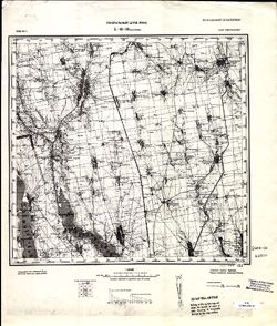
- Description:
- 1929
- Subject:
- Geographic Subject: Velykyy Buyalyk, Topical Subject: Soviet Union, and Topical Subject: Maps
- Publisher:
- Генеральный штаб РККА
- Language:
- Russian
- Date Created:
- 1930
- Identifier:
- VAC9619-001881
- Genre:
- Military Maps and Topographic Maps
- Geographic Location:
- Coordinates: 46.6667, 30.5, 47, 31
- Related URL:
- Catalog URL: https://iucat.iu.edu/catalog/5020129 and Download GeoTIFF: https://drive.google.com/open?id=1DslmoKrUzN-WwOZ2LD_ZXhe3N-y0oVCN
- Abstract:
- Modern area represented: Velykyy Buyalyk, Odessa oblast, Ukraine
- Call Number:
- G7000 s100 .S7 sheet L-36-38
- Caption:
- Не подлежит оглашению
- City:
- Благоево (Blagoyevo)
- Copyright Holder:
- No Copyright - United States
- Country:
- СССР (USSR)
- State/Province:
- Одесская область (Odessa oblast) and Украинская ССР (Ukrainian Soviet Socialist Republic)
- Physical Description:
- Scale: 1:100,000
- Persistent URL:
- http://purl.dlib.indiana.edu/iudl/images/VAC9619/VAC9619-001881
- Provenance:
- CIA Map Library
-
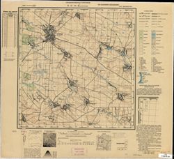
- Subject:
- Geographic Subject: Старий Остропіль (Staryy Ostropil’), Topical Subject: Maps, and Topical Subject: Soviet Union
- Publisher:
- Управление военных топографов
- Language:
- Russian
- Identifier:
- VAC9619-000837
- Genre:
- Military Maps and Topographic Maps
- Geographic Location:
- Coordinates: 49.667, 27.5, 49.833, 27.75
- Related URL:
- Download GeoTIFF: https://drive.google.com/open?id=14wAwOlKqK1HWUQmWU-hz_ig-RQCU4h4r and Catalog URL: http://iucat.iu.edu/catalog/5020131
- Abstract:
- Modern area represented: Старий Остропіль (Staryy Ostropil’), Khmelnytskyi Oblast, Ukraine
- Call Number:
- G7000 s50 .S68 sheet M-35-80-C
- Caption:
- Не подлежит оглашению
- City:
- Остропиль (Ostropil')
- Copyright Holder:
- No Copyright - United States
- Country:
- СССР (USSR)
- State/Province:
- Украинская ССР (Ukrainian Soviet Socialist Republic) and Винницкая область (Vinnytsia oblast)
- Physical Description:
- Scale: 1:50,000
- Persistent URL:
- http://purl.dlib.indiana.edu/iudl/images/VAC9619/VAC9619-000837
- Provenance:
- CIA Map Branch -- Received
-
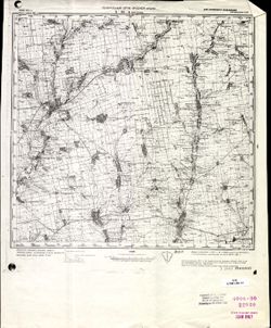
- Description:
- 1928
- Subject:
- Topical Subject: Maps, Geographic Subject: Bratske, and Topical Subject: Soviet Union
- Publisher:
- Генеральный штаб Красной Армии
- Language:
- Russian
- Date Created:
- 1941
- Identifier:
- VAC9619-001862
- Genre:
- Military Maps and Topographic Maps
- Geographic Location:
- Coordinates: 47.6667, 31.5, 48, 32
- Related URL:
- Catalog URL: https://iucat.iu.edu/catalog/5020129 and Download GeoTIFF: https://drive.google.com/open?id=1CRkSh7sskcbMSmRNTPMYkQvk89B_3WMF
- Abstract:
- Modern area represented: Bratske, Mykolaiv oblast, Ukraine
- Call Number:
- G7000 s100 .S7 sheet L-36-4
- Caption:
- Для служебного пользования
- City:
- Братское (Bratskoye)
- Copyright Holder:
- No Copyright - United States
- Country:
- СССР (USSR)
- State/Province:
- Украинская ССР (Ukrainian Soviet Socialist Republic)
- Physical Description:
- Scale: 1:100,000
- Persistent URL:
- http://purl.dlib.indiana.edu/iudl/images/VAC9619/VAC9619-001862
- Provenance:
- CIA Map Library
-
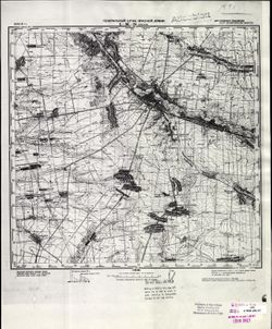
- Description:
- 1940
- Subject:
- Topical Subject: Soviet Union, Geographic Subject: Orikhiv, and Topical Subject: Maps
- Publisher:
- Генеральный штаб Красной Армии
- Language:
- Russian
- Date Created:
- 1941
- Identifier:
- VAC9619-001870
- Genre:
- Topographic Maps and Military Maps
- Geographic Location:
- Coordinates: 47.3333, 35.5, 47.6667, 36
- Related URL:
- Catalog URL: https://iucat.iu.edu/catalog/5020129 and Download GeoTIFF: https://drive.google.com/open?id=1AXZ-XrQdgFQXRG3b8AQpUU8UVELbTcb0
- Abstract:
- Modern area represented: Orikhiv, Zaporizhia oblast, Ukraine
- Call Number:
- G7000 s100 .S7 sheet L-36-24
- Caption:
- Для служебного пользования
- City:
- Орехов (Orikhiv)
- Copyright Holder:
- No Copyright - United States
- Country:
- СССР (USSR)
- State/Province:
- Запорожская область (Zaporizhia oblast) and Украинская ССР (Ukrainian Soviet Socialist Republic)
- Physical Description:
- Scale: 1:100,000
- Persistent URL:
- http://purl.dlib.indiana.edu/iudl/images/VAC9619/VAC9619-001870
- Provenance:
- CIA Map Library, Atlasblatt
-
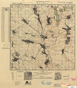
- Subject:
- Geographic Subject: Зарічанка (Zarichanka), Topical Subject: Maps, and Topical Subject: Soviet Union
- Publisher:
- Управление военных топографов
- Language:
- Russian
- Identifier:
- VAC9619-000877
- Genre:
- Military Maps and Topographic Maps
- Geographic Location:
- Coordinates: 48.8333, 26.25, 49, 26.5
- Related URL:
- Catalog URL: http://iucat.iu.edu/catalog/5020131 and Download GeoTIFF: https://drive.google.com/open?id=1q7f4o0zCOzXih9xf9t39PFr-bHTtRI6n
- Abstract:
- Modern area represented: Зарічанка (Zarichanka), Khmelnytskyi Oblast, Ukraine
- Call Number:
- G7000 s50 .S68 sheet M-35-113-B
- Caption:
- Не подлежит оглашению
- City:
- Лянцкорунь (Lanckoruń)
- Copyright Holder:
- No Copyright - United States
- Country:
- СССР (USSR)
- State/Province:
- Винницкая область (Vinnytsia oblast) and Украинская ССР (Ukrainian Soviet Socialist Republic)
- Physical Description:
- Scale: 1:50,000
- Persistent URL:
- http://purl.dlib.indiana.edu/iudl/images/VAC9619/VAC9619-000877
- Provenance:
- M. I. Map Library
-
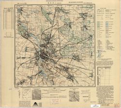
- Subject:
- Geographic Subject: Berdychiv, Topical Subject: Soviet Union, and Topical Subject: Maps
- Publisher:
- Управление военных топографов
- Language:
- Russian
- Identifier:
- VAC9619-000843
- Genre:
- Topographic Maps and Military Maps
- Geographic Location:
- Coordinates: 49.833, 28.5, 50, 28.75
- Related URL:
- Catalog URL: http://iucat.iu.edu/catalog/5020131 and Download GeoTIFF: https://drive.google.com/open?id=1R6PbpTgx2gBWT7HFAf-lzGDP_0Ul7Zvx
- Abstract:
- Modern area represented: Berdychiv, Zhytomyr oblast, Ukraine
- Call Number:
- G7000 s50 .S68 sheet M-35-82-A
- Caption:
- Не подлежит оглашению
- City:
- Бердичев (Berdichev)
- Copyright Holder:
- No Copyright - United States
- Country:
- СССР (USSR)
- State/Province:
- Украинская ССР (Ukrainian Soviet Socialist Republic) and Киевская область (Kyiv oblast)
- Physical Description:
- Scale: 1:50,000
- Persistent URL:
- http://purl.dlib.indiana.edu/iudl/images/VAC9619/VAC9619-000843
- Provenance:
- CIA Map Branch -- Received
-
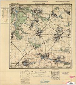
- Subject:
- Topical Subject: Maps, Topical Subject: Soviet Union, and Geographic Subject: Vchoraishe
- Publisher:
- Управление военных топографов РККА
- Language:
- Russian
- Identifier:
- VAC9619-000847
- Genre:
- Topographic Maps and Military Maps
- Geographic Location:
- Coordinates: 49.833, 29, 50, 29.25
- Related URL:
- Download GeoTIFF: https://drive.google.com/open?id=13sCVG8brfXE9iDwdan3fG7wvBC_JwvI1 and Catalog URL: http://iucat.iu.edu/catalog/5020131
- Abstract:
- Modern area represented: Vchoraishe, Zhytomyr oblast, Ukraine
- Call Number:
- G7000 s50 .S68 sheet M-35-83-A
- Caption:
- Не подлежит оглашению
- City:
- Вчерайше (Vcheraishe)
- Copyright Holder:
- No Copyright - United States
- Country:
- СССР (USSR)
- State/Province:
- Украинская ССР (Ukrainian Soviet Socialist Republic) and Киевская область (Kyiv oblast)
- Physical Description:
- Scale: 1:50,000
- Persistent URL:
- http://purl.dlib.indiana.edu/iudl/images/VAC9619/VAC9619-000847
- Provenance:
- M. I. Map Library, G000-30, GS, RA
-
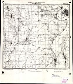
- Description:
- 1907
- Subject:
- Topical Subject: Maps, Geographic Subject: Velyka Korenykha, and Topical Subject: Soviet Union
- Publisher:
- Генеральный штаб Красной Армии
- Language:
- Russian
- Date Created:
- 1941
- Identifier:
- VAC9619-001884
- Genre:
- Military Maps and Topographic Maps
- Geographic Location:
- Coordinates: 46.6667, 31.5, 47, 32
- Related URL:
- Download GeoTIFF: https://drive.google.com/open?id=1fNdbJ2rMnjnma3fM8xJgn6ozu_NI6Aox and Catalog URL: https://iucat.iu.edu/catalog/5020129
- Abstract:
- Modern area represented: Velyka Korenykha, Mykolaiv oblast, Ukraine
- Call Number:
- G7000 s100 .S7 sheet L-36-40
- Caption:
- Для служебного пользования
- City:
- Бол. Корениха (Bolshaya Korenikha)
- Copyright Holder:
- No Copyright - United States
- Country:
- СССР (USSR)
- State/Province:
- Украинская ССР (Ukrainian Soviet Socialist Republic)
- Physical Description:
- Scale: 1:100,000
- Persistent URL:
- http://purl.dlib.indiana.edu/iudl/images/VAC9619/VAC9619-001884
- Provenance:
- CIA Map Library
-
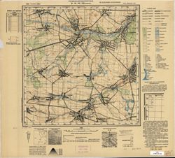
- Subject:
- Topical Subject: Soviet Union, Geographic Subject: Chervone, and Topical Subject: Maps
- Publisher:
- Управление военных топографов
- Language:
- Russian
- Identifier:
- VAC9619-000844
- Genre:
- Military Maps and Topographic Maps
- Geographic Location:
- Coordinates: 49.833, 28.75, 50, 29
- Related URL:
- Download GeoTIFF: https://drive.google.com/open?id=1GvOvUlz4kOAb_-j2kL93PqpFsVA9gsFw and Catalog URL: http://iucat.iu.edu/catalog/5020131
- Abstract:
- Modern area represented: Chervone, Zhytomyr oblast, Ukraine
- Call Number:
- G7000 s50 .S68 sheet M-35-82-B
- Caption:
- Не подлежит оглашению
- City:
- Червоное (Chervonoye)
- Copyright Holder:
- No Copyright - United States
- Country:
- СССР (USSR)
- State/Province:
- Украинская ССР (Ukrainian Soviet Socialist Republic) and Киевская область (Kyiv oblast)
- Physical Description:
- Scale: 1:50,000
- Persistent URL:
- http://purl.dlib.indiana.edu/iudl/images/VAC9619/VAC9619-000844
- Provenance:
- CIA Map Branch -- Received
-
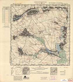
- Subject:
- Topical Subject: Maps, Topical Subject: Soviet Union, and Geographic Subject: Trylisy
- Publisher:
- Управление военных топографов
- Language:
- Russian
- Identifier:
- VAC9619-000851
- Genre:
- Military Maps and Topographic Maps
- Geographic Location:
- Coordinates: 49.8333, 29.75, 50, 30
- Related URL:
- Download GeoTIFF: https://drive.google.com/open?id=1P9bNifqUPQ36msrnTWVhjlGQLg2S3IYA and Catalog URL: http://iucat.iu.edu/catalog/5020131
- Abstract:
- Modern area represented: Trylisy, Kyiv oblast, Ukraine
- Call Number:
- G7000 s50 .S68 sheet M-35-84-B
- Caption:
- Не подлежит оглашению
- City:
- Трылисы (Trylisy)
- Copyright Holder:
- No Copyright - United States
- Country:
- СССР (USSR)
- State/Province:
- Украинская ССР (Ukrainian Soviet Socialist Republic) and Киевская область (Kyiv oblast)
- Physical Description:
- Scale: 1:50,000
- Persistent URL:
- http://purl.dlib.indiana.edu/iudl/images/VAC9619/VAC9619-000851
- Provenance:
- CIA Map Branch -- Received
-
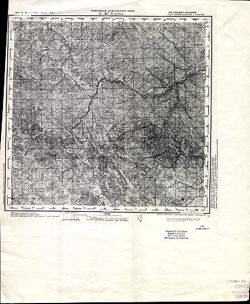
- Description:
- 1873
- Subject:
- Geographic Subject: Selyatyn, Topical Subject: Maps, and Topical Subject: Soviet Union
- Publisher:
- Генеральный штаб Красной Армии
- Language:
- Russian
- Date Created:
- 1939
- Identifier:
- VAC9619-001472
- Genre:
- Military Maps and Topographic Maps
- Geographic Location:
- Coordinates: 47.6667, 25, 48, 25.5
- Related URL:
- Download GeoTIFF: https://drive.google.com/open?id=1v6zIUxpzw2mb5AD7jE4-hVpFfWBpe8B8 and Catalog URL: https://iucat.iu.edu/catalog/5020129
- Abstract:
- Modern area represented: Selyatyn, Chernivtsi oblast, Ukraine
- Call Number:
- G7000 s100 .S7 sheet L-35-3
- Caption:
- Для служебного пользования
- City:
- Селетин (Selyatyn)
- Copyright Holder:
- No Copyright - United States
- Country:
- Румыния (Romania)
- State/Province:
- Украинская ССР (Ukrainian Soviet Socialist Republic) and Черновицкая область (Chernivtsi oblast)
- Physical Description:
- Scale: 1:100,000
- Persistent URL:
- http://purl.dlib.indiana.edu/iudl/images/VAC9619/VAC9619-001472
- Provenance:
- CIA Map Library
-
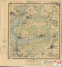
- Description:
- 1930
- Subject:
- Topical Subject: Maps, Topical Subject: Soviet Union, and Geographic Subject: Kamenskiy Khutor
- Publisher:
- Управление военных топографов
- Language:
- Russian
- Identifier:
- VAC9619-001580
- Genre:
- Topographic Maps and Military Maps
- Geographic Location:
- Coordinates: 52, 32.25, 52.1667, 32.5
- Related URL:
- Catalog URL: http://iucat.iu.edu/catalog/5020131 and Download GeoTIFF: https://drive.google.com/open?id=1F40ViE0yDvGViIOC-bOSCTmjsYKUPP0M
- Abstract:
- Modern area represented: Kamenskiy Khutor, Bryansk oblast, Russia
- Call Number:
- G7000 s50 .S68 sheet N-36-137-D
- Caption:
- Не подлежит оглашению
- City:
- Каменский Хутор (Kamenskiy Khutor)
- Copyright Holder:
- No Copyright - United States
- Country:
- СССР (USSR)
- State/Province:
- Западная область (Western oblast), РСФСР (RSFSR), and Украинская ССР (Ukrainian Soviet Socialist Republic)
- Physical Description:
- Scale: 1:50,000
- Persistent URL:
- http://purl.dlib.indiana.edu/iudl/images/VAC9619/VAC9619-001580
- Provenance:
- M. I. Map Library, Atlasblatt
-
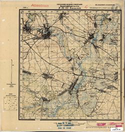
- Description:
- 1930
- Subject:
- Topical Subject: Maps, Geographic Subject: Novyy Ropsk, and Topical Subject: Soviet Union
- Publisher:
- Управление военных топографов
- Language:
- Russian
- Identifier:
- VAC9619-001578
- Genre:
- Topographic Maps and Military Maps
- Geographic Location:
- Coordinates: 52.1667, 32.25, 52.3333, 32.5
- Related URL:
- Catalog URL: http://iucat.iu.edu/catalog/5020131 and Download GeoTIFF: https://drive.google.com/open?id=13t64kb76EHxk27fhUSp4LHrgQc7MI4jm
- Abstract:
- Modern area represented: Novyy Ropsk, Bryansk oblast, Russia
- Call Number:
- G7000 s50 .S68 sheet N-36-137-Б
- Caption:
- Не подлежит оглашению
- City:
- М. Нов. Ропск (Novyy Ropsk)
- Copyright Holder:
- No Copyright - United States
- Country:
- СССР (USSR)
- State/Province:
- Украинская ССР (Ukrainian Soviet Socialist Republic), РСФСР (RSFSR), and Западная область (Western oblast)
- Physical Description:
- Scale: 1:50,000
- Persistent URL:
- http://purl.dlib.indiana.edu/iudl/images/VAC9619/VAC9619-001578
- Provenance:
- M. I. Map Library, Atlasblatt
-
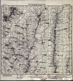
- Description:
- 1939
- Subject:
- Topical Subject: Soviet Union, Topical Subject: Maps, and Geographic Subject: Rozdolne
- Publisher:
- Генеральный штаб Красной Армии
- Language:
- Russian
- Date Created:
- 1941
- Identifier:
- VAC9619-002003
- Genre:
- Military Maps and Topographic Maps
- Geographic Location:
- Coordinates: 47.3333, 38, 47.6667, 38.5
- Related URL:
- Catalog URL: https://iucat.iu.edu/catalog/5020129 and Download GeoTIFF: https://drive.google.com/open?id=1cdFtj_43ppiv47dkF7XJ1JNspIgopc33
- Abstract:
- Modern area represented: Rozdolne, Donetsk oblast, Ukraine
- Call Number:
- G7000 s100 .S7 sheet L-37-17
- Caption:
- Для служебного пользования
- City:
- Большая Каракуба (Bolshaya Karakuba)
- Copyright Holder:
- No Copyright - United States
- Country:
- СССР (USSR)
- State/Province:
- РСФСР (RSFSR) and Украинская ССР (Ukrainian Soviet Socialist Republic)
- Physical Description:
- Scale: 1:100,000
- Persistent URL:
- http://purl.dlib.indiana.edu/iudl/images/VAC9619/VAC9619-002003
- Provenance:
- CIA Map Library
-
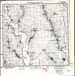
- Description:
- 1923
- Subject:
- Topical Subject: Soviet Union, Geographic Subject: Anatolyevka, and Topical Subject: Maps
- Publisher:
- Генеральный штаб Красной Армии
- Language:
- Russian
- Date Created:
- 1941
- Identifier:
- VAC9619-001883
- Genre:
- Topographic Maps and Military Maps
- Geographic Location:
- Coordinates: 46.6667, 31, 47, 31.5
- Related URL:
- Catalog URL: https://iucat.iu.edu/catalog/5020129 and Download GeoTIFF: https://drive.google.com/open?id=13VfyVaR-q2kWZN6Gos9K23WCuU0PKXNA
- Abstract:
- Modern area represented: Anatolyevka, Mykolaiv oblast, Ukraine
- Call Number:
- G7000 s100 .S7 sheet L-36-39
- Caption:
- Для служебного пользования
- City:
- Анатольевка (Anatolyevka)
- Copyright Holder:
- No Copyright - United States
- Country:
- СССР (USSR)
- State/Province:
- Украинская ССР (Ukrainian Soviet Socialist Republic)
- Physical Description:
- Scale: 1:100,000
- Persistent URL:
- http://purl.dlib.indiana.edu/iudl/images/VAC9619/VAC9619-001883
- Provenance:
- CIA Map Library, Atlasblatt, Library of Congress Geography & Map Division
-
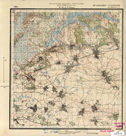
- Description:
- 1929
- Subject:
- Geographic Subject: Петрушi (Petrushi), Topical Subject: Soviet Union, and Topical Subject: Maps
- Publisher:
- Управление военных топографов
- Language:
- Russian
- Identifier:
- VAC9619-000900
- Genre:
- Topographic Maps and Military Maps
- Geographic Location:
- Coordinates: 51.6667, 30.75, 51.8333, 31
- Related URL:
- Download GeoTIFF: https://drive.google.com/open?id=1YUNfCVqepCOgytX5t8nmx6Q3EY7Lj7tN and Catalog URL: http://iucat.iu.edu/catalog/5020131
- Abstract:
- Modern area represented: Петрушi (Petrushi), Chernihiv Oblast, Ukraine
- Call Number:
- G7000 s50 .S68 sheet M-36-2-D
- Caption:
- Не подлежит оглашению
- City:
- Петруши (Petrushi)
- Copyright Holder:
- No Copyright - United States
- Country:
- СССР (USSR)
- State/Province:
- Украинская ССР (Ukrainian Soviet Socialist Republic)
- Physical Description:
- Scale: 1:50,000
- Persistent URL:
- http://purl.dlib.indiana.edu/iudl/images/VAC9619/VAC9619-000900
- Provenance:
- M. I. Map Library
-
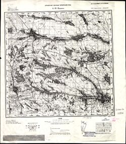
- Description:
- 1914
- Subject:
- Topical Subject: Maps, Topical Subject: Soviet Union, and Geographic Subject: Podilsk
- Publisher:
- Управление военных топографов РККА
- Language:
- Russian
- Date Created:
- 1932
- Identifier:
- VAC9619-001503
- Genre:
- Topographic Maps and Military Maps
- Geographic Location:
- Coordinates: 47.6667, 29.5, 48, 30
- Related URL:
- Catalog URL: https://iucat.iu.edu/catalog/5020129 and Download GeoTIFF: https://drive.google.com/open?id=1GY1T_2cRAKuBJomRz9ZEfhqJTuF0vfG8
- Abstract:
- Modern area represented: Podilsk, Odessa oblast, Ukraine
- Call Number:
- G7000 s100 .S7 sheet L-35-12
- Caption:
- Не подлежит оглашению
- City:
- Котовск (Kotovsk)
- Copyright Holder:
- No Copyright - United States
- Country:
- СССР (USSR)
- State/Province:
- Одесская область (Odessa oblast), Украинская ССР (Ukrainian Soviet Socialist Republic), and Молдавская АССР (Moldavian Autonomous Soviet Socialist Republic)
- Physical Description:
- Scale: 1:100,000
- Persistent URL:
- http://purl.dlib.indiana.edu/iudl/images/VAC9619/VAC9619-001503
- Provenance:
- CIA Map Library, Auswärtiges Amt. Geographischer Dienst
-
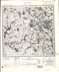
- Description:
- 1873
- Subject:
- Topical Subject: Maps, Topical Subject: Soviet Union, and Geographic Subject: Slobidka
- Publisher:
- Генеральный штаб РККА
- Language:
- Russian
- Date Created:
- 1933
- Identifier:
- VAC9619-001502
- Genre:
- Military Maps and Topographic Maps
- Geographic Location:
- Coordinates: 47.6667, 29, 48, 29.5
- Related URL:
- Download GeoTIFF: https://drive.google.com/open?id=12hPOl2XNIpsYO7n4_yTuCA5VYkAUpSEV and Catalog URL: https://iucat.iu.edu/catalog/5020129
- Abstract:
- Modern area represented: Slobidka, Odessa oblast, Ukraine
- Call Number:
- G7000 s100 .S7 sheet L-35-11
- Caption:
- Не подлежит оглашению
- City:
- Пос. Слободка (Slobodka village)
- Copyright Holder:
- No Copyright - United States
- State/Province:
- Украинская ССР (Ukrainian Soviet Socialist Republic), Бессарабия (Bessarabia), and Молдавская АССР (Moldavian Autonomous Soviet Socialist Republic)
- Physical Description:
- Scale: 1:100,000
- Persistent URL:
- http://purl.dlib.indiana.edu/iudl/images/VAC9619/VAC9619-001502
- Provenance:
- CIA Map Library
-
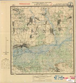
- Description:
- 1930
- Subject:
- Geographic Subject: Shumilovka, Topical Subject: Maps, and Topical Subject: Soviet Union
- Publisher:
- Управление военных топографов
- Language:
- Russian
- Identifier:
- VAC9619-001579
- Genre:
- Military Maps and Topographic Maps
- Geographic Location:
- Coordinates: 52, 32, 52.1667, 32.25
- Related URL:
- Download GeoTIFF: https://drive.google.com/open?id=1ag3f8ipdIBTu9si4SD7EBCIPQZrD4_po and Catalog URL: http://iucat.iu.edu/catalog/5020131
- Abstract:
- Modern area represented: Shumilovka, Bryansk oblast, Russia
- Call Number:
- G7000 s50 .S68 sheet N-36-137-C
- Caption:
- Не подлежит оглашению
- City:
- Шумиловка (Shumilovka)
- Copyright Holder:
- No Copyright - United States
- Country:
- СССР (USSR)
- State/Province:
- Западная область (Western oblast), РСФСР (RSFSR), and Украинская ССР (Ukrainian Soviet Socialist Republic)
- Physical Description:
- Scale: 1:50,000
- Persistent URL:
- http://purl.dlib.indiana.edu/iudl/images/VAC9619/VAC9619-001579
- Provenance:
- M. I. Map Library, Atlasblatt
-
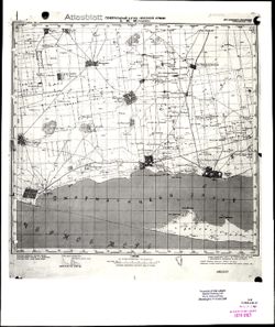
- Description:
- 1941
- Subject:
- Topical Subject: Maps, Topical Subject: Soviet Union, and Geographic Subject: Skadowsk
- Publisher:
- Генеральный штаб Красной Армии
- Language:
- Russian
- Identifier:
- VAC9619-001921
- Genre:
- Military Maps and Topographic Maps
- Geographic Location:
- Coordinates: 46, 32.5, 46.3333, 33
- Related URL:
- Catalog URL: https://iucat.iu.edu/catalog/5020129 and Download GeoTIFF: https://drive.google.com/file/d/1xtbzarw03n6d4ePGPcTdYxMxETtBFgmw/view?usp=sharing
- Abstract:
- Modern area represented: Skadowsk, Kherson oblast, Ukraine
- Call Number:
- G7000 s100 .S7 sheet L-36-66
- Caption:
- Для служебного пользования
- City:
- Скадовск (Skadowsk)
- Copyright Holder:
- No Copyright - United States
- Country:
- СССР (USSR)
- State/Province:
- Украинская ССР (Ukrainian Soviet Socialist Republic)
- Physical Description:
- Scale: 1:100,000
- Persistent URL:
- http://purl.dlib.indiana.edu/iudl/images/VAC9619/VAC9619-001921
- Provenance:
- CIA Map Library, Atlasblatt
-
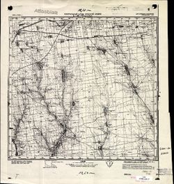
- Description:
- 1923
- Subject:
- Topical Subject: Maps, Topical Subject: Soviet Union, and Geographic Subject: Novosvetlovka
- Publisher:
- Генеральный штаб Красной Армии
- Language:
- Russian
- Date Created:
- 1941
- Identifier:
- VAC9619-001875
- Genre:
- Military Maps and Topographic Maps
- Geographic Location:
- Coordinates: 47, 31, 47.3333, 31.5
- Related URL:
- Catalog URL: https://iucat.iu.edu/catalog/5020129 and Download GeoTIFF: https://drive.google.com/open?id=1EbK0cGpvSMNX1svCUjtHP05b5fU5NuIV
- Abstract:
- Modern area represented: Novosvetlovka, Odessa oblast, Ukraine
- Call Number:
- G7000 s100 .S7 sheet L-36-27
- Caption:
- Для служебного пользования
- City:
- Колония Рорбах (Koloniya Rorbakh)
- Copyright Holder:
- No Copyright - United States
- Country:
- СССР (USSR)
- State/Province:
- Украинская ССР (Ukrainian Soviet Socialist Republic)
- Physical Description:
- Scale: 1:100,000
- Persistent URL:
- http://purl.dlib.indiana.edu/iudl/images/VAC9619/VAC9619-001875
- Provenance:
- CIA Map Library, Atlasblatt, Heeresplankammer Gruppe Archive Auslandskartenarchiv
-
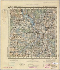
- Description:
- 1887
- Subject:
- Geographic Subject: Dubienka, Topical Subject: Soviet Union, and Topical Subject: Maps
- Publisher:
- Генеральный штаб Красной Армии
- Language:
- Russian
- Date Created:
- 1940
- Identifier:
- VAC9619-002783
- Genre:
- Topographic Maps and Military Maps
- Geographic Location:
- Coordinates: 51, 23.5, 51.333, 24
- Related URL:
- Catalog URL: https://iucat.iu.edu/catalog/5020129 and Download GeoTIFF: https://drive.google.com/file/d/15PI_PAoHjXuB6rKl-ywGbLkUrtJOCEKS/view?usp=sharing
- Abstract:
- Modern area represented: Dubienka, Lublin province, Poland
- Call Number:
- G7000 s100 .S7 sheet M-34-36
- City:
- Дубенка (Dubienka)
- Copyright Holder:
- No Copyright - United States
- Country:
- СССР (USSR)
- State/Province:
- Украинская ССР (Ukrainian Soviet Socialist Republic), Область государственных интересов Германии (Region of German state interests), and Волынская область (V...
- Physical Description:
- Scale: 1:100,000
- Persistent URL:
- http://purl.dlib.indiana.edu/iudl/images/VAC9619/VAC9619-002783
- Provenance:
- CIA Map Library, CIA Map Branch -- Received, FEM Austria
-
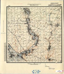
- Description:
- 1929
- Subject:
- Geographic Subject: Irkliyiv, Topical Subject: Soviet Union, and Topical Subject: Maps
- Publisher:
- Управление военных топографов РККА
- Language:
- Russian
- Identifier:
- VAC9619-001032
- Genre:
- Topographic Maps and Military Maps
- Geographic Location:
- Coordinates: 49.5, 32.25, 49.6667, 32.5
- Related URL:
- Download GeoTIFF: https://drive.google.com/open?id=1ZRBdES0YuBkEKcr34UNAvvPd_Px7yU-r and Catalog URL: http://iucat.iu.edu/catalog/5020131
- Abstract:
- Modern area represented: Іркліїв (Irkliyiv), Cherkasy oblast, Ukraine
- Call Number:
- G7000 s50 .S68 sheet M-36-89-B
- Caption:
- Не подлежит оглашению (crossed out) and Рассекречено
- City:
- Ирклеев (Irkliyev)
- Copyright Holder:
- No Copyright - United States
- Country:
- СССР (USSR)
- State/Province:
- Украинская ССР (Ukrainian Soviet Socialist Republic) and Киевская область (Kyiv oblast)
- Physical Description:
- Scale: 1:50,000
- Persistent URL:
- http://purl.dlib.indiana.edu/iudl/images/VAC9619/VAC9619-001032
- Provenance:
- M. I. Map Library
-
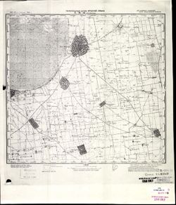
- Description:
- 1921
- Subject:
- Topical Subject: Soviet Union, Topical Subject: Maps, and Geographic Subject: Nova Mayachka
- Publisher:
- Генеральный штаб Красной Армии
- Language:
- Russian
- Date Created:
- 1941
- Identifier:
- VAC9619-001906
- Genre:
- Topographic Maps and Military Maps
- Geographic Location:
- Coordinates: 46.3333, 33, 46.6667, 33.5
- Related URL:
- Download GeoTIFF: https://drive.google.com/open?id=1Yr9vRnGudy0KWOqJTTRm-qy8PGNtqZ5f and Catalog URL: https://iucat.iu.edu/catalog/5020129
- Abstract:
- Modern area represented: Nova Mayachka, Kherson oblast, Ukraine
- Call Number:
- G7000 s100 .S7 sheet L-36-55
- Caption:
- Для служебного пользования
- City:
- Бол. Маячка (Bolshaya Mayachka)
- Copyright Holder:
- No Copyright - United States
- Country:
- СССР (USSR)
- State/Province:
- Украинская ССР (Ukrainian Soviet Socialist Republic) and Николаевская область (Mykolaiv oblast)
- Physical Description:
- Scale: 1:100,000
- Persistent URL:
- http://purl.dlib.indiana.edu/iudl/images/VAC9619/VAC9619-001906
- Provenance:
- CIA Map Library
-
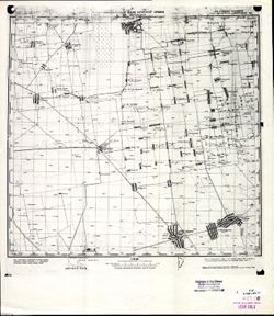
- Description:
- 1921
- Subject:
- Topical Subject: Maps, Geographic Subject: Novotroyitske, and Topical Subject: Soviet Union
- Publisher:
- Генеральный штаб Красной Армии
- Language:
- Russian
- Date Created:
- 1941
- Identifier:
- VAC9619-001910
- Genre:
- Topographic Maps and Military Maps
- Geographic Location:
- Coordinates: 46.3333, 34, 46.6667, 34.5
- Related URL:
- Catalog URL: https://iucat.iu.edu/catalog/5020129 and Download GeoTIFF: https://drive.google.com/open?id=16tAOz1x8-tQ824R-6muIVRvXEhtSQEDe
- Abstract:
- Modern area represented: Novotroyitske, Kherson oblast, Ukraine
- Call Number:
- G7000 s100 .S7 sheet L-36-57
- Caption:
- Для служебного пользования
- City:
- Ново-Троицкое (Novo-Troitskoye)
- Copyright Holder:
- No Copyright - United States
- Country:
- СССР (USSR)
- State/Province:
- Николаевская область (Mykolaiv oblast), Запорожская область (Zaporizhia oblast), and Украинская ССР (Ukrainian Soviet Socialist Republic)
- Physical Description:
- Scale: 1:100,000
- Persistent URL:
- http://purl.dlib.indiana.edu/iudl/images/VAC9619/VAC9619-001910
- Provenance:
- CIA Map Library
-
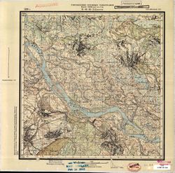
- Description:
- 1929
- Subject:
- Topical Subject: Soviet Union, Topical Subject: Maps, and Geographic Subject: Domantove
- Publisher:
- Управление военных топографов
- Language:
- Russian
- Identifier:
- VAC9619-001028
- Genre:
- Topographic Maps and Military Maps
- Geographic Location:
- Coordinates: 49.5, 31.75, 49.6667, 32
- Related URL:
- Download GeoTIFF: https://drive.google.com/open?id=1u0qOuwDpd0GsiJ3l0cPytWDxvVqyougj and Catalog URL: http://iucat.iu.edu/catalog/5020131
- Abstract:
- Modern area represented: Домантове (Domantove), Cherkasy oblast, Ukraine
- Call Number:
- G7000 s50 .S68 sheet M-36-88-B
- Caption:
- Рассекречено and Не подлежит оглашению
- City:
- Домантов (Domantov)
- Copyright Holder:
- No Copyright - United States
- Country:
- СССР (USSR)
- State/Province:
- Украинская ССР (Ukrainian Soviet Socialist Republic)
- Physical Description:
- Scale: 1:50,000
- Persistent URL:
- http://purl.dlib.indiana.edu/iudl/images/VAC9619/VAC9619-001028
- Provenance:
- M. I. Map Library, Library of Congress Geography & Map Division
-
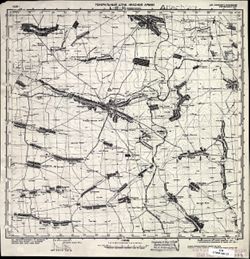
- Description:
- 1928
- Subject:
- Topical Subject: Maps, Topical Subject: Soviet Union, and Geographic Subject: Chernihivka
- Publisher:
- Генеральный штаб Красной Армии
- Language:
- Russian
- Date Created:
- 1941
- Identifier:
- VAC9619-002282
- Genre:
- Military Maps and Topographic Maps
- Geographic Location:
- Coordinates: 47, 36, 47.3333, 36.5
- Related URL:
- Download GeoTIFF: https://drive.google.com/file/d/1mo9Bpmz48kxlqvW7ySPLp9B3AAterdgn/view?usp=sharing and Catalog URL: https://iucat.iu.edu/catalog/5020129
- Abstract:
- Modern area represented: Chernihivka, Zaporizhia oblast, Ukraine
- Call Number:
- G7000 s100 .S7 sheet L-37-25
- Caption:
- Для служебного пользования
- City:
- Токмачанск (Tokmachansk)
- Copyright Holder:
- No Copyright - United States
- Country:
- СССР (USSR)
- State/Province:
- Украинская ССР (Ukrainian Soviet Socialist Republic)
- Physical Description:
- Scale: 1:100,000
- Persistent URL:
- http://purl.dlib.indiana.edu/iudl/images/VAC9619/VAC9619-002282
- Provenance:
- CIA Map Library
-
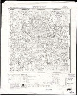
- Description:
- 1932
- Subject:
- Geographic Subject: Narayivka, Topical Subject: Maps, and Topical Subject: Soviet Union
- Publisher:
- Управление военных топографов
- Language:
- Russian
- Identifier:
- VAC9619-002642
- Genre:
- Military Maps and Topographic Maps
- Geographic Location:
- Coordinates: 50.75, 27.868056, 50.833333, 28
- Related URL:
- Catalog URL: http://iucat.iu.edu/catalog/5020131 and Download GeoTIFF: https://drive.google.com/file/d/1X-esDNu-5Lg-QDF4iBj4GKUVxNaEAGji/view?usp=sharing
- Abstract:
- Modern area represented: Narayivka, Zhytomyr oblast, Ukraine
- Call Number:
- G7000 s50 .S68 sheet M-35-44-Г-Ҕ
- Caption:
- Секретно
- City:
- Нараевка (Narayivka)
- Copyright Holder:
- No Copyright - United States
- Country:
- СССР (USSR)
- State/Province:
- Украинская ССР (Ukrainian Soviet Socialist Republic) and Киевская область (Kyiv oblast)
- Physical Description:
- Scale: 1:50,000
- Persistent URL:
- http://purl.dlib.indiana.edu/iudl/images/VAC9619/VAC9619-002642
- Provenance:
- M. I. Map Library, GS, RA, CIA Map Library
-
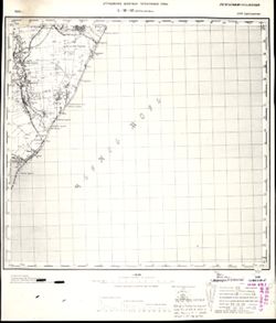
- Description:
- 1929
- Subject:
- Geographic Subject: Oleksandrivka, Topical Subject: Maps, and Topical Subject: Soviet Union
- Publisher:
- Управление военных топографов РККА
- Language:
- Russian
- Identifier:
- VAC9619-001916
- Genre:
- Topographic Maps and Military Maps
- Geographic Location:
- Coordinates: 46, 30.5, 46.3333, 31
- Related URL:
- Download GeoTIFF: https://drive.google.com/open?id=1o0K1EpICQ3Qizp5-srX110AUXB3z7vGm and Catalog URL: https://iucat.iu.edu/catalog/5020129
- Abstract:
- Modern area represented: Oleksandrivka, Odessa oblast, Ukraine
- Call Number:
- G7000 s100 .S7 sheet L-36-62
- Caption:
- Не подлежит оглашению
- City:
- Александровка (Oleksandrivka)
- Copyright Holder:
- No Copyright - United States
- Country:
- СССР (USSR)
- State/Province:
- Одесская область (Odessa oblast) and Украинская ССР (Ukrainian Soviet Socialist Republic)
- Physical Description:
- Scale: 1:100,000
- Persistent URL:
- http://purl.dlib.indiana.edu/iudl/images/VAC9619/VAC9619-001916
- Provenance:
- CIA Map Library
-
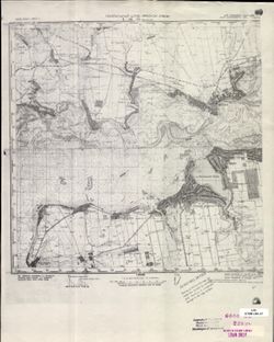
- Description:
- 1926
- Subject:
- Topical Subject: Soviet Union, Topical Subject: Maps, and Geographic Subject: Nikopol
- Publisher:
- Генеральный штаб Красной Армии
- Language:
- Russian
- Date Created:
- 1941
- Identifier:
- VAC9619-001867
- Genre:
- Military Maps and Topographic Maps
- Geographic Location:
- Coordinates: 47.3333, 34, 47.6667, 34.5
- Related URL:
- Download GeoTIFF: https://drive.google.com/open?id=1255dfmhEQnsVoMASiJgE0Wqbhh4ks-Bt and Catalog URL: https://iucat.iu.edu/catalog/5020129
- Abstract:
- Modern area represented: Nikopol, Dnipropetrovsk, Ukraine
- Call Number:
- G7000 s100 .S7 sheet L-36-21
- Caption:
- Для служебного пользования
- City:
- Никополь (Nikopol)
- Copyright Holder:
- No Copyright - United States
- Country:
- СССР (USSR)
- State/Province:
- Днепропетровская область (Dnipropetrovsk oblast) and Украинская ССР (Ukrainian Soviet Socialist Republic)
- Physical Description:
- Scale: 1:100,000
- Persistent URL:
- http://purl.dlib.indiana.edu/iudl/images/VAC9619/VAC9619-001867
- Provenance:
- CIA Map Library
-
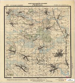
- Description:
- 1929
- Subject:
- Topical Subject: Maps, Geographic Subject: Perepis, and Topical Subject: Soviet Union
- Publisher:
- Военно-топографическое управление
- Language:
- Russian
- Identifier:
- VAC9619-001573
- Genre:
- Military Maps and Topographic Maps
- Geographic Location:
- Coordinates: 52, 31.25, 52.1667, 31.5
- Related URL:
- Download GeoTIFF: https://drive.google.com/open?id=1IRbUSwpZbhhRPZFIBdro4RVzKaabMFon and Catalog URL: http://iucat.iu.edu/catalog/5020131
- Abstract:
- Modern area represented: Perepis, Chernihiv oblast, Ukraine
- Call Number:
- G7000 s50 .S68 sheet N-36-135-Г
- Caption:
- Не подлежит оглашению
- City:
- Перепис (Perepis)
- Copyright Holder:
- No Copyright - United States
- Country:
- СССР (USSR)
- State/Province:
- Белорусская ССР (Byelorussian Soviet Socialist Republic) and Украинская ССР (Ukrainian Soviet Socialist Republic)
- Physical Description:
- Scale: 1:50,000
- Persistent URL:
- http://purl.dlib.indiana.edu/iudl/images/VAC9619/VAC9619-001573
- Provenance:
- G000-30
-
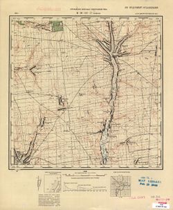
- Description:
- 1931
- Subject:
- Topical Subject: Soviet Union, Topical Subject: Maps, and Geographic Subject: Zelene
- Publisher:
- Управление военных топографов РККА
- Language:
- Russian
- Identifier:
- VAC9619-001144
- Genre:
- Military Maps and Topographic Maps
- Geographic Location:
- Coordinates: 48.333, 33.25, 48.5, 33.5
- Related URL:
- Download GeoTIFF: https://drive.google.com/file/d/1WA1X9hJ0Jciaw8ylB1f48j_NanweR6Nf/view?usp=sharing and Catalog URL: http://iucat.iu.edu/catalog/5020131
- Abstract:
- Modern area represented: Zelene, Kirovohrad oblast, Ukraine
- Call Number:
- G7000 s50 .S68 sheet M-36-127-D
- Caption:
- Не подлежит оглашению
- City:
- Зеленое (Zelenoye)
- Copyright Holder:
- No Copyright - United States
- Country:
- СССР (USSR)
- State/Province:
- Днепропетровская область (Dnipropetrovsk oblast) and Украинская ССР (Ukrainian Soviet Socialist Republic)
- Physical Description:
- Scale: 1:50,000
- Persistent URL:
- http://purl.dlib.indiana.edu/iudl/images/VAC9619/VAC9619-001144
- Provenance:
- M. I. Map Library, GS, RA, Atlasblatt
-
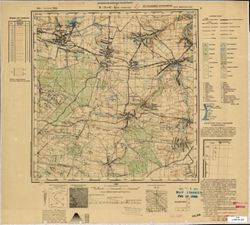
- Subject:
- Topical Subject: Maps, Geographic Subject: Velyki Korovyntsi, and Topical Subject: Soviet Union
- Publisher:
- Управление военных топографов
- Language:
- Russian
- Identifier:
- VAC9619-000840
- Genre:
- Topographic Maps and Military Maps
- Geographic Location:
- Coordinates: 49.833, 28.25, 50, 28.5
- Related URL:
- Download GeoTIFF: https://drive.google.com/open?id=19Uq6V87MH4xgFkHSogVc-XzLP5crtJrE and Catalog URL: http://iucat.iu.edu/catalog/5020131
- Abstract:
- Modern area represented: Velyki Korovyntsi, Zhytomyr oblast, Ukraine
- Call Number:
- G7000 s50 .S68 sheet M-35-81-B
- Caption:
- Не подлежит оглашению
- City:
- Большие Коровинцы (Bol’shiye Korovintsy)
- Copyright Holder:
- No Copyright - United States
- Country:
- СССР (USSR)
- State/Province:
- Украинская ССР (Ukrainian Soviet Socialist Republic) and Винницкая область (Vinnytsia oblast)
- Physical Description:
- Scale: 1:50,000
- Persistent URL:
- http://purl.dlib.indiana.edu/iudl/images/VAC9619/VAC9619-000840
- Provenance:
- M. I. Map Library, G000-30, GS, RA
-
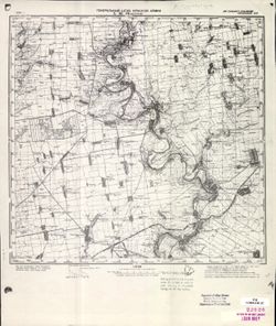
- Description:
- 1930
- Subject:
- Geographic Subject: Shesternya, Topical Subject: Soviet Union, and Topical Subject: Maps
- Publisher:
- Генеральный штаб Красной Армии
- Language:
- Russian
- Date Created:
- 1941
- Identifier:
- VAC9619-001864
- Genre:
- Topographic Maps and Military Maps
- Geographic Location:
- Coordinates: 47.3333, 33, 47.6667, 33.5
- Related URL:
- Download GeoTIFF: https://drive.google.com/open?id=10v6rNSmRqiUeQcnPF6pp5pnh6Csl7aE8 and Catalog URL: https://iucat.iu.edu/catalog/5020129
- Abstract:
- Modern area represented: Shesternya, Kherson oblast, Ukraine
- Call Number:
- G7000 s100 .S7 sheet L-36-19
- Caption:
- Для служебного пользования
- City:
- Шестерня (Shesternya)
- Copyright Holder:
- No Copyright - United States
- Country:
- СССР (USSR)
- State/Province:
- Украинская ССР (Ukrainian Soviet Socialist Republic)
- Physical Description:
- Scale: 1:100,000
- Persistent URL:
- http://purl.dlib.indiana.edu/iudl/images/VAC9619/VAC9619-001864
- Provenance:
- CIA Map Library, Atlasblatt
-
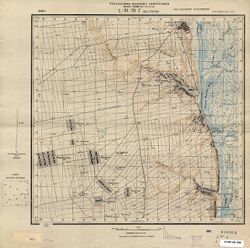
- Description:
- 1930
- Subject:
- Topical Subject: Soviet Union, Topical Subject: Maps, and Geographic Subject: Malyye Girly
- Publisher:
- Управление военных топографов
- Language:
- Russian
- Identifier:
- VAC9619-000694
- Genre:
- Topographic Maps and Military Maps
- Geographic Location:
- Coordinates: 47.3333, 33.75, 47.5, 34
- Related URL:
- Catalog URL: http://iucat.iu.edu/catalog/5020131 and Download GeoTIFF: https://drive.google.com/open?id=1-Etw30MkUGwJuupV_yxxq0wPtWJifXTy
- Abstract:
- Modern area represented: Malyye Girly, Kherson oblast, Ukraine
- Call Number:
- G7000 s50 .S68 sheet L-36-20-D
- Caption:
- Не подлежит оглашению
- City:
- Малые Гирлы (Malyye Girly)
- Copyright Holder:
- No Copyright - United States
- Country:
- СССР (USSR)
- State/Province:
- Украинская ССР (Ukrainian Soviet Socialist Republic)
- Physical Description:
- Scale: 1:50,000
- Persistent URL:
- http://purl.dlib.indiana.edu/iudl/images/VAC9619/VAC9619-000694
-
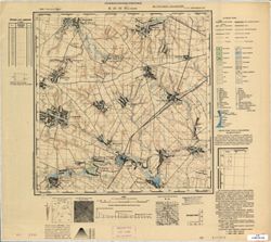
- Description:
- 1908
- Subject:
- Topical Subject: Maps, Topical Subject: Soviet Union, and Geographic Subject: Ulaniv
- Publisher:
- Управление военных топографов
- Language:
- Russian
- Date Created:
- 1932
- Identifier:
- VAC9619-000841
- Genre:
- Topographic Maps and Military Maps
- Geographic Location:
- Coordinates: 49.667, 28, 49.833, 28.25
- Related URL:
- Catalog URL: http://iucat.iu.edu/catalog/5020131 and Download GeoTIFF: https://drive.google.com/open?id=15FLKW1QTqYOGScP21xQURzauigFeLyZz
- Abstract:
- Modern area represented: Ulaniv, Vinnytsia oblast, Ukraine
- Call Number:
- G7000 s50 .S68 sheet M-35-81-С
- Caption:
- Не подлежит оглашению
- City:
- Уланов (Ulanov)
- Copyright Holder:
- No Copyright - United States
- Country:
- СССР (USSR)
- State/Province:
- Украинская ССР (Ukrainian Soviet Socialist Republic) and Винницкая область (Vinnytsia oblast)
- Physical Description:
- Scale: 1:50,000
- Persistent URL:
- http://purl.dlib.indiana.edu/iudl/images/VAC9619/VAC9619-000841
- Provenance:
- CIA Map Branch -- Received
-
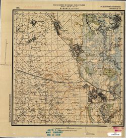
- Description:
- 1929
- Subject:
- Topical Subject: Soviet Union, Topical Subject: Maps, and Geographic Subject: Velyka Burimka
- Publisher:
- Управление военных топографов
- Language:
- Russian
- Identifier:
- VAC9619-001035
- Genre:
- Topographic Maps and Military Maps
- Geographic Location:
- Coordinates: 49.5, 32.5, 49.6667, 32.75
- Related URL:
- Download GeoTIFF: https://drive.google.com/open?id=1fA7PIN8KaLEj79NkKHIHAdHJh6UgpjVl and Catalog URL: http://iucat.iu.edu/catalog/5020131
- Abstract:
- Modern area represented: Велика Бурімка (Velyka Burimka), Cherkasy oblast, Ukraine
- Call Number:
- G7000 s50 .S68 sheet M-36-90-A
- Caption:
- Не подлежит оглашению
- City:
- Большая Буромка (Bolshaya Buromka)
- Copyright Holder:
- No Copyright - United States
- Country:
- СССР (USSR)
- State/Province:
- Украинская ССР (Ukrainian Soviet Socialist Republic)
- Physical Description:
- Scale: 1:50,000
- Persistent URL:
- http://purl.dlib.indiana.edu/iudl/images/VAC9619/VAC9619-001035
- Provenance:
- M. I. Map Library
-
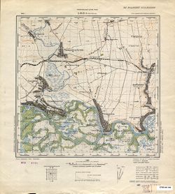
- Description:
- 1926
- Subject:
- Geographic Subject: Pokrovske, Topical Subject: Maps, and Topical Subject: Soviet Union
- Publisher:
- Генеральный штаб РККА
- Language:
- Russian
- Identifier:
- VAC9619-000695
- Genre:
- Topographic Maps and Military Maps
- Geographic Location:
- Coordinates: 47.5, 34, 47.6667, 34.25
- Related URL:
- Catalog URL: http://iucat.iu.edu/catalog/5020131 and Download GeoTIFF: https://drive.google.com/open?id=1p5HdLuTj5TaGLvVdGHcU73xvaGxAxCLM
- Abstract:
- Modern area represented: Pokrovske, Dnipropetrovsk oblast, Ukraine
- Call Number:
- G7000 s50 .S68 and zsheet L-36-21-A
- Caption:
- Не подлежит оглашению
- City:
- Покровское (Pokrovskoe)
- Copyright Holder:
- No Copyright - United States
- Country:
- СССР (USSR)
- State/Province:
- Днепропетровская область (Dnipropetrovsk oblast) and Украинская ССР (Ukrainian Soviet Socialist Republic)
- Physical Description:
- Scale: 1:50,000
- Persistent URL:
- http://purl.dlib.indiana.edu/iudl/images/VAC9619/VAC9619-000695
-
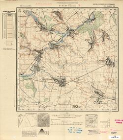
- Subject:
- Geographic Subject: Verkhivnya, Topical Subject: Maps, and Topical Subject: Soviet Union
- Publisher:
- Управление военных топографов
- Language:
- Russian
- Identifier:
- VAC9619-000850
- Genre:
- Military Maps and Topographic Maps
- Geographic Location:
- Coordinates: 49.6667, 29.25, 49.8333, 29.5
- Related URL:
- Catalog URL: http://iucat.iu.edu/catalog/5020131 and Download GeoTIFF: https://drive.google.com/open?id=1-_R2i_KtFyhBTFCh3UGCxpZNnAYHPb83
- Abstract:
- Modern area represented: Verkhivnya, Zhytomyr oblast, Ukraine
- Call Number:
- G7000 s50 .S68 sheet M-35-83-D
- Caption:
- Не подлежит оглашению
- City:
- Верховня (Verkhovnya)
- Copyright Holder:
- No Copyright - United States
- Country:
- СССР (USSR)
- State/Province:
- Украинская ССР (Ukrainian Soviet Socialist Republic) and Киевская область (Kyiv oblast)
- Physical Description:
- Scale: 1:50,000
- Persistent URL:
- http://purl.dlib.indiana.edu/iudl/images/VAC9619/VAC9619-000850
- Provenance:
- M. I. Map Library, G000-30, GS, RA, Atlasblatt
