Indiana University
Indiana University
IU
Skip to Content
Digital Collections
Toggle navigation
Digital
Collections
Switch language
English
Switch language
Deutsch
English
Español
Français
Italiano
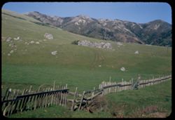
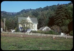
Português do Brasil
中文
Login
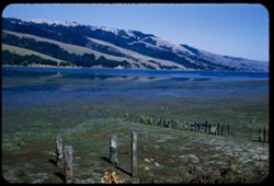
Home
About
Contact
Search Digital Collections
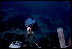
Go
×
Search Constraints
Start Over
You searched for:
County
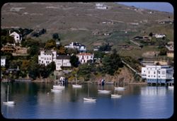
Marin
Remove constraint County: Marin
« Previous |
1
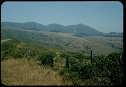
-
100
of
301
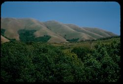
|
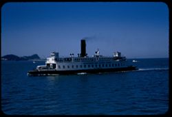
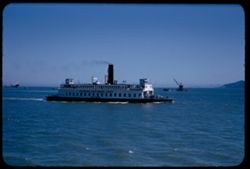
Next »
Sort by date created ▲
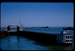
relevance ▼
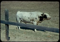
recently updated
title ▲
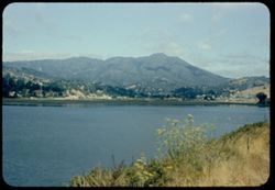
title ▼
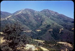
date created ▲
date created ▼
pages ▲
pages ▼
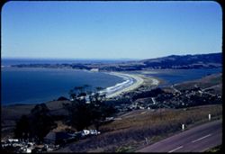
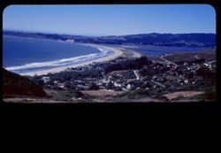
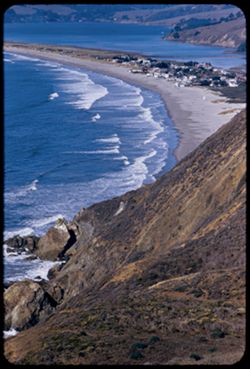
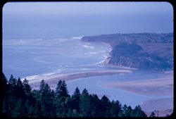
collection size ▲
collection size ▼
Number of results to display per page
100 per page
10
per page
20
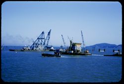
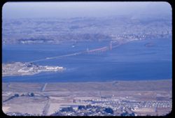
per page
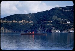
50
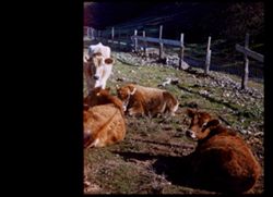
per page
100
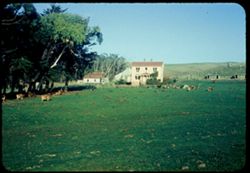
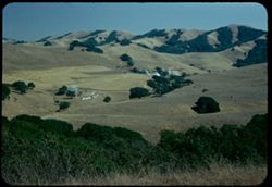
per page
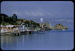
View results as:
List
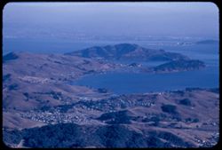
Gallery
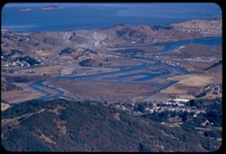
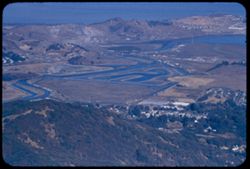
Masonry
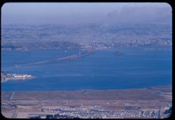
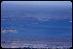
Search Results
1.
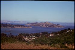
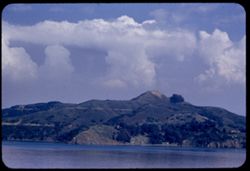
Angel Island, Belvedere, Richardson Bay from hills above Sausalito
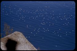
2.
Angel Island, S.F. Bay East Bay Hills
3.
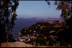
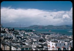
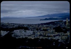
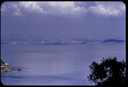
San Francisco from heights back of Sausalito.
4.
View east from Tamalpais Rd. above Mill Valley - toward Belvedere.
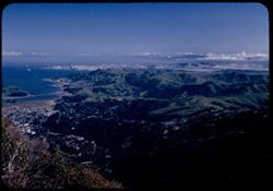
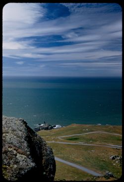
5.
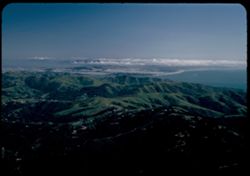
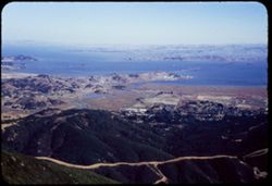
Marin Hills, the Bay and San Francisco from top of Mount Tamalpais.
6.
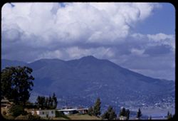
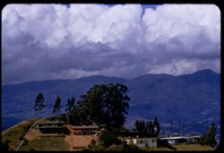
Marin hills north of Mt. Tamalpais.
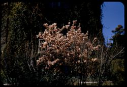
7.
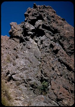
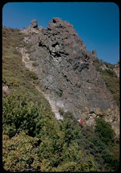
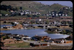
Great cinder-like rock at top of Mt. Tamalpais.
8.
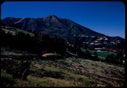
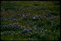
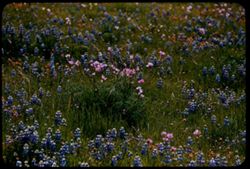
Mount Tamalpais from road above Mill Valley.
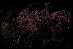
9.
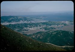
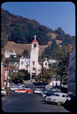
View N by E over San Rafael from top of Tamalpais.
10.
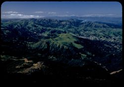
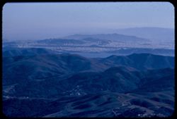
View south from top of Mt. Tamalpais across Marin hills to San Francisco's West half.
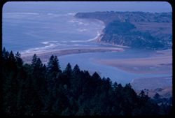
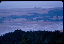
11.
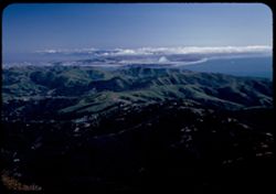
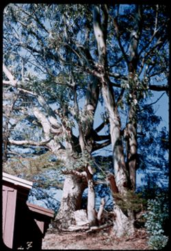
Marin hills and west part of San Francisco from top of Mt. Tamalpais.
12.
A great cinder-like rock at top of Mt. Tamalpais.
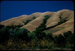
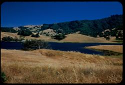
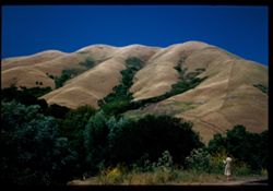
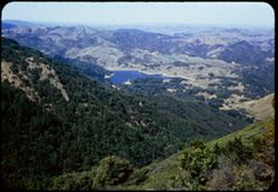
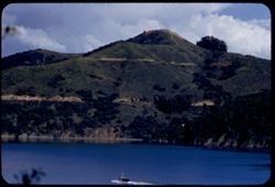
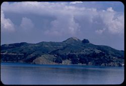
13.
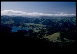
Main hills and lake north of Mt. Tamalpais, California.
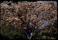
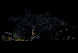
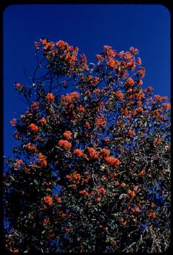
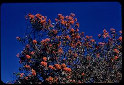
14.
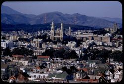
Toward Marin and the Golden Gate from Telegraph Hill San Francisco Cushman San Francisco
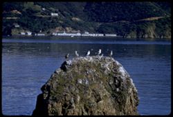
15.
Bolinas lagoon showing sand spit.
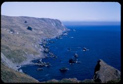
16.
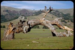
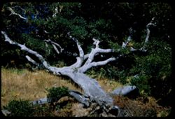
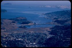
Fallen tree in Marin county meadow.
17.
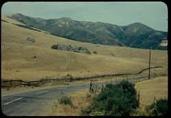
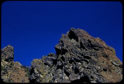
Sonoma county landscape from Roberts road, looking west.
18.
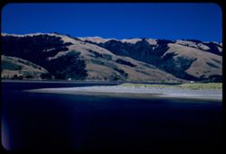
Black Mtn. 1276 ft. Marin county,Calif. Near haed of Tamales Bay.
19.
Tomales Bay fromcove on east side 3 mi. north of Marshall, California.
20.
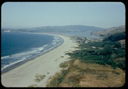
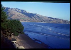
Marin county shore south of Stinson Beach, Calif.
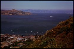
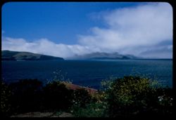
21.
Angel Island with fog bank in north bay from height back of Sausalito. California.
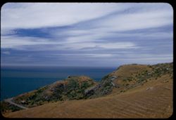
22.
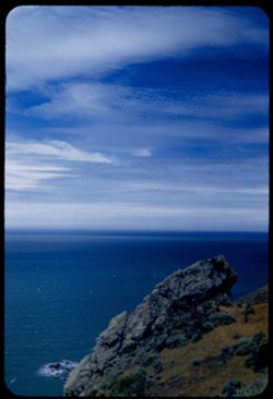
Looking out over Pacific from height of Calif. Hwy 1 in Marin county south of Stinson Beach.
23.
Clam digger. Bolinas, California.
24.
Bolinas lagoon - early afternoon. California.
25.
Marin county landscape. California.
26.
Black Mtn. - 1276 ft. Marin Co. - California near Tamales Bay.
27.
The Pacific from Calif. Hwy 1 a few miles south of Stinson Beach in Marin county.
28.
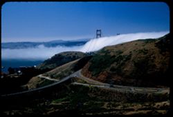
Golden Gate bridge towers above incoming fog bank. View from Waldo tunnel entrance on Marin side.
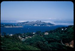
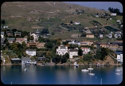
29.
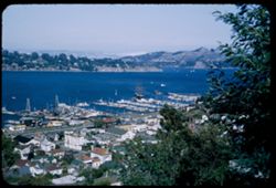
Sausalito and a part of Richardson bay. San Francisco Bay. Calif.
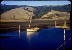
30.
Pacific coast near Rocky Pt., Marin county. Along Calif. Hwy 1.
31.
Uprooted Oak along Calif. Hwy 1 along Bolinas lagoon.
32.
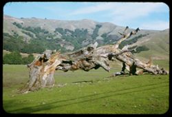
Fallen tree in meadow. Marin county, California.
33.
Marin county fields and hills 4 or 5 miles east of Pt. Reyes Station.
34.
Stinson Beach with Bolinas Bay at left and at right Bolinas Lagoon.
35.
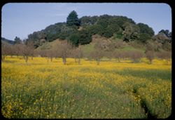
Mustard in a field near Novato Marin county California
36.
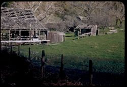
Skeleton farm along Salmon Creek Marin county California
37.
Black Mountain from Lagunitas road Marin county California
38.
Ferry boat KLAMATH in San Fransisco Bay en route from Richmond to San Rafael
39.
Bolinas Bay Stinson Beach at lower left
40.
Ferry slip at Richmond, California seen from Ferry boat RUSSIAN RIVER
41.
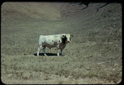
Marin county Ayrshire bull.
42.
Marin county along Salmon Creek California
43.
Mount Tamalpais seen from US101 across arm of Richardson Bay
44.
Mt. Tamalpais from SSW.
45.
Mount Tamalpais from southwest
46.
Dairy farm along Coast Hwy Calif 1 near Bleu Baie Tomales Bay
47.
View NNW from top of Tamalpais.
48.
Looking down on Stinson Beach, Calif.
49.
Farm along east side of Bolinas Lagoon.
50.
View eastward across Bolinas Bay.
51.
Bolinas Lagoon from west shore at low tide.
52.
Ayrshire bull. Marin county.
53.
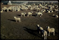
Sheep ranch near Dillon Beach Marin county, Calif. ANSCO
54.
Marin County fields along Salmon Creek
55.
Setting piers for new San Rafael - Richmond bridge - seen from ferry Russian River.
56.
Ferry boat EL PASO crossing San Fransisco Bay from Richmond to San Rafael
57.
Cows graze below Black Mountain Marin county California
58.
View eastward from top of Tamalpais.
59.
Marin county dairy farm along Petaluma - Pt. Reyes road.
60.
Eastern point of Mount Tamalpais from high point of Sausalito
61.
View up California coast from Buena Vista Park in San Francisco Tel. long - wrong focus
62.
South point of Tiburon
63.
Looking down on mouth of Corte Manera Creek from top of Tamalpais
64.
New San Rafael - Richmond bridge under construction from top of Tamalpais
65.
Toward Angel Island and Belvidere from top of Tamalpais
66.
Angel Island form Sausalito height
67.
Birds in water below point of Belvedere
68.
San Rafael - Richmond Bridge under construction from top of Tamalpais
69.
Toward north end of Angel Island from Tiburon
70.
Heifers along Bolinas lagoon
71.
Angel island from Belvedere
72.
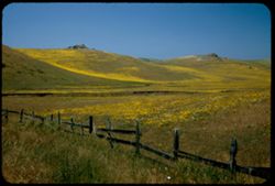
Field of wild flowers near Novato, Marin county
73.
from top of Mount Tamalpais down and eastward
74.
Magnolia in Belvedere
75.
Bolinas Bay, Bar and Lagoon - and town
76.
Cloud mass above Mount Tamalpais seen from top point of Sausalito
77.
Spring blossoms high up in Sausalito
78.
New housing between Belvedere and Tiburon
79.
Toward Golden Gate Bridge and Marin hills from Mt. Olympus San Francisco
80.
Pink flowers in field of lupine near Novato, Marin county
81.
A prunus pendulant in bloom at Belvedere
82.
Mission church San Rafael, Calif.
83.
Toward East Bay cities from Belvedere
84.
toward San Francisco and San Bruno Mtn. from top of Tamalpais
85.
Mud flats of Bolinas Lagoon at low tide - seen from shoulder of Tamalpais
86.
Eucalyptus grove near Bolinas
87.
San Rafael - Richmond bridge under construction from top of Tamalpais in smoke haze
88.
Toward Tiburon from Belvedere
89.
Angel Island from high shoulder of Sausalito
90.
Sail boats in harbor of Tiburon from Belvedere
91.
Wild lilac Mill Valley Calif.
92.
Stinson Beach Bolinas Bay
93.
EK C1 Gulls on rock off Tiburon
94.
Blooms of Silk Tree Bolinas, Calif.
95.
Bolinas Bay and Bolinas Lagoon from west shoulder of Tamalpais
96.
Richardson Bay and San Francisco Bay from top of Tamalpais
97.
Toward Belvidere and Angel Island from road up to Mt. Tamalpais
98.
Craggy rock near top of Mt. Tamalpais
99.
Blooms of Silk Tree Bolinas, Calif.
100.
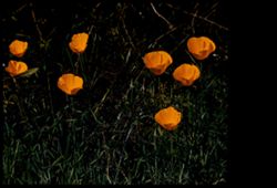
Belvedere poppies from 8 1/2 ft.
« Previous
Next »
1
2
3
4
Toggle facets
Limit your search
Type
Image
301
Creator
Cushman, Charles W., 1896-1972
301
Subject
Hills
173
Trees
165
Bays (Bodies of water)
104
Mountains
77
Coastlines
67
Shrubs
57
Tamalpais, Mount (Calif.)
56
Grasses
53
Buildings
46
Clouds
45
more
Subjects
»
Date Created
1955-03-10
19
1956-03-14
18
1955-10-31
13
1952-03-30
10
1956-06-09
10
1954-10-23
8
1956-09-08
8
1953-07-08
7
1957-04-25
7
1958-07-18
7
more
Date Createds
»
Pages
0-99 pages
301
Collections
Charles W. Cushman Kodachrome Slides
301
State
deposited
301
Campus
IUB
301
Frame Number
17
15
8
14
1
13
10
13
11
13
16
13
2
13
18
12
9
12
12
11
County
Marin
[remove]
301
San Francisco
34
Sonoma
15
Contra Costa
10
Alameda
1
Series
5-55
20
2-56
18
29-55
17
1-68
13
2-60
13
7-56
13
12-56
12
7-53
11
1-60
10
12-52
10
City
Bolinas
44
San Francisco
34
Sausalito
31
San Rafael
29
Petaluma
15
Belvedere
14
Nicasio
12
Tiburon
12
Richmond
9
Point Reyes Station
8
Country
United States
301
State/Province
California
301
Holding Location
B-ARCHIVES
301