
Search Constraints
You searched for:
Pages
0-99 pages
Remove constraint Pages: 0-99 pages
Provenance
CIA Map Library
Remove constraint Provenance: CIA Map Library
State/Province
Одесская область (Odessa oblast)
Remove constraint State/Province: Одесская область (Odessa oblast)
1 - 7 of 7
Search Results
-
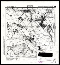
- Description:
- 1939
- Subject:
- Topical Subject: Maps, Topical Subject: Soviet Union, and Geographic Subject: Khashchuvate
- Publisher:
- Геологическое управление УССР
- Language:
- Russian
- Identifier:
- VAC9619-002823
- Genre:
- Topographic Maps and Military Maps
- Geographic Location:
- Coordinates: 48.166667, 29.75 and 48.333333, 30.0
- Related URL:
- DataCORE Dataset Download: https://datacore.iu.edu/concern/data_sets/3b591941t
- Abstract:
- Modern area represented: Khashchuvate, Kirovohrad oblast, Ukraine
- Call Number:
- G7000 s50 .S68 sheet M-35-144-Б
- Caption:
- Для служебного пользования
- Copyright Holder:
- No Copyright - United States
- Country:
- СССР (USSR)
- State/Province:
- Молдавская АССР (Moldavian Autonomous Soviet Socialist Republic), Окникцкая область (Ocnița oblast), and Одесская область (Odessa oblast)
- Physical Description:
- Scale: 1:50,000
- Persistent URL:
- http://purl.dlib.indiana.edu/iudl/images/VAC9619/VAC9619-002823
- Provenance:
- CIA Map Library
-
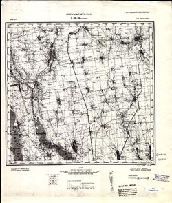
- Description:
- 1929
- Subject:
- Geographic Subject: Velykyy Buyalyk, Topical Subject: Soviet Union, and Topical Subject: Maps
- Publisher:
- Генеральный штаб РККА
- Language:
- Russian
- Date Created:
- 1930
- Identifier:
- VAC9619-001881
- Genre:
- Military Maps and Topographic Maps
- Geographic Location:
- Coordinates: 46.6667, 30.5, 47, 31
- Related URL:
- DataCORE Dataset Download: https://datacore.iu.edu/concern/data_sets/gm80hw07f
- Abstract:
- Modern area represented: Velykyy Buyalyk, Odessa oblast, Ukraine
- Call Number:
- G7000 s100 .S7 sheet L-36-38
- Caption:
- Не подлежит оглашению
- City:
- Благоево (Blagoyevo)
- Copyright Holder:
- No Copyright - United States
- Country:
- СССР (USSR)
- State/Province:
- Одесская область (Odessa oblast) and Украинская ССР (Ukrainian Soviet Socialist Republic)
- Physical Description:
- Scale: 1:100,000
- Persistent URL:
- http://purl.dlib.indiana.edu/iudl/images/VAC9619/VAC9619-001881
- Provenance:
- CIA Map Library
-
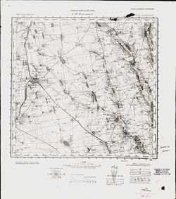
- Description:
- 1929
- Subject:
- Topical Subject: Soviet Union, Topical Subject: Maps, and Geographic Subject: Rozdilna
- Publisher:
- Генеральный штаб РККА
- Language:
- Russian
- Date Created:
- 1933
- Identifier:
- VAC9619-001880
- Genre:
- Topographic Maps and Military Maps
- Geographic Location:
- Coordinates: 46.6667, 30, 47, 30.5
- Related URL:
- DataCORE Dataset Download: https://datacore.iu.edu/concern/data_sets/f1881m719
- Abstract:
- Modern area represented: Rozdilna, Odessa oblast, Ukraine
- Call Number:
- G7000 s100 .S7 sheet L-36-37
- Caption:
- Не подлежит оглашению
- City:
- Пос. Раздельная (Posad Pazdelnaya)
- Copyright Holder:
- No Copyright - United States
- Country:
- СССР (USSR)
- State/Province:
- Молдавская АССР (Moldavian Autonomous Soviet Socialist Republic) and Одесская область (Odessa oblast)
- Physical Description:
- Scale: 1:100,000
- Persistent URL:
- http://purl.dlib.indiana.edu/iudl/images/VAC9619/VAC9619-001880
- Provenance:
- CIA Map Library
-
- Description:
- 1929
- Subject:
- Geographic Subject: Oleksandrivka, Topical Subject: Maps, and Topical Subject: Soviet Union
- Publisher:
- Управление военных топографов РККА
- Language:
- Russian
- Identifier:
- VAC9619-001916
- Genre:
- Topographic Maps and Military Maps
- Geographic Location:
- Coordinates: 46, 30.5, 46.3333, 31
- Related URL:
- DataCORE Dataset Download: https://datacore.iu.edu/concern/data_sets/9019s3253
- Abstract:
- Modern area represented: Oleksandrivka, Odessa oblast, Ukraine
- Call Number:
- G7000 s100 .S7 sheet L-36-62
- Caption:
- Не подлежит оглашению
- City:
- Александровка (Oleksandrivka)
- Copyright Holder:
- No Copyright - United States
- Country:
- СССР (USSR)
- State/Province:
- Одесская область (Odessa oblast) and Украинская ССР (Ukrainian Soviet Socialist Republic)
- Physical Description:
- Scale: 1:100,000
- Persistent URL:
- http://purl.dlib.indiana.edu/iudl/images/VAC9619/VAC9619-001916
- Provenance:
- CIA Map Library
-
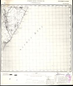
- Description:
- 1928
- Subject:
- Topical Subject: Maps, Geographic Subject: Odessa, and Topical Subject: Soviet Union
- Publisher:
- Генеральный штаб РККА
- Language:
- Russian
- Date Created:
- 1930
- Identifier:
- VAC9619-001903
- Genre:
- Topographic Maps and Military Maps
- Geographic Location:
- Coordinates: 46.3333, 30.5, 46.6667, 31
- Related URL:
- DataCORE Dataset Download: https://datacore.iu.edu/concern/data_sets/fj2362734
- Abstract:
- Modern area represented: Odessa, Odessa oblast, Ukraine
- Call Number:
- G7000 s100 .S7 sheet L-36-50
- Caption:
- Не подлежит оглашению
- City:
- Одесса (Odessa)
- Copyright Holder:
- No Copyright - United States
- Country:
- СССР (USSR)
- State/Province:
- Одесская область (Odessa oblast) and Украинская ССР (Ukrainian Soviet Socialist Republic)
- Physical Description:
- Scale: 1:100,000
- Persistent URL:
- http://purl.dlib.indiana.edu/iudl/images/VAC9619/VAC9619-001903
- Provenance:
- CIA Map Library
-
- Description:
- 1875
- Subject:
- Topical Subject: Soviet Union, Geographic Subject: Tiraspol, and Topical Subject: Maps
- Publisher:
- Генеральный штаб РККА
- Language:
- Russian
- Date Created:
- 1929
- Identifier:
- VAC9619-001718
- Genre:
- Military Maps and Topographic Maps
- Geographic Location:
- Coordinates: 46.6667, 29.5, 47, 30
- Related URL:
- DataCORE Dataset Download: https://datacore.iu.edu/concern/data_sets/bz60cx02x
- Abstract:
- Modern area represented: Tiraspol, Stînga Nistrului, Moldova
- Call Number:
- G7000 s100 .S7 sheet L-35-48
- Caption:
- Не подлежит оглашению
- City:
- Тирасполь (Tiraspol)
- Copyright Holder:
- No Copyright - United States
- State/Province:
- Украинская ССР (Ukrainian Soviet Socialist Republic), Молдавская АССР (Moldavian Autonomous Soviet Socialist Republic), Бессарабия (Bessarabia), and Одесская...
- Physical Description:
- Scale: 1:100,000
- Persistent URL:
- http://purl.dlib.indiana.edu/iudl/images/VAC9619/VAC9619-001718
- Provenance:
- CIA Map Library
-
- Description:
- 1939
- Subject:
- Geographic Subject: Бугове (Buhove), Topical Subject: Soviet Union, and Topical Subject: Maps
- Publisher:
- Геологическое управление УССР
- Language:
- Russian
- Identifier:
- VAC9619-000893
- Genre:
- Topographic Maps and Military Maps
- Geographic Location:
- Coordinates: 48.1667, 29.75, 48.3333, 30
- Related URL:
- DataCORE Dataset Download: https://datacore.iu.edu/concern/data_sets/ww72bc248
- Abstract:
- Modern area represented: Бугове (Buhove), former Юзефполь (Yuzefpol'), Kirovohrad Oblast, Ukraine
- Call Number:
- G7000 s50 .S68 sheet M-35-144-B
- Caption:
- Для служебного пользования
- Copyright Holder:
- No Copyright - United States
- Country:
- СССР (USSR)
- State/Province:
- Винницкая область (Vinnytsia oblast), Песчанский район (Peschansky district), Одесская область (Odessa oblast), Бершадский район (Bershadsky district), Молда...
- Physical Description:
- Scale: 1:50,000
- Persistent URL:
- http://purl.dlib.indiana.edu/iudl/images/VAC9619/VAC9619-000893
- Provenance:
- CIA Map Library
