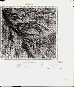
Indiana University
Indiana University
IU
Skip to Content
Digital Collections
Toggle navigation
Digital
Collections
Switch language
English
Switch language
Deutsch
English
Español
Français
Italiano
Português do Brasil
中文
Login
Home
About
Contact
Search Digital Collections
Go
×
Search Constraints
Start Over
You searched for:
Date Created
1940
Remove constraint Date Created: 1940
Subject
Topical Subject: Maps
Remove constraint Subject: Topical Subject: Maps
« Previous |
1
-
10
of
424
|
Next »
Sort by relevance ▼
relevance ▼
recently updated
title ▲
title ▼
date created ▲
date created ▼
pages ▲
pages ▼
collection size ▲
collection size ▼
Number of results to display per page
10 per page
10
per page
20
per page
50
per page
100
per page
View results as:
List
Gallery
Masonry
Search Results
1.
L-35-60 Волинтирь
2.
L-35-57 Леово
3.
L-35-62 Сигишоара
4.
L-35-47 Бендеры
5.
L-35-42 Роман
6.
L-35-33 Калараш-Тырг
7.
M-34-50 Беутен
8.
N-36-141 Середина-Буда
9.
N-35-100 Новая Мышь
10.
N-35-99 Слоним
« Previous
Next »
1
2
3
4
5
…
42
43
Toggle facets
Limit your search
Type
Image
424
Subject
Topical Subject: Maps
[remove]
424
Topical Subject: Soviet Union
424
Geographic Subject: Bytom
2
Geographic Subject: Gusev
2
Geographic Subject: Vysokoye
2
Geographic Subject: Agilos Įlanka
1
Geographic Subject: Aleksandra Kosmodem’yanskogo
1
Geographic Subject: Aleksandrovka
1
Geographic Subject: Alytus
1
Geographic Subject: Amosovo
1
more
Subjects
»
Language
Russian
424
Publisher
Генеральный штаб Красной Армии
278
Генеральный штаб РККА
126
Главное управление геодезии и картографии при СНК СССР
10
Наркомрыбпром Главрыбвод
5
Главное управление государственной съемки и картографии НКВД СССР
4
Date Created
1940
[remove]
424
Pages
0-99 pages
424
Collections
Russian Military Topographic Map Collection
424
State
deposited
424
Campus
IUB
424
City
Беутен (Beuthen)
2
Йургайтшен (Jurgaitschen)
2
Абракунис
1
Азов (Azov)
1
Александровка (Aleksandrovka)
1
Алитус (Alytus)
1
Алленбург (Allenburg)
1
Альт Лаппинен (Al’t Lappinen)
1
Амосово (Amosovo)
1
Антреа (Antrea)
1
Country
Германия (Восточная Пруссия) (Germany (East Prussia))
132
Германия (Germany)
101
СССР (USSR)
88
Румыния (Romania)
18
Финляндия (Finland)
16
Восточная Пруссия (East Prussia)
11
Иран (Iran)
4
Литва (Lithuania)
2
Словакия (Slovakia)
2
Болгария (Bulgaria)
1
State/Province
Область государственных интересов Германии (Region of German state interests)
93
Белорусская ССР (Byelorussian Soviet Socialist Republic)
28
Литовская ССР (Lithuanian Soviet Socialist Republic)
25
РСФСР (RSFSR)
20
Украинская ССР (Ukrainian Soviet Socialist Republic)
18
Барановичская область (Baranavichy oblast)
12
Ленинградская область (Leningrad oblast)
11
Белостокская область (Belastok oblast)
10
Вилейская область (Vileyka oblast)
5
Краснодарский край (Krasnodar kray)
5
Holding Location
B-WELLS
424
Provenance
DMA Topographic Center, Army Map Service Library
64
DMA Topographic Center, Army Map Service Library, OMAHA
54
M. I. Map Library
50
CIA Map Branch -- Received
46
Army Map Service Library, OMAHA, Library of Congress Geography & Map Division
24
DMA Topographic Center, Army Map Service Library, Library of Congress Geography & Map Division
23
DMA Topographic Center, Army Map Service Library, OMAHA, Library of Congress Geography & Map Division
19
DMA Topographic Center, Library of Congress Geography & Map Division, Army Map Service Library, OMAHA
18
DMA Topographic Center, Army Map Service Library, Auswärtiges Amt. Geographischer Dienst
13
CIA Map Library
10