
Search Constraints
You searched for:
Provenance
DMA Topographic Center, Army Map Service Library
Remove constraint Provenance: DMA Topographic Center, Army Map Service Library
« Previous |
1 - 100 of 221
|
Next »
Search Results
-
- Description:
- 1930
- Subject:
- Topical Subject: Soviet Union, Geographic Subject: Vetmitsa, and Topical Subject: Maps
- Publisher:
- Управление военных топографов
- Language:
- Russian
- Identifier:
- VAC9619-001417
- Genre:
- Topographic Maps and Military Maps
- Geographic Location:
- Coordinates: 53.833, 33.75, 54, 34
- Related URL:
- Catalog URL: http://iucat.iu.edu/catalog/5020131 and Download GeoTIFF: https://drive.google.com/open?id=1HAhHSNA0lRxPg7TbBBtSLmlHRCxLnLLJ
- Abstract:
- Modern area represented: Vetmitsa, Kaluga oblast, Russia
- Call Number:
- GM G7000 S50 .S68 N-36-80-Б
- Caption:
- Не подлежит оглашению
- City:
- Ветмица (Vetmitsa)
- Copyright Holder:
- No Copyright - United States
- Country:
- СССР (USSR)
- State/Province:
- РСФСР (RSFSR) and Западная область (Western oblast)
- Physical Description:
- Scale: 1:50,000
- Persistent URL:
- http://purl.dlib.indiana.edu/iudl/images/VAC9619/VAC9619-001417
- Provenance:
- DMA Topographic Center, Army Map Service Library
-

- Description:
- 1923
- Subject:
- Topical Subject: Maps, Topical Subject: Soviet Union, and Geographic Subject: Ogorodnya
- Publisher:
- Генеральный штаб Красной Армии
- Language:
- Russian
- Date Created:
- 1941
- Identifier:
- VAC9619-004213
- Genre:
- Topographic Maps and Military Maps
- Geographic Location:
- Coordinates: 52, 31.5, 52.333, 32
- Related URL:
- Download GeoTIFF: https://drive.google.com/file/d/1MuU_oyIyusePmX5IlnPsAE4zUOKWaE3e/view?usp=sharing and Catalog URL: https://iucat.iu.edu/catalog/5020129
- Abstract:
- Modern area represented: Ogorodnya, Homyel voblasc, Belarus
- Call Number:
- G7000 s100 .S7 sheet N-36-136
- City:
- Огородня-Гомельская (Ogorodnya-Gomelskaya)
- Copyright Holder:
- No Copyright - United States
- Country:
- СССР (USSR)
- State/Province:
- Орловская область (Oryol oblast), Украинская ССР (Ukrainian Soviet Socialist Republic), Белорусская ССР (Byelorussian Soviet Socialist Republic), Черниговска...
- Physical Description:
- Scale: 1:100,000
- Persistent URL:
- http://purl.dlib.indiana.edu/iudl/images/VAC9619/VAC9619-004213
- Provenance:
- DMA Topographic Center, Army Map Service Library
-
- Description:
- 1923
- Subject:
- Topical Subject: Soviet Union, Geographic Subject: Klimovo, and Topical Subject: Maps
- Publisher:
- Генеральный штаб Красной Армии
- Language:
- Russian
- Date Created:
- 1941
- Identifier:
- VAC9619-004204
- Genre:
- Topographic Maps and Military Maps
- Geographic Location:
- Coordinates: 52.333, 32, 52.667, 32.5
- Related URL:
- Download GeoTIFF: https://drive.google.com/file/d/1Zb60MqhS8TeDqZFeikIrdV6AmkbqBHg4/view?usp=sharing and Catalog URL: https://iucat.iu.edu/catalog/5020129
- Abstract:
- Modern area represented: Klimovo, Bryansk oblast, Russia
- Call Number:
- G7000 s100 .S7 sheet N-36-125
- City:
- Климово (Klimovo)
- Copyright Holder:
- No Copyright - United States
- Country:
- СССР (USSR)
- State/Province:
- Орловская область (Oryol oblast) and РСФСР (RSFSR)
- Physical Description:
- Scale: 1:100,000
- Persistent URL:
- http://purl.dlib.indiana.edu/iudl/images/VAC9619/VAC9619-004204
- Provenance:
- DMA Topographic Center, Army Map Service Library
-
- Description:
- 1931
- Subject:
- Geographic Subject: Unecha, Topical Subject: Maps, and Topical Subject: Soviet Union
- Publisher:
- Генеральный штаб Красной Армии
- Language:
- Russian
- Date Created:
- 1941
- Identifier:
- VAC9619-004194
- Genre:
- Topographic Maps and Military Maps
- Geographic Location:
- Coordinates: 52.667, 32.5, 53, 33
- Related URL:
- Catalog URL: https://iucat.iu.edu/catalog/5020129 and Download GeoTIFF: https://drive.google.com/file/d/1UTZ0zmTwJF3940BO2uH_BRR7iPaxq7QO/view?usp=sharing
- Abstract:
- Modern area represented: Unecha, Bryansk Oblast, Russia
- Call Number:
- G7000 s100 .S7 sheet N-36-114
- City:
- Унеча (Unecha)
- Copyright Holder:
- No Copyright - United States
- Country:
- СССР (USSR)
- State/Province:
- Орловская область (Oryol oblast) and РСФСР (RSFSR)
- Physical Description:
- Scale: 1:100,000
- Persistent URL:
- http://purl.dlib.indiana.edu/iudl/images/VAC9619/VAC9619-004194
- Provenance:
- DMA Topographic Center, Army Map Service Library
-
- Description:
- 1931
- Subject:
- Topical Subject: Soviet Union, Topical Subject: Maps, and Geographic Subject: Zhytnavichy
- Publisher:
- Генеральный штаб РККА
- Language:
- Russian
- Identifier:
- VAC9619-004141
- Genre:
- Military Maps and Topographic Maps
- Geographic Location:
- Coordinates: 52, 27.5, 52.333, 28
- Related URL:
- Download GeoTIFF: https://drive.google.com/file/d/1TRa3FrvHrlTcoOqC7Zb0okd9Jr5kSmlw/view?usp=sharing and Catalog URL: https://iucat.iu.edu/catalog/5020129
- Abstract:
- Modern area represented: Zhytnavichy, Brest oblast, Belarus
- Call Number:
- G7000 s100 .S7 sheet N-35-140
- Caption:
- Не подлежит оглашению
- City:
- Житновичи (Zhytnavichy)
- Copyright Holder:
- No Copyright - United States
- Country:
- СССР (USSR) and Польша (Poland)
- State/Province:
- Белорусская ССР (Byelorussian Soviet Socialist Republic)
- Physical Description:
- Scale: 1:100,000
- Persistent URL:
- http://purl.dlib.indiana.edu/iudl/images/VAC9619/VAC9619-004141
- Provenance:
- DMA Topographic Center, Army Map Service Library
-
- Description:
- 1917
- Subject:
- Topical Subject: Soviet Union, Topical Subject: Maps, and Geographic Subject: Moroch
- Publisher:
- Управление военных топографов РККА
- Language:
- Russian
- Date Created:
- 1936
- Identifier:
- VAC9619-004130
- Genre:
- Topographic Maps and Military Maps
- Geographic Location:
- Coordinates: 52.333, 27.5, 52.667, 28
- Related URL:
- Catalog URL: https://iucat.iu.edu/catalog/5020129 and Download GeoTIFF: https://drive.google.com/file/d/1HUuzBKcEpGGkMff5L63dHETUlsQCusTP/view?usp=sharing
- Abstract:
- Modern area represented: Moroch, Minsk oblast, Belarus
- Call Number:
- G7000 s100 .S7 sheet N-35-128
- Caption:
- Не подлежит оглашению
- City:
- Морочь (Moroch)
- Copyright Holder:
- No Copyright - United States
- Country:
- Польша (Poland) and СССР (USSR)
- State/Province:
- Белорусская ССР (Byelorussian Soviet Socialist Republic)
- Physical Description:
- Scale: 1:100,000
- Persistent URL:
- http://purl.dlib.indiana.edu/iudl/images/VAC9619/VAC9619-004130
- Provenance:
- DMA Topographic Center, Army Map Service Library
-
- Description:
- 1936
- Subject:
- Topical Subject: Soviet Union, Geographic Subject: Urechcha, and Topical Subject: Maps
- Publisher:
- Управление военных топографов РККА
- Language:
- Russian
- Identifier:
- VAC9619-004120
- Genre:
- Military Maps and Topographic Maps
- Geographic Location:
- Coordinates: 52.667, 27.5, 53, 28
- Related URL:
- Download GeoTIFF: https://drive.google.com/file/d/10MhdgmjxEPkvlCQOiAroeDUQfM3VYLsp/view?usp=sharing and Catalog URL: https://iucat.iu.edu/catalog/5020129
- Abstract:
- Modern area represented: Urechcha, Minsk oblast, Belarus
- Call Number:
- G7000 s100 .S7 sheet N-35-116
- Caption:
- Не подлежит оглашению
- City:
- Уречье (Urechcha)
- Copyright Holder:
- No Copyright - United States
- Country:
- СССР (USSR)
- State/Province:
- Белорусская ССР (Byelorussian Soviet Socialist Republic)
- Physical Description:
- Scale: 1:100,000
- Persistent URL:
- http://purl.dlib.indiana.edu/iudl/images/VAC9619/VAC9619-004120
- Provenance:
- DMA Topographic Center, Army Map Service Library
-
- Description:
- 1911
- Subject:
- Geographic Subject: Krasnaya Sloboda, Topical Subject: Soviet Union, and Topical Subject: Maps
- Publisher:
- Генеральный штаб Красной Армии
- Language:
- Russian
- Date Created:
- 1937
- Identifier:
- VAC9619-004119
- Genre:
- Military Maps and Topographic Maps
- Geographic Location:
- Coordinates: 52.667, 27, 53, 27.5
- Related URL:
- Catalog URL: https://iucat.iu.edu/catalog/5020129 and Download GeoTIFF: https://drive.google.com/file/d/1io-MtOMKCDA1XzekP320viXyXSPBm8h7/view?usp=sharing
- Abstract:
- Modern area represented: Krasnaya Sloboda, Belarus
- Call Number:
- G7000 s100 .S7 sheet N-35-115
- Caption:
- Не подлежит оглашению
- City:
- Красная Слобода (Krasnaya Sloboda)
- Copyright Holder:
- No Copyright - United States
- Country:
- СССР (USSR)
- State/Province:
- Пинская область (Pinsk oblast), Барановичская область (Baranavichy oblast), Белорусская ССР (Byelorussian Soviet Socialist Republic), and Минская область (Mi...
- Physical Description:
- Scale: 1:100,000
- Persistent URL:
- http://purl.dlib.indiana.edu/iudl/images/VAC9619/VAC9619-004119
- Provenance:
- DMA Topographic Center, Army Map Service Library
-
- Description:
- 1896
- Subject:
- Topical Subject: Soviet Union, Geographic Subject: Baranovichi, and Topical Subject: Maps
- Publisher:
- Генеральный штаб Красной Армии
- Language:
- Russian
- Date Created:
- 1939
- Identifier:
- VAC9619-004102
- Genre:
- Topographic Maps and Military Maps
- Geographic Location:
- Coordinates: 53, 26, 53.333, 26.5
- Related URL:
- Download GeoTIFF: https://drive.google.com/file/d/1dqxA-1_0S1J6uBYxlrI-RBAv_akNskfp/view?usp=sharing and Catalog URL: https://iucat.iu.edu/catalog/5020129
- Abstract:
- Modern area represented: Baranovichi, Brest oblast, Belarus
- Call Number:
- G7000 s100 .S7 sheet N-35-101
- City:
- Барановичи (Baranovichi)
- Copyright Holder:
- No Copyright - United States
- Country:
- СССР (USSR)
- State/Province:
- Барановичская область (Baranavichy oblast) and Белорусская ССР (Byelorussian Soviet Socialist Republic)
- Physical Description:
- Scale: 1:100,000
- Persistent URL:
- http://purl.dlib.indiana.edu/iudl/images/VAC9619/VAC9619-004102
- Provenance:
- DMA Topographic Center, Army Map Service Library
-

- Description:
- 1890
- Subject:
- Topical Subject: Soviet Union, Topical Subject: Maps, and Geographic Subject: Slonim
- Publisher:
- Генеральный штаб Красной Армии
- Language:
- Russian
- Date Created:
- 1940
- Identifier:
- VAC9619-004100
- Genre:
- Military Maps and Topographic Maps
- Geographic Location:
- Coordinates: 53, 25, 53.333, 25.5
- Related URL:
- Download GeoTIFF: https://drive.google.com/file/d/11uIlcuAi2jRjN2zbDtSfPdBrUot13QKy/view?usp=sharing and Catalog URL: https://iucat.iu.edu/catalog/5020129
- Abstract:
- Modern area represented: Slonim, Belarus
- Call Number:
- G7000 s100 .S7 sheet N-35-99
- City:
- Слоним (Slonim)
- Copyright Holder:
- No Copyright - United States
- Country:
- СССР (USSR)
- State/Province:
- Белорусская ССР (Byelorussian Soviet Socialist Republic) and Барановичская область (Baranavichy oblast)
- Physical Description:
- Scale: 1:100,000
- Persistent URL:
- http://purl.dlib.indiana.edu/iudl/images/VAC9619/VAC9619-004100
- Provenance:
- DMA Topographic Center, Army Map Service Library
-
- Description:
- 1936
- Subject:
- Topical Subject: Soviet Union, Topical Subject: Maps, and Geographic Subject: Svislach
- Publisher:
- Управление военных топографов РККА
- Language:
- Russian
- Identifier:
- VAC9619-004094
- Genre:
- Topographic Maps and Military Maps
- Geographic Location:
- Coordinates: 53.333, 28.5, 53.667, 29
- Related URL:
- Download GeoTIFF: https://drive.google.com/file/d/1wKKzZhgv9Dr2ahNLD1JmLpBLB1twGSqm/view?usp=sharing and Catalog URL: https://iucat.iu.edu/catalog/5020129
- Abstract:
- Modern area represented: Svislach, Belarus
- Call Number:
- G7000 s100 .S7 sheet N-35-94
- Caption:
- Не подлежит оглашению
- City:
- Свислочь (Svislach)
- Copyright Holder:
- No Copyright - United States
- Country:
- СССР (USSR)
- State/Province:
- Белорусская ССР (Byelorussian Soviet Socialist Republic)
- Physical Description:
- Scale: 1:100,000
- Persistent URL:
- http://purl.dlib.indiana.edu/iudl/images/VAC9619/VAC9619-004094
- Provenance:
- DMA Topographic Center, Army Map Service Library
-

- Description:
- 1892
- Subject:
- Topical Subject: Maps, Topical Subject: Soviet Union, and Geographic Subject: Masty
- Publisher:
- Генеральный штаб Красной Армии
- Language:
- Russian
- Date Created:
- 1940
- Identifier:
- VAC9619-004086
- Genre:
- Military Maps and Topographic Maps
- Geographic Location:
- Coordinates: 53.333, 24.5, 53.667, 25
- Related URL:
- Catalog URL: https://iucat.iu.edu/catalog/5020129 and Download GeoTIFF: https://drive.google.com/file/d/1oNc9X6dj_CufOGM3qycfol_3ZNvgto8i/view?usp=sharing
- Abstract:
- Modern area represented: Masty, Hrodno oblast, Belarus
- Call Number:
- G7000 s100 .S7 sheet N-35-86
- City:
- Мосты (Masty)
- Copyright Holder:
- No Copyright - United States
- Country:
- СССР (USSR)
- State/Province:
- Белорусская ССР (Byelorussian Soviet Socialist Republic), Барановичская область (Baranavichy oblast), and Белостокская область (Belastok oblast)
- Physical Description:
- Scale: 1:100,000
- Persistent URL:
- http://purl.dlib.indiana.edu/iudl/images/VAC9619/VAC9619-004086
- Provenance:
- DMA Topographic Center, Army Map Service Library
-
- Description:
- 1888
- Subject:
- Geographic Subject: Porechye, Topical Subject: Maps, and Topical Subject: Soviet Union
- Publisher:
- Генеральный штаб РККА
- Language:
- Russian
- Date Created:
- 1931
- Identifier:
- VAC9619-004073
- Genre:
- Topographic Maps and Military Maps
- Geographic Location:
- Coordinates: 53.667, 24, 54, 24.5
- Related URL:
- Catalog URL: https://iucat.iu.edu/catalog/5020129 and Download GeoTIFF: https://drive.google.com/file/d/17gk-50F3r1-yPzZU3hTI8ayuCb0foMKg/view?usp=sharing
- Abstract:
- Modern area represented: Porechye, Hrodna oblast, Belarus
- Call Number:
- G7000 s100 .S7 sheet N-35-73
- City:
- Пожэчэ (Porzecze)
- Copyright Holder:
- No Copyright - United States
- Country:
- СССР (USSR)
- State/Province:
- Белорусская ССР (Byelorussian Soviet Socialist Republic), Белостокская область (Belastok oblast), and Барановичская область (Baranavichy oblast)
- Physical Description:
- Scale: 1:100,000
- Persistent URL:
- http://purl.dlib.indiana.edu/iudl/images/VAC9619/VAC9619-004073
- Provenance:
- DMA Topographic Center, Army Map Service Library
-
- Description:
- 1903
- Subject:
- Topical Subject: Soviet Union, Topical Subject: Maps, and Geographic Subject: Vishnevo
- Publisher:
- Генеральный штаб РККА
- Language:
- Russian
- Date Created:
- 1924
- Identifier:
- VAC9619-004066
- Genre:
- Military Maps and Topographic Maps
- Geographic Location:
- Coordinates: 54, 26, 54.333, 26.5
- Related URL:
- Catalog URL: https://iucat.iu.edu/catalog/5020129 and Download GeoTIFF: https://drive.google.com/file/d/1t1OidGLAHINGaGoBn0f-Pwhuq9th3MVC/view?usp=sharing
- Abstract:
- Modern area represented: Vishnevo, Belarus
- Call Number:
- G7000 s100 .S7 sheet N-35-65
- City:
- Вишнев (Vishnevo)
- Copyright Holder:
- No Copyright - United States
- Country:
- Польша (Poland)
- Physical Description:
- Scale: 1:100,000
- Persistent URL:
- http://purl.dlib.indiana.edu/iudl/images/VAC9619/VAC9619-004066
- Provenance:
- DMA Topographic Center, Army Map Service Library
-
- Description:
- 1899
- Subject:
- Geographic Subject: Yuratsishki, Topical Subject: Soviet Union, and Topical Subject: Maps
- Publisher:
- Генеральный штаб Красной Армии
- Language:
- Russian
- Date Created:
- 1940
- Identifier:
- VAC9619-004065
- Genre:
- Topographic Maps and Military Maps
- Geographic Location:
- Coordinates: 54, 25.5, 54.333, 26
- Related URL:
- Download GeoTIFF: https://drive.google.com/file/d/1S208tYzBNgJlOJ0Z-RWb-phjImadfveI/view?usp=sharing and Catalog URL: https://iucat.iu.edu/catalog/5020129
- Abstract:
- Modern area represented: Yuratsishki, Hrodna oblast, Belarus
- Call Number:
- G7000 s100 .S7 sheet N-35-64
- Caption:
- Для служебного пользования
- City:
- Юратишки (Yuratsishki)
- Copyright Holder:
- No Copyright - United States
- Country:
- СССР (USSR)
- State/Province:
- Барановичская область (Baranavichy oblast), Вилейская область (Vileyka oblast), and Белорусская ССР (Byelorussian Soviet Socialist Republic)
- Physical Description:
- Scale: 1:100,000
- Persistent URL:
- http://purl.dlib.indiana.edu/iudl/images/VAC9619/VAC9619-004065
- Provenance:
- DMA Topographic Center, Army Map Service Library
-

- Description:
- 1890
- Subject:
- Topical Subject: Maps, Geographic Subject: Merkinė, and Topical Subject: Soviet Union
- Publisher:
- Генеральный штаб Красной Армии
- Language:
- Russian
- Date Created:
- 1940
- Identifier:
- VAC9619-004062
- Genre:
- Military Maps and Topographic Maps
- Geographic Location:
- Coordinates: 54, 24, 54.333, 24.5
- Related URL:
- Download GeoTIFF: https://drive.google.com/file/d/1y93Q-evfnuFOv1Y5G5Dz9TqcZre99-Eq/view?usp=sharing and Catalog URL: https://iucat.iu.edu/catalog/5020129
- Abstract:
- Modern area represented: Merkinė, Lithuania
- Call Number:
- G7000 s100 .S7 sheet N-35-61
- Caption:
- Для служебного пользования
- City:
- Меречь (Merecz)
- Copyright Holder:
- No Copyright - United States
- Country:
- СССР (USSR)
- State/Province:
- Литовская ССР (Lithuanian Soviet Socialist Republic)
- Physical Description:
- Scale: 1:100,000
- Persistent URL:
- http://purl.dlib.indiana.edu/iudl/images/VAC9619/VAC9619-004062
- Provenance:
- DMA Topographic Center, Army Map Service Library
-
- Description:
- 1934
- Subject:
- Topical Subject: Maps, Geographic Subject: Kholopenichi, and Topical Subject: Soviet Union
- Publisher:
- Генеральный штаб РККА
- Language:
- Russian
- Date Created:
- 1936
- Identifier:
- VAC9619-004060
- Genre:
- Topographic Maps and Military Maps
- Geographic Location:
- Coordinates: 54.333, 28.5, 54.667, 29
- Related URL:
- Download GeoTIFF: https://drive.google.com/file/d/1onjuqrKcfu2cD0BzmRZ9pHaNVRSwX1oU/view?usp=sharing and Catalog URL: https://iucat.iu.edu/catalog/5020129
- Abstract:
- Modern area represented: Kholopenichi, Belarus
- Call Number:
- G7000 s100 .S7 sheet N-35-58
- Caption:
- Не подлежит оглашению
- City:
- Холопеничи (Kholopenichi)
- Copyright Holder:
- No Copyright - United States
- Country:
- СССР (USSR)
- State/Province:
- Белорусская ССР (Byelorussian Soviet Socialist Republic)
- Physical Description:
- Scale: 1:100,000
- Persistent URL:
- http://purl.dlib.indiana.edu/iudl/images/VAC9619/VAC9619-004060
- Provenance:
- DMA Topographic Center, Army Map Service Library
-
- Description:
- 1909
- Subject:
- Topical Subject: Soviet Union, Topical Subject: Maps, and Geographic Subject: Dolginovo
- Publisher:
- Генеральный штаб РККА
- Language:
- Russian
- Date Created:
- 1931
- Identifier:
- VAC9619-004057
- Genre:
- Topographic Maps and Military Maps
- Geographic Location:
- Coordinates: 54.333, 27, 54.667, 27.5
- Related URL:
- Catalog URL: https://iucat.iu.edu/catalog/5020129 and Download GeoTIFF: https://drive.google.com/file/d/1AaQXE20baQzJ9XDGZ41VWaMfJlw8ANcS/view?usp=sharing
- Abstract:
- Modern area represented: Dolginovo, Belarus
- Call Number:
- G7000 s100 .S7 sheet N-35-55
- Caption:
- Не подлежит оглашению
- City:
- Долгинув (Dolginovo)
- Copyright Holder:
- No Copyright - United States
- Country:
- СССР (USSR)
- State/Province:
- Белорусская ССР (Byelorussian Soviet Socialist Republic)
- Physical Description:
- Scale: 1:100,000
- Persistent URL:
- http://purl.dlib.indiana.edu/iudl/images/VAC9619/VAC9619-004057
- Provenance:
- DMA Topographic Center, Army Map Service Library
-
- Description:
- 1904
- Subject:
- Geographic Subject: Vileyka, Topical Subject: Soviet Union, and Topical Subject: Maps
- Publisher:
- Генеральный штаб Красной Армии
- Language:
- Russian
- Date Created:
- 1940
- Identifier:
- VAC9619-004056
- Genre:
- Military Maps and Topographic Maps
- Geographic Location:
- Coordinates: 54.333, 26.5, 54.667, 27
- Related URL:
- Download GeoTIFF: https://drive.google.com/file/d/1kyEkVOJvt8AXa5spmn7Jfn3fOLgVscJy/view?usp=sharing and Catalog URL: https://iucat.iu.edu/catalog/5020129
- Abstract:
- Modern area represented: Vileyka, Belarus
- Call Number:
- G7000 s100 .S7 sheet N-35-54
- City:
- Вилейка (Vileyka)
- Copyright Holder:
- No Copyright - United States
- Country:
- СССР (USSR)
- State/Province:
- Вилейская область (Vileyka oblast) and Белорусская ССР (Byelorussian Soviet Socialist Republic)
- Physical Description:
- Scale: 1:100,000
- Persistent URL:
- http://purl.dlib.indiana.edu/iudl/images/VAC9619/VAC9619-004056
- Provenance:
- DMA Topographic Center, Army Map Service Library
-
- Description:
- 1903
- Subject:
- Geographic Subject: Smarhon, Topical Subject: Maps, and Topical Subject: Soviet Union
- Publisher:
- Генеральный штаб Красной Армии
- Language:
- Russian
- Date Created:
- 1940
- Identifier:
- VAC9619-004055
- Genre:
- Topographic Maps and Military Maps
- Geographic Location:
- Coordinates: 54.333, 26, 54.667, 26.5
- Related URL:
- Download GeoTIFF: https://drive.google.com/file/d/1Hyh1FTHPh2WfcSA6rFTZ67hecvz2-9cA/view?usp=sharing and Catalog URL: https://iucat.iu.edu/catalog/5020129
- Abstract:
- Modern area represented: Smarhon, Hrodna oblast, Belarus
- Call Number:
- G7000 s100 .S7 sheet N-35-53
- City:
- Сморгонь (Smarhon)
- Copyright Holder:
- No Copyright - United States
- Country:
- СССР (USSR)
- State/Province:
- Белорусская ССР (Byelorussian Soviet Socialist Republic) and Вилейская область (Vileyka oblast)
- Physical Description:
- Scale: 1:100,000
- Persistent URL:
- http://purl.dlib.indiana.edu/iudl/images/VAC9619/VAC9619-004055
- Provenance:
- DMA Topographic Center, Army Map Service Library
-
- Description:
- 1896
- Subject:
- Geographic Subject: Ashmyany, Topical Subject: Soviet Union, and Topical Subject: Maps
- Publisher:
- Генеральный штаб Красной Армии
- Language:
- Russian
- Date Created:
- 1940
- Identifier:
- VAC9619-004054
- Genre:
- Military Maps and Topographic Maps
- Geographic Location:
- Coordinates: 54.333, 25.5, 54.667, 26
- Related URL:
- Catalog URL: https://iucat.iu.edu/catalog/5020129 and Download GeoTIFF: https://drive.google.com/file/d/1VKQrpZUJwdq1ZfSwfhpiT5_kAXvkbyQM/view?usp=sharing
- Abstract:
- Modern area represented: Ashmyany, Hrodna oblast, Belarus
- Call Number:
- G7000 s100 .S7 sheet N-35-52
- City:
- Ошмяны (Ashmyany)
- Copyright Holder:
- No Copyright - United States
- Country:
- СССР (USSR)
- State/Province:
- Литовская ССР (Lithuanian Soviet Socialist Republic) and Белорусская ССР (Byelorussian Soviet Socialist Republic)
- Physical Description:
- Scale: 1:100,000
- Persistent URL:
- http://purl.dlib.indiana.edu/iudl/images/VAC9619/VAC9619-004054
- Provenance:
- DMA Topographic Center, Army Map Service Library
-

- Description:
- 1891
- Subject:
- Topical Subject: Soviet Union, Topical Subject: Maps, and Geographic Subject: Lentvaris
- Publisher:
- Генеральный штаб Красной Армии
- Language:
- Russian
- Date Created:
- 1940
- Identifier:
- VAC9619-004053
- Genre:
- Military Maps and Topographic Maps
- Geographic Location:
- Coordinates: 54.333, 25, 54.667, 25.5
- Related URL:
- Catalog URL: https://iucat.iu.edu/catalog/5020129 and Download GeoTIFF: https://drive.google.com/file/d/1pGDy3t6VgddIj8je6N5NWJd-o0jXgLYB/view?usp=sharing
- Abstract:
- Modern area represented: Lentvaris, Lithuania
- Call Number:
- G7000 s100 .S7 sheet N-35-51
- City:
- Ландворово (Landwarów)
- Copyright Holder:
- No Copyright - United States
- Country:
- СССР (USSR)
- State/Province:
- Белорусская ССР (Byelorussian Soviet Socialist Republic), Барановичская область (Baranavichy oblast), and Литовская ССР (Lithuanian Soviet Socialist Republic)
- Physical Description:
- Scale: 1:100,000
- Persistent URL:
- http://purl.dlib.indiana.edu/iudl/images/VAC9619/VAC9619-004053
- Provenance:
- DMA Topographic Center, Army Map Service Library
-
- Description:
- 1902
- Subject:
- Topical Subject: Maps, Topical Subject: Soviet Union, and Geographic Subject: Kanstantsinava
- Publisher:
- Генеральный штаб Красной Армии
- Language:
- Russian
- Date Created:
- 1940
- Identifier:
- VAC9619-004043
- Genre:
- Military Maps and Topographic Maps
- Geographic Location:
- Coordinates: 54.667, 26, 55, 26.5
- Related URL:
- Download GeoTIFF: https://drive.google.com/file/d/1fERWEWK0tAjQ0A3TwarxKhNxb2zUh5xs/view?usp=sharing and Catalog URL: https://iucat.iu.edu/catalog/5020129
- Abstract:
- Modern area represented: Kanstantsinava, Belarus
- Call Number:
- G7000 s100 .S7 sheet N-35-41
- Caption:
- Для служебного пользования
- City:
- Константинов (Konstantinov)
- Copyright Holder:
- No Copyright - United States
- Country:
- СССР (USSR)
- State/Province:
- Литовская ССР (Lithuanian Soviet Socialist Republic), Вилейская область (Vileyka oblast), and Белорусская ССР (Byelorussian Soviet Socialist Republic)
- Physical Description:
- Scale: 1:100,000
- Persistent URL:
- http://purl.dlib.indiana.edu/iudl/images/VAC9619/VAC9619-004043
- Provenance:
- DMA Topographic Center, Army Map Service Library
-
- Description:
- 1896
- Subject:
- Topical Subject: Soviet Union, Geographic Subject: Pabradė, and Topical Subject: Maps
- Publisher:
- Генеральный штаб Красной Армии
- Language:
- Russian
- Date Created:
- 1940
- Identifier:
- VAC9619-004042
- Genre:
- Military Maps and Topographic Maps
- Geographic Location:
- Coordinates: 54.667, 25.5, 55, 26
- Related URL:
- Catalog URL: https://iucat.iu.edu/catalog/5020129 and Download GeoTIFF: https://drive.google.com/file/d/1YFsfTU9po10RXE5Yt1qzruLaxNk6ivoW/view?usp=sharing
- Abstract:
- Modern area represented: Pabradė, Lithuania
- Call Number:
- G7000 s100 .S7 sheet N-35-40
- Caption:
- Для служебного пользования
- City:
- Подбродзе (Podbrodze)
- Copyright Holder:
- No Copyright - United States
- Country:
- СССР (USSR)
- State/Province:
- Белорусская ССР (Byelorussian Soviet Socialist Republic), Литовская ССР (Lithuanian Soviet Socialist Republic), and Вилейская область (Vileyka oblast)
- Physical Description:
- Scale: 1:100,000
- Persistent URL:
- http://purl.dlib.indiana.edu/iudl/images/VAC9619/VAC9619-004042
- Provenance:
- DMA Topographic Center, Army Map Service Library
-
- Description:
- 1933
- Subject:
- Geographic Subject: Kaišiadorys, Topical Subject: Maps, and Topical Subject: Soviet Union
- Publisher:
- Генеральный штаб Красной Армии
- Language:
- Russian
- Date Created:
- 1940
- Identifier:
- VAC9619-004039
- Genre:
- Military Maps and Topographic Maps
- Geographic Location:
- Coordinates: 54.667, 24, 55, 24.5
- Related URL:
- Download GeoTIFF: https://drive.google.com/file/d/1u7iA_SJyy7oFXOHofJMR2OXOAWl6U3oT/view?usp=sharing and Catalog URL: https://iucat.iu.edu/catalog/5020129
- Abstract:
- Modern area represented: Kaišiadorys, Kaunas, Lithuania
- Call Number:
- G7000 s100 .S7 sheet N-35-37
- Caption:
- Не подлежит оглашению
- City:
- Кошедары (Kashedary)
- Copyright Holder:
- No Copyright - United States
- Country:
- СССР (USSR)
- State/Province:
- Литовская ССР (Lithuanian Soviet Socialist Republic)
- Physical Description:
- Scale: 1:100,000
- Persistent URL:
- http://purl.dlib.indiana.edu/iudl/images/VAC9619/VAC9619-004039
- Provenance:
- DMA Topographic Center, Army Map Service Library
-
- Description:
- 1936
- Subject:
- Topical Subject: Maps, Topical Subject: Soviet Union, and Geographic Subject: Shumilina
- Publisher:
- Генеральный штаб РККА
- Language:
- Russian
- Identifier:
- VAC9619-004038
- Genre:
- Topographic Maps and Military Maps
- Geographic Location:
- Coordinates: 55, 29.5, 55.333, 30
- Related URL:
- Download GeoTIFF: https://drive.google.com/file/d/1nvlhkY4re7Tb2KQEDToP7LoExskmZqai/view?usp=sharing and Catalog URL: https://iucat.iu.edu/catalog/5020129
- Abstract:
- Modern area represented: Shumilina, Vitebsk oblast, Belarus
- Call Number:
- G7000 s100 .S7 sheet N-35-36
- Caption:
- Не подлежит оглашению
- City:
- Шумилино (Shumilina)
- Copyright Holder:
- No Copyright - United States
- Country:
- СССР (USSR)
- State/Province:
- Белорусская ССР (Byelorussian Soviet Socialist Republic) and Витебская область (Vitebsk oblast)
- Physical Description:
- Scale: 1:100,000
- Persistent URL:
- http://purl.dlib.indiana.edu/iudl/images/VAC9619/VAC9619-004038
- Provenance:
- DMA Topographic Center, Army Map Service Library
-

- Description:
- 1916
- Subject:
- Topical Subject: Maps, Topical Subject: Soviet Union, and Geographic Subject: Kublichi
- Publisher:
- Генеральный штаб РККА
- Language:
- Russian
- Date Created:
- 1936
- Identifier:
- VAC9619-004036
- Genre:
- Topographic Maps and Military Maps
- Geographic Location:
- Coordinates: 55, 28, 55.333, 28.5
- Related URL:
- Download GeoTIFF: https://drive.google.com/file/d/1qwv3V7xq3-ylgCjFe9t0yig5IBNmZ15V/view?usp=sharing and Catalog URL: https://iucat.iu.edu/catalog/5020129
- Abstract:
- Modern area represented: Kublichi, Vitebsk oblast, Belarus
- Call Number:
- G7000 s100 .S7 sheet N-35-33
- Caption:
- Не подлежит оглашению
- City:
- Кубличи (Kublichi)
- Copyright Holder:
- No Copyright - United States
- Country:
- Польша (Poland) and СССР (USSR)
- State/Province:
- Витебская область (Vitebsk oblast) and Белорусская ССР (Byelorussian Soviet Socialist Republic)
- Physical Description:
- Scale: 1:100,000
- Persistent URL:
- http://purl.dlib.indiana.edu/iudl/images/VAC9619/VAC9619-004036
- Provenance:
- DMA Topographic Center, Army Map Service Library
-
- Description:
- 1903
- Subject:
- Topical Subject: Maps, Topical Subject: Soviet Union, and Geographic Subject: Pastavy
- Publisher:
- Генеральный штаб Красной Армии
- Language:
- Russian
- Date Created:
- 1936
- Identifier:
- VAC9619-004033
- Genre:
- Topographic Maps and Military Maps
- Geographic Location:
- Coordinates: 55, 26.5, 55.333, 27
- Related URL:
- Download GeoTIFF: https://drive.google.com/file/d/1Ynk6JxAB7yA5oy7GB_jG4JWPQqhw5OhT/view?usp=sharing and Catalog URL: https://iucat.iu.edu/catalog/5020129
- Abstract:
- Modern area represented: Pastavy, Vileyka oblast, Belarus
- Call Number:
- G7000 s100 .S7 sheet N-35-30
- City:
- Поставы (Pastavy)
- Copyright Holder:
- No Copyright - United States
- Country:
- СССР (USSR)
- State/Province:
- Вилейская область (Vileyka oblast) and Белорусская ССР (Byelorussian Soviet Socialist Republic)
- Physical Description:
- Scale: 1:100,000
- Persistent URL:
- http://purl.dlib.indiana.edu/iudl/images/VAC9619/VAC9619-004033
- Provenance:
- DMA Topographic Center, Army Map Service Library
-
- Description:
- 1893
- Subject:
- Topical Subject: Maps, Topical Subject: Soviet Union, and Geographic Subject: Jonava
- Publisher:
- Генеральный штаб РККА
- Language:
- Russian
- Date Created:
- 1932
- Identifier:
- VAC9619-004028
- Genre:
- Military Maps and Topographic Maps
- Geographic Location:
- Coordinates: 55, 24, 55.333, 24.5
- Related URL:
- Catalog URL: https://iucat.iu.edu/catalog/5020129 and Download GeoTIFF: https://drive.google.com/file/d/1JvGl1RJM5BUAjk9eFNYkYyBPV_ejY9-u/view?usp=sharing
- Abstract:
- Modern area represented: Jonava, Lithuania
- Call Number:
- G7000 s100 .S7 sheet N-35-25
- City:
- Йонава (Jonava)
- Copyright Holder:
- No Copyright - United States
- Country:
- Литва (Lithuania)
- Physical Description:
- Scale: 1:100,000
- Persistent URL:
- http://purl.dlib.indiana.edu/iudl/images/VAC9619/VAC9619-004028
- Provenance:
- DMA Topographic Center, Army Map Service Library
-
- Description:
- 1937
- Subject:
- Topical Subject: Soviet Union, Topical Subject: Maps, and Geographic Subject: Obol
- Publisher:
- Генеральный штаб РККА
- Language:
- Russian
- Identifier:
- VAC9619-004024
- Genre:
- Topographic Maps and Military Maps
- Geographic Location:
- Coordinates: 55.333, 29, 55.667, 29.5
- Related URL:
- Download GeoTIFF: https://drive.google.com/file/d/1alYOCqMYlhVrYb2kL8G7ZXGzwxCCqz8J/view?usp=sharing and Catalog URL: https://iucat.iu.edu/catalog/5020129
- Abstract:
- Modern area represented: Obol, Vitebsk oblast, Belarus
- Call Number:
- G7000 s100 .S7 sheet N-35-23
- Caption:
- Не подлежит оглашению
- City:
- Оболь (Obol)
- Copyright Holder:
- No Copyright - United States
- Country:
- СССР (USSR)
- State/Province:
- Витебская область (Vitebsk oblast) and Белорусская ССР (Byelorussian Soviet Socialist Republic)
- Physical Description:
- Scale: 1:100,000
- Persistent URL:
- http://purl.dlib.indiana.edu/iudl/images/VAC9619/VAC9619-004024
- Provenance:
- DMA Topographic Center, Army Map Service Library
-
- Description:
- 1901
- Subject:
- Topical Subject: Maps, Geographic Subject: Utena, and Topical Subject: Soviet Union
- Publisher:
- Генеральный штаб РККА
- Language:
- Russian
- Date Created:
- 1903
- Identifier:
- VAC9619-004018
- Genre:
- Topographic Maps and Military Maps
- Geographic Location:
- Coordinates: 55.333, 25.5, 55.667, 26
- Related URL:
- Download GeoTIFF: https://drive.google.com/file/d/1pEEG0_-uG8tVJDX5J7ToJBZF8UXZ4fwm/view?usp=sharing and Catalog URL: https://iucat.iu.edu/catalog/5020129
- Abstract:
- Modern area represented: Utena, Lithuania
- Call Number:
- G7000 s100 .S7 sheet N-35-16
- City:
- Утена (Utena)
- Copyright Holder:
- No Copyright - United States
- Country:
- Литва (Lithuania) and Польша (Poland)
- Physical Description:
- Scale: 1:100,000
- Persistent URL:
- http://purl.dlib.indiana.edu/iudl/images/VAC9619/VAC9619-004018
- Provenance:
- DMA Topographic Center, Army Map Service Library
-
- Description:
- 1937
- Subject:
- Topical Subject: Soviet Union, Topical Subject: Maps, and Geographic Subject: Yezyaryshcha
- Publisher:
- Генеральный штаб РККА
- Language:
- Russian
- Identifier:
- VAC9619-004015
- Genre:
- Topographic Maps and Military Maps
- Geographic Location:
- Coordinates: 55.667, 29.5, 56, 30
- Related URL:
- Download GeoTIFF: https://drive.google.com/file/d/18c6_uwAVXM3sK2KmH_i1KniTGwg85m2-/view?usp=sharing and Catalog URL: https://iucat.iu.edu/catalog/5020129
- Abstract:
- Modern area represented: Yezyaryshcha, Vitebsk oblast, Belarus
- Call Number:
- G7000 s100 .S7 sheet N-35-12
- Caption:
- Не подлежит оглашению
- City:
- Езерище (Yezerishe)
- Copyright Holder:
- No Copyright - United States
- Country:
- СССР (USSR)
- State/Province:
- Белорусская ССР (Byelorussian Soviet Socialist Republic), РСФСР (RSFSR), Калининская область (Kalinin oblast), and Витебская область (Vitebsk oblast)
- Physical Description:
- Scale: 1:100,000
- Persistent URL:
- http://purl.dlib.indiana.edu/iudl/images/VAC9619/VAC9619-004015
- Provenance:
- DMA Topographic Center, Army Map Service Library
-
- Description:
- 1937
- Subject:
- Topical Subject: Maps, Geographic Subject: Stanislavovo, and Topical Subject: Soviet Union
- Publisher:
- Генеральный штаб РККА
- Language:
- Russian
- Identifier:
- VAC9619-004012
- Genre:
- Topographic Maps and Military Maps
- Geographic Location:
- Coordinates: 55.667, 28.5, 56, 29
- Related URL:
- Catalog URL: https://iucat.iu.edu/catalog/5020129 and Download GeoTIFF: https://drive.google.com/file/d/11U0l99uF69tvCWzqaiO5PeXCcKNvi3fE/view?usp=sharing
- Abstract:
- Modern area represented: Stanislavovo, Vitebsk oblast, Belarus
- Call Number:
- G7000 s100 .S7 sheet N-35-10
- Caption:
- Не подлежит оглашению
- City:
- Станиславово (Stanislavovo)
- Copyright Holder:
- No Copyright - United States
- Country:
- СССР (USSR)
- State/Province:
- Калининская область (Kalinin oblast), Витебская область (Vitebsk oblast), Белорусская ССР (Byelorussian Soviet Socialist Republic), and РСФСР (RSFSR)
- Physical Description:
- Scale: 1:100,000
- Persistent URL:
- http://purl.dlib.indiana.edu/iudl/images/VAC9619/VAC9619-004012
- Provenance:
- DMA Topographic Center, Army Map Service Library
-
- Description:
- 1937
- Subject:
- Topical Subject: Soviet Union, Geographic Subject: Borkovichi, and Topical Subject: Maps
- Publisher:
- Генеральный штаб РККА
- Language:
- Russian
- Identifier:
- VAC9619-004011
- Genre:
- Topographic Maps and Military Maps
- Geographic Location:
- Coordinates: 55.667, 28, 56, 28.5
- Related URL:
- Download GeoTIFF: https://drive.google.com/file/d/1rMaBmFPEdOL0kNdTqKdXUg987TcMcTbx/view?usp=sharing and Catalog URL: https://iucat.iu.edu/catalog/5020129
- Abstract:
- Modern area represented: Borkovichi, Vitebsk oblast, Belarus
- Call Number:
- G7000 s100 .S7 sheet N-35-9
- Caption:
- Не подлежит оглашению
- City:
- Борковичи (Borkovichi)
- Copyright Holder:
- No Copyright - United States
- Country:
- Польша (Poland) and СССР (USSR)
- State/Province:
- Витебская область (Vitebsk oblast) and Белорусская ССР (Byelorussian Soviet Socialist Republic)
- Physical Description:
- Scale: 1:100,000
- Persistent URL:
- http://purl.dlib.indiana.edu/iudl/images/VAC9619/VAC9619-004011
- Provenance:
- DMA Topographic Center, Army Map Service Library
-
- Description:
- 1900
- Subject:
- Topical Subject: Maps, Geographic Subject: Skapiškis, and Topical Subject: Soviet Union
- Publisher:
- Генеральный штаб РККА
- Language:
- Russian
- Date Created:
- 1901
- Identifier:
- VAC9619-004006
- Genre:
- Military Maps and Topographic Maps
- Geographic Location:
- Coordinates: 55.667, 25, 56, 25.5
- Related URL:
- Download GeoTIFF: https://drive.google.com/file/d/1BBjlhpx-F8-dX1D0kxT586TRCxy3BDAj/view?usp=sharing and Catalog URL: https://iucat.iu.edu/catalog/5020129
- Abstract:
- Modern area represented: Skapiškis, Panevėžys, Lithuania
- Call Number:
- G7000 s100 .S7 sheet N-35-3
- City:
- Скапишкис (Skapiškis)
- Copyright Holder:
- No Copyright - United States
- Country:
- Литва (Lithuania)
- Physical Description:
- Scale: 1:100,000
- Persistent URL:
- http://purl.dlib.indiana.edu/iudl/images/VAC9619/VAC9619-004006
- Provenance:
- DMA Topographic Center, Army Map Service Library
-
- Description:
- 1883
- Subject:
- Geographic Subject: Błonie, Topical Subject: Soviet Union, and Topical Subject: Maps
- Publisher:
- Генеральный штаб Красной Армии
- Language:
- Russian
- Date Created:
- 1940
- Identifier:
- VAC9619-003999
- Genre:
- Topographic Maps and Military Maps
- Geographic Location:
- Coordinates: 52, 20.5, 52.333, 21
- Related URL:
- Download GeoTIFF: https://drive.google.com/file/d/1Ka8pZd6P8aK1VYeCYu-ITjJaj12ruNSL/view?usp=sharing and Catalog URL: https://iucat.iu.edu/catalog/5020129
- Abstract:
- Modern area represented: Błonie, Masovian Voivodeship, Poland
- Call Number:
- G7000 s100 .S7 sheet N-34-138
- City:
- Блоне (Błonie)
- Copyright Holder:
- No Copyright - United States
- State/Province:
- Область государственных интересов Германии (Region of German state interests)
- Physical Description:
- Scale: 1:100,000
- Persistent URL:
- http://purl.dlib.indiana.edu/iudl/images/VAC9619/VAC9619-003999
- Provenance:
- DMA Topographic Center, Army Map Service Library
-

- Description:
- 1885
- Subject:
- Geographic Subject: Sochaczew, Topical Subject: Maps, and Topical Subject: Soviet Union
- Publisher:
- Генеральный штаб Красной Армии
- Language:
- Russian
- Date Created:
- 1940
- Identifier:
- VAC9619-003998
- Genre:
- Topographic Maps and Military Maps
- Geographic Location:
- Coordinates: 52, 20, 52.333, 20.5
- Related URL:
- Download GeoTIFF: https://drive.google.com/file/d/1sN0McnQZcS0wFqJrSIbV8XhVmgQK2SKA/view?usp=sharing and Catalog URL: https://iucat.iu.edu/catalog/5020129
- Abstract:
- Modern area represented: Sochaczew, Masovian Voivodeship, Poland
- Call Number:
- G7000 s100 .S7 sheet N-34-137
- City:
- Сохачев (Sochaczew)
- Copyright Holder:
- No Copyright - United States
- State/Province:
- Область государственных интересов Германии (Region of German state interests)
- Physical Description:
- Scale: 1:100,000
- Persistent URL:
- http://purl.dlib.indiana.edu/iudl/images/VAC9619/VAC9619-003998
- Provenance:
- DMA Topographic Center, Army Map Service Library
-
- Description:
- 1902
- Subject:
- Topical Subject: Soviet Union, Topical Subject: Maps, and Geographic Subject: Kutno
- Publisher:
- Генеральный штаб Красной Армии
- Language:
- Russian
- Date Created:
- 1940
- Identifier:
- VAC9619-003996
- Genre:
- Military Maps and Topographic Maps
- Geographic Location:
- Coordinates: 52, 19, 52.333, 19.5
- Related URL:
- Download GeoTIFF: https://drive.google.com/file/d/1jLBT7McZOV4EgCKD4TNViMFJBvUYoFEF/view?usp=sharing and Catalog URL: https://iucat.iu.edu/catalog/5020129
- Abstract:
- Modern area represented: Kutno, Łódź Voivodeship, Poland
- Call Number:
- G7000 s100 .S7 sheet N-34-135
- City:
- Кутно (Kutno)
- Copyright Holder:
- No Copyright - United States
- State/Province:
- Область государственных интересов Германии (Region of German state interests)
- Physical Description:
- Scale: 1:100,000
- Persistent URL:
- http://purl.dlib.indiana.edu/iudl/images/VAC9619/VAC9619-003996
- Provenance:
- DMA Topographic Center, Army Map Service Library
-
- Description:
- 1880
- Subject:
- Geographic Subject: Gmina Jadów, Topical Subject: Soviet Union, and Topical Subject: Maps
- Publisher:
- Генеральный штаб Красной Армии
- Language:
- Russian
- Date Created:
- 1940
- Identifier:
- VAC9619-003991
- Genre:
- Topographic Maps and Military Maps
- Geographic Location:
- Coordinates: 52.333, 21.5, 52.667, 22
- Related URL:
- Download GeoTIFF: https://drive.google.com/file/d/1mtSm9PaMfrTfFHwbr9CyBuoRcAWPtvuV/view?usp=sharing and Catalog URL: https://iucat.iu.edu/catalog/5020129
- Abstract:
- Modern area represented: Gmina Jadów, Masovian Voivodeship, Poland
- Call Number:
- G7000 s100 .S7 sheet N-34-128
- City:
- Ядув (Jadów)
- Copyright Holder:
- No Copyright - United States
- State/Province:
- Область государственных интересов Германии (Region of German state interests)
- Physical Description:
- Scale: 1:100,000
- Persistent URL:
- http://purl.dlib.indiana.edu/iudl/images/VAC9619/VAC9619-003991
- Provenance:
- DMA Topographic Center, Army Map Service Library
-
- Description:
- 1880
- Subject:
- Topical Subject: Soviet Union, Topical Subject: Maps, and Geographic Subject: Ostrow Mazowiecka
- Publisher:
- Генеральный штаб Красной Армии
- Language:
- Russian
- Date Created:
- 1940
- Identifier:
- VAC9619-003982
- Genre:
- Topographic Maps and Military Maps
- Geographic Location:
- Coordinates: 52.667, 21.5, 53, 22
- Related URL:
- Catalog URL: https://iucat.iu.edu/catalog/5020129 and Download GeoTIFF: https://drive.google.com/file/d/1HCGHGN4Ns_z7w6hyB17RSdg5Y_1WmW0a/view?usp=sharing
- Abstract:
- Modern area represented: Ostrow Mazowiecka, Masovian Voivodeship, Poland
- Call Number:
- G7000 s100 .S7 sheet N-34-116
- City:
- Острув-Мазовецки (Ostrow Mazowiecka)
- Copyright Holder:
- No Copyright - United States
- Country:
- СССР (USSR)
- State/Province:
- Область государственных интересов Германии (Region of German state interests), Белостокская область (Belastok oblast), and Белорусская ССР (Byelorussian Sovi...
- Physical Description:
- Scale: 1:100,000
- Persistent URL:
- http://purl.dlib.indiana.edu/iudl/images/VAC9619/VAC9619-003982
- Provenance:
- DMA Topographic Center, Army Map Service Library
-
- Description:
- 1883
- Subject:
- Geographic Subject: Pultusk, Topical Subject: Maps, and Topical Subject: Soviet Union
- Publisher:
- Генеральный штаб Красной Армии
- Language:
- Russian
- Date Created:
- 1940
- Identifier:
- VAC9619-003981
- Genre:
- Military Maps and Topographic Maps
- Geographic Location:
- Coordinates: 52.667, 21, 53, 21.5
- Related URL:
- Catalog URL: https://iucat.iu.edu/catalog/5020129 and Download GeoTIFF: https://drive.google.com/file/d/19LM1Y-p0SZOPHxfdVEu8byb4UdXlO2HU/view?usp=sharing
- Abstract:
- Modern area represented: Pultusk, Masovian Voivodship, Poland
- Call Number:
- G7000 s100 .S7 sheet N-34-115
- City:
- Пултуск (Pultusk)
- Copyright Holder:
- No Copyright - United States
- State/Province:
- Область государственных интересов Германии (Region of German state interests)
- Physical Description:
- Scale: 1:100,000
- Persistent URL:
- http://purl.dlib.indiana.edu/iudl/images/VAC9619/VAC9619-003981
- Provenance:
- DMA Topographic Center, Army Map Service Library
-
- Subject:
- Topical Subject: Soviet Union and Topical Subject: Maps
- Language:
- Russian
- Identifier:
- VAC9619-003980
- Genre:
- Topographic Maps and Military Maps
- Geographic Location:
- Coordinates: 52.667, 21, 53, 21.5
- Related URL:
- Download GeoTIFF: https://drive.google.com/file/d/1M9yp5UJNoxIeLaEUPHZ0LSBaJhl60e8J/view?usp=sharing and Catalog URL: https://iucat.iu.edu/catalog/5020129
- Abstract:
- Modern area represented: Pultusk, Masovian Voivodship, Poland
- Call Number:
- G7000 s100 .S7 sheet N-34-115
- Copyright Holder:
- No Copyright - United States
- Physical Description:
- Scale: 1:100,000
- Persistent URL:
- http://purl.dlib.indiana.edu/iudl/images/VAC9619/VAC9619-003980
- Provenance:
- DMA Topographic Center, Army Map Service Library
-
- Subject:
- Topical Subject: Maps and Topical Subject: Soviet Union
- Language:
- Russian
- Identifier:
- VAC9619-003978
- Genre:
- Military Maps and Topographic Maps
- Geographic Location:
- Coordinates: 52.667, 20.5, 53, 21
- Related URL:
- Download GeoTIFF: https://drive.google.com/file/d/1byNYsgEkmuztOdECHO3onJgvlMxhKB4s/view?usp=sharing and Catalog URL: https://iucat.iu.edu/catalog/5020129
- Abstract:
- Modern area represented: Ciechanow, Masovian Voivodeship, Poland
- Call Number:
- G7000 s100 .S7 sheet N-34-114
- Copyright Holder:
- No Copyright - United States
- Physical Description:
- Scale: 1:100,000
- Persistent URL:
- http://purl.dlib.indiana.edu/iudl/images/VAC9619/VAC9619-003978
- Provenance:
- DMA Topographic Center, Army Map Service Library
-
- Description:
- 1901
- Subject:
- Topical Subject: Soviet Union, Topical Subject: Maps, and Geographic Subject: Lipno
- Publisher:
- Генеральный штаб Красной Армии
- Language:
- Russian
- Date Created:
- 1940
- Identifier:
- VAC9619-003975
- Genre:
- Military Maps and Topographic Maps
- Geographic Location:
- Coordinates: 52.667, 19, 53, 19.5
- Related URL:
- Download GeoTIFF: https://drive.google.com/file/d/1vIfASC507Jo9afctWNeELpAO5bDsfxh8/view?usp=sharing and Catalog URL: https://iucat.iu.edu/catalog/5020129
- Abstract:
- Modern area represented: Lipno, Kuyavian-Pomeranian Voivodeship, Poland
- Call Number:
- G7000 s100 .S7 sheet N-34-111
- City:
- Липно (Lipno)
- Copyright Holder:
- No Copyright - United States
- State/Province:
- Область государственных интересов Германии (Region of German state interests)
- Physical Description:
- Scale: 1:100,000
- Persistent URL:
- http://purl.dlib.indiana.edu/iudl/images/VAC9619/VAC9619-003975
- Provenance:
- DMA Topographic Center, Army Map Service Library
-
- Description:
- 1886
- Subject:
- Geographic Subject: Krynki, Topical Subject: Soviet Union, and Topical Subject: Maps
- Publisher:
- Генеральный штаб РККА
- Language:
- Russian
- Date Created:
- 1932
- Identifier:
- VAC9619-003973
- Genre:
- Military Maps and Topographic Maps
- Geographic Location:
- Coordinates: 53, 23.5, 53.333, 24
- Related URL:
- Download GeoTIFF: https://drive.google.com/file/d/1cYQBXgCPiDuroIh8MWthVwa6_PJlmpLm/view?usp=sharing and Catalog URL: https://iucat.iu.edu/catalog/5020129
- Abstract:
- Modern area represented: Krynki, Podlaskie Voivodeship, Poland
- Call Number:
- G7000 s100 .S7 sheet N-34-108
- City:
- Крынки (Krynki)
- Copyright Holder:
- No Copyright - United States
- Country:
- Польша (Poland)
- Physical Description:
- Scale: 1:100,000
- Persistent URL:
- http://purl.dlib.indiana.edu/iudl/images/VAC9619/VAC9619-003973
- Provenance:
- DMA Topographic Center, Army Map Service Library
-
- Description:
- 1924
- Subject:
- Topical Subject: Maps, Topical Subject: Soviet Union, and Geographic Subject: Mława
- Publisher:
- Генеральный штаб РККА
- Language:
- Russian
- Date Created:
- 1936
- Identifier:
- VAC9619-003967
- Genre:
- Topographic Maps and Military Maps
- Geographic Location:
- Coordinates: 53, 20, 53.333, 20.5
- Related URL:
- Download GeoTIFF: https://drive.google.com/file/d/1QIhXg78SpLv4gIZa_N6lbUv5nS9F4-aa/view?usp=sharing and Catalog URL: https://iucat.iu.edu/catalog/5020129
- Abstract:
- Modern area represented: Mława, Masovian Voivodeship, Poland
- Call Number:
- G7000 s100 .S7 sheet N-34-101
- City:
- Млава (Mława)
- Copyright Holder:
- No Copyright - United States
- Country:
- Германия (Germany)
- State/Province:
- Область государственных интересов Германии (Region of German state interests)
- Physical Description:
- Scale: 1:100,000
- Persistent URL:
- http://purl.dlib.indiana.edu/iudl/images/VAC9619/VAC9619-003967
- Provenance:
- DMA Topographic Center, Army Map Service Library
-
- Description:
- 1919
- Subject:
- Geographic Subject: Lidzbark Warmiński, Topical Subject: Maps, and Topical Subject: Soviet Union
- Publisher:
- Генеральный штаб РККА
- Language:
- Russian
- Date Created:
- 1934
- Identifier:
- VAC9619-003966
- Genre:
- Military Maps and Topographic Maps
- Geographic Location:
- Coordinates: 53, 19.5, 53.333, 20
- Related URL:
- Catalog URL: https://iucat.iu.edu/catalog/5020129 and Download GeoTIFF: https://drive.google.com/file/d/1b6-h38Tzskzru8fV-gooKBZmiwM5-JiX/view?usp=sharing
- Abstract:
- Modern area represented: Lidzbark Warmiński, Warmian-Masurian Voivodeship, Poland
- Call Number:
- G7000 s100 .S7 sheet N-34-100
- City:
- Лидзбарк (Lidzbark)
- Copyright Holder:
- No Copyright - United States
- Country:
- Германия (Germany)
- State/Province:
- Область государственных интересов Германии (Region of German state interests)
- Physical Description:
- Scale: 1:100,000
- Persistent URL:
- http://purl.dlib.indiana.edu/iudl/images/VAC9619/VAC9619-003966
- Provenance:
- DMA Topographic Center, Army Map Service Library
-
- Description:
- 1924
- Subject:
- Topical Subject: Soviet Union, Topical Subject: Maps, and Geographic Subject: Toruń
- Publisher:
- Генеральный штаб Красной Армии
- Language:
- Russian
- Date Created:
- 1940
- Identifier:
- VAC9619-003964
- Genre:
- Military Maps and Topographic Maps
- Geographic Location:
- Coordinates: 53, 18.5, 53.333, 19
- Related URL:
- Download GeoTIFF: https://drive.google.com/file/d/1JcRCYg0ag1jhz42kgoDL2EfF8cA63V7a/view?usp=sharing and Catalog URL: https://iucat.iu.edu/catalog/5020129
- Abstract:
- Modern area represented: Toruń, Kujawsko-Pomorskie, Poland
- Call Number:
- G7000 s100 .S7 sheet N-34-98
- City:
- Торн (Torn)
- Copyright Holder:
- No Copyright - United States
- Country:
- Германия (Germany)
- State/Province:
- Область государственных интересов Германии (Region of German state interests)
- Physical Description:
- Scale: 1:100,000
- Persistent URL:
- http://purl.dlib.indiana.edu/iudl/images/VAC9619/VAC9619-003964
- Provenance:
- DMA Topographic Center, Army Map Service Library
-
- Description:
- 1887
- Subject:
- Topical Subject: Maps, Geographic Subject: Dąbrowa Białostocka, and Topical Subject: Soviet Union
- Publisher:
- Генеральный штаб РККА
- Language:
- Russian
- Date Created:
- 1936
- Identifier:
- VAC9619-003961
- Genre:
- Military Maps and Topographic Maps
- Geographic Location:
- Coordinates: 53.333, 23, 53.667, 23.5
- Related URL:
- Catalog URL: https://iucat.iu.edu/catalog/5020129 and Download GeoTIFF: https://drive.google.com/file/d/1S4yPZX7mnO1ThQsSs1pyq1my1dxl968Q/view?usp=sharing
- Abstract:
- Modern area represented: Dąbrowa Białostocka, Podlasie, Poland
- Call Number:
- G7000 s100 .S7 sheet N-34-95
- City:
- Домброва (Dąbrowa)
- Copyright Holder:
- No Copyright - United States
- Country:
- СССР (USSR)
- State/Province:
- Белостокская область (Belastok oblast) and Белорусская ССР (Byelorussian Soviet Socialist Republic)
- Physical Description:
- Scale: 1:100,000
- Persistent URL:
- http://purl.dlib.indiana.edu/iudl/images/VAC9619/VAC9619-003961
- Provenance:
- DMA Topographic Center, Army Map Service Library
-
- Description:
- 1916
- Subject:
- Geographic Subject: Janowo, Topical Subject: Maps, and Topical Subject: Soviet Union
- Publisher:
- Генеральный штаб РККА
- Language:
- Russian
- Date Created:
- 1936
- Identifier:
- VAC9619-003959
- Genre:
- Topographic Maps and Military Maps
- Geographic Location:
- Coordinates: 53.333, 21.5, 53.667, 22
- Related URL:
- Catalog URL: https://iucat.iu.edu/catalog/5020129 and Download GeoTIFF: https://drive.google.com/file/d/1V9_BtRhfFGWhUMbvWGMSthlnHu_vi1pv/view?usp=sharing
- Abstract:
- Modern area represented: Janowo, Warmia-Masuria, Poland
- Call Number:
- G7000 s100 .S7 sheet N-34-92
- City:
- Иоганнисбург (Johannisberg)
- Copyright Holder:
- No Copyright - United States
- Country:
- СССР (USSR) and Германия (Germany)
- State/Province:
- Белорусская ССР (Byelorussian Soviet Socialist Republic), Область государственных интересов Германии (Region of German state interests), and Белостокская обл...
- Physical Description:
- Scale: 1:100,000
- Persistent URL:
- http://purl.dlib.indiana.edu/iudl/images/VAC9619/VAC9619-003959
- Provenance:
- DMA Topographic Center, Army Map Service Library
-
- Description:
- 1910
- Subject:
- Topical Subject: Maps, Geographic Subject: Myszyniec, and Topical Subject: Soviet Union
- Publisher:
- Генеральный штаб РККА
- Language:
- Russian
- Date Created:
- 1936
- Identifier:
- VAC9619-003958
- Genre:
- Military Maps and Topographic Maps
- Geographic Location:
- Coordinates: 53.333, 21, 53.667, 21.5
- Related URL:
- Download GeoTIFF: https://drive.google.com/file/d/1B6ZEwsNeUZ6BWE_--ZMSM0vuCXUzT4tV/view?usp=sharing and Catalog URL: https://iucat.iu.edu/catalog/5020129
- Abstract:
- Modern area represented: Myszyniec, Mazovia, Poland
- Call Number:
- G7000 s100 .S7 sheet N-34-91
- City:
- Мышинец (Myszyniec)
- Copyright Holder:
- No Copyright - United States
- Country:
- Германия (Germany)
- State/Province:
- Область государственных интересов Германии (Region of German state interests)
- Physical Description:
- Scale: 1:100,000
- Persistent URL:
- http://purl.dlib.indiana.edu/iudl/images/VAC9619/VAC9619-003958
- Provenance:
- DMA Topographic Center, Army Map Service Library
-
- Description:
- 1914
- Subject:
- Topical Subject: Maps, Topical Subject: Soviet Union, and Geographic Subject: Szczytno
- Publisher:
- Генеральный штаб РККА
- Language:
- Russian
- Date Created:
- 1936
- Identifier:
- VAC9619-003957
- Genre:
- Topographic Maps and Military Maps
- Geographic Location:
- Coordinates: 53.333, 20.5, 53.667, 21
- Related URL:
- Catalog URL: https://iucat.iu.edu/catalog/5020129 and Download GeoTIFF: https://drive.google.com/file/d/1PGwif-x5nWuOwkHqZXDxeLjCMtPziPN9/view?usp=sharing
- Abstract:
- Modern area represented: Szczytno, Warmia-Masuria, Poland
- Call Number:
- G7000 s100 .S7 sheet N-34-90
- City:
- Ортельсбург (Ortelsburg)
- Copyright Holder:
- No Copyright - United States
- Country:
- Германия (Germany)
- State/Province:
- Область государственных интересов Германии (Region of German state interests)
- Physical Description:
- Scale: 1:100,000
- Persistent URL:
- http://purl.dlib.indiana.edu/iudl/images/VAC9619/VAC9619-003957
- Provenance:
- DMA Topographic Center, Army Map Service Library
-
- Description:
- 1911
- Subject:
- Geographic Subject: Lubawa, Topical Subject: Soviet Union, and Topical Subject: Maps
- Publisher:
- Генеральный штаб РККА
- Language:
- Russian
- Date Created:
- 1936
- Identifier:
- VAC9619-003955
- Genre:
- Topographic Maps and Military Maps
- Geographic Location:
- Coordinates: 53.333, 19.5, 53.667, 20
- Related URL:
- Catalog URL: https://iucat.iu.edu/catalog/5020129 and Download GeoTIFF: https://drive.google.com/file/d/1T8Q9d-qnPW0VZuYvESGyginsS0dOibxj/view?usp=sharing
- Abstract:
- Modern area represented: Lubawa, Warmia-Masuria, Poland
- Call Number:
- G7000 s100 .S7 sheet N-34-88
- City:
- Любава (Lubawa)
- Copyright Holder:
- No Copyright - United States
- Country:
- Германия (Germany)
- Physical Description:
- Scale: 1:100,000
- Persistent URL:
- http://purl.dlib.indiana.edu/iudl/images/VAC9619/VAC9619-003955
- Provenance:
- DMA Topographic Center, Army Map Service Library
-
- Description:
- 1924
- Subject:
- Topical Subject: Soviet Union, Geographic Subject: Kisielice, and Topical Subject: Maps
- Publisher:
- Генеральный штаб Красной Армии
- Language:
- Russian
- Date Created:
- 1936
- Identifier:
- VAC9619-003954
- Genre:
- Topographic Maps and Military Maps
- Geographic Location:
- Coordinates: 53.333, 19, 53.667, 19.5
- Related URL:
- Download GeoTIFF: https://drive.google.com/file/d/1a1oC7T7kUhxbAx_lZjFhfn_psQ3ZZpjT/view?usp=sharing and Catalog URL: https://iucat.iu.edu/catalog/5020129
- Abstract:
- Modern area represented: Kisielice, Warmia-Masuria, Poland
- Call Number:
- G7000 s100 .S7 sheet N-34-87
- City:
- Фрайштадт (Freystadt)
- Copyright Holder:
- No Copyright - United States
- Country:
- Германия (Germany)
- Physical Description:
- Scale: 1:100,000
- Persistent URL:
- http://purl.dlib.indiana.edu/iudl/images/VAC9619/VAC9619-003954
- Provenance:
- DMA Topographic Center, Army Map Service Library
-
- Description:
- 1924
- Subject:
- Topical Subject: Soviet Union, Geographic Subject: Chełmno, and Topical Subject: Maps
- Publisher:
- Генеральный штаб Красной Армии
- Language:
- Russian
- Date Created:
- 1940
- Identifier:
- VAC9619-003952
- Genre:
- Military Maps and Topographic Maps
- Geographic Location:
- Coordinates: 53.333, 18, 53.667, 18.5
- Related URL:
- Download GeoTIFF: https://drive.google.com/file/d/1NSqvdlGKH54QrEQZf4fNSE9JC-SRrzMx/view?usp=sharing and Catalog URL: https://iucat.iu.edu/catalog/5020129
- Abstract:
- Modern area represented: Chełmno, Kujawsko-Pomorskie, Poland
- Call Number:
- G7000 s100 .S7 sheet N-34-85
- City:
- Кульм (Kulm)
- Copyright Holder:
- No Copyright - United States
- Country:
- Германия (Germany)
- Physical Description:
- Scale: 1:100,000
- Persistent URL:
- http://purl.dlib.indiana.edu/iudl/images/VAC9619/VAC9619-003952
- Provenance:
- DMA Topographic Center, Army Map Service Library
-
- Description:
- 1878
- Subject:
- Geographic Subject: Lipsk, Topical Subject: Maps, and Topical Subject: Soviet Union
- Publisher:
- Генеральный штаб РККА
- Language:
- Russian
- Date Created:
- 1937
- Identifier:
- VAC9619-003950
- Genre:
- Military Maps and Topographic Maps
- Geographic Location:
- Coordinates: 53.667, 23, 54, 23.5
- Related URL:
- Download GeoTIFF: https://drive.google.com/file/d/1Vt1cXy3nrJ2wHeT9LFWcv3wfVkYDaYui/view?usp=sharing and Catalog URL: https://iucat.iu.edu/catalog/5020129
- Abstract:
- Modern area represented: Lipsk, Podlasie, Poland
- Call Number:
- G7000 s100 .S7 sheet N-34-83
- City:
- Липск (Lipsk)
- Copyright Holder:
- No Copyright - United States
- State/Province:
- Литовская ССР (Lithuanian Soviet Socialist Republic), Область государственных интересов Германии (Region of German state interests), and Белорусская ССР (Bye...
- Physical Description:
- Scale: 1:100,000
- Persistent URL:
- http://purl.dlib.indiana.edu/iudl/images/VAC9619/VAC9619-003950
- Provenance:
- DMA Topographic Center, Army Map Service Library
-
- Description:
- 1925
- Subject:
- Topical Subject: Maps and Topical Subject: Soviet Union
- Publisher:
- Генеральный штаб РККА
- Language:
- Russian
- Date Created:
- 1932
- Identifier:
- VAC9619-003948
- Genre:
- Topographic Maps and Military Maps
- Geographic Location:
- Coordinates: 53.667, 22, 54, 22.5
- Related URL:
- Catalog URL: https://iucat.iu.edu/catalog/5020129 and Download GeoTIFF: https://drive.google.com/file/d/14ciSWOni-z2UfNW-sIdCLfEd5I6uNINs/view?usp=sharing
- Abstract:
- Modern area represented: Poland
- Call Number:
- G7000 s100 .S7 sheet N-34-81
- City:
- Ликк (Likk)
- Copyright Holder:
- No Copyright - United States
- Country:
- СССР (USSR) and Германия (Germany)
- State/Province:
- Белорусская ССР (Byelorussian Soviet Socialist Republic)
- Physical Description:
- Scale: 1:100,000
- Persistent URL:
- http://purl.dlib.indiana.edu/iudl/images/VAC9619/VAC9619-003948
- Provenance:
- DMA Topographic Center, Army Map Service Library
-
- Description:
- 1906
- Subject:
- Geographic Subject: Kwidzyn, Topical Subject: Maps, and Topical Subject: Soviet Union
- Publisher:
- Генеральный штаб Красной Армии
- Language:
- Russian
- Date Created:
- 1940
- Identifier:
- VAC9619-003942
- Genre:
- Military Maps and Topographic Maps
- Geographic Location:
- Coordinates: 53.667, 18.5, 54, 19
- Related URL:
- Catalog URL: https://iucat.iu.edu/catalog/5020129 and Download GeoTIFF: https://drive.google.com/file/d/1-5kDJDDNJLlI47BNm9MrRQ7Mg5I3rMnI/view?usp=sharing
- Abstract:
- Modern area represented: Kwidzyn, Pomeranian voivodeship, Poland
- Call Number:
- G7000 s100 .S7 sheet N-34-74
- City:
- Мариенвердер (Marienwerder)
- Copyright Holder:
- No Copyright - United States
- Country:
- Германия (Germany)
- Physical Description:
- Scale: 1:100,000
- Persistent URL:
- http://purl.dlib.indiana.edu/iudl/images/VAC9619/VAC9619-003942
- Provenance:
- DMA Topographic Center, Army Map Service Library
-
- Description:
- 1890
- Subject:
- Geographic Subject: Druskininkai, Topical Subject: Soviet Union, and Topical Subject: Maps
- Publisher:
- Генеральный штаб Красной Армии
- Language:
- Russian
- Date Created:
- 1940
- Identifier:
- VAC9619-003940
- Genre:
- Topographic Maps and Military Maps
- Geographic Location:
- Coordinates: 54, 23.5, 54.333, 24
- Related URL:
- Catalog URL: https://iucat.iu.edu/catalog/5020129 and Download GeoTIFF: https://drive.google.com/file/d/1fVmLCB9FxdoaO03vgdau2SmN2DopTPfv/view?usp=sharing
- Abstract:
- Modern area represented: Druskininkai, Alytus, Lithuania
- Call Number:
- G7000 s100 .S7 sheet N-34-72
- Caption:
- Для служебного пользования
- City:
- Друскеники (Druskininkai)
- Copyright Holder:
- No Copyright - United States
- Country:
- СССР (USSR)
- State/Province:
- Белорусская ССР (Byelorussian Soviet Socialist Republic), Литовская ССР (Lithuanian Soviet Socialist Republic), and Область государственных интересов Германи...
- Physical Description:
- Scale: 1:100,000
- Persistent URL:
- http://purl.dlib.indiana.edu/iudl/images/VAC9619/VAC9619-003940
- Provenance:
- DMA Topographic Center, Army Map Service Library
-
- Description:
- 1922
- Subject:
- Topical Subject: Soviet Union, Topical Subject: Maps, and Geographic Subject: Suwalki
- Publisher:
- Генеральный штаб РККА
- Language:
- Russian
- Date Created:
- 1936
- Identifier:
- VAC9619-003938
- Genre:
- Topographic Maps and Military Maps
- Geographic Location:
- Coordinates: 54.0, 22.5, 54.3333, 23.0
- Related URL:
- Catalog URL: https://iucat.iu.edu/catalog/5020129 and Download GeoTIFF: https://drive.google.com/file/d/1_Vnz1OW4YgD2F43wKc9msJYUYJg2lnqD/view?usp=sharing
- Abstract:
- Modern area represented: Suwalki, Podlaskie voivodeship, Poland
- Call Number:
- G7000 s100 .S7 sheet N-34-70
- City:
- Сувалки (Suwalki)
- Copyright Holder:
- No Copyright - United States
- Country:
- Германия (Germany)
- State/Province:
- Область государственных интересов Германии (Region of German state interests)
- Physical Description:
- Scale: 1:100,000
- Persistent URL:
- http://purl.dlib.indiana.edu/iudl/images/VAC9619/VAC9619-003938
- Provenance:
- DMA Topographic Center, Army Map Service Library
-
- Description:
- 1911
- Subject:
- Geographic Subject: Orneta, Topical Subject: Maps, and Topical Subject: Soviet Union
- Publisher:
- Генеральный штаб РККА
- Language:
- Russian
- Date Created:
- 1913
- Identifier:
- VAC9619-003933
- Genre:
- Topographic Maps and Military Maps
- Geographic Location:
- Coordinates: 54, 20, 54.333, 20.5
- Related URL:
- Download GeoTIFF: https://drive.google.com/file/d/1mhqpGIUzgjkxdNebMpoYyDnLoXBiiGhN/view?usp=sharing and Catalog URL: https://iucat.iu.edu/catalog/5020129
- Abstract:
- Modern area represented: Orneta, Warmian-Masurian Voivodeship, Poland
- Call Number:
- G7000 s100 .S7 sheet N-34-65
- City:
- Вормдитт (Wormditt)
- Copyright Holder:
- No Copyright - United States
- State/Province:
- Западно-Прусская провинция (Province of West Prussia) and Восточная Пруссия (East Prussia)
- Physical Description:
- Scale: 1:100,000
- Persistent URL:
- http://purl.dlib.indiana.edu/iudl/images/VAC9619/VAC9619-003933
- Provenance:
- DMA Topographic Center, Army Map Service Library
-
- Description:
- 1925
- Subject:
- Topical Subject: Soviet Union, Geographic Subject: Skarszewy, and Topical Subject: Maps
- Publisher:
- Генеральный штаб Красной Армии
- Language:
- Russian
- Date Created:
- 1940
- Identifier:
- VAC9619-003930
- Genre:
- Topographic Maps and Military Maps
- Geographic Location:
- Coordinates: 54, 18, 54.333, 18.5
- Related URL:
- Catalog URL: https://iucat.iu.edu/catalog/5020129 and Download GeoTIFF: https://drive.google.com/file/d/1mCfUViGAZRTBWeMnSq6MhXHT7gTXeXp0/view?usp=sharing
- Abstract:
- Modern area represented: Skarszewy, Pomeranian Voivodeship, Poland
- Call Number:
- G7000 s100 .S7 sheet N-34-61
- City:
- Шёнек (Schöneck)
- Copyright Holder:
- No Copyright - United States
- Country:
- Германия (Germany)
- Physical Description:
- Scale: 1:100,000
- Persistent URL:
- http://purl.dlib.indiana.edu/iudl/images/VAC9619/VAC9619-003930
- Provenance:
- DMA Topographic Center, Army Map Service Library
-
- Description:
- 1935
- Subject:
- Topical Subject: Soviet Union, Geographic Subject: Prienai, and Topical Subject: Maps
- Publisher:
- Генеральный штаб Красной Армии
- Language:
- Russian
- Date Created:
- 1940
- Identifier:
- VAC9619-003929
- Genre:
- Military Maps and Topographic Maps
- Geographic Location:
- Coordinates: 54.333, 23.5, 54.667, 24
- Related URL:
- Download GeoTIFF: https://drive.google.com/file/d/1IErvlYgjYTVhhRVcnCNvVp9-cfFALEYq/view?usp=sharing and Catalog URL: https://iucat.iu.edu/catalog/5020129
- Abstract:
- Modern area represented: Prienai, Kaunas, Lithuania
- Call Number:
- G7000 s100 .S7 sheet N-34-60
- Caption:
- Не подлежит оглашению
- City:
- Прены (Prienai)
- Copyright Holder:
- No Copyright - United States
- Country:
- СССР (USSR)
- State/Province:
- Литовская ССР (Lithuanian Soviet Socialist Republic)
- Physical Description:
- Scale: 1:100,000
- Persistent URL:
- http://purl.dlib.indiana.edu/iudl/images/VAC9619/VAC9619-003929
- Provenance:
- DMA Topographic Center, Army Map Service Library
-

- Description:
- 1912
- Subject:
- Topical Subject: Maps, Geographic Subject: Znamensk, and Topical Subject: Soviet Union
- Publisher:
- Генеральный штаб РККА
- Language:
- Russian
- Date Created:
- 1936
- Identifier:
- VAC9619-003924
- Genre:
- Military Maps and Topographic Maps
- Geographic Location:
- Coordinates: 54.333, 21, 54.667, 21.5
- Related URL:
- Catalog URL: https://iucat.iu.edu/catalog/5020129 and Download GeoTIFF: https://drive.google.com/file/d/1klj3iKp6-RV9iDQDrdn4YvbJz7_KWecK/view?usp=sharing
- Abstract:
- Modern area represented: Znamensk, Kaliningrad oblast, Russia
- Call Number:
- G7000 s100 .S7 sheet N-34-55
- City:
- Велау (Wehlau)
- Copyright Holder:
- No Copyright - United States
- State/Province:
- Восточная Пруссия (East Prussia) and Кенигсбергская провинция (Königsberg province)
- Physical Description:
- Scale: 1:100,000
- Persistent URL:
- http://purl.dlib.indiana.edu/iudl/images/VAC9619/VAC9619-003924
- Provenance:
- DMA Topographic Center, Army Map Service Library
-
- Description:
- 1928
- Subject:
- Topical Subject: Maps, Geographic Subject: Neustadt, and Topical Subject: Soviet Union
- Publisher:
- Генеральный штаб Красной Армии
- Language:
- Russian
- Date Created:
- 1940
- Identifier:
- VAC9619-003918
- Genre:
- Topographic Maps and Military Maps
- Geographic Location:
- Coordinates: 54.333, 18, 54.667, 18.5
- Related URL:
- Catalog URL: https://iucat.iu.edu/catalog/5020129 and Download GeoTIFF: https://drive.google.com/file/d/1QRW-an_IjgASFp8OzHEeAlKwGaXPJgou/view?usp=sharing
- Abstract:
- Modern area represented: Neustadt, Germany
- Call Number:
- G7000 s100 .S7 sheet N-34-49
- City:
- Нойштадт (Neustadt)
- Copyright Holder:
- No Copyright - United States
- Country:
- Германия (Germany)
- Physical Description:
- Scale: 1:100,000
- Persistent URL:
- http://purl.dlib.indiana.edu/iudl/images/VAC9619/VAC9619-003918
- Provenance:
- DMA Topographic Center, Army Map Service Library
-
- Description:
- 1935
- Subject:
- Topical Subject: Maps, Geographic Subject: Kaunas, and Topical Subject: Soviet Union
- Publisher:
- Генеральный штаб Красной Армии
- Language:
- Russian
- Date Created:
- 1940
- Identifier:
- VAC9619-003917
- Genre:
- Military Maps and Topographic Maps
- Geographic Location:
- Coordinates: 54.667, 23.5, 55, 24
- Related URL:
- Catalog URL: https://iucat.iu.edu/catalog/5020129 and Download GeoTIFF: https://drive.google.com/file/d/1bdD856UDYKqiy_u7OBKFqN-xy5ajue5w/view?usp=sharing
- Abstract:
- Modern area represented: Kaunas, Lithuania
- Call Number:
- G7000 s100 .S7 sheet N-34-48
- Caption:
- Не подлежит оглашению
- City:
- Каунас (Kaunas)
- Copyright Holder:
- No Copyright - United States
- Country:
- СССР (USSR)
- State/Province:
- Литовская ССР (Lithuanian Soviet Socialist Republic)
- Physical Description:
- Scale: 1:100,000
- Persistent URL:
- http://purl.dlib.indiana.edu/iudl/images/VAC9619/VAC9619-003917
- Provenance:
- DMA Topographic Center, Army Map Service Library
-
- Description:
- 1936
- Subject:
- Topical Subject: Soviet Union, Topical Subject: Maps, and Geographic Subject: Šakiai
- Publisher:
- Генеральный штаб Красной Армии
- Language:
- Russian
- Date Created:
- 1940
- Identifier:
- VAC9619-003916
- Genre:
- Topographic Maps and Military Maps
- Geographic Location:
- Coordinates: 54.667, 23, 55, 23.5
- Related URL:
- Download GeoTIFF: https://drive.google.com/file/d/1yl9c3i15DB1nP-G_qji-ZbnOs8IYDGc7/view?usp=sharing and Catalog URL: https://iucat.iu.edu/catalog/5020129
- Abstract:
- Modern area represented: Šakiai, Marijampolė county, Lithuania
- Call Number:
- G7000 s100 .S7 sheet N-34-47
- Caption:
- Не подлежит оглашению
- City:
- Шаки (Shaki)
- Copyright Holder:
- No Copyright - United States
- Country:
- СССР (USSR)
- State/Province:
- Литовская ССР (Lithuanian Soviet Socialist Republic)
- Physical Description:
- Scale: 1:100,000
- Persistent URL:
- http://purl.dlib.indiana.edu/iudl/images/VAC9619/VAC9619-003916
- Provenance:
- DMA Topographic Center, Army Map Service Library
-
- Description:
- 1926
- Subject:
- Geographic Subject: Jastarnia, Topical Subject: Soviet Union, and Topical Subject: Maps
- Publisher:
- Генеральный штаб Красной Армии
- Language:
- Russian
- Date Created:
- 1940
- Identifier:
- VAC9619-003910
- Genre:
- Military Maps and Topographic Maps
- Geographic Location:
- Coordinates: 54.667, 18.5, 55, 19
- Related URL:
- Download GeoTIFF: https://drive.google.com/file/d/16i_UVTwQO4qabxTGPPJCCqsJODHPIwDv/view?usp=sharing and Catalog URL: https://iucat.iu.edu/catalog/5020129
- Abstract:
- Modern area represented: Jastarnia, Pomerania, Poland
- Call Number:
- G7000 s100 .S7 sheet N-34-38
- City:
- Хайстернест (Heisternest)
- Copyright Holder:
- No Copyright - United States
- Country:
- Германия (Germany)
- Physical Description:
- Scale: 1:100,000
- Persistent URL:
- http://purl.dlib.indiana.edu/iudl/images/VAC9619/VAC9619-003910
- Provenance:
- DMA Topographic Center, Army Map Service Library
-
- Description:
- 1892
- Subject:
- Geographic Subject: Raseiniai, Topical Subject: Soviet Union, and Topical Subject: Maps
- Publisher:
- Управление военных топографов РККА
- Language:
- Russian
- Date Created:
- 1894
- Identifier:
- VAC9619-003903
- Genre:
- Topographic Maps and Military Maps
- Geographic Location:
- Coordinates: 55.333, 23, 55.667, 23.5
- Related URL:
- Catalog URL: https://iucat.iu.edu/catalog/5020129 and Download GeoTIFF: https://drive.google.com/file/d/1tmXQFHBkCfSkDM6lzkHUehMJPLaPBPTe/view?usp=sharing
- Abstract:
- Modern area represented: Raseiniai, Kaunas, Lithuania
- Call Number:
- G7000 s100 .S7 sheet N-34-23
- City:
- Россиены (Raseiniai)
- Copyright Holder:
- No Copyright - United States
- Country:
- Литва (Lithuania)
- Physical Description:
- Scale: 1:100,000
- Persistent URL:
- http://purl.dlib.indiana.edu/iudl/images/VAC9619/VAC9619-003903
- Provenance:
- DMA Topographic Center, Army Map Service Library
-
- Description:
- 1894
- Subject:
- Topical Subject: Maps, Geographic Subject: Šiauliai, and Topical Subject: Soviet Union
- Publisher:
- Генеральный штаб РККА
- Language:
- Russian
- Date Created:
- 1897
- Identifier:
- VAC9619-003897
- Genre:
- Topographic Maps and Military Maps
- Geographic Location:
- Coordinates: 55.667, 23, 56, 23.5
- Related URL:
- Catalog URL: https://iucat.iu.edu/catalog/5020129 and Download GeoTIFF: https://drive.google.com/file/d/17q8wKjbmAP1jEOLcIwYRkUU9jMY_GsJ1/view?usp=sharing
- Abstract:
- Modern area represented: Šiauliai, Lithuania
- Call Number:
- G7000 s100 .S7 sheet N-34-11
- City:
- Шауляй (Šiauliai)
- Copyright Holder:
- No Copyright - United States
- Country:
- Литва (Lithuania)
- Physical Description:
- Scale: 1:100,000
- Persistent URL:
- http://purl.dlib.indiana.edu/iudl/images/VAC9619/VAC9619-003897
- Provenance:
- DMA Topographic Center, Army Map Service Library
-
- Description:
- 1894
- Subject:
- Geographic Subject: Luokė, Topical Subject: Soviet Union, and Topical Subject: Maps
- Publisher:
- Генеральный штаб РККА
- Language:
- Russian
- Date Created:
- 1896
- Identifier:
- VAC9619-003896
- Genre:
- Topographic Maps and Military Maps
- Geographic Location:
- Coordinates: 55.667, 22.5, 56, 23
- Related URL:
- Catalog URL: https://iucat.iu.edu/catalog/5020129 and Download GeoTIFF: https://drive.google.com/file/d/1_Cepetu398ZwMQrc3W9WmQEjSwniyTXd/view?usp=sharing
- Abstract:
- Modern area represented: Luokė, Telšiai county, Lithuania
- Call Number:
- G7000 s100 .S7 sheet N-34-10
- City:
- Луока (Luokė)
- Copyright Holder:
- No Copyright - United States
- Country:
- Литва (Lithuania)
- Physical Description:
- Scale: 1:100,000
- Persistent URL:
- http://purl.dlib.indiana.edu/iudl/images/VAC9619/VAC9619-003896
- Provenance:
- DMA Topographic Center, Army Map Service Library
-
- Description:
- 1894
- Subject:
- Topical Subject: Maps, Geographic Subject: Klaipėda, and Topical Subject: Soviet Union
- Publisher:
- Управление военных топографов РККА
- Language:
- Russian
- Date Created:
- 1910
- Identifier:
- VAC9619-003895
- Genre:
- Military Maps and Topographic Maps
- Geographic Location:
- Coordinates: 55.667, 21, 56, 21.5
- Related URL:
- Download GeoTIFF: https://drive.google.com/file/d/1Ww8-LLBsEzHcY-lFDTijchVNj8HHcVlj/view?usp=sharing and Catalog URL: https://iucat.iu.edu/catalog/5020129
- Abstract:
- Modern area represented: Klaipėda, Klaipėda county, Lithuania
- Call Number:
- G7000 s100 .S7 sheet N-34-7
- City:
- Клайпеда (Klaipėda)
- Copyright Holder:
- No Copyright - United States
- Country:
- Литва (Lithuania)
- Physical Description:
- Scale: 1:100,000
- Persistent URL:
- http://purl.dlib.indiana.edu/iudl/images/VAC9619/VAC9619-003895
- Provenance:
- DMA Topographic Center, Army Map Service Library
-
- Description:
- 1887
- Subject:
- Topical Subject: Maps, Geographic Subject: Środa Wielkopolska, and Topical Subject: Soviet Union
- Publisher:
- Генеральный штаб Красной Армии
- Language:
- Russian
- Date Created:
- 1940
- Identifier:
- VAC9619-003893
- Genre:
- Topographic Maps and Military Maps
- Geographic Location:
- Coordinates: 52, 17, 52.333, 17.5
- Related URL:
- Catalog URL: https://iucat.iu.edu/catalog/5020129 and Download GeoTIFF: https://drive.google.com/file/d/1zr42bGMIXuIeutLedZXgZIk58L8iQK-0/view?usp=sharing
- Abstract:
- Modern area represented: Środa Wielkopolska, Greater Poland, Poland
- Call Number:
- G7000 s100 .S7 sheet N-33-143
- City:
- Шрода (Środa)
- Copyright Holder:
- No Copyright - United States
- Country:
- Германия (Germany)
- Physical Description:
- Scale: 1:100,000
- Persistent URL:
- http://purl.dlib.indiana.edu/iudl/images/VAC9619/VAC9619-003893
- Provenance:
- DMA Topographic Center, Army Map Service Library
-
- Description:
- 1888
- Subject:
- Geographic Subject: Kościan, Topical Subject: Maps, and Topical Subject: Soviet Union
- Publisher:
- Генеральный штаб Красной Армии
- Language:
- Russian
- Date Created:
- 1940
- Identifier:
- VAC9619-003892
- Genre:
- Military Maps and Topographic Maps
- Geographic Location:
- Coordinates: 52, 16.5, 52.333, 17
- Related URL:
- Catalog URL: https://iucat.iu.edu/catalog/5020129 and Download GeoTIFF: https://drive.google.com/file/d/1mznGLi02tFSckz2sIq8iklzRvm94fNfY/view?usp=sharing
- Abstract:
- Modern area represented: Kościan, Greater Poland, Poland
- Call Number:
- G7000 s100 .S7 sheet N-33-142
- City:
- Костен (Kosten)
- Copyright Holder:
- No Copyright - United States
- Country:
- Германия (Germany)
- Physical Description:
- Scale: 1:100,000
- Persistent URL:
- http://purl.dlib.indiana.edu/iudl/images/VAC9619/VAC9619-003892
- Provenance:
- DMA Topographic Center, Army Map Service Library
-
- Description:
- 1887
- Subject:
- Topical Subject: Soviet Union, Topical Subject: Maps, and Geographic Subject: Grodzisk Wielkopolski
- Publisher:
- Генеральный штаб Красной Армии
- Language:
- Russian
- Date Created:
- 1940
- Identifier:
- VAC9619-003891
- Genre:
- Military Maps and Topographic Maps
- Geographic Location:
- Coordinates: 52, 16, 52.333, 16.5
- Related URL:
- Download GeoTIFF: https://drive.google.com/file/d/1q6fF0TcfUBhjq8GYqY5zU1SItM39LlO-/view?usp=sharing and Catalog URL: https://iucat.iu.edu/catalog/5020129
- Abstract:
- Modern area represented: Grodzisk Wielkopolski, Greater Poland, Poland
- Call Number:
- G7000 s100 .S7 sheet N-33-141
- City:
- Грец (Grätz)
- Copyright Holder:
- No Copyright - United States
- Country:
- Германия (Germany)
- Physical Description:
- Scale: 1:100,000
- Persistent URL:
- http://purl.dlib.indiana.edu/iudl/images/VAC9619/VAC9619-003891
- Provenance:
- DMA Topographic Center, Army Map Service Library
-

- Description:
- 1892
- Subject:
- Topical Subject: Maps, Geographic Subject: Sulechów, and Topical Subject: Soviet Union
- Publisher:
- Генеральный штаб Красной Армии
- Language:
- Russian
- Date Created:
- 1940
- Identifier:
- VAC9619-003890
- Genre:
- Topographic Maps and Military Maps
- Geographic Location:
- Coordinates: 52, 15.5, 52.333, 16
- Related URL:
- Catalog URL: https://iucat.iu.edu/catalog/5020129 and Download GeoTIFF: https://drive.google.com/file/d/12xZrWGUbuTPTZJu8i0mfw0xzxTdroGEU/view?usp=sharing
- Abstract:
- Modern area represented: Sulechów, Lubusz Voivodeship, Poland
- Call Number:
- G7000 s100 .S7 sheet N-33-140
- City:
- Цюллихау (Sulechów)
- Copyright Holder:
- No Copyright - United States
- Country:
- Германия (Germany)
- Physical Description:
- Scale: 1:100,000
- Persistent URL:
- http://purl.dlib.indiana.edu/iudl/images/VAC9619/VAC9619-003890
- Provenance:
- DMA Topographic Center, Army Map Service Library
-
- Description:
- 1933
- Subject:
- Geographic Subject: Gniezno, Topical Subject: Maps, and Topical Subject: Soviet Union
- Publisher:
- Генеральный штаб Красной Армии
- Language:
- Russian
- Date Created:
- 1940
- Identifier:
- VAC9619-003889
- Genre:
- Military Maps and Topographic Maps
- Geographic Location:
- Coordinates: 52.333, 17.5, 52.667, 18
- Related URL:
- Catalog URL: https://iucat.iu.edu/catalog/5020129 and Download GeoTIFF: https://drive.google.com/file/d/1NrI_SU6A58V9FpjD-AdxgNMiR4II_rNX/view?usp=sharing
- Abstract:
- Modern area represented: Gniezno, Greater Poland, Poland
- Call Number:
- G7000 s100 .S7 sheet N-33-132
- City:
- Гнезен (Gnesen)
- Copyright Holder:
- No Copyright - United States
- Country:
- Германия (Germany)
- State/Province:
- Область государственных интересов Германии (Region of German state interests)
- Physical Description:
- Scale: 1:100,000
- Persistent URL:
- http://purl.dlib.indiana.edu/iudl/images/VAC9619/VAC9619-003889
- Provenance:
- DMA Topographic Center, Army Map Service Library
-
- Description:
- 1932
- Subject:
- Topical Subject: Soviet Union, Geographic Subject: Pobiedziska, and Topical Subject: Maps
- Publisher:
- Генеральный штаб Красной Армии
- Language:
- Russian
- Date Created:
- 1940
- Identifier:
- VAC9619-003888
- Genre:
- Topographic Maps and Military Maps
- Geographic Location:
- Coordinates: 52.333, 17, 52.667, 17.5
- Related URL:
- Catalog URL: https://iucat.iu.edu/catalog/5020129 and Download GeoTIFF: https://drive.google.com/file/d/11VZi9roOFCgtXkclGQ4cSsPkO1YRxCe_/view?usp=sharing
- Abstract:
- Modern area represented: Pobiedziska, Greater Poland, Poland
- Call Number:
- G7000 s100 .S7 sheet N-33-131
- City:
- Пудевиц (Pudewitz)
- Copyright Holder:
- No Copyright - United States
- Country:
- Германия (Germany)
- Physical Description:
- Scale: 1:100,000
- Persistent URL:
- http://purl.dlib.indiana.edu/iudl/images/VAC9619/VAC9619-003888
- Provenance:
- DMA Topographic Center, Army Map Service Library
-
- Description:
- 1926
- Subject:
- Topical Subject: Maps, Topical Subject: Soviet Union, and Geographic Subject: Międzyrzecz
- Publisher:
- Генеральный штаб Красной Армии
- Language:
- Russian
- Date Created:
- 1940
- Identifier:
- VAC9619-003885
- Genre:
- Topographic Maps and Military Maps
- Geographic Location:
- Coordinates: 52.333, 15.5, 52.667, 16
- Related URL:
- Download GeoTIFF: https://drive.google.com/file/d/1ldv2AHj1qD6qQ_06De9wu4ZTrzQzZkcR/view?usp=sharing and Catalog URL: https://iucat.iu.edu/catalog/5020129
- Abstract:
- Modern area represented: Międzyrzecz, Lubusz province, Poland
- Call Number:
- G7000 s100 .S7 sheet N-33-128
- City:
- Мезеритц (Międzyrzecz)
- Copyright Holder:
- No Copyright - United States
- Country:
- Германия (Germany)
- Physical Description:
- Scale: 1:100,000
- Persistent URL:
- http://purl.dlib.indiana.edu/iudl/images/VAC9619/VAC9619-003885
- Provenance:
- DMA Topographic Center, Army Map Service Library
-
- Description:
- 1933
- Subject:
- Geographic Subject: Znin, Topical Subject: Soviet Union, and Topical Subject: Maps
- Publisher:
- Генеральный штаб Красной Армии
- Language:
- Russian
- Date Created:
- 1940
- Identifier:
- VAC9619-003884
- Genre:
- Military Maps and Topographic Maps
- Geographic Location:
- Coordinates: 52.667, 17.5, 53, 18
- Related URL:
- Download GeoTIFF: https://drive.google.com/file/d/14rL5U0MMtm_d1jNNR43ajp4UgnsuwzG6/view?usp=sharing and Catalog URL: https://iucat.iu.edu/catalog/5020129
- Abstract:
- Modern area represented: Znin, Kujawsko-Pomorskie province, Poland
- Call Number:
- G7000 s100 .S7 sheet N-33-120
- City:
- Цнин (Znin)
- Copyright Holder:
- No Copyright - United States
- Country:
- Германия (Germany)
- Physical Description:
- Scale: 1:100,000
- Persistent URL:
- http://purl.dlib.indiana.edu/iudl/images/VAC9619/VAC9619-003884
- Provenance:
- DMA Topographic Center, Army Map Service Library
-
- Description:
- 1932
- Subject:
- Topical Subject: Maps, Geographic Subject: Wągrowiec, and Topical Subject: Soviet Union
- Publisher:
- Генеральный штаб Красной Армии
- Language:
- Russian
- Date Created:
- 1940
- Identifier:
- VAC9619-003883
- Genre:
- Topographic Maps and Military Maps
- Geographic Location:
- Coordinates: 52.667, 17, 53, 17.5
- Related URL:
- Catalog URL: https://iucat.iu.edu/catalog/5020129 and Download GeoTIFF: https://drive.google.com/file/d/1Na510C0WQ4QdCzWjaNTrrHieEYVRRtMO/view?usp=sharing
- Abstract:
- Modern area represented: Wągrowiec, Greater Poland, Poland
- Call Number:
- G7000 s100 .S7 sheet N-33-119
- City:
- Вонгровец (Wągrowiec)
- Copyright Holder:
- No Copyright - United States
- Country:
- Германия (Germany)
- Physical Description:
- Scale: 1:100,000
- Persistent URL:
- http://purl.dlib.indiana.edu/iudl/images/VAC9619/VAC9619-003883
- Provenance:
- DMA Topographic Center, Army Map Service Library
-

- Description:
- 1891
- Subject:
- Topical Subject: Maps, Topical Subject: Soviet Union, and Geographic Subject: Drezdenko
- Publisher:
- Генеральный штаб Красной Армии
- Language:
- Russian
- Date Created:
- 1940
- Identifier:
- VAC9619-003880
- Genre:
- Military Maps and Topographic Maps
- Geographic Location:
- Coordinates: 52.667, 15.5, 53, 16
- Related URL:
- Catalog URL: https://iucat.iu.edu/catalog/5020129 and Download GeoTIFF: https://drive.google.com/file/d/1IYYz4o6EnXhOk5pW3HDygosERnktg-WN/view?usp=sharing
- Abstract:
- Modern area represented: Drezdenko, Lubusz province, Poland
- Call Number:
- G7000 s100 .S7 sheet N-33-116
- City:
- Дризен (Driesen)
- Copyright Holder:
- No Copyright - United States
- Country:
- Германия (Germany)
- Physical Description:
- Scale: 1:100,000
- Persistent URL:
- http://purl.dlib.indiana.edu/iudl/images/VAC9619/VAC9619-003880
- Provenance:
- DMA Topographic Center, Army Map Service Library
-
- Description:
- 1909
- Subject:
- Geographic Subject: Nakło nad Notecią, Topical Subject: Maps, and Topical Subject: Soviet Union
- Publisher:
- Генеральный штаб РККА
- Language:
- Russian
- Date Created:
- 1925
- Identifier:
- VAC9619-003879
- Genre:
- Topographic Maps and Military Maps
- Geographic Location:
- Coordinates: 53, 17.5, 53.333, 18
- Related URL:
- Download GeoTIFF: https://drive.google.com/file/d/1Y43GJTSA8DysouAljQWn6AWfsFnFdki8/view?usp=sharing and Catalog URL: https://iucat.iu.edu/catalog/5020129
- Abstract:
- Modern area represented: Nakło nad Notecią, Kujawsko-Pomorskie, Poland
- Call Number:
- G7000 s100 .S7 sheet N-33-108
- City:
- Накло (Naklo)
- Copyright Holder:
- No Copyright - United States
- Country:
- Германия (Germany)
- Physical Description:
- Scale: 1:100,000
- Persistent URL:
- http://purl.dlib.indiana.edu/iudl/images/VAC9619/VAC9619-003879
- Provenance:
- DMA Topographic Center, Army Map Service Library
-
- Description:
- 1921
- Subject:
- Geographic Subject: Wyrzysk, Topical Subject: Maps, and Topical Subject: Soviet Union
- Publisher:
- Генеральный штаб Красной Армии
- Language:
- Russian
- Date Created:
- 1940
- Identifier:
- VAC9619-003878
- Genre:
- Topographic Maps and Military Maps
- Geographic Location:
- Coordinates: 53, 17, 53.333, 17.5
- Related URL:
- Catalog URL: https://iucat.iu.edu/catalog/5020129 and Download GeoTIFF: https://drive.google.com/file/d/1IsZVaDphHmvBL8gyyG7cFePODCUwPWgs/view?usp=sharing
- Abstract:
- Modern area represented: Wyrzysk, Greater Poland, Poland
- Call Number:
- G7000 s100 .S7 sheet N-33-107
- City:
- Вирзитц (Wirsitz)
- Copyright Holder:
- No Copyright - United States
- Country:
- Германия (Germany)
- Physical Description:
- Scale: 1:100,000
- Persistent URL:
- http://purl.dlib.indiana.edu/iudl/images/VAC9619/VAC9619-003878
- Provenance:
- DMA Topographic Center, Army Map Service Library
-
- Description:
- 1928
- Subject:
- Geographic Subject: Chojnice, Topical Subject: Maps, and Topical Subject: Soviet Union
- Publisher:
- Генеральный штаб Красной Армии
- Language:
- Russian
- Date Created:
- 1940
- Identifier:
- VAC9619-003870
- Genre:
- Military Maps and Topographic Maps
- Geographic Location:
- Coordinates: 53.667, 17.5, 54, 18
- Related URL:
- Catalog URL: https://iucat.iu.edu/catalog/5020129 and Download GeoTIFF: https://drive.google.com/file/d/1odqQ66BMOV6IjcvCn2etl9a0s3XzeLnB/view?usp=sharing
- Abstract:
- Modern area represented: Chojnice, Pomeranian Voivodeship, Poland
- Call Number:
- G7000 s100 .S7 sheet N-33-84
- City:
- Конитц (Conitz)
- Copyright Holder:
- No Copyright - United States
- Country:
- Германия (Germany)
- Physical Description:
- Scale: 1:100,000
- Persistent URL:
- http://purl.dlib.indiana.edu/iudl/images/VAC9619/VAC9619-003870
- Provenance:
- DMA Topographic Center, Army Map Service Library
-
- Description:
- 1921
- Subject:
- Topical Subject: Maps, Topical Subject: Soviet Union, and Geographic Subject: Pomeranian Voivodeship
- Publisher:
- Генеральный штаб РККА
- Language:
- Russian
- Date Created:
- 1940
- Identifier:
- VAC9619-003869
- Genre:
- Topographic Maps and Military Maps
- Geographic Location:
- Coordinates: 53.667, 17, 54, 17.5
- Related URL:
- Download GeoTIFF: https://drive.google.com/file/d/1ECQb8yIcYW04beF4Fx_4EfgbRIo6n1fH/view?usp=sharing and Catalog URL: https://iucat.iu.edu/catalog/5020129
- Abstract:
- Modern area represented: Pomeranian Voivodeship, Poland
- Call Number:
- G7000 s100 .S7 sheet N-33-83
- City:
- Прехлау (Priechlau)
- Copyright Holder:
- No Copyright - United States
- Country:
- Германия (Germany)
- Physical Description:
- Scale: 1:100,000
- Persistent URL:
- http://purl.dlib.indiana.edu/iudl/images/VAC9619/VAC9619-003869
- Provenance:
- DMA Topographic Center, Army Map Service Library
-
- Description:
- 1875
- Subject:
- Topical Subject: Maps, Geographic Subject: Połczyn-Zdrój, and Topical Subject: Soviet Union
- Publisher:
- Генеральный штаб Красной Армии
- Language:
- Russian
- Date Created:
- 1940
- Identifier:
- VAC9619-003867
- Genre:
- Military Maps and Topographic Maps
- Geographic Location:
- Coordinates: 53.667, 16, 54, 16.5
- Related URL:
- Catalog URL: https://iucat.iu.edu/catalog/5020129 and Download GeoTIFF: https://drive.google.com/file/d/1Keo5DhvSXaaA3wxFf6A3x9F73pHENMEn/view?usp=sharing
- Abstract:
- Modern area represented: Połczyn-Zdrój, West Pomerania, Poland
- Call Number:
- G7000 s100 .S7 sheet N-33-81
- City:
- Польцин (Polzin)
- Copyright Holder:
- No Copyright - United States
- Country:
- Германия (Germany)
- Physical Description:
- Scale: 1:100,000
- Persistent URL:
- http://purl.dlib.indiana.edu/iudl/images/VAC9619/VAC9619-003867
- Provenance:
- DMA Topographic Center, Army Map Service Library
-
- Description:
- 1928
- Subject:
- Geographic Subject: Kościerzyna, Topical Subject: Maps, and Topical Subject: Soviet Union
- Publisher:
- Генеральный штаб Красной Армии
- Language:
- Russian
- Date Created:
- 1940
- Identifier:
- VAC9619-003865
- Genre:
- Topographic Maps and Military Maps
- Geographic Location:
- Coordinates: 54, 17.5, 54.333, 18
- Related URL:
- Catalog URL: https://iucat.iu.edu/catalog/5020129 and Download GeoTIFF: https://drive.google.com/file/d/1-5SRMq5waAz4GHBNJQcb0A8j4PwwiUL7/view?usp=sharing
- Abstract:
- Modern area represented: Kościerzyna, Pomerania region, Poland
- Call Number:
- G7000 s100 .S7 sheet N-33-72
- City:
- Берент (Berent)
- Copyright Holder:
- No Copyright - United States
- Country:
- Германия (Germany)
- Physical Description:
- Scale: 1:100,000
- Persistent URL:
- http://purl.dlib.indiana.edu/iudl/images/VAC9619/VAC9619-003865
- Provenance:
- DMA Topographic Center, Army Map Service Library
-
- Description:
- 1875
- Subject:
- Topical Subject: Maps and Topical Subject: Soviet Union
- Publisher:
- Генеральный штаб Красной Армии
- Language:
- Russian
- Date Created:
- 1940
- Identifier:
- VAC9619-003569
- Genre:
- Topographic Maps and Military Maps
- Geographic Location:
- Coordinates: 54, 16.5, 54.333, 17
- Related URL:
- Download GeoTIFF: https://drive.google.com/file/d/1SGE_ACbLi0h5eR5zSeHyi5tS0kPX32a0/view?usp=sharing and Catalog URL: https://iucat.iu.edu/catalog/5020129
- Abstract:
- Modern area represented: Poland
- Call Number:
- G7000 s100 .S7 sheet N-33-70
- City:
- Поллнов (Pollnow)
- Copyright Holder:
- No Copyright - United States
- Country:
- Германия (Germany)
- Physical Description:
- Scale: 1:100,000
- Persistent URL:
- http://purl.dlib.indiana.edu/iudl/images/VAC9619/VAC9619-003569
- Provenance:
- DMA Topographic Center, Army Map Service Library
-
- Description:
- 1890
- Subject:
- Geographic Subject: Koszalin, Topical Subject: Soviet Union, and Topical Subject: Maps
- Publisher:
- Генеральный штаб Красной Армии
- Language:
- Russian
- Date Created:
- 1940
- Identifier:
- VAC9619-003568
- Genre:
- Topographic Maps and Military Maps
- Geographic Location:
- Coordinates: 54, 16, 54.333, 16.5
- Related URL:
- Catalog URL: https://iucat.iu.edu/catalog/5020129 and Download GeoTIFF: https://drive.google.com/file/d/12cZmWL7A0xlHGmsn4W0BsUttDysAXTDS/view?usp=sharing
- Abstract:
- Modern area represented: Koszalin, West Pomerania province, Poland
- Call Number:
- G7000 s100 .S7 sheet N-33-69
- City:
- Кезлин (Köslin)
- Copyright Holder:
- No Copyright - United States
- Country:
- Германия (Germany)
- Physical Description:
- Scale: 1:100,000
- Persistent URL:
- http://purl.dlib.indiana.edu/iudl/images/VAC9619/VAC9619-003568
- Provenance:
- DMA Topographic Center, Army Map Service Library
-
- Description:
- 1877
- Subject:
- Topical Subject: Maps, Topical Subject: Soviet Union, and Geographic Subject: Słupsk
- Publisher:
- Генеральный штаб Красной Армии
- Language:
- Russian
- Date Created:
- 1940
- Identifier:
- VAC9619-003565
- Genre:
- Topographic Maps and Military Maps
- Geographic Location:
- Coordinates: 54.333, 17, 54.667, 17.5
- Related URL:
- Catalog URL: https://iucat.iu.edu/catalog/5020129 and Download GeoTIFF: https://drive.google.com/file/d/191xq8eRbkifOubd-tnEk7HYn4h3V3JsX/view?usp=sharing
- Abstract:
- Modern area represented: Słupsk, Pomerania province, Poland
- Call Number:
- G7000 s100 .S7 sheet N-33-59
- City:
- Штольп (Stolp)
- Copyright Holder:
- No Copyright - United States
- Country:
- Германия (Germany)
- Physical Description:
- Scale: 1:100,000
- Persistent URL:
- http://purl.dlib.indiana.edu/iudl/images/VAC9619/VAC9619-003565
- Provenance:
- DMA Topographic Center, Army Map Service Library
-
- Description:
- 1890
- Subject:
- Topical Subject: Soviet Union, Geographic Subject: Darłowo, and Topical Subject: Maps
- Publisher:
- Генеральный штаб РККА
- Language:
- Russian
- Date Created:
- 1940
- Identifier:
- VAC9619-003563
- Genre:
- Military Maps and Topographic Maps
- Geographic Location:
- Coordinates: 54.333, 16, 54.667, 16.5
- Related URL:
- Download GeoTIFF: https://drive.google.com/file/d/1nkgJQP1YCZZMvFiZpCeeWK15exzGHer4/view?usp=sharing and Catalog URL: https://iucat.iu.edu/catalog/5020129
- Abstract:
- Modern area represented: Darłowo, West Pomerania province, Poland
- Call Number:
- G7000 s100 .S7 sheet N-33-57
- City:
- Рюгенвальде (Rügenwalde)
- Copyright Holder:
- No Copyright - United States
- Country:
- Германия (Germany)
- Physical Description:
- Scale: 1:100,000
- Persistent URL:
- http://purl.dlib.indiana.edu/iudl/images/VAC9619/VAC9619-003563
- Provenance:
- DMA Topographic Center, Army Map Service Library
-
- Description:
- 1889
- Subject:
- Geographic Subject: Izbica, Topical Subject: Maps, and Topical Subject: Soviet Union
- Publisher:
- Генеральный штаб РККА
- Language:
- Russian
- Date Created:
- 1940
- Identifier:
- VAC9619-003561
- Genre:
- Topographic Maps and Military Maps
- Geographic Location:
- Coordinates: 54.667, 17, 55, 17.5
- Related URL:
- Download GeoTIFF: https://drive.google.com/file/d/1jgimCqhUKreoPlh9ZZ57DAi5wmcomXg0/view?usp=sharing and Catalog URL: https://iucat.iu.edu/catalog/5020129
- Abstract:
- Modern area represented: Izbica, Pomerania province, Poland
- Call Number:
- G7000 s100 .S7 sheet N-33-47
- City:
- Гизебиц (Izbica)
- Copyright Holder:
- No Copyright - United States
- Country:
- Германия (Germany)
- Physical Description:
- Scale: 1:100,000
- Persistent URL:
- http://purl.dlib.indiana.edu/iudl/images/VAC9619/VAC9619-003561
- Provenance:
- DMA Topographic Center, Army Map Service Library
-
- Description:
- 1931
- Subject:
- Geographic Subject: Gromoslavka, Topical Subject: Maps, and Topical Subject: Soviet Union
- Publisher:
- Генеральный штаб Красной Армии
- Language:
- Russian
- Date Created:
- 1941
- Identifier:
- VAC9619-003443
- Genre:
- Topographic Maps and Military Maps
- Geographic Location:
- Coordinates: 48, 43.5, 48.333, 44
- Related URL:
- Catalog URL: https://iucat.iu.edu/catalog/5020129 and Download GeoTIFF: https://drive.google.com/file/d/1tYy5n_oK5nQpH0QLNkcEDm0KQpLC8FPN/view?usp=sharing
- Abstract:
- Modern area represented: Gromoslavka, Volgograd oblast, Russia
- Call Number:
- G7000 s100 .S7 sheet M-38-136
- Caption:
- Для служебного пользования
- City:
- Громославка (Gromoslavka)
- Copyright Holder:
- No Copyright - United States
- Country:
- СССР (USSR)
- State/Province:
- РСФСР (RSFSR) and Сталинградская область (Stalingrad oblast)
- Physical Description:
- Scale: 1:100,000
- Persistent URL:
- http://purl.dlib.indiana.edu/iudl/images/VAC9619/VAC9619-003443
- Provenance:
- DMA Topographic Center, Army Map Service Library
-
- Description:
- 1932
- Subject:
- Topical Subject: Soviet Union, Geographic Subject: Shebalino, and Topical Subject: Maps
- Publisher:
- Генеральный штаб Красной Армии
- Language:
- Russian
- Date Created:
- 1941
- Identifier:
- VAC9619-003442
- Genre:
- Topographic Maps and Military Maps
- Geographic Location:
- Coordinates: 48, 43, 48.333, 43.5
- Related URL:
- Download GeoTIFF: https://drive.google.com/file/d/1NVYy9M_NdqxfIwR3TbkcCxAHMtUvQarK/view?usp=sharing and Catalog URL: https://iucat.iu.edu/catalog/5020129
- Abstract:
- Modern area represented: Shebalino, Volgograd oblast, Russia
- Call Number:
- G7000 s100 .S7 sheet M-38-135
- Caption:
- Для служебного пользования
- City:
- Шабалин (Shabalin)
- Copyright Holder:
- No Copyright - United States
- Country:
- СССР (USSR)
- State/Province:
- РСФСР (RSFSR) and Сталинградская область (Stalingrad oblast)
- Physical Description:
- Scale: 1:100,000
- Persistent URL:
- http://purl.dlib.indiana.edu/iudl/images/VAC9619/VAC9619-003442
- Provenance:
- DMA Topographic Center, Army Map Service Library
-
- Description:
- 1933
- Subject:
- Geographic Subject: Tormosin, Topical Subject: Soviet Union, and Topical Subject: Maps
- Publisher:
- Генеральный штаб Красной Армии
- Language:
- Russian
- Date Created:
- 1941
- Identifier:
- VAC9619-003441
- Genre:
- Military Maps and Topographic Maps
- Geographic Location:
- Coordinates: 48, 42.5, 48.333, 43
- Related URL:
- Download GeoTIFF: https://drive.google.com/file/d/1lpiFLzWb_26VeLPjmxK8TlIWsRvRpCgr/view?usp=sharing and Catalog URL: https://iucat.iu.edu/catalog/5020129
- Abstract:
- Modern area represented: Tormosin, Volgograd oblast, Russia
- Call Number:
- G7000 s100 .S7 sheet M-38-134
- Caption:
- Для служебного пользования
- City:
- Тормосин (Tormosin)
- Copyright Holder:
- No Copyright - United States
- Country:
- СССР (USSR)
- State/Province:
- Сталинградская область (Stalingrad oblast), РСФСР (RSFSR), and Ростовская область (Rostov oblast)
- Physical Description:
- Scale: 1:100,000
- Persistent URL:
- http://purl.dlib.indiana.edu/iudl/images/VAC9619/VAC9619-003441
- Provenance:
- DMA Topographic Center, Army Map Service Library
-
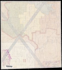
- Description:
- 1928
- Subject:
- Topical Subject: Maps, Geographic Subject: Verkhnegnutov, and Topical Subject: Soviet Union
- Publisher:
- Генеральный штаб Красной Армии
- Language:
- Russian
- Date Created:
- 1941
- Identifier:
- VAC9619-003439
- Genre:
- Topographic Maps and Military Maps
- Geographic Location:
- Coordinates: 48, 42, 48.333, 42.5
- Related URL:
- Catalog URL: https://iucat.iu.edu/catalog/5020129 and Download GeoTIFF: https://drive.google.com/file/d/16oHd3hV7zDupf2Oym-3NSA1sX9fyIzxx/view?usp=sharing
- Abstract:
- Modern area represented: Verkhnegnutov, Volgograd oblast, Russia
- Call Number:
- G7000 s100 .S7 sheet M-38-133
- Caption:
- Временное издание,Для служебного пользования
- City:
- Верх. Гнутов (Verkhniy Gnutov)
- Copyright Holder:
- No Copyright - United States
- Country:
- СССР (USSR)
- State/Province:
- РСФСР (RSFSR), Ростовская область (Rostov oblast), and Сталинградская область (Stalingrad oblast)
- Physical Description:
- Scale: 1:100,000
- Persistent URL:
- http://purl.dlib.indiana.edu/iudl/images/VAC9619/VAC9619-003439
- Provenance:
- DMA Topographic Center, Army Map Service Library
-
- Description:
- 1930
- Subject:
- Topical Subject: Maps, Topical Subject: Soviet Union, and Geographic Subject: Krasnoarmeysk
- Publisher:
- Генеральный штаб Красной Армии
- Language:
- Russian
- Date Created:
- 1941
- Identifier:
- VAC9619-003437
- Genre:
- Topographic Maps and Military Maps
- Geographic Location:
- Coordinates: 48.333, 44.5, 48.667, 45
- Related URL:
- Download GeoTIFF: https://drive.google.com/file/d/1QDgSZFMvREfw9DwOfjUuI4IK8YMnze_U/view?usp=sharing and Catalog URL: https://iucat.iu.edu/catalog/5020129
- Abstract:
- Modern area represented: Krasnoarmeysk, Volgograd oblast, Russia
- Call Number:
- G7000 s100 .S7 sheet M-38-126
- Caption:
- Секретно
- City:
- Красноармейск (Krasnoarmeysk)
- Copyright Holder:
- No Copyright - United States
- Country:
- СССР (USSR)
- State/Province:
- Сталинградская область (Stalingrad oblast) and РСФСР (RSFSR)
- Physical Description:
- Scale: 1:100,000
- Persistent URL:
- http://purl.dlib.indiana.edu/iudl/images/VAC9619/VAC9619-003437
- Provenance:
- DMA Topographic Center, Army Map Service Library
-
- Description:
- 1931
- Subject:
- Geographic Subject: Beketovka, Topical Subject: Maps, and Topical Subject: Soviet Union
- Publisher:
- Генеральный штаб Красной Армии
- Language:
- Russian
- Date Created:
- 1941
- Identifier:
- VAC9619-003436
- Genre:
- Topographic Maps and Military Maps
- Geographic Location:
- Coordinates: 48.333, 44, 48.667, 44.5
- Related URL:
- Catalog URL: https://iucat.iu.edu/catalog/5020129 and Download GeoTIFF: https://drive.google.com/file/d/1sJjvWyUwEDoxK1R9KYj8UGSqzpKxj-EO/view?usp=sharing
- Abstract:
- Modern area represented: Beketovka, Volgograd oblast, Russia
- Call Number:
- G7000 s100 .S7 sheet M-38-125
- Caption:
- Секретно
- City:
- Бекетовка (Beketovka)
- Copyright Holder:
- No Copyright - United States
- Country:
- СССР (USSR)
- State/Province:
- РСФСР (RSFSR) and Сталинградская область (Stalingrad oblast)
- Physical Description:
- Scale: 1:100,000
- Persistent URL:
- http://purl.dlib.indiana.edu/iudl/images/VAC9619/VAC9619-003436
- Provenance:
- DMA Topographic Center, Army Map Service Library
-
- Description:
- 1939
- Subject:
- Geographic Subject: Surovikino, Topical Subject: Soviet Union, and Topical Subject: Maps
- Publisher:
- Генеральный штаб Красной Армии
- Language:
- Russian
- Date Created:
- 1941
- Identifier:
- VAC9619-003434
- Genre:
- Military Maps and Topographic Maps
- Geographic Location:
- Coordinates: 48.333, 42.5, 48.667, 43
- Related URL:
- Download GeoTIFF: https://drive.google.com/file/d/1IklMCz8LqY7v79fI3kROuDDC6V5cGWZK/view?usp=sharing and Catalog URL: https://iucat.iu.edu/catalog/5020129
- Abstract:
- Modern area represented: Surovikino, Volgograd oblast, Russia
- Call Number:
- G7000 s100 .S7 sheet M-38-122
- Caption:
- Для служебного пользования
- City:
- Суровикино (Surovikino)
- Copyright Holder:
- No Copyright - United States
- Country:
- СССР (USSR)
- State/Province:
- Сталинградская область (Stalingrad oblast), РСФСР (RSFSR), and Ростовская область (Rostov oblast)
- Physical Description:
- Scale: 1:100,000
- Persistent URL:
- http://purl.dlib.indiana.edu/iudl/images/VAC9619/VAC9619-003434
- Provenance:
- DMA Topographic Center, Army Map Service Library

- « Previous
- Next »
- 1
- 2
- 3