
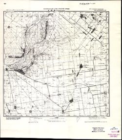
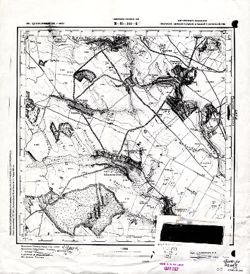
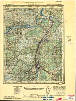
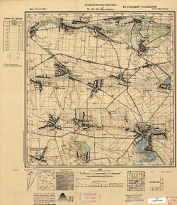
Search Constraints
« Previous |
1 - 100 of 2,760
|
Next »
Search Results
-

- Description:
- 1926
- Subject:
- Geographic Subject: Balky, Topical Subject: Soviet Union, and Topical Subject: Maps
- Publisher:
- Генеральный штаб Красной Армии
- Language:
- Russian
- Date Created:
- 1941
- Identifier:
- VAC9619-001868
- Genre:
- Topographic Maps and Military Maps
- Geographic Location:
- Coordinates: 47.3333, 34.5, 47.6667, 35
- Related URL:
- Catalog URL: https://iucat.iu.edu/catalog/5020129 and Download GeoTIFF: https://drive.google.com/open?id=1V7PHm7Dg5ABV8yybrFeMKAmxM9f2EO27
- Abstract:
- Modern area represented: Balky, Zaporizhia oblast, Ukraine
- Call Number:
- G7000 s100 .S7 sheet L-36-22
- Caption:
- Для служебного пользования
- City:
- Балки (Balky)
- Copyright Holder:
- No Copyright - United States
- Country:
- СССР (USSR)
- State/Province:
- Украинская ССР (Ukrainian Soviet Socialist Republic)
- Physical Description:
- Scale: 1:100,000
- Persistent URL:
- http://purl.dlib.indiana.edu/iudl/images/VAC9619/VAC9619-001868
- Provenance:
- CIA Map Library
-
- Description:
- 1927
- Subject:
- Topical Subject: Soviet Union, Geographic Subject: Shoptovo, and Topical Subject: Maps
- Publisher:
- Военно-топографическое управление
- Language:
- Russian
- Identifier:
- VAC9619-003504
- Genre:
- Topographic Maps and Military Maps
- Geographic Location:
- Coordinates: 56.0, 33.0, 56.16667, 33.25
- Related URL:
- Catalog URL: http://iucat.iu.edu/catalog/5020131 and Download GeoTIFF: https://drive.google.com/file/d/1jBZ7c8YBwoL20pu6vc6Qs9-_gZvQX4Sd/view?usp=sharing
- Abstract:
- Modern area represented: Шоптово (Shoptovo), Tverskaya oblast, Russia
- Call Number:
- GM G7000 s50 .S68 sheet O-36-139-C
- City:
- Шопотово (Shopotovo)
- Copyright Holder:
- No Copyright - United States
- Country:
- СССР (USSR)
- State/Province:
- РСФСР (RSFSR) and Западная область (Western oblast)
- Physical Description:
- Scale: 1:50,000
- Persistent URL:
- http://purl.dlib.indiana.edu/iudl/images/VAC9619/VAC9619-003504
- Provenance:
- CIA Map Library
-
- Description:
- 1927
- Subject:
- Topical Subject: Maps, Topical Subject: Soviet Union, and Geographic Subject: Shchuchye
- Publisher:
- Военно-топографическое управление
- Language:
- Russian
- Identifier:
- VAC9619-001198
- Genre:
- Military Maps and Topographic Maps
- Geographic Location:
- Coordinates: 55.6667, 32, 55.8333, 32.25
- Related URL:
- Download GeoTIFF: https://drive.google.com/open?id=147RGpw0Na2siN-y2rk7SMsc9WXSSvCjn and Catalog URL: http://iucat.iu.edu/catalog/5020131
- Abstract:
- Modern area represented: Shchuchye, Tver oblast, Russia
- Call Number:
- GM G7000 S50 .S68 N-36-5-B
- Caption:
- Секретно
- City:
- Щучье (Shchuchye)
- Copyright Holder:
- No Copyright - United States
- Country:
- СССР (USSR)
- State/Province:
- Западная область (Western oblast) and РСФСР (RSFSR)
- Physical Description:
- Scale: 1:50,000
- Persistent URL:
- http://purl.dlib.indiana.edu/iudl/images/VAC9619/VAC9619-001198
- Provenance:
- Library of Congress Geography & Map Division
-
- Description:
- 1939
- Subject:
- Geographic Subject: Lushchikovo, Topical Subject: Soviet Union, and Topical Subject: Maps
- Publisher:
- Главное Управление Геодезии и Картографии при СНК СССР
- Language:
- Russian
- Date Created:
- 1941
- Identifier:
- VAC9619-001316
- Genre:
- Topographic Maps and Military Maps
- Geographic Location:
- Coordinates: 54.667, 33.5, 54.833, 33.75
- Related URL:
- Download GeoTIFF: https://drive.google.com/open?id=1QqwkbeqMxBP_h4g_YQjctsz1Sdi9nkJC and Catalog URL: http://iucat.iu.edu/catalog/5020131
- Abstract:
- Modern area represented: Lushchikovo, Smolensk oblast, Russia
- Call Number:
- GM G7000 S50 .S68 N-36-44-C
- Copyright Holder:
- No Copyright - United States
- Country:
- СССР (USSR)
- State/Province:
- РСФСР (RSFSR) and Смоленская область (Smolensk oblast)
- Physical Description:
- Scale: 1:50,000
- Persistent URL:
- http://purl.dlib.indiana.edu/iudl/images/VAC9619/VAC9619-001316
- Provenance:
- M. I. Map Library, G000-30, CIA Map Library
-
- Description:
- 1936
- Subject:
- Topical Subject: Maps, Geographic Subject: Zhary, and Topical Subject: Soviet Union
- Publisher:
- Управление военных топографов РККА
- Language:
- Russian
- Identifier:
- VAC9619-000506
- Genre:
- Topographic Maps and Military Maps
- Geographic Location:
- Coordinates: 55, 28.5, 55.1667, 28.75
- Related URL:
- Catalog URL: http://iucat.iu.edu/catalog/5020131 and Download GeoTIFF: https://drive.google.com/open?id=12xIllqwKpdwEgnCo3bYF-_-hnHxKLB1I
- Abstract:
- Modern area represented: Zhary, Vitebsk oblast, Belarus
- Call Number:
- G7000 s50 .S68 sheet N-35-34-C
- Caption:
- Не подлежит оглашению
- City:
- Жары (Zhary)
- Copyright Holder:
- No Copyright - United States
- Country:
- СССР (USSR)
- State/Province:
- Белорусская ССР (Byelorussian Soviet Socialist Republic)
- Physical Description:
- Scale: 1:50,000
- Persistent URL:
- http://purl.dlib.indiana.edu/iudl/images/VAC9619/VAC9619-000506
- Provenance:
- M. I. Map Library, Justus Perthes Kartensammlung, GS, RA, G000-30
-
- Description:
- 1924
- Subject:
- Topical Subject: Maps, Topical Subject: Soviet Union, and Geographic Subject: Bologoye
- Publisher:
- Главное геодезическое управление
- Language:
- Russian
- Identifier:
- VAC9619-003526
- Genre:
- Military Maps and Topographic Maps
- Geographic Location:
- Coordinates: 57.83333, 34.0, 58.0, 34.25
- Related URL:
- Download GeoTIFF: https://drive.google.com/file/d/1lKo1upa-fCEH_6HHmrxRE5MEUJX84ipc/view?usp=sharing and Catalog URL: http://iucat.iu.edu/catalog/5020131
- Abstract:
- Modern area represented: Бологое (Bologoye), Tverskaya oblast, Russia
- Call Number:
- GM G7000 s50 .S68 sheet O-36-81-A
- Caption:
- Не подлежит оглашению
- City:
- Бологое (Bologoye)
- Copyright Holder:
- No Copyright - United States
- Country:
- СССР (USSR)
- State/Province:
- РСФСР (RSFSR) and Ленинградская область (Leningrad oblast)
- Physical Description:
- Scale: 1:50,000
- Persistent URL:
- http://purl.dlib.indiana.edu/iudl/images/VAC9619/VAC9619-003526
- Provenance:
- CIA Map Library
-
- Description:
- 1927
- Subject:
- Topical Subject: Maps and Topical Subject: Soviet Union
- Publisher:
- Военно-топографическое управление
- Language:
- Russian
- Identifier:
- VAC9619-001194
- Genre:
- Topographic Maps and Military Maps
- Geographic Location:
- Coordinates: 55.6667, 31.5, 55.8333, 31.75
- Related URL:
- Catalog URL: http://iucat.iu.edu/catalog/5020131 and Download GeoTIFF: https://drive.google.com/open?id=18ng3Ha-DW463QtUgByL-39NyU8ttBktM
- Abstract:
- Modern area represented: Tver oblast, Russia
- Call Number:
- GM G7000 S50 .S68 N-36-4-B
- Caption:
- Секретно
- City:
- Березьково (Berezkovo)
- Copyright Holder:
- No Copyright - United States
- Country:
- СССР (USSR)
- State/Province:
- Ленинградская область (Leningrad oblast) and РСФСР (RSFSR)
- Physical Description:
- Scale: 1:50,000
- Persistent URL:
- http://purl.dlib.indiana.edu/iudl/images/VAC9619/VAC9619-001194
- Provenance:
- Geographic Names Branch, Library of Congress Geography & Map Division
-
- Description:
- 1923
- Subject:
- Topical Subject: Maps, Geographic Subject: Sablinskoye, and Topical Subject: Soviet Union
- Publisher:
- Генеральный штаб Красной Армии
- Language:
- Russian
- Date Created:
- 1941
- Identifier:
- VAC9619-002211
- Genre:
- Military Maps and Topographic Maps
- Geographic Location:
- Coordinates: 44.3333, 43, 44.6667, 43.5
- Related URL:
- Download GeoTIFF: https://drive.google.com/file/d/1XKS7KWbAoJw_Y2_4sVaI_8kbt1mQSdlP/view?usp=sharing and Catalog URL: https://iucat.iu.edu/catalog/5020129
- Abstract:
- Modern area represented: Sablinskoye, Stavropol kray, Russia
- Call Number:
- G7000 s100 .S7 sheet L-38-123
- Caption:
- Для служебного пользования
- City:
- Саблинское (Sablinskoye)
- Copyright Holder:
- No Copyright - United States
- Country:
- СССР (USSR)
- State/Province:
- Орджоникидзевский край (Ordzhonikidze kray) and РСФСР (RSFSR)
- Physical Description:
- Scale: 1:100,000
- Persistent URL:
- http://purl.dlib.indiana.edu/iudl/images/VAC9619/VAC9619-002211
- Provenance:
- CIA Map Library, Heeresplankammer Gruppe Archive Auslandskartenarchiv
-
- Description:
- 1940
- Subject:
- Geographic Subject: Lineynoye, Topical Subject: Maps, and Topical Subject: Soviet Union
- Publisher:
- Генеральный штаб Красной Армии
- Language:
- Russian
- Date Created:
- 1941
- Identifier:
- VAC9619-002072
- Genre:
- Military Maps and Topographic Maps
- Geographic Location:
- Coordinates: 46, 47, 46.3333, 47.5
- Related URL:
- Catalog URL: https://iucat.iu.edu/catalog/5020129 and Download GeoTIFF: https://drive.google.com/open?id=1MibNB9hpyceu8pM7sN1fkg1uvRwQitcf
- Abstract:
- Modern area represented: Lineynoye, Astrakhan oblast, Russia
- Call Number:
- G7000 s100 .S7 sheet L-38-71
- Caption:
- Для служебного пользования
- City:
- Линейное (Lineynoye)
- Copyright Holder:
- No Copyright - United States
- Country:
- СССР (USSR)
- State/Province:
- Калмыцкая АССР (Kalmyk Autonomous Soviet Socialist Republic), РСФСР (RSFSR), and Сталинградская область (Stalingrad oblast)
- Physical Description:
- Scale: 1:100,000
- Persistent URL:
- http://purl.dlib.indiana.edu/iudl/images/VAC9619/VAC9619-002072
- Provenance:
- CIA Map Library
-
- Description:
- 1941
- Subject:
- Topical Subject: Maps, Topical Subject: Soviet Union, and Geographic Subject: Koltan-Nur lake
- Publisher:
- Генеральный штаб Красной Армии
- Language:
- Russian
- Date Created:
- 1942
- Identifier:
- VAC9619-002166
- Genre:
- Military Maps and Topographic Maps
- Geographic Location:
- Coordinates: 45.3333, 45.5, 45.6667, 46
- Related URL:
- Download GeoTIFF: https://drive.google.com/open?id=1TbdH0pLoQrfNjccE9h9zqh8Dh0XLyveo and Catalog URL: https://iucat.iu.edu/catalog/5020129
- Abstract:
- Modern area represented: Koltan-Nur lake, Kalmykiya Republic, Russia
- Call Number:
- G7000 s100 .S7 sheet L-38-92
- Caption:
- Для служебного пользования
- City:
- Оз. Колтан-Нур (Koltan-Nur lake)
- Copyright Holder:
- No Copyright - United States
- Country:
- СССР (USSR)
- State/Province:
- Калмыцкая АССР (Kalmyk Autonomous Soviet Socialist Republic) and РСФСР (RSFSR)
- Physical Description:
- Scale: 1:100,000
- Persistent URL:
- http://purl.dlib.indiana.edu/iudl/images/VAC9619/VAC9619-002166
- Provenance:
- CIA Map Library
-
- Description:
- 1930
- Subject:
- Topical Subject: Maps, Geographic Subject: Novyy Buh, and Topical Subject: Soviet Union
- Publisher:
- Генеральный штаб Красной Армии
- Language:
- Russian
- Date Created:
- 1941
- Identifier:
- VAC9619-001863
- Genre:
- Military Maps and Topographic Maps
- Geographic Location:
- Coordinates: 47.6667, 32.5, 48, 33
- Related URL:
- Download GeoTIFF: https://drive.google.com/open?id=1T0wPHo0RpDwORrKZXGfpt1IyrZgBA6b4 and Catalog URL: https://iucat.iu.edu/catalog/5020129
- Abstract:
- Modern area represented: Novyy Buh, Mykolaiv, Ukraine
- Call Number:
- G7000 s100 .S7 sheet L-36-6
- Caption:
- Для служебного пользования
- City:
- Новый Буг (Novyy Buh)
- Copyright Holder:
- No Copyright - United States
- Country:
- СССР (USSR)
- State/Province:
- Украинская ССР (Ukrainian Soviet Socialist Republic)
- Physical Description:
- Scale: 1:100,000
- Persistent URL:
- http://purl.dlib.indiana.edu/iudl/images/VAC9619/VAC9619-001863
- Provenance:
- CIA Map Library
-
- Description:
- 1872
- Subject:
- Topical Subject: Maps, Topical Subject: Soviet Union, and Geographic Subject: Kovshutlu
- Publisher:
- Управление военных топографов РККА
- Language:
- Russian
- Identifier:
- VAC9619-000087
- Genre:
- Topographic Maps and Military Maps
- Geographic Location:
- Coordinates: 39.1667, 47, 39.3333, 47.25
- Related URL:
- Download GeoTIFF: https://drive.google.com/open?id=1EU4ziheoeAfs54SUPW__rCtyqLYBsMmq and Catalog URL: http://iucat.iu.edu/catalog/5020131
- Abstract:
- Modern area represented: Kovshutlu, Azerbaijan
- Call Number:
- G7000 s50 .S68 sheet J-38-35-A
- Caption:
- Не подлежит оглашению
- City:
- Ковшутлу (Kovshutlu)
- Copyright Holder:
- No Copyright - United States
- Country:
- Иран (Iran) and СССР (USSR)
- State/Province:
- Азербайджанская ССР (Azerbaijan Soviet Socialist Republic)
- Physical Description:
- Scale: 1:50,000
- Persistent URL:
- http://purl.dlib.indiana.edu/iudl/images/VAC9619/VAC9619-000087
- Provenance:
- CIA Map Library
-
- Description:
- 1939
- Subject:
- Geographic Subject: Il’yushino, Topical Subject: Maps, and Topical Subject: Soviet Union
- Publisher:
- Главное управление геодезии и картографии при СНК СССР
- Language:
- Russian
- Date Created:
- 1941
- Identifier:
- VAC9619-003468
- Genre:
- Military Maps and Topographic Maps
- Geographic Location:
- Coordinates: 56.333, 32.5, 56.5, 32.75
- Related URL:
- Catalog URL: http://iucat.iu.edu/catalog/5020131 and Download GeoTIFF: https://drive.google.com/file/d/1gFCKXL3LEEV_HoW5baG2udOZMvB2T_-c/view?usp=sharing
- Abstract:
- Modern area represented: Ильюшино (Il’yushino), Tverskaya oblast, Russia
- Call Number:
- G7000 s50 .S68 sheet O-36-126-C
- City:
- Ильюшино (Il’yushino)
- Copyright Holder:
- No Copyright - United States
- Country:
- СССР (USSR)
- State/Province:
- Нелидовский район (Nelidovsky district), Калининская область (Kalinin oblast), and Ленинский район (Leninsky district)
- Physical Description:
- Scale: 1:50,000
- Persistent URL:
- http://purl.dlib.indiana.edu/iudl/images/VAC9619/VAC9619-003468
- Provenance:
- M. I. Map Library, Library of Congress Geography & Map Division
-
- Subject:
- Geographic Subject: Darsūniškis, Topical Subject: Soviet Union, and Topical Subject: Maps
- Publisher:
- Генеральный штаб Красной Армии
- Language:
- Russian
- Date Created:
- 1941
- Identifier:
- VAC9619-000522
- Genre:
- Military Maps and Topographic Maps
- Geographic Location:
- Coordinates: 54.6667, 24, 54.8333, 24.25
- Related URL:
- Catalog URL: http://iucat.iu.edu/catalog/5020131 and Download GeoTIFF: https://drive.google.com/open?id=1J1xb-H1oQhiom6Du9L0ftYYMyrI-1Img
- Abstract:
- Modern area represented: Darsūniškis, Lithuania
- Call Number:
- G7000 s50 .S68 sheet N-35-37-C
- Caption:
- Для служебного пользования
- City:
- Дорсунишки (Dorsunishki)
- Copyright Holder:
- No Copyright - United States
- Country:
- СССР (USSR)
- State/Province:
- Литовская ССР (Lithuanian Soviet Socialist Republic)
- Physical Description:
- Scale: 1:50,000
- Persistent URL:
- http://purl.dlib.indiana.edu/iudl/images/VAC9619/VAC9619-000522
- Provenance:
- M. I. Map Library
-

- Subject:
- Topical Subject: Soviet Union, Topical Subject: Maps, and Geographic Subject: Zapyškis
- Publisher:
- Генеральный штаб Красной Армии
- Language:
- Russian
- Date Created:
- 1941
- Identifier:
- VAC9619-003722
- Genre:
- Topographic Maps and Military Maps
- Geographic Location:
- Coordinates: 54.913, 23.625, 55, 23.75
- Related URL:
- Catalog URL: https://iucat.iu.edu/catalog/14701157 and Download GeoTIFF: https://drive.google.com/file/d/1PAMqLanXnzAq1f9dj7s_PUqP_lpBr_F1/view?usp=sharing
- Abstract:
- Modern area represented: Zapyškis, Lithuania
- Call Number:
- G7063.K2 s25 .S6 sheet N-34-48-A-b
- Caption:
- Секретно
- City:
- Сапежишки (Sapezhishki)
- Copyright Holder:
- No Copyright - United States
- Country:
- СССР (USSR)
- State/Province:
- Литовская ССР (Lithuanian Soviet Socialist Republic)
- Physical Description:
- Scale: 1:25,000
- Persistent URL:
- http://purl.dlib.indiana.edu/iudl/images/VAC9619/VAC9619-003722
- Provenance:
- M. I. Map Library, CIA Map Library
-
- Description:
- 1939
- Subject:
- Geographic Subject: Əbrəqunus, Topical Subject: Soviet Union, and Topical Subject: Maps
- Publisher:
- Генеральный штаб РККА
- Language:
- Russian
- Date Created:
- 1940
- Identifier:
- VAC9619-000079
- Genre:
- Military Maps and Topographic Maps
- Geographic Location:
- Coordinates: 39, 45.5, 39.1667, 45.75
- Related URL:
- Download GeoTIFF: https://drive.google.com/open?id=1998swVPJ9QtnYo-IMWGIfroqvaOTFJb9 and Catalog URL: http://iucat.iu.edu/catalog/5020131
- Abstract:
- Modern area represented: Əbrəqunus, Azerbaijan
- Call Number:
- G7000 s50 .S68 sheet J-38-32-C
- Caption:
- Не подлежит оглашению
- City:
- Абракунис
- Copyright Holder:
- No Copyright - United States
- Country:
- СССР (USSR)
- State/Province:
- Нахичеванская АССР (Nakhichevan Autonomous Soviet Socialist Republic)
- Physical Description:
- Scale: 1:50,000
- Persistent URL:
- http://purl.dlib.indiana.edu/iudl/images/VAC9619/VAC9619-000079
- Provenance:
- CIA Map Library
-
- Subject:
- Topical Subject: Soviet Union, Topical Subject: Maps, and Geographic Subject: Kushliki
- Publisher:
- Генеральный штаб РККА
- Language:
- Russian
- Identifier:
- VAC9619-000465
- Genre:
- Military Maps and Topographic Maps
- Geographic Location:
- Coordinates: 55.5, 28.25, 55.6667, 28.5
- Related URL:
- Catalog URL: http://iucat.iu.edu/catalog/5020131 and Download GeoTIFF: https://drive.google.com/open?id=1XbehAzt5zkwfXwHX2ADcjKRsPPo4q6Tb
- Abstract:
- Modern area represented: Kushliki, Vitebsk oblast, Belarus
- Call Number:
- G7000 s50 .S68 sheet N-35-21-B
- Caption:
- Не подлежит оглашению
- City:
- Кушлики (Kushliki)
- Copyright Holder:
- No Copyright - United States
- Country:
- СССР (USSR) and Польша (Poland)
- State/Province:
- Белорусская ССР (Byelorussian Soviet Socialist Republic) and Витебская область (Vitebsk oblast)
- Physical Description:
- Scale: 1:50,000
- Persistent URL:
- http://purl.dlib.indiana.edu/iudl/images/VAC9619/VAC9619-000465
- Provenance:
- M. I. Map Library, G000-30, GS, RA
-
- Description:
- 1932
- Subject:
- Topical Subject: Soviet Union, Topical Subject: Maps, and Geographic Subject: Veselyy
- Publisher:
- Генеральный штаб Красной Армии
- Language:
- Russian
- Date Created:
- 1941
- Identifier:
- VAC9619-002288
- Genre:
- Topographic Maps and Military Maps
- Geographic Location:
- Coordinates: 47, 40.5, 47.3333, 41
- Related URL:
- Download GeoTIFF: https://drive.google.com/file/d/1x_6moHatJsnMhQhHzqjSPuO0h_az_FsS/view?usp=sharing and Catalog URL: https://iucat.iu.edu/catalog/5020129
- Abstract:
- Modern area represented: Veselyy, Russia
- Call Number:
- G7000 s100 .S7 sheet L-37-34
- Caption:
- Для служебного пользования
- City:
- Веселый (Veselyy)
- Copyright Holder:
- No Copyright - United States
- Country:
- СССР (USSR)
- State/Province:
- Ростовская область (Rostov oblast) and РСФСР (RSFSR)
- Physical Description:
- Scale: 1:100,000
- Persistent URL:
- http://purl.dlib.indiana.edu/iudl/images/VAC9619/VAC9619-002288
- Provenance:
- CIA Map Library
-
- Description:
- 1928
- Subject:
- Geographic Subject: Manychskoye, Topical Subject: Soviet Union, and Topical Subject: Maps
- Publisher:
- Генеральный штаб Красной Армии
- Language:
- Russian
- Date Created:
- 1941
- Identifier:
- VAC9619-002063
- Genre:
- Topographic Maps and Military Maps
- Geographic Location:
- Coordinates: 46, 43, 46.3333, 43.5
- Related URL:
- Download GeoTIFF: https://drive.google.com/open?id=1n-R1bSl6LZW_J3pMeBtQTM79GYtOIJNr and Catalog URL: https://iucat.iu.edu/catalog/5020129
- Abstract:
- Modern area represented: Manychskoye, Stavropol kray, Russia
- Call Number:
- G7000 s100 .S7 sheet L-38-63
- Caption:
- Для служебного пользования
- City:
- Киста (Kista)
- Copyright Holder:
- No Copyright - United States
- Country:
- СССР (USSR)
- State/Province:
- Орджоникидзевский край (Ordzhonikidze kray), Калмыцкая АССР (Kalmyk Autonomous Soviet Socialist Republic), РСФСР (RSFSR), and Ростовская область (Rostov oblast)
- Physical Description:
- Scale: 1:100,000
- Persistent URL:
- http://purl.dlib.indiana.edu/iudl/images/VAC9619/VAC9619-002063
- Provenance:
- CIA Map Library
-
- Description:
- 1927
- Subject:
- Topical Subject: Soviet Union, Topical Subject: Maps, and Geographic Subject: Levokumskoye
- Publisher:
- Генеральный штаб Красной Армии
- Language:
- Russian
- Date Created:
- 1942
- Identifier:
- VAC9619-002202
- Genre:
- Topographic Maps and Military Maps
- Geographic Location:
- Coordinates: 44.6667, 44.5, 45, 45
- Related URL:
- Catalog URL: https://iucat.iu.edu/catalog/5020129 and Download GeoTIFF: https://drive.google.com/file/d/1SQiPKlpdvjp6G_t_-vG-PKMxxowyxdse/view?usp=sharing
- Abstract:
- Modern area represented: Levokumskoye, Stavropol kray, Russia
- Call Number:
- G7000 s100 .S7 sheet L-38-114
- Caption:
- Для служебного пользования
- City:
- Левокумское (Levokumskoye)
- Copyright Holder:
- No Copyright - United States
- Country:
- СССР (USSR)
- State/Province:
- Кизлярский округ (Kizlyar district), РСФСР (RSFSR), and Орджоникидзевский край (Ordzhonikidze kray)
- Physical Description:
- Scale: 1:100,000
- Persistent URL:
- http://purl.dlib.indiana.edu/iudl/images/VAC9619/VAC9619-002202
- Provenance:
- CIA Map Library
-
- Subject:
- Topical Subject: Maps, Geographic Subject: Yazna, and Topical Subject: Soviet Union
- Publisher:
- Генеральный штаб РККА
- Language:
- Russian
- Identifier:
- VAC9619-000466
- Genre:
- Topographic Maps and Military Maps
- Geographic Location:
- Coordinates: 55.3333, 28, 55.5, 28.25
- Related URL:
- Catalog URL: http://iucat.iu.edu/catalog/5020131 and Download GeoTIFF: https://drive.google.com/open?id=1Gd6FswJxoPQ7Si4MVPoFPWKllyjyDTeL
- Abstract:
- Modern area represented: Yazna, Vitebsk oblast, Belarus
- Call Number:
- G7000 s50 .S68 sheet N-35-21-C
- City:
- Язно (Yazno)
- Copyright Holder:
- No Copyright - United States
- Country:
- СССР (USSR)
- Physical Description:
- Scale: 1:50,000
- Persistent URL:
- http://purl.dlib.indiana.edu/iudl/images/VAC9619/VAC9619-000466
- Provenance:
- M. I. Map Library, Reichsamt für Landesaufnahme, Kartensammlung, GS, RA, G000-30
-
- Subject:
- Topical Subject: Maps, Topical Subject: Soviet Union, and Geographic Subject: Muniškiai
- Publisher:
- Генеральный штаб Красной Армии
- Language:
- Russian
- Date Created:
- 1941
- Identifier:
- VAC9619-003634
- Genre:
- Military Maps and Topographic Maps
- Geographic Location:
- Coordinates: 55, 23.75, 55.083, 23.875
- Related URL:
- Download GeoTIFF: https://drive.google.com/file/d/1RSHjF8sA7nONXJFs4vMmAN6eP3uezOJd/view?usp=sharing and Catalog URL: https://iucat.iu.edu/catalog/14701157
- Abstract:
- Modern area represented: Muniškiai, Lithuania
- Call Number:
- G7063.K2 s25 .S6 sheet N-34-36-D-c
- Caption:
- Секретно
- City:
- Мунишканцы (Munishkantsy)
- Copyright Holder:
- No Copyright - United States
- Country:
- СССР (USSR)
- State/Province:
- Литовская ССР (Lithuanian Soviet Socialist Republic)
- Physical Description:
- Scale: 1:25,000
- Persistent URL:
- http://purl.dlib.indiana.edu/iudl/images/VAC9619/VAC9619-003634
- Provenance:
- M. I. Map Library
-
- Description:
- 1940
- Subject:
- Geographic Subject: Nezamayevskaya, Topical Subject: Soviet Union, and Topical Subject: Maps
- Publisher:
- Генеральный штаб Красной Армии
- Language:
- Russian
- Date Created:
- 1941
- Identifier:
- VAC9619-002331
- Genre:
- Military Maps and Topographic Maps
- Geographic Location:
- Coordinates: 46, 40, 46.3333, 40.5
- Related URL:
- Catalog URL: https://iucat.iu.edu/catalog/5020129 and Download GeoTIFF: https://drive.google.com/file/d/1KWYrAI3qHrR_O6WF5vmeSjmXKm7q3Sio/view?usp=sharing
- Abstract:
- Modern area represented: Nezamayevskaya, Russia
- Call Number:
- G7000 s100 .S7 sheet L-37-69
- Caption:
- Для служебного пользования
- City:
- Незамаевская (Nezamayevskaya)
- Copyright Holder:
- No Copyright - United States
- Country:
- СССР (USSR)
- State/Province:
- Ростовская область (Rostov oblast), РСФСР (RSFSR), and Краснодарский край (Krasnodar kray)
- Physical Description:
- Scale: 1:100,000
- Persistent URL:
- http://purl.dlib.indiana.edu/iudl/images/VAC9619/VAC9619-002331
- Provenance:
- CIA Map Library
-
- Description:
- 1929
- Subject:
- Topical Subject: Soviet Union, Topical Subject: Maps, and Geographic Subject: Kuvechichi
- Publisher:
- Военно-топографическое управление
- Language:
- Russian
- Identifier:
- VAC9619-000920
- Genre:
- Military Maps and Topographic Maps
- Geographic Location:
- Coordinates: 51.5, 30.75, 51.666667, 31.0
- Related URL:
- Catalog URL: http://iucat.iu.edu/catalog/5020131 and Download GeoTIFF: https://drive.google.com/open?id=18vl201YR0RtrebxwBjWTwtKji74iJryK
- Abstract:
- Modern area represented: Kuvechichi, Chernihiv oblast, Ukraine
- Call Number:
- G7000 s50 .S68 М-36-14-Б
- Caption:
- Секретно,Для служебного пользования
- City:
- Кувечичи (Kuvechichi)
- Copyright Holder:
- No Copyright - United States
- Country:
- СССР (USSR)
- State/Province:
- Украинская ССР (Ukrainian Soviet Socialist Republic)
- Physical Description:
- Scale: 1:50,000
- Persistent URL:
- http://purl.dlib.indiana.edu/iudl/images/VAC9619/VAC9619-000920
- Provenance:
- DMA Topographic Center, Army Map Service Library, OMAHA, Library of Congress Geography & Map Division
-
- Description:
- 1925
- Subject:
- Topical Subject: Maps, Topical Subject: Soviet Union, and Geographic Subject: Yegorlykskaya
- Publisher:
- Генеральный штаб Красной Армии
- Language:
- Russian
- Date Created:
- 1941
- Identifier:
- VAC9619-002324
- Genre:
- Topographic Maps and Military Maps
- Geographic Location:
- Coordinates: 46.3333, 40.5, 46.6667, 41
- Related URL:
- Download GeoTIFF: https://drive.google.com/file/d/1Vno5pFrXmYsLk7cNSrTkoNPk8hjwCPIL/view?usp=sharing and Catalog URL: https://iucat.iu.edu/catalog/5020129
- Abstract:
- Modern area represented: Yegorlykskaya, Russia
- Call Number:
- G7000 s100 .S7 sheet L-37-58
- Caption:
- Для служебного пользования
- City:
- Егорлыкская (Yegorlykskaya)
- Copyright Holder:
- No Copyright - United States
- Country:
- СССР (USSR)
- State/Province:
- РСФСР (RSFSR) and Ростовская область (Rostov oblast)
- Physical Description:
- Scale: 1:100,000
- Persistent URL:
- http://purl.dlib.indiana.edu/iudl/images/VAC9619/VAC9619-002324
- Provenance:
- DMA Topographic Center, Library of Congress Geography & Map Division
-
- Description:
- 1926
- Subject:
- Topical Subject: Soviet Union, Topical Subject: Maps, and Geographic Subject: Borki
- Publisher:
- Военно-топографическое управление
- Language:
- Russian
- Date Created:
- 1927
- Identifier:
- VAC9619-001224
- Genre:
- Topographic Maps and Military Maps
- Geographic Location:
- Coordinates: 55.3333, 31, 55.5, 31.25
- Related URL:
- Download GeoTIFF: https://drive.google.com/open?id=11OV9gPg6icl2T0fgqVyS5gBFHZo3nPFZ and Catalog URL: http://iucat.iu.edu/catalog/5020131
- Abstract:
- Modern area represented: Borki, Smolensk oblast, Russia
- Call Number:
- GM G7000 S50 .S68 N-36-15-B
- Caption:
- Секретно
- City:
- Борки (Borki)
- Copyright Holder:
- No Copyright - United States
- Country:
- СССР (USSR)
- State/Province:
- Западная область (Western oblast) and РСФСР (RSFSR)
- Physical Description:
- Scale: 1:50,000
- Persistent URL:
- http://purl.dlib.indiana.edu/iudl/images/VAC9619/VAC9619-001224
- Provenance:
- M. I. Map Library, G000-30, GS, RA
-
- Description:
- 1941
- Subject:
- Geographic Subject: Babayurt, Topical Subject: Maps, and Topical Subject: Soviet Union
- Publisher:
- Генеральный штаб Красной Армии
- Language:
- Russian
- Date Created:
- 1942
- Identifier:
- VAC9619-000784
- Genre:
- Topographic Maps and Military Maps
- Geographic Location:
- Coordinates: 43.3333, 46.5, 43.6667, 47
- Related URL:
- Download GeoTIFF: https://drive.google.com/open?id=1J0-KZD89YETRBJk8JXDeJgXjmkM-Bz0H and Catalog URL: https://iucat.iu.edu/catalog/5020129
- Abstract:
- Modern area represented: Babayurt, Dagestan republic, Russia
- Call Number:
- G7000 s100 .S7 sheet K-38-22
- Caption:
- Для служебного пользования
- City:
- Баба-Юрт (Baba-Yurt)
- Copyright Holder:
- No Copyright - United States
- Country:
- СССР (USSR)
- State/Province:
- Дагестанская АССР (Dagestan Autonomous Soviet Socialist Republic) and РСФСР (RSFSR)
- Physical Description:
- Scale: 1:100,000
- Persistent URL:
- http://purl.dlib.indiana.edu/iudl/images/VAC9619/VAC9619-000784
- Provenance:
- CIA Map Library, Atlasblatt
-
- Description:
- 1941
- Subject:
- Topical Subject: Soviet Union, Geographic Subject: Bakres, and Topical Subject: Maps
- Publisher:
- Генеральный штаб Красной Армии
- Language:
- Russian
- Date Created:
- 1942
- Identifier:
- VAC9619-002204
- Genre:
- Topographic Maps and Military Maps
- Geographic Location:
- Coordinates: 44.6667, 45.5, 45, 46
- Related URL:
- Catalog URL: https://iucat.iu.edu/catalog/5020129 and Download GeoTIFF: https://drive.google.com/file/d/1AJLkcZgpYOsDHCtkJc31gv9140nbE6P8/view?usp=sharing
- Abstract:
- Modern area represented: Bakres, Stavropol kray, Russia
- Call Number:
- G7000 s100 .S7 sheet L-38-116
- Caption:
- Для служебного пользования
- City:
- Бакрес (Bakres)
- Copyright Holder:
- No Copyright - United States
- Country:
- СССР (USSR)
- State/Province:
- Калмыцкая АССР (Kalmyk Autonomous Soviet Socialist Republic), Орджоникидзевский край (Ordzhonikidze kray), and РСФСР (RSFSR)
- Physical Description:
- Scale: 1:100,000
- Persistent URL:
- http://purl.dlib.indiana.edu/iudl/images/VAC9619/VAC9619-002204
- Provenance:
- CIA Map Library
-
- Description:
- 1931
- Subject:
- Geographic Subject: Тураў (Turow), Topical Subject: Soviet Union, and Topical Subject: Maps
- Publisher:
- Управление военных топографов
- Language:
- Russian
- Identifier:
- VAC9619-000807
- Genre:
- Military Maps and Topographic Maps
- Geographic Location:
- Coordinates: 52, 27.5, 52.167, 27.75
- Related URL:
- Catalog URL: http://iucat.iu.edu/catalog/5020131 and Download GeoTIFF: https://drive.google.com/open?id=1XSod-am5pw3wlcn9E8g_3g3WtxOdNnyD
- Abstract:
- Modern area represented: Тураў (Turow), Homyel' oblast, Belarus
- Call Number:
- G7000 s50 .s68 sheet N-35-140-C
- Caption:
- Не подлежит оглашению
- City:
- Туров (Turov)
- Copyright Holder:
- No Copyright - United States
- Country:
- Польша (Poland) and СССР (USSR)
- State/Province:
- Белорусская ССР (Byelorussian Soviet Socialist Republic)
- Physical Description:
- Scale: 1:50,000
- Persistent URL:
- http://purl.dlib.indiana.edu/iudl/images/VAC9619/VAC9619-000807
- Provenance:
- M. I. Map Library
-
- Description:
- 1921
- Subject:
- Topical Subject: Maps, Geographic Subject: Askania-Nova, and Topical Subject: Soviet Union
- Publisher:
- Генеральный штаб Красной Армии
- Language:
- Russian
- Date Created:
- 1941
- Identifier:
- VAC9619-001908
- Genre:
- Topographic Maps and Military Maps
- Geographic Location:
- Coordinates: 46.3333, 33.5, 46.6667, 34
- Related URL:
- Download GeoTIFF: https://drive.google.com/open?id=1X2zli5lz_FZwB19KYsJ72lmGfakR0GSR and Catalog URL: https://iucat.iu.edu/catalog/5020129
- Abstract:
- Modern area represented: Askania-Nova, Kherson oblast, Ukraine
- Call Number:
- G7000 s100 .S7 sheet L-36-56
- Caption:
- Для служебного пользования
- City:
- Аскания Нова (Askania-Nova)
- Copyright Holder:
- No Copyright - United States
- Country:
- СССР (USSR)
- State/Province:
- Запорожская область (Zaporizhia oblast), Украинская ССР (Ukrainian Soviet Socialist Republic), and Николаевская область (Mykolaiv oblast)
- Physical Description:
- Scale: 1:100,000
- Persistent URL:
- http://purl.dlib.indiana.edu/iudl/images/VAC9619/VAC9619-001908
- Provenance:
- CIA Map Library, Army Map Service Library
-
- Description:
- 1939
- Subject:
- Geographic Subject: Donetsk, Topical Subject: Soviet Union, Geographic Subject: Platonovka, and Topical Subject: Maps
- Publisher:
- Генеральный штаб Красной Армии
- Language:
- Russian
- Date Created:
- 1941
- Identifier:
- VAC9619-002002
- Genre:
- Topographic Maps and Military Maps
- Geographic Location:
- Coordinates: 47.3333, 37.5, 47.6667, 37.5
- Related URL:
- Catalog URL: https://iucat.iu.edu/catalog/5020129 and Download GeoTIFF: https://drive.google.com/open?id=1rcAVudLKQYH89ByRQ8FaN6st2evLxa46
- Abstract:
- Modern area represented: Платоновка (Platonovka), Donetsk, Ukraine
- Call Number:
- G7000 s100 .S7 sheet L-37-16
- Caption:
- Для cлужебного пользования
- City:
- Платоновка (Platonovka)
- Copyright Holder:
- No Copyright - United States
- Country:
- СССР (USSR)
- State/Province:
- Украинская ССР (Ukrainian Soviet Socialist Republic) and Сталинская область (Stalino oblast)
- Physical Description:
- Scale: 1:100,000
- Persistent URL:
- http://purl.dlib.indiana.edu/iudl/images/VAC9619/VAC9619-002002
- Provenance:
- Geographic Names Branch
-
- Description:
- 1936
- Subject:
- Topical Subject: Soviet Union, Topical Subject: Maps, and Geographic Subject: Zubarevichy
- Publisher:
- Управление военных топографов РККА
- Language:
- Russian
- Identifier:
- VAC9619-000729
- Genre:
- Topographic Maps and Military Maps
- Geographic Location:
- Coordinates: 52.66667, 28.75, 52.83333, 29.0
- Related URL:
- Download GeoTIFF: https://drive.google.com/open?id=1BpT8Vcx1JDWiiE8Mkr_wnDoQI5a77sx8 and Catalog URL: http://iucat.iu.edu/catalog/5020131
- Abstract:
- Modern area represented: Zubarevichy, Mahilyow oblast, Belarus
- Call Number:
- GM G7000 s50 .S68 sheet N-35-118-D
- Caption:
- Не подлежит оглашению
- City:
- Зубаревичи (Zubarevichi)
- Copyright Holder:
- No Copyright - United States
- Country:
- СССР (USSR)
- State/Province:
- Белорусская ССР (Byelorussian Soviet Socialist Republic)
- Physical Description:
- Scale: 1:50,000
- Persistent URL:
- http://purl.dlib.indiana.edu/iudl/images/VAC9619/VAC9619-000729
- Provenance:
- M. I. Map Library, G000-30, GS, RA
-
- Description:
- 1927
- Subject:
- Topical Subject: Soviet Union, Geographic Subject: Kovali, and Topical Subject: Maps
- Publisher:
- Управление военных топографов
- Language:
- Russian
- Identifier:
- VAC9619-003494
- Genre:
- Topographic Maps and Military Maps
- Geographic Location:
- Coordinates: 56.0, 31.75, 56.16667, 32.0
- Related URL:
- Download GeoTIFF: https://drive.google.com/file/d/1aUs01744U8z9WJUyVwJHJ7uEfI1G5EIX/view?usp=sharing and Catalog URL: http://iucat.iu.edu/catalog/5020131
- Abstract:
- Modern area represented: Ковали (Kovali), Tverskaya oblast, Russia
- Call Number:
- G7000 s50 .S68 sheet O-36-136-D
- Caption:
- Не подлежит оглашению
- City:
- Ковали (Kovali)
- Copyright Holder:
- No Copyright - United States
- Country:
- СССР (USSR)
- State/Province:
- РСФСР (RSFSR) and Западная область (Western oblast)
- Physical Description:
- Scale: 1:50,000
- Persistent URL:
- http://purl.dlib.indiana.edu/iudl/images/VAC9619/VAC9619-003494
- Provenance:
- M. I. Map Library
-
- Description:
- 1935
- Subject:
- Geographic Subject: Novaya Tayga, Topical Subject: Maps, and Topical Subject: Soviet Union
- Publisher:
- Управление военных топографов РККА
- Language:
- Russian
- Identifier:
- VAC9619-002582
- Genre:
- Military Maps and Topographic Maps
- Geographic Location:
- Coordinates: 44.333, 135, 44.667, 135.5
- Related URL:
- Catalog URL: https://iucat.iu.edu/catalog/5020129 and Download GeoTIFF: https://drive.google.com/file/d/1RIcE94wbwyxP1PKoJIbffVis3GXkqE93/view?usp=sharing
- Abstract:
- Modern area represented: Novaya Tayga, Primorsky kray, Russia
- Call Number:
- G7000 s100 .S7 sheet L-53-127
- Caption:
- Не подлежит оглашению
- City:
- Новая Тайга (Novaya Tayga)
- Copyright Holder:
- No Copyright - United States
- Country:
- СССР (USSR)
- State/Province:
- РСФСР (RSFSR) and Дальневосточный край (Far Eastern kray)
- Physical Description:
- Scale: 1:100,000
- Persistent URL:
- http://purl.dlib.indiana.edu/iudl/images/VAC9619/VAC9619-002582
- Provenance:
- CIA Map Library, Library of Congress Geography & Map Division, Atlasblatt
-
- Description:
- 1936
- Subject:
- Topical Subject: Soviet Union, Topical Subject: Maps, and Geographic Subject: Astrowna
- Publisher:
- Генеральный штаб РККА
- Language:
- Russian
- Identifier:
- VAC9619-000517
- Genre:
- Military Maps and Topographic Maps
- Geographic Location:
- Coordinates: 55, 29.75, 55.1667, 30
- Related URL:
- Catalog URL: http://iucat.iu.edu/catalog/5020131 and Download GeoTIFF: https://drive.google.com/open?id=1JnJoLP7vFnNius8aOTHWQewKLZvUI38u
- Abstract:
- Modern area represented: Astrowna, Vitebsk oblast, Belarus
- Call Number:
- G7000 s50 .S68 sheet N-35-36-D
- Caption:
- Не подлежит оглашению
- City:
- Островно (Ostrovno)
- Copyright Holder:
- No Copyright - United States
- Country:
- СССР (USSR)
- State/Province:
- Белорусская ССР (Byelorussian Soviet Socialist Republic)
- Physical Description:
- Scale: 1:50,000
- Persistent URL:
- http://purl.dlib.indiana.edu/iudl/images/VAC9619/VAC9619-000517
- Provenance:
- M. I. Map Library, Reichsamt für Landesaufnahme, Kartensammlung, GS, RA, G000-30
-
- Description:
- 1929
- Subject:
- Geographic Subject: Moshny, Topical Subject: Soviet Union, and Topical Subject: Maps
- Publisher:
- Управление военных топографов
- Language:
- Russian
- Date Created:
- 1932
- Identifier:
- VAC9619-001027
- Genre:
- Military Maps and Topographic Maps
- Geographic Location:
- Coordinates: 49.5, 31.5, 49.6667, 31.75
- Related URL:
- Catalog URL: http://iucat.iu.edu/catalog/5020131 and Download GeoTIFF: https://drive.google.com/open?id=1YDdnSgfHB6iMpwwVJPx9zoDfBiEx-g7S
- Abstract:
- Modern area represented: Мошни (Moshny), Cherkasy oblast, Ukraine
- Call Number:
- G7000 s50 .S68 sheet M-36-88-A
- Caption:
- Рассекречено and Не подлежит оглашению
- City:
- Мошны (Moshny)
- Copyright Holder:
- No Copyright - United States
- Country:
- СССР (USSR)
- State/Province:
- Украинская ССР (Ukrainian Soviet Socialist Republic)
- Physical Description:
- Scale: 1:50,000
- Persistent URL:
- http://purl.dlib.indiana.edu/iudl/images/VAC9619/VAC9619-001027
- Provenance:
- M. I. Map Library, Library of Congress Geography & Map Division
-
- Description:
- 1926
- Subject:
- Topical Subject: Maps, Geographic Subject: Salsk, and Topical Subject: Soviet Union
- Publisher:
- Генеральный штаб Красной Армии
- Language:
- Russian
- Date Created:
- 1941
- Identifier:
- VAC9619-002326
- Genre:
- Military Maps and Topographic Maps
- Geographic Location:
- Coordinates: 46.3333, 41.5, 46.6667, 42
- Related URL:
- Catalog URL: https://iucat.iu.edu/catalog/5020129 and Download GeoTIFF: https://drive.google.com/file/d/1PArZEQhSATe1EKVgUDFtZ3ICldn22WR5/view?usp=sharing
- Abstract:
- Modern area represented: Salsk, Russia
- Call Number:
- G7000 s100 .S7 sheet L-37-60
- Caption:
- Для служебного пользования
- City:
- Сальск (Salsk)
- Copyright Holder:
- No Copyright - United States
- Country:
- СССР (USSR)
- State/Province:
- Ростовская область (Rostov oblast) and РСФСР (RSFSR)
- Physical Description:
- Scale: 1:100,000
- Persistent URL:
- http://purl.dlib.indiana.edu/iudl/images/VAC9619/VAC9619-002326
- Provenance:
- CIA Map Library, Heeresplankammer Gruppe Archive Auslandskartenarchiv
-
- Description:
- 1932
- Subject:
- Geographic Subject: Khorol, Topical Subject: Maps, and Topical Subject: Soviet Union
- Publisher:
- Генеральный штаб РККА
- Language:
- Russian
- Date Created:
- 1937
- Identifier:
- VAC9619-002580
- Genre:
- Military Maps and Topographic Maps
- Geographic Location:
- Coordinates: 44.333, 132, 44.667, 132.5
- Related URL:
- Catalog URL: https://iucat.iu.edu/catalog/5020129 and Download GeoTIFF: https://drive.google.com/file/d/1f1acE_UwwKTVcp9HkXa-ZXvOjK6E2Mtl/view?usp=sharing
- Abstract:
- Modern area represented: Khorol, Primorskiy kray, Russia
- Call Number:
- G7000 s100 .S7 sheet L-53-121
- Caption:
- Не подлежит оглашению
- City:
- Хороль (Khorol)
- Copyright Holder:
- No Copyright - United States
- Country:
- СССР (USSR)
- State/Province:
- Дальневосточный край (Far Eastern kray), РСФСР (RSFSR), and Уссурийская область (Ussuriysk oblast)
- Physical Description:
- Scale: 1:100,000
- Persistent URL:
- http://purl.dlib.indiana.edu/iudl/images/VAC9619/VAC9619-002580
- Provenance:
- Army Map Service Library
-
- Description:
- 1928
- Subject:
- Geographic Subject: Kairy, Topical Subject: Maps, and Topical Subject: Soviet Union
- Publisher:
- Генеральный штаб Красной Армии
- Language:
- Russian
- Date Created:
- 1941
- Identifier:
- VAC9619-001889
- Genre:
- Topographic Maps and Military Maps
- Geographic Location:
- Coordinates: 46.6667, 33.5, 47, 34
- Related URL:
- Catalog URL: https://iucat.iu.edu/catalog/5020129 and Download GeoTIFF: https://drive.google.com/file/d/1osSsR-E4nP09v5-wiUbmEixGdIeS0X75/view?usp=sharing
- Abstract:
- Modern area represented: Kayiry, Kherson oblast, Ukraine
- Call Number:
- G7000 s100 .S7 sheet L-36-44
- Caption:
- Для служебного пользования
- City:
- Западные Каиры (Zapadnye Kairy)
- Copyright Holder:
- No Copyright - United States
- Country:
- СССР (USSR)
- State/Province:
- Николаевская область (Mykolaiv oblast) and Украинская ССР (Ukrainian Soviet Socialist Republic)
- Physical Description:
- Scale: 1:100,000
- Persistent URL:
- http://purl.dlib.indiana.edu/iudl/images/VAC9619/VAC9619-001889
- Provenance:
- CIA Map Library, Atlasblatt
-
- Description:
- 1939
- Subject:
- Geographic Subject: Бугове (Buhove), Topical Subject: Soviet Union, and Topical Subject: Maps
- Publisher:
- Геологическое управление УССР
- Language:
- Russian
- Identifier:
- VAC9619-000893
- Genre:
- Topographic Maps and Military Maps
- Geographic Location:
- Coordinates: 48.1667, 29.75, 48.3333, 30
- Related URL:
- Download GeoTIFF: https://drive.google.com/open?id=1QFgfODqrkNeA2pXdlkziZ6Cfew_LYlfj and Catalog URL: http://iucat.iu.edu/catalog/5020131
- Abstract:
- Modern area represented: Бугове (Buhove), former Юзефполь (Yuzefpol'), Kirovohrad Oblast, Ukraine
- Call Number:
- G7000 s50 .S68 sheet M-35-144-B
- Caption:
- Для служебного пользования
- Copyright Holder:
- No Copyright - United States
- Country:
- СССР (USSR)
- State/Province:
- Винницкая область (Vinnytsia oblast), Песчанский район (Peschansky district), Одесская область (Odessa oblast), Бершадский район (Bershadsky district), Молда...
- Physical Description:
- Scale: 1:50,000
- Persistent URL:
- http://purl.dlib.indiana.edu/iudl/images/VAC9619/VAC9619-000893
- Provenance:
- CIA Map Library
-
- Description:
- 1894
- Subject:
- Geographic Subject: Nizy, Topical Subject: Soviet Union, and Topical Subject: Maps
- Publisher:
- Управление военных топографов РККА
- Language:
- Russian
- Date Created:
- 1927
- Identifier:
- VAC9619-001846
- Genre:
- Topographic Maps and Military Maps
- Geographic Location:
- Coordinates: 59.167, 28, 59.333, 28.25
- Related URL:
- Download GeoTIFF: https://drive.google.com/open?id=1nHoJTx2yIRluGG2yLGI-d7mZA3xRz94z and Catalog URL: http://iucat.iu.edu/catalog/5020131
- Abstract:
- Modern area represented: Nizy, Russia
- Call Number:
- G7000 s50 .S68 sheet O-35-33-A
- Caption:
- Секретно
- City:
- Низы (Nizy)
- Copyright Holder:
- No Copyright - United States
- Country:
- Эстония (Estonia) and СССР (USSR)
- State/Province:
- Ленинградская область (Leningrad oblast) and РСФСР (RSFSR)
- Physical Description:
- Scale: 1:50,000
- Persistent URL:
- http://purl.dlib.indiana.edu/iudl/images/VAC9619/VAC9619-001846
- Provenance:
- Atlasblatt, M. I. Map Library, GS, RA, G000-30
-
- Subject:
- Topical Subject: Maps, Topical Subject: Soviet Union, and Geographic Subject: Pavoloch
- Publisher:
- Управление военных топографов
- Language:
- Russian
- Identifier:
- VAC9619-000848
- Genre:
- Military Maps and Topographic Maps
- Geographic Location:
- Coordinates: 49.8333, 29.25, 50, 29.5
- Related URL:
- Download GeoTIFF: https://drive.google.com/open?id=1rClY9QwrPg534wZKiLiyAW-wSoq55sEd and Catalog URL: http://iucat.iu.edu/catalog/5020131
- Abstract:
- Modern area represented: Pavoloch, Zhytomyr oblast, Ukraine
- Call Number:
- G7000 s50 .S68 sheet M-35-83-B
- Caption:
- Не подлежит оглашению
- City:
- Паволочь (Pavoloch)
- Copyright Holder:
- No Copyright - United States
- Country:
- СССР (USSR)
- State/Province:
- Украинская ССР (Ukrainian Soviet Socialist Republic) and Киевская область (Kyiv oblast)
- Physical Description:
- Scale: 1:50,000
- Persistent URL:
- http://purl.dlib.indiana.edu/iudl/images/VAC9619/VAC9619-000848
- Provenance:
- CIA Map Branch -- Received
-
- Description:
- 1923
- Subject:
- Geographic Subject: Ponizovye, Topical Subject: Maps, and Topical Subject: Soviet Union
- Publisher:
- Военно-топографическое управление
- Language:
- Russian
- Date Created:
- 1926
- Identifier:
- VAC9619-001260
- Genre:
- Military Maps and Topographic Maps
- Geographic Location:
- Coordinates: 55.167, 31, 55.333, 31.25
- Related URL:
- Catalog URL: http://iucat.iu.edu/catalog/5020131 and Download GeoTIFF: https://drive.google.com/open?id=1PZjNOKR1skowYlHdAzmajaOG6TFjphSl
- Abstract:
- Modern area represented: Ponizovye, Smolensk oblast, Russia
- Call Number:
- GM G7000 S50 .S68 N-36-27-A
- Caption:
- Секретно
- City:
- Понизовье (Ponizovye)
- Copyright Holder:
- No Copyright - United States
- Country:
- СССР (USSR)
- State/Province:
- Западная область (Western oblast) and РСФСР (RSFSR)
- Physical Description:
- Scale: 1:50,000
- Persistent URL:
- http://purl.dlib.indiana.edu/iudl/images/VAC9619/VAC9619-001260
- Provenance:
- M. I. Map Library, G000-30, GS, RA
-
- Description:
- 1928
- Subject:
- Topical Subject: Maps, Geographic Subject: Odessa, and Topical Subject: Soviet Union
- Publisher:
- Генеральный штаб РККА
- Language:
- Russian
- Date Created:
- 1930
- Identifier:
- VAC9619-001903
- Genre:
- Topographic Maps and Military Maps
- Geographic Location:
- Coordinates: 46.3333, 30.5, 46.6667, 31
- Related URL:
- Download GeoTIFF: https://drive.google.com/open?id=1gLL-JxmNGbuz-u1gNxeqgZ8NbWRxc8g2 and Catalog URL: https://iucat.iu.edu/catalog/5020129
- Abstract:
- Modern area represented: Odessa, Odessa oblast, Ukraine
- Call Number:
- G7000 s100 .S7 sheet L-36-50
- Caption:
- Не подлежит оглашению
- City:
- Одесса (Odessa)
- Copyright Holder:
- No Copyright - United States
- Country:
- СССР (USSR)
- State/Province:
- Одесская область (Odessa oblast) and Украинская ССР (Ukrainian Soviet Socialist Republic)
- Physical Description:
- Scale: 1:100,000
- Persistent URL:
- http://purl.dlib.indiana.edu/iudl/images/VAC9619/VAC9619-001903
- Provenance:
- CIA Map Library
-
- Description:
- 1929
- Subject:
- Geographic Subject: Azarychy, Topical Subject: Maps, and Topical Subject: Soviet Union
- Publisher:
- Управление военных топографов
- Language:
- Russian
- Identifier:
- VAC9619-000790
- Genre:
- Military Maps and Topographic Maps
- Geographic Location:
- Coordinates: 52.333, 29.25, 52.5, 29.5
- Related URL:
- Download GeoTIFF: https://drive.google.com/open?id=1Uqe7-WXNazdS1P1xaQVm59gXsGcZNwg- and Catalog URL: http://iucat.iu.edu/catalog/5020131
- Abstract:
- Modern area represented: Azarychy, Homyel oblast, Belarus
- Call Number:
- G7000 s50 .s68 sheet N-35-131-D
- Caption:
- Не подлежит оглашению
- City:
- Озаричи (Ozarichi)
- Copyright Holder:
- No Copyright - United States
- Country:
- СССР (USSR)
- State/Province:
- Белорусская ССР (Byelorussian Soviet Socialist Republic)
- Physical Description:
- Scale: 1:50,000
- Persistent URL:
- http://purl.dlib.indiana.edu/iudl/images/VAC9619/VAC9619-000790
- Provenance:
- CIA Map Branch -- Received
-
- Subject:
- Geographic Subject: Рудківці (Rudkivtsi), Topical Subject: Soviet Union, and Topical Subject: Maps
- Publisher:
- Управление военных топографов РККА
- Language:
- Russian
- Identifier:
- VAC9619-000884
- Genre:
- Topographic Maps and Military Maps
- Geographic Location:
- Coordinates: 48.5, 27.25, 48.6667, 27.5
- Related URL:
- Download GeoTIFF: https://drive.google.com/open?id=1WiFQHZLNIdmuyAdOYqXPFxWqaP2WSMB9 and Catalog URL: http://iucat.iu.edu/catalog/5020131
- Abstract:
- Modern area represented: the place was flooded by the Dniester Reservoir due to the construction of the Dniester Hydroelectric Power Plant. The nearest popul...
- Call Number:
- G7000 s50 .S68 sheet M-35-127-B
- Caption:
- Не подлежит оглашению
- City:
- Калюс (Kalyus)
- Copyright Holder:
- No Copyright - United States
- Country:
- СССР (USSR)
- State/Province:
- Украинская ССР (Ukrainian Soviet Socialist Republic), Бессарабия (Bessarabia), and Винницкая область (Vinnytsia oblast)
- Physical Description:
- Scale: 1:50,000
- Persistent URL:
- http://purl.dlib.indiana.edu/iudl/images/VAC9619/VAC9619-000884
- Provenance:
- M. I. Map Library, CIA Map Library, Library of Congress Geography & Map Division
-
- Description:
- 1928
- Subject:
- Topical Subject: Maps, Geographic Subject: Elista, and Topical Subject: Soviet Union
- Publisher:
- Генеральный штаб Красной Армии
- Language:
- Russian
- Date Created:
- 1942
- Identifier:
- VAC9619-002066
- Genre:
- Military Maps and Topographic Maps
- Geographic Location:
- Coordinates: 46, 44, 46.3333, 44.5
- Related URL:
- Catalog URL: https://iucat.iu.edu/catalog/5020129 and Download GeoTIFF: https://drive.google.com/open?id=1Z872nh1rDTs6KSo14cuOrMaCp-DoQXCn
- Abstract:
- Modern area represented: Elista, Kalmykiya Republic, Russia
- Call Number:
- G7000 s100 .S7 sheet L-38-65
- Caption:
- Для служебного пользования
- City:
- Элиста (Elista)
- Copyright Holder:
- No Copyright - United States
- Country:
- СССР (USSR)
- State/Province:
- РСФСР (RSFSR) and Калмыцкая АССР (Kalmyk Autonomous Soviet Socialist Republic)
- Physical Description:
- Scale: 1:100,000
- Persistent URL:
- http://purl.dlib.indiana.edu/iudl/images/VAC9619/VAC9619-002066
- Provenance:
- CIA Map Library
-
- Description:
- 1941
- Subject:
- Topical Subject: Maps, Geographic Subject: Utta, and Topical Subject: Soviet Union
- Publisher:
- Генеральный штаб Красной Армии
- Language:
- Russian
- Date Created:
- 1942
- Identifier:
- VAC9619-002057
- Genre:
- Topographic Maps and Military Maps
- Geographic Location:
- Coordinates: 46.3333, 46, 46.6667, 46.5
- Related URL:
- Catalog URL: https://iucat.iu.edu/catalog/5020129 and Download GeoTIFF: https://drive.google.com/open?id=1vXBruwxOZ8ks5mW3YJota2bQY1fSkDZw
- Abstract:
- Modern area represented: Utta, Kalmykiya Republic, Russia
- Call Number:
- G7000 s100 .S7 sheet L-38-57
- Caption:
- Для служебного пользования
- City:
- Утта (Utta)
- Copyright Holder:
- No Copyright - United States
- Country:
- СССР (USSR)
- State/Province:
- Калмыцкая АССР (Kalmyk Autonomous Soviet Socialist Republic) and РСФСР (RSFSR)
- Physical Description:
- Scale: 1:100,000
- Persistent URL:
- http://purl.dlib.indiana.edu/iudl/images/VAC9619/VAC9619-002057
- Provenance:
- CIA Map Library
-

- Description:
- 1896
- Subject:
- Topical Subject: Maps, Topical Subject: Soviet Union, and Geographic Subject: Sary-Bash
- Publisher:
- Генеральный штаб Красной Армии
- Language:
- Russian
- Date Created:
- 1941
- Identifier:
- VAC9619-001949
- Genre:
- Topographic Maps and Military Maps
- Geographic Location:
- Coordinates: 45.3333, 33.5, 45.6667, 34
- Related URL:
- Catalog URL: https://iucat.iu.edu/catalog/5020129 and Download GeoTIFF: https://drive.google.com/open?id=198a1c5n1y2mIiNpDyuHqRfuTZjmRL7j9
- Abstract:
- Modern area represented: Сары-Баш (Sary-Bash), Republic of Crimea, Ukraine
- Call Number:
- G7000 s100 .S7 sheet L-36-92
- Caption:
- Для cлужебного пользования
- City:
- Сары-Баш (Sary-Bash)
- Copyright Holder:
- No Copyright - United States
- Country:
- СССР (USSR)
- State/Province:
- РСФСР (RSFSR) and Крымская АССР (Crimean Autonomous Soviet Socialist Republic)
- Physical Description:
- Scale: 1:100,000
- Persistent URL:
- http://purl.dlib.indiana.edu/iudl/images/VAC9619/VAC9619-001949
- Provenance:
- CIA Map Library
-
- Description:
- 1892
- Subject:
- Geographic Subject: Lekėčiai, Topical Subject: Maps, and Topical Subject: Soviet Union
- Publisher:
- Генеральный штаб Красной Армии
- Language:
- Russian
- Date Created:
- 1941
- Identifier:
- VAC9619-000318
- Genre:
- Military Maps and Topographic Maps
- Geographic Location:
- Coordinates: 54.833, 23.25, 55, 23.5
- Related URL:
- Download GeoTIFF: https://drive.google.com/open?id=1uD2NV_CJJeCP6VSUswot-xA8Gb1MFvuq and Catalog URL: http://iucat.iu.edu/catalog/5020131
- Abstract:
- Modern area represented: Lekėčiai, Marijampolė county, Lithuania
- Call Number:
- G7000 s50 .S68 N-34-47-B
- Caption:
- Для служебного пользования
- City:
- Лекайце (Lekėčiai)
- Copyright Holder:
- No Copyright - United States
- Country:
- СССР (USSR)
- State/Province:
- Литовская ССР (Lithuanian Soviet Socialist Republic)
- Physical Description:
- Scale: 1:50,000
- Persistent URL:
- http://purl.dlib.indiana.edu/iudl/images/VAC9619/VAC9619-000318
- Provenance:
- CIA Map Branch -- Received, G000-30
-
- Subject:
- Geographic Subject: Krasnapolle, Topical Subject: Soviet Union, and Topical Subject: Maps
- Publisher:
- Генеральный штаб РККА
- Language:
- Russian
- Identifier:
- VAC9619-000428
- Genre:
- Topographic Maps and Military Maps
- Geographic Location:
- Coordinates: 55.6667, 29.25, 55.8333, 29.5
- Related URL:
- Catalog URL: http://iucat.iu.edu/catalog/5020131 and Download GeoTIFF: https://drive.google.com/open?id=1lnFFPfIgSAAmfNYy3K1v2DcWEbI3vPvP
- Abstract:
- Modern area represented: Krasnapolle, Vitebsk oblast, Belarus
- Call Number:
- G7000 s50 .S68 sheet N-35-11-D
- Caption:
- Не подлежит оглашению
- City:
- Краснополье (Krasnopolye)
- Copyright Holder:
- No Copyright - United States
- Country:
- СССР (USSR)
- State/Province:
- РСФСР (RSFSR), Калининская область (Kalinin oblast), Витебская область (Vitebsk oblast), and Белорусская ССР (Byelorussian Soviet Socialist Republic)
- Physical Description:
- Scale: 1:50,000
- Persistent URL:
- http://purl.dlib.indiana.edu/iudl/images/VAC9619/VAC9619-000428
- Provenance:
- M. I. Map Library, G000-30, GS, RA
-
- Description:
- 1937
- Subject:
- Geographic Subject: Koshelevo, Topical Subject: Soviet Union, and Topical Subject: Maps
- Publisher:
- Генеральный штаб РККА
- Language:
- Russian
- Identifier:
- VAC9619-001180
- Genre:
- Topographic Maps and Military Maps
- Geographic Location:
- Coordinates: 55.8333, 30, 56, 30.25
- Related URL:
- Catalog URL: http://iucat.iu.edu/catalog/5020131 and Download GeoTIFF: https://drive.google.com/open?id=1fvQPflRZMi0_C7WOT511XnuTxVOZrbYm
- Abstract:
- Modern area represented: Koshelevo, Russia
- Call Number:
- GM G7000 S50 .S68 N-36-1-A
- Caption:
- Не подлежит оглашению
- City:
- Кошелево (Koshelevo)
- Copyright Holder:
- No Copyright - United States
- Country:
- СССР (USSR)
- State/Province:
- Витебская область (Vitebsk oblast), РСФСР (RSFSR), Калининская область (Kalinin oblast), and Белорусская ССР (Byelorussian Soviet Socialist Republic)
- Physical Description:
- Scale: 1:50,000
- Persistent URL:
- http://purl.dlib.indiana.edu/iudl/images/VAC9619/VAC9619-001180
- Provenance:
- M. I. Map Library, G000-30
-
- Subject:
- Geographic Subject: Ərəfsə, Topical Subject: Maps, and Topical Subject: Soviet Union
- Publisher:
- Управление военных топографов РККА
- Language:
- Russian
- Identifier:
- VAC9619-000078
- Genre:
- Topographic Maps and Military Maps
- Geographic Location:
- Coordinates: 39.1667, 45.75, 39.3333, 46
- Related URL:
- Download GeoTIFF: https://drive.google.com/open?id=18fc-j1fb45aEoY6tgRNiF_yKJu4aahkG and Catalog URL: http://iucat.iu.edu/catalog/5020131
- Abstract:
- Modern area represented: Ərəfsə, Azerbaijan
- Call Number:
- G7000 s50 .S68 sheet J-38-32-B
- Caption:
- Не подлежит оглашению
- City:
- Арафса (Arafsa)
- Copyright Holder:
- No Copyright - United States
- Country:
- СССР (USSR)
- State/Province:
- Азербайджанская ССР (Azerbaijan Soviet Socialist Republic) and Армянская ССР (Armenian Soviet Socialist Republic)
- Physical Description:
- Scale: 1:50,000
- Persistent URL:
- http://purl.dlib.indiana.edu/iudl/images/VAC9619/VAC9619-000078
- Provenance:
- CIA Map Library
-
- Description:
- 1933
- Subject:
- Geographic Subject: Hromivka, Topical Subject: Soviet Union, and Topical Subject: Maps
- Publisher:
- Генеральный штаб Красной Армии
- Language:
- Russian
- Date Created:
- 1941
- Identifier:
- VAC9619-001923
- Genre:
- Topographic Maps and Military Maps
- Geographic Location:
- Coordinates: 46, 34, 46.3333, 34.5
- Related URL:
- Download GeoTIFF: https://drive.google.com/open?id=1sOMPSRT5vHzGSJy5FqPqnkWmkwqYR5YH and Catalog URL: https://iucat.iu.edu/catalog/5020129
- Abstract:
- Modern area represented: Hromivka, Kherson oblast, Ukraine
- Call Number:
- G7000 s100 .S7 sheet L-36-69
- Caption:
- Для служебного пользования
- City:
- Громовка (Gromovka)
- Copyright Holder:
- No Copyright - United States
- Country:
- СССР (USSR)
- State/Province:
- Украинская ССР (Ukrainian Soviet Socialist Republic), Крымская АССР (Crimean Autonomous Soviet Socialist Republic), Запорожская область (Zaporizhia oblast), ...
- Physical Description:
- Scale: 1:100,000
- Persistent URL:
- http://purl.dlib.indiana.edu/iudl/images/VAC9619/VAC9619-001923
- Provenance:
- CIA Map Library
-
- Description:
- 1936
- Subject:
- Geographic Subject: Ubarok, Topical Subject: Soviet Union, and Topical Subject: Maps
- Publisher:
- Управление военных топографов РККА
- Language:
- Russian
- Date Created:
- 1937
- Identifier:
- VAC9619-000567
- Genre:
- Topographic Maps and Military Maps
- Geographic Location:
- Coordinates: 54.5, 28.25, 54.667, 28.5
- Related URL:
- Catalog URL: http://iucat.iu.edu/catalog/5020131 and Download GeoTIFF: https://drive.google.com/open?id=1yIx-TM28JTWHuBhMdWOWkQ0Os1GV8Y7K
- Abstract:
- Modern area represented: Ubarok, Minsk oblast, Belarus
- Call Number:
- G7000 s50 .S68 sheet N-35-57-B
- Caption:
- Не подлежит оглашению
- City:
- Уборок (Uborok)
- Copyright Holder:
- No Copyright - United States
- Country:
- СССР (USSR)
- State/Province:
- Белорусская ССР (Byelorussian Soviet Socialist Republic)
- Physical Description:
- Scale: 1:50,000
- Persistent URL:
- http://purl.dlib.indiana.edu/iudl/images/VAC9619/VAC9619-000567
- Provenance:
- M. I. Map Library, Justus Perthes Kartensammlung, G000-30
-
- Description:
- 1930
- Subject:
- Topical Subject: Maps, Geographic Subject: Achikulak, and Topical Subject: Soviet Union
- Publisher:
- Генеральный штаб Красной Армии
- Language:
- Russian
- Date Created:
- 1942
- Identifier:
- VAC9619-002214
- Genre:
- Military Maps and Topographic Maps
- Geographic Location:
- Coordinates: 44.3333, 44.5, 44.6667, 45
- Related URL:
- Catalog URL: https://iucat.iu.edu/catalog/5020129 and Download GeoTIFF: https://drive.google.com/file/d/1xPG0Awalns8_J2uCRw4bzCYwJqqGWPxU/view?usp=sharing
- Abstract:
- Modern area represented: Achikulak, Stavropol kray, Russia
- Call Number:
- G7000 s100 .S7 sheet L-38-126
- Caption:
- Для служебного пользования
- City:
- Ачикулак (Achikulak)
- Copyright Holder:
- No Copyright - United States
- Country:
- СССР (USSR)
- State/Province:
- Кизлярский округ (Kizlyar district), Орджоникидзевский край (Ordzhonikidze kray), and РСФСР (RSFSR)
- Physical Description:
- Scale: 1:100,000
- Persistent URL:
- http://purl.dlib.indiana.edu/iudl/images/VAC9619/VAC9619-002214
- Provenance:
- CIA Map Library, Library of Congress G & M Division
-
- Description:
- 1936
- Subject:
- Topical Subject: Soviet Union, Geographic Subject: Shumilina, and Topical Subject: Maps
- Publisher:
- Управление военных топографов РККА
- Language:
- Russian
- Identifier:
- VAC9619-000518
- Genre:
- Military Maps and Topographic Maps
- Geographic Location:
- Coordinates: 55.1667, 29.5, 55.3333, 29.75
- Related URL:
- Catalog URL: http://iucat.iu.edu/catalog/5020131 and Download GeoTIFF: https://iu.box.com/s/r91wp913i3axdm3ztmkabuyycwn0deog
- Abstract:
- Modern area represented: Shumilina, Vitebsk oblast, Belarus
- Call Number:
- G7000 s50 .S68 sheet N-35-36-A
- Caption:
- Не подлежит оглашению
- City:
- Шумилино (Shumilino)
- Copyright Holder:
- No Copyright - United States
- Country:
- СССР (USSR)
- State/Province:
- Белорусская ССР (Byelorussian Soviet Socialist Republic)
- Physical Description:
- Scale: 1:50,000
- Persistent URL:
- http://purl.dlib.indiana.edu/iudl/images/VAC9619/VAC9619-000518
- Provenance:
- M. I. Map Library, Justus Perthes Kartensammlung, GS, RA, G000-30
-
- Description:
- 1930
- Subject:
- Geographic Subject: Ipatovo, Topical Subject: Soviet Union, and Topical Subject: Maps
- Publisher:
- Главное управление геодезии и картографии при СНК СССР
- Language:
- Russian
- Date Created:
- 1941
- Identifier:
- VAC9619-002075
- Genre:
- Topographic Maps and Military Maps
- Geographic Location:
- Coordinates: 45.6667, 42.5, 46, 43
- Related URL:
- Download GeoTIFF: https://drive.google.com/open?id=1uYm7E4Ln86KvT-Fc9-5nOxrUsVGDIYGe and Catalog URL: https://iucat.iu.edu/catalog/5020129
- Abstract:
- Modern area represented: Ipatovo, Stavropol kray, Russia
- Call Number:
- G7000 s100 .S7 sheet L-38-74
- Caption:
- Для служебного пользования
- City:
- Ипатово (Ipatovo)
- Copyright Holder:
- No Copyright - United States
- Country:
- СССР (USSR)
- State/Province:
- Калмыцкая АССР (Kalmyk Autonomous Soviet Socialist Republic), РСФСР (RSFSR), and Орджоникидзевский край (Ordzhonikidze kray)
- Physical Description:
- Scale: 1:100,000
- Persistent URL:
- http://purl.dlib.indiana.edu/iudl/images/VAC9619/VAC9619-002075
- Provenance:
- CIA Map Library
-
- Subject:
- Topical Subject: Soviet Union, Topical Subject: Maps, and Geographic Subject: Didieji Ibėnai
- Publisher:
- Генеральный штаб Красной Армии
- Language:
- Russian
- Date Created:
- 1941
- Identifier:
- VAC9619-003635
- Genre:
- Military Maps and Topographic Maps
- Geographic Location:
- Coordinates: 55, 23.875, 55.083, 24
- Related URL:
- Catalog URL: https://iucat.iu.edu/catalog/14701157 and Download GeoTIFF: https://drive.google.com/file/d/1tupUHbpChdC5mnOsJmV22NSUxvuLLwGp/view?usp=sharing
- Abstract:
- Modern area represented: Didieji Ibėnai, Lithuania
- Call Number:
- G7063.K2 s25 .S6 sheet N-34-36-D-d
- Caption:
- Секретно
- City:
- Никольская (Nikol’skaya)
- Copyright Holder:
- No Copyright - United States
- Country:
- СССР (USSR)
- State/Province:
- Литовская ССР (Lithuanian Soviet Socialist Republic)
- Physical Description:
- Scale: 1:25,000
- Persistent URL:
- http://purl.dlib.indiana.edu/iudl/images/VAC9619/VAC9619-003635
- Provenance:
- M. I. Map Library
-
- Description:
- 1929
- Subject:
- Geographic Subject: Novopokrovskaya, Topical Subject: Soviet Union, and Topical Subject: Maps
- Publisher:
- Генеральный штаб Красной Армии
- Language:
- Russian
- Date Created:
- 1941
- Identifier:
- VAC9619-002341
- Genre:
- Topographic Maps and Military Maps
- Geographic Location:
- Coordinates: 45.667, 40.5, 46, 41
- Related URL:
- Download GeoTIFF: https://drive.google.com/file/d/19fDUMprNtMR3Orl_Toiy1MMll60YY-HW/view?usp=sharing and Catalog URL: https://iucat.iu.edu/catalog/5020129
- Abstract:
- Modern area represented: Novopokrovskaya, Krasnodar kray, Russia
- Call Number:
- G7000 s100 .S7 sheet L-37-82
- Caption:
- Для служебного пользования
- City:
- Ново-Покровская (Novo-Pokrovskaya)
- Copyright Holder:
- No Copyright - United States
- Country:
- СССР (USSR)
- State/Province:
- Орджоникидзевский край (Ordzhonikidze kray), Краснодарский край (Krasnodar kray), and РСФСР (RSFSR)
- Physical Description:
- Scale: 1:100,000
- Persistent URL:
- http://purl.dlib.indiana.edu/iudl/images/VAC9619/VAC9619-002341
- Provenance:
- CIA Map Library
-
- Description:
- 1925
- Subject:
- Topical Subject: Maps, Topical Subject: Soviet Union, and Geographic Subject: Yashalta
- Publisher:
- Генеральный штаб Красной Армии
- Language:
- Russian
- Date Created:
- 1941
- Identifier:
- VAC9619-002062
- Genre:
- Topographic Maps and Military Maps
- Geographic Location:
- Coordinates: 46, 42.5, 46.3333, 43
- Related URL:
- Download GeoTIFF: https://drive.google.com/open?id=13hdTwWFTIa4e_VQbXW0xtm2cwCRcE5or and Catalog URL: https://iucat.iu.edu/catalog/5020129
- Abstract:
- Modern area represented: Yashalta, Kalmykiya Republic, Russia
- Call Number:
- G7000 s100 .S7 sheet L-38-62
- Caption:
- Для служебного пользования
- City:
- Яшалта (Yashalta)
- Copyright Holder:
- No Copyright - United States
- Country:
- СССР (USSR)
- State/Province:
- РСФСР (RSFSR) and Орджоникидзевский край (Ordzhonikidze kray)
- Physical Description:
- Scale: 1:100,000
- Persistent URL:
- http://purl.dlib.indiana.edu/iudl/images/VAC9619/VAC9619-002062
- Provenance:
- CIA Map Library
-
- Description:
- 1893
- Subject:
- Topical Subject: Maps, Topical Subject: Soviet Union, and Geographic Subject: Bolshoye Kuzemkino
- Publisher:
- Генеральный штаб РККА
- Language:
- Russian
- Date Created:
- 1930
- Identifier:
- VAC9619-000011
- Genre:
- Topographic Maps and Military Maps
- Geographic Location:
- Coordinates: 59.5, 28, 59.667, 28.25
- Related URL:
- Catalog URL: http://iucat.iu.edu/catalog/5020131 and Download GeoTIFF: https://drive.google.com/open?id=1nqLKDCsAThqjIx8GW9P4AB9M9wcg8C66
- Abstract:
- Modern area represented: Bolshoye Kuzemkino, Leningrad oblast, Russia
- Call Number:
- zsheet O-35-21-A and G7000 s50 .S68
- Caption:
- Не подлежит оглашению
- City:
- Бол. Куземкино (Bolshoye Kuzemkino)
- Copyright Holder:
- No Copyright - United States
- Country:
- Эстония (Estonia) and СССР (USSR)
- State/Province:
- РСФСР (RSFSR) and Ленинградская область (Leningrad oblast)
- Physical Description:
- Scale: 1:50,000
- Persistent URL:
- http://purl.dlib.indiana.edu/iudl/images/VAC9619/VAC9619-000011
- Provenance:
- M. I. Map Library, Atlasblatt, GS, RA
-
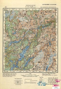
- Description:
- 1937
- Subject:
- Geographic Subject: Vypush, Topical Subject: Soviet Union, and Topical Subject: Maps
- Publisher:
- Генеральный штаб РККА
- Language:
- Russian
- Identifier:
- VAC9619-000432
- Genre:
- Topographic Maps and Military Maps
- Geographic Location:
- Coordinates: 55.6667, 29.5, 55.8333, 29.75
- Related URL:
- Catalog URL: http://iucat.iu.edu/catalog/5020131 and Download GeoTIFF: https://drive.google.com/open?id=1SLX1MIVRQSAGqoHdUivrMkMO70pMHy7r
- Abstract:
- Modern area represented: abandoned populated place Vypush, Vitebsk oblast, Belarus
- Call Number:
- G7000 s50 .S68 sheet N-35-12-C
- Caption:
- Не подлежит оглашению
- City:
- Выпуш (Vypush)
- Copyright Holder:
- No Copyright - United States
- Country:
- СССР (USSR)
- State/Province:
- Белорусская ССР (Byelorussian Soviet Socialist Republic), РСФСР (RSFSR), Витебская область (Vitebsk oblast), and Калининская область (Kalinin oblast)
- Physical Description:
- Scale: 1:50,000
- Persistent URL:
- http://purl.dlib.indiana.edu/iudl/images/VAC9619/VAC9619-000432
- Provenance:
- M. I. Map Library, Reichsamt für Landesaufnahme, Kartensammlung, GS, RA, G000-30
-
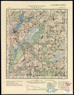
- Description:
- 1936
- Subject:
- Geographic Subject: Chareya, Topical Subject: Soviet Union, and Topical Subject: Maps
- Publisher:
- Управление военных топографов РККА
- Language:
- Russian
- Identifier:
- VAC9619-000576
- Genre:
- Military Maps and Topographic Maps
- Geographic Location:
- Coordinates: 54.5, 29.25, 54.667, 29.5
- Related URL:
- Download GeoTIFF: https://drive.google.com/open?id=13b1hFNUPOYi05RK7KJm4NUHb8ghsZTvo and Catalog URL: http://iucat.iu.edu/catalog/5020131
- Abstract:
- Modern area represented: Chareya, Vitebsk oblast, Belarus
- Call Number:
- zsheet N-35-59-B and G7000 s50 .S68
- Caption:
- Не подлежит оглашению
- City:
- Черея (Chereya)
- Copyright Holder:
- No Copyright - United States
- Country:
- СССР (USSR)
- State/Province:
- Белорусская ССР (Byelorussian Soviet Socialist Republic)
- Physical Description:
- Scale: 1:50,000
- Persistent URL:
- http://purl.dlib.indiana.edu/iudl/images/VAC9619/VAC9619-000576
- Provenance:
- M. I. Map Library, G000-30
-
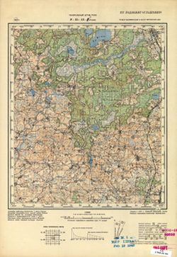
- Description:
- 1937
- Subject:
- Topical Subject: Soviet Union, Topical Subject: Maps, and Geographic Subject: Rudnya
- Publisher:
- Генеральный штаб РККА
- Language:
- Russian
- Identifier:
- VAC9619-000433
- Genre:
- Military Maps and Topographic Maps
- Geographic Location:
- Coordinates: 55.6667, 29.75, 55.8333, 30
- Related URL:
- Download GeoTIFF: https://drive.google.com/open?id=1pjBbMvMADu6X1fhFqKNsAViSBd9R1ZK8 and Catalog URL: http://iucat.iu.edu/catalog/5020131
- Abstract:
- Modern area represented: abandoned populated place Rudnya, Vitebskaya oblast, Belarus
- Call Number:
- G7000 s50 .S68 sheet N-35-12-D
- Caption:
- Не подлежит оглашению
- City:
- Рудня (Rudnya)
- Copyright Holder:
- No Copyright - United States
- Country:
- СССР (USSR)
- State/Province:
- РСФСР (RSFSR), Белорусская ССР (Byelorussian Soviet Socialist Republic), Витебская область (Vitebsk oblast), and Калининская область (Kalinin oblast)
- Physical Description:
- Scale: 1:50,000
- Persistent URL:
- http://purl.dlib.indiana.edu/iudl/images/VAC9619/VAC9619-000433
- Provenance:
- M. I. Map Library, G000-30
-
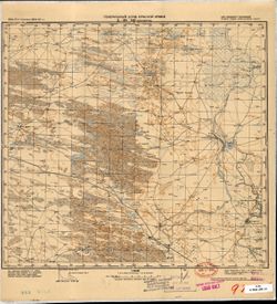
- Description:
- 1935
- Subject:
- Topical Subject: Soviet Union, Topical Subject: Maps, Geographic Subject: Chubutla, and Geographic Subject: Dagestan
- Publisher:
- Генеральный штаб Красной Армии
- Language:
- Russian
- Date Created:
- 1942
- Identifier:
- VAC9619-002248
- Genre:
- Topographic Maps and Military Maps
- Geographic Location:
- Coordinates: 44, 46, 44.3333, 46.5
- Related URL:
- Catalog URL: https://iucat.iu.edu/catalog/5020129 and Download GeoTIFF: https://drive.google.com/file/d/100QQ5ahXVFMaFSsAM9CrZFGoR3oHOl0l/view?usp=sharing
- Abstract:
- Modern area represented: Чубутла (Chubutla), Dagestan, Russia
- Call Number:
- G7000 s100 .S7 sheet L-38-141
- Caption:
- Для cлужебного пользования
- City:
- Аул-Чубутла (Aul-Chubutla)
- Copyright Holder:
- No Copyright - United States
- Country:
- СССР (USSR)
- State/Province:
- Орджоникидзевский край (Ordzhonikidze kray), Кизлярский округ (Kizlyar district), and РСФСР (RSFSR)
- Physical Description:
- Scale: 1:100,000
- Persistent URL:
- http://purl.dlib.indiana.edu/iudl/images/VAC9619/VAC9619-002248
- Provenance:
- CIA Map Library
-
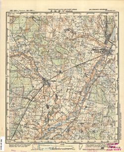
- Subject:
- Topical Subject: Maps, Geographic Subject: Kėdainiai, and Topical Subject: Soviet Union
- Publisher:
- Генеральный штаб Красной Армии
- Language:
- Russian
- Date Created:
- 1941
- Identifier:
- VAC9619-000285
- Genre:
- Topographic Maps and Military Maps
- Geographic Location:
- Coordinates: 55.1667, 23.75, 55.3333, 24
- Related URL:
- Download GeoTIFF: https://drive.google.com/open?id=1uGlzXVd5V1MbMjl6rFakM6q19ovdnldY and Catalog URL: http://iucat.iu.edu/catalog/5020131
- Abstract:
- Modern area represented: Kėdainiai, Lithuania
- Call Number:
- G7000 s50 .S68 N-34-36-B
- Caption:
- Для служебного пользования
- City:
- Кедайняй (Kėdainiai)
- Copyright Holder:
- No Copyright - United States
- Country:
- СССР (USSR)
- State/Province:
- Литовская ССР (Lithuanian Soviet Socialist Republic)
- Physical Description:
- Scale: 1:50,000
- Persistent URL:
- http://purl.dlib.indiana.edu/iudl/images/VAC9619/VAC9619-000285
- Provenance:
- CIA Map Branch -- Received, G000-30, CIA Map Library
-
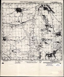
- Description:
- 1936
- Subject:
- Topical Subject: Maps, Geographic Subject: Svetlograd, and Topical Subject: Soviet Union
- Publisher:
- Главное управление геодезии и картографии при СНК СССР
- Language:
- Russian
- Date Created:
- 1941
- Identifier:
- VAC9619-002169
- Genre:
- Military Maps and Topographic Maps
- Geographic Location:
- Coordinates: 45, 42.5, 45.33333, 43
- Related URL:
- Catalog URL: https://iucat.iu.edu/catalog/5020129 and Download GeoTIFF: https://drive.google.com/open?id=1uFPKdptgUTl0ZXnLCivKm0m4gwI7N7YD
- Abstract:
- Modern area represented: Svetlograd, Stavropol kray, Russia
- Call Number:
- G7000 s100 .S7 sheet L-38-98
- Caption:
- Для служебного пользования
- City:
- Петровское (Petrovskoye)
- Copyright Holder:
- No Copyright - United States
- Country:
- СССР (USSR)
- State/Province:
- Орджоникидзевский край (Ordzhonikidze kray) and РСФСР (RSFSR)
- Physical Description:
- Scale: 1:100,000
- Persistent URL:
- http://purl.dlib.indiana.edu/iudl/images/VAC9619/VAC9619-002169
- Provenance:
- CIA Map Library
-
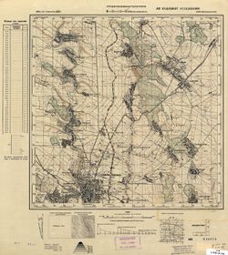
- Subject:
- Topical Subject: Maps, Geographic Subject: Камянець-Подільський (Kamianets-Podilskyi), and Topical Subject: Soviet Union
- Publisher:
- Управление военных топографов
- Language:
- Russian
- Identifier:
- VAC9619-000878
- Genre:
- Military Maps and Topographic Maps
- Geographic Location:
- Coordinates: 48.6667, 26.5, 48.8333, 26.75
- Related URL:
- Download GeoTIFF: https://drive.google.com/open?id=1d9zmDF1aOMAqfbDt_Z1j4-1yPA9Wetkx and Catalog URL: http://iucat.iu.edu/catalog/5020131
- Abstract:
- Modern area represented: Камянець-Подільський (Kamianets-Podilskyi), Khmelnytskyi Oblast, Ukraine
- Call Number:
- G7000 s50 .S68 sheet M-35-114-C
- Caption:
- Не подлежит оглашению
- City:
- Каменец-Подольск (Kamenets-Podol’sk)
- Copyright Holder:
- No Copyright - United States
- Country:
- СССР (USSR)
- State/Province:
- Украинская ССР (Ukrainian Soviet Socialist Republic) and Винницкая область (Vinnytsia oblast)
- Physical Description:
- Scale: 1:50,000
- Persistent URL:
- http://purl.dlib.indiana.edu/iudl/images/VAC9619/VAC9619-000878
- Provenance:
- CIA Map Branch -- Received
-
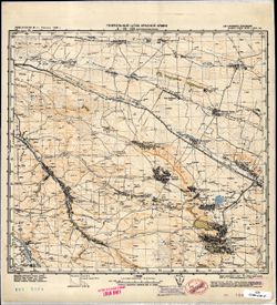
- Description:
- 1928
- Subject:
- Topical Subject: Maps, Geographic Subject: Vorovskolesskaya, Topical Subject: Soviet Union, and Geographic Subject: Stavropol' Krai
- Publisher:
- Генеральный штаб Красной Армии
- Language:
- Russian
- Date Created:
- 1942
- Identifier:
- VAC9619-002207
- Genre:
- Military Maps and Topographic Maps
- Geographic Location:
- Coordinates: 44.3333, 42, 44.6667, 42.5
- Related URL:
- Catalog URL: https://iucat.iu.edu/catalog/5020129 and Download GeoTIFF: https://drive.google.com/file/d/1zWxRfN0S2bbgOMpQplCOmjlyz-MQgi81/view?usp=sharing
- Abstract:
- Modern area represented: Воровсколесская (Vorovskolesskaya), Stavropol' Krai, Russia
- Call Number:
- G7000 s100 .S7 sheet L-38-121
- Caption:
- Для cлужебного пользования
- City:
- Воровсколесская (Vorovskolesskaya)
- Copyright Holder:
- No Copyright - United States
- Country:
- СССР (USSR)
- State/Province:
- РСФСР (RSFSR), Орджоникидзевский край (Ordzhonikidze kray), and Черкесская автономная область (Cherkess Autonomous Oblast)
- Physical Description:
- Scale: 1:100,000
- Persistent URL:
- http://purl.dlib.indiana.edu/iudl/images/VAC9619/VAC9619-002207
- Provenance:
- CIA Map Library
-
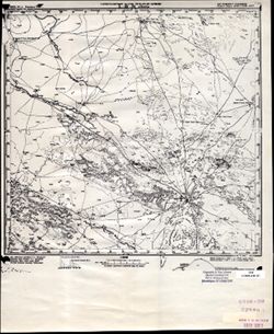
- Description:
- 1932
- Subject:
- Topical Subject: Soviet Union, Geographic Subject: Sostinskiy, and Topical Subject: Maps
- Publisher:
- Генеральный штаб Красной Армии
- Language:
- Russian
- Date Created:
- 1942
- Identifier:
- VAC9619-002165
- Genre:
- Topographic Maps and Military Maps
- Geographic Location:
- Coordinates: 45.3333, 45, 45.6667, 45.5
- Related URL:
- Download GeoTIFF: https://drive.google.com/open?id=1mPzTxGKH5jVyadj_6X9zxs5fzkbRDVmU and Catalog URL: https://iucat.iu.edu/catalog/5020129
- Abstract:
- Modern area represented: Sostinskiy, Kalmykiya Republic, Russia
- Call Number:
- G7000 s100 .S7 sheet L-38-91
- Caption:
- Для служебного пользования
- City:
- Ачинеры (Achinery)
- Copyright Holder:
- No Copyright - United States
- Country:
- СССР (USSR)
- State/Province:
- РСФСР (RSFSR), Калмыцкая АССР (Kalmyk Autonomous Soviet Socialist Republic), and Орджоникидзевский край (Ordzhonikidze kray)
- Physical Description:
- Scale: 1:100,000
- Persistent URL:
- http://purl.dlib.indiana.edu/iudl/images/VAC9619/VAC9619-002165
- Provenance:
- CIA Map Library
-
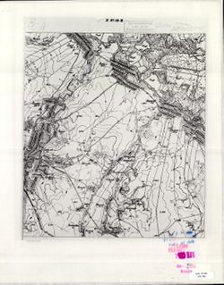
- Subject:
- Geographic Subject: Nazarevo, Topical Subject: Soviet Union, and Topical Subject: Maps
- Language:
- Russian
- Identifier:
- VAC9619-001613
- Genre:
- Military Maps and Topographic Maps
- Related URL:
- Catalog URL: http://iucat.iu.edu/catalog/5020131
- Abstract:
- Modern area represented: Nazarevo, Ryazan oblast, Russia
- Call Number:
- G7000 s50 .S68 sheet N-37-83-B
- Copyright Holder:
- No Copyright - United States
- Country:
- СССР (USSR)
- Physical Description:
- Scale: 1:50,000
- Persistent URL:
- http://purl.dlib.indiana.edu/iudl/images/VAC9619/VAC9619-001613
- Provenance:
- M. I. Map Library, Atlasblatt, Heeresplankammer Gruppe Archive Auslandskartenarchiv
-
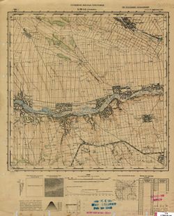
- Description:
- 1927
- Subject:
- Geographic Subject: Hvozdavka Druha, Topical Subject: Maps, Geographic Subject: Hvozdavka Persha, and Topical Subject: Soviet Union
- Publisher:
- Управление военных топографов
- Language:
- Russian
- Identifier:
- VAC9619-000118
- Genre:
- Military Maps and Topographic Maps
- Geographic Location:
- Coordinates: 47.8333, 30, 48, 30.25
- Related URL:
- Download GeoTIFF: https://drive.google.com/open?id=1SO72YG1VGyq5w1BQaBhlf1XJy0bjJxuu and Catalog URL: http://iucat.iu.edu/catalog/5020131
- Abstract:
- Modern area represented: Hvozdavka Persha and Hvozdavka Druha, Odessa oblast, Ukraine
- Call Number:
- G7000 s50 .S68 sheet L-36-1-A
- Caption:
- Не подлежит оглашению
- City:
- Гвоздавка (Gvozdavka)
- Copyright Holder:
- No Copyright - United States
- Country:
- СССР (USSR)
- State/Province:
- Одесская область (Odessa oblast) and Украинская ССР (Ukrainian Soviet Socialist Republic)
- Physical Description:
- Scale: 1:50,000
- Persistent URL:
- http://purl.dlib.indiana.edu/iudl/images/VAC9619/VAC9619-000118
- Provenance:
- M. I. Map Library, G000-30, GS, RA, Atlasblatt
-
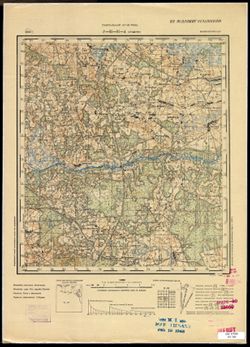
- Description:
- 1933
- Subject:
- Topical Subject: Maps, Topical Subject: Soviet Union, and Geographic Subject: Studzyonka
- Publisher:
- Генеральный штаб РККА
- Language:
- Russian
- Identifier:
- VAC9619-000624
- Genre:
- Military Maps and Topographic Maps
- Geographic Location:
- Coordinates: 53.833, 28, 54, 28.25
- Related URL:
- Catalog URL: http://iucat.iu.edu/catalog/5020131 and Download GeoTIFF: https://drive.google.com/open?id=1_VDH4iLeZVuefLXGsMdUPFqCQLqLN_JV
- Abstract:
- Modern area represented: Studzyonka, Minsk oblast, Belarus
- Call Number:
- G7000 s50 .S68 sheet N-35-81-A
- Caption:
- Не подлежит оглашению
- City:
- Студенка (Studenka)
- Copyright Holder:
- No Copyright - United States
- Country:
- СССР (USSR)
- State/Province:
- Белорусская ССР (Byelorussian Soviet Socialist Republic)
- Physical Description:
- Scale: 1:50,000
- Persistent URL:
- http://purl.dlib.indiana.edu/iudl/images/VAC9619/VAC9619-000624
- Provenance:
- M. I. Map Library, G000-30
-
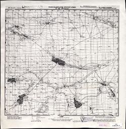
- Description:
- 1927
- Subject:
- Geographic Subject: Kazgulak, Topical Subject: Maps, and Topical Subject: Soviet Union
- Publisher:
- Генеральный штаб Красной Армии
- Language:
- Russian
- Date Created:
- 1941
- Identifier:
- VAC9619-002162
- Genre:
- Military Maps and Topographic Maps
- Geographic Location:
- Coordinates: 45.3333, 43, 45.6667, 43.5
- Related URL:
- Catalog URL: https://iucat.iu.edu/catalog/5020129 and Download GeoTIFF: https://drive.google.com/file/d/1yZXGqBnQYcp1i3-Vmzd0UDBDT9RL_MRV/view?usp=sharing
- Abstract:
- Modern area represented: Kazgulak, Stavropol kray, Russia
- Call Number:
- G7000 s100 .S7 sheet L-38-87
- Caption:
- Для служебного пользования
- City:
- Казгулак (Kazgulak)
- Copyright Holder:
- No Copyright - United States
- Country:
- СССР (USSR)
- State/Province:
- РСФСР (RSFSR) and Орджоникидзевский край (Ordzhonikidze kray)
- Physical Description:
- Scale: 1:100,000
- Persistent URL:
- http://purl.dlib.indiana.edu/iudl/images/VAC9619/VAC9619-002162
- Provenance:
- CIA Map Library, Heeresplankammer Gruppe Archive Auslandskartenarchiv
-
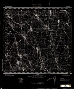
- Description:
- 1875
- Subject:
- Topical Subject: Maps, Topical Subject: Soviet Union, and Geographic Subject: Berezyne
- Publisher:
- Генеральный штаб РККА
- Language:
- Russian
- Date Created:
- 1916
- Identifier:
- VAC9619-001629
- Genre:
- Military Maps and Topographic Maps
- Geographic Location:
- Coordinates: 46, 29, 46.3333, 29.5
- Related URL:
- Catalog URL: https://iucat.iu.edu/catalog/5020129 and Download GeoTIFF: https://drive.google.com/open?id=1C3sEntFJccgyBICFoDtKC-3pwp46wFsk
- Abstract:
- Modern area represented: Berezyne, Odessa oblast, Ukraine.
- Call Number:
- G7000 s100 .S7 sheet L-35-71
- City:
- Березина (Berezyne)
- Copyright Holder:
- No Copyright - United States
- Country:
- СССР (USSR)
- State/Province:
- Бессарабия (Bessarabia)
- Physical Description:
- Scale: 1:100,000
- Persistent URL:
- http://purl.dlib.indiana.edu/iudl/images/VAC9619/VAC9619-001629
- Provenance:
- CIA Map Library
-
- Description:
- 1938
- Subject:
- Topical Subject: Maps, Geographic Subject: Kalmykiya Republic, and Topical Subject: Soviet Union
- Publisher:
- Генеральный штаб Красной Армии
- Language:
- Russian
- Date Created:
- 1941
- Identifier:
- VAC9619-002059
- Genre:
- Military Maps and Topographic Maps
- Geographic Location:
- Coordinates: 46.3333, 47, 46.6667, 47.5
- Related URL:
- Download GeoTIFF: https://drive.google.com/open?id=1gQRsPFmbY6YrgUnfdgJfB1Zuug-PSFXO and Catalog URL: https://iucat.iu.edu/catalog/5020129
- Abstract:
- Modern area represented: Kalmykiya Republic, Russia
- Call Number:
- G7000 s100 .S7 sheet L-38-59
- Caption:
- Для служебного пользования
- City:
- Ур. Южная Мухта (Urochishche Yuzhnaya Mukhta)
- Copyright Holder:
- No Copyright - United States
- Country:
- СССР (USSR)
- State/Province:
- РСФСР (RSFSR) and Калмыцкая АССР (Kalmyk Autonomous Soviet Socialist Republic)
- Physical Description:
- Scale: 1:100,000
- Persistent URL:
- http://purl.dlib.indiana.edu/iudl/images/VAC9619/VAC9619-002059
- Provenance:
- CIA Map Library, Atlasblatt
-
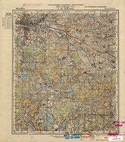
- Subject:
- Geographic Subject: Polatsk, Topical Subject: Soviet Union, and Topical Subject: Maps
- Publisher:
- Управление военных топографов
- Language:
- Russian
- Identifier:
- VAC9619-000471
- Genre:
- Topographic Maps and Military Maps
- Geographic Location:
- Coordinates: 55.3333, 28.75, 55.5, 29
- Related URL:
- Catalog URL: http://iucat.iu.edu/catalog/5020131, https://drive.google.com/file/d/1TY-0kTKyfdgF2LLcg73BzOAkT5uqYwUa/view?usp=sharing, and Download GeoTIFF: h...
- Abstract:
- Modern area represented: Polatsk, Vitebsk oblast, Belarus
- Call Number:
- G7000 s50 .S68 sheet N-35-22-D
- Caption:
- Не подлежит оглашению
- City:
- Полоцк (Polotsk)
- Copyright Holder:
- No Copyright - United States
- Country:
- СССР (USSR)
- State/Province:
- Белорусская ССР (Byelorussian Soviet Socialist Republic)
- Physical Description:
- Scale: 1:50,000
- Persistent URL:
- http://purl.dlib.indiana.edu/iudl/images/VAC9619/VAC9619-000471
- Provenance:
- M. I. Map Library, Library of Congress Geography & Map Division, GS, RA, G000-30, Atlasblatt
-
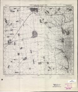
- Description:
- 1926
- Subject:
- Topical Subject: Soviet Union, Topical Subject: Maps, and Geographic Subject: Apostolove
- Publisher:
- Генеральный штаб Красной Армии
- Language:
- Russian
- Date Created:
- 1941
- Identifier:
- VAC9619-001866
- Genre:
- Military Maps and Topographic Maps
- Geographic Location:
- Coordinates: 47.3333, 33.5, 47.6667, 34
- Related URL:
- Catalog URL: https://iucat.iu.edu/catalog/5020129 and Download GeoTIFF: https://drive.google.com/file/d/19vU-7kd0gBkHRSMRDc-_C2Jsbp5EDO89/view?usp=sharing
- Abstract:
- Modern area represented: Apostolove, Dnipropetrovsk oblast, Ukraine
- Call Number:
- G7000 s100 .S7 sheet L-36-20
- Caption:
- Для служебного пользования
- City:
- Апостолово (Apostolovo)
- Copyright Holder:
- No Copyright - United States
- Country:
- СССР (USSR)
- State/Province:
- Украинская ССР (Ukrainian Soviet Socialist Republic)
- Physical Description:
- Scale: 1:100,000
- Persistent URL:
- http://purl.dlib.indiana.edu/iudl/images/VAC9619/VAC9619-001866
- Provenance:
- CIA Map Library, Atlasblatt
-
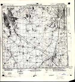
- Description:
- 1903
- Subject:
- Geographic Subject: Dzhankoi, Topical Subject: Soviet Union, and Topical Subject: Maps
- Publisher:
- Генеральный штаб Красной Армии
- Language:
- Russian
- Date Created:
- 1941
- Identifier:
- VAC9619-001943
- Genre:
- Topographic Maps and Military Maps
- Geographic Location:
- Coordinates: 45.6667, 34, 46, 34.5
- Related URL:
- Download GeoTIFF: https://drive.google.com/open?id=1Uezem1DTHm_K_ar57W6lultAdVkJlsj1 and Catalog URL: https://iucat.iu.edu/catalog/5020129
- Abstract:
- Modern area represented: Dzhankoi, Republic of Crimea, Ukraine
- Call Number:
- G7000 s100 .S7 sheet L-36-81
- Caption:
- Для cлужебного пользования
- City:
- Джанкой (Dzhankoi)
- Copyright Holder:
- No Copyright - United States
- Country:
- СССР (USSR)
- State/Province:
- Крымская АССР (Crimean Autonomous Soviet Socialist Republic), РСФСР (RSFSR), and Украинская ССР (Ukrainian Soviet Socialist Republic)
- Physical Description:
- Scale: 1:100,000
- Persistent URL:
- http://purl.dlib.indiana.edu/iudl/images/VAC9619/VAC9619-001943
- Provenance:
- G000-30
-
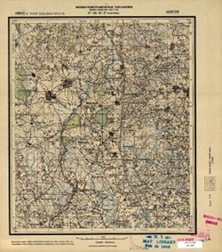
- Description:
- 1926
- Subject:
- Geographic Subject: Osinovitsy, Topical Subject: Soviet Union, and Topical Subject: Maps
- Publisher:
- Военно-топографическое управление
- Language:
- Russian
- Date Created:
- 1927
- Identifier:
- VAC9619-001225
- Genre:
- Topographic Maps and Military Maps
- Geographic Location:
- Coordinates: 55.3333, 31.25, 55.5, 31.5
- Related URL:
- Download GeoTIFF: https://drive.google.com/open?id=1H0g9VKnYBI20vGvvKq5_SjO6e7wWyvjY and Catalog URL: http://iucat.iu.edu/catalog/5020131
- Abstract:
- Modern area represented: Osinovitsy, Smolensk oblast, Russia
- Call Number:
- GM G7000 S50 .S68 N-36-15-Г
- Caption:
- Секретно
- City:
- Осиновцы (Osinovitsy)
- Copyright Holder:
- No Copyright - United States
- Country:
- СССР (USSR)
- State/Province:
- РСФСР (RSFSR) and Западная область (Western oblast)
- Physical Description:
- Scale: 1:50,000
- Persistent URL:
- http://purl.dlib.indiana.edu/iudl/images/VAC9619/VAC9619-001225
- Provenance:
- M. I. Map Library, G000-30, GS, RA
-
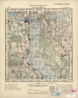
- Description:
- 1936
- Subject:
- Topical Subject: Soviet Union, Geographic Subject: Stasyewka, and Topical Subject: Maps
- Publisher:
- Управление военных топографов РККА
- Language:
- Russian
- Identifier:
- VAC9619-000732
- Genre:
- Military Maps and Topographic Maps
- Geographic Location:
- Coordinates: 52.833, 29.25, 53, 29.5
- Related URL:
- Download GeoTIFF: https://drive.google.com/open?id=11yb0-O7JeEIBSqyDA_aZqXVPCgDGUKCp and Catalog URL: http://iucat.iu.edu/catalog/5020131
- Abstract:
- Modern area represented: Stasyewka, Mogilev oblast, Belarus
- Call Number:
- G7000 s50 .s68 sheet N-35-119-B
- Caption:
- Не подлежит оглашению
- City:
- Стасевка (Stasevka)
- Copyright Holder:
- No Copyright - United States
- Country:
- СССР (USSR)
- State/Province:
- Белорусская ССР (Byelorussian Soviet Socialist Republic)
- Physical Description:
- Scale: 1:50,000
- Persistent URL:
- http://purl.dlib.indiana.edu/iudl/images/VAC9619/VAC9619-000732
- Provenance:
- M. I. Map Library, CIA Map Library, GS, RA, G000-30
-
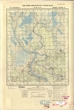
- Description:
- 1938
- Subject:
- Geographic Subject: Yur'yevo, Topical Subject: Soviet Union, and Topical Subject: Maps
- Publisher:
- Главное управление государственной съемки и картографии НКВД СССР
- Language:
- Russian
- Identifier:
- VAC9619-002911
- Genre:
- Military Maps and Topographic Maps
- Geographic Location:
- Coordinates: 58, 31.5, 58.167, 31.75
- Related URL:
- Catalog URL: http://iucat.iu.edu/catalog/5020131 and Download GeoTIFF: https://drive.google.com/file/d/1_4MNylz2L__3yRfDgH-rc80b98Suz4MY/view?usp=sharing
- Abstract:
- Modern area represented: Юрьево (Yur'yevo), Novgorodskaya oblast, Russia
- Call Number:
- GM G7000 s50 .S68 sheet O-36-64-С
- Caption:
- Для служебного пользования
- City:
- Юрьево (Yur'yevo)
- Copyright Holder:
- No Copyright - United States
- Country:
- СССР (USSR)
- State/Province:
- Лычковский район (Lychkovsky district), Старорусский район (Starorussky district), and Ленинградская область (Leningrad oblast)
- Physical Description:
- Scale: 1:50,000
- Persistent URL:
- http://purl.dlib.indiana.edu/iudl/images/VAC9619/VAC9619-002911
- Provenance:
- M. I. Map Library, Library of Congress Geography & Map Division
-
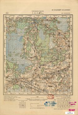
- Description:
- 1937
- Subject:
- Topical Subject: Maps, Topical Subject: Soviet Union, and Geographic Subject: Obal
- Publisher:
- Генеральный штаб РККА
- Language:
- Russian
- Identifier:
- VAC9619-000476
- Genre:
- Topographic Maps and Military Maps
- Geographic Location:
- Coordinates: 55.3333, 29.25, 55.5, 29.5
- Related URL:
- Download GeoTIFF: https://drive.google.com/file/d/1F-gTw7EF5Im-bMChmcKIIBYs1VPSLU2Y/view?usp=sharing and Catalog URL: http://iucat.iu.edu/catalog/5020131
- Abstract:
- Modern area represented: Obal, Vitebsk oblast, Belarus
- Call Number:
- G7000 s50 .S68 sheet N-35-23-D
- Caption:
- Не подлежит оглашению
- City:
- Оболь (Obol)
- Copyright Holder:
- No Copyright - United States
- Country:
- СССР (USSR)
- State/Province:
- Белорусская ССР (Byelorussian Soviet Socialist Republic) and Витебская область (Vitebsk oblast)
- Physical Description:
- Scale: 1:50,000
- Persistent URL:
- http://purl.dlib.indiana.edu/iudl/images/VAC9619/VAC9619-000476
- Provenance:
- M. I. Map Library, Reichsamt für Landesaufnahme, Kartensammlung, Library of Congress Geography & Map Division, G000-30
-
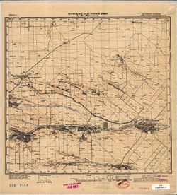
- Description:
- 1936
- Subject:
- Topical Subject: Soviet Union, Topical Subject: Maps, and Geographic Subject: Blagodarnyy
- Publisher:
- Генеральный штаб Красной Армии
- Language:
- Russian
- Date Created:
- 1941
- Identifier:
- VAC9619-002170
- Genre:
- Topographic Maps and Military Maps
- Geographic Location:
- Coordinates: 45, 43, 45.3333, 43.5
- Related URL:
- Catalog URL: https://iucat.iu.edu/catalog/5020129 and Download GeoTIFF: https://drive.google.com/open?id=1r7eJXaOyMSAYEak-ZAIZXnWNk3LkYbbW
- Abstract:
- Modern area represented: Blagodarnyy, Stavropol kray, Russia
- Call Number:
- G7000 s100 .S7 sheet L-38-99
- Caption:
- Для служебного пользования
- City:
- Благодарное (Blagodarnoye)
- Copyright Holder:
- No Copyright - United States
- Country:
- СССР (USSR)
- State/Province:
- Орджоникидзевский край (Ordzhonikidze kray) and РСФСР (RSFSR)
- Physical Description:
- Scale: 1:100,000
- Persistent URL:
- http://purl.dlib.indiana.edu/iudl/images/VAC9619/VAC9619-002170
- Provenance:
- CIA Map Library, CIA Map Branch -- Received
-
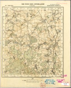
- Description:
- 1939
- Subject:
- Topical Subject: Maps, Geographic Subject: Stomna, and Topical Subject: Soviet Union
- Publisher:
- Главное Управление Геодезии и Картографии при СНК СССР
- Language:
- Russian
- Date Created:
- 1941
- Identifier:
- VAC9619-001603
- Genre:
- Topographic Maps and Military Maps
- Geographic Location:
- Coordinates: 54.5, 38, 54.6667, 38.25
- Related URL:
- Catalog URL: http://iucat.iu.edu/catalog/5020131 and Download GeoTIFF: https://drive.google.com/open?id=1fs2-EGb5ger0tLjvx8GzSczBiLrnBpJ-
- Abstract:
- Modern area represented: Stomna, Tula oblast, Russia
- Call Number:
- G7000 s50 .S68 sheet N-37-53-A
- Caption:
- Для служебного пользования
- Copyright Holder:
- No Copyright - United States
- Country:
- СССР (USSR)
- State/Province:
- Тульская область (Tula oblast) and РСФСР (RSFSR)
- Physical Description:
- Scale: 1:50,000
- Persistent URL:
- http://purl.dlib.indiana.edu/iudl/images/VAC9619/VAC9619-001603
- Provenance:
- M. I. Map Library, Atlasblatt, Library of Congress Geography & Map Division
-
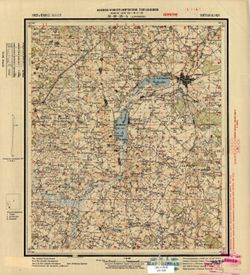
- Description:
- 1921
- Subject:
- Topical Subject: Soviet Union, Topical Subject: Maps, and Geographic Subject: Yanovichi
- Publisher:
- Военно-топографическое управление
- Language:
- Russian
- Date Created:
- 1928
- Identifier:
- VAC9619-001256
- Genre:
- Military Maps and Topographic Maps
- Geographic Location:
- Coordinates: 55.167, 30.5, 55.333, 30.75
- Related URL:
- Catalog URL: http://iucat.iu.edu/catalog/5020131 and Download GeoTIFF: https://drive.google.com/open?id=1_5GCfvhlNi6nhQfbYEauCBKWA0xqJ8og
- Abstract:
- Modern area represented: Yanovichi, Vitebsk oblast, Belarus
- Call Number:
- GM G7000 S50 .S68 N-36-26-A
- Caption:
- Секретно
- City:
- Яновичи (Yanovichi)
- Copyright Holder:
- No Copyright - United States
- Country:
- СССР (USSR)
- State/Province:
- Белорусская ССР (Byelorussian Soviet Socialist Republic)
- Physical Description:
- Scale: 1:50,000
- Persistent URL:
- http://purl.dlib.indiana.edu/iudl/images/VAC9619/VAC9619-001256
- Provenance:
- M. I. Map Library, G000-30
-
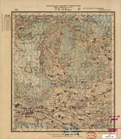
- Description:
- 1927
- Subject:
- Topical Subject: Maps, Geographic Subject: Obal', and Topical Subject: Soviet Union
- Publisher:
- Управление военных топографов
- Language:
- Russian
- Identifier:
- VAC9619-000475
- Genre:
- Topographic Maps and Military Maps
- Geographic Location:
- Coordinates: 55.3333, 29.25, 55.5, 29.5
- Related URL:
- Download GeoTIFF: https://drive.google.com/open?id=1428G9RMQGVjNdCQONPzIAHOxW1ev1rmz and Catalog URL: http://iucat.iu.edu/catalog/5020131
- Abstract:
- Modern area represented: Обаль (Obal'), Vitebsk District, Belarus
- Call Number:
- G7000 s50 .S68 sheet N-35-23-D
- Caption:
- Не подлежит оглашению
- City:
- Оболь (Obol')
- Copyright Holder:
- No Copyright - United States
- Country:
- СССР (USSR)
- State/Province:
- Белорусская ССР (Byelorussian Soviet Socialist Republic)
- Physical Description:
- Scale: 1:50,000
- Persistent URL:
- http://purl.dlib.indiana.edu/iudl/images/VAC9619/VAC9619-000475
- Provenance:
- M. I. Map Library, Library of Congress Geography & Map Division
-
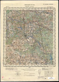
- Description:
- 1936
- Subject:
- Topical Subject: Soviet Union, Topical Subject: Maps, and Geographic Subject: Bogushëvsk
- Publisher:
- Генеральный штаб РККА
- Language:
- Russian
- Date Created:
- 1938
- Identifier:
- VAC9619-004176
- Genre:
- Topographic Maps and Military Maps
- Geographic Location:
- Coordinates: 54.667, 30, 55, 30.5
- Related URL:
- Catalog URL: https://iucat.iu.edu/catalog/5020129 and Download GeoTIFF: https://drive.google.com/file/d/1iS8-uU5-0W33Qvxrg_F5oj_sXo4MR9e0/view?usp=sharing
- Abstract:
- Modern area represented: Bogushëvsk, Vitebsk oblast, Belarus
- Call Number:
- G7000 s100 .S7 sheet N-36-37
- Caption:
- Не подлежит оглашению
- City:
- Богушевское (Bogushëvskoe)
- Copyright Holder:
- No Copyright - United States
- Country:
- СССР (USSR)
- State/Province:
- Витебская область (Vitebsk oblast) and Белорусская ССР (Byelorussian Soviet Socialist Republic)
- Physical Description:
- Scale: 1:100,000
- Persistent URL:
- http://purl.dlib.indiana.edu/iudl/images/VAC9619/VAC9619-004176
-
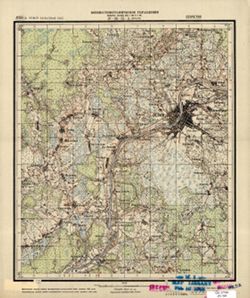
- Description:
- 1926
- Subject:
- Geographic Subject: Velizh, Topical Subject: Soviet Union, and Topical Subject: Maps
- Publisher:
- Военно-топографическое управление
- Language:
- Russian
- Identifier:
- VAC9619-001222
- Genre:
- Topographic Maps and Military Maps
- Geographic Location:
- Coordinates: 55.5, 31, 55.6667, 31.25
- Related URL:
- Catalog URL: http://iucat.iu.edu/catalog/5020131 and Download GeoTIFF: https://drive.google.com/open?id=1J6hNpeoiw5pxXOf4w-lPlsgnoJdwxh2N
- Abstract:
- Modern area represented: Velizh, Smolensk oblast, Russia
- Call Number:
- GM G7000 S50 .S68 N-36-15-A
- Caption:
- Секретно
- City:
- Велиж (Velizh)
- Copyright Holder:
- No Copyright - United States
- Country:
- СССР (USSR)
- State/Province:
- Западная область (Western oblast) and РСФСР (RSFSR)
- Physical Description:
- Scale: 1:50,000
- Persistent URL:
- http://purl.dlib.indiana.edu/iudl/images/VAC9619/VAC9619-001222
- Provenance:
- M. I. Map Library, G000-30, GS, RA
-
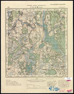
- Description:
- 1936
- Subject:
- Topical Subject: Maps, Geographic Subject: Капланцы (Kaplantsy), and Topical Subject: Soviet Union
- Publisher:
- Управление военных топографов РККА
- Language:
- Russian
- Identifier:
- VAC9619-000635
- Genre:
- Military Maps and Topographic Maps
- Geographic Location:
- Coordinates: 53.66667, 29.0, 53.83333, 29.25
- Related URL:
- Catalog URL: http://iucat.iu.edu/catalog/5020131 and Download GeoTIFF: https://drive.google.com/open?id=1XHwwliwJ8D9ypwF9smwhMphEODJX3DZ-
- Abstract:
- Modern area represented: Капланцы (Kaplantsy), Minsk Oblast, Belarus
- Call Number:
- G7000 s50 .S68 sheet N-35-83-C
- Caption:
- Не подлежит оглашению
- City:
- Капланцы (Kaplantsy)
- Copyright Holder:
- No Copyright - United States
- Country:
- СССР (USSR)
- State/Province:
- Белорусская ССР (Byelorussian Soviet Socialist Republic)
- Physical Description:
- Scale: 1:50,000
- Persistent URL:
- http://purl.dlib.indiana.edu/iudl/images/VAC9619/VAC9619-000635
- Provenance:
- M. I. Map Library, CIA Map Library
-
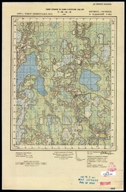
- Description:
- 1937
- Subject:
- Topical Subject: Maps, Topical Subject: Soviet Union, and Geographic Subject: Zenino
- Publisher:
- Главное управление государственной съемки и картографии НКВД СССР
- Language:
- Russian
- Identifier:
- VAC9619-003012
- Genre:
- Military Maps and Topographic Maps
- Geographic Location:
- Coordinates: 59.333, 31.5, 59.5, 31.75
- Related URL:
- Download GeoTIFF: https://drive.google.com/file/d/1jQcCmrOddHVgk6gEwdGWG0-JCsxASGdI/view?usp=sharing and Catalog URL: http://iucat.iu.edu/catalog/5020131
- Abstract:
- Modern area represented: Zenino, Leningrad oblast, Russia
- Call Number:
- G7000 s50 .S68 sheet O-36-16-C
- Caption:
- Для служебного пользования
- City:
- Зенино (Zenino)
- Copyright Holder:
- No Copyright - United States
- Country:
- СССР (USSR)
- State/Province:
- Киришский район (Kirishsky district), РСФСР (RSFSR), Чудовский район (Chudovsky district), Ленинградская область (Leningrad oblast), and Тосненский район (To...
- Physical Description:
- Scale: 1:50,000
- Persistent URL:
- http://purl.dlib.indiana.edu/iudl/images/VAC9619/VAC9619-003012
- Provenance:
- M. I. Map Library, Atlasblatt
-
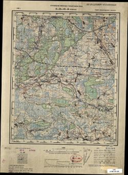
- Description:
- 1936
- Subject:
- Topical Subject: Maps, Geographic Subject: Kryakusha, and Topical Subject: Soviet Union
- Publisher:
- Управление военных топографов РККА
- Language:
- Russian
- Identifier:
- VAC9619-002807
- Genre:
- Military Maps and Topographic Maps
- Geographic Location:
- Coordinates: 57.667, 28.5, 57.833, 28.75
- Related URL:
- Catalog URL: http://iucat.iu.edu/catalog/5020131 and Download GeoTIFF: https://drive.google.com/file/d/1DXiqfT3K8Ch29aROKepDdUq69Q2mvw7F/view?usp=sharing
- Abstract:
- Modern area represented: Крякуша (Kryakusha), Псковская область (Pskovskaya oblast), Russia
- Call Number:
- GM G7000 s50 .S68 sheet O-35-82-C
- Caption:
- Не подлежит оглашению and Captured map
- City:
- Крякуша (Kryakusha)
- Copyright Holder:
- No Copyright - United States
- Country:
- СССР (USSR)
- State/Province:
- РСФСР (RSFSR) and Ленинградская область (Leningrad oblast)
- Physical Description:
- Scale: 1:50,000
- Persistent URL:
- http://purl.dlib.indiana.edu/iudl/images/VAC9619/VAC9619-002807
- Provenance:
- Army Map Service Library, Library of Congress G & M Division
-
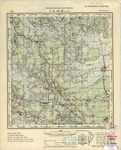
- Description:
- 1936
- Subject:
- Topical Subject: Maps, Topical Subject: Soviet Union, and Geographic Subject: Сосны (Sosny)
- Publisher:
- Управление военных топографов РККА
- Language:
- Russian
- Identifier:
- VAC9619-000763
- Genre:
- Military Maps and Topographic Maps
- Geographic Location:
- Coordinates: 52.5, 27.75, 52.667, 28
- Related URL:
- Download GeoTIFF: https://drive.google.com/open?id=18Jdevul3YJXffildfZj5OED269v2htyW and Catalog URL: http://iucat.iu.edu/catalog/5020131
- Abstract:
- Modern area represented: Сосны (Sosny), Minsk oblast, Belarus
- Call Number:
- G7000 s50 .s68 sheet N-35-128-B
- Caption:
- Не подлежит оглашению
- City:
- Совхоз Сосны (Sovkhoz Sosny)
- Copyright Holder:
- No Copyright - United States
- Country:
- СССР (USSR)
- State/Province:
- Белорусская ССР (Byelorussian Soviet Socialist Republic)
- Physical Description:
- Scale: 1:50,000
- Persistent URL:
- http://purl.dlib.indiana.edu/iudl/images/VAC9619/VAC9619-000763
- Provenance:
- M. I. Map Library
-
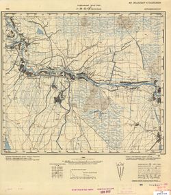
- Description:
- 1936
- Subject:
- Topical Subject: Maps, Topical Subject: Soviet Union, and Geographic Subject: Xıllı
- Publisher:
- Генеральный штаб РККА
- Language:
- Russian
- Identifier:
- VAC9619-000094
- Genre:
- Military Maps and Topographic Maps
- Geographic Location:
- Coordinates: 39.3333, 49, 39.5, 49.25
- Related URL:
- Download GeoTIFF: https://drive.google.com/open?id=1g3lgH2KmHtb_cqa1nqrk8t79C-YHIXlP and Catalog URL: http://iucat.iu.edu/catalog/5020131
- Abstract:
- Modern area represented: Xıllı, Azerbaijan
- Call Number:
- G7000 s50 .S68 sheet J-39-15-C
- Caption:
- Не подлежит оглашению
- City:
- Юхари-Хиллы (Yukhari-Khilly)
- Copyright Holder:
- No Copyright - United States
- Country:
- СССР (USSR)
- State/Province:
- Азербайджанская ССР (Azerbaijan Soviet Socialist Republic)
- Physical Description:
- Scale: 1:50,000
- Persistent URL:
- http://purl.dlib.indiana.edu/iudl/images/VAC9619/VAC9619-000094
- Provenance:
- CIA Map Branch -- Received, G000-30, CIA Map Library
-
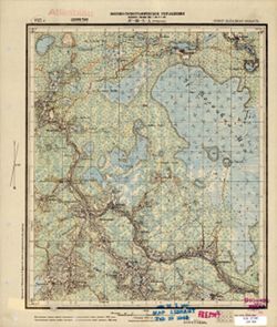
- Description:
- 1927
- Subject:
- Geographic Subject: Ordynka, Topical Subject: Soviet Union, and Topical Subject: Maps
- Publisher:
- Военно-топографическое управление
- Language:
- Russian
- Identifier:
- VAC9619-001196
- Genre:
- Military Maps and Topographic Maps
- Geographic Location:
- Coordinates: 55.8333, 32, 56, 32.25
- Related URL:
- Download GeoTIFF: https://drive.google.com/open?id=1AbPgfYMrmpfstQexUb-V9LxNOUkAC9_X and Catalog URL: http://iucat.iu.edu/catalog/5020131
- Abstract:
- Modern area represented: Ordynka, Tver oblast, Russia
- Call Number:
- GM G7000 S50 .S68 N-36-5-A
- Caption:
- Секретно
- City:
- Ордынка (Ordynka)
- Copyright Holder:
- No Copyright - United States
- Country:
- СССР (USSR)
- State/Province:
- РСФСР (RSFSR) and Западная область (Western oblast)
- Physical Description:
- Scale: 1:50,000
- Persistent URL:
- http://purl.dlib.indiana.edu/iudl/images/VAC9619/VAC9619-001196
- Provenance:
- M. I. Map Library, G000-30, GS, RA, Atlasblatt
-
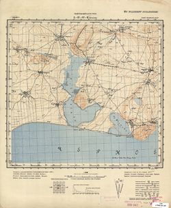
- Subject:
- Topical Subject: Maps, Topical Subject: Soviet Union, and Geographic Subject: Marivka
- Publisher:
- Генеральный штаб РККА
- Language:
- Russian
- Identifier:
- VAC9619-000135
- Genre:
- Military Maps and Topographic Maps
- Geographic Location:
- Coordinates: 45, 36, 45.1667, 36.25
- Related URL:
- Catalog URL: http://iucat.iu.edu/catalog/5020131 and Download GeoTIFF: https://drive.google.com/open?id=1PT8SdyXHcahebOwNRwqtocvV-yNJmkwb
- Abstract:
- Modern area represented: Marivka, Republic of Crimea, Ukraine
- Call Number:
- G7000 s50 .S68 sheet L-37-97-C
- Caption:
- Не подлежит оглашению
- City:
- Марьевка (Maryevka)
- Copyright Holder:
- No Copyright - United States
- Country:
- СССР (USSR)
- State/Province:
- РСФСР (RSFSR) and Крымская АССР (Crimean Autonomous Soviet Socialist Republic)
- Physical Description:
- Scale: 1:50,000
- Persistent URL:
- http://purl.dlib.indiana.edu/iudl/images/VAC9619/VAC9619-000135
- Provenance:
- CIA Map Branch -- Received, G000-30
-
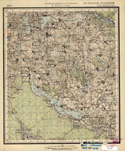
- Description:
- 1926
- Subject:
- Geographic Subject: Pukhnovo, Topical Subject: Soviet Union, and Topical Subject: Maps
- Publisher:
- Управление военных топографов РККА
- Language:
- Russian
- Identifier:
- VAC9619-001188
- Genre:
- Military Maps and Topographic Maps
- Geographic Location:
- Coordinates: 55.8333, 31, 56, 31.25
- Related URL:
- Download GeoTIFF: https://drive.google.com/open?id=1NABJEth3rjI2iCLt9qSEOmI3AvkryE_A and Catalog URL: http://iucat.iu.edu/catalog/5020131
- Abstract:
- Modern area represented: Pukhnovo, Pskov oblast, Russia
- Call Number:
- GM G7000 S50 .S68 N-36-3-A
- Caption:
- Не подлежит оглашению
- City:
- Пухново (Pukhnovo)
- Copyright Holder:
- No Copyright - United States
- Country:
- СССР (USSR)
- State/Province:
- Западная область (Western oblast) and РСФСР (RSFSR)
- Physical Description:
- Scale: 1:50,000
- Persistent URL:
- http://purl.dlib.indiana.edu/iudl/images/VAC9619/VAC9619-001188
- Provenance:
- M. I. Map Library
-
- Description:
- 1936
- Subject:
- Topical Subject: Maps, Geographic Subject: Mount Konskaya Golova, and Topical Subject: Soviet Union
- Publisher:
- Управление военных топографов РККА
- Language:
- Russian
- Identifier:
- VAC9619-002584
- Genre:
- Military Maps and Topographic Maps
- Geographic Location:
- Coordinates: 47.667, 138.5, 48, 139
- Related URL:
- Download GeoTIFF: https://drive.google.com/file/d/1hh1M1a9FQWxe9zRW0GYu74bta20N3WMJ/view?usp=sharing and Catalog URL: https://iucat.iu.edu/catalog/5020129
- Abstract:
- Modern area represented: Mount Konskaya Golova, Russia
- Call Number:
- G7000 s100 .S7 sheet L-54-2
- Caption:
- Не подлежит оглашению
- City:
- Гора Конская Голова (Mount Konskaya Golova)
- Copyright Holder:
- No Copyright - United States
- Country:
- СССР (USSR)
- State/Province:
- РСФСР (RSFSR) and Дальневосточный край (Far Eastern kray)
- Physical Description:
- Scale: 1:100,000
- Persistent URL:
- http://purl.dlib.indiana.edu/iudl/images/VAC9619/VAC9619-002584
- Provenance:
- Army Map Service Library
-
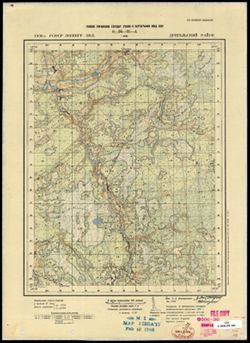
- Description:
- 1936
- Subject:
- Geographic Subject: Zobishchi, Topical Subject: Soviet Union, and Topical Subject: Maps
- Publisher:
- Главное управление государственной съемки и картографии НКВД СССР
- Language:
- Russian
- Identifier:
- VAC9619-003331
- Genre:
- Topographic Maps and Military Maps
- Geographic Location:
- Coordinates: 59.167, 33, 59.333, 33.25
- Related URL:
- Catalog URL: http://iucat.iu.edu/catalog/5020131 and Download GeoTIFF: https://drive.google.com/file/d/1Jhg2Tj7hINVBD96Uc7O27K8ARG3-xpsB/view?usp=sharing
- Abstract:
- Modern area represented: Зобищи (Zobishchi), Novgorodskaya oblast, Russia
- Call Number:
- G7000 s50 .S68 sheet O-36-31-A
- Caption:
- Для служебного пользования
- City:
- Зобище (Zobishche)
- Copyright Holder:
- No Copyright - United States
- Country:
- СССР (USSR)
- State/Province:
- Дрегельский район (Dregelsky district), РСФСР (RSFSR), and Ленинградская область (Leningrad oblast)
- Physical Description:
- Scale: 1:50,000
- Persistent URL:
- http://purl.dlib.indiana.edu/iudl/images/VAC9619/VAC9619-003331
- Provenance:
- M. I. Map Library
