
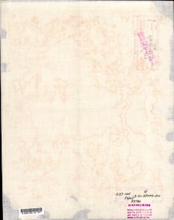
Search Constraints
You searched for:
Provenance
DMA Topographic Center, Army Map Service Library
Remove constraint Provenance: DMA Topographic Center, Army Map Service Library
Search Results
-
- Subject:
- Topical Subject: Soviet Union, Topical Subject: Maps, and Geographic Subject: Krasnoostrovskiy
- Publisher:
- Генеральный штаб РККА
- Language:
- Russian
- Date Created:
- 1939
- Identifier:
- VAC9619-002416
- Genre:
- Military Maps and Topographic Maps
- Geographic Location:
- Coordinates: 60, 28.5, 60.333, 29
- Related URL:
- Download GeoTIFF: https://drive.google.com/file/d/1BZ4cCb4BI9yHKnw4AhipKu_bSbjBEq1Q/view?usp=sharing and Catalog URL: https://iucat.iu.edu/catalog/5020129
- Abstract:
- Modern area represented: Красноостровский (Krasnoostrovskiy), Leningradskaya oblast, Russia
- Call Number:
- G7000 s100 .S7 sheet P-35-142
- Caption:
- Captured map
- City:
- Саренпяя (Saarenpää)
- Copyright Holder:
- No Copyright - United States
- Country:
- СССР (USSR) and Финляндия (Finland)
- Physical Description:
- Scale: 1:100,000
- Persistent URL:
- http://purl.dlib.indiana.edu/iudl/images/VAC9619/VAC9619-002416
- Provenance:
- DMA Topographic Center, Army Map Service Library
-
- Subject:
- Topical Subject: Soviet Union, Geographic Subject: Tapanila, and Topical Subject: Maps
- Publisher:
- Генеральный штаб Красной Армии
- Language:
- Russian
- Date Created:
- 1939
- Identifier:
- VAC9619-002412
- Genre:
- Military Maps and Topographic Maps
- Geographic Location:
- Coordinates: 60, 25, 60.333, 25.5
- Related URL:
- Catalog URL: https://iucat.iu.edu/catalog/5020129 and Download GeoTIFF: https://drive.google.com/file/d/1iFASd5MYfRFOfLEYYGOm3N-IZUmVhjFw/view?usp=sharing
- Abstract:
- Modern area represented: Tapanila, Finland
- Call Number:
- G7000 s100 .S7 sheet P-35-135
- Caption:
- Captured map
- City:
- Тапанила (Tapanila)
- Copyright Holder:
- No Copyright - United States
- Country:
- Финляндия (Finland)
- Physical Description:
- Scale: 1:100,000
- Persistent URL:
- http://purl.dlib.indiana.edu/iudl/images/VAC9619/VAC9619-002412
- Provenance:
- DMA Topographic Center, Army Map Service Library
-
- Description:
- 1938
- Subject:
- Geographic Subject: Oshtomozero, Topical Subject: Maps, and Topical Subject: Soviet Union
- Publisher:
- Itä-Karjalan kartasto
- Language:
- Russian
- Date Created:
- 1941
- Identifier:
- VAC9619-002478
- Genre:
- Topographic Maps and Military Maps
- Geographic Location:
- Coordinates: 63.667, 35.5, 64, 36
- Related URL:
- Catalog URL: https://iucat.iu.edu/catalog/5020129 and Download GeoTIFF: https://drive.google.com/file/d/1WoShYoULNk17wOvfGLQvbRo-sY35QiIL/view?usp=sharing
- Abstract:
- Modern area represented: Oshtomozero, Republic of Karelia, Russia
- Call Number:
- G7000 s100 .S7 sheet P-36-12
- City:
- Oshtomozero
- Copyright Holder:
- No Copyright - United States
- Country:
- СССР (USSR)
- State/Province:
- Карело-Финская ССР (Karelo-Finnish Soviet Socialist Republic)
- Physical Description:
- Scale: 1:100,000
- Persistent URL:
- http://purl.dlib.indiana.edu/iudl/images/VAC9619/VAC9619-002478
- Provenance:
- DMA Topographic Center, Army Map Service Library
-
- Subject:
- Topical Subject: Soviet Union, Topical Subject: Maps, and Geographic Subject: Muyezerskiy
- Language:
- Russian
- Identifier:
- VAC9619-002470
- Genre:
- Military Maps and Topographic Maps
- Geographic Location:
- Coordinates: 63.667, 31.5, 64, 32
- Related URL:
- Download GeoTIFF: https://drive.google.com/file/d/12_y9sfFp1iAD4SM0rS5CX4Q_JCULa4qp/view?usp=sharing and Catalog URL: https://iucat.iu.edu/catalog/5020129
- Abstract:
- Modern area represented: Муезерский (Muyezerskiy), Republic of Karelia, Russia
- Call Number:
- G7000 s100 .S7 sheet P-36-4
- Copyright Holder:
- No Copyright - United States
- Physical Description:
- Scale: 1:100,000
- Persistent URL:
- http://purl.dlib.indiana.edu/iudl/images/VAC9619/VAC9619-002470
- Provenance:
- DMA Topographic Center, Army Map Service Library
-
- Description:
- 1928
- Subject:
- Topical Subject: Soviet Union, Geographic Subject: Orlovskiy, and Topical Subject: Maps
- Publisher:
- Генеральный штаб Красной Армии
- Language:
- Russian
- Date Created:
- 1941
- Identifier:
- VAC9619-002467
- Genre:
- Topographic Maps and Military Maps
- Geographic Location:
- Coordinates: 46.667, 42, 47, 42.5
- Related URL:
- Download GeoTIFF: https://drive.google.com/file/d/1A5W_rrMYJa6yA7Ti1dQxHa_LjP1eK3E6/view?usp=sharing and Catalog URL: https://iucat.iu.edu/catalog/5020129
- Abstract:
- Modern area represented: Orlovskiy, Russia
- Call Number:
- G7000 s100 .S7 sheet L-38-37
- Caption:
- Для служебного пользования
- City:
- Орловская (Orlovskaya)
- Copyright Holder:
- No Copyright - United States
- Country:
- СССР (USSR)
- State/Province:
- Ростовская область (Rostov oblast) and РСФСР (RSFSR)
- Physical Description:
- Scale: 1:100,000
- Persistent URL:
- http://purl.dlib.indiana.edu/iudl/images/VAC9619/VAC9619-002467
- Provenance:
- DMA Topographic Center, Army Map Service Library
-
- Description:
- 1932
- Subject:
- Topical Subject: Maps, Geographic Subject: Kharba, and Topical Subject: Soviet Union
- Publisher:
- Генеральный штаб Красной Армии
- Language:
- Russian
- Date Created:
- 1941
- Identifier:
- VAC9619-002465
- Genre:
- Topographic Maps and Military Maps
- Geographic Location:
- Coordinates: 47, 46.5, 47.333, 47
- Related URL:
- Download GeoTIFF: https://drive.google.com/file/d/1lcOiJ6uyZ7tkConvjWw1Jx3JQwxs-2x8/view?usp=sharing and Catalog URL: https://iucat.iu.edu/catalog/5020129
- Abstract:
- Modern area represented: Kharba, Kalmykiya Republic, Russia
- Call Number:
- G7000 s100 .S7 sheet L-38-34
- Caption:
- Для служебного пользования
- City:
- Харба (Kharba)
- Copyright Holder:
- No Copyright - United States
- Country:
- СССР (USSR)
- State/Province:
- Сталинградская область (Stalingrad oblast), Калмыцкая АССР (Kalmyk Autonomous Soviet Socialist Republic), and РСФСР (RSFSR)
- Physical Description:
- Scale: 1:100,000
- Persistent URL:
- http://purl.dlib.indiana.edu/iudl/images/VAC9619/VAC9619-002465
- Provenance:
- DMA Topographic Center, Army Map Service Library
-
- Description:
- 1931
- Subject:
- Topical Subject: Soviet Union, Geographic Subject: Ketchenery, and Topical Subject: Maps
- Publisher:
- Генеральный штаб Красной Армии
- Language:
- Russian
- Date Created:
- 1941
- Identifier:
- VAC9619-002464
- Genre:
- Topographic Maps and Military Maps
- Geographic Location:
- Coordinates: 47, 44.5, 47.333, 45
- Related URL:
- Download GeoTIFF: https://drive.google.com/file/d/1StKcPI0TS-gA-MldKe6eF8DPegMv_-Ag/view?usp=sharing and Catalog URL: https://iucat.iu.edu/catalog/5020129
- Abstract:
- Modern area represented: Ketchenery, Kalmykiya Republic, Russia
- Call Number:
- G7000 s100 .S7 sheet L-38-30
- Caption:
- Для служебного пользования
- City:
- Кетченеры (Ketchenery)
- Copyright Holder:
- No Copyright - United States
- Country:
- СССР (USSR)
- State/Province:
- РСФСР (RSFSR) and Калмыцкая АССР (Kalmyk Autonomous Soviet Socialist Republic)
- Physical Description:
- Scale: 1:100,000
- Persistent URL:
- http://purl.dlib.indiana.edu/iudl/images/VAC9619/VAC9619-002464
- Provenance:
- DMA Topographic Center, Army Map Service Library
-

- Description:
- 1926
- Subject:
- Topical Subject: Soviet Union, Geographic Subject: Sirotskiy, and Topical Subject: Maps
- Publisher:
- Генеральный штаб Красной Армии
- Language:
- Russian
- Date Created:
- 1941
- Identifier:
- VAC9619-002461
- Genre:
- Military Maps and Topographic Maps
- Geographic Location:
- Coordinates: 47, 43, 47.333, 43.5
- Related URL:
- Download GeoTIFF: https://drive.google.com/file/d/1lKyxlwfueH8iSqR8tLrAkEEVeuu5mIWT/view?usp=sharing and Catalog URL: https://iucat.iu.edu/catalog/5020129
- Abstract:
- Modern area represented: Sirotskiy, Russia
- Call Number:
- G7000 s100 .S7 sheet L-38-27
- Caption:
- Для служебного пользования
- City:
- Сиротский (Sirotskiy)
- Copyright Holder:
- No Copyright - United States
- Country:
- СССР (USSR)
- State/Province:
- РСФСР (RSFSR) and Ростовская область (Rostov oblast)
- Physical Description:
- Scale: 1:100,000
- Persistent URL:
- http://purl.dlib.indiana.edu/iudl/images/VAC9619/VAC9619-002461
- Provenance:
- DMA Topographic Center, Army Map Service Library
-
- Description:
- 1931
- Subject:
- Topical Subject: Soviet Union, Topical Subject: Maps, and Geographic Subject: Barun
- Publisher:
- Генеральный штаб Красной Армии
- Language:
- Russian
- Date Created:
- 1942
- Identifier:
- VAC9619-002457
- Genre:
- Military Maps and Topographic Maps
- Geographic Location:
- Coordinates: 47.333, 45.5, 47.667, 46
- Related URL:
- Download GeoTIFF: https://drive.google.com/file/d/1ZhUnzUsUyv-giIC_768gciWJUl90Aqqu/view?usp=sharing and Catalog URL: https://iucat.iu.edu/catalog/5020129
- Abstract:
- Modern area represented: Barun, Kalmykiya Republic, Russia
- Call Number:
- G7000 s100 .S7 sheet L-38-20
- Caption:
- Для служебного пользования
- City:
- Баруны (Baruny)
- Copyright Holder:
- No Copyright - United States
- Country:
- СССР (USSR)
- State/Province:
- РСФСР (RSFSR), Сталинградская область (Stalingrad oblast), and Калмыцкая АССР (Kalmyk Autonomous Soviet Socialist Republic)
- Physical Description:
- Scale: 1:100,000
- Persistent URL:
- http://purl.dlib.indiana.edu/iudl/images/VAC9619/VAC9619-002457
- Provenance:
- DMA Topographic Center, Army Map Service Library
-
- Description:
- 1932
- Subject:
- Topical Subject: Soviet Union, Geographic Subject: Krylov, and Topical Subject: Maps
- Publisher:
- Генеральный штаб Красной Армии
- Language:
- Russian
- Date Created:
- 1941
- Identifier:
- VAC9619-002455
- Genre:
- Military Maps and Topographic Maps
- Geographic Location:
- Coordinates: 47.333, 43.5, 47.667, 44
- Related URL:
- Download GeoTIFF: https://drive.google.com/file/d/15cdqOcteoaeszjnWnZ1n38RIsB4_yYlU/view?usp=sharing and Catalog URL: https://iucat.iu.edu/catalog/5020129
- Abstract:
- Modern area represented: Krylov, Rostov oblast, Russia
- Call Number:
- G7000 s100 .S7 sheet L-38-16
- Caption:
- Для служебного пользования
- City:
- Крылов (Krylov)
- Copyright Holder:
- No Copyright - United States
- Country:
- СССР (USSR)
- State/Province:
- Сталинградская область (Stalingrad oblast), РСФСР (RSFSR), Ростовская область (Rostov oblast), and Калмыцкая АССР (Kalmyk Autonomous Soviet Socialist Republic)
- Physical Description:
- Scale: 1:100,000
- Persistent URL:
- http://purl.dlib.indiana.edu/iudl/images/VAC9619/VAC9619-002455
- Provenance:
- DMA Topographic Center, Army Map Service Library
-
- Description:
- 1931
- Subject:
- Geographic Subject: Aksay, Topical Subject: Soviet Union, and Topical Subject: Maps
- Publisher:
- Генеральный штаб Красной Армии
- Language:
- Russian
- Date Created:
- 1941
- Identifier:
- VAC9619-002450
- Genre:
- Military Maps and Topographic Maps
- Geographic Location:
- Coordinates: 47.667, 43.5, 48, 44
- Related URL:
- Catalog URL: https://iucat.iu.edu/catalog/5020129 and Download GeoTIFF: https://drive.google.com/file/d/1e95e_juvWZ9e1rxqkp3_Xm2B3jwwpAVr/view?usp=sharing
- Abstract:
- Modern area represented: Aksay, Volgograd oblast, Russia
- Call Number:
- G7000 s100 .S7 sheet L-38-4
- Caption:
- Для служебного пользования
- City:
- Аксай (Aksay)
- Copyright Holder:
- No Copyright - United States
- Country:
- СССР (USSR)
- State/Province:
- РСФСР (RSFSR), Сталинградская область (Stalingrad oblast), and Калмыцкая АССР (Kalmyk Autonomous Soviet Socialist Republic)
- Physical Description:
- Scale: 1:100,000
- Persistent URL:
- http://purl.dlib.indiana.edu/iudl/images/VAC9619/VAC9619-002450
- Provenance:
- DMA Topographic Center, Army Map Service Library
-
- Description:
- 1940
- Subject:
- Geographic Subject: Vyselki, Topical Subject: Soviet Union, and Topical Subject: Maps
- Publisher:
- Генеральный штаб Красной Армии
- Language:
- Russian
- Date Created:
- 1941
- Identifier:
- VAC9619-002351
- Genre:
- Topographic Maps and Military Maps
- Geographic Location:
- Coordinates: 45.333, 39.5, 45.667, 40
- Related URL:
- Catalog URL: https://iucat.iu.edu/catalog/5020129 and Download GeoTIFF: https://drive.google.com/file/d/1RbJVTEmf-PM-QQ0AjcaM7Rm_PcbhTWc5/view?usp=sharing
- Abstract:
- Modern area represented: Vyselki, Russia
- Call Number:
- G7000 s100 .S7 sheet L-37-92
- Caption:
- Для служебного пользования
- City:
- Выселки (Vyselki)
- Copyright Holder:
- No Copyright - United States
- Country:
- СССР (USSR)
- State/Province:
- Краснодарский край (Krasnodar kray) and РСФСР (RSFSR)
- Physical Description:
- Scale: 1:100,000
- Persistent URL:
- http://purl.dlib.indiana.edu/iudl/images/VAC9619/VAC9619-002351
- Provenance:
- DMA Topographic Center, Army Map Service Library
-
- Description:
- 1936
- Subject:
- Topical Subject: Maps, Geographic Subject: Stepnaya, and Topical Subject: Soviet Union
- Publisher:
- Главное управление геодезии и картографии при СНК СССР
- Language:
- Russian
- Date Created:
- 1941
- Identifier:
- VAC9619-002337
- Genre:
- Topographic Maps and Military Maps
- Geographic Location:
- Coordinates: 45.667, 38, 46, 38.5
- Related URL:
- Catalog URL: https://iucat.iu.edu/catalog/5020129 and Download GeoTIFF: https://drive.google.com/file/d/1JbpHtvnICqALvD_ZX180f74-4Ca2Qrxr/view?usp=sharing
- Abstract:
- Modern area represented: Stepnaya, Russia
- Call Number:
- G7000 s100 .S7 sheet L-37-77
- Caption:
- Для служебного пользования
- City:
- Степная (Stepnaya)
- Copyright Holder:
- No Copyright - United States
- Country:
- СССР (USSR)
- State/Province:
- Краснодарский край (Krasnodar kray) and РСФСР (RSFSR)
- Physical Description:
- Scale: 1:100,000
- Persistent URL:
- http://purl.dlib.indiana.edu/iudl/images/VAC9619/VAC9619-002337
- Provenance:
- DMA Topographic Center, Army Map Service Library
-
- Description:
- 1925
- Subject:
- Topical Subject: Maps, Topical Subject: Soviet Union, and Geographic Subject: Belaya Glina
- Publisher:
- Главное управление геодезии и картографии при СНК СССР
- Language:
- Russian
- Date Created:
- 1941
- Identifier:
- VAC9619-002332
- Genre:
- Topographic Maps and Military Maps
- Geographic Location:
- Coordinates: 46, 40.5, 46.3333, 41
- Related URL:
- Download GeoTIFF: https://drive.google.com/file/d/16ok6NmTf8d6f0gWQVCGVYyo4CYtRyilo/view?usp=sharing and Catalog URL: https://iucat.iu.edu/catalog/5020129
- Abstract:
- Modern area represented: Belaya Glina, Russia
- Call Number:
- G7000 s100 .S7 sheet L-37-70
- Caption:
- Для служебного пользования
- City:
- Белая Глина (Belaya Glina)
- Copyright Holder:
- No Copyright - United States
- Country:
- СССР (USSR)
- State/Province:
- Краснодарский край (Krasnodar kray), Ростовская область (Rostov oblast), and РСФСР (RSFSR)
- Physical Description:
- Scale: 1:100,000
- Persistent URL:
- http://purl.dlib.indiana.edu/iudl/images/VAC9619/VAC9619-002332
- Provenance:
- DMA Topographic Center, Army Map Service Library
-
- Description:
- 1940
- Subject:
- Geographic Subject: Pavlovskaya, Topical Subject: Maps, and Topical Subject: Soviet Union
- Publisher:
- Генеральный штаб Красной Армии
- Language:
- Russian
- Date Created:
- 1941
- Identifier:
- VAC9619-002330
- Genre:
- Topographic Maps and Military Maps
- Geographic Location:
- Coordinates: 46, 39.5, 46.3333, 40
- Related URL:
- Download GeoTIFF: https://drive.google.com/file/d/1xbqEApJ5hSLMPVxfU-oodDof-dkkXh20/view?usp=sharing and Catalog URL: https://iucat.iu.edu/catalog/5020129
- Abstract:
- Modern area represented: Pavlovskaya, Russia
- Call Number:
- G7000 s100 .S7 sheet L-37-68
- Caption:
- Для служебного пользования
- City:
- Павловская (Pavlovskaya)
- Copyright Holder:
- No Copyright - United States
- Country:
- СССР (USSR)
- State/Province:
- Краснодарский край (Krasnodar kray) and РСФСР (RSFSR)
- Physical Description:
- Scale: 1:100,000
- Persistent URL:
- http://purl.dlib.indiana.edu/iudl/images/VAC9619/VAC9619-002330
- Provenance:
- DMA Topographic Center, Army Map Service Library
-
- Description:
- 1940
- Subject:
- Topical Subject: Soviet Union, Geographic Subject: Leningradskaya, and Topical Subject: Maps
- Publisher:
- Генеральный штаб Красной Армии
- Language:
- Russian
- Date Created:
- 1941
- Identifier:
- VAC9619-002329
- Genre:
- Military Maps and Topographic Maps
- Geographic Location:
- Coordinates: 46, 39, 46.3333, 39.5
- Related URL:
- Download GeoTIFF: https://drive.google.com/file/d/1O9ZH2ptxPJJ9cDyD-JH5mXSQdZcyF-6n/view?usp=sharing and Catalog URL: https://iucat.iu.edu/catalog/5020129
- Abstract:
- Modern area represented: Leningradskaya, Russia
- Call Number:
- G7000 s100 .S7 sheet L-37-67
- Caption:
- Для служебного пользования
- City:
- Ленинградская (Leningradskaya)
- Copyright Holder:
- No Copyright - United States
- Country:
- СССР (USSR)
- State/Province:
- Краснодарский край (Krasnodar kray) and РСФСР (RSFSR)
- Physical Description:
- Scale: 1:100,000
- Persistent URL:
- http://purl.dlib.indiana.edu/iudl/images/VAC9619/VAC9619-002329
- Provenance:
- DMA Topographic Center, Army Map Service Library
-
- Description:
- 1935
- Subject:
- Topical Subject: Maps, Geographic Subject: Primorsko-Akhtarsk, and Topical Subject: Soviet Union
- Publisher:
- Главное управление геодезии и картографии при СНК СССР
- Language:
- Russian
- Date Created:
- 1941
- Identifier:
- VAC9619-002328
- Genre:
- Topographic Maps and Military Maps
- Geographic Location:
- Coordinates: 46, 38, 46.3333, 38.5
- Related URL:
- Catalog URL: https://iucat.iu.edu/catalog/5020129 and Download GeoTIFF: https://drive.google.com/file/d/1ewOVZfHJkultmnEPuV5g1xtQzXm1FKEb/view?usp=sharing
- Abstract:
- Modern area represented: Primorsko-Akhtarsk, Russia
- Call Number:
- G7000 s100 .S7 sheet L-37-65
- Caption:
- Для служебного пользования
- City:
- Приморско-Ахтарская (Primorsko-Akhtarskaya)
- Copyright Holder:
- No Copyright - United States
- Country:
- СССР (USSR)
- State/Province:
- Краснодарский край (Krasnodar kray) and РСФСР (RSFSR)
- Physical Description:
- Scale: 1:100,000
- Persistent URL:
- http://purl.dlib.indiana.edu/iudl/images/VAC9619/VAC9619-002328
- Provenance:
- DMA Topographic Center, Army Map Service Library
-
- Description:
- 1935
- Subject:
- Topical Subject: Soviet Union, Topical Subject: Maps, and Geographic Subject: Staroshcherbinovskaya
- Publisher:
- Генеральный штаб Красной Армии
- Language:
- Russian
- Date Created:
- 1940
- Identifier:
- VAC9619-002321
- Genre:
- Military Maps and Topographic Maps
- Geographic Location:
- Coordinates: 46.3333, 38.5, 46.6667, 39
- Related URL:
- Catalog URL: https://iucat.iu.edu/catalog/5020129 and Download GeoTIFF: https://drive.google.com/file/d/1ra_mJa5O-R4zF0rl3TtNkSQRl0GDEvcn/view?usp=sharing
- Abstract:
- Modern area represented: Staroshcherbinovskaya, Russia
- Call Number:
- G7000 s100 .S7 sheet L-37-54
- Caption:
- Для служебного пользования
- City:
- Ст-ца Старо-Щербиновская (Staro-Shcherbinovskaya)
- Copyright Holder:
- No Copyright - United States
- Country:
- СССР (USSR)
- State/Province:
- РСФСР (RSFSR), Краснодарский край (Krasnodar kray), and Ростовская область (Rostov oblast)
- Physical Description:
- Scale: 1:100,000
- Persistent URL:
- http://purl.dlib.indiana.edu/iudl/images/VAC9619/VAC9619-002321
- Provenance:
- DMA Topographic Center, Army Map Service Library
-
- Description:
- 1935
- Subject:
- Topical Subject: Soviet Union, Geographic Subject: Yasenskaya, and Topical Subject: Maps
- Publisher:
- Генеральный штаб Красной Армии
- Language:
- Russian
- Date Created:
- 1940
- Identifier:
- VAC9619-002320
- Genre:
- Military Maps and Topographic Maps
- Geographic Location:
- Coordinates: 46.3333, 38, 46.6667, 38.5
- Related URL:
- Catalog URL: https://iucat.iu.edu/catalog/5020129 and Download GeoTIFF: https://drive.google.com/file/d/1ANfBQuPlscLZ3TLWYKArV4_UX4oV-Ab6/view?usp=sharing
- Abstract:
- Modern area represented: Yasenskaya, Russia
- Call Number:
- G7000 s100 .S7 sheet L-37-53
- Caption:
- Для служебного пользования
- City:
- Ст-ца Ясенская (Yasenskaya)
- Copyright Holder:
- No Copyright - United States
- Country:
- СССР (USSR)
- State/Province:
- РСФСР (RSFSR) and Краснодарский край (Krasnodar kray)
- Physical Description:
- Scale: 1:100,000
- Persistent URL:
- http://purl.dlib.indiana.edu/iudl/images/VAC9619/VAC9619-002320
- Provenance:
- DMA Topographic Center, Army Map Service Library
-
- Description:
- 1812
- Subject:
- Topical Subject: Soviet Union and Topical Subject: Maps
- Publisher:
- Генеральный штаб Красной Армии
- Language:
- Russian
- Date Created:
- 1939
- Identifier:
- VAC9619-002306
- Genre:
- Topographic Maps and Military Maps
- Geographic Location:
- Coordinates: 60.3333, 20, 60.6667, 20.5
- Related URL:
- Catalog URL: https://iucat.iu.edu/catalog/5020129 and Download GeoTIFF: https://drive.google.com/file/d/1ssGRsHxxD0Pj0hftG9pQQtIYo3bQi9Df/view?usp=sharing
- Call Number:
- G7000 s100 .S7 sheet P-34-125
- City:
- Крокен (Krokören)
- Copyright Holder:
- No Copyright - United States
- Country:
- Финляндия (Finland)
- State/Province:
- Аландские острова (Åland)
- Physical Description:
- Scale: 1:100,000
- Persistent URL:
- http://purl.dlib.indiana.edu/iudl/images/VAC9619/VAC9619-002306
- Provenance:
- DMA Topographic Center, Army Map Service Library
-
- Description:
- 1910
- Subject:
- Geographic Subject: Geta, Topical Subject: Soviet Union, and Topical Subject: Maps
- Publisher:
- Генеральный штаб Красной Армии
- Language:
- Russian
- Date Created:
- 1939
- Identifier:
- VAC9619-002305
- Genre:
- Topographic Maps and Military Maps
- Geographic Location:
- Coordinates: 60.3333, 19.5, 60.6667, 20
- Related URL:
- Catalog URL: https://iucat.iu.edu/catalog/5020129 and Download GeoTIFF: https://drive.google.com/file/d/10rZO9T0gr7UmZj_2AsnyPCry90dbNAV_/view?usp=sharing
- Abstract:
- Modern area represented: Geta, Finland
- Call Number:
- G7000 s100 .S7 sheet P-34-124
- City:
- Гета (Geta)
- Copyright Holder:
- No Copyright - United States
- Country:
- Финляндия (Finland)
- State/Province:
- Аландские острова (Åland)
- Physical Description:
- Scale: 1:100,000
- Persistent URL:
- http://purl.dlib.indiana.edu/iudl/images/VAC9619/VAC9619-002305
- Provenance:
- DMA Topographic Center, Army Map Service Library
-
- Description:
- 1928
- Subject:
- Geographic Subject: Chervyanka, Topical Subject: Soviet Union, and Topical Subject: Maps
- Language:
- Russian
- Identifier:
- VAC9619-002304
- Genre:
- Military Maps and Topographic Maps
- Geographic Location:
- Coordinates: 57.3333, 99, 57.6667, 99.5
- Related URL:
- Catalog URL: https://iucat.iu.edu/catalog/5020129 and Download GeoTIFF: https://drive.google.com/file/d/1j8I_wq9eBSAmIpL9E29Y8xe-dLN3n_el/view?usp=sharing
- Abstract:
- Currently: Irkutskaya oblast
- Call Number:
- G7000 s100 .S7 sheet O-47-91
- City:
- Червянка (Chervyanka)
- Copyright Holder:
- No Copyright - United States
- Country:
- СССР (USSR)
- State/Province:
- Сибирский край (Siberia kray) and Канский округ (Kansky district)
- Physical Description:
- Scale: 1:100,000
- Persistent URL:
- http://purl.dlib.indiana.edu/iudl/images/VAC9619/VAC9619-002304
- Provenance:
- DMA Topographic Center, Army Map Service Library
-
- Description:
- 1925
- Subject:
- Topical Subject: Soviet Union, Topical Subject: Maps, and Geographic Subject: Severnaya
- Publisher:
- Геодезический комитет ВСНХ-СССР
- Language:
- Russian
- Date Created:
- 1927
- Identifier:
- VAC9619-002301
- Genre:
- Military Maps and Topographic Maps
- Geographic Location:
- Coordinates: 58, 60, 58.3333, 60.5
- Related URL:
- Download GeoTIFF: https://drive.google.com/file/d/1o_vAe_BRYbHzSAeCwHc6Fvpp9aaR2qCk/view?usp=sharing and Catalog URL: https://iucat.iu.edu/catalog/5020129
- Abstract:
- Currently: Sverdlovskaya oblast, Verkhnesaldinskij rayon
- Call Number:
- G7000 s100 .S7 sheet O-41-61
- City:
- Северная (Severnaya)
- Copyright Holder:
- No Copyright - United States
- Country:
- СССР (USSR)
- State/Province:
- Тагильский округ (Tagilsky district) and Уральская область (Ural oblast)
- Physical Description:
- Scale: 1:100,000
- Persistent URL:
- http://purl.dlib.indiana.edu/iudl/images/VAC9619/VAC9619-002301
- Provenance:
- DMA Topographic Center, Army Map Service Library
-

- Description:
- 1938
- Subject:
- Topical Subject: Maps, Topical Subject: Soviet Union, and Geographic Subject: Nizhniye Sergi
- Publisher:
- Главное управление государственной съемки и картографии НКВД СССР
- Language:
- Russian
- Identifier:
- VAC9619-002300
- Genre:
- Topographic Maps and Military Maps
- Geographic Location:
- Coordinates: 56.3333, 59, 56.6667, 59.5
- Related URL:
- Download GeoTIFF: https://drive.google.com/file/d/1NO9kt2bJTbNiD91eJqzhQEITkT6AmIda/view?usp=sharing and Catalog URL: https://iucat.iu.edu/catalog/5020129
- Abstract:
- Modern area represented: Nizhniye Sergi, Russia
- Call Number:
- G7000 s100 .S7 sheet O-40-131
- City:
- Нижние Серги (Nizhniye Sergi)
- Copyright Holder:
- No Copyright - United States
- Country:
- СССР (USSR)
- State/Province:
- Свердловская область (Sverdlovsk oblast), Артинский район (Artinsky district), Нижнесергинский район (Nizhneserginsky district), Нязепетровский район (Nyazep...
- Physical Description:
- Scale: 1:100,000
- Persistent URL:
- http://purl.dlib.indiana.edu/iudl/images/VAC9619/VAC9619-002300
- Provenance:
- DMA Topographic Center, Army Map Service Library
-
- Description:
- 1926
- Subject:
- Geographic Subject: Zhuravlyovka, Topical Subject: Soviet Union, and Topical Subject: Maps
- Publisher:
- Генеральный штаб Красной Армии
- Language:
- Russian
- Date Created:
- 1941
- Identifier:
- VAC9619-002299
- Genre:
- Military Maps and Topographic Maps
- Geographic Location:
- Coordinates: 46.6667, 41, 47, 41.5
- Related URL:
- Catalog URL: https://iucat.iu.edu/catalog/5020129 and Download GeoTIFF: https://drive.google.com/file/d/1RZe7TX8nGnwp5iv7M1fYWr1GLhQJkoo7/view?usp=sharing
- Abstract:
- Modern area represented: Zhuravlyovka, Russia
- Call Number:
- G7000 s100 .S7 sheet L-37-47
- Caption:
- Для служебного пользования
- City:
- Журавлевка (Zhuravlyovka)
- Copyright Holder:
- No Copyright - United States
- Country:
- СССР (USSR)
- State/Province:
- Ростовская область (Rostov oblast) and РСФСР (RSFSR)
- Physical Description:
- Scale: 1:100,000
- Persistent URL:
- http://purl.dlib.indiana.edu/iudl/images/VAC9619/VAC9619-002299
- Provenance:
- DMA Topographic Center, Army Map Service Library
-
- Description:
- 1926
- Subject:
- Topical Subject: Soviet Union, Topical Subject: Maps, and Geographic Subject: Rostov
- Publisher:
- Главное управление геодезии и картографии при СНК СССР
- Language:
- Russian
- Date Created:
- 1941
- Identifier:
- VAC9619-002286
- Genre:
- Topographic Maps and Military Maps
- Geographic Location:
- Coordinates: 47, 39.5, 47.3333, 40
- Related URL:
- Catalog URL: https://iucat.iu.edu/catalog/5020129 and Download GeoTIFF: https://drive.google.com/file/d/1XcqLQR-DzZL4b2V2aY4UGhly62ywbl77/view?usp=sharing
- Abstract:
- Modern area represented: Rostov, Russia
- Call Number:
- G7000 s100 .S7 sheet L-37-32
- Caption:
- Для служебного пользования
- City:
- Ростов (Rostov)
- Copyright Holder:
- No Copyright - United States
- Country:
- СССР (USSR)
- State/Province:
- Ростовская область (Rostov oblast) and РСФСР (RSFSR)
- Physical Description:
- Scale: 1:100,000
- Persistent URL:
- http://purl.dlib.indiana.edu/iudl/images/VAC9619/VAC9619-002286
- Provenance:
- DMA Topographic Center, Army Map Service Library
-
- Description:
- 1934
- Subject:
- Topical Subject: Soviet Union, Geographic Subject: Bolshoy Sundyr, and Topical Subject: Maps
- Language:
- Russian
- Identifier:
- VAC9619-002279
- Genre:
- Topographic Maps and Military Maps
- Geographic Location:
- Coordinates: 56, 46.5, 56.3333, 47
- Related URL:
- Catalog URL: https://iucat.iu.edu/catalog/5020129 and Download GeoTIFF: https://drive.google.com/file/d/1cbWuZe6lGUjLhtzCUAjYuKuexOLcD5uK/view?usp=sharing
- Abstract:
- Modern area represented: Bolshoy Sundyr, Russia
- Call Number:
- G7000 s100 .S7 sheet O-38-142
- City:
- Б. Сундырь (Bolshoy Sundyr)
- Copyright Holder:
- No Copyright - United States
- Country:
- СССР (USSR)
- State/Province:
- Ишлейский район (Ishlei district), Татар-Касинский район (Tatar-Kasinsky district), and Чувашская АССР (Chuvash Autonomous Soviet Socialist Republic)
- Physical Description:
- Scale: 1:100,000
- Persistent URL:
- http://purl.dlib.indiana.edu/iudl/images/VAC9619/VAC9619-002279
- Provenance:
- DMA Topographic Center, Army Map Service Library
-
- Description:
- 1925
- Subject:
- Geographic Subject: Vladimir, Topical Subject: Maps, and Topical Subject: Soviet Union
- Publisher:
- Управление военных топографов РККА
- Language:
- Russian
- Identifier:
- VAC9619-002276
- Genre:
- Military Maps and Topographic Maps
- Geographic Location:
- Coordinates: 56, 40, 56.3333, 40.5
- Related URL:
- Catalog URL: https://iucat.iu.edu/catalog/5020129 and Download GeoTIFF: https://drive.google.com/file/d/1pTzPgO62_-YyPVydPxK_Nvcpwyr407wl/view?usp=sharing
- Abstract:
- Modern area represented: Владимир (Vladimir), Vladimirskaya oblast, Russia
- Call Number:
- G7000 s100 .S7 sheet O-37-141
- City:
- Владимир (Vladimir)
- Copyright Holder:
- No Copyright - United States
- Country:
- СССР (USSR)
- State/Province:
- Ивановская область (Ivanovo oblast)
- Physical Description:
- Scale: 1:100,000
- Persistent URL:
- http://purl.dlib.indiana.edu/iudl/images/VAC9619/VAC9619-002276
- Provenance:
- DMA Topographic Center, Army Map Service Library
-
- Description:
- 1927
- Subject:
- Topical Subject: Maps, Geographic Subject: Tyntsy, and Topical Subject: Soviet Union
- Publisher:
- Управление военных топографов РККА
- Language:
- Russian
- Identifier:
- VAC9619-002272
- Genre:
- Military Maps and Topographic Maps
- Geographic Location:
- Coordinates: 56.3333, 40.5, 56.6667, 41
- Related URL:
- Download GeoTIFF: https://drive.google.com/file/d/102D4vu1uG3HlLnspP2zmEKvXMZnMEkAk/view?usp=sharing and Catalog URL: https://iucat.iu.edu/catalog/5020129
- Abstract:
- Modern area represented: Тынцы (Tyntsy), Vladimirskaya oblast, Russia
- Call Number:
- G7000 s100 .S7 sheet O-37-130
- City:
- Тынцы (Tyntsy)
- Copyright Holder:
- No Copyright - United States
- Country:
- СССР (USSR)
- State/Province:
- РСФСР (RSFSR) and Ивановская область (Ivanovo oblast)
- Physical Description:
- Scale: 1:100,000
- Persistent URL:
- http://purl.dlib.indiana.edu/iudl/images/VAC9619/VAC9619-002272
- Provenance:
- DMA Topographic Center, Army Map Service Library
-
- Description:
- 1926
- Subject:
- Geographic Subject: Yur’yev-Pol’skiy, Topical Subject: Maps, and Topical Subject: Soviet Union
- Publisher:
- Главное геодезическое управление
- Language:
- Russian
- Identifier:
- VAC9619-002271
- Genre:
- Military Maps and Topographic Maps
- Geographic Location:
- Coordinates: 56.3333, 39.5, 56.6667, 40
- Related URL:
- Catalog URL: https://iucat.iu.edu/catalog/5020129 and Download GeoTIFF: https://drive.google.com/file/d/1ebxT7XKVqlRY2S2fN6VBQvZd7Kgdkjg9/view?usp=sharing
- Abstract:
- Modern area represented: Юрьев-Польский (Yur’yev-Pol’skiy), Vladimirskaya oblast, Russia
- Call Number:
- G7000 s100 .S7 sheet O-37-128
- City:
- Юрьев-Польский (Yur’yev-Pol’skiy)
- Copyright Holder:
- No Copyright - United States
- Country:
- СССР (USSR)
- State/Province:
- РСФСР (RSFSR) and Ивановская промышленная область (Ivanovo industrial oblast)
- Physical Description:
- Scale: 1:100,000
- Persistent URL:
- http://purl.dlib.indiana.edu/iudl/images/VAC9619/VAC9619-002271
- Provenance:
- DMA Topographic Center, Army Map Service Library
-
- Description:
- 1940
- Subject:
- Topical Subject: Maps, Topical Subject: Soviet Union, and Geographic Subject: Konstantinovo
- Publisher:
- Генеральный штаб Красной Армии
- Language:
- Russian
- Date Created:
- 1941
- Identifier:
- VAC9619-002270
- Genre:
- Topographic Maps and Military Maps
- Geographic Location:
- Coordinates: 56.3333, 38, 56.6667, 38.5
- Related URL:
- Catalog URL: https://iucat.iu.edu/catalog/5020129 and Download GeoTIFF: https://drive.google.com/file/d/18TKm-zzpCkazemDPv8SYfhfO8Ynm9ivL/view?usp=sharing
- Abstract:
- Modern area represented: Konstantinovo, Russia
- Call Number:
- G7000 s100 .S7 sheet O-37-125
- Caption:
- Для служебного пользования
- City:
- Константиново (Konstantinovo)
- Copyright Holder:
- No Copyright - United States
- Country:
- СССР (USSR)
- State/Province:
- Ивановская область (Ivanovo oblast), Московская область (Moscow oblast), and Ярославская область (Yaroslavl oblast)
- Physical Description:
- Scale: 1:100,000
- Persistent URL:
- http://purl.dlib.indiana.edu/iudl/images/VAC9619/VAC9619-002270
- Provenance:
- DMA Topographic Center, Army Map Service Library
-
- Subject:
- Topical Subject: Maps, Geographic Subject: Dmitrov, and Topical Subject: Soviet Union
- Publisher:
- Генеральный штаб Красной Армии
- Language:
- Russian
- Date Created:
- 1941
- Identifier:
- VAC9619-002269
- Genre:
- Military Maps and Topographic Maps
- Geographic Location:
- Coordinates: 56.3333, 37.5, 56.6667, 38
- Related URL:
- Catalog URL: https://iucat.iu.edu/catalog/5020129 and Download GeoTIFF: https://drive.google.com/file/d/17fda1Gv37GoO70UekfBLwpwDzWKOPect/view?usp=sharing
- Abstract:
- Modern area represented: Dmitrov, Moscow oblast, Russia
- Call Number:
- G7000 s100 .S7 sheet O-37-124
- Caption:
- Captured map
- City:
- Дмитров (Dmitrov)
- Copyright Holder:
- No Copyright - United States
- Country:
- СССР (USSR)
- State/Province:
- РСФСР (RSFSR) and Московская область (Moscow oblast)
- Physical Description:
- Scale: 1:100,000
- Persistent URL:
- http://purl.dlib.indiana.edu/iudl/images/VAC9619/VAC9619-002269
- Provenance:
- DMA Topographic Center, Army Map Service Library
-
- Description:
- 1941
- Subject:
- Topical Subject: Soviet Union, Geographic Subject: Teykovo, and Topical Subject: Maps
- Publisher:
- Генеральный штаб Красной Армии
- Language:
- Russian
- Date Created:
- 1941
- Identifier:
- VAC9619-002267
- Genre:
- Topographic Maps and Military Maps
- Geographic Location:
- Coordinates: 56.6667, 40.5, 57, 41
- Related URL:
- Download GeoTIFF: https://drive.google.com/file/d/1RjM2rC6M3gF57M03QhrF9yCakUvILk10/view?usp=sharing and Catalog URL: https://iucat.iu.edu/catalog/5020129
- Abstract:
- Modern area represented: Teykovo, Ivanovo oblast, Russia
- Call Number:
- G7000 s100 .S7 sheet O-37-118
- Caption:
- Для служебного пользования
- City:
- Тейково (Teykovo)
- Copyright Holder:
- No Copyright - United States
- Country:
- СССР (USSR)
- State/Province:
- Ивановская область (Ivanovo oblast) and РСФСР (RSFSR)
- Physical Description:
- Scale: 1:100,000
- Persistent URL:
- http://purl.dlib.indiana.edu/iudl/images/VAC9619/VAC9619-002267
- Provenance:
- DMA Topographic Center, Army Map Service Library
-
- Subject:
- Topical Subject: Maps, Geographic Subject: Kimry, and Topical Subject: Soviet Union
- Publisher:
- Генеральный штаб Красной Армии
- Language:
- Russian
- Date Created:
- 1941
- Identifier:
- VAC9619-002262
- Genre:
- Military Maps and Topographic Maps
- Geographic Location:
- Coordinates: 56.6667, 37, 57, 37.5
- Related URL:
- Download GeoTIFF: https://drive.google.com/file/d/1TQHCU93JrRDEdONTzJmYwAkk8JMrHVcG/view?usp=sharing and Catalog URL: https://iucat.iu.edu/catalog/5020129
- Abstract:
- Modern area represented: Кимры (Kimry), Tverskaya oblast, Russia
- Call Number:
- G7000 s100 .S7 sheet O-37-111
- Caption:
- Captured map
- City:
- Кимры (Kimry)
- Copyright Holder:
- No Copyright - United States
- Country:
- СССР (USSR)
- State/Province:
- Московская область (Moscow oblast) and Калининская область (Kalinin oblast)
- Physical Description:
- Scale: 1:100,000
- Persistent URL:
- http://purl.dlib.indiana.edu/iudl/images/VAC9619/VAC9619-002262
- Provenance:
- DMA Topographic Center, Army Map Service Library
-
- Subject:
- Topical Subject: Maps, Topical Subject: Soviet Union, and Geographic Subject: Komsomol'sk
- Publisher:
- Генеральный штаб Красной Армии
- Language:
- Russian
- Date Created:
- 1941
- Identifier:
- VAC9619-002260
- Genre:
- Military Maps and Topographic Maps
- Geographic Location:
- Coordinates: 57, 40, 57.3333, 40.5
- Related URL:
- Catalog URL: https://iucat.iu.edu/catalog/5020129 and Download GeoTIFF: https://drive.google.com/file/d/14tRLuYnJAQUsHpoXw8ZLFqoMR0eBn57k/view?usp=sharing
- Abstract:
- Modern area represented: Комсомольск (Komsomol'sk), Ivanovskaya oblast, Russia
- Call Number:
- G7000 s100 .S7 sheet O-37-105
- City:
- Комсомольск (Komsomol'sk)
- Copyright Holder:
- No Copyright - United States
- Country:
- СССР (USSR)
- State/Province:
- РСФСР (RSFSR), Ярославская область (Yaroslavl oblast), and Ивановская область (Ivanovo oblast)
- Physical Description:
- Scale: 1:100,000
- Persistent URL:
- http://purl.dlib.indiana.edu/iudl/images/VAC9619/VAC9619-002260
- Provenance:
- DMA Topographic Center, Army Map Service Library
-

- Description:
- 1941
- Subject:
- Geographic Subject: Gavrilov-Yam, Topical Subject: Maps, and Topical Subject: Soviet Union
- Publisher:
- Генеральный штаб Красной Армии
- Language:
- Russian
- Identifier:
- VAC9619-002259
- Genre:
- Topographic Maps and Military Maps
- Geographic Location:
- Coordinates: 57, 39.5, 57.3333, 40
- Related URL:
- Catalog URL: https://iucat.iu.edu/catalog/5020129 and Download GeoTIFF: https://drive.google.com/file/d/1ULQwkv4HdL36FK4OZ1g8DeSUnHJozPzo/view?usp=sharing
- Abstract:
- Modern area represented: Gavrilov-Yam, Yaroslavl oblast, Russia
- Call Number:
- G7000 s100 .S7 sheet O-37-104
- Caption:
- Captured map
- City:
- Гаврилов-Ям (Gavrilov-Yam)
- Copyright Holder:
- No Copyright - United States
- Country:
- СССР (USSR)
- State/Province:
- Ивановская область (Ivanovo oblast), Ярославская область (Yaroslavl oblast), and РСФСР (RSFSR)
- Physical Description:
- Scale: 1:100,000
- Persistent URL:
- http://purl.dlib.indiana.edu/iudl/images/VAC9619/VAC9619-002259
- Provenance:
- DMA Topographic Center, Army Map Service Library
-
- Description:
- 1939
- Subject:
- Topical Subject: Maps and Topical Subject: Soviet Union
- Publisher:
- Наркомрыбпром Главрыбвод
- Language:
- Russian
- Date Created:
- 1940
- Identifier:
- VAC9619-002257
- Genre:
- Military Maps and Topographic Maps
- Geographic Location:
- Coordinates: 46, 49, 46.3333, 49.5
- Related URL:
- Download GeoTIFF: https://drive.google.com/file/d/1I7NS-oTIE8zvKcR-m2t3RlBKoI4u9B6g/view?usp=sharing and Catalog URL: https://iucat.iu.edu/catalog/5020129
- Abstract:
- Modern area represented:
- Call Number:
- G7000 s100 .S7 sheet L-39-63
- Caption:
- Рабочий оттиск. Бесплатно. Временное издание. Для внутреннего использования.
- Copyright Holder:
- No Copyright - United States
- Country:
- СССР (USSR)
- State/Province:
- РСФСР (RSFSR) and Сталинградская область (Stalingrad oblast)
- Physical Description:
- Scale: 1:100,000
- Persistent URL:
- http://purl.dlib.indiana.edu/iudl/images/VAC9619/VAC9619-002257
- Provenance:
- DMA Topographic Center, Army Map Service Library
-
- Description:
- 1939
- Subject:
- Geographic Subject: Kamyzyak, Topical Subject: Maps, Topical Subject: Soviet Union, and Geographic Subject: Astrakhan Oblast
- Publisher:
- Наркомрыбпром Главрыбвод
- Language:
- Russian
- Date Created:
- 1940
- Identifier:
- VAC9619-002256
- Genre:
- Military Maps and Topographic Maps
- Geographic Location:
- Coordinates: 46, 48, 46.3333, 48.5
- Related URL:
- Catalog URL: https://iucat.iu.edu/catalog/5020129 and Download GeoTIFF: https://drive.google.com/file/d/1COuEZimX0zDKPsy-a9vlykqgrNjh2Jla/view?usp=sharing
- Abstract:
- Modern area represented: Камызяк (Kamyzyak), Astrakhan Oblast, Russia
- Call Number:
- G7000 s100 .S7 sheet L-39-61
- Caption:
- Рабочий оттиск. Бесплатно. Временное Издание. Для внутреннего использования.
- City:
- Камызяк (Kamyzyak)
- Copyright Holder:
- No Copyright - United States
- Country:
- СССР (USSR)
- State/Province:
- РСФСР (RSFSR) and Сталинградская область (Stalingrad oblast)
- Physical Description:
- Scale: 1:100,000
- Persistent URL:
- http://purl.dlib.indiana.edu/iudl/images/VAC9619/VAC9619-002256
- Provenance:
- DMA Topographic Center, Army Map Service Library
-
- Description:
- 1939
- Subject:
- Topical Subject: Maps, Geographic Subject: Atyraū, Topical Subject: Soviet Union, and Geographic Subject: Surkhan
- Publisher:
- Наркомрыбпром Главрыбвод
- Language:
- Russian
- Identifier:
- VAC9619-002255
- Genre:
- Topographic Maps and Military Maps
- Geographic Location:
- Coordinates: 46.3333, 49.5, 46.6667, 50
- Related URL:
- Download GeoTIFF: https://drive.google.com/file/d/17dQsDfhKepOgCTMRu9XS9x3X0Ssg7hAK/view?usp=sharing and Catalog URL: https://iucat.iu.edu/catalog/5020129
- Abstract:
- Modern area represented: Сурхан (Surkhan), Atyraū, Kazakhstan
- Call Number:
- G7000 s100 .S7 sheet L-39-52
- Caption:
- Для внутреннего использования. Рабочий оттиск. Бесплатно.
- City:
- Сурхан (Surkhan)
- Copyright Holder:
- No Copyright - United States
- Country:
- СССР (USSR)
- State/Province:
- Казахская ССР (Kazakh Soviet Socialist Republic) and Гуриевская область (Guriev oblast)
- Physical Description:
- Scale: 1:100,000
- Persistent URL:
- http://purl.dlib.indiana.edu/iudl/images/VAC9619/VAC9619-002255
- Provenance:
- DMA Topographic Center, Army Map Service Library
-
- Description:
- 1939
- Subject:
- Topical Subject: Maps, Geographic Subject: Astrakhan, Topical Subject: Soviet Union, and Geographic Subject: Astrakhan Oblast’
- Publisher:
- Наркомрыбпром Главрыбвод
- Language:
- Russian
- Date Created:
- 1940
- Identifier:
- VAC9619-002254
- Genre:
- Topographic Maps and Military Maps
- Geographic Location:
- Coordinates: 46.3333, 48, 46.6667, 48.5
- Related URL:
- Catalog URL: https://iucat.iu.edu/catalog/5020129 and Download GeoTIFF: https://drive.google.com/file/d/1RCqPg_tDMJxKMYAkWR-P5U_oyqYZuJMF/view?usp=sharing
- Abstract:
- Modern area represented: Астрахань (Astrakhan), Astrakhan Oblast’, Russia
- Call Number:
- G7000 s100 .S7 sheet L-39-49
- City:
- Астрахань (Astrakhan)
- Copyright Holder:
- No Copyright - United States
- Country:
- СССР (USSR)
- State/Province:
- РСФСР (RSFSR), Калмыцкая АССР (Kalmyk Autonomous Soviet Socialist Republic), and Сталинградская область (Stalingrad oblast)
- Physical Description:
- Scale: 1:100,000
- Persistent URL:
- http://purl.dlib.indiana.edu/iudl/images/VAC9619/VAC9619-002254
- Provenance:
- DMA Topographic Center, Army Map Service Library
-
- Description:
- 1939
- Subject:
- Topical Subject: Soviet Union and Topical Subject: Maps
- Publisher:
- Наркомрыбпром Главрыбвод
- Language:
- Russian
- Date Created:
- 1940
- Identifier:
- VAC9619-002253
- Genre:
- Topographic Maps and Military Maps
- Geographic Location:
- Coordinates: 46.6667, 48.5, 47, 49
- Related URL:
- Download GeoTIFF: https://drive.google.com/file/d/12YwoFqwwXRltjU5q71pYY85QKDnbyHn9/view?usp=sharing and Catalog URL: https://iucat.iu.edu/catalog/5020129
- Abstract:
- Modern area represented:
- Call Number:
- G7000 s100 .S7 sheet L-39-38
- Copyright Holder:
- No Copyright - United States
- Country:
- СССР (USSR)
- State/Province:
- РСФСР (RSFSR), Сталинградская область (Stalingrad oblast), Гуриевская область (Guriev oblast), and Казахская ССР (Kazakh Soviet Socialist Republic)
- Physical Description:
- Scale: 1:100,000
- Persistent URL:
- http://purl.dlib.indiana.edu/iudl/images/VAC9619/VAC9619-002253
- Provenance:
- DMA Topographic Center, Army Map Service Library
-
- Description:
- 1939
- Subject:
- Topical Subject: Soviet Union and Topical Subject: Maps
- Publisher:
- Наркомрыбпром Главрыбвод
- Language:
- Russian
- Date Created:
- 1940
- Identifier:
- VAC9619-002252
- Genre:
- Military Maps and Topographic Maps
- Geographic Location:
- Coordinates: 46.6667, 48, 47, 48.5
- Related URL:
- Catalog URL: https://iucat.iu.edu/catalog/5020129 and Download GeoTIFF: https://drive.google.com/file/d/1JEcZSvpfcZHSYq47tULdaaommNe3T6fT/view?usp=sharing
- Abstract:
- Modern area represented:
- Call Number:
- G7000 s100 .S7 sheet L-39-37
- Caption:
- Рабочий оттиск. Бесплатно. Временное издание. Для внутреннего использования.
- City:
- Новая Урусовка (Novaya Urusovka)
- Copyright Holder:
- No Copyright - United States
- Country:
- СССР (USSR)
- State/Province:
- РСФСР (RSFSR) and Сталинградская область (Stalingrad oblast)
- Physical Description:
- Scale: 1:100,000
- Persistent URL:
- http://purl.dlib.indiana.edu/iudl/images/VAC9619/VAC9619-002252
- Provenance:
- DMA Topographic Center, Army Map Service Library
-

- Description:
- 1935
- Subject:
- Topical Subject: Soviet Union, Geographic Subject: Dagestan, Topical Subject: Maps, and Geographic Subject: Chubutla
- Publisher:
- Генеральный штаб Красной Армии
- Language:
- Russian
- Date Created:
- 1942
- Identifier:
- VAC9619-002249
- Genre:
- Topographic Maps and Military Maps
- Geographic Location:
- Coordinates: 44, 46, 44.3333, 46.5
- Related URL:
- Catalog URL: https://iucat.iu.edu/catalog/5020129 and Download GeoTIFF: https://drive.google.com/file/d/1CtOJbTsOR2cKivui8A9rZyUndxVZuweF/view?usp=sharing
- Abstract:
- Modern area represented: Чубутла (Chubutla), Dagestan, Russia
- Call Number:
- G7000 s100 .S7 sheet L-38-141
- Caption:
- Для cлужебного пользования
- City:
- Аул-Чубутла (Aul-Chubutla)
- Copyright Holder:
- No Copyright - United States
- Country:
- СССР (USSR)
- State/Province:
- Кизлярский округ (Kizlyar district), РСФСР (RSFSR), and Орджоникидзевский край (Ordzhonikidze kray)
- Physical Description:
- Scale: 1:100,000
- Persistent URL:
- http://purl.dlib.indiana.edu/iudl/images/VAC9619/VAC9619-002249
- Provenance:
- DMA Topographic Center, Army Map Service Library
-
- Description:
- 1927
- Subject:
- Topical Subject: Soviet Union, Geographic Subject: Stepnoe, Geographic Subject: Stavropol' Krai, and Topical Subject: Maps
- Publisher:
- Генеральный штаб Красной Армии
- Language:
- Russian
- Date Created:
- 1942
- Identifier:
- VAC9619-002245
- Genre:
- Topographic Maps and Military Maps
- Geographic Location:
- Coordinates: 44, 44.5, 44.3333, 45
- Related URL:
- Catalog URL: https://iucat.iu.edu/catalog/5020129 and Download GeoTIFF: https://drive.google.com/file/d/1owpEknd01CfxB1AG5PAYsRllgjCo-Jte/view?usp=sharing
- Abstract:
- Modern area represented: Степное (Stepnoe), Stavropol' Krai, Russia
- Call Number:
- G7000 s100 .S7 sheet L-38-138
- Caption:
- Для cлужебного пользования
- City:
- Степное (Stepnoe)
- Copyright Holder:
- No Copyright - United States
- Country:
- СССР (USSR)
- State/Province:
- Орджоникидзевский край (Ordzhonikidze kray), Кизлярский округ (Kizlyar district), and РСФСР (RSFSR)
- Physical Description:
- Scale: 1:100,000
- Persistent URL:
- http://purl.dlib.indiana.edu/iudl/images/VAC9619/VAC9619-002245
- Provenance:
- DMA Topographic Center, Army Map Service Library
-
- Description:
- 1909
- Subject:
- Geographic Subject: Stavropol’ Krai, Topical Subject: Maps, Topical Subject: Soviet Union, and Geographic Subject: Pyatigorsk
- Publisher:
- Управление военных топографов РККА
- Language:
- Russian
- Date Created:
- 1936
- Identifier:
- VAC9619-002242
- Genre:
- Military Maps and Topographic Maps
- Geographic Location:
- Coordinates: 44, 43, 44.3333, 43.5
- Related URL:
- Download GeoTIFF: https://drive.google.com/file/d/1b87g1ffiH5tUIIxMUlRAMC1SpRo9sRtq/view?usp=sharing and Catalog URL: https://iucat.iu.edu/catalog/5020129
- Abstract:
- Modern area represented: Пятигорск (Pyatigorsk), Stavropol’ Krai, Russia
- Call Number:
- G7000 s100 .S7 sheet L-38-135
- Caption:
- Для cлужебного пользования
- City:
- Пятигорск (Pyatigorsk)
- Copyright Holder:
- No Copyright - United States
- Country:
- СССР (USSR)
- State/Province:
- Орджоникидзевский край (Ordzhonikidze kray) and РСФСР (RSFSR)
- Physical Description:
- Scale: 1:100,000
- Persistent URL:
- http://purl.dlib.indiana.edu/iudl/images/VAC9619/VAC9619-002242
- Provenance:
- DMA Topographic Center, Army Map Service Library
-
- Subject:
- Topical Subject: Soviet Union, Geographic Subject: Yaroslavl, and Topical Subject: Maps
- Publisher:
- Генеральный штаб Красной Армии
- Language:
- Russian
- Date Created:
- 1941
- Identifier:
- VAC9619-002239
- Genre:
- Topographic Maps and Military Maps
- Geographic Location:
- Coordinates: 57.3333, 39.5, 57.6667, 40
- Related URL:
- Catalog URL: https://iucat.iu.edu/catalog/5020129 and Download GeoTIFF: https://drive.google.com/file/d/1s1X2JX-UlHkHlKMosuECdWUBwvDsqFQ1/view?usp=sharing
- Abstract:
- Modern area represented: Yaroslavl, Yaroslavl oblast, Russia
- Call Number:
- G7000 s100 .S7 sheet O-37-92
- Caption:
- Для служебного пользования,Captured map
- City:
- Ярославль (Yaroslavl')
- Copyright Holder:
- No Copyright - United States
- Country:
- СССР (USSR)
- State/Province:
- Ярославская область (Yaroslavl oblast) and РСФСР (RSFSR)
- Physical Description:
- Scale: 1:100,000
- Persistent URL:
- http://purl.dlib.indiana.edu/iudl/images/VAC9619/VAC9619-002239
- Provenance:
- DMA Topographic Center, Army Map Service Library
-
- Description:
- 1940
- Subject:
- Geographic Subject: Myshkin, Topical Subject: Maps, and Topical Subject: Soviet Union
- Publisher:
- Генеральный штаб Красной Армии
- Language:
- Russian
- Date Created:
- 1941
- Identifier:
- VAC9619-002236
- Genre:
- Military Maps and Topographic Maps
- Geographic Location:
- Coordinates: 57.6667, 38, 58, 38.5
- Related URL:
- Download GeoTIFF: https://drive.google.com/file/d/1oDZnjFtMtP6X8UNKiCsr8XExnCrpmU89/view?usp=sharing and Catalog URL: https://iucat.iu.edu/catalog/5020129
- Abstract:
- Modern area represented: Мышкин (Myshkin), Yaroslavskaya oblast, Russia
- Call Number:
- G7000 s100 .S7 sheet O-37-77
- Caption:
- Для служебного пользования
- City:
- Мышкино (Myshkino)
- Copyright Holder:
- No Copyright - United States
- Country:
- СССР (USSR)
- State/Province:
- Ярославская область (Yaroslavl oblast) and РСФСР (RSFSR)
- Physical Description:
- Scale: 1:100,000
- Persistent URL:
- http://purl.dlib.indiana.edu/iudl/images/VAC9619/VAC9619-002236
- Provenance:
- DMA Topographic Center, Army Map Service Library
-
- Description:
- 1927
- Subject:
- Topical Subject: Maps, Topical Subject: Soviet Union, and Geographic Subject: Zapadnaya Dvina
- Publisher:
- Генеральный штаб Красной Армии
- Language:
- Russian
- Date Created:
- 1941
- Identifier:
- VAC9619-002233
- Genre:
- Military Maps and Topographic Maps
- Geographic Location:
- Coordinates: 56, 32, 56.3333, 32.5
- Related URL:
- Catalog URL: https://iucat.iu.edu/catalog/5020129 and Download GeoTIFF: https://drive.google.com/file/d/1ilppakufLs2qQPDjQwcVhMDRRILKyH-b/view?usp=sharing
- Abstract:
- Modern area represented: Западная Двина (Zapadnaya Dvina), Tverskaya oblast, Russia
- Call Number:
- G7000 s100 .S7 sheet O-36-137
- Caption:
- Captured map
- City:
- Западная Двина (Zapadnaya Dvina)
- Copyright Holder:
- No Copyright - United States
- Country:
- СССР (USSR)
- State/Province:
- Калининская область (Kalinin oblast), Смоленская область (Smolensk oblast), and РСФСР (RSFSR)
- Physical Description:
- Scale: 1:100,000
- Persistent URL:
- http://purl.dlib.indiana.edu/iudl/images/VAC9619/VAC9619-002233
- Provenance:
- DMA Topographic Center, Army Map Service Library
-
- Description:
- 1913
- Subject:
- Geographic Subject: Karachayevo-Cherkesiya Republic, Topical Subject: Soviet Union, Geographic Subject: Cherkessk, and Topical Subject: Maps
- Publisher:
- Генеральный штаб Красной Армии
- Language:
- Russian
- Date Created:
- 1941
- Identifier:
- VAC9619-002218
- Genre:
- Military Maps and Topographic Maps
- Geographic Location:
- Coordinates: 44, 42, 44.3333, 42.5
- Related URL:
- Download GeoTIFF: https://drive.google.com/file/d/1Wo8pG1mz4dK-6g0Eflf45MwRYbMBebqS/view?usp=sharing and Catalog URL: https://iucat.iu.edu/catalog/5020129
- Abstract:
- Modern area represented: Черкесск (Cherkessk), Karachayevo-Cherkesiya Republic, Russia
- Call Number:
- G7000 s100 .S7 sheet L-38-133
- Caption:
- Для cлужебного пользования
- City:
- Черкесск (Cherkessk)
- Copyright Holder:
- No Copyright - United States
- Country:
- СССР (USSR)
- State/Province:
- Черкесская автономная область (Cherkess Autonomous Oblast), РСФСР (RSFSR), Карачаевская автономная область (Karachay Autonomous Oblast), and Орджоникидзевски...
- Physical Description:
- Scale: 1:100,000
- Persistent URL:
- http://purl.dlib.indiana.edu/iudl/images/VAC9619/VAC9619-002218
- Provenance:
- DMA Topographic Center, Army Map Service Library
-
- Description:
- 1935
- Subject:
- Topical Subject: Maps, Geographic Subject: Big Manych lake, Topical Subject: Soviet Union, and Geographic Subject: Dagestan
- Publisher:
- Генеральный штаб Красной Армии
- Language:
- Russian
- Date Created:
- 1942
- Identifier:
- VAC9619-002216
- Genre:
- Topographic Maps and Military Maps
- Geographic Location:
- Coordinates: 44.3333, 46, 44.6667, 46.5
- Related URL:
- Catalog URL: https://iucat.iu.edu/catalog/5020129 and Download GeoTIFF: https://drive.google.com/file/d/1Bpf6v_qIt4vBHulSs9jLk38dhKwbQ3jw/view?usp=sharing
- Abstract:
- Modern area represented: Озеро Большой Маныч (Big Manych lake), Dagestan, Russia
- Call Number:
- G7000 s100 .S7 sheet L-38-129
- Caption:
- Для cлужебного пользования
- City:
- Озеро Большой Маныч (Big Manych lake)
- Copyright Holder:
- No Copyright - United States
- Country:
- СССР (USSR)
- State/Province:
- РСФСР (RSFSR), Орджоникидзевский край (Ordzhonikidze kray), and Кизлярский округ (Kizlyar district)
- Physical Description:
- Scale: 1:100,000
- Persistent URL:
- http://purl.dlib.indiana.edu/iudl/images/VAC9619/VAC9619-002216
- Provenance:
- DMA Topographic Center, Army Map Service Library
