
Search Constraints
You searched for:
Campus
IUB
Remove constraint Campus: IUB
Country
Германия (Germany)
Remove constraint Country: Германия (Germany)
Date Created
1940
Remove constraint Date Created: 1940
Type
Image
Remove constraint Type: Image
Search Results
-
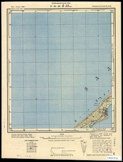
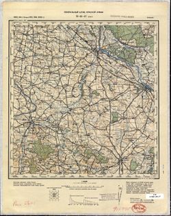
- Subject:
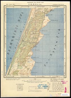
- Topical Subject: Soviet Union, Geographic Subject: Lesnoy, and Topical Subject: Maps
- Publisher:
- Генеральный штаб РККА
- Language:
- Russian
- Date Created:
- 1940
- Identifier:
- VAC9619-003588
- Genre:
- Military Maps and Topographic Maps
- Geographic Location:
- Coordinates: 55, 20.5, 55.083, 20.625
- Related URL:
- Catalog URL: https://iucat.iu.edu/catalog/14701157 and Download GeoTIFF: https://drive.google.com/file/d/1iAyyaQlcH3PgnIB6KJJKHwl0iTJ-n3-D/view?usp=sharing
- Abstract:
- Modern area represented: Lesnoy, Kaliningrad oblast, Russia
- Call Number:
- G7063.K2 s25 .S6 sheet N-34-30-C-c
- City:
- Заркау (Zarkau)
- Copyright Holder:
- No Copyright - United States
- Country:
- Германия (Germany) and Восточная Пруссия (East Prussia)
- Physical Description:
- Scale: 1:25,000
- Persistent URL:
- http://purl.dlib.indiana.edu/iudl/images/VAC9619/VAC9619-003588
- Provenance:
- CIA Map Branch -- Received, G000-30
-
- Description:
- 1912
- Subject:
- Topical Subject: Soviet Union and Topical Subject: Maps
- Publisher:
- Генеральный штаб Красной Армии
- Language:
- Russian
- Date Created:
- 1940
- Identifier:
- VAC9619-003587
- Genre:
- Military Maps and Topographic Maps
- Geographic Location:
- Coordinates: 55.083, 20.625, 55.167, 20.75
- Related URL:
- Download GeoTIFF: https://drive.google.com/file/d/1so0g2PTFh3q_dU1hTXnqvi3FX660pmNL/view?usp=sharing and Catalog URL: https://iucat.iu.edu/catalog/14701157
- Abstract:
- Modern area represented: Curonian Spit, Kaliningrad oblast, Russia
- Call Number:
- G7063.K2 s25 .S6 sheet N-34-30-C-b
- City:
- Ной Ляттенвальде (Noi Lyatteval'de)
- Copyright Holder:
- No Copyright - United States
- Country:
- Восточная Пруссия (East Prussia) and Германия (Germany)
- Physical Description:
- Scale: 1:25,000
- Persistent URL:
- http://purl.dlib.indiana.edu/iudl/images/VAC9619/VAC9619-003587
- Provenance:
- CIA Map Branch -- Received, G000-30
-
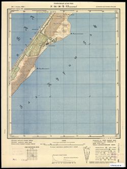
- Subject:
- Topical Subject: Soviet Union, Topical Subject: Maps, and Geographic Subject: Morskoye
- Publisher:
- Генеральный штаб РККА
- Language:
- Russian
- Date Created:
- 1940
- Identifier:
- VAC9619-003586
- Genre:
- Military Maps and Topographic Maps
- Geographic Location:
- Coordinates: 55.167, 20.875, 55.25, 21
- Related URL:
- Catalog URL: https://iucat.iu.edu/catalog/14701157 and Download GeoTIFF: https://drive.google.com/file/d/1Rsb9vB0P3JuEDMdk-KNbVt1oSoBEfUAp/view?usp=sharing
- Abstract:
- Modern area represented: Morskoye, Kaliningrad oblast, Russia
- Call Number:
- G7063.K2 s25 .S6 sheet N-34-30-B-d
- City:
- Пиллкоппен (Pillkoppen)
- Copyright Holder:
- No Copyright - United States
- Country:
- Восточная Пруссия (East Prussia) and Германия (Germany)
- Physical Description:
- Scale: 1:25,000
- Persistent URL:
- http://purl.dlib.indiana.edu/iudl/images/VAC9619/VAC9619-003586
- Provenance:
- CIA Map Branch -- Received, G000-30
-
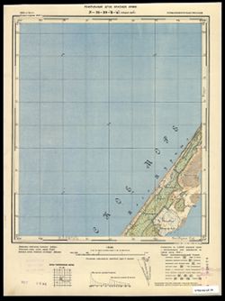
- Description:
- 1910
- Subject:
- Geographic Subject: Gora Vyshka, Topical Subject: Soviet Union, and Topical Subject: Maps
- Publisher:
- Генеральный штаб Красной Армии
- Language:
- Russian
- Date Created:
- 1940
- Identifier:
- VAC9619-003585
- Genre:
- Topographic Maps and Military Maps
- Geographic Location:
- Coordinates: 55.167, 20.75, 55.25, 20.875
- Related URL:
- Download GeoTIFF: https://drive.google.com/file/d/1Kewy2gfGiTYuXyDWBAycNeLEZU9U5CiW/view?usp=sharing and Catalog URL: https://iucat.iu.edu/catalog/14701157
- Abstract:
- Modern area represented: Gora Vyshka, Kaliningrad oblast, Russia
- Call Number:
- G7063.K2 s25 .S6 sheet N-34-30-B-c
- City:
- Предин-Берг (Predinberg)
- Copyright Holder:
- No Copyright - United States
- Country:
- Германия (Germany) and Восточная Пруссия (East Prussia)
- Physical Description:
- Scale: 1:25,000
- Persistent URL:
- http://purl.dlib.indiana.edu/iudl/images/VAC9619/VAC9619-003585
- Provenance:
- CIA Map Branch -- Received, G000-30
-
- Subject:
- Geographic Subject: Preila, Topical Subject: Soviet Union, and Topical Subject: Maps
- Publisher:
- Генеральный штаб Красной Армии
- Language:
- Russian
- Date Created:
- 1940
- Identifier:
- VAC9619-003580
- Genre:
- Military Maps and Topographic Maps
- Geographic Location:
- Coordinates: 55.33333, 21.0, 55.416667, 21.125
- Related URL:
- Download GeoTIFF: https://drive.google.com/file/d/1o6JqVoJJ-l_X9hzi-gbflEHyKdQdjyWk/view?usp=sharing and Catalog URL: https://iucat.iu.edu/catalog/14701157
- Abstract:
- Modern area represented: Preila, Lithuania
- Call Number:
- G7063.K2 s25 .S6 sheet N-34-19-C-c
- City:
- Прейль (Preil)
- Copyright Holder:
- No Copyright - United States
- Country:
- Восточная Пруссия (East Prussia) and Германия (Germany)
- Physical Description:
- Scale: 1:25,000
- Persistent URL:
- http://purl.dlib.indiana.edu/iudl/images/VAC9619/VAC9619-003580
- Provenance:
- M. I. Map Library, G000-30, GS, RA
-
- Description:
- 1910
- Subject:
- Topical Subject: Maps, Topical Subject: Soviet Union, and Geographic Subject: Vaidaugai
- Publisher:
- Генеральный штаб Красной Армии
- Language:
- Russian
- Date Created:
- 1940
- Identifier:
- VAC9619-003575
- Genre:
- Military Maps and Topographic Maps
- Geographic Location:
- Coordinates: 55.583, 21.125, 55.667, 21.25
- Related URL:
- Catalog URL: https://iucat.iu.edu/catalog/14701157 and Download GeoTIFF: https://drive.google.com/file/d/1ENUdxTjt0Yew0sa9JFZsVlfV87z8pA3Y/view?usp=sharing
- Abstract:
- Modern area represented: Vaidaugai, Lithuania
- Call Number:
- G7063.K2 s25 .S6 sheet N-34-19-A-b
- City:
- Карлсберг (Karlsberg)
- Copyright Holder:
- No Copyright - United States
- Country:
- Восточная Пруссия (East Prussia) and Германия (Germany)
- Physical Description:
- Scale: 1:25,000
- Persistent URL:
- http://purl.dlib.indiana.edu/iudl/images/VAC9619/VAC9619-003575
- Provenance:
- DMA Topographic Center, Army Map Service Library, Library of Congress Geography & Map Division
-
- Description:
- 1910
- Subject:
- Topical Subject: Soviet Union, Geographic Subject: Meškų Dauba, and Topical Subject: Maps
- Publisher:
- Генеральный штаб Красной Армии
- Language:
- Russian
- Date Created:
- 1940
- Identifier:
- VAC9619-003574
- Genre:
- Military Maps and Topographic Maps
- Geographic Location:
- Coordinates: 55.583, 21, 55.667, 21.125
- Related URL:
- Catalog URL: https://iucat.iu.edu/catalog/14701157 and Download GeoTIFF: https://drive.google.com/file/d/1jn-aNRd1PbWQua5cDP_7MwVE_Mk4sm49/view?usp=sharing
- Abstract:
- Modern area represented: Meškų Dauba, Lithuania
- Call Number:
- G7063.K2 s25 .S6 sheet N-34-19-A-a
- City:
- Бэреншлухт (Berenshlukht)
- Copyright Holder:
- No Copyright - United States
- Country:
- Германия (Germany) and Восточная Пруссия (East Prussia)
- Physical Description:
- Scale: 1:25,000
- Persistent URL:
- http://purl.dlib.indiana.edu/iudl/images/VAC9619/VAC9619-003574
- Provenance:
- DMA Topographic Center, Army Map Service Library, Library of Congress Geography & Map Division
-
- Subject:
- Topical Subject: Maps, Geographic Subject: Klaipėda, and Topical Subject: Soviet Union
- Publisher:
- Генеральный штаб Красной Армии
- Language:
- Russian
- Date Created:
- 1940
- Identifier:
- VAC9619-003572
- Genre:
- Topographic Maps and Military Maps
- Geographic Location:
- Coordinates: 55.667, 21, 55.75, 21.125
- Related URL:
- Download GeoTIFF: https://drive.google.com/file/d/1ucGyZ3zOSP9dSG4wVOP7_laU1XD281Nc/view?usp=sharing and Catalog URL: https://iucat.iu.edu/catalog/14701157
- Abstract:
- Modern area represented: District of Klaipėda, Lithuania
- Call Number:
- G7063.K2 s25 .S6 sheet N-34-7-C-c
- City:
- Боммельсфитте (Bommelsvitte)
- Copyright Holder:
- No Copyright - United States
- Country:
- Восточная Пруссия (East Prussia) and Германия (Germany)
- Physical Description:
- Scale: 1:25,000
- Persistent URL:
- http://purl.dlib.indiana.edu/iudl/images/VAC9619/VAC9619-003572
- Provenance:
- DMA Topographic Center, Army Map Service Library, Library of Congress Geography & Map Division
-
- Description:
- 1875
- Subject:
- Geographic Subject: Bytów, Topical Subject: Maps, and Topical Subject: Soviet Union
- Publisher:
- Генеральный штаб Красной Армии
- Language:
- Russian
- Date Created:
- 1940
- Identifier:
- VAC9619-003570
- Genre:
- Topographic Maps and Military Maps
- Geographic Location:
- Coordinates: 54, 17, 54.333, 17.5
- Related URL:
- Download GeoTIFF: https://drive.google.com/file/d/1iSD1hiMPKAiW5DNUQI53_Hn66urF1E4O/view?usp=sharing and Catalog URL: https://iucat.iu.edu/catalog/5020129
- Abstract:
- Modern area represented: Bytów, Pomerania province, Poland
- Call Number:
- G7000 s100 .S7 sheet N-33-71
- City:
- Бютов (Bütow)
- Copyright Holder:
- No Copyright - United States
- Country:
- Германия (Germany)
- Physical Description:
- Scale: 1:100,000
- Persistent URL:
- http://purl.dlib.indiana.edu/iudl/images/VAC9619/VAC9619-003570
- Provenance:
- DMA Topographic Center, Army Map Service Library, Heeresplankammer Gruppe Archive Auslandskartenarchiv
-
- Description:
- 1875
- Subject:
- Topical Subject: Maps and Topical Subject: Soviet Union
- Publisher:
- Генеральный штаб Красной Армии
- Language:
- Russian
- Date Created:
- 1940
- Identifier:
- VAC9619-003569
- Genre:
- Topographic Maps and Military Maps
- Geographic Location:
- Coordinates: 54, 16.5, 54.333, 17
- Related URL:
- Download GeoTIFF: https://drive.google.com/file/d/1SGE_ACbLi0h5eR5zSeHyi5tS0kPX32a0/view?usp=sharing and Catalog URL: https://iucat.iu.edu/catalog/5020129
- Abstract:
- Modern area represented: Poland
- Call Number:
- G7000 s100 .S7 sheet N-33-70
- City:
- Поллнов (Pollnow)
- Copyright Holder:
- No Copyright - United States
- Country:
- Германия (Germany)
- Physical Description:
- Scale: 1:100,000
- Persistent URL:
- http://purl.dlib.indiana.edu/iudl/images/VAC9619/VAC9619-003569
- Provenance:
- DMA Topographic Center, Army Map Service Library
-
- Description:
- 1890
- Subject:
- Geographic Subject: Koszalin, Topical Subject: Soviet Union, and Topical Subject: Maps
- Publisher:
- Генеральный штаб Красной Армии
- Language:
- Russian
- Date Created:
- 1940
- Identifier:
- VAC9619-003568
- Genre:
- Topographic Maps and Military Maps
- Geographic Location:
- Coordinates: 54, 16, 54.333, 16.5
- Related URL:
- Catalog URL: https://iucat.iu.edu/catalog/5020129 and Download GeoTIFF: https://drive.google.com/file/d/12cZmWL7A0xlHGmsn4W0BsUttDysAXTDS/view?usp=sharing
- Abstract:
- Modern area represented: Koszalin, West Pomerania province, Poland
- Call Number:
- G7000 s100 .S7 sheet N-33-69
- City:
- Кезлин (Köslin)
- Copyright Holder:
- No Copyright - United States
- Country:
- Германия (Germany)
- Physical Description:
- Scale: 1:100,000
- Persistent URL:
- http://purl.dlib.indiana.edu/iudl/images/VAC9619/VAC9619-003568
- Provenance:
- DMA Topographic Center, Army Map Service Library
-
- Description:
- 1889
- Subject:
- Geographic Subject: Kołobrzeg, Topical Subject: Maps, and Topical Subject: Soviet Union
- Publisher:
- Генеральный штаб РККА
- Language:
- Russian
- Date Created:
- 1940
- Identifier:
- VAC9619-003567
- Genre:
- Topographic Maps and Military Maps
- Geographic Location:
- Coordinates: 54, 15.5, 54.333, 16
- Related URL:
- Catalog URL: https://iucat.iu.edu/catalog/5020129 and Download GeoTIFF: https://drive.google.com/file/d/1X9RLb-NA1jLTLaCTQk2Mx-_X0nO9kXgc/view?usp=sharing
- Abstract:
- Modern area represented: Kołobrzeg, West Pomerania province, Poland
- Call Number:
- G7000 s100 .S7 sheet N-33-68
- City:
- Ко́льберг (Kolberg)
- Copyright Holder:
- No Copyright - United States
- Country:
- Германия (Germany)
- Physical Description:
- Scale: 1:100,000
- Persistent URL:
- http://purl.dlib.indiana.edu/iudl/images/VAC9619/VAC9619-003567
- Provenance:
- DMA Topographic Center, Army Map Service Library, Heeresplankammer Gruppe Archive Auslandskartenarchiv
-
- Description:
- 1928
- Subject:
- Topical Subject: Maps, Geographic Subject: Lębork, and Topical Subject: Soviet Union
- Publisher:
- Генеральный штаб Красной Армии
- Language:
- Russian
- Date Created:
- 1940
- Identifier:
- VAC9619-003566
- Genre:
- Topographic Maps and Military Maps
- Geographic Location:
- Coordinates: 54.333, 17.5, 54.667, 18
- Related URL:
- Catalog URL: https://iucat.iu.edu/catalog/5020129 and Download GeoTIFF: https://drive.google.com/file/d/1r1a8qnvqecdrpNkvLNXWBuPqx767gqkt/view?usp=sharing
- Abstract:
- Modern area represented: Lębork, Pomerania province, Poland
- Call Number:
- G7000 s100 .S7 sheet N-33-60
- City:
- Лауенбург (Lauenburg)
- Copyright Holder:
- No Copyright - United States
- Country:
- Германия (Germany)
- Physical Description:
- Scale: 1:100,000
- Persistent URL:
- http://purl.dlib.indiana.edu/iudl/images/VAC9619/VAC9619-003566
- Provenance:
- DMA Topographic Center, Army Map Service Library, University of Kansas Map Library, Auswärtiges Amt. Geographischer Dienst
-
- Description:
- 1877
- Subject:
- Topical Subject: Maps, Topical Subject: Soviet Union, and Geographic Subject: Słupsk
- Publisher:
- Генеральный штаб Красной Армии
- Language:
- Russian
- Date Created:
- 1940
- Identifier:
- VAC9619-003565
- Genre:
- Topographic Maps and Military Maps
- Geographic Location:
- Coordinates: 54.333, 17, 54.667, 17.5
- Related URL:
- Catalog URL: https://iucat.iu.edu/catalog/5020129 and Download GeoTIFF: https://drive.google.com/file/d/191xq8eRbkifOubd-tnEk7HYn4h3V3JsX/view?usp=sharing
- Abstract:
- Modern area represented: Słupsk, Pomerania province, Poland
- Call Number:
- G7000 s100 .S7 sheet N-33-59
- City:
- Штольп (Stolp)
- Copyright Holder:
- No Copyright - United States
- Country:
- Германия (Germany)
- Physical Description:
- Scale: 1:100,000
- Persistent URL:
- http://purl.dlib.indiana.edu/iudl/images/VAC9619/VAC9619-003565
- Provenance:
- DMA Topographic Center, Army Map Service Library
-
- Description:
- 1890
- Subject:
- Topical Subject: Soviet Union, Geographic Subject: Darłowo, and Topical Subject: Maps
- Publisher:
- Генеральный штаб РККА
- Language:
- Russian
- Date Created:
- 1940
- Identifier:
- VAC9619-003563
- Genre:
- Military Maps and Topographic Maps
- Geographic Location:
- Coordinates: 54.333, 16, 54.667, 16.5
- Related URL:
- Download GeoTIFF: https://drive.google.com/file/d/1nkgJQP1YCZZMvFiZpCeeWK15exzGHer4/view?usp=sharing and Catalog URL: https://iucat.iu.edu/catalog/5020129
- Abstract:
- Modern area represented: Darłowo, West Pomerania province, Poland
- Call Number:
- G7000 s100 .S7 sheet N-33-57
- City:
- Рюгенвальде (Rügenwalde)
- Copyright Holder:
- No Copyright - United States
- Country:
- Германия (Germany)
- Physical Description:
- Scale: 1:100,000
- Persistent URL:
- http://purl.dlib.indiana.edu/iudl/images/VAC9619/VAC9619-003563
- Provenance:
- DMA Topographic Center, Army Map Service Library
-
- Description:
- 1889
- Subject:
- Topical Subject: Soviet Union, Geographic Subject: Leba, and Topical Subject: Maps
- Publisher:
- Генеральный штаб Красной Армии
- Language:
- Russian
- Date Created:
- 1940
- Identifier:
- VAC9619-003562
- Genre:
- Topographic Maps and Military Maps
- Geographic Location:
- Coordinates: 54.667, 17.5, 55, 18
- Related URL:
- Catalog URL: https://iucat.iu.edu/catalog/5020129 and Download GeoTIFF: https://drive.google.com/file/d/1yf4uFfcHKh3Kooi-on2xUzOsWHbfo8jL/view?usp=sharing
- Abstract:
- Modern area represented: Leba, Pomerania province, Poland
- Call Number:
- G7000 s100 .S7 sheet N-33-48
- City:
- Леба (Leba)
- Copyright Holder:
- No Copyright - United States
- Country:
- Германия (Germany)
- Physical Description:
- Scale: 1:100,000
- Persistent URL:
- http://purl.dlib.indiana.edu/iudl/images/VAC9619/VAC9619-003562
- Provenance:
- DMA Topographic Center, Army Map Service Library, Geographic Names Branch
-
- Description:
- 1889
- Subject:
- Geographic Subject: Izbica, Topical Subject: Maps, and Topical Subject: Soviet Union
- Publisher:
- Генеральный штаб РККА
- Language:
- Russian
- Date Created:
- 1940
- Identifier:
- VAC9619-003561
- Genre:
- Topographic Maps and Military Maps
- Geographic Location:
- Coordinates: 54.667, 17, 55, 17.5
- Related URL:
- Download GeoTIFF: https://drive.google.com/file/d/1jgimCqhUKreoPlh9ZZ57DAi5wmcomXg0/view?usp=sharing and Catalog URL: https://iucat.iu.edu/catalog/5020129
- Abstract:
- Modern area represented: Izbica, Pomerania province, Poland
- Call Number:
- G7000 s100 .S7 sheet N-33-47
- City:
- Гизебиц (Izbica)
- Copyright Holder:
- No Copyright - United States
- Country:
- Германия (Germany)
- Physical Description:
- Scale: 1:100,000
- Persistent URL:
- http://purl.dlib.indiana.edu/iudl/images/VAC9619/VAC9619-003561
- Provenance:
- DMA Topographic Center, Army Map Service Library
-
- Description:
- 1896
- Subject:
- Topical Subject: Soviet Union, Geographic Subject: Katowice, and Topical Subject: Maps
- Publisher:
- Генеральный штаб Красной Армии
- Language:
- Russian
- Date Created:
- 1940
- Identifier:
- VAC9619-002862
- Genre:
- Topographic Maps and Military Maps
- Geographic Location:
- Coordinates: 50, 19, 50.333, 19.5
- Related URL:
- Catalog URL: https://iucat.iu.edu/catalog/5020129 and Download GeoTIFF: https://drive.google.com/file/d/1jVwnEnut9hOzj9dvqs5LRp2cJarooOxx/view?usp=sharing
- Abstract:
- Modern area represented: Katowice, Silesian province, Poland
- Call Number:
- G7000 s100 .S7 sheet M-34-63
- City:
- Каттовиц (Kattowitz)
- Copyright Holder:
- No Copyright - United States
- Country:
- Германия (Germany)
- State/Province:
- Область государственных интересов Германии (Region of German state interests)
- Physical Description:
- Scale: 1:100,000
- Persistent URL:
- http://purl.dlib.indiana.edu/iudl/images/VAC9619/VAC9619-002862
- Provenance:
- DMA Topographic Center, Army Map Service Library, Library of Congress Geography & Map Division, Geographic Names Branch
-

- Description:
- 1882
- Subject:
- Geographic Subject: Racibórz, Topical Subject: Soviet Union, and Topical Subject: Maps
- Publisher:
- Генеральный штаб Красной Армии
- Language:
- Russian
- Date Created:
- 1940
- Identifier:
- VAC9619-002860
- Genre:
- Military Maps and Topographic Maps
- Geographic Location:
- Coordinates: 50, 18, 50.333, 18.5
- Related URL:
- Download GeoTIFF: https://drive.google.com/file/d/1XcG44qM_SkibVzjFK8EuHetzDeu3O5g7/view?usp=sharing and Catalog URL: https://iucat.iu.edu/catalog/5020129
- Abstract:
- Modern area represented: Racibórz, Silesian province, Poland
- Call Number:
- G7000 s100 .S7 sheet M-34-61
- City:
- Ратибор (Ratibor)
- Copyright Holder:
- No Copyright - United States
- Country:
- Германия (Germany)
- Physical Description:
- Scale: 1:100,000
- Persistent URL:
- http://purl.dlib.indiana.edu/iudl/images/VAC9619/VAC9619-002860
- Provenance:
- DMA Topographic Center, Army Map Service Library, Library of Congress Geography & Map Division
-
- Description:
- 1883
- Subject:
- Topical Subject: Maps, Topical Subject: Soviet Union, and Geographic Subject: Zabrze
- Publisher:
- Генеральный штаб Красной Армии
- Language:
- Russian
- Date Created:
- 1940
- Identifier:
- VAC9619-002861
- Genre:
- Military Maps and Topographic Maps
- Geographic Location:
- Coordinates: 50, 18.5, 50.333, 19
- Related URL:
- Catalog URL: https://iucat.iu.edu/catalog/5020129 and Download GeoTIFF: https://drive.google.com/file/d/1sDDZR5sQRloUr3WJ3L7tUb7R4IcBSezh/view?usp=sharing
- Abstract:
- Modern area represented: Zabrze, Silesian province, Poland
- Call Number:
- G7000 s100 .S7 sheet M-34-62
- City:
- Гинденбург (Hindenburg)
- Copyright Holder:
- No Copyright - United States
- Country:
- Германия (Germany)
- Physical Description:
- Scale: 1:100,000
- Persistent URL:
- http://purl.dlib.indiana.edu/iudl/images/VAC9619/VAC9619-002861
- Provenance:
- DMA Topographic Center, Army Map Service Library, Library of Congress Geography & Map Division
-
- Description:
- 1881
- Subject:
- Topical Subject: Soviet Union, Topical Subject: Maps, and Geographic Subject: Zawiercie
- Publisher:
- Генеральный штаб Красной Армии
- Language:
- Russian
- Date Created:
- 1940
- Identifier:
- VAC9619-002831
- Genre:
- Topographic Maps and Military Maps
- Geographic Location:
- Coordinates: 50.333, 19, 50.666, 19.5
- Related URL:
- Catalog URL: https://iucat.iu.edu/catalog/5020129 and Download GeoTIFF: https://drive.google.com/file/d/1I6FP3jxW2IQKJN78MHQOxsR66qID6VfU/view?usp=sharing
- Abstract:
- Modern area represented: Zawiercie, Silesia province, Poland
- Call Number:
- G7000 s100 .S7 sheet M-34-51
- City:
- Заверце (Zawiercie)
- Copyright Holder:
- No Copyright - United States
- Country:
- Германия (Germany)
- State/Province:
- Область государственных интересов Германии (Region of German state interests)
- Physical Description:
- Scale: 1:100,000
- Persistent URL:
- http://purl.dlib.indiana.edu/iudl/images/VAC9619/VAC9619-002831
- Provenance:
- DMA Topographic Center, Army Map Service Library, OMAHA
-
- Description:
- 1881
- Subject:
- Topical Subject: Maps, Topical Subject: Soviet Union, and Geographic Subject: Bytom
- Publisher:
- Генеральный штаб Красной Армии
- Language:
- Russian
- Date Created:
- 1940
- Identifier:
- VAC9619-002830
- Genre:
- Topographic Maps and Military Maps
- Geographic Location:
- Coordinates: 50.333, 18.5, 50.667, 19
- Related URL:
- Download GeoTIFF: https://drive.google.com/file/d/1F1kYHexEwvuxUTVXMVQlMoytxx2mAwha/view?usp=sharing and Catalog URL: https://iucat.iu.edu/catalog/5020129
- Abstract:
- Modern area represented: Bytom, Silesia province, Poland
- Call Number:
- G7000 s100 .S7 sheet M-34-50
- City:
- Беутен (Beuthen)
- Copyright Holder:
- No Copyright - United States
- Country:
- Германия (Germany)
- State/Province:
- Область государственных интересов Германии (Region of German state interests)
- Physical Description:
- Scale: 1:100,000
- Persistent URL:
- http://purl.dlib.indiana.edu/iudl/images/VAC9619/VAC9619-002830
- Provenance:
- DMA Topographic Center, OMAHA
-
- Description:
- 1881
- Subject:
- Topical Subject: Maps, Topical Subject: Soviet Union, and Geographic Subject: Strzelce Opolskie
- Publisher:
- Генеральный штаб Красной Армии
- Language:
- Russian
- Date Created:
- 1940
- Identifier:
- VAC9619-002829
- Genre:
- Topographic Maps and Military Maps
- Geographic Location:
- Coordinates: 50.333, 18, 50.667, 18.5
- Related URL:
- Download GeoTIFF: https://drive.google.com/file/d/1-gmESuCfsrBOp7j-ohnildukr_nGIopT/view?usp=sharing and Catalog URL: https://iucat.iu.edu/catalog/5020129
- Abstract:
- Modern area represented: Strzelce Opolskie, Opole province, Poland
- Call Number:
- G7000 s100 .S7 sheet M-34-49
- City:
- Гросс Стрелитц (Groß Strehlitz)
- Copyright Holder:
- No Copyright - United States
- Country:
- Германия (Germany)
- Physical Description:
- Scale: 1:100,000
- Persistent URL:
- http://purl.dlib.indiana.edu/iudl/images/VAC9619/VAC9619-002829
- Provenance:
- DMA Topographic Center, Army Map Service Library, OMAHA
-
- Description:
- 1882
- Subject:
- Topical Subject: Maps, Geographic Subject: Krnov, and Topical Subject: Soviet Union
- Publisher:
- Генеральный штаб Красной Армии
- Language:
- Russian
- Date Created:
- 1940
- Identifier:
- VAC9619-002680
- Genre:
- Military Maps and Topographic Maps
- Geographic Location:
- Coordinates: 50.0, 17.5, 50.3333, 18.0
- Related URL:
- Download GeoTIFF: https://drive.google.com/file/d/1OsA4NUrYek1eUbOu3RQ7WCt-bX_ATsS8/view?usp=sharing and Catalog URL: https://iucat.iu.edu/catalog/5020129
- Abstract:
- Modern area represented: Krnov, Moravian-Silesian region, Czech Republic
- Call Number:
- G7000 s100 .S7 sheet M-33-72
- City:
- Егерндорф (Jägerndorf)
- Copyright Holder:
- No Copyright - United States
- Country:
- Германия (Germany)
- Physical Description:
- Scale: 1:100,000
- Persistent URL:
- http://purl.dlib.indiana.edu/iudl/images/VAC9619/VAC9619-002680
- Provenance:
- DMA Topographic Center, Army Map Service Library, Auswärtiges Amt. Geographischer Dienst
-
- Description:
- 1881
- Subject:
- Geographic Subject: Głuchołazy, Topical Subject: Maps, and Topical Subject: Soviet Union
- Publisher:
- Генеральный штаб Красной Армии
- Language:
- Russian
- Date Created:
- 1940
- Identifier:
- VAC9619-002679
- Genre:
- Topographic Maps and Military Maps
- Geographic Location:
- Coordinates: 50.0, 17.0, 50.3333, 17.5
- Related URL:
- Download GeoTIFF: https://drive.google.com/file/d/1eko3WswhFBLCUjkvMJYg1RtqlgNPdXg4/view?usp=sharing and Catalog URL: https://iucat.iu.edu/catalog/5020129
- Abstract:
- Modern area represented: Głuchołazy, Opole province, Poland
- Call Number:
- G7000 s100 .S7 sheet M-33-71
- City:
- Цигенхальс (Ziegenhals)
- Copyright Holder:
- No Copyright - United States
- Country:
- Германия (Germany)
- Physical Description:
- Scale: 1:100,000
- Persistent URL:
- http://purl.dlib.indiana.edu/iudl/images/VAC9619/VAC9619-002679
- Provenance:
- DMA Topographic Center, Library of Congress Geography & Map Division, Army Map Service Library, OMAHA
-
- Description:
- 1881
- Subject:
- Geographic Subject: Bystrzyca Kłodzka, Topical Subject: Soviet Union, and Topical Subject: Maps
- Publisher:
- Генеральный штаб Красной Армии
- Language:
- Russian
- Date Created:
- 1940
- Identifier:
- VAC9619-002678
- Genre:
- Military Maps and Topographic Maps
- Geographic Location:
- Coordinates: 50.0, 16.5, 50.3333, 17.0
- Related URL:
- Catalog URL: https://iucat.iu.edu/catalog/5020129 and Download GeoTIFF: https://drive.google.com/file/d/1-KppvaFgw7CxdcIFF1CmM1ATyLDv3uit/view?usp=sharing
- Abstract:
- Modern area represented: Bystrzyca Kłodzka, Lower Silesian province, Poland
- Call Number:
- G7000 s100 .S7 sheet M-33-70
- City:
- Габельшвердт (Habelschwerdt)
- Copyright Holder:
- No Copyright - United States
- Country:
- Германия (Germany)
- State/Province:
- Протекторат Богемии и Моравии (Protectorate of Bohemia and Moravia)
- Physical Description:
- Scale: 1:100,000
- Persistent URL:
- http://purl.dlib.indiana.edu/iudl/images/VAC9619/VAC9619-002678
- Provenance:
- DMA Topographic Center, Library of Congress Geography & Map Division, Army Map Service Library, Geographic Names Branch, OMAHA, Reichsamt für Landesaufna...
-
- Description:
- 1883
- Subject:
- Topical Subject: Maps, Topical Subject: Soviet Union, and Geographic Subject: Opole
- Publisher:
- Генеральный штаб Красной Армии
- Language:
- Russian
- Date Created:
- 1940
- Identifier:
- VAC9619-002676
- Genre:
- Topographic Maps and Military Maps
- Geographic Location:
- Coordinates: 50.3333, 17.5, 50.6667, 18.0
- Related URL:
- Download GeoTIFF: https://drive.google.com/file/d/1zZ7IVy_B0EcLhdD-Q1sxl0__k-upeH_v/view?usp=sharing and Catalog URL: https://iucat.iu.edu/catalog/5020129
- Abstract:
- Modern area represented: Opole, Opole province, Poland
- Call Number:
- G7000 s100 .S7 sheet M-33-60
- City:
- Оппельн (Oppeln)
- Copyright Holder:
- No Copyright - United States
- Country:
- Германия (Germany)
- Physical Description:
- Scale: 1:100,000
- Persistent URL:
- http://purl.dlib.indiana.edu/iudl/images/VAC9619/VAC9619-002676
- Provenance:
- DMA Topographic Center, Library of Congress Geography & Map Division, Army Map Service Library, Geographic Names Branch, OMAHA
-
- Description:
- 1881
- Subject:
- Topical Subject: Maps, Geographic Subject: Nysa, and Topical Subject: Soviet Union
- Publisher:
- Генеральный штаб Красной Армии
- Language:
- Russian
- Date Created:
- 1940
- Identifier:
- VAC9619-002675
- Genre:
- Military Maps and Topographic Maps
- Geographic Location:
- Coordinates: 50.3333, 17.0, 50.6667, 17.5
- Related URL:
- Download GeoTIFF: https://drive.google.com/file/d/1pIH_KuPyBng-yoZCWbb9826cQnGspSKE/view?usp=sharing and Catalog URL: https://iucat.iu.edu/catalog/5020129
- Abstract:
- Modern area represented: Nysa, Opole Province, Poland
- Call Number:
- G7000 s100 .S7 sheet M-33-59
- City:
- Нейссе (Neisse)
- Copyright Holder:
- No Copyright - United States
- Country:
- Германия (Germany)
- Physical Description:
- Scale: 1:100,000
- Persistent URL:
- http://purl.dlib.indiana.edu/iudl/images/VAC9619/VAC9619-002675
- Provenance:
- DMA Topographic Center, Army Map Service Library
-
- Description:
- 1881
- Subject:
- Topical Subject: Maps, Topical Subject: Soviet Union, and Geographic Subject: Kłodzko
- Publisher:
- Генеральный штаб Красной Армии
- Language:
- Russian
- Date Created:
- 1940
- Identifier:
- VAC9619-002674
- Genre:
- Military Maps and Topographic Maps
- Geographic Location:
- Coordinates: 50.3333, 16.5, 50.6667, 17.0
- Related URL:
- Download GeoTIFF: https://drive.google.com/file/d/1O5qHBrm7cBmiCJ45DWbhDWidRAMOieHm/view?usp=sharing and Catalog URL: https://iucat.iu.edu/catalog/5020129
- Abstract:
- Modern area represented: Kłodzko, Lower Silesia province, Poland
- Call Number:
- G7000 s100 .S7 sheet M-33-58
- City:
- Глатц (Glatz)
- Copyright Holder:
- No Copyright - United States
- Country:
- Германия (Germany)
- Physical Description:
- Scale: 1:100,000
- Persistent URL:
- http://purl.dlib.indiana.edu/iudl/images/VAC9619/VAC9619-002674
- Provenance:
- DMA Topographic Center, Army Map Service Library, Library of Congress Geography & Map Division, Geographic Names Branch, OMAHA, Reichsamt für Landesaufna...
-
- Description:
- 1883
- Subject:
- Geographic Subject: Lewin Brzeski, Topical Subject: Maps, and Topical Subject: Soviet Union
- Publisher:
- Генеральный штаб Красной Армии
- Language:
- Russian
- Date Created:
- 1940
- Identifier:
- VAC9619-002672
- Genre:
- Military Maps and Topographic Maps
- Geographic Location:
- Coordinates: 50.66667, 17.5, 51.0, 18.0
- Related URL:
- Download GeoTIFF: https://drive.google.com/file/d/1efqECY_1fb-X-YuBKxwOnxrtOYrrelJs/view?usp=sharing and Catalog URL: https://iucat.iu.edu/catalog/5020129
- Abstract:
- Modern area represented: Lewin Brzeski, Opole province, Poland
- Call Number:
- G7000 s100 .S7 sheet M-33-48
- City:
- Левен (Lewin)
- Copyright Holder:
- No Copyright - United States
- Country:
- Германия (Germany)
- Physical Description:
- Scale: 1:100,000
- Persistent URL:
- http://purl.dlib.indiana.edu/iudl/images/VAC9619/VAC9619-002672
- Provenance:
- DMA Topographic Center, Army Map Service Library, Library of Congress Geography & Map Division, Geographic Names Branch
-
- Description:
- 1883
- Subject:
- Geographic Subject: Oława, Topical Subject: Maps, and Topical Subject: Soviet Union
- Publisher:
- Генеральный штаб Красной Армии
- Language:
- Russian
- Date Created:
- 1940
- Identifier:
- VAC9619-002671
- Genre:
- Topographic Maps and Military Maps
- Geographic Location:
- Coordinates: 50.66667, 17.0, 51.0, 17.5
- Related URL:
- Download GeoTIFF: https://drive.google.com/file/d/1Qg4kTVxI2fTFtLyW8ACRRXTAs72cReNX/view?usp=sharing and Catalog URL: https://iucat.iu.edu/catalog/5020129
- Abstract:
- Modern area represented: Oława, Lower Silesia, Poland
- Call Number:
- G7000 s100 .S7 sheet M-33-47
- City:
- Олау (Ohlau)
- Copyright Holder:
- No Copyright - United States
- Country:
- Германия (Germany)
- Physical Description:
- Scale: 1:100,000
- Persistent URL:
- http://purl.dlib.indiana.edu/iudl/images/VAC9619/VAC9619-002671
- Provenance:
- DMA Topographic Center, Library of Congress Geography & Map Division, Army Map Service Library, Geographic Names Branch, OMAHA
-
- Description:
- 1881
- Subject:
- Topical Subject: Soviet Union, Topical Subject: Maps, and Geographic Subject: Dzierżoniów
- Publisher:
- Генеральный штаб Красной Армии
- Language:
- Russian
- Date Created:
- 1940
- Identifier:
- VAC9619-002670
- Genre:
- Military Maps and Topographic Maps
- Geographic Location:
- Coordinates: 50.667, 16.5, 51, 17
- Related URL:
- Download GeoTIFF: https://drive.google.com/file/d/1rqQN58cHNXRGgmzg-fcO04CM6yviyFlr/view?usp=sharing and Catalog URL: https://iucat.iu.edu/catalog/5020129
- Abstract:
- Modern area represented: Dzierżoniów, Lower Silesian province, Poland
- Call Number:
- G7000 s100 .S7 sheet M-33-46
- City:
- Рейхенбах (Reichenbach)
- Copyright Holder:
- No Copyright - United States
- Country:
- Германия (Germany)
- Physical Description:
- Scale: 1:100,000
- Persistent URL:
- http://purl.dlib.indiana.edu/iudl/images/VAC9619/VAC9619-002670
- Provenance:
- DMA Topographic Center, Auswärtiges Amt. Geographischer Dienst
-
- Description:
- 1884
- Subject:
- Geographic Subject: Namysłów, Topical Subject: Maps, and Topical Subject: Soviet Union
- Publisher:
- Генеральный штаб Красной Армии
- Language:
- Russian
- Date Created:
- 1940
- Identifier:
- VAC9619-002610
- Genre:
- Military Maps and Topographic Maps
- Geographic Location:
- Coordinates: 51, 17.5, 51.333, 18
- Related URL:
- Download GeoTIFF: https://drive.google.com/file/d/1kh7SD0fdDpNwq7RJtiSbuc_6xG5igIfc/view?usp=sharing and Catalog URL: https://iucat.iu.edu/catalog/5020129
- Abstract:
- Modern area represented: Namysłów, Opole province, Poland
- Call Number:
- G7000 s100 .S7 sheet M-33-36
- City:
- Намслау (Namysłów)
- Copyright Holder:
- No Copyright - United States
- Country:
- Германия (Germany)
- Physical Description:
- Scale: 1:100,000
- Persistent URL:
- http://purl.dlib.indiana.edu/iudl/images/VAC9619/VAC9619-002610
- Provenance:
- DMA Topographic Center, Library of Congress G & M Division, Army Map Service Library, Geographic Names Branch, OMAHA
-
- Description:
- 1885
- Subject:
- Topical Subject: Maps, Geographic Subject: Wrocław, and Topical Subject: Soviet Union
- Publisher:
- Генеральный штаб Красной Армии
- Language:
- Russian
- Date Created:
- 1940
- Identifier:
- VAC9619-002609
- Genre:
- Military Maps and Topographic Maps
- Geographic Location:
- Coordinates: 51, 17, 51.333, 17.5
- Related URL:
- Download GeoTIFF: https://drive.google.com/file/d/1uFzjhoF6Wx5vOPw0Sp0CN4JZTK3BNnQ6/view?usp=sharing and Catalog URL: https://iucat.iu.edu/catalog/5020129
- Abstract:
- Modern area represented: Wrocław, Lower Silesia province, Poland
- Call Number:
- G7000 s100 .S7 sheet M-33-35
- City:
- Бреслау (Wrocław)
- Copyright Holder:
- No Copyright - United States
- Country:
- Германия (Germany)
- Physical Description:
- Scale: 1:100,000
- Persistent URL:
- http://purl.dlib.indiana.edu/iudl/images/VAC9619/VAC9619-002609
- Provenance:
- DMA Topographic Center, Library of Congress G & M Division, Army Map Service Library, Auswärtiges Amt. Geographischer Dienst, OMAHA
-
- Description:
- 1886
- Subject:
- Topical Subject: Maps, Geographic Subject: Środa Śląska, and Topical Subject: Soviet Union
- Publisher:
- Генеральный штаб Красной Армии
- Language:
- Russian
- Date Created:
- 1940
- Identifier:
- VAC9619-002608
- Genre:
- Military Maps and Topographic Maps
- Geographic Location:
- Coordinates: 51, 16.5, 51.333, 17
- Related URL:
- Download GeoTIFF: https://drive.google.com/file/d/1SrSMPElmJIrozUCQVb61cLpQRrS4bJkm/view?usp=sharing and Catalog URL: https://iucat.iu.edu/catalog/5020129
- Abstract:
- Modern area represented: Środa Śląska, Lower Silesian province, Poland
- Call Number:
- G7000 s100 .S7 sheet M-33-34
- City:
- Ноймаркт (Neumarkt)
- Copyright Holder:
- No Copyright - United States
- Country:
- Германия (Germany)
- Physical Description:
- Scale: 1:100,000
- Persistent URL:
- http://purl.dlib.indiana.edu/iudl/images/VAC9619/VAC9619-002608
- Provenance:
- DMA Topographic Center, Library of Congress G & M Division, Army Map Service Library, Auswärtiges Amt. Geographischer Dienst, OMAHA
-
- Description:
- 1885
- Subject:
- Geographic Subject: Milicz, Topical Subject: Soviet Union, and Topical Subject: Maps
- Publisher:
- Генеральный штаб Красной Армии
- Language:
- Russian
- Date Created:
- 1940
- Identifier:
- VAC9619-002606
- Genre:
- Topographic Maps and Military Maps
- Geographic Location:
- Coordinates: 51.333, 17, 51.667, 17.5
- Related URL:
- Download GeoTIFF: https://drive.google.com/file/d/11cAPL6zvsZLMCrE0g3mRTOEqO4lK5fuh/view?usp=sharing and Catalog URL: https://iucat.iu.edu/catalog/5020129
- Abstract:
- Modern area represented: Milicz, Lower Silesian province, Poland
- Call Number:
- G7000 s100 .S7 sheet M-33-23
- City:
- Милич (Milicz)
- Copyright Holder:
- No Copyright - United States
- Country:
- Германия (Germany)
- Physical Description:
- Scale: 1:100,000
- Persistent URL:
- http://purl.dlib.indiana.edu/iudl/images/VAC9619/VAC9619-002606
- Provenance:
- DMA Topographic Center, Library of Congress G & M Division, Army Map Service Library, OMAHA
-
- Description:
- 1885
- Subject:
- Topical Subject: Maps, Geographic Subject: Rawicz, and Topical Subject: Soviet Union
- Publisher:
- Генеральный штаб Красной Армии
- Language:
- Russian
- Date Created:
- 1940
- Identifier:
- VAC9619-002605
- Genre:
- Military Maps and Topographic Maps
- Geographic Location:
- Coordinates: 51.333, 16.5, 51.667, 17
- Related URL:
- Download GeoTIFF: https://drive.google.com/file/d/1l1lg-AtD1Ti0RNRJFsEicO6F6AHM_Hai/view?usp=sharing and Catalog URL: https://iucat.iu.edu/catalog/5020129
- Abstract:
- Modern area represented: Rawicz, Greater Poland province, Poland
- Call Number:
- G7000 s100 .S7 sheet M-33-22
- City:
- Равич (Rawicz)
- Copyright Holder:
- No Copyright - United States
- Country:
- Германия (Germany)
- Physical Description:
- Scale: 1:100,000
- Persistent URL:
- http://purl.dlib.indiana.edu/iudl/images/VAC9619/VAC9619-002605
- Provenance:
- DMA Topographic Center, Library of Congress G & M Division, Army Map Service Library, OMAHA
-
- Description:
- 1888
- Subject:
- Topical Subject: Maps, Topical Subject: Soviet Union, and Geographic Subject: Głogów
- Publisher:
- Генеральный штаб Красной Армии
- Language:
- Russian
- Date Created:
- 1940
- Identifier:
- VAC9619-002604
- Genre:
- Topographic Maps and Military Maps
- Geographic Location:
- Coordinates: 51.333, 16, 51.667, 16.5
- Related URL:
- Catalog URL: https://iucat.iu.edu/catalog/5020129 and Download GeoTIFF: https://drive.google.com/file/d/132tQw59_UVYPpS2FHIo-f3fPW2xHrIyq/view?usp=sharing
- Abstract:
- Modern area represented: Głogów, Lower Silesian province, Poland
- Call Number:
- G7000 s100 .S7 sheet M-33-21
- City:
- Глогау (Głogów)
- Copyright Holder:
- No Copyright - United States
- Country:
- Германия (Germany)
- Physical Description:
- Scale: 1:100,000
- Persistent URL:
- http://purl.dlib.indiana.edu/iudl/images/VAC9619/VAC9619-002604
- Provenance:
- DMA Topographic Center, Library of Congress G & M Division, Army Map Service Library, OMAHA
-
- Description:
- 1888
- Subject:
- Geographic Subject: Pleszew, Topical Subject: Maps, and Topical Subject: Soviet Union
- Publisher:
- Генеральный штаб Красной Армии
- Language:
- Russian
- Date Created:
- 1940
- Identifier:
- VAC9619-002602
- Genre:
- Topographic Maps and Military Maps
- Geographic Location:
- Coordinates: 51.667, 17.5, 52, 18
- Related URL:
- Catalog URL: https://iucat.iu.edu/catalog/5020129 and Download GeoTIFF: https://drive.google.com/file/d/1-JMKlL84G9K-S3FaeQfud8YayWmCCVew/view?usp=sharing
- Abstract:
- Modern area represented: Pleszew, Greater Poland province, Poland
- Call Number:
- G7000 s100 .S7 sheet M-33-12
- City:
- Плешев (Pleszew)
- Copyright Holder:
- No Copyright - United States
- Country:
- Германия (Germany)
- State/Province:
- Область государственных интересов Германии (Region of German state interests)
- Physical Description:
- Scale: 1:100,000
- Persistent URL:
- http://purl.dlib.indiana.edu/iudl/images/VAC9619/VAC9619-002602
- Provenance:
- DMA Topographic Center, Library of Congress G & M Division, Army Map Service Library, OMAHA
-
- Description:
- 1886
- Subject:
- Topical Subject: Maps, Topical Subject: Soviet Union, and Geographic Subject: Krotoszyn
- Publisher:
- Генеральный штаб Красной Армии
- Language:
- Russian
- Date Created:
- 1940
- Identifier:
- VAC9619-002601
- Genre:
- Military Maps and Topographic Maps
- Geographic Location:
- Coordinates: 51.667, 17, 52, 17.5
- Related URL:
- Catalog URL: https://iucat.iu.edu/catalog/5020129 and Download GeoTIFF: https://drive.google.com/file/d/1_dL56LQQ7RKKwx98a_coOrEKj2OxyFw1/view?usp=sharing
- Abstract:
- Modern area represented: Krotoszyn, Greater Poland province, Poland
- Call Number:
- G7000 s100 .S7 sheet M-33-11
- City:
- Кротошин (Krotoszyn)
- Copyright Holder:
- No Copyright - United States
- Country:
- Германия (Germany)
- Physical Description:
- Scale: 1:100,000
- Persistent URL:
- http://purl.dlib.indiana.edu/iudl/images/VAC9619/VAC9619-002601
- Provenance:
- CIA Map Library
-
- Description:
- 1899
- Subject:
- Topical Subject: Maps, Topical Subject: Soviet Union, and Geographic Subject: Wieluń
- Publisher:
- Генеральный штаб Красной Армии
- Language:
- Russian
- Date Created:
- 1940
- Identifier:
- VAC9619-002765
- Genre:
- Topographic Maps and Military Maps
- Geographic Location:
- Coordinates: 51, 18.5, 51.333, 19
- Related URL:
- Download GeoTIFF: https://drive.google.com/file/d/1tJFdMQQyPUMK8BZ64oesijhKjBaKF3qZ/view?usp=sharing and Catalog URL: https://iucat.iu.edu/catalog/5020129
- Abstract:
- Modern area represented: Wieluń, Łódź province, Poland
- Call Number:
- G7000 s100 .S7 sheet M-34-26
- City:
- Велюнь (Wieluń)
- Copyright Holder:
- No Copyright - United States
- Country:
- Германия (Germany)
- State/Province:
- Область государственных интересов Германии (Region of German state interests)
- Physical Description:
- Scale: 1:100,000
- Persistent URL:
- http://purl.dlib.indiana.edu/iudl/images/VAC9619/VAC9619-002765
- Provenance:
- DMA Topographic Center, Army Map Service Library, Library of Congress Geography & Map Division, Geographic Names Branch, OMAHA
-
- Description:
- 1889
- Subject:
- Topical Subject: Maps, Topical Subject: Soviet Union, and Geographic Subject: Wołczyn
- Publisher:
- Генеральный штаб Красной Армии
- Language:
- Russian
- Date Created:
- 1940
- Identifier:
- VAC9619-002763
- Genre:
- Military Maps and Topographic Maps
- Geographic Location:
- Coordinates: 51, 18, 51.333, 18.5
- Related URL:
- Download GeoTIFF: https://drive.google.com/file/d/1I3uex-_opah9_pRGLfsW3JPf4PovfMDg/view?usp=sharing and Catalog URL: https://iucat.iu.edu/catalog/5020129
- Abstract:
- Modern area represented: Wołczyn, Opole province, Poland
- Call Number:
- G7000 s100 .S7 sheet M-34-25
- City:
- Конштадт (Konstadt)
- Copyright Holder:
- No Copyright - United States
- Country:
- Германия (Germany)
- State/Province:
- Область государственных интересов Германии (Region of German state interests)
- Physical Description:
- Scale: 1:100,000
- Persistent URL:
- http://purl.dlib.indiana.edu/iudl/images/VAC9619/VAC9619-002763
- Provenance:
- DMA Topographic Center, Library of Congress Geography & Map Division, Army Map Service Library, OMAHA
-
- Description:
- 1888
- Subject:
- Topical Subject: Maps, Geographic Subject: Gmina Błaszki, and Topical Subject: Soviet Union
- Publisher:
- Генеральный штаб Красной Армии
- Language:
- Russian
- Date Created:
- 1940
- Identifier:
- VAC9619-002744
- Genre:
- Military Maps and Topographic Maps
- Geographic Location:
- Coordinates: 51.333, 18, 51.667, 18.5
- Related URL:
- Download GeoTIFF: https://drive.google.com/file/d/1SQp0BLc72f55Sm9zQeg72FX3ionw7K2R/view?usp=sharing and Catalog URL: https://iucat.iu.edu/catalog/5020129
- Abstract:
- Modern area represented: Gmina Błaszki, Łódź province, Poland
- Call Number:
- G7000 s100 .S7 sheet M-34-13
- City:
- Блашки (Błaszki)
- Copyright Holder:
- No Copyright - United States
- Country:
- Германия (Germany)
- State/Province:
- Область государственных интересов Германии (Region of German state interests)
- Physical Description:
- Scale: 1:100,000
- Persistent URL:
- http://purl.dlib.indiana.edu/iudl/images/VAC9619/VAC9619-002744
- Provenance:
- DMA Topographic Center, Library of Congress Geography & Map Division, Army Map Service Library
-
- Description:
- 1900
- Subject:
- Geographic Subject: Kalisz, Topical Subject: Soviet Union, and Topical Subject: Maps
- Publisher:
- Генеральный штаб Красной Армии
- Language:
- Russian
- Date Created:
- 1940
- Identifier:
- VAC9619-002720
- Genre:
- Military Maps and Topographic Maps
- Geographic Location:
- Coordinates: 51.667, 18, 52, 18.5
- Related URL:
- Download GeoTIFF: https://drive.google.com/file/d/1uKooZWs3G44Hyeu_TvWM3sMucsqBvmbR/view?usp=sharing and Catalog URL: https://iucat.iu.edu/catalog/5020129
- Abstract:
- Modern area represented: Kalisz, Greater Poland province, Poland
- Call Number:
- G7000 s100 .S7 sheet M-34-1
- City:
- Калиш (Kalisz)
- Copyright Holder:
- No Copyright - United States
- Country:
- Германия (Germany)
- State/Province:
- Область государственных интересов Германии (Region of German state interests)
- Physical Description:
- Scale: 1:100,000
- Persistent URL:
- http://purl.dlib.indiana.edu/iudl/images/VAC9619/VAC9619-002720
- Provenance:
- DMA Topographic Center, Army Map Service Library
-
- Description:
- 1887
- Subject:
- Geographic Subject: Břeclav, Topical Subject: Maps, and Topical Subject: Soviet Union
- Publisher:
- Генеральный штаб РККА
- Language:
- Russian
- Date Created:
- 1940
- Identifier:
- VAC9619-002716
- Genre:
- Topographic Maps and Military Maps
- Geographic Location:
- Coordinates: 48.667, 16.5, 49, 17
- Related URL:
- Download GeoTIFF: https://drive.google.com/file/d/1Xz9QjEJFlda42zTIvCh3f9f004Vs9M1C/view?usp=sharing and Catalog URL: https://iucat.iu.edu/catalog/5020129
- Abstract:
- Modern area represented: Břeclav, South Moravian region, Czech Republic
- Call Number:
- G7000 s100 .S7 sheet M-33-118
- City:
- Бржеслав (Břeclav)
- Copyright Holder:
- No Copyright - United States
- Country:
- Словакия (Slovakia) and Германия (Germany)
- State/Province:
- Протекторат Богемии и Моравии (Protectorate of Bohemia and Moravia)
- Physical Description:
- Scale: 1:100,000
- Persistent URL:
- http://purl.dlib.indiana.edu/iudl/images/VAC9619/VAC9619-002716
- Provenance:
- DMA Topographic Center, Library of Congress Geography & Map Division, Army Map Service Library
-
- Description:
- 1889
- Subject:
- Geographic Subject: Opava, Topical Subject: Maps, and Topical Subject: Soviet Union
- Publisher:
- Генеральный штаб Красной Армии
- Language:
- Russian
- Date Created:
- 1940
- Identifier:
- VAC9619-002711
- Genre:
- Military Maps and Topographic Maps
- Geographic Location:
- Coordinates: 49.667, 17.5, 50, 18
- Related URL:
- Catalog URL: https://iucat.iu.edu/catalog/5020129 and Download GeoTIFF: https://drive.google.com/file/d/1dMVHPH3rowscHXvE1xHwK8r4s0MGSDgL/view?usp=sharing
- Abstract:
- Modern area represented: Opava, Moravian-Silesian region, Czech Republic
- Call Number:
- G7000 s100 .S7 sheet M-33-84
- City:
- Троппау (Troppau)
- Copyright Holder:
- No Copyright - United States
- Country:
- Германия (Germany)
- Physical Description:
- Scale: 1:100,000
- Persistent URL:
- http://purl.dlib.indiana.edu/iudl/images/VAC9619/VAC9619-002711
- Provenance:
- DMA Topographic Center, Library of Congress Geography & Map Division, Army Map Service Library, Auswärtiges Amt. Geographischer Dienst, OMAHA
-
- Description:
- 1889
- Subject:
- Topical Subject: Soviet Union, Topical Subject: Maps, and Geographic Subject: Šternberk
- Publisher:
- Генеральный штаб Красной Армии
- Language:
- Russian
- Date Created:
- 1940
- Identifier:
- VAC9619-002710
- Genre:
- Topographic Maps and Military Maps
- Geographic Location:
- Coordinates: 49.667, 17, 50, 17.5
- Related URL:
- Download GeoTIFF: https://drive.google.com/file/d/1Rz2xBDwJLf08cL2SGJPOFr173ARLyeXI/view?usp=sharing and Catalog URL: https://iucat.iu.edu/catalog/5020129
- Abstract:
- Modern area represented: Šternberk, Olomouc region, Czech Republic
- Call Number:
- G7000 s100 .S7 sheet M-33-83
- City:
- Штернберг (Šternberk)
- Copyright Holder:
- No Copyright - United States
- Country:
- Германия (Germany)
- State/Province:
- Протекторат Богемии и Моравии (Protectorate of Bohemia and Moravia)
- Physical Description:
- Scale: 1:100,000
- Persistent URL:
- http://purl.dlib.indiana.edu/iudl/images/VAC9619/VAC9619-002710
- Provenance:
- DMA Topographic Center, Library of Congress Geography & Map Division, Army Map Service Library, OMAHA
-
- Description:
- 1930
- Subject:
- Topical Subject: Maps, Geographic Subject: Zábřeh, and Topical Subject: Soviet Union
- Publisher:
- Генеральный штаб Красной Армии
- Language:
- Russian
- Date Created:
- 1940
- Identifier:
- VAC9619-002709
- Genre:
- Military Maps and Topographic Maps
- Geographic Location:
- Coordinates: 49.667, 16.5, 50, 17
- Related URL:
- Download GeoTIFF: https://drive.google.com/file/d/1CjzX8Dyvms5C72UF_C4UuUXEF5fI8WuI/view?usp=sharing and Catalog URL: https://iucat.iu.edu/catalog/5020129
- Abstract:
- Modern area represented: Zábřeh, Olomouc region, Czech Republic
- Call Number:
- G7000 s100 .S7 sheet M-33-82
- City:
- Хоенштадт (Hohenstadt)
- Copyright Holder:
- No Copyright - United States
- Country:
- Германия (Germany)
- State/Province:
- Протекторат Богемии и Моравии (Protectorate of Bohemia and Moravia)
- Physical Description:
- Scale: 1:100,000
- Persistent URL:
- http://purl.dlib.indiana.edu/iudl/images/VAC9619/VAC9619-002709
- Provenance:
- DMA Topographic Center, Library of Congress Geography & Map Division, Army Map Service Library, OMAHA
-
- Description:
- 1889
- Subject:
- Topical Subject: Maps, Topical Subject: Soviet Union, and Geographic Subject: Leszno
- Publisher:
- Генеральный штаб Красной Армии
- Language:
- Russian
- Date Created:
- 1940
- Identifier:
- VAC9619-002600
- Genre:
- Topographic Maps and Military Maps
- Geographic Location:
- Coordinates: 51.667, 16.5, 52, 17
- Related URL:
- Download GeoTIFF: https://drive.google.com/file/d/1qcz3KhHAqPFsX6CtdfiqqCVVuuFvfkOb/view?usp=sharing and Catalog URL: https://iucat.iu.edu/catalog/5020129
- Abstract:
- Modern area represented: Leszno, Greater Poland province, Poland
- Call Number:
- G7000 s100 .S7 sheet M-33-10
- City:
- Лисса (Lissa)
- Copyright Holder:
- No Copyright - United States
- Country:
- Германия (Germany)
- Physical Description:
- Scale: 1:100,000
- Persistent URL:
- http://purl.dlib.indiana.edu/iudl/images/VAC9619/VAC9619-002600
- Provenance:
- DMA Topographic Center, Library of Congress G & M Division, Army Map Service Library, OMAHA
-
- Description:
- 1890
- Subject:
- Topical Subject: Soviet Union, Topical Subject: Maps, and Geographic Subject: Wschowa
- Publisher:
- Генеральный штаб Красной Армии
- Language:
- Russian
- Date Created:
- 1940
- Identifier:
- VAC9619-002599
- Genre:
- Military Maps and Topographic Maps
- Geographic Location:
- Coordinates: 51.667, 16, 52, 16.5
- Related URL:
- Download GeoTIFF: https://drive.google.com/file/d/1qZMUTk_vq5rRTBPQ7ZCbxqo5jpUQ8Mxq/view?usp=sharing and Catalog URL: https://iucat.iu.edu/catalog/5020129
- Abstract:
- Modern area represented: Wschowa, Lubusz province, Poland
- Call Number:
- G7000 s100 .S7 sheet M-33-9
- City:
- Фрауштадт (Fraustadt)
- Copyright Holder:
- No Copyright - United States
- Country:
- Германия (Germany)
- Physical Description:
- Scale: 1:100,000
- Persistent URL:
- http://purl.dlib.indiana.edu/iudl/images/VAC9619/VAC9619-002599
- Provenance:
- DMA Topographic Center, Library of Congress G & M Division, Army Map Service Library, OMAHA

- « Previous
- Next »
- 1
- 2
- 3