
Search Constraints
You searched for:
Campus
IUB
Remove constraint Campus: IUB
Country
United States
Remove constraint Country: United States
Pages
0-99 pages
Remove constraint Pages: 0-99 pages
Subject
Hills
Remove constraint Subject: Hills
« Previous |
1 - 50 of 1,847
|
Next »
Search Results
-
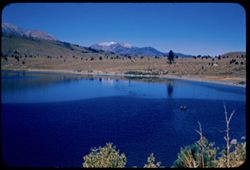
- Description:
- 100 f 8 sl
- Subject:
- Trees, June Lake (Calif.), Light, Lakes & ponds, Hills, Reflections, and Mountains
- Series:
- 27-55
- Creator:
- Cushman, Charles W., 1896-1972
- Date Created:
- 1955-09-26
- Genre:
- Landscape photographs
- Frame Number:
- 10
- County:
- Mono
- Abstract:
- Northward across June lake
- Call Number:
- P08430
- Country:
- United States
- State/Province:
- California
- Alternate Identifier:
- 2755.10
- Persistent URL:
- http://purl.dlib.indiana.edu/iudl/archives/cushman/P08430
- Holding Location:
- Bloomington - University Archives
Wells Library E460
1320 E 10th St.
Bloomington, IN 47405
Contact at archives@indiana.edu, 812-855-1127
-
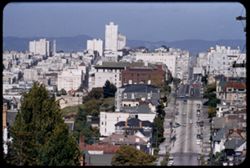
- Description:
- 100 f 6 + tl
- Subject:
- Electric lines, Automobiles, Trees, Roofs, Streets, Sidewalks, Shrubs, Hills, Utility poles, and Buildings
- Series:
- 15-55
- Creator:
- Cushman, Charles W., 1896-1972
- Date Created:
- 1955-05-15
- Genre:
- Cityscape photographs
- Frame Number:
- 2
- Street Address:
- Divisadero Street and Broadway Street
- County:
- San Francisco
- Abstract:
- View east from Broadway at Divisadero
- Call Number:
- P08010
- City:
- San Francisco
- Country:
- United States
- State/Province:
- California
- Alternate Identifier:
- 1555.2
- Persistent URL:
- http://purl.dlib.indiana.edu/iudl/archives/cushman/P08010
- Holding Location:
- Bloomington - University Archives
Wells Library E460
1320 E 10th St.
Bloomington, IN 47405
Contact at archives@indiana.edu, 812-855-1127
-
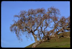
- Description:
- 100 f 8
- Subject:
- Tree limbs, Hills, Oakland Inner Harbor (Calif.), and Trees
- Series:
- 4-68
- Creator:
- Cushman, Charles W., 1896-1972
- Date Created:
- 1968-12-04
- Genre:
- Identification photographs
- Frame Number:
- 9
- County:
- Marin
- Call Number:
- P15682
- Country:
- United States
- State/Province:
- California
- Alternate Identifier:
- 468.9
- Persistent URL:
- http://purl.dlib.indiana.edu/iudl/archives/cushman/P15682
- Holding Location:
- Bloomington - University Archives
Wells Library E460
1320 E 10th St.
Bloomington, IN 47405
Contact at archives@indiana.edu, 812-855-1127
-
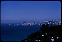
- Description:
- 100 f 6.3 tl
- Subject:
- Cities & towns, Hills, Roads, Mountains, Tamalpais, Mount (Calif.), Shadows, San Bruno Mountain (Calif.), and Bays (Bodies of water)
- Series:
- 29-55
- Creator:
- Cushman, Charles W., 1896-1972
- Date Created:
- 1955-10-31
- Genre:
- Landscape photographs and Cityscape photographs
- Frame Number:
- 10
- County:
- Marin and San Francisco
- Abstract:
- Toward SE - to San Bruno Mtn
- Call Number:
- P08501
- City:
- San Francisco
- Country:
- United States
- State/Province:
- California
- Alternate Identifier:
- 2955.10
- Persistent URL:
- http://purl.dlib.indiana.edu/iudl/archives/cushman/P08501
- Holding Location:
- Bloomington - University Archives
Wells Library E460
1320 E 10th St.
Bloomington, IN 47405
Contact at archives@indiana.edu, 812-855-1127
-
- Description:
- 200 f 5 tl
- Subject:
- Seas, Houses, Hunters Point (San Francisco, Calif.), Streets, Cities & towns, Clouds, Hills, and Twin Peaks (San Francisco County, Calif.)
- Series:
- 29-55
- Creator:
- Cushman, Charles W., 1896-1972
- Date Created:
- 1955-12-01
- Genre:
- Cityscape photographs
- Frame Number:
- 27
- County:
- San Francisco
- Abstract:
- Hunters Point from Twin Peaks
- Call Number:
- P08518
- City:
- San Francisco
- Country:
- United States
- State/Province:
- California
- Alternate Identifier:
- 2955.27
- Persistent URL:
- http://purl.dlib.indiana.edu/iudl/archives/cushman/P08518
- Holding Location:
- Bloomington - University Archives
Wells Library E460
1320 E 10th St.
Bloomington, IN 47405
Contact at archives@indiana.edu, 812-855-1127
-
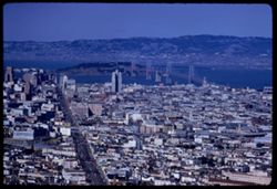
- Description:
- 50 f 8
- Subject:
- Elevated highways, Streets, Hills, Automobiles, Business districts, Skyscrapers, Windows, Bridges, Rincon Hill (San Francisco, Calif.), Buildings, Russian Hi...
- Series:
- 7-53
- Creator:
- Cushman, Charles W., 1896-1972
- Date Created:
- 1953-06-28
- Genre:
- Cityscape photographs
- Frame Number:
- 12
- Street Address:
- Nob Hill
- County:
- San Francisco
- Abstract:
- View NW from top of Russian Hill - strong wind.
- Call Number:
- P06737
- City:
- San Francisco
- Country:
- United States
- State/Province:
- California
- Alternate Identifier:
- 753.12
- Persistent URL:
- http://purl.dlib.indiana.edu/iudl/archives/cushman/P06737
- Holding Location:
- Bloomington - University Archives
Wells Library E460
1320 E 10th St.
Bloomington, IN 47405
Contact at archives@indiana.edu, 812-855-1127
-
- Description:
- 100 f 11 TL
- Subject:
- Willows, Flowers, Hills, Trees, and Clouds
- Series:
- 1-67
- Creator:
- Cushman, Charles W., 1896-1972
- Date Created:
- 1967-03-14
- Genre:
- Identification photographs and Landscape photographs
- Frame Number:
- 21
- County:
- Sonoma
- Abstract:
- Willows in spring sonoma
- Call Number:
- P15496
- Country:
- United States
- State/Province:
- California
- Alternate Identifier:
- 167.21
- Persistent URL:
- http://purl.dlib.indiana.edu/iudl/archives/cushman/P15496
- Holding Location:
- Bloomington - University Archives
Wells Library E460
1320 E 10th St.
Bloomington, IN 47405
Contact at archives@indiana.edu, 812-855-1127
-
- Description:
- 100 f 11
- Subject:
- Rocks, Grasses, Coastlines, Mountains, Lakes & ponds, Clouds, Black Mountain (Marin County, Calif.), and Hills
- Series:
- 27-65
- Creator:
- Cushman, Charles W., 1896-1972
- Date Created:
- 1965-07-26
- Genre:
- Landscape photographs
- Frame Number:
- 2
- County:
- Marin
- Abstract:
- Hopi Pt. and Black Mtn. Western Marin
- Call Number:
- P14801
- City:
- Nicasio
- Country:
- United States
- State/Province:
- California
- Alternate Identifier:
- 2765.2
- Persistent URL:
- http://purl.dlib.indiana.edu/iudl/archives/cushman/P14801
- Holding Location:
- Bloomington - University Archives
Wells Library E460
1320 E 10th St.
Bloomington, IN 47405
Contact at archives@indiana.edu, 812-855-1127
-
- Description:
- 100 f 8 tl
- Subject:
- Bays (Bodies of water), Skyscrapers, San Francisco-Oakland Bay Bridge (Oakland and San Francisco, Calif.), Roofs, Telegraph Hill (San Francisco, Calif.), Bui...
- Series:
- 12-56
- Creator:
- Cushman, Charles W., 1896-1972
- Date Created:
- 1956-09-08
- Genre:
- Cityscape photographs
- Frame Number:
- 33
- County:
- Marin and San Francisco
- Abstract:
- SF from hts of Sausalito
- Call Number:
- P08968
- City:
- Sausalito and San Francisco
- Country:
- United States
- State/Province:
- California
- Alternate Identifier:
- 1256.33
- Persistent URL:
- http://purl.dlib.indiana.edu/iudl/archives/cushman/P08968
- Holding Location:
- Bloomington - University Archives
Wells Library E460
1320 E 10th St.
Bloomington, IN 47405
Contact at archives@indiana.edu, 812-855-1127
-
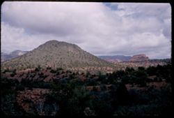
- Description:
- 25 f 11
- Subject:
- Canyons, Cliffs, Trees, Mountains, Shrubs, Clouds, Hills, Oak Creek Canyon (Ariz.), and Rock formations
- Series:
- 16-52
- Creator:
- Cushman, Charles W., 1896-1972
- Date Created:
- 1952-04-12
- Genre:
- Landscape photographs
- Frame Number:
- 29
- County:
- Coconino
- Abstract:
- Green pyramid
- Call Number:
- P06087
- Country:
- United States
- State/Province:
- Arizona
- Alternate Identifier:
- 1652.29
- Persistent URL:
- http://purl.dlib.indiana.edu/iudl/archives/cushman/P06087
- Holding Location:
- Bloomington - University Archives
Wells Library E460
1320 E 10th St.
Bloomington, IN 47405
Contact at archives@indiana.edu, 812-855-1127
-
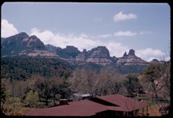
- Description:
- 25 f 10
- Subject:
- Canyons, Trees, Tree limbs, Mountains, Buildings, Rock formations, Hills, and Oak Creek Canyon (Ariz.)
- Series:
- 16-52
- Creator:
- Cushman, Charles W., 1896-1972
- Date Created:
- 1952-04-12
- Genre:
- Landscape photographs
- Frame Number:
- 27
- County:
- Coconino
- Abstract:
- Red monuments Spots
- Call Number:
- P06085
- Country:
- United States
- State/Province:
- Arizona
- Alternate Identifier:
- 1652.27
- Persistent URL:
- http://purl.dlib.indiana.edu/iudl/archives/cushman/P06085
- Holding Location:
- Bloomington - University Archives
Wells Library E460
1320 E 10th St.
Bloomington, IN 47405
Contact at archives@indiana.edu, 812-855-1127
-
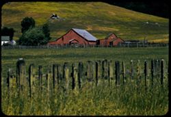
- Description:
- 100 f 8 tl
- Subject:
- Barns, Grasses, Farms, Trees, Corrals, Fences, and Hills
- Series:
- 7-56
- Creator:
- Cushman, Charles W., 1896-1972
- Date Created:
- 1956-06-09
- Genre:
- Landscape photographs
- Frame Number:
- 31
- County:
- Marin
- Abstract:
- Red barns nr. Nicasio Marin county
- Call Number:
- P08778
- City:
- Nicasio
- Country:
- United States
- State/Province:
- California
- Alternate Identifier:
- 756.31
- Persistent URL:
- http://purl.dlib.indiana.edu/iudl/archives/cushman/P08778
- Holding Location:
- Bloomington - University Archives
Wells Library E460
1320 E 10th St.
Bloomington, IN 47405
Contact at archives@indiana.edu, 812-855-1127
-
- Description:
- 100 f 8 TL HF
- Subject:
- Fences, Shrubs, Hills, and Plants
- Series:
- 11-58
- Creator:
- Cushman, Charles W., 1896-1972
- Date Created:
- 1958-06-15
- Genre:
- Landscape photographs
- Frame Number:
- 33
- County:
- Gem
- Abstract:
- Folded mtn. Ridge near Montour
- Call Number:
- P10008
- City:
- Montour
- Country:
- United States
- State/Province:
- Idaho
- Alternate Identifier:
- 1158.33
- Persistent URL:
- http://purl.dlib.indiana.edu/iudl/archives/cushman/P10008
- Holding Location:
- Bloomington - University Archives
Wells Library E460
1320 E 10th St.
Bloomington, IN 47405
Contact at archives@indiana.edu, 812-855-1127
-

- Description:
- 25 f 6.3
- Subject:
- Rocks, Crosses, Boundaries, Roads, Boulders, Mexican border, Mountains, Shrubs, Hills, and Mexican-American Border Region
- Series:
- 6-52
- Creator:
- Cushman, Charles W., 1896-1972
- Date Created:
- 1952-02-08
- Genre:
- Landscape photographs
- Frame Number:
- 1
- County:
- Imperial and San Diego
- Abstract:
- In mtns near Jacumba along Mexican border
- Call Number:
- P05684
- City:
- Jacumba, El Centro, and San Diego
- Country:
- United States
- State/Province:
- California
- Alternate Identifier:
- 652.1
- Persistent URL:
- http://purl.dlib.indiana.edu/iudl/archives/cushman/P05684
- Holding Location:
- Bloomington - University Archives
Wells Library E460
1320 E 10th St.
Bloomington, IN 47405
Contact at archives@indiana.edu, 812-855-1127
-
- Description:
- 100 f 6.3 TL HF
- Subject:
- Boise Ridge (Idaho), Grasses, Trees, Mountains, Clouds, Hills, and Rivers
- Series:
- 11-58
- Creator:
- Cushman, Charles W., 1896-1972
- Date Created:
- 1958-06-15
- Genre:
- Landscape photographs
- Frame Number:
- 28
- County:
- Boise
- Abstract:
- Ridge above Horeshoe Bend [P]
- Call Number:
- P10003
- City:
- Horseshoe Bend
- Country:
- United States
- State/Province:
- Idaho
- Alternate Identifier:
- 1158.28
- Persistent URL:
- http://purl.dlib.indiana.edu/iudl/archives/cushman/P10003
- Holding Location:
- Bloomington - University Archives
Wells Library E460
1320 E 10th St.
Bloomington, IN 47405
Contact at archives@indiana.edu, 812-855-1127
-
- Description:
- 100 f 8 TL
- Subject:
- Hills and Clouds
- Series:
- 3-69
- Creator:
- Cushman, Charles W., 1896-1972
- Date Created:
- 1969-03-21
- Genre:
- Landscape photographs
- Frame Number:
- 24
- County:
- San Luis Obispo
- Abstract:
- Faded green hills near Cholame
- Call Number:
- P15776
- City:
- Cholame
- Country:
- United States
- State/Province:
- California
- Alternate Identifier:
- 369.24
- Persistent URL:
- http://purl.dlib.indiana.edu/iudl/archives/cushman/P15776
- Holding Location:
- Bloomington - University Archives
Wells Library E460
1320 E 10th St.
Bloomington, IN 47405
Contact at archives@indiana.edu, 812-855-1127
-
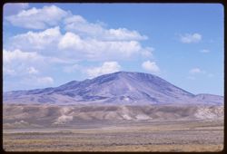
- Description:
- 100 f 6.3 TL
- Subject:
- Pyramid Lake (Nev.), Hills, Mountains, and Shrubs
- Series:
- 12-58
- Creator:
- Cushman, Charles W., 1896-1972
- Date Created:
- 1958-06-18
- Genre:
- Landscape photographs
- Frame Number:
- 33
- County:
- Washoe
- Abstract:
- Mtn. North of Wadsworth
- Call Number:
- P10044
- City:
- Wadsworth
- Country:
- United States
- State/Province:
- Nevada
- Alternate Identifier:
- 1258.33
- Persistent URL:
- http://purl.dlib.indiana.edu/iudl/archives/cushman/P10044
- Holding Location:
- Bloomington - University Archives
Wells Library E460
1320 E 10th St.
Bloomington, IN 47405
Contact at archives@indiana.edu, 812-855-1127
-
- Description:
- 100 f 8 tl
- Subject:
- Mountains, Clouds, and Hills
- Series:
- 17-58
- Creator:
- Cushman, Charles W., 1896-1972
- Date Created:
- 1958-08-26
- Genre:
- Landscape photographs
- Frame Number:
- 15
- County:
- Carbon
- Abstract:
- Mtn north of Lamont
- Call Number:
- P10177
- City:
- Lamont
- Country:
- United States
- State/Province:
- Wyoming
- Alternate Identifier:
- 1758.15
- Persistent URL:
- http://purl.dlib.indiana.edu/iudl/archives/cushman/P10177
- Holding Location:
- Bloomington - University Archives
Wells Library E460
1320 E 10th St.
Bloomington, IN 47405
Contact at archives@indiana.edu, 812-855-1127
-
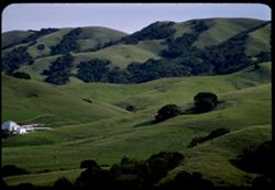
- Description:
- 100 f 5.6 tl
- Subject:
- Barns, Dairy farming, Grazing, Farms, Trees, Meadows, Cattle, Hills, Agricultural facilities, Autumn, and Outbuildings
- Series:
- 16-57
- Creator:
- Cushman, Charles W., 1896-1972
- Date Created:
- 1957-11-11
- Genre:
- Landscape photographs
- Frame Number:
- 15
- County:
- Marin
- Abstract:
- Farms in Marin county dairy country 7 or 8 mi. SW of Petulama in unusual autumn green
- Call Number:
- P09581
- City:
- Petaluma
- Country:
- United States
- State/Province:
- California
- Alternate Identifier:
- 1657.15
- Persistent URL:
- http://purl.dlib.indiana.edu/iudl/archives/cushman/P09581
- Holding Location:
- Bloomington - University Archives
Wells Library E460
1320 E 10th St.
Bloomington, IN 47405
Contact at archives@indiana.edu, 812-855-1127
-
- Description:
- 100 f 16 SL
- Subject:
- Boundaries, Grasses, Cliffs, Mesas, Navajo Indian Reservation, Rock formations, Hills, and Trees
- Series:
- 36-65
- Creator:
- Cushman, Charles W., 1896-1972
- Date Created:
- 1965-10-08
- Genre:
- Landscape photographs
- Frame Number:
- 34
- County:
- McKinley
- Abstract:
- [Fade]
- Call Number:
- P15102
- Country:
- United States
- State/Province:
- Arizona and New Mexico
- Alternate Identifier:
- 3665.34
- Persistent URL:
- http://purl.dlib.indiana.edu/iudl/archives/cushman/P15102
- Holding Location:
- Bloomington - University Archives
Wells Library E460
1320 E 10th St.
Bloomington, IN 47405
Contact at archives@indiana.edu, 812-855-1127
-
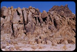
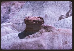
- Description:
- 100 f 8 tl
- Subject:
- Rocks, Boulders, Shrubs, Hills, Alabama Hills (Calif.), and Rock formations
- Series:
- 4-55
- Creator:
- Cushman, Charles W., 1896-1972
- Date Created:
- 1955-02-28
- Genre:
- Landscape photographs
- Frame Number:
- 9
- County:
- Inyo
- Abstract:
- Another odd formation in Alabama Hills
- Call Number:
- P07637
- City:
- Lone Pine
- Country:
- United States
- State/Province:
- California
- Alternate Identifier:
- 455.9
- Persistent URL:
- http://purl.dlib.indiana.edu/iudl/archives/cushman/P07637
- Holding Location:
- Bloomington - University Archives
Wells Library E460
1320 E 10th St.
Bloomington, IN 47405
Contact at archives@indiana.edu, 812-855-1127
-
- Description:
- 200 f 4 tl
- Subject:
- Automobiles, Trees, Diamond Heights (San Francisco, Calif.), Streets, Mountains, Buildings, Trucks, Dwellings, Hills, Utility poles, Buena Vista Park (San Fr...
- Series:
- 6-55
- Creator:
- Cushman, Charles W., 1896-1972
- Date Created:
- 1955-03-14
- Genre:
- Cityscape photographs
- Frame Number:
- 5
- Street Address:
- Farnum Street
- County:
- San Francisco
- Abstract:
- Toward Buena Vista and Corona Hts.
- Call Number:
- P07707
- City:
- San Francisco
- Country:
- United States
- State/Province:
- California
- Alternate Identifier:
- 655.5
- Persistent URL:
- http://purl.dlib.indiana.edu/iudl/archives/cushman/P07707
- Holding Location:
- Bloomington - University Archives
Wells Library E460
1320 E 10th St.
Bloomington, IN 47405
Contact at archives@indiana.edu, 812-855-1127
-
- Description:
- 25 f 4
- Subject:
- Hills, Utility poles, Electric lines, Trees, and Dwellings
- Series:
- 8-51
- Creator:
- Cushman, Charles W., 1896-1972
- Date Created:
- 1951-12-02
- Genre:
- Cityscape photographs
- Frame Number:
- 14
- County:
- Hamilton
- Abstract:
- Heights in western Chat
- Call Number:
- P05119
- City:
- Chattanooga
- Country:
- United States
- State/Province:
- Tennessee
- Alternate Identifier:
- 851.14
- Persistent URL:
- http://purl.dlib.indiana.edu/iudl/archives/cushman/P05119
- Holding Location:
- Bloomington - University Archives
Wells Library E460
1320 E 10th St.
Bloomington, IN 47405
Contact at archives@indiana.edu, 812-855-1127
-
- Description:
- 200 f 5.6
- Subject:
- Bays (Bodies of water), Twin Peaks (San Francisco County, Calif.), Cities & towns, Buildings, Hills, and Houses
- Series:
- 1-56
- Creator:
- Cushman, Charles W., 1896-1972
- Date Created:
- 1956-03-06
- Genre:
- Cityscape photographs
- Frame Number:
- 29
- County:
- San Francisco
- Call Number:
- P08558
- City:
- San Francisco
- Country:
- United States
- State/Province:
- California
- Alternate Identifier:
- 156.29
- Persistent URL:
- http://purl.dlib.indiana.edu/iudl/archives/cushman/P08558
- Holding Location:
- Bloomington - University Archives
Wells Library E460
1320 E 10th St.
Bloomington, IN 47405
Contact at archives@indiana.edu, 812-855-1127
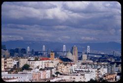
-
- Description:
- 250 f 5.6 TL
- Subject:
- Bays (Bodies of water), Apartment houses, Twin Peaks (San Francisco County, Calif.), Skyscrapers, Streets, Mountains, Buildings, Islands, Dwellings, Hills, S...
- Series:
- 12-59
- Creator:
- Cushman, Charles W., 1896-1972
- Date Created:
- 1959-05-10
- Genre:
- Cityscape photographs
- Frame Number:
- 33
- County:
- San Francisco
- Abstract:
- Top of Twin Peaks
- Call Number:
- P10795
- City:
- San Francisco
- Country:
- United States
- State/Province:
- California
- Alternate Identifier:
- 1259.33
- Persistent URL:
- http://purl.dlib.indiana.edu/iudl/archives/cushman/P10795
- Holding Location:
- Bloomington - University Archives
Wells Library E460
1320 E 10th St.
Bloomington, IN 47405
Contact at archives@indiana.edu, 812-855-1127
-
- Description:
- 250 f 5.6 TL
- Subject:
- Billboards, Twin Peaks (San Francisco County, Calif.), Suspension bridges, Skyscrapers, San Francisco-Oakland Bay Bridge (Oakland and San Francisco, Calif.),...
- Series:
- 12-59
- Creator:
- Cushman, Charles W., 1896-1972
- Date Created:
- 1959-05-10
- Genre:
- Cityscape photographs
- Frame Number:
- 34
- County:
- San Francisco
- Abstract:
- Top of Twin Peaks
- Call Number:
- P10796
- City:
- San Francisco
- Country:
- United States
- State/Province:
- California
- Alternate Identifier:
- 1259.34
- Persistent URL:
- http://purl.dlib.indiana.edu/iudl/archives/cushman/P10796
- Holding Location:
- Bloomington - University Archives
Wells Library E460
1320 E 10th St.
Bloomington, IN 47405
Contact at archives@indiana.edu, 812-855-1127
-
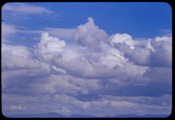
- Description:
- 100 f 6.3 or f 8 tl
- Subject:
- Hills and Clouds
- Series:
- 29-55
- Creator:
- Cushman, Charles W., 1896-1972
- Date Created:
- 1955-12-03
- Genre:
- Views
- Frame Number:
- 35
- Street Address:
- 100 Broderick Street
- County:
- San Francisco
- Abstract:
- 32-39 incl. (Dec. 3) 2:30 PM clouds in eastern sky from top of 100 Broderick
- Call Number:
- P08526
- City:
- San Francisco
- Country:
- United States
- State/Province:
- California
- Alternate Identifier:
- 2955.35
- Persistent URL:
- http://purl.dlib.indiana.edu/iudl/archives/cushman/P08526
- Holding Location:
- Bloomington - University Archives
Wells Library E460
1320 E 10th St.
Bloomington, IN 47405
Contact at archives@indiana.edu, 812-855-1127
-
- Description:
- 100 f 8 tl
- Subject:
- Domes, Cities & towns, Hills, San Francisco-Oakland Bay Bridge (Oakland and San Francisco, Calif.), Bays (Bodies of water), Buildings, Suspension bridges...
- Series:
- 29-55
- Creator:
- Cushman, Charles W., 1896-1972
- Date Created:
- 1955-12-03
- Genre:
- Cityscape photographs
- Frame Number:
- 32
- Street Address:
- 100 Broderick Street
- County:
- San Francisco
- Abstract:
- 32-39 incl. (Dec. 3) 2:30 PM clouds in eastern sky from top of 100 Broderick
- Call Number:
- P08523
- City:
- San Francisco
- Country:
- United States
- State/Province:
- California
- Alternate Identifier:
- 2955.32
- Persistent URL:
- http://purl.dlib.indiana.edu/iudl/archives/cushman/P08523
- Holding Location:
- Bloomington - University Archives
Wells Library E460
1320 E 10th St.
Bloomington, IN 47405
Contact at archives@indiana.edu, 812-855-1127
-

- Description:
- 100 f 8 tl
- Subject:
- Bays (Bodies of water), Houses, Cities & towns, Buildings, Clouds, and Hills
- Series:
- 29-55
- Creator:
- Cushman, Charles W., 1896-1972
- Date Created:
- 1955-12-03
- Genre:
- Cityscape photographs
- Frame Number:
- 33
- Street Address:
- 100 Broderick Street
- County:
- San Francisco
- Abstract:
- 32-39 incl. (Dec. 3) 2:3 PM clouds in eastern sky from top of 100 Broderick
- Call Number:
- P08524
- City:
- San Francisco
- Country:
- United States
- State/Province:
- California
- Alternate Identifier:
- 2955.33
- Persistent URL:
- http://purl.dlib.indiana.edu/iudl/archives/cushman/P08524
- Holding Location:
- Bloomington - University Archives
Wells Library E460
1320 E 10th St.
Bloomington, IN 47405
Contact at archives@indiana.edu, 812-855-1127
-
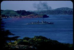
- Description:
- 200 f 5.6?
- Subject:
- Hills, Smoke, San Francisco Bay (Calif.), Bays (Bodies of water), Trees, Golden Gate Bridge (San Francisco, Calif.), Coastlines, Plants, and Ships
- Series:
- 2-56
- Creator:
- Cushman, Charles W., 1896-1972
- Date Created:
- 1956-03-27
- Genre:
- Seascapes and Landscape photographs
- Frame Number:
- 37
- County:
- San Francisco
- Abstract:
- USS (742) entering SF Bay
- Call Number:
- P08601
- City:
- San Francisco
- Country:
- United States
- State/Province:
- California
- Alternate Identifier:
- 256.37
- Persistent URL:
- http://purl.dlib.indiana.edu/iudl/archives/cushman/P08601
- Holding Location:
- Bloomington - University Archives
Wells Library E460
1320 E 10th St.
Bloomington, IN 47405
Contact at archives@indiana.edu, 812-855-1127
-
- Description:
- 100 f 6.3 tl
- Subject:
- Farms, Boulders, Meadows, Morro Bay (Calif.), and Hills
- Series:
- 4-56
- Creator:
- Cushman, Charles W., 1896-1972
- Date Created:
- 1956-04-19
- Genre:
- Landscape photographs
- Frame Number:
- 23
- County:
- San Luis Obispo
- Abstract:
- From farther
- Call Number:
- P08661
- City:
- San Luis Obispo
- Country:
- United States
- State/Province:
- California
- Alternate Identifier:
- 456.23
- Persistent URL:
- http://purl.dlib.indiana.edu/iudl/archives/cushman/P08661
- Holding Location:
- Bloomington - University Archives
Wells Library E460
1320 E 10th St.
Bloomington, IN 47405
Contact at archives@indiana.edu, 812-855-1127
-
- Description:
- 100 f 6 SL
- Subject:
- Buttes, Sutter Buttes (Calif.), Hills, and Meadows
- Series:
- 24-55
- Creator:
- Cushman, Charles W., 1896-1972
- Date Created:
- 1955-08-11
- Genre:
- Landscape photographs
- Frame Number:
- 26
- County:
- Sutter
- Abstract:
- from WSW
- Call Number:
- P08335
- Country:
- United States
- State/Province:
- California
- Physical Description:
- masked.
- Alternate Identifier:
- 2455.26
- Persistent URL:
- http://purl.dlib.indiana.edu/iudl/archives/cushman/P08335
- Holding Location:
- Bloomington - University Archives
Wells Library E460
1320 E 10th St.
Bloomington, IN 47405
Contact at archives@indiana.edu, 812-855-1127
-
- Description:
- 200 f 4.5 tl
- Subject:
- Bays (Bodies of water), Twin Peaks (San Francisco County, Calif.), Trees, Streets, Telegraph Hill (San Francisco, Calif.), Buildings, Hills, and Cities &...
- Series:
- 28-55
- Creator:
- Cushman, Charles W., 1896-1972
- Date Created:
- 1955-10-07
- Genre:
- Cityscape photographs
- Frame Number:
- 15
- County:
- San Francisco
- Abstract:
- From southern of Twin Peaks Toward Telegraph Hill
- Call Number:
- P08472
- City:
- San Francisco
- Country:
- United States
- State/Province:
- California
- Alternate Identifier:
- 2855.15
- Persistent URL:
- http://purl.dlib.indiana.edu/iudl/archives/cushman/P08472
- Holding Location:
- Bloomington - University Archives
Wells Library E460
1320 E 10th St.
Bloomington, IN 47405
Contact at archives@indiana.edu, 812-855-1127
-
- Description:
- 100 f 8 tl
- Subject:
- Hills, San Francisco Bay (Calif.), Cliffs, Bridges, Pacific Ocean, Bays (Bodies of water), Boats, Golden Gate Bridge (San Francisco, Calif.), Coastlines, Sus...
- Series:
- 16-59
- Creator:
- Cushman, Charles W., 1896-1972
- Date Created:
- 1959-10-01
- Genre:
- Marine photographs
- Frame Number:
- 19
- County:
- San Francisco
- Abstract:
- View east thru gate
- Call Number:
- P10871
- City:
- San Francisco
- Country:
- United States
- State/Province:
- California
- Physical Description:
- Anscochrome film.
- Alternate Identifier:
- 1659.19
- Persistent URL:
- http://purl.dlib.indiana.edu/iudl/archives/cushman/P10871
- Holding Location:
- Bloomington - University Archives
Wells Library E460
1320 E 10th St.
Bloomington, IN 47405
Contact at archives@indiana.edu, 812-855-1127
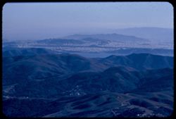
-
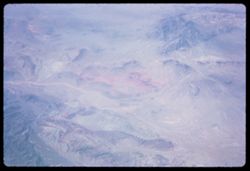
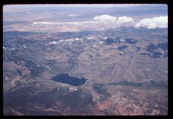
- Subject:
- Pan American World Airways, inc., Hills, Mountains, Rivers, and Air travel
- Series:
- 1-65
- Creator:
- Cushman, Charles W., 1896-1972
- Date Created:
- 1965-03-30
- Genre:
- Aerial photographs and Landscape photographs
- Frame Number:
- 19
- Call Number:
- P13883
- Country:
- United States
- Alternate Identifier:
- 165.19
- Persistent URL:
- http://purl.dlib.indiana.edu/iudl/archives/cushman/P13883
- Holding Location:
- Bloomington - University Archives
Wells Library E460
1320 E 10th St.
Bloomington, IN 47405
Contact at archives@indiana.edu, 812-855-1127
-
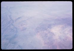
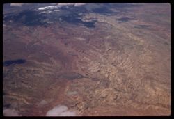
- Subject:
- Pan American World Airways, inc., Valleys, Hills, Mountains, Rivers, and Air travel
- Series:
- 1-65
- Creator:
- Cushman, Charles W., 1896-1972
- Date Created:
- 1965-03-30
- Genre:
- Aerial photographs and Landscape photographs
- Frame Number:
- 20
- Call Number:
- P13884
- Country:
- United States
- Alternate Identifier:
- 165.20
- Persistent URL:
- http://purl.dlib.indiana.edu/iudl/archives/cushman/P13884
- Holding Location:
- Bloomington - University Archives
Wells Library E460
1320 E 10th St.
Bloomington, IN 47405
Contact at archives@indiana.edu, 812-855-1127
-
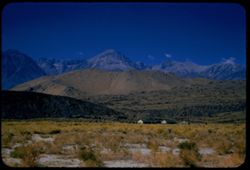
- Description:
- 100 f 8 SL
- Subject:
- Houses, Plains, Owens Valley (Calif.), Mountains, Sierra Nevada (Calif. and Nev.), Hills, and Plants
- Series:
- 25-55
- Creator:
- Cushman, Charles W., 1896-1972
- Date Created:
- 1955-09-25
- Genre:
- Landscape photographs
- Frame Number:
- 35
- County:
- Inyo
- Abstract:
- And looking west
- Call Number:
- P08380
- City:
- Big Pine
- Country:
- United States
- State/Province:
- California
- Alternate Identifier:
- 2555.35
- Persistent URL:
- http://purl.dlib.indiana.edu/iudl/archives/cushman/P08380
- Holding Location:
- Bloomington - University Archives
Wells Library E460
1320 E 10th St.
Bloomington, IN 47405
Contact at archives@indiana.edu, 812-855-1127
-
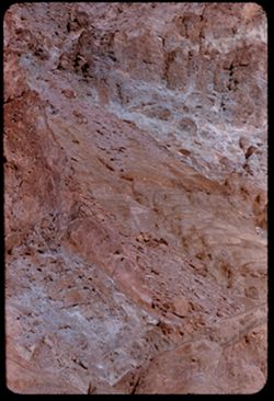
- Description:
- 100 f 8 tl
- Subject:
- Hills, Mountains, Death Valley National Park (Calif. and Nev.), Rocks, and Black Mountains (Inyo County, Calif.)
- Series:
- 9-55
- Creator:
- Cushman, Charles W., 1896-1972
- Date Created:
- 1955-03-22
- Frame Number:
- 35
- Street Address:
- Artist's View Drive
- County:
- Inyo
- Abstract:
- Above Artists Drive [P]
- Call Number:
- P07825
- Country:
- United States
- State/Province:
- California
- Alternate Identifier:
- 955.35
- Persistent URL:
- http://purl.dlib.indiana.edu/iudl/archives/cushman/P07825
- Holding Location:
- Bloomington - University Archives
Wells Library E460
1320 E 10th St.
Bloomington, IN 47405
Contact at archives@indiana.edu, 812-855-1127
-
- Description:
- 100 f 5
- Subject:
- Lakes & ponds, Air France, Air travel, Mountains, Snow, Shadows, Clouds, and Hills
- Series:
- 3-60
- Creator:
- Cushman, Charles W., 1896-1972
- Date Created:
- 1960-05-07
- Genre:
- Aerial photographs and Landscape photographs
- Frame Number:
- 8
- Abstract:
- Snow spotted mtns
- Call Number:
- P10968
- Country:
- United States
- Alternate Identifier:
- 360.8
- Persistent URL:
- http://purl.dlib.indiana.edu/iudl/archives/cushman/P10968
- Holding Location:
- Bloomington - University Archives
Wells Library E460
1320 E 10th St.
Bloomington, IN 47405
Contact at archives@indiana.edu, 812-855-1127
-
- Description:
- 250 f 5.6
- Subject:
- Air France, Mountains, Rock formations, Clouds, Hills, Shadows, and Air travel
- Series:
- 3-60
- Creator:
- Cushman, Charles W., 1896-1972
- Date Created:
- 1960-05-07
- Genre:
- Aerial photographs and Landscape photographs
- Frame Number:
- 13
- Abstract:
- [Vemailleisu] & brown
- Call Number:
- P10973
- Country:
- United States
- Alternate Identifier:
- 360.13
- Persistent URL:
- http://purl.dlib.indiana.edu/iudl/archives/cushman/P10973
- Holding Location:
- Bloomington - University Archives
Wells Library E460
1320 E 10th St.
Bloomington, IN 47405
Contact at archives@indiana.edu, 812-855-1127
-
- Description:
- 100 f 8 tl
- Subject:
- Mountains, Zabriskie Point (Calif.), and Hills
- Series:
- 10-55
- Creator:
- Cushman, Charles W., 1896-1972
- Date Created:
- 1955-03-23
- Genre:
- Landscape photographs
- Frame Number:
- 27
- County:
- Inyo
- Abstract:
- Down from below Zabriskie Pt
- Call Number:
- P07852
- Country:
- United States
- State/Province:
- California
- Alternate Identifier:
- 1055.27
- Persistent URL:
- http://purl.dlib.indiana.edu/iudl/archives/cushman/P07852
- Holding Location:
- Bloomington - University Archives
Wells Library E460
1320 E 10th St.
Bloomington, IN 47405
Contact at archives@indiana.edu, 812-855-1127
-
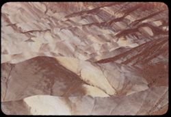
- Description:
- 100 f 8 tl
- Subject:
- Mountains, Zabriskie Point (Calif.), and Hills
- Series:
- 10-55
- Creator:
- Cushman, Charles W., 1896-1972
- Date Created:
- 1955-03-23
- Genre:
- Landscape photographs
- Frame Number:
- 26
- County:
- Inyo
- Abstract:
- Striped rock from Zabriskie Pt.
- Call Number:
- P07851
- Country:
- United States
- State/Province:
- California
- Alternate Identifier:
- 1055.26
- Persistent URL:
- http://purl.dlib.indiana.edu/iudl/archives/cushman/P07851
- Holding Location:
- Bloomington - University Archives
Wells Library E460
1320 E 10th St.
Bloomington, IN 47405
Contact at archives@indiana.edu, 812-855-1127
-
- Description:
- 100 f 11 TL
- Subject:
- Deserts, Blue Mesa (Ariz.), Petrified forests, Petrified Forest National Park (Ariz.), National parks & reserves, Logs, Hills, Erosion, Shadows, and Rock...
- Series:
- 6-63
- Creator:
- Cushman, Charles W., 1896-1972
- Date Created:
- 1963-06-27
- Genre:
- Landscape photographs and Identification photographs
- Frame Number:
- 8
- County:
- Apache and Navajo
- Abstract:
- Distantly Down from Blue Mesa
- Call Number:
- P12961
- City:
- Holbrook
- Country:
- United States
- State/Province:
- Arizona
- Alternate Identifier:
- 663.8
- Persistent URL:
- http://purl.dlib.indiana.edu/iudl/archives/cushman/P12961
- Holding Location:
- Bloomington - University Archives
Wells Library E460
1320 E 10th St.
Bloomington, IN 47405
Contact at archives@indiana.edu, 812-855-1127
-
- Description:
- 100 f 13 TL
- Subject:
- Deserts, Blue Mesa (Ariz.), Valleys, Petrified forests, Mesas, Petrified Forest National Park (Ariz.), National parks & reserves, Hills, and Rivers
- Series:
- 6-63
- Creator:
- Cushman, Charles W., 1896-1972
- Date Created:
- 1963-06-27
- Genre:
- Landscape photographs
- Frame Number:
- 10
- County:
- Apache and Navajo
- Abstract:
- Distantly Down from Blue Mesa
- Call Number:
- P12963
- City:
- Holbrook
- Country:
- United States
- State/Province:
- Arizona
- Alternate Identifier:
- 663.10
- Persistent URL:
- http://purl.dlib.indiana.edu/iudl/archives/cushman/P12963
- Holding Location:
- Bloomington - University Archives
Wells Library E460
1320 E 10th St.
Bloomington, IN 47405
Contact at archives@indiana.edu, 812-855-1127
-
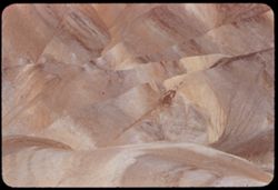
- Description:
- 100 f 8 tl
- Subject:
- Volcanic rock, Zabriskie Point (Calif.), and Hills
- Series:
- 10-55
- Creator:
- Cushman, Charles W., 1896-1972
- Date Created:
- 1955-03-23
- Frame Number:
- 28
- County:
- Inyo
- Abstract:
- Down from below Zabriskie Pt
- Call Number:
- P07853
- Country:
- United States
- State/Province:
- California
- Alternate Identifier:
- 1055.28
- Persistent URL:
- http://purl.dlib.indiana.edu/iudl/archives/cushman/P07853
- Holding Location:
- Bloomington - University Archives
Wells Library E460
1320 E 10th St.
Bloomington, IN 47405
Contact at archives@indiana.edu, 812-855-1127
-
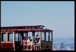
- Description:
- 100 f 11 tl
- Subject:
- Twin Peaks (San Francisco County, Calif.), Passengers, Hills, Street railroads, San Francisco Bay (Calif.), Bays (Bodies of water), Families, Buildings, and ...
- Series:
- 27-65
- Creator:
- Cushman, Charles W., 1896-1972
- Date Created:
- 1965-07-27
- Genre:
- Portraits and Cityscape photographs
- Frame Number:
- 10
- County:
- San Francisco
- Abstract:
- Cable car
- Call Number:
- P14809
- City:
- San Francisco
- Country:
- United States
- State/Province:
- California
- Alternate Identifier:
- 2765.10
- Persistent URL:
- http://purl.dlib.indiana.edu/iudl/archives/cushman/P14809
- Holding Location:
- Bloomington - University Archives
Wells Library E460
1320 E 10th St.
Bloomington, IN 47405
Contact at archives@indiana.edu, 812-855-1127
-
- Description:
- 100 f 5.6 tl
- Subject:
- Farms, Boulders, Meadows, Morro Bay (Calif.), and Hills
- Series:
- 4-56
- Creator:
- Cushman, Charles W., 1896-1972
- Date Created:
- 1956-04-19
- Genre:
- Landscape photographs
- Frame Number:
- 22
- County:
- San Luis Obispo
- Abstract:
- Rock & farm
- Call Number:
- P08660
- City:
- San Luis Obispo
- Country:
- United States
- State/Province:
- California
- Alternate Identifier:
- 456.22
- Persistent URL:
- http://purl.dlib.indiana.edu/iudl/archives/cushman/P08660
- Holding Location:
- Bloomington - University Archives
Wells Library E460
1320 E 10th St.
Bloomington, IN 47405
Contact at archives@indiana.edu, 812-855-1127
-
- Description:
- 100 f 6.3 SL
- Subject:
- Grasses, Volcanic rock, Shrubs, Clouds, and Hills
- Series:
- 11-58
- Creator:
- Cushman, Charles W., 1896-1972
- Date Created:
- 1958-06-14
- Genre:
- Landscape photographs
- Frame Number:
- 6
- Street Address:
- United States Highway 20
- County:
- Malheur
- Abstract:
- Great brown lava
- Call Number:
- P09981
- Country:
- United States
- State/Province:
- Oregon
- Alternate Identifier:
- 1158.6
- Persistent URL:
- http://purl.dlib.indiana.edu/iudl/archives/cushman/P09981
- Holding Location:
- Bloomington - University Archives
Wells Library E460
1320 E 10th St.
Bloomington, IN 47405
Contact at archives@indiana.edu, 812-855-1127
-
- Description:
- 100 f 5.6 tl
- Subject:
- Lilacs, Hills, Shrubs, Trees, and Fences
- Series:
- 13-55
- Creator:
- Cushman, Charles W., 1896-1972
- Date Created:
- 1955-04-08
- Genre:
- Identification photographs
- Frame Number:
- 21
- Street Address:
- Palomares Road
- County:
- Alameda
- Abstract:
- Wild lilac on distant slope
- Call Number:
- P07955
- Country:
- United States
- State/Province:
- California
- Alternate Identifier:
- 1355.21
- Persistent URL:
- http://purl.dlib.indiana.edu/iudl/archives/cushman/P07955
- Holding Location:
- Bloomington - University Archives
Wells Library E460
1320 E 10th St.
Bloomington, IN 47405
Contact at archives@indiana.edu, 812-855-1127
-
- Description:
- 100 f 6.3 sl
- Subject:
- Croplands, Meadows, Caterpillar Tractor Company, Hills, Agricultural machinery & implements, Hay, Farms, and Tractors
- Series:
- 7-57
- Creator:
- Cushman, Charles W., 1896-1972
- Date Created:
- 1957-05-31
- Genre:
- Landscape photographs
- Frame Number:
- 34
- Street Address:
- Marsh Creek Road
- County:
- Contra Costa
- Abstract:
- More Caterpillars from Marsh Creek road
- Call Number:
- P09313
- Country:
- United States
- State/Province:
- California
- Alternate Identifier:
- 757.34
- Persistent URL:
- http://purl.dlib.indiana.edu/iudl/archives/cushman/P09313
- Holding Location:
- Bloomington - University Archives
Wells Library E460
1320 E 10th St.
Bloomington, IN 47405
Contact at archives@indiana.edu, 812-855-1127