
Search Constraints
You searched for:
Campus
IUB
Remove constraint Campus: IUB
Country
United States
Remove constraint Country: United States
Subject
Hills
Remove constraint Subject: Hills
Subject
Mountains
Remove constraint Subject: Mountains
« Previous |
1 - 100 of 807
|
Next »
Search Results
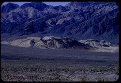
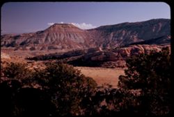
-
- Description:
- 100 f 8 tl
- Subject:
- Hills, Funeral Mountains (Calif.), Funeral Mountains Wilderness (Calif.), Mountains, Shrubs, Furnace Creek (Calif.), Rocks, and Clouds
- Series:
- 2-55
- Creator:
- Cushman, Charles W., 1896-1972
- Date Created:
- 1955-02-27
- Genre:
- Landscape photographs
- Frame Number:
- 29
- Street Address:
- Furance Creek-Death Valley Junction Road
- County:
- Mono and Inyo
- Abstract:
- North toward Funeral Mtns
- Call Number:
- P07586
- City:
- Death Valley Junction
- Country:
- United States
- State/Province:
- California
- Alternate Identifier:
- 255.29
- Persistent URL:
- http://purl.dlib.indiana.edu/iudl/archives/cushman/P07586
- Holding Location:
- Bloomington - University Archives
Wells Library E460
1320 E 10th St.
Bloomington, IN 47405
Contact at archives@indiana.edu, 812-855-1127
-
- Description:
- 100 f 8 tl
- Subject:
- Hills, Tom's Place, Mountains, Utility poles, Sierra Nevada (Calif. and Nev.), and Plants
- Series:
- 26-55
- Creator:
- Cushman, Charles W., 1896-1972
- Date Created:
- 1955-09-26
- Genre:
- Landscape photographs
- Frame Number:
- 35
- Street Address:
- United States Highway 395
- Abstract:
- Dark-colored mtns west from Tom's Place
- Call Number:
- P08417
- Country:
- United States
- State/Province:
- California
- Alternate Identifier:
- 2655.35
- Persistent URL:
- http://purl.dlib.indiana.edu/iudl/archives/cushman/P08417
- Holding Location:
- Bloomington - University Archives
Wells Library E460
1320 E 10th St.
Bloomington, IN 47405
Contact at archives@indiana.edu, 812-855-1127
-
- Description:
- 100 f 6.3 tl
- Subject:
- Hills, Mountains, Tamalpais, Mount (Calif.), and Trees
- Series:
- 2-56
- Creator:
- Cushman, Charles W., 1896-1972
- Date Created:
- 1956-03-14
- Genre:
- Landscape photographs
- Frame Number:
- 2
- County:
- Marin
- Abstract:
- From road on West shoulder of Mt. Tamalpais: Folded hills to north
- Call Number:
- P08568
- Country:
- United States
- State/Province:
- California
- Alternate Identifier:
- 256.2
- Persistent URL:
- http://purl.dlib.indiana.edu/iudl/archives/cushman/P08568
- Holding Location:
- Bloomington - University Archives
Wells Library E460
1320 E 10th St.
Bloomington, IN 47405
Contact at archives@indiana.edu, 812-855-1127
-
- Description:
- 50 f 11
- Subject:
- Hills, Mountains, Shrubs, Trees, Buttes, and Fences
- Series:
- 18-52
- Creator:
- Cushman, Charles W., 1896-1972
- Date Created:
- 1952-04-15
- Genre:
- Landscape photographs
- Frame Number:
- 29
- Street Address:
- Los Alamos Road
- County:
- Santa Fe
- Abstract:
- View west from same pt as 27.
- Call Number:
- P06160
- City:
- Santa Fe
- Country:
- United States
- State/Province:
- New Mexico
- Alternate Identifier:
- 1852.29
- Persistent URL:
- http://purl.dlib.indiana.edu/iudl/archives/cushman/P06160
- Holding Location:
- Bloomington - University Archives
Wells Library E460
1320 E 10th St.
Bloomington, IN 47405
Contact at archives@indiana.edu, 812-855-1127
-
- Description:
- 100 f 4.5 TL
- Subject:
- Croplands, Streets, Hills, Agricultural machinery & implements, Mountains, Trees, Farms, Farming, and Houses
- Series:
- 2-60
- Creator:
- Cushman, Charles W., 1896-1972
- Date Created:
- 1960-03-10
- Genre:
- Cityscape photographs
- Frame Number:
- 16
- County:
- San Mateo
- Abstract:
- From ht wsw of tower
- Call Number:
- P10947
- City:
- Pescadero
- Country:
- United States
- State/Province:
- California
- Alternate Identifier:
- 260.16
- Persistent URL:
- http://purl.dlib.indiana.edu/iudl/archives/cushman/P10947
- Holding Location:
- Bloomington - University Archives
Wells Library E460
1320 E 10th St.
Bloomington, IN 47405
Contact at archives@indiana.edu, 812-855-1127
-
- Description:
- 100 f 8 TL
- Subject:
- Diablo, Mount (Calif.), Meadows, Flowers, Hills, Mustard (Plant), Mountains, Trees, Grasses, and Fences
- Series:
- 2-60
- Creator:
- Cushman, Charles W., 1896-1972
- Date Created:
- 1960-03-25
- Genre:
- Landscape photographs
- Frame Number:
- 28
- County:
- Contra Costa
- Abstract:
- Mustard & grass SE of Clayton
- Call Number:
- P10959
- City:
- Clayton
- Country:
- United States
- State/Province:
- California
- Alternate Identifier:
- 260.28
- Persistent URL:
- http://purl.dlib.indiana.edu/iudl/archives/cushman/P10959
- Holding Location:
- Bloomington - University Archives
Wells Library E460
1320 E 10th St.
Bloomington, IN 47405
Contact at archives@indiana.edu, 812-855-1127
-
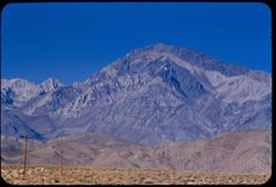
- Description:
- 100 f 5.6 tl
- Subject:
- Hills, Mountains, Sierra Nevada (Calif. and Nev.), Alabama Hills (Calif.), Rock formations, and Snow
- Series:
- 4-55
- Creator:
- Cushman, Charles W., 1896-1972
- Date Created:
- 1955-02-28
- Genre:
- Landscape photographs
- Frame Number:
- 4
- County:
- Inyo
- Abstract:
- In alabama Hills
- Call Number:
- P07632
- City:
- Lone Pine
- Country:
- United States
- State/Province:
- California
- Alternate Identifier:
- 455.4
- Persistent URL:
- http://purl.dlib.indiana.edu/iudl/archives/cushman/P07632
- Holding Location:
- Bloomington - University Archives
Wells Library E460
1320 E 10th St.
Bloomington, IN 47405
Contact at archives@indiana.edu, 812-855-1127
-
- Description:
- 50 f 7 Pola
- Subject:
- Sangre de Cristo Mountains (Colo. and N.M.), Hills, Barbed wire, Cliffs, Mountains, Shrubs, Snow, and Fences
- Series:
- 18-52
- Creator:
- Cushman, Charles W., 1896-1972
- Date Created:
- 1952-04-15
- Genre:
- Landscape photographs
- Frame Number:
- 31
- Street Address:
- Highway 84
- County:
- Santa Fe
- Abstract:
- Again - from Hwy 84.
- Call Number:
- P06162
- City:
- Santa Fe
- Country:
- United States
- State/Province:
- New Mexico
- Alternate Identifier:
- 1852.31
- Persistent URL:
- http://purl.dlib.indiana.edu/iudl/archives/cushman/P06162
- Holding Location:
- Bloomington - University Archives
Wells Library E460
1320 E 10th St.
Bloomington, IN 47405
Contact at archives@indiana.edu, 812-855-1127
-
- Description:
- 25 f 8 Pola
- Subject:
- Lakes & ponds, Houses, Bodies of water, Sand, Mountains, Waterfronts, Trees, Beaches, Grasses, and Hills
- Series:
- 7-53
- Creator:
- Cushman, Charles W., 1896-1972
- Date Created:
- 1953-07-08
- Genre:
- Landscape photographs
- Frame Number:
- 29
- County:
- Marin
- Abstract:
- Across Bolinas lagoon from Bolinas.
- Call Number:
- P06753
- City:
- Bolinas
- Country:
- United States
- State/Province:
- California
- Alternate Identifier:
- 753.29
- Persistent URL:
- http://purl.dlib.indiana.edu/iudl/archives/cushman/P06753
- Holding Location:
- Bloomington - University Archives
Wells Library E460
1320 E 10th St.
Bloomington, IN 47405
Contact at archives@indiana.edu, 812-855-1127
-
- Description:
- 100 f 5.6 tl
- Subject:
- Valleys, Hills, Bodies of water, Roads, Mountains, Tamalpais, Mount (Calif.), Trees, Buildings, Clouds, Dwellings, and Utility poles
- Series:
- 5-55
- Creator:
- Cushman, Charles W., 1896-1972
- Date Created:
- 1955-03-10
- Genre:
- Landscape photographs
- Frame Number:
- 4
- County:
- Marin
- Abstract:
- Cloud mass above Mt. Tamalpais from top of Sausalito All of frame will next to 3
- Call Number:
- P07669
- City:
- Sausalito
- Country:
- United States
- State/Province:
- California
- Alternate Identifier:
- 555.4
- Persistent URL:
- http://purl.dlib.indiana.edu/iudl/archives/cushman/P07669
- Holding Location:
- Bloomington - University Archives
Wells Library E460
1320 E 10th St.
Bloomington, IN 47405
Contact at archives@indiana.edu, 812-855-1127
-
- Description:
- 25 f 6.3
- Subject:
- Hills, Mountains, Shrubs, Colorado River (Colo.-Mexico), and Rivers
- Series:
- 25-52
- Creator:
- Cushman, Charles W., 1896-1972
- Date Created:
- 1952-11-02
- Genre:
- Landscape photographs
- Frame Number:
- 28
- County:
- Garfield
- Abstract:
- Colorado river 16 mi. east of Glenwood Springs.
- Call Number:
- P06397
- City:
- Glenwood Springs
- Country:
- United States
- State/Province:
- Colorado
- Alternate Identifier:
- 2552.28
- Persistent URL:
- http://purl.dlib.indiana.edu/iudl/archives/cushman/P06397
- Holding Location:
- Bloomington - University Archives
Wells Library E460
1320 E 10th St.
Bloomington, IN 47405
Contact at archives@indiana.edu, 812-855-1127
-
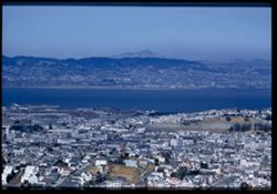
- Description:
- 100 f 8 tl
- Subject:
- Domes, San Francisco Bay Area (Calif.), Palace of Fine Arts (San Francisco), Sailboats, Columns, Mountains, Buildings, Rotundas, Hills, Bays (Bodies of water...
- Series:
- 1-60
- Creator:
- Cushman, Charles W., 1896-1972
- Date Created:
- 1960-01-16
- Genre:
- Marine photographs, Cityscape photographs, and Views
- Frame Number:
- 3
- Street Address:
- Broderick Street and Broadway Street
- County:
- San Francisco
- Abstract:
- North Bay from Broadway + Broderick
- Call Number:
- P10897
- City:
- San Francisco
- Country:
- United States
- State/Province:
- California
- Alternate Identifier:
- 160.3
- Persistent URL:
- http://purl.dlib.indiana.edu/iudl/archives/cushman/P10897
- Holding Location:
- Bloomington - University Archives
Wells Library E460
1320 E 10th St.
Bloomington, IN 47405
Contact at archives@indiana.edu, 812-855-1127
-
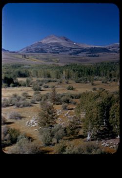
- Description:
- 50 f 9
- Subject:
- Sheep, Hills, Mountains, Shrubs, Sierra Nevada (Calif. and Nev.), Trees, Grazing, Grasses, and Dunderberg Peak (Calif.)
- Series:
- 9-54
- Creator:
- Cushman, Charles W., 1896-1972
- Date Created:
- 1954-09-16
- Genre:
- Landscape photographs
- Frame Number:
- 20
- Street Address:
- United States Highway 395
- County:
- Mono
- Abstract:
- Sheep below - looking toward Dunderberg Pk. (19-20-21 were taken less than mile north of Conway Summit)
- Call Number:
- P07331
- City:
- Bridgeport
- Country:
- United States
- State/Province:
- California
- Physical Description:
- masked.
- Alternate Identifier:
- 954.20
- Persistent URL:
- http://purl.dlib.indiana.edu/iudl/archives/cushman/P07331
- Holding Location:
- Bloomington - University Archives
Wells Library E460
1320 E 10th St.
Bloomington, IN 47405
Contact at archives@indiana.edu, 812-855-1127
-
- Description:
- 50 f 8
- Subject:
- Hills, Roads, Franklin Mountains (Tex. and N.M.), Mountains, Shrubs, Shadows, and Clouds
- Series:
- 17-51
- Creator:
- Cushman, Charles W., 1896-1972
- Date Created:
- 1952-01-01
- Genre:
- Landscape photographs
- Frame Number:
- 30
- County:
- El Paso
- Abstract:
- Whorls on a Mtn. side = Franklin Mtns.
- Call Number:
- P05481
- City:
- El Paso
- Country:
- United States
- State/Province:
- Texas
- Alternate Identifier:
- 1751.30
- Persistent URL:
- http://purl.dlib.indiana.edu/iudl/archives/cushman/P05481
- Holding Location:
- Bloomington - University Archives
Wells Library E460
1320 E 10th St.
Bloomington, IN 47405
Contact at archives@indiana.edu, 812-855-1127
-
- Description:
- 25 f 11
- Subject:
- Flowers, Hills, Flowering dogwood, Mountains, Trees, Grasses, and Ozark Mountains
- Series:
- 18-52
- Creator:
- Cushman, Charles W., 1896-1972
- Date Created:
- 1952-04-18
- Genre:
- Landscape photographs
- Frame Number:
- 34
- County:
- Taney
- Abstract:
- Dogwood + Ozark panorama. Hwy is near Branson.
- Call Number:
- P06165
- City:
- Branson
- Country:
- United States
- State/Province:
- Missouri
- Alternate Identifier:
- 1852.34
- Persistent URL:
- http://purl.dlib.indiana.edu/iudl/archives/cushman/P06165
- Holding Location:
- Bloomington - University Archives
Wells Library E460
1320 E 10th St.
Bloomington, IN 47405
Contact at archives@indiana.edu, 812-855-1127
-
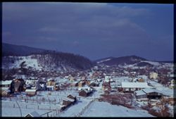
- Subject:
- Streets, Hills, Automobiles, Mountains, Dwellings, Snow, Trees, Clouds, and Fences
- Series:
- 1-41
- Creator:
- Cushman, Charles W., 1896-1972
- Date Created:
- 1941-02-01
- Genre:
- Cityscape photographs
- Frame Number:
- 9
- Abstract:
- Snow -covered hamlet, south central Penna.
- Call Number:
- P02179
- Country:
- United States
- State/Province:
- Pennsylvania
- Physical Description:
- Image was originally mounted in a glass enclosure. Before digitization, the image was removed and placed in a Wess Plastic, Inc. brand, 2" x 2", pl...
- Alternate Identifier:
- 141.9
- Persistent URL:
- http://purl.dlib.indiana.edu/iudl/archives/cushman/P02179
- Holding Location:
- Bloomington - University Archives
Wells Library E460
1320 E 10th St.
Bloomington, IN 47405
Contact at archives@indiana.edu, 812-855-1127
-
- Description:
- 100 f 6.3 tl
- Subject:
- Valleys, Black Mountains (Inyo County, Calif.), Death Valley (Calif. and Nev.), Mountains, Shrubs, and Hills
- Series:
- 8-55
- Creator:
- Cushman, Charles W., 1896-1972
- Date Created:
- 1955-03-22
- Genre:
- Landscape photographs
- Frame Number:
- 20
- Street Address:
- California State Highway 190
- County:
- Inyo
- Abstract:
- From 18 mi out - west toward Black Mtns - colored rock in valley
- Call Number:
- P07778
- Country:
- United States
- State/Province:
- California
- Alternate Identifier:
- 855.20
- Persistent URL:
- http://purl.dlib.indiana.edu/iudl/archives/cushman/P07778
- Holding Location:
- Bloomington - University Archives
Wells Library E460
1320 E 10th St.
Bloomington, IN 47405
Contact at archives@indiana.edu, 812-855-1127
-
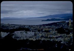
- Description:
- 100 f 5 tl wrong focus error at 300 ft.
- Subject:
- Domes, Cities & towns, Streets, Hills, Bodies of water, Mountains, Dwellings, Buena Vista Park (San Francisco, Calif.), Buildings, Coastlines, Clouds, Tr...
- Series:
- 5-55
- Creator:
- Cushman, Charles W., 1896-1972
- Date Created:
- 1955-03-12
- Genre:
- Cityscape photographs
- Frame Number:
- 20
- County:
- Marin and San Francisco
- Abstract:
- Toward Pt. Reyes under clouds were out too far to left and had to be remounted
- Call Number:
- P07685
- City:
- San Francisco and Point Reyes Station
- Country:
- United States
- State/Province:
- California
- Alternate Identifier:
- 555.20
- Persistent URL:
- http://purl.dlib.indiana.edu/iudl/archives/cushman/P07685
- Holding Location:
- Bloomington - University Archives
Wells Library E460
1320 E 10th St.
Bloomington, IN 47405
Contact at archives@indiana.edu, 812-855-1127
-
- Description:
- 100 f 8 TL
- Subject:
- Meadows, Valleys, Hills, Mountains, Trees, and Little Rabbit Valley (Calif.)
- Series:
- 6-56
- Creator:
- Cushman, Charles W., 1896-1972
- Date Created:
- 1956-04-22
- Genre:
- Landscape photographs
- Frame Number:
- 16
- County:
- San Benito
- Abstract:
- San Benito county valley (Little Rabbit) near Bitterwater
- Call Number:
- P08725
- City:
- Bitterwater
- Country:
- United States
- State/Province:
- California
- Alternate Identifier:
- 656.16
- Persistent URL:
- http://purl.dlib.indiana.edu/iudl/archives/cushman/P08725
- Holding Location:
- Bloomington - University Archives
Wells Library E460
1320 E 10th St.
Bloomington, IN 47405
Contact at archives@indiana.edu, 812-855-1127
-

- Description:
- 25 f 11
- Subject:
- Hills, Mountains, Shrubs, Boulders, Rocks, Rock formations, and Crazy rocks
- Series:
- 14-52
- Creator:
- Cushman, Charles W., 1896-1972
- Date Created:
- 1952-04-08
- Genre:
- Landscape photographs
- Frame Number:
- 33
- Street Address:
- Mount Whitney Road
- County:
- Inyo
- Abstract:
- Crazy rocks along lower Mt. Whitney rd.
- Call Number:
- P06016
- City:
- Lone Pine
- Country:
- United States
- State/Province:
- California
- Alternate Identifier:
- 1452.33
- Persistent URL:
- http://purl.dlib.indiana.edu/iudl/archives/cushman/P06016
- Holding Location:
- Bloomington - University Archives
Wells Library E460
1320 E 10th St.
Bloomington, IN 47405
Contact at archives@indiana.edu, 812-855-1127
-
- Description:
- 100 f 6.3
- Subject:
- Novato Creek Dam (Calif.), Little Mountain (Marin County, Calif.), Hills, Mountains, Reservoirs, and Meadows
- Series:
- 4-57
- Creator:
- Cushman, Charles W., 1896-1972
- Date Created:
- 1957-04-25
- Genre:
- Landscape photographs
- Frame Number:
- 17
- County:
- Marin
- Abstract:
- Green Hill above Novato Dam (Little Mtn.)
- Call Number:
- P09201
- Country:
- United States
- State/Province:
- California
- Alternate Identifier:
- 457.17
- Persistent URL:
- http://purl.dlib.indiana.edu/iudl/archives/cushman/P09201
- Holding Location:
- Bloomington - University Archives
Wells Library E460
1320 E 10th St.
Bloomington, IN 47405
Contact at archives@indiana.edu, 812-855-1127
-
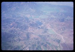
- Description:
- 200 f 5.6
- Subject:
- Valleys, Hills, Mountains, Air travel, and Lakes & ponds
- Series:
- 1-65
- Creator:
- Cushman, Charles W., 1896-1972
- Date Created:
- 1965-03-30
- Genre:
- Aerial photographs and Landscape photographs
- Frame Number:
- 5
- County:
- Los Angeles
- Abstract:
- California Fields north of Los Angeles and Over mountains and fields on way to L.A.
- Call Number:
- P13869
- City:
- Los Angeles
- Country:
- United States
- State/Province:
- California
- Alternate Identifier:
- 165.5
- Persistent URL:
- http://purl.dlib.indiana.edu/iudl/archives/cushman/P13869
- Holding Location:
- Bloomington - University Archives
Wells Library E460
1320 E 10th St.
Bloomington, IN 47405
Contact at archives@indiana.edu, 812-855-1127
-
- Description:
- 100 f 5.6 TL
- Subject:
- Hills, Mountains, Trees, Clear Lake (Lake County, Calif.), and Lakes & ponds
- Series:
- 24-55
- Creator:
- Cushman, Charles W., 1896-1972
- Date Created:
- 1955-08-11
- Genre:
- Landscape photographs
- Frame Number:
- 11
- County:
- Lake
- Abstract:
- Lower lake (view north)
- Call Number:
- P08320
- City:
- Lower Lake
- Country:
- United States
- State/Province:
- California
- Alternate Identifier:
- 2455.11
- Persistent URL:
- http://purl.dlib.indiana.edu/iudl/archives/cushman/P08320
- Holding Location:
- Bloomington - University Archives
Wells Library E460
1320 E 10th St.
Bloomington, IN 47405
Contact at archives@indiana.edu, 812-855-1127
-
- Description:
- 25 f 4.5 POLA
- Subject:
- Red Rocks Amphitheatre, Rock formations, Rocks, Red Rocks Park (Jefferson County, Colo.), Hills, Mountains, Shadows, Clouds, Amphitheaters, Parks, and Boulders
- Series:
- 24-52
- Creator:
- Cushman, Charles W., 1896-1972
- Date Created:
- 1952-10-30
- Genre:
- Landscape photographs
- Frame Number:
- 11
- County:
- Jefferson and Denver
- Abstract:
- View SE and down from Red Rocks Amphitheatre
- Call Number:
- P06342
- City:
- Morrison and Denver
- Country:
- United States
- State/Province:
- Colorado
- Alternate Identifier:
- 2452.11
- Persistent URL:
- http://purl.dlib.indiana.edu/iudl/archives/cushman/P06342
- Holding Location:
- Bloomington - University Archives
Wells Library E460
1320 E 10th St.
Bloomington, IN 47405
Contact at archives@indiana.edu, 812-855-1127
-
- Description:
- 50 mm 1/100 short lens
- Subject:
- Meadows, Diablo, Mount (Calif.), Hills, Mountains, Trees, Utility poles, Roads, and Clouds
- Series:
- 1-56
- Creator:
- Cushman, Charles W., 1896-1972
- Date Created:
- 1956-02-23
- Genre:
- Landscape photographs
- Frame Number:
- 8
- Street Address:
- Norris Canyon Road
- County:
- Contra Costa
- Abstract:
- Mt. Diablo
- Call Number:
- P08537
- Country:
- United States
- State/Province:
- California
- Alternate Identifier:
- 156.8
- Persistent URL:
- http://purl.dlib.indiana.edu/iudl/archives/cushman/P08537
- Holding Location:
- Bloomington - University Archives
Wells Library E460
1320 E 10th St.
Bloomington, IN 47405
Contact at archives@indiana.edu, 812-855-1127
-
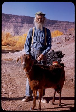
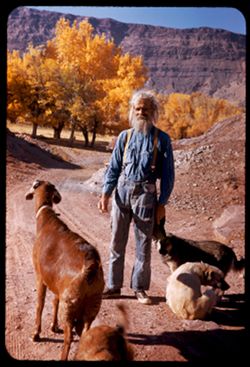
- Description:
- 150 f 6.3 or f 5.6
- Subject:
- Rocks, Hills, Mountains, Men, Trees, Goats, Cliffs, and Dirt roads
- Series:
- 27-52
- Creator:
- Cushman, Charles W., 1896-1972
- Date Created:
- 1952-11-04
- Genre:
- Portraits
- Frame Number:
- 7
- County:
- Grand
- Persons Pictured:
- Holley, Jack W.
- Abstract:
- 1 to 7 - at Jack Holley's abode.
- Call Number:
- P06452
- City:
- Moab
- Country:
- United States
- State/Province:
- Utah
- Alternate Identifier:
- 2752.7
- Persistent URL:
- http://purl.dlib.indiana.edu/iudl/archives/cushman/P06452
- Holding Location:
- Bloomington - University Archives
Wells Library E460
1320 E 10th St.
Bloomington, IN 47405
Contact at archives@indiana.edu, 812-855-1127
-
- Description:
- 100 f 6.3 tel. Lens
- Subject:
- Diablo, Mount (Calif.), Vessels, Streets, Hills, Bodies of water, Mountains, Dwellings, Trees, Buildings, Twin Peaks (San Francisco County, Calif.), Automobi...
- Series:
- 19-55
- Creator:
- Cushman, Charles W., 1896-1972
- Date Created:
- 1955-07-02
- Genre:
- Cityscape photographs
- Frame Number:
- 1
- County:
- San Francisco
- Abstract:
- Mt. Diablo from Twin Peaks
- Call Number:
- P08154
- City:
- San Francisco
- Country:
- United States
- State/Province:
- California
- Physical Description:
- Image was originally mounted in a glass enclosure. Before digitization, the image was removed and placed in a Wess Plastic, Inc. brand, 2" x 2", pl...
- Alternate Identifier:
- 1955.1
- Persistent URL:
- http://purl.dlib.indiana.edu/iudl/archives/cushman/P08154
- Holding Location:
- Bloomington - University Archives
Wells Library E460
1320 E 10th St.
Bloomington, IN 47405
Contact at archives@indiana.edu, 812-855-1127
-
- Description:
- 50 f 8
- Subject:
- Valleys, Hills, Mountains, Lost Mine Trail (Big Bend National Park (Tex.)), Trees, Canyons, National parks & reserves, Big Bend National Park (Tex.), Cli...
- Series:
- 16-51
- Creator:
- Cushman, Charles W., 1896-1972
- Date Created:
- 1951-12-27
- Genre:
- Landscape photographs
- Frame Number:
- 11
- County:
- Brewster
- Abstract:
- Road winds down to The Basin
- Call Number:
- P05430
- Country:
- United States
- State/Province:
- Texas
- Alternate Identifier:
- 1651.11
- Persistent URL:
- http://purl.dlib.indiana.edu/iudl/archives/cushman/P05430
- Holding Location:
- Bloomington - University Archives
Wells Library E460
1320 E 10th St.
Bloomington, IN 47405
Contact at archives@indiana.edu, 812-855-1127
-
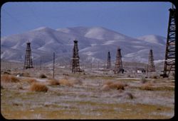
- Description:
- 100 f 5.6 tl
- Subject:
- Valleys, Facilities, Hills, Mountains, Storage tanks, Oil wells, Temblor Range (Calif.), Electric lines, Shrubs, Roads, and Utility poles
- Series:
- 4-55
- Creator:
- Cushman, Charles W., 1896-1972
- Date Created:
- 1955-03-01
- Genre:
- Views
- Frame Number:
- 23
- County:
- Kern
- Abstract:
- View west from Fellows
- Call Number:
- P07650
- City:
- Fellows
- Country:
- United States
- State/Province:
- California
- Alternate Identifier:
- 455.23
- Persistent URL:
- http://purl.dlib.indiana.edu/iudl/archives/cushman/P07650
- Holding Location:
- Bloomington - University Archives
Wells Library E460
1320 E 10th St.
Bloomington, IN 47405
Contact at archives@indiana.edu, 812-855-1127
-
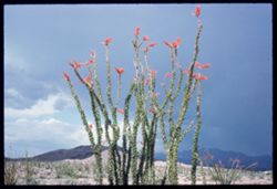
- Description:
- 100 f 13 ?
- Subject:
- Hills, Mountains, Plants, Ocotillo, Deserts, Storms, Flowers, Clouds, and Grasses
- Series:
- 1-66
- Creator:
- Cushman, Charles W., 1896-1972
- Date Created:
- 1966-04-22
- Genre:
- Identification photographs and Landscape photographs
- Frame Number:
- 7
- Street Address:
- United States Highway 66
- County:
- Mohave
- Abstract:
- Ocotillo along U.S. 66- Mojave county
- Call Number:
- P15248
- Country:
- United States
- State/Province:
- Arizona
- Alternate Identifier:
- 166.7
- Persistent URL:
- http://purl.dlib.indiana.edu/iudl/archives/cushman/P15248
- Holding Location:
- Bloomington - University Archives
Wells Library E460
1320 E 10th St.
Bloomington, IN 47405
Contact at archives@indiana.edu, 812-855-1127
-
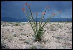
- Description:
- 100 f 12?
- Subject:
- Rocks, Hills, Mountains, Grasses, Ocotillo, Deserts, Storms, Flowers, and Plants
- Series:
- 1-66
- Creator:
- Cushman, Charles W., 1896-1972
- Date Created:
- 1966-04-22
- Genre:
- Identification photographs and Landscape photographs
- Frame Number:
- 8
- Street Address:
- United States Highway 66
- County:
- Mohave
- Abstract:
- Ocotillo along U.S. 66- Mojave county
- Call Number:
- P15249
- Country:
- United States
- State/Province:
- Arizona
- Alternate Identifier:
- 166.8
- Persistent URL:
- http://purl.dlib.indiana.edu/iudl/archives/cushman/P15249
- Holding Location:
- Bloomington - University Archives
Wells Library E460
1320 E 10th St.
Bloomington, IN 47405
Contact at archives@indiana.edu, 812-855-1127
-
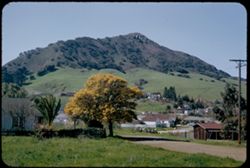
- Description:
- 50 f 5.6
- Subject:
- Buildings, Hills, Mountains, Grasses, Trees, Utility poles, Acacia, Houses, Flowers, Roads, Automobiles, Electric lines, and Shrubs
- Series:
- 8-52
- Creator:
- Cushman, Charles W., 1896-1972
- Date Created:
- 1952-03-02
- Genre:
- Landscape photographs
- Frame Number:
- 37
- County:
- San Luis Obispo
- Abstract:
- San Luis mtn with acacia below
- Call Number:
- P05796
- City:
- San Luis Obispo
- Country:
- United States
- State/Province:
- California
- Alternate Identifier:
- 852.37
- Persistent URL:
- http://purl.dlib.indiana.edu/iudl/archives/cushman/P05796
- Holding Location:
- Bloomington - University Archives
Wells Library E460
1320 E 10th St.
Bloomington, IN 47405
Contact at archives@indiana.edu, 812-855-1127
-
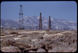
- Description:
- 100 f 5.6 tl
- Subject:
- Oil wells, Storage tanks, Hills, Mountains, Dirt roads, Shrubs, Oil well drilling rigs, and Facilities
- Series:
- 4-55
- Creator:
- Cushman, Charles W., 1896-1972
- Date Created:
- 1955-03-01
- Genre:
- Views
- Frame Number:
- 22
- County:
- Kern
- Abstract:
- 3 derricks with folded hills in background (Hazy)
- Call Number:
- P07649
- City:
- Taft
- Country:
- United States
- State/Province:
- California
- Alternate Identifier:
- 455.22
- Persistent URL:
- http://purl.dlib.indiana.edu/iudl/archives/cushman/P07649
- Holding Location:
- Bloomington - University Archives
Wells Library E460
1320 E 10th St.
Bloomington, IN 47405
Contact at archives@indiana.edu, 812-855-1127
-
- Description:
- 100 f 6.3 tl hf
- Subject:
- Cities & towns, Mountains, Trees, Clouds, Hills, and Plains
- Series:
- 16-58
- Creator:
- Cushman, Charles W., 1896-1972
- Date Created:
- 1958-08-23
- Genre:
- Landscape photographs
- Frame Number:
- 10
- Street Address:
- Redwood Road and Twenty-first South Street
- County:
- Salt Lake
- Abstract:
- Telescope view of Salt Lake City from Redwood and 21st So. St.
- Call Number:
- P10136
- City:
- Salt Lake City
- Country:
- United States
- State/Province:
- Utah
- Alternate Identifier:
- 1658.10
- Persistent URL:
- http://purl.dlib.indiana.edu/iudl/archives/cushman/P10136
- Holding Location:
- Bloomington - University Archives
Wells Library E460
1320 E 10th St.
Bloomington, IN 47405
Contact at archives@indiana.edu, 812-855-1127
-
- Description:
- 100 f 11
- Subject:
- Hills, Roads, Cliffs, Mountains, Shrubs, Trees, and Grasses
- Series:
- 5-62
- Creator:
- Cushman, Charles W., 1896-1972
- Date Created:
- 1962-10-05
- Genre:
- Landscape photographs
- Frame Number:
- 16
- County:
- Coconino
- Abstract:
- East from 6 or 7 mi. west of Sedona
- Call Number:
- P12783
- City:
- Sedona
- Country:
- United States
- State/Province:
- Arizona
- Alternate Identifier:
- 562.16
- Persistent URL:
- http://purl.dlib.indiana.edu/iudl/archives/cushman/P12783
- Holding Location:
- Bloomington - University Archives
Wells Library E460
1320 E 10th St.
Bloomington, IN 47405
Contact at archives@indiana.edu, 812-855-1127
-
- Description:
- 200 f 4.5 tl
- Subject:
- Twin Peaks (San Francisco County, Calif.), Cities & towns, Streets, Hills, Bays (Bodies of water), Trees, Buildings, Diablo, Mount (Calif.), Houses, and ...
- Series:
- 1-56
- Creator:
- Cushman, Charles W., 1896-1972
- Date Created:
- 1956-03-06
- Genre:
- Cityscape photographs
- Frame Number:
- 28
- County:
- San Francisco
- Call Number:
- P08557
- City:
- San Francisco
- Country:
- United States
- State/Province:
- California
- Alternate Identifier:
- 156.28
- Persistent URL:
- http://purl.dlib.indiana.edu/iudl/archives/cushman/P08557
- Holding Location:
- Bloomington - University Archives
Wells Library E460
1320 E 10th St.
Bloomington, IN 47405
Contact at archives@indiana.edu, 812-855-1127
-
- Description:
- 25 f 6.3 POLA
- Subject:
- National parks & reserves, Hot Springs National Park (Ark.), Forests, Fog, Mountains, Trees, Hot Springs Mountain (Ark.), Clouds, and Hills
- Series:
- 12-53
- Creator:
- Cushman, Charles W., 1896-1972
- Date Created:
- 1953-11-12
- Genre:
- Landscape photographs
- Frame Number:
- 10
- County:
- Garland
- Abstract:
- NE from tower
- Call Number:
- P06928
- City:
- Hot Springs
- Country:
- United States
- State/Province:
- Arkansas
- Alternate Identifier:
- 1253.10
- Persistent URL:
- http://purl.dlib.indiana.edu/iudl/archives/cushman/P06928
- Holding Location:
- Bloomington - University Archives
Wells Library E460
1320 E 10th St.
Bloomington, IN 47405
Contact at archives@indiana.edu, 812-855-1127
-
- Subject:
- San Francisco Peaks (Ariz.), Hills, Automobiles, Roads, Bridges, Mountains, Grand Canyon Junction (Ariz.), Shrubs, Snow, Trees, Rocks, Fences, and Masonry
- Series:
- 10-39
- Creator:
- Cushman, Charles W., 1896-1972
- Date Created:
- 1939-12-01
- Genre:
- Landscape photographs
- Frame Number:
- 3
- County:
- Coconino
- Abstract:
- T-3: San Franciscos Pk. from Grand Canyon Junction
- Call Number:
- P01719
- City:
- Flagstaff
- Country:
- United States
- State/Province:
- Arizona
- Physical Description:
- some dye fading. Image was originally mounted in a glass enclosure. Before digitization, the image was removed and placed in a Wess Plastic, Inc. brand, 2&qu...
- Alternate Identifier:
- 1039.3
- Persistent URL:
- http://purl.dlib.indiana.edu/iudl/archives/cushman/P01719
- Holding Location:
- Bloomington - University Archives
Wells Library E460
1320 E 10th St.
Bloomington, IN 47405
Contact at archives@indiana.edu, 812-855-1127
-
- Description:
- 25 f 9
- Subject:
- Plains, Hills, Mountains, Shrubs, Sawtooth Mountain (Tex.), and Davis Mountains State Park (Tex.)
- Series:
- 17-51
- Creator:
- Cushman, Charles W., 1896-1972
- Date Created:
- 1951-12-29
- Genre:
- Landscape photographs
- Frame Number:
- 5
- Street Address:
- Texas State Highway 166 and Loop Texas State Highway 166
- County:
- Jeff Davis
- Abstract:
- Sawtooth Mtn. from SW.
- Call Number:
- P05462
- Country:
- United States
- State/Province:
- Texas
- Alternate Identifier:
- 1751.5
- Persistent URL:
- http://purl.dlib.indiana.edu/iudl/archives/cushman/P05462
- Holding Location:
- Bloomington - University Archives
Wells Library E460
1320 E 10th St.
Bloomington, IN 47405
Contact at archives@indiana.edu, 812-855-1127
-
- Description:
- 100 f 6.3
- Subject:
- Hills, Whitney, Mount (Calif.), Mountains, Sierra Nevada (Calif. and Nev.), Trees, Corcoran, Mount (Calif.), and Le Conte, Mount (Calif.)
- Series:
- 26-55
- Creator:
- Cushman, Charles W., 1896-1972
- Date Created:
- 1955-09-25
- Genre:
- Landscape photographs
- Frame Number:
- 11
- County:
- Inyo
- Abstract:
- And a little further to south (perhaps Mt. Corcoran)
- Call Number:
- P08394
- Country:
- United States
- State/Province:
- California
- Alternate Identifier:
- 2655.11
- Persistent URL:
- http://purl.dlib.indiana.edu/iudl/archives/cushman/P08394
- Holding Location:
- Bloomington - University Archives
Wells Library E460
1320 E 10th St.
Bloomington, IN 47405
Contact at archives@indiana.edu, 812-855-1127
-
- Description:
- 50 f 6.3
- Subject:
- Hills, Mountains, Trees, Tehachapi Mountains (Calif.), Clouds, and Grasses
- Series:
- 16-53
- Creator:
- Cushman, Charles W., 1896-1972
- Date Created:
- 1953-11-23
- Genre:
- Landscape photographs
- Frame Number:
- 22
- County:
- Kern
- Abstract:
- Clouds through Tehachapi Mtns
- Call Number:
- P07094
- City:
- Tehachapi and Bakersfield
- Country:
- United States
- State/Province:
- California
- Alternate Identifier:
- 1653.22
- Persistent URL:
- http://purl.dlib.indiana.edu/iudl/archives/cushman/P07094
- Holding Location:
- Bloomington - University Archives
Wells Library E460
1320 E 10th St.
Bloomington, IN 47405
Contact at archives@indiana.edu, 812-855-1127
-
- Description:
- 100 f 6.3 tl
- Subject:
- Hills, Bodies of water, Mountains, Shrubs, Snow, Trees, Clouds, Fences, Shasta, Mount (Calif. : Mountain), and Grasses
- Series:
- 18-55
- Creator:
- Cushman, Charles W., 1896-1972
- Date Created:
- 1955-06-17
- Genre:
- Landscape photographs
- Frame Number:
- 2
- County:
- Siskiyou
- Abstract:
- Mt. Shasta at 2:35 from road east of Grenada
- Call Number:
- P08119
- City:
- Grenada
- Country:
- United States
- State/Province:
- California
- Alternate Identifier:
- 1855.2
- Persistent URL:
- http://purl.dlib.indiana.edu/iudl/archives/cushman/P08119
- Holding Location:
- Bloomington - University Archives
Wells Library E460
1320 E 10th St.
Bloomington, IN 47405
Contact at archives@indiana.edu, 812-855-1127
-
- Description:
- 100 f 9 TL
- Subject:
- Deserts, Mojave Desert (Calif.), Hills, Mountains, and Tehachapi Mountains (Calif.)
- Series:
- 3-69
- Creator:
- Cushman, Charles W., 1896-1972
- Date Created:
- 1969-03-21
- Genre:
- Landscape photographs
- Frame Number:
- 16
- Street Address:
- California State Highway 14
- County:
- Los Angeles and Kern
- Abstract:
- Toward Tehachapi Mtns from Hwy 14
- Call Number:
- P15768
- City:
- Mojave and Lancaster
- Country:
- United States
- State/Province:
- California
- Alternate Identifier:
- 369.16
- Persistent URL:
- http://purl.dlib.indiana.edu/iudl/archives/cushman/P15768
- Holding Location:
- Bloomington - University Archives
Wells Library E460
1320 E 10th St.
Bloomington, IN 47405
Contact at archives@indiana.edu, 812-855-1127
-
- Description:
- 100 f 9 TL
- Subject:
- Passes (Landforms), Hills, Cajon Pass (Calif.), Shrubs, Trees, Rock formations, Mountains, and Grasses
- Series:
- 2-69
- Creator:
- Cushman, Charles W., 1896-1972
- Date Created:
- 1969-03-14
- Genre:
- Landscape photographs
- Frame Number:
- 17
- County:
- San Bernardino
- Abstract:
- Cajon Pass
- Call Number:
- P15734
- Country:
- United States
- State/Province:
- California
- Alternate Identifier:
- 269.17
- Persistent URL:
- http://purl.dlib.indiana.edu/iudl/archives/cushman/P15734
- Holding Location:
- Bloomington - University Archives
Wells Library E460
1320 E 10th St.
Bloomington, IN 47405
Contact at archives@indiana.edu, 812-855-1127
-
- Description:
- 50 f 9
- Subject:
- National parks & reserves, Deserts, Devils Garden (Grand County, Utah), Hills, Sand, Mountains, Shrubs, Arches National Park (Utah), Wildflowers, Rock fo...
- Series:
- 27-52
- Creator:
- Cushman, Charles W., 1896-1972
- Date Created:
- 1952-11-04
- Genre:
- Landscape photographs
- Frame Number:
- 21
- County:
- Grand
- Abstract:
- En route to Devil's Garden. Sandstone Dunes.
- Call Number:
- P06466
- Country:
- United States
- State/Province:
- Utah
- Alternate Identifier:
- 2752.21
- Persistent URL:
- http://purl.dlib.indiana.edu/iudl/archives/cushman/P06466
- Holding Location:
- Bloomington - University Archives
Wells Library E460
1320 E 10th St.
Bloomington, IN 47405
Contact at archives@indiana.edu, 812-855-1127
-
- Description:
- 100 f 5.6 TL
- Subject:
- Lakes & ponds, Hills, Mountains, Walker Lake (Nev. : Lake), Rocks, and Coastlines
- Series:
- 3-62
- Creator:
- Cushman, Charles W., 1896-1972
- Date Created:
- 1962-09-29
- Genre:
- Landscape photographs
- Frame Number:
- 32
- County:
- Mineral
- Abstract:
- Walker Lake.
- Call Number:
- P12729
- Country:
- United States
- State/Province:
- Nevada
- Alternate Identifier:
- 362.32
- Persistent URL:
- http://purl.dlib.indiana.edu/iudl/archives/cushman/P12729
- Holding Location:
- Bloomington - University Archives
Wells Library E460
1320 E 10th St.
Bloomington, IN 47405
Contact at archives@indiana.edu, 812-855-1127
-
- Description:
- 50 f 5.6 POLA
- Subject:
- Smokestacks, Houses, Smoke, Factories, Copper industry, Copper mining, Mountains, Smelters, Trees, Inspiration Copper Co. (Miami, Ariz.), Grasses, and Hills
- Series:
- 14-53
- Creator:
- Cushman, Charles W., 1896-1972
- Date Created:
- 1953-11-19
- Genre:
- Cityscape photographs
- Frame Number:
- 7
- County:
- Gila
- Abstract:
- Inspiration smelter from south=
- Call Number:
- P07003
- City:
- Miami
- Country:
- United States
- State/Province:
- Arizona
- Alternate Identifier:
- 1453.7
- Persistent URL:
- http://purl.dlib.indiana.edu/iudl/archives/cushman/P07003
- Holding Location:
- Bloomington - University Archives
Wells Library E460
1320 E 10th St.
Bloomington, IN 47405
Contact at archives@indiana.edu, 812-855-1127
-
- Description:
- 100 f 11 SL
- Subject:
- Meadows, Black Mountain (Marin County, Calif.), Hills, Mountains, Trees, Grazing, and Clouds
- Series:
- 1-63
- Creator:
- Cushman, Charles W., 1896-1972
- Date Created:
- 1963-04-09
- Genre:
- Landscape photographs
- Frame Number:
- 12
- County:
- Marin
- Abstract:
- Black Mtn-
- Call Number:
- P12816
- City:
- Point Reyes Station
- Country:
- United States
- State/Province:
- California
- Alternate Identifier:
- 163.12
- Persistent URL:
- http://purl.dlib.indiana.edu/iudl/archives/cushman/P12816
- Holding Location:
- Bloomington - University Archives
Wells Library E460
1320 E 10th St.
Bloomington, IN 47405
Contact at archives@indiana.edu, 812-855-1127
-
- Description:
- 25 f 5.6 POLA
- Subject:
- National parks & reserves, Smokestacks, Hot Springs National Park (Ark.), Smoke, Fog, Mountains, Trees, Buildings, Towers, Hot Springs Mountain (Ark.), C...
- Series:
- 12-53
- Creator:
- Cushman, Charles W., 1896-1972
- Date Created:
- 1953-11-12
- Genre:
- Cityscape photographs
- Frame Number:
- 13
- County:
- Garland
- Abstract:
- Southwest again
- Call Number:
- P06931
- City:
- Hot Springs
- Country:
- United States
- State/Province:
- Arkansas
- Alternate Identifier:
- 1253.13
- Persistent URL:
- http://purl.dlib.indiana.edu/iudl/archives/cushman/P06931
- Holding Location:
- Bloomington - University Archives
Wells Library E460
1320 E 10th St.
Bloomington, IN 47405
Contact at archives@indiana.edu, 812-855-1127
-
- Description:
- 25 f 6.3 Pola
- Subject:
- National parks & reserves, Hills, Colorado National Monument (Colo.), Cliffs, Mountains, Boulders, Rocks, Buttes, Rock formations, Junipers, and Trees
- Series:
- 25-52
- Creator:
- Cushman, Charles W., 1896-1972
- Date Created:
- 1952-11-03
- Genre:
- Landscape photographs
- Frame Number:
- 38
- County:
- Mesa
- Abstract:
- Across juniper tops.
- Call Number:
- P06407
- City:
- Grand Junction
- Country:
- United States
- State/Province:
- Colorado
- Alternate Identifier:
- 2552.38
- Persistent URL:
- http://purl.dlib.indiana.edu/iudl/archives/cushman/P06407
- Holding Location:
- Bloomington - University Archives
Wells Library E460
1320 E 10th St.
Bloomington, IN 47405
Contact at archives@indiana.edu, 812-855-1127
-
- Description:
- 100 f 6.3 tl
- Subject:
- Lakes & ponds, Cities & towns, Hills, Roads, Mountains, Shrubs, Trees, Buildings, Plants, Houses, and Lake Elsinore (Calif.)
- Series:
- 11-59
- Creator:
- Cushman, Charles W., 1896-1972
- Date Created:
- 1959-03-25
- Genre:
- Aerial photographs
- Frame Number:
- 22
- County:
- Riverside
- Abstract:
- L. Elsinore from above
- Call Number:
- P10747
- City:
- Elsinore
- Country:
- United States
- State/Province:
- California
- Alternate Identifier:
- 1159.22
- Persistent URL:
- http://purl.dlib.indiana.edu/iudl/archives/cushman/P10747
- Holding Location:
- Bloomington - University Archives
Wells Library E460
1320 E 10th St.
Bloomington, IN 47405
Contact at archives@indiana.edu, 812-855-1127
-
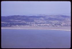
- Description:
- 100 f 5.6 tl
- Subject:
- Pacheco Pass (Calif.), Hills, Mountains, Trees, and Clouds
- Series:
- 2-55
- Creator:
- Cushman, Charles W., 1896-1972
- Date Created:
- 1955-02-25
- Genre:
- Landscape photographs
- Frame Number:
- 1
- County:
- Santa Clara
- Abstract:
- View east from summit of Pacheco Pass
- Call Number:
- P07559
- Country:
- United States
- State/Province:
- California
- Physical Description:
- masked.
- Alternate Identifier:
- 255.1
- Persistent URL:
- http://purl.dlib.indiana.edu/iudl/archives/cushman/P07559
- Holding Location:
- Bloomington - University Archives
Wells Library E460
1320 E 10th St.
Bloomington, IN 47405
Contact at archives@indiana.edu, 812-855-1127
-
- Description:
- 100 f 8 tl
- Subject:
- Plains, Hills, Mountains, Utility poles, and Tom, Mount (Inyo County, Calif.)
- Series:
- 26-55
- Creator:
- Cushman, Charles W., 1896-1972
- Date Created:
- 1955-09-26
- Genre:
- Landscape photographs
- Frame Number:
- 31
- County:
- Inyo
- Abstract:
- Mt. Tom from 4 miles NW of Bishop
- Call Number:
- P08413
- City:
- Bishop
- Country:
- United States
- State/Province:
- California
- Alternate Identifier:
- 2655.31
- Persistent URL:
- http://purl.dlib.indiana.edu/iudl/archives/cushman/P08413
- Holding Location:
- Bloomington - University Archives
Wells Library E460
1320 E 10th St.
Bloomington, IN 47405
Contact at archives@indiana.edu, 812-855-1127
-
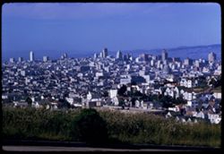
- Description:
- 100 f 8 TL
- Subject:
- Domes, Streets, Hills, Skyscrapers, Roads, Mountains, Shrubs, Buildings, Grasses, Houses, and Dwellings
- Series:
- 12-59
- Creator:
- Cushman, Charles W., 1896-1972
- Date Created:
- 1959-05-10
- Genre:
- Cityscape photographs
- Frame Number:
- 36
- Street Address:
- Clipper Street
- County:
- San Francisco
- Abstract:
- From top of Clipper St.
- Call Number:
- P10798
- City:
- San Francisco
- Country:
- United States
- State/Province:
- California
- Alternate Identifier:
- 1259.36
- Persistent URL:
- http://purl.dlib.indiana.edu/iudl/archives/cushman/P10798
- Holding Location:
- Bloomington - University Archives
Wells Library E460
1320 E 10th St.
Bloomington, IN 47405
Contact at archives@indiana.edu, 812-855-1127
-
- Description:
- 100 f 6.3 tl
- Subject:
- Lakes & ponds, Cities & towns, Houses, Mountains, Trees, Buildings, Lake Elsinore (Calif.), and Hills
- Series:
- 11-59
- Creator:
- Cushman, Charles W., 1896-1972
- Date Created:
- 1959-03-25
- Genre:
- Cityscape photographs
- Frame Number:
- 20
- County:
- Riverside
- Abstract:
- Across Lake Elsinore Toward Elsinore town
- Call Number:
- P10745
- City:
- Elsinore
- Country:
- United States
- State/Province:
- California
- Alternate Identifier:
- 1159.20
- Persistent URL:
- http://purl.dlib.indiana.edu/iudl/archives/cushman/P10745
- Holding Location:
- Bloomington - University Archives
Wells Library E460
1320 E 10th St.
Bloomington, IN 47405
Contact at archives@indiana.edu, 812-855-1127
-
- Description:
- ?
- Subject:
- Dogs, Puppies, Men, Hills, Cliffs, Mountains, Dirt roads, Families, Goats, and Trees
- Series:
- 26-52
- Creator:
- Cushman, Charles W., 1896-1972
- Date Created:
- 1952-11-04
- Genre:
- Portraits
- Frame Number:
- 38
- County:
- Grand
- Persons Pictured:
- Holley, Jack W.
- Abstract:
- Jack W. Holley and family. Dandy, 3 dogs + 1 puppy.
- Call Number:
- P06444
- City:
- Moab
- Country:
- United States
- State/Province:
- Utah
- Alternate Identifier:
- 2652.38
- Persistent URL:
- http://purl.dlib.indiana.edu/iudl/archives/cushman/P06444
- Holding Location:
- Bloomington - University Archives
Wells Library E460
1320 E 10th St.
Bloomington, IN 47405
Contact at archives@indiana.edu, 812-855-1127
-
- Description:
- 100 f 9 tl
- Subject:
- San Jacinto Peak (Calif.), Hills, San Gorgonio Mountain (Calif.), Sand, Mountains, Shrubs, and Snow
- Series:
- 11-59
- Creator:
- Cushman, Charles W., 1896-1972
- Date Created:
- 1959-03-25
- Genre:
- Landscape photographs
- Frame Number:
- 16
- County:
- Riverside
- Abstract:
- San Jacinto mtn thru watch in bown foothills
- Call Number:
- P10741
- Country:
- United States
- State/Province:
- California
- Alternate Identifier:
- 1159.16
- Persistent URL:
- http://purl.dlib.indiana.edu/iudl/archives/cushman/P10741
- Holding Location:
- Bloomington - University Archives
Wells Library E460
1320 E 10th St.
Bloomington, IN 47405
Contact at archives@indiana.edu, 812-855-1127
-
- Description:
- 100 f 5.6 tl
- Subject:
- Cities & towns, Storage tanks, Hills, Bodies of water, Birds, Mountains, Utility poles, Trees, Piers & wharves, Coastlines, Boats, and Dwellings
- Series:
- 5-55
- Creator:
- Cushman, Charles W., 1896-1972
- Date Created:
- 1955-03-10
- Genre:
- Marine photographs
- Frame Number:
- 18
- County:
- Marin
- Abstract:
- South point of Tiburon Has strip of .7 but is correct at it
- Call Number:
- P07683
- City:
- Tiburon
- Country:
- United States
- State/Province:
- California
- Alternate Identifier:
- 555.18
- Persistent URL:
- http://purl.dlib.indiana.edu/iudl/archives/cushman/P07683
- Holding Location:
- Bloomington - University Archives
Wells Library E460
1320 E 10th St.
Bloomington, IN 47405
Contact at archives@indiana.edu, 812-855-1127
-

- Description:
- 25 f 14
- Subject:
- Deserts, Amargosa Range (Nev. and Calif.), Valleys, Hills, Death Valley (Calif. and Nev.), Cliffs, Mountains, Shrubs, Rocks, Canyons, and Desolation Canyon (...
- Series:
- 15-52
- Creator:
- Cushman, Charles W., 1896-1972
- Date Created:
- 1952-04-09
- Genre:
- Landscape photographs
- Frame Number:
- 21
- Street Address:
- Bad Water Road
- County:
- Inyo
- Abstract:
- Approx. same.
- Call Number:
- P06041
- City:
- Furnace Creek
- Country:
- United States
- State/Province:
- California
- Alternate Identifier:
- 1552.21
- Persistent URL:
- http://purl.dlib.indiana.edu/iudl/archives/cushman/P06041
- Holding Location:
- Bloomington - University Archives
Wells Library E460
1320 E 10th St.
Bloomington, IN 47405
Contact at archives@indiana.edu, 812-855-1127
-
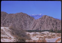
- Description:
- 50 f 11 haze filter
- Subject:
- Valleys, San Jacinto Mountains (Calif.), Hills, Coachella Valley (Calif.), and Mountains
- Series:
- 24-61
- Creator:
- Cushman, Charles W., 1896-1972
- Date Created:
- 1961-12-27
- Genre:
- Landscape photographs
- Frame Number:
- 8
- Street Address:
- California State Highway 74
- County:
- Riverside
- Abstract:
- Looking down into Coachella Valley from ht of rd. 74
- Call Number:
- P12574
- Country:
- United States
- State/Province:
- California
- Alternate Identifier:
- 2461.8
- Persistent URL:
- http://purl.dlib.indiana.edu/iudl/archives/cushman/P12574
- Holding Location:
- Bloomington - University Archives
Wells Library E460
1320 E 10th St.
Bloomington, IN 47405
Contact at archives@indiana.edu, 812-855-1127
-
- Description:
- 100 f ? TL
- Subject:
- Valleys, Hills, Sneffels, Mount (Colo.), Forests, San Juan Mountains (Colo. and N.M.), Mountains, Hay, Trees, and Snow
- Series:
- 35-65
- Creator:
- Cushman, Charles W., 1896-1972
- Date Created:
- 1965-10-05
- Genre:
- Landscape photographs
- Frame Number:
- 34
- Street Address:
- Colorado State Highway 62
- County:
- Ouray
- Abstract:
- Mt. Sneffels (14,150') seen from Colo. Hwy 62 NW of Ouray.
- Call Number:
- P15064
- City:
- Ouray
- Country:
- United States
- State/Province:
- Colorado
- Alternate Identifier:
- 3565.34
- Persistent URL:
- http://purl.dlib.indiana.edu/iudl/archives/cushman/P15064
- Holding Location:
- Bloomington - University Archives
Wells Library E460
1320 E 10th St.
Bloomington, IN 47405
Contact at archives@indiana.edu, 812-855-1127
-
- Description:
- 100 f 8 TL HF
- Subject:
- Hills, Mountains, Trees, Clouds, and Fences
- Series:
- 11-58
- Creator:
- Cushman, Charles W., 1896-1972
- Date Created:
- 1958-06-15
- Genre:
- Landscape photographs and Views
- Frame Number:
- 37
- County:
- Boise
- Abstract:
- Horseshoe Bend from south
- Call Number:
- P10012
- City:
- Horseshoe Bend
- Country:
- United States
- State/Province:
- Idaho
- Alternate Identifier:
- 1158.37
- Persistent URL:
- http://purl.dlib.indiana.edu/iudl/archives/cushman/P10012
- Holding Location:
- Bloomington - University Archives
Wells Library E460
1320 E 10th St.
Bloomington, IN 47405
Contact at archives@indiana.edu, 812-855-1127
-
- Description:
- 50 f 9
- Subject:
- Hills, Mountains, Trees, and Grasses
- Series:
- 9-53
- Creator:
- Cushman, Charles W., 1896-1972
- Date Created:
- 1953-10-11
- Genre:
- Landscape photographs
- Frame Number:
- 17
- Street Address:
- United States Highway 50
- County:
- Utah
- Abstract:
- Up at mtn 4 mi w of Thistle.
- Call Number:
- P06818
- City:
- Thistle
- Country:
- United States
- State/Province:
- Utah
- Alternate Identifier:
- 953.17
- Persistent URL:
- http://purl.dlib.indiana.edu/iudl/archives/cushman/P06818
- Holding Location:
- Bloomington - University Archives
Wells Library E460
1320 E 10th St.
Bloomington, IN 47405
Contact at archives@indiana.edu, 812-855-1127
-
- Description:
- 100 f 5.6 TL
- Subject:
- Croplands, Houses, Automobiles, Roads, Mountains, Trees, Cemeteries, and Hills
- Series:
- 2-60
- Creator:
- Cushman, Charles W., 1896-1972
- Date Created:
- 1960-03-10
- Genre:
- Landscape photographs
- Frame Number:
- 18
- County:
- San Mateo
- Abstract:
- Little cemetary under hill
- Call Number:
- P10949
- City:
- Pescadero
- Country:
- United States
- State/Province:
- California
- Alternate Identifier:
- 260.18
- Persistent URL:
- http://purl.dlib.indiana.edu/iudl/archives/cushman/P10949
- Holding Location:
- Bloomington - University Archives
Wells Library E460
1320 E 10th St.
Bloomington, IN 47405
Contact at archives@indiana.edu, 812-855-1127
-
- Description:
- 100 f 5 tl
- Subject:
- Hills, Roads, Mountains, Trees, Buildings, Clouds, and Greenhorn Mountains (Calif.)
- Series:
- 2-55
- Creator:
- Cushman, Charles W., 1896-1972
- Date Created:
- 1955-02-26
- Genre:
- Landscape photographs
- Frame Number:
- 3
- Street Address:
- California State Highway 178
- County:
- Kern
- Abstract:
- From pt. 12 mi E of Bakersfield view east toward Greenhorn Mtns
- Call Number:
- P07561
- City:
- Bakersfield
- Country:
- United States
- State/Province:
- California
- Alternate Identifier:
- 255.3
- Persistent URL:
- http://purl.dlib.indiana.edu/iudl/archives/cushman/P07561
- Holding Location:
- Bloomington - University Archives
Wells Library E460
1320 E 10th St.
Bloomington, IN 47405
Contact at archives@indiana.edu, 812-855-1127
-
- Description:
- 25 f 11
- Subject:
- Noon, National parks & reserves, Pulliam Peak (Tex.), Canyons, Valleys, Hills, Cliffs, Big Bend National Park (Tex.), Mountains, Shrubs, Trees, Basin (Bi...
- Series:
- 16-51
- Creator:
- Cushman, Charles W., 1896-1972
- Date Created:
- 1951-12-27
- Genre:
- Landscape photographs
- Frame Number:
- 5
- County:
- Brewster
- Abstract:
- Great bold front of Pulliam Pk. From Green gulch from south
- Call Number:
- P05424
- Country:
- United States
- State/Province:
- Texas
- Alternate Identifier:
- 1651.5
- Persistent URL:
- http://purl.dlib.indiana.edu/iudl/archives/cushman/P05424
- Holding Location:
- Bloomington - University Archives
Wells Library E460
1320 E 10th St.
Bloomington, IN 47405
Contact at archives@indiana.edu, 812-855-1127
-
- Description:
- 100 f 8 tl
- Subject:
- Deserts, Hills, Mountains, Picketpost Mountain (Ariz.), and Cactus
- Series:
- 10-59
- Creator:
- Cushman, Charles W., 1896-1972
- Date Created:
- 1959-02-27
- Frame Number:
- 1
- County:
- Pinal
- Abstract:
- Pickett Post Mtn.
- Call Number:
- P10689
- City:
- Superior
- Country:
- United States
- State/Province:
- Arizona
- Alternate Identifier:
- 1059.1
- Persistent URL:
- http://purl.dlib.indiana.edu/iudl/archives/cushman/P10689
- Holding Location:
- Bloomington - University Archives
Wells Library E460
1320 E 10th St.
Bloomington, IN 47405
Contact at archives@indiana.edu, 812-855-1127
-
- Description:
- 50 f 6.3
- Subject:
- Lakes & ponds, Tree limbs, Hills, Forests, Mountains, Shrubs, Piers & wharves, and Tahoe, Lake (Calif. and Nev.)
- Series:
- 28-52
- Creator:
- Cushman, Charles W., 1896-1972
- Date Created:
- 1952-11-08
- Genre:
- Landscape photographs
- Frame Number:
- 21
- Abstract:
- Lake Tahoe.
- Call Number:
- P06505
- Country:
- United States
- State/Province:
- Nevada and California
- Alternate Identifier:
- 2852.21
- Persistent URL:
- http://purl.dlib.indiana.edu/iudl/archives/cushman/P06505
- Holding Location:
- Bloomington - University Archives
Wells Library E460
1320 E 10th St.
Bloomington, IN 47405
Contact at archives@indiana.edu, 812-855-1127
-

- Description:
- 25 f 9 Pola
- Subject:
- Deserts, Valleys, Hills, Death Valley (Calif. and Nev.), Mountains, Colored mountains, Rocks, Rock formations, and Black Mountains (Inyo County, Calif.)
- Series:
- 15-52
- Creator:
- Cushman, Charles W., 1896-1972
- Date Created:
- 1952-04-09
- Genre:
- Landscape photographs
- Frame Number:
- 23
- County:
- Inyo
- Abstract:
- Colored Mtns. The Black Mtns.
- Call Number:
- P06043
- Country:
- United States
- State/Province:
- California
- Alternate Identifier:
- 1552.23
- Persistent URL:
- http://purl.dlib.indiana.edu/iudl/archives/cushman/P06043
- Holding Location:
- Bloomington - University Archives
Wells Library E460
1320 E 10th St.
Bloomington, IN 47405
Contact at archives@indiana.edu, 812-855-1127
-
- Description:
- 100 f 11
- Subject:
- Lakes & ponds, Black Mountain (Marin County, Calif.), Hills, Mountains, Coastlines, Clouds, and Grasses
- Series:
- 27-65
- Creator:
- Cushman, Charles W., 1896-1972
- Date Created:
- 1965-07-26
- Genre:
- Landscape photographs
- Frame Number:
- 1
- County:
- Marin
- Abstract:
- Hopi Pt. and Black Mtn. Western Marin
- Call Number:
- P14800
- Country:
- United States
- State/Province:
- California
- Alternate Identifier:
- 2765.1
- Persistent URL:
- http://purl.dlib.indiana.edu/iudl/archives/cushman/P14800
- Holding Location:
- Bloomington - University Archives
Wells Library E460
1320 E 10th St.
Bloomington, IN 47405
Contact at archives@indiana.edu, 812-855-1127
-
- Description:
- 100 f 6 tl
- Subject:
- Croplands, Hills, Saint Helena, Mount (Calif.), Mountains, Shrubs, Trees, Plants, and Clouds
- Series:
- 15-55
- Creator:
- Cushman, Charles W., 1896-1972
- Date Created:
- 1955-05-17
- Genre:
- Landscape photographs
- Frame Number:
- 15
- Street Address:
- California State Highway 29
- County:
- Napa
- Abstract:
- Mt. St Helena from Hwy. 29 4 mi. so. of Calistoga
- Call Number:
- P08023
- City:
- Calistoga
- Country:
- United States
- State/Province:
- California
- Alternate Identifier:
- 1555.15
- Persistent URL:
- http://purl.dlib.indiana.edu/iudl/archives/cushman/P08023
- Holding Location:
- Bloomington - University Archives
Wells Library E460
1320 E 10th St.
Bloomington, IN 47405
Contact at archives@indiana.edu, 812-855-1127
-
- Description:
- 100 f 11 tl
- Subject:
- Hills, Mountains, Dwellings, Trees, Buildings, Rock formations, Parks, Bays (Bodies of water), and Buena Vista Park (San Francisco, Calif.)
- Series:
- 27-65
- Creator:
- Cushman, Charles W., 1896-1972
- Date Created:
- 1965-07-27
- Genre:
- Cityscape photographs
- Frame Number:
- 19
- County:
- San Francisco
- Abstract:
- South from Buena Vista
- Call Number:
- P14818
- City:
- San Francisco
- Country:
- United States
- State/Province:
- California
- Alternate Identifier:
- 2765.19
- Persistent URL:
- http://purl.dlib.indiana.edu/iudl/archives/cushman/P14818
- Holding Location:
- Bloomington - University Archives
Wells Library E460
1320 E 10th St.
Bloomington, IN 47405
Contact at archives@indiana.edu, 812-855-1127
-
- Description:
- 50 f 9
- Subject:
- Whetstone Mountains (Ariz.), Hills, Oaks, Live oak, Trees, and Mountains
- Series:
- 2-52
- Creator:
- Cushman, Charles W., 1896-1972
- Date Created:
- 1952-01-14
- Genre:
- Landscape photographs
- Frame Number:
- 37
- Street Address:
- Arizona State Highway 83
- Abstract:
- Live oak-tow colored valley and distant mtns from Hwy 83.
- Call Number:
- P05567
- Country:
- United States
- State/Province:
- Arizona
- Alternate Identifier:
- 252.37
- Persistent URL:
- http://purl.dlib.indiana.edu/iudl/archives/cushman/P05567
- Holding Location:
- Bloomington - University Archives
Wells Library E460
1320 E 10th St.
Bloomington, IN 47405
Contact at archives@indiana.edu, 812-855-1127
-
- Description:
- 100 f 8 tl
- Subject:
- Red Hill (Kern County, Calif.), Hills, Mountains, Shrubs, Sierra Nevada (Calif. and Nev.), Rocks, Jawbone Canyon (Calif.), Wagon Wheel Mountain (Calif.), and...
- Series:
- 7-55
- Creator:
- Cushman, Charles W., 1896-1972
- Date Created:
- 1955-03-21
- Genre:
- Landscape photographs
- Frame Number:
- 14
- Street Address:
- Randsburg Road and United States Highway 6
- County:
- Kern
- Abstract:
- Colorful mtns along US 6 2 mi. south of Wagon Wheel at turn off to Randsburg west of Red Hill
- Call Number:
- P07738
- Country:
- United States
- State/Province:
- California
- Alternate Identifier:
- 755.14
- Persistent URL:
- http://purl.dlib.indiana.edu/iudl/archives/cushman/P07738
- Holding Location:
- Bloomington - University Archives
Wells Library E460
1320 E 10th St.
Bloomington, IN 47405
Contact at archives@indiana.edu, 812-855-1127
-
- Description:
- 25 f 12
- Subject:
- Meadows, Hills, Ranches, Roads, Bridges, Mountains, Utility poles, Trees, Buttes, Grasses, White House Ranch (Colorado Springs, Colo.), Houses, Garden of the...
- Series:
- 21-52
- Creator:
- Cushman, Charles W., 1896-1972
- Date Created:
- 1952-10-27
- Genre:
- Landscape photographs
- Frame Number:
- 14
- County:
- El Paso
- Abstract:
- Across White House Ranch to Garden of Gods
- Call Number:
- P06245
- City:
- Colorado Springs
- Country:
- United States
- State/Province:
- Colorado
- Alternate Identifier:
- 2152.14
- Persistent URL:
- http://purl.dlib.indiana.edu/iudl/archives/cushman/P06245
- Holding Location:
- Bloomington - University Archives
Wells Library E460
1320 E 10th St.
Bloomington, IN 47405
Contact at archives@indiana.edu, 812-855-1127
-
- Description:
- 125 f 4.5
- Subject:
- Horseback riding, Guards, Horses, Men, Hills, Border patrols, Boquillas Canyon (Big Bend National Park (Tex.)), Cliffs, Mountains, Shrubs, Cactus, Mounted po...
- Series:
- 16-51
- Creator:
- Cushman, Charles W., 1896-1972
- Date Created:
- 1951-12-27
- Genre:
- Portraits
- Frame Number:
- 17
- County:
- Brewster
- Abstract:
- Border patrol near Boquillas.
- Call Number:
- P05436
- Country:
- United States
- State/Province:
- Texas
- Alternate Identifier:
- 1651.17
- Persistent URL:
- http://purl.dlib.indiana.edu/iudl/archives/cushman/P05436
- Holding Location:
- Bloomington - University Archives
Wells Library E460
1320 E 10th St.
Bloomington, IN 47405
Contact at archives@indiana.edu, 812-855-1127
-
- Description:
- 50 f 9
- Subject:
- Flowers, Hills, Roads, Mountains, Shrubs, Sierra Nevada (Calif. and Nev.), Trees, Rocks, and Grasses
- Series:
- 11-54
- Creator:
- Cushman, Charles W., 1896-1972
- Date Created:
- 1954-09-17
- Genre:
- Landscape photographs
- Frame Number:
- 5
- Street Address:
- Sabrina Lake Road
- County:
- Inyo
- Abstract:
- High Sierra seen from Sabrina Lake road SW of Bishop.
- Call Number:
- P07374
- City:
- Bishop
- Country:
- United States
- State/Province:
- California
- Alternate Identifier:
- 1154.5
- Persistent URL:
- http://purl.dlib.indiana.edu/iudl/archives/cushman/P07374
- Holding Location:
- Bloomington - University Archives
Wells Library E460
1320 E 10th St.
Bloomington, IN 47405
Contact at archives@indiana.edu, 812-855-1127
-
- Description:
- 25 f 11
- Subject:
- Noon, Hills, Cliffs, Franklin Mountains (Tex. and N.M.), Mountains, and Shrubs
- Series:
- 17-51
- Creator:
- Cushman, Charles W., 1896-1972
- Date Created:
- 1952-01-01
- Genre:
- Landscape photographs
- Frame Number:
- 28
- County:
- El Paso
- Abstract:
- Mtns. at noon.
- Call Number:
- P05479
- City:
- El Paso
- Country:
- United States
- State/Province:
- Texas
- Alternate Identifier:
- 1751.28
- Persistent URL:
- http://purl.dlib.indiana.edu/iudl/archives/cushman/P05479
- Holding Location:
- Bloomington - University Archives
Wells Library E460
1320 E 10th St.
Bloomington, IN 47405
Contact at archives@indiana.edu, 812-855-1127
-
- Description:
- 25 f 6 Pola
- Subject:
- Hills, Fog, Pacific Ocean, Mountains, Pacific Coast (Calif.), Shrubs, Trees, and Grasses
- Series:
- 12-52
- Creator:
- Cushman, Charles W., 1896-1972
- Date Created:
- 1952-03-28
- Genre:
- Landscape photographs
- Frame Number:
- 13
- Street Address:
- Skyline Drive
- County:
- San Francisco and San Mateo
- Abstract:
- Fog bank moving in across mtns. South of S.F. = view is NW from Skyline Dr. above San Mateo.
- Call Number:
- P05920
- City:
- San Francisco and San Mateo
- Country:
- United States
- State/Province:
- California
- Alternate Identifier:
- 1252.13
- Persistent URL:
- http://purl.dlib.indiana.edu/iudl/archives/cushman/P05920
- Holding Location:
- Bloomington - University Archives
Wells Library E460
1320 E 10th St.
Bloomington, IN 47405
Contact at archives@indiana.edu, 812-855-1127
-
- Description:
- 100 f 4.5 tl
- Subject:
- Redwood Creek (Humboldt County, Calif.), Hills, Roads, Mountains, Trees, Clouds, and Berry Summit (Calif.)
- Series:
- 16-55
- Creator:
- Cushman, Charles W., 1896-1972
- Date Created:
- 1955-06-15
- Genre:
- Landscape photographs
- Frame Number:
- 8
- Street Address:
- United States Highway 299
- County:
- Humboldt
- Abstract:
- 65423 mi. Looking across Redwood Creek Valley from up road toward Berry Summit
- Call Number:
- P08053
- Country:
- United States
- State/Province:
- California
- Alternate Identifier:
- 1655.8
- Persistent URL:
- http://purl.dlib.indiana.edu/iudl/archives/cushman/P08053
- Holding Location:
- Bloomington - University Archives
Wells Library E460
1320 E 10th St.
Bloomington, IN 47405
Contact at archives@indiana.edu, 812-855-1127
-
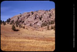
- Description:
- 25 f 11
- Subject:
- Rocky Mountains, Hills, Barbed wire, Mountains, Boulders, Rock formations, Fences, Trees, and Grasses
- Series:
- 22-52
- Creator:
- Cushman, Charles W., 1896-1972
- Date Created:
- 1952-10-27
- Genre:
- Landscape photographs
- Frame Number:
- 23
- Street Address:
- Colorado State Highway 143
- County:
- Teller
- Abstract:
- And to the left, this scene-the Rock is truly overlapped
- Call Number:
- P06277
- City:
- Cripple Creek and Florissant
- Country:
- United States
- State/Province:
- Colorado
- Physical Description:
- masked.
- Alternate Identifier:
- 2252.23
- Persistent URL:
- http://purl.dlib.indiana.edu/iudl/archives/cushman/P06277
- Holding Location:
- Bloomington - University Archives
Wells Library E460
1320 E 10th St.
Bloomington, IN 47405
Contact at archives@indiana.edu, 812-855-1127
-

- Description:
- 100 f 5.6 tl
- Subject:
- Canyons, Hills, Mountains, and Cajon Canyon (Calif.)
- Series:
- 6-57
- Creator:
- Cushman, Charles W., 1896-1972
- Date Created:
- 1957-05-14
- Genre:
- Landscape photographs
- Frame Number:
- 35
- County:
- San Bernardino
- Abstract:
- In Cajon Canyon
- Call Number:
- P09277
- Country:
- United States
- State/Province:
- California
- Alternate Identifier:
- 657.35
- Persistent URL:
- http://purl.dlib.indiana.edu/iudl/archives/cushman/P09277
- Holding Location:
- Bloomington - University Archives
Wells Library E460
1320 E 10th St.
Bloomington, IN 47405
Contact at archives@indiana.edu, 812-855-1127
-

- Description:
- 50 f 9
- Subject:
- Hills, Roads, Whitney, Mount (Calif.), Mountains, Shrubs, Sierra Nevada (Calif. and Nev.), Trees, Rocks, Fences, Snow, Boulders, and Buildings
- Series:
- 14-52
- Creator:
- Cushman, Charles W., 1896-1972
- Date Created:
- 1952-04-08
- Genre:
- Landscape photographs
- Frame Number:
- 18
- County:
- Inyo
- Abstract:
- Mt. Whitney at dead center.
- Call Number:
- P06002
- Country:
- United States
- State/Province:
- California
- Alternate Identifier:
- 1452.18
- Persistent URL:
- http://purl.dlib.indiana.edu/iudl/archives/cushman/P06002
- Holding Location:
- Bloomington - University Archives
Wells Library E460
1320 E 10th St.
Bloomington, IN 47405
Contact at archives@indiana.edu, 812-855-1127
-
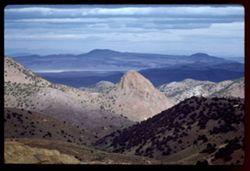
- Description:
- 100 f 8 TL
- Subject:
- Hills, Mountains, Shrubs, and Clouds
- Series:
- 3-62
- Creator:
- Cushman, Charles W., 1896-1972
- Date Created:
- 1962-09-28
- Genre:
- Landscape photographs
- Frame Number:
- 20
- County:
- Storey
- Abstract:
- View east from Va. Cy.
- Call Number:
- P12718
- City:
- Virginia City
- Country:
- United States
- State/Province:
- Nevada
- Alternate Identifier:
- 362.20
- Persistent URL:
- http://purl.dlib.indiana.edu/iudl/archives/cushman/P12718
- Holding Location:
- Bloomington - University Archives
Wells Library E460
1320 E 10th St.
Bloomington, IN 47405
Contact at archives@indiana.edu, 812-855-1127
-
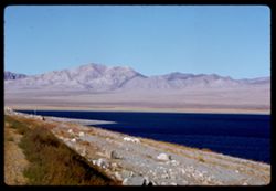
- Description:
- 100 f 8 TL
- Subject:
- Lakes & ponds, Hills, Mountains, Walker Lake (Nev. : Lake), Rocks, Coastlines, and Grasses
- Series:
- 3-62
- Creator:
- Cushman, Charles W., 1896-1972
- Date Created:
- 1962-09-29
- Genre:
- Landscape photographs
- Frame Number:
- 35
- County:
- Mineral
- Abstract:
- Walker Lake.
- Call Number:
- P12732
- Country:
- United States
- State/Province:
- Nevada
- Alternate Identifier:
- 362.35
- Persistent URL:
- http://purl.dlib.indiana.edu/iudl/archives/cushman/P12732
- Holding Location:
- Bloomington - University Archives
Wells Library E460
1320 E 10th St.
Bloomington, IN 47405
Contact at archives@indiana.edu, 812-855-1127
-
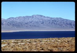
- Description:
- 100 f 8 TL
- Subject:
- Lakes & ponds, Hills, Mountains, Walker Lake (Nev. : Lake), Coastlines, and Grasses
- Series:
- 3-62
- Creator:
- Cushman, Charles W., 1896-1972
- Date Created:
- 1962-09-29
- Genre:
- Landscape photographs
- Frame Number:
- 31
- County:
- Mineral
- Abstract:
- Walker Lake.
- Call Number:
- P12728
- Country:
- United States
- State/Province:
- Nevada
- Alternate Identifier:
- 362.31
- Persistent URL:
- http://purl.dlib.indiana.edu/iudl/archives/cushman/P12728
- Holding Location:
- Bloomington - University Archives
Wells Library E460
1320 E 10th St.
Bloomington, IN 47405
Contact at archives@indiana.edu, 812-855-1127
-
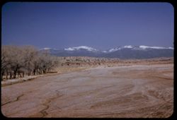
- Description:
- 50 f 6.3 Pola
- Subject:
- Snow, Rio Grande, Trees, Mountains, Sangre de Cristo Mountains (Colo. and N.M.), Hills, Rivers, and Cliffs
- Series:
- 18-52
- Creator:
- Cushman, Charles W., 1896-1972
- Date Created:
- 1952-04-15
- Genre:
- Landscape photographs
- Frame Number:
- 30
- County:
- Santa Fe
- Abstract:
- Highest of Sangre de Cristo.
- Call Number:
- P06161
- City:
- Santa Fe and Pojoaque
- Country:
- United States
- State/Province:
- New Mexico
- Alternate Identifier:
- 1852.30
- Persistent URL:
- http://purl.dlib.indiana.edu/iudl/archives/cushman/P06161
- Holding Location:
- Bloomington - University Archives
Wells Library E460
1320 E 10th St.
Bloomington, IN 47405
Contact at archives@indiana.edu, 812-855-1127
-
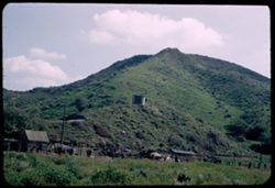
- Description:
- 25 f 9
- Subject:
- Boundaries, Automobiles, Trees, Pacific Ocean, Mexican border, Mountains, Buildings, Shrubs, Water tanks, Hills, Utility poles, Mexican-American Border Regio...
- Series:
- 6-52
- Creator:
- Cushman, Charles W., 1896-1972
- Date Created:
- 1952-02-10
- Genre:
- Landscape photographs
- Frame Number:
- 7
- County:
- San Diego
- Abstract:
- Green mountain side on US side Mexican border a mile or two from ocean
- Call Number:
- P05690
- Country:
- United States
- State/Province:
- California
- Alternate Identifier:
- 652.7
- Persistent URL:
- http://purl.dlib.indiana.edu/iudl/archives/cushman/P05690
- Holding Location:
- Bloomington - University Archives
Wells Library E460
1320 E 10th St.
Bloomington, IN 47405
Contact at archives@indiana.edu, 812-855-1127
-
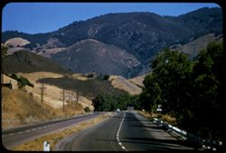
- Description:
- 100 f 6.3
- Subject:
- Roads, Cuesta Pass (Calif.), Trees, Meadows, Mountains, Passes (Landforms), Utility poles, and Hills
- Series:
- 14-57
- Creator:
- Cushman, Charles W., 1896-1972
- Date Created:
- 1957-09-19
- Genre:
- Landscape photographs
- Frame Number:
- 7
- Street Address:
- United States Highway 101
- County:
- San Luis Obispo
- Abstract:
- View north up Cuesta Grade
- Call Number:
- P09506
- Country:
- United States
- State/Province:
- California
- Alternate Identifier:
- 1457.7
- Persistent URL:
- http://purl.dlib.indiana.edu/iudl/archives/cushman/P09506
- Holding Location:
- Bloomington - University Archives
Wells Library E460
1320 E 10th St.
Bloomington, IN 47405
Contact at archives@indiana.edu, 812-855-1127
-
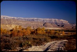
- Description:
- 25 f 6.3 Pola
- Subject:
- Reserva de la Biosfera Santa Elena-Sierra del Carmen (Mexico), Cliffs, Dirt roads, Trails & paths, Trees, Mountains, National parks & reserves, Hills...
- Series:
- 16-51
- Creator:
- Cushman, Charles W., 1896-1972
- Date Created:
- 1951-12-27
- Genre:
- Landscape photographs
- Frame Number:
- 19
- County:
- Brewster
- Abstract:
- Across to Boquillas.
- Call Number:
- P05438
- Country:
- United States and Mexico
- State/Province:
- Texas
- Alternate Identifier:
- 1651.19
- Persistent URL:
- http://purl.dlib.indiana.edu/iudl/archives/cushman/P05438
- Holding Location:
- Bloomington - University Archives
Wells Library E460
1320 E 10th St.
Bloomington, IN 47405
Contact at archives@indiana.edu, 812-855-1127
-
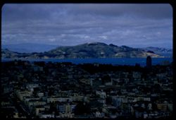
- Description:
- 100 f 5.6 tl
- Subject:
- Bodies of water, Angel Island (Calif.), Trees, Coastlines, Streets, Mountains, Buildings, Clouds, Vehicles, Islands, Dwellings, Hills, and Buena Vista Park (...
- Series:
- 5-55
- Creator:
- Cushman, Charles W., 1896-1972
- Date Created:
- 1955-03-12
- Genre:
- Cityscape photographs
- Frame Number:
- 21
- County:
- San Francisco
- Abstract:
- Toward Angel Island were out too far to left and had to be remounted
- Call Number:
- P07686
- City:
- San Francisco
- Country:
- United States
- State/Province:
- California
- Alternate Identifier:
- 555.21
- Persistent URL:
- http://purl.dlib.indiana.edu/iudl/archives/cushman/P07686
- Holding Location:
- Bloomington - University Archives
Wells Library E460
1320 E 10th St.
Bloomington, IN 47405
Contact at archives@indiana.edu, 812-855-1127
-
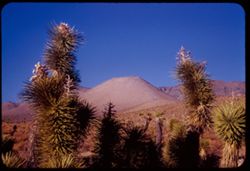
- Description:
- 25 f 13
- Subject:
- Deserts, Mojave Desert (Calif.), Walker Pass (Calif.), Joshua trees, Mountains, Shrubs, and Hills
- Series:
- 12-54
- Creator:
- Cushman, Charles W., 1896-1972
- Date Created:
- 1954-09-18
- Genre:
- Identification photographs
- Frame Number:
- 30
- Street Address:
- California State Highway 178 and Walker Pass Road
- County:
- Kern
- Abstract:
- Joshua trees along Walker Pass Rd.
- Call Number:
- P07420
- Country:
- United States
- State/Province:
- California
- Alternate Identifier:
- 1254.30
- Persistent URL:
- http://purl.dlib.indiana.edu/iudl/archives/cushman/P07420
- Holding Location:
- Bloomington - University Archives
Wells Library E460
1320 E 10th St.
Bloomington, IN 47405
Contact at archives@indiana.edu, 812-855-1127
-
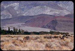
- Description:
- 100 f 6.3 tl
- Subject:
- Grasses, Trees, Owens Valley (Calif.), Mountains, Land, Hills, and Inyo Mountains (Calif.)
- Series:
- 26-55
- Creator:
- Cushman, Charles W., 1896-1972
- Date Created:
- 1955-09-25
- Genre:
- Landscape photographs
- Frame Number:
- 19
- County:
- Inyo
- Abstract:
- Red mount at foothills of Inyo Mtns
- Call Number:
- P08402
- City:
- Big Pine
- Country:
- United States
- State/Province:
- California
- Alternate Identifier:
- 2655.19
- Persistent URL:
- http://purl.dlib.indiana.edu/iudl/archives/cushman/P08402
- Holding Location:
- Bloomington - University Archives
Wells Library E460
1320 E 10th St.
Bloomington, IN 47405
Contact at archives@indiana.edu, 812-855-1127
-
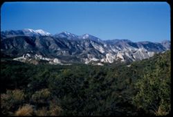
- Description:
- 50 f 8
- Subject:
- Rocks, Grasses, Trees, Cajon Pass (Calif.), Passes (Landforms), San Gabriel Mountains (Calif.), Mountains, and Hills
- Series:
- 16-53
- Creator:
- Cushman, Charles W., 1896-1972
- Date Created:
- 1953-11-23
- Genre:
- Landscape photographs
- Frame Number:
- 7
- Street Address:
- United States Highway 66
- County:
- San Bernardino
- Abstract:
- San Gabriel Mtns from Cajon Pass
- Call Number:
- P07079
- Country:
- United States
- State/Province:
- California
- Alternate Identifier:
- 1653.7
- Persistent URL:
- http://purl.dlib.indiana.edu/iudl/archives/cushman/P07079
- Holding Location:
- Bloomington - University Archives
Wells Library E460
1320 E 10th St.
Bloomington, IN 47405
Contact at archives@indiana.edu, 812-855-1127
-
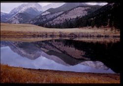
- Description:
- 25 f 5.6
- Subject:
- Rocky Mountains, Trees, Mummy Range (Colo.), Meadows, Mummy Mountain (Colo.), Mountains, National parks & reserves, Lakes & ponds, Hills, Reflections...
- Series:
- 24-52
- Creator:
- Cushman, Charles W., 1896-1972
- Date Created:
- 1952-11-01
- Genre:
- Landscape photographs
- Frame Number:
- 35
- County:
- Larimer
- Abstract:
- Mummy Mtns reflected in Sheep Lake (east side of Pk)
- Call Number:
- P06366
- City:
- Estes Park
- Country:
- United States
- State/Province:
- Colorado
- Physical Description:
- Image was originally mounted in a glass enclosure. Before digitization, the image was removed and placed in a Wess Plastic, Inc. brand, 2" x 2", pl...
- Alternate Identifier:
- 2452.35
- Persistent URL:
- http://purl.dlib.indiana.edu/iudl/archives/cushman/P06366
- Holding Location:
- Bloomington - University Archives
Wells Library E460
1320 E 10th St.
Bloomington, IN 47405
Contact at archives@indiana.edu, 812-855-1127
-
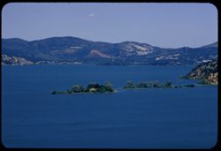
- Description:
- 100 f 8 tl
- Subject:
- Trees, Mountains, Lakes & ponds, Islands, Hills, and Clear Lake (Lake County, Calif.)
- Series:
- 10-57
- Creator:
- Cushman, Charles W., 1896-1972
- Date Created:
- 1957-06-30
- Genre:
- Landscape photographs
- Frame Number:
- 3
- County:
- Lake
- Abstract:
- East across waist of Cl. Lk from Buckingham Pk
- Call Number:
- P09377
- City:
- Buckingham Park
- Country:
- United States
- State/Province:
- California
- Alternate Identifier:
- 1057.3
- Persistent URL:
- http://purl.dlib.indiana.edu/iudl/archives/cushman/P09377
- Holding Location:
- Bloomington - University Archives
Wells Library E460
1320 E 10th St.
Bloomington, IN 47405
Contact at archives@indiana.edu, 812-855-1127
-
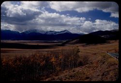
- Description:
- 50 f 8 Pola
- Subject:
- Snow, Railings, Valleys, Grasses, Roads, Trees, Shadows, Meadows, Kenosha Mountains (Colo.), Kenosha Pass (Colo.), Mountains, Clouds, and Hills
- Series:
- 10-53
- Creator:
- Cushman, Charles W., 1896-1972
- Date Created:
- 1953-10-14
- Genre:
- Landscape photographs
- Frame Number:
- 24
- County:
- Park
- Abstract:
- West from Kenosha Pass-SW slope
- Call Number:
- P06864
- Country:
- United States
- State/Province:
- Colorado
- Alternate Identifier:
- 1053.24
- Persistent URL:
- http://purl.dlib.indiana.edu/iudl/archives/cushman/P06864
- Holding Location:
- Bloomington - University Archives
Wells Library E460
1320 E 10th St.
Bloomington, IN 47405
Contact at archives@indiana.edu, 812-855-1127
-
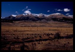
- Description:
- 50 f 9 Pola
- Subject:
- Snow, Grasses, Grazing, Meadows, Cattle, Mountains, Fences, Shrubs, Clouds, Hills, and Elbert, Mount (Colo.)
- Series:
- 11-53
- Creator:
- Cushman, Charles W., 1896-1972
- Date Created:
- 1953-10-15
- Genre:
- Landscape photographs
- Frame Number:
- 5
- County:
- Lake
- Abstract:
- Mt. Elbert from east
- Call Number:
- P06884
- City:
- Leadville
- Country:
- United States
- State/Province:
- Colorado
- Physical Description:
- Image was originally mounted in a glass enclosure. Before digitization, the image was removed and placed in a Wess Plastic, Inc. brand, 2" x 2", pl...
- Alternate Identifier:
- 1153.5
- Persistent URL:
- http://purl.dlib.indiana.edu/iudl/archives/cushman/P06884
- Holding Location:
- Bloomington - University Archives
Wells Library E460
1320 E 10th St.
Bloomington, IN 47405
Contact at archives@indiana.edu, 812-855-1127
-
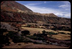
- Description:
- 50 f 5.6 Pola
- Subject:
- Grasses, Trees, Mountains, Fences, Shrubs, Clouds, and Hills
- Series:
- 9-53
- Creator:
- Cushman, Charles W., 1896-1972
- Date Created:
- 1953-10-11
- Genre:
- Landscape photographs
- Frame Number:
- 14
- Street Address:
- United States Highway 50
- County:
- Utah
- Abstract:
- From US 50 6 mi w of Thistle.
- Call Number:
- P06815
- City:
- Thistle
- Country:
- United States
- State/Province:
- Utah
- Alternate Identifier:
- 953.14
- Persistent URL:
- http://purl.dlib.indiana.edu/iudl/archives/cushman/P06815
- Holding Location:
- Bloomington - University Archives
Wells Library E460
1320 E 10th St.
Bloomington, IN 47405
Contact at archives@indiana.edu, 812-855-1127
-
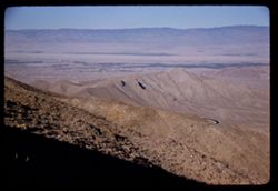
- Description:
- 50 f 11SL haze filter
- Subject:
- Valleys, Roads, San Jacinto Mountains (Calif.), Mountains, Coachella Valley (Calif.), and Hills
- Series:
- 24-61
- Creator:
- Cushman, Charles W., 1896-1972
- Date Created:
- 1961-12-27
- Genre:
- Landscape photographs
- Frame Number:
- 7
- Street Address:
- California State Highway 74
- County:
- Riverside
- Abstract:
- Looking down into Coachella Valley from ht of rd. 74
- Call Number:
- P12573
- Country:
- United States
- State/Province:
- California
- Alternate Identifier:
- 2461.7
- Persistent URL:
- http://purl.dlib.indiana.edu/iudl/archives/cushman/P12573
- Holding Location:
- Bloomington - University Archives
Wells Library E460
1320 E 10th St.
Bloomington, IN 47405
Contact at archives@indiana.edu, 812-855-1127