
Search Constraints
You searched for:
Campus
IUB
Remove constraint Campus: IUB
County
Inyo
Remove constraint County: Inyo
Subject
Shrubs
Remove constraint Subject: Shrubs
« Previous |
1 - 100 of 164
|
Next »
Search Results
-
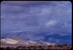
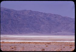
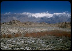
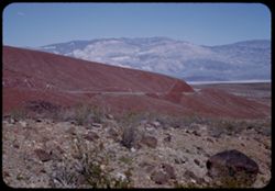
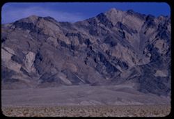
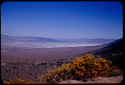
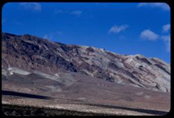
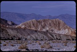
- Description:
- 100 f 8 tl
- Subject:
- Hills, Funeral Mountains (Calif.), Funeral Mountains Wilderness (Calif.), Mountains, Shrubs, Furnace Creek (Calif.), Rocks, and Clouds
- Series:
- 2-55
- Creator:
- Cushman, Charles W., 1896-1972
- Date Created:
- 1955-02-27
- Genre:
- Landscape photographs
- Frame Number:
- 29
- Street Address:
- Furance Creek-Death Valley Junction Road
- County:
- Mono and Inyo
- Abstract:
- North toward Funeral Mtns
- Call Number:
- P07586
- City:
- Death Valley Junction
- Country:
- United States
- State/Province:
- California
- Alternate Identifier:
- 255.29
- Persistent URL:
- http://purl.dlib.indiana.edu/iudl/archives/cushman/P07586
-
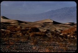
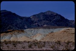
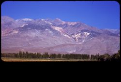
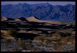
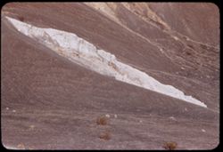
- Description:
- 100 f 7 tl
- Subject:
- Valleys, Death Valley (Calif. and Nev.), Mountains, Shrubs, and Dunes
- Series:
- 3-55
- Creator:
- Cushman, Charles W., 1896-1972
- Date Created:
- 1955-02-27
- Genre:
- Landscape photographs
- Frame Number:
- 25
- County:
- Inyo
- Abstract:
- Sand Dunes near Stove Pipe Wells
- Call Number:
- P07616
- City:
- Stovepipe Wells
- Country:
- United States
- State/Province:
- California
- Alternate Identifier:
- 355.25
- Persistent URL:
- http://purl.dlib.indiana.edu/iudl/archives/cushman/P07616
-
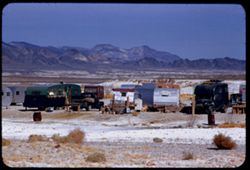
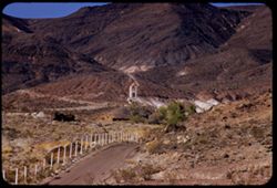
- Description:
- 100 f 8 + tl
- Subject:
- Minerals, Trucks, Valleys, Mountains, Shrubs, Tecopa Hot Springs (Calif.), and Trailers
- Series:
- 12-55
- Creator:
- Cushman, Charles W., 1896-1972
- Date Created:
- 1955-03-24
- Genre:
- Views
- Frame Number:
- 6
- County:
- Inyo
- Abstract:
- Trailer colony near Tecopa Hot Springs
- Call Number:
- P07902
- Country:
- United States
- State/Province:
- California
- Alternate Identifier:
- 1255.6
- Persistent URL:
- http://purl.dlib.indiana.edu/iudl/archives/cushman/P07902
-
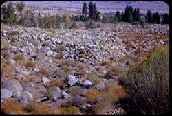
- Description:
- 50 f 9
- Subject:
- Deserts, Glacier Lodge (Calif.), Shrubs, Trees, and Rocks
- Series:
- 12-54
- Creator:
- Cushman, Charles W., 1896-1972
- Date Created:
- 1954-09-18
- Genre:
- Landscape photographs
- Frame Number:
- 14
- County:
- Inyo
- Abstract:
- Tumbled rocks in dry river bed.
- Call Number:
- P07404
- City:
- Big Pine
- Country:
- United States
- State/Province:
- California
- Alternate Identifier:
- 1254.14
- Persistent URL:
- http://purl.dlib.indiana.edu/iudl/archives/cushman/P07404
-
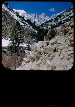
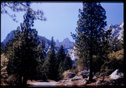
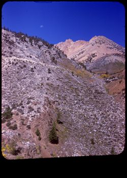
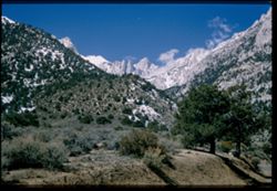
- Description:
- 25 f 9 Pola
- Subject:
- Whitney, Mount (Calif.), Mountains, Shrubs, Snow, Trees, Rocks, Portal station, Rock formations, and Boulders
- Series:
- 14-52
- Creator:
- Cushman, Charles W., 1896-1972
- Date Created:
- 1952-04-08
- Genre:
- Landscape photographs
- Frame Number:
- 29
- County:
- Inyo
- Abstract:
- Whitney from Portal Station.
- Call Number:
- P06013
- Country:
- United States
- State/Province:
- California
- Physical Description:
- masked.
- Alternate Identifier:
- 1452.29
- Persistent URL:
- http://purl.dlib.indiana.edu/iudl/archives/cushman/P06013
-
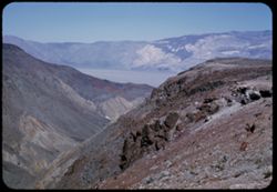
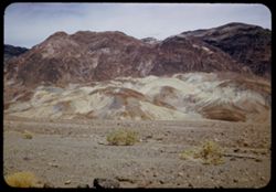
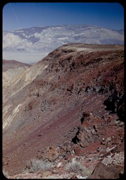
- Description:
- 100 f 6.3 tl
- Subject:
- Valleys, Black Mountains (Inyo County, Calif.), Death Valley (Calif. and Nev.), Mountains, Shrubs, and Hills
- Series:
- 8-55
- Creator:
- Cushman, Charles W., 1896-1972
- Date Created:
- 1955-03-22
- Genre:
- Landscape photographs
- Frame Number:
- 20
- Street Address:
- California State Highway 190
- County:
- Inyo
- Abstract:
- From 18 mi out - west toward Black Mtns - colored rock in valley
- Call Number:
- P07778
- Country:
- United States
- State/Province:
- California
- Alternate Identifier:
- 855.20
- Persistent URL:
- http://purl.dlib.indiana.edu/iudl/archives/cushman/P07778
-
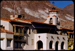
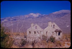
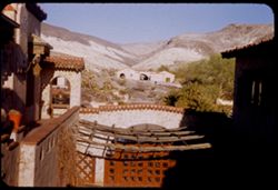
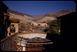
- Description:
- 100 f 8 tl
- Subject:
- Shutters, Balconies, Roofs, Flowers, Flowerpots, Death Valley (Calif. and Nev.), Windows, Scotty's Castle (Calif.), Mountains, Shrubs, Castles & pala...
- Series:
- 11-55
- Creator:
- Cushman, Charles W., 1896-1972
- Date Created:
- 1955-03-23
- Genre:
- Architectural photographs
- Frame Number:
- 31
- County:
- Inyo
- Abstract:
- the Castle
- Call Number:
- P07890
- Country:
- United States
- State/Province:
- California
- Alternate Identifier:
- 1155.31
- Persistent URL:
- http://purl.dlib.indiana.edu/iudl/archives/cushman/P07890
-

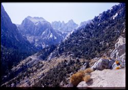
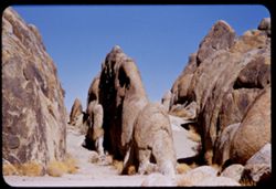
- Description:
- 25 f 11
- Subject:
- Hills, Mountains, Shrubs, Boulders, Rocks, Rock formations, and Crazy rocks
- Series:
- 14-52
- Creator:
- Cushman, Charles W., 1896-1972
- Date Created:
- 1952-04-08
- Genre:
- Landscape photographs
- Frame Number:
- 33
- Street Address:
- Mount Whitney Road
- County:
- Inyo
- Abstract:
- Crazy rocks along lower Mt. Whitney rd.
- Call Number:
- P06016
- City:
- Lone Pine
- Country:
- United States
- State/Province:
- California
- Alternate Identifier:
- 1452.33
- Persistent URL:
- http://purl.dlib.indiana.edu/iudl/archives/cushman/P06016
-
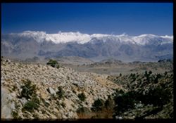
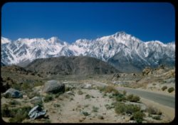
- Description:
- 50 f 8 Haze F
- Subject:
- Valleys, Rocks, Bishop Peak (Calif.), Mountains, Trees, Owens Valley (Calif.), Shadows, Shrubs, and Roads
- Series:
- 11-54
- Creator:
- Cushman, Charles W., 1896-1972
- Date Created:
- 1954-09-16
- Genre:
- Landscape photographs
- Frame Number:
- 4
- Street Address:
- United States Highway 395, United States Highway 6/395, and California State Highway 14
- County:
- Inyo
- Abstract:
- View south toward Owens valley where Bishop lies.
- Call Number:
- P07373
- Country:
- United States
- State/Province:
- California
- Alternate Identifier:
- 1154.4
- Persistent URL:
- http://purl.dlib.indiana.edu/iudl/archives/cushman/P07373
-
- Description:
- 50 f 8
- Subject:
- Bishop Creek (Inyo County, Calif.), Flowers, Donkeys, Animals, Mountains, Shrubs, Trees, Sagebrush, and Rocks
- Series:
- 11-54
- Creator:
- Cushman, Charles W., 1896-1972
- Date Created:
- 1954-09-17
- Genre:
- Identification photographs
- Frame Number:
- 18
- County:
- Inyo
- Abstract:
- Jennie in the sage brush.
- Call Number:
- P07387
- City:
- Bishop
- Country:
- United States
- State/Province:
- California
- Alternate Identifier:
- 1154.18
- Persistent URL:
- http://purl.dlib.indiana.edu/iudl/archives/cushman/P07387
-
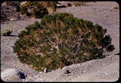
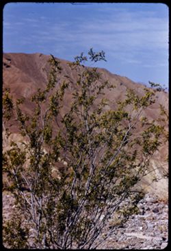
- Description:
- 25 f 16
- Subject:
- Valleys, Rocks, Death Valley (Calif. and Nev.), Deserts, and Shrubs
- Series:
- 15-52
- Creator:
- Cushman, Charles W., 1896-1972
- Date Created:
- 1952-04-09
- Genre:
- Identification photographs
- Frame Number:
- 32
- County:
- Inyo
- Abstract:
- Desert holly.
- Call Number:
- P06051
- Country:
- United States
- State/Province:
- California
- Alternate Identifier:
- 1552.32
- Persistent URL:
- http://purl.dlib.indiana.edu/iudl/archives/cushman/P06051
-
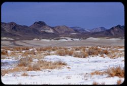
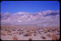
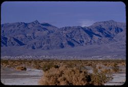
- Description:
- 50 f 11 HF
- Subject:
- Valleys, Inyo Mountains (Calif.), Mountains, Owens Valley (Calif.), Deserts, Shrubs, Roads, and Rocks
- Series:
- 12-54
- Creator:
- Cushman, Charles W., 1896-1972
- Date Created:
- 1954-09-18
- Genre:
- Landscape photographs
- Frame Number:
- 27
- Street Address:
- Mt. Whitney Road
- County:
- Inyo
- Abstract:
- Switch-back coming down Mt Whitney rd.
- Call Number:
- P07417
- Country:
- United States
- State/Province:
- California
- Alternate Identifier:
- 1254.27
- Persistent URL:
- http://purl.dlib.indiana.edu/iudl/archives/cushman/P07417
-
- Description:
- 100 f 8 tl
- Subject:
- Sightseers, Castles & palaces, Death Valley (Calif. and Nev.), Scotty's Castle (Calif.), Roofs, Masonry, Windows, Arches, Flowerpots, and Shrubs
- Series:
- 11-55
- Creator:
- Cushman, Charles W., 1896-1972
- Date Created:
- 1955-03-23
- Genre:
- Architectural photographs
- Frame Number:
- 29
- County:
- Inyo
- Abstract:
- the Castle
- Call Number:
- P07888
- Country:
- United States
- State/Province:
- California
- Alternate Identifier:
- 1155.29
- Persistent URL:
- http://purl.dlib.indiana.edu/iudl/archives/cushman/P07888
-
- Description:
- 50 f 11 HF
- Subject:
- Deserts, Striped Mountain (Inyo County, Calif.), Mountains, and Shrubs
- Series:
- 12-54
- Creator:
- Cushman, Charles W., 1896-1972
- Date Created:
- 1954-09-18
- Genre:
- Landscape photographs
- Frame Number:
- 15
- Street Address:
- United States Highway 395 and United States Highway 6
- County:
- Inyo
- Abstract:
- High Sierra wall including Striped Mtn. - 13,160 ft. seen from US 6 - 395 about 10 mi. south of Big Pine.
- Call Number:
- P07405
- City:
- Big Pine
- Country:
- United States
- State/Province:
- California
- Alternate Identifier:
- 1254.15
- Persistent URL:
- http://purl.dlib.indiana.edu/iudl/archives/cushman/P07405
-
- Description:
- 50 f 11
- Subject:
- Deserts, Glacier Lodge (Calif.), Mountains, Shrubs, Sierra Nevada (Calif. and Nev.), and Middle Palisade Glacier (Calif.)
- Series:
- 12-54
- Creator:
- Cushman, Charles W., 1896-1972
- Date Created:
- 1954-09-18
- Genre:
- Landscape photographs
- Frame Number:
- 13
- Street Address:
- Glacier Lodge Road
- County:
- Inyo
- Abstract:
- Looking SW up Glacier Lodge road at 1020 am DST.
- Call Number:
- P07403
- City:
- Big Pine
- Country:
- United States
- State/Province:
- California
- Alternate Identifier:
- 1254.13
- Persistent URL:
- http://purl.dlib.indiana.edu/iudl/archives/cushman/P07403
-
- Description:
- 100 f 6.3 tl
- Subject:
- Hibiscus, Valleys, Death Valley (Calif. and Nev.), Funeral Mountains (Calif.), Mountains, Shrubs, and Furnace Creek Ranch
- Series:
- 8-55
- Creator:
- Cushman, Charles W., 1896-1972
- Date Created:
- 1955-03-21
- Genre:
- Landscape photographs
- Frame Number:
- 13
- County:
- Inyo
- Abstract:
- Funeral Mtns east of Furnace Creek Ranch at 5:30 pm
- Call Number:
- P07771
- Country:
- United States
- State/Province:
- California
- Alternate Identifier:
- 855.13
- Persistent URL:
- http://purl.dlib.indiana.edu/iudl/archives/cushman/P07771
-
- Description:
- 100 f 9 tl
- Subject:
- Valleys, Whitney, Mount (Calif.), Mountains, Shrubs, Snow, Trees, Rocks, and Rock formations
- Series:
- 3-55
- Creator:
- Cushman, Charles W., 1896-1972
- Date Created:
- 1955-02-28
- Genre:
- Landscape photographs
- Frame Number:
- 38
- County:
- Inyo
- Abstract:
- Mt. Whitney
- Call Number:
- P07629
- Country:
- United States
- State/Province:
- California
- Alternate Identifier:
- 355.38
- Persistent URL:
- http://purl.dlib.indiana.edu/iudl/archives/cushman/P07629
-
- Description:
- 50 f 8
- Subject:
- Deserts, Valleys, Glacier Lodge (Calif.), Roads, Mountains, Shrubs, Trees, Rocks, and Owens Valley (Calif.)
- Series:
- 12-54
- Creator:
- Cushman, Charles W., 1896-1972
- Date Created:
- 1954-09-18
- Genre:
- Landscape photographs
- Frame Number:
- 12
- Street Address:
- Glacier Lodge Road
- County:
- Inyo
- Abstract:
- Looking down on Big Pine from Glacier Lodge road.
- Call Number:
- P07402
- City:
- Big Pine
- Country:
- United States
- State/Province:
- California
- Alternate Identifier:
- 1254.12
- Persistent URL:
- http://purl.dlib.indiana.edu/iudl/archives/cushman/P07402
-

- Description:
- 25 f 14
- Subject:
- Deserts, Amargosa Range (Nev. and Calif.), Valleys, Hills, Death Valley (Calif. and Nev.), Cliffs, Mountains, Shrubs, Rocks, Canyons, and Desolation Canyon (...
- Series:
- 15-52
- Creator:
- Cushman, Charles W., 1896-1972
- Date Created:
- 1952-04-09
- Genre:
- Landscape photographs
- Frame Number:
- 21
- Street Address:
- Bad Water Road
- County:
- Inyo
- Abstract:
- Approx. same.
- Call Number:
- P06041
- City:
- Furnace Creek
- Country:
- United States
- State/Province:
- California
- Alternate Identifier:
- 1552.21
- Persistent URL:
- http://purl.dlib.indiana.edu/iudl/archives/cushman/P06041
-
- Description:
- 100 f 8 tl
- Subject:
- Furnace Creek Inn (Death Valley Junction, Calif.), Death Valley (Calif. and Nev.), Shrubs, Rocks, and Mesquite
- Series:
- 9-55
- Creator:
- Cushman, Charles W., 1896-1972
- Date Created:
- 1955-03-22
- Genre:
- Identification photographs
- Frame Number:
- 24
- County:
- Inyo
- Abstract:
- Mesquite nr. Furnace Creek Inn
- Call Number:
- P07815
- City:
- Death Valley Junction
- Country:
- United States
- State/Province:
- California
- Physical Description:
- masked.
- Alternate Identifier:
- 955.24
- Persistent URL:
- http://purl.dlib.indiana.edu/iudl/archives/cushman/P07815
-
- Description:
- 50 f 9
- Subject:
- Flowers, Hills, Roads, Mountains, Shrubs, Sierra Nevada (Calif. and Nev.), Trees, Rocks, and Grasses
- Series:
- 11-54
- Creator:
- Cushman, Charles W., 1896-1972
- Date Created:
- 1954-09-17
- Genre:
- Landscape photographs
- Frame Number:
- 5
- Street Address:
- Sabrina Lake Road
- County:
- Inyo
- Abstract:
- High Sierra seen from Sabrina Lake road SW of Bishop.
- Call Number:
- P07374
- City:
- Bishop
- Country:
- United States
- State/Province:
- California
- Alternate Identifier:
- 1154.5
- Persistent URL:
- http://purl.dlib.indiana.edu/iudl/archives/cushman/P07374
-
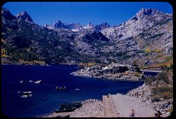
- Description:
- 50 f 11
- Subject:
- Sabrina, Lake (Calif.), Lakes & ponds, Bodies of water, Mountains, Shrubs, and Trees
- Series:
- 11-54
- Creator:
- Cushman, Charles W., 1896-1972
- Date Created:
- 1954-09-17
- Genre:
- Landscape photographs
- Frame Number:
- 7
- County:
- Inyo
- Abstract:
- Across little lake to high Sierra.
- Call Number:
- P07376
- City:
- Bishop
- Country:
- United States
- State/Province:
- California
- Alternate Identifier:
- 1154.7
- Persistent URL:
- http://purl.dlib.indiana.edu/iudl/archives/cushman/P07376
-
- Description:
- 100 f 8 tl
- Subject:
- Park headquarters, Valleys, Fog, Mountains, Shrubs, and Panamint Range (Calif.)
- Series:
- 11-55
- Creator:
- Cushman, Charles W., 1896-1972
- Date Created:
- 1955-03-23
- Genre:
- Landscape photographs
- Frame Number:
- 14
- County:
- Inyo
- Abstract:
- Valley floor from near Park Hqtrs
- Call Number:
- P07876
- Country:
- United States
- State/Province:
- California
- Alternate Identifier:
- 1155.14
- Persistent URL:
- http://purl.dlib.indiana.edu/iudl/archives/cushman/P07876
-
- Description:
- 100 f 6.3 tl 35 ft
- Subject:
- Deserts, Death Valley National Park (Calif. and Nev.), Furnace Creek Wash (Calif.), Shrubs, and Rocks
- Series:
- 10-55
- Creator:
- Cushman, Charles W., 1896-1972
- Date Created:
- 1955-03-23
- Genre:
- Identification photographs
- Frame Number:
- 25
- County:
- Inyo
- Abstract:
- Desert bush
- Call Number:
- P07850
- Country:
- United States
- State/Province:
- California
- Alternate Identifier:
- 1055.25
- Persistent URL:
- http://purl.dlib.indiana.edu/iudl/archives/cushman/P07850
-
- Description:
- 50 f 7.5
- Subject:
- Roads, Whitney, Mount (Calif.), Mountains, Shrubs, Trees, and Rocks
- Series:
- 12-54
- Creator:
- Cushman, Charles W., 1896-1972
- Date Created:
- 1954-09-18
- Genre:
- Landscape photographs
- Frame Number:
- 23
- Street Address:
- Mt. Whitney Road
- County:
- Inyo
- Abstract:
- Closest to Mt Whitney - backlighted.
- Call Number:
- P07413
- Country:
- United States
- State/Province:
- California
- Physical Description:
- Image was originally mounted in a glass enclosure. Before digitization, the image was removed and placed in a Wess Plastic, Inc. brand, 2" x 2", pl...
- Alternate Identifier:
- 1254.23
- Persistent URL:
- http://purl.dlib.indiana.edu/iudl/archives/cushman/P07413
-
- Description:
- 50 f 10
- Subject:
- Mountains, Shrubs, Sierra Nevada (Calif. and Nev.), and Grasses
- Series:
- 12-54
- Creator:
- Cushman, Charles W., 1896-1972
- Date Created:
- 1954-09-18
- Genre:
- Landscape photographs
- Frame Number:
- 8
- Street Address:
- Glacier Lodge Road
- County:
- Inyo
- Abstract:
- White top of Pyramidal peak - from Glacier Lodge.
- Call Number:
- P07398
- City:
- Big Pine
- Country:
- United States
- State/Province:
- California
- Alternate Identifier:
- 1254.8
- Persistent URL:
- http://purl.dlib.indiana.edu/iudl/archives/cushman/P07398
-

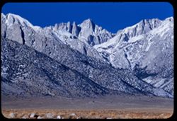
- Description:
- 50 f 9
- Subject:
- Hills, Roads, Whitney, Mount (Calif.), Mountains, Shrubs, Sierra Nevada (Calif. and Nev.), Trees, Rocks, Fences, Snow, Boulders, and Buildings
- Series:
- 14-52
- Creator:
- Cushman, Charles W., 1896-1972
- Date Created:
- 1952-04-08
- Genre:
- Landscape photographs
- Frame Number:
- 18
- County:
- Inyo
- Abstract:
- Mt. Whitney at dead center.
- Call Number:
- P06002
- Country:
- United States
- State/Province:
- California
- Alternate Identifier:
- 1452.18
- Persistent URL:
- http://purl.dlib.indiana.edu/iudl/archives/cushman/P06002
-
- Description:
- 25 f 8 Pola
- Subject:
- Rocks, Inyo Mountains (Calif.), Boulders, Owens Valley (Calif.), Mountains, Shrubs, Hills, and Snow
- Series:
- 14-52
- Creator:
- Cushman, Charles W., 1896-1972
- Date Created:
- 1952-04-08
- Genre:
- Landscape photographs
- Frame Number:
- 32
- Street Address:
- Mount Whitney Road
- County:
- Inyo
- Abstract:
- Across Owens Valley to Inyo Mtns.
- Call Number:
- P06015
- City:
- Lone Pine
- Country:
- United States
- State/Province:
- California
- Alternate Identifier:
- 1452.32
- Persistent URL:
- http://purl.dlib.indiana.edu/iudl/archives/cushman/P06015
-
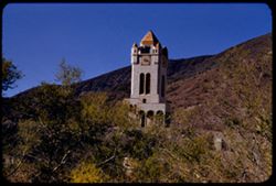
- Description:
- 100 f 8 tl
- Subject:
- Towers, Roads, Trees, Mountains, Buildings, Shrubs, Scotty's Castle (Calif.), Death Valley (Calif. and Nev.), Castles & palaces, and Rocks
- Series:
- 11-55
- Creator:
- Cushman, Charles W., 1896-1972
- Date Created:
- 1955-03-23
- Genre:
- Landscape photographs
- Frame Number:
- 27
- County:
- Inyo
- Abstract:
- First view of Scott's Tower
- Call Number:
- P07886
- Country:
- United States
- State/Province:
- California
- Alternate Identifier:
- 1155.27
- Persistent URL:
- http://purl.dlib.indiana.edu/iudl/archives/cushman/P07886
-
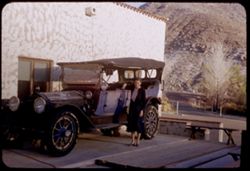
- Subject:
- Rocks, Benches, Roads, Spouses, Automobiles, Trees, Mountains, Shrubs, Scotty's Castle (Calif.), Death Valley (Calif. and Nev.), Castles & palaces, P...
- Series:
- 11-55
- Creator:
- Cushman, Charles W., 1896-1972
- Date Created:
- 1955-03-23
- Genre:
- Portraits and Identification photographs
- Frame Number:
- 37
- County:
- Inyo
- Persons Pictured:
- Cushman, Jean
- Abstract:
- Jean with old Packard touring car
- Call Number:
- P07896
- Country:
- United States
- State/Province:
- California
- Alternate Identifier:
- 1155.37
- Persistent URL:
- http://purl.dlib.indiana.edu/iudl/archives/cushman/P07896
-
- Description:
- 100 f 8 tl
- Subject:
- Rocks, Valleys, Mountains, Shrubs, Death Valley (Calif. and Nev.), Black Mountains (Inyo County, Calif.), and Hills
- Series:
- 8-55
- Creator:
- Cushman, Charles W., 1896-1972
- Date Created:
- 1955-03-22
- Genre:
- Landscape photographs
- Frame Number:
- 22
- Street Address:
- Dante's View Road
- County:
- Inyo
- Abstract:
- colored rock in valley from closer (along Dante's V. rd.
- Call Number:
- P07780
- Country:
- United States
- State/Province:
- California
- Alternate Identifier:
- 855.22
- Persistent URL:
- http://purl.dlib.indiana.edu/iudl/archives/cushman/P07780
-
- Description:
- 25 f 13
- Subject:
- Rocks, Valleys, Panamint Range (Calif.), Panamint Mountains (Calif.), Argus Range (Calif.), Boulders, Mountains, Rock Candy Mountain (Calif.), Shrubs, Panami...
- Series:
- 15-52
- Creator:
- Cushman, Charles W., 1896-1972
- Date Created:
- 1952-04-08
- Genre:
- Landscape photographs
- Frame Number:
- 7
- Street Address:
- California State Highway 190
- County:
- Inyo
- Abstract:
- Red earth at Rock Candy mtn. (Panamint).
- Call Number:
- P06028
- City:
- Panamint
- Country:
- United States
- State/Province:
- California
- Alternate Identifier:
- 1552.7
- Persistent URL:
- http://purl.dlib.indiana.edu/iudl/archives/cushman/P06028
-
- Description:
- 25 f 13
- Subject:
- Rocks, Valleys, Panamint Range (Calif.), Argus Range (Calif.), Boulders, Mountains, Shrubs, Panamint Valley (Calif.), Canyons, and Cliffs
- Series:
- 15-52
- Creator:
- Cushman, Charles W., 1896-1972
- Date Created:
- 1952-04-08
- Genre:
- Landscape photographs
- Frame Number:
- 5
- County:
- Inyo
- Abstract:
- Flatbed of Panamint Valley from same pt. A gap in Argus Range.
- Call Number:
- P06026
- Country:
- United States
- State/Province:
- California
- Alternate Identifier:
- 1552.5
- Persistent URL:
- http://purl.dlib.indiana.edu/iudl/archives/cushman/P06026
-
- Description:
- 25 f 8 Pola
- Subject:
- Snow, Panamint Range (Calif.), Mountains, Shrubs, Clouds, Hills, and Rocks
- Series:
- 15-52
- Creator:
- Cushman, Charles W., 1896-1972
- Date Created:
- 1952-04-08
- Genre:
- Landscape photographs
- Frame Number:
- 2
- Street Address:
- California State Highway 190
- County:
- Inyo
- Abstract:
- Snow-covered Panamints from Hwy 190 40 mi. from Lone Pine.
- Call Number:
- P06023
- City:
- Lone Pine
- Country:
- United States
- State/Province:
- California
- Alternate Identifier:
- 1552.2
- Persistent URL:
- http://purl.dlib.indiana.edu/iudl/archives/cushman/P06023
-
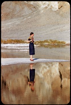
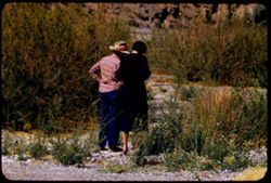
- Description:
- 100 f 5.6 tl
- Subject:
- Rocks, Valleys, Bodies of water, Spouses, Minerals, Salt, Shrubs, Death Valley (Calif. and Nev.), and Reflections
- Series:
- 10-55
- Creator:
- Cushman, Charles W., 1896-1972
- Date Created:
- 1955-03-22
- Genre:
- Portraits and Identification photographs
- Frame Number:
- 17
- County:
- Inyo
- Persons Pictured:
- Cushman, Jean
- Abstract:
- Jean at BW End of Mar. 22
- Call Number:
- P07842
- City:
- Badwater
- Country:
- United States
- State/Province:
- California
- Alternate Identifier:
- 1055.17
- Persistent URL:
- http://purl.dlib.indiana.edu/iudl/archives/cushman/P07842
-
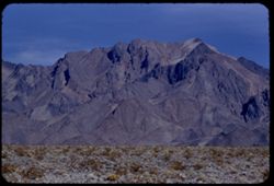
- Description:
- 50 f 11 HF
- Subject:
- Concrete, White Mountains (Calif. and Nev.), Trees, Abandoned buildings, Mountains, Shrubs, Dwellings, Houses, and Owens Valley (Calif.)
- Series:
- 11-54
- Creator:
- Cushman, Charles W., 1896-1972
- Date Created:
- 1954-09-17
- Genre:
- Architectural photographs
- Frame Number:
- 21
- Street Address:
- United States Highway 6
- County:
- Inyo
- Abstract:
- Skeleton concrete home on US 6 North of Bishop.
- Call Number:
- P07390
- City:
- Bishop
- Country:
- United States
- State/Province:
- California
- Alternate Identifier:
- 1154.21
- Persistent URL:
- http://purl.dlib.indiana.edu/iudl/archives/cushman/P07390
-
- Description:
- 25 f 8 Pola
- Subject:
- Rocks, Valleys, Inyo Mountains (Calif.), Trees, Boulders, Owens Valley (Calif.), Mountains, Shrubs, Hills, and Snow
- Series:
- 14-52
- Creator:
- Cushman, Charles W., 1896-1972
- Date Created:
- 1952-04-08
- Genre:
- Landscape photographs
- Frame Number:
- 31
- Street Address:
- Mount Whitney Road
- County:
- Inyo
- Abstract:
- Owens Valley from Mt. Whitney Rd.
- Call Number:
- P06014
- Country:
- United States
- State/Province:
- California
- Physical Description:
- Image was originally mounted in a glass enclosure. Before digitization, the image was removed and placed in a Wess Plastic, Inc. brand, 2" x 2", pl...
- Alternate Identifier:
- 1452.31
- Persistent URL:
- http://purl.dlib.indiana.edu/iudl/archives/cushman/P06014
-
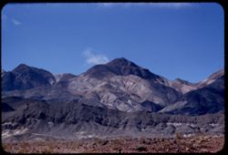
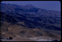
- Description:
- 50 f 9
- Subject:
- Rocks, Canyons, Crown Mountain, Trees, Moon Mountain, Moon, Mountains, Shrubs, Sierra Nevada (Calif. and Nev.), Sabrina, Lake (Calif.), and Bishop Creek Cany...
- Series:
- 11-54
- Creator:
- Cushman, Charles W., 1896-1972
- Date Created:
- 1954-09-17
- Genre:
- Landscape photographs
- Frame Number:
- 13
- County:
- Inyo
- Abstract:
- View NW across Bishop Creek Canyon to Moon + Crown mtn [ ] [P] Mt. Emerson?
- Call Number:
- P07382
- Country:
- United States
- State/Province:
- California
- Physical Description:
- masked.
- Alternate Identifier:
- 1154.13
- Persistent URL:
- http://purl.dlib.indiana.edu/iudl/archives/cushman/P07382
-
- Description:
- 25 f 9 Pola
- Subject:
- Deserts, Valleys, Salt pools, Mountains, Shrubs, Hills, Black Mountains (Inyo County, Calif.), Rocks, and Death Valley (Calif. and Nev.)
- Series:
- 15-52
- Creator:
- Cushman, Charles W., 1896-1972
- Date Created:
- 1952-04-09
- Genre:
- Landscape photographs
- Frame Number:
- 24
- County:
- Inyo
- Abstract:
- Colored Mtns. The Black Mtns - near Salt Pools this time.
- Call Number:
- P06044
- Country:
- United States
- State/Province:
- California
- Alternate Identifier:
- 1552.24
- Persistent URL:
- http://purl.dlib.indiana.edu/iudl/archives/cushman/P06044
-
- Description:
- 25 f 13
- Subject:
- Snow, Roads, Trees, Mountains, Rock formations, Whitney, Mount (Calif.), Sierra Nevada (Calif. and Nev.), Shrubs, and Clouds
- Series:
- 14-52
- Creator:
- Cushman, Charles W., 1896-1972
- Date Created:
- 1952-04-08
- Genre:
- Landscape photographs
- Frame Number:
- 28
- County:
- Inyo
- Abstract:
- Mt. Whitney + spires.
- Call Number:
- P06012
- Country:
- United States
- State/Province:
- California
- Physical Description:
- Image was originally mounted in a glass enclosure. Before digitization, the image was removed and placed in a Wess Plastic, Inc. brand, 2" x 2", pl...
- Alternate Identifier:
- 1452.28
- Persistent URL:
- http://purl.dlib.indiana.edu/iudl/archives/cushman/P06012
-
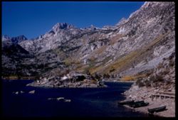
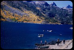
- Description:
- 50 f 8
- Subject:
- Rocks, Bodies of water, Trees, Mountains, Shrubs, Lakes & ponds, Rowboats, Sierra Nevada (Calif. and Nev.), Sabrina, Lake (Calif.), Boats, and People
- Series:
- 11-54
- Creator:
- Cushman, Charles W., 1896-1972
- Date Created:
- 1954-09-11
- Genre:
- Landscape photographs
- Frame Number:
- 11
- County:
- Inyo
- Abstract:
- [P] Across Sabrina Lake toward yellow-leaved mountain slopes.
- Call Number:
- P07380
- City:
- Bishop
- Country:
- United States
- State/Province:
- California
- Alternate Identifier:
- 1154.11
- Persistent URL:
- http://purl.dlib.indiana.edu/iudl/archives/cushman/P07380
-
- Description:
- 100 f 8 tl
- Subject:
- Rocks, Canyons, Mountains, Rock formations, Whitney, Mount (Calif.), Snow, and Shrubs
- Series:
- 3-55
- Creator:
- Cushman, Charles W., 1896-1972
- Date Created:
- 1955-02-28
- Genre:
- Landscape photographs
- Frame Number:
- 31
- County:
- Inyo
- Abstract:
- Whitney
- Call Number:
- P07622
- Country:
- United States
- State/Province:
- California
- Alternate Identifier:
- 355.31
- Persistent URL:
- http://purl.dlib.indiana.edu/iudl/archives/cushman/P07622
-
- Description:
- 100 f 8 tl 35'
- Subject:
- Rocks, Furnace Creek Wash (Calif.), Teachers, Spouses, Women, Shrubs, and Death Valley (Calif. and Nev.)
- Series:
- 11-55
- Creator:
- Cushman, Charles W., 1896-1972
- Date Created:
- 1955-03-23
- Genre:
- Portraits and Identification photographs
- Frame Number:
- 11
- County:
- Inyo
- Persons Pictured:
- Cushman, Jean
- Abstract:
- Jean & teacher at Tamarisk
- Call Number:
- P07873
- Country:
- United States
- State/Province:
- California
- Alternate Identifier:
- 1155.11
- Persistent URL:
- http://purl.dlib.indiana.edu/iudl/archives/cushman/P07873
-
- Description:
- 100 f 8 tl
- Subject:
- Valleys, Funeral Mountains (Calif.), Pyramid Peak (Inyo County, Calif.), Mountains, Shrubs, and Death Valley (Calif. and Nev.)
- Series:
- 8-55
- Creator:
- Cushman, Charles W., 1896-1972
- Date Created:
- 1955-03-22
- Genre:
- Landscape photographs
- Frame Number:
- 19
- County:
- Inyo
- Abstract:
- Big rock candy mtn from 12 mi. out probably Pyramid Pk
- Call Number:
- P07777
- Country:
- United States
- State/Province:
- California
- Alternate Identifier:
- 855.19
- Persistent URL:
- http://purl.dlib.indiana.edu/iudl/archives/cushman/P07777
-
- Description:
- 25 f 8 Pola
- Subject:
- Deserts, Valleys, Panamint Range (Calif.), Panamint Mountains (Calif.), Argus Range (Calif.), Mountains, Shrubs, Panamint Valley (Calif.), Death Valley (Cali...
- Series:
- 15-52
- Creator:
- Cushman, Charles W., 1896-1972
- Date Created:
- 1952-04-08
- Genre:
- Landscape photographs
- Frame Number:
- 4
- County:
- Inyo
- Abstract:
- Same [P]
- Call Number:
- P06025
- Country:
- United States
- State/Province:
- California
- Alternate Identifier:
- 1552.4
- Persistent URL:
- http://purl.dlib.indiana.edu/iudl/archives/cushman/P06025
-
- Description:
- 25 f 8 Pola
- Subject:
- Snow, Roads, Boulders, Mountains, Rock formations, Whitney, Mount (Calif.), Sierra Nevada (Calif. and Nev.), Hills, Rocks, Lone Pine Peak (Calif.), and Shrubs
- Series:
- 14-52
- Creator:
- Cushman, Charles W., 1896-1972
- Date Created:
- 1952-04-08
- Genre:
- Landscape photographs
- Frame Number:
- 37
- County:
- Inyo
- Abstract:
- Whitney's neighbors + the south again.
- Call Number:
- P06020
- Country:
- United States
- State/Province:
- California
- Alternate Identifier:
- 1452.37
- Persistent URL:
- http://purl.dlib.indiana.edu/iudl/archives/cushman/P06020
-
- Description:
- 50 f 9 50 mm
- Subject:
- Bell towers, Valleys, Trees, Roofs, Arches, Mountains, Flowerpots, Shrubs, Scotty's Castle (Calif.), Lamps, Castles & palaces, Gates, Courtyards, and...
- Series:
- 11-55
- Creator:
- Cushman, Charles W., 1896-1972
- Date Created:
- 1955-03-23
- Genre:
- Architectural photographs
- Frame Number:
- 36
- County:
- Inyo
- Abstract:
- View east
- Call Number:
- P07895
- Country:
- United States
- State/Province:
- California
- Alternate Identifier:
- 1155.36
- Persistent URL:
- http://purl.dlib.indiana.edu/iudl/archives/cushman/P07895
-
- Description:
- 50 f 10
- Subject:
- Rocks, Bodies of water, Trees, Mountains, Shrubs, Lakes & ponds, Rowboats, Islands, Sabrina, Lake (Calif.), Boats, Sierra Nevada (Calif. and Nev.), and P...
- Series:
- 11-54
- Creator:
- Cushman, Charles W., 1896-1972
- Date Created:
- 1954-09-17
- Genre:
- Landscape photographs
- Frame Number:
- 12
- County:
- Inyo
- Abstract:
- SSW across Sabrina Lake to high mtn.
- Call Number:
- P07381
- City:
- Bishop
- Country:
- United States
- State/Province:
- California
- Alternate Identifier:
- 1154.12
- Persistent URL:
- http://purl.dlib.indiana.edu/iudl/archives/cushman/P07381
-
- Description:
- 100 f 8 tl
- Subject:
- Funeral Mountains (Calif.), Mountains, and Shrubs
- Series:
- 8-55
- Creator:
- Cushman, Charles W., 1896-1972
- Date Created:
- 1955-03-22
- Genre:
- Landscape photographs
- Frame Number:
- 18
- Street Address:
- California State Highway 190
- County:
- Inyo
- Abstract:
- Colorful mtns north of pt 10 mi west of DV Junctn
- Call Number:
- P07776
- City:
- Death Valley Junction
- Country:
- United States
- State/Province:
- California
- Alternate Identifier:
- 855.18
- Persistent URL:
- http://purl.dlib.indiana.edu/iudl/archives/cushman/P07776
-
- Description:
- 100 f 8 tl
- Subject:
- Valleys, Greasewood, Mountains, Shrubs, Clouds, and Death Valley (Calif. and Nev.)
- Series:
- 11-55
- Creator:
- Cushman, Charles W., 1896-1972
- Date Created:
- 1955-03-23
- Genre:
- Identification photographs
- Frame Number:
- 8
- County:
- Inyo
- Abstract:
- Greasewood in bloom.
- Call Number:
- P07870
- Country:
- United States
- State/Province:
- California
- Alternate Identifier:
- 1155.8
- Persistent URL:
- http://purl.dlib.indiana.edu/iudl/archives/cushman/P07870
-
- Description:
- 50 f 10
- Subject:
- Rocks, Piers & wharves, Bodies of water, Trees, Mountains, Shrubs, Lakes & ponds, Rowboats, Islands, Sabrina, Lake (Calif.), Boats, and Sierra Nevada...
- Series:
- 11-54
- Creator:
- Cushman, Charles W., 1896-1972
- Date Created:
- 1954-09-17
- Genre:
- Landscape photographs
- Frame Number:
- 9
- County:
- Inyo
- Abstract:
- Sabrina Lake with an island - end of the road.
- Call Number:
- P07378
- City:
- Bishop
- Country:
- United States
- State/Province:
- California
- Physical Description:
- Image was originally mounted in a glass enclosure. Before digitization, the image was removed and placed in a Wess Plastic, Inc. brand, 2" x 2", pl...
- Alternate Identifier:
- 1154.9
- Persistent URL:
- http://purl.dlib.indiana.edu/iudl/archives/cushman/P07378
-
- Description:
- 50 f 12 HF
- Subject:
- Deserts, Valleys, Owens Lake (Inyo County, Calif.), Flowers, Owens Valley (Calif.), Mountains, Shrubs, and Lakes & ponds
- Series:
- 12-54
- Creator:
- Cushman, Charles W., 1896-1972
- Date Created:
- 1954-09-18
- Genre:
- Landscape photographs
- Frame Number:
- 28
- Street Address:
- Mt. Whitney Road
- County:
- Inyo
- Abstract:
- Owens Lake.
- Call Number:
- P07418
- Country:
- United States
- State/Province:
- California
- Alternate Identifier:
- 1254.28
- Persistent URL:
- http://purl.dlib.indiana.edu/iudl/archives/cushman/P07418
-
- Description:
- 100 f 8 tl
- Subject:
- Valleys, Buttes, Mountains, Shrubs, Death Valley National Park (Calif. and Nev.), and Black Mountains (Inyo County, Calif.)
- Series:
- 9-55
- Creator:
- Cushman, Charles W., 1896-1972
- Date Created:
- 1955-03-22
- Genre:
- Landscape photographs
- Frame Number:
- 3
- County:
- Inyo
- Abstract:
- Green & brown butte below east side of Black Mtns
- Call Number:
- P07795
- Country:
- United States
- State/Province:
- California
- Alternate Identifier:
- 955.3
- Persistent URL:
- http://purl.dlib.indiana.edu/iudl/archives/cushman/P07795
-
- Description:
- 100 f 5.6 tl
- Subject:
- Rocks, Dantes View (Calif.), Mountains, Shrubs, Clouds, Death Valley (Calif. and Nev.), and Black Mountains (Inyo County, Calif.)
- Series:
- 2-55
- Creator:
- Cushman, Charles W., 1896-1972
- Date Created:
- 1955-02-27
- Genre:
- Landscape photographs
- Frame Number:
- 32
- County:
- Inyo
- Abstract:
- Black Mtns on way to Dante's View from road near Ryan
- Call Number:
- P07589
- City:
- Ryan
- Country:
- United States
- State/Province:
- California
- Alternate Identifier:
- 255.32
- Persistent URL:
- http://purl.dlib.indiana.edu/iudl/archives/cushman/P07589
-
- Description:
- 100 f 8 + tl
- Subject:
- Valleys, Greenwater Range (Calif.), Minerals, Alkali, Mountains, Shrubs, and Hills
- Series:
- 12-55
- Creator:
- Cushman, Charles W., 1896-1972
- Date Created:
- 1955-03-24
- Genre:
- Landscape photographs
- Frame Number:
- 4
- County:
- Inyo
- Abstract:
- Alkali beds south of Shoshone
- Call Number:
- P07900
- City:
- Shoshone
- Country:
- United States
- State/Province:
- California
- Alternate Identifier:
- 1255.4
- Persistent URL:
- http://purl.dlib.indiana.edu/iudl/archives/cushman/P07900
-
- Subject:
- Rocks, Trails & paths, Trees, Mountains, Shrubs, and Whitney, Mount (Calif.)
- Series:
- 12-54
- Creator:
- Cushman, Charles W., 1896-1972
- Date Created:
- 1954-09-17
- Genre:
- Landscape photographs
- Frame Number:
- 26
- Street Address:
- Mt. Whitney Road
- County:
- Inyo
- Abstract:
- Looking back at Mt. Whitney from high up Mt. Whitney road. Backlighted.
- Call Number:
- P07416
- Country:
- United States
- State/Province:
- California
- Physical Description:
- Image was originally mounted in a glass enclosure. Before digitization, the image was removed and placed in a Wess Plastic, Inc. brand, 2" x 2", pl...
- Alternate Identifier:
- 1254.26
- Persistent URL:
- http://purl.dlib.indiana.edu/iudl/archives/cushman/P07416
-
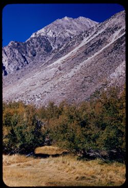
- Description:
- 25 f 8
- Subject:
- Grasses, Barbed wire, Trees, Fences, Shrubs, and Gates
- Series:
- 11-54
- Creator:
- Cushman, Charles W., 1896-1972
- Date Created:
- 1954-09-17
- Frame Number:
- 19
- Street Address:
- Hanby Street and East Pine Street
- County:
- Inyo
- Abstract:
- Bishop Calif noon. Gate at E. Pine + Hanby.
- Call Number:
- P07388
- City:
- Bishop
- Country:
- United States
- State/Province:
- California
- Alternate Identifier:
- 1154.19
- Persistent URL:
- http://purl.dlib.indiana.edu/iudl/archives/cushman/P07388
-
- Description:
- 100 f 8 tl
- Subject:
- Rocks, Bell towers, Trees, Arches, Mountains, Shrubs, Clock towers, Scotty's Castle (Calif.), Death Valley (Calif. and Nev.), Columns, Castles & pala...
- Series:
- 11-55
- Creator:
- Cushman, Charles W., 1896-1972
- Date Created:
- 1955-03-23
- Genre:
- Architectural photographs
- Frame Number:
- 28
- County:
- Inyo
- Abstract:
- Scotty's Tower from gate
- Call Number:
- P07887
- Country:
- United States
- State/Province:
- California
- Alternate Identifier:
- 1155.28
- Persistent URL:
- http://purl.dlib.indiana.edu/iudl/archives/cushman/P07887
-
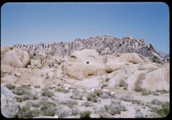
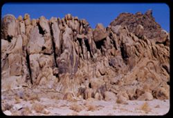
- Description:
- 25 f 11
- Subject:
- Rocks, Boulders, Alabama Hills (Calif.), Hills, Shrubs, and Rock formations
- Series:
- 14-52
- Creator:
- Cushman, Charles W., 1896-1972
- Date Created:
- 1952-04-08
- Genre:
- Landscape photographs
- Frame Number:
- 35
- County:
- Inyo
- Abstract:
- Gorilla + shark.
- Call Number:
- P06018
- City:
- Lone Pine
- Country:
- United States
- State/Province:
- California
- Alternate Identifier:
- 1452.35
- Persistent URL:
- http://purl.dlib.indiana.edu/iudl/archives/cushman/P06018
-
- Description:
- 25 f 8 Pola
- Subject:
- Snow, Grasses, Barbed wire, Trees, Mountains, Fences, Shrubs, and Inyo Mountains (Calif.)
- Series:
- 14-52
- Creator:
- Cushman, Charles W., 1896-1972
- Date Created:
- 1952-04-08
- Genre:
- Landscape photographs
- Frame Number:
- 38
- County:
- Inyo
- Abstract:
- Inyo Mtns from Lone Pine.
- Call Number:
- P06021
- City:
- Lone Pine
- Country:
- United States
- State/Province:
- California
- Physical Description:
- Image was originally mounted in a glass enclosure. Before digitization, the image was removed and placed in a Wess Plastic, Inc. brand, 2" x 2", pl...
- Alternate Identifier:
- 1452.38
- Persistent URL:
- http://purl.dlib.indiana.edu/iudl/archives/cushman/P06021
-
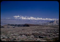
- Description:
- 25 f 8 Pola
- Subject:
- Snow, Mountains, Shrubs, Sierra Nevada (Calif. and Nev.), and Hills
- Series:
- 15-52
- Creator:
- Cushman, Charles W., 1896-1972
- Date Created:
- 1952-04-08
- Genre:
- Landscape photographs
- Frame Number:
- 1
- Street Address:
- California State Highway 190
- County:
- Inyo
- Abstract:
- The very high Sierras from Hwy 190 twenty five miles east of Lone Pine.
- Call Number:
- P06022
- City:
- Lone Pine
- Country:
- United States
- State/Province:
- California
- Physical Description:
- masked.
- Alternate Identifier:
- 1552.1
- Persistent URL:
- http://purl.dlib.indiana.edu/iudl/archives/cushman/P06022
-
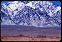
- Description:
- 100 f 5.6
- Subject:
- Snow, Valleys, Trees, Mountains, Williamson, Mount (Inyo County, Calif.), Shrubs, and Sierra Nevada (Calif. and Nev.)
- Series:
- 4-55
- Creator:
- Cushman, Charles W., 1896-1972
- Date Created:
- 1955-02-28
- Genre:
- Landscape photographs
- Frame Number:
- 13
- Street Address:
- United States Highway 6
- County:
- Inyo
- Abstract:
- Mtns north of Williamson
- Call Number:
- P07640
- Country:
- United States
- State/Province:
- California
- Alternate Identifier:
- 455.13
- Persistent URL:
- http://purl.dlib.indiana.edu/iudl/archives/cushman/P07640
-
- Description:
- 50 f 12 HF
- Subject:
- Rocks, Valleys, Owens Lake (Inyo County, Calif.), Owens Valley (Calif.), Mountains, Shrubs, Lakes & ponds, Deserts, Trees, and Rock formations
- Series:
- 12-54
- Creator:
- Cushman, Charles W., 1896-1972
- Date Created:
- 1954-09-18
- Genre:
- Landscape photographs
- Frame Number:
- 25
- Street Address:
- Mt. Whitney Road
- County:
- Inyo
- Abstract:
- Owens Dry Lake from high up Mt Whitney rd.
- Call Number:
- P07415
- Country:
- United States
- State/Province:
- California
- Alternate Identifier:
- 1254.25
- Persistent URL:
- http://purl.dlib.indiana.edu/iudl/archives/cushman/P07415
-
- Description:
- 100 f 6.3 tl
- Subject:
- Rocks, Roads, Trails & paths, Mountains, Shrubs, Alabama Hills (Calif.), and Rock formations
- Series:
- 4-55
- Creator:
- Cushman, Charles W., 1896-1972
- Date Created:
- 1955-02-28
- Genre:
- Landscape photographs
- Frame Number:
- 1
- Street Address:
- Mount Whitney Road
- County:
- Inyo
- Abstract:
- Alabama Hills from Mt Whitney road
- Call Number:
- P07630
- Country:
- United States
- State/Province:
- California
- Alternate Identifier:
- 455.1
- Persistent URL:
- http://purl.dlib.indiana.edu/iudl/archives/cushman/P07630
-
- Description:
- 100 f 8 tl
- Subject:
- Snow, Canyons, Trees, Lone Pine Peak (Calif.), Mountains, and Shrubs
- Series:
- 3-55
- Creator:
- Cushman, Charles W., 1896-1972
- Date Created:
- 1955-02-28
- Genre:
- Landscape photographs
- Frame Number:
- 32
- Street Address:
- Mount Whitney Road
- County:
- Inyo
- Abstract:
- Base of Lone Pine Peak
- Call Number:
- P07623
- Country:
- United States
- State/Province:
- California
- Alternate Identifier:
- 355.32
- Persistent URL:
- http://purl.dlib.indiana.edu/iudl/archives/cushman/P07623
-
- Description:
- 100 f 9 tl
- Subject:
- Devils Cornfield (Calif.), Valleys, Grapevine Mountains (Calif. and Nev.), Mountains, Shrubs, Death Valley (Calif. and Nev.), Amargosa Range (Nev. and Calif....
- Series:
- 8-55
- Creator:
- Cushman, Charles W., 1896-1972
- Date Created:
- 1955-03-21
- Genre:
- Landscape photographs
- Frame Number:
- 10
- County:
- Inyo
- Abstract:
- Folded rocks of Grapevine Mtns of Amargosa range and Devil's cornfield
- Call Number:
- P07769
- City:
- Stovepipe Wells
- Country:
- United States
- State/Province:
- California
- Alternate Identifier:
- 855.10
- Persistent URL:
- http://purl.dlib.indiana.edu/iudl/archives/cushman/P07769
-
- Description:
- 50 f 9
- Subject:
- Rocks, Grasses, Middle Palisade Glacier (Calif.), Trees, Flowers, Mountains, Shrubs, and Sierra Nevada (Calif. and Nev.)
- Series:
- 12-54
- Creator:
- Cushman, Charles W., 1896-1972
- Date Created:
- 1954-09-18
- Genre:
- Landscape photographs
- Frame Number:
- 10
- County:
- Inyo
- Abstract:
- Again - with yellow.
- Call Number:
- P07400
- City:
- Lone Pine
- Country:
- United States
- State/Province:
- California
- Alternate Identifier:
- 1254.10
- Persistent URL:
- http://purl.dlib.indiana.edu/iudl/archives/cushman/P07400
-
- Description:
- 100 f 8 tl
- Subject:
- Valleys, Dantes View (Calif.), Mountains, Shrubs, Death Valley (Calif. and Nev.), and Black Mountains (Inyo County, Calif.)
- Series:
- 3-55
- Creator:
- Cushman, Charles W., 1896-1972
- Date Created:
- 1955-02-27
- Genre:
- Landscape photographs
- Frame Number:
- 5
- County:
- Inyo
- Abstract:
- East side of Black Mtns from road below Dante's View
- Call Number:
- P07598
- Country:
- United States
- State/Province:
- California
- Alternate Identifier:
- 355.5
- Persistent URL:
- http://purl.dlib.indiana.edu/iudl/archives/cushman/P07598
-
- Description:
- 50 f 11
- Subject:
- Poplars, Ranches, White Mountains (Calif. and Nev.), Trees, Owens Valley (Calif.), Mountains, Shrubs, and Lombardy poplar
- Series:
- 12-54
- Creator:
- Cushman, Charles W., 1896-1972
- Date Created:
- 1954-09-17
- Genre:
- Landscape photographs
- Frame Number:
- 5
- County:
- Esmeralda and Inyo
- Abstract:
- Ranch with rows of Lombardy poplars below backdrop of White Mtns.
- Call Number:
- P07395
- Country:
- United States
- State/Province:
- California and Nevada
- Physical Description:
- masked.
- Alternate Identifier:
- 1254.5
- Persistent URL:
- http://purl.dlib.indiana.edu/iudl/archives/cushman/P07395
-
- Description:
- 100 f 9 50 mm OR 125 f 9
- Subject:
- Courtyards, Trees, Roofs, Arches, Mountains, Shrubs, Scotty's Castle (Calif.), Death Valley (Calif. and Nev.), Castles & palaces, Gates, and Bell towers
- Series:
- 11-55
- Creator:
- Cushman, Charles W., 1896-1972
- Date Created:
- 1955-03-23
- Genre:
- Architectural photographs
- Frame Number:
- 35
- County:
- Inyo
- Abstract:
- View east Wrong setting
- Call Number:
- P07894
- Country:
- United States
- State/Province:
- California
- Alternate Identifier:
- 1155.35
- Persistent URL:
- http://purl.dlib.indiana.edu/iudl/archives/cushman/P07894
-
- Description:
- 100 f 6.3 tl
- Subject:
- Shrubs, Hills, Alabama Hills (Calif.), and Rock formations
- Series:
- 4-55
- Creator:
- Cushman, Charles W., 1896-1972
- Date Created:
- 1955-02-28
- Genre:
- Landscape photographs
- Frame Number:
- 7
- County:
- Inyo
- Abstract:
- Inside the Alabama Hills
- Call Number:
- P07635
- Country:
- United States
- State/Province:
- California
- Alternate Identifier:
- 455.7
- Persistent URL:
- http://purl.dlib.indiana.edu/iudl/archives/cushman/P07635
-
- Description:
- 100 f 6.3 tl
- Subject:
- Rocks, Valleys, Grapevine Mountains (Calif. and Nev.), Dunes, Mountains, Shrubs, and Death Valley (Calif. and Nev.)
- Series:
- 8-55
- Creator:
- Cushman, Charles W., 1896-1972
- Date Created:
- 1955-03-21
- Genre:
- Landscape photographs
- Frame Number:
- 6
- County:
- Inyo
- Abstract:
- S Sand dunes and Grapevine Mtns. north of road a mile or 2 e. of S.P.W. SD
- Call Number:
- P07766
- City:
- Stovepipe Wells
- Country:
- United States
- State/Province:
- California
- Physical Description:
- Image was originally mounted in a glass enclosure. Before digitization, the image was removed and placed in a Wess Plastic, Inc. brand, 2" x 2", pl...
- Alternate Identifier:
- 855.6
- Persistent URL:
- http://purl.dlib.indiana.edu/iudl/archives/cushman/P07766
-
- Description:
- 50 f 11
- Subject:
- Deserts, White Mountains (Calif. and Nev.), Owens Valley (Calif.), Mountains, and Shrubs
- Series:
- 12-54
- Creator:
- Cushman, Charles W., 1896-1972
- Date Created:
- 1954-09-17
- Genre:
- Landscape photographs
- Frame Number:
- 1
- Street Address:
- United States Highway 6
- County:
- Inyo
- Abstract:
- White Mtns Colorful mountain wall east side Owen Valley from US 6 about 20 mi. north of Bishop.
- Call Number:
- P07392
- City:
- Bishop
- Country:
- United States
- State/Province:
- California
- Alternate Identifier:
- 1254.1
- Persistent URL:
- http://purl.dlib.indiana.edu/iudl/archives/cushman/P07392
-
- Description:
- 50 f 8
- Subject:
- Rocks, Bodies of water, Trees, Mountains, Shrubs, Lakes & ponds, Rowboats, Sabrina, Lake (Calif.), Boats, and People
- Series:
- 11-54
- Creator:
- Cushman, Charles W., 1896-1972
- Date Created:
- 1954-09-17
- Genre:
- Landscape photographs
- Frame Number:
- 10
- County:
- Inyo
- Abstract:
- [L] Across Sabrina Lake toward yellow-leaved mountain slopes.
- Call Number:
- P07379
- City:
- Bishop
- Country:
- United States
- State/Province:
- California
- Alternate Identifier:
- 1154.10
- Persistent URL:
- http://purl.dlib.indiana.edu/iudl/archives/cushman/P07379
-
- Description:
- 100 f 8 tl
- Subject:
- Rocks, Boulders, Shrubs, Hills, Alabama Hills (Calif.), and Rock formations
- Series:
- 4-55
- Creator:
- Cushman, Charles W., 1896-1972
- Date Created:
- 1955-02-28
- Genre:
- Landscape photographs
- Frame Number:
- 9
- County:
- Inyo
- Abstract:
- Another odd formation in Alabama Hills
- Call Number:
- P07637
- City:
- Lone Pine
- Country:
- United States
- State/Province:
- California
- Alternate Identifier:
- 455.9
- Persistent URL:
- http://purl.dlib.indiana.edu/iudl/archives/cushman/P07637
-
- Description:
- 100 f 8 tl
- Subject:
- Rocks, Valleys, Mountains, Shrubs, Zabriskie Point (Calif.), Death Valley National Park (Calif. and Nev.), and Hills
- Series:
- 9-55
- Creator:
- Cushman, Charles W., 1896-1972
- Date Created:
- 1955-03-22
- Genre:
- Landscape photographs
- Frame Number:
- 5
- County:
- Inyo
- Abstract:
- Yellow fan-shaped rock vicinity of Zabriskie Pt.
- Call Number:
- P07797
- Country:
- United States
- State/Province:
- California
- Alternate Identifier:
- 955.5
- Persistent URL:
- http://purl.dlib.indiana.edu/iudl/archives/cushman/P07797
-
- Description:
- 100 f 6.3 tl
- Subject:
- Rocks, Craters, Mountains, Shrubs, Hills, Ubehebe Crater (Calif.), and Death Valley (Calif. and Nev.)
- Series:
- 11-55
- Creator:
- Cushman, Charles W., 1896-1972
- Date Created:
- 1955-03-23
- Frame Number:
- 25
- County:
- Inyo
- Abstract:
- Strange white ridge in bowl of Ubehebe Crater
- Call Number:
- P07884
- Country:
- United States
- State/Province:
- California
- Alternate Identifier:
- 1155.25
- Persistent URL:
- http://purl.dlib.indiana.edu/iudl/archives/cushman/P07884
-
- Description:
- 100 f 6.3
- Subject:
- Valleys, Grapevine Mountains (Calif. and Nev.), Mountains, Shrubs, Clouds, Death Valley (Calif. and Nev.), and Amargosa Range (Nev. and Calif.)
- Series:
- 8-55
- Creator:
- Cushman, Charles W., 1896-1972
- Date Created:
- 1955-03-21
- Genre:
- Landscape photographs
- Frame Number:
- 2
- Street Address:
- California State Highway 190
- County:
- Inyo
- Abstract:
- NE toward Grapevine Mtns of Amargosa Range from near Stovepipe Wells
- Call Number:
- P07763
- City:
- Stovepipe Wells
- Country:
- United States
- State/Province:
- California
- Alternate Identifier:
- 855.2
- Persistent URL:
- http://purl.dlib.indiana.edu/iudl/archives/cushman/P07763
-
- Description:
- 100 f 8 tl
- Subject:
- Rocks, Valleys, Roads, Argus Range (Calif.), Emigrant Pass (Inyo County, Calif.), Mountains, Shrubs, and Panamint Valley (Calif.)
- Series:
- 7-55
- Creator:
- Cushman, Charles W., 1896-1972
- Date Created:
- 1955-03-21
- Genre:
- Landscape photographs
- Frame Number:
- 34
- County:
- Inyo
- Abstract:
- NW along Argus mtns at west side of Panamint Valley from Emigrant pass.
- Call Number:
- P07758
- Country:
- United States
- State/Province:
- California
- Alternate Identifier:
- 755.34
- Persistent URL:
- http://purl.dlib.indiana.edu/iudl/archives/cushman/P07758
-
- Description:
- 100 f 8 tl
- Subject:
- Valleys, Ubehebe Crater (Calif.), Shrubs, Death Valley (Calif. and Nev.), and Mountains
- Series:
- 11-55
- Creator:
- Cushman, Charles W., 1896-1972
- Date Created:
- 1955-03-23
- Genre:
- Landscape photographs
- Frame Number:
- 24
- County:
- Inyo
- Abstract:
- Valley north of Ubehebe Crate
- Call Number:
- P07883
- Country:
- United States
- State/Province:
- California
- Alternate Identifier:
- 1155.24
- Persistent URL:
- http://purl.dlib.indiana.edu/iudl/archives/cushman/P07883
-
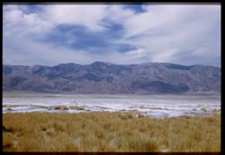
- Description:
- 100 f 6.3 tl
- Subject:
- Rocks, Bodies of water, Minerals, Salt, Shrubs, and Death Valley (Calif. and Nev.)
- Series:
- 10-55
- Creator:
- Cushman, Charles W., 1896-1972
- Date Created:
- 1955-03-22
- Frame Number:
- 16
- County:
- Inyo
- Abstract:
- Salt island at Bad Water
- Call Number:
- P07841
- City:
- Badwater
- Country:
- United States
- State/Province:
- California
- Alternate Identifier:
- 1055.16
- Persistent URL:
- http://purl.dlib.indiana.edu/iudl/archives/cushman/P07841
-
- Description:
- 100 f 5.6 tl
- Subject:
- Snow, Valleys, Trees, Lone Pine Peak (Calif.), Mountains, Shrubs, and Rocks
- Series:
- 3-55
- Creator:
- Cushman, Charles W., 1896-1972
- Date Created:
- 1955-02-28
- Genre:
- Landscape photographs
- Frame Number:
- 35
- Street Address:
- Mount Whitney Road
- County:
- Inyo
- Abstract:
- top of Lone Pine Pk
- Call Number:
- P07626
- City:
- Lone Pine
- Country:
- United States
- State/Province:
- California
- Alternate Identifier:
- 355.35
- Persistent URL:
- http://purl.dlib.indiana.edu/iudl/archives/cushman/P07626
-
- Description:
- 50 f 11
- Subject:
- Middle Palisade Glacier (Calif.), Trees, Flowers, Mountains, Shrubs, and Sierra Nevada (Calif. and Nev.)
- Series:
- 12-54
- Creator:
- Cushman, Charles W., 1896-1972
- Date Created:
- 1954-09-18
- Genre:
- Landscape photographs
- Frame Number:
- 6
- Street Address:
- Glacier Lodge Road
- County:
- Inyo
- Abstract:
- High Sierra west of Big Pine - from Glacier Lodge road.
- Call Number:
- P07396
- City:
- Big Pine
- Country:
- United States
- State/Province:
- California
- Physical Description:
- film scratched.
- Alternate Identifier:
- 1254.6
- Persistent URL:
- http://purl.dlib.indiana.edu/iudl/archives/cushman/P07396
-
- Description:
- 100 f 8 tl
- Subject:
- Valleys, Mountains, Shrubs, Death Valley National Park (Calif. and Nev.), and Black Mountains (Inyo County, Calif.)
- Series:
- 12-55
- Creator:
- Cushman, Charles W., 1896-1972
- Date Created:
- 1955-03-24
- Genre:
- Landscape photographs
- Frame Number:
- 9
- County:
- Inyo
- Abstract:
- The colorful Black Mtns. of Death Valley Nat'l Mon. from Hwy near Tecopa
- Call Number:
- P07905
- City:
- Tecopa
- Country:
- United States
- State/Province:
- California
- Alternate Identifier:
- 1255.9
- Persistent URL:
- http://purl.dlib.indiana.edu/iudl/archives/cushman/P07905
-
- Description:
- 100 f 8 tl
- Subject:
- Rocks, Valleys, Dantes View (Calif.), Mountains, Shrubs, Clouds, Death Valley National Park (Calif. and Nev.), and Black Mountains (Inyo County, Calif.)
- Series:
- 3-55
- Creator:
- Cushman, Charles W., 1896-1972
- Date Created:
- 1955-02-27
- Genre:
- Landscape photographs
- Frame Number:
- 6
- County:
- Inyo
- Abstract:
- East side of Black Mtns from road below Dante's View from another angle.
- Call Number:
- P07599
- Country:
- United States
- State/Province:
- California
- Alternate Identifier:
- 355.6
- Persistent URL:
- http://purl.dlib.indiana.edu/iudl/archives/cushman/P07599
-
- Description:
- 100 f 6.3 tl
- Subject:
- Spouses, Women, Alabama Hills (Calif.), Hills, Shrubs, and Rock formations
- Series:
- 4-55
- Creator:
- Cushman, Charles W., 1896-1972
- Date Created:
- 1955-02-28
- Genre:
- Portraits
- Frame Number:
- 8
- County:
- Inyo
- Persons Pictured:
- Cushman, Jean
- Abstract:
- Inside the Alabama Hills
- Call Number:
- P07636
- City:
- Lone Pine
- Country:
- United States
- State/Province:
- California
- Alternate Identifier:
- 455.8
- Persistent URL:
- http://purl.dlib.indiana.edu/iudl/archives/cushman/P07636
-
- Description:
- 50 f 8 HF
- Subject:
- Rocks, Rocks, Igneous, Owens Valley (Calif.), Mountains, Shrubs, Sierra Nevada (Calif. and Nev.), and Deserts
- Series:
- 12-54
- Creator:
- Cushman, Charles W., 1896-1972
- Date Created:
- 1954-09-18
- Genre:
- Landscape photographs
- Frame Number:
- 18
- County:
- Inyo
- Abstract:
- To show sawteeth - 13 mi. north of Independence. - desert showing lava rock.
- Call Number:
- P07408
- City:
- Big Pine and Independence
- Country:
- United States
- State/Province:
- California
- Physical Description:
- Image was originally mounted in a glass enclosure. Before digitization, the image was removed and placed in a Wess Plastic, Inc. brand, 2" x 2", pl...
- Alternate Identifier:
- 1254.18
- Persistent URL:
- http://purl.dlib.indiana.edu/iudl/archives/cushman/P07408
-
- Description:
- 100 f 8 + tl 40 ft.
- Subject:
- Minerals, Alkali, and Shrubs
- Series:
- 12-55
- Creator:
- Cushman, Charles W., 1896-1972
- Date Created:
- 1955-03-24
- Genre:
- Landscape photographs
- Frame Number:
- 5
- County:
- Inyo
- Abstract:
- Closeup
- Call Number:
- P07901
- City:
- Shoshone
- Country:
- United States
- State/Province:
- California
- Alternate Identifier:
- 1255.5
- Persistent URL:
- http://purl.dlib.indiana.edu/iudl/archives/cushman/P07901
-
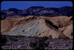
- Description:
- 200 f 4.5 tl
- Subject:
- Rocks, Dantes View (Calif.), Mountains, Shrubs, Death Valley (Calif. and Nev.), Rock formations, and Furnace Creek Inn (Death Valley Junction, Calif.)
- Series:
- 2-55
- Creator:
- Cushman, Charles W., 1896-1972
- Date Created:
- 1955-02-27
- Genre:
- Landscape photographs
- Frame Number:
- 26
- County:
- Inyo
- Abstract:
- Elephant hide 10 miles SE of Furnace Ck. Inn
- Call Number:
- P07584
- City:
- Death Valley Junction
- Country:
- United States
- State/Province:
- California
- Alternate Identifier:
- 255.26
- Persistent URL:
- http://purl.dlib.indiana.edu/iudl/archives/cushman/P07584
-
- Description:
- 100 f 6.3 tl
- Subject:
- Valleys, Roads, Automobiles, Shrubs, Indigenous peoples, Masonry, Zabriskie Point (Calif.), and Hills
- Series:
- 9-55
- Creator:
- Cushman, Charles W., 1896-1972
- Date Created:
- 1955-03-22
- Genre:
- Identification photographs
- Frame Number:
- 10
- County:
- Inyo
- Abstract:
- A couple of natives and a jeep
- Call Number:
- P07802
- Country:
- United States
- State/Province:
- California
- Alternate Identifier:
- 955.10
- Persistent URL:
- http://purl.dlib.indiana.edu/iudl/archives/cushman/P07802
-
- Description:
- 25 f 8 Pola
- Subject:
- Deserts, Valleys, Roads, Mountains, Shrubs, Panamint Valley (Calif.), Hills, Rocks, Panamint Range (Calif.), and Death Valley (Calif. and Nev.)
- Series:
- 15-52
- Creator:
- Cushman, Charles W., 1896-1972
- Date Created:
- 1952-04-08
- Genre:
- Landscape photographs
- Frame Number:
- 6
- County:
- Inyo
- Abstract:
- Road is straight across Panamint Valley.
- Call Number:
- P06027
- Country:
- United States
- State/Province:
- California
- Physical Description:
- Image was originally mounted in a glass enclosure. Before digitization, the image was removed and placed in a Wess Plastic, Inc. brand, 2" x 2", pl...
- Alternate Identifier:
- 1552.6
- Persistent URL:
- http://purl.dlib.indiana.edu/iudl/archives/cushman/P06027
-
- Description:
- 25 f 13
- Subject:
- Rocks, Mesquite, Valleys, Cliffs, Women, Mountains, Shrubs, Death Valley (Calif. and Nev.), Utility poles, Furnace Creek (Calif.), and Hills
- Series:
- 15-52
- Creator:
- Cushman, Charles W., 1896-1972
- Date Created:
- 1952-04-09
- Genre:
- Landscape photographs and Portraits
- Frame Number:
- 14
- County:
- Inyo
- Persons Pictured:
- Cushman, Jean
- Abstract:
- Mesquite and green rocks. (near Furnace Creek)
- Call Number:
- P06035
- Country:
- United States
- State/Province:
- California
- Alternate Identifier:
- 1552.14
- Persistent URL:
- http://purl.dlib.indiana.edu/iudl/archives/cushman/P06035
-
- Description:
- 25 f 8 Pola
- Subject:
- Snow, Valleys, Inyo Mountains (Calif.), Boulders, Owens Valley (Calif.), Mountains, Shrubs, Hills, Rocks, Alabama Hills (Calif.), and Rock formations
- Series:
- 14-52
- Creator:
- Cushman, Charles W., 1896-1972
- Date Created:
- 1952-04-08
- Genre:
- Landscape photographs
- Frame Number:
- 36
- Street Address:
- Mount Whitney Road
- County:
- Inyo
- Abstract:
- View across valley weird rock at it.
- Call Number:
- P06019
- Country:
- United States
- State/Province:
- California
- Alternate Identifier:
- 1452.36
- Persistent URL:
- http://purl.dlib.indiana.edu/iudl/archives/cushman/P06019
-
- Description:
- 50 f 11 HF
- Subject:
- Valleys, Grasses, White Mountains (Calif. and Nev.), Trees, Owens Valley (Calif.), Mountains, and Shrubs
- Series:
- 11-54
- Creator:
- Cushman, Charles W., 1896-1972
- Date Created:
- 1954-09-17
- Genre:
- Landscape photographs
- Frame Number:
- 20
- County:
- Inyo
- Abstract:
- White Mtns east wall of Owens Valley with 2 bare trees.
- Call Number:
- P07389
- Country:
- United States
- State/Province:
- California and Nevada
- Alternate Identifier:
- 1154.20
- Persistent URL:
- http://purl.dlib.indiana.edu/iudl/archives/cushman/P07389
-
- Description:
- 50 f 11 HF
- Subject:
- Deserts, Inyo Mountains (Calif.), Flowers, Mountains, Shrubs, Hills, and Rock formations
- Series:
- 12-54
- Creator:
- Cushman, Charles W., 1896-1972
- Date Created:
- 1954-09-18
- Genre:
- Landscape photographs
- Frame Number:
- 29
- Street Address:
- Mt. Whitney Road
- County:
- Inyo
- Abstract:
- Inyo Mtns beyond one of the Alabama Hills.
- Call Number:
- P07419
- City:
- Alabama Hills and Lone Pine
- Country:
- United States
- State/Province:
- California
- Alternate Identifier:
- 1254.29
- Persistent URL:
- http://purl.dlib.indiana.edu/iudl/archives/cushman/P07419
-
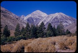
- Description:
- 100 f 6.3 tl
- Subject:
- Snow, Valleys, Trees, Mountains, Williamson, Mount (Inyo County, Calif.), Shrubs, and Whitney, Mount (Calif.)
- Series:
- 4-55
- Creator:
- Cushman, Charles W., 1896-1972
- Date Created:
- 1955-02-28
- Genre:
- Landscape photographs
- Frame Number:
- 10
- County:
- Inyo
- Abstract:
- High peak Mt. Williamson of Independence 14,384 ft.
- Call Number:
- P07638
- City:
- Independence
- Country:
- United States
- State/Province:
- California
- Alternate Identifier:
- 455.10
- Persistent URL:
- http://purl.dlib.indiana.edu/iudl/archives/cushman/P07638
-
- Description:
- 50 f 11
- Subject:
- Deserts, Middle Palisade Glacier (Calif.), Trees, Mountains, Shrubs, Sierra Nevada (Calif. and Nev.), and Glacier Lodge (Calif.)
- Series:
- 12-54
- Creator:
- Cushman, Charles W., 1896-1972
- Date Created:
- 1954-09-18
- Genre:
- Landscape photographs
- Frame Number:
- 11
- County:
- Inyo
- Abstract:
- Again [L]
- Call Number:
- P07401
- City:
- Lone Pine
- Country:
- United States
- State/Province:
- California
- Alternate Identifier:
- 1254.11
- Persistent URL:
- http://purl.dlib.indiana.edu/iudl/archives/cushman/P07401
-
- Description:
- 25 f 8 Pola
- Subject:
- Deserts, Valleys, Mountains, Shrubs, and Death Valley (Calif. and Nev.)
- Series:
- 15-52
- Creator:
- Cushman, Charles W., 1896-1972
- Date Created:
- 1952-04-09
- Genre:
- Landscape photographs
- Frame Number:
- 13
- County:
- Inyo
- Abstract:
- View WSW across valley.
- Call Number:
- P06034
- Country:
- United States
- State/Province:
- California
- Physical Description:
- Image was originally mounted in a glass enclosure. Before digitization, the image was removed and placed in a Wess Plastic, Inc. brand, 2" x 2", pl...
- Alternate Identifier:
- 1552.13
- Persistent URL:
- http://purl.dlib.indiana.edu/iudl/archives/cushman/P06034
-
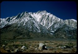
- Description:
- 25 f 9 Pola
- Subject:
- Rocks, Lone Pine Peak (Calif.), Mountains, Shrubs, Sierra Nevada (Calif. and Nev.), Langley, Mount (Calif.), Snow, and Boulders
- Series:
- 14-52
- Creator:
- Cushman, Charles W., 1896-1972
- Date Created:
- 1952-04-08
- Genre:
- Landscape photographs
- Frame Number:
- 24
- County:
- Inyo
- Abstract:
- Same high peak - Langley, 14,042.
- Call Number:
- P06008
- Country:
- United States
- State/Province:
- California
- Alternate Identifier:
- 1452.24
- Persistent URL:
- http://purl.dlib.indiana.edu/iudl/archives/cushman/P06008
-
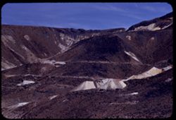
- Description:
- 100 f 8 tl
- Subject:
- Valleys, Mountains, Shrubs, and Black Mountains (Inyo County, Calif.)
- Series:
- 8-55
- Creator:
- Cushman, Charles W., 1896-1972
- Date Created:
- 1955-03-22
- Genre:
- Landscape photographs
- Frame Number:
- 38
- County:
- Inyo
- Abstract:
- Dark Mtns near Ryan
- Call Number:
- P07793
- City:
- Ryan
- Country:
- United States
- State/Province:
- California
- Alternate Identifier:
- 855.38
- Persistent URL:
- http://purl.dlib.indiana.edu/iudl/archives/cushman/P07793