
Search Constraints
You searched for:
Campus
IUB
Remove constraint Campus: IUB
County
Inyo
Remove constraint County: Inyo
Subject
Valleys
Remove constraint Subject: Valleys
« Previous |
1 - 100 of 146
|
Next »
Search Results
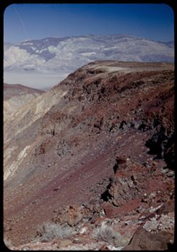
-
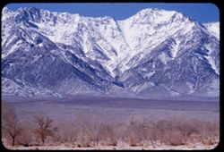
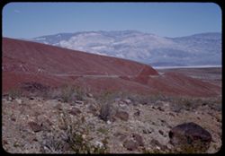
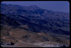
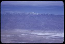
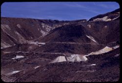
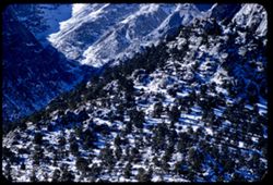
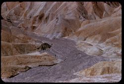
- Description:
- 100 f 5.6
- Subject:
- Snow, Valleys, Trees, Mountains, Williamson, Mount (Inyo County, Calif.), Shrubs, and Sierra Nevada (Calif. and Nev.)
- Series:
- 4-55
- Creator:
- Cushman, Charles W., 1896-1972
- Date Created:
- 1955-02-28
- Genre:
- Landscape photographs
- Frame Number:
- 13
- Street Address:
- United States Highway 6
- County:
- Inyo
- Abstract:
- Mtns north of Williamson
- Call Number:
- P07640
- Country:
- United States
- State/Province:
- California
- Alternate Identifier:
- 455.13
- Persistent URL:
- http://purl.dlib.indiana.edu/iudl/archives/cushman/P07640
- Holding Location:
- Bloomington - University Archives
Wells Library E460
1320 E 10th St.
Bloomington, IN 47405
Contact at archives@indiana.edu, 812-855-1127
-
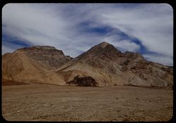
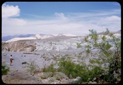
- Description:
- 100 f 8+ tl
- Subject:
- Rocks, Valleys, Mountains, and Death Valley National Park (Calif. and Nev.)
- Series:
- 10-55
- Creator:
- Cushman, Charles W., 1896-1972
- Date Created:
- 1955-03-22
- Frame Number:
- 1
- Street Address:
- Artist's View Drive
- County:
- Inyo
- Abstract:
- From top of Artists Drive
- Call Number:
- P07829
- Country:
- United States
- State/Province:
- California
- Alternate Identifier:
- 1055.1
- Persistent URL:
- http://purl.dlib.indiana.edu/iudl/archives/cushman/P07829
- Holding Location:
- Bloomington - University Archives
Wells Library E460
1320 E 10th St.
Bloomington, IN 47405
Contact at archives@indiana.edu, 812-855-1127
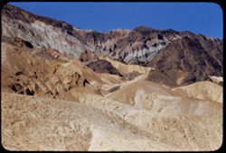
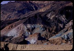
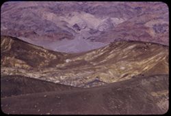
-
- Description:
- 100 f 8 tl
- Subject:
- Rocks, Valleys, Mountains, Death Valley National Park (Calif. and Nev.), and Black Mountains (Inyo County, Calif.)
- Series:
- 9-55
- Creator:
- Cushman, Charles W., 1896-1972
- Date Created:
- 1955-03-22
- Frame Number:
- 36
- Street Address:
- Artist's View Drive
- County:
- Inyo
- Abstract:
- Aboave Artists Drive [P]
- Call Number:
- P07826
- Country:
- United States
- State/Province:
- California
- Alternate Identifier:
- 955.36
- Persistent URL:
- http://purl.dlib.indiana.edu/iudl/archives/cushman/P07826
- Holding Location:
- Bloomington - University Archives
Wells Library E460
1320 E 10th St.
Bloomington, IN 47405
Contact at archives@indiana.edu, 812-855-1127
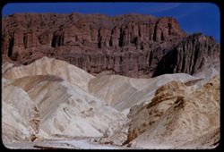
-
- Description:
- 100 f 6.3 tl
- Subject:
- Rocks, Twenty Mule Team Canyon (Calif.), Canyons, Mountains, Rock formations, Death Valley National Park (Calif. and Nev.), and Valleys
- Series:
- 10-55
- Creator:
- Cushman, Charles W., 1896-1972
- Date Created:
- 1955-03-23
- Genre:
- Landscape photographs
- Frame Number:
- 34
- County:
- Inyo
- Abstract:
- Same canyon
- Call Number:
- P07859
- Country:
- United States
- State/Province:
- California
- Alternate Identifier:
- 1055.34
- Persistent URL:
- http://purl.dlib.indiana.edu/iudl/archives/cushman/P07859
- Holding Location:
- Bloomington - University Archives
Wells Library E460
1320 E 10th St.
Bloomington, IN 47405
Contact at archives@indiana.edu, 812-855-1127
-
- Description:
- 100 f 8 tl
- Subject:
- Twenty Mule Team Canyon (Calif.), Canyons, Mountains, Death Valley National Park (Calif. and Nev.), and Valleys
- Series:
- 10-55
- Creator:
- Cushman, Charles W., 1896-1972
- Date Created:
- 1955-03-23
- Genre:
- Landscape photographs
- Frame Number:
- 32
- County:
- Inyo
- Abstract:
- In 20 mule team canyon
- Call Number:
- P07857
- Country:
- United States
- State/Province:
- California
- Alternate Identifier:
- 1055.32
- Persistent URL:
- http://purl.dlib.indiana.edu/iudl/archives/cushman/P07857
- Holding Location:
- Bloomington - University Archives
Wells Library E460
1320 E 10th St.
Bloomington, IN 47405
Contact at archives@indiana.edu, 812-855-1127
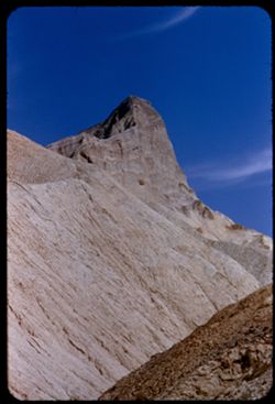
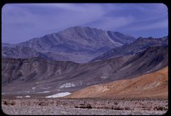
-
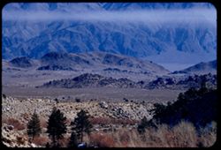
- Description:
- 50 f 11
- Subject:
- Deserts, Valleys, White Mountains (Calif. and Nev.), Dirt roads, Sand, Owens Valley (Calif.), Mountains, Shrubs, Dwellings, and Farms
- Series:
- 11-54
- Creator:
- Cushman, Charles W., 1896-1972
- Date Created:
- 1954-09-17
- Genre:
- Landscape photographs
- Frame Number:
- 22
- County:
- Inyo
- Abstract:
- White Mtns. have color. In center should be White Mtn. (14,242 ft.)
- Call Number:
- P07391
- Country:
- United States
- State/Province:
- California
- Physical Description:
- Image was originally mounted in a glass enclosure. Before digitization, the image was removed and placed in a Wess Plastic, Inc. brand, 2" x 2", pl...
- Alternate Identifier:
- 1154.22
- Persistent URL:
- http://purl.dlib.indiana.edu/iudl/archives/cushman/P07391
- Holding Location:
- Bloomington - University Archives
Wells Library E460
1320 E 10th St.
Bloomington, IN 47405
Contact at archives@indiana.edu, 812-855-1127
-
- Description:
- 50 f 11 HF
- Subject:
- Valleys, Grasses, White Mountains (Calif. and Nev.), Trees, Owens Valley (Calif.), Mountains, and Shrubs
- Series:
- 11-54
- Creator:
- Cushman, Charles W., 1896-1972
- Date Created:
- 1954-09-17
- Genre:
- Landscape photographs
- Frame Number:
- 20
- County:
- Inyo
- Abstract:
- White Mtns east wall of Owens Valley with 2 bare trees.
- Call Number:
- P07389
- Country:
- United States
- State/Province:
- California and Nevada
- Alternate Identifier:
- 1154.20
- Persistent URL:
- http://purl.dlib.indiana.edu/iudl/archives/cushman/P07389
- Holding Location:
- Bloomington - University Archives
Wells Library E460
1320 E 10th St.
Bloomington, IN 47405
Contact at archives@indiana.edu, 812-855-1127
-
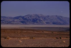
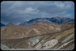
- Description:
- tl
- Subject:
- Valleys, Panamint Range (Calif.), Dantes View (Calif.), Mountains, Clouds, and Death Valley (Calif. and Nev.)
- Series:
- 2-55
- Creator:
- Cushman, Charles W., 1896-1972
- Date Created:
- 1955-02-27
- Genre:
- Landscape photographs
- Frame Number:
- 35
- County:
- Inyo
- Abstract:
- West by north across valley toward Panamints
- Call Number:
- P07592
- Country:
- United States
- State/Province:
- California
- Alternate Identifier:
- 255.35
- Persistent URL:
- http://purl.dlib.indiana.edu/iudl/archives/cushman/P07592
- Holding Location:
- Bloomington - University Archives
Wells Library E460
1320 E 10th St.
Bloomington, IN 47405
Contact at archives@indiana.edu, 812-855-1127
-
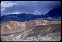
- Description:
- 100 f 6.3 tl
- Subject:
- Valleys, Mountains, and Black Mountains (Inyo County, Calif.)
- Series:
- 3-55
- Creator:
- Cushman, Charles W., 1896-1972
- Date Created:
- 1955-02-27
- Genre:
- Landscape photographs
- Frame Number:
- 16
- Street Address:
- Bad Water Road
- County:
- Inyo
- Abstract:
- W slope of Black Mtns from Bad Water Rd.
- Call Number:
- P07608
- Country:
- United States
- State/Province:
- California
- Alternate Identifier:
- 355.16
- Persistent URL:
- http://purl.dlib.indiana.edu/iudl/archives/cushman/P07608
- Holding Location:
- Bloomington - University Archives
Wells Library E460
1320 E 10th St.
Bloomington, IN 47405
Contact at archives@indiana.edu, 812-855-1127
-
- Description:
- 50 mm lens
- Subject:
- Deserts, Craters, Valleys, Dantes View (Calif.), Mountains, Clouds, Death Valley (Calif. and Nev.), and Black Mountains (Inyo County, Calif.)
- Series:
- 3-55
- Creator:
- Cushman, Charles W., 1896-1972
- Date Created:
- 1955-02-27
- Genre:
- Landscape photographs
- Frame Number:
- 4
- County:
- Inyo
- Abstract:
- West across floor of Death Valley
- Call Number:
- P07597
- Country:
- United States
- State/Province:
- California
- Alternate Identifier:
- 355.4
- Persistent URL:
- http://purl.dlib.indiana.edu/iudl/archives/cushman/P07597
- Holding Location:
- Bloomington - University Archives
Wells Library E460
1320 E 10th St.
Bloomington, IN 47405
Contact at archives@indiana.edu, 812-855-1127
-
- Description:
- 25 f 9 Pola
- Subject:
- Deserts, Valleys, Cliffs, Mountains, Zabriskie Point (Calif.), Death Valley (Calif. and Nev.), Streams, and Hills
- Series:
- 15-52
- Creator:
- Cushman, Charles W., 1896-1972
- Date Created:
- 1952-04-09
- Genre:
- Landscape photographs
- Frame Number:
- 16
- County:
- Inyo
- Abstract:
- West from Zabriskie Pt.
- Call Number:
- P06036
- City:
- Furnace Creek
- Country:
- United States
- State/Province:
- California
- Physical Description:
- Image was originally mounted in a glass enclosure. Before digitization, the image was removed and placed in a Wess Plastic, Inc. brand, 2" x 2", pl...
- Alternate Identifier:
- 1552.16
- Persistent URL:
- http://purl.dlib.indiana.edu/iudl/archives/cushman/P06036
- Holding Location:
- Bloomington - University Archives
Wells Library E460
1320 E 10th St.
Bloomington, IN 47405
Contact at archives@indiana.edu, 812-855-1127
-
- Description:
- 25 f 9 Pola
- Subject:
- Deserts, Valleys, Mountains, Rock formations, Zabriskie Point (Calif.), and Death Valley (Calif. and Nev.)
- Series:
- 15-52
- Creator:
- Cushman, Charles W., 1896-1972
- Date Created:
- 1952-04-09
- Genre:
- Landscape photographs
- Frame Number:
- 18
- County:
- Inyo
- Abstract:
- NW from out on shoulder.
- Call Number:
- P06038
- City:
- Furnace Creek
- Country:
- United States
- State/Province:
- California
- Alternate Identifier:
- 1552.18
- Persistent URL:
- http://purl.dlib.indiana.edu/iudl/archives/cushman/P06038
- Holding Location:
- Bloomington - University Archives
Wells Library E460
1320 E 10th St.
Bloomington, IN 47405
Contact at archives@indiana.edu, 812-855-1127
-
- Description:
- 100 f 8 tl
- Subject:
- Valleys, Mountains, Clouds, Death Valley (Calif. and Nev.), and Black Mountains (Inyo County, Calif.)
- Series:
- 9-55
- Creator:
- Cushman, Charles W., 1896-1972
- Date Created:
- 1955-03-22
- Genre:
- Landscape photographs
- Frame Number:
- 34
- Street Address:
- Artist's View Drive
- County:
- Inyo
- Abstract:
- Up from Artists (View) Drive
- Call Number:
- P07824
- Country:
- United States
- State/Province:
- California
- Alternate Identifier:
- 955.34
- Persistent URL:
- http://purl.dlib.indiana.edu/iudl/archives/cushman/P07824
- Holding Location:
- Bloomington - University Archives
Wells Library E460
1320 E 10th St.
Bloomington, IN 47405
Contact at archives@indiana.edu, 812-855-1127
-
- Description:
- 50 f 10
- Subject:
- Sabrina, Lake (Calif.), Canyons, Valleys, Mountains, Shrubs, Sierra Nevada (Calif. and Nev.), Trees, Rocks, and Dwellings
- Series:
- 11-54
- Creator:
- Cushman, Charles W., 1896-1972
- Date Created:
- 1954-09-17
- Genre:
- Landscape photographs
- Frame Number:
- 8
- County:
- Inyo
- Abstract:
- Up canyon of yellow trees.
- Call Number:
- P07377
- Country:
- United States
- State/Province:
- California
- Alternate Identifier:
- 1154.8
- Persistent URL:
- http://purl.dlib.indiana.edu/iudl/archives/cushman/P07377
- Holding Location:
- Bloomington - University Archives
Wells Library E460
1320 E 10th St.
Bloomington, IN 47405
Contact at archives@indiana.edu, 812-855-1127
-
- Description:
- 100 f 6.3 tl
- Subject:
- Valleys, Mountains, Shrubs, Snow, Trees, and Rocks
- Series:
- 3-55
- Creator:
- Cushman, Charles W., 1896-1972
- Date Created:
- 1955-02-28
- Genre:
- Landscape photographs
- Frame Number:
- 33
- Street Address:
- Mount Whitney Road and Whitney Portal Road
- County:
- Inyo
- Abstract:
- view of Whitney Road from 9 mi. up the Whitney Portal rd.
- Call Number:
- P07624
- City:
- Lone Pine
- Country:
- United States
- State/Province:
- California
- Alternate Identifier:
- 355.33
- Persistent URL:
- http://purl.dlib.indiana.edu/iudl/archives/cushman/P07624
- Holding Location:
- Bloomington - University Archives
Wells Library E460
1320 E 10th St.
Bloomington, IN 47405
Contact at archives@indiana.edu, 812-855-1127
-
- Description:
- tl
- Subject:
- Valleys, Roads, Dantes View (Calif.), Black Mountain (Inyo County, Calif.), Clouds, Death Valley (Calif. and Nev.), and Mountains
- Series:
- 2-55
- Creator:
- Cushman, Charles W., 1896-1972
- Date Created:
- 1955-02-27
- Genre:
- Landscape photographs
- Frame Number:
- 37
- County:
- Inyo
- Abstract:
- Up valley - NNW.
- Call Number:
- P07594
- Country:
- United States
- State/Province:
- California
- Alternate Identifier:
- 255.37
- Persistent URL:
- http://purl.dlib.indiana.edu/iudl/archives/cushman/P07594
- Holding Location:
- Bloomington - University Archives
Wells Library E460
1320 E 10th St.
Bloomington, IN 47405
Contact at archives@indiana.edu, 812-855-1127
-
- Description:
- 50 f 8 Haze F
- Subject:
- Valleys, Rocks, Bishop Peak (Calif.), Mountains, Trees, Owens Valley (Calif.), Shadows, Shrubs, and Roads
- Series:
- 11-54
- Creator:
- Cushman, Charles W., 1896-1972
- Date Created:
- 1954-09-16
- Genre:
- Landscape photographs
- Frame Number:
- 4
- Street Address:
- United States Highway 395, United States Highway 6/395, and California State Highway 14
- County:
- Inyo
- Abstract:
- View south toward Owens valley where Bishop lies.
- Call Number:
- P07373
- Country:
- United States
- State/Province:
- California
- Alternate Identifier:
- 1154.4
- Persistent URL:
- http://purl.dlib.indiana.edu/iudl/archives/cushman/P07373
- Holding Location:
- Bloomington - University Archives
Wells Library E460
1320 E 10th St.
Bloomington, IN 47405
Contact at archives@indiana.edu, 812-855-1127
-
- Description:
- 100 f 9 error 50 mm
- Subject:
- Valleys, Trees, Mountains, Fences, Shrubs, Scotty's Castle (Calif.), Death Valley (Calif. and Nev.), Castles & palaces, and Hills
- Series:
- 11-55
- Creator:
- Cushman, Charles W., 1896-1972
- Date Created:
- 1955-03-23
- Genre:
- Landscape photographs
- Frame Number:
- 34
- County:
- Inyo
- Abstract:
- South from verandah of Scotty's castle
- Call Number:
- P07893
- Country:
- United States
- State/Province:
- California
- Alternate Identifier:
- 1155.34
- Persistent URL:
- http://purl.dlib.indiana.edu/iudl/archives/cushman/P07893
- Holding Location:
- Bloomington - University Archives
Wells Library E460
1320 E 10th St.
Bloomington, IN 47405
Contact at archives@indiana.edu, 812-855-1127
-
- Description:
- 100 f 8 tl
- Subject:
- Canyons, Valleys, Twenty Mule Team Canyon (Calif.), Mountains, and Furnace Creek (Calif.)
- Series:
- 10-55
- Creator:
- Cushman, Charles W., 1896-1972
- Date Created:
- 1955-03-23
- Genre:
- Landscape photographs
- Frame Number:
- 30
- County:
- Inyo
- Abstract:
- In 20 mule team canyon
- Call Number:
- P07855
- Country:
- United States
- State/Province:
- California
- Alternate Identifier:
- 1055.30
- Persistent URL:
- http://purl.dlib.indiana.edu/iudl/archives/cushman/P07855
- Holding Location:
- Bloomington - University Archives
Wells Library E460
1320 E 10th St.
Bloomington, IN 47405
Contact at archives@indiana.edu, 812-855-1127
-
- Description:
- 100 f 8 - tel.
- Subject:
- Valleys, Mountains, Zabriskie Point (Calif.), Death Valley (Calif. and Nev.), and Rock formations
- Series:
- 9-55
- Creator:
- Cushman, Charles W., 1896-1972
- Date Created:
- 1955-03-22
- Genre:
- Landscape photographs
- Frame Number:
- 7
- County:
- Inyo
- Abstract:
- NW from Zabriskie Pt.
- Call Number:
- P07799
- Country:
- United States
- State/Province:
- California
- Physical Description:
- Image was originally mounted in a glass enclosure. Before digitization, the image was removed and placed in a Wess Plastic, Inc. brand, 2" x 2", pl...
- Alternate Identifier:
- 955.7
- Persistent URL:
- http://purl.dlib.indiana.edu/iudl/archives/cushman/P07799
- Holding Location:
- Bloomington - University Archives
Wells Library E460
1320 E 10th St.
Bloomington, IN 47405
Contact at archives@indiana.edu, 812-855-1127
-
- Description:
- 25 f 8 Pola
- Subject:
- Deserts, Valleys, Panamint Range (Calif.), Panamint Mountains (Calif.), Argus Range (Calif.), Mountains, Shrubs, Panamint Valley (Calif.), Death Valley (Cali...
- Series:
- 15-52
- Creator:
- Cushman, Charles W., 1896-1972
- Date Created:
- 1952-04-08
- Genre:
- Landscape photographs
- Frame Number:
- 4
- County:
- Inyo
- Abstract:
- Same [P]
- Call Number:
- P06025
- Country:
- United States
- State/Province:
- California
- Alternate Identifier:
- 1552.4
- Persistent URL:
- http://purl.dlib.indiana.edu/iudl/archives/cushman/P06025
- Holding Location:
- Bloomington - University Archives
Wells Library E460
1320 E 10th St.
Bloomington, IN 47405
Contact at archives@indiana.edu, 812-855-1127
-
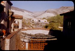
- Description:
- 50 f 9 50 mm
- Subject:
- Bell towers, Valleys, Trees, Roofs, Arches, Mountains, Flowerpots, Shrubs, Scotty's Castle (Calif.), Lamps, Castles & palaces, Gates, Courtyards, and...
- Series:
- 11-55
- Creator:
- Cushman, Charles W., 1896-1972
- Date Created:
- 1955-03-23
- Genre:
- Architectural photographs
- Frame Number:
- 36
- County:
- Inyo
- Abstract:
- View east
- Call Number:
- P07895
- Country:
- United States
- State/Province:
- California
- Alternate Identifier:
- 1155.36
- Persistent URL:
- http://purl.dlib.indiana.edu/iudl/archives/cushman/P07895
- Holding Location:
- Bloomington - University Archives
Wells Library E460
1320 E 10th St.
Bloomington, IN 47405
Contact at archives@indiana.edu, 812-855-1127
-
- Description:
- 100 f 6.3 tl
- Subject:
- Valleys, Mountains, Snow, Clouds, and Panamint Range (Calif.)
- Series:
- 2-55
- Creator:
- Cushman, Charles W., 1896-1972
- Date Created:
- 1955-02-26
- Genre:
- Landscape photographs
- Frame Number:
- 22
- Street Address:
- Trona Road
- County:
- Inyo
- Abstract:
- Panamint Mtns east of rd north from Trona
- Call Number:
- P07580
- Country:
- United States
- State/Province:
- California
- Alternate Identifier:
- 255.22
- Persistent URL:
- http://purl.dlib.indiana.edu/iudl/archives/cushman/P07580
- Holding Location:
- Bloomington - University Archives
Wells Library E460
1320 E 10th St.
Bloomington, IN 47405
Contact at archives@indiana.edu, 812-855-1127
-
- Description:
- 25 f 8 Pola
- Subject:
- Snow, Valleys, Inyo Mountains (Calif.), Boulders, Owens Valley (Calif.), Mountains, Shrubs, Hills, Rocks, Alabama Hills (Calif.), and Rock formations
- Series:
- 14-52
- Creator:
- Cushman, Charles W., 1896-1972
- Date Created:
- 1952-04-08
- Genre:
- Landscape photographs
- Frame Number:
- 36
- Street Address:
- Mount Whitney Road
- County:
- Inyo
- Abstract:
- View across valley weird rock at it.
- Call Number:
- P06019
- Country:
- United States
- State/Province:
- California
- Alternate Identifier:
- 1452.36
- Persistent URL:
- http://purl.dlib.indiana.edu/iudl/archives/cushman/P06019
- Holding Location:
- Bloomington - University Archives
Wells Library E460
1320 E 10th St.
Bloomington, IN 47405
Contact at archives@indiana.edu, 812-855-1127
-
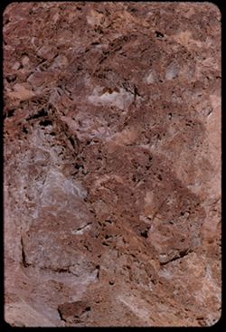
- Description:
- 25 f 13
- Subject:
- Rocks, Valleys, Panamint Range (Calif.), Panamint Mountains (Calif.), Argus Range (Calif.), Boulders, Mountains, Rock Candy Mountain (Calif.), Shrubs, Panami...
- Series:
- 15-52
- Creator:
- Cushman, Charles W., 1896-1972
- Date Created:
- 1952-04-08
- Genre:
- Landscape photographs
- Frame Number:
- 7
- Street Address:
- California State Highway 190
- County:
- Inyo
- Abstract:
- Red earth at Rock Candy mtn. (Panamint).
- Call Number:
- P06028
- City:
- Panamint
- Country:
- United States
- State/Province:
- California
- Alternate Identifier:
- 1552.7
- Persistent URL:
- http://purl.dlib.indiana.edu/iudl/archives/cushman/P06028
- Holding Location:
- Bloomington - University Archives
Wells Library E460
1320 E 10th St.
Bloomington, IN 47405
Contact at archives@indiana.edu, 812-855-1127
-
- Description:
- 100 f 6.3 tl
- Subject:
- Valleys, Mountains, Shrubs, Death Valley (Calif. and Nev.), Black Mountains (Inyo County, Calif.), and Salt flats
- Series:
- 8-55
- Creator:
- Cushman, Charles W., 1896-1972
- Date Created:
- 1955-03-21
- Genre:
- Landscape photographs
- Frame Number:
- 12
- Street Address:
- Sand Dune Junction, Bealty Road, California State Highway 190, and Scotty Castle Road
- County:
- Inyo
- Abstract:
- View southeast in late afternoon toward Black Mtns from near Sand Dune junction of 190 & [Bealty] road & Scotty Castle road
- Call Number:
- P07770
- Country:
- United States
- State/Province:
- California
- Alternate Identifier:
- 855.12
- Persistent URL:
- http://purl.dlib.indiana.edu/iudl/archives/cushman/P07770
- Holding Location:
- Bloomington - University Archives
Wells Library E460
1320 E 10th St.
Bloomington, IN 47405
Contact at archives@indiana.edu, 812-855-1127
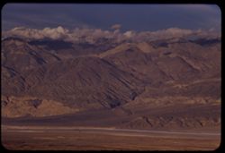
-
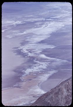
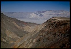
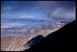
- Description:
- 100 f 6.3
- Subject:
- Valleys, Fog, Dantes View (Calif.), Mountains, and Death Valley (Calif. and Nev.)
- Series:
- 8-55
- Creator:
- Cushman, Charles W., 1896-1972
- Date Created:
- 1955-03-22
- Genre:
- Landscape photographs
- Frame Number:
- 32
- County:
- Inyo
- Abstract:
- Down to NW
- Call Number:
- P07788
- Country:
- United States
- State/Province:
- California
- Alternate Identifier:
- 855.32
- Persistent URL:
- http://purl.dlib.indiana.edu/iudl/archives/cushman/P07788
- Holding Location:
- Bloomington - University Archives
Wells Library E460
1320 E 10th St.
Bloomington, IN 47405
Contact at archives@indiana.edu, 812-855-1127
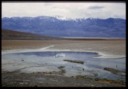
-
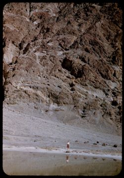
- Description:
- 100 f 8 tl
- Subject:
- Lakes & ponds, Deserts, Reflections, Valleys, Black Mountains (Inyo County, Calif.), Death Valley (Calif. and Nev.), Mountains, and Shrubs
- Series:
- 12-55
- Creator:
- Cushman, Charles W., 1896-1972
- Date Created:
- 1955-03-24
- Genre:
- Landscape photographs
- Frame Number:
- 7
- County:
- Inyo
- Abstract:
- Desert lake near Tecopa - view N.W.
- Call Number:
- P07903
- City:
- Tecopa
- Country:
- United States
- State/Province:
- California
- Alternate Identifier:
- 1255.7
- Persistent URL:
- http://purl.dlib.indiana.edu/iudl/archives/cushman/P07903
- Holding Location:
- Bloomington - University Archives
Wells Library E460
1320 E 10th St.
Bloomington, IN 47405
Contact at archives@indiana.edu, 812-855-1127
-
- Description:
- 100 f 8 tl
- Subject:
- Rocks, Valleys, Roads, Argus Range (Calif.), Emigrant Pass (Inyo County, Calif.), Mountains, Shrubs, and Panamint Valley (Calif.)
- Series:
- 7-55
- Creator:
- Cushman, Charles W., 1896-1972
- Date Created:
- 1955-03-21
- Genre:
- Landscape photographs
- Frame Number:
- 34
- County:
- Inyo
- Abstract:
- NW along Argus mtns at west side of Panamint Valley from Emigrant pass.
- Call Number:
- P07758
- Country:
- United States
- State/Province:
- California
- Alternate Identifier:
- 755.34
- Persistent URL:
- http://purl.dlib.indiana.edu/iudl/archives/cushman/P07758
- Holding Location:
- Bloomington - University Archives
Wells Library E460
1320 E 10th St.
Bloomington, IN 47405
Contact at archives@indiana.edu, 812-855-1127
-
- Description:
- 100 f 8 tl
- Subject:
- Canyons, Valleys, Twenty Mule Team Canyon (Calif.), Mountains, Death Valley National Park (Calif. and Nev.), and Furnace Creek (Calif.)
- Series:
- 10-55
- Creator:
- Cushman, Charles W., 1896-1972
- Date Created:
- 1955-03-23
- Genre:
- Landscape photographs
- Frame Number:
- 31
- County:
- Inyo
- Abstract:
- In 20 mule team canyon
- Call Number:
- P07856
- Country:
- United States
- State/Province:
- California
- Alternate Identifier:
- 1055.31
- Persistent URL:
- http://purl.dlib.indiana.edu/iudl/archives/cushman/P07856
- Holding Location:
- Bloomington - University Archives
Wells Library E460
1320 E 10th St.
Bloomington, IN 47405
Contact at archives@indiana.edu, 812-855-1127
-
- Description:
- 100 f 8+ tl
- Subject:
- Golden Canyon (Inyo County, Calif.), Canyons, Valleys, Roads, Death Valley National Park (Calif. and Nev.), and Rock formations
- Series:
- 9-55
- Creator:
- Cushman, Charles W., 1896-1972
- Date Created:
- 1955-03-22
- Genre:
- Landscape photographs
- Frame Number:
- 16
- County:
- Inyo
- Abstract:
- made inside Golden Canyon
- Call Number:
- P07808
- Country:
- United States
- State/Province:
- California
- Alternate Identifier:
- 955.16
- Persistent URL:
- http://purl.dlib.indiana.edu/iudl/archives/cushman/P07808
- Holding Location:
- Bloomington - University Archives
Wells Library E460
1320 E 10th St.
Bloomington, IN 47405
Contact at archives@indiana.edu, 812-855-1127
-
- Description:
- 100 f 8+ tl
- Subject:
- Canyons, Rock formations, Clouds, Death Valley (Calif. and Nev.), Golden Canyon (Inyo County, Calif.), and Valleys
- Series:
- 9-55
- Creator:
- Cushman, Charles W., 1896-1972
- Date Created:
- 1955-03-22
- Genre:
- Landscape photographs
- Frame Number:
- 19
- County:
- Inyo
- Abstract:
- made inside Golden Canyon
- Call Number:
- P07811
- Country:
- United States
- State/Province:
- California
- Alternate Identifier:
- 955.19
- Persistent URL:
- http://purl.dlib.indiana.edu/iudl/archives/cushman/P07811
- Holding Location:
- Bloomington - University Archives
Wells Library E460
1320 E 10th St.
Bloomington, IN 47405
Contact at archives@indiana.edu, 812-855-1127
-
- Description:
- 100 f 6.3 tl
- Subject:
- Rocks, Twenty Mule Team Canyon (Calif.), Valleys, Mountains, Death Valley National Park (Calif. and Nev.), and Canyons
- Series:
- 10-55
- Creator:
- Cushman, Charles W., 1896-1972
- Date Created:
- 1955-03-23
- Genre:
- Landscape photographs
- Frame Number:
- 33
- County:
- Inyo
- Abstract:
- Same canyon
- Call Number:
- P07858
- Country:
- United States
- State/Province:
- California
- Alternate Identifier:
- 1055.33
- Persistent URL:
- http://purl.dlib.indiana.edu/iudl/archives/cushman/P07858
- Holding Location:
- Bloomington - University Archives
Wells Library E460
1320 E 10th St.
Bloomington, IN 47405
Contact at archives@indiana.edu, 812-855-1127
-
- Description:
- 100 f 8 + tl
- Subject:
- Minerals, Trucks, Valleys, Mountains, Shrubs, Tecopa Hot Springs (Calif.), and Trailers
- Series:
- 12-55
- Creator:
- Cushman, Charles W., 1896-1972
- Date Created:
- 1955-03-24
- Genre:
- Views
- Frame Number:
- 6
- County:
- Inyo
- Abstract:
- Trailer colony near Tecopa Hot Springs
- Call Number:
- P07902
- Country:
- United States
- State/Province:
- California
- Alternate Identifier:
- 1255.6
- Persistent URL:
- http://purl.dlib.indiana.edu/iudl/archives/cushman/P07902
- Holding Location:
- Bloomington - University Archives
Wells Library E460
1320 E 10th St.
Bloomington, IN 47405
Contact at archives@indiana.edu, 812-855-1127
-
- Description:
- 100 f 8 tl
- Subject:
- Deserts, Valleys, Black Mountains (Inyo County, Calif.), Death Valley (Calif. and Nev.), Mountains, Shrubs, and Furnace Creek (Calif.)
- Series:
- 9-55
- Creator:
- Cushman, Charles W., 1896-1972
- Date Created:
- 1955-03-22
- Genre:
- Landscape photographs
- Frame Number:
- 26
- Street Address:
- Furnace Creek-Bad Water Road
- County:
- Mono and Inyo
- Abstract:
- From Bad Water road near exit to Golden Canyon
- Call Number:
- P07817
- City:
- Badwater
- Country:
- United States
- State/Province:
- California
- Alternate Identifier:
- 955.26
- Persistent URL:
- http://purl.dlib.indiana.edu/iudl/archives/cushman/P07817
- Holding Location:
- Bloomington - University Archives
Wells Library E460
1320 E 10th St.
Bloomington, IN 47405
Contact at archives@indiana.edu, 812-855-1127
-
- Description:
- 100 f 8 tl
- Subject:
- Valleys, Furnace Creek Wash (Calif.), Boulders, Buttes, Mountains, Shrubs, Clouds, and Death Valley National Park (Calif. and Nev.)
- Series:
- 9-55
- Creator:
- Cushman, Charles W., 1896-1972
- Date Created:
- 1955-03-22
- Genre:
- Landscape photographs
- Frame Number:
- 4
- County:
- Inyo
- Abstract:
- The butte like a brown-crusted biscuit
- Call Number:
- P07796
- Country:
- United States
- State/Province:
- California
- Alternate Identifier:
- 955.4
- Persistent URL:
- http://purl.dlib.indiana.edu/iudl/archives/cushman/P07796
- Holding Location:
- Bloomington - University Archives
Wells Library E460
1320 E 10th St.
Bloomington, IN 47405
Contact at archives@indiana.edu, 812-855-1127
-

- Description:
- 25 f 9 Pola
- Subject:
- Deserts, Valleys, Hills, Death Valley (Calif. and Nev.), Mountains, Colored mountains, Rocks, Rock formations, and Black Mountains (Inyo County, Calif.)
- Series:
- 15-52
- Creator:
- Cushman, Charles W., 1896-1972
- Date Created:
- 1952-04-09
- Genre:
- Landscape photographs
- Frame Number:
- 23
- County:
- Inyo
- Abstract:
- Colored Mtns. The Black Mtns.
- Call Number:
- P06043
- Country:
- United States
- State/Province:
- California
- Alternate Identifier:
- 1552.23
- Persistent URL:
- http://purl.dlib.indiana.edu/iudl/archives/cushman/P06043
- Holding Location:
- Bloomington - University Archives
Wells Library E460
1320 E 10th St.
Bloomington, IN 47405
Contact at archives@indiana.edu, 812-855-1127
-
- Description:
- 25 f 9 Pola
- Subject:
- Deserts, Valleys, Salt pools, Mountains, Shrubs, Hills, Black Mountains (Inyo County, Calif.), Rocks, and Death Valley (Calif. and Nev.)
- Series:
- 15-52
- Creator:
- Cushman, Charles W., 1896-1972
- Date Created:
- 1952-04-09
- Genre:
- Landscape photographs
- Frame Number:
- 24
- County:
- Inyo
- Abstract:
- Colored Mtns. The Black Mtns - near Salt Pools this time.
- Call Number:
- P06044
- Country:
- United States
- State/Province:
- California
- Alternate Identifier:
- 1552.24
- Persistent URL:
- http://purl.dlib.indiana.edu/iudl/archives/cushman/P06044
- Holding Location:
- Bloomington - University Archives
Wells Library E460
1320 E 10th St.
Bloomington, IN 47405
Contact at archives@indiana.edu, 812-855-1127
-
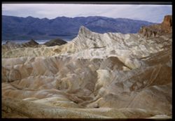
- Description:
- 100 f 6.3 tl
- Subject:
- Valleys, Mountains, Death Valley National Park (Calif. and Nev.), Hills, and Artists Palette (Calif.)
- Series:
- 10-55
- Creator:
- Cushman, Charles W., 1896-1972
- Date Created:
- 1955-03-22
- Genre:
- Landscape photographs
- Frame Number:
- 3
- County:
- Inyo
- Abstract:
- The artists Palette
- Call Number:
- P07831
- Country:
- United States
- State/Province:
- California
- Alternate Identifier:
- 1055.3
- Persistent URL:
- http://purl.dlib.indiana.edu/iudl/archives/cushman/P07831
- Holding Location:
- Bloomington - University Archives
Wells Library E460
1320 E 10th St.
Bloomington, IN 47405
Contact at archives@indiana.edu, 812-855-1127
-
- Description:
- 25 f 8 Pola
- Subject:
- Bodies of water, Telescope Peak (Inyo County, Calif.), Hills, Mountains, Death Valley (Calif. and Nev.), Deserts, Shrubs, Valleys, and Snow
- Series:
- 15-52
- Creator:
- Cushman, Charles W., 1896-1972
- Date Created:
- 1952-04-09
- Genre:
- Landscape photographs
- Frame Number:
- 25
- County:
- Inyo
- Abstract:
- Telescope Pk. from Bad Water. 280 ft. below sea level.
- Call Number:
- P06045
- City:
- Badwater
- Country:
- United States
- State/Province:
- California
- Physical Description:
- Image was originally mounted in a glass enclosure. Before digitization, the image was removed and placed in a Wess Plastic, Inc. brand, 2" x 2", pl...
- Alternate Identifier:
- 1552.25
- Persistent URL:
- http://purl.dlib.indiana.edu/iudl/archives/cushman/P06045
- Holding Location:
- Bloomington - University Archives
Wells Library E460
1320 E 10th St.
Bloomington, IN 47405
Contact at archives@indiana.edu, 812-855-1127
-
- Description:
- 100 f 6.3 tl
- Subject:
- Valleys, Fog, Emigrant Pass (Inyo County, Calif.), Mountains, Panamint Valley (Calif.), and Telescope Peak (Inyo County, Calif.)
- Series:
- 7-55
- Creator:
- Cushman, Charles W., 1896-1972
- Date Created:
- 1955-03-21
- Genre:
- Landscape photographs
- Frame Number:
- 35
- County:
- Inyo
- Abstract:
- Telescope Pk.
- Call Number:
- P07759
- Country:
- United States
- State/Province:
- California
- Alternate Identifier:
- 755.35
- Persistent URL:
- http://purl.dlib.indiana.edu/iudl/archives/cushman/P07759
- Holding Location:
- Bloomington - University Archives
Wells Library E460
1320 E 10th St.
Bloomington, IN 47405
Contact at archives@indiana.edu, 812-855-1127
-
- Description:
- 100 f 5.6 50mm
- Subject:
- Snow, Valleys, Telescope Peak (Inyo County, Calif.), Dantes View (Calif.), Mountains, Death Valley (Calif. and Nev.), and Fog
- Series:
- 8-55
- Creator:
- Cushman, Charles W., 1896-1972
- Date Created:
- 1955-03-22
- Genre:
- Landscape photographs
- Frame Number:
- 36
- County:
- Inyo
- Abstract:
- Tel PK
- Call Number:
- P07791
- Country:
- United States
- State/Province:
- California
- Alternate Identifier:
- 855.36
- Persistent URL:
- http://purl.dlib.indiana.edu/iudl/archives/cushman/P07791
- Holding Location:
- Bloomington - University Archives
Wells Library E460
1320 E 10th St.
Bloomington, IN 47405
Contact at archives@indiana.edu, 812-855-1127
-
- Description:
- 100 f 8 tl
- Subject:
- Snow, Valleys, Telescope Peak (Inyo County, Calif.), Dantes View (Calif.), and Mountains
- Series:
- 8-55
- Creator:
- Cushman, Charles W., 1896-1972
- Date Created:
- 1955-03-22
- Genre:
- Landscape photographs
- Frame Number:
- 23
- County:
- Inyo
- Abstract:
- Telescope Peak. 11045 ft.
- Call Number:
- P07781
- Country:
- United States
- State/Province:
- California
- Alternate Identifier:
- 855.23
- Persistent URL:
- http://purl.dlib.indiana.edu/iudl/archives/cushman/P07781
- Holding Location:
- Bloomington - University Archives
Wells Library E460
1320 E 10th St.
Bloomington, IN 47405
Contact at archives@indiana.edu, 812-855-1127
-
- Description:
- 100 f 8 tl
- Subject:
- Snow, Valleys, Telescope Peak (Inyo County, Calif.), Dantes View (Calif.), Mountains, and Death Valley (Calif. and Nev.)
- Series:
- 8-55
- Creator:
- Cushman, Charles W., 1896-1972
- Date Created:
- 1955-03-22
- Genre:
- Landscape photographs
- Frame Number:
- 26
- County:
- Inyo
- Abstract:
- Tel. Pk [P]
- Call Number:
- P07784
- Country:
- United States
- State/Province:
- California
- Physical Description:
- Image was originally mounted in a glass enclosure. Before digitization, the image was removed and placed in a Wess Plastic, Inc. brand, 2" x 2", pl...
- Alternate Identifier:
- 855.26
- Persistent URL:
- http://purl.dlib.indiana.edu/iudl/archives/cushman/P07784
- Holding Location:
- Bloomington - University Archives
Wells Library E460
1320 E 10th St.
Bloomington, IN 47405
Contact at archives@indiana.edu, 812-855-1127
-
- Description:
- 25 f 8 Pola
- Subject:
- Deserts, Valleys, Cliffs, Mountains, Rock formations, Zabriskie Point (Calif.), and Death Valley (Calif. and Nev.)
- Series:
- 15-52
- Creator:
- Cushman, Charles W., 1896-1972
- Date Created:
- 1952-04-09
- Genre:
- Landscape photographs
- Frame Number:
- 17
- County:
- Inyo
- Abstract:
- West from north of Pt.
- Call Number:
- P06037
- City:
- Furnace Creek
- Country:
- United States
- State/Province:
- California
- Physical Description:
- Image was originally mounted in a glass enclosure. Before digitization, the image was removed and placed in a Wess Plastic, Inc. brand, 2" x 2", pl...
- Alternate Identifier:
- 1552.17
- Persistent URL:
- http://purl.dlib.indiana.edu/iudl/archives/cushman/P06037
- Holding Location:
- Bloomington - University Archives
Wells Library E460
1320 E 10th St.
Bloomington, IN 47405
Contact at archives@indiana.edu, 812-855-1127
-
- Description:
- 100 f 8 tl
- Subject:
- Valleys, Mountains, Shrubs, and Black Mountains (Inyo County, Calif.)
- Series:
- 8-55
- Creator:
- Cushman, Charles W., 1896-1972
- Date Created:
- 1955-03-22
- Genre:
- Landscape photographs
- Frame Number:
- 38
- County:
- Inyo
- Abstract:
- Dark Mtns near Ryan
- Call Number:
- P07793
- City:
- Ryan
- Country:
- United States
- State/Province:
- California
- Alternate Identifier:
- 855.38
- Persistent URL:
- http://purl.dlib.indiana.edu/iudl/archives/cushman/P07793
- Holding Location:
- Bloomington - University Archives
Wells Library E460
1320 E 10th St.
Bloomington, IN 47405
Contact at archives@indiana.edu, 812-855-1127
-
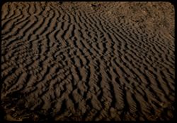
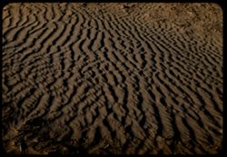
- Description:
- 25 f 8 Pola (with screen turned)
- Subject:
- Deserts, Ripples, Valleys, Sand, Dunes, and Death Valley (Calif. and Nev.)
- Series:
- 15-52
- Creator:
- Cushman, Charles W., 1896-1972
- Date Created:
- 1952-04-08
- Genre:
- Snapshots
- Frame Number:
- 10
- County:
- Inyo
- Abstract:
- Sand ripples.
- Call Number:
- P06031
- City:
- Stovepipe Wells
- Country:
- United States
- State/Province:
- California
- Alternate Identifier:
- 1552.10
- Persistent URL:
- http://purl.dlib.indiana.edu/iudl/archives/cushman/P06031
- Holding Location:
- Bloomington - University Archives
Wells Library E460
1320 E 10th St.
Bloomington, IN 47405
Contact at archives@indiana.edu, 812-855-1127
-
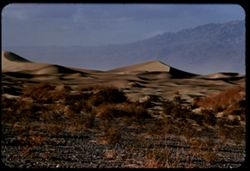
- Description:
- 100 f 7 tl
- Subject:
- Valleys, Death Valley (Calif. and Nev.), Mountains, Shrubs, and Dunes
- Series:
- 3-55
- Creator:
- Cushman, Charles W., 1896-1972
- Date Created:
- 1955-02-27
- Genre:
- Landscape photographs
- Frame Number:
- 25
- County:
- Inyo
- Abstract:
- Sand Dunes near Stove Pipe Wells
- Call Number:
- P07616
- City:
- Stovepipe Wells
- Country:
- United States
- State/Province:
- California
- Alternate Identifier:
- 355.25
- Persistent URL:
- http://purl.dlib.indiana.edu/iudl/archives/cushman/P07616
- Holding Location:
- Bloomington - University Archives
Wells Library E460
1320 E 10th St.
Bloomington, IN 47405
Contact at archives@indiana.edu, 812-855-1127
-
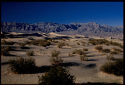
- Description:
- 25 f 8 Pola
- Subject:
- Deserts, Valleys, Sand, Dunes, Mountains, Shrubs, and Death Valley (Calif. and Nev.)
- Series:
- 15-52
- Creator:
- Cushman, Charles W., 1896-1972
- Date Created:
- 1952-04-01
- Genre:
- Landscape photographs
- Frame Number:
- 9
- County:
- Inyo
- Abstract:
- Sand Dunes near Stovepipe Wells.
- Call Number:
- P06030
- City:
- Stovepipe Wells
- Country:
- United States
- State/Province:
- California
- Physical Description:
- Image was originally mounted in a glass enclosure. Before digitization, the image was removed and placed in a Wess Plastic, Inc. brand, 2" x 2", pl...
- Alternate Identifier:
- 1552.9
- Persistent URL:
- http://purl.dlib.indiana.edu/iudl/archives/cushman/P06030
- Holding Location:
- Bloomington - University Archives
Wells Library E460
1320 E 10th St.
Bloomington, IN 47405
Contact at archives@indiana.edu, 812-855-1127
-
- Description:
- 25 f 8 Pola
- Subject:
- Deserts, Ripples, Valleys, Sand, Dunes, and Death Valley (Calif. and Nev.)
- Series:
- 15-52
- Creator:
- Cushman, Charles W., 1896-1972
- Date Created:
- 1952-04-08
- Genre:
- Snapshots
- Frame Number:
- 11
- County:
- Inyo
- Abstract:
- Sand ripples.
- Call Number:
- P06032
- City:
- Stovepipe Wells
- Country:
- United States
- State/Province:
- California
- Alternate Identifier:
- 1552.11
- Persistent URL:
- http://purl.dlib.indiana.edu/iudl/archives/cushman/P06032
- Holding Location:
- Bloomington - University Archives
Wells Library E460
1320 E 10th St.
Bloomington, IN 47405
Contact at archives@indiana.edu, 812-855-1127
-
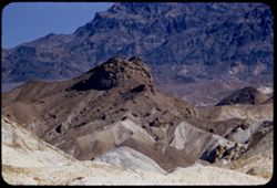
- Description:
- 100 f 8 tl
- Subject:
- Rocks, Valleys, Ubehebe Crater (Calif.), Shrubs, Death Valley (Calif. and Nev.), and Mountains
- Series:
- 11-55
- Creator:
- Cushman, Charles W., 1896-1972
- Date Created:
- 1955-03-23
- Genre:
- Landscape photographs
- Frame Number:
- 26
- County:
- Inyo
- Abstract:
- Ridges NE of crater long at right corrected
- Call Number:
- P07885
- Country:
- United States
- State/Province:
- California
- Alternate Identifier:
- 1155.26
- Persistent URL:
- http://purl.dlib.indiana.edu/iudl/archives/cushman/P07885
- Holding Location:
- Bloomington - University Archives
Wells Library E460
1320 E 10th St.
Bloomington, IN 47405
Contact at archives@indiana.edu, 812-855-1127
-
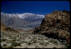
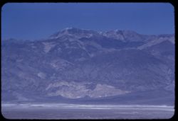
- Description:
- 100 f 8 tl
- Subject:
- Snow, Valleys, Pyramid Peak (Inyo County, Calif.), Mountains, Shrubs, and Clouds
- Series:
- 9-55
- Creator:
- Cushman, Charles W., 1896-1972
- Date Created:
- 1955-03-22
- Genre:
- Landscape photographs
- Frame Number:
- 2
- County:
- Inyo
- Abstract:
- Comb seen from [view] top of Ryan probably Pyramid PK
- Call Number:
- P07794
- City:
- Ryan
- Country:
- United States
- State/Province:
- California
- Alternate Identifier:
- 955.2
- Persistent URL:
- http://purl.dlib.indiana.edu/iudl/archives/cushman/P07794
- Holding Location:
- Bloomington - University Archives
Wells Library E460
1320 E 10th St.
Bloomington, IN 47405
Contact at archives@indiana.edu, 812-855-1127
-
- Description:
- 100 f 8 tl
- Subject:
- Valleys, Funeral Mountains (Calif.), Pyramid Peak (Inyo County, Calif.), Mountains, Shrubs, and Death Valley (Calif. and Nev.)
- Series:
- 8-55
- Creator:
- Cushman, Charles W., 1896-1972
- Date Created:
- 1955-03-22
- Genre:
- Landscape photographs
- Frame Number:
- 19
- County:
- Inyo
- Abstract:
- Big rock candy mtn from 12 mi. out probably Pyramid Pk
- Call Number:
- P07777
- Country:
- United States
- State/Province:
- California
- Alternate Identifier:
- 855.19
- Persistent URL:
- http://purl.dlib.indiana.edu/iudl/archives/cushman/P07777
- Holding Location:
- Bloomington - University Archives
Wells Library E460
1320 E 10th St.
Bloomington, IN 47405
Contact at archives@indiana.edu, 812-855-1127
-
- Description:
- 25 f 8 Pola
- Subject:
- Deserts, Valleys, Roads, Mountains, Shrubs, Panamint Valley (Calif.), Hills, Rocks, Panamint Range (Calif.), and Death Valley (Calif. and Nev.)
- Series:
- 15-52
- Creator:
- Cushman, Charles W., 1896-1972
- Date Created:
- 1952-04-08
- Genre:
- Landscape photographs
- Frame Number:
- 6
- County:
- Inyo
- Abstract:
- Road is straight across Panamint Valley.
- Call Number:
- P06027
- Country:
- United States
- State/Province:
- California
- Physical Description:
- Image was originally mounted in a glass enclosure. Before digitization, the image was removed and placed in a Wess Plastic, Inc. brand, 2" x 2", pl...
- Alternate Identifier:
- 1552.6
- Persistent URL:
- http://purl.dlib.indiana.edu/iudl/archives/cushman/P06027
- Holding Location:
- Bloomington - University Archives
Wells Library E460
1320 E 10th St.
Bloomington, IN 47405
Contact at archives@indiana.edu, 812-855-1127
-
- Description:
- 100 f 6.3 tl
- Subject:
- Valleys, Panamint Range (Calif.), Fog, Emigrant Pass (Inyo County, Calif.), Mountains, Panamint Valley (Calif.), and Telescope Peak (Inyo County, Calif.)
- Series:
- 7-55
- Creator:
- Cushman, Charles W., 1896-1972
- Date Created:
- 1955-03-21
- Genre:
- Landscape photographs
- Frame Number:
- 36
- County:
- Inyo
- Abstract:
- Panamints south of Telescope
- Call Number:
- P07760
- Country:
- United States
- State/Province:
- California
- Alternate Identifier:
- 755.36
- Persistent URL:
- http://purl.dlib.indiana.edu/iudl/archives/cushman/P07760
- Holding Location:
- Bloomington - University Archives
Wells Library E460
1320 E 10th St.
Bloomington, IN 47405
Contact at archives@indiana.edu, 812-855-1127
-
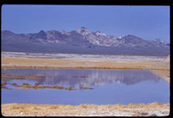
- Description:
- 50 f 12 HF
- Subject:
- Rocks, Valleys, Owens Lake (Inyo County, Calif.), Owens Valley (Calif.), Mountains, Shrubs, Lakes & ponds, Deserts, Trees, and Rock formations
- Series:
- 12-54
- Creator:
- Cushman, Charles W., 1896-1972
- Date Created:
- 1954-09-18
- Genre:
- Landscape photographs
- Frame Number:
- 25
- Street Address:
- Mt. Whitney Road
- County:
- Inyo
- Abstract:
- Owens Dry Lake from high up Mt Whitney rd.
- Call Number:
- P07415
- Country:
- United States
- State/Province:
- California
- Alternate Identifier:
- 1254.25
- Persistent URL:
- http://purl.dlib.indiana.edu/iudl/archives/cushman/P07415
- Holding Location:
- Bloomington - University Archives
Wells Library E460
1320 E 10th St.
Bloomington, IN 47405
Contact at archives@indiana.edu, 812-855-1127
-
- Description:
- 25 f 8 Pola
- Subject:
- Rocks, Valleys, Inyo Mountains (Calif.), Trees, Boulders, Owens Valley (Calif.), Mountains, Shrubs, Hills, and Snow
- Series:
- 14-52
- Creator:
- Cushman, Charles W., 1896-1972
- Date Created:
- 1952-04-08
- Genre:
- Landscape photographs
- Frame Number:
- 31
- Street Address:
- Mount Whitney Road
- County:
- Inyo
- Abstract:
- Owens Valley from Mt. Whitney Rd.
- Call Number:
- P06014
- Country:
- United States
- State/Province:
- California
- Physical Description:
- Image was originally mounted in a glass enclosure. Before digitization, the image was removed and placed in a Wess Plastic, Inc. brand, 2" x 2", pl...
- Alternate Identifier:
- 1452.31
- Persistent URL:
- http://purl.dlib.indiana.edu/iudl/archives/cushman/P06014
- Holding Location:
- Bloomington - University Archives
Wells Library E460
1320 E 10th St.
Bloomington, IN 47405
Contact at archives@indiana.edu, 812-855-1127
-
- Description:
- 50 f 12 HF
- Subject:
- Deserts, Valleys, Owens Lake (Inyo County, Calif.), Flowers, Owens Valley (Calif.), Mountains, Shrubs, and Lakes & ponds
- Series:
- 12-54
- Creator:
- Cushman, Charles W., 1896-1972
- Date Created:
- 1954-09-18
- Genre:
- Landscape photographs
- Frame Number:
- 28
- Street Address:
- Mt. Whitney Road
- County:
- Inyo
- Abstract:
- Owens Lake.
- Call Number:
- P07418
- Country:
- United States
- State/Province:
- California
- Alternate Identifier:
- 1254.28
- Persistent URL:
- http://purl.dlib.indiana.edu/iudl/archives/cushman/P07418
- Holding Location:
- Bloomington - University Archives
Wells Library E460
1320 E 10th St.
Bloomington, IN 47405
Contact at archives@indiana.edu, 812-855-1127
-
- Description:
- tl
- Subject:
- Valleys, Dantes View (Calif.), Mountains, Clouds, Death Valley (Calif. and Nev.), and Black Mountains (Inyo County, Calif.)
- Series:
- 2-55
- Creator:
- Cushman, Charles W., 1896-1972
- Date Created:
- 1955-02-27
- Genre:
- Landscape photographs
- Frame Number:
- 34
- County:
- Inyo
- Abstract:
- Northward over tops of Black Mtns.
- Call Number:
- P07591
- Country:
- United States
- State/Province:
- California
- Alternate Identifier:
- 255.34
- Persistent URL:
- http://purl.dlib.indiana.edu/iudl/archives/cushman/P07591
- Holding Location:
- Bloomington - University Archives
Wells Library E460
1320 E 10th St.
Bloomington, IN 47405
Contact at archives@indiana.edu, 812-855-1127
-
- Description:
- 100 f 6.3 tl
- Subject:
- Valleys, Death Valley (Calif. and Nev.), Mountains, and Tucki Mountain (Calif.)
- Series:
- 8-55
- Creator:
- Cushman, Charles W., 1896-1972
- Date Created:
- 1955-03-21
- Genre:
- Landscape photographs
- Frame Number:
- 3
- Street Address:
- California State Highway 190
- County:
- Inyo
- Abstract:
- South toward Tucki Mtn from near Stovepipe Wells
- Call Number:
- P07764
- City:
- Stovepipe Wells
- Country:
- United States
- State/Province:
- California
- Alternate Identifier:
- 855.3
- Persistent URL:
- http://purl.dlib.indiana.edu/iudl/archives/cushman/P07764
- Holding Location:
- Bloomington - University Archives
Wells Library E460
1320 E 10th St.
Bloomington, IN 47405
Contact at archives@indiana.edu, 812-855-1127
-
- Description:
- 25 f 10
- Subject:
- Deserts, Mushroom Rock (Inyo County, Calif.), Boulders, Rock formations, Hills, Rocks, Valleys, and Death Valley (Calif. and Nev.)
- Series:
- 15-52
- Creator:
- Cushman, Charles W., 1896-1972
- Date Created:
- 1952-04-09
- Genre:
- Snapshots
- Frame Number:
- 22
- County:
- Inyo
- Abstract:
- Mushroom rock.
- Call Number:
- P06042
- City:
- Furnace Creek
- Country:
- United States
- State/Province:
- California
- Alternate Identifier:
- 1552.22
- Persistent URL:
- http://purl.dlib.indiana.edu/iudl/archives/cushman/P06042
- Holding Location:
- Bloomington - University Archives
Wells Library E460
1320 E 10th St.
Bloomington, IN 47405
Contact at archives@indiana.edu, 812-855-1127
-
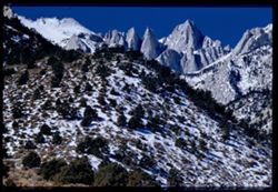
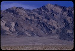
- Description:
- 100 f 8 tl
- Subject:
- Valleys, Whitney, Mount (Calif.), Mountains, Shrubs, Snow, Trees, Rocks, and Rock formations
- Series:
- 3-55
- Creator:
- Cushman, Charles W., 1896-1972
- Date Created:
- 1955-02-28
- Genre:
- Landscape photographs
- Frame Number:
- 37
- Street Address:
- Portal Road
- County:
- Inyo
- Abstract:
- Mt. Whitney
- Call Number:
- P07628
- Country:
- United States
- State/Province:
- California
- Physical Description:
- Image was originally mounted in a glass enclosure. Before digitization, the image was removed and placed in a Wess Plastic, Inc. brand, 2" x 2", pl...
- Alternate Identifier:
- 355.37
- Persistent URL:
- http://purl.dlib.indiana.edu/iudl/archives/cushman/P07628
- Holding Location:
- Bloomington - University Archives
Wells Library E460
1320 E 10th St.
Bloomington, IN 47405
Contact at archives@indiana.edu, 812-855-1127
-
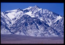
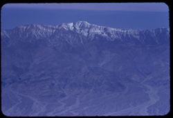
- Description:
- 100 f 6.3.tl
- Subject:
- Valleys, Williamson, Mount (Inyo County, Calif.), Mountains, and Snow
- Series:
- 4-55
- Creator:
- Cushman, Charles W., 1896-1972
- Date Created:
- 1955-02-28
- Genre:
- Landscape photographs
- Frame Number:
- 12
- Street Address:
- United States Highway 6
- County:
- Inyo
- Abstract:
- S Mt Williamson (14,384')
- Call Number:
- P07639
- Country:
- United States
- State/Province:
- California
- Physical Description:
- Image was originally mounted in a glass enclosure. Before digitization, the image was removed and placed in a Wess Plastic, Inc. brand, 2" x 2", pl...
- Alternate Identifier:
- 455.12
- Persistent URL:
- http://purl.dlib.indiana.edu/iudl/archives/cushman/P07639
- Holding Location:
- Bloomington - University Archives
Wells Library E460
1320 E 10th St.
Bloomington, IN 47405
Contact at archives@indiana.edu, 812-855-1127
-
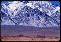
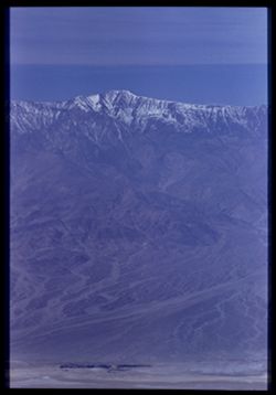
- Description:
- 100 f 6.3 tl
- Subject:
- Snow, Valleys, Trees, Mountains, Williamson, Mount (Inyo County, Calif.), Shrubs, and Whitney, Mount (Calif.)
- Series:
- 4-55
- Creator:
- Cushman, Charles W., 1896-1972
- Date Created:
- 1955-02-28
- Genre:
- Landscape photographs
- Frame Number:
- 10
- County:
- Inyo
- Abstract:
- High peak Mt. Williamson of Independence 14,384 ft.
- Call Number:
- P07638
- City:
- Independence
- Country:
- United States
- State/Province:
- California
- Alternate Identifier:
- 455.10
- Persistent URL:
- http://purl.dlib.indiana.edu/iudl/archives/cushman/P07638
- Holding Location:
- Bloomington - University Archives
Wells Library E460
1320 E 10th St.
Bloomington, IN 47405
Contact at archives@indiana.edu, 812-855-1127
-
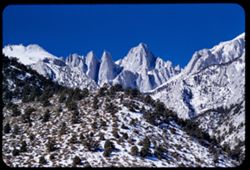
- Description:
- 100 f 9 tl
- Subject:
- Valleys, Whitney, Mount (Calif.), Mountains, Shrubs, Snow, Trees, Rocks, and Rock formations
- Series:
- 3-55
- Creator:
- Cushman, Charles W., 1896-1972
- Date Created:
- 1955-02-28
- Genre:
- Landscape photographs
- Frame Number:
- 38
- County:
- Inyo
- Abstract:
- Mt. Whitney
- Call Number:
- P07629
- Country:
- United States
- State/Province:
- California
- Alternate Identifier:
- 355.38
- Persistent URL:
- http://purl.dlib.indiana.edu/iudl/archives/cushman/P07629
- Holding Location:
- Bloomington - University Archives
Wells Library E460
1320 E 10th St.
Bloomington, IN 47405
Contact at archives@indiana.edu, 812-855-1127
-
- Description:
- 25 f 9
- Subject:
- Panamint Mountains (Calif.), Deserts, Canyons, Valleys, Death Valley (Calif. and Nev.), Panamint Valley (Calif.), Mountains, Cliffs, and Panamint Range (Calif.)
- Series:
- 15-52
- Creator:
- Cushman, Charles W., 1896-1972
- Date Created:
- 1952-04-01
- Genre:
- Landscape photographs
- Frame Number:
- 3
- County:
- Inyo
- Abstract:
- Mouth of Canyon into Panamint Valley - Panamint Mtns in distance.
- Call Number:
- P06024
- Country:
- United States
- State/Province:
- California
- Physical Description:
- Image was originally mounted in a glass enclosure. Before digitization, the image was removed and placed in a Wess Plastic, Inc. brand, 2" x 2", pl...
- Alternate Identifier:
- 1552.3
- Persistent URL:
- http://purl.dlib.indiana.edu/iudl/archives/cushman/P06024
- Holding Location:
- Bloomington - University Archives
Wells Library E460
1320 E 10th St.
Bloomington, IN 47405
Contact at archives@indiana.edu, 812-855-1127
-
- Description:
- 100 f 6.3
- Subject:
- Valleys, Mountains, Clouds, and Death Valley National Park (Calif. and Nev.)
- Series:
- 3-55
- Creator:
- Cushman, Charles W., 1896-1972
- Date Created:
- 1955-02-27
- Genre:
- Landscape photographs
- Frame Number:
- 9
- County:
- Inyo
- Abstract:
- Closer view of same
- Call Number:
- P07601
- City:
- Ryan
- Country:
- United States
- State/Province:
- California
- Alternate Identifier:
- 355.9
- Persistent URL:
- http://purl.dlib.indiana.edu/iudl/archives/cushman/P07601
- Holding Location:
- Bloomington - University Archives
Wells Library E460
1320 E 10th St.
Bloomington, IN 47405
Contact at archives@indiana.edu, 812-855-1127
-
- Description:
- 200 f 4.5 tl
- Subject:
- Valleys, Mountains, Clouds, and Death Valley National Park (Calif. and Nev.)
- Series:
- 3-55
- Creator:
- Cushman, Charles W., 1896-1972
- Date Created:
- 1955-02-27
- Genre:
- Landscape photographs
- Frame Number:
- 7
- County:
- Inyo
- Abstract:
- Brown & mauve mtns near Ryan
- Call Number:
- P07600
- City:
- Ryan
- Country:
- United States
- State/Province:
- California
- Alternate Identifier:
- 355.7
- Persistent URL:
- http://purl.dlib.indiana.edu/iudl/archives/cushman/P07600
- Holding Location:
- Bloomington - University Archives
Wells Library E460
1320 E 10th St.
Bloomington, IN 47405
Contact at archives@indiana.edu, 812-855-1127
-
- Description:
- 25 f 13
- Subject:
- Lakes & ponds, Deserts, Reflections, Valleys, Death Valley (Calif. and Nev.), Roads, Cliffs, Mountains, Women, Boulders, and Rocks
- Series:
- 15-52
- Creator:
- Cushman, Charles W., 1896-1972
- Date Created:
- 1952-04-09
- Genre:
- Portraits and Snapshots
- Frame Number:
- 28
- County:
- Inyo
- Persons Pictured:
- Cushman, Jean
- Abstract:
- Mtns at Bad Water, 279.6 ft. below.
- Call Number:
- P06048
- City:
- Badwater
- Country:
- United States
- State/Province:
- California
- Alternate Identifier:
- 1552.28
- Persistent URL:
- http://purl.dlib.indiana.edu/iudl/archives/cushman/P06048
- Holding Location:
- Bloomington - University Archives
Wells Library E460
1320 E 10th St.
Bloomington, IN 47405
Contact at archives@indiana.edu, 812-855-1127
-
- Description:
- 25 f 8 Pola
- Subject:
- Deserts, Valleys, Hills, Death Valley (Calif. and Nev.), Mountains, Rocks, and Clouds
- Series:
- 15-52
- Creator:
- Cushman, Charles W., 1896-1972
- Date Created:
- 1952-04-09
- Genre:
- Landscape photographs
- Frame Number:
- 35
- Street Address:
- Artists Drive
- County:
- Inyo
- Abstract:
- From top of Artists Drive. Back across valley.
- Call Number:
- P06054
- Country:
- United States
- State/Province:
- California
- Alternate Identifier:
- 1552.35
- Persistent URL:
- http://purl.dlib.indiana.edu/iudl/archives/cushman/P06054
- Holding Location:
- Bloomington - University Archives
Wells Library E460
1320 E 10th St.
Bloomington, IN 47405
Contact at archives@indiana.edu, 812-855-1127
-
- Description:
- 25 f 16
- Subject:
- Rocks, Valleys, Cliffs, Boulders, Mountains, Death Valley (Calif. and Nev.), and Deserts
- Series:
- 15-52
- Creator:
- Cushman, Charles W., 1896-1972
- Date Created:
- 1952-04-09
- Genre:
- Landscape photographs
- Frame Number:
- 37
- Street Address:
- Artists Drive
- County:
- Inyo
- Abstract:
- From top of Artists Drive. Up from Artists Dr.
- Call Number:
- P06056
- Country:
- United States
- State/Province:
- California
- Alternate Identifier:
- 1552.37
- Persistent URL:
- http://purl.dlib.indiana.edu/iudl/archives/cushman/P06056
- Holding Location:
- Bloomington - University Archives
Wells Library E460
1320 E 10th St.
Bloomington, IN 47405
Contact at archives@indiana.edu, 812-855-1127
-
- Description:
- 25 f 16
- Subject:
- Deserts, Valleys, Cliffs, Mountains, Hills, and Death Valley (Calif. and Nev.)
- Series:
- 15-52
- Creator:
- Cushman, Charles W., 1896-1972
- Date Created:
- 1952-04-09
- Genre:
- Landscape photographs
- Frame Number:
- 34
- Street Address:
- Artists Drive
- County:
- Inyo
- Abstract:
- From top of Artists Drive. Up.
- Call Number:
- P06053
- Country:
- United States
- State/Province:
- California
- Physical Description:
- Image was originally mounted in a glass enclosure. Before digitization, the image was removed and placed in a Wess Plastic, Inc. brand, 2" x 2", pl...
- Alternate Identifier:
- 1552.34
- Persistent URL:
- http://purl.dlib.indiana.edu/iudl/archives/cushman/P06053
- Holding Location:
- Bloomington - University Archives
Wells Library E460
1320 E 10th St.
Bloomington, IN 47405
Contact at archives@indiana.edu, 812-855-1127
-
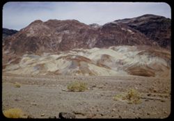
- Description:
- 100 f 8+ tl
- Subject:
- Valleys, Mountains, Clouds, Death Valley National Park (Calif. and Nev.), and Artists Palette (Calif.)
- Series:
- 10-55
- Creator:
- Cushman, Charles W., 1896-1972
- Date Created:
- 1955-03-22
- Genre:
- Landscape photographs
- Frame Number:
- 10
- Street Address:
- Artist's View Drive
- County:
- Inyo
- Abstract:
- From observation pt of Artists Palette
- Call Number:
- P07835
- Country:
- United States
- State/Province:
- California
- Physical Description:
- Image was originally mounted in a glass enclosure. Before digitization, the image was removed and placed in a Wess Plastic, Inc. brand, 2" x 2", pl...
- Alternate Identifier:
- 1055.10
- Persistent URL:
- http://purl.dlib.indiana.edu/iudl/archives/cushman/P07835
- Holding Location:
- Bloomington - University Archives
Wells Library E460
1320 E 10th St.
Bloomington, IN 47405
Contact at archives@indiana.edu, 812-855-1127
-
- Description:
- 100 f 5.6 tl
- Subject:
- Snow, Valleys, Trees, Lone Pine Peak (Calif.), Mountains, Shrubs, and Rocks
- Series:
- 3-55
- Creator:
- Cushman, Charles W., 1896-1972
- Date Created:
- 1955-02-28
- Genre:
- Landscape photographs
- Frame Number:
- 35
- Street Address:
- Mount Whitney Road
- County:
- Inyo
- Abstract:
- top of Lone Pine Pk
- Call Number:
- P07626
- City:
- Lone Pine
- Country:
- United States
- State/Province:
- California
- Alternate Identifier:
- 355.35
- Persistent URL:
- http://purl.dlib.indiana.edu/iudl/archives/cushman/P07626
- Holding Location:
- Bloomington - University Archives
Wells Library E460
1320 E 10th St.
Bloomington, IN 47405
Contact at archives@indiana.edu, 812-855-1127
-
- Description:
- 25 f 9 Pola
- Subject:
- Deserts, Valleys, Mountains, Death Valley (Calif. and Nev.), Canyons, Hills, and Desolation Canyon (Calif.)
- Series:
- 15-52
- Creator:
- Cushman, Charles W., 1896-1972
- Date Created:
- 1952-04-09
- Genre:
- Landscape photographs
- Frame Number:
- 20
- County:
- Inyo
- Abstract:
- From road to Bad Water toward Desolation Canyon.
- Call Number:
- P06040
- City:
- Furnace Creek and Badwater
- Country:
- United States
- State/Province:
- California
- Alternate Identifier:
- 1552.20
- Persistent URL:
- http://purl.dlib.indiana.edu/iudl/archives/cushman/P06040
- Holding Location:
- Bloomington - University Archives
Wells Library E460
1320 E 10th St.
Bloomington, IN 47405
Contact at archives@indiana.edu, 812-855-1127
-
- Description:
- 50 mm lens
- Subject:
- Valleys, Dantes View (Calif.), Mountains, Death Valley (Calif. and Nev.), Black Mountains (Inyo County, Calif.), and Clouds
- Series:
- 3-55
- Creator:
- Cushman, Charles W., 1896-1972
- Date Created:
- 1955-02-27
- Genre:
- Landscape photographs
- Frame Number:
- 3
- County:
- Inyo
- Abstract:
- View north along ridge of Black Mtns
- Call Number:
- P07596
- Country:
- United States
- State/Province:
- California
- Alternate Identifier:
- 355.3
- Persistent URL:
- http://purl.dlib.indiana.edu/iudl/archives/cushman/P07596
- Holding Location:
- Bloomington - University Archives
Wells Library E460
1320 E 10th St.
Bloomington, IN 47405
Contact at archives@indiana.edu, 812-855-1127
-
- Description:
- 100 f 6.3 tl
- Subject:
- Owens Valley (Calif.), Mountains, Shrubs, Trees, Rocks, and Valleys
- Series:
- 3-55
- Creator:
- Cushman, Charles W., 1896-1972
- Date Created:
- 1955-02-28
- Genre:
- Landscape photographs
- Frame Number:
- 36
- Street Address:
- Mount Whitney Road
- County:
- Inyo
- Abstract:
- East across Owens Valley from Mt. Whitney rd.
- Call Number:
- P07627
- Country:
- United States
- State/Province:
- California
- Alternate Identifier:
- 355.36
- Persistent URL:
- http://purl.dlib.indiana.edu/iudl/archives/cushman/P07627
- Holding Location:
- Bloomington - University Archives
Wells Library E460
1320 E 10th St.
Bloomington, IN 47405
Contact at archives@indiana.edu, 812-855-1127
-
- Description:
- 100 f 8 tl
- Subject:
- Rocks, Valleys, Trails & paths, Mountains, Lara Stream, Zabriskie Point (Calif.), and Death Valley National Park (Calif. and Nev.)
- Series:
- 9-55
- Creator:
- Cushman, Charles W., 1896-1972
- Date Created:
- 1955-03-22
- Genre:
- Landscape photographs
- Frame Number:
- 8
- County:
- Inyo
- Abstract:
- natural road way below Zabriskie Pt
- Call Number:
- P07800
- Country:
- United States
- State/Province:
- California
- Alternate Identifier:
- 955.8
- Persistent URL:
- http://purl.dlib.indiana.edu/iudl/archives/cushman/P07800
- Holding Location:
- Bloomington - University Archives
Wells Library E460
1320 E 10th St.
Bloomington, IN 47405
Contact at archives@indiana.edu, 812-855-1127
-
- Description:
- 25 f 13
- Subject:
- Rocks, Mesquite, Valleys, Cliffs, Women, Mountains, Shrubs, Death Valley (Calif. and Nev.), Utility poles, Furnace Creek (Calif.), and Hills
- Series:
- 15-52
- Creator:
- Cushman, Charles W., 1896-1972
- Date Created:
- 1952-04-09
- Genre:
- Landscape photographs and Portraits
- Frame Number:
- 14
- County:
- Inyo
- Persons Pictured:
- Cushman, Jean
- Abstract:
- Mesquite and green rocks. (near Furnace Creek)
- Call Number:
- P06035
- Country:
- United States
- State/Province:
- California
- Alternate Identifier:
- 1552.14
- Persistent URL:
- http://purl.dlib.indiana.edu/iudl/archives/cushman/P06035
- Holding Location:
- Bloomington - University Archives
Wells Library E460
1320 E 10th St.
Bloomington, IN 47405
Contact at archives@indiana.edu, 812-855-1127
-
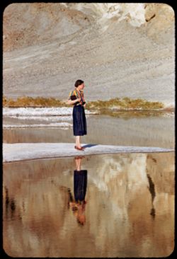
- Description:
- 100 f 5.6 tl
- Subject:
- Rocks, Valleys, Bodies of water, Spouses, Minerals, Salt, Shrubs, Death Valley (Calif. and Nev.), and Reflections
- Series:
- 10-55
- Creator:
- Cushman, Charles W., 1896-1972
- Date Created:
- 1955-03-22
- Genre:
- Portraits and Identification photographs
- Frame Number:
- 17
- County:
- Inyo
- Persons Pictured:
- Cushman, Jean
- Abstract:
- Jean at BW End of Mar. 22
- Call Number:
- P07842
- City:
- Badwater
- Country:
- United States
- State/Province:
- California
- Alternate Identifier:
- 1055.17
- Persistent URL:
- http://purl.dlib.indiana.edu/iudl/archives/cushman/P07842
- Holding Location:
- Bloomington - University Archives
Wells Library E460
1320 E 10th St.
Bloomington, IN 47405
Contact at archives@indiana.edu, 812-855-1127
-
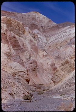
- Description:
- 100 f 8+ tl
- Subject:
- Golden Canyon (Inyo County, Calif.), Canyons, Valleys, Death Valley (Calif. and Nev.), and Shrubs
- Series:
- 9-55
- Creator:
- Cushman, Charles W., 1896-1972
- Date Created:
- 1955-03-22
- Genre:
- Landscape photographs
- Frame Number:
- 20
- County:
- Inyo
- Abstract:
- made inside Golden Canyon
- Call Number:
- P07812
- Country:
- United States
- State/Province:
- California
- Alternate Identifier:
- 955.20
- Persistent URL:
- http://purl.dlib.indiana.edu/iudl/archives/cushman/P07812
- Holding Location:
- Bloomington - University Archives
Wells Library E460
1320 E 10th St.
Bloomington, IN 47405
Contact at archives@indiana.edu, 812-855-1127
-
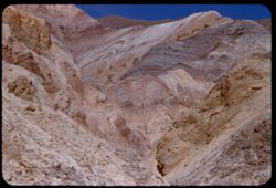
- Description:
- 100 f 8+ tl
- Subject:
- Canyons, Mountains, Death Valley (Calif. and Nev.), Golden Canyon (Inyo County, Calif.), and Valleys
- Series:
- 9-55
- Creator:
- Cushman, Charles W., 1896-1972
- Date Created:
- 1955-03-22
- Genre:
- Landscape photographs
- Frame Number:
- 18
- County:
- Inyo
- Abstract:
- made inside Golden Canyon
- Call Number:
- P07810
- Country:
- United States
- State/Province:
- California
- Alternate Identifier:
- 955.18
- Persistent URL:
- http://purl.dlib.indiana.edu/iudl/archives/cushman/P07810
- Holding Location:
- Bloomington - University Archives
Wells Library E460
1320 E 10th St.
Bloomington, IN 47405
Contact at archives@indiana.edu, 812-855-1127
-
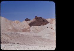
- Description:
- 100 f 8 tl
- Subject:
- Twenty Mule Team Canyon (Calif.), Valleys, Rock formations, Death Valley National Park (Calif. and Nev.), Hills, and Canyons
- Series:
- 10-55
- Creator:
- Cushman, Charles W., 1896-1972
- Date Created:
- 1955-03-23
- Genre:
- Landscape photographs
- Frame Number:
- 38
- County:
- Inyo
- Abstract:
- In 20 Mule Team canyon
- Call Number:
- P07862
- Country:
- United States
- State/Province:
- California
- Physical Description:
- masked.
- Alternate Identifier:
- 1055.38
- Persistent URL:
- http://purl.dlib.indiana.edu/iudl/archives/cushman/P07862
- Holding Location:
- Bloomington - University Archives
Wells Library E460
1320 E 10th St.
Bloomington, IN 47405
Contact at archives@indiana.edu, 812-855-1127
-
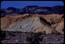
- Description:
- 100 f 8 tl
- Subject:
- Rocks, Valleys, Mountains, Shrubs, Death Valley (Calif. and Nev.), Black Mountains (Inyo County, Calif.), and Hills
- Series:
- 8-55
- Creator:
- Cushman, Charles W., 1896-1972
- Date Created:
- 1955-03-22
- Genre:
- Landscape photographs
- Frame Number:
- 22
- Street Address:
- Dante's View Road
- County:
- Inyo
- Abstract:
- colored rock in valley from closer (along Dante's V. rd.
- Call Number:
- P07780
- Country:
- United States
- State/Province:
- California
- Alternate Identifier:
- 855.22
- Persistent URL:
- http://purl.dlib.indiana.edu/iudl/archives/cushman/P07780
- Holding Location:
- Bloomington - University Archives
Wells Library E460
1320 E 10th St.
Bloomington, IN 47405
Contact at archives@indiana.edu, 812-855-1127
-
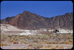
- Description:
- 100 f 8 tl
- Subject:
- Greenwater Range (Calif.), Valleys, Mountains, Shrubs, and Rock formations
- Series:
- 12-55
- Creator:
- Cushman, Charles W., 1896-1972
- Date Created:
- 1955-03-24
- Genre:
- Landscape photographs
- Frame Number:
- 3
- County:
- Inyo
- Abstract:
- Greenwater Mtns west of Shoshone
- Call Number:
- P07899
- City:
- Shoshone
- Country:
- United States
- State/Province:
- California
- Alternate Identifier:
- 1255.3
- Persistent URL:
- http://purl.dlib.indiana.edu/iudl/archives/cushman/P07899
- Holding Location:
- Bloomington - University Archives
Wells Library E460
1320 E 10th St.
Bloomington, IN 47405
Contact at archives@indiana.edu, 812-855-1127
-
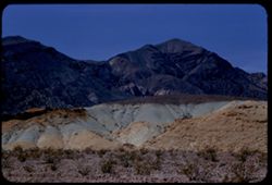
- Description:
- 100 f 8 tl
- Subject:
- Valleys, Buttes, Mountains, Shrubs, Death Valley National Park (Calif. and Nev.), and Black Mountains (Inyo County, Calif.)
- Series:
- 9-55
- Creator:
- Cushman, Charles W., 1896-1972
- Date Created:
- 1955-03-22
- Genre:
- Landscape photographs
- Frame Number:
- 3
- County:
- Inyo
- Abstract:
- Green & brown butte below east side of Black Mtns
- Call Number:
- P07795
- Country:
- United States
- State/Province:
- California
- Alternate Identifier:
- 955.3
- Persistent URL:
- http://purl.dlib.indiana.edu/iudl/archives/cushman/P07795
- Holding Location:
- Bloomington - University Archives
Wells Library E460
1320 E 10th St.
Bloomington, IN 47405
Contact at archives@indiana.edu, 812-855-1127
-
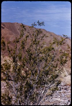
- Description:
- 100 f 8 tl
- Subject:
- Valleys, Greasewood, Mountains, Shrubs, Clouds, and Death Valley (Calif. and Nev.)
- Series:
- 11-55
- Creator:
- Cushman, Charles W., 1896-1972
- Date Created:
- 1955-03-23
- Genre:
- Identification photographs
- Frame Number:
- 8
- County:
- Inyo
- Abstract:
- Greasewood in bloom.
- Call Number:
- P07870
- Country:
- United States
- State/Province:
- California
- Alternate Identifier:
- 1155.8
- Persistent URL:
- http://purl.dlib.indiana.edu/iudl/archives/cushman/P07870
- Holding Location:
- Bloomington - University Archives
Wells Library E460
1320 E 10th St.
Bloomington, IN 47405
Contact at archives@indiana.edu, 812-855-1127
-
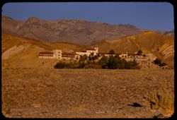
- Description:
- 100 f 5.6
- Subject:
- Valleys, Trees, Mountains, Furnace Creek Inn (Death Valley Junction, Calif.), Hotels, Hills, Funeral Mountains (Calif.), Shrubs, and Death Valley (Calif. and...
- Series:
- 8-55
- Creator:
- Cushman, Charles W., 1896-1972
- Date Created:
- 1955-03-21
- Genre:
- Architectural photographs
- Frame Number:
- 15
- County:
- Inyo
- Abstract:
- Furnace Cr Inn
- Call Number:
- P07773
- City:
- Death Valley Junction
- Country:
- United States
- State/Province:
- California
- Alternate Identifier:
- 855.15
- Persistent URL:
- http://purl.dlib.indiana.edu/iudl/archives/cushman/P07773
- Holding Location:
- Bloomington - University Archives
Wells Library E460
1320 E 10th St.
Bloomington, IN 47405
Contact at archives@indiana.edu, 812-855-1127
-
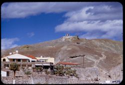
- Description:
- 200 f 5.6 tl
- Subject:
- Valleys, Resorts, Automobiles, Trees, Chimneys, Arches, Mountains, Furnace Creek Inn (Death Valley Junction, Calif.), Hotels, Masonry, Death Valley (Calif. a...
- Series:
- 3-55
- Creator:
- Cushman, Charles W., 1896-1972
- Date Created:
- 1955-02-27
- Frame Number:
- 23
- County:
- Inyo
- Abstract:
- Furnace Ck. Inn
- Call Number:
- P07614
- City:
- Death Valley Junction
- Country:
- United States
- State/Province:
- California
- Alternate Identifier:
- 355.23
- Persistent URL:
- http://purl.dlib.indiana.edu/iudl/archives/cushman/P07614
- Holding Location:
- Bloomington - University Archives
Wells Library E460
1320 E 10th St.
Bloomington, IN 47405
Contact at archives@indiana.edu, 812-855-1127
-
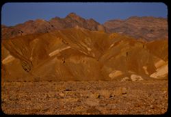
- Description:
- 100 f 5.6 tl
- Subject:
- Rocks, Valleys, Funeral Mountains (Calif.), Mountains, Shrubs, Death Valley (Calif. and Nev.), and Furnace Creek Inn (Death Valley Junction, Calif.)
- Series:
- 8-55
- Creator:
- Cushman, Charles W., 1896-1972
- Date Created:
- 1955-03-21
- Genre:
- Landscape photographs
- Frame Number:
- 14
- County:
- Inyo
- Abstract:
- Funeral mtns just north of Furnace CR Inn
- Call Number:
- P07772
- City:
- Death Valley Junction
- Country:
- United States
- State/Province:
- California
- Alternate Identifier:
- 855.14
- Persistent URL:
- http://purl.dlib.indiana.edu/iudl/archives/cushman/P07772
- Holding Location:
- Bloomington - University Archives
Wells Library E460
1320 E 10th St.
Bloomington, IN 47405
Contact at archives@indiana.edu, 812-855-1127
-
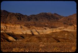
- Description:
- 100 f 6.3 tl
- Subject:
- Hibiscus, Valleys, Death Valley (Calif. and Nev.), Funeral Mountains (Calif.), Mountains, Shrubs, and Furnace Creek Ranch
- Series:
- 8-55
- Creator:
- Cushman, Charles W., 1896-1972
- Date Created:
- 1955-03-21
- Genre:
- Landscape photographs
- Frame Number:
- 13
- County:
- Inyo
- Abstract:
- Funeral Mtns east of Furnace Creek Ranch at 5:30 pm
- Call Number:
- P07771
- Country:
- United States
- State/Province:
- California
- Alternate Identifier:
- 855.13
- Persistent URL:
- http://purl.dlib.indiana.edu/iudl/archives/cushman/P07771
- Holding Location:
- Bloomington - University Archives
Wells Library E460
1320 E 10th St.
Bloomington, IN 47405
Contact at archives@indiana.edu, 812-855-1127
-
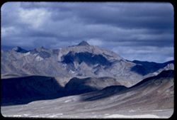
- Description:
- 200 f 5.6 tl
- Subject:
- Valleys, Funeral Mountains (Calif.), Mountains, Death Valley National Park (Calif. and Nev.), Shadows, and Clouds
- Series:
- 3-55
- Creator:
- Cushman, Charles W., 1896-1972
- Date Created:
- 1955-02-27
- Genre:
- Landscape photographs
- Frame Number:
- 10
- County:
- Inyo
- Abstract:
- Funeral Mtns.
- Call Number:
- P07602
- Country:
- United States
- State/Province:
- California
- Alternate Identifier:
- 355.10
- Persistent URL:
- http://purl.dlib.indiana.edu/iudl/archives/cushman/P07602
- Holding Location:
- Bloomington - University Archives
Wells Library E460
1320 E 10th St.
Bloomington, IN 47405
Contact at archives@indiana.edu, 812-855-1127
-
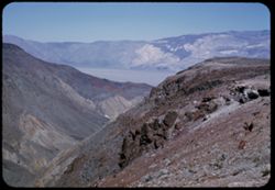
- Description:
- 25 f 13
- Subject:
- Rocks, Valleys, Panamint Range (Calif.), Argus Range (Calif.), Boulders, Mountains, Shrubs, Panamint Valley (Calif.), Canyons, and Cliffs
- Series:
- 15-52
- Creator:
- Cushman, Charles W., 1896-1972
- Date Created:
- 1952-04-08
- Genre:
- Landscape photographs
- Frame Number:
- 5
- County:
- Inyo
- Abstract:
- Flatbed of Panamint Valley from same pt. A gap in Argus Range.
- Call Number:
- P06026
- Country:
- United States
- State/Province:
- California
- Alternate Identifier:
- 1552.5
- Persistent URL:
- http://purl.dlib.indiana.edu/iudl/archives/cushman/P06026
- Holding Location:
- Bloomington - University Archives
Wells Library E460
1320 E 10th St.
Bloomington, IN 47405
Contact at archives@indiana.edu, 812-855-1127
-
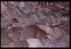
- Description:
- 100 f 8 tel l
- Subject:
- Valleys, Rock formations, Zabriskie Point (Calif.), Hills, and Death Valley (Calif. and Nev.)
- Series:
- 9-55
- Creator:
- Cushman, Charles W., 1896-1972
- Date Created:
- 1955-03-22
- Genre:
- Landscape photographs
- Frame Number:
- 12
- County:
- Inyo
- Abstract:
- Ridges WNW from pt.
- Call Number:
- P07804
- Country:
- United States
- State/Province:
- California
- Physical Description:
- Image was originally mounted in a glass enclosure. Before digitization, the image was removed and placed in a Wess Plastic, Inc. brand, 2" x 2", pl...
- Alternate Identifier:
- 955.12
- Persistent URL:
- http://purl.dlib.indiana.edu/iudl/archives/cushman/P07804
- Holding Location:
- Bloomington - University Archives
Wells Library E460
1320 E 10th St.
Bloomington, IN 47405
Contact at archives@indiana.edu, 812-855-1127
-
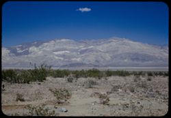
- Description:
- 25 f 9 Pola
- Subject:
- Panamint Mountains (Calif.), Valleys, Panamint Valley (Calif.), Panamint Range (Calif.), Shrubs, Rocks, and Mountains
- Series:
- 15-52
- Creator:
- Cushman, Charles W., 1896-1972
- Date Created:
- 1952-04-08
- Genre:
- Landscape photographs
- Frame Number:
- 8
- County:
- Inyo
- Abstract:
- Across Panamint Valley to Panamint Mtns from Panamint Springs.
- Call Number:
- P06029
- City:
- Panamint Springs
- Country:
- United States
- State/Province:
- California
- Alternate Identifier:
- 1552.8
- Persistent URL:
- http://purl.dlib.indiana.edu/iudl/archives/cushman/P06029
- Holding Location:
- Bloomington - University Archives
Wells Library E460
1320 E 10th St.
Bloomington, IN 47405
Contact at archives@indiana.edu, 812-855-1127
-
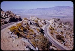
- Description:
- 50 f 11 HF
- Subject:
- Valleys, Inyo Mountains (Calif.), Mountains, Owens Valley (Calif.), Deserts, Shrubs, Roads, and Rocks
- Series:
- 12-54
- Creator:
- Cushman, Charles W., 1896-1972
- Date Created:
- 1954-09-18
- Genre:
- Landscape photographs
- Frame Number:
- 27
- Street Address:
- Mt. Whitney Road
- County:
- Inyo
- Abstract:
- Switch-back coming down Mt Whitney rd.
- Call Number:
- P07417
- Country:
- United States
- State/Province:
- California
- Alternate Identifier:
- 1254.27
- Persistent URL:
- http://purl.dlib.indiana.edu/iudl/archives/cushman/P07417
- Holding Location:
- Bloomington - University Archives
Wells Library E460
1320 E 10th St.
Bloomington, IN 47405
Contact at archives@indiana.edu, 812-855-1127
-
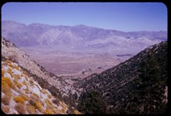
- Description:
- 50 f 12 HF
- Subject:
- Rocks, Valleys, Inyo Mountains (Calif.), Trees, Owens Valley (Calif.), Mountains, and Shrubs
- Series:
- 12-54
- Creator:
- Cushman, Charles W., 1896-1972
- Date Created:
- 1954-09-18
- Genre:
- Landscape photographs
- Frame Number:
- 24
- Street Address:
- Mt. Whitney Road
- County:
- Inyo
- Abstract:
- Owens Valley from high up Mt Whitney Rd.
- Call Number:
- P07414
- Country:
- United States
- State/Province:
- California
- Alternate Identifier:
- 1254.24
- Persistent URL:
- http://purl.dlib.indiana.edu/iudl/archives/cushman/P07414
- Holding Location:
- Bloomington - University Archives
Wells Library E460
1320 E 10th St.
Bloomington, IN 47405
Contact at archives@indiana.edu, 812-855-1127
-

- Description:
- 25 f 14
- Subject:
- Deserts, Amargosa Range (Nev. and Calif.), Valleys, Hills, Death Valley (Calif. and Nev.), Cliffs, Mountains, Shrubs, Rocks, Canyons, and Desolation Canyon (...
- Series:
- 15-52
- Creator:
- Cushman, Charles W., 1896-1972
- Date Created:
- 1952-04-09
- Genre:
- Landscape photographs
- Frame Number:
- 21
- Street Address:
- Bad Water Road
- County:
- Inyo
- Abstract:
- Approx. same.
- Call Number:
- P06041
- City:
- Furnace Creek
- Country:
- United States
- State/Province:
- California
- Alternate Identifier:
- 1552.21
- Persistent URL:
- http://purl.dlib.indiana.edu/iudl/archives/cushman/P06041
- Holding Location:
- Bloomington - University Archives
Wells Library E460
1320 E 10th St.
Bloomington, IN 47405
Contact at archives@indiana.edu, 812-855-1127
-
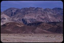
- Description:
- 100 f 8 tl
- Subject:
- Valleys, Mountains, Furnace Creek Inn (Death Valley Junction, Calif.), Black Mountains (Inyo County, Calif.), and Furnace Creek (Calif.)
- Series:
- 9-55
- Creator:
- Cushman, Charles W., 1896-1972
- Date Created:
- 1955-03-22
- Genre:
- Landscape photographs
- Frame Number:
- 28
- Street Address:
- Bad Water Road
- County:
- Inyo
- Abstract:
- East from Bad Water Road 6 miles south of Furnace C K Inn
- Call Number:
- P07819
- City:
- Death Valley Junction and Badwater
- Country:
- United States
- State/Province:
- California
- Alternate Identifier:
- 955.28
- Persistent URL:
- http://purl.dlib.indiana.edu/iudl/archives/cushman/P07819
- Holding Location:
- Bloomington - University Archives
Wells Library E460
1320 E 10th St.
Bloomington, IN 47405
Contact at archives@indiana.edu, 812-855-1127
-
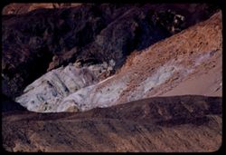
- Description:
- 100 f 8 tl
- Subject:
- Valleys, Artists Palette (Calif.), Black Mountains (Inyo County, Calif.), Mountains, Death Valley National Park (Calif. and Nev.), Rocks, and Hills
- Series:
- 10-55
- Creator:
- Cushman, Charles W., 1896-1972
- Date Created:
- 1955-03-22
- Genre:
- Landscape photographs
- Frame Number:
- 12
- Street Address:
- Artist's View Drive
- County:
- Inyo
- Abstract:
- From observation pt of Artists Palette
- Call Number:
- P07837
- Country:
- United States
- State/Province:
- California
- Alternate Identifier:
- 1055.12
- Persistent URL:
- http://purl.dlib.indiana.edu/iudl/archives/cushman/P07837
- Holding Location:
- Bloomington - University Archives
Wells Library E460
1320 E 10th St.
Bloomington, IN 47405
Contact at archives@indiana.edu, 812-855-1127