
Search Constraints
You searched for:
Campus
IUB
Remove constraint Campus: IUB
Creator
Cushman, Charles W., 1896-1972
Remove constraint Creator: Cushman, Charles W., 1896-1972
Pages
0-99 pages
Remove constraint Pages: 0-99 pages
Subject
Mountains
Remove constraint Subject: Mountains
Subject
Cliffs
Remove constraint Subject: Cliffs
« Previous |
1 - 100 of 417
|
Next »
Search Results
-
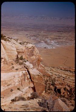
- Description:
- 25 f 8 Pola
- Subject:
- Colorado River Valley (Colo.-Mexico), National parks & reserves, Deserts, Valleys, Colorado National Monument (Colo.), Cliffs, Mountains, Shrubs, Buttes,...
- Series:
- 26-52
- Creator:
- Cushman, Charles W., 1896-1972
- Date Created:
- 1952-11-03
- Genre:
- Landscape photographs
- Frame Number:
- 6
- County:
- Mesa
- Abstract:
- View down [P] across buttes + valley of Colo. River.
- Call Number:
- P06413
- City:
- Grand Junction
- Country:
- United States
- State/Province:
- Colorado
- Alternate Identifier:
- 2652.6
- Persistent URL:
- http://purl.dlib.indiana.edu/iudl/archives/cushman/P06413
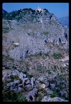
-
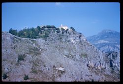
- Description:
- 250 f 4.5
- Subject:
- Canyons, Gorge du Loup (France), Cliffs, Mountains, Trees, and Buildings
- Series:
- 8-60
- Creator:
- Cushman, Charles W., 1896-1972
- Date Created:
- 1960-05-16
- Genre:
- Landscape photographs and Cityscape photographs
- Frame Number:
- 23
- County:
- Alpes-Maritimes
- Abstract:
- Gourdons
- Call Number:
- P11123
- City:
- Gourdon and La Colle-sur-Loup
- Country:
- France
- State/Province:
- Provence-Alpes-Côte d'Azur
- Alternate Identifier:
- 860.23
- Persistent URL:
- http://purl.dlib.indiana.edu/iudl/archives/cushman/P11123
-
- Description:
- 50 f 7 Pola
- Subject:
- Sangre de Cristo Mountains (Colo. and N.M.), Hills, Barbed wire, Cliffs, Mountains, Shrubs, Snow, and Fences
- Series:
- 18-52
- Creator:
- Cushman, Charles W., 1896-1972
- Date Created:
- 1952-04-15
- Genre:
- Landscape photographs
- Frame Number:
- 31
- Street Address:
- Highway 84
- County:
- Santa Fe
- Abstract:
- Again - from Hwy 84.
- Call Number:
- P06162
- City:
- Santa Fe
- Country:
- United States
- State/Province:
- New Mexico
- Alternate Identifier:
- 1852.31
- Persistent URL:
- http://purl.dlib.indiana.edu/iudl/archives/cushman/P06162
-
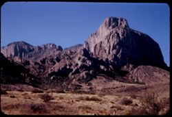
- Description:
- 25 f 11
- Subject:
- National parks & reserves, Pulliam Peak (Tex.), Green Gulch (Tex.), Valleys, Cliffs, Big Bend National Park (Tex.), Mountains, Shrubs, Basin (Big Bend Na...
- Series:
- 16-51
- Creator:
- Cushman, Charles W., 1896-1972
- Date Created:
- 1951-12-27
- Genre:
- Landscape photographs
- Frame Number:
- 4
- County:
- Brewster
- Abstract:
- Great bold front of Pulliam Pk. from Green gulch
- Call Number:
- P05423
- Country:
- United States
- State/Province:
- Texas
- Alternate Identifier:
- 1651.4
- Persistent URL:
- http://purl.dlib.indiana.edu/iudl/archives/cushman/P05423
-
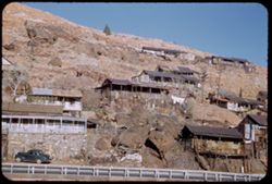
- Description:
- 25 F 9
- Subject:
- Sacramento Pit, Cities & towns, Houses, Automobiles, Cliffs, Mountains, Clotheslines, Utility poles, Electric lines, Trees, Rocks, Retaining walls, Porch...
- Series:
- 1-52
- Creator:
- Cushman, Charles W., 1896-1972
- Date Created:
- 1952-01-04
- Genre:
- Cityscape photographs and Views
- Frame Number:
- 36
- County:
- Cochise
- Abstract:
- Bisbee houses on mountainside.
- Call Number:
- P05526
- City:
- Bisbee
- Country:
- United States
- State/Province:
- Arizona
- Alternate Identifier:
- 152.36
- Persistent URL:
- http://purl.dlib.indiana.edu/iudl/archives/cushman/P05526
-
- Description:
- 250 f 4.5
- Subject:
- Canyons, Gorge du Loup (France), Cliffs, Mountains, Trees, Rocks, and Buildings
- Series:
- 8-60
- Creator:
- Cushman, Charles W., 1896-1972
- Date Created:
- 1960-05-16
- Genre:
- Landscape photographs and Cityscape photographs
- Frame Number:
- 25
- County:
- Alpes-Maritimes
- Abstract:
- Gourdons
- Call Number:
- P11125
- City:
- Gourdon and La Colle-sur-Loup
- Country:
- France
- State/Province:
- Provence-Alpes and Provence-Alpes-Côte d'Azur
- Alternate Identifier:
- 860.25
- Persistent URL:
- http://purl.dlib.indiana.edu/iudl/archives/cushman/P11125
-
- Description:
- 50 f 6.3 pola
- Subject:
- Cliffs, Mountains, Shrubs, Santa Catalina Mountains (Ariz.), Boulders, Rock formations, and Clouds
- Series:
- 4-52
- Creator:
- Cushman, Charles W., 1896-1972
- Date Created:
- 1952-01-25
- Genre:
- Landscape photographs
- Frame Number:
- 20
- Street Address:
- Mount Lemmon Road
- Abstract:
- View toward Santa Catalina tops westward
- Call Number:
- P05626
- Country:
- United States
- State/Province:
- Arizona
- Alternate Identifier:
- 452.20
- Persistent URL:
- http://purl.dlib.indiana.edu/iudl/archives/cushman/P05626
-
- Description:
- 25 f 12
- Subject:
- Oak Creek Canyon (Ariz.), Canyons, Cliffs, Mountains, Trees, and Rock formations
- Series:
- 16-52
- Creator:
- Cushman, Charles W., 1896-1972
- Date Created:
- 1952-04-12
- Genre:
- Landscape photographs
- Frame Number:
- 37
- County:
- Coconino and Coconimo
- Abstract:
- Side of canyon smudge
- Call Number:
- P06095
- City:
- Flagstaff and Sedona
- Country:
- United States
- State/Province:
- Arizona
- Alternate Identifier:
- 1652.37
- Persistent URL:
- http://purl.dlib.indiana.edu/iudl/archives/cushman/P06095
-
- Description:
- 25 f 9
- Subject:
- National parks & reserves, Casa Grande Peak (Tex.), Cliffs, Big Bend National Park (Tex.), Mountains, Trees, Buttes, and Rock formations
- Series:
- 16-51
- Creator:
- Cushman, Charles W., 1896-1972
- Date Created:
- 1951-12-28
- Genre:
- Landscape photographs
- Frame Number:
- 35
- County:
- Brewster
- Abstract:
- The squarish hump of Casa Grande at 2:30.
- Call Number:
- P05453
- Country:
- United States
- State/Province:
- Texas
- Alternate Identifier:
- 1651.35
- Persistent URL:
- http://purl.dlib.indiana.edu/iudl/archives/cushman/P05453
-
- Description:
- 50 f 8
- Subject:
- Valleys, Roads, Cliffs, Mountains, Santa Catalina Mountains (Ariz.), Boulders, Rocks, and Rock formations
- Series:
- 4-52
- Creator:
- Cushman, Charles W., 1896-1972
- Date Created:
- 1952-01-25
- Genre:
- Landscape photographs
- Frame Number:
- 18
- Street Address:
- Mount Lemmon Road
- Abstract:
- Looking down the mtn from same point
- Call Number:
- P05624
- Country:
- United States
- State/Province:
- Arizona
- Alternate Identifier:
- 452.18
- Persistent URL:
- http://purl.dlib.indiana.edu/iudl/archives/cushman/P05624
-
- Description:
- 25 f 8
- Subject:
- Oak Tree Canyon (Ariz.), Cliffs, Mountains, Trees, and Rock formations
- Series:
- 16-52
- Creator:
- Cushman, Charles W., 1896-1972
- Date Created:
- 1952-04-12
- Genre:
- Landscape photographs
- Frame Number:
- 21
- Abstract:
- High red jutting rock 25 f 8 by error
- Call Number:
- P06079
- Country:
- United States
- State/Province:
- Arizona
- Alternate Identifier:
- 1652.21
- Persistent URL:
- http://purl.dlib.indiana.edu/iudl/archives/cushman/P06079
-
- Subject:
- Weeping Rock (Utah), Mountains, Trees, Temple of Sinawava (Utah), Zion Canyon (Utah), Zion National Park (Utah), Cliffs, Roads, National parks & reserves...
- Series:
- 11-40
- Creator:
- Cushman, Charles W., 1896-1972
- Date Created:
- 1940-07-11/1940-07-12
- Genre:
- Landscape photographs
- Frame Number:
- 2
- County:
- Washington
- Abstract:
- Bed of mountain stream below Weeping Rock.
- Call Number:
- P01962
- Country:
- United States
- State/Province:
- Utah
- Physical Description:
- Image was originally mounted in a glass enclosure. Before digitization, the image was removed and placed in a Wess Plastic, Inc. brand, 2" x 2", pl...
- Alternate Identifier:
- 1140.2
- Persistent URL:
- http://purl.dlib.indiana.edu/iudl/archives/cushman/P01962
-
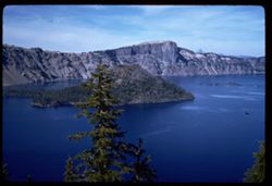
- Description:
- 100 f 8 sl
- Subject:
- Forests, Islands, Mountains, Tree limbs, Trees, Crater Lake (Or.), Cliffs, Lakes & ponds, and Wizard Island (Or.)
- Series:
- 23-60
- Creator:
- Cushman, Charles W., 1896-1972
- Date Created:
- 1960-09-16
- Genre:
- Landscape photographs
- Frame Number:
- 20
- County:
- Klamath
- Abstract:
- Wizard Isl.
- Call Number:
- P11641
- Country:
- United States
- State/Province:
- Oregon
- Alternate Identifier:
- 2360.20
- Persistent URL:
- http://purl.dlib.indiana.edu/iudl/archives/cushman/P11641
-
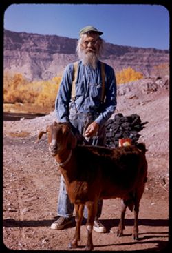
- Description:
- 150 f 6.3 or f 5.6
- Subject:
- Rocks, Hills, Mountains, Men, Trees, Goats, Cliffs, and Dirt roads
- Series:
- 27-52
- Creator:
- Cushman, Charles W., 1896-1972
- Date Created:
- 1952-11-04
- Genre:
- Portraits
- Frame Number:
- 7
- County:
- Grand
- Persons Pictured:
- Holley, Jack W.
- Abstract:
- 1 to 7 - at Jack Holley's abode.
- Call Number:
- P06452
- City:
- Moab
- Country:
- United States
- State/Province:
- Utah
- Alternate Identifier:
- 2752.7
- Persistent URL:
- http://purl.dlib.indiana.edu/iudl/archives/cushman/P06452
-

- Description:
- 100 f 5.6
- Subject:
- Bodies of water, Buildings, Meta (Ship), Mountains, Trees, Lifeboats, Vines, Walls, Ships, and Cliffs
- Series:
- 13-60
- Creator:
- Cushman, Charles W., 1896-1972
- Date Created:
- 1960-05-27
- Genre:
- Marine photographs and Cityscape photographs
- Frame Number:
- 5
- County:
- Naples
- Abstract:
- META in bound
- Call Number:
- P11287
- City:
- Sorrento
- Country:
- Italy
- State/Province:
- Campania
- Alternate Identifier:
- 1360.5
- Persistent URL:
- http://purl.dlib.indiana.edu/iudl/archives/cushman/P11287
-
- Description:
- 50 f 8
- Subject:
- Valleys, Hills, Mountains, Lost Mine Trail (Big Bend National Park (Tex.)), Trees, Canyons, National parks & reserves, Big Bend National Park (Tex.), Cli...
- Series:
- 16-51
- Creator:
- Cushman, Charles W., 1896-1972
- Date Created:
- 1951-12-27
- Genre:
- Landscape photographs
- Frame Number:
- 11
- County:
- Brewster
- Abstract:
- Road winds down to The Basin
- Call Number:
- P05430
- Country:
- United States
- State/Province:
- Texas
- Alternate Identifier:
- 1651.11
- Persistent URL:
- http://purl.dlib.indiana.edu/iudl/archives/cushman/P05430
-
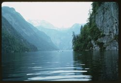
- Description:
- 100 f 5.6
- Subject:
- Mountains, Trees, Snow, Coastlines, Cliffs, Königssee (Germany : Lake), and Lakes & ponds
- Series:
- 10-64
- Creator:
- Cushman, Charles W., 1896-1972
- Date Created:
- 1964-05-25
- Genre:
- Landscape photographs
- Frame Number:
- 11
- County:
- Oberbayern
- Abstract:
- Toward end of lake
- Call Number:
- P13289
- City:
- Berchtesgaden
- Country:
- Germany
- State/Province:
- Bavaria
- Alternate Identifier:
- 1064.11
- Persistent URL:
- http://purl.dlib.indiana.edu/iudl/archives/cushman/P13289
-
- Subject:
- National parks & reserves, Zion National Park (Utah), Temple of Sinawava (Utah), Cliffs, Mountains, Shrubs, Trees, and Clouds
- Series:
- 11-40
- Creator:
- Cushman, Charles W., 1896-1972
- Date Created:
- 1940-07-11/1940-07-12
- Genre:
- Landscape photographs
- Frame Number:
- 8
- County:
- Washington
- Abstract:
- Temple of Sinawara.
- Call Number:
- P01968
- Country:
- United States
- State/Province:
- Utah
- Physical Description:
- Image was originally mounted in a glass enclosure. Before digitization, the image was removed and placed in a Wess Plastic, Inc. brand, 2" x 2", pl...
- Alternate Identifier:
- 1140.8
- Persistent URL:
- http://purl.dlib.indiana.edu/iudl/archives/cushman/P01968
-
- Description:
- 100 f 8
- Subject:
- Rock formations, Hills, Mountains, Untersberg (Austria), Shrubs, Roads, Airports, and Cliffs
- Series:
- 9-64
- Creator:
- Cushman, Charles W., 1896-1972
- Date Created:
- 1964-05-24
- Genre:
- Landscape photographs
- Frame Number:
- 17
- Abstract:
- On Untersberg Toward Salzburg
- Call Number:
- P13257
- City:
- Salzburg
- Country:
- Austria
- State/Province:
- Salzburg
- Alternate Identifier:
- 964.17
- Persistent URL:
- http://purl.dlib.indiana.edu/iudl/archives/cushman/P13257
-
- Description:
- 25 f 8 Pola
- Subject:
- Scenic overlooks, Trees, National parks & reserves, Snow, Cliffs, Roads, Sequoia National Park (Calif.), Sierra Nevada (Calif. and Nev.), Mountains, and ...
- Series:
- 14-52
- Creator:
- Cushman, Charles W., 1896-1972
- Date Created:
- 1952-04-06
- Genre:
- Landscape photographs
- Frame Number:
- 1
- Street Address:
- California State Highway 198
- County:
- Tulare
- Abstract:
- High ridge from turnout on road down.
- Call Number:
- P05985
- Country:
- United States
- State/Province:
- California
- Alternate Identifier:
- 1452.1
- Persistent URL:
- http://purl.dlib.indiana.edu/iudl/archives/cushman/P05985
-
- Description:
- 100 f 11
- Subject:
- Hills, Roads, Cliffs, Mountains, Shrubs, Trees, and Grasses
- Series:
- 5-62
- Creator:
- Cushman, Charles W., 1896-1972
- Date Created:
- 1962-10-05
- Genre:
- Landscape photographs
- Frame Number:
- 16
- County:
- Coconino
- Abstract:
- East from 6 or 7 mi. west of Sedona
- Call Number:
- P12783
- City:
- Sedona
- Country:
- United States
- State/Province:
- Arizona
- Alternate Identifier:
- 562.16
- Persistent URL:
- http://purl.dlib.indiana.edu/iudl/archives/cushman/P12783
-
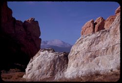
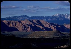
- Description:
- 25 f 11
- Subject:
- Pikes Peak (Colo.), Cliffs, Mountains, Shrubs, Buttes, Rock formations, and Garden of the Gods (Colorado Springs, Colo.)
- Series:
- 22-52
- Creator:
- Cushman, Charles W., 1896-1972
- Date Created:
- 1952-10-27
- Genre:
- Landscape photographs
- Frame Number:
- 1
- County:
- El Paso
- Abstract:
- Pike's Peak through gateway of Garden of Gods
- Call Number:
- P06255
- City:
- Colorado Springs
- Country:
- United States
- State/Province:
- Colorado
- Alternate Identifier:
- 2252.1
- Persistent URL:
- http://purl.dlib.indiana.edu/iudl/archives/cushman/P06255
-
- Description:
- 100 f 6.3 tl
- Subject:
- Cliffs, Mountains, Snow, Rocks, Pine Valley Mountain (Utah), Clouds, Shadows, and Rock formations
- Series:
- 3-58
- Creator:
- Cushman, Charles W., 1896-1972
- Date Created:
- 1958-04-25
- Genre:
- Landscape photographs
- Frame Number:
- 35
- County:
- Washington
- Abstract:
- Pine Valley Mtn.
- Call Number:
- P09751
- City:
- Saint George
- Country:
- United States
- State/Province:
- Utah
- Alternate Identifier:
- 358.35
- Persistent URL:
- http://purl.dlib.indiana.edu/iudl/archives/cushman/P09751
-
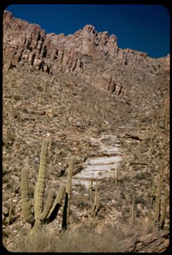
- Description:
- 25 f 13
- Subject:
- Sabino Canyon (Ariz.), Canyons, Saguaro, Cliffs, Mountains, Shrubs, Cactus, Rocks, Rock formations, and Santa Catalina Mountains (Ariz.)
- Series:
- 5-52
- Creator:
- Cushman, Charles W., 1896-1972
- Date Created:
- 1952-02-05
- Genre:
- Landscape photographs
- Frame Number:
- 26
- County:
- Pima
- Abstract:
- Up wall of Sabino Canyon in morning
- Call Number:
- P05671
- Country:
- United States
- State/Province:
- Arizona
- Alternate Identifier:
- 552.26
- Persistent URL:
- http://purl.dlib.indiana.edu/iudl/archives/cushman/P05671
-
- Description:
- 25 f 13
- Subject:
- National parks & reserves, Cliffs, Massai Point (Ariz.), Mountains, Chiricahua National Monument (Ariz.), and Rock formations
- Series:
- 4-52
- Creator:
- Cushman, Charles W., 1896-1972
- Date Created:
- 1952-01-22
- Genre:
- Landscape photographs
- Frame Number:
- 8
- County:
- Cochise
- Abstract:
- View NW from the Lookout Pt.
- Call Number:
- P05614
- Country:
- United States
- State/Province:
- Arizona
- Alternate Identifier:
- 452.8
- Persistent URL:
- http://purl.dlib.indiana.edu/iudl/archives/cushman/P05614
-
- Description:
- 100 f 5.6 tl
- Subject:
- Turtleback Dome (Calif.), Forests, Cliffs, Mountains, Yosemite National Park (Calif.), Trees, Cascade Falls (Calif.), Rock formations, and National parks &am...
- Series:
- 22-55
- Creator:
- Cushman, Charles W., 1896-1972
- Date Created:
- 1955-07-09
- Genre:
- Landscape photographs
- Frame Number:
- 31
- Street Address:
- Big Oak Flat Road
- County:
- Mariposa
- Abstract:
- Turtle back Dome from Big Oak Flat Rd Bridge over Cascade Falls
- Call Number:
- P08284
- Country:
- United States
- State/Province:
- California
- Alternate Identifier:
- 2255.31
- Persistent URL:
- http://purl.dlib.indiana.edu/iudl/archives/cushman/P08284
-
- Description:
- 100 f 6.3 tl
- Subject:
- Mile Rock (Calif.), San Francisco Bay (Calif.), Cliffs, Bays (Bodies of water), Mile Rock Lighthouse (Calif.), Tamalpais, Mount (Calif.), Lands End (Calif.),...
- Series:
- 1-57
- Creator:
- Cushman, Charles W., 1896-1972
- Date Created:
- 1957-03-16
- Genre:
- Marine photographs, Seascapes, and Architectural photographs
- Frame Number:
- 11
- County:
- San Francisco
- Abstract:
- Mile Rock light
- Call Number:
- P09117
- City:
- San Francisco
- Country:
- United States
- State/Province:
- California
- Alternate Identifier:
- 157.11
- Persistent URL:
- http://purl.dlib.indiana.edu/iudl/archives/cushman/P09117
-
- Description:
- 25 f 6.3 Pola
- Subject:
- National parks & reserves, Hills, Colorado National Monument (Colo.), Cliffs, Mountains, Boulders, Rocks, Buttes, Rock formations, Junipers, and Trees
- Series:
- 25-52
- Creator:
- Cushman, Charles W., 1896-1972
- Date Created:
- 1952-11-03
- Genre:
- Landscape photographs
- Frame Number:
- 38
- County:
- Mesa
- Abstract:
- Across juniper tops.
- Call Number:
- P06407
- City:
- Grand Junction
- Country:
- United States
- State/Province:
- Colorado
- Alternate Identifier:
- 2552.38
- Persistent URL:
- http://purl.dlib.indiana.edu/iudl/archives/cushman/P06407
-
- Description:
- 50 f 11
- Subject:
- Erosion, Canyons, Cliffs, Mountains, Dirt roads, Trees, Rocks, California Zephyr (Express train), Colorado River (Colo.-Mexico), Grasses, Railroads, Clouds, ...
- Series:
- 9-53
- Creator:
- Cushman, Charles W., 1896-1972
- Date Created:
- 1953-10-12
- Genre:
- Snapshots
- Frame Number:
- 27
- County:
- Mesa
- Abstract:
- California Zephyr along Colorado river.
- Call Number:
- P06828
- City:
- Grand Junction
- Country:
- United States
- State/Province:
- Colorado
- Alternate Identifier:
- 953.27
- Persistent URL:
- http://purl.dlib.indiana.edu/iudl/archives/cushman/P06828
-
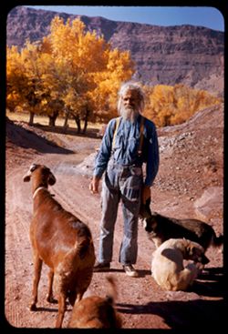
- Description:
- ?
- Subject:
- Dogs, Puppies, Men, Hills, Cliffs, Mountains, Dirt roads, Families, Goats, and Trees
- Series:
- 26-52
- Creator:
- Cushman, Charles W., 1896-1972
- Date Created:
- 1952-11-04
- Genre:
- Portraits
- Frame Number:
- 38
- County:
- Grand
- Persons Pictured:
- Holley, Jack W.
- Abstract:
- Jack W. Holley and family. Dandy, 3 dogs + 1 puppy.
- Call Number:
- P06444
- City:
- Moab
- Country:
- United States
- State/Province:
- Utah
- Alternate Identifier:
- 2652.38
- Persistent URL:
- http://purl.dlib.indiana.edu/iudl/archives/cushman/P06444
-

- Description:
- 25 f 16
- Subject:
- Adobe houses, Dogs, Logs, Barbed wire, Roads, Cliffs, Mountains, Taylor, Mount (N.M.), Mesas, and Fences
- Series:
- 18-52
- Creator:
- Cushman, Charles W., 1896-1972
- Date Created:
- 1952-04-14
- Genre:
- Views
- Frame Number:
- 7
- Street Address:
- United States Highway 66
- County:
- Cibola
- Abstract:
- Indian adobe house near McCarty's on Hwy 66 south of Mt. Taylor.
- Call Number:
- P06138
- City:
- McCartys
- Country:
- United States
- State/Province:
- New Mexico
- Alternate Identifier:
- 1852.7
- Persistent URL:
- http://purl.dlib.indiana.edu/iudl/archives/cushman/P06138
-

- Description:
- 25 f 14
- Subject:
- Deserts, Amargosa Range (Nev. and Calif.), Valleys, Hills, Death Valley (Calif. and Nev.), Cliffs, Mountains, Shrubs, Rocks, Canyons, and Desolation Canyon (...
- Series:
- 15-52
- Creator:
- Cushman, Charles W., 1896-1972
- Date Created:
- 1952-04-09
- Genre:
- Landscape photographs
- Frame Number:
- 21
- Street Address:
- Bad Water Road
- County:
- Inyo
- Abstract:
- Approx. same.
- Call Number:
- P06041
- City:
- Furnace Creek
- Country:
- United States
- State/Province:
- California
- Alternate Identifier:
- 1552.21
- Persistent URL:
- http://purl.dlib.indiana.edu/iudl/archives/cushman/P06041
-
- Description:
- 100 f 11 TL
- Subject:
- Canyons, Forests, Roads, Cliffs, Mountains, Trees, and San Miguel River (Colo.)
- Series:
- 36-65
- Creator:
- Cushman, Charles W., 1896-1972
- Date Created:
- 1965-10-05
- Genre:
- Landscape photographs
- Frame Number:
- 3
- Street Address:
- Colorado State Highway 145
- County:
- San Miguel
- Abstract:
- Rd to Telluride, Colo. Hwy 45.
- Call Number:
- P15071
- City:
- Telluride
- Country:
- United States
- State/Province:
- Colorado
- Alternate Identifier:
- 3665.3
- Persistent URL:
- http://purl.dlib.indiana.edu/iudl/archives/cushman/P15071
-
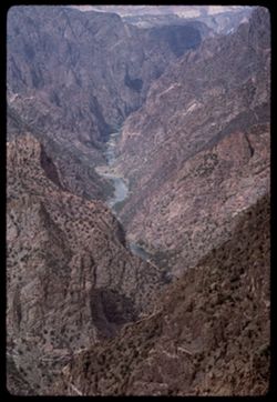
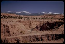
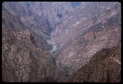
- Description:
- 100 f 13 TL
- Subject:
- Black Canyon of the Gunnison National Park (Colo.), Canyons, Cliffs, Mountains, Black Canyon of the Gunnison (Colo.), Rock formations, National parks & r...
- Series:
- 35-65
- Creator:
- Cushman, Charles W., 1896-1972
- Date Created:
- 1965-10-05
- Genre:
- Landscape photographs
- Frame Number:
- 30
- County:
- Montrose
- Abstract:
- Downstream from Sunset View
- Call Number:
- P15060
- Country:
- United States
- State/Province:
- Colorado
- Alternate Identifier:
- 3565.30
- Persistent URL:
- http://purl.dlib.indiana.edu/iudl/archives/cushman/P15060
-
- Description:
- 100 f 13
- Subject:
- Black Canyon of the Gunnison National Park (Colo.), Canyons, Cliffs, Mountains, Black Canyon of the Gunnison (Colo.), Rock formations, National parks & r...
- Series:
- 35-65
- Creator:
- Cushman, Charles W., 1896-1972
- Date Created:
- 1965-10-05
- Genre:
- Landscape photographs
- Frame Number:
- 28
- County:
- Montrose
- Abstract:
- Downstream from Sunset View.
- Call Number:
- P15058
- Country:
- United States
- State/Province:
- Colorado
- Alternate Identifier:
- 3565.28
- Persistent URL:
- http://purl.dlib.indiana.edu/iudl/archives/cushman/P15058
-
- Description:
- 200 f 4
- Subject:
- Erosion, Air France, Air travel, Cliffs, Mountains, Shadows, and Clouds
- Series:
- 3-60
- Creator:
- Cushman, Charles W., 1896-1972
- Date Created:
- 1960-05-07
- Genre:
- Aerial photographs and Landscape photographs
- Frame Number:
- 18
- Abstract:
- Several minutes later
- Call Number:
- P10978
- Country:
- United States
- Alternate Identifier:
- 360.18
- Persistent URL:
- http://purl.dlib.indiana.edu/iudl/archives/cushman/P10978
-
- Description:
- 25 f 11
- Subject:
- Noon, National parks & reserves, Pulliam Peak (Tex.), Canyons, Valleys, Hills, Cliffs, Big Bend National Park (Tex.), Mountains, Shrubs, Trees, Basin (Bi...
- Series:
- 16-51
- Creator:
- Cushman, Charles W., 1896-1972
- Date Created:
- 1951-12-27
- Genre:
- Landscape photographs
- Frame Number:
- 5
- County:
- Brewster
- Abstract:
- Great bold front of Pulliam Pk. From Green gulch from south
- Call Number:
- P05424
- Country:
- United States
- State/Province:
- Texas
- Alternate Identifier:
- 1651.5
- Persistent URL:
- http://purl.dlib.indiana.edu/iudl/archives/cushman/P05424
-
- Description:
- 100 f 5.6 sl
- Subject:
- Cliffs, Mountains, Tunnels, Rocks, Buttes, Streams, Elephant Butte (Calif.), Feather River (Calif.), and Grizzly Dome (Calif.)
- Series:
- 12-57
- Creator:
- Cushman, Charles W., 1896-1972
- Date Created:
- 1957-07-26
- Genre:
- Landscape photographs
- Frame Number:
- 26
- County:
- Plumas
- Abstract:
- Grizzly Dome & Elephant Butte
- Call Number:
- P09470
- Country:
- United States
- State/Province:
- California
- Alternate Identifier:
- 1257.26
- Persistent URL:
- http://purl.dlib.indiana.edu/iudl/archives/cushman/P09470
-
- Description:
- 50 f 8
- Subject:
- Bumpass Mountain (Calif.), Lava domes, Lassen Volcanic National Park (Calif.), Volcanic domes, Cliffs, Mountains, Shrubs, Pines, Volcanoes, and Trees
- Series:
- 5-54
- Creator:
- Cushman, Charles W., 1896-1972
- Date Created:
- 1954-08-19
- Genre:
- Landscape photographs
- Frame Number:
- 19
- County:
- Shasta
- Abstract:
- Great tree clad cliff, probably side of Bumpass Mtn- tall pines top in center
- Call Number:
- P07215
- Country:
- United States
- State/Province:
- California
- Physical Description:
- Anscochrome film.
- Alternate Identifier:
- 554.19
- Persistent URL:
- http://purl.dlib.indiana.edu/iudl/archives/cushman/P07215
-
- Description:
- 25 f 13
- Subject:
- Oak Creek Canyon (Ariz.), Tree limbs, Canyons, Cliffs, Mountains, and Shrubs
- Series:
- 16-52
- Creator:
- Cushman, Charles W., 1896-1972
- Date Created:
- 1952-04-12
- Genre:
- Landscape photographs
- Frame Number:
- 25
- County:
- Coconino
- Abstract:
- [P] Spots
- Call Number:
- P06083
- Country:
- United States
- State/Province:
- Arizona
- Alternate Identifier:
- 1652.25
- Persistent URL:
- http://purl.dlib.indiana.edu/iudl/archives/cushman/P06083
-
- Description:
- 25 f 13
- Subject:
- Sabino Canyon (Ariz.), Canyons, Saguaro, Cliffs, Mountains, Shrubs, Santa Catalina Mountains (Ariz.), Rock formations, and Cactus
- Series:
- 5-52
- Creator:
- Cushman, Charles W., 1896-1972
- Date Created:
- 1952-02-04
- Genre:
- Landscape photographs
- Frame Number:
- 25
- County:
- Pima
- Abstract:
- Pent house - at left - and the square castle - late
- Call Number:
- P05670
- Country:
- United States
- State/Province:
- Arizona
- Alternate Identifier:
- 552.25
- Persistent URL:
- http://purl.dlib.indiana.edu/iudl/archives/cushman/P05670
-
- Description:
- 100 f 6.3 tl
- Subject:
- Cliffs, Mountains, Boulders, Rainier, Mount (Wash.), Cascade Range, Trees, and Rocks
- Series:
- 24-60
- Creator:
- Cushman, Charles W., 1896-1972
- Date Created:
- 1960-09-20
- Genre:
- Landscape photographs
- Frame Number:
- 22
- County:
- Pierce
- Abstract:
- Little peak east of Rainier
- Call Number:
- P11674
- Country:
- United States
- State/Province:
- Washington
- Alternate Identifier:
- 2460.22
- Persistent URL:
- http://purl.dlib.indiana.edu/iudl/archives/cushman/P11674
-
- Description:
- 25 f 10
- Subject:
- Meadows, Horses, Barbed wire, Cliffs, Mountains, Trees, Grazing, and Fences
- Series:
- 26-52
- Creator:
- Cushman, Charles W., 1896-1972
- Date Created:
- 1952-11-04
- Genre:
- Identification photographs
- Frame Number:
- 37
- County:
- Grand
- Abstract:
- Horse + colt in field at Moab.
- Call Number:
- P06443
- City:
- Moab
- Country:
- United States
- State/Province:
- Utah
- Alternate Identifier:
- 2652.37
- Persistent URL:
- http://purl.dlib.indiana.edu/iudl/archives/cushman/P06443
-
- Description:
- 125 f 4.5
- Subject:
- Horseback riding, Guards, Horses, Men, Hills, Border patrols, Boquillas Canyon (Big Bend National Park (Tex.)), Cliffs, Mountains, Shrubs, Cactus, Mounted po...
- Series:
- 16-51
- Creator:
- Cushman, Charles W., 1896-1972
- Date Created:
- 1951-12-27
- Genre:
- Portraits
- Frame Number:
- 17
- County:
- Brewster
- Abstract:
- Border patrol near Boquillas.
- Call Number:
- P05436
- Country:
- United States
- State/Province:
- Texas
- Alternate Identifier:
- 1651.17
- Persistent URL:
- http://purl.dlib.indiana.edu/iudl/archives/cushman/P05436
-
- Subject:
- Cliffs, Mountains, Shrubs, Trees, and Rocks
- Series:
- 12-40
- Creator:
- Cushman, Charles W., 1896-1972
- Date Created:
- 1940-07-12
- Genre:
- Landscape photographs
- Frame Number:
- 9
- Abstract:
- Looking east across tree clad mountains.
- Call Number:
- P01988
- Country:
- United States
- State/Province:
- Utah
- Alternate Identifier:
- 1240.9
- Persistent URL:
- http://purl.dlib.indiana.edu/iudl/archives/cushman/P01988
-
- Description:
- 100 f 13 tl
- Subject:
- Forests, Cliffs, Mountains, Trees, and Rock formations
- Series:
- 32-65
- Creator:
- Cushman, Charles W., 1896-1972
- Date Created:
- 1965-10-02
- Genre:
- Landscape photographs
- Frame Number:
- 27
- Street Address:
- United States Highway 550
- County:
- La Plata
- Abstract:
- Waterfall nearby
- Call Number:
- P14945
- City:
- Durango
- Country:
- United States
- State/Province:
- Colorado
- Alternate Identifier:
- 3265.27
- Persistent URL:
- http://purl.dlib.indiana.edu/iudl/archives/cushman/P14945
-
- Description:
- 25 f 11
- Subject:
- Noon, Hills, Cliffs, Franklin Mountains (Tex. and N.M.), Mountains, and Shrubs
- Series:
- 17-51
- Creator:
- Cushman, Charles W., 1896-1972
- Date Created:
- 1952-01-01
- Genre:
- Landscape photographs
- Frame Number:
- 28
- County:
- El Paso
- Abstract:
- Mtns. at noon.
- Call Number:
- P05479
- City:
- El Paso
- Country:
- United States
- State/Province:
- Texas
- Alternate Identifier:
- 1751.28
- Persistent URL:
- http://purl.dlib.indiana.edu/iudl/archives/cushman/P05479
-
- Description:
- 25 f 9 Pola
- Subject:
- Lakes & ponds, Deserts, Valleys, Death Valley (Calif. and Nev.), Roads, Cliffs, Mountains, Boulders, and Rocks
- Series:
- 15-52
- Creator:
- Cushman, Charles W., 1896-1972
- Date Created:
- 1952-04-09
- Genre:
- Snapshots
- Frame Number:
- 29
- County:
- Inyo
- Abstract:
- Mtns at Bad Water, 279.6 ft. below
- Call Number:
- P06049
- City:
- Badwater
- Country:
- United States
- State/Province:
- California
- Alternate Identifier:
- 1552.29
- Persistent URL:
- http://purl.dlib.indiana.edu/iudl/archives/cushman/P06049
-
- Description:
- 25 f 9
- Subject:
- National parks & reserves, Berries, Colorado National Monument (Colo.), Cliffs, Mountains, Shrubs, Boulders, Rocks, Junipers, and Trees
- Series:
- 26-52
- Creator:
- Cushman, Charles W., 1896-1972
- Date Created:
- 1952-11-03
- Genre:
- Identification photographs
- Frame Number:
- 3
- County:
- Mesa
- Abstract:
- Juniper. A beauty.
- Call Number:
- P06410
- City:
- Grand Junction
- Country:
- United States
- State/Province:
- Colorado
- Alternate Identifier:
- 2652.3
- Persistent URL:
- http://purl.dlib.indiana.edu/iudl/archives/cushman/P06410
-
- Description:
- 25 f 9
- Subject:
- Panamint Mountains (Calif.), Deserts, Canyons, Valleys, Death Valley (Calif. and Nev.), Panamint Valley (Calif.), Mountains, Cliffs, and Panamint Range (Calif.)
- Series:
- 15-52
- Creator:
- Cushman, Charles W., 1896-1972
- Date Created:
- 1952-04-01
- Genre:
- Landscape photographs
- Frame Number:
- 3
- County:
- Inyo
- Abstract:
- Mouth of Canyon into Panamint Valley - Panamint Mtns in distance.
- Call Number:
- P06024
- Country:
- United States
- State/Province:
- California
- Physical Description:
- Image was originally mounted in a glass enclosure. Before digitization, the image was removed and placed in a Wess Plastic, Inc. brand, 2" x 2", pl...
- Alternate Identifier:
- 1552.3
- Persistent URL:
- http://purl.dlib.indiana.edu/iudl/archives/cushman/P06024
-
- Description:
- 25 f 7.5 pola
- Subject:
- Sabino Canyon (Ariz.), Canyons, Saguaro, Cliffs, Mountains, Shrubs, Santa Catalina Mountains (Ariz.), Rocks, Rock formations, and Cactus
- Series:
- 5-52
- Creator:
- Cushman, Charles W., 1896-1972
- Date Created:
- 1952-02-04
- Genre:
- Landscape photographs
- Frame Number:
- 23
- County:
- Pima
- Abstract:
- High square castle seen through a gap above Sabino canyon - both
- Call Number:
- P05668
- Country:
- United States
- State/Province:
- Arizona
- Alternate Identifier:
- 552.23
- Persistent URL:
- http://purl.dlib.indiana.edu/iudl/archives/cushman/P05668
-
- Description:
- 50 f 6.3 Pola
- Subject:
- Snow, Rio Grande, Trees, Mountains, Sangre de Cristo Mountains (Colo. and N.M.), Hills, Rivers, and Cliffs
- Series:
- 18-52
- Creator:
- Cushman, Charles W., 1896-1972
- Date Created:
- 1952-04-15
- Genre:
- Landscape photographs
- Frame Number:
- 30
- County:
- Santa Fe
- Abstract:
- Highest of Sangre de Cristo.
- Call Number:
- P06161
- City:
- Santa Fe and Pojoaque
- Country:
- United States
- State/Province:
- New Mexico
- Alternate Identifier:
- 1852.30
- Persistent URL:
- http://purl.dlib.indiana.edu/iudl/archives/cushman/P06161
-
- Description:
- 100 f 4.5 tl
- Subject:
- Columbia River, Roads, Columbia River Palisades, Barbed wire, Trees, Signs (Notices), Mountains, Fences, Traffic signs & signals, Railroad tracks, Utilit...
- Series:
- 24-60
- Creator:
- Cushman, Charles W., 1896-1972
- Date Created:
- 1960-09-19
- Genre:
- Landscape photographs
- Frame Number:
- 11
- County:
- Wasco
- Abstract:
- Columbia palisades near Rowena
- Call Number:
- P11665
- City:
- Rowena
- Country:
- United States
- State/Province:
- Oregon
- Alternate Identifier:
- 2460.11
- Persistent URL:
- http://purl.dlib.indiana.edu/iudl/archives/cushman/P11665
-
- Description:
- 100 f 6.3 tl
- Subject:
- Columbia River, Cliffs, Columbia River Palisades, Mountains, Shrubs, Columbia Palisades, and Rock formations
- Series:
- 24-60
- Creator:
- Cushman, Charles W., 1896-1972
- Date Created:
- 1960-09-19
- Genre:
- Landscape photographs
- Frame Number:
- 12
- County:
- Wasco
- Abstract:
- Palisades on right bank
- Call Number:
- P11666
- City:
- Rowena
- Country:
- United States
- State/Province:
- Oregon
- Alternate Identifier:
- 2460.12
- Persistent URL:
- http://purl.dlib.indiana.edu/iudl/archives/cushman/P11666
-
- Description:
- 50 f 4.5
- Subject:
- Rocks, Canyons, Roads, Gila River (N.M. and Ariz.), Trees, Coolidge Dam (Ariz.), Mountains, Dams, Rivers, and Cliffs
- Series:
- 13-53
- Creator:
- Cushman, Charles W., 1896-1972
- Date Created:
- 1953-11-18
- Genre:
- Landscape photographs
- Frame Number:
- 34
- Abstract:
- From Coolidge dam - downstream Gila river
- Call Number:
- P06992
- Country:
- United States
- State/Province:
- Arizona
- Alternate Identifier:
- 1353.34
- Persistent URL:
- http://purl.dlib.indiana.edu/iudl/archives/cushman/P06992
-
- Description:
- 25 f 6.3 Pola
- Subject:
- Reserva de la Biosfera Santa Elena-Sierra del Carmen (Mexico), Cliffs, Dirt roads, Trails & paths, Trees, Mountains, National parks & reserves, Hills...
- Series:
- 16-51
- Creator:
- Cushman, Charles W., 1896-1972
- Date Created:
- 1951-12-27
- Genre:
- Landscape photographs
- Frame Number:
- 19
- County:
- Brewster
- Abstract:
- Across to Boquillas.
- Call Number:
- P05438
- Country:
- United States and Mexico
- State/Province:
- Texas
- Alternate Identifier:
- 1651.19
- Persistent URL:
- http://purl.dlib.indiana.edu/iudl/archives/cushman/P05438
-
- Description:
- 100 f 8 tl
- Subject:
- Bays (Bodies of water), Fort Barry Military Reservation (Calif.), Cliffs, Lands End (Calif.), Bonita, Point (Calif.), Capes (Coasts), Mountains, Clouds, Wate...
- Series:
- 1-57
- Creator:
- Cushman, Charles W., 1896-1972
- Date Created:
- 1957-03-16
- Genre:
- Landscape photographs
- Frame Number:
- 10
- County:
- San Francisco
- Abstract:
- Point Bonita and Fort Barry with Mt. Tamalpais beyond
- Call Number:
- P09116
- City:
- San Francisco
- Country:
- United States
- State/Province:
- California
- Alternate Identifier:
- 157.10
- Persistent URL:
- http://purl.dlib.indiana.edu/iudl/archives/cushman/P09116
-
- Description:
- 50 f 9
- Subject:
- Rocks, Valleys, Grasses, Cliffs, Queen Creek (Ariz.), Mountains, Rock formations, and Queen Creek Bridge (Ariz.)
- Series:
- 14-53
- Creator:
- Cushman, Charles W., 1896-1972
- Date Created:
- 1953-11-19
- Genre:
- Landscape photographs
- Frame Number:
- 32
- Street Address:
- United States Highway 60 and United States Highway 70
- County:
- Pinal
- Abstract:
- Two views from Queen Ck. Bridge
- Call Number:
- P07028
- City:
- Superior
- Country:
- United States
- State/Province:
- Arizona
- Alternate Identifier:
- 1453.32
- Persistent URL:
- http://purl.dlib.indiana.edu/iudl/archives/cushman/P07028
-
- Description:
- 50 f 8
- Subject:
- Dump trucks, Cliffs, Copper miners, Mining, Machinery, Copper mining, Mountains, Shrubs, Trucks, Miners, Mining equipment, and Phelps Dodge Corporation
- Series:
- 1-52
- Creator:
- Cushman, Charles W., 1896-1972
- Date Created:
- 1952-01-04
- Genre:
- Snapshots
- Frame Number:
- 22
- County:
- Cochise
- Abstract:
- Mining a mountainside at Lowell.
- Call Number:
- P05512
- City:
- Lowell
- Country:
- United States
- State/Province:
- Arizona
- Alternate Identifier:
- 152.22
- Persistent URL:
- http://purl.dlib.indiana.edu/iudl/archives/cushman/P05512
-

- Description:
- 25 f 13
- Subject:
- Rocks, Colored mountains, Valleys, Cliffs, Mountains, Rock formations, Death Valley (Calif. and Nev.), Deserts, and Hills
- Series:
- 15-52
- Creator:
- Cushman, Charles W., 1896-1972
- Date Created:
- 1952-04-09
- Genre:
- Landscape photographs
- Frame Number:
- 38
- Street Address:
- Artists Drive
- County:
- Inyo
- Abstract:
- From top of Artists Drive. Off Artists Drive.
- Call Number:
- P06057
- Country:
- United States
- State/Province:
- California
- Alternate Identifier:
- 1552.38
- Persistent URL:
- http://purl.dlib.indiana.edu/iudl/archives/cushman/P06057
-
- Description:
- 50 f 5.6
- Subject:
- Cliffs, Meadows, Morro Bay (Calif.), Mountains, Rock formations, and Clouds
- Series:
- 8-52
- Creator:
- Cushman, Charles W., 1896-1972
- Date Created:
- 1952-03-01
- Genre:
- Landscape photographs
- Frame Number:
- 34
- Street Address:
- California State Highway 1
- County:
- San Luis Obispo
- Abstract:
- Mtn along Cal 1 between San Luis & Morro Bay
- Call Number:
- P05793
- City:
- San Luis Obispo
- Country:
- United States
- State/Province:
- California
- Alternate Identifier:
- 852.34
- Persistent URL:
- http://purl.dlib.indiana.edu/iudl/archives/cushman/P05793
-
- Subject:
- Cliffs, Königssee (Germany : Lake), Trees, Coastlines, Mountains, Lakes & ponds, Boats, and Life preservers
- Series:
- 10-64
- Creator:
- Cushman, Charles W., 1896-1972
- Date Created:
- 1964-05-25
- Genre:
- Landscape photographs and Marine photographs
- Frame Number:
- 10
- County:
- Oberbayern
- Abstract:
- Rock side of Konigssee from boat
- Call Number:
- P13288
- Country:
- Germany
- State/Province:
- Bavaria
- Alternate Identifier:
- 1064.10
- Persistent URL:
- http://purl.dlib.indiana.edu/iudl/archives/cushman/P13288
-
- Description:
- 25 f 13
- Subject:
- Rocks, Valleys, Panamint Range (Calif.), Argus Range (Calif.), Boulders, Mountains, Shrubs, Panamint Valley (Calif.), Canyons, and Cliffs
- Series:
- 15-52
- Creator:
- Cushman, Charles W., 1896-1972
- Date Created:
- 1952-04-08
- Genre:
- Landscape photographs
- Frame Number:
- 5
- County:
- Inyo
- Abstract:
- Flatbed of Panamint Valley from same pt. A gap in Argus Range.
- Call Number:
- P06026
- Country:
- United States
- State/Province:
- California
- Alternate Identifier:
- 1552.5
- Persistent URL:
- http://purl.dlib.indiana.edu/iudl/archives/cushman/P06026
-
- Description:
- 50 f 8
- Subject:
- Canyons, Grasses, Cliffs, Trees, Red Canyon (Garfield County, Colo.), Tree limbs, Mountains, Rock formations, Clouds, and Hills
- Series:
- 9-53
- Creator:
- Cushman, Charles W., 1896-1972
- Date Created:
- 1953-10-13
- Genre:
- Landscape photographs
- Frame Number:
- 38
- County:
- Garfield
- Abstract:
- Red Canyon, south of Glenwood Spgs.
- Call Number:
- P06839
- City:
- Glenwood Springs
- Country:
- United States
- State/Province:
- Colorado
- Alternate Identifier:
- 953.38
- Persistent URL:
- http://purl.dlib.indiana.edu/iudl/archives/cushman/P06839
-
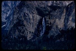
- Description:
- 100 f 8 tl
- Subject:
- Cliffs, Bridalveil Fall (Calif.), Yosemite National Park (Calif.), Waterfalls, Trees, Mountains, National parks & reserves, Discovery View (Calif.), and ...
- Series:
- 22-55
- Creator:
- Cushman, Charles W., 1896-1972
- Date Created:
- 1955-07-09
- Genre:
- Landscape photographs
- Frame Number:
- 23
- County:
- Mariposa
- Abstract:
- Bridal Veil fall from Tunnel View
- Call Number:
- P08276
- Country:
- United States
- State/Province:
- California
- Alternate Identifier:
- 2255.23
- Persistent URL:
- http://purl.dlib.indiana.edu/iudl/archives/cushman/P08276
-
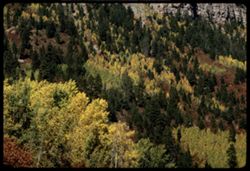
- Description:
- 100 f 16 tl
- Subject:
- Cliffs, Trees, Mountains, Colors, Firs, and Forests
- Series:
- 32-65
- Creator:
- Cushman, Charles W., 1896-1972
- Date Created:
- 1965-10-02
- Genre:
- Landscape photographs
- Frame Number:
- 30
- Street Address:
- United States Highway 550
- County:
- San Juan and La Plata
- Abstract:
- Cliffs and fall colors
- Call Number:
- P14948
- City:
- Durango and Silverton
- Country:
- United States
- State/Province:
- Colorado
- Alternate Identifier:
- 3265.30
- Persistent URL:
- http://purl.dlib.indiana.edu/iudl/archives/cushman/P14948
-
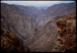
- Description:
- 100 f 11 TL
- Subject:
- Canyons, Cliffs, Black Canyon of the Gunnison National Park (Colo.), Mountains, National parks & reserves, Black Canyon of the Gunnison (Colo.), Rivers, ...
- Series:
- 35-65
- Creator:
- Cushman, Charles W., 1896-1972
- Date Created:
- 1965-10-05
- Genre:
- Landscape photographs
- Frame Number:
- 29
- County:
- Montrose
- Abstract:
- Downstream from Sunset View
- Call Number:
- P15059
- Country:
- United States
- State/Province:
- Colorado
- Alternate Identifier:
- 3565.29
- Persistent URL:
- http://purl.dlib.indiana.edu/iudl/archives/cushman/P15059
-
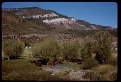
- Description:
- 100 f 16
- Subject:
- Grasses, Cliffs, Horses, Trees, Mountains, Fences, and Gates
- Series:
- 32-65
- Creator:
- Cushman, Charles W., 1896-1972
- Date Created:
- 1965-10-02
- Genre:
- Landscape photographs
- Frame Number:
- 24
- Street Address:
- United States Highway 550
- County:
- La Plata
- Abstract:
- Horses below mtn side
- Call Number:
- P14942
- City:
- Durango
- Country:
- United States
- State/Province:
- Colorado
- Alternate Identifier:
- 3265.24
- Persistent URL:
- http://purl.dlib.indiana.edu/iudl/archives/cushman/P14942
-
- Subject:
- Snow, Cliffs, Königssee (Germany : Lake), Trees, Coastlines, Mountains, Lakes & ponds, and Reflections
- Series:
- 10-64
- Creator:
- Cushman, Charles W., 1896-1972
- Date Created:
- 1964-05-25
- Genre:
- Landscape photographs
- Frame Number:
- 8
- County:
- Oberbayern
- Abstract:
- On Konigssee
- Call Number:
- P13286
- City:
- Königssee
- Country:
- Germany
- State/Province:
- Bavaria
- Alternate Identifier:
- 1064.8
- Persistent URL:
- http://purl.dlib.indiana.edu/iudl/archives/cushman/P13286
-
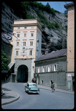
- Description:
- 100 f 11
- Subject:
- Pedestrians, Electric lines, Cliffs, Light fixtures, Automobiles, Streets, Monchsberg (Salzburg, Austria), Sidewalks, Tunnels, Architectural decorations &...
- Series:
- 11-64
- Creator:
- Cushman, Charles W., 1896-1972
- Date Created:
- 1964-05-30
- Genre:
- Cityscape photographs and Architectural photographs
- Frame Number:
- 26
- Street Address:
- Burgerspitalplatz
- Abstract:
- Tunnel off Burgerspital Platz
- Call Number:
- P13341
- City:
- Salzburg
- Country:
- Austria
- State/Province:
- Salzburg
- Alternate Identifier:
- 1164.26
- Persistent URL:
- http://purl.dlib.indiana.edu/iudl/archives/cushman/P13341
-
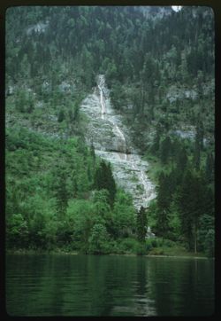
- Description:
- 200 f 2.8
- Subject:
- Cliffs, Königssee (Germany : Lake), Waterfalls, Trees, Coastlines, Mountains, Lakes & ponds, and Forests
- Series:
- 10-64
- Creator:
- Cushman, Charles W., 1896-1972
- Date Created:
- 1964-05-25
- Genre:
- Landscape photographs
- Frame Number:
- 16
- County:
- Oberbayern
- Abstract:
- Waterfall
- Call Number:
- P13293
- Country:
- Germany
- State/Province:
- Bavaria
- Alternate Identifier:
- 1064.16
- Persistent URL:
- http://purl.dlib.indiana.edu/iudl/archives/cushman/P13293
-
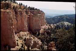
- Subject:
- Canyons, Cliffs, Bryce Canyon National Park (Utah), Trees, Mountains, National parks & reserves, Bryce Canyon (Utah : Valley), Bryce Natural Bridge (Utah...
- Series:
- 12-40
- Creator:
- Cushman, Charles W., 1896-1972
- Date Created:
- 1940-07-12
- Genre:
- Landscape photographs
- Frame Number:
- 4
- County:
- Garfield
- Abstract:
- Part of canyon wall from topo f Natural Bridge
- Call Number:
- P01983
- Country:
- United States
- State/Province:
- Utah
- Physical Description:
- Image was originally mounted in a glass enclosure. Before digitization, the image was removed and placed in a Wess Plastic, Inc. brand, 2" x 2", pl...
- Alternate Identifier:
- 1240.4
- Persistent URL:
- http://purl.dlib.indiana.edu/iudl/archives/cushman/P01983
-
- Description:
- 25 f 8
- Subject:
- Cliffs, Trees, Mountains, Rock formations, Cottonwood, Hills, Streams, and Roads
- Series:
- 17-51
- Creator:
- Cushman, Charles W., 1896-1972
- Date Created:
- 1951-12-29
- Genre:
- Landscape photographs and Identification photographs
- Frame Number:
- 3
- Street Address:
- Texas State Highway 118
- County:
- Jeff Davis
- Abstract:
- Cottonwoods along Hwy 118 north of Ft. Davis.
- Call Number:
- P05460
- City:
- Fort Davis
- Country:
- United States
- State/Province:
- Texas
- Alternate Identifier:
- 1751.3
- Persistent URL:
- http://purl.dlib.indiana.edu/iudl/archives/cushman/P05460
-
- Description:
- 100 f 8 tl
- Subject:
- Eagle's Nest Trading Post (Washington County, Utah), Cliffs, Trees, Mountains, National parks & reserves, Zion National Park (Utah), West Temple (Uta...
- Series:
- 4-58
- Creator:
- Cushman, Charles W., 1896-1972
- Date Created:
- 1958-04-26
- Genre:
- Landscape photographs
- Frame Number:
- 8
- County:
- Washington
- Abstract:
- West Temple Rock ridge above Eagle's Nest Trading Post
- Call Number:
- P09760
- Country:
- United States
- State/Province:
- Utah
- Alternate Identifier:
- 458.8
- Persistent URL:
- http://purl.dlib.indiana.edu/iudl/archives/cushman/P09760
-
- Description:
- 100 f 8 sl
- Subject:
- Rocks, Cliffs, Mountains, Rock formations, Zion National Park (Utah), East Temple (Utah), Plants, and National parks & reserves
- Series:
- 5-58
- Creator:
- Cushman, Charles W., 1896-1972
- Date Created:
- 1958-04-26
- Genre:
- Landscape photographs
- Frame Number:
- 17
- County:
- Washington
- Abstract:
- East Temple
- Call Number:
- P09805
- Country:
- United States
- State/Province:
- Utah
- Alternate Identifier:
- 558.17
- Persistent URL:
- http://purl.dlib.indiana.edu/iudl/archives/cushman/P09805
-
- Description:
- 25 f 13
- Subject:
- Cliffs, Tree limbs, Mountains, National parks & reserves, Massai Point (Ariz.), Chiricahua National Monument (Ariz.), Rock formations, and Clouds
- Series:
- 4-52
- Creator:
- Cushman, Charles W., 1896-1972
- Date Created:
- 1952-01-22
- Genre:
- Landscape photographs
- Frame Number:
- 7
- County:
- Cochise
- Abstract:
- View NW from the Lookout Pt.
- Call Number:
- P05613
- Country:
- United States
- State/Province:
- Arizona
- Alternate Identifier:
- 452.7
- Persistent URL:
- http://purl.dlib.indiana.edu/iudl/archives/cushman/P05613
-
- Subject:
- Cliffs, Great White Throne (Utah), Trees, Shadows, Mountains, National parks & reserves, Zion National Park (Utah), and Clouds
- Series:
- 11-40
- Creator:
- Cushman, Charles W., 1896-1972
- Date Created:
- 1940-07-11
- Genre:
- Landscape photographs
- Frame Number:
- 10
- County:
- Washington
- Abstract:
- The Great White Throne.
- Call Number:
- P01970
- Country:
- United States
- State/Province:
- Utah
- Physical Description:
- Image was originally mounted in a glass enclosure. Before digitization, the image was removed and placed in a Wess Plastic, Inc. brand, 2" x 2", pl...
- Alternate Identifier:
- 1140.10
- Persistent URL:
- http://purl.dlib.indiana.edu/iudl/archives/cushman/P01970
-
- Description:
- 50 f 6.3
- Subject:
- Canyons, Cliffs, Shadows, Mountains, and Royal Gorge (Colo.)
- Series:
- 23-52
- Creator:
- Cushman, Charles W., 1896-1972
- Date Created:
- 1952-10-28
- Genre:
- Landscape photographs
- Frame Number:
- 10
- County:
- Fremont
- Abstract:
- Downstream from center of bridge
- Call Number:
- P06302
- Country:
- United States
- State/Province:
- Colorado
- Alternate Identifier:
- 2352.10
- Persistent URL:
- http://purl.dlib.indiana.edu/iudl/archives/cushman/P06302
-
- Description:
- 200 f 8
- Subject:
- Cliffs, Trees, Mountains, and Forests
- Series:
- 34-65
- Creator:
- Cushman, Charles W., 1896-1972
- Date Created:
- 1965-10-04
- Genre:
- Landscape photographs
- Frame Number:
- 35
- County:
- Ouray
- Abstract:
- Mtnside.
- Call Number:
- P15027
- City:
- Ouray
- Country:
- United States
- State/Province:
- Colorado
- Alternate Identifier:
- 3465.35
- Persistent URL:
- http://purl.dlib.indiana.edu/iudl/archives/cushman/P15027
-
- Description:
- 200 f 8
- Subject:
- Cliffs, Trees, Mountains, and Forests
- Series:
- 34-65
- Creator:
- Cushman, Charles W., 1896-1972
- Date Created:
- 1965-10-04
- Genre:
- Landscape photographs
- Frame Number:
- 36
- County:
- Ouray
- Abstract:
- W
- Call Number:
- P15028
- City:
- Ouray
- Country:
- United States
- State/Province:
- Colorado
- Alternate Identifier:
- 3465.36
- Persistent URL:
- http://purl.dlib.indiana.edu/iudl/archives/cushman/P15028
-
- Description:
- 25 f 6 Pola
- Subject:
- Bays (Bodies of water), Climbing, Cliffs, Mountaineering, Shadows, Mountains, Rock formations, Tamalpais, Mount (Calif.), Hills, People, and San Francisco Ba...
- Series:
- 12-52
- Creator:
- Cushman, Charles W., 1896-1972
- Date Created:
- 1952-03-30
- Genre:
- Landscape photographs and Cityscape photographs
- Frame Number:
- 25
- County:
- San Francisco
- Abstract:
- View past profile rock.
- Call Number:
- P05931
- Country:
- United States
- State/Province:
- California
- Alternate Identifier:
- 1252.25
- Persistent URL:
- http://purl.dlib.indiana.edu/iudl/archives/cushman/P05931
-
- Description:
- 50 f 7
- Subject:
- Rocks, Oceans, Cliffs, Carmel Bay (Calif.), Trees, Pines, Pacific Ocean, Mountains, Pacific Coast (Calif.), Coastlines, and Point Lobos State Reserve (Calif.)
- Series:
- 9-52
- Creator:
- Cushman, Charles W., 1896-1972
- Date Created:
- 1952-03-03
- Genre:
- Landscape photographs
- Frame Number:
- 28
- County:
- Monterey
- Abstract:
- Pines on rocks
- Call Number:
- P05825
- City:
- Monterey
- Country:
- United States
- State/Province:
- California
- Alternate Identifier:
- 952.28
- Persistent URL:
- http://purl.dlib.indiana.edu/iudl/archives/cushman/P05825
-
- Description:
- 25 f 11
- Subject:
- Billboards, Houses, Automobiles, Streets, Cities & towns, Sidewalks, Hotels, Electric signs, La Salle Hotel, Coca-Cola Company, Cliffs, Mountains, Buildi...
- Series:
- 27-52
- Creator:
- Cushman, Charles W., 1896-1972
- Date Created:
- 1952-11-05
- Genre:
- Views
- Frame Number:
- 30
- Street Address:
- United States Highway 50
- County:
- Carbon
- Abstract:
- Helper, Utah.
- Call Number:
- P06475
- City:
- Helper
- Country:
- United States
- State/Province:
- Utah
- Alternate Identifier:
- 2752.30
- Persistent URL:
- http://purl.dlib.indiana.edu/iudl/archives/cushman/P06475
-
- Subject:
- Bright Angel Point (Ariz.), Canyons, Cliffs, Trees, Shadows, Mountains, National parks & reserves, and Grand Canyon (Ariz.)
- Series:
- 12-40
- Creator:
- Cushman, Charles W., 1896-1972
- Date Created:
- 1940-07-13
- Genre:
- Landscape photographs
- Frame Number:
- 15
- County:
- Coconino
- Abstract:
- View south from B.A. Pt. In morning. B.A. canyon at left.
- Call Number:
- P01994
- Country:
- United States
- State/Province:
- Arizona
- Physical Description:
- Image was originally mounted in a glass enclosure. Before digitization, the image was removed and placed in a Wess Plastic, Inc. brand, 2" x 2", pl...
- Alternate Identifier:
- 1240.15
- Persistent URL:
- http://purl.dlib.indiana.edu/iudl/archives/cushman/P01994
-
- Subject:
- Cliffs, Trees, Mountains, National parks & reserves, Zion National Park (Utah), and Rock formations
- Series:
- 4-58
- Creator:
- Cushman, Charles W., 1896-1972
- Date Created:
- 1958-04-26
- Genre:
- Landscape photographs
- Frame Number:
- 24
- County:
- Washington
- Call Number:
- P09776
- Country:
- United States
- State/Province:
- Utah
- Alternate Identifier:
- 458.24
- Persistent URL:
- http://purl.dlib.indiana.edu/iudl/archives/cushman/P09776
-
- Description:
- 100 f 8 tl
- Subject:
- Sinewava, Temple of (Utah), Cliffs, Great White Throne (Utah), Trees, Moon, Mountains, National parks & reserves, Zion National Park (Utah), and Rock for...
- Series:
- 5-58
- Creator:
- Cushman, Charles W., 1896-1972
- Date Created:
- 1958-04-26
- Genre:
- Landscape photographs
- Frame Number:
- 5
- County:
- Washington
- Abstract:
- Moon over from Sinewava
- Call Number:
- P09794
- Country:
- United States
- State/Province:
- Utah
- Alternate Identifier:
- 558.5
- Persistent URL:
- http://purl.dlib.indiana.edu/iudl/archives/cushman/P09794
-
- Description:
- 25 f 8 Pola
- Subject:
- Electric lines, Roads, Trees, Mountains, Buildings, Shrubs, Utility poles, and Cliffs
- Series:
- 8-52
- Creator:
- Cushman, Charles W., 1896-1972
- Date Created:
- 1952-02-28
- Genre:
- Cityscape photographs
- Frame Number:
- 13
- County:
- Santa Barbara
- Abstract:
- Santa Barbara from Heights on S.W. looking across the mtns above town
- Call Number:
- P05772
- City:
- Santa Barbara
- Country:
- United States
- State/Province:
- California
- Alternate Identifier:
- 852.13
- Persistent URL:
- http://purl.dlib.indiana.edu/iudl/archives/cushman/P05772
-
- Description:
- 25 f 16
- Subject:
- Rocks, Valleys, Cliffs, Boulders, Mountains, Death Valley (Calif. and Nev.), and Deserts
- Series:
- 15-52
- Creator:
- Cushman, Charles W., 1896-1972
- Date Created:
- 1952-04-09
- Genre:
- Landscape photographs
- Frame Number:
- 37
- Street Address:
- Artists Drive
- County:
- Inyo
- Abstract:
- From top of Artists Drive. Up from Artists Dr.
- Call Number:
- P06056
- Country:
- United States
- State/Province:
- California
- Alternate Identifier:
- 1552.37
- Persistent URL:
- http://purl.dlib.indiana.edu/iudl/archives/cushman/P06056
-
- Description:
- 50 f 8
- Subject:
- Three Brothers (Mariposa County, Calif.), Cliffs, Yosemite National Park (Calif.), Trees, Mountains, National parks & reserves, and Clouds
- Series:
- 6-53
- Creator:
- Cushman, Charles W., 1896-1972
- Date Created:
- 1953-05-14
- Genre:
- Landscape photographs
- Frame Number:
- 10
- County:
- Mariposa
- Abstract:
- The 3 Brothers
- Call Number:
- P06698
- Country:
- United States
- State/Province:
- California
- Alternate Identifier:
- 653.10
- Persistent URL:
- http://purl.dlib.indiana.edu/iudl/archives/cushman/P06698
-
- Description:
- 25 f 11
- Subject:
- Roads, Trees, Mountains, Shrubs, Hills, Utility poles, Cliffs, and Coast Mountains (Calif.)
- Series:
- 8-52
- Creator:
- Cushman, Charles W., 1896-1972
- Date Created:
- 1952-02-27
- Genre:
- Landscape photographs
- Frame Number:
- 6
- Street Address:
- United States Highway 101
- County:
- Ventura
- Abstract:
- Coast Mnts along US 101 west of Ventura
- Call Number:
- P05765
- City:
- Ventura
- Country:
- United States
- State/Province:
- California
- Alternate Identifier:
- 852.6
- Persistent URL:
- http://purl.dlib.indiana.edu/iudl/archives/cushman/P05765
-
- Description:
- 25 f 8 Pola
- Subject:
- Deserts, Valleys, Cliffs, Mountains, Rock formations, Zabriskie Point (Calif.), and Death Valley (Calif. and Nev.)
- Series:
- 15-52
- Creator:
- Cushman, Charles W., 1896-1972
- Date Created:
- 1952-04-09
- Genre:
- Landscape photographs
- Frame Number:
- 17
- County:
- Inyo
- Abstract:
- West from north of Pt.
- Call Number:
- P06037
- City:
- Furnace Creek
- Country:
- United States
- State/Province:
- California
- Physical Description:
- Image was originally mounted in a glass enclosure. Before digitization, the image was removed and placed in a Wess Plastic, Inc. brand, 2" x 2", pl...
- Alternate Identifier:
- 1552.17
- Persistent URL:
- http://purl.dlib.indiana.edu/iudl/archives/cushman/P06037
-
- Description:
- 50 f 6.3 sl
- Subject:
- Sinewava, Temple of (Utah), Cliffs, Waterfalls, Trees, Mountains, Rock formations, Zion National Park (Utah), Rivers, and National parks & reserves
- Series:
- 7-58
- Creator:
- Cushman, Charles W., 1896-1972
- Date Created:
- 1958-04-28
- Genre:
- Landscape photographs
- Frame Number:
- 23
- County:
- Washington
- Abstract:
- Sinewava Temple, from across the river at south
- Call Number:
- P09875
- Country:
- United States
- State/Province:
- Utah
- Alternate Identifier:
- 758.23
- Persistent URL:
- http://purl.dlib.indiana.edu/iudl/archives/cushman/P09875
-
- Subject:
- Walls, Railings, Cliffs, Trees, Shadows, Glacier National Park (Mont.), Mountains, National parks & reserves, Clouds, Garden Wall (Mont.), and Roads
- Series:
- 5-38
- Creator:
- Cushman, Charles W., 1896-1972
- Date Created:
- 1938-09-23/1938-09-24
- Genre:
- Landscape photographs
- Frame Number:
- 35
- Abstract:
- E- 35= Road narrows , along Garden Wall
- Call Number:
- P01487
- Country:
- United States
- State/Province:
- Montana
- Physical Description:
- Color corrected: magenta cast [fading of yellow dye]. Image was originally mounted in a glass enclosure. Before digitization, the image was removed and place...
- Alternate Identifier:
- 538.35
- Persistent URL:
- http://purl.dlib.indiana.edu/iudl/archives/cushman/P01487
-
- Description:
- 50 f 8
- Subject:
- Rocks, Electric lines, Cliffs, Mining, Machinery, Mountains, Shrubs, Utility poles, Miners, Phelps Dodge Corporation, Dump trucks, and Mining equipment
- Series:
- 1-52
- Creator:
- Cushman, Charles W., 1896-1972
- Date Created:
- 1952-01-04
- Genre:
- Snapshots
- Frame Number:
- 20
- County:
- Cochise
- Abstract:
- Mining a mountainside at Lowell.
- Call Number:
- P05510
- City:
- Lowell
- Country:
- United States
- State/Province:
- Arizona
- Alternate Identifier:
- 152.20
- Persistent URL:
- http://purl.dlib.indiana.edu/iudl/archives/cushman/P05510
-
- Description:
- 25 f 9
- Subject:
- Rocks, Electric lines, Cliffs, Boulders, Mountains, Rock formations, Hills, and Shrubs
- Series:
- 27-52
- Creator:
- Cushman, Charles W., 1896-1972
- Date Created:
- 1952-11-05
- Genre:
- Snapshots and Identification photographs
- Frame Number:
- 34
- Street Address:
- United States Highway 50
- County:
- Utah
- Abstract:
- Odd rock formation Utah Co. Utah.
- Call Number:
- P06479
- Country:
- United States
- State/Province:
- Utah
- Alternate Identifier:
- 2752.34
- Persistent URL:
- http://purl.dlib.indiana.edu/iudl/archives/cushman/P06479
-
- Description:
- 100 f 11 TL
- Subject:
- Cliffs, Mesas, Buttes, Mountains, Rock formations, and Clouds
- Series:
- 36-65
- Creator:
- Cushman, Charles W., 1896-1972
- Date Created:
- 1965-10-07
- Genre:
- Landscape photographs
- Frame Number:
- 16
- Street Address:
- United States Highway 666
- County:
- San Juan
- Abstract:
- A square mesa along Hwy 666.
- Call Number:
- P15084
- City:
- Ship Rock
- Country:
- United States
- State/Province:
- New Mexico
- Alternate Identifier:
- 3665.16
- Persistent URL:
- http://purl.dlib.indiana.edu/iudl/archives/cushman/P15084
-
- Description:
- 100 f 11
- Subject:
- Canyons, Cliffs, Black Canyon of the Gunnison National Park (Colo.), Mountains, Rock formations, Black Canyon of the Gunnison (Colo.), Rivers, and National p...
- Series:
- 35-65
- Creator:
- Cushman, Charles W., 1896-1972
- Date Created:
- 1965-10-05
- Genre:
- Landscape photographs
- Frame Number:
- 27
- County:
- Montrose
- Abstract:
- Downstream from Sunset View.
- Call Number:
- P15057
- Country:
- United States
- State/Province:
- Colorado
- Alternate Identifier:
- 3565.27
- Persistent URL:
- http://purl.dlib.indiana.edu/iudl/archives/cushman/P15057
-
- Description:
- 25 f 13
- Subject:
- Canyons, Cliffs, Trees, Mountains, Rock formations, Clouds, Hills, and Oak Creek Canyon (Ariz.)
- Series:
- 16-52
- Creator:
- Cushman, Charles W., 1896-1972
- Date Created:
- 1952-04-12
- Genre:
- Landscape photographs
- Frame Number:
- 35
- County:
- Coconino
- Abstract:
- Contorted red rocks Sedona
- Call Number:
- P06093
- City:
- Sedona
- Country:
- United States
- State/Province:
- Arizona
- Alternate Identifier:
- 1652.35
- Persistent URL:
- http://purl.dlib.indiana.edu/iudl/archives/cushman/P06093
-
- Description:
- 25 f 4.5 Pola
- Subject:
- Cliffs, Mountains, National parks & reserves, Toll Mountain (Tex.), Lost Mine Trail (Big Bend National Park (Tex.)), Big Bend National Park (Tex.), and S...
- Series:
- 16-51
- Creator:
- Cushman, Charles W., 1896-1972
- Date Created:
- 1951-12-28
- Genre:
- Landscape photographs
- Frame Number:
- 25
- County:
- Brewster
- Abstract:
- Toll Mtn. from Lost mine Trail 3/4 mi.
- Call Number:
- P05443
- Country:
- United States
- State/Province:
- Texas
- Alternate Identifier:
- 1651.25
- Persistent URL:
- http://purl.dlib.indiana.edu/iudl/archives/cushman/P05443
-
- Description:
- 100 f 8 tl
- Subject:
- Oceans, Cliffs, Santa Cruz Mountains (Calif.), Coastlines, Pacific Ocean, Mountains, Beaches, Clouds, Waterfronts, Buildings, and Pacific Coast (Calif.)
- Series:
- 3-57
- Creator:
- Cushman, Charles W., 1896-1972
- Date Created:
- 1957-04-12
- Genre:
- Landscape photographs, Seascapes, and Views
- Frame Number:
- 20
- County:
- Santa Cruz
- Abstract:
- Cloud over mountain NE of Santa Cruz
- Call Number:
- P09184
- City:
- Santa Cruz
- Country:
- United States
- State/Province:
- California
- Alternate Identifier:
- 357.20
- Persistent URL:
- http://purl.dlib.indiana.edu/iudl/archives/cushman/P09184