
Search Constraints
You searched for:
Campus
IUB
Remove constraint Campus: IUB
Creator
Cushman, Charles W., 1896-1972
Remove constraint Creator: Cushman, Charles W., 1896-1972
Pages
0-99 pages
Remove constraint Pages: 0-99 pages
Subject
Mountains
Remove constraint Subject: Mountains
State/Province
Arizona
Remove constraint State/Province: Arizona
« Previous |
1 - 100 of 407
|
Next »
Search Results
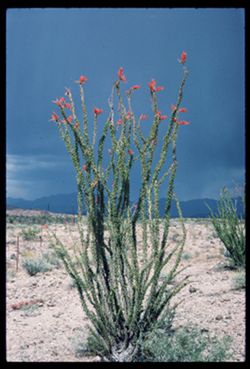
-
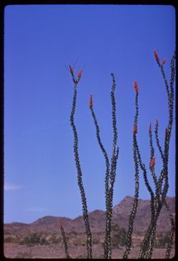
- Description:
- 100 f 8 tl
- Subject:
- Deserts, Flowers, Ocotillo, Mountains, Shrubs, and Clouds
- Series:
- 11-59
- Creator:
- Cushman, Charles W., 1896-1972
- Date Created:
- 1959-03-24
- Genre:
- Identification photographs
- Frame Number:
- 11
- County:
- Yuma and Riverside
- Abstract:
- Our finest ocotillo - 15-20 mi east of Blythe
- Call Number:
- P10736
- City:
- Blythe and Quartzsite
- Country:
- United States
- State/Province:
- Arizona and California
- Alternate Identifier:
- 1159.11
- Persistent URL:
- http://purl.dlib.indiana.edu/iudl/archives/cushman/P10736
- Holding Location:
- Bloomington - University Archives
Wells Library E460
1320 E 10th St.
Bloomington, IN 47405
Contact at archives@indiana.edu, 812-855-1127
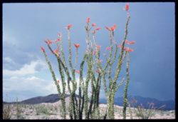
-
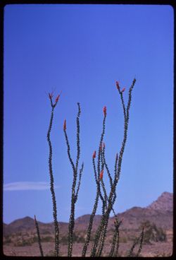
- Description:
- 250 f 5.6
- Subject:
- Deserts, Flowers, Ocotillo, Mountains, Shrubs, and Clouds
- Series:
- 11-59
- Creator:
- Cushman, Charles W., 1896-1972
- Date Created:
- 1959-03-24
- Genre:
- Identification photographs
- Frame Number:
- 12
- County:
- Yuma and Riverside
- Abstract:
- Our finest ocotillo - 15-20 mi east of Blythe
- Call Number:
- P10737
- City:
- Blythe and Quartzsite
- Country:
- United States
- State/Province:
- Arizona and California
- Alternate Identifier:
- 1159.12
- Persistent URL:
- http://purl.dlib.indiana.edu/iudl/archives/cushman/P10737
- Holding Location:
- Bloomington - University Archives
Wells Library E460
1320 E 10th St.
Bloomington, IN 47405
Contact at archives@indiana.edu, 812-855-1127
-
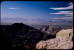
- Description:
- 50 f 6.3 Pola
- Subject:
- Valleys, Mountains, Tucson Mountains (Ariz.), Sierrita Mountains (Ariz.), Rock formations, and Clouds
- Series:
- 4-52
- Creator:
- Cushman, Charles W., 1896-1972
- Date Created:
- 1952-01-25
- Genre:
- Landscape photographs
- Frame Number:
- 17
- Street Address:
- Mount Lemmon Road
- County:
- Pima
- Abstract:
- View over Tucson from same location
- Call Number:
- P05623
- City:
- Tucson
- Country:
- United States
- State/Province:
- Arizona
- Alternate Identifier:
- 452.17
- Persistent URL:
- http://purl.dlib.indiana.edu/iudl/archives/cushman/P05623
- Holding Location:
- Bloomington - University Archives
Wells Library E460
1320 E 10th St.
Bloomington, IN 47405
Contact at archives@indiana.edu, 812-855-1127
-
- Description:
- 100 f 8
- Subject:
- Mountains, Tucson Mountains (Ariz.), Shrubs, Cactus, and Clouds
- Series:
- 7-59
- Creator:
- Cushman, Charles W., 1896-1972
- Date Created:
- 1959-02-02
- Genre:
- Landscape photographs
- Frame Number:
- 2
- Street Address:
- Ajo Way
- County:
- Pima
- Abstract:
- a Tucson mtn. from SE
- Call Number:
- P10578
- City:
- Tucson
- Country:
- United States
- State/Province:
- Arizona
- Physical Description:
- masked.
- Alternate Identifier:
- 759.2
- Persistent URL:
- http://purl.dlib.indiana.edu/iudl/archives/cushman/P10578
- Holding Location:
- Bloomington - University Archives
Wells Library E460
1320 E 10th St.
Bloomington, IN 47405
Contact at archives@indiana.edu, 812-855-1127
-
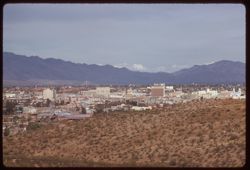
- Description:
- 100 f 6.3 tl
- Subject:
- Domes, Cities & towns, Streets, Automobiles, Mountains, Tucson Mountains (Ariz.), Shrubs, Trees, Buildings, Signs (Notices), Clouds, and Dwellings
- Series:
- 8-59
- Creator:
- Cushman, Charles W., 1896-1972
- Date Created:
- 1959-02-11
- Genre:
- Cityscape photographs
- Frame Number:
- 4
- County:
- Pima
- Abstract:
- Tucson from A Mtn.
- Call Number:
- P10618
- City:
- Tucson
- Country:
- United States
- State/Province:
- Arizona
- Alternate Identifier:
- 859.4
- Persistent URL:
- http://purl.dlib.indiana.edu/iudl/archives/cushman/P10618
- Holding Location:
- Bloomington - University Archives
Wells Library E460
1320 E 10th St.
Bloomington, IN 47405
Contact at archives@indiana.edu, 812-855-1127
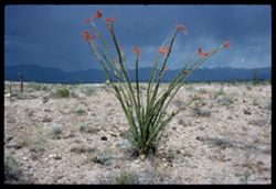
-
- Description:
- 100 f 8 tl
- Subject:
- Flowers, Mountains, and Shrubs
- Series:
- 11-59
- Creator:
- Cushman, Charles W., 1896-1972
- Date Created:
- 1959-03-24
- Genre:
- Landscape photographs
- Frame Number:
- 6
- County:
- Yuma
- Abstract:
- RM Mtns
- Call Number:
- P10731
- City:
- Quartzsite
- Country:
- United States
- State/Province:
- Arizona
- Alternate Identifier:
- 1159.6
- Persistent URL:
- http://purl.dlib.indiana.edu/iudl/archives/cushman/P10731
- Holding Location:
- Bloomington - University Archives
Wells Library E460
1320 E 10th St.
Bloomington, IN 47405
Contact at archives@indiana.edu, 812-855-1127
-
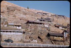
- Description:
- 25 F 9
- Subject:
- Sacramento Pit, Cities & towns, Houses, Automobiles, Cliffs, Mountains, Clotheslines, Utility poles, Electric lines, Trees, Rocks, Retaining walls, Porch...
- Series:
- 1-52
- Creator:
- Cushman, Charles W., 1896-1972
- Date Created:
- 1952-01-04
- Genre:
- Cityscape photographs and Views
- Frame Number:
- 36
- County:
- Cochise
- Abstract:
- Bisbee houses on mountainside.
- Call Number:
- P05526
- City:
- Bisbee
- Country:
- United States
- State/Province:
- Arizona
- Alternate Identifier:
- 152.36
- Persistent URL:
- http://purl.dlib.indiana.edu/iudl/archives/cushman/P05526
- Holding Location:
- Bloomington - University Archives
Wells Library E460
1320 E 10th St.
Bloomington, IN 47405
Contact at archives@indiana.edu, 812-855-1127
-
- Description:
- 50 f 6.3 pola
- Subject:
- Cliffs, Mountains, Shrubs, Santa Catalina Mountains (Ariz.), Boulders, Rock formations, and Clouds
- Series:
- 4-52
- Creator:
- Cushman, Charles W., 1896-1972
- Date Created:
- 1952-01-25
- Genre:
- Landscape photographs
- Frame Number:
- 20
- Street Address:
- Mount Lemmon Road
- Abstract:
- View toward Santa Catalina tops westward
- Call Number:
- P05626
- Country:
- United States
- State/Province:
- Arizona
- Alternate Identifier:
- 452.20
- Persistent URL:
- http://purl.dlib.indiana.edu/iudl/archives/cushman/P05626
- Holding Location:
- Bloomington - University Archives
Wells Library E460
1320 E 10th St.
Bloomington, IN 47405
Contact at archives@indiana.edu, 812-855-1127
-
- Description:
- 100 f 9 tl
- Subject:
- Roskruge Mountains (Ariz.), Mountains, and Shrubs
- Series:
- 8-59
- Creator:
- Cushman, Charles W., 1896-1972
- Date Created:
- 1959-02-20
- Genre:
- Landscape photographs
- Frame Number:
- 34
- Street Address:
- Ajo Way
- County:
- Pima
- Abstract:
- A single beauty
- Call Number:
- P10648
- Country:
- United States
- State/Province:
- Arizona
- Alternate Identifier:
- 859.34
- Persistent URL:
- http://purl.dlib.indiana.edu/iudl/archives/cushman/P10648
- Holding Location:
- Bloomington - University Archives
Wells Library E460
1320 E 10th St.
Bloomington, IN 47405
Contact at archives@indiana.edu, 812-855-1127
-
- Description:
- 100 f 8 tl
- Subject:
- Baboquivari Peak (Ariz.), Mountains, Shrubs, Cactus, and Topara
- Series:
- 8-59
- Creator:
- Cushman, Charles W., 1896-1972
- Date Created:
- 1959-02-20
- Genre:
- Landscape photographs
- Frame Number:
- 37
- County:
- Pima
- Abstract:
- Babaoquivari from road south of Topara
- Call Number:
- P10651
- Country:
- United States
- State/Province:
- Arizona
- Alternate Identifier:
- 859.37
- Persistent URL:
- http://purl.dlib.indiana.edu/iudl/archives/cushman/P10651
- Holding Location:
- Bloomington - University Archives
Wells Library E460
1320 E 10th St.
Bloomington, IN 47405
Contact at archives@indiana.edu, 812-855-1127
-
- Description:
- 25 f 12
- Subject:
- Oak Creek Canyon (Ariz.), Canyons, Cliffs, Mountains, Trees, and Rock formations
- Series:
- 16-52
- Creator:
- Cushman, Charles W., 1896-1972
- Date Created:
- 1952-04-12
- Genre:
- Landscape photographs
- Frame Number:
- 37
- County:
- Coconino and Coconimo
- Abstract:
- Side of canyon smudge
- Call Number:
- P06095
- City:
- Flagstaff and Sedona
- Country:
- United States
- State/Province:
- Arizona
- Alternate Identifier:
- 1652.37
- Persistent URL:
- http://purl.dlib.indiana.edu/iudl/archives/cushman/P06095
- Holding Location:
- Bloomington - University Archives
Wells Library E460
1320 E 10th St.
Bloomington, IN 47405
Contact at archives@indiana.edu, 812-855-1127
-
- Description:
- 50 f 8
- Subject:
- Valleys, Roads, Cliffs, Mountains, Santa Catalina Mountains (Ariz.), Boulders, Rocks, and Rock formations
- Series:
- 4-52
- Creator:
- Cushman, Charles W., 1896-1972
- Date Created:
- 1952-01-25
- Genre:
- Landscape photographs
- Frame Number:
- 18
- Street Address:
- Mount Lemmon Road
- Abstract:
- Looking down the mtn from same point
- Call Number:
- P05624
- Country:
- United States
- State/Province:
- Arizona
- Alternate Identifier:
- 452.18
- Persistent URL:
- http://purl.dlib.indiana.edu/iudl/archives/cushman/P05624
- Holding Location:
- Bloomington - University Archives
Wells Library E460
1320 E 10th St.
Bloomington, IN 47405
Contact at archives@indiana.edu, 812-855-1127
-
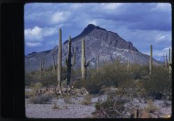
- Description:
- 25 f 12
- Subject:
- National parks & reserves, Deserts, Saguaro, Mountains, Saguaro National Park (Ariz.), Cactus, and Shrubs
- Series:
- 3-52
- Creator:
- Cushman, Charles W., 1896-1972
- Date Created:
- 1952-01-15
- Genre:
- Identification photographs
- Frame Number:
- 4
- County:
- Pima
- Abstract:
- Multi branched Sahuaro showing nobbins.
- Call Number:
- P05573
- City:
- Tucson
- Country:
- United States
- State/Province:
- Arizona
- Alternate Identifier:
- 352.4
- Persistent URL:
- http://purl.dlib.indiana.edu/iudl/archives/cushman/P05573
- Holding Location:
- Bloomington - University Archives
Wells Library E460
1320 E 10th St.
Bloomington, IN 47405
Contact at archives@indiana.edu, 812-855-1127
-
- Description:
- 50 f 11
- Subject:
- Mountains, Shrubs, Rocks, Grasses, Chimney rocks, and Rock formations
- Series:
- 14-53
- Creator:
- Cushman, Charles W., 1896-1972
- Date Created:
- 1953-11-19
- Genre:
- Identification photographs and Landscape photographs
- Frame Number:
- 23
- Street Address:
- United States Highway 70 and United States Highway 60
- County:
- Pinal
- Abstract:
- Row of high chimney rocks above old road
- Call Number:
- P07019
- City:
- Superior
- Country:
- United States
- State/Province:
- Arizona
- Alternate Identifier:
- 1453.23
- Persistent URL:
- http://purl.dlib.indiana.edu/iudl/archives/cushman/P07019
- Holding Location:
- Bloomington - University Archives
Wells Library E460
1320 E 10th St.
Bloomington, IN 47405
Contact at archives@indiana.edu, 812-855-1127
-
- Description:
- 100 f 9 tl
- Subject:
- Baboquivari Peak (Ariz.), Mountains, Shrubs, and Grasses
- Series:
- 6-59
- Creator:
- Cushman, Charles W., 1896-1972
- Date Created:
- 1959-01-28
- Genre:
- Landscape photographs
- Frame Number:
- 17
- County:
- Pima
- Abstract:
- Broadside view of Babo. range further north of PK.
- Call Number:
- P10555
- Country:
- United States
- State/Province:
- Arizona
- Alternate Identifier:
- 659.17
- Persistent URL:
- http://purl.dlib.indiana.edu/iudl/archives/cushman/P10555
- Holding Location:
- Bloomington - University Archives
Wells Library E460
1320 E 10th St.
Bloomington, IN 47405
Contact at archives@indiana.edu, 812-855-1127
-
- Description:
- 25 f 8
- Subject:
- Oak Tree Canyon (Ariz.), Cliffs, Mountains, Trees, and Rock formations
- Series:
- 16-52
- Creator:
- Cushman, Charles W., 1896-1972
- Date Created:
- 1952-04-12
- Genre:
- Landscape photographs
- Frame Number:
- 21
- Abstract:
- High red jutting rock 25 f 8 by error
- Call Number:
- P06079
- Country:
- United States
- State/Province:
- Arizona
- Alternate Identifier:
- 1652.21
- Persistent URL:
- http://purl.dlib.indiana.edu/iudl/archives/cushman/P06079
- Holding Location:
- Bloomington - University Archives
Wells Library E460
1320 E 10th St.
Bloomington, IN 47405
Contact at archives@indiana.edu, 812-855-1127
-
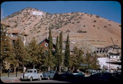
- Description:
- 25 f 9
- Subject:
- Buildings, Cities & towns, Mountains, Trees, Dwellings, Hotels, Streets, Copper Queen Hotel (Bisbee, Ariz.), Automobiles, Shrubs, Churches, Flagpoles, an...
- Series:
- 1-52
- Creator:
- Cushman, Charles W., 1896-1972
- Date Created:
- 1952-01-04
- Genre:
- Views and Cityscape photographs
- Frame Number:
- 30
- County:
- Cochise
- Abstract:
- from higher up. [Bisbee + Mtn from Main st.]
- Call Number:
- P05520
- City:
- Bisbee
- Country:
- United States
- State/Province:
- Arizona
- Alternate Identifier:
- 152.30
- Persistent URL:
- http://purl.dlib.indiana.edu/iudl/archives/cushman/P05520
- Holding Location:
- Bloomington - University Archives
Wells Library E460
1320 E 10th St.
Bloomington, IN 47405
Contact at archives@indiana.edu, 812-855-1127
-
- Description:
- 100 f 11 + f 12/13
- Subject:
- Mountains, Plants, Ocotillo, Deserts, Storms, and Flowers
- Series:
- 1-66
- Creator:
- Cushman, Charles W., 1896-1972
- Date Created:
- 1966-04-22
- Genre:
- Identification photographs and Landscape photographs
- Frame Number:
- 6
- Street Address:
- United States Highway 66
- County:
- Mohave
- Abstract:
- Ocotillo along U.S. 66- Mojave county and Little red head and friend at drinking fountain - same in error
- Call Number:
- P15247
- Country:
- United States
- State/Province:
- Arizona
- Alternate Identifier:
- 166.6
- Persistent URL:
- http://purl.dlib.indiana.edu/iudl/archives/cushman/P15247
- Holding Location:
- Bloomington - University Archives
Wells Library E460
1320 E 10th St.
Bloomington, IN 47405
Contact at archives@indiana.edu, 812-855-1127
-
- Description:
- 100 f 13 ?
- Subject:
- Hills, Mountains, Plants, Ocotillo, Deserts, Storms, Flowers, Clouds, and Grasses
- Series:
- 1-66
- Creator:
- Cushman, Charles W., 1896-1972
- Date Created:
- 1966-04-22
- Genre:
- Identification photographs and Landscape photographs
- Frame Number:
- 7
- Street Address:
- United States Highway 66
- County:
- Mohave
- Abstract:
- Ocotillo along U.S. 66- Mojave county
- Call Number:
- P15248
- Country:
- United States
- State/Province:
- Arizona
- Alternate Identifier:
- 166.7
- Persistent URL:
- http://purl.dlib.indiana.edu/iudl/archives/cushman/P15248
- Holding Location:
- Bloomington - University Archives
Wells Library E460
1320 E 10th St.
Bloomington, IN 47405
Contact at archives@indiana.edu, 812-855-1127
-
- Description:
- 100 f 12?
- Subject:
- Rocks, Hills, Mountains, Grasses, Ocotillo, Deserts, Storms, Flowers, and Plants
- Series:
- 1-66
- Creator:
- Cushman, Charles W., 1896-1972
- Date Created:
- 1966-04-22
- Genre:
- Identification photographs and Landscape photographs
- Frame Number:
- 8
- Street Address:
- United States Highway 66
- County:
- Mohave
- Abstract:
- Ocotillo along U.S. 66- Mojave county
- Call Number:
- P15249
- Country:
- United States
- State/Province:
- Arizona
- Alternate Identifier:
- 166.8
- Persistent URL:
- http://purl.dlib.indiana.edu/iudl/archives/cushman/P15249
- Holding Location:
- Bloomington - University Archives
Wells Library E460
1320 E 10th St.
Bloomington, IN 47405
Contact at archives@indiana.edu, 812-855-1127
-
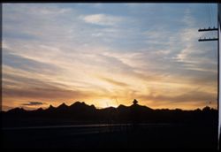
- Subject:
- Tucson Mountains (Ariz.), Mountains, Sunrises & sunsets, Roads, and Clouds
- Series:
- 2-40
- Creator:
- Cushman, Charles W., 1896-1972
- Date Created:
- 1940-02-01
- Genre:
- Landscape photographs
- Frame Number:
- 2
- Street Address:
- Ajo Way
- County:
- Pima
- Abstract:
- Sunday evening , sunset sky, along Ajo road.
- Call Number:
- P01757
- City:
- Tucson
- Country:
- United States
- State/Province:
- Arizona
- Physical Description:
- Image was originally mounted in a glass enclosure. Before digitization, the image was removed and placed in a Wess Plastic, Inc. brand, 2" x 2", pl...
- Alternate Identifier:
- 240.2
- Persistent URL:
- http://purl.dlib.indiana.edu/iudl/archives/cushman/P01757
- Holding Location:
- Bloomington - University Archives
Wells Library E460
1320 E 10th St.
Bloomington, IN 47405
Contact at archives@indiana.edu, 812-855-1127
-
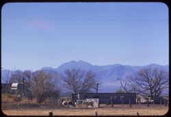
- Description:
- 100 f 6.3 tl
- Subject:
- Fences, Mountains, Trees, Dwellings, Horses, Electric lines, Shrubs, and Cochise Head (Ariz.)
- Series:
- 5-59
- Creator:
- Cushman, Charles W., 1896-1972
- Date Created:
- 1959-01-23
- Genre:
- Landscape photographs
- Frame Number:
- 36
- Street Address:
- Arizona State Highway 86
- County:
- Cochise
- Abstract:
- Cochise Head from Ariz Hwy 86
- Call Number:
- P10537
- Country:
- United States
- State/Province:
- Arizona
- Alternate Identifier:
- 559.36
- Persistent URL:
- http://purl.dlib.indiana.edu/iudl/archives/cushman/P10537
- Holding Location:
- Bloomington - University Archives
Wells Library E460
1320 E 10th St.
Bloomington, IN 47405
Contact at archives@indiana.edu, 812-855-1127
-
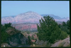
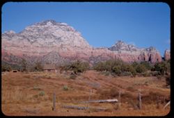
- Description:
- 100 f 11
- Subject:
- Hills, Roads, Cliffs, Mountains, Shrubs, Trees, and Grasses
- Series:
- 5-62
- Creator:
- Cushman, Charles W., 1896-1972
- Date Created:
- 1962-10-05
- Genre:
- Landscape photographs
- Frame Number:
- 16
- County:
- Coconino
- Abstract:
- East from 6 or 7 mi. west of Sedona
- Call Number:
- P12783
- City:
- Sedona
- Country:
- United States
- State/Province:
- Arizona
- Alternate Identifier:
- 562.16
- Persistent URL:
- http://purl.dlib.indiana.edu/iudl/archives/cushman/P12783
- Holding Location:
- Bloomington - University Archives
Wells Library E460
1320 E 10th St.
Bloomington, IN 47405
Contact at archives@indiana.edu, 812-855-1127
-
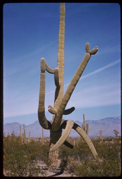
- Description:
- 50 f 11 sl
- Subject:
- Deserts, Mountains, Shrubs, Cactus, and Saguaro National Park (Ariz.)
- Series:
- 10-59
- Creator:
- Cushman, Charles W., 1896-1972
- Date Created:
- 1959-03-03
- Genre:
- Identification photographs
- Frame Number:
- 5
- County:
- Pima
- Abstract:
- Multi-branched Giant Sohuaro
- Call Number:
- P10693
- City:
- Tucson
- Country:
- United States
- State/Province:
- Arizona
- Alternate Identifier:
- 1059.5
- Persistent URL:
- http://purl.dlib.indiana.edu/iudl/archives/cushman/P10693
- Holding Location:
- Bloomington - University Archives
Wells Library E460
1320 E 10th St.
Bloomington, IN 47405
Contact at archives@indiana.edu, 812-855-1127
-
- Subject:
- Deserts, Flowers, Saguaro, Ocotillo, Mountains, Shrubs, Cactus, and Clouds
- Series:
- 4-40
- Creator:
- Cushman, Charles W., 1896-1972
- Date Created:
- 1940-04-01
- Genre:
- Identification photographs
- Frame Number:
- 18
- County:
- Pima
- Abstract:
- Desert blooms: Flaming Ocotillo: Giant Sahuaras
- Call Number:
- P01805
- Country:
- United States
- State/Province:
- Arizona
- Physical Description:
- Image was originally mounted in a glass enclosure. Before digitization, the image was removed and placed in a Wess Plastic, Inc. brand, 2" x 2", pl...
- Alternate Identifier:
- 440.18
- Persistent URL:
- http://purl.dlib.indiana.edu/iudl/archives/cushman/P01805
- Holding Location:
- Bloomington - University Archives
Wells Library E460
1320 E 10th St.
Bloomington, IN 47405
Contact at archives@indiana.edu, 812-855-1127
-
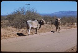
- Description:
- 100 f 6.3 tl
- Subject:
- Channels, Brawley Wash (Ariz.), Roads, Mountains, Shrubs, Electric lines, and Bulls
- Series:
- 6-59
- Creator:
- Cushman, Charles W., 1896-1972
- Date Created:
- 1959-01-28
- Genre:
- Identification photographs
- Frame Number:
- 18
- Street Address:
- Sasabe Road
- County:
- Pima
- Abstract:
- 2 Brahma bulls on Sasabe road
- Call Number:
- P10556
- Country:
- United States
- State/Province:
- Arizona
- Alternate Identifier:
- 659.18
- Persistent URL:
- http://purl.dlib.indiana.edu/iudl/archives/cushman/P10556
- Holding Location:
- Bloomington - University Archives
Wells Library E460
1320 E 10th St.
Bloomington, IN 47405
Contact at archives@indiana.edu, 812-855-1127
-
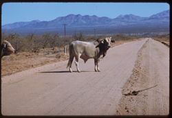
- Description:
- 100 f 6.3 tl
- Subject:
- Channels, Brawley Wash (Ariz.), Roads, Mountains, Shrubs, Electric lines, and Bulls
- Series:
- 6-59
- Creator:
- Cushman, Charles W., 1896-1972
- Date Created:
- 1959-01-28
- Genre:
- Identification photographs
- Frame Number:
- 19
- Street Address:
- Sasabe Road
- County:
- Pima
- Abstract:
- One B B
- Call Number:
- P10557
- Country:
- United States
- State/Province:
- Arizona
- Alternate Identifier:
- 659.19
- Persistent URL:
- http://purl.dlib.indiana.edu/iudl/archives/cushman/P10557
- Holding Location:
- Bloomington - University Archives
Wells Library E460
1320 E 10th St.
Bloomington, IN 47405
Contact at archives@indiana.edu, 812-855-1127
-
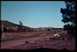
- Subject:
- San Francisco Peaks (Ariz.), Hills, Automobiles, Roads, Bridges, Mountains, Grand Canyon Junction (Ariz.), Shrubs, Snow, Trees, Rocks, Fences, and Masonry
- Series:
- 10-39
- Creator:
- Cushman, Charles W., 1896-1972
- Date Created:
- 1939-12-01
- Genre:
- Landscape photographs
- Frame Number:
- 3
- County:
- Coconino
- Abstract:
- T-3: San Franciscos Pk. from Grand Canyon Junction
- Call Number:
- P01719
- City:
- Flagstaff
- Country:
- United States
- State/Province:
- Arizona
- Physical Description:
- some dye fading. Image was originally mounted in a glass enclosure. Before digitization, the image was removed and placed in a Wess Plastic, Inc. brand, 2&qu...
- Alternate Identifier:
- 1039.3
- Persistent URL:
- http://purl.dlib.indiana.edu/iudl/archives/cushman/P01719
- Holding Location:
- Bloomington - University Archives
Wells Library E460
1320 E 10th St.
Bloomington, IN 47405
Contact at archives@indiana.edu, 812-855-1127
-
- Description:
- 25 f 13
- Subject:
- Sabino Canyon (Ariz.), Canyons, Saguaro, Cliffs, Mountains, Shrubs, Cactus, Rocks, Rock formations, and Santa Catalina Mountains (Ariz.)
- Series:
- 5-52
- Creator:
- Cushman, Charles W., 1896-1972
- Date Created:
- 1952-02-05
- Genre:
- Landscape photographs
- Frame Number:
- 26
- County:
- Pima
- Abstract:
- Up wall of Sabino Canyon in morning
- Call Number:
- P05671
- Country:
- United States
- State/Province:
- Arizona
- Alternate Identifier:
- 552.26
- Persistent URL:
- http://purl.dlib.indiana.edu/iudl/archives/cushman/P05671
- Holding Location:
- Bloomington - University Archives
Wells Library E460
1320 E 10th St.
Bloomington, IN 47405
Contact at archives@indiana.edu, 812-855-1127
-
- Subject:
- Deserts, Roskruge Mountains (Ariz.), Mountains, Shrubs, Cactus, and Clouds
- Series:
- 5-40
- Creator:
- Cushman, Charles W., 1896-1972
- Date Created:
- 1940-05-01
- Genre:
- Landscape photographs
- Frame Number:
- 17
- County:
- Pima
- Abstract:
- An Arizona desert . Roskruge Mtns. In distance. View is northeast.
- Call Number:
- P01835
- Country:
- United States
- State/Province:
- Arizona
- Physical Description:
- Image was originally mounted in a glass enclosure. Before digitization, the image was removed and placed in a Wess Plastic, Inc. brand, 2" x 2", pl...
- Alternate Identifier:
- 540.17
- Persistent URL:
- http://purl.dlib.indiana.edu/iudl/archives/cushman/P01835
- Holding Location:
- Bloomington - University Archives
Wells Library E460
1320 E 10th St.
Bloomington, IN 47405
Contact at archives@indiana.edu, 812-855-1127
-
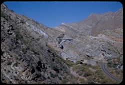
- Description:
- 50 f 9
- Subject:
- Pinto Creek (Ariz.), Steel, Arches, Roads, Bridges, Mountains, Rocks, Railings, Streams, and Grasses
- Series:
- 14-53
- Creator:
- Cushman, Charles W., 1896-1972
- Date Created:
- 1953-11-19
- Genre:
- Landscape photographs and Architectural photographs
- Frame Number:
- 12
- Street Address:
- United States Highway 70 and United States Highway 60
- County:
- Pinal and Gila
- Abstract:
- Steel Arch bridge over Pinto Creek - between Miami & Superior US 70
- Call Number:
- P07008
- City:
- Miami and Superior
- Country:
- United States
- State/Province:
- Arizona
- Alternate Identifier:
- 1453.12
- Persistent URL:
- http://purl.dlib.indiana.edu/iudl/archives/cushman/P07008
- Holding Location:
- Bloomington - University Archives
Wells Library E460
1320 E 10th St.
Bloomington, IN 47405
Contact at archives@indiana.edu, 812-855-1127
-
- Description:
- 25 f 13
- Subject:
- National parks & reserves, Cliffs, Massai Point (Ariz.), Mountains, Chiricahua National Monument (Ariz.), and Rock formations
- Series:
- 4-52
- Creator:
- Cushman, Charles W., 1896-1972
- Date Created:
- 1952-01-22
- Genre:
- Landscape photographs
- Frame Number:
- 8
- County:
- Cochise
- Abstract:
- View NW from the Lookout Pt.
- Call Number:
- P05614
- Country:
- United States
- State/Province:
- Arizona
- Alternate Identifier:
- 452.8
- Persistent URL:
- http://purl.dlib.indiana.edu/iudl/archives/cushman/P05614
- Holding Location:
- Bloomington - University Archives
Wells Library E460
1320 E 10th St.
Bloomington, IN 47405
Contact at archives@indiana.edu, 812-855-1127
-
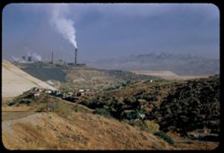
- Description:
- 50 f 5.6 POLA
- Subject:
- Smokestacks, Houses, Smoke, Factories, Copper industry, Copper mining, Mountains, Smelters, Trees, Inspiration Copper Co. (Miami, Ariz.), Grasses, and Hills
- Series:
- 14-53
- Creator:
- Cushman, Charles W., 1896-1972
- Date Created:
- 1953-11-19
- Genre:
- Cityscape photographs
- Frame Number:
- 7
- County:
- Gila
- Abstract:
- Inspiration smelter from south=
- Call Number:
- P07003
- City:
- Miami
- Country:
- United States
- State/Province:
- Arizona
- Alternate Identifier:
- 1453.7
- Persistent URL:
- http://purl.dlib.indiana.edu/iudl/archives/cushman/P07003
- Holding Location:
- Bloomington - University Archives
Wells Library E460
1320 E 10th St.
Bloomington, IN 47405
Contact at archives@indiana.edu, 812-855-1127
-
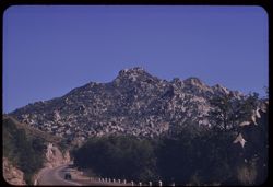
- Description:
- 100 f 8 tl
- Subject:
- Automobiles, Roads, Mountains, and Trees
- Series:
- 9-59
- Creator:
- Cushman, Charles W., 1896-1972
- Date Created:
- 1959-02-27
- Genre:
- Landscape photographs
- Frame Number:
- 23
- Street Address:
- United States Highway 70 and United States Highway 60
- County:
- Pinal and Gila
- Abstract:
- Familiar mountain above the Superior- Miami road (from 1936)
- Call Number:
- P10674
- City:
- Miami and Superior
- Country:
- United States
- State/Province:
- Arizona
- Alternate Identifier:
- 959.23
- Persistent URL:
- http://purl.dlib.indiana.edu/iudl/archives/cushman/P10674
- Holding Location:
- Bloomington - University Archives
Wells Library E460
1320 E 10th St.
Bloomington, IN 47405
Contact at archives@indiana.edu, 812-855-1127
-
- Description:
- 50 f 11
- Subject:
- Queen Creek (Ariz.), Valleys, Roads, Queen Creek Bridge (Ariz.), Bridges, Mountains, Rocks, Streams, and Grasses
- Series:
- 14-53
- Creator:
- Cushman, Charles W., 1896-1972
- Date Created:
- 1953-11-19
- Genre:
- Landscape photographs
- Frame Number:
- 34
- Street Address:
- United States Highway 70 and United States Highway 60
- County:
- Pinal
- Abstract:
- Two bridges over Queen Creek near Superior
- Call Number:
- P07030
- City:
- Superior
- Country:
- United States
- State/Province:
- Arizona
- Alternate Identifier:
- 1453.34
- Persistent URL:
- http://purl.dlib.indiana.edu/iudl/archives/cushman/P07030
- Holding Location:
- Bloomington - University Archives
Wells Library E460
1320 E 10th St.
Bloomington, IN 47405
Contact at archives@indiana.edu, 812-855-1127
-
- Description:
- 100 f 8 tl
- Subject:
- Deserts, Hills, Mountains, Picketpost Mountain (Ariz.), and Cactus
- Series:
- 10-59
- Creator:
- Cushman, Charles W., 1896-1972
- Date Created:
- 1959-02-27
- Frame Number:
- 1
- County:
- Pinal
- Abstract:
- Pickett Post Mtn.
- Call Number:
- P10689
- City:
- Superior
- Country:
- United States
- State/Province:
- Arizona
- Alternate Identifier:
- 1059.1
- Persistent URL:
- http://purl.dlib.indiana.edu/iudl/archives/cushman/P10689
- Holding Location:
- Bloomington - University Archives
Wells Library E460
1320 E 10th St.
Bloomington, IN 47405
Contact at archives@indiana.edu, 812-855-1127
-
- Description:
- 25 f 13
- Subject:
- Oak Creek Canyon (Ariz.), Tree limbs, Canyons, Cliffs, Mountains, and Shrubs
- Series:
- 16-52
- Creator:
- Cushman, Charles W., 1896-1972
- Date Created:
- 1952-04-12
- Genre:
- Landscape photographs
- Frame Number:
- 25
- County:
- Coconino
- Abstract:
- [P] Spots
- Call Number:
- P06083
- Country:
- United States
- State/Province:
- Arizona
- Alternate Identifier:
- 1652.25
- Persistent URL:
- http://purl.dlib.indiana.edu/iudl/archives/cushman/P06083
- Holding Location:
- Bloomington - University Archives
Wells Library E460
1320 E 10th St.
Bloomington, IN 47405
Contact at archives@indiana.edu, 812-855-1127
-
- Description:
- 50 f 8 sl
- Subject:
- Mountains, Tucson Mountains (Ariz.), Shrubs, Cactus, Rocks, and Gates Pass (Ariz.)
- Series:
- 6-59
- Creator:
- Cushman, Charles W., 1896-1972
- Date Created:
- 1959-01-26
- Genre:
- Landscape photographs
- Frame Number:
- 8
- County:
- Pima
- Abstract:
- Tucson Mtns. - up from Gates Pass
- Call Number:
- P10546
- City:
- Tucson
- Country:
- United States
- State/Province:
- Arizona
- Alternate Identifier:
- 659.8
- Persistent URL:
- http://purl.dlib.indiana.edu/iudl/archives/cushman/P10546
- Holding Location:
- Bloomington - University Archives
Wells Library E460
1320 E 10th St.
Bloomington, IN 47405
Contact at archives@indiana.edu, 812-855-1127
-
- Description:
- 100 f 8 tl
- Subject:
- Deserts, Mountains, Dirt roads, Shrubs, Picacho Mountains (Ariz.), and Fences
- Series:
- 10-59
- Creator:
- Cushman, Charles W., 1896-1972
- Date Created:
- 1959-03-22
- Genre:
- Landscape photographs
- Frame Number:
- 31
- County:
- Pima and Pinal
- Abstract:
- Picacho, near Red Rock
- Call Number:
- P10719
- City:
- Tucson and Red Rock
- Country:
- United States
- State/Province:
- Arizona
- Alternate Identifier:
- 1059.31
- Persistent URL:
- http://purl.dlib.indiana.edu/iudl/archives/cushman/P10719
- Holding Location:
- Bloomington - University Archives
Wells Library E460
1320 E 10th St.
Bloomington, IN 47405
Contact at archives@indiana.edu, 812-855-1127
-
- Description:
- 25 f 13
- Subject:
- Sabino Canyon (Ariz.), Canyons, Saguaro, Cliffs, Mountains, Shrubs, Santa Catalina Mountains (Ariz.), Rock formations, and Cactus
- Series:
- 5-52
- Creator:
- Cushman, Charles W., 1896-1972
- Date Created:
- 1952-02-04
- Genre:
- Landscape photographs
- Frame Number:
- 25
- County:
- Pima
- Abstract:
- Pent house - at left - and the square castle - late
- Call Number:
- P05670
- Country:
- United States
- State/Province:
- Arizona
- Alternate Identifier:
- 552.25
- Persistent URL:
- http://purl.dlib.indiana.edu/iudl/archives/cushman/P05670
- Holding Location:
- Bloomington - University Archives
Wells Library E460
1320 E 10th St.
Bloomington, IN 47405
Contact at archives@indiana.edu, 812-855-1127
-
- Description:
- 50 f 9
- Subject:
- Whetstone Mountains (Ariz.), Hills, Oaks, Live oak, Trees, and Mountains
- Series:
- 2-52
- Creator:
- Cushman, Charles W., 1896-1972
- Date Created:
- 1952-01-14
- Genre:
- Landscape photographs
- Frame Number:
- 37
- Street Address:
- Arizona State Highway 83
- Abstract:
- Live oak-tow colored valley and distant mtns from Hwy 83.
- Call Number:
- P05567
- Country:
- United States
- State/Province:
- Arizona
- Alternate Identifier:
- 252.37
- Persistent URL:
- http://purl.dlib.indiana.edu/iudl/archives/cushman/P05567
- Holding Location:
- Bloomington - University Archives
Wells Library E460
1320 E 10th St.
Bloomington, IN 47405
Contact at archives@indiana.edu, 812-855-1127
-
- Description:
- 50 f 8
- Subject:
- Baboquivari Peak (Ariz.), Deserts, Mountains, Shrubs, and Cactus
- Series:
- 2-52
- Creator:
- Cushman, Charles W., 1896-1972
- Date Created:
- 1952-01-09
- Genre:
- Landscape photographs
- Frame Number:
- 10
- Street Address:
- San Miguel Road
- County:
- Pima
- Abstract:
- Baboquivari Pk from Sells - San Miguel Rd.
- Call Number:
- P05540
- City:
- Sells
- Country:
- United States
- State/Province:
- Arizona
- Alternate Identifier:
- 252.10
- Persistent URL:
- http://purl.dlib.indiana.edu/iudl/archives/cushman/P05540
- Holding Location:
- Bloomington - University Archives
Wells Library E460
1320 E 10th St.
Bloomington, IN 47405
Contact at archives@indiana.edu, 812-855-1127
-
- Description:
- 25 f 7.5 pola
- Subject:
- Sabino Canyon (Ariz.), Canyons, Saguaro, Cliffs, Mountains, Shrubs, Santa Catalina Mountains (Ariz.), Rocks, Rock formations, and Cactus
- Series:
- 5-52
- Creator:
- Cushman, Charles W., 1896-1972
- Date Created:
- 1952-02-04
- Genre:
- Landscape photographs
- Frame Number:
- 23
- County:
- Pima
- Abstract:
- High square castle seen through a gap above Sabino canyon - both
- Call Number:
- P05668
- Country:
- United States
- State/Province:
- Arizona
- Alternate Identifier:
- 552.23
- Persistent URL:
- http://purl.dlib.indiana.edu/iudl/archives/cushman/P05668
- Holding Location:
- Bloomington - University Archives
Wells Library E460
1320 E 10th St.
Bloomington, IN 47405
Contact at archives@indiana.edu, 812-855-1127
-
- Description:
- 50 f 8
- Subject:
- National parks & reserves, Cochise Head (Ariz.), Mountains, Trees, Chiricahua National Monument (Ariz.), and Rock formations
- Series:
- 4-52
- Creator:
- Cushman, Charles W., 1896-1972
- Date Created:
- 1952-01-22
- Genre:
- Landscape photographs
- Frame Number:
- 12
- County:
- Cochise
- Abstract:
- Chochise head seen from the high drive
- Call Number:
- P05618
- Country:
- United States
- State/Province:
- Arizona
- Alternate Identifier:
- 452.12
- Persistent URL:
- http://purl.dlib.indiana.edu/iudl/archives/cushman/P05618
- Holding Location:
- Bloomington - University Archives
Wells Library E460
1320 E 10th St.
Bloomington, IN 47405
Contact at archives@indiana.edu, 812-855-1127
-
- Description:
- 50 f 4.5
- Subject:
- Rocks, Canyons, Roads, Gila River (N.M. and Ariz.), Trees, Coolidge Dam (Ariz.), Mountains, Dams, Rivers, and Cliffs
- Series:
- 13-53
- Creator:
- Cushman, Charles W., 1896-1972
- Date Created:
- 1953-11-18
- Genre:
- Landscape photographs
- Frame Number:
- 34
- Abstract:
- From Coolidge dam - downstream Gila river
- Call Number:
- P06992
- Country:
- United States
- State/Province:
- Arizona
- Alternate Identifier:
- 1353.34
- Persistent URL:
- http://purl.dlib.indiana.edu/iudl/archives/cushman/P06992
- Holding Location:
- Bloomington - University Archives
Wells Library E460
1320 E 10th St.
Bloomington, IN 47405
Contact at archives@indiana.edu, 812-855-1127
-
- Description:
- 100 f 9 tl
- Subject:
- Mountains, Shrubs, and Roskruge Mountains (Ariz.)
- Series:
- 8-59
- Creator:
- Cushman, Charles W., 1896-1972
- Date Created:
- 1959-02-20
- Genre:
- Landscape photographs
- Frame Number:
- 33
- Street Address:
- Ajo Way
- County:
- Pima
- Abstract:
- Two Roskruge pyramids from south
- Call Number:
- P10647
- Country:
- United States
- State/Province:
- Arizona
- Alternate Identifier:
- 859.33
- Persistent URL:
- http://purl.dlib.indiana.edu/iudl/archives/cushman/P10647
- Holding Location:
- Bloomington - University Archives
Wells Library E460
1320 E 10th St.
Bloomington, IN 47405
Contact at archives@indiana.edu, 812-855-1127
-
- Description:
- 50 f 9 sl
- Subject:
- Deserts, Deterioration, Cactus, Mountains, Shrubs, and Saguaro National Park (Ariz.)
- Series:
- 10-59
- Creator:
- Cushman, Charles W., 1896-1972
- Date Created:
- 1959-03-03
- Genre:
- Identification photographs
- Frame Number:
- 6
- County:
- Pima
- Abstract:
- A skeleton
- Call Number:
- P10694
- City:
- Tucson
- Country:
- United States
- State/Province:
- Arizona
- Alternate Identifier:
- 1059.6
- Persistent URL:
- http://purl.dlib.indiana.edu/iudl/archives/cushman/P10694
- Holding Location:
- Bloomington - University Archives
Wells Library E460
1320 E 10th St.
Bloomington, IN 47405
Contact at archives@indiana.edu, 812-855-1127
-
- Description:
- 100 f 9 tl
- Subject:
- Cactus, Roskruge Mountains (Ariz.), Shrubs, and Mountains
- Series:
- 9-59
- Creator:
- Cushman, Charles W., 1896-1972
- Date Created:
- 1959-02-20
- Genre:
- Landscape photographs
- Frame Number:
- 4
- Street Address:
- Ajo Way
- County:
- Pima
- Abstract:
- Roskruge Mtns. -from Ajo road
- Call Number:
- P10655
- City:
- Tucson
- Country:
- United States
- State/Province:
- Arizona
- Alternate Identifier:
- 959.4
- Persistent URL:
- http://purl.dlib.indiana.edu/iudl/archives/cushman/P10655
- Holding Location:
- Bloomington - University Archives
Wells Library E460
1320 E 10th St.
Bloomington, IN 47405
Contact at archives@indiana.edu, 812-855-1127
-
- Description:
- 50 f 7 POLA
- Subject:
- Grasses, Pinal Mountains (Ariz.), Mining, Castle Dome Mountains (Ariz.), Mountains, Lakes & ponds, Castle Dome mine (Gila County, Ariz.), and Dirt
- Series:
- 14-53
- Creator:
- Cushman, Charles W., 1896-1972
- Date Created:
- 1953-11-19
- Genre:
- Landscape photographs
- Frame Number:
- 13
- Street Address:
- United States Highway 70
- County:
- Gila
- Abstract:
- From US 70 toward Castle Dome mine
- Call Number:
- P07009
- City:
- Miami
- Country:
- United States
- State/Province:
- Arizona
- Alternate Identifier:
- 1453.13
- Persistent URL:
- http://purl.dlib.indiana.edu/iudl/archives/cushman/P07009
- Holding Location:
- Bloomington - University Archives
Wells Library E460
1320 E 10th St.
Bloomington, IN 47405
Contact at archives@indiana.edu, 812-855-1127
-
- Description:
- 50 6. 3 Pola
- Subject:
- Sierrita Mountains (Ariz.), Mountains, Rock formations, Tucson Mountains (Ariz.), Clouds, Santa Catalina Mountains (Ariz.), and Valleys
- Series:
- 4-52
- Creator:
- Cushman, Charles W., 1896-1972
- Date Created:
- 1952-01-25
- Genre:
- Landscape photographs
- Frame Number:
- 16
- Street Address:
- Mount Lemmon Road
- County:
- Pima
- Abstract:
- View from Tucson Mtns from Mt. Lemmon Rd
- Call Number:
- P05622
- Country:
- United States
- State/Province:
- Arizona
- Alternate Identifier:
- 452.16
- Persistent URL:
- http://purl.dlib.indiana.edu/iudl/archives/cushman/P05622
- Holding Location:
- Bloomington - University Archives
Wells Library E460
1320 E 10th St.
Bloomington, IN 47405
Contact at archives@indiana.edu, 812-855-1127
-
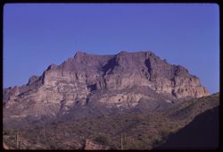
- Description:
- 100 f 9 tl
- Subject:
- Chimneys, Mountains, Buildings, and Shrubs
- Series:
- 9-59
- Creator:
- Cushman, Charles W., 1896-1972
- Date Created:
- 1959-02-27
- Genre:
- Landscape photographs
- Frame Number:
- 20
- County:
- Pinal
- Abstract:
- Mtns above Superior
- Call Number:
- P10671
- City:
- Superior
- Country:
- United States
- State/Province:
- Arizona
- Alternate Identifier:
- 959.20
- Persistent URL:
- http://purl.dlib.indiana.edu/iudl/archives/cushman/P10671
- Holding Location:
- Bloomington - University Archives
Wells Library E460
1320 E 10th St.
Bloomington, IN 47405
Contact at archives@indiana.edu, 812-855-1127
-
- Description:
- 25 f 16
- Subject:
- Trees, Mountains, National parks & reserves, Massai Point (Ariz.), Chiricahua National Monument (Ariz.), Shrubs, and Rock formations
- Series:
- 4-52
- Creator:
- Cushman, Charles W., 1896-1972
- Date Created:
- 1952-01-27
- Genre:
- Landscape photographs
- Frame Number:
- 36
- County:
- Cochise
- Abstract:
- Two high rocks from top of Massai - Elev. 6871 ft.
- Call Number:
- P05642
- Country:
- United States
- State/Province:
- Arizona
- Alternate Identifier:
- 452.36
- Persistent URL:
- http://purl.dlib.indiana.edu/iudl/archives/cushman/P05642
- Holding Location:
- Bloomington - University Archives
Wells Library E460
1320 E 10th St.
Bloomington, IN 47405
Contact at archives@indiana.edu, 812-855-1127
-
- Description:
- 50 f 9
- Subject:
- Grasses, Trees, Mountains, Rock formations, and Hills
- Series:
- 15-53
- Creator:
- Cushman, Charles W., 1896-1972
- Date Created:
- 1953-11-21
- Genre:
- Landscape photographs
- Frame Number:
- 21
- Street Address:
- United States Highway 89A
- County:
- Coconino
- Abstract:
- Red rock east of green hill
- Call Number:
- P07054
- City:
- Sedona
- Country:
- United States
- State/Province:
- Arizona
- Alternate Identifier:
- 1553.21
- Persistent URL:
- http://purl.dlib.indiana.edu/iudl/archives/cushman/P07054
- Holding Location:
- Bloomington - University Archives
Wells Library E460
1320 E 10th St.
Bloomington, IN 47405
Contact at archives@indiana.edu, 812-855-1127
-
- Subject:
- Electric lines, Trees, Mountains, Tucson Mountains (Ariz.), Clouds, Sunrises & sunsets, and Utility poles
- Series:
- 2-40
- Creator:
- Cushman, Charles W., 1896-1972
- Date Created:
- 1940-02-01
- Genre:
- Landscape photographs
- Frame Number:
- 4
- Street Address:
- Ajo Way
- County:
- Pima
- Abstract:
- The afterglow , sunset sky, along Ajo road.
- Call Number:
- P01759
- City:
- Tucson
- Country:
- United States
- State/Province:
- Arizona
- Physical Description:
- Image was originally mounted in a glass enclosure. Before digitization, the image was removed and placed in a Wess Plastic, Inc. brand, 2" x 2", pl...
- Alternate Identifier:
- 240.4
- Persistent URL:
- http://purl.dlib.indiana.edu/iudl/archives/cushman/P01759
- Holding Location:
- Bloomington - University Archives
Wells Library E460
1320 E 10th St.
Bloomington, IN 47405
Contact at archives@indiana.edu, 812-855-1127
-
- Description:
- 50 f 9
- Subject:
- Rocks, Valleys, Grasses, Cliffs, Queen Creek (Ariz.), Mountains, Rock formations, and Queen Creek Bridge (Ariz.)
- Series:
- 14-53
- Creator:
- Cushman, Charles W., 1896-1972
- Date Created:
- 1953-11-19
- Genre:
- Landscape photographs
- Frame Number:
- 32
- Street Address:
- United States Highway 60 and United States Highway 70
- County:
- Pinal
- Abstract:
- Two views from Queen Ck. Bridge
- Call Number:
- P07028
- City:
- Superior
- Country:
- United States
- State/Province:
- Arizona
- Alternate Identifier:
- 1453.32
- Persistent URL:
- http://purl.dlib.indiana.edu/iudl/archives/cushman/P07028
- Holding Location:
- Bloomington - University Archives
Wells Library E460
1320 E 10th St.
Bloomington, IN 47405
Contact at archives@indiana.edu, 812-855-1127
-
- Description:
- 25 f 12
- Subject:
- Deserts, Cactus, Mountains, National parks & reserves, Saguaro, Saguaro National Park (Ariz.), Women, and Shrubs
- Series:
- 3-52
- Creator:
- Cushman, Charles W., 1896-1972
- Date Created:
- 1952-01-15
- Genre:
- Portraits and Identification photographs
- Frame Number:
- 5
- County:
- Pima
- Persons Pictured:
- Cushman, Jean
- Abstract:
- Jean look at tall sahuaro.
- Call Number:
- P05574
- City:
- Tucson
- Country:
- United States
- State/Province:
- Arizona
- Alternate Identifier:
- 352.5
- Persistent URL:
- http://purl.dlib.indiana.edu/iudl/archives/cushman/P05574
- Holding Location:
- Bloomington - University Archives
Wells Library E460
1320 E 10th St.
Bloomington, IN 47405
Contact at archives@indiana.edu, 812-855-1127
-
- Description:
- 50 f 11 sl
- Subject:
- Deserts, Roads, Cactus, Mountains, Shrubs, and Saguaro National Park (Ariz.)
- Series:
- 10-59
- Creator:
- Cushman, Charles W., 1896-1972
- Date Created:
- 1959-03-03
- Frame Number:
- 3
- County:
- Pima
- Abstract:
- View north
- Call Number:
- P10691
- City:
- Tucson
- Country:
- United States
- State/Province:
- Arizona
- Alternate Identifier:
- 1059.3
- Persistent URL:
- http://purl.dlib.indiana.edu/iudl/archives/cushman/P10691
- Holding Location:
- Bloomington - University Archives
Wells Library E460
1320 E 10th St.
Bloomington, IN 47405
Contact at archives@indiana.edu, 812-855-1127
-
- Description:
- 25 f 11
- Subject:
- Electric lines, Houses, Streets, Mountains, Buildings, Utility poles, Water towers, Cities & towns, and People
- Series:
- 1-52
- Creator:
- Cushman, Charles W., 1896-1972
- Date Created:
- 1952-01-04
- Genre:
- Views and Cityscape photographs
- Frame Number:
- 35
- County:
- Cochise
- Abstract:
- Bisbee houses on mountainside.
- Call Number:
- P05525
- City:
- Bisbee
- Country:
- United States
- State/Province:
- Arizona
- Alternate Identifier:
- 152.35
- Persistent URL:
- http://purl.dlib.indiana.edu/iudl/archives/cushman/P05525
- Holding Location:
- Bloomington - University Archives
Wells Library E460
1320 E 10th St.
Bloomington, IN 47405
Contact at archives@indiana.edu, 812-855-1127
-
- Subject:
- Palo verde trees, Parks, Cactus, Trails & paths, Flowers, Mountains, Shrubs, Clouds, and Tucson Mountain Park (Ariz.)
- Series:
- 4-40
- Creator:
- Cushman, Charles W., 1896-1972
- Date Created:
- 1940-04-01
- Genre:
- Identification photographs
- Frame Number:
- 5
- County:
- Pima
- Abstract:
- Palo Verde in flower. Tucson Mtn. Park
- Call Number:
- P01793
- Country:
- United States
- State/Province:
- Arizona
- Physical Description:
- Image was originally mounted in a glass enclosure. Before digitization, the image was removed and placed in a Wess Plastic, Inc. brand, 2" x 2", pl...
- Alternate Identifier:
- 440.5
- Persistent URL:
- http://purl.dlib.indiana.edu/iudl/archives/cushman/P01793
- Holding Location:
- Bloomington - University Archives
Wells Library E460
1320 E 10th St.
Bloomington, IN 47405
Contact at archives@indiana.edu, 812-855-1127
-
- Description:
- 50 f 8
- Subject:
- Dump trucks, Cliffs, Copper miners, Mining, Machinery, Copper mining, Mountains, Shrubs, Trucks, Miners, Mining equipment, and Phelps Dodge Corporation
- Series:
- 1-52
- Creator:
- Cushman, Charles W., 1896-1972
- Date Created:
- 1952-01-04
- Genre:
- Snapshots
- Frame Number:
- 22
- County:
- Cochise
- Abstract:
- Mining a mountainside at Lowell.
- Call Number:
- P05512
- City:
- Lowell
- Country:
- United States
- State/Province:
- Arizona
- Alternate Identifier:
- 152.22
- Persistent URL:
- http://purl.dlib.indiana.edu/iudl/archives/cushman/P05512
- Holding Location:
- Bloomington - University Archives
Wells Library E460
1320 E 10th St.
Bloomington, IN 47405
Contact at archives@indiana.edu, 812-855-1127
-
- Description:
- 50 f 8 pola
- Subject:
- Rocks, Bear Canyon (Pima County, Ariz.), Valleys, Roads, Trees, Boulders, Mountains, Shrubs, Clouds, Santa Catalina Mountains (Ariz.), Canyons, and Rock form...
- Series:
- 4-52
- Creator:
- Cushman, Charles W., 1896-1972
- Date Created:
- 1952-01-25
- Genre:
- Landscape photographs
- Frame Number:
- 21
- Street Address:
- Mount Lemmon Road
- Abstract:
- View northeast from mt above Bear Canyon.
- Call Number:
- P05627
- Country:
- United States
- State/Province:
- Arizona
- Alternate Identifier:
- 452.21
- Persistent URL:
- http://purl.dlib.indiana.edu/iudl/archives/cushman/P05627
- Holding Location:
- Bloomington - University Archives
Wells Library E460
1320 E 10th St.
Bloomington, IN 47405
Contact at archives@indiana.edu, 812-855-1127
-
- Description:
- 100 f 8 tl
- Subject:
- Dirt roads, Picacho Mountains (Ariz.), Mountains, Fences, and Shrubs
- Series:
- 10-59
- Creator:
- Cushman, Charles W., 1896-1972
- Date Created:
- 1959-03-22
- Genre:
- Landscape photographs
- Frame Number:
- 32
- County:
- Pinal and Pima
- Abstract:
- RM Picacho, near Red Rock
- Call Number:
- P10720
- City:
- Red Rock and Tucson
- Country:
- United States
- State/Province:
- Arizona
- Alternate Identifier:
- 1059.32
- Persistent URL:
- http://purl.dlib.indiana.edu/iudl/archives/cushman/P10720
- Holding Location:
- Bloomington - University Archives
Wells Library E460
1320 E 10th St.
Bloomington, IN 47405
Contact at archives@indiana.edu, 812-855-1127
-
- Description:
- 50 f 6.3
- Subject:
- Mountains, Whitlock Mountains (Ariz.), Clouds, and Hills
- Series:
- 13-53
- Creator:
- Cushman, Charles W., 1896-1972
- Date Created:
- 1953-11-18
- Genre:
- Landscape photographs
- Frame Number:
- 25
- Street Address:
- United States Highway 70
- County:
- Graham and Greenlee
- Abstract:
- Whitlock Mtns under heavy clouds
- Call Number:
- P06982
- City:
- Duncan and Safford
- Country:
- United States
- State/Province:
- Arizona
- Alternate Identifier:
- 1353.25
- Persistent URL:
- http://purl.dlib.indiana.edu/iudl/archives/cushman/P06982
- Holding Location:
- Bloomington - University Archives
Wells Library E460
1320 E 10th St.
Bloomington, IN 47405
Contact at archives@indiana.edu, 812-855-1127
-
- Description:
- 50 f 4
- Subject:
- Snow, Trees, Mountains, and Mingus Mountain (Ariz.)
- Series:
- 15-53
- Creator:
- Cushman, Charles W., 1896-1972
- Date Created:
- 1953-11-20
- Genre:
- Landscape photographs
- Frame Number:
- 4
- Street Address:
- United States Highway 89A
- County:
- Yavapai
- Abstract:
- Snow in Mingus Mtns
- Call Number:
- P07038
- City:
- Prescott
- Country:
- United States
- State/Province:
- Arizona
- Alternate Identifier:
- 1553.4
- Persistent URL:
- http://purl.dlib.indiana.edu/iudl/archives/cushman/P07038
- Holding Location:
- Bloomington - University Archives
Wells Library E460
1320 E 10th St.
Bloomington, IN 47405
Contact at archives@indiana.edu, 812-855-1127
-
- Subject:
- Cactus, Shadows, Mountains, Shrubs, Clouds, and Santa Catalina Mountains (Ariz.)
- Series:
- 1-40
- Creator:
- Cushman, Charles W., 1896-1972
- Date Created:
- 1940-02-01
- Genre:
- Landscape photographs
- Frame Number:
- 8
- County:
- Pima
- Abstract:
- Row of giant cacti. Santa Catalina foothills
- Call Number:
- P01745
- City:
- Tucson
- Country:
- United States
- State/Province:
- Arizona
- Physical Description:
- Image was originally mounted in a glass enclosure. Before digitization, the image was removed and placed in a Wess Plastic, Inc. brand, 2" x 2", pl...
- Alternate Identifier:
- 140.8
- Persistent URL:
- http://purl.dlib.indiana.edu/iudl/archives/cushman/P01745
- Holding Location:
- Bloomington - University Archives
Wells Library E460
1320 E 10th St.
Bloomington, IN 47405
Contact at archives@indiana.edu, 812-855-1127
-
- Description:
- 25 f 13
- Subject:
- Cliffs, Tree limbs, Mountains, National parks & reserves, Massai Point (Ariz.), Chiricahua National Monument (Ariz.), Rock formations, and Clouds
- Series:
- 4-52
- Creator:
- Cushman, Charles W., 1896-1972
- Date Created:
- 1952-01-22
- Genre:
- Landscape photographs
- Frame Number:
- 7
- County:
- Cochise
- Abstract:
- View NW from the Lookout Pt.
- Call Number:
- P05613
- Country:
- United States
- State/Province:
- Arizona
- Alternate Identifier:
- 452.7
- Persistent URL:
- http://purl.dlib.indiana.edu/iudl/archives/cushman/P05613
- Holding Location:
- Bloomington - University Archives
Wells Library E460
1320 E 10th St.
Bloomington, IN 47405
Contact at archives@indiana.edu, 812-855-1127
-
- Subject:
- Bright Angel Point (Ariz.), Canyons, Cliffs, Trees, Shadows, Mountains, National parks & reserves, and Grand Canyon (Ariz.)
- Series:
- 12-40
- Creator:
- Cushman, Charles W., 1896-1972
- Date Created:
- 1940-07-13
- Genre:
- Landscape photographs
- Frame Number:
- 15
- County:
- Coconino
- Abstract:
- View south from B.A. Pt. In morning. B.A. canyon at left.
- Call Number:
- P01994
- Country:
- United States
- State/Province:
- Arizona
- Physical Description:
- Image was originally mounted in a glass enclosure. Before digitization, the image was removed and placed in a Wess Plastic, Inc. brand, 2" x 2", pl...
- Alternate Identifier:
- 1240.15
- Persistent URL:
- http://purl.dlib.indiana.edu/iudl/archives/cushman/P01994
- Holding Location:
- Bloomington - University Archives
Wells Library E460
1320 E 10th St.
Bloomington, IN 47405
Contact at archives@indiana.edu, 812-855-1127
-
- Description:
- 50 f 11 sl
- Subject:
- Deserts, Cristate saguaro, Cactus, Mountains, Shrubs, and Saguaro National Park (Ariz.)
- Series:
- 10-59
- Creator:
- Cushman, Charles W., 1896-1972
- Date Created:
- 1959-03-05
- Genre:
- Identification photographs
- Frame Number:
- 9
- County:
- Pima
- Abstract:
- A fine cristate
- Call Number:
- P10697
- City:
- Tucson
- Country:
- United States
- State/Province:
- Arizona
- Alternate Identifier:
- 1059.9
- Persistent URL:
- http://purl.dlib.indiana.edu/iudl/archives/cushman/P10697
- Holding Location:
- Bloomington - University Archives
Wells Library E460
1320 E 10th St.
Bloomington, IN 47405
Contact at archives@indiana.edu, 812-855-1127
-
- Subject:
- Cactus, Mining, Mountains, Rock formations, Tucson Mountains (Ariz.), Clouds, Facilities, and Shrubs
- Series:
- 5-40
- Creator:
- Cushman, Charles W., 1896-1972
- Date Created:
- 1940-05-01
- Genre:
- Landscape photographs
- Frame Number:
- 1
- County:
- Pima
- Abstract:
- jagged rocks of Tucson Mtn. Foothills
- Call Number:
- P01809
- Country:
- United States
- State/Province:
- Arizona
- Alternate Identifier:
- 540.1
- Persistent URL:
- http://purl.dlib.indiana.edu/iudl/archives/cushman/P01809
- Holding Location:
- Bloomington - University Archives
Wells Library E460
1320 E 10th St.
Bloomington, IN 47405
Contact at archives@indiana.edu, 812-855-1127
-
- Description:
- 50 f 8
- Subject:
- Deserts, Cactus, Mountains, Shrubs, and Saguaro
- Series:
- 2-52
- Creator:
- Cushman, Charles W., 1896-1972
- Date Created:
- 1952-01-09
- Genre:
- Landscape photographs
- Frame Number:
- 9
- County:
- Pima
- Abstract:
- Sahuaros on a rock-topped mtn south of Sells.
- Call Number:
- P05539
- City:
- Sells
- Country:
- United States
- State/Province:
- Arizona
- Alternate Identifier:
- 252.9
- Persistent URL:
- http://purl.dlib.indiana.edu/iudl/archives/cushman/P05539
- Holding Location:
- Bloomington - University Archives
Wells Library E460
1320 E 10th St.
Bloomington, IN 47405
Contact at archives@indiana.edu, 812-855-1127
-
![View northward up Apache Trail [Ariz 88] from US 60-70 near Miami, Ariz.](https://iiif.uits.iu.edu/iiif/2/4t64gn68z%2Ffiles%2F8b7f1c67-b13e-4a94-a15c-638f142e49ee/full/250,/0/default.jpg)
- Description:
- 50 f 5.6 POLA
- Subject:
- Grasses, Trails & paths, Trees, Mountains, and Hills
- Series:
- 14-53
- Creator:
- Cushman, Charles W., 1896-1972
- Date Created:
- 1953-11-19
- Genre:
- Landscape photographs
- Frame Number:
- 3
- Street Address:
- United States Highway 60 and United States Highway 70
- County:
- Gila
- Abstract:
- View up Apache Trail
- Call Number:
- P06999
- City:
- Miami
- Country:
- United States
- State/Province:
- Arizona
- Alternate Identifier:
- 1453.3
- Persistent URL:
- http://purl.dlib.indiana.edu/iudl/archives/cushman/P06999
- Holding Location:
- Bloomington - University Archives
Wells Library E460
1320 E 10th St.
Bloomington, IN 47405
Contact at archives@indiana.edu, 812-855-1127
-
- Description:
- 50 f 9
- Subject:
- Valleys, Mountains, Hills, and Weaver Mountains (Ariz.)
- Series:
- 14-53
- Creator:
- Cushman, Charles W., 1896-1972
- Date Created:
- 1953-11-20
- Genre:
- Landscape photographs
- Frame Number:
- 38
- Street Address:
- United States Highway 89
- County:
- Yavapai and Maricopa
- Abstract:
- Views of valley west of Weaver Mtns. From US 89 - 23 mi. from Wickenburg
- Call Number:
- P07034
- City:
- Wickenberg
- Country:
- United States
- State/Province:
- Arizona
- Physical Description:
- masked.
- Alternate Identifier:
- 1453.38
- Persistent URL:
- http://purl.dlib.indiana.edu/iudl/archives/cushman/P07034
- Holding Location:
- Bloomington - University Archives
Wells Library E460
1320 E 10th St.
Bloomington, IN 47405
Contact at archives@indiana.edu, 812-855-1127
-
- Description:
- 50 f 6.3 pola
- Subject:
- Rocks, Boulders, Mountains, Rock formations, Clouds, Santa Catalina Mountains (Ariz.), and Shrubs
- Series:
- 4-52
- Creator:
- Cushman, Charles W., 1896-1972
- Date Created:
- 1952-01-25
- Genre:
- Landscape photographs
- Frame Number:
- 23
- Street Address:
- Mount Lemmon Road
- Abstract:
- On down road = rock like..cuirass
- Call Number:
- P05629
- Country:
- United States
- State/Province:
- Arizona
- Alternate Identifier:
- 452.23
- Persistent URL:
- http://purl.dlib.indiana.edu/iudl/archives/cushman/P05629
- Holding Location:
- Bloomington - University Archives
Wells Library E460
1320 E 10th St.
Bloomington, IN 47405
Contact at archives@indiana.edu, 812-855-1127
-
- Subject:
- Cactus, Shadows, Mountains, Shrubs, Clouds, Santa Catalina Mountains (Ariz.), and Saguaro
- Series:
- 1-40
- Creator:
- Cushman, Charles W., 1896-1972
- Date Created:
- 1940-02-01
- Genre:
- Landscape photographs
- Frame Number:
- 9
- County:
- Pima
- Abstract:
- Giant sahuaras. Santa Catalina foothills.
- Call Number:
- P01746
- City:
- Tucson
- Country:
- United States
- State/Province:
- Arizona
- Physical Description:
- Image was originally mounted in a glass enclosure. Before digitization, the image was removed and placed in a Wess Plastic, Inc. brand, 2" x 2", pl...
- Alternate Identifier:
- 140.9
- Persistent URL:
- http://purl.dlib.indiana.edu/iudl/archives/cushman/P01746
- Holding Location:
- Bloomington - University Archives
Wells Library E460
1320 E 10th St.
Bloomington, IN 47405
Contact at archives@indiana.edu, 812-855-1127
-
- Description:
- 25 f 11 pola
- Subject:
- Rocks, Boulders, Petrified Forest National Park (Ariz.), Mountains, Rock formations, Hills, Deserts, and National parks & reserves
- Series:
- 17-52
- Creator:
- Cushman, Charles W., 1896-1972
- Date Created:
- 1952-04-13
- Genre:
- Landscape photographs
- Frame Number:
- 28
- County:
- Apache
- Abstract:
- Bad lands
- Call Number:
- P06120
- City:
- Badlands
- Country:
- United States
- State/Province:
- Arizona
- Alternate Identifier:
- 1752.28
- Persistent URL:
- http://purl.dlib.indiana.edu/iudl/archives/cushman/P06120
- Holding Location:
- Bloomington - University Archives
Wells Library E460
1320 E 10th St.
Bloomington, IN 47405
Contact at archives@indiana.edu, 812-855-1127
-
- Description:
- 50 f 5.6
- Subject:
- Rocks, Railings, Roads, San Carlos Lake (Ariz.), Coolidge Dam (Ariz.), Mountains, Shrubs, and San Carlos Reservoir (Ariz.)
- Series:
- 13-53
- Creator:
- Cushman, Charles W., 1896-1972
- Date Created:
- 1953-11-18
- Genre:
- Landscape photographs
- Frame Number:
- 31
- Street Address:
- United States Highway 70
- Abstract:
- 4 views made from heights above San Carlos lake
- Call Number:
- P06988
- Country:
- United States
- State/Province:
- Arizona
- Alternate Identifier:
- 1353.31
- Persistent URL:
- http://purl.dlib.indiana.edu/iudl/archives/cushman/P06988
- Holding Location:
- Bloomington - University Archives
Wells Library E460
1320 E 10th St.
Bloomington, IN 47405
Contact at archives@indiana.edu, 812-855-1127
-
- Description:
- 100 f 8 tl
- Subject:
- Altar River Valley (Mexico), Cerro Colorado Mountains (Ariz.), Mountains, and Shrubs
- Series:
- 6-59
- Creator:
- Cushman, Charles W., 1896-1972
- Date Created:
- 1959-01-28
- Genre:
- Landscape photographs
- Frame Number:
- 26
- County:
- Pima
- Abstract:
- Cerro Colorado Mtns from across Altar valley
- Call Number:
- P10564
- Country:
- United States
- State/Province:
- Arizona
- Alternate Identifier:
- 659.26
- Persistent URL:
- http://purl.dlib.indiana.edu/iudl/archives/cushman/P10564
- Holding Location:
- Bloomington - University Archives
Wells Library E460
1320 E 10th St.
Bloomington, IN 47405
Contact at archives@indiana.edu, 812-855-1127
-
- Description:
- 50 f 9
- Subject:
- Farmhouses, Farms, Trees, Log cabins, Mountains, Fences, Shrubs, Grasses, and Rock formations
- Series:
- 15-53
- Creator:
- Cushman, Charles W., 1896-1972
- Date Created:
- 1953-11-21
- Genre:
- Landscape photographs
- Frame Number:
- 23
- County:
- Coconino
- Abstract:
- Log cabin & high wall near Sedona
- Call Number:
- P07056
- City:
- Sedona
- Country:
- United States
- State/Province:
- Arizona
- Alternate Identifier:
- 1553.23
- Persistent URL:
- http://purl.dlib.indiana.edu/iudl/archives/cushman/P07056
- Holding Location:
- Bloomington - University Archives
Wells Library E460
1320 E 10th St.
Bloomington, IN 47405
Contact at archives@indiana.edu, 812-855-1127
-
![View NE into Pinal Mtns. From US 70 west of Miami, Arizona. [Vicinity of Castle Dome mine.]](https://iiif.uits.iu.edu/iiif/2/df65v834d%2Ffiles%2F7e5ee33f-81cc-4721-a786-43c43058207e/full/250,/0/default.jpg)
- Description:
- 50 f 8
- Subject:
- Rocks, Bodies of water, Pinal Mountains (Ariz.), Mining, Mountains, Castle Dome Mine (Gila County, Ariz.), and Clouds
- Series:
- 13-53
- Creator:
- Cushman, Charles W., 1896-1972
- Date Created:
- 1953-11-18
- Genre:
- Landscape photographs
- Frame Number:
- 36
- Street Address:
- United States Highway 70
- County:
- Pinal and Gila
- Abstract:
- View NE into Pinal Mtns. Sunlit pyramid near Castle Dome mine from US 70 between Miami & Superior
- Call Number:
- P06994
- City:
- Superior and Miami
- Country:
- United States
- State/Province:
- Arizona
- Alternate Identifier:
- 1353.36
- Persistent URL:
- http://purl.dlib.indiana.edu/iudl/archives/cushman/P06994
- Holding Location:
- Bloomington - University Archives
Wells Library E460
1320 E 10th St.
Bloomington, IN 47405
Contact at archives@indiana.edu, 812-855-1127
-
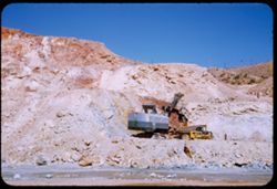
- Description:
- 50 f 8
- Subject:
- Rocks, Electric lines, Cliffs, Mining, Machinery, Mountains, Shrubs, Utility poles, Miners, Phelps Dodge Corporation, Dump trucks, and Mining equipment
- Series:
- 1-52
- Creator:
- Cushman, Charles W., 1896-1972
- Date Created:
- 1952-01-04
- Genre:
- Snapshots
- Frame Number:
- 20
- County:
- Cochise
- Abstract:
- Mining a mountainside at Lowell.
- Call Number:
- P05510
- City:
- Lowell
- Country:
- United States
- State/Province:
- Arizona
- Alternate Identifier:
- 152.20
- Persistent URL:
- http://purl.dlib.indiana.edu/iudl/archives/cushman/P05510
- Holding Location:
- Bloomington - University Archives
Wells Library E460
1320 E 10th St.
Bloomington, IN 47405
Contact at archives@indiana.edu, 812-855-1127
-
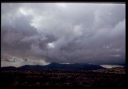
- Description:
- 50 f 4.5 Pola
- Subject:
- Weather, Grasses, Mountains, Whitlock Mountains (Ariz.), Clouds, and Hills
- Series:
- 13-53
- Creator:
- Cushman, Charles W., 1896-1972
- Date Created:
- 1953-11-18
- Genre:
- Landscape photographs
- Frame Number:
- 26
- Street Address:
- United States Highway 70
- County:
- Graham and Greenlee
- Abstract:
- Cloud formation over Whitlock Mtns.
- Call Number:
- P06983
- City:
- Duncan and Safford
- Country:
- United States
- State/Province:
- Arizona
- Physical Description:
- Image was originally mounted in a glass enclosure. Before digitization, the image was removed and placed in a Wess Plastic, Inc. brand, 2" x 2", pl...
- Alternate Identifier:
- 1353.26
- Persistent URL:
- http://purl.dlib.indiana.edu/iudl/archives/cushman/P06983
- Holding Location:
- Bloomington - University Archives
Wells Library E460
1320 E 10th St.
Bloomington, IN 47405
Contact at archives@indiana.edu, 812-855-1127
-
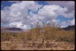
- Description:
- 50 f 11 sl
- Subject:
- Palo verde trees, Trees, Mountains, Shrubs, Tucson Mountains (Ariz.), and Clouds
- Series:
- 8-59
- Creator:
- Cushman, Charles W., 1896-1972
- Date Created:
- 1959-02-13
- Genre:
- Landscape photographs
- Frame Number:
- 7
- County:
- Pima
- Abstract:
- Those lovely clouds above the Tucson Mtns.
- Call Number:
- P10621
- City:
- Tucson
- Country:
- United States
- State/Province:
- Arizona
- Alternate Identifier:
- 859.7
- Persistent URL:
- http://purl.dlib.indiana.edu/iudl/archives/cushman/P10621
- Holding Location:
- Bloomington - University Archives
Wells Library E460
1320 E 10th St.
Bloomington, IN 47405
Contact at archives@indiana.edu, 812-855-1127
-
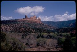
- Description:
- 25 f 13
- Subject:
- Canyons, Cliffs, Trees, Mountains, Rock formations, Clouds, Hills, and Oak Creek Canyon (Ariz.)
- Series:
- 16-52
- Creator:
- Cushman, Charles W., 1896-1972
- Date Created:
- 1952-04-12
- Genre:
- Landscape photographs
- Frame Number:
- 35
- County:
- Coconino
- Abstract:
- Contorted red rocks Sedona
- Call Number:
- P06093
- City:
- Sedona
- Country:
- United States
- State/Province:
- Arizona
- Alternate Identifier:
- 1652.35
- Persistent URL:
- http://purl.dlib.indiana.edu/iudl/archives/cushman/P06093
- Holding Location:
- Bloomington - University Archives
Wells Library E460
1320 E 10th St.
Bloomington, IN 47405
Contact at archives@indiana.edu, 812-855-1127
-
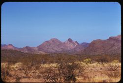
- Description:
- 100 f 8 tl
- Subject:
- Mountains, Fences, Shrubs, and Roskruge Mountains (Ariz.)
- Series:
- 9-59
- Creator:
- Cushman, Charles W., 1896-1972
- Date Created:
- 1959-02-20
- Genre:
- Landscape photographs
- Frame Number:
- 5
- Street Address:
- Tucson-Ajo Highway and Ajo Way
- County:
- Pima
- Abstract:
- Roskruge Mtns. - from Ajo road
- Call Number:
- P10656
- City:
- Tucson
- Country:
- United States
- State/Province:
- Arizona
- Alternate Identifier:
- 959.5
- Persistent URL:
- http://purl.dlib.indiana.edu/iudl/archives/cushman/P10656
- Holding Location:
- Bloomington - University Archives
Wells Library E460
1320 E 10th St.
Bloomington, IN 47405
Contact at archives@indiana.edu, 812-855-1127
-
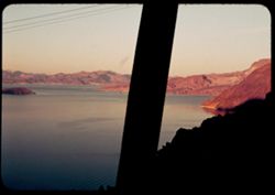
- Subject:
- Mead, Lake (Ariz. and Nev.), Fortification Range (Nev.), Mountains, Lakes & ponds, and Islands
- Series:
- 10-39
- Creator:
- Cushman, Charles W., 1896-1972
- Date Created:
- 1939-12-01
- Genre:
- Landscape photographs
- Frame Number:
- 18
- Abstract:
- T-18: Looking across Lake Mead to Fortification Mtn
- Call Number:
- P01733
- Country:
- United States
- State/Province:
- Arizona and Nevada
- Physical Description:
- some dye fading, tape down middle of slide.
- Alternate Identifier:
- 1039.18
- Persistent URL:
- http://purl.dlib.indiana.edu/iudl/archives/cushman/P01733
- Holding Location:
- Bloomington - University Archives
Wells Library E460
1320 E 10th St.
Bloomington, IN 47405
Contact at archives@indiana.edu, 812-855-1127
-
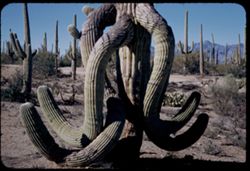
- Description:
- 25 f 10
- Subject:
- Deserts, Cactus, Mountains, Shrubs, Saguaro, Saguaro National Park (Ariz.), and National parks & reserves
- Series:
- 3-52
- Creator:
- Cushman, Charles W., 1896-1972
- Date Created:
- 1952-01-15
- Genre:
- Identification photographs
- Frame Number:
- 12
- County:
- Pima
- Abstract:
- A drunken Sahuaro
- Call Number:
- P05581
- City:
- Tucson
- Country:
- United States
- State/Province:
- Arizona
- Alternate Identifier:
- 352.12
- Persistent URL:
- http://purl.dlib.indiana.edu/iudl/archives/cushman/P05581
- Holding Location:
- Bloomington - University Archives
Wells Library E460
1320 E 10th St.
Bloomington, IN 47405
Contact at archives@indiana.edu, 812-855-1127
-
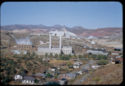
- Description:
- 50 f 9
- Subject:
- Houses, Trees, Smoke, Streets, Miami Copper Co. (Miami, Ariz.), Cities & towns, Buildings, Hills, Smokestacks, Factories, Copper industry, Copper mining,...
- Series:
- 14-53
- Creator:
- Cushman, Charles W., 1896-1972
- Date Created:
- 1953-11-19
- Genre:
- Cityscape photographs and Architectural photographs
- Frame Number:
- 5
- County:
- Gila
- Abstract:
- Miami Copper Co plant Miami-
- Call Number:
- P07001
- City:
- Miami
- Country:
- United States
- State/Province:
- Arizona
- Alternate Identifier:
- 1453.5
- Persistent URL:
- http://purl.dlib.indiana.edu/iudl/archives/cushman/P07001
- Holding Location:
- Bloomington - University Archives
Wells Library E460
1320 E 10th St.
Bloomington, IN 47405
Contact at archives@indiana.edu, 812-855-1127
-
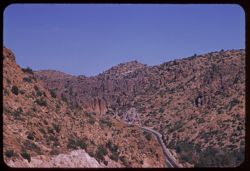
- Description:
- 100 f 9 tl
- Subject:
- Roads, Automobiles, Mountains, and Shrubs
- Series:
- 9-59
- Creator:
- Cushman, Charles W., 1896-1972
- Date Created:
- 1959-02-27
- Genre:
- Landscape photographs
- Frame Number:
- 22
- Street Address:
- United States Highway 60 and United States Highway 70
- County:
- Pinal and Gila
- Abstract:
- US 60/70 winding eastward over hump from Superior to Miami
- Call Number:
- P10673
- City:
- Superior and Miami
- Country:
- United States
- State/Province:
- Arizona
- Alternate Identifier:
- 959.22
- Persistent URL:
- http://purl.dlib.indiana.edu/iudl/archives/cushman/P10673
- Holding Location:
- Bloomington - University Archives
Wells Library E460
1320 E 10th St.
Bloomington, IN 47405
Contact at archives@indiana.edu, 812-855-1127
-
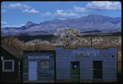
- Description:
- 100 f 6.3 tl
- Subject:
- Stores & shops, Electric lines, Trees, Signs (Notices), Cities & towns, Buildings, Shrubs, Clouds, Windows, Doors & doorways, Galiuro Mountains (...
- Series:
- 7-59
- Creator:
- Cushman, Charles W., 1896-1972
- Date Created:
- 1959-02-03
- Genre:
- Landscape photographs
- Frame Number:
- 12
- County:
- Pinal
- Abstract:
- Galiuro Mtns. From Mammoth Ariz.
- Call Number:
- P10588
- City:
- Mammoth
- Country:
- United States
- State/Province:
- Arizona
- Alternate Identifier:
- 759.12
- Persistent URL:
- http://purl.dlib.indiana.edu/iudl/archives/cushman/P10588
- Holding Location:
- Bloomington - University Archives
Wells Library E460
1320 E 10th St.
Bloomington, IN 47405
Contact at archives@indiana.edu, 812-855-1127
-
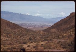
- Description:
- 100 f 6.3 tl
- Subject:
- Roads, Cactus, Cities & towns, Buildings, Gates Pass (Ariz.), Tucson Mountains (Ariz.), Clouds, Dwellings, Mountains, Shrubs, and Traffic signs & sig...
- Series:
- 8-59
- Creator:
- Cushman, Charles W., 1896-1972
- Date Created:
- 1959-02-11
- Genre:
- Cityscape photographs
- Frame Number:
- 3
- County:
- Pima
- Abstract:
- Tucson seen from Gates Pass in Tuscon Mtns.
- Call Number:
- P10617
- City:
- Tucson
- Country:
- United States
- State/Province:
- Arizona
- Alternate Identifier:
- 859.3
- Persistent URL:
- http://purl.dlib.indiana.edu/iudl/archives/cushman/P10617
- Holding Location:
- Bloomington - University Archives
Wells Library E460
1320 E 10th St.
Bloomington, IN 47405
Contact at archives@indiana.edu, 812-855-1127
-
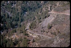
- Description:
- 50 f 6
- Subject:
- Canyons, Roads, Trees, Mountains, Shrubs, and Oak Creek Canyon (Ariz.)
- Series:
- 16-52
- Creator:
- Cushman, Charles W., 1896-1972
- Date Created:
- 1952-04-12
- Genre:
- Landscape photographs
- Frame Number:
- 18
- Street Address:
- United States Highway 89A
- County:
- Coconino
- Abstract:
- Road down into canyon
- Call Number:
- P06076
- Country:
- United States
- State/Province:
- Arizona
- Alternate Identifier:
- 1652.18
- Persistent URL:
- http://purl.dlib.indiana.edu/iudl/archives/cushman/P06076
- Holding Location:
- Bloomington - University Archives
Wells Library E460
1320 E 10th St.
Bloomington, IN 47405
Contact at archives@indiana.edu, 812-855-1127
-
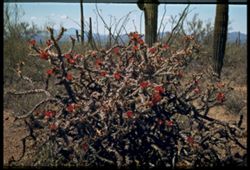
- Subject:
- Cactus, Flowers, Mountains, Shrubs, Clouds, Tucson Mountain Park (Ariz.), Cholla, and Ferocactus
- Series:
- 4-40
- Creator:
- Cushman, Charles W., 1896-1972
- Date Created:
- 1940-04-01
- Genre:
- Identification photographs
- Frame Number:
- 16
- County:
- Pima
- Abstract:
- Cholla in red bloom. Tucson Mtn-Park. Large blooming cholla, barrel cactuss, cursed
- Call Number:
- P01803
- Country:
- United States
- State/Province:
- Arizona
- Physical Description:
- Image was originally mounted in a glass enclosure. Before digitization, the image was removed and placed in a Wess Plastic, Inc. brand, 2" x 2", pl...
- Alternate Identifier:
- 440.16
- Persistent URL:
- http://purl.dlib.indiana.edu/iudl/archives/cushman/P01803
- Holding Location:
- Bloomington - University Archives
Wells Library E460
1320 E 10th St.
Bloomington, IN 47405
Contact at archives@indiana.edu, 812-855-1127
-
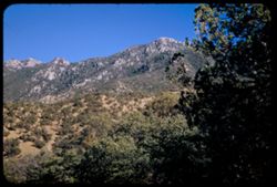
- Description:
- 50 f 8
- Subject:
- Canyons, Madeira Canyon (Ariz.), Trees, Mountains, Shrubs, and Santa Rita Mountains (Ariz.)
- Series:
- 2-52
- Creator:
- Cushman, Charles W., 1896-1972
- Date Created:
- 1952-01-14
- Genre:
- Landscape photographs
- Frame Number:
- 27
- Abstract:
- Santa Rita Mtns from Madeira Canyon.
- Call Number:
- P05557
- Country:
- United States
- State/Province:
- Arizona
- Alternate Identifier:
- 252.27
- Persistent URL:
- http://purl.dlib.indiana.edu/iudl/archives/cushman/P05557
- Holding Location:
- Bloomington - University Archives
Wells Library E460
1320 E 10th St.
Bloomington, IN 47405
Contact at archives@indiana.edu, 812-855-1127
-
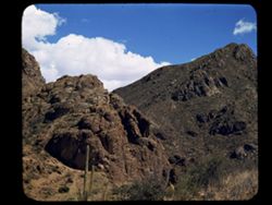
- Subject:
- Dirt roads, Mountains, Shrubs, Tucson Mountains (Ariz.), Clouds, Passes (Landforms), and Cactus
- Series:
- 4-40
- Creator:
- Cushman, Charles W., 1896-1972
- Date Created:
- 1940-04-01
- Genre:
- Landscape photographs
- Frame Number:
- 2
- Street Address:
- Gates Pass
- County:
- Pima
- Abstract:
- Tucson Mtns. At Gates Pass.
- Call Number:
- P01790
- Country:
- United States
- State/Province:
- Arizona
- Physical Description:
- masked.
- Alternate Identifier:
- 440.2
- Persistent URL:
- http://purl.dlib.indiana.edu/iudl/archives/cushman/P01790
- Holding Location:
- Bloomington - University Archives
Wells Library E460
1320 E 10th St.
Bloomington, IN 47405
Contact at archives@indiana.edu, 812-855-1127
-
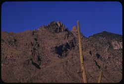
- Description:
- 100 f 9 tl
- Subject:
- Cactus, Mountains, and Santa Catalina Mountains (Ariz.)
- Series:
- 9-59
- Creator:
- Cushman, Charles W., 1896-1972
- Date Created:
- 1959-02-22
- Genre:
- Landscape photographs
- Frame Number:
- 7
- County:
- Pima
- Abstract:
- A closer view
- Call Number:
- P10658
- City:
- Tucson
- Country:
- United States
- State/Province:
- Arizona
- Alternate Identifier:
- 959.7
- Persistent URL:
- http://purl.dlib.indiana.edu/iudl/archives/cushman/P10658
- Holding Location:
- Bloomington - University Archives
Wells Library E460
1320 E 10th St.
Bloomington, IN 47405
Contact at archives@indiana.edu, 812-855-1127
-
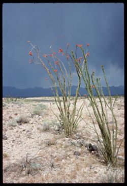
- Description:
- 100 f 12 or 13
- Subject:
- Deserts, Flowers, Storms, Mountains, Ocotillo, Plants, and Rocks
- Series:
- 1-66
- Creator:
- Cushman, Charles W., 1896-1972
- Date Created:
- 1966-04-22
- Genre:
- Landscape photographs and Identification photographs
- Frame Number:
- 9
- Street Address:
- United States Highway 66
- County:
- Mohave
- Abstract:
- Ocotillo along U.S. 66- Mojave county
- Call Number:
- P15250
- Country:
- United States
- State/Province:
- Arizona
- Alternate Identifier:
- 166.9
- Persistent URL:
- http://purl.dlib.indiana.edu/iudl/archives/cushman/P15250
- Holding Location:
- Bloomington - University Archives
Wells Library E460
1320 E 10th St.
Bloomington, IN 47405
Contact at archives@indiana.edu, 812-855-1127
-
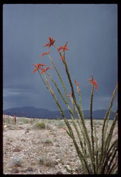
- Description:
- 100 f 13 ?
- Subject:
- Deserts, Flowers, Storms, Mountains, Ocotillo, Plants, and Rocks
- Series:
- 1-66
- Creator:
- Cushman, Charles W., 1896-1972
- Date Created:
- 1966-04-22
- Genre:
- Landscape photographs and Identification photographs
- Frame Number:
- 10
- Street Address:
- United States Highway 66
- County:
- Mohave
- Abstract:
- Ocotillo along U.S. 66- Mojave county
- Call Number:
- P15251
- Country:
- United States
- State/Province:
- Arizona
- Alternate Identifier:
- 166.10
- Persistent URL:
- http://purl.dlib.indiana.edu/iudl/archives/cushman/P15251
- Holding Location:
- Bloomington - University Archives
Wells Library E460
1320 E 10th St.
Bloomington, IN 47405
Contact at archives@indiana.edu, 812-855-1127
-
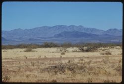
- Description:
- 100 f 8 tl
- Subject:
- Altar River Valley (Mexico), Sierrita Mountains (Ariz.), Mountains, and Shrubs
- Series:
- 6-59
- Creator:
- Cushman, Charles W., 1896-1972
- Date Created:
- 1959-01-28
- Genre:
- Landscape photographs
- Frame Number:
- 25
- County:
- Pima
- Abstract:
- Sierrita Mtns. seen from SW
- Call Number:
- P10563
- Country:
- United States
- State/Province:
- Arizona
- Alternate Identifier:
- 659.25
- Persistent URL:
- http://purl.dlib.indiana.edu/iudl/archives/cushman/P10563
- Holding Location:
- Bloomington - University Archives
Wells Library E460
1320 E 10th St.
Bloomington, IN 47405
Contact at archives@indiana.edu, 812-855-1127
-
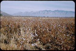
- Description:
- 25 f 11
- Subject:
- Cotton industry, Cotton, Trees, Mountains, Agricultural facilities, Santa Catalina Mountains (Ariz.), and Croplands
- Series:
- 1-52
- Creator:
- Cushman, Charles W., 1896-1972
- Date Created:
- 1952-01-05
- Genre:
- Landscape photographs
- Frame Number:
- 37
- County:
- Pima
- Abstract:
- Cotton field SW of Tucson.
- Call Number:
- P05527
- City:
- Tucson
- Country:
- United States
- State/Province:
- Arizona
- Alternate Identifier:
- 152.37
- Persistent URL:
- http://purl.dlib.indiana.edu/iudl/archives/cushman/P05527
- Holding Location:
- Bloomington - University Archives
Wells Library E460
1320 E 10th St.
Bloomington, IN 47405
Contact at archives@indiana.edu, 812-855-1127
-
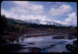
- Description:
- 25 f 13
- Subject:
- Snow, Puddles, San Francisco Peaks (Ariz.), Trees, Mountains, Clouds, Hills, Rocks, Mud, Electric lines, and Bodies of water
- Series:
- 16-52
- Creator:
- Cushman, Charles W., 1896-1972
- Date Created:
- 1952-04-11
- Genre:
- Landscape photographs
- Frame Number:
- 15
- Street Address:
- United States Highway 66
- County:
- Coconino
- Abstract:
- San Francisco Pks-from 5 mi west of Flagstaff on 66
- Call Number:
- P06073
- City:
- Flagstaff
- Country:
- United States
- State/Province:
- Arizona
- Alternate Identifier:
- 1652.15
- Persistent URL:
- http://purl.dlib.indiana.edu/iudl/archives/cushman/P06073
- Holding Location:
- Bloomington - University Archives
Wells Library E460
1320 E 10th St.
Bloomington, IN 47405
Contact at archives@indiana.edu, 812-855-1127