
Search Constraints
You searched for:
Campus
IUB
Remove constraint Campus: IUB
Creator
Cushman, Charles W., 1896-1972
Remove constraint Creator: Cushman, Charles W., 1896-1972
Pages
0-99 pages
Remove constraint Pages: 0-99 pages
Subject
Shrubs
Remove constraint Subject: Shrubs
Subject
Grasses
Remove constraint Subject: Grasses
State/Province
California
Remove constraint State/Province: California
« Previous |
1 - 100 of 142
|
Next »
Search Results
-
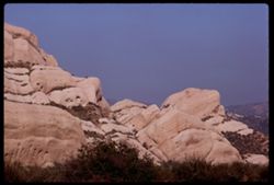
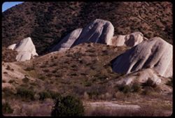
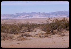
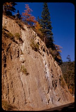
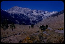
- Description:
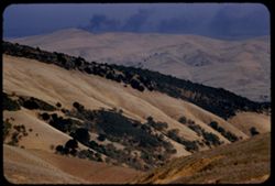
- 100 f 9 TL
- Subject:
- Passes (Landforms), Cajon Pass (Calif.), Shrubs, Rock formations, Mountains, and Grasses
- Series:
- 3-69
- Creator:
- Cushman, Charles W., 1896-1972
- Date Created:
- 1969-03-20
- Genre:
- Landscape photographs
- Frame Number:
- 15
- County:
- San Bernardino
- Abstract:
- In Cajon Pass
- Call Number:
- P15767
- Country:
- United States
- State/Province:
- California
- Alternate Identifier:
- 369.15
- Persistent URL:
- http://purl.dlib.indiana.edu/iudl/archives/cushman/P15767
- Holding Location:
- Bloomington - University Archives
Wells Library E460
1320 E 10th St.
Bloomington, IN 47405
Contact at archives@indiana.edu, 812-855-1127
-
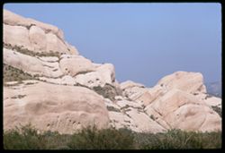
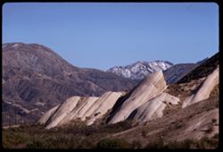
- Description:
- 100 f 9 TL
- Subject:
- Grasses, Cajon Pass (Calif.), Rock formations, Passes (Landforms), and Shrubs
- Series:
- 3-69
- Creator:
- Cushman, Charles W., 1896-1972
- Date Created:
- 1969-03-20
- Genre:
- Landscape photographs
- Frame Number:
- 12
- County:
- San Bernardino
- Abstract:
- In Cajon Pass
- Call Number:
- P15764
- Country:
- United States
- State/Province:
- California
- Alternate Identifier:
- 369.12
- Persistent URL:
- http://purl.dlib.indiana.edu/iudl/archives/cushman/P15764
- Holding Location:
- Bloomington - University Archives
Wells Library E460
1320 E 10th St.
Bloomington, IN 47405
Contact at archives@indiana.edu, 812-855-1127
-
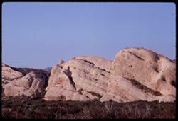
- Description:
- 100 f 9 TL
- Subject:
- Grasses, Cajon Pass (Calif.), Shrubs, Passes (Landforms), and Rock formations
- Series:
- 3-69
- Creator:
- Cushman, Charles W., 1896-1972
- Date Created:
- 1969-03-20
- Genre:
- Landscape photographs
- Frame Number:
- 11
- County:
- San Bernardino
- Abstract:
- In Cajon Pass
- Call Number:
- P15763
- Country:
- United States
- State/Province:
- California
- Alternate Identifier:
- 369.11
- Persistent URL:
- http://purl.dlib.indiana.edu/iudl/archives/cushman/P15763
- Holding Location:
- Bloomington - University Archives
Wells Library E460
1320 E 10th St.
Bloomington, IN 47405
Contact at archives@indiana.edu, 812-855-1127
-
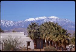
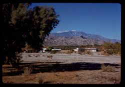
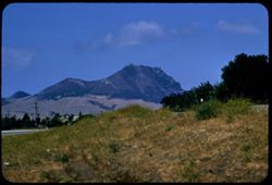
- Description:
- 100 f 9 TL
- Subject:
- San Jacinto Peak (Calif.), Mountains, Shrubs, Electric lines, Buildings, Palms, Grasses, and Snow
- Series:
- 2-69
- Creator:
- Cushman, Charles W., 1896-1972
- Date Created:
- 1969-03-16
- Genre:
- Landscape photographs and Views
- Frame Number:
- 25
- County:
- Riverside
- Abstract:
- China berry Mt. San Jacinto near Palm springs
- Call Number:
- P15742
- City:
- Palm Springs
- Country:
- United States
- State/Province:
- California
- Alternate Identifier:
- 269.25
- Persistent URL:
- http://purl.dlib.indiana.edu/iudl/archives/cushman/P15742
- Holding Location:
- Bloomington - University Archives
Wells Library E460
1320 E 10th St.
Bloomington, IN 47405
Contact at archives@indiana.edu, 812-855-1127
-
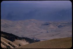
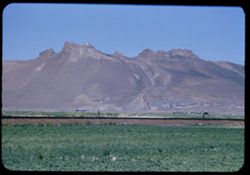
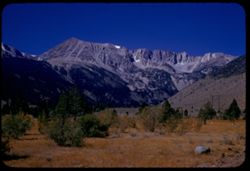
- Description:
- 100 f 9 TL
- Subject:
- Passes (Landforms), Hills, Cajon Pass (Calif.), Shrubs, Trees, Rock formations, Mountains, and Grasses
- Series:
- 2-69
- Creator:
- Cushman, Charles W., 1896-1972
- Date Created:
- 1969-03-14
- Genre:
- Landscape photographs
- Frame Number:
- 17
- County:
- San Bernardino
- Abstract:
- Cajon Pass
- Call Number:
- P15734
- Country:
- United States
- State/Province:
- California
- Alternate Identifier:
- 269.17
- Persistent URL:
- http://purl.dlib.indiana.edu/iudl/archives/cushman/P15734
- Holding Location:
- Bloomington - University Archives
Wells Library E460
1320 E 10th St.
Bloomington, IN 47405
Contact at archives@indiana.edu, 812-855-1127
-
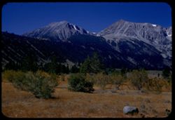
- Description:
- 100 f 9 TL
- Subject:
- Passes (Landforms), Mountains, Shrubs, Snow, Rock formations, Cajon Pass (Calif.), and Grasses
- Series:
- 2-69
- Creator:
- Cushman, Charles W., 1896-1972
- Date Created:
- 1969-03-14
- Genre:
- Landscape photographs
- Frame Number:
- 16
- County:
- San Bernardino
- Abstract:
- Cajon Pass
- Call Number:
- P15733
- Country:
- United States
- State/Province:
- California
- Alternate Identifier:
- 269.16
- Persistent URL:
- http://purl.dlib.indiana.edu/iudl/archives/cushman/P15733
- Holding Location:
- Bloomington - University Archives
Wells Library E460
1320 E 10th St.
Bloomington, IN 47405
Contact at archives@indiana.edu, 812-855-1127
-
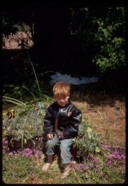
- Description:
- 100 f 8
- Subject:
- Boys, Flowers, Smiling, Coats, Shrubs, Trees, Plants, and Grasses
- Series:
- 2-68
- Creator:
- Cushman, Charles W., 1896-1972
- Date Created:
- 1968-05-10
- Genre:
- Portraits
- Frame Number:
- 19
- County:
- Sonoma
- Abstract:
- Little Cecil- Sebastopol
- Call Number:
- P15651
- City:
- Sebastopol
- Country:
- United States
- State/Province:
- California
- Alternate Identifier:
- 268.19
- Persistent URL:
- http://purl.dlib.indiana.edu/iudl/archives/cushman/P15651
- Holding Location:
- Bloomington - University Archives
Wells Library E460
1320 E 10th St.
Bloomington, IN 47405
Contact at archives@indiana.edu, 812-855-1127
-
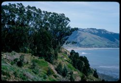
- Description:
- 100 f 8
- Subject:
- Bays (Bodies of water), Grasses, Cliffs, Trees, Coastlines, Bolinas Bay (Calif.), Mountains, Beaches, Shrubs, and Hills
- Series:
- 1-68
- Creator:
- Cushman, Charles W., 1896-1972
- Date Created:
- 1968-03-20
- Genre:
- Landscape photographs and Seascapes
- Frame Number:
- 29
- County:
- Marin
- Abstract:
- Across Bolinas Bay
- Call Number:
- P15623
- City:
- Bolinas
- Country:
- United States
- State/Province:
- California
- Alternate Identifier:
- 168.29
- Persistent URL:
- http://purl.dlib.indiana.edu/iudl/archives/cushman/P15623
- Holding Location:
- Bloomington - University Archives
Wells Library E460
1320 E 10th St.
Bloomington, IN 47405
Contact at archives@indiana.edu, 812-855-1127
-
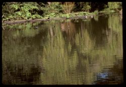
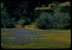
- Description:
- 100 f 8 tl
- Subject:
- Botanical gardens, Strybing Arboretum and Botanical Gardens, Grasses, Golden Gate Park (San Francisco, Calif.), Trees, Shrubs, Lakes & ponds, Reflections...
- Series:
- 3-67
- Creator:
- Cushman, Charles W., 1896-1972
- Date Created:
- 1967-04-03
- Genre:
- Landscape photographs
- Frame Number:
- 7
- County:
- San Francisco
- Abstract:
- At Strybing arboretum
- Call Number:
- P15524
- City:
- San Francisco
- Country:
- United States
- State/Province:
- California
- Alternate Identifier:
- 367.7
- Persistent URL:
- http://purl.dlib.indiana.edu/iudl/archives/cushman/P15524
- Holding Location:
- Bloomington - University Archives
Wells Library E460
1320 E 10th St.
Bloomington, IN 47405
Contact at archives@indiana.edu, 812-855-1127
-

- Subject:
- Grasses, Shadows, Children playing in water, Girls, Shrubs, Bathing suits, Marina Green (Calif.), and Butterflies
- Series:
- 1-66
- Creator:
- Cushman, Charles W., 1896-1972
- Date Created:
- 1966-04-01
- Genre:
- Snapshots and Portraits
- Frame Number:
- 5
- Street Address:
- Marina District
- County:
- San Francisco
- Abstract:
- Little red head and friend at drinking fountain - same in error and mid Apr.
- Call Number:
- P15246
- City:
- San Francisco
- Country:
- United States
- State/Province:
- California
- Alternate Identifier:
- 166.5
- Persistent URL:
- http://purl.dlib.indiana.edu/iudl/archives/cushman/P15246
- Holding Location:
- Bloomington - University Archives
Wells Library E460
1320 E 10th St.
Bloomington, IN 47405
Contact at archives@indiana.edu, 812-855-1127
-
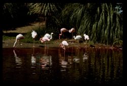
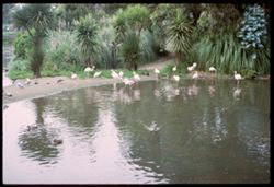
- Description:
- 100 f 13
- Subject:
- Lakes & ponds, Zoo animals, Zoos, Shrubs, Flamingos, Palms, San Francisco Zoo (San Francisco, Calif.), and Grasses
- Series:
- 31-65
- Creator:
- Cushman, Charles W., 1896-1972
- Date Created:
- 1965-09-08
- Genre:
- Identification photographs
- Frame Number:
- 11
- County:
- San Francisco
- Abstract:
- Flamingo
- Call Number:
- P14892
- City:
- San Francisco
- Country:
- United States
- State/Province:
- California
- Alternate Identifier:
- 3165.11
- Persistent URL:
- http://purl.dlib.indiana.edu/iudl/archives/cushman/P14892
- Holding Location:
- Bloomington - University Archives
Wells Library E460
1320 E 10th St.
Bloomington, IN 47405
Contact at archives@indiana.edu, 812-855-1127
-
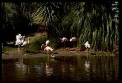
- Description:
- 100 f 11
- Subject:
- Lakes & ponds, Zoo animals, Reflections, Zoos, Shrubs, Flamingos, Palms, San Francisco Zoo (San Francisco, Calif.), Grasses, and Ducks
- Series:
- 31-65
- Creator:
- Cushman, Charles W., 1896-1972
- Date Created:
- 1965-09-08
- Genre:
- Identification photographs
- Frame Number:
- 10
- County:
- San Francisco
- Abstract:
- Flamingo
- Call Number:
- P14891
- City:
- San Francisco
- Country:
- United States
- State/Province:
- California
- Alternate Identifier:
- 3165.10
- Persistent URL:
- http://purl.dlib.indiana.edu/iudl/archives/cushman/P14891
- Holding Location:
- Bloomington - University Archives
Wells Library E460
1320 E 10th St.
Bloomington, IN 47405
Contact at archives@indiana.edu, 812-855-1127
-
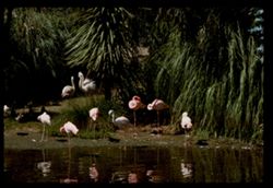
- Description:
- 100 f 11 tl
- Subject:
- Lakes & ponds, Zoo animals, Reflections, Zoos, Shrubs, Flamingos, Palms, San Francisco Zoo (San Francisco, Calif.), and Grasses
- Series:
- 31-65
- Creator:
- Cushman, Charles W., 1896-1972
- Date Created:
- 1965-09-08
- Genre:
- Identification photographs
- Frame Number:
- 9
- County:
- San Francisco
- Abstract:
- Flamingo
- Call Number:
- P14890
- City:
- San Francisco
- Country:
- United States
- State/Province:
- California
- Alternate Identifier:
- 3165.9
- Persistent URL:
- http://purl.dlib.indiana.edu/iudl/archives/cushman/P14890
- Holding Location:
- Bloomington - University Archives
Wells Library E460
1320 E 10th St.
Bloomington, IN 47405
Contact at archives@indiana.edu, 812-855-1127
-
- Subject:
- Ducks, Gulls, Shrubs, Lakes & ponds, Flamingos, Reflections, Palms, Zoo animals, Grasses, San Francisco Zoo (San Francisco, Calif.), and Zoos
- Series:
- 31-65
- Creator:
- Cushman, Charles W., 1896-1972
- Date Created:
- 1965-01-01
- Genre:
- Identification photographs
- Frame Number:
- 4
- County:
- San Francisco
- Call Number:
- P14888
- City:
- San Francisco
- Country:
- United States
- State/Province:
- California
- Alternate Identifier:
- 3165.4
- Persistent URL:
- http://purl.dlib.indiana.edu/iudl/archives/cushman/P14888
- Holding Location:
- Bloomington - University Archives
Wells Library E460
1320 E 10th St.
Bloomington, IN 47405
Contact at archives@indiana.edu, 812-855-1127
-
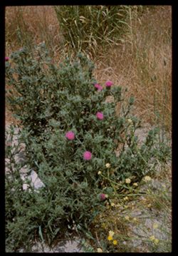
- Description:
- 100 f 11
- Subject:
- Flowers, Shrubs, Grasses, Wildflowers, and Thistles
- Series:
- 27-65
- Creator:
- Cushman, Charles W., 1896-1972
- Date Created:
- 1965-07-26
- Genre:
- Identification photographs
- Frame Number:
- 4
- County:
- Marin
- Abstract:
- Hopi Pt. and Road side flowers near Nicasio
- Call Number:
- P14803
- City:
- Nicasio
- Country:
- United States
- State/Province:
- California
- Alternate Identifier:
- 2765.4
- Persistent URL:
- http://purl.dlib.indiana.edu/iudl/archives/cushman/P14803
- Holding Location:
- Bloomington - University Archives
Wells Library E460
1320 E 10th St.
Bloomington, IN 47405
Contact at archives@indiana.edu, 812-855-1127
-
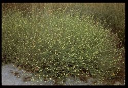
- Description:
- 100 f 11
- Subject:
- Shrubs, Grasses, and Wildflowers
- Series:
- 27-65
- Creator:
- Cushman, Charles W., 1896-1972
- Date Created:
- 1965-07-26
- Genre:
- Identification photographs
- Frame Number:
- 3
- County:
- Marin
- Abstract:
- Hopi Pt. and Road side flowers near Nicasio
- Call Number:
- P14802
- City:
- Nicasio
- Country:
- United States
- State/Province:
- California
- Alternate Identifier:
- 2765.3
- Persistent URL:
- http://purl.dlib.indiana.edu/iudl/archives/cushman/P14802
- Holding Location:
- Bloomington - University Archives
Wells Library E460
1320 E 10th St.
Bloomington, IN 47405
Contact at archives@indiana.edu, 812-855-1127
-
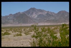
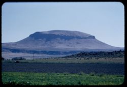
- Description:
- 100 f 11 TL
- Subject:
- Deserts, Mojave Desert (Calif.), Grasses, Cady Mountains (Calif.), Mountains, and Shrubs
- Series:
- 5-62
- Creator:
- Cushman, Charles W., 1896-1972
- Date Created:
- 1962-10-08
- Genre:
- Landscape photographs
- Frame Number:
- 26
- Street Address:
- United States Highway 66
- County:
- San Bernardino
- Abstract:
- Cady Mtns
- Call Number:
- P12793
- City:
- Barstow
- Country:
- United States
- State/Province:
- California
- Alternate Identifier:
- 562.26
- Persistent URL:
- http://purl.dlib.indiana.edu/iudl/archives/cushman/P12793
- Holding Location:
- Bloomington - University Archives
Wells Library E460
1320 E 10th St.
Bloomington, IN 47405
Contact at archives@indiana.edu, 812-855-1127
-
- Description:
- 100 f 8 TL
- Subject:
- Deserts, Grasses, San Bernardino Desert (Calif.), Mountains, and Shrubs
- Series:
- 24-61
- Creator:
- Cushman, Charles W., 1896-1972
- Date Created:
- 1961-12-29
- Genre:
- Landscape photographs
- Frame Number:
- 27
- County:
- San Bernardino
- Abstract:
- Panorama north from 12 mi. w. of 29 Palms and Panorama north of 29 Palm S Hwy 7 miles west of 29 Palms San Bernardino Desert
- Call Number:
- P12593
- City:
- Twentynine Palms
- Country:
- United States
- State/Province:
- California
- Alternate Identifier:
- 2461.27
- Persistent URL:
- http://purl.dlib.indiana.edu/iudl/archives/cushman/P12593
- Holding Location:
- Bloomington - University Archives
Wells Library E460
1320 E 10th St.
Bloomington, IN 47405
Contact at archives@indiana.edu, 812-855-1127
-
- Description:
- 100 f 6..3 TL
- Subject:
- Grasses, Houses, Trees, San Jacinto Peak (Calif.), Shadows, Mountains, and Shrubs
- Series:
- 23-61
- Creator:
- Cushman, Charles W., 1896-1972
- Date Created:
- 1961-12-25
- Genre:
- Landscape photographs
- Frame Number:
- 37
- County:
- Riverside
- Abstract:
- Mr. San Jacinto from Palm Desert and Mt. San Jacinto from Palm Desert
- Call Number:
- P12566
- City:
- Palm Desert
- Country:
- United States
- State/Province:
- California
- Alternate Identifier:
- 2361.37
- Persistent URL:
- http://purl.dlib.indiana.edu/iudl/archives/cushman/P12566
- Holding Location:
- Bloomington - University Archives
Wells Library E460
1320 E 10th St.
Bloomington, IN 47405
Contact at archives@indiana.edu, 812-855-1127
-
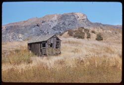
- Description:
- 100 f 6.3 TL
- Subject:
- Abandoned buildings, Houses, Greenbrae Shake Mill (Green Brae, Calif.), Shrubs, Building deterioration, Rocks, Grasses, and Hills
- Series:
- 22-61
- Creator:
- Cushman, Charles W., 1896-1972
- Date Created:
- 1961-10-06
- Genre:
- Landscape photographs
- Frame Number:
- 4
- County:
- Marin
- Abstract:
- Marin county near San Quentin- hill back of old Greenbrae Shake Mill and Near old greenbrae Shake Mill dwt San Quentin was
- Call Number:
- P12495
- City:
- Green Brae and San Quentin
- Country:
- United States
- State/Province:
- California
- Alternate Identifier:
- 2261.4
- Persistent URL:
- http://purl.dlib.indiana.edu/iudl/archives/cushman/P12495
- Holding Location:
- Bloomington - University Archives
Wells Library E460
1320 E 10th St.
Bloomington, IN 47405
Contact at archives@indiana.edu, 812-855-1127
-
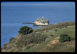
- Description:
- 100 f 6.3 tl
- Subject:
- Bays (Bodies of water), San Pablo Bay (Calif.), Grasses, Cliffs, Shrubs, and Islands
- Series:
- 27-60
- Creator:
- Cushman, Charles W., 1896-1972
- Date Created:
- 1961-01-31
- Genre:
- Landscape photographs and Seascapes
- Frame Number:
- 16
- County:
- Marin
- Abstract:
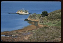
- San Pablo Bay- Islet near China Camp
- Call Number:
- P11758
- City:
- China Camp
- Country:
- United States
- State/Province:
- California
- Alternate Identifier:
- 2760.16
- Persistent URL:
- http://purl.dlib.indiana.edu/iudl/archives/cushman/P11758
- Holding Location:
- Bloomington - University Archives
Wells Library E460
1320 E 10th St.
Bloomington, IN 47405
Contact at archives@indiana.edu, 812-855-1127
-
- Description:
- 100 f 8 tl
- Subject:
- Bays (Bodies of water), San Pablo Bay (Calif.), Grasses, Cliffs, Shrubs, and Islands
- Series:
- 27-60
- Creator:
- Cushman, Charles W., 1896-1972
- Date Created:
- 1961-01-31
- Genre:
- Landscape photographs
- Frame Number:
- 15
- County:
- Marin
- Abstract:
- San Pablo Bay- Islet near China Camp
- Call Number:
- P11757
- City:
- China Camp
- Country:
- United States
- State/Province:
- California
- Alternate Identifier:
- 2760.15
- Persistent URL:
- http://purl.dlib.indiana.edu/iudl/archives/cushman/P11757
- Holding Location:
- Bloomington - University Archives
Wells Library E460
1320 E 10th St.
Bloomington, IN 47405
Contact at archives@indiana.edu, 812-855-1127
-
- Description:
- 50 f 8
- Subject:
- Grasses, Barbed wire, Mountains, Fences, Shrubs, and Hills
- Series:
- 27-60
- Creator:
- Cushman, Charles W., 1896-1972
- Date Created:
- 1960-12-29
- Genre:
- Landscape photographs
- Frame Number:
- 7
- Street Address:
- United States Highway 101
- County:
- Santa Barbara
- Abstract:
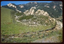
- Hills north of Gaviota
- Call Number:
- P11749
- City:
- Gaviota
- Country:
- United States
- State/Province:
- California
- Alternate Identifier:
- 2760.7
- Persistent URL:
- http://purl.dlib.indiana.edu/iudl/archives/cushman/P11749
- Holding Location:
- Bloomington - University Archives
Wells Library E460
1320 E 10th St.
Bloomington, IN 47405
Contact at archives@indiana.edu, 812-855-1127
-
- Description:
- 50 f 8
- Subject:
- Grasses, Roads, Grazing, Barbed wire, Livestock, Mountains, Fences, Shrubs, Hills, and Utility poles
- Series:
- 27-60
- Creator:
- Cushman, Charles W., 1896-1972
- Date Created:
- 1960-12-29
- Genre:
- Landscape photographs
- Frame Number:
- 6
- County:
- Santa Barbara
- Abstract:
- Hills north of Gaviota
- Call Number:
- P11748
- City:
- Gaviota
- Country:
- United States
- State/Province:
- California
- Alternate Identifier:
- 2760.6
- Persistent URL:
- http://purl.dlib.indiana.edu/iudl/archives/cushman/P11748
- Holding Location:
- Bloomington - University Archives
Wells Library E460
1320 E 10th St.
Bloomington, IN 47405
Contact at archives@indiana.edu, 812-855-1127
-
- Description:
- 100 f 8
- Subject:
- Grasses, Trees, Flowers, Tree limbs, Shrubs, Flowering crabapples, and Crabapples
- Series:
- 2-60
- Creator:
- Cushman, Charles W., 1896-1972
- Date Created:
- 1960-03-08
- Genre:
- Identification photographs
- Frame Number:
- 11
- County:
- Marin
- Abstract:
- Flowering crab - lower
- Call Number:
- P10942
- City:
- San Rafael
- Country:
- United States
- State/Province:
- California
- Alternate Identifier:
- 260.11
- Persistent URL:
- http://purl.dlib.indiana.edu/iudl/archives/cushman/P10942
- Holding Location:
- Bloomington - University Archives
Wells Library E460
1320 E 10th St.
Bloomington, IN 47405
Contact at archives@indiana.edu, 812-855-1127
-
- Description:
- 100 f 4.5 tl
- Subject:
- Rocks, Grasses, Trees, Shrubs, Hills, and Streams
- Series:
- 1-60
- Creator:
- Cushman, Charles W., 1896-1972
- Date Created:
- 1960-02-11
- Genre:
- Landscape photographs
- Frame Number:
- 15
- Street Address:
- Calistoga Road
- County:
- Sonoma and Napa
- Abstract:
- View east from Mr. Barhan's on Calistoga rd nr. Napa Sonoma line- Big Rock
- Call Number:
- P10909
- City:
- Santa Rosa
- Country:
- United States
- State/Province:
- California
- Alternate Identifier:
- 160.15
- Persistent URL:
- http://purl.dlib.indiana.edu/iudl/archives/cushman/P10909
- Holding Location:
- Bloomington - University Archives
Wells Library E460
1320 E 10th St.
Bloomington, IN 47405
Contact at archives@indiana.edu, 812-855-1127
-
- Description:
- 100 f 8 TL
- Subject:
- Domes, Streets, Hills, Skyscrapers, Roads, Mountains, Shrubs, Buildings, Grasses, Houses, and Dwellings
- Series:
- 12-59
- Creator:
- Cushman, Charles W., 1896-1972
- Date Created:
- 1959-05-10
- Genre:
- Cityscape photographs
- Frame Number:
- 36
- Street Address:
- Clipper Street
- County:
- San Francisco
- Abstract:
- From top of Clipper St.
- Call Number:
- P10798
- City:
- San Francisco
- Country:
- United States
- State/Province:
- California
- Alternate Identifier:
- 1259.36
- Persistent URL:
- http://purl.dlib.indiana.edu/iudl/archives/cushman/P10798
- Holding Location:
- Bloomington - University Archives
Wells Library E460
1320 E 10th St.
Bloomington, IN 47405
Contact at archives@indiana.edu, 812-855-1127
-
- Description:
- 100 f 8 TL
- Subject:
- Grasses, Houses, Skyscrapers, Streets, Mountains, Buildings, Shrubs, Dwellings, Domes, Roads, and Hills
- Series:
- 12-59
- Creator:
- Cushman, Charles W., 1896-1972
- Date Created:
- 1959-05-10
- Genre:
- Cityscape photographs
- Frame Number:
- 35
- Street Address:
- Clipper Street
- County:
- San Francisco
- Abstract:
- From top of Clipper St.
- Call Number:
- P10797
- City:
- San Francisco
- Country:
- United States
- State/Province:
- California
- Alternate Identifier:
- 1259.35
- Persistent URL:
- http://purl.dlib.indiana.edu/iudl/archives/cushman/P10797
- Holding Location:
- Bloomington - University Archives
Wells Library E460
1320 E 10th St.
Bloomington, IN 47405
Contact at archives@indiana.edu, 812-855-1127
-
- Description:
- 100 f 5.6 TL
- Subject:
- Grasses, Missions, Adobe buildings, Trees, Mission La Purísima Concepción (Calif.), Carts & wagons, State parks & reserves, Shrubs, La Purisima Missi...
- Series:
- 12-59
- Creator:
- Cushman, Charles W., 1896-1972
- Date Created:
- 1959-03-31
- Genre:
- Snapshots and Identification photographs
- Frame Number:
- 10
- County:
- Santa Barbara
- Abstract:
- Carreta (prime mover of bulk items)
- Call Number:
- P10772
- City:
- Lompoc
- Country:
- United States
- State/Province:
- California
- Alternate Identifier:
- 1259.10
- Persistent URL:
- http://purl.dlib.indiana.edu/iudl/archives/cushman/P10772
- Holding Location:
- Bloomington - University Archives
Wells Library E460
1320 E 10th St.
Bloomington, IN 47405
Contact at archives@indiana.edu, 812-855-1127
-
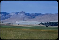
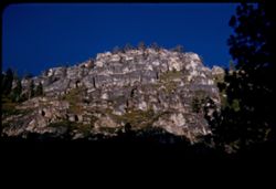
- Description:
- 100 f 8 tl
- Subject:
- Grasses, Mountains, Shrubs, and Hollister Peak (Calif.)
- Series:
- 14-57
- Creator:
- Cushman, Charles W., 1896-1972
- Date Created:
- 1957-09-19
- Genre:
- Landscape photographs
- Frame Number:
- 14
- Street Address:
- Morro Bay Road, California State Highway 1, and Pacific Coast Highway
- County:
- San Luis Obispo
- Abstract:
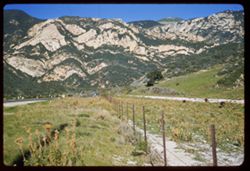
- Rocky comb (Hollister Pk) along Cal 1 between San Luis & Morro Bay
- Call Number:
- P09513
- City:
- San Luis Obispo and Morro Bay
- Country:
- United States
- State/Province:
- California
- Alternate Identifier:
- 1457.14
- Persistent URL:
- http://purl.dlib.indiana.edu/iudl/archives/cushman/P09513
- Holding Location:
- Bloomington - University Archives
Wells Library E460
1320 E 10th St.
Bloomington, IN 47405
Contact at archives@indiana.edu, 812-855-1127
-
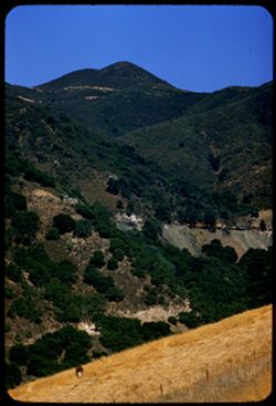
- Description:
- 100 f 6.3 tl
- Subject:
- Canyons, Grasses, Cuesta Pass (Calif.), Trees, Mountains, Shrubs, Railroad passenger cars, Passes (Landforms), Embankments, Railroads, and Southern Pacific R...
- Series:
- 14-57
- Creator:
- Cushman, Charles W., 1896-1972
- Date Created:
- 1957-09-19
- Genre:
- Landscape photographs
- Frame Number:
- 5
- County:
- San Luis Obispo
- Abstract:
- [P] View across Cuesta grade
- Call Number:
- P09504
- Country:
- United States
- State/Province:
- California
- Alternate Identifier:
- 1457.5
- Persistent URL:
- http://purl.dlib.indiana.edu/iudl/archives/cushman/P09504
- Holding Location:
- Bloomington - University Archives
Wells Library E460
1320 E 10th St.
Bloomington, IN 47405
Contact at archives@indiana.edu, 812-855-1127
-
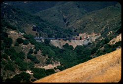
- Description:
- 100 f 4.5 tl
- Subject:
- Embankments, Passes (Landforms), Canyons, Southern Pacific Railroad Company, Railroad passenger cars, Cuesta Pass (Calif.), Mountains, Tunnels, Trees, Railro...
- Series:
- 14-57
- Creator:
- Cushman, Charles W., 1896-1972
- Date Created:
- 1957-09-19
- Genre:
- Landscape photographs and Snapshots
- Frame Number:
- 4
- County:
- San Luis Obispo
- Abstract:
- Sou. Pac. passenger train north bound
- Call Number:
- P09503
- Country:
- United States
- State/Province:
- California
- Alternate Identifier:
- 1457.4
- Persistent URL:
- http://purl.dlib.indiana.edu/iudl/archives/cushman/P09503
- Holding Location:
- Bloomington - University Archives
Wells Library E460
1320 E 10th St.
Bloomington, IN 47405
Contact at archives@indiana.edu, 812-855-1127
-
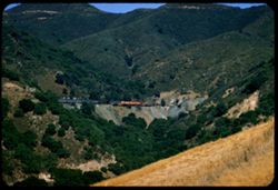
- Description:
- 100 f 4.5 tl
- Subject:
- Canyons, Grasses, Cuesta Pass (Calif.), Southern Pacific Railroad Company, Mountains, Shrubs, Railroad passenger cars, Passes (Landforms), Embankments, Railr...
- Series:
- 14-57
- Creator:
- Cushman, Charles W., 1896-1972
- Date Created:
- 1957-09-19
- Genre:
- Landscape photographs and Snapshots
- Frame Number:
- 3
- County:
- San Luis Obispo
- Abstract:
- Sou. Pac. passenger train north bound
- Call Number:
- P09502
- Country:
- United States
- State/Province:
- California
- Alternate Identifier:
- 1457.3
- Persistent URL:
- http://purl.dlib.indiana.edu/iudl/archives/cushman/P09502
- Holding Location:
- Bloomington - University Archives
Wells Library E460
1320 E 10th St.
Bloomington, IN 47405
Contact at archives@indiana.edu, 812-855-1127
-
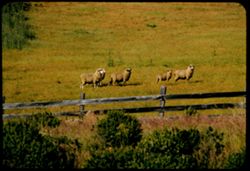
- Description:
- 100 f 5.6 tl
- Subject:
- Grasses, Grazing, Meadows, Fences, Shrubs, and Sheep
- Series:
- 9-57
- Creator:
- Cushman, Charles W., 1896-1972
- Date Created:
- 1957-06-18
- Genre:
- Identification photographs
- Frame Number:
- 21
- Street Address:
- California State Highway 1 and Pacific Coast Highway
- County:
- Mendocino
- Abstract:
- Sheep along Cal 1 south of Westport
- Call Number:
- P09358
- City:
- Westport
- Country:
- United States
- State/Province:
- California
- Alternate Identifier:
- 957.21
- Persistent URL:
- http://purl.dlib.indiana.edu/iudl/archives/cushman/P09358
- Holding Location:
- Bloomington - University Archives
Wells Library E460
1320 E 10th St.
Bloomington, IN 47405
Contact at archives@indiana.edu, 812-855-1127
-
- Description:
- 100 f 6.3 tl tele lens
- Subject:
- Roofs, Shrubs, Trees, Herbs, Grasses, and Lupines
- Series:
- 3-57
- Creator:
- Cushman, Charles W., 1896-1972
- Date Created:
- 1957-04-09
- Genre:
- Landscape photographs
- Frame Number:
- 7
- Street Address:
- California State Highway 128
- County:
- Sonoma
- Abstract:
- Grass, lupine & hill ride a few miles N.W. of Cloverdale on Cal. 128
- Call Number:
- P09171
- City:
- Cloverdale
- Country:
- United States
- State/Province:
- California
- Alternate Identifier:
- 357.7
- Persistent URL:
- http://purl.dlib.indiana.edu/iudl/archives/cushman/P09171
- Holding Location:
- Bloomington - University Archives
Wells Library E460
1320 E 10th St.
Bloomington, IN 47405
Contact at archives@indiana.edu, 812-855-1127
-
- Description:
- 100 f 6.3 tl
- Subject:
- Valleys, Grasses, Barbed wire, Diablo, Mount (Calif.), Fences, Shrubs, Hills, and Meadows
- Series:
- 14-56
- Creator:
- Cushman, Charles W., 1896-1972
- Date Created:
- 1956-11-13
- Genre:
- Landscape photographs
- Frame Number:
- 27
- Street Address:
- Beck Road
- County:
- Contra Costa
- Abstract:
- Views E.ward from Beck road in Contra Costa county
- Call Number:
- P09024
- Country:
- United States
- State/Province:
- California
- Alternate Identifier:
- 1456.27
- Persistent URL:
- http://purl.dlib.indiana.edu/iudl/archives/cushman/P09024
- Holding Location:
- Bloomington - University Archives
Wells Library E460
1320 E 10th St.
Bloomington, IN 47405
Contact at archives@indiana.edu, 812-855-1127
-
- Description:
- 100 f 5.6 tl
- Subject:
- Grasses, Meadows, Shrubs, Hills, and Diablo, Mount (Calif.)
- Series:
- 14-56
- Creator:
- Cushman, Charles W., 1896-1972
- Date Created:
- 1956-11-13
- Genre:
- Landscape photographs
- Frame Number:
- 26
- Street Address:
- Beck Road
- County:
- Contra Costa
- Abstract:
- Views E.ward from Beck road in Contra Costa county
- Call Number:
- P09023
- Country:
- United States
- State/Province:
- California
- Alternate Identifier:
- 1456.26
- Persistent URL:
- http://purl.dlib.indiana.edu/iudl/archives/cushman/P09023
- Holding Location:
- Bloomington - University Archives
Wells Library E460
1320 E 10th St.
Bloomington, IN 47405
Contact at archives@indiana.edu, 812-855-1127
-
- Description:
- 100 f8 tl
- Subject:
- Grasses, Meadows, Croplands, Shrubs, and Hills
- Series:
- 13-56
- Creator:
- Cushman, Charles W., 1896-1972
- Date Created:
- 1956-10-22
- Genre:
- Landscape photographs
- Frame Number:
- 8
- County:
- San Mateo
- Abstract:
- Toward the hills & the sea
- Call Number:
- P08981
- City:
- Pescadero and San Gregorio
- Country:
- United States
- State/Province:
- California
- Alternate Identifier:
- 1356.8
- Persistent URL:
- http://purl.dlib.indiana.edu/iudl/archives/cushman/P08981
- Holding Location:
- Bloomington - University Archives
Wells Library E460
1320 E 10th St.
Bloomington, IN 47405
Contact at archives@indiana.edu, 812-855-1127
-
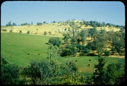
- Description:
- 100 f 8 tl
- Subject:
- Croplands, Roads, Cattle, Shrubs, Grazing, and Grasses
- Series:
- 13-56
- Creator:
- Cushman, Charles W., 1896-1972
- Date Created:
- 1956-10-22
- Genre:
- Landscape photographs
- Frame Number:
- 7
- County:
- San Mateo
- Abstract:
- Cattle in a nearby field
- Call Number:
- P08980
- City:
- San Gregorio and Pescadero
- Country:
- United States
- State/Province:
- California
- Alternate Identifier:
- 1356.7
- Persistent URL:
- http://purl.dlib.indiana.edu/iudl/archives/cushman/P08980
- Holding Location:
- Bloomington - University Archives
Wells Library E460
1320 E 10th St.
Bloomington, IN 47405
Contact at archives@indiana.edu, 812-855-1127
-
- Description:
- 100 f 6.3 tl
- Subject:
- Grasses, Meadows, Croplands, Shrubs, and Hay
- Series:
- 13-56
- Creator:
- Cushman, Charles W., 1896-1972
- Date Created:
- 1956-10-22
- Genre:
- Landscape photographs
- Frame Number:
- 6
- Street Address:
- California State Highway 1 and Pacific Coast Highway
- County:
- San Mateo
- Abstract:
- Looking down on newly cut hayfield - along old road between San Gregorio & Pescadero
- Call Number:
- P08979
- City:
- Pescadero and San Gregorio
- Country:
- United States
- State/Province:
- California
- Alternate Identifier:
- 1356.6
- Persistent URL:
- http://purl.dlib.indiana.edu/iudl/archives/cushman/P08979
- Holding Location:
- Bloomington - University Archives
Wells Library E460
1320 E 10th St.
Bloomington, IN 47405
Contact at archives@indiana.edu, 812-855-1127
-
- Description:
- 100 f 7 TL
- Subject:
- Valleys, Grasses, Poppies, Flowers, Becker Valley (Calif.), Shrubs, Hills, and Meadows
- Series:
- 6-56
- Creator:
- Cushman, Charles W., 1896-1972
- Date Created:
- 1956-04-22
- Genre:
- Landscape photographs
- Frame Number:
- 10
- County:
- San Benito
- Call Number:
- P08720
- Country:
- United States
- State/Province:
- California
- Alternate Identifier:
- 656.10
- Persistent URL:
- http://purl.dlib.indiana.edu/iudl/archives/cushman/P08720
- Holding Location:
- Bloomington - University Archives
Wells Library E460
1320 E 10th St.
Bloomington, IN 47405
Contact at archives@indiana.edu, 812-855-1127
-
- Description:
- 100 f 8 TL
- Subject:
- Grasses, Flowers, Solanaceae, Hames Valley (Calif.), and Shrubs
- Series:
- 5-56
- Creator:
- Cushman, Charles W., 1896-1972
- Date Created:
- 1956-04-21
- Genre:
- Identification photographs
- Frame Number:
- 35
- County:
- Monterey
- Abstract:
- Lovely bush with blue flower - Hames Valley Solanum (nightshade)
- Call Number:
- P08708
- Country:
- United States
- State/Province:
- California
- Alternate Identifier:
- 556.35
- Persistent URL:
- http://purl.dlib.indiana.edu/iudl/archives/cushman/P08708
- Holding Location:
- Bloomington - University Archives
Wells Library E460
1320 E 10th St.
Bloomington, IN 47405
Contact at archives@indiana.edu, 812-855-1127
-
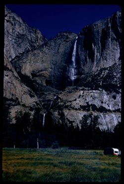
- Description:
- 100 f 6.3 50mm
- Subject:
- Trailers, Grasses, Upper Yosemite Fall (Calif.), Yosemite Falls (Calif.), Waterfalls, Trees, Rock formations, and Shrubs
- Series:
- 19-55
- Creator:
- Cushman, Charles W., 1896-1972
- Date Created:
- 1955-07-07
- Genre:
- Landscape photographs
- Frame Number:
- 10
- County:
- Mariposa
- Abstract:
- Yosemite Falls from Old Village
- Call Number:
- P08162
- Country:
- United States
- State/Province:
- California
- Alternate Identifier:
- 1955.10
- Persistent URL:
- http://purl.dlib.indiana.edu/iudl/archives/cushman/P08162
- Holding Location:
- Bloomington - University Archives
Wells Library E460
1320 E 10th St.
Bloomington, IN 47405
Contact at archives@indiana.edu, 812-855-1127
-
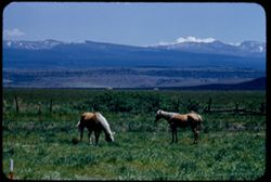
- Description:
- 100 f 6.3 tl
- Subject:
- Snow, Grasses, Grazing, Horses, Trees, Mountains, Fences, Shrubs, and Clouds
- Series:
- 18-55
- Creator:
- Cushman, Charles W., 1896-1972
- Date Created:
- 1955-06-18
- Genre:
- Identification photographs
- Frame Number:
- 16
- County:
- Modoc
- Abstract:
- Blond horses 3.3. mi south of Alturas
- Call Number:
- P08133
- City:
- Alturas
- Country:
- United States
- State/Province:
- California
- Alternate Identifier:
- 1855.16
- Persistent URL:
- http://purl.dlib.indiana.edu/iudl/archives/cushman/P08133
- Holding Location:
- Bloomington - University Archives
Wells Library E460
1320 E 10th St.
Bloomington, IN 47405
Contact at archives@indiana.edu, 812-855-1127
-
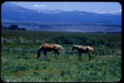
- Description:
- 100 f 6.3 tl
- Subject:
- Horses, Mountains, Shrubs, Snow, Trees, Grazing, Grasses, Fences, and Clouds
- Series:
- 18-55
- Creator:
- Cushman, Charles W., 1896-1972
- Date Created:
- 1955-06-18
- Genre:
- Identification photographs
- Frame Number:
- 15
- County:
- Modoc
- Abstract:
- Blond horses 3.3 mi south of Alturas
- Call Number:
- P08132
- City:
- Alturas
- Country:
- United States
- State/Province:
- California
- Alternate Identifier:
- 1855.15
- Persistent URL:
- http://purl.dlib.indiana.edu/iudl/archives/cushman/P08132
- Holding Location:
- Bloomington - University Archives
Wells Library E460
1320 E 10th St.
Bloomington, IN 47405
Contact at archives@indiana.edu, 812-855-1127
-
- Description:
- 100 f 6.3 tl
- Subject:
- Grasses, Automobiles, Mountains, Shrubs, Railroad tracks, Dwellings, Utility poles, and Electric lines
- Series:
- 18-55
- Creator:
- Cushman, Charles W., 1896-1972
- Date Created:
- 1955-06-18
- Genre:
- Landscape photographs
- Frame Number:
- 11
- Street Address:
- California State Highway 139
- County:
- Modoc
- Abstract:
- Odd slope on other side of Hwy 139
- Call Number:
- P08128
- Country:
- United States
- State/Province:
- California
- Alternate Identifier:
- 1855.11
- Persistent URL:
- http://purl.dlib.indiana.edu/iudl/archives/cushman/P08128
- Holding Location:
- Bloomington - University Archives
Wells Library E460
1320 E 10th St.
Bloomington, IN 47405
Contact at archives@indiana.edu, 812-855-1127
-
- Description:
- 100 f6 tl
- Subject:
- Grasses, Buttes, Croplands, Fences, Shrubs, Dwellings, and Utility poles
- Series:
- 18-55
- Creator:
- Cushman, Charles W., 1896-1972
- Date Created:
- 1955-06-18
- Genre:
- Landscape photographs
- Frame Number:
- 10
- Street Address:
- California State Highway 139
- County:
- Modoc
- Abstract:
- Broad butte near stronghold, Modoc county
- Call Number:
- P08127
- Country:
- United States
- State/Province:
- California
- Alternate Identifier:
- 1855.10
- Persistent URL:
- http://purl.dlib.indiana.edu/iudl/archives/cushman/P08127
- Holding Location:
- Bloomington - University Archives
Wells Library E460
1320 E 10th St.
Bloomington, IN 47405
Contact at archives@indiana.edu, 812-855-1127
-
- Description:
- 100 f 6.3 tl
- Subject:
- Hills, Bodies of water, Mountains, Shrubs, Snow, Trees, Clouds, Fences, Shasta, Mount (Calif. : Mountain), and Grasses
- Series:
- 18-55
- Creator:
- Cushman, Charles W., 1896-1972
- Date Created:
- 1955-06-17
- Genre:
- Landscape photographs
- Frame Number:
- 2
- County:
- Siskiyou
- Abstract:
- Mt. Shasta at 2:35 from road east of Grenada
- Call Number:
- P08119
- City:
- Grenada
- Country:
- United States
- State/Province:
- California
- Alternate Identifier:
- 1855.2
- Persistent URL:
- http://purl.dlib.indiana.edu/iudl/archives/cushman/P08119
- Holding Location:
- Bloomington - University Archives
Wells Library E460
1320 E 10th St.
Bloomington, IN 47405
Contact at archives@indiana.edu, 812-855-1127
-
- Description:
- 100 f 6.3 tl
- Subject:
- Grasses, Trees, Croplands, Fences, Shrubs, and Mountains
- Series:
- 17-55
- Creator:
- Cushman, Charles W., 1896-1972
- Date Created:
- 1955-06-17
- Genre:
- Landscape photographs
- Frame Number:
- 36
- Street Address:
- United States Highway 99
- County:
- Siskiyou
- Abstract:
- Far-off landscape from US 99 10 mi. NW of Weed
- Call Number:
- P08115
- City:
- Weed
- Country:
- United States
- State/Province:
- California
- Alternate Identifier:
- 1755.36
- Persistent URL:
- http://purl.dlib.indiana.edu/iudl/archives/cushman/P08115
- Holding Location:
- Bloomington - University Archives
Wells Library E460
1320 E 10th St.
Bloomington, IN 47405
Contact at archives@indiana.edu, 812-855-1127
-
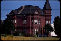
- Description:
- 100 f 5 tl
- Subject:
- Chimneys, Houses, Automobiles, Windows, Utility poles, Electric lines, Trees, Grasses, and Shrubs
- Series:
- 15-55
- Creator:
- Cushman, Charles W., 1896-1972
- Date Created:
- 1955-06-15
- Genre:
- Architectural photographs
- Frame Number:
- 36
- Street Address:
- Ninth Street and G Street
- County:
- Humboldt
- Abstract:
- Old red house at 9th & G Sts.
- Call Number:
- P08043
- City:
- Eureka
- Country:
- United States
- State/Province:
- California
- Alternate Identifier:
- 1555.36
- Persistent URL:
- http://purl.dlib.indiana.edu/iudl/archives/cushman/P08043
- Holding Location:
- Bloomington - University Archives
Wells Library E460
1320 E 10th St.
Bloomington, IN 47405
Contact at archives@indiana.edu, 812-855-1127
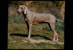
-
- Description:
- 100 f 5.6 tl
- Subject:
- Grasses, Dogs, Fences, and Shrubs
- Series:
- 13-55
- Creator:
- Cushman, Charles W., 1896-1972
- Date Created:
- 1955-04-08
- Genre:
- Identification photographs
- Frame Number:
- 24
- Street Address:
- Palomares Road
- County:
- Alameda
- Abstract:
- Katy alone
- Call Number:
- P07958
- Country:
- United States
- State/Province:
- California
- Physical Description:
- masked.
- Alternate Identifier:
- 1355.24
- Persistent URL:
- http://purl.dlib.indiana.edu/iudl/archives/cushman/P07958
- Holding Location:
- Bloomington - University Archives
Wells Library E460
1320 E 10th St.
Bloomington, IN 47405
Contact at archives@indiana.edu, 812-855-1127
-
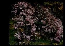
- Description:
- 100 f 7 tl 40'
- Subject:
- Grasses, Golden Gate Park (San Francisco, Calif.), Trees, Flowers, Japanese Tea Garden (San Francisco, Calif.), Cherry trees, Japanese gardens, and Shrubs
- Series:
- 13-55
- Creator:
- Cushman, Charles W., 1896-1972
- Date Created:
- 1955-03-31
- Genre:
- Identification photographs
- Frame Number:
- 12
- County:
- San Francisco
- Abstract:
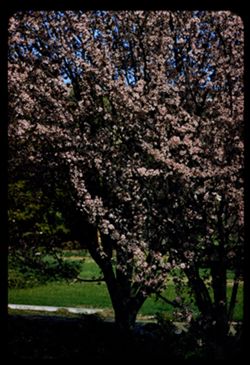
- Dwarf, pendulant cherry
- Call Number:
- P07946
- City:
- San Francisco
- Country:
- United States
- State/Province:
- California
- Physical Description:
- masked.
- Alternate Identifier:
- 1355.12
- Persistent URL:
- http://purl.dlib.indiana.edu/iudl/archives/cushman/P07946
- Holding Location:
- Bloomington - University Archives
Wells Library E460
1320 E 10th St.
Bloomington, IN 47405
Contact at archives@indiana.edu, 812-855-1127
-
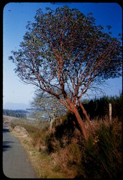
- Description:
- 25 f 10
- Subject:
- Grasses, Roads, Madrono, Trees, Flowers, Mountains, Shrubs, Pacific madrone, and Hills
- Series:
- 1-55
- Creator:
- Cushman, Charles W., 1896-1972
- Date Created:
- 1955-01-23
- Genre:
- Identification photographs
- Frame Number:
- 1
- County:
- Sonoma
- Abstract:
- Madrone - Sonoma county north of Bloomfield
- Call Number:
- P07540
- City:
- Bloomfield
- Country:
- United States
- State/Province:
- California
- Alternate Identifier:
- 155.1
- Persistent URL:
- http://purl.dlib.indiana.edu/iudl/archives/cushman/P07540
- Holding Location:
- Bloomington - University Archives
Wells Library E460
1320 E 10th St.
Bloomington, IN 47405
Contact at archives@indiana.edu, 812-855-1127
-
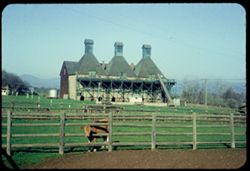
- Description:
- 50 f 8
- Subject:
- Cupolas, Kilns, Cows, Fenton Acres (Healdsburg, Calif.), Shrubs, Electric lines, Russian River (Calif.), Farms, Barns, Grasses, Fences, Storage tanks, Utilit...
- Series:
- 17-54
- Creator:
- Cushman, Charles W., 1896-1972
- Date Created:
- 1954-12-08
- Genre:
- Architectural photographs
- Frame Number:
- 16
- County:
- Sonoma
- Abstract:
- Jersey cow and barn with three cupoles & kilns (Fenton Acres)
- Call Number:
- P07534
- City:
- Healdsburg
- Country:
- United States
- State/Province:
- California
- Physical Description:
- Anscochrome film.
- Alternate Identifier:
- 1754.16
- Persistent URL:
- http://purl.dlib.indiana.edu/iudl/archives/cushman/P07534
- Holding Location:
- Bloomington - University Archives
Wells Library E460
1320 E 10th St.
Bloomington, IN 47405
Contact at archives@indiana.edu, 812-855-1127
-
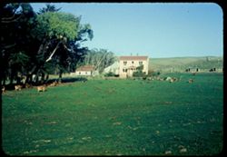
- Description:
- 50 f 8
- Subject:
- Dairy farming, Farmhouses, Grazing, Farms, Trees, Tomales Bay (Calif.), Fences, Shrubs, Cows, Bleu Baie Tavern (Marshall, Calif.), Hills, Agricultural facili...
- Series:
- 17-54
- Creator:
- Cushman, Charles W., 1896-1972
- Date Created:
- 1954-11-27
- Genre:
- Landscape photographs
- Frame Number:
- 14
- Street Address:
- California State Highway 1
- County:
- Marin
- Abstract:
- Cows green pasture & yellow house [L] near Bleu Baie Tomales Bay
- Call Number:
- P07532
- Country:
- United States
- State/Province:
- California
- Physical Description:
- Anscochrome film.
- Alternate Identifier:
- 1754.14
- Persistent URL:
- http://purl.dlib.indiana.edu/iudl/archives/cushman/P07532
- Holding Location:
- Bloomington - University Archives
Wells Library E460
1320 E 10th St.
Bloomington, IN 47405
Contact at archives@indiana.edu, 812-855-1127
-
- Description:
- 50 f 6.3
- Subject:
- Rocks, Grasses, Squaw Rock (Hopland, Calif.), Russian River (Calif.), Trees, Shrubs, Reflections, Rivers, and Rock formations
- Series:
- 16-54
- Creator:
- Cushman, Charles W., 1896-1972
- Date Created:
- 1954-11-04
- Genre:
- Landscape photographs
- Frame Number:
- 19
- Street Address:
- United States Highway 101
- County:
- Sonoma
- Abstract:
- Squaw Rock above Rus. Riv.
- Call Number:
- P07518
- City:
- Cloverdale
- Country:
- United States
- State/Province:
- California
- Physical Description:
- Anscochrome film.
- Alternate Identifier:
- 1654.19
- Persistent URL:
- http://purl.dlib.indiana.edu/iudl/archives/cushman/P07518
- Holding Location:
- Bloomington - University Archives
Wells Library E460
1320 E 10th St.
Bloomington, IN 47405
Contact at archives@indiana.edu, 812-855-1127
-
- Description:
- 50 f 9
- Subject:
- Grasses, Trees, Buttes, Sierra Buttes (Calif.), and Shrubs
- Series:
- 15-54
- Creator:
- Cushman, Charles W., 1896-1972
- Date Created:
- 1954-10-11
- Genre:
- Landscape photographs
- Frame Number:
- 12
- County:
- Butte
- Abstract:
- Buttes from which the county is named from 12 mi. SE of Chico.
- Call Number:
- P07491
- City:
- Chico
- Country:
- United States
- State/Province:
- California
- Physical Description:
- Image was originally mounted in a glass enclosure. Before digitization, the image was removed and placed in a Wess Plastic, Inc. brand, 2" x 2", pl...
- Alternate Identifier:
- 1554.12
- Persistent URL:
- http://purl.dlib.indiana.edu/iudl/archives/cushman/P07491
- Holding Location:
- Bloomington - University Archives
Wells Library E460
1320 E 10th St.
Bloomington, IN 47405
Contact at archives@indiana.edu, 812-855-1127
-
- Description:
- 50 f 8
- Subject:
- Road cuts, Erosion, Roads, Trees, Western Pacific Railroad Company, Shrubs, Grasses, and Cliffs
- Series:
- 14-54
- Creator:
- Cushman, Charles W., 1896-1972
- Date Created:
- 1954-10-10
- Frame Number:
- 32
- Street Address:
- United States Highway 40
- County:
- Plumas
- Abstract:
- From same point, view up cliff above US 40 Alt.
- Call Number:
- P07473
- City:
- Keddie
- Country:
- United States
- State/Province:
- California
- Alternate Identifier:
- 1454.32
- Persistent URL:
- http://purl.dlib.indiana.edu/iudl/archives/cushman/P07473
- Holding Location:
- Bloomington - University Archives
Wells Library E460
1320 E 10th St.
Bloomington, IN 47405
Contact at archives@indiana.edu, 812-855-1127
-
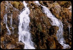
- Description:
- 50 f 6.3
- Subject:
- Rocks, Grasses, Big Springs (Sierra County, Calif.), Waterfalls, Shrubs, Lichens, and Plants
- Series:
- 14-54
- Creator:
- Cushman, Charles W., 1896-1972
- Date Created:
- 1954-10-10
- Frame Number:
- 17
- Street Address:
- California State Highway 49
- County:
- Sierra
- Abstract:
- Big Spring at side of Hwy 49 a few miles (3 or 4) NE of Sierra City.
- Call Number:
- P07459
- City:
- Sierra City
- Country:
- United States
- State/Province:
- California
- Alternate Identifier:
- 1454.17
- Persistent URL:
- http://purl.dlib.indiana.edu/iudl/archives/cushman/P07459
- Holding Location:
- Bloomington - University Archives
Wells Library E460
1320 E 10th St.
Bloomington, IN 47405
Contact at archives@indiana.edu, 812-855-1127
-
- Description:
- 50 f 8
- Subject:
- Grasses, Grazing, Trees, Meadows, Cattle, Fences, Shrubs, Cows, and Hills
- Series:
- 13-54
- Creator:
- Cushman, Charles W., 1896-1972
- Date Created:
- 1954-10-09
- Genre:
- Identification photographs
- Frame Number:
- 14
- Street Address:
- California State Highway 20
- County:
- Yuba
- Abstract:
- Grazing Herefords on hillside below Cal 20 near Smartville.
- Call Number:
- P07437
- City:
- Smartville
- Country:
- United States
- State/Province:
- California
- Alternate Identifier:
- 1354.14
- Persistent URL:
- http://purl.dlib.indiana.edu/iudl/archives/cushman/P07437
- Holding Location:
- Bloomington - University Archives
Wells Library E460
1320 E 10th St.
Bloomington, IN 47405
Contact at archives@indiana.edu, 812-855-1127
-
- Description:
- 50 f 6.3
- Subject:
- Yuba River (Calif.), Meadows, Hills, Shrubs, Trees, Grasses, Wildflowers, and Fences
- Series:
- 13-54
- Creator:
- Cushman, Charles W., 1896-1972
- Date Created:
- 1954-10-09
- Genre:
- Landscape photographs
- Frame Number:
- 12
- Street Address:
- California State Highway 20
- County:
- Yuba
- Abstract:
- Tree clad hills above Yuba river near bridge of Cal 20.
- Call Number:
- P07435
- Country:
- United States
- State/Province:
- California
- Alternate Identifier:
- 1354.12
- Persistent URL:
- http://purl.dlib.indiana.edu/iudl/archives/cushman/P07435
- Holding Location:
- Bloomington - University Archives
Wells Library E460
1320 E 10th St.
Bloomington, IN 47405
Contact at archives@indiana.edu, 812-855-1127
-
- Description:
- 50 f 9
- Subject:
- Rocks, Grasses, Middle Palisade Glacier (Calif.), Trees, Flowers, Mountains, Shrubs, and Sierra Nevada (Calif. and Nev.)
- Series:
- 12-54
- Creator:
- Cushman, Charles W., 1896-1972
- Date Created:
- 1954-09-18
- Genre:
- Landscape photographs
- Frame Number:
- 10
- County:
- Inyo
- Abstract:
- Again - with yellow.
- Call Number:
- P07400
- City:
- Lone Pine
- Country:
- United States
- State/Province:
- California
- Alternate Identifier:
- 1254.10
- Persistent URL:
- http://purl.dlib.indiana.edu/iudl/archives/cushman/P07400
- Holding Location:
- Bloomington - University Archives
Wells Library E460
1320 E 10th St.
Bloomington, IN 47405
Contact at archives@indiana.edu, 812-855-1127
-
- Description:
- 50 f 10
- Subject:
- Mountains, Shrubs, Sierra Nevada (Calif. and Nev.), and Grasses
- Series:
- 12-54
- Creator:
- Cushman, Charles W., 1896-1972
- Date Created:
- 1954-09-18
- Genre:
- Landscape photographs
- Frame Number:
- 8
- Street Address:
- Glacier Lodge Road
- County:
- Inyo
- Abstract:
- White top of Pyramidal peak - from Glacier Lodge.
- Call Number:
- P07398
- City:
- Big Pine
- Country:
- United States
- State/Province:
- California
- Alternate Identifier:
- 1254.8
- Persistent URL:
- http://purl.dlib.indiana.edu/iudl/archives/cushman/P07398
- Holding Location:
- Bloomington - University Archives
Wells Library E460
1320 E 10th St.
Bloomington, IN 47405
Contact at archives@indiana.edu, 812-855-1127
-
- Description:
- 25 f 8
- Subject:
- Grasses, Barbed wire, Trees, Fences, Shrubs, and Gates
- Series:
- 11-54
- Creator:
- Cushman, Charles W., 1896-1972
- Date Created:
- 1954-09-17
- Frame Number:
- 19
- Street Address:
- Hanby Street and East Pine Street
- County:
- Inyo
- Abstract:
- Bishop Calif noon. Gate at E. Pine + Hanby.
- Call Number:
- P07388
- City:
- Bishop
- Country:
- United States
- State/Province:
- California
- Alternate Identifier:
- 1154.19
- Persistent URL:
- http://purl.dlib.indiana.edu/iudl/archives/cushman/P07388
- Holding Location:
- Bloomington - University Archives
Wells Library E460
1320 E 10th St.
Bloomington, IN 47405
Contact at archives@indiana.edu, 812-855-1127
-
- Description:
- 50 f 11 HF
- Subject:
- Valleys, Grasses, White Mountains (Calif. and Nev.), Trees, Owens Valley (Calif.), Mountains, and Shrubs
- Series:
- 11-54
- Creator:
- Cushman, Charles W., 1896-1972
- Date Created:
- 1954-09-17
- Genre:
- Landscape photographs
- Frame Number:
- 20
- County:
- Inyo
- Abstract:
- White Mtns east wall of Owens Valley with 2 bare trees.
- Call Number:
- P07389
- Country:
- United States
- State/Province:
- California and Nevada
- Alternate Identifier:
- 1154.20
- Persistent URL:
- http://purl.dlib.indiana.edu/iudl/archives/cushman/P07389
- Holding Location:
- Bloomington - University Archives
Wells Library E460
1320 E 10th St.
Bloomington, IN 47405
Contact at archives@indiana.edu, 812-855-1127
-
- Description:
- 50 f 9
- Subject:
- Flowers, Hills, Roads, Mountains, Shrubs, Sierra Nevada (Calif. and Nev.), Trees, Rocks, and Grasses
- Series:
- 11-54
- Creator:
- Cushman, Charles W., 1896-1972
- Date Created:
- 1954-09-17
- Genre:
- Landscape photographs
- Frame Number:
- 5
- Street Address:
- Sabrina Lake Road
- County:
- Inyo
- Abstract:
- High Sierra seen from Sabrina Lake road SW of Bishop.
- Call Number:
- P07374
- City:
- Bishop
- Country:
- United States
- State/Province:
- California
- Alternate Identifier:
- 1154.5
- Persistent URL:
- http://purl.dlib.indiana.edu/iudl/archives/cushman/P07374
- Holding Location:
- Bloomington - University Archives
Wells Library E460
1320 E 10th St.
Bloomington, IN 47405
Contact at archives@indiana.edu, 812-855-1127
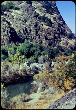
-
- Description:
- 50 f 9
- Subject:
- Rocks, Canyons, Grasses, Trees, Flowers, Lee Vining Creek (Calif.), Mountains, Shrubs, and Lee Vining Canyon (Calif.)
- Series:
- 10-54
- Creator:
- Cushman, Charles W., 1896-1972
- Date Created:
- 1954-09-16
- Genre:
- Landscape photographs
- Frame Number:
- 21
- County:
- Mono
- Abstract:
- Another view east down canyon.
- Call Number:
- P07368
- Country:
- United States
- State/Province:
- California
- Physical Description:
- Anscochrome film.
- Alternate Identifier:
- 1054.21
- Persistent URL:
- http://purl.dlib.indiana.edu/iudl/archives/cushman/P07368
- Holding Location:
- Bloomington - University Archives
Wells Library E460
1320 E 10th St.
Bloomington, IN 47405
Contact at archives@indiana.edu, 812-855-1127
-
- Description:
- 50 f 9
- Subject:
- Rocks, Canyons, Grasses, Roads, Yosemite National Park (Calif.), Trees, Pines, Lee Vining Creek (Calif.), Tioga Peak (Calif.), Tioga Pass (Calif.), Mountains...
- Series:
- 9-54
- Creator:
- Cushman, Charles W., 1896-1972
- Date Created:
- 1954-09-16
- Genre:
- Landscape photographs
- Frame Number:
- 30
- Street Address:
- Tioga Pass Road
- County:
- Mono
- Abstract:
- Tioga Peak from east. 11,537 ft.
- Call Number:
- P07341
- Country:
- United States
- State/Province:
- California
- Alternate Identifier:
- 954.30
- Persistent URL:
- http://purl.dlib.indiana.edu/iudl/archives/cushman/P07341
- Holding Location:
- Bloomington - University Archives
Wells Library E460
1320 E 10th St.
Bloomington, IN 47405
Contact at archives@indiana.edu, 812-855-1127
-
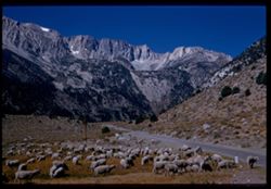
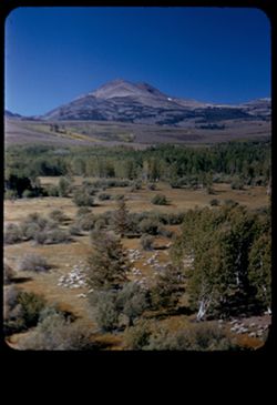
- Description:
- 50 f 10
- Subject:
- Sheep, Lee Vining Creek (Calif.), Deserts, Dana Plateau (Calif.), Roads, Mountains, Yosemite National Park (Calif.), Shrubs, Trees, Rocks, Grazing, Grasses, ...
- Series:
- 9-54
- Creator:
- Cushman, Charles W., 1896-1972
- Date Created:
- 1954-09-16
- Genre:
- Identification photographs
- Frame Number:
- 28
- Street Address:
- Tioga Pass Road
- County:
- Mono
- Abstract:
- Sheep along Tioga Pass road.
- Call Number:
- P07339
- Country:
- United States
- State/Province:
- California
- Physical Description:
- Image was originally mounted in a glass enclosure. Before digitization, the image was removed and placed in a Wess Plastic, Inc. brand, 2" x 2", pl...
- Alternate Identifier:
- 954.28
- Persistent URL:
- http://purl.dlib.indiana.edu/iudl/archives/cushman/P07339
- Holding Location:
- Bloomington - University Archives
Wells Library E460
1320 E 10th St.
Bloomington, IN 47405
Contact at archives@indiana.edu, 812-855-1127
-
- Description:
- 50 f 10
- Subject:
- Lee Vining Creek (Calif.), Deserts, Flowers, Dana, Mount (Calif.), Dana Plateau (Calif.), Roads, Mountains, Yosemite National Park (Calif.), Shrubs, Trees, R...
- Series:
- 9-54
- Creator:
- Cushman, Charles W., 1896-1972
- Date Created:
- 1954-09-16
- Genre:
- Landscape photographs
- Frame Number:
- 27
- County:
- Mono
- Abstract:
- Great east wall of Mt. Dana.
- Call Number:
- P07338
- Country:
- United States
- State/Province:
- California
- Alternate Identifier:
- 954.27
- Persistent URL:
- http://purl.dlib.indiana.edu/iudl/archives/cushman/P07338
- Holding Location:
- Bloomington - University Archives
Wells Library E460
1320 E 10th St.
Bloomington, IN 47405
Contact at archives@indiana.edu, 812-855-1127
-
- Description:
- 50 f 9
- Subject:
- Rocks, Dana Plateau (Calif.), Grasses, Yosemite National Park (Calif.), Trees, Volcanoes, Gibbs, Mount (Calif.), Dana, Mount (Calif.), Mountains, and Shrubs
- Series:
- 9-54
- Creator:
- Cushman, Charles W., 1896-1972
- Date Created:
- 1954-09-16
- Genre:
- Landscape photographs
- Frame Number:
- 26
- Street Address:
- Tioga Pass Road
- County:
- Mono
- Abstract:
- Mt. Gibbs - to south of Dana.
- Call Number:
- P07337
- Country:
- United States
- State/Province:
- California
- Alternate Identifier:
- 954.26
- Persistent URL:
- http://purl.dlib.indiana.edu/iudl/archives/cushman/P07337
- Holding Location:
- Bloomington - University Archives
Wells Library E460
1320 E 10th St.
Bloomington, IN 47405
Contact at archives@indiana.edu, 812-855-1127
-
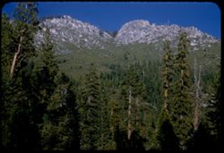
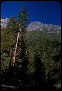
- Description:
- 50 f 11
- Subject:
- Dana, Mount (Calif.), Mountains, Yosemite National Park (Calif.), Shrubs, Trees, Rocks, Grasses, and Volcanoes
- Series:
- 9-54
- Creator:
- Cushman, Charles W., 1896-1972
- Date Created:
- 1954-09-16
- Genre:
- Landscape photographs
- Frame Number:
- 25
- Street Address:
- Tioga Pass Road
- County:
- Mono
- Abstract:
- Mt. Dana from east. (13,050 elev.)
- Call Number:
- P07336
- Country:
- United States
- State/Province:
- California
- Alternate Identifier:
- 954.25
- Persistent URL:
- http://purl.dlib.indiana.edu/iudl/archives/cushman/P07336
- Holding Location:
- Bloomington - University Archives
Wells Library E460
1320 E 10th St.
Bloomington, IN 47405
Contact at archives@indiana.edu, 812-855-1127
-
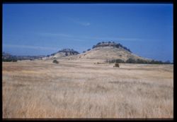
- Description:
- 50 f 9
- Subject:
- Sheep, Hills, Mountains, Shrubs, Sierra Nevada (Calif. and Nev.), Trees, Grazing, Grasses, and Dunderberg Peak (Calif.)
- Series:
- 9-54
- Creator:
- Cushman, Charles W., 1896-1972
- Date Created:
- 1954-09-16
- Genre:
- Landscape photographs
- Frame Number:
- 20
- Street Address:
- United States Highway 395
- County:
- Mono
- Abstract:
- Sheep below - looking toward Dunderberg Pk. (19-20-21 were taken less than mile north of Conway Summit)
- Call Number:
- P07331
- City:
- Bridgeport
- Country:
- United States
- State/Province:
- California
- Physical Description:
- masked.
- Alternate Identifier:
- 954.20
- Persistent URL:
- http://purl.dlib.indiana.edu/iudl/archives/cushman/P07331
- Holding Location:
- Bloomington - University Archives
Wells Library E460
1320 E 10th St.
Bloomington, IN 47405
Contact at archives@indiana.edu, 812-855-1127
-
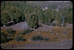
- Description:
- 50 f 9
- Subject:
- Grasses, Grazing, Trees, Conway Summit (Calif.), Mountains, Shrubs, Sheep, and Hills
- Series:
- 9-54
- Creator:
- Cushman, Charles W., 1896-1972
- Date Created:
- 1954-09-16
- Genre:
- Identification photographs
- Frame Number:
- 19
- Street Address:
- United States Highway 395
- County:
- Mono
- Abstract:
- Sheep below. (19-20-21 were taken less than mile north of Conway Summit)
- Call Number:
- P07330
- City:
- Bridgeport
- Country:
- United States
- State/Province:
- California
- Alternate Identifier:
- 954.19
- Persistent URL:
- http://purl.dlib.indiana.edu/iudl/archives/cushman/P07330
- Holding Location:
- Bloomington - University Archives
Wells Library E460
1320 E 10th St.
Bloomington, IN 47405
Contact at archives@indiana.edu, 812-855-1127
-
- Description:
- 50 f 8
- Subject:
- Grasses, Trees, Shadows, Buttes, Mountains, Rock formations, Sonora Peak (Calif.), and Shrubs
- Series:
- 9-54
- Creator:
- Cushman, Charles W., 1896-1972
- Date Created:
- 1954-09-15
- Genre:
- Landscape photographs
- Frame Number:
- 7
- Street Address:
- Sonora Pass Road
- County:
- Tuolumne
- Abstract:
- Up at sun lit escarpment east of Dardanelle.
- Call Number:
- P07318
- City:
- Dardanelle
- Country:
- United States
- State/Province:
- California
- Alternate Identifier:
- 954.7
- Persistent URL:
- http://purl.dlib.indiana.edu/iudl/archives/cushman/P07318
- Holding Location:
- Bloomington - University Archives
Wells Library E460
1320 E 10th St.
Bloomington, IN 47405
Contact at archives@indiana.edu, 812-855-1127
-
- Description:
- 50 f 8
- Subject:
- Rocks, Grasses, Trees, Buttes, Stanislaus River (Calif.), Mountains, Rock formations, and Shrubs
- Series:
- 9-54
- Creator:
- Cushman, Charles W., 1896-1972
- Date Created:
- 1954-09-15
- Genre:
- Landscape photographs
- Frame Number:
- 6
- Street Address:
- California State Highway 108
- County:
- Tuolumne
- Abstract:
- Looking up at granite ridge from Hwy 108 far below. 5:30 PM.
- Call Number:
- P07317
- City:
- Dardanelle
- Country:
- United States
- State/Province:
- California
- Alternate Identifier:
- 954.6
- Persistent URL:
- http://purl.dlib.indiana.edu/iudl/archives/cushman/P07317
- Holding Location:
- Bloomington - University Archives
Wells Library E460
1320 E 10th St.
Bloomington, IN 47405
Contact at archives@indiana.edu, 812-855-1127
-
- Description:
- 50 f 8
- Subject:
- Rocks, Stanislaus River Canyon (Calif.), Grasses, Trees, Buttes, Mountains, Shrubs, and Rock formations
- Series:
- 9-54
- Creator:
- Cushman, Charles W., 1896-1972
- Date Created:
- 1954-09-15
- Genre:
- Landscape photographs
- Frame Number:
- 5
- Street Address:
- California State Highway 108
- County:
- Tuolumne
- Abstract:
- Looking up at granite ridge from Hwy 108 far below. 5:30 PM.
- Call Number:
- P07316
- City:
- Dardanelle
- Country:
- United States
- State/Province:
- California
- Alternate Identifier:
- 954.5
- Persistent URL:
- http://purl.dlib.indiana.edu/iudl/archives/cushman/P07316
- Holding Location:
- Bloomington - University Archives
Wells Library E460
1320 E 10th St.
Bloomington, IN 47405
Contact at archives@indiana.edu, 812-855-1127
-
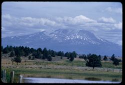
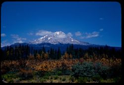
- Description:
- 50 f 9
- Subject:
- Snow, Cascade Range, Grasses, Trees, Volcanoes, Lassen Volcanic National Park (Calif.), Mountains, Shrubs, Mount Shasta (Calif. : Mountain), and Stratovolcanoes
- Series:
- 7-54
- Creator:
- Cushman, Charles W., 1896-1972
- Date Created:
- 1954-08-21
- Genre:
- Landscape photographs
- Frame Number:
- 2
- Street Address:
- California State Highway 89
- County:
- Siskiyou
- Abstract:
- Mt Shasta from Cal. 89 on SE.
- Call Number:
- P07258
- Country:
- United States
- State/Province:
- California
- Physical Description:
- Image was originally mounted in a glass enclosure. Before digitization, the image was removed and placed in a Wess Plastic, Inc. brand, 2" x 2", pl...
- Alternate Identifier:
- 754.2
- Persistent URL:
- http://purl.dlib.indiana.edu/iudl/archives/cushman/P07258
- Holding Location:
- Bloomington - University Archives
Wells Library E460
1320 E 10th St.
Bloomington, IN 47405
Contact at archives@indiana.edu, 812-855-1127
-
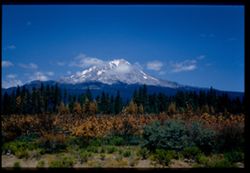
- Description:
- 50 f 10
- Subject:
- Snow, Cascade Range, Grasses, Trees, Volcanoes, Stratovolcanoes, Mountains, Shrubs, Mount Shasta (Calif. : Mountain), and Lassen Volcanic National Park (Calif.)
- Series:
- 7-54
- Creator:
- Cushman, Charles W., 1896-1972
- Date Created:
- 1954-08-21
- Genre:
- Landscape photographs
- Frame Number:
- 1
- Street Address:
- California State Highway 89
- County:
- Siskiyou
- Abstract:
- Mt Shasta from Cal. 89 on SE.
- Call Number:
- P07257
- Country:
- United States
- State/Province:
- California
- Alternate Identifier:
- 754.1
- Persistent URL:
- http://purl.dlib.indiana.edu/iudl/archives/cushman/P07257
- Holding Location:
- Bloomington - University Archives
Wells Library E460
1320 E 10th St.
Bloomington, IN 47405
Contact at archives@indiana.edu, 812-855-1127
-
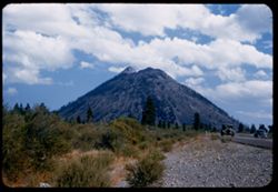
- Description:
- 50 f 6.3
- Subject:
- Cascade Range, Grasses, Roads, Shasta, Mount (Calif. : Mountain), Trees, Volcanoes, Buttes, Lassen Volcanic National Park (Calif.), Lava domes, Shrubs, Black...
- Series:
- 6-54
- Creator:
- Cushman, Charles W., 1896-1972
- Date Created:
- 1954-08-20
- Genre:
- Landscape photographs
- Frame Number:
- 31
- Street Address:
- United States Highway 99
- County:
- Siskiyou
- Abstract:
- Black Butte from N on 99.
- Call Number:
- P07248
- Country:
- United States
- State/Province:
- California
- Alternate Identifier:
- 654.31
- Persistent URL:
- http://purl.dlib.indiana.edu/iudl/archives/cushman/P07248
- Holding Location:
- Bloomington - University Archives
Wells Library E460
1320 E 10th St.
Bloomington, IN 47405
Contact at archives@indiana.edu, 812-855-1127
-
- Description:
- 50 f 9
- Subject:
- Long-Bell Lumber Co., Smokestacks, Mills, Automobiles, Lumber industry, Parking lots, Shrubs, Buildings, Clouds, Smoke, and Grasses
- Series:
- 6-54
- Creator:
- Cushman, Charles W., 1896-1972
- Date Created:
- 1954-08-20
- Frame Number:
- 29
- County:
- Siskiyou
- Abstract:
- 5 belching stacks at Long-Bell - Weed.
- Call Number:
- P07246
- City:
- Weed
- Country:
- United States
- State/Province:
- California
- Physical Description:
- masked.
- Alternate Identifier:
- 654.29
- Persistent URL:
- http://purl.dlib.indiana.edu/iudl/archives/cushman/P07246
- Holding Location:
- Bloomington - University Archives
Wells Library E460
1320 E 10th St.
Bloomington, IN 47405
Contact at archives@indiana.edu, 812-855-1127
-
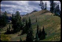
- Description:
- 50 f 9
- Subject:
- Rocks, Cascade Range, Grasses, Trees, Flowers, Lassen Volcanic National Park (Calif.), Mountains, Shrubs, and Lupines
- Series:
- 6-54
- Creator:
- Cushman, Charles W., 1896-1972
- Date Created:
- 1954-08-19
- Genre:
- Landscape photographs
- Frame Number:
- 9
- County:
- Shasta
- Abstract:
- Lupine on slope.
- Call Number:
- P07227
- Country:
- United States
- State/Province:
- California
- Alternate Identifier:
- 654.9
- Persistent URL:
- http://purl.dlib.indiana.edu/iudl/archives/cushman/P07227
- Holding Location:
- Bloomington - University Archives
Wells Library E460
1320 E 10th St.
Bloomington, IN 47405
Contact at archives@indiana.edu, 812-855-1127
-
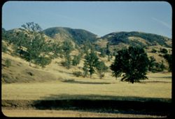
- Description:
- 50 f 8
- Subject:
- Grasses, Trees, Meadows, Shrubs, and Hills
- Series:
- 4-54
- Creator:
- Cushman, Charles W., 1896-1972
- Date Created:
- 1954-08-13
- Genre:
- Landscape photographs
- Frame Number:
- 19
- Street Address:
- Lakeport-Hopland Road
- County:
- Mendocino and Lake
- Abstract:
- Tinder dry grass and green trees+ folded hills of Lake Co. on way from Lakeport to Hopland- 6 PM
- Call Number:
- P07193
- City:
- Lakeport and Hopland
- Country:
- United States
- State/Province:
- California
- Physical Description:
- Anscochrome film.
- Alternate Identifier:
- 454.19
- Persistent URL:
- http://purl.dlib.indiana.edu/iudl/archives/cushman/P07193
- Holding Location:
- Bloomington - University Archives
Wells Library E460
1320 E 10th St.
Bloomington, IN 47405
Contact at archives@indiana.edu, 812-855-1127
-
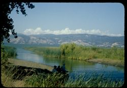
- Description:
- 50 f 9
- Subject:
- Bodies of water, Weeds, Fishing, Mountains, Shrubs, Lakes & ponds, Clouds, People, Clear Lake (Lake County, Calif.), Grasses, and Plants
- Series:
- 4-54
- Creator:
- Cushman, Charles W., 1896-1972
- Date Created:
- 1954-08-13
- Genre:
- Landscape photographs
- Frame Number:
- 17
- County:
- Lake
- Abstract:
- Clear Lake
- Call Number:
- P07191
- Country:
- United States
- State/Province:
- California
- Physical Description:
- Anscochrome film.
- Alternate Identifier:
- 454.17
- Persistent URL:
- http://purl.dlib.indiana.edu/iudl/archives/cushman/P07191
- Holding Location:
- Bloomington - University Archives
Wells Library E460
1320 E 10th St.
Bloomington, IN 47405
Contact at archives@indiana.edu, 812-855-1127
-
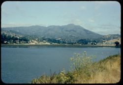
- Description:
- 50 f 8
- Subject:
- Wildflowers, Bays (Bodies of water), Richardson Bay Bridge (Calif.), Grasses, Trees, Mountains, Richardson Bay (Calif.), Shrubs, Tamalpais, Mount (Calif.), H...
- Series:
- 4-54
- Creator:
- Cushman, Charles W., 1896-1972
- Date Created:
- 1954-08-13
- Genre:
- Cityscape photographs
- Frame Number:
- 14
- Street Address:
- United States Highway 101
- County:
- Marin
- Abstract:
- Mt. Tamalpais from US101- Richardson Bay bridge
- Call Number:
- P07188
- Country:
- United States
- State/Province:
- California
- Physical Description:
- Anscochrome film.
- Alternate Identifier:
- 454.14
- Persistent URL:
- http://purl.dlib.indiana.edu/iudl/archives/cushman/P07188
- Holding Location:
- Bloomington - University Archives
Wells Library E460
1320 E 10th St.
Bloomington, IN 47405
Contact at archives@indiana.edu, 812-855-1127
-
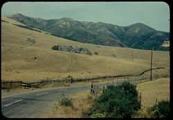
- Description:
- 50 f 9 haze filter
- Subject:
- Croplands, Meadows, Hills, Roads, Mountains, Shrubs, Trees, Rocks, Grasses, Fences, and Salmon Creek (Marin County, Calif.)
- Series:
- 4-54
- Creator:
- Cushman, Charles W., 1896-1972
- Date Created:
- 1954-07-29
- Genre:
- Landscape photographs
- Frame Number:
- 12
- County:
- Marin
- Abstract:
- Dry pasture land - outcrop in center, dark green mtn in background along Salmon creek [ad in Main]
- Call Number:
- P07186
- Country:
- United States
- State/Province:
- California
- Physical Description:
- Anscochrome film.
- Alternate Identifier:
- 454.12
- Persistent URL:
- http://purl.dlib.indiana.edu/iudl/archives/cushman/P07186
- Holding Location:
- Bloomington - University Archives
Wells Library E460
1320 E 10th St.
Bloomington, IN 47405
Contact at archives@indiana.edu, 812-855-1127
-
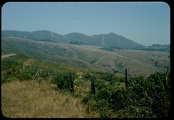
- Description:
- 50 f 9
- Subject:
- Grasses, Grazing, Trees, Meadows, Mountains, Fences, Shrubs, and Tamalpais, Mount (Calif.)
- Series:
- 4-54
- Creator:
- Cushman, Charles W., 1896-1972
- Date Created:
- 1954-07-29
- Genre:
- Landscape photographs
- Frame Number:
- 10
- County:
- Marin
- Abstract:
- Tamalpais from SW.
- Call Number:
- P07184
- Country:
- United States
- State/Province:
- California
- Physical Description:
- Anscochrome film.
- Alternate Identifier:
- 454.10
- Persistent URL:
- http://purl.dlib.indiana.edu/iudl/archives/cushman/P07184
- Holding Location:
- Bloomington - University Archives
Wells Library E460
1320 E 10th St.
Bloomington, IN 47405
Contact at archives@indiana.edu, 812-855-1127
-
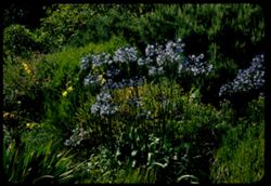
- Description:
- 50 f 8
- Subject:
- Strybing Arboretum and Botanical Gardens, Grasses, Golden Gate Park (San Francisco, Calif.), Flowers, African lily, Shrubs, Lilies, and Plants
- Series:
- 4-54
- Creator:
- Cushman, Charles W., 1896-1972
- Date Created:
- 1954-07-28
- Genre:
- Identification photographs
- Frame Number:
- 9
- County:
- San Francisco
- Abstract:
- African Lily - group of tall blue flowers on tall stalks
- Call Number:
- P07183
- City:
- San Francisco
- Country:
- United States
- State/Province:
- California
- Physical Description:
- Anscochrome film.
- Alternate Identifier:
- 454.9
- Persistent URL:
- http://purl.dlib.indiana.edu/iudl/archives/cushman/P07183
- Holding Location:
- Bloomington - University Archives
Wells Library E460
1320 E 10th St.
Bloomington, IN 47405
Contact at archives@indiana.edu, 812-855-1127
-
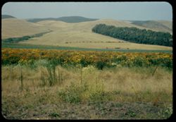
- Description:
- 50 f 9
- Subject:
- Straw flowers, Grasses, Trees, Flowers, Meadows, Mountains, Shrubs, and Half Moon Bay (Calif.)
- Series:
- 4-54
- Creator:
- Cushman, Charles W., 1896-1972
- Date Created:
- 1954-07-22
- Genre:
- Landscape photographs
- Frame Number:
- 5
- Street Address:
- California State Highway 1
- County:
- San Mateo
- Abstract:
- Field of straw flowers with mtns in distance - along Hwy 1near Half Moon Bay
- Call Number:
- P07179
- Country:
- United States
- State/Province:
- California
- Physical Description:
- Anscochrome film.
- Alternate Identifier:
- 454.5
- Persistent URL:
- http://purl.dlib.indiana.edu/iudl/archives/cushman/P07179
- Holding Location:
- Bloomington - University Archives
Wells Library E460
1320 E 10th St.
Bloomington, IN 47405
Contact at archives@indiana.edu, 812-855-1127
-

- Description:
- 50 f 8
- Subject:
- Roofs, Hills, Dwellings, Trees, Buildings, Grasses, Corona Heights (San Francisco, Calif.), and Shrubs
- Series:
- 3-54
- Creator:
- Cushman, Charles W., 1896-1972
- Date Created:
- 1954-07-03
- Genre:
- Cityscape photographs
- Frame Number:
- 21
- Street Address:
- Roosevelt Way
- County:
- San Francisco
- Abstract:
- Corona Heights from SW. along Roosevelt Way
- Call Number:
- P07172
- City:
- San Francisco
- Country:
- United States
- State/Province:
- California
- Physical Description:
- Anscochrome film.
- Alternate Identifier:
- 354.21
- Persistent URL:
- http://purl.dlib.indiana.edu/iudl/archives/cushman/P07172
- Holding Location:
- Bloomington - University Archives
Wells Library E460
1320 E 10th St.
Bloomington, IN 47405
Contact at archives@indiana.edu, 812-855-1127
-
![Wachendorfia Thyrsiflora [South Africa] Golden Gate Park](https://iiif.uits.iu.edu/iiif/2/n583xv380%2Ffiles%2F56804bb7-8258-4a3c-b68c-00425c351dc4/full/250,/0/default.jpg)
- Description:
- 50 f 8
- Subject:
- Strybing Arboretum and Botanical Gardens, Grasses, Golden Gate Park (San Francisco, Calif.), Trees, Flowers, Shrubs, and Wachendorfia thyrsiflora
- Series:
- 3-54
- Creator:
- Cushman, Charles W., 1896-1972
- Date Created:
- 1954-06-18
- Genre:
- Identification photographs
- Frame Number:
- 8
- County:
- San Francisco
- Abstract:
- Wachendorfia Thyrsiflora from S. Africa
- Call Number:
- P07159
- City:
- San Francisco
- Country:
- United States
- State/Province:
- California
- Physical Description:
- Anscochrome film.
- Alternate Identifier:
- 354.8
- Persistent URL:
- http://purl.dlib.indiana.edu/iudl/archives/cushman/P07159
- Holding Location:
- Bloomington - University Archives
Wells Library E460
1320 E 10th St.
Bloomington, IN 47405
Contact at archives@indiana.edu, 812-855-1127
-
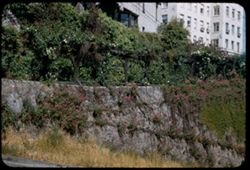
- Description:
- 50 f 6.3
- Subject:
- Walls, Grasses, Flowers, Russian Hill (San Francisco, Calif.), Shrubs, Buildings, and Arbors (Bowers)
- Series:
- 2-54
- Creator:
- Cushman, Charles W., 1896-1972
- Date Created:
- 1954-05-22
- Genre:
- Landscape photographs
- Frame Number:
- 17
- Street Address:
- Taylor Street and Vallejo Street
- County:
- San Francisco
- Abstract:
- Top of Taylor at Vallejo
- Call Number:
- P07147
- City:
- San Francisco
- Country:
- United States
- State/Province:
- California
- Alternate Identifier:
- 254.17
- Persistent URL:
- http://purl.dlib.indiana.edu/iudl/archives/cushman/P07147
- Holding Location:
- Bloomington - University Archives
Wells Library E460
1320 E 10th St.
Bloomington, IN 47405
Contact at archives@indiana.edu, 812-855-1127
-
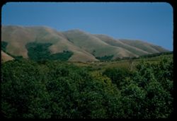
- Description:
- 50 f 9
- Subject:
- Grasses, Grazing, Farms, Trees, Cattle, Mountains, Shrubs, Cows, Black Mountain (Marin County, Calif.), and Hills
- Series:
- 2-54
- Creator:
- Cushman, Charles W., 1896-1972
- Date Created:
- 1954-05-21
- Genre:
- Landscape photographs
- Frame Number:
- 5
- County:
- Marin
- Abstract:
- Cows graze below Black Mtn. - Marin county
- Call Number:
- P07136
- Country:
- United States
- State/Province:
- California
- Alternate Identifier:
- 254.5
- Persistent URL:
- http://purl.dlib.indiana.edu/iudl/archives/cushman/P07136
- Holding Location:
- Bloomington - University Archives
Wells Library E460
1320 E 10th St.
Bloomington, IN 47405
Contact at archives@indiana.edu, 812-855-1127
-
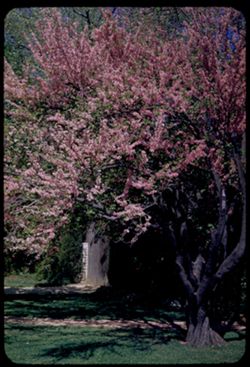
- Description:
- 25 f 11
- Subject:
- Grasses, Parks, Trees, Walkways, Sutter's Fort State Historical Monument (Calif.), Flowering trees, and Shrubs
- Series:
- 1-54
- Creator:
- Cushman, Charles W., 1896-1972
- Date Created:
- 1954-04-18
- Genre:
- Identification photographs
- Frame Number:
- 16
- County:
- Sacramento
- Abstract:
- Flowering tree in Sutter's Fort State Park
- Call Number:
- P07126
- City:
- Sacramento
- Country:
- United States
- State/Province:
- California
- Alternate Identifier:
- 154.16
- Persistent URL:
- http://purl.dlib.indiana.edu/iudl/archives/cushman/P07126
- Holding Location:
- Bloomington - University Archives
Wells Library E460
1320 E 10th St.
Bloomington, IN 47405
Contact at archives@indiana.edu, 812-855-1127
-
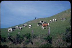
- Description:
- 25 f 9
- Subject:
- Grasses, Grazing, Farms, Barbed wire, Meadows, Cattle, Fences, Shrubs, Cows, and Hills
- Series:
- 1-54
- Creator:
- Cushman, Charles W., 1896-1972
- Date Created:
- 1954-04-07
- Genre:
- Identification photographs
- Frame Number:
- 14
- County:
- San Mateo
- Abstract:
- Cows on side of hill - near Pescadero
- Call Number:
- P07124
- City:
- Pescadero
- Country:
- United States
- State/Province:
- California
- Alternate Identifier:
- 154.14
- Persistent URL:
- http://purl.dlib.indiana.edu/iudl/archives/cushman/P07124
- Holding Location:
- Bloomington - University Archives
Wells Library E460
1320 E 10th St.
Bloomington, IN 47405
Contact at archives@indiana.edu, 812-855-1127
-
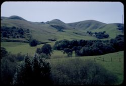
- Description:
- 25 f 11
- Subject:
- Grasses, Grazing, Farms, Trees, Meadows, Fences, Shrubs, Hills, and Norris Canyon (Calif.)
- Series:
- 1-54
- Creator:
- Cushman, Charles W., 1896-1972
- Date Created:
- 1954-03-14
- Genre:
- Landscape photographs
- Frame Number:
- 12
- County:
- Alameda
- Abstract:
- Green clad mtn. From Norris Canyon road
- Call Number:
- P07122
- Country:
- United States
- State/Province:
- California
- Alternate Identifier:
- 154.12
- Persistent URL:
- http://purl.dlib.indiana.edu/iudl/archives/cushman/P07122
- Holding Location:
- Bloomington - University Archives
Wells Library E460
1320 E 10th St.
Bloomington, IN 47405
Contact at archives@indiana.edu, 812-855-1127
-
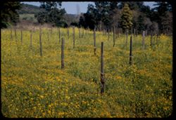
- Description:
- 25 f 11
- Subject:
- Grasses, Trees, Flowers, Meadows, Croplands, Shrubs, Hills, Mustard (Plant), and Plants
- Series:
- 1-54
- Creator:
- Cushman, Charles W., 1896-1972
- Date Created:
- 1954-03-02
- Genre:
- Landscape photographs
- Frame Number:
- 9
- County:
- Sonoma
- Abstract:
- Field of mustard and golden near Sonoma
- Call Number:
- P07119
- City:
- Sonoma
- Country:
- United States
- State/Province:
- California
- Alternate Identifier:
- 154.9
- Persistent URL:
- http://purl.dlib.indiana.edu/iudl/archives/cushman/P07119
- Holding Location:
- Bloomington - University Archives
Wells Library E460
1320 E 10th St.
Bloomington, IN 47405
Contact at archives@indiana.edu, 812-855-1127
-
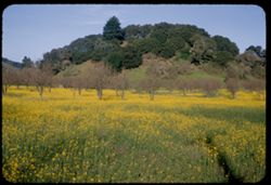
- Description:
- 50 f 8
- Subject:
- Meadows, Flowers, Hills, Mustard (Plant), Shrubs, Trees, and Grasses
- Series:
- 1-54
- Creator:
- Cushman, Charles W., 1896-1972
- Date Created:
- 1954-02-21
- Genre:
- Landscape photographs
- Frame Number:
- 4
- County:
- Marin
- Abstract:
- Mustard in a field near Novato
- Call Number:
- P07114
- City:
- Novato
- Country:
- United States
- State/Province:
- California
- Alternate Identifier:
- 154.4
- Persistent URL:
- http://purl.dlib.indiana.edu/iudl/archives/cushman/P07114
- Holding Location:
- Bloomington - University Archives
Wells Library E460
1320 E 10th St.
Bloomington, IN 47405
Contact at archives@indiana.edu, 812-855-1127
-
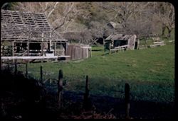
- Description:
- 50 f 6.8
- Subject:
- Barns, Grasses, Salmon Creek (Marin County, Calif.), Farms, Trees, Meadows, Abandoned buildings, Fences, Shrubs, and Agricultural facilities
- Series:
- 1-54
- Creator:
- Cushman, Charles W., 1896-1972
- Date Created:
- 1954-02-21
- Frame Number:
- 3
- County:
- Marin
- Abstract:
- Skeleton farm along Salmon Creek, Marin County
- Call Number:
- P07113
- Country:
- United States
- State/Province:
- California
- Alternate Identifier:
- 154.3
- Persistent URL:
- http://purl.dlib.indiana.edu/iudl/archives/cushman/P07113
- Holding Location:
- Bloomington - University Archives
Wells Library E460
1320 E 10th St.
Bloomington, IN 47405
Contact at archives@indiana.edu, 812-855-1127
-
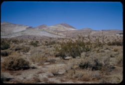
- Description:
- 50 f 10
- Subject:
- Deserts, Mojave Desert (Calif.), Grasses, Houses, Mountains, Shrubs, and Hills
- Series:
- 16-53
- Creator:
- Cushman, Charles W., 1896-1972
- Date Created:
- 1953-11-23
- Genre:
- Landscape photographs
- Frame Number:
- 15
- Street Address:
- United States Highway 6
- County:
- Kern
- Abstract:
- Desert mountain in color. Near Rosamond
- Call Number:
- P07087
- City:
- Rosamond
- Country:
- United States
- State/Province:
- California
- Alternate Identifier:
- 1653.15
- Persistent URL:
- http://purl.dlib.indiana.edu/iudl/archives/cushman/P07087
- Holding Location:
- Bloomington - University Archives
Wells Library E460
1320 E 10th St.
Bloomington, IN 47405
Contact at archives@indiana.edu, 812-855-1127