
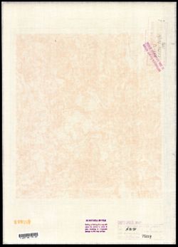
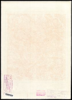
Search Constraints
You searched for:
Campus
IUB
Remove constraint Campus: IUB
Date Created
1940
Remove constraint Date Created: 1940
Type
Image
Remove constraint Type: Image
Pages
0-99 pages
Remove constraint Pages: 0-99 pages
Provenance
DMA Topographic Center, Army Map Service Library
Remove constraint Provenance: DMA Topographic Center, Army Map Service Library
1 - 64 of 64
Search Results
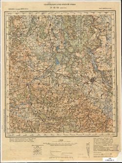
-

- Description:
- 1890
- Subject:
- Topical Subject: Maps, Geographic Subject: Merkinė, and Topical Subject: Soviet Union
- Publisher:
- Генеральный штаб Красной Армии
- Language:
- Russian
- Date Created:
- 1940
- Identifier:
- VAC9619-004062
- Genre:
- Military Maps and Topographic Maps
- Geographic Location:
- Coordinates: 54, 24, 54.333, 24.5
- Related URL:
- Download GeoTIFF: https://drive.google.com/file/d/1y93Q-evfnuFOv1Y5G5Dz9TqcZre99-Eq/view?usp=sharing and Catalog URL: https://iucat.iu.edu/catalog/5020129
- Abstract:
- Modern area represented: Merkinė, Lithuania
- Call Number:
- G7000 s100 .S7 sheet N-35-61
- Caption:
- Для служебного пользования
- City:
- Меречь (Merecz)
- Copyright Holder:
- No Copyright - United States
- Country:
- СССР (USSR)
- State/Province:
- Литовская ССР (Lithuanian Soviet Socialist Republic)
- Physical Description:
- Scale: 1:100,000
- Persistent URL:
- http://purl.dlib.indiana.edu/iudl/images/VAC9619/VAC9619-004062
- Provenance:
- DMA Topographic Center, Army Map Service Library
-

- Description:
- 1890
- Subject:
- Topical Subject: Soviet Union, Topical Subject: Maps, and Geographic Subject: Slonim
- Publisher:
- Генеральный штаб Красной Армии
- Language:
- Russian
- Date Created:
- 1940
- Identifier:
- VAC9619-004100
- Genre:
- Military Maps and Topographic Maps
- Geographic Location:
- Coordinates: 53, 25, 53.333, 25.5
- Related URL:
- Download GeoTIFF: https://drive.google.com/file/d/11uIlcuAi2jRjN2zbDtSfPdBrUot13QKy/view?usp=sharing and Catalog URL: https://iucat.iu.edu/catalog/5020129
- Abstract:
- Modern area represented: Slonim, Belarus
- Call Number:
- G7000 s100 .S7 sheet N-35-99
- City:
- Слоним (Slonim)
- Copyright Holder:
- No Copyright - United States
- Country:
- СССР (USSR)
- State/Province:
- Белорусская ССР (Byelorussian Soviet Socialist Republic) and Барановичская область (Baranavichy oblast)
- Physical Description:
- Scale: 1:100,000
- Persistent URL:
- http://purl.dlib.indiana.edu/iudl/images/VAC9619/VAC9619-004100
- Provenance:
- DMA Topographic Center, Army Map Service Library
-
- Description:
- 1939
- Subject:
- Geographic Subject: Kamyzyak, Topical Subject: Maps, Topical Subject: Soviet Union, and Geographic Subject: Astrakhan Oblast
- Publisher:
- Наркомрыбпром Главрыбвод
- Language:
- Russian
- Date Created:
- 1940
- Identifier:
- VAC9619-002256
- Genre:
- Military Maps and Topographic Maps
- Geographic Location:
- Coordinates: 46, 48, 46.3333, 48.5
- Related URL:
- Catalog URL: https://iucat.iu.edu/catalog/5020129 and Download GeoTIFF: https://drive.google.com/file/d/1COuEZimX0zDKPsy-a9vlykqgrNjh2Jla/view?usp=sharing
- Abstract:
- Modern area represented: Камызяк (Kamyzyak), Astrakhan Oblast, Russia
- Call Number:
- G7000 s100 .S7 sheet L-39-61
- Caption:
- Рабочий оттиск. Бесплатно. Временное Издание. Для внутреннего использования.
- City:
- Камызяк (Kamyzyak)
- Copyright Holder:
- No Copyright - United States
- Country:
- СССР (USSR)
- State/Province:
- РСФСР (RSFSR) and Сталинградская область (Stalingrad oblast)
- Physical Description:
- Scale: 1:100,000
- Persistent URL:
- http://purl.dlib.indiana.edu/iudl/images/VAC9619/VAC9619-002256
- Provenance:
- DMA Topographic Center, Army Map Service Library
-
- Description:
- 1880
- Subject:
- Geographic Subject: Gmina Jadów, Topical Subject: Soviet Union, and Topical Subject: Maps
- Publisher:
- Генеральный штаб Красной Армии
- Language:
- Russian
- Date Created:
- 1940
- Identifier:
- VAC9619-003991
- Genre:
- Topographic Maps and Military Maps
- Geographic Location:
- Coordinates: 52.333, 21.5, 52.667, 22
- Related URL:
- Download GeoTIFF: https://drive.google.com/file/d/1mtSm9PaMfrTfFHwbr9CyBuoRcAWPtvuV/view?usp=sharing and Catalog URL: https://iucat.iu.edu/catalog/5020129
- Abstract:
- Modern area represented: Gmina Jadów, Masovian Voivodeship, Poland
- Call Number:
- G7000 s100 .S7 sheet N-34-128
- City:
- Ядув (Jadów)
- Copyright Holder:
- No Copyright - United States
- State/Province:
- Область государственных интересов Германии (Region of German state interests)
- Physical Description:
- Scale: 1:100,000
- Persistent URL:
- http://purl.dlib.indiana.edu/iudl/images/VAC9619/VAC9619-003991
- Provenance:
- DMA Topographic Center, Army Map Service Library
-
- Description:
- 1906
- Subject:
- Geographic Subject: Kwidzyn, Topical Subject: Maps, and Topical Subject: Soviet Union
- Publisher:
- Генеральный штаб Красной Армии
- Language:
- Russian
- Date Created:
- 1940
- Identifier:
- VAC9619-003942
- Genre:
- Military Maps and Topographic Maps
- Geographic Location:
- Coordinates: 53.667, 18.5, 54, 19
- Related URL:
- Catalog URL: https://iucat.iu.edu/catalog/5020129 and Download GeoTIFF: https://drive.google.com/file/d/1-5kDJDDNJLlI47BNm9MrRQ7Mg5I3rMnI/view?usp=sharing
- Abstract:
- Modern area represented: Kwidzyn, Pomeranian voivodeship, Poland
- Call Number:
- G7000 s100 .S7 sheet N-34-74
- City:
- Мариенвердер (Marienwerder)
- Copyright Holder:
- No Copyright - United States
- Country:
- Германия (Germany)
- Physical Description:
- Scale: 1:100,000
- Persistent URL:
- http://purl.dlib.indiana.edu/iudl/images/VAC9619/VAC9619-003942
- Provenance:
- DMA Topographic Center, Army Map Service Library
-

- Description:
- 1891
- Subject:
- Topical Subject: Soviet Union, Topical Subject: Maps, and Geographic Subject: Lentvaris
- Publisher:
- Генеральный штаб Красной Армии
- Language:
- Russian
- Date Created:
- 1940
- Identifier:
- VAC9619-004053
- Genre:
- Military Maps and Topographic Maps
- Geographic Location:
- Coordinates: 54.333, 25, 54.667, 25.5
- Related URL:
- Catalog URL: https://iucat.iu.edu/catalog/5020129 and Download GeoTIFF: https://drive.google.com/file/d/1pGDy3t6VgddIj8je6N5NWJd-o0jXgLYB/view?usp=sharing
- Abstract:
- Modern area represented: Lentvaris, Lithuania
- Call Number:
- G7000 s100 .S7 sheet N-35-51
- City:
- Ландворово (Landwarów)
- Copyright Holder:
- No Copyright - United States
- Country:
- СССР (USSR)
- State/Province:
- Белорусская ССР (Byelorussian Soviet Socialist Republic), Барановичская область (Baranavichy oblast), and Литовская ССР (Lithuanian Soviet Socialist Republic)
- Physical Description:
- Scale: 1:100,000
- Persistent URL:
- http://purl.dlib.indiana.edu/iudl/images/VAC9619/VAC9619-004053
- Provenance:
- DMA Topographic Center, Army Map Service Library
-
- Description:
- 1921
- Subject:
- Topical Subject: Maps, Topical Subject: Soviet Union, and Geographic Subject: Pomeranian Voivodeship
- Publisher:
- Генеральный штаб РККА
- Language:
- Russian
- Date Created:
- 1940
- Identifier:
- VAC9619-003869
- Genre:
- Topographic Maps and Military Maps
- Geographic Location:
- Coordinates: 53.667, 17, 54, 17.5
- Related URL:
- Download GeoTIFF: https://drive.google.com/file/d/1ECQb8yIcYW04beF4Fx_4EfgbRIo6n1fH/view?usp=sharing and Catalog URL: https://iucat.iu.edu/catalog/5020129
- Abstract:
- Modern area represented: Pomeranian Voivodeship, Poland
- Call Number:
- G7000 s100 .S7 sheet N-33-83
- City:
- Прехлау (Priechlau)
- Copyright Holder:
- No Copyright - United States
- Country:
- Германия (Germany)
- Physical Description:
- Scale: 1:100,000
- Persistent URL:
- http://purl.dlib.indiana.edu/iudl/images/VAC9619/VAC9619-003869
- Provenance:
- DMA Topographic Center, Army Map Service Library
-
- Description:
- 1901
- Subject:
- Topical Subject: Soviet Union, Topical Subject: Maps, and Geographic Subject: Lipno
- Publisher:
- Генеральный штаб Красной Армии
- Language:
- Russian
- Date Created:
- 1940
- Identifier:
- VAC9619-003975
- Genre:
- Military Maps and Topographic Maps
- Geographic Location:
- Coordinates: 52.667, 19, 53, 19.5
- Related URL:
- Download GeoTIFF: https://drive.google.com/file/d/1vIfASC507Jo9afctWNeELpAO5bDsfxh8/view?usp=sharing and Catalog URL: https://iucat.iu.edu/catalog/5020129
- Abstract:
- Modern area represented: Lipno, Kuyavian-Pomeranian Voivodeship, Poland
- Call Number:
- G7000 s100 .S7 sheet N-34-111
- City:
- Липно (Lipno)
- Copyright Holder:
- No Copyright - United States
- State/Province:
- Область государственных интересов Германии (Region of German state interests)
- Physical Description:
- Scale: 1:100,000
- Persistent URL:
- http://purl.dlib.indiana.edu/iudl/images/VAC9619/VAC9619-003975
- Provenance:
- DMA Topographic Center, Army Map Service Library
-
- Description:
- 1935
- Subject:
- Topical Subject: Soviet Union, Geographic Subject: Yasenskaya, and Topical Subject: Maps
- Publisher:
- Генеральный штаб Красной Армии
- Language:
- Russian
- Date Created:
- 1940
- Identifier:
- VAC9619-002320
- Genre:
- Military Maps and Topographic Maps
- Geographic Location:
- Coordinates: 46.3333, 38, 46.6667, 38.5
- Related URL:
- Catalog URL: https://iucat.iu.edu/catalog/5020129 and Download GeoTIFF: https://drive.google.com/file/d/1ANfBQuPlscLZ3TLWYKArV4_UX4oV-Ab6/view?usp=sharing
- Abstract:
- Modern area represented: Yasenskaya, Russia
- Call Number:
- G7000 s100 .S7 sheet L-37-53
- Caption:
- Для служебного пользования
- City:
- Ст-ца Ясенская (Yasenskaya)
- Copyright Holder:
- No Copyright - United States
- Country:
- СССР (USSR)
- State/Province:
- РСФСР (RSFSR) and Краснодарский край (Krasnodar kray)
- Physical Description:
- Scale: 1:100,000
- Persistent URL:
- http://purl.dlib.indiana.edu/iudl/images/VAC9619/VAC9619-002320
- Provenance:
- DMA Topographic Center, Army Map Service Library
-
- Description:
- 1888
- Subject:
- Geographic Subject: Kościan, Topical Subject: Maps, and Topical Subject: Soviet Union
- Publisher:
- Генеральный штаб Красной Армии
- Language:
- Russian
- Date Created:
- 1940
- Identifier:
- VAC9619-003892
- Genre:
- Military Maps and Topographic Maps
- Geographic Location:
- Coordinates: 52, 16.5, 52.333, 17
- Related URL:
- Catalog URL: https://iucat.iu.edu/catalog/5020129 and Download GeoTIFF: https://drive.google.com/file/d/1mznGLi02tFSckz2sIq8iklzRvm94fNfY/view?usp=sharing
- Abstract:
- Modern area represented: Kościan, Greater Poland, Poland
- Call Number:
- G7000 s100 .S7 sheet N-33-142
- City:
- Костен (Kosten)
- Copyright Holder:
- No Copyright - United States
- Country:
- Германия (Germany)
- Physical Description:
- Scale: 1:100,000
- Persistent URL:
- http://purl.dlib.indiana.edu/iudl/images/VAC9619/VAC9619-003892
- Provenance:
- DMA Topographic Center, Army Map Service Library
-
- Description:
- 1898
- Subject:
- Geographic Subject: Ropczyce, Topical Subject: Maps, and Topical Subject: Soviet Union
- Publisher:
- Генеральный штаб Красной Армии
- Language:
- Russian
- Date Created:
- 1940
- Identifier:
- VAC9619-002867
- Genre:
- Topographic Maps and Military Maps
- Geographic Location:
- Coordinates: 50, 21.5, 50.333, 22
- Related URL:
- Catalog URL: https://iucat.iu.edu/catalog/5020129 and Download GeoTIFF: https://drive.google.com/file/d/19Rh3Ua_G5ljdOoF9neRQsQPqzkNLXgTP/view?usp=sharing
- Abstract:
- Modern area represented: Ropczyce, Subcarpathian province, Poland
- Call Number:
- G7000 s100 .S7 sheet M-34-68
- City:
- Ропчице (Ropczyce)
- Copyright Holder:
- No Copyright - United States
- State/Province:
- Область государственных интересов Германии (Region of German state interests)
- Physical Description:
- Scale: 1:100,000
- Persistent URL:
- http://purl.dlib.indiana.edu/iudl/images/VAC9619/VAC9619-002867
- Provenance:
- DMA Topographic Center, Army Map Service Library
-
- Description:
- 1890
- Subject:
- Topical Subject: Maps, Geographic Subject: Brzeziny, and Topical Subject: Soviet Union
- Publisher:
- Генеральный штаб Красной Армии
- Language:
- Russian
- Date Created:
- 1940
- Identifier:
- VAC9619-002726
- Genre:
- Topographic Maps and Military Maps
- Geographic Location:
- Coordinates: 51.667, 19.5, 52, 20
- Related URL:
- Download GeoTIFF: https://drive.google.com/file/d/1aFCg1gjz79gcOSi9wgCX83MO2KgGjJzh/view?usp=sharing and Catalog URL: https://iucat.iu.edu/catalog/5020129
- Abstract:
- Modern area represented: Brzeziny, Łódź province, Poland
- Call Number:
- G7000 s100 .S7 sheet M-34-4
- City:
- Бжезины (Brzeziny)
- Copyright Holder:
- No Copyright - United States
- State/Province:
- Область государственных интересов Германии (Region of German state interests)
- Physical Description:
- Scale: 1:100,000
- Persistent URL:
- http://purl.dlib.indiana.edu/iudl/images/VAC9619/VAC9619-002726
- Provenance:
- DMA Topographic Center, Army Map Service Library
-
- Description:
- 1932
- Subject:
- Topical Subject: Soviet Union, Geographic Subject: Pobiedziska, and Topical Subject: Maps
- Publisher:
- Генеральный штаб Красной Армии
- Language:
- Russian
- Date Created:
- 1940
- Identifier:
- VAC9619-003888
- Genre:
- Topographic Maps and Military Maps
- Geographic Location:
- Coordinates: 52.333, 17, 52.667, 17.5
- Related URL:
- Catalog URL: https://iucat.iu.edu/catalog/5020129 and Download GeoTIFF: https://drive.google.com/file/d/11VZi9roOFCgtXkclGQ4cSsPkO1YRxCe_/view?usp=sharing
- Abstract:
- Modern area represented: Pobiedziska, Greater Poland, Poland
- Call Number:
- G7000 s100 .S7 sheet N-33-131
- City:
- Пудевиц (Pudewitz)
- Copyright Holder:
- No Copyright - United States
- Country:
- Германия (Germany)
- Physical Description:
- Scale: 1:100,000
- Persistent URL:
- http://purl.dlib.indiana.edu/iudl/images/VAC9619/VAC9619-003888
- Provenance:
- DMA Topographic Center, Army Map Service Library
-
- Description:
- 1893
- Subject:
- Topical Subject: Maps, Geographic Subject: Tarnów, and Topical Subject: Soviet Union
- Publisher:
- Генеральный штаб Красной Армии
- Language:
- Russian
- Date Created:
- 1940
- Identifier:
- VAC9619-002865
- Genre:
- Military Maps and Topographic Maps
- Geographic Location:
- Coordinates: 50, 20.5, 50.333, 21
- Related URL:
- Download GeoTIFF: https://drive.google.com/file/d/1sfPl4-UBMbIYwVDlMiLFy8Et4a_ZNYE0/view?usp=sharing and Catalog URL: https://iucat.iu.edu/catalog/5020129
- Abstract:
- Modern area represented: Tarnów, Lesser Poland province, Poland
- Call Number:
- G7000 s100 .S7 sheet M-34-66
- City:
- Тарнув (Tarnów)
- Copyright Holder:
- No Copyright - United States
- State/Province:
- Область государственных интересов Германии (Region of German state interests)
- Physical Description:
- Scale: 1:100,000
- Persistent URL:
- http://purl.dlib.indiana.edu/iudl/images/VAC9619/VAC9619-002865
- Provenance:
- DMA Topographic Center, Army Map Service Library
-
- Description:
- 1899
- Subject:
- Geographic Subject: Yuratsishki, Topical Subject: Soviet Union, and Topical Subject: Maps
- Publisher:
- Генеральный штаб Красной Армии
- Language:
- Russian
- Date Created:
- 1940
- Identifier:
- VAC9619-004065
- Genre:
- Topographic Maps and Military Maps
- Geographic Location:
- Coordinates: 54, 25.5, 54.333, 26
- Related URL:
- Download GeoTIFF: https://drive.google.com/file/d/1S208tYzBNgJlOJ0Z-RWb-phjImadfveI/view?usp=sharing and Catalog URL: https://iucat.iu.edu/catalog/5020129
- Abstract:
- Modern area represented: Yuratsishki, Hrodna oblast, Belarus
- Call Number:
- G7000 s100 .S7 sheet N-35-64
- Caption:
- Для служебного пользования
- City:
- Юратишки (Yuratsishki)
- Copyright Holder:
- No Copyright - United States
- Country:
- СССР (USSR)
- State/Province:
- Барановичская область (Baranavichy oblast), Вилейская область (Vileyka oblast), and Белорусская ССР (Byelorussian Soviet Socialist Republic)
- Physical Description:
- Scale: 1:100,000
- Persistent URL:
- http://purl.dlib.indiana.edu/iudl/images/VAC9619/VAC9619-004065
- Provenance:
- DMA Topographic Center, Army Map Service Library
-
- Description:
- 1921
- Subject:
- Geographic Subject: Wyrzysk, Topical Subject: Maps, and Topical Subject: Soviet Union
- Publisher:
- Генеральный штаб Красной Армии
- Language:
- Russian
- Date Created:
- 1940
- Identifier:
- VAC9619-003878
- Genre:
- Topographic Maps and Military Maps
- Geographic Location:
- Coordinates: 53, 17, 53.333, 17.5
- Related URL:
- Catalog URL: https://iucat.iu.edu/catalog/5020129 and Download GeoTIFF: https://drive.google.com/file/d/1IsZVaDphHmvBL8gyyG7cFePODCUwPWgs/view?usp=sharing
- Abstract:
- Modern area represented: Wyrzysk, Greater Poland, Poland
- Call Number:
- G7000 s100 .S7 sheet N-33-107
- City:
- Вирзитц (Wirsitz)
- Copyright Holder:
- No Copyright - United States
- Country:
- Германия (Germany)
- Physical Description:
- Scale: 1:100,000
- Persistent URL:
- http://purl.dlib.indiana.edu/iudl/images/VAC9619/VAC9619-003878
- Provenance:
- DMA Topographic Center, Army Map Service Library
-
- Description:
- 1926
- Subject:
- Topical Subject: Maps, Topical Subject: Soviet Union, and Geographic Subject: Międzyrzecz
- Publisher:
- Генеральный штаб Красной Армии
- Language:
- Russian
- Date Created:
- 1940
- Identifier:
- VAC9619-003885
- Genre:
- Topographic Maps and Military Maps
- Geographic Location:
- Coordinates: 52.333, 15.5, 52.667, 16
- Related URL:
- Download GeoTIFF: https://drive.google.com/file/d/1ldv2AHj1qD6qQ_06De9wu4ZTrzQzZkcR/view?usp=sharing and Catalog URL: https://iucat.iu.edu/catalog/5020129
- Abstract:
- Modern area represented: Międzyrzecz, Lubusz province, Poland
- Call Number:
- G7000 s100 .S7 sheet N-33-128
- City:
- Мезеритц (Międzyrzecz)
- Copyright Holder:
- No Copyright - United States
- Country:
- Германия (Germany)
- Physical Description:
- Scale: 1:100,000
- Persistent URL:
- http://purl.dlib.indiana.edu/iudl/images/VAC9619/VAC9619-003885
- Provenance:
- DMA Topographic Center, Army Map Service Library
-
- Description:
- 1875
- Subject:
- Topical Subject: Maps, Geographic Subject: Połczyn-Zdrój, and Topical Subject: Soviet Union
- Publisher:
- Генеральный штаб Красной Армии
- Language:
- Russian
- Date Created:
- 1940
- Identifier:
- VAC9619-003867
- Genre:
- Military Maps and Topographic Maps
- Geographic Location:
- Coordinates: 53.667, 16, 54, 16.5
- Related URL:
- Catalog URL: https://iucat.iu.edu/catalog/5020129 and Download GeoTIFF: https://drive.google.com/file/d/1Keo5DhvSXaaA3wxFf6A3x9F73pHENMEn/view?usp=sharing
- Abstract:
- Modern area represented: Połczyn-Zdrój, West Pomerania, Poland
- Call Number:
- G7000 s100 .S7 sheet N-33-81
- City:
- Польцин (Polzin)
- Copyright Holder:
- No Copyright - United States
- Country:
- Германия (Germany)
- Physical Description:
- Scale: 1:100,000
- Persistent URL:
- http://purl.dlib.indiana.edu/iudl/images/VAC9619/VAC9619-003867
- Provenance:
- DMA Topographic Center, Army Map Service Library
-
- Description:
- 1928
- Subject:
- Geographic Subject: Chojnice, Topical Subject: Maps, and Topical Subject: Soviet Union
- Publisher:
- Генеральный штаб Красной Армии
- Language:
- Russian
- Date Created:
- 1940
- Identifier:
- VAC9619-003870
- Genre:
- Military Maps and Topographic Maps
- Geographic Location:
- Coordinates: 53.667, 17.5, 54, 18
- Related URL:
- Catalog URL: https://iucat.iu.edu/catalog/5020129 and Download GeoTIFF: https://drive.google.com/file/d/1odqQ66BMOV6IjcvCn2etl9a0s3XzeLnB/view?usp=sharing
- Abstract:
- Modern area represented: Chojnice, Pomeranian Voivodeship, Poland
- Call Number:
- G7000 s100 .S7 sheet N-33-84
- City:
- Конитц (Conitz)
- Copyright Holder:
- No Copyright - United States
- Country:
- Германия (Germany)
- Physical Description:
- Scale: 1:100,000
- Persistent URL:
- http://purl.dlib.indiana.edu/iudl/images/VAC9619/VAC9619-003870
- Provenance:
- DMA Topographic Center, Army Map Service Library
-
- Description:
- 1928
- Subject:
- Geographic Subject: Kościerzyna, Topical Subject: Maps, and Topical Subject: Soviet Union
- Publisher:
- Генеральный штаб Красной Армии
- Language:
- Russian
- Date Created:
- 1940
- Identifier:
- VAC9619-003865
- Genre:
- Topographic Maps and Military Maps
- Geographic Location:
- Coordinates: 54, 17.5, 54.333, 18
- Related URL:
- Catalog URL: https://iucat.iu.edu/catalog/5020129 and Download GeoTIFF: https://drive.google.com/file/d/1-5SRMq5waAz4GHBNJQcb0A8j4PwwiUL7/view?usp=sharing
- Abstract:
- Modern area represented: Kościerzyna, Pomerania region, Poland
- Call Number:
- G7000 s100 .S7 sheet N-33-72
- City:
- Берент (Berent)
- Copyright Holder:
- No Copyright - United States
- Country:
- Германия (Germany)
- Physical Description:
- Scale: 1:100,000
- Persistent URL:
- http://purl.dlib.indiana.edu/iudl/images/VAC9619/VAC9619-003865
- Provenance:
- DMA Topographic Center, Army Map Service Library
-
- Description:
- 1935
- Subject:
- Topical Subject: Soviet Union, Topical Subject: Maps, and Geographic Subject: Staroshcherbinovskaya
- Publisher:
- Генеральный штаб Красной Армии
- Language:
- Russian
- Date Created:
- 1940
- Identifier:
- VAC9619-002321
- Genre:
- Military Maps and Topographic Maps
- Geographic Location:
- Coordinates: 46.3333, 38.5, 46.6667, 39
- Related URL:
- Catalog URL: https://iucat.iu.edu/catalog/5020129 and Download GeoTIFF: https://drive.google.com/file/d/1ra_mJa5O-R4zF0rl3TtNkSQRl0GDEvcn/view?usp=sharing
- Abstract:
- Modern area represented: Staroshcherbinovskaya, Russia
- Call Number:
- G7000 s100 .S7 sheet L-37-54
- Caption:
- Для служебного пользования
- City:
- Ст-ца Старо-Щербиновская (Staro-Shcherbinovskaya)
- Copyright Holder:
- No Copyright - United States
- Country:
- СССР (USSR)
- State/Province:
- РСФСР (RSFSR), Краснодарский край (Krasnodar kray), and Ростовская область (Rostov oblast)
- Physical Description:
- Scale: 1:100,000
- Persistent URL:
- http://purl.dlib.indiana.edu/iudl/images/VAC9619/VAC9619-002321
- Provenance:
- DMA Topographic Center, Army Map Service Library
-
- Description:
- 1939
- Subject:
- Topical Subject: Maps and Topical Subject: Soviet Union
- Publisher:
- Наркомрыбпром Главрыбвод
- Language:
- Russian
- Date Created:
- 1940
- Identifier:
- VAC9619-002257
- Genre:
- Military Maps and Topographic Maps
- Geographic Location:
- Coordinates: 46, 49, 46.3333, 49.5
- Related URL:
- Download GeoTIFF: https://drive.google.com/file/d/1I7NS-oTIE8zvKcR-m2t3RlBKoI4u9B6g/view?usp=sharing and Catalog URL: https://iucat.iu.edu/catalog/5020129
- Abstract:
- Modern area represented:
- Call Number:
- G7000 s100 .S7 sheet L-39-63
- Caption:
- Рабочий оттиск. Бесплатно. Временное издание. Для внутреннего использования.
- Copyright Holder:
- No Copyright - United States
- Country:
- СССР (USSR)
- State/Province:
- РСФСР (RSFSR) and Сталинградская область (Stalingrad oblast)
- Physical Description:
- Scale: 1:100,000
- Persistent URL:
- http://purl.dlib.indiana.edu/iudl/images/VAC9619/VAC9619-002257
- Provenance:
- DMA Topographic Center, Army Map Service Library
-
- Description:
- 1925
- Subject:
- Topical Subject: Soviet Union, Geographic Subject: Skarszewy, and Topical Subject: Maps
- Publisher:
- Генеральный штаб Красной Армии
- Language:
- Russian
- Date Created:
- 1940
- Identifier:
- VAC9619-003930
- Genre:
- Topographic Maps and Military Maps
- Geographic Location:
- Coordinates: 54, 18, 54.333, 18.5
- Related URL:
- Catalog URL: https://iucat.iu.edu/catalog/5020129 and Download GeoTIFF: https://drive.google.com/file/d/1mCfUViGAZRTBWeMnSq6MhXHT7gTXeXp0/view?usp=sharing
- Abstract:
- Modern area represented: Skarszewy, Pomeranian Voivodeship, Poland
- Call Number:
- G7000 s100 .S7 sheet N-34-61
- City:
- Шёнек (Schöneck)
- Copyright Holder:
- No Copyright - United States
- Country:
- Германия (Germany)
- Physical Description:
- Scale: 1:100,000
- Persistent URL:
- http://purl.dlib.indiana.edu/iudl/images/VAC9619/VAC9619-003930
- Provenance:
- DMA Topographic Center, Army Map Service Library
-
- Description:
- 1935
- Subject:
- Topical Subject: Soviet Union, Geographic Subject: Prienai, and Topical Subject: Maps
- Publisher:
- Генеральный штаб Красной Армии
- Language:
- Russian
- Date Created:
- 1940
- Identifier:
- VAC9619-003929
- Genre:
- Military Maps and Topographic Maps
- Geographic Location:
- Coordinates: 54.333, 23.5, 54.667, 24
- Related URL:
- Download GeoTIFF: https://drive.google.com/file/d/1IErvlYgjYTVhhRVcnCNvVp9-cfFALEYq/view?usp=sharing and Catalog URL: https://iucat.iu.edu/catalog/5020129
- Abstract:
- Modern area represented: Prienai, Kaunas, Lithuania
- Call Number:
- G7000 s100 .S7 sheet N-34-60
- Caption:
- Не подлежит оглашению
- City:
- Прены (Prienai)
- Copyright Holder:
- No Copyright - United States
- Country:
- СССР (USSR)
- State/Province:
- Литовская ССР (Lithuanian Soviet Socialist Republic)
- Physical Description:
- Scale: 1:100,000
- Persistent URL:
- http://purl.dlib.indiana.edu/iudl/images/VAC9619/VAC9619-003929
- Provenance:
- DMA Topographic Center, Army Map Service Library
-
- Description:
- 1939
- Subject:
- Topical Subject: Maps, Geographic Subject: Astrakhan, Topical Subject: Soviet Union, and Geographic Subject: Astrakhan Oblast’
- Publisher:
- Наркомрыбпром Главрыбвод
- Language:
- Russian
- Date Created:
- 1940
- Identifier:
- VAC9619-002254
- Genre:
- Topographic Maps and Military Maps
- Geographic Location:
- Coordinates: 46.3333, 48, 46.6667, 48.5
- Related URL:
- Catalog URL: https://iucat.iu.edu/catalog/5020129 and Download GeoTIFF: https://drive.google.com/file/d/1RCqPg_tDMJxKMYAkWR-P5U_oyqYZuJMF/view?usp=sharing
- Abstract:
- Modern area represented: Астрахань (Astrakhan), Astrakhan Oblast’, Russia
- Call Number:
- G7000 s100 .S7 sheet L-39-49
- City:
- Астрахань (Astrakhan)
- Copyright Holder:
- No Copyright - United States
- Country:
- СССР (USSR)
- State/Province:
- РСФСР (RSFSR), Калмыцкая АССР (Kalmyk Autonomous Soviet Socialist Republic), and Сталинградская область (Stalingrad oblast)
- Physical Description:
- Scale: 1:100,000
- Persistent URL:
- http://purl.dlib.indiana.edu/iudl/images/VAC9619/VAC9619-002254
- Provenance:
- DMA Topographic Center, Army Map Service Library
-
- Description:
- 1896
- Subject:
- Topical Subject: Soviet Union, Geographic Subject: Pabradė, and Topical Subject: Maps
- Publisher:
- Генеральный штаб Красной Армии
- Language:
- Russian
- Date Created:
- 1940
- Identifier:
- VAC9619-004042
- Genre:
- Military Maps and Topographic Maps
- Geographic Location:
- Coordinates: 54.667, 25.5, 55, 26
- Related URL:
- Catalog URL: https://iucat.iu.edu/catalog/5020129 and Download GeoTIFF: https://drive.google.com/file/d/1YFsfTU9po10RXE5Yt1qzruLaxNk6ivoW/view?usp=sharing
- Abstract:
- Modern area represented: Pabradė, Lithuania
- Call Number:
- G7000 s100 .S7 sheet N-35-40
- Caption:
- Для служебного пользования
- City:
- Подбродзе (Podbrodze)
- Copyright Holder:
- No Copyright - United States
- Country:
- СССР (USSR)
- State/Province:
- Белорусская ССР (Byelorussian Soviet Socialist Republic), Литовская ССР (Lithuanian Soviet Socialist Republic), and Вилейская область (Vileyka oblast)
- Physical Description:
- Scale: 1:100,000
- Persistent URL:
- http://purl.dlib.indiana.edu/iudl/images/VAC9619/VAC9619-004042
- Provenance:
- DMA Topographic Center, Army Map Service Library
-
- Description:
- 1890
- Subject:
- Geographic Subject: Koszalin, Topical Subject: Soviet Union, and Topical Subject: Maps
- Publisher:
- Генеральный штаб Красной Армии
- Language:
- Russian
- Date Created:
- 1940
- Identifier:
- VAC9619-003568
- Genre:
- Topographic Maps and Military Maps
- Geographic Location:
- Coordinates: 54, 16, 54.333, 16.5
- Related URL:
- Catalog URL: https://iucat.iu.edu/catalog/5020129 and Download GeoTIFF: https://drive.google.com/file/d/12cZmWL7A0xlHGmsn4W0BsUttDysAXTDS/view?usp=sharing
- Abstract:
- Modern area represented: Koszalin, West Pomerania province, Poland
- Call Number:
- G7000 s100 .S7 sheet N-33-69
- City:
- Кезлин (Köslin)
- Copyright Holder:
- No Copyright - United States
- Country:
- Германия (Germany)
- Physical Description:
- Scale: 1:100,000
- Persistent URL:
- http://purl.dlib.indiana.edu/iudl/images/VAC9619/VAC9619-003568
- Provenance:
- DMA Topographic Center, Army Map Service Library
-
- Description:
- 1883
- Subject:
- Geographic Subject: Błonie, Topical Subject: Soviet Union, and Topical Subject: Maps
- Publisher:
- Генеральный штаб Красной Армии
- Language:
- Russian
- Date Created:
- 1940
- Identifier:
- VAC9619-003999
- Genre:
- Topographic Maps and Military Maps
- Geographic Location:
- Coordinates: 52, 20.5, 52.333, 21
- Related URL:
- Download GeoTIFF: https://drive.google.com/file/d/1Ka8pZd6P8aK1VYeCYu-ITjJaj12ruNSL/view?usp=sharing and Catalog URL: https://iucat.iu.edu/catalog/5020129
- Abstract:
- Modern area represented: Błonie, Masovian Voivodeship, Poland
- Call Number:
- G7000 s100 .S7 sheet N-34-138
- City:
- Блоне (Błonie)
- Copyright Holder:
- No Copyright - United States
- State/Province:
- Область государственных интересов Германии (Region of German state interests)
- Physical Description:
- Scale: 1:100,000
- Persistent URL:
- http://purl.dlib.indiana.edu/iudl/images/VAC9619/VAC9619-003999
- Provenance:
- DMA Topographic Center, Army Map Service Library
-
- Description:
- 1889
- Subject:
- Geographic Subject: Izbica, Topical Subject: Maps, and Topical Subject: Soviet Union
- Publisher:
- Генеральный штаб РККА
- Language:
- Russian
- Date Created:
- 1940
- Identifier:
- VAC9619-003561
- Genre:
- Topographic Maps and Military Maps
- Geographic Location:
- Coordinates: 54.667, 17, 55, 17.5
- Related URL:
- Download GeoTIFF: https://drive.google.com/file/d/1jgimCqhUKreoPlh9ZZ57DAi5wmcomXg0/view?usp=sharing and Catalog URL: https://iucat.iu.edu/catalog/5020129
- Abstract:
- Modern area represented: Izbica, Pomerania province, Poland
- Call Number:
- G7000 s100 .S7 sheet N-33-47
- City:
- Гизебиц (Izbica)
- Copyright Holder:
- No Copyright - United States
- Country:
- Германия (Germany)
- Physical Description:
- Scale: 1:100,000
- Persistent URL:
- http://purl.dlib.indiana.edu/iudl/images/VAC9619/VAC9619-003561
- Provenance:
- DMA Topographic Center, Army Map Service Library
-
- Description:
- 1935
- Subject:
- Topical Subject: Maps, Geographic Subject: Kaunas, and Topical Subject: Soviet Union
- Publisher:
- Генеральный штаб Красной Армии
- Language:
- Russian
- Date Created:
- 1940
- Identifier:
- VAC9619-003917
- Genre:
- Military Maps and Topographic Maps
- Geographic Location:
- Coordinates: 54.667, 23.5, 55, 24
- Related URL:
- Catalog URL: https://iucat.iu.edu/catalog/5020129 and Download GeoTIFF: https://drive.google.com/file/d/1bdD856UDYKqiy_u7OBKFqN-xy5ajue5w/view?usp=sharing
- Abstract:
- Modern area represented: Kaunas, Lithuania
- Call Number:
- G7000 s100 .S7 sheet N-34-48
- Caption:
- Не подлежит оглашению
- City:
- Каунас (Kaunas)
- Copyright Holder:
- No Copyright - United States
- Country:
- СССР (USSR)
- State/Province:
- Литовская ССР (Lithuanian Soviet Socialist Republic)
- Physical Description:
- Scale: 1:100,000
- Persistent URL:
- http://purl.dlib.indiana.edu/iudl/images/VAC9619/VAC9619-003917
- Provenance:
- DMA Topographic Center, Army Map Service Library
-
- Description:
- 1877
- Subject:
- Topical Subject: Maps, Topical Subject: Soviet Union, and Geographic Subject: Słupsk
- Publisher:
- Генеральный штаб Красной Армии
- Language:
- Russian
- Date Created:
- 1940
- Identifier:
- VAC9619-003565
- Genre:
- Topographic Maps and Military Maps
- Geographic Location:
- Coordinates: 54.333, 17, 54.667, 17.5
- Related URL:
- Catalog URL: https://iucat.iu.edu/catalog/5020129 and Download GeoTIFF: https://drive.google.com/file/d/191xq8eRbkifOubd-tnEk7HYn4h3V3JsX/view?usp=sharing
- Abstract:
- Modern area represented: Słupsk, Pomerania province, Poland
- Call Number:
- G7000 s100 .S7 sheet N-33-59
- City:
- Штольп (Stolp)
- Copyright Holder:
- No Copyright - United States
- Country:
- Германия (Germany)
- Physical Description:
- Scale: 1:100,000
- Persistent URL:
- http://purl.dlib.indiana.edu/iudl/images/VAC9619/VAC9619-003565
- Provenance:
- DMA Topographic Center, Army Map Service Library
-

- Description:
- 1885
- Subject:
- Geographic Subject: Sochaczew, Topical Subject: Maps, and Topical Subject: Soviet Union
- Publisher:
- Генеральный штаб Красной Армии
- Language:
- Russian
- Date Created:
- 1940
- Identifier:
- VAC9619-003998
- Genre:
- Topographic Maps and Military Maps
- Geographic Location:
- Coordinates: 52, 20, 52.333, 20.5
- Related URL:
- Download GeoTIFF: https://drive.google.com/file/d/1sN0McnQZcS0wFqJrSIbV8XhVmgQK2SKA/view?usp=sharing and Catalog URL: https://iucat.iu.edu/catalog/5020129
- Abstract:
- Modern area represented: Sochaczew, Masovian Voivodeship, Poland
- Call Number:
- G7000 s100 .S7 sheet N-34-137
- City:
- Сохачев (Sochaczew)
- Copyright Holder:
- No Copyright - United States
- State/Province:
- Область государственных интересов Германии (Region of German state interests)
- Physical Description:
- Scale: 1:100,000
- Persistent URL:
- http://purl.dlib.indiana.edu/iudl/images/VAC9619/VAC9619-003998
- Provenance:
- DMA Topographic Center, Army Map Service Library
-
- Description:
- 1939
- Subject:
- Topical Subject: Soviet Union and Topical Subject: Maps
- Publisher:
- Наркомрыбпром Главрыбвод
- Language:
- Russian
- Date Created:
- 1940
- Identifier:
- VAC9619-002252
- Genre:
- Military Maps and Topographic Maps
- Geographic Location:
- Coordinates: 46.6667, 48, 47, 48.5
- Related URL:
- Catalog URL: https://iucat.iu.edu/catalog/5020129 and Download GeoTIFF: https://drive.google.com/file/d/1JEcZSvpfcZHSYq47tULdaaommNe3T6fT/view?usp=sharing
- Abstract:
- Modern area represented:
- Call Number:
- G7000 s100 .S7 sheet L-39-37
- Caption:
- Рабочий оттиск. Бесплатно. Временное издание. Для внутреннего использования.
- City:
- Новая Урусовка (Novaya Urusovka)
- Copyright Holder:
- No Copyright - United States
- Country:
- СССР (USSR)
- State/Province:
- РСФСР (RSFSR) and Сталинградская область (Stalingrad oblast)
- Physical Description:
- Scale: 1:100,000
- Persistent URL:
- http://purl.dlib.indiana.edu/iudl/images/VAC9619/VAC9619-002252
- Provenance:
- DMA Topographic Center, Army Map Service Library
-

- Description:
- 1892
- Subject:
- Topical Subject: Maps, Geographic Subject: Sulechów, and Topical Subject: Soviet Union
- Publisher:
- Генеральный штаб Красной Армии
- Language:
- Russian
- Date Created:
- 1940
- Identifier:
- VAC9619-003890
- Genre:
- Topographic Maps and Military Maps
- Geographic Location:
- Coordinates: 52, 15.5, 52.333, 16
- Related URL:
- Catalog URL: https://iucat.iu.edu/catalog/5020129 and Download GeoTIFF: https://drive.google.com/file/d/12xZrWGUbuTPTZJu8i0mfw0xzxTdroGEU/view?usp=sharing
- Abstract:
- Modern area represented: Sulechów, Lubusz Voivodeship, Poland
- Call Number:
- G7000 s100 .S7 sheet N-33-140
- City:
- Цюллихау (Sulechów)
- Copyright Holder:
- No Copyright - United States
- Country:
- Германия (Germany)
- Physical Description:
- Scale: 1:100,000
- Persistent URL:
- http://purl.dlib.indiana.edu/iudl/images/VAC9619/VAC9619-003890
- Provenance:
- DMA Topographic Center, Army Map Service Library
-
- Description:
- 1936
- Subject:
- Topical Subject: Soviet Union, Topical Subject: Maps, and Geographic Subject: Šakiai
- Publisher:
- Генеральный штаб Красной Армии
- Language:
- Russian
- Date Created:
- 1940
- Identifier:
- VAC9619-003916
- Genre:
- Topographic Maps and Military Maps
- Geographic Location:
- Coordinates: 54.667, 23, 55, 23.5
- Related URL:
- Download GeoTIFF: https://drive.google.com/file/d/1yl9c3i15DB1nP-G_qji-ZbnOs8IYDGc7/view?usp=sharing and Catalog URL: https://iucat.iu.edu/catalog/5020129
- Abstract:
- Modern area represented: Šakiai, Marijampolė county, Lithuania
- Call Number:
- G7000 s100 .S7 sheet N-34-47
- Caption:
- Не подлежит оглашению
- City:
- Шаки (Shaki)
- Copyright Holder:
- No Copyright - United States
- Country:
- СССР (USSR)
- State/Province:
- Литовская ССР (Lithuanian Soviet Socialist Republic)
- Physical Description:
- Scale: 1:100,000
- Persistent URL:
- http://purl.dlib.indiana.edu/iudl/images/VAC9619/VAC9619-003916
- Provenance:
- DMA Topographic Center, Army Map Service Library
-
- Description:
- 1900
- Subject:
- Geographic Subject: Kalisz, Topical Subject: Soviet Union, and Topical Subject: Maps
- Publisher:
- Генеральный штаб Красной Армии
- Language:
- Russian
- Date Created:
- 1940
- Identifier:
- VAC9619-002720
- Genre:
- Military Maps and Topographic Maps
- Geographic Location:
- Coordinates: 51.667, 18, 52, 18.5
- Related URL:
- Download GeoTIFF: https://drive.google.com/file/d/1uKooZWs3G44Hyeu_TvWM3sMucsqBvmbR/view?usp=sharing and Catalog URL: https://iucat.iu.edu/catalog/5020129
- Abstract:
- Modern area represented: Kalisz, Greater Poland province, Poland
- Call Number:
- G7000 s100 .S7 sheet M-34-1
- City:
- Калиш (Kalisz)
- Copyright Holder:
- No Copyright - United States
- Country:
- Германия (Germany)
- State/Province:
- Область государственных интересов Германии (Region of German state interests)
- Physical Description:
- Scale: 1:100,000
- Persistent URL:
- http://purl.dlib.indiana.edu/iudl/images/VAC9619/VAC9619-002720
- Provenance:
- DMA Topographic Center, Army Map Service Library
-
- Description:
- 1890
- Subject:
- Topical Subject: Soviet Union, Geographic Subject: Khmelnytskyi, and Topical Subject: Maps
- Publisher:
- Генеральный штаб РККА
- Language:
- Russian
- Date Created:
- 1940
- Identifier:
- VAC9619-003233
- Genre:
- Military Maps and Topographic Maps
- Geographic Location:
- Coordinates: 49.333, 26.5, 49.667, 27
- Related URL:
- Download GeoTIFF: https://drive.google.com/file/d/1eZqI0jbXLXLHml2ES6k_KCezVSwTmU4l/view?usp=sharing and Catalog URL: https://iucat.iu.edu/catalog/5020129
- Abstract:
- Modern area represented: Khmelnytskyi, Khmelnytskyi oblast, Ukraine
- Call Number:
- G7000 s100 .S7 sheet M-35-90
- Caption:
- Не подлежит оглашению
- City:
- Проскуров (Proskurov)
- Copyright Holder:
- No Copyright - United States
- Country:
- СССР (USSR)
- State/Province:
- Каменец-Подольская область (Kamianets-Podilskyi oblast) and Украинская ССР (Ukrainian Soviet Socialist Republic)
- Physical Description:
- Scale: 1:100,000
- Persistent URL:
- http://purl.dlib.indiana.edu/iudl/images/VAC9619/VAC9619-003233
- Provenance:
- DMA Topographic Center, Army Map Service Library
-
- Description:
- 1932
- Subject:
- Topical Subject: Maps, Geographic Subject: Wągrowiec, and Topical Subject: Soviet Union
- Publisher:
- Генеральный штаб Красной Армии
- Language:
- Russian
- Date Created:
- 1940
- Identifier:
- VAC9619-003883
- Genre:
- Topographic Maps and Military Maps
- Geographic Location:
- Coordinates: 52.667, 17, 53, 17.5
- Related URL:
- Catalog URL: https://iucat.iu.edu/catalog/5020129 and Download GeoTIFF: https://drive.google.com/file/d/1Na510C0WQ4QdCzWjaNTrrHieEYVRRtMO/view?usp=sharing
- Abstract:
- Modern area represented: Wągrowiec, Greater Poland, Poland
- Call Number:
- G7000 s100 .S7 sheet N-33-119
- City:
- Вонгровец (Wągrowiec)
- Copyright Holder:
- No Copyright - United States
- Country:
- Германия (Germany)
- Physical Description:
- Scale: 1:100,000
- Persistent URL:
- http://purl.dlib.indiana.edu/iudl/images/VAC9619/VAC9619-003883
- Provenance:
- DMA Topographic Center, Army Map Service Library
-

- Description:
- 1891
- Subject:
- Topical Subject: Maps, Topical Subject: Soviet Union, and Geographic Subject: Drezdenko
- Publisher:
- Генеральный штаб Красной Армии
- Language:
- Russian
- Date Created:
- 1940
- Identifier:
- VAC9619-003880
- Genre:
- Military Maps and Topographic Maps
- Geographic Location:
- Coordinates: 52.667, 15.5, 53, 16
- Related URL:
- Catalog URL: https://iucat.iu.edu/catalog/5020129 and Download GeoTIFF: https://drive.google.com/file/d/1IYYz4o6EnXhOk5pW3HDygosERnktg-WN/view?usp=sharing
- Abstract:
- Modern area represented: Drezdenko, Lubusz province, Poland
- Call Number:
- G7000 s100 .S7 sheet N-33-116
- City:
- Дризен (Driesen)
- Copyright Holder:
- No Copyright - United States
- Country:
- Германия (Germany)
- Physical Description:
- Scale: 1:100,000
- Persistent URL:
- http://purl.dlib.indiana.edu/iudl/images/VAC9619/VAC9619-003880
- Provenance:
- DMA Topographic Center, Army Map Service Library
-
- Description:
- 1896
- Subject:
- Geographic Subject: Ashmyany, Topical Subject: Soviet Union, and Topical Subject: Maps
- Publisher:
- Генеральный штаб Красной Армии
- Language:
- Russian
- Date Created:
- 1940
- Identifier:
- VAC9619-004054
- Genre:
- Military Maps and Topographic Maps
- Geographic Location:
- Coordinates: 54.333, 25.5, 54.667, 26
- Related URL:
- Catalog URL: https://iucat.iu.edu/catalog/5020129 and Download GeoTIFF: https://drive.google.com/file/d/1VKQrpZUJwdq1ZfSwfhpiT5_kAXvkbyQM/view?usp=sharing
- Abstract:
- Modern area represented: Ashmyany, Hrodna oblast, Belarus
- Call Number:
- G7000 s100 .S7 sheet N-35-52
- City:
- Ошмяны (Ashmyany)
- Copyright Holder:
- No Copyright - United States
- Country:
- СССР (USSR)
- State/Province:
- Литовская ССР (Lithuanian Soviet Socialist Republic) and Белорусская ССР (Byelorussian Soviet Socialist Republic)
- Physical Description:
- Scale: 1:100,000
- Persistent URL:
- http://purl.dlib.indiana.edu/iudl/images/VAC9619/VAC9619-004054
- Provenance:
- DMA Topographic Center, Army Map Service Library
-
- Description:
- 1887
- Subject:
- Topical Subject: Maps, Geographic Subject: Środa Wielkopolska, and Topical Subject: Soviet Union
- Publisher:
- Генеральный штаб Красной Армии
- Language:
- Russian
- Date Created:
- 1940
- Identifier:
- VAC9619-003893
- Genre:
- Topographic Maps and Military Maps
- Geographic Location:
- Coordinates: 52, 17, 52.333, 17.5
- Related URL:
- Catalog URL: https://iucat.iu.edu/catalog/5020129 and Download GeoTIFF: https://drive.google.com/file/d/1zr42bGMIXuIeutLedZXgZIk58L8iQK-0/view?usp=sharing
- Abstract:
- Modern area represented: Środa Wielkopolska, Greater Poland, Poland
- Call Number:
- G7000 s100 .S7 sheet N-33-143
- City:
- Шрода (Środa)
- Copyright Holder:
- No Copyright - United States
- Country:
- Германия (Germany)
- Physical Description:
- Scale: 1:100,000
- Persistent URL:
- http://purl.dlib.indiana.edu/iudl/images/VAC9619/VAC9619-003893
- Provenance:
- DMA Topographic Center, Army Map Service Library
-
- Description:
- 1933
- Subject:
- Geographic Subject: Znin, Topical Subject: Soviet Union, and Topical Subject: Maps
- Publisher:
- Генеральный штаб Красной Армии
- Language:
- Russian
- Date Created:
- 1940
- Identifier:
- VAC9619-003884
- Genre:
- Military Maps and Topographic Maps
- Geographic Location:
- Coordinates: 52.667, 17.5, 53, 18
- Related URL:
- Download GeoTIFF: https://drive.google.com/file/d/14rL5U0MMtm_d1jNNR43ajp4UgnsuwzG6/view?usp=sharing and Catalog URL: https://iucat.iu.edu/catalog/5020129
- Abstract:
- Modern area represented: Znin, Kujawsko-Pomorskie province, Poland
- Call Number:
- G7000 s100 .S7 sheet N-33-120
- City:
- Цнин (Znin)
- Copyright Holder:
- No Copyright - United States
- Country:
- Германия (Germany)
- Physical Description:
- Scale: 1:100,000
- Persistent URL:
- http://purl.dlib.indiana.edu/iudl/images/VAC9619/VAC9619-003884
- Provenance:
- DMA Topographic Center, Army Map Service Library
-
- Description:
- 1924
- Subject:
- Topical Subject: Soviet Union, Geographic Subject: Chełmno, and Topical Subject: Maps
- Publisher:
- Генеральный штаб Красной Армии
- Language:
- Russian
- Date Created:
- 1940
- Identifier:
- VAC9619-003952
- Genre:
- Military Maps and Topographic Maps
- Geographic Location:
- Coordinates: 53.333, 18, 53.667, 18.5
- Related URL:
- Download GeoTIFF: https://drive.google.com/file/d/1NSqvdlGKH54QrEQZf4fNSE9JC-SRrzMx/view?usp=sharing and Catalog URL: https://iucat.iu.edu/catalog/5020129
- Abstract:
- Modern area represented: Chełmno, Kujawsko-Pomorskie, Poland
- Call Number:
- G7000 s100 .S7 sheet N-34-85
- City:
- Кульм (Kulm)
- Copyright Holder:
- No Copyright - United States
- Country:
- Германия (Germany)
- Physical Description:
- Scale: 1:100,000
- Persistent URL:
- http://purl.dlib.indiana.edu/iudl/images/VAC9619/VAC9619-003952
- Provenance:
- DMA Topographic Center, Army Map Service Library
-
- Description:
- 1898
- Subject:
- Topical Subject: Soviet Union, Topical Subject: Maps, and Geographic Subject: Dębica
- Publisher:
- Генеральный штаб Красной Армии
- Language:
- Russian
- Date Created:
- 1940
- Identifier:
- VAC9619-002866
- Genre:
- Topographic Maps and Military Maps
- Geographic Location:
- Coordinates: 50, 21, 50.333, 21.5
- Related URL:
- Catalog URL: https://iucat.iu.edu/catalog/5020129 and Download GeoTIFF: https://drive.google.com/file/d/1Uy6ofukadNUJXLmDEIrhqb_c8F1atEvZ/view?usp=sharing
- Abstract:
- Modern area represented: Dębica, Subcarpathian province, Poland
- Call Number:
- G7000 s100 .S7 sheet M-34-67
- City:
- Дембица (Dembica)
- Copyright Holder:
- No Copyright - United States
- State/Province:
- Область государственных интересов Германии (Region of German state interests)
- Physical Description:
- Scale: 1:100,000
- Persistent URL:
- http://purl.dlib.indiana.edu/iudl/images/VAC9619/VAC9619-002866
- Provenance:
- DMA Topographic Center, Army Map Service Library
-
- Description:
- 1903
- Subject:
- Geographic Subject: Smarhon, Topical Subject: Maps, and Topical Subject: Soviet Union
- Publisher:
- Генеральный штаб Красной Армии
- Language:
- Russian
- Date Created:
- 1940
- Identifier:
- VAC9619-004055
- Genre:
- Topographic Maps and Military Maps
- Geographic Location:
- Coordinates: 54.333, 26, 54.667, 26.5
- Related URL:
- Download GeoTIFF: https://drive.google.com/file/d/1Hyh1FTHPh2WfcSA6rFTZ67hecvz2-9cA/view?usp=sharing and Catalog URL: https://iucat.iu.edu/catalog/5020129
- Abstract:
- Modern area represented: Smarhon, Hrodna oblast, Belarus
- Call Number:
- G7000 s100 .S7 sheet N-35-53
- City:
- Сморгонь (Smarhon)
- Copyright Holder:
- No Copyright - United States
- Country:
- СССР (USSR)
- State/Province:
- Белорусская ССР (Byelorussian Soviet Socialist Republic) and Вилейская область (Vileyka oblast)
- Physical Description:
- Scale: 1:100,000
- Persistent URL:
- http://purl.dlib.indiana.edu/iudl/images/VAC9619/VAC9619-004055
- Provenance:
- DMA Topographic Center, Army Map Service Library
-
- Description:
- 1890
- Subject:
- Topical Subject: Soviet Union, Geographic Subject: Darłowo, and Topical Subject: Maps
- Publisher:
- Генеральный штаб РККА
- Language:
- Russian
- Date Created:
- 1940
- Identifier:
- VAC9619-003563
- Genre:
- Military Maps and Topographic Maps
- Geographic Location:
- Coordinates: 54.333, 16, 54.667, 16.5
- Related URL:
- Download GeoTIFF: https://drive.google.com/file/d/1nkgJQP1YCZZMvFiZpCeeWK15exzGHer4/view?usp=sharing and Catalog URL: https://iucat.iu.edu/catalog/5020129
- Abstract:
- Modern area represented: Darłowo, West Pomerania province, Poland
- Call Number:
- G7000 s100 .S7 sheet N-33-57
- City:
- Рюгенвальде (Rügenwalde)
- Copyright Holder:
- No Copyright - United States
- Country:
- Германия (Germany)
- Physical Description:
- Scale: 1:100,000
- Persistent URL:
- http://purl.dlib.indiana.edu/iudl/images/VAC9619/VAC9619-003563
- Provenance:
- DMA Topographic Center, Army Map Service Library
-
- Description:
- 1890
- Subject:
- Geographic Subject: Druskininkai, Topical Subject: Soviet Union, and Topical Subject: Maps
- Publisher:
- Генеральный штаб Красной Армии
- Language:
- Russian
- Date Created:
- 1940
- Identifier:
- VAC9619-003940
- Genre:
- Topographic Maps and Military Maps
- Geographic Location:
- Coordinates: 54, 23.5, 54.333, 24
- Related URL:
- Catalog URL: https://iucat.iu.edu/catalog/5020129 and Download GeoTIFF: https://drive.google.com/file/d/1fVmLCB9FxdoaO03vgdau2SmN2DopTPfv/view?usp=sharing
- Abstract:
- Modern area represented: Druskininkai, Alytus, Lithuania
- Call Number:
- G7000 s100 .S7 sheet N-34-72
- Caption:
- Для служебного пользования
- City:
- Друскеники (Druskininkai)
- Copyright Holder:
- No Copyright - United States
- Country:
- СССР (USSR)
- State/Province:
- Белорусская ССР (Byelorussian Soviet Socialist Republic), Литовская ССР (Lithuanian Soviet Socialist Republic), and Область государственных интересов Германи...
- Physical Description:
- Scale: 1:100,000
- Persistent URL:
- http://purl.dlib.indiana.edu/iudl/images/VAC9619/VAC9619-003940
- Provenance:
- DMA Topographic Center, Army Map Service Library
-

- Description:
- 1892
- Subject:
- Topical Subject: Maps, Topical Subject: Soviet Union, and Geographic Subject: Masty
- Publisher:
- Генеральный штаб Красной Армии
- Language:
- Russian
- Date Created:
- 1940
- Identifier:
- VAC9619-004086
- Genre:
- Military Maps and Topographic Maps
- Geographic Location:
- Coordinates: 53.333, 24.5, 53.667, 25
- Related URL:
- Catalog URL: https://iucat.iu.edu/catalog/5020129 and Download GeoTIFF: https://drive.google.com/file/d/1oNc9X6dj_CufOGM3qycfol_3ZNvgto8i/view?usp=sharing
- Abstract:
- Modern area represented: Masty, Hrodno oblast, Belarus
- Call Number:
- G7000 s100 .S7 sheet N-35-86
- City:
- Мосты (Masty)
- Copyright Holder:
- No Copyright - United States
- Country:
- СССР (USSR)
- State/Province:
- Белорусская ССР (Byelorussian Soviet Socialist Republic), Барановичская область (Baranavichy oblast), and Белостокская область (Belastok oblast)
- Physical Description:
- Scale: 1:100,000
- Persistent URL:
- http://purl.dlib.indiana.edu/iudl/images/VAC9619/VAC9619-004086
- Provenance:
- DMA Topographic Center, Army Map Service Library
-
- Description:
- 1883
- Subject:
- Geographic Subject: Pultusk, Topical Subject: Maps, and Topical Subject: Soviet Union
- Publisher:
- Генеральный штаб Красной Армии
- Language:
- Russian
- Date Created:
- 1940
- Identifier:
- VAC9619-003981
- Genre:
- Military Maps and Topographic Maps
- Geographic Location:
- Coordinates: 52.667, 21, 53, 21.5
- Related URL:
- Catalog URL: https://iucat.iu.edu/catalog/5020129 and Download GeoTIFF: https://drive.google.com/file/d/19LM1Y-p0SZOPHxfdVEu8byb4UdXlO2HU/view?usp=sharing
- Abstract:
- Modern area represented: Pultusk, Masovian Voivodship, Poland
- Call Number:
- G7000 s100 .S7 sheet N-34-115
- City:
- Пултуск (Pultusk)
- Copyright Holder:
- No Copyright - United States
- State/Province:
- Область государственных интересов Германии (Region of German state interests)
- Physical Description:
- Scale: 1:100,000
- Persistent URL:
- http://purl.dlib.indiana.edu/iudl/images/VAC9619/VAC9619-003981
- Provenance:
- DMA Topographic Center, Army Map Service Library
-
- Description:
- 1933
- Subject:
- Geographic Subject: Gniezno, Topical Subject: Maps, and Topical Subject: Soviet Union
- Publisher:
- Генеральный штаб Красной Армии
- Language:
- Russian
- Date Created:
- 1940
- Identifier:
- VAC9619-003889
- Genre:
- Military Maps and Topographic Maps
- Geographic Location:
- Coordinates: 52.333, 17.5, 52.667, 18
- Related URL:
- Catalog URL: https://iucat.iu.edu/catalog/5020129 and Download GeoTIFF: https://drive.google.com/file/d/1NrI_SU6A58V9FpjD-AdxgNMiR4II_rNX/view?usp=sharing
- Abstract:
- Modern area represented: Gniezno, Greater Poland, Poland
- Call Number:
- G7000 s100 .S7 sheet N-33-132
- City:
- Гнезен (Gnesen)
- Copyright Holder:
- No Copyright - United States
- Country:
- Германия (Germany)
- State/Province:
- Область государственных интересов Германии (Region of German state interests)
- Physical Description:
- Scale: 1:100,000
- Persistent URL:
- http://purl.dlib.indiana.edu/iudl/images/VAC9619/VAC9619-003889
- Provenance:
- DMA Topographic Center, Army Map Service Library
-
- Description:
- 1904
- Subject:
- Geographic Subject: Vileyka, Topical Subject: Soviet Union, and Topical Subject: Maps
- Publisher:
- Генеральный штаб Красной Армии
- Language:
- Russian
- Date Created:
- 1940
- Identifier:
- VAC9619-004056
- Genre:
- Military Maps and Topographic Maps
- Geographic Location:
- Coordinates: 54.333, 26.5, 54.667, 27
- Related URL:
- Download GeoTIFF: https://drive.google.com/file/d/1kyEkVOJvt8AXa5spmn7Jfn3fOLgVscJy/view?usp=sharing and Catalog URL: https://iucat.iu.edu/catalog/5020129
- Abstract:
- Modern area represented: Vileyka, Belarus
- Call Number:
- G7000 s100 .S7 sheet N-35-54
- City:
- Вилейка (Vileyka)
- Copyright Holder:
- No Copyright - United States
- Country:
- СССР (USSR)
- State/Province:
- Вилейская область (Vileyka oblast) and Белорусская ССР (Byelorussian Soviet Socialist Republic)
- Physical Description:
- Scale: 1:100,000
- Persistent URL:
- http://purl.dlib.indiana.edu/iudl/images/VAC9619/VAC9619-004056
- Provenance:
- DMA Topographic Center, Army Map Service Library
-
- Description:
- 1933
- Subject:
- Geographic Subject: Kaišiadorys, Topical Subject: Maps, and Topical Subject: Soviet Union
- Publisher:
- Генеральный штаб Красной Армии
- Language:
- Russian
- Date Created:
- 1940
- Identifier:
- VAC9619-004039
- Genre:
- Military Maps and Topographic Maps
- Geographic Location:
- Coordinates: 54.667, 24, 55, 24.5
- Related URL:
- Download GeoTIFF: https://drive.google.com/file/d/1u7iA_SJyy7oFXOHofJMR2OXOAWl6U3oT/view?usp=sharing and Catalog URL: https://iucat.iu.edu/catalog/5020129
- Abstract:
- Modern area represented: Kaišiadorys, Kaunas, Lithuania
- Call Number:
- G7000 s100 .S7 sheet N-35-37
- Caption:
- Не подлежит оглашению
- City:
- Кошедары (Kashedary)
- Copyright Holder:
- No Copyright - United States
- Country:
- СССР (USSR)
- State/Province:
- Литовская ССР (Lithuanian Soviet Socialist Republic)
- Physical Description:
- Scale: 1:100,000
- Persistent URL:
- http://purl.dlib.indiana.edu/iudl/images/VAC9619/VAC9619-004039
- Provenance:
- DMA Topographic Center, Army Map Service Library
-
- Description:
- 1902
- Subject:
- Topical Subject: Soviet Union, Topical Subject: Maps, and Geographic Subject: Kutno
- Publisher:
- Генеральный штаб Красной Армии
- Language:
- Russian
- Date Created:
- 1940
- Identifier:
- VAC9619-003996
- Genre:
- Military Maps and Topographic Maps
- Geographic Location:
- Coordinates: 52, 19, 52.333, 19.5
- Related URL:
- Download GeoTIFF: https://drive.google.com/file/d/1jLBT7McZOV4EgCKD4TNViMFJBvUYoFEF/view?usp=sharing and Catalog URL: https://iucat.iu.edu/catalog/5020129
- Abstract:
- Modern area represented: Kutno, Łódź Voivodeship, Poland
- Call Number:
- G7000 s100 .S7 sheet N-34-135
- City:
- Кутно (Kutno)
- Copyright Holder:
- No Copyright - United States
- State/Province:
- Область государственных интересов Германии (Region of German state interests)
- Physical Description:
- Scale: 1:100,000
- Persistent URL:
- http://purl.dlib.indiana.edu/iudl/images/VAC9619/VAC9619-003996
- Provenance:
- DMA Topographic Center, Army Map Service Library
-
- Description:
- 1887
- Subject:
- Topical Subject: Soviet Union, Topical Subject: Maps, and Geographic Subject: Grodzisk Wielkopolski
- Publisher:
- Генеральный штаб Красной Армии
- Language:
- Russian
- Date Created:
- 1940
- Identifier:
- VAC9619-003891
- Genre:
- Military Maps and Topographic Maps
- Geographic Location:
- Coordinates: 52, 16, 52.333, 16.5
- Related URL:
- Download GeoTIFF: https://drive.google.com/file/d/1q6fF0TcfUBhjq8GYqY5zU1SItM39LlO-/view?usp=sharing and Catalog URL: https://iucat.iu.edu/catalog/5020129
- Abstract:
- Modern area represented: Grodzisk Wielkopolski, Greater Poland, Poland
- Call Number:
- G7000 s100 .S7 sheet N-33-141
- City:
- Грец (Grätz)
- Copyright Holder:
- No Copyright - United States
- Country:
- Германия (Germany)
- Physical Description:
- Scale: 1:100,000
- Persistent URL:
- http://purl.dlib.indiana.edu/iudl/images/VAC9619/VAC9619-003891
- Provenance:
- DMA Topographic Center, Army Map Service Library
-

- Description:
- 1875
- Subject:
- Topical Subject: Soviet Union, Geographic Subject: Przeworsk, and Topical Subject: Maps
- Publisher:
- Генеральный штаб Красной Армии
- Language:
- Russian
- Date Created:
- 1940
- Identifier:
- VAC9619-002868
- Genre:
- Topographic Maps and Military Maps
- Geographic Location:
- Coordinates: 50, 22, 50.333, 22.5
- Related URL:
- Catalog URL: https://iucat.iu.edu/catalog/5020129 and Download GeoTIFF: https://drive.google.com/file/d/1oCqOtN6Te7oAxQACpnA02llWGY9nkUcN/view?usp=sharing
- Abstract:
- Modern area represented: Przeworsk, Subcarpathian province, Poland
- Call Number:
- G7000 s100 .S7 sheet M-34-69
- City:
- Пшевурск (Przeworsk)
- Copyright Holder:
- No Copyright - United States
- State/Province:
- Область государственных интересов Германии (Region of German state interests)
- Physical Description:
- Scale: 1:100,000
- Persistent URL:
- http://purl.dlib.indiana.edu/iudl/images/VAC9619/VAC9619-002868
- Provenance:
- DMA Topographic Center, Army Map Service Library
-
- Description:
- 1880
- Subject:
- Topical Subject: Soviet Union, Topical Subject: Maps, and Geographic Subject: Ostrow Mazowiecka
- Publisher:
- Генеральный штаб Красной Армии
- Language:
- Russian
- Date Created:
- 1940
- Identifier:
- VAC9619-003982
- Genre:
- Topographic Maps and Military Maps
- Geographic Location:
- Coordinates: 52.667, 21.5, 53, 22
- Related URL:
- Catalog URL: https://iucat.iu.edu/catalog/5020129 and Download GeoTIFF: https://drive.google.com/file/d/1HCGHGN4Ns_z7w6hyB17RSdg5Y_1WmW0a/view?usp=sharing
- Abstract:
- Modern area represented: Ostrow Mazowiecka, Masovian Voivodeship, Poland
- Call Number:
- G7000 s100 .S7 sheet N-34-116
- City:
- Острув-Мазовецки (Ostrow Mazowiecka)
- Copyright Holder:
- No Copyright - United States
- Country:
- СССР (USSR)
- State/Province:
- Область государственных интересов Германии (Region of German state interests), Белостокская область (Belastok oblast), and Белорусская ССР (Byelorussian Sovi...
- Physical Description:
- Scale: 1:100,000
- Persistent URL:
- http://purl.dlib.indiana.edu/iudl/images/VAC9619/VAC9619-003982
- Provenance:
- DMA Topographic Center, Army Map Service Library
-
- Description:
- 1881
- Subject:
- Topical Subject: Maps, Geographic Subject: Nysa, and Topical Subject: Soviet Union
- Publisher:
- Генеральный штаб Красной Армии
- Language:
- Russian
- Date Created:
- 1940
- Identifier:
- VAC9619-002675
- Genre:
- Military Maps and Topographic Maps
- Geographic Location:
- Coordinates: 50.3333, 17.0, 50.6667, 17.5
- Related URL:
- Download GeoTIFF: https://drive.google.com/file/d/1pIH_KuPyBng-yoZCWbb9826cQnGspSKE/view?usp=sharing and Catalog URL: https://iucat.iu.edu/catalog/5020129
- Abstract:
- Modern area represented: Nysa, Opole Province, Poland
- Call Number:
- G7000 s100 .S7 sheet M-33-59
- City:
- Нейссе (Neisse)
- Copyright Holder:
- No Copyright - United States
- Country:
- Германия (Germany)
- Physical Description:
- Scale: 1:100,000
- Persistent URL:
- http://purl.dlib.indiana.edu/iudl/images/VAC9619/VAC9619-002675
- Provenance:
- DMA Topographic Center, Army Map Service Library
-
- Description:
- 1926
- Subject:
- Geographic Subject: Jastarnia, Topical Subject: Soviet Union, and Topical Subject: Maps
- Publisher:
- Генеральный штаб Красной Армии
- Language:
- Russian
- Date Created:
- 1940
- Identifier:
- VAC9619-003910
- Genre:
- Military Maps and Topographic Maps
- Geographic Location:
- Coordinates: 54.667, 18.5, 55, 19
- Related URL:
- Download GeoTIFF: https://drive.google.com/file/d/16i_UVTwQO4qabxTGPPJCCqsJODHPIwDv/view?usp=sharing and Catalog URL: https://iucat.iu.edu/catalog/5020129
- Abstract:
- Modern area represented: Jastarnia, Pomerania, Poland
- Call Number:
- G7000 s100 .S7 sheet N-34-38
- City:
- Хайстернест (Heisternest)
- Copyright Holder:
- No Copyright - United States
- Country:
- Германия (Germany)
- Physical Description:
- Scale: 1:100,000
- Persistent URL:
- http://purl.dlib.indiana.edu/iudl/images/VAC9619/VAC9619-003910
- Provenance:
- DMA Topographic Center, Army Map Service Library
-
- Description:
- 1902
- Subject:
- Topical Subject: Maps, Topical Subject: Soviet Union, and Geographic Subject: Kanstantsinava
- Publisher:
- Генеральный штаб Красной Армии
- Language:
- Russian
- Date Created:
- 1940
- Identifier:
- VAC9619-004043
- Genre:
- Military Maps and Topographic Maps
- Geographic Location:
- Coordinates: 54.667, 26, 55, 26.5
- Related URL:
- Download GeoTIFF: https://drive.google.com/file/d/1fERWEWK0tAjQ0A3TwarxKhNxb2zUh5xs/view?usp=sharing and Catalog URL: https://iucat.iu.edu/catalog/5020129
- Abstract:
- Modern area represented: Kanstantsinava, Belarus
- Call Number:
- G7000 s100 .S7 sheet N-35-41
- Caption:
- Для служебного пользования
- City:
- Константинов (Konstantinov)
- Copyright Holder:
- No Copyright - United States
- Country:
- СССР (USSR)
- State/Province:
- Литовская ССР (Lithuanian Soviet Socialist Republic), Вилейская область (Vileyka oblast), and Белорусская ССР (Byelorussian Soviet Socialist Republic)
- Physical Description:
- Scale: 1:100,000
- Persistent URL:
- http://purl.dlib.indiana.edu/iudl/images/VAC9619/VAC9619-004043
- Provenance:
- DMA Topographic Center, Army Map Service Library
-
- Description:
- 1928
- Subject:
- Topical Subject: Maps, Geographic Subject: Neustadt, and Topical Subject: Soviet Union
- Publisher:
- Генеральный штаб Красной Армии
- Language:
- Russian
- Date Created:
- 1940
- Identifier:
- VAC9619-003918
- Genre:
- Topographic Maps and Military Maps
- Geographic Location:
- Coordinates: 54.333, 18, 54.667, 18.5
- Related URL:
- Catalog URL: https://iucat.iu.edu/catalog/5020129 and Download GeoTIFF: https://drive.google.com/file/d/1QRW-an_IjgASFp8OzHEeAlKwGaXPJgou/view?usp=sharing
- Abstract:
- Modern area represented: Neustadt, Germany
- Call Number:
- G7000 s100 .S7 sheet N-34-49
- City:
- Нойштадт (Neustadt)
- Copyright Holder:
- No Copyright - United States
- Country:
- Германия (Germany)
- Physical Description:
- Scale: 1:100,000
- Persistent URL:
- http://purl.dlib.indiana.edu/iudl/images/VAC9619/VAC9619-003918
- Provenance:
- DMA Topographic Center, Army Map Service Library
-
- Description:
- 1924
- Subject:
- Topical Subject: Soviet Union, Topical Subject: Maps, and Geographic Subject: Toruń
- Publisher:
- Генеральный штаб Красной Армии
- Language:
- Russian
- Date Created:
- 1940
- Identifier:
- VAC9619-003964
- Genre:
- Military Maps and Topographic Maps
- Geographic Location:
- Coordinates: 53, 18.5, 53.333, 19
- Related URL:
- Download GeoTIFF: https://drive.google.com/file/d/1JcRCYg0ag1jhz42kgoDL2EfF8cA63V7a/view?usp=sharing and Catalog URL: https://iucat.iu.edu/catalog/5020129
- Abstract:
- Modern area represented: Toruń, Kujawsko-Pomorskie, Poland
- Call Number:
- G7000 s100 .S7 sheet N-34-98
- City:
- Торн (Torn)
- Copyright Holder:
- No Copyright - United States
- Country:
- Германия (Germany)
- State/Province:
- Область государственных интересов Германии (Region of German state interests)
- Physical Description:
- Scale: 1:100,000
- Persistent URL:
- http://purl.dlib.indiana.edu/iudl/images/VAC9619/VAC9619-003964
- Provenance:
- DMA Topographic Center, Army Map Service Library
-
- Description:
- 1895
- Subject:
- Topical Subject: Maps, Topical Subject: Soviet Union, and Geographic Subject: Niepołomice
- Publisher:
- Генеральный штаб Красной Армии
- Language:
- Russian
- Date Created:
- 1940
- Identifier:
- VAC9619-002864
- Genre:
- Military Maps and Topographic Maps
- Geographic Location:
- Coordinates: 50, 20, 50.333, 20.5
- Related URL:
- Catalog URL: https://iucat.iu.edu/catalog/5020129 and Download GeoTIFF: https://drive.google.com/file/d/1coFHyZ0WlU2BWdczsQQU63t1T5g7dZTV/view?usp=sharing
- Abstract:
- Modern area represented: Niepołomice, Lesser Poland province, Poland
- Call Number:
- G7000 s100 .S7 sheet M-34-65
- City:
- Неполомице (Niepołomice)
- Copyright Holder:
- No Copyright - United States
- State/Province:
- Область государственных интересов Германии (Region of German state interests)
- Physical Description:
- Scale: 1:100,000
- Persistent URL:
- http://purl.dlib.indiana.edu/iudl/images/VAC9619/VAC9619-002864
- Provenance:
- DMA Topographic Center, Army Map Service Library
-

- Description:
- 1875
- Subject:
- Topical Subject: Maps and Topical Subject: Soviet Union
- Publisher:
- Генеральный штаб Красной Армии
- Language:
- Russian
- Date Created:
- 1940
- Identifier:
- VAC9619-003569
- Genre:
- Topographic Maps and Military Maps
- Geographic Location:
- Coordinates: 54, 16.5, 54.333, 17
- Related URL:
- Download GeoTIFF: https://drive.google.com/file/d/1SGE_ACbLi0h5eR5zSeHyi5tS0kPX32a0/view?usp=sharing and Catalog URL: https://iucat.iu.edu/catalog/5020129
- Abstract:
- Modern area represented: Poland
- Call Number:
- G7000 s100 .S7 sheet N-33-70
- City:
- Поллнов (Pollnow)
- Copyright Holder:
- No Copyright - United States
- Country:
- Германия (Germany)
- Physical Description:
- Scale: 1:100,000
- Persistent URL:
- http://purl.dlib.indiana.edu/iudl/images/VAC9619/VAC9619-003569
- Provenance:
- DMA Topographic Center, Army Map Service Library
-
- Description:
- 1939
- Subject:
- Topical Subject: Soviet Union and Topical Subject: Maps
- Publisher:
- Наркомрыбпром Главрыбвод
- Language:
- Russian
- Date Created:
- 1940
- Identifier:
- VAC9619-002253
- Genre:
- Topographic Maps and Military Maps
- Geographic Location:
- Coordinates: 46.6667, 48.5, 47, 49
- Related URL:
- Download GeoTIFF: https://drive.google.com/file/d/12YwoFqwwXRltjU5q71pYY85QKDnbyHn9/view?usp=sharing and Catalog URL: https://iucat.iu.edu/catalog/5020129
- Abstract:
- Modern area represented:
- Call Number:
- G7000 s100 .S7 sheet L-39-38
- Copyright Holder:
- No Copyright - United States
- Country:
- СССР (USSR)
- State/Province:
- РСФСР (RSFSR), Сталинградская область (Stalingrad oblast), Гуриевская область (Guriev oblast), and Казахская ССР (Kazakh Soviet Socialist Republic)
- Physical Description:
- Scale: 1:100,000
- Persistent URL:
- http://purl.dlib.indiana.edu/iudl/images/VAC9619/VAC9619-002253
- Provenance:
- DMA Topographic Center, Army Map Service Library
