
Search Constraints
You searched for:
Campus
IUB
Remove constraint Campus: IUB
Collections
Charles W. Cushman Kodachrome Slides
Remove constraint Collections: Charles W. Cushman Kodachrome Slides
Subject
Mountains
Remove constraint Subject: Mountains
Subject
Shrubs
Remove constraint Subject: Shrubs
Subject
Cliffs
Remove constraint Subject: Cliffs
« Previous |
1 - 100 of 164
|
Next »
Search Results
-
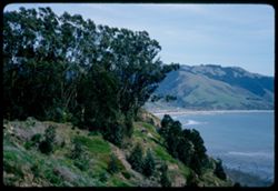
- Description:
- 100 f 8
- Subject:
- Bays (Bodies of water), Grasses, Cliffs, Trees, Coastlines, Bolinas Bay (Calif.), Mountains, Beaches, Shrubs, and Hills
- Series:
- 1-68
- Creator:
- Cushman, Charles W., 1896-1972
- Date Created:
- 1968-03-20
- Genre:
- Landscape photographs and Seascapes
- Frame Number:
- 29
- County:
- Marin
- Abstract:
- Across Bolinas Bay
- Call Number:
- P15623
- City:
- Bolinas
- Country:
- United States
- State/Province:
- California
- Alternate Identifier:
- 168.29
- Persistent URL:
- http://purl.dlib.indiana.edu/iudl/archives/cushman/P15623
- Holding Location:
- Bloomington - University Archives
Wells Library E460
1320 E 10th St.
Bloomington, IN 47405
Contact at archives@indiana.edu, 812-855-1127
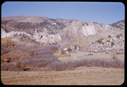
-
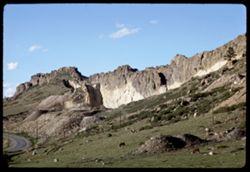
- Description:
- 100 f 11 tl
- Subject:
- Rocks, Cliffs, Grazing, Mining, Cattle, Mountains, Rock formations, Utility poles, Roads, and Shrubs
- Series:
- 9-66
- Creator:
- Cushman, Charles W., 1896-1972
- Date Created:
- 1966-06-14
- Genre:
- Landscape photographs
- Frame Number:
- 22
- Street Address:
- Colorado State Highway 93
- County:
- Jefferson and Boulder
- Call Number:
- P15425
- City:
- Golden and Boulder
- Country:
- United States
- State/Province:
- Colorado
- Alternate Identifier:
- 966.22
- Persistent URL:
- http://purl.dlib.indiana.edu/iudl/archives/cushman/P15425
- Holding Location:
- Bloomington - University Archives
Wells Library E460
1320 E 10th St.
Bloomington, IN 47405
Contact at archives@indiana.edu, 812-855-1127
-
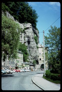
- Description:
- 100 f 11
- Subject:
- Cliffs, Automobiles, Trees, Streets, Monchsberg (Salzburg, Austria), Street lights, Rock formations, Utility poles, Mountains, Buildings, Sidewalks, and Shrubs
- Series:
- 10-64
- Creator:
- Cushman, Charles W., 1896-1972
- Date Created:
- 1964-05-27
- Genre:
- Cityscape photographs
- Frame Number:
- 38
- Street Address:
- Josefs-Kai
- Abstract:
- Josefs Kai below Monchsberg
- Call Number:
- P13315
- City:
- Salzburg
- Country:
- Austria
- State/Province:
- Salzburg
- Alternate Identifier:
- 1064.38
- Persistent URL:
- http://purl.dlib.indiana.edu/iudl/archives/cushman/P13315
- Holding Location:
- Bloomington - University Archives
Wells Library E460
1320 E 10th St.
Bloomington, IN 47405
Contact at archives@indiana.edu, 812-855-1127
-
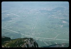
- Description:
- 100 f 8
- Subject:
- Rock formations, Hills, Mountains, Untersberg (Austria), Shrubs, Roads, Airports, and Cliffs
- Series:
- 9-64
- Creator:
- Cushman, Charles W., 1896-1972
- Date Created:
- 1964-05-24
- Genre:
- Landscape photographs
- Frame Number:
- 17
- Abstract:
- On Untersberg Toward Salzburg
- Call Number:
- P13257
- City:
- Salzburg
- Country:
- Austria
- State/Province:
- Salzburg
- Alternate Identifier:
- 964.17
- Persistent URL:
- http://purl.dlib.indiana.edu/iudl/archives/cushman/P13257
- Holding Location:
- Bloomington - University Archives
Wells Library E460
1320 E 10th St.
Bloomington, IN 47405
Contact at archives@indiana.edu, 812-855-1127
-
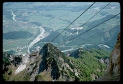
- Description:
- 100 f 8
- Subject:
- Snow, Untersberg (Austria), Salzach River (Austria and Germany), Cliffs, Cable railroads, Mountains, Shrubs, Forests, Rivers, and Rock formations
- Series:
- 9-64
- Creator:
- Cushman, Charles W., 1896-1972
- Date Created:
- 1964-05-24
- Genre:
- Landscape photographs, Views, and Cityscape photographs
- Frame Number:
- 15
- Abstract:
- On Untersberg Looking down to right of cables
- Call Number:
- P13255
- City:
- Salzburg
- Country:
- Austria
- State/Province:
- Salzburg
- Alternate Identifier:
- 964.15
- Persistent URL:
- http://purl.dlib.indiana.edu/iudl/archives/cushman/P13255
- Holding Location:
- Bloomington - University Archives
Wells Library E460
1320 E 10th St.
Bloomington, IN 47405
Contact at archives@indiana.edu, 812-855-1127
-
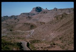
- Description:
- 100 f 11 SL
- Subject:
- Erosion, Cliffs, Mesas, Mountains, Rock formations, Utility poles, Roads, and Shrubs
- Series:
- 5-62
- Creator:
- Cushman, Charles W., 1896-1972
- Date Created:
- 1962-10-07
- Genre:
- Landscape photographs
- Frame Number:
- 22
- Street Address:
- Sitgreaves Pass
- County:
- Mohave
- Abstract:
- West side of Sitgreaves Pass
- Call Number:
- P12789
- Country:
- United States
- State/Province:
- Arizona
- Alternate Identifier:
- 562.22
- Persistent URL:
- http://purl.dlib.indiana.edu/iudl/archives/cushman/P12789
- Holding Location:
- Bloomington - University Archives
Wells Library E460
1320 E 10th St.
Bloomington, IN 47405
Contact at archives@indiana.edu, 812-855-1127
-
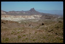
- Description:
- 100 f 11 SL
- Subject:
- Rocks, Erosion, Cliffs, Buttes, Mountains, Rock formations, Hills, and Shrubs
- Series:
- 5-62
- Creator:
- Cushman, Charles W., 1896-1972
- Date Created:
- 1962-10-07
- Genre:
- Landscape photographs
- Frame Number:
- 21
- Street Address:
- Sitgreaves Pass
- County:
- Mohave
- Abstract:
- Expanse
- Call Number:
- P12788
- Country:
- United States
- State/Province:
- Arizona
- Alternate Identifier:
- 562.21
- Persistent URL:
- http://purl.dlib.indiana.edu/iudl/archives/cushman/P12788
- Holding Location:
- Bloomington - University Archives
Wells Library E460
1320 E 10th St.
Bloomington, IN 47405
Contact at archives@indiana.edu, 812-855-1127
-
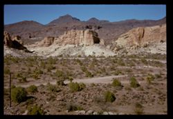
- Description:
- 100 f 11 SL
- Subject:
- Rocks, Erosion, Cliffs, Buttes, Mountains, Shrubs, Hills, Roads, and Rock formations
- Series:
- 5-62
- Creator:
- Cushman, Charles W., 1896-1972
- Date Created:
- 1962-10-07
- Genre:
- Landscape photographs
- Frame Number:
- 20
- Street Address:
- Sitgreaves Pass
- County:
- Mohave
- Abstract:
- Light + dark rock
- Call Number:
- P12787
- Country:
- United States
- State/Province:
- Arizona
- Alternate Identifier:
- 562.20
- Persistent URL:
- http://purl.dlib.indiana.edu/iudl/archives/cushman/P12787
- Holding Location:
- Bloomington - University Archives
Wells Library E460
1320 E 10th St.
Bloomington, IN 47405
Contact at archives@indiana.edu, 812-855-1127
-
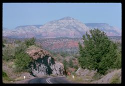
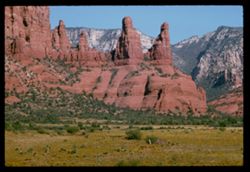
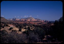
- Description:
- 100 f 9
- Subject:
- Hills, Roads, Cliffs, Mountains, Shrubs, Trees, and Grasses
- Series:
- 5-62
- Creator:
- Cushman, Charles W., 1896-1972
- Date Created:
- 1962-10-05
- Genre:
- Landscape photographs
- Frame Number:
- 17
- County:
- Coconino
- Abstract:
- East from 6 or 7 mi. west of Sedona
- Call Number:
- P12784
- City:
- Sedona
- Country:
- United States
- State/Province:
- Arizona
- Alternate Identifier:
- 562.17
- Persistent URL:
- http://purl.dlib.indiana.edu/iudl/archives/cushman/P12784
- Holding Location:
- Bloomington - University Archives
Wells Library E460
1320 E 10th St.
Bloomington, IN 47405
Contact at archives@indiana.edu, 812-855-1127
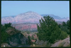
-
- Description:
- 100 f 11
- Subject:
- Hills, Roads, Cliffs, Mountains, Shrubs, Trees, and Grasses
- Series:
- 5-62
- Creator:
- Cushman, Charles W., 1896-1972
- Date Created:
- 1962-10-05
- Genre:
- Landscape photographs
- Frame Number:
- 16
- County:
- Coconino
- Abstract:
- East from 6 or 7 mi. west of Sedona
- Call Number:
- P12783
- City:
- Sedona
- Country:
- United States
- State/Province:
- Arizona
- Alternate Identifier:
- 562.16
- Persistent URL:
- http://purl.dlib.indiana.edu/iudl/archives/cushman/P12783
- Holding Location:
- Bloomington - University Archives
Wells Library E460
1320 E 10th St.
Bloomington, IN 47405
Contact at archives@indiana.edu, 812-855-1127
-
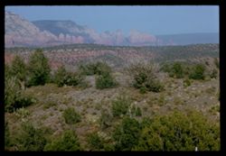
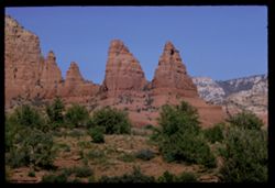
- Description:
- 100 f 13 ?
- Subject:
- Cliffs, Cactus, Trees, Mountains, Shrubs, and Hills
- Series:
- 5-62
- Creator:
- Cushman, Charles W., 1896-1972
- Date Created:
- 1962-10-05
- Genre:
- Landscape photographs
- Frame Number:
- 15
- County:
- Coconino
- Abstract:
- East from 6 or 7 mi west of Sedona
- Call Number:
- P12782
- City:
- Sedona
- Country:
- United States
- State/Province:
- Arizona
- Alternate Identifier:
- 562.15
- Persistent URL:
- http://purl.dlib.indiana.edu/iudl/archives/cushman/P12782
- Holding Location:
- Bloomington - University Archives
Wells Library E460
1320 E 10th St.
Bloomington, IN 47405
Contact at archives@indiana.edu, 812-855-1127
-
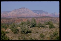
- Description:
- 100 f 13 ?
- Subject:
- Cliffs, Cactus, Trees, Mountains, Shrubs, and Hills
- Series:
- 5-62
- Creator:
- Cushman, Charles W., 1896-1972
- Date Created:
- 1962-10-05
- Genre:
- Landscape photographs
- Frame Number:
- 14
- County:
- Coconino
- Abstract:
- East from 6 or 7 mi west of Sedona
- Call Number:
- P12781
- City:
- Sedona
- Country:
- United States
- State/Province:
- Arizona
- Alternate Identifier:
- 562.14
- Persistent URL:
- http://purl.dlib.indiana.edu/iudl/archives/cushman/P12781
- Holding Location:
- Bloomington - University Archives
Wells Library E460
1320 E 10th St.
Bloomington, IN 47405
Contact at archives@indiana.edu, 812-855-1127
-
- Description:
- 100 f 11 TL
- Subject:
- Erosion, Cliffs, Buttes, Mountains, Rock formations, Grasses, and Shrubs
- Series:
- 5-62
- Creator:
- Cushman, Charles W., 1896-1972
- Date Created:
- 1962-10-05
- Genre:
- Landscape photographs
- Frame Number:
- 10
- County:
- Coconino
- Abstract:
- Little peaks so. of Sedona from west
- Call Number:
- P12777
- City:
- Sedona
- Country:
- United States
- State/Province:
- Arizona
- Alternate Identifier:
- 562.10
- Persistent URL:
- http://purl.dlib.indiana.edu/iudl/archives/cushman/P12777
- Holding Location:
- Bloomington - University Archives
Wells Library E460
1320 E 10th St.
Bloomington, IN 47405
Contact at archives@indiana.edu, 812-855-1127
-
- Description:
- 100 f 13 TL
- Subject:
- Erosion, Hills, Cliffs, Mountains, Shrubs, Trees, Buttes, and Rock formations
- Series:
- 5-62
- Creator:
- Cushman, Charles W., 1896-1972
- Date Created:
- 1962-10-15
- Genre:
- Landscape photographs
- Frame Number:
- 9
- County:
- Coconino
- Abstract:
- Little peaks so. of Sedona
- Call Number:
- P12776
- City:
- Sedona
- Country:
- United States
- State/Province:
- Arizona
- Alternate Identifier:
- 562.9
- Persistent URL:
- http://purl.dlib.indiana.edu/iudl/archives/cushman/P12776
- Holding Location:
- Bloomington - University Archives
Wells Library E460
1320 E 10th St.
Bloomington, IN 47405
Contact at archives@indiana.edu, 812-855-1127
-
- Description:
- 50 f 8 sl
- Subject:
- Rocks, Columbia River, Cliffs, Trees, Plains, Mountains, Shrubs, Hills, and Grasses
- Series:
- 24-60
- Creator:
- Cushman, Charles W., 1896-1972
- Date Created:
- 1960-09-19
- Genre:
- Landscape photographs
- Frame Number:
- 16
- County:
- Wasco
- Abstract:
- Washington side of Columbia 10m: from The Dalles
- Call Number:
- P11670
- City:
- Dalles
- Country:
- United States
- State/Province:
- Washington
- Alternate Identifier:
- 2460.16
- Persistent URL:
- http://purl.dlib.indiana.edu/iudl/archives/cushman/P11670
- Holding Location:
- Bloomington - University Archives
Wells Library E460
1320 E 10th St.
Bloomington, IN 47405
Contact at archives@indiana.edu, 812-855-1127
-
- Description:
- 100 f 6.3 tl
- Subject:
- Columbia River, Cliffs, Columbia River Palisades, Mountains, Shrubs, Columbia Palisades, and Rock formations
- Series:
- 24-60
- Creator:
- Cushman, Charles W., 1896-1972
- Date Created:
- 1960-09-19
- Genre:
- Landscape photographs
- Frame Number:
- 12
- County:
- Wasco
- Abstract:
- Palisades on right bank
- Call Number:
- P11666
- City:
- Rowena
- Country:
- United States
- State/Province:
- Oregon
- Alternate Identifier:
- 2460.12
- Persistent URL:
- http://purl.dlib.indiana.edu/iudl/archives/cushman/P11666
- Holding Location:
- Bloomington - University Archives
Wells Library E460
1320 E 10th St.
Bloomington, IN 47405
Contact at archives@indiana.edu, 812-855-1127
-
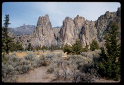
- Description:
- 50 f 9
- Subject:
- Cliffs, Trees, Buttes, Mountains, Rock formations, Smith Rock (Or.), and Shrubs
- Series:
- 23-60
- Creator:
- Cushman, Charles W., 1896-1972
- Date Created:
- 1960-09-17
- Genre:
- Landscape photographs
- Frame Number:
- 33
- County:
- Deschutes
- Abstract:
- Broad view of 29 + 30
- Call Number:
- P11652
- Country:
- United States
- State/Province:
- Oregon
- Alternate Identifier:
- 2360.33
- Persistent URL:
- http://purl.dlib.indiana.edu/iudl/archives/cushman/P11652
- Holding Location:
- Bloomington - University Archives
Wells Library E460
1320 E 10th St.
Bloomington, IN 47405
Contact at archives@indiana.edu, 812-855-1127
-
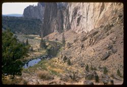
- Description:
- 50 f 6.3 sl
- Subject:
- Cliffs, Trees, Boulders, Buttes, Mountains, Shrubs, Smith Rock (Or.), Streams, and Rock formations
- Series:
- 23-60
- Creator:
- Cushman, Charles W., 1896-1972
- Date Created:
- 1960-09-17
- Genre:
- Landscape photographs
- Frame Number:
- 32
- County:
- Deschutes
- Abstract:
- Looking down into creek
- Call Number:
- P11651
- Country:
- United States
- State/Province:
- Oregon
- Alternate Identifier:
- 2360.32
- Persistent URL:
- http://purl.dlib.indiana.edu/iudl/archives/cushman/P11651
- Holding Location:
- Bloomington - University Archives
Wells Library E460
1320 E 10th St.
Bloomington, IN 47405
Contact at archives@indiana.edu, 812-855-1127
-
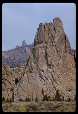
- Description:
- 100 f 8 tl
- Subject:
- Cliffs, Buttes, Mountains, Rock formations, Smith Rock (Or.), and Shrubs
- Series:
- 23-60
- Creator:
- Cushman, Charles W., 1896-1972
- Date Created:
- 1960-09-17
- Genre:
- Landscape photographs and Identification photographs
- Frame Number:
- 29
- County:
- Deschutes
- Call Number:
- P11649
- City:
- Terrebonne
- Country:
- United States
- State/Province:
- Oregon
- Alternate Identifier:
- 2360.29
- Persistent URL:
- http://purl.dlib.indiana.edu/iudl/archives/cushman/P11649
- Holding Location:
- Bloomington - University Archives
Wells Library E460
1320 E 10th St.
Bloomington, IN 47405
Contact at archives@indiana.edu, 812-855-1127
-
- Description:
- 50 f 11 sl
- Subject:
- Rocks, Sinewava, Temple of (Utah), Angels Landing (Utah), Cliffs, Trees, Mountains, Castle Dome (Utah), National parks & reserves, Zion National Park (Ut...
- Series:
- 7-58
- Creator:
- Cushman, Charles W., 1896-1972
- Date Created:
- 1958-04-28
- Genre:
- Landscape photographs
- Frame Number:
- 19
- County:
- Washington
- Abstract:
- Castle Dome ? or Cathedral Mtn? - just south of Angel's L.
- Call Number:
- P09872
- Country:
- United States
- State/Province:
- Utah
- Alternate Identifier:
- 758.19
- Persistent URL:
- http://purl.dlib.indiana.edu/iudl/archives/cushman/P09872
- Holding Location:
- Bloomington - University Archives
Wells Library E460
1320 E 10th St.
Bloomington, IN 47405
Contact at archives@indiana.edu, 812-855-1127
-
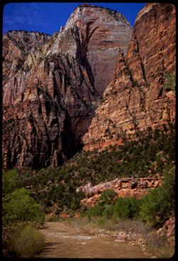
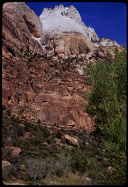
- Description:
- 100 f 6.3 sl
- Subject:
- Canyons, Cliffs, Trees, Swing bridge, Grotto Campground (Utah), Mountains, Shrubs, Zion National Park (Utah), Rivers, National parks & reserves, and Rock...
- Series:
- 7-58
- Creator:
- Cushman, Charles W., 1896-1972
- Date Created:
- 1958-04-28
- Genre:
- Landscape photographs
- Frame Number:
- 17
- County:
- Washington
- Abstract:
- View downstream from Swing Bridge at Grotto Campground
- Call Number:
- P09870
- Country:
- United States
- State/Province:
- Utah
- Alternate Identifier:
- 758.17
- Persistent URL:
- http://purl.dlib.indiana.edu/iudl/archives/cushman/P09870
- Holding Location:
- Bloomington - University Archives
Wells Library E460
1320 E 10th St.
Bloomington, IN 47405
Contact at archives@indiana.edu, 812-855-1127
-
- Description:
- 100 f 8 tl ?
- Subject:
- Canyons, Cajon Canyon (Calif.), Cliffs, Mountains, Shrubs, Cajon Pass (Calif.), and Rock formations
- Series:
- 7-57
- Creator:
- Cushman, Charles W., 1896-1972
- Date Created:
- 1957-05-14
- Genre:
- Landscape photographs
- Frame Number:
- 7
- Street Address:
- United States Highway 66
- County:
- San Bernardino
- Abstract:
- View SW & W from high point on US 66 through Cajon Pass (4255') View SW
- Call Number:
- P09286
- Country:
- United States
- State/Province:
- California
- Alternate Identifier:
- 757.7
- Persistent URL:
- http://purl.dlib.indiana.edu/iudl/archives/cushman/P09286
- Holding Location:
- Bloomington - University Archives
Wells Library E460
1320 E 10th St.
Bloomington, IN 47405
Contact at archives@indiana.edu, 812-855-1127
-
- Description:
- 100 f 7 tl
- Subject:
- Cajon Canyon (Calif.), Cliffs, Mountains, Shrubs, Clouds, Utility poles, Rock formations, and Sandstone
- Series:
- 6-57
- Creator:
- Cushman, Charles W., 1896-1972
- Date Created:
- 1957-05-14
- Genre:
- Landscape photographs
- Frame Number:
- 37
- County:
- San Bernardino
- Abstract:
- Sandstone rock in lower Cajon Canyon
- Call Number:
- P09279
- Country:
- United States
- State/Province:
- California
- Alternate Identifier:
- 657.37
- Persistent URL:
- http://purl.dlib.indiana.edu/iudl/archives/cushman/P09279
- Holding Location:
- Bloomington - University Archives
Wells Library E460
1320 E 10th St.
Bloomington, IN 47405
Contact at archives@indiana.edu, 812-855-1127
-
- Description:
- 50 f 8
- Subject:
- Rocks, Canyons, Cliffs, Trees, Lee Vining Creek (Calif.), Mountains, and Shrubs
- Series:
- 10-54
- Creator:
- Cushman, Charles W., 1896-1972
- Date Created:
- 1954-09-16
- Genre:
- Landscape photographs
- Frame Number:
- 20
- Street Address:
- California State Highway 140
- County:
- Mono
- Abstract:
- View down into canyon.
- Call Number:
- P07367
- City:
- Lee Vining
- Country:
- United States
- State/Province:
- California
- Physical Description:
- Anscochrome film.
- Alternate Identifier:
- 1054.20
- Persistent URL:
- http://purl.dlib.indiana.edu/iudl/archives/cushman/P07367
- Holding Location:
- Bloomington - University Archives
Wells Library E460
1320 E 10th St.
Bloomington, IN 47405
Contact at archives@indiana.edu, 812-855-1127
-
- Description:
- 100 f 6
- Subject:
- Rocks, Cliffs, Volcanic rock, Trees, Lassen Volcanic National Park (Calif.), Mountains, Shrubs, Clouds, Bumpass Mountain (Calif.), and Rock formations
- Series:
- 5-54
- Creator:
- Cushman, Charles W., 1896-1972
- Date Created:
- 1954-08-19
- Genre:
- Landscape photographs
- Frame Number:
- 20
- County:
- Shasta
- Abstract:
- A lava bump - [P] in strong wind
- Call Number:
- P07216
- Country:
- United States
- State/Province:
- California
- Physical Description:
- Anscochrome film.
- Alternate Identifier:
- 554.20
- Persistent URL:
- http://purl.dlib.indiana.edu/iudl/archives/cushman/P07216
- Holding Location:
- Bloomington - University Archives
Wells Library E460
1320 E 10th St.
Bloomington, IN 47405
Contact at archives@indiana.edu, 812-855-1127
-
- Description:
- 50 f 8
- Subject:
- Bumpass Mountain (Calif.), Lava domes, Lassen Volcanic National Park (Calif.), Volcanic domes, Cliffs, Mountains, Shrubs, Pines, Volcanoes, and Trees
- Series:
- 5-54
- Creator:
- Cushman, Charles W., 1896-1972
- Date Created:
- 1954-08-19
- Genre:
- Landscape photographs
- Frame Number:
- 19
- County:
- Shasta
- Abstract:
- Great tree clad cliff, probably side of Bumpass Mtn- tall pines top in center
- Call Number:
- P07215
- Country:
- United States
- State/Province:
- California
- Physical Description:
- Anscochrome film.
- Alternate Identifier:
- 554.19
- Persistent URL:
- http://purl.dlib.indiana.edu/iudl/archives/cushman/P07215
- Holding Location:
- Bloomington - University Archives
Wells Library E460
1320 E 10th St.
Bloomington, IN 47405
Contact at archives@indiana.edu, 812-855-1127
-
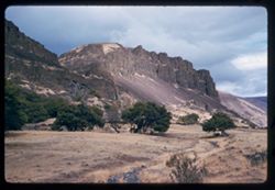
- Description:
- 50 f 8
- Subject:
- Rocks, Cliffs, Raker Peak (Calif.), Volcanoes, Volcanic domes, Lassen Volcanic National Park (Calif.), Devastated Area (Calif.), Lava domes, Shrubs, Shield v...
- Series:
- 5-54
- Creator:
- Cushman, Charles W., 1896-1972
- Date Created:
- 1954-08-19
- Genre:
- Landscape photographs
- Frame Number:
- 4
- County:
- Shasta
- Abstract:
- Looking up at Raker Mtn face above Devastated Area
- Call Number:
- P07200
- Country:
- United States
- State/Province:
- California
- Physical Description:
- Anscochrome film.
- Alternate Identifier:
- 554.4
- Persistent URL:
- http://purl.dlib.indiana.edu/iudl/archives/cushman/P07200
- Holding Location:
- Bloomington - University Archives
Wells Library E460
1320 E 10th St.
Bloomington, IN 47405
Contact at archives@indiana.edu, 812-855-1127
-
- Description:
- 50 f 6.3 POLA
- Subject:
- Grasses, Cliffs, Mesas, Mountains, Fences, Shrubs, Clouds, Hills, and Trees
- Series:
- 15-53
- Creator:
- Cushman, Charles W., 1896-1972
- Date Created:
- 1953-11-21
- Genre:
- Landscape photographs
- Frame Number:
- 18
- Street Address:
- United States Highway 89A
- County:
- Coconino
- Abstract:
- View North
- Call Number:
- P07051
- City:
- Sedona
- Country:
- United States
- State/Province:
- Arizona
- Alternate Identifier:
- 1553.18
- Persistent URL:
- http://purl.dlib.indiana.edu/iudl/archives/cushman/P07051
- Holding Location:
- Bloomington - University Archives
Wells Library E460
1320 E 10th St.
Bloomington, IN 47405
Contact at archives@indiana.edu, 812-855-1127
-
- Description:
- 50 f 6.3 POLA
- Subject:
- Grasses, Cliffs, Trees, Mountains, Shrubs, Hills, Mesas, and Rock formations
- Series:
- 15-53
- Creator:
- Cushman, Charles W., 1896-1972
- Date Created:
- 1953-11-21
- Genre:
- Landscape photographs
- Frame Number:
- 17
- Street Address:
- United States Highway 89A
- County:
- Coconino
- Abstract:
- View NE.
- Call Number:
- P07050
- City:
- Sedona
- Country:
- United States
- State/Province:
- Arizona
- Alternate Identifier:
- 1553.17
- Persistent URL:
- http://purl.dlib.indiana.edu/iudl/archives/cushman/P07050
- Holding Location:
- Bloomington - University Archives
Wells Library E460
1320 E 10th St.
Bloomington, IN 47405
Contact at archives@indiana.edu, 812-855-1127
-
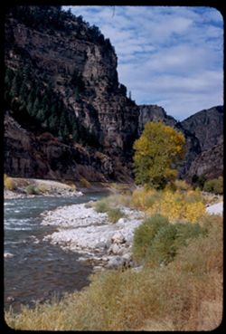
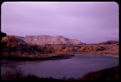
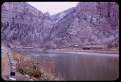
- Description:
- 50 f 8
- Subject:
- Rocks, Valleys, Grasses, Cliffs, Trees, Pines, Mountains, Shrubs, Rivers, Glenwood Canyon (Colo.), Canyons, and Colorado River (Colo.-Mexico)
- Series:
- 9-53
- Creator:
- Cushman, Charles W., 1896-1972
- Date Created:
- 1953-10-13
- Frame Number:
- 39
- County:
- Garfield
- Abstract:
- Glenwood canyon
- Call Number:
- P06840
- City:
- Glenwood Springs
- Country:
- United States
- State/Province:
- Colorado
- Alternate Identifier:
- 953.39
- Persistent URL:
- http://purl.dlib.indiana.edu/iudl/archives/cushman/P06840
- Holding Location:
- Bloomington - University Archives
Wells Library E460
1320 E 10th St.
Bloomington, IN 47405
Contact at archives@indiana.edu, 812-855-1127
-
- Description:
- 50 f 11
- Subject:
- Grasses, Roads, Trees, Mountains, Fences, Shrubs, Clouds, Hills, Cliffs, and Bridges
- Series:
- 9-53
- Creator:
- Cushman, Charles W., 1896-1972
- Date Created:
- 1953-10-12
- Genre:
- Landscape photographs
- Frame Number:
- 35
- County:
- Mesa
- Abstract:
- Mtns near De Beque
- Call Number:
- P06836
- City:
- De Beque
- Country:
- United States
- State/Province:
- Colorado
- Alternate Identifier:
- 953.35
- Persistent URL:
- http://purl.dlib.indiana.edu/iudl/archives/cushman/P06836
- Holding Location:
- Bloomington - University Archives
Wells Library E460
1320 E 10th St.
Bloomington, IN 47405
Contact at archives@indiana.edu, 812-855-1127
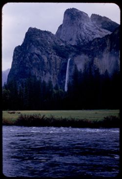
-
- Description:
- 25 f 5.6
- Subject:
- Rain, Cliffs, Bridalveil Fall (Calif.), Yosemite National Park (Calif.), Waterfalls, Trees, Mountains, Shrubs, Merced River (Calif.), Rivers, and National pa...
- Series:
- 6-53
- Creator:
- Cushman, Charles W., 1896-1972
- Date Created:
- 1953-05-14
- Genre:
- Landscape photographs
- Frame Number:
- 12
- County:
- Mariposa
- Abstract:
- Bridal Veil Fall - in the rain - sky a bit brighter [P]
- Call Number:
- P06700
- Country:
- United States
- State/Province:
- California
- Alternate Identifier:
- 653.12
- Persistent URL:
- http://purl.dlib.indiana.edu/iudl/archives/cushman/P06700
- Holding Location:
- Bloomington - University Archives
Wells Library E460
1320 E 10th St.
Bloomington, IN 47405
Contact at archives@indiana.edu, 812-855-1127
-
- Description:
- 25 f 9
- Subject:
- Rocks, Electric lines, Cliffs, Boulders, Mountains, Rock formations, Hills, and Shrubs
- Series:
- 27-52
- Creator:
- Cushman, Charles W., 1896-1972
- Date Created:
- 1952-11-05
- Genre:
- Snapshots and Identification photographs
- Frame Number:
- 34
- Street Address:
- United States Highway 50
- County:
- Utah
- Abstract:
- Odd rock formation Utah Co. Utah.
- Call Number:
- P06479
- Country:
- United States
- State/Province:
- Utah
- Alternate Identifier:
- 2752.34
- Persistent URL:
- http://purl.dlib.indiana.edu/iudl/archives/cushman/P06479
- Holding Location:
- Bloomington - University Archives
Wells Library E460
1320 E 10th St.
Bloomington, IN 47405
Contact at archives@indiana.edu, 812-855-1127
-
- Description:
- 25 f 9
- Subject:
- Hills, Barbed wire, Cliffs, Mountains, Shrubs, Trees, Rock formations, Fences, and Boulders
- Series:
- 27-52
- Creator:
- Cushman, Charles W., 1896-1972
- Date Created:
- 1952-11-05
- Genre:
- Landscape photographs
- Frame Number:
- 35
- Street Address:
- United States Highway 50
- County:
- Utah
- Abstract:
- Odd rock formation - east of Thistle.
- Call Number:
- P06480
- City:
- Thistle
- Country:
- United States
- State/Province:
- Utah
- Alternate Identifier:
- 2752.35
- Persistent URL:
- http://purl.dlib.indiana.edu/iudl/archives/cushman/P06480
- Holding Location:
- Bloomington - University Archives
Wells Library E460
1320 E 10th St.
Bloomington, IN 47405
Contact at archives@indiana.edu, 812-855-1127
-
- Description:
- 25 f 9
- Subject:
- Canyons, Roads, Mountains, Denver and Rio Grande Western Railway Company, Rock formations, Railroad tracks, Railroad cars, Coal, Cliffs, Buildings, Price Riv...
- Series:
- 27-52
- Creator:
- Cushman, Charles W., 1896-1972
- Date Created:
- 1952-11-05
- Genre:
- Landscape photographs
- Frame Number:
- 31
- Street Address:
- United States Highway 50
- County:
- Carbon
- Abstract:
- Hwy 50 runs through Price river gorge along with D + RGW at Royal, north of Helper.
- Call Number:
- P06476
- City:
- Royal and Helper
- Country:
- United States
- State/Province:
- Utah
- Alternate Identifier:
- 2752.31
- Persistent URL:
- http://purl.dlib.indiana.edu/iudl/archives/cushman/P06476
- Holding Location:
- Bloomington - University Archives
Wells Library E460
1320 E 10th St.
Bloomington, IN 47405
Contact at archives@indiana.edu, 812-855-1127
-
- Description:
- 50 f 9
- Subject:
- Rocks, Cliffs, Dirt roads, Trees, Mountains, National parks & reserves, Devils Garden (Grand County, Utah), Hills, Shrubs, and Arches National Park (Utah)
- Series:
- 27-52
- Creator:
- Cushman, Charles W., 1896-1972
- Date Created:
- 1952-11-04
- Genre:
- Landscape photographs
- Frame Number:
- 20
- County:
- Grand
- Abstract:
- En route to Devil's Garden.
- Call Number:
- P06465
- Country:
- United States
- State/Province:
- Utah
- Alternate Identifier:
- 2752.20
- Persistent URL:
- http://purl.dlib.indiana.edu/iudl/archives/cushman/P06465
- Holding Location:
- Bloomington - University Archives
Wells Library E460
1320 E 10th St.
Bloomington, IN 47405
Contact at archives@indiana.edu, 812-855-1127
-

- Description:
- 25 f 10
- Subject:
- Cliffs, Mountains, Shrubs, and Trees
- Series:
- 26-52
- Creator:
- Cushman, Charles W., 1896-1972
- Date Created:
- 1952-11-04
- Genre:
- Landscape photographs
- Frame Number:
- 36
- County:
- Grand
- Abstract:
- High ridge back.
- Call Number:
- P06442
- City:
- Moab
- Country:
- United States
- State/Province:
- Utah
- Alternate Identifier:
- 2652.36
- Persistent URL:
- http://purl.dlib.indiana.edu/iudl/archives/cushman/P06442
- Holding Location:
- Bloomington - University Archives
Wells Library E460
1320 E 10th St.
Bloomington, IN 47405
Contact at archives@indiana.edu, 812-855-1127
-
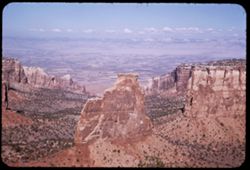
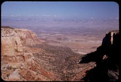
- Description:
- 25 f 11
- Subject:
- Valleys, Cliffs, Colorado National Monument (Colo.), Grand View Overlook (Colo.), Mesas, Colorado River (Colo.-Mexico), Buttes, Mountains, Rock formations, C...
- Series:
- 26-52
- Creator:
- Cushman, Charles W., 1896-1972
- Date Created:
- 1952-11-03
- Genre:
- Landscape photographs
- Frame Number:
- 19
- County:
- Mesa
- Abstract:
- from Grandview Overlook.
- Call Number:
- P06425
- City:
- Grand Junction
- Country:
- United States
- State/Province:
- Colorado
- Alternate Identifier:
- 2652.19
- Persistent URL:
- http://purl.dlib.indiana.edu/iudl/archives/cushman/P06425
- Holding Location:
- Bloomington - University Archives
Wells Library E460
1320 E 10th St.
Bloomington, IN 47405
Contact at archives@indiana.edu, 812-855-1127
-
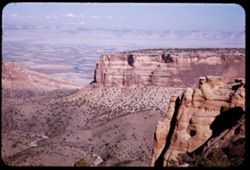
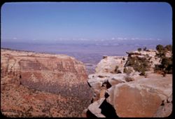
- Description:
- 25 f 11
- Subject:
- Valleys, Bodies of water, Cliffs, Colorado National Monument (Colo.), Mesas, Colorado River (Colo.-Mexico), Shadows, Mountains, Rock formations, Colorado Riv...
- Series:
- 26-52
- Creator:
- Cushman, Charles W., 1896-1972
- Date Created:
- 1952-11-03
- Genre:
- Landscape photographs
- Frame Number:
- 17
- County:
- Mesa
- Abstract:
- view north.
- Call Number:
- P06423
- City:
- Grand Junction
- Country:
- United States
- State/Province:
- Colorado
- Alternate Identifier:
- 2652.17
- Persistent URL:
- http://purl.dlib.indiana.edu/iudl/archives/cushman/P06423
- Holding Location:
- Bloomington - University Archives
Wells Library E460
1320 E 10th St.
Bloomington, IN 47405
Contact at archives@indiana.edu, 812-855-1127
-
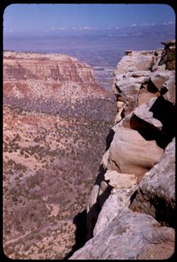
- Description:
- 25 f 12
- Subject:
- Canyons, Cliffs, Colorado National Monument (Colo.), Mesas, Shadows, Mountains, Rock formations, Roads, National parks & reserves, and Shrubs
- Series:
- 26-52
- Creator:
- Cushman, Charles W., 1896-1972
- Date Created:
- 1952-11-03
- Genre:
- Landscape photographs
- Frame Number:
- 12
- County:
- Mesa
- Abstract:
- Grand shelves.
- Call Number:
- P06419
- City:
- Grand Junction
- Country:
- United States
- State/Province:
- Colorado
- Alternate Identifier:
- 2652.12
- Persistent URL:
- http://purl.dlib.indiana.edu/iudl/archives/cushman/P06419
- Holding Location:
- Bloomington - University Archives
Wells Library E460
1320 E 10th St.
Bloomington, IN 47405
Contact at archives@indiana.edu, 812-855-1127
-
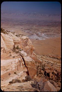
- Description:
- 25 f 12
- Subject:
- National parks & reserves, Canyons, Colorado National Monument (Colo.), Cliffs, Mountains, Shrubs, Trees, Scenic overlooks, and Mesas
- Series:
- 26-52
- Creator:
- Cushman, Charles W., 1896-1972
- Date Created:
- 1952-11-03
- Genre:
- Landscape photographs
- Frame Number:
- 11
- Abstract:
- View from Highland Overlook.
- Call Number:
- P06418
- Country:
- United States
- State/Province:
- Colorado
- Alternate Identifier:
- 2652.11
- Persistent URL:
- http://purl.dlib.indiana.edu/iudl/archives/cushman/P06418
- Holding Location:
- Bloomington - University Archives
Wells Library E460
1320 E 10th St.
Bloomington, IN 47405
Contact at archives@indiana.edu, 812-855-1127
-
- Description:
- 25 f 8 Pola
- Subject:
- Valleys, Cliffs, Colorado National Monument (Colo.), Mesas, Shadows, Mountains, National parks & reserves, Colorado River Valley (Colo.-Mexico), Canyons,...
- Series:
- 26-52
- Creator:
- Cushman, Charles W., 1896-1972
- Date Created:
- 1952-11-03
- Genre:
- Landscape photographs
- Frame Number:
- 10
- Abstract:
- Panorama down the canyon.
- Call Number:
- P06417
- Country:
- United States
- State/Province:
- Colorado
- Alternate Identifier:
- 2652.10
- Persistent URL:
- http://purl.dlib.indiana.edu/iudl/archives/cushman/P06417
- Holding Location:
- Bloomington - University Archives
Wells Library E460
1320 E 10th St.
Bloomington, IN 47405
Contact at archives@indiana.edu, 812-855-1127
-
- Description:
- 25 f 8 Pola
- Subject:
- Colorado National Monument (Colo.), Mountains, Trees, Canyons, Cold Shivers Point (Colo.), National parks & reserves, Shrubs, Mesas, and Cliffs
- Series:
- 26-52
- Creator:
- Cushman, Charles W., 1896-1972
- Date Created:
- 1952-11-03
- Genre:
- Landscape photographs
- Frame Number:
- 9
- Abstract:
- From Cold Shivers Pt.
- Call Number:
- P06416
- Country:
- United States
- State/Province:
- Colorado
- Alternate Identifier:
- 2652.9
- Persistent URL:
- http://purl.dlib.indiana.edu/iudl/archives/cushman/P06416
- Holding Location:
- Bloomington - University Archives
Wells Library E460
1320 E 10th St.
Bloomington, IN 47405
Contact at archives@indiana.edu, 812-855-1127
-
- Description:
- 25 f 11
- Subject:
- Canyons, Cliffs, Colorado National Monument (Colo.), Mesas, Shadows, Mountains, National parks & reserves, Cold Shivers Point (Colo.), and Shrubs
- Series:
- 26-52
- Creator:
- Cushman, Charles W., 1896-1972
- Date Created:
- 1952-11-03
- Genre:
- Landscape photographs
- Frame Number:
- 8
- Abstract:
- From Cold Shivers Pt.
- Call Number:
- P06415
- Country:
- United States
- State/Province:
- Colorado
- Alternate Identifier:
- 2652.8
- Persistent URL:
- http://purl.dlib.indiana.edu/iudl/archives/cushman/P06415
- Holding Location:
- Bloomington - University Archives
Wells Library E460
1320 E 10th St.
Bloomington, IN 47405
Contact at archives@indiana.edu, 812-855-1127
-
- Description:
- 25 f 8 Pola
- Subject:
- Colorado River Valley (Colo.-Mexico), National parks & reserves, Deserts, Valleys, Colorado National Monument (Colo.), Cliffs, Mountains, Shrubs, Buttes,...
- Series:
- 26-52
- Creator:
- Cushman, Charles W., 1896-1972
- Date Created:
- 1952-11-03
- Genre:
- Landscape photographs
- Frame Number:
- 6
- County:
- Mesa
- Abstract:
- View down [P] across buttes + valley of Colo. River.
- Call Number:
- P06413
- City:
- Grand Junction
- Country:
- United States
- State/Province:
- Colorado
- Alternate Identifier:
- 2652.6
- Persistent URL:
- http://purl.dlib.indiana.edu/iudl/archives/cushman/P06413
- Holding Location:
- Bloomington - University Archives
Wells Library E460
1320 E 10th St.
Bloomington, IN 47405
Contact at archives@indiana.edu, 812-855-1127
-
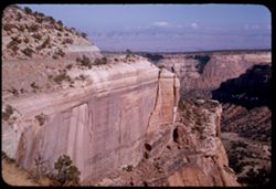
- Description:
- 25 f 6.3 Pola
- Subject:
- Roads, Colorado National Monument (Colo.), Mesas, Mountains, Shrubs, Cliffs, and National parks & reserves
- Series:
- 26-52
- Creator:
- Cushman, Charles W., 1896-1972
- Date Created:
- 1952-11-03
- Genre:
- Landscape photographs
- Frame Number:
- 7
- Abstract:
- Down along 1st rock wall.
- Call Number:
- P06414
- Country:
- United States
- State/Province:
- Colorado
- Alternate Identifier:
- 2652.7
- Persistent URL:
- http://purl.dlib.indiana.edu/iudl/archives/cushman/P06414
- Holding Location:
- Bloomington - University Archives
Wells Library E460
1320 E 10th St.
Bloomington, IN 47405
Contact at archives@indiana.edu, 812-855-1127
-
- Description:
- 25 f 6.3 Pola
- Subject:
- Deserts, Cliffs, Colorado National Monument (Colo.), Mesas, Buttes, Mountains, Shrubs, Clouds, Roads, Trees, and National parks & reserves
- Series:
- 26-52
- Creator:
- Cushman, Charles W., 1896-1972
- Date Created:
- 1952-11-03
- Genre:
- Landscape photographs
- Frame Number:
- 5
- County:
- Mesa
- Abstract:
- View over Grnd Juctn.
- Call Number:
- P06412
- City:
- Grand Junction
- Country:
- United States
- State/Province:
- Colorado
- Alternate Identifier:
- 2652.5
- Persistent URL:
- http://purl.dlib.indiana.edu/iudl/archives/cushman/P06412
- Holding Location:
- Bloomington - University Archives
Wells Library E460
1320 E 10th St.
Bloomington, IN 47405
Contact at archives@indiana.edu, 812-855-1127
-
- Description:
- 25 f 6.3 Pola
- Subject:
- Rocks, Canyons, Cliffs, Colorado National Monument (Colo.), Mesas, Boulders, Mountains, Shrubs, Clouds, Valleys, and National parks & reserves
- Series:
- 26-52
- Creator:
- Cushman, Charles W., 1896-1972
- Date Created:
- 1952-11-04
- Genre:
- Landscape photographs
- Frame Number:
- 4
- County:
- Mesa
- Abstract:
- East along red rock wall.
- Call Number:
- P06411
- City:
- Grand Junction
- Country:
- United States
- State/Province:
- Colorado
- Alternate Identifier:
- 2652.4
- Persistent URL:
- http://purl.dlib.indiana.edu/iudl/archives/cushman/P06411
- Holding Location:
- Bloomington - University Archives
Wells Library E460
1320 E 10th St.
Bloomington, IN 47405
Contact at archives@indiana.edu, 812-855-1127
-
- Description:
- 25 f 9
- Subject:
- National parks & reserves, Berries, Colorado National Monument (Colo.), Cliffs, Mountains, Shrubs, Boulders, Rocks, Junipers, and Trees
- Series:
- 26-52
- Creator:
- Cushman, Charles W., 1896-1972
- Date Created:
- 1952-11-03
- Genre:
- Identification photographs
- Frame Number:
- 3
- County:
- Mesa
- Abstract:
- Juniper. A beauty.
- Call Number:
- P06410
- City:
- Grand Junction
- Country:
- United States
- State/Province:
- Colorado
- Alternate Identifier:
- 2652.3
- Persistent URL:
- http://purl.dlib.indiana.edu/iudl/archives/cushman/P06410
- Holding Location:
- Bloomington - University Archives
Wells Library E460
1320 E 10th St.
Bloomington, IN 47405
Contact at archives@indiana.edu, 812-855-1127
-
- Description:
- 25 f 8
- Subject:
- Cliffs, Mesas, Colorado River (Colo.-Mexico), Mountains, Shrubs, Hills, Utility poles, Rivers, and Trees
- Series:
- 25-52
- Creator:
- Cushman, Charles W., 1896-1972
- Date Created:
- 1952-11-02
- Genre:
- Landscape photographs
- Frame Number:
- 32
- County:
- Mesa
- Abstract:
- The Colorado river 14 miles east of Grand Junction.
- Call Number:
- P06401
- City:
- Grand Junction
- Country:
- United States
- State/Province:
- Colorado
- Alternate Identifier:
- 2552.32
- Persistent URL:
- http://purl.dlib.indiana.edu/iudl/archives/cushman/P06401
- Holding Location:
- Bloomington - University Archives
Wells Library E460
1320 E 10th St.
Bloomington, IN 47405
Contact at archives@indiana.edu, 812-855-1127
-
- Description:
- 25 f 2.8
- Subject:
- Canyons, Glenwood Canyon (Colo.), Roads, Cliffs, Railroad tracks, Mountains, Shrubs, Trees, Buildings, Colorado River (Colo.-Mexico), Rivers, Railroad cars, ...
- Series:
- 25-52
- Creator:
- Cushman, Charles W., 1896-1972
- Date Created:
- 1952-11-02
- Genre:
- Landscape photographs
- Frame Number:
- 30
- County:
- Garfield
- Abstract:
- Dark in Glenwood Canyon.
- Call Number:
- P06399
- City:
- Glenwood Springs
- Country:
- United States
- State/Province:
- Colorado
- Alternate Identifier:
- 2552.30
- Persistent URL:
- http://purl.dlib.indiana.edu/iudl/archives/cushman/P06399
- Holding Location:
- Bloomington - University Archives
Wells Library E460
1320 E 10th St.
Bloomington, IN 47405
Contact at archives@indiana.edu, 812-855-1127
-
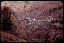
- Description:
- 25 f 4
- Subject:
- Rocks, Rocky Mountains, Valleys, Houses, Trees, Mountains, Buildings, Shrubs, Utility poles, Roads, and Cliffs
- Series:
- 25-52
- Creator:
- Cushman, Charles W., 1896-1972
- Date Created:
- 1952-11-01
- Genre:
- Cityscape photographs
- Frame Number:
- 12
- County:
- Clear Creek
- Abstract:
- Georgetown.
- Call Number:
- P06381
- City:
- Georgetown
- Country:
- United States
- State/Province:
- Colorado
- Alternate Identifier:
- 2552.12
- Persistent URL:
- http://purl.dlib.indiana.edu/iudl/archives/cushman/P06381
- Holding Location:
- Bloomington - University Archives
Wells Library E460
1320 E 10th St.
Bloomington, IN 47405
Contact at archives@indiana.edu, 812-855-1127
-
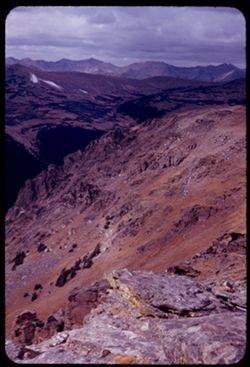
- Description:
- 50 f 8
- Subject:
- National parks & reserves, Rocky Mountains, Passes (Landforms), Rocky Mountain National Park (Colo.), Forests, Cliffs, Mountains, Shrubs, Trees, Rocks, a...
- Series:
- 25-52
- Creator:
- Cushman, Charles W., 1896-1972
- Date Created:
- 1952-11-01
- Genre:
- Landscape photographs
- Frame Number:
- 5
- Abstract:
- View west from pass of 12,110 ft elev.
- Call Number:
- P06374
- Country:
- United States
- State/Province:
- Colorado
- Alternate Identifier:
- 2552.5
- Persistent URL:
- http://purl.dlib.indiana.edu/iudl/archives/cushman/P06374
- Holding Location:
- Bloomington - University Archives
Wells Library E460
1320 E 10th St.
Bloomington, IN 47405
Contact at archives@indiana.edu, 812-855-1127
-
- Description:
- 25 f 11
- Subject:
- Rocks, Cliffs, Trees, Mountains, Rock formations, Arches National Park (Utah), Hills, and Shrubs
- Series:
- 27-52
- Creator:
- Cushman, Charles W., 1896-1972
- Date Created:
- 1952-11-04
- Genre:
- Landscape photographs
- Frame Number:
- 8
- County:
- Grand
- Abstract:
- Along Hwy from Moab to Arches.
- Call Number:
- P06453
- City:
- Moab
- Country:
- United States
- State/Province:
- Utah
- Alternate Identifier:
- 2752.8
- Persistent URL:
- http://purl.dlib.indiana.edu/iudl/archives/cushman/P06453
- Holding Location:
- Bloomington - University Archives
Wells Library E460
1320 E 10th St.
Bloomington, IN 47405
Contact at archives@indiana.edu, 812-855-1127
-
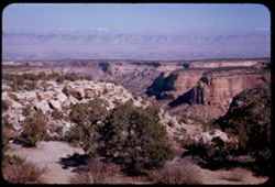
- Description:
- 25 f 11
- Subject:
- National parks & reserves, La Sal Mountains (Utah), Cliffs, Mountains, Dirt roads, Shrubs, Trees, Buttes, Rock formations, and Arches National Park (Utah)
- Series:
- 26-52
- Creator:
- Cushman, Charles W., 1896-1972
- Date Created:
- 1952-11-03
- Genre:
- Landscape photographs
- Frame Number:
- 22
- County:
- Grand
- Abstract:
- Entering Nat'l Mon.
- Call Number:
- P06428
- City:
- Moab
- Country:
- United States
- State/Province:
- Utah
- Alternate Identifier:
- 2652.22
- Persistent URL:
- http://purl.dlib.indiana.edu/iudl/archives/cushman/P06428
- Holding Location:
- Bloomington - University Archives
Wells Library E460
1320 E 10th St.
Bloomington, IN 47405
Contact at archives@indiana.edu, 812-855-1127
-
- Description:
- 25 f 11
- Subject:
- Valleys, Cliffs, Colorado National Monument (Colo.), Mesas, Shadows, Mountains, National parks & reserves, Colorado River Valley (Colo.-Mexico), Canyons,...
- Series:
- 26-52
- Creator:
- Cushman, Charles W., 1896-1972
- Date Created:
- 1952-11-03
- Genre:
- Landscape photographs
- Frame Number:
- 20
- County:
- Mesa
- Call Number:
- P06426
- City:
- Grand Junction
- Country:
- United States
- State/Province:
- Colorado
- Alternate Identifier:
- 2652.20
- Persistent URL:
- http://purl.dlib.indiana.edu/iudl/archives/cushman/P06426
- Holding Location:
- Bloomington - University Archives
Wells Library E460
1320 E 10th St.
Bloomington, IN 47405
Contact at archives@indiana.edu, 812-855-1127
-
- Description:
- 25 f 11
- Subject:
- Cliffs, Parks, Shadows, Buttes, Mountains, Fences, Rock formations, Red Rocks Park (Jefferson County, Colo.), Hills, Roads, and Shrubs
- Series:
- 24-52
- Creator:
- Cushman, Charles W., 1896-1972
- Date Created:
- 1952-10-30
- Genre:
- Landscape photographs
- Frame Number:
- 7
- County:
- Jefferson
- Abstract:
- NE from Red Rock Park
- Call Number:
- P06338
- City:
- Morrison
- Country:
- United States
- State/Province:
- Colorado
- Alternate Identifier:
- 2452.7
- Persistent URL:
- http://purl.dlib.indiana.edu/iudl/archives/cushman/P06338
- Holding Location:
- Bloomington - University Archives
Wells Library E460
1320 E 10th St.
Bloomington, IN 47405
Contact at archives@indiana.edu, 812-855-1127
-
- Description:
- 25 f 6.3 pola
- Subject:
- Red Rocks Park (Jefferson County, Colo.), Parks, Roads, Cliffs, Mountains, Shrubs, Boulders, Rocks, Buttes, Rock formations, Hills, Buildings, and Clouds
- Series:
- 24-52
- Creator:
- Cushman, Charles W., 1896-1972
- Date Created:
- 1952-10-30
- Genre:
- Landscape photographs
- Frame Number:
- 2
- County:
- Jefferson
- Abstract:
- Red Rock Park west of Denver
- Call Number:
- P06333
- City:
- Morrison
- Country:
- United States
- State/Province:
- Colorado
- Physical Description:
- Image was originally mounted in a glass enclosure. Before digitization, the image was removed and placed in a Wess Plastic, Inc. brand, 2" x 2", pl...
- Alternate Identifier:
- 2452.2
- Persistent URL:
- http://purl.dlib.indiana.edu/iudl/archives/cushman/P06333
- Holding Location:
- Bloomington - University Archives
Wells Library E460
1320 E 10th St.
Bloomington, IN 47405
Contact at archives@indiana.edu, 812-855-1127
-
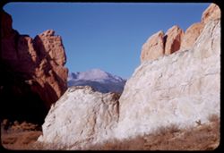
- Description:
- 25 f 11
- Subject:
- Cliffs, Trees, Buttes, Mountains, Shrubs, Pikes Peak (Colo.), Hills, Garden of the Gods (Colorado Springs, Colo.), and Rock formations
- Series:
- 23-52
- Creator:
- Cushman, Charles W., 1896-1972
- Date Created:
- 1952-10-29
- Genre:
- Landscape photographs
- Frame Number:
- 32
- County:
- El Paso
- Abstract:
- Farewell to Pike's Peak
- Call Number:
- P06324
- City:
- Colorado Springs
- Country:
- United States
- State/Province:
- Colorado
- Alternate Identifier:
- 2352.32
- Persistent URL:
- http://purl.dlib.indiana.edu/iudl/archives/cushman/P06324
- Holding Location:
- Bloomington - University Archives
Wells Library E460
1320 E 10th St.
Bloomington, IN 47405
Contact at archives@indiana.edu, 812-855-1127
-
- Description:
- 25 f 9
- Subject:
- Crosses, Cliffs, Trees, Shadows, Buttes, Mountains, Rock formations, Hills, Garden of the Gods (Colorado Springs, Colo.), Meadows, and Shrubs
- Series:
- 23-52
- Creator:
- Cushman, Charles W., 1896-1972
- Date Created:
- 1952-10-29
- Genre:
- Landscape photographs
- Frame Number:
- 26
- County:
- El Paso
- Abstract:
- In Garden of Gods
- Call Number:
- P06318
- City:
- Colorado Springs
- Country:
- United States
- State/Province:
- Colorado
- Alternate Identifier:
- 2352.26
- Persistent URL:
- http://purl.dlib.indiana.edu/iudl/archives/cushman/P06318
- Holding Location:
- Bloomington - University Archives
Wells Library E460
1320 E 10th St.
Bloomington, IN 47405
Contact at archives@indiana.edu, 812-855-1127
-
- Description:
- 25 f 9
- Subject:
- Meadows, Cliffs, Mountains, Shrubs, Trees, Buttes, Rock formations, and Garden of the Gods (Colorado Springs, Colo.)
- Series:
- 23-52
- Creator:
- Cushman, Charles W., 1896-1972
- Date Created:
- 1952-10-29
- Genre:
- Landscape photographs
- Frame Number:
- 25
- County:
- El Paso
- Abstract:
- In Garden of Gods
- Call Number:
- P06317
- City:
- Colorado Springs
- Country:
- United States
- State/Province:
- Colorado
- Alternate Identifier:
- 2352.25
- Persistent URL:
- http://purl.dlib.indiana.edu/iudl/archives/cushman/P06317
- Holding Location:
- Bloomington - University Archives
Wells Library E460
1320 E 10th St.
Bloomington, IN 47405
Contact at archives@indiana.edu, 812-855-1127
-
- Description:
- 25 f 11
- Subject:
- Cliffs, Shadows, Buttes, Mountains, Shrubs, Pikes Peak (Colo.), Garden of the Gods (Colorado Springs, Colo.), and Rock formations
- Series:
- 23-52
- Creator:
- Cushman, Charles W., 1896-1972
- Date Created:
- 1952-10-29
- Genre:
- Landscape photographs
- Frame Number:
- 24
- County:
- El Paso
- Abstract:
- Thru Gateway covered Pike's Peak
- Call Number:
- P06316
- City:
- Colorado Springs
- Country:
- United States
- State/Province:
- Colorado
- Alternate Identifier:
- 2352.24
- Persistent URL:
- http://purl.dlib.indiana.edu/iudl/archives/cushman/P06316
- Holding Location:
- Bloomington - University Archives
Wells Library E460
1320 E 10th St.
Bloomington, IN 47405
Contact at archives@indiana.edu, 812-855-1127
-
- Description:
- 25 f 11
- Subject:
- Grasses, Cliffs, Trees, Mountains, Buildings, Rock formations, Hills, Garden of the Gods (Colorado Springs, Colo.), Houses, and Shrubs
- Series:
- 23-52
- Creator:
- Cushman, Charles W., 1896-1972
- Date Created:
- 1952-10-29
- Genre:
- Landscape photographs
- Frame Number:
- 23
- County:
- El Paso
- Abstract:
- Rocks north of Garden of the Gods
- Call Number:
- P06315
- City:
- Colorado Springs
- Country:
- United States
- State/Province:
- Colorado
- Alternate Identifier:
- 2352.23
- Persistent URL:
- http://purl.dlib.indiana.edu/iudl/archives/cushman/P06315
- Holding Location:
- Bloomington - University Archives
Wells Library E460
1320 E 10th St.
Bloomington, IN 47405
Contact at archives@indiana.edu, 812-855-1127
-
- Description:
- 25 f 4.5 Pola
- Subject:
- Canyons, Cliffs, Trees, Tree limbs, Mountains, Shrubs, and Royal Gorge (Colo.)
- Series:
- 23-52
- Creator:
- Cushman, Charles W., 1896-1972
- Date Created:
- 1952-10-28
- Genre:
- Landscape photographs
- Frame Number:
- 18
- County:
- Fremont
- Abstract:
- View northwest from left bank top
- Call Number:
- P06310
- Country:
- United States
- State/Province:
- Colorado
- Alternate Identifier:
- 2352.18
- Persistent URL:
- http://purl.dlib.indiana.edu/iudl/archives/cushman/P06310
- Holding Location:
- Bloomington - University Archives
Wells Library E460
1320 E 10th St.
Bloomington, IN 47405
Contact at archives@indiana.edu, 812-855-1127
-
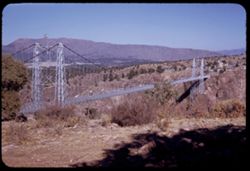
- Description:
- 25 f 11
- Subject:
- Canyons, Roads, Cliffs, Mountains, Shrubs, Trees, Shadows, Towers, Suspension bridges, Royal Gorge (Colo.), Buildings, and Flags
- Series:
- 23-52
- Creator:
- Cushman, Charles W., 1896-1972
- Date Created:
- 1952-10-28
- Genre:
- Landscape photographs
- Frame Number:
- 9
- County:
- Fremont
- Abstract:
- Suspension bridge from top of right bank
- Call Number:
- P06301
- Country:
- United States
- State/Province:
- Colorado
- Alternate Identifier:
- 2352.9
- Persistent URL:
- http://purl.dlib.indiana.edu/iudl/archives/cushman/P06301
- Holding Location:
- Bloomington - University Archives
Wells Library E460
1320 E 10th St.
Bloomington, IN 47405
Contact at archives@indiana.edu, 812-855-1127
-
- Description:
- 25 f 11
- Subject:
- Canyons, Roads, Cliffs, Point Sublime (Colo.), Mountains, Shrubs, Boulders, Rocks, Scenic overlooks, Royal Gorge (Colo.), Trees, and Buildings
- Series:
- 23-52
- Creator:
- Cushman, Charles W., 1896-1972
- Date Created:
- 1952-10-28
- Genre:
- Landscape photographs
- Frame Number:
- 7
- County:
- Fremont
- Abstract:
- Rocks at top-Pt. Sublime
- Call Number:
- P06299
- Country:
- United States
- State/Province:
- Colorado
- Alternate Identifier:
- 2352.7
- Persistent URL:
- http://purl.dlib.indiana.edu/iudl/archives/cushman/P06299
- Holding Location:
- Bloomington - University Archives
Wells Library E460
1320 E 10th St.
Bloomington, IN 47405
Contact at archives@indiana.edu, 812-855-1127
-

- Description:
- 25 f 6.3 Pola
- Subject:
- Rocks, Roads, Boulders, Buttes, Mountains, Rock formations, Pikes Peak (Colo.), Hills, Garden of the Gods (Colorado Springs, Colo.), Cliffs, and Shrubs
- Series:
- 22-52
- Creator:
- Cushman, Charles W., 1896-1972
- Date Created:
- 1952-10-27
- Genre:
- Landscape photographs
- Frame Number:
- 2
- County:
- El Paso
- Abstract:
- Pike's Peak through gateway of Garden of Gods
- Call Number:
- P06256
- City:
- Colorado Springs
- Country:
- United States
- State/Province:
- Colorado
- Alternate Identifier:
- 2252.2
- Persistent URL:
- http://purl.dlib.indiana.edu/iudl/archives/cushman/P06256
- Holding Location:
- Bloomington - University Archives
Wells Library E460
1320 E 10th St.
Bloomington, IN 47405
Contact at archives@indiana.edu, 812-855-1127
-
- Description:
- 25 f 11
- Subject:
- Pikes Peak (Colo.), Cliffs, Mountains, Shrubs, Buttes, Rock formations, and Garden of the Gods (Colorado Springs, Colo.)
- Series:
- 22-52
- Creator:
- Cushman, Charles W., 1896-1972
- Date Created:
- 1952-10-27
- Genre:
- Landscape photographs
- Frame Number:
- 1
- County:
- El Paso
- Abstract:
- Pike's Peak through gateway of Garden of Gods
- Call Number:
- P06255
- City:
- Colorado Springs
- Country:
- United States
- State/Province:
- Colorado
- Alternate Identifier:
- 2252.1
- Persistent URL:
- http://purl.dlib.indiana.edu/iudl/archives/cushman/P06255
- Holding Location:
- Bloomington - University Archives
Wells Library E460
1320 E 10th St.
Bloomington, IN 47405
Contact at archives@indiana.edu, 812-855-1127
-
- Description:
- 25 f 13
- Subject:
- Roads, Buttes, Mountains, Rock formations, Sentinel Rock (Colo.), Hills, Garden of the Gods (Colorado Springs, Colo.), Cliffs, and Shrubs
- Series:
- 21-52
- Creator:
- Cushman, Charles W., 1896-1972
- Date Created:
- 1952-10-27
- Genre:
- Landscape photographs
- Frame Number:
- 20
- County:
- El Paso
- Abstract:
- Sentinel Rock again
- Call Number:
- P06251
- City:
- Colorado Springs
- Country:
- United States
- State/Province:
- Colorado
- Alternate Identifier:
- 2152.20
- Persistent URL:
- http://purl.dlib.indiana.edu/iudl/archives/cushman/P06251
- Holding Location:
- Bloomington - University Archives
Wells Library E460
1320 E 10th St.
Bloomington, IN 47405
Contact at archives@indiana.edu, 812-855-1127
-
- Description:
- 50 f 7 Pola
- Subject:
- Sangre de Cristo Mountains (Colo. and N.M.), Hills, Barbed wire, Cliffs, Mountains, Shrubs, Snow, and Fences
- Series:
- 18-52
- Creator:
- Cushman, Charles W., 1896-1972
- Date Created:
- 1952-04-15
- Genre:
- Landscape photographs
- Frame Number:
- 31
- Street Address:
- Highway 84
- County:
- Santa Fe
- Abstract:
- Again - from Hwy 84.
- Call Number:
- P06162
- City:
- Santa Fe
- Country:
- United States
- State/Province:
- New Mexico
- Alternate Identifier:
- 1852.31
- Persistent URL:
- http://purl.dlib.indiana.edu/iudl/archives/cushman/P06162
- Holding Location:
- Bloomington - University Archives
Wells Library E460
1320 E 10th St.
Bloomington, IN 47405
Contact at archives@indiana.edu, 812-855-1127
-
- Description:
- 25 f 16
- Subject:
- National parks & reserves, Canyons, Hills, Cliffs, Mountains, Shrubs, Bandelier National Monument (N.M.), Trees, Rock formations, and Boulders
- Series:
- 18-52
- Creator:
- Cushman, Charles W., 1896-1972
- Date Created:
- 1952-04-15
- Genre:
- Landscape photographs
- Frame Number:
- 27
- Abstract:
- Up again like 24.
- Call Number:
- P06158
- Country:
- United States
- State/Province:
- New Mexico
- Alternate Identifier:
- 1852.27
- Persistent URL:
- http://purl.dlib.indiana.edu/iudl/archives/cushman/P06158
- Holding Location:
- Bloomington - University Archives
Wells Library E460
1320 E 10th St.
Bloomington, IN 47405
Contact at archives@indiana.edu, 812-855-1127
-
- Description:
- 25 f 8 Pola
- Subject:
- Canyons, Cliffs, Trees, Bandelier National Monument (N.M.), Mountains, Rock formations, Hills, National parks & reserves, and Shrubs
- Series:
- 18-52
- Creator:
- Cushman, Charles W., 1896-1972
- Date Created:
- 1952-04-15
- Genre:
- Landscape photographs
- Frame Number:
- 25
- Street Address:
- New Mexico State Highway 4
- Abstract:
- View up a canyon (along NM 4).
- Call Number:
- P06155
- Country:
- United States
- State/Province:
- New Mexico
- Alternate Identifier:
- 1852.25
- Persistent URL:
- http://purl.dlib.indiana.edu/iudl/archives/cushman/P06155
- Holding Location:
- Bloomington - University Archives
Wells Library E460
1320 E 10th St.
Bloomington, IN 47405
Contact at archives@indiana.edu, 812-855-1127
-
- Description:
- 25 f 13
- Subject:
- Cliffs, Adobe buildings, Trees, Bandelier National Monument (N.M.), Walkways, Signs (Notices), Frijoles Canyon (Colo. and N.M.), Buildings, National parks &a...
- Series:
- 18-52
- Creator:
- Cushman, Charles W., 1896-1972
- Date Created:
- 1952-04-15
- Genre:
- Views
- Frame Number:
- 24
- County:
- Rio Arriba
- Abstract:
- Hdqtrs - Bandelier N Pk in Frijoles Canyon.
- Call Number:
- P06154
- Country:
- United States
- State/Province:
- New Mexico
- Alternate Identifier:
- 1852.24
- Persistent URL:
- http://purl.dlib.indiana.edu/iudl/archives/cushman/P06154
- Holding Location:
- Bloomington - University Archives
Wells Library E460
1320 E 10th St.
Bloomington, IN 47405
Contact at archives@indiana.edu, 812-855-1127
-
- Description:
- 25 f 13
- Subject:
- Boundaries, Cliffs, Barbed wire, Mesas, Buttes, Mountains, Fences, Rock formations, and Shrubs
- Series:
- 18-52
- Creator:
- Cushman, Charles W., 1896-1972
- Date Created:
- 1952-04-13
- Genre:
- Landscape photographs
- Frame Number:
- 6
- Street Address:
- United States Highway 66
- County:
- Apache
- Abstract:
- Others at the state line. Lupion, Ariz.
- Call Number:
- P06137
- City:
- Lupton
- Country:
- United States
- State/Province:
- Arizona and New Mexico
- Alternate Identifier:
- 1852.6
- Persistent URL:
- http://purl.dlib.indiana.edu/iudl/archives/cushman/P06137
- Holding Location:
- Bloomington - University Archives
Wells Library E460
1320 E 10th St.
Bloomington, IN 47405
Contact at archives@indiana.edu, 812-855-1127
-
- Description:
- 25 f 16
- Subject:
- Boundaries, Cliffs, Trees, Mountains, Shrubs, and Mesas
- Series:
- 18-52
- Creator:
- Cushman, Charles W., 1896-1972
- Date Created:
- 1952-04-13
- Genre:
- Landscape photographs
- Frame Number:
- 5
- Street Address:
- United States Highway 66
- Abstract:
- Pink mtns near NM-Ariz. line - on 66.
- Call Number:
- P06136
- Country:
- United States
- State/Province:
- Arizona and New Mexico
- Alternate Identifier:
- 1852.5
- Persistent URL:
- http://purl.dlib.indiana.edu/iudl/archives/cushman/P06136
- Holding Location:
- Bloomington - University Archives
Wells Library E460
1320 E 10th St.
Bloomington, IN 47405
Contact at archives@indiana.edu, 812-855-1127
-
- Description:
- 25 f 11 pola
- Subject:
- Blue Mesa (Ariz.), Canyons, Petrified forests, Cliffs, Mesas, Shadows, Mountains, Rock formations, Hills, Petrified Forest National Park (Ariz.), National pa...
- Series:
- 17-52
- Creator:
- Cushman, Charles W., 1896-1972
- Date Created:
- 1952-04-13
- Genre:
- Landscape photographs
- Frame Number:
- 35
- County:
- Apache
- Abstract:
- In Blue Forest 113737
- Call Number:
- P06127
- Country:
- United States
- State/Province:
- Arizona
- Alternate Identifier:
- 1752.35
- Persistent URL:
- http://purl.dlib.indiana.edu/iudl/archives/cushman/P06127
- Holding Location:
- Bloomington - University Archives
Wells Library E460
1320 E 10th St.
Bloomington, IN 47405
Contact at archives@indiana.edu, 812-855-1127
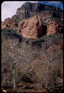
-
- Description:
- 25 f 11
- Subject:
- Canyons, Cliffs, Trees, Mountains, Shrubs, Clouds, Junipers, Rock formations, and Oak Creek Canyon (Ariz.)
- Series:
- 16-52
- Creator:
- Cushman, Charles W., 1896-1972
- Date Created:
- 1952-04-12
- Genre:
- Landscape photographs
- Frame Number:
- 30
- County:
- Coconino
- Abstract:
- Across the Juniper tops toward red
- Call Number:
- P06088
- City:
- Flagstaff
- Country:
- United States
- State/Province:
- Arizona
- Alternate Identifier:
- 1652.30
- Persistent URL:
- http://purl.dlib.indiana.edu/iudl/archives/cushman/P06088
- Holding Location:
- Bloomington - University Archives
Wells Library E460
1320 E 10th St.
Bloomington, IN 47405
Contact at archives@indiana.edu, 812-855-1127
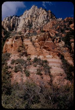
-
- Description:
- 25 f 11
- Subject:
- Canyons, Cliffs, Trees, Mountains, Shrubs, Clouds, Hills, Oak Creek Canyon (Ariz.), and Rock formations
- Series:
- 16-52
- Creator:
- Cushman, Charles W., 1896-1972
- Date Created:
- 1952-04-12
- Genre:
- Landscape photographs
- Frame Number:
- 29
- County:
- Coconino
- Abstract:
- Green pyramid
- Call Number:
- P06087
- Country:
- United States
- State/Province:
- Arizona
- Alternate Identifier:
- 1652.29
- Persistent URL:
- http://purl.dlib.indiana.edu/iudl/archives/cushman/P06087
- Holding Location:
- Bloomington - University Archives
Wells Library E460
1320 E 10th St.
Bloomington, IN 47405
Contact at archives@indiana.edu, 812-855-1127
-
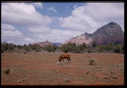
- Description:
- 25 f 11
- Subject:
- Cliffs, Horses, Trees, Mountains, Saddle Rock Ranch (Sedona, Calif.), Shrubs, and Rock formations
- Series:
- 16-52
- Creator:
- Cushman, Charles W., 1896-1972
- Date Created:
- 1952-04-12
- Genre:
- Landscape photographs
- Frame Number:
- 28
- Street Address:
- United States Highway 89A
- County:
- Coconino
- Persons Pictured:
- Cushman, Charles W. (Charles Weever), 1896-1972
- Abstract:
- Horse grazing at Saddle Rock ranch
- Call Number:
- P06086
- City:
- Sedona
- Country:
- United States
- State/Province:
- Arizona
- Physical Description:
- Image was originally mounted in a glass enclosure. Before digitization, the image was removed and placed in a Wess Plastic, Inc. brand, 2" x 2", pl...
- Alternate Identifier:
- 1652.28
- Persistent URL:
- http://purl.dlib.indiana.edu/iudl/archives/cushman/P06086
- Holding Location:
- Bloomington - University Archives
Wells Library E460
1320 E 10th St.
Bloomington, IN 47405
Contact at archives@indiana.edu, 812-855-1127
-
- Description:
- 25 f 10
- Subject:
- Canyons, Cliffs, Trees, Mountains, Shrubs, Oak Creek Canyon (Ariz.), Sycamores, and Rock formations
- Series:
- 16-52
- Creator:
- Cushman, Charles W., 1896-1972
- Date Created:
- 1952-04-12
- Genre:
- Landscape photographs
- Frame Number:
- 26
- County:
- Coconino
- Abstract:
- Sycamore tops & red rocks Spots
- Call Number:
- P06084
- Country:
- United States
- State/Province:
- Arizona
- Alternate Identifier:
- 1652.26
- Persistent URL:
- http://purl.dlib.indiana.edu/iudl/archives/cushman/P06084
- Holding Location:
- Bloomington - University Archives
Wells Library E460
1320 E 10th St.
Bloomington, IN 47405
Contact at archives@indiana.edu, 812-855-1127
-
- Description:
- 25 f 13
- Subject:
- Oak Creek Canyon (Ariz.), Tree limbs, Canyons, Cliffs, Mountains, and Shrubs
- Series:
- 16-52
- Creator:
- Cushman, Charles W., 1896-1972
- Date Created:
- 1952-04-12
- Genre:
- Landscape photographs
- Frame Number:
- 25
- County:
- Coconino
- Abstract:
- [P] Spots
- Call Number:
- P06083
- Country:
- United States
- State/Province:
- Arizona
- Alternate Identifier:
- 1652.25
- Persistent URL:
- http://purl.dlib.indiana.edu/iudl/archives/cushman/P06083
- Holding Location:
- Bloomington - University Archives
Wells Library E460
1320 E 10th St.
Bloomington, IN 47405
Contact at archives@indiana.edu, 812-855-1127
-
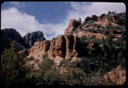
- Description:
- 25 f 11
- Subject:
- Canyons, Cliffs, Trees, Mountains, Rock formations, Oak Creek Canyon (Ariz.), and Shrubs
- Series:
- 16-52
- Creator:
- Cushman, Charles W., 1896-1972
- Date Created:
- 1952-04-12
- Genre:
- Landscape photographs
- Frame Number:
- 24
- County:
- Coconino
- Abstract:
- [L] Spots
- Call Number:
- P06082
- City:
- Flagstaff
- Country:
- United States
- State/Province:
- Arizona
- Alternate Identifier:
- 1652.24
- Persistent URL:
- http://purl.dlib.indiana.edu/iudl/archives/cushman/P06082
- Holding Location:
- Bloomington - University Archives
Wells Library E460
1320 E 10th St.
Bloomington, IN 47405
Contact at archives@indiana.edu, 812-855-1127
-
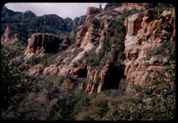
- Description:
- 25 f 11
- Subject:
- Canyons, Roads, Trees, Tree limbs, Mountains, Tunnels, Oak Creek Canyon (Ariz.), Cliffs, Shrubs, and Rock formations
- Series:
- 16-52
- Creator:
- Cushman, Charles W., 1896-1972
- Date Created:
- 1952-04-12
- Genre:
- Landscape photographs
- Frame Number:
- 23
- County:
- Coconino
- Abstract:
- Across canyon Spots
- Call Number:
- P06081
- Country:
- United States
- State/Province:
- Arizona
- Alternate Identifier:
- 1652.23
- Persistent URL:
- http://purl.dlib.indiana.edu/iudl/archives/cushman/P06081
- Holding Location:
- Bloomington - University Archives
Wells Library E460
1320 E 10th St.
Bloomington, IN 47405
Contact at archives@indiana.edu, 812-855-1127
-

- Description:
- 25 f 14
- Subject:
- Deserts, Amargosa Range (Nev. and Calif.), Valleys, Hills, Death Valley (Calif. and Nev.), Cliffs, Mountains, Shrubs, Rocks, Canyons, and Desolation Canyon (...
- Series:
- 15-52
- Creator:
- Cushman, Charles W., 1896-1972
- Date Created:
- 1952-04-09
- Genre:
- Landscape photographs
- Frame Number:
- 21
- Street Address:
- Bad Water Road
- County:
- Inyo
- Abstract:
- Approx. same.
- Call Number:
- P06041
- City:
- Furnace Creek
- Country:
- United States
- State/Province:
- California
- Alternate Identifier:
- 1552.21
- Persistent URL:
- http://purl.dlib.indiana.edu/iudl/archives/cushman/P06041
- Holding Location:
- Bloomington - University Archives
Wells Library E460
1320 E 10th St.
Bloomington, IN 47405
Contact at archives@indiana.edu, 812-855-1127
-
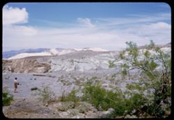
- Description:
- 25 f 13
- Subject:
- Rocks, Mesquite, Valleys, Cliffs, Women, Mountains, Shrubs, Death Valley (Calif. and Nev.), Utility poles, Furnace Creek (Calif.), and Hills
- Series:
- 15-52
- Creator:
- Cushman, Charles W., 1896-1972
- Date Created:
- 1952-04-09
- Genre:
- Landscape photographs and Portraits
- Frame Number:
- 14
- County:
- Inyo
- Persons Pictured:
- Cushman, Jean
- Abstract:
- Mesquite and green rocks. (near Furnace Creek)
- Call Number:
- P06035
- Country:
- United States
- State/Province:
- California
- Alternate Identifier:
- 1552.14
- Persistent URL:
- http://purl.dlib.indiana.edu/iudl/archives/cushman/P06035
- Holding Location:
- Bloomington - University Archives
Wells Library E460
1320 E 10th St.
Bloomington, IN 47405
Contact at archives@indiana.edu, 812-855-1127
-
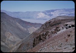
- Description:
- 25 f 13
- Subject:
- Rocks, Valleys, Panamint Range (Calif.), Argus Range (Calif.), Boulders, Mountains, Shrubs, Panamint Valley (Calif.), Canyons, and Cliffs
- Series:
- 15-52
- Creator:
- Cushman, Charles W., 1896-1972
- Date Created:
- 1952-04-08
- Genre:
- Landscape photographs
- Frame Number:
- 5
- County:
- Inyo
- Abstract:
- Flatbed of Panamint Valley from same pt. A gap in Argus Range.
- Call Number:
- P06026
- Country:
- United States
- State/Province:
- California
- Alternate Identifier:
- 1552.5
- Persistent URL:
- http://purl.dlib.indiana.edu/iudl/archives/cushman/P06026
- Holding Location:
- Bloomington - University Archives
Wells Library E460
1320 E 10th St.
Bloomington, IN 47405
Contact at archives@indiana.edu, 812-855-1127
-
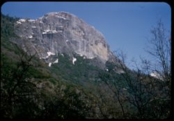
- Description:
- 25 f 11
- Subject:
- Snow, Sequoia National Park (Calif.), Cliffs, Morro Rock (Calif.), Tree limbs, Mountains, National parks & reserves, Palm Sunday, Shrubs, and Rock format...
- Series:
- 14-52
- Creator:
- Cushman, Charles W., 1896-1972
- Date Created:
- 1952-04-06
- Genre:
- Landscape photographs
- Frame Number:
- 2
- County:
- Tulare
- Abstract:
- Moro Rock.
- Call Number:
- P05986
- Country:
- United States
- State/Province:
- California
- Alternate Identifier:
- 1452.2
- Persistent URL:
- http://purl.dlib.indiana.edu/iudl/archives/cushman/P05986
- Holding Location:
- Bloomington - University Archives
Wells Library E460
1320 E 10th St.
Bloomington, IN 47405
Contact at archives@indiana.edu, 812-855-1127
-
- Description:
- 25 f 8 Pola
- Subject:
- Scenic overlooks, Trees, National parks & reserves, Snow, Cliffs, Roads, Sequoia National Park (Calif.), Sierra Nevada (Calif. and Nev.), Mountains, and ...
- Series:
- 14-52
- Creator:
- Cushman, Charles W., 1896-1972
- Date Created:
- 1952-04-06
- Genre:
- Landscape photographs
- Frame Number:
- 1
- Street Address:
- California State Highway 198
- County:
- Tulare
- Abstract:
- High ridge from turnout on road down.
- Call Number:
- P05985
- Country:
- United States
- State/Province:
- California
- Alternate Identifier:
- 1452.1
- Persistent URL:
- http://purl.dlib.indiana.edu/iudl/archives/cushman/P05985
- Holding Location:
- Bloomington - University Archives
Wells Library E460
1320 E 10th St.
Bloomington, IN 47405
Contact at archives@indiana.edu, 812-855-1127
-
- Description:
- 25 f 9
- Subject:
- National parks & reserves, Cliffs, Mountains, Shrubs, Snow, Trees, Sequoia National Park (Calif.), Morro Rock (Calif.), Rock formations, and Tree limbs
- Series:
- 13-52
- Creator:
- Cushman, Charles W., 1896-1972
- Date Created:
- 1952-04-06
- Genre:
- Landscape photographs
- Frame Number:
- 31
- County:
- Tulare
- Abstract:
- High rock face (Moro Rock) + dead tree.
- Call Number:
- P05976
- Country:
- United States
- State/Province:
- California
- Alternate Identifier:
- 1352.31
- Persistent URL:
- http://purl.dlib.indiana.edu/iudl/archives/cushman/P05976
- Holding Location:
- Bloomington - University Archives
Wells Library E460
1320 E 10th St.
Bloomington, IN 47405
Contact at archives@indiana.edu, 812-855-1127
-
- Description:
- 50 f 6.3
- Subject:
- Canyons, Roads, Trees, Salmon Creek Canyon (Mendocino County, Calif.), Shrubs, Pacific Coast Highway, Cliffs, Salmon Creek (Mendocino County, Calif.), Mounta...
- Series:
- 9-52
- Creator:
- Cushman, Charles W., 1896-1972
- Date Created:
- 1952-01-01
- Genre:
- Landscape photographs
- Frame Number:
- 14
- Street Address:
- California State Highway 1
- County:
- San Luis Obispo and Monterey
- Abstract:
- Across a green clad canyon. The road winds at Salmon Creek
- Call Number:
- P05812
- City:
- Big Sur and San Simeon
- Country:
- United States
- State/Province:
- California
- Physical Description:
- Image was originally mounted in a glass enclosure. Before digitization, the image was removed and placed in a Wess Plastic, Inc. brand, 2" x 2", pl...
- Alternate Identifier:
- 952.14
- Persistent URL:
- http://purl.dlib.indiana.edu/iudl/archives/cushman/P05812
- Holding Location:
- Bloomington - University Archives
Wells Library E460
1320 E 10th St.
Bloomington, IN 47405
Contact at archives@indiana.edu, 812-855-1127
-
- Description:
- 25 f 8
- Subject:
- Hills, Roads, Cliffs, Mountains, Shrubs, Trees, Buildings, San Marcos Pass (Calif.), and Rocks
- Series:
- 8-52
- Creator:
- Cushman, Charles W., 1896-1972
- Date Created:
- 1952-03-01
- Genre:
- Landscape photographs
- Frame Number:
- 25
- Street Address:
- California State Highway 150
- County:
- Santa Barbara and San Diego
- Abstract:
- From cut in Cal 150 on way to San Marcos
- Call Number:
- P05784
- City:
- San Marcos and Santa Barbara
- Country:
- United States
- State/Province:
- California
- Alternate Identifier:
- 852.25
- Persistent URL:
- http://purl.dlib.indiana.edu/iudl/archives/cushman/P05784
- Holding Location:
- Bloomington - University Archives
Wells Library E460
1320 E 10th St.
Bloomington, IN 47405
Contact at archives@indiana.edu, 812-855-1127
-
- Description:
- 25 f 8 Pola
- Subject:
- Electric lines, Roads, Trees, Mountains, Buildings, Shrubs, Utility poles, and Cliffs
- Series:
- 8-52
- Creator:
- Cushman, Charles W., 1896-1972
- Date Created:
- 1952-02-28
- Genre:
- Cityscape photographs
- Frame Number:
- 13
- County:
- Santa Barbara
- Abstract:
- Santa Barbara from Heights on S.W. looking across the mtns above town
- Call Number:
- P05772
- City:
- Santa Barbara
- Country:
- United States
- State/Province:
- California
- Alternate Identifier:
- 852.13
- Persistent URL:
- http://purl.dlib.indiana.edu/iudl/archives/cushman/P05772
- Holding Location:
- Bloomington - University Archives
Wells Library E460
1320 E 10th St.
Bloomington, IN 47405
Contact at archives@indiana.edu, 812-855-1127
-
- Description:
- 25 f 11
- Subject:
- Roads, Trees, Mountains, Shrubs, Hills, Utility poles, Cliffs, and Coast Mountains (Calif.)
- Series:
- 8-52
- Creator:
- Cushman, Charles W., 1896-1972
- Date Created:
- 1952-02-27
- Genre:
- Landscape photographs
- Frame Number:
- 6
- Street Address:
- United States Highway 101
- County:
- Ventura
- Abstract:
- Coast Mnts along US 101 west of Ventura
- Call Number:
- P05765
- City:
- Ventura
- Country:
- United States
- State/Province:
- California
- Alternate Identifier:
- 852.6
- Persistent URL:
- http://purl.dlib.indiana.edu/iudl/archives/cushman/P05765
- Holding Location:
- Bloomington - University Archives
Wells Library E460
1320 E 10th St.
Bloomington, IN 47405
Contact at archives@indiana.edu, 812-855-1127
-
- Description:
- 50 f 8
- Subject:
- Saguaro, Cliffs, Mountains, Shrubs, Cactus, Trees, and Picacho Peak (Ariz.)
- Series:
- 5-52
- Creator:
- Cushman, Charles W., 1896-1972
- Date Created:
- 1952-02-07
- Genre:
- Landscape photographs
- Frame Number:
- 36
- Street Address:
- Highway 84
- County:
- Pima
- Abstract:
- Picacho Pk.
- Call Number:
- P05681
- Country:
- United States
- State/Province:
- Arizona
- Alternate Identifier:
- 552.36
- Persistent URL:
- http://purl.dlib.indiana.edu/iudl/archives/cushman/P05681
- Holding Location:
- Bloomington - University Archives
Wells Library E460
1320 E 10th St.
Bloomington, IN 47405
Contact at archives@indiana.edu, 812-855-1127
-
- Description:
- 25 f 11
- Subject:
- Saguaro, Cliffs, Mountains, Shrubs, Cactus, Picacho Peak (Ariz.), and Wildflowers
- Series:
- 5-52
- Creator:
- Cushman, Charles W., 1896-1972
- Date Created:
- 1952-02-07
- Genre:
- Landscape photographs
- Frame Number:
- 35
- Street Address:
- Highway 84
- County:
- Pima
- Abstract:
- Picacho Pk.
- Call Number:
- P05680
- Country:
- United States
- State/Province:
- Arizona
- Alternate Identifier:
- 552.35
- Persistent URL:
- http://purl.dlib.indiana.edu/iudl/archives/cushman/P05680
- Holding Location:
- Bloomington - University Archives
Wells Library E460
1320 E 10th St.
Bloomington, IN 47405
Contact at archives@indiana.edu, 812-855-1127
-
- Description:
- 25 f 16
- Subject:
- Sabino Canyon (Ariz.), Canyons, Saguaro, Cliffs, Mountains, Shrubs, Cactus, Boulders, Rocks, Streams, Rock formations, Santa Catalina Mountains (Ariz.), and ...
- Series:
- 5-52
- Creator:
- Cushman, Charles W., 1896-1972
- Date Created:
- 1952-02-05
- Genre:
- Landscape photographs
- Frame Number:
- 33
- County:
- Pima
- Abstract:
- Rocks in stream
- Call Number:
- P05678
- Country:
- United States
- State/Province:
- Arizona
- Alternate Identifier:
- 552.33
- Persistent URL:
- http://purl.dlib.indiana.edu/iudl/archives/cushman/P05678
- Holding Location:
- Bloomington - University Archives
Wells Library E460
1320 E 10th St.
Bloomington, IN 47405
Contact at archives@indiana.edu, 812-855-1127
-
- Description:
- 25 f 13
- Subject:
- Rocks, Canyons, Cliffs, Trees, Sabino Canyon (Ariz.), Mountains, Shrubs, Streams, Santa Catalina Mountains (Ariz.), and Rock formations
- Series:
- 5-52
- Creator:
- Cushman, Charles W., 1896-1972
- Date Created:
- 1952-02-05
- Genre:
- Landscape photographs
- Frame Number:
- 28
- County:
- Pima
- Abstract:
- From higher up - a view of stream at canyon bottom
- Call Number:
- P05673
- Country:
- United States
- State/Province:
- Arizona
- Alternate Identifier:
- 552.28
- Persistent URL:
- http://purl.dlib.indiana.edu/iudl/archives/cushman/P05673
- Holding Location:
- Bloomington - University Archives
Wells Library E460
1320 E 10th St.
Bloomington, IN 47405
Contact at archives@indiana.edu, 812-855-1127
-
- Description:
- 25 f 13
- Subject:
- Sabino Canyon (Ariz.), Canyons, Saguaro, Cliffs, Mountains, Shrubs, Cactus, Rocks, Rock formations, and Santa Catalina Mountains (Ariz.)
- Series:
- 5-52
- Creator:
- Cushman, Charles W., 1896-1972
- Date Created:
- 1952-02-05
- Genre:
- Landscape photographs
- Frame Number:
- 26
- County:
- Pima
- Abstract:
- Up wall of Sabino Canyon in morning
- Call Number:
- P05671
- Country:
- United States
- State/Province:
- Arizona
- Alternate Identifier:
- 552.26
- Persistent URL:
- http://purl.dlib.indiana.edu/iudl/archives/cushman/P05671
- Holding Location:
- Bloomington - University Archives
Wells Library E460
1320 E 10th St.
Bloomington, IN 47405
Contact at archives@indiana.edu, 812-855-1127
-
- Description:
- 25 f 13
- Subject:
- Sabino Canyon (Ariz.), Canyons, Saguaro, Cliffs, Mountains, Shrubs, Santa Catalina Mountains (Ariz.), Rock formations, and Cactus
- Series:
- 5-52
- Creator:
- Cushman, Charles W., 1896-1972
- Date Created:
- 1952-02-04
- Genre:
- Landscape photographs
- Frame Number:
- 25
- County:
- Pima
- Abstract:
- Pent house - at left - and the square castle - late
- Call Number:
- P05670
- Country:
- United States
- State/Province:
- Arizona
- Alternate Identifier:
- 552.25
- Persistent URL:
- http://purl.dlib.indiana.edu/iudl/archives/cushman/P05670
- Holding Location:
- Bloomington - University Archives
Wells Library E460
1320 E 10th St.
Bloomington, IN 47405
Contact at archives@indiana.edu, 812-855-1127
-
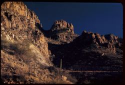
- Description:
- 25 f 6.3 pola
- Subject:
- Rocks, Canyons, Cliffs, Cactus, Sabino Canyon (Ariz.), Mountains, Shrubs, Saguaro, Santa Catalina Mountains (Ariz.), and Rock formations
- Series:
- 5-52
- Creator:
- Cushman, Charles W., 1896-1972
- Date Created:
- 1952-02-04
- Genre:
- Landscape photographs
- Frame Number:
- 24
- County:
- Pima
- Abstract:
- High square castle seen through a gap above Sabino canyon - both
- Call Number:
- P05669
- Country:
- United States
- State/Province:
- Arizona
- Alternate Identifier:
- 552.24
- Persistent URL:
- http://purl.dlib.indiana.edu/iudl/archives/cushman/P05669
- Holding Location:
- Bloomington - University Archives
Wells Library E460
1320 E 10th St.
Bloomington, IN 47405
Contact at archives@indiana.edu, 812-855-1127