
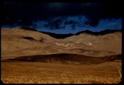
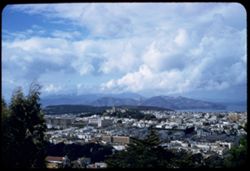
Search Constraints
You searched for:
Campus
IUB
Remove constraint Campus: IUB
Pages
0-99 pages
Remove constraint Pages: 0-99 pages
Subject
Clouds
Remove constraint Subject: Clouds
State/Province
California
Remove constraint State/Province: California
State
deposited
Remove constraint State: deposited
« Previous |
1 - 100 of 624
|
Next »
Search Results
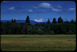
-
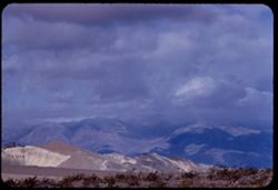
- Description:
- 100 f 8 tl
- Subject:
- Hills, Funeral Mountains (Calif.), Funeral Mountains Wilderness (Calif.), Mountains, Shrubs, Furnace Creek (Calif.), Rocks, and Clouds
- Series:
- 2-55
- Creator:
- Cushman, Charles W., 1896-1972
- Date Created:
- 1955-02-27
- Genre:
- Landscape photographs
- Frame Number:
- 29
- Street Address:
- Furance Creek-Death Valley Junction Road
- County:
- Mono and Inyo
- Abstract:
- North toward Funeral Mtns
- Call Number:
- P07586
- City:
- Death Valley Junction
- Country:
- United States
- State/Province:
- California
- Alternate Identifier:
- 255.29
- Persistent URL:
- http://purl.dlib.indiana.edu/iudl/archives/cushman/P07586
- Holding Location:
- Bloomington - University Archives
Wells Library E460
1320 E 10th St.
Bloomington, IN 47405
Contact at archives@indiana.edu, 812-855-1127
-
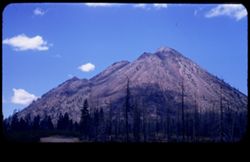
- Description:
- 50 f 8
- Subject:
- Black Butte (Siskiyou County, Calif.), Lava domes, Lassen Volcanic National Park (Calif.), Volcanic domes, Mountains, Shrubs, Trees, Cascade Range, Buttes, C...
- Series:
- 6-54
- Creator:
- Cushman, Charles W., 1896-1972
- Date Created:
- 1954-08-20
- Genre:
- Landscape photographs
- Frame Number:
- 26
- County:
- Siskiyou
- Abstract:
- That same triple cone (Black Butte) west of Mt Shasta.
- Call Number:
- P07243
- Country:
- United States
- State/Province:
- California
- Physical Description:
- masked.
- Alternate Identifier:
- 654.26
- Persistent URL:
- http://purl.dlib.indiana.edu/iudl/archives/cushman/P07243
- Holding Location:
- Bloomington - University Archives
Wells Library E460
1320 E 10th St.
Bloomington, IN 47405
Contact at archives@indiana.edu, 812-855-1127
-
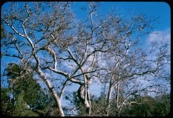
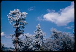
- Description:
- 50 f 6.3 sl
- Subject:
- Tree limbs, Sycamores, Trees, and Clouds
- Series:
- 1-58
- Creator:
- Cushman, Charles W., 1896-1972
- Date Created:
- 1958-01-18
- Genre:
- Identification photographs
- Frame Number:
- 12
- County:
- Alameda
- Abstract:
- Sycamore tops - Sunol
- Call Number:
- P09672
- City:
- Sunol
- Country:
- United States
- State/Province:
- California
- Alternate Identifier:
- 158.12
- Persistent URL:
- http://purl.dlib.indiana.edu/iudl/archives/cushman/P09672
- Holding Location:
- Bloomington - University Archives
Wells Library E460
1320 E 10th St.
Bloomington, IN 47405
Contact at archives@indiana.edu, 812-855-1127
-
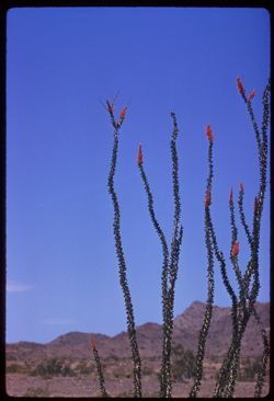
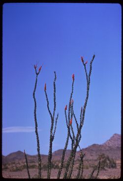
- Description:
- 100 f 8 tl
- Subject:
- Deserts, Flowers, Ocotillo, Mountains, Shrubs, and Clouds
- Series:
- 11-59
- Creator:
- Cushman, Charles W., 1896-1972
- Date Created:
- 1959-03-24
- Genre:
- Identification photographs
- Frame Number:
- 11
- County:
- Yuma and Riverside
- Abstract:
- Our finest ocotillo - 15-20 mi east of Blythe
- Call Number:
- P10736
- City:
- Blythe and Quartzsite
- Country:
- United States
- State/Province:
- Arizona and California
- Alternate Identifier:
- 1159.11
- Persistent URL:
- http://purl.dlib.indiana.edu/iudl/archives/cushman/P10736
- Holding Location:
- Bloomington - University Archives
Wells Library E460
1320 E 10th St.
Bloomington, IN 47405
Contact at archives@indiana.edu, 812-855-1127
-
- Description:
- 250 f 5.6
- Subject:
- Deserts, Flowers, Ocotillo, Mountains, Shrubs, and Clouds
- Series:
- 11-59
- Creator:
- Cushman, Charles W., 1896-1972
- Date Created:
- 1959-03-24
- Genre:
- Identification photographs
- Frame Number:
- 12
- County:
- Yuma and Riverside
- Abstract:
- Our finest ocotillo - 15-20 mi east of Blythe
- Call Number:
- P10737
- City:
- Blythe and Quartzsite
- Country:
- United States
- State/Province:
- Arizona and California
- Alternate Identifier:
- 1159.12
- Persistent URL:
- http://purl.dlib.indiana.edu/iudl/archives/cushman/P10737
- Holding Location:
- Bloomington - University Archives
Wells Library E460
1320 E 10th St.
Bloomington, IN 47405
Contact at archives@indiana.edu, 812-855-1127
-
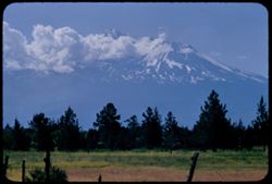
- Description:
- 100 f 8 TL
- Subject:
- Lakes & ponds, Shasta, Mount (Calif. : Mountain), Mountains, Trees, and Clouds
- Series:
- 10-58
- Creator:
- Cushman, Charles W., 1896-1972
- Date Created:
- 1958-06-13
- Genre:
- Landscape photographs
- Frame Number:
- 25
- County:
- Shasta
- Abstract:
- Mt Shasta from SE
- Call Number:
- P09964
- Country:
- United States
- State/Province:
- California
- Alternate Identifier:
- 1058.25
- Persistent URL:
- http://purl.dlib.indiana.edu/iudl/archives/cushman/P09964
- Holding Location:
- Bloomington - University Archives
Wells Library E460
1320 E 10th St.
Bloomington, IN 47405
Contact at archives@indiana.edu, 812-855-1127
-
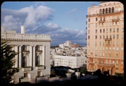
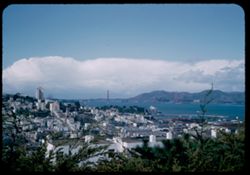
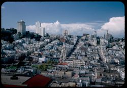
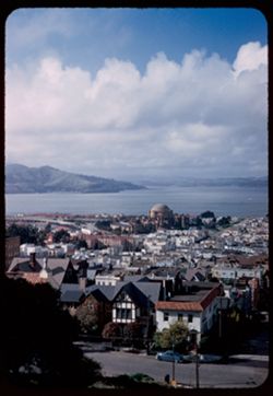
- Description:
- 25 f 11
- Subject:
- Streets, Hills, Street lights, Windows, Columns, Dwellings, Trees, Buildings, Lafayette Square (San Francisco, Calif.), Russian Hill (San Francisco, Calif.),...
- Series:
- 1-53
- Creator:
- Cushman, Charles W., 1896-1972
- Date Created:
- 1953-01-20
- Genre:
- Cityscape photographs
- Frame Number:
- 17
- County:
- San Francisco
- Abstract:
- View NE from Lafayette Pk. - Russian Hill between Spreekels Mansion + Apt. Bldg.
- Call Number:
- P06530
- City:
- San Francisco
- Country:
- United States
- State/Province:
- California
- Alternate Identifier:
- 153.17
- Persistent URL:
- http://purl.dlib.indiana.edu/iudl/archives/cushman/P06530
- Holding Location:
- Bloomington - University Archives
Wells Library E460
1320 E 10th St.
Bloomington, IN 47405
Contact at archives@indiana.edu, 812-855-1127
-

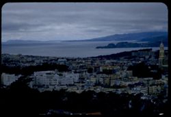
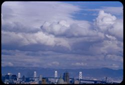
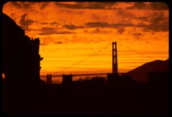
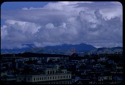
- Description:
- 100 f 8 tl
- Subject:
- Cities & towns, San Francisco-Oakland Bay Bridge (Oakland and San Francisco, Calif.), Bays (Bodies of water), Buildings, Suspension bridges, and Clouds
- Series:
- 1-56
- Creator:
- Cushman, Charles W., 1896-1972
- Date Created:
- 1956-02-23
- Genre:
- Cityscape photographs
- Frame Number:
- 20
- Street Address:
- 100 Broderick Street
- County:
- Alameda and San Francisco
- Abstract:
- Cloud mass above Oklnd
- Call Number:
- P08549
- City:
- Oakland and San Francisco
- Country:
- United States
- State/Province:
- California
- Alternate Identifier:
- 156.20
- Persistent URL:
- http://purl.dlib.indiana.edu/iudl/archives/cushman/P08549
- Holding Location:
- Bloomington - University Archives
Wells Library E460
1320 E 10th St.
Bloomington, IN 47405
Contact at archives@indiana.edu, 812-855-1127
-
- Description:
- 100 f 8 tl
- Subject:
- Sky, Trees, Clouds, Clear Creek (Plumas County, Calif.), and Pines
- Series:
- 11-57
- Creator:
- Cushman, Charles W., 1896-1972
- Date Created:
- 1957-07-24
- Frame Number:
- 29
- County:
- Plumas
- Abstract:
- From road near Clear Creek - Cloud above pine trees
- Call Number:
- P09438
- Country:
- United States
- State/Province:
- California
- Alternate Identifier:
- 1157.29
- Persistent URL:
- http://purl.dlib.indiana.edu/iudl/archives/cushman/P09438
- Holding Location:
- Bloomington - University Archives
Wells Library E460
1320 E 10th St.
Bloomington, IN 47405
Contact at archives@indiana.edu, 812-855-1127
-

- Description:
- 100 f 6.3 tl
- Subject:
- Cities & towns, Streets, Houses, Buildings, and Clouds
- Series:
- 28-55
- Creator:
- Cushman, Charles W., 1896-1972
- Date Created:
- 1955-10-20
- Genre:
- Cityscape photographs
- Frame Number:
- 30
- Street Address:
- Pacific Heights and 100 Broderick Street
- County:
- San Francisco
- Abstract:
- Toward Pacific Hts.
- Call Number:
- P08484
- City:
- San Francisco
- Country:
- United States
- State/Province:
- California
- Alternate Identifier:
- 2855.30
- Persistent URL:
- http://purl.dlib.indiana.edu/iudl/archives/cushman/P08484
- Holding Location:
- Bloomington - University Archives
Wells Library E460
1320 E 10th St.
Bloomington, IN 47405
Contact at archives@indiana.edu, 812-855-1127
-

- Description:
- 100 f 8+ tl
- Subject:
- Sky and Clouds
- Series:
- 10-56
- Creator:
- Cushman, Charles W., 1896-1972
- Date Created:
- 1956-07-13
- Genre:
- Views
- Frame Number:
- 27
- County:
- Siskiyou
- Abstract:
- That fine cloud of 25 again
- Call Number:
- P08887
- City:
- Yreka
- Country:
- United States
- State/Province:
- California
- Alternate Identifier:
- 1056.27
- Persistent URL:
- http://purl.dlib.indiana.edu/iudl/archives/cushman/P08887
- Holding Location:
- Bloomington - University Archives
Wells Library E460
1320 E 10th St.
Bloomington, IN 47405
Contact at archives@indiana.edu, 812-855-1127
-
- Description:
- 100 f 5.6 tl
- Subject:
- Valleys, Hills, Bodies of water, Roads, Mountains, Tamalpais, Mount (Calif.), Trees, Buildings, Clouds, Dwellings, and Utility poles
- Series:
- 5-55
- Creator:
- Cushman, Charles W., 1896-1972
- Date Created:
- 1955-03-10
- Genre:
- Landscape photographs
- Frame Number:
- 4
- County:
- Marin
- Abstract:
- Cloud mass above Mt. Tamalpais from top of Sausalito All of frame will next to 3
- Call Number:
- P07669
- City:
- Sausalito
- Country:
- United States
- State/Province:
- California
- Alternate Identifier:
- 555.4
- Persistent URL:
- http://purl.dlib.indiana.edu/iudl/archives/cushman/P07669
- Holding Location:
- Bloomington - University Archives
Wells Library E460
1320 E 10th St.
Bloomington, IN 47405
Contact at archives@indiana.edu, 812-855-1127
-
- Description:
- 100 f 8 tl
- Subject:
- Sky and Clouds
- Series:
- 10-56
- Creator:
- Cushman, Charles W., 1896-1972
- Date Created:
- 1956-07-13
- Genre:
- Views
- Frame Number:
- 25
- County:
- Siskiyou
- Abstract:
- Evening cloud high above Yreka
- Call Number:
- P08885
- City:
- Yreka
- Country:
- United States
- State/Province:
- California
- Alternate Identifier:
- 1056.25
- Persistent URL:
- http://purl.dlib.indiana.edu/iudl/archives/cushman/P08885
- Holding Location:
- Bloomington - University Archives
Wells Library E460
1320 E 10th St.
Bloomington, IN 47405
Contact at archives@indiana.edu, 812-855-1127
-
- Description:
- 25 f 5.6 pola
- Subject:
- Mount Wilson (Calif.), Mountains, Pines, Clouds, and San Gabriel Mountains (Calif.)
- Series:
- 6-52
- Creator:
- Cushman, Charles W., 1896-1972
- Date Created:
- 1952-02-18
- Genre:
- Landscape photographs
- Frame Number:
- 15
- County:
- Los Angeles
- Abstract:
- NE from Mt. Wilson
- Call Number:
- P05698
- Country:
- United States
- State/Province:
- California
- Alternate Identifier:
- 652.15
- Persistent URL:
- http://purl.dlib.indiana.edu/iudl/archives/cushman/P05698
- Holding Location:
- Bloomington - University Archives
Wells Library E460
1320 E 10th St.
Bloomington, IN 47405
Contact at archives@indiana.edu, 812-855-1127
-
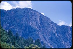
- Description:
- 50 f 11
- Subject:
- Tree limbs, Forests, Mountains, Sierra Nevada (Calif. and Nev.), Trees, Rock slopes, Rock formations, and Clouds
- Series:
- 8-53
- Creator:
- Cushman, Charles W., 1896-1972
- Date Created:
- 1953-10-09
- Genre:
- Landscape photographs
- Frame Number:
- 26
- County:
- El Dorado
- Abstract:
- Mtn ridge NW from Echo Lake. (Echo Summit is 7365)
- Call Number:
- P06788
- City:
- Echo Lake
- Country:
- United States
- State/Province:
- California
- Alternate Identifier:
- 853.26
- Persistent URL:
- http://purl.dlib.indiana.edu/iudl/archives/cushman/P06788
- Holding Location:
- Bloomington - University Archives
Wells Library E460
1320 E 10th St.
Bloomington, IN 47405
Contact at archives@indiana.edu, 812-855-1127
-
- Description:
- 100 f 5 tl wrong focus error at 300 ft.
- Subject:
- Domes, Cities & towns, Streets, Hills, Bodies of water, Mountains, Dwellings, Buena Vista Park (San Francisco, Calif.), Buildings, Coastlines, Clouds, Tr...
- Series:
- 5-55
- Creator:
- Cushman, Charles W., 1896-1972
- Date Created:
- 1955-03-12
- Genre:
- Cityscape photographs
- Frame Number:
- 20
- County:
- Marin and San Francisco
- Abstract:
- Toward Pt. Reyes under clouds were out too far to left and had to be remounted
- Call Number:
- P07685
- City:
- San Francisco and Point Reyes Station
- Country:
- United States
- State/Province:
- California
- Alternate Identifier:
- 555.20
- Persistent URL:
- http://purl.dlib.indiana.edu/iudl/archives/cushman/P07685
- Holding Location:
- Bloomington - University Archives
Wells Library E460
1320 E 10th St.
Bloomington, IN 47405
Contact at archives@indiana.edu, 812-855-1127
-
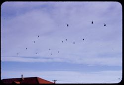
- Description:
- 200 f 5.6 tl
- Subject:
- Roofs, Helicopters, Utility poles, Electric lines, and Clouds
- Series:
- 10-55
- Creator:
- Cushman, Charles W., 1896-1972
- Date Created:
- 1955-03-23
- Frame Number:
- 22
- County:
- Inyo
- Abstract:
- Another flight of whirly birds
- Call Number:
- P07847
- City:
- Death Valley Junction
- Country:
- United States
- State/Province:
- California
- Alternate Identifier:
- 1055.22
- Persistent URL:
- http://purl.dlib.indiana.edu/iudl/archives/cushman/P07847
- Holding Location:
- Bloomington - University Archives
Wells Library E460
1320 E 10th St.
Bloomington, IN 47405
Contact at archives@indiana.edu, 812-855-1127
-
- Description:
- 200 f 5 tl
- Subject:
- Valleys, Panamint Valley (Calif.), Panamint Range (Calif.), Shrubs, Trails & paths, Clouds, and Mountains
- Series:
- 3-55
- Creator:
- Cushman, Charles W., 1896-1972
- Date Created:
- 1955-02-27
- Genre:
- Landscape photographs
- Frame Number:
- 27
- Street Address:
- California State Highway 190
- Abstract:
- E across Panamint Valley from floor (Cal 190)
- Call Number:
- P07618
- Country:
- United States
- State/Province:
- California
- Alternate Identifier:
- 355.27
- Persistent URL:
- http://purl.dlib.indiana.edu/iudl/archives/cushman/P07618
- Holding Location:
- Bloomington - University Archives
Wells Library E460
1320 E 10th St.
Bloomington, IN 47405
Contact at archives@indiana.edu, 812-855-1127
-
- Description:
- 100 f 5.6 sl
- Subject:
- Channels, Tree limbs, Cities & towns, San Francisco Bay (Calif.), Olympus, Mount (San Francisco County, Calif.), Mountains, Buildings, Suspension bridges...
- Series:
- 15-57
- Creator:
- Cushman, Charles W., 1896-1972
- Date Created:
- 1957-10-06
- Genre:
- Cityscape photographs
- Frame Number:
- 34
- County:
- San Francisco
- Abstract:
- Clouds above Golden Gate seen from Mt. Olympus
- Call Number:
- P09564
- City:
- San Francisco
- Country:
- United States
- State/Province:
- California
- Alternate Identifier:
- 1557.34
- Persistent URL:
- http://purl.dlib.indiana.edu/iudl/archives/cushman/P09564
- Holding Location:
- Bloomington - University Archives
Wells Library E460
1320 E 10th St.
Bloomington, IN 47405
Contact at archives@indiana.edu, 812-855-1127
-
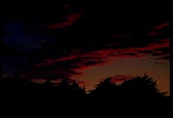
- Description:
- 100 f 4 tl
- Subject:
- Trees, Shadows, Clouds, and Sunrises & sunsets
- Series:
- 28-55
- Creator:
- Cushman, Charles W., 1896-1972
- Date Created:
- 1955-10-03
- Genre:
- Views
- Frame Number:
- 12
- Street Address:
- Buena Vista
- County:
- San Francisco
- Abstract:
- a little later
- Call Number:
- P08469
- City:
- San Francisco
- Country:
- United States
- State/Province:
- California
- Alternate Identifier:
- 2855.12
- Persistent URL:
- http://purl.dlib.indiana.edu/iudl/archives/cushman/P08469
- Holding Location:
- Bloomington - University Archives
Wells Library E460
1320 E 10th St.
Bloomington, IN 47405
Contact at archives@indiana.edu, 812-855-1127
-
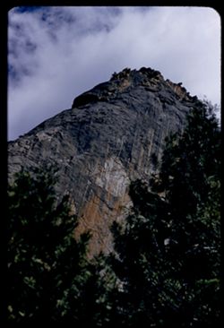
- Description:
- 100 f 6.3 tl
- Subject:
- Rock formations, Yosemite National Park (Calif.), Trees, Cathedral Rocks (Calif.), National parks & reserves, Cliffs, and Clouds
- Series:
- 22-55
- Creator:
- Cushman, Charles W., 1896-1972
- Date Created:
- 1955-07-09
- Genre:
- Landscape photographs
- Frame Number:
- 22
- County:
- Mariposa
- Abstract:
- Tiptop of a Cathedral Rock
- Call Number:
- P08275
- Country:
- United States
- State/Province:
- California
- Alternate Identifier:
- 2255.22
- Persistent URL:
- http://purl.dlib.indiana.edu/iudl/archives/cushman/P08275
- Holding Location:
- Bloomington - University Archives
Wells Library E460
1320 E 10th St.
Bloomington, IN 47405
Contact at archives@indiana.edu, 812-855-1127
-
- Description:
- 50 f 8
- Subject:
- Mountains, Cascade Range, Lassen Volcanic National Park (Calif.), Lava domes, Bumpass Mountain (Calif.), Volcanoes, Shrubs, Clouds, Volcanic domes, and Trees
- Series:
- 6-54
- Creator:
- Cushman, Charles W., 1896-1972
- Date Created:
- 1954-08-19
- Genre:
- Landscape photographs
- Frame Number:
- 4
- County:
- Shasta
- Abstract:
- Bumpass
- Call Number:
- P07223
- Country:
- United States
- State/Province:
- California
- Alternate Identifier:
- 654.4
- Persistent URL:
- http://purl.dlib.indiana.edu/iudl/archives/cushman/P07223
- Holding Location:
- Bloomington - University Archives
Wells Library E460
1320 E 10th St.
Bloomington, IN 47405
Contact at archives@indiana.edu, 812-855-1127
-
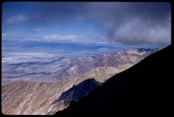
- Description:
- 50 mm lens
- Subject:
- Valleys, Dantes View (Calif.), Mountains, Death Valley (Calif. and Nev.), Black Mountains (Inyo County, Calif.), and Clouds
- Series:
- 3-55
- Creator:
- Cushman, Charles W., 1896-1972
- Date Created:
- 1955-02-27
- Genre:
- Landscape photographs
- Frame Number:
- 3
- County:
- Inyo
- Abstract:
- View north along ridge of Black Mtns
- Call Number:
- P07596
- Country:
- United States
- State/Province:
- California
- Alternate Identifier:
- 355.3
- Persistent URL:
- http://purl.dlib.indiana.edu/iudl/archives/cushman/P07596
- Holding Location:
- Bloomington - University Archives
Wells Library E460
1320 E 10th St.
Bloomington, IN 47405
Contact at archives@indiana.edu, 812-855-1127
-
- Description:
- 50 mm 1/100 short lens
- Subject:
- Meadows, Diablo, Mount (Calif.), Hills, Mountains, Trees, Utility poles, Roads, and Clouds
- Series:
- 1-56
- Creator:
- Cushman, Charles W., 1896-1972
- Date Created:
- 1956-02-23
- Genre:
- Landscape photographs
- Frame Number:
- 8
- Street Address:
- Norris Canyon Road
- County:
- Contra Costa
- Abstract:
- Mt. Diablo
- Call Number:
- P08537
- Country:
- United States
- State/Province:
- California
- Alternate Identifier:
- 156.8
- Persistent URL:
- http://purl.dlib.indiana.edu/iudl/archives/cushman/P08537
- Holding Location:
- Bloomington - University Archives
Wells Library E460
1320 E 10th St.
Bloomington, IN 47405
Contact at archives@indiana.edu, 812-855-1127
-
- Description:
- 100 f 8 tl
- Subject:
- Buildings, San Francisco-Oakland Bay Bridge (Oakland and San Francisco, Calif.), Cities & towns, Suspension bridges, Bays (Bodies of water), Roofs, Domes...
- Series:
- 29-55
- Creator:
- Cushman, Charles W., 1896-1972
- Date Created:
- 1955-12-03
- Genre:
- Cityscape photographs
- Frame Number:
- 34
- Street Address:
- 100 Broderick Street
- County:
- San Francisco
- Abstract:
- 32-39 incl. (Dec. 3) 2:30 PM clouds in eastern sky from top of 100 Broderick
- Call Number:
- P08525
- City:
- San Francisco
- Country:
- United States
- State/Province:
- California
- Alternate Identifier:
- 2955.34
- Persistent URL:
- http://purl.dlib.indiana.edu/iudl/archives/cushman/P08525
- Holding Location:
- Bloomington - University Archives
Wells Library E460
1320 E 10th St.
Bloomington, IN 47405
Contact at archives@indiana.edu, 812-855-1127
-
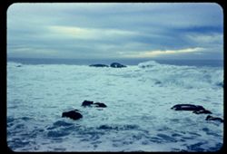
- Description:
- 50 f 4.5
- Subject:
- Bodies of water, Pigeon Point (Santa Clara County, Calif.), Rocks, Clouds, Seas, and Sunrises & sunsets
- Series:
- 17-54
- Creator:
- Cushman, Charles W., 1896-1972
- Date Created:
- 1954-11-19
- Genre:
- Seascapes
- Frame Number:
- 10
- County:
- Santa Clara
- Abstract:
- Surf at Pigeon Pt. in offshore wind - view west
- Call Number:
- P07530
- Country:
- United States
- State/Province:
- California
- Physical Description:
- Anscochrome film. Image was originally mounted in a glass enclosure. Before digitization, the image was removed and placed in a Wess Plastic, Inc. brand, 2&q...
- Alternate Identifier:
- 1754.10
- Persistent URL:
- http://purl.dlib.indiana.edu/iudl/archives/cushman/P07530
- Holding Location:
- Bloomington - University Archives
Wells Library E460
1320 E 10th St.
Bloomington, IN 47405
Contact at archives@indiana.edu, 812-855-1127
-
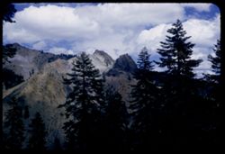
- Description:
- 100 f 6.3 tl
- Subject:
- Mountains, Sierra Nevada (Calif. and Nev.), and Clouds
- Series:
- 26-55
- Creator:
- Cushman, Charles W., 1896-1972
- Date Created:
- 1955-09-25
- Genre:
- Landscape photographs
- Frame Number:
- 16
- Street Address:
- United States Highway 395 and United States Highway 6
- County:
- Inyo
- Abstract:
- From US 6/395 between Independence & Big Pine - toward a [push?] in the high Sierra
- Call Number:
- P08399
- City:
- Independence and Big Pine
- Country:
- United States
- State/Province:
- California
- Alternate Identifier:
- 2655.16
- Persistent URL:
- http://purl.dlib.indiana.edu/iudl/archives/cushman/P08399
- Holding Location:
- Bloomington - University Archives
Wells Library E460
1320 E 10th St.
Bloomington, IN 47405
Contact at archives@indiana.edu, 812-855-1127
-

- Description:
- 50 f 6.3
- Subject:
- San Francisco-Oakland Bay Bridge (Oakland and San Francisco, Calif.), Trucks, Suspension bridges, Bays (Bodies of water), Ferries, Telegraph Hill (San Franci...
- Series:
- 6-53
- Creator:
- Cushman, Charles W., 1896-1972
- Date Created:
- 1953-05-23
- Frame Number:
- 32
- Street Address:
- Union Street and Montgomery Street
- County:
- San Francisco
- Abstract:
- Houses atop Telegraph Hill on Union nr. Montgomery from opposite sidewalk with Bay Ferry in corner.
- Call Number:
- P06720
- City:
- San Francisco
- Country:
- United States
- State/Province:
- California
- Alternate Identifier:
- 653.32
- Persistent URL:
- http://purl.dlib.indiana.edu/iudl/archives/cushman/P06720
- Holding Location:
- Bloomington - University Archives
Wells Library E460
1320 E 10th St.
Bloomington, IN 47405
Contact at archives@indiana.edu, 812-855-1127
-
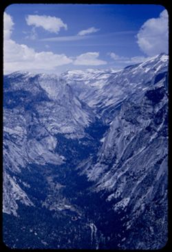
- Description:
- 50 f 11
- Subject:
- Yosemite National Park (Calif.), Mountains, Tenaya Canyon (Calif.), Canyons, National parks & reserves, Snow, Mirror Lake (Mariposa County, Calif.), Lake...
- Series:
- 5-53
- Creator:
- Cushman, Charles W., 1896-1972
- Date Created:
- 1953-05-13
- Genre:
- Landscape photographs
- Frame Number:
- 31
- County:
- Mariposa
- Abstract:
- View up Tenaya Canyon - NE from Glacier Point (Mirror Lake at bottom).
- Call Number:
- P06681
- Country:
- United States
- State/Province:
- California
- Alternate Identifier:
- 553.31
- Persistent URL:
- http://purl.dlib.indiana.edu/iudl/archives/cushman/P06681
- Holding Location:
- Bloomington - University Archives
Wells Library E460
1320 E 10th St.
Bloomington, IN 47405
Contact at archives@indiana.edu, 812-855-1127
-
- Description:
- 25 f 9
- Subject:
- Buildings, Cities & towns, Mountains, Telegraph Hill (San Francisco, Calif.), Suspension bridges, Bays (Bodies of water), Golden Gate Bridge (San Francis...
- Series:
- 10-52
- Creator:
- Cushman, Charles W., 1896-1972
- Date Created:
- 1952-03-12
- Genre:
- Views and Cityscape photographs
- Frame Number:
- 11
- County:
- San Francisco
- Abstract:
- Golden Gate from Telegraph Hill
- Call Number:
- P05846
- City:
- San Francisco
- Country:
- United States
- State/Province:
- California
- Alternate Identifier:
- 1052.11
- Persistent URL:
- http://purl.dlib.indiana.edu/iudl/archives/cushman/P05846
- Holding Location:
- Bloomington - University Archives
Wells Library E460
1320 E 10th St.
Bloomington, IN 47405
Contact at archives@indiana.edu, 812-855-1127
-
- Description:
- 50 f 11
- Subject:
- Mount Wilson (Calif.), Trees, Clouds, and Pines
- Series:
- 6-52
- Creator:
- Cushman, Charles W., 1896-1972
- Date Created:
- 1952-02-18
- Genre:
- Identification photographs
- Frame Number:
- 27
- County:
- Los Angeles
- Abstract:
- Fairy land
- Call Number:
- P05710
- Country:
- United States
- State/Province:
- California
- Alternate Identifier:
- 652.27
- Persistent URL:
- http://purl.dlib.indiana.edu/iudl/archives/cushman/P05710
- Holding Location:
- Bloomington - University Archives
Wells Library E460
1320 E 10th St.
Bloomington, IN 47405
Contact at archives@indiana.edu, 812-855-1127
-
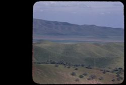
- Description:
- 100 f 7 tel
- Subject:
- Valleys, Mountains, Panamint Valley (Calif.), Panamint Range (Calif.), and Clouds
- Series:
- 3-55
- Creator:
- Cushman, Charles W., 1896-1972
- Date Created:
- 1955-02-27
- Genre:
- Landscape photographs
- Frame Number:
- 26
- Street Address:
- California State Highway 190
- Abstract:
- NE across Panamint Valley from floor (Cal 190)
- Call Number:
- P07617
- Country:
- United States
- State/Province:
- California
- Physical Description:
- Image was originally mounted in a glass enclosure. Before digitization, the image was removed and placed in a Wess Plastic, Inc. brand, 2" x 2", pl...
- Alternate Identifier:
- 355.26
- Persistent URL:
- http://purl.dlib.indiana.edu/iudl/archives/cushman/P07617
- Holding Location:
- Bloomington - University Archives
Wells Library E460
1320 E 10th St.
Bloomington, IN 47405
Contact at archives@indiana.edu, 812-855-1127
-
- Description:
- 100 f 6.3 or f 8 tl
- Subject:
- Hills and Clouds
- Series:
- 29-55
- Creator:
- Cushman, Charles W., 1896-1972
- Date Created:
- 1955-12-03
- Genre:
- Views
- Frame Number:
- 35
- Street Address:
- 100 Broderick Street
- County:
- San Francisco
- Abstract:
- 32-39 incl. (Dec. 3) 2:30 PM clouds in eastern sky from top of 100 Broderick
- Call Number:
- P08526
- City:
- San Francisco
- Country:
- United States
- State/Province:
- California
- Alternate Identifier:
- 2955.35
- Persistent URL:
- http://purl.dlib.indiana.edu/iudl/archives/cushman/P08526
- Holding Location:
- Bloomington - University Archives
Wells Library E460
1320 E 10th St.
Bloomington, IN 47405
Contact at archives@indiana.edu, 812-855-1127
-
- Description:
- 100 f 6.3 tl telescope lens
- Subject:
- Meadows, Moffett Field (Calif.), Mountains, Universities & colleges, Stanford University, Clouds, and Skeggs Point (Calif.)
- Series:
- 3-57
- Creator:
- Cushman, Charles W., 1896-1972
- Date Created:
- 1957-04-12
- Genre:
- Landscape photographs and Views
- Frame Number:
- 14
- Street Address:
- Skyline Drive
- County:
- San Mateo
- Abstract:
- Towards Stanford & Moffett Field from Skeggs Pt.
- Call Number:
- P09178
- Country:
- United States
- State/Province:
- California
- Alternate Identifier:
- 357.14
- Persistent URL:
- http://purl.dlib.indiana.edu/iudl/archives/cushman/P09178
- Holding Location:
- Bloomington - University Archives
Wells Library E460
1320 E 10th St.
Bloomington, IN 47405
Contact at archives@indiana.edu, 812-855-1127
-
- Description:
- 100 f 8 TL
- Subject:
- Cities & towns, Houses, Mountains, Tamalpais, Mount (Calif.), Golden Gate Bridge (San Francisco, Calif.), Suspension bridges, Clouds, and Buildings
- Series:
- 6-56
- Creator:
- Cushman, Charles W., 1896-1972
- Date Created:
- 1956-05-07
- Genre:
- Cityscape photographs
- Frame Number:
- 33
- Street Address:
- 100 Broderick Street
- County:
- San Francisco
- Abstract:
- Clouds in northern sky, seen from top of 100 Broderick Mt. Tamalpais and Golden Gate Bridge and dark clouds
- Call Number:
- P08742
- City:
- San Francisco
- Country:
- United States
- State/Province:
- California
- Alternate Identifier:
- 656.33
- Persistent URL:
- http://purl.dlib.indiana.edu/iudl/archives/cushman/P08742
- Holding Location:
- Bloomington - University Archives
Wells Library E460
1320 E 10th St.
Bloomington, IN 47405
Contact at archives@indiana.edu, 812-855-1127
-
- Description:
- 50 f 8
- Subject:
- Streets, Automobiles, Skyscrapers, Potrero Hill (San Francisco, Calif.), Buildings, Clouds, and Shadows
- Series:
- 16-53
- Creator:
- Cushman, Charles W., 1896-1972
- Date Created:
- 1953-01-17
- Genre:
- Cityscape photographs
- Frame Number:
- 31
- Street Address:
- Wisconsin Street, Twentieth Street, and Nob Hill
- County:
- San Francisco
- Abstract:
- Nob Hill highlighted - Sunday a.m. from 20th & Wisconsin
- Call Number:
- P07103
- City:
- San Francisco
- Country:
- United States
- State/Province:
- California
- Alternate Identifier:
- 1653.31
- Persistent URL:
- http://purl.dlib.indiana.edu/iudl/archives/cushman/P07103
- Holding Location:
- Bloomington - University Archives
Wells Library E460
1320 E 10th St.
Bloomington, IN 47405
Contact at archives@indiana.edu, 812-855-1127
-
- Description:
- 100 f 6.3 sl with 50mm
- Subject:
- Mountains, Sierra Nevada (Calif. and Nev.), Trees, and Clouds
- Series:
- 26-55
- Creator:
- Cushman, Charles W., 1896-1972
- Date Created:
- 1955-09-25
- Genre:
- Landscape photographs
- Frame Number:
- 23
- County:
- Inyo
- Abstract:
- Cloud mass over Sierra - from Bishop
- Call Number:
- P08405
- City:
- Bishop
- Country:
- United States
- State/Province:
- California
- Alternate Identifier:
- 2655.23
- Persistent URL:
- http://purl.dlib.indiana.edu/iudl/archives/cushman/P08405
- Holding Location:
- Bloomington - University Archives
Wells Library E460
1320 E 10th St.
Bloomington, IN 47405
Contact at archives@indiana.edu, 812-855-1127
-
- Description:
- 50 f 6.3
- Subject:
- Hills, Mountains, Trees, Tehachapi Mountains (Calif.), Clouds, and Grasses
- Series:
- 16-53
- Creator:
- Cushman, Charles W., 1896-1972
- Date Created:
- 1953-11-23
- Genre:
- Landscape photographs
- Frame Number:
- 22
- County:
- Kern
- Abstract:
- Clouds through Tehachapi Mtns
- Call Number:
- P07094
- City:
- Tehachapi and Bakersfield
- Country:
- United States
- State/Province:
- California
- Alternate Identifier:
- 1653.22
- Persistent URL:
- http://purl.dlib.indiana.edu/iudl/archives/cushman/P07094
- Holding Location:
- Bloomington - University Archives
Wells Library E460
1320 E 10th St.
Bloomington, IN 47405
Contact at archives@indiana.edu, 812-855-1127
-
- Description:
- 100 f 6.3 tl
- Subject:
- Hills, Bodies of water, Mountains, Shrubs, Snow, Trees, Clouds, Fences, Shasta, Mount (Calif. : Mountain), and Grasses
- Series:
- 18-55
- Creator:
- Cushman, Charles W., 1896-1972
- Date Created:
- 1955-06-17
- Genre:
- Landscape photographs
- Frame Number:
- 2
- County:
- Siskiyou
- Abstract:
- Mt. Shasta at 2:35 from road east of Grenada
- Call Number:
- P08119
- City:
- Grenada
- Country:
- United States
- State/Province:
- California
- Alternate Identifier:
- 1855.2
- Persistent URL:
- http://purl.dlib.indiana.edu/iudl/archives/cushman/P08119
- Holding Location:
- Bloomington - University Archives
Wells Library E460
1320 E 10th St.
Bloomington, IN 47405
Contact at archives@indiana.edu, 812-855-1127
-
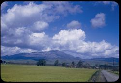
- Description:
- 100 f 8
- Subject:
- Meadows, Hills, Farmhouses, Trees, and Clouds
- Series:
- 2-68
- Creator:
- Cushman, Charles W., 1896-1972
- Date Created:
- 1968-05-15
- Genre:
- Landscape photographs
- Frame Number:
- 22
- Street Address:
- Wilson Hill Road
- County:
- Marin
- Abstract:
- Marin county- east from Wilson Hill Rd.
- Call Number:
- P15654
- Country:
- United States
- State/Province:
- California
- Alternate Identifier:
- 268.22
- Persistent URL:
- http://purl.dlib.indiana.edu/iudl/archives/cushman/P15654
- Holding Location:
- Bloomington - University Archives
Wells Library E460
1320 E 10th St.
Bloomington, IN 47405
Contact at archives@indiana.edu, 812-855-1127
-
- Description:
- 100 f TL
- Subject:
- Channels, Houses, San Francisco Bay (Calif.), Bridges, Bays (Bodies of water), Waterfronts, Tunnels, Golden Gate Bridge (San Francisco, Calif.), Coastlines, ...
- Series:
- 1-69
- Creator:
- Cushman, Charles W., 1896-1972
- Date Created:
- 1969-02-01
- Genre:
- Landscape photographs
- Frame Number:
- 5
- County:
- Marin and San Francisco
- Call Number:
- P15700
- City:
- San Francisco
- Country:
- United States
- State/Province:
- California
- Alternate Identifier:
- 169.5
- Persistent URL:
- http://purl.dlib.indiana.edu/iudl/archives/cushman/P15700
- Holding Location:
- Bloomington - University Archives
Wells Library E460
1320 E 10th St.
Bloomington, IN 47405
Contact at archives@indiana.edu, 812-855-1127
-
- Description:
- 100 f 8 TL
- Subject:
- Channels, Hills, Bridges, Bays (Bodies of water), Waterfronts, Tunnels, Trees, Golden Gate Bridge (San Francisco, Calif.), Cargo ships, Clouds, and Coastlines
- Series:
- 1-69
- Creator:
- Cushman, Charles W., 1896-1972
- Date Created:
- 1969-02-01
- Genre:
- Marine photographs and Landscape photographs
- Frame Number:
- 10
- County:
- Marin and San Francisco
- Call Number:
- P15705
- City:
- San Francisco
- Country:
- United States
- State/Province:
- California
- Alternate Identifier:
- 169.10
- Persistent URL:
- http://purl.dlib.indiana.edu/iudl/archives/cushman/P15705
- Holding Location:
- Bloomington - University Archives
Wells Library E460
1320 E 10th St.
Bloomington, IN 47405
Contact at archives@indiana.edu, 812-855-1127
-
- Description:
- 100 f 8 TL
- Subject:
- Hills, Birds, Bridges, Waterfronts, Tunnels, Coastlines, Clouds, Houses, Ships, and Boats
- Series:
- 1-69
- Creator:
- Cushman, Charles W., 1896-1972
- Date Created:
- 1969-02-01
- Genre:
- Marine photographs and Landscape photographs
- Frame Number:
- 16
- County:
- Marin and San Francisco
- Call Number:
- P15711
- City:
- San Francisco
- Country:
- United States
- State/Province:
- California
- Alternate Identifier:
- 169.16
- Persistent URL:
- http://purl.dlib.indiana.edu/iudl/archives/cushman/P15711
- Holding Location:
- Bloomington - University Archives
Wells Library E460
1320 E 10th St.
Bloomington, IN 47405
Contact at archives@indiana.edu, 812-855-1127
-
- Description:
- 100 f 8 TL
- Subject:
- Houses, Bridges, Waterfronts, Tunnels, Trees, Clouds, and Hills
- Series:
- 1-69
- Creator:
- Cushman, Charles W., 1896-1972
- Date Created:
- 1969-02-01
- Genre:
- Landscape photographs
- Frame Number:
- 4
- County:
- Marin and San Francisco
- Call Number:
- P15699
- City:
- San Francisco
- Country:
- United States
- State/Province:
- California
- Alternate Identifier:
- 169.4
- Persistent URL:
- http://purl.dlib.indiana.edu/iudl/archives/cushman/P15699
- Holding Location:
- Bloomington - University Archives
Wells Library E460
1320 E 10th St.
Bloomington, IN 47405
Contact at archives@indiana.edu, 812-855-1127
-
- Description:
- 100 f TL
- Subject:
- Hills, San Francisco Bay (Calif.), Birds, Bays (Bodies of water), Coastlines, Clouds, and Ships
- Series:
- 1-69
- Creator:
- Cushman, Charles W., 1896-1972
- Date Created:
- 1969-02-01
- Genre:
- Marine photographs
- Frame Number:
- 14
- County:
- San Francisco
- Call Number:
- P15709
- City:
- San Francisco
- Country:
- United States
- State/Province:
- California
- Alternate Identifier:
- 169.14
- Persistent URL:
- http://purl.dlib.indiana.edu/iudl/archives/cushman/P15709
- Holding Location:
- Bloomington - University Archives
Wells Library E460
1320 E 10th St.
Bloomington, IN 47405
Contact at archives@indiana.edu, 812-855-1127
-
- Description:
- 100 f TL
- Subject:
- Hills, Trees, and Clouds
- Series:
- 1-69
- Creator:
- Cushman, Charles W., 1896-1972
- Date Created:
- 1969-02-01
- Genre:
- Landscape photographs
- Frame Number:
- 17
- County:
- Marin
- Call Number:
- P15712
- Country:
- United States
- State/Province:
- California
- Alternate Identifier:
- 169.17
- Persistent URL:
- http://purl.dlib.indiana.edu/iudl/archives/cushman/P15712
- Holding Location:
- Bloomington - University Archives
Wells Library E460
1320 E 10th St.
Bloomington, IN 47405
Contact at archives@indiana.edu, 812-855-1127
-
- Description:
- 100 f 8 TL
- Subject:
- Hills and Clouds
- Series:
- 3-69
- Creator:
- Cushman, Charles W., 1896-1972
- Date Created:
- 1969-03-21
- Genre:
- Landscape photographs
- Frame Number:
- 24
- County:
- San Luis Obispo
- Abstract:
- Faded green hills near Cholame
- Call Number:
- P15776
- City:
- Cholame
- Country:
- United States
- State/Province:
- California
- Alternate Identifier:
- 369.24
- Persistent URL:
- http://purl.dlib.indiana.edu/iudl/archives/cushman/P15776
- Holding Location:
- Bloomington - University Archives
Wells Library E460
1320 E 10th St.
Bloomington, IN 47405
Contact at archives@indiana.edu, 812-855-1127
-
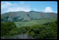
- Description:
- 100 f 8 TL
- Subject:
- Hills and Clouds
- Series:
- 3-69
- Creator:
- Cushman, Charles W., 1896-1972
- Date Created:
- 1969-03-21
- Genre:
- Landscape photographs
- Frame Number:
- 25
- County:
- San Luis Obispo
- Call Number:
- P15777
- City:
- Cholame
- Country:
- United States
- State/Province:
- California
- Alternate Identifier:
- 369.25
- Persistent URL:
- http://purl.dlib.indiana.edu/iudl/archives/cushman/P15777
- Holding Location:
- Bloomington - University Archives
Wells Library E460
1320 E 10th St.
Bloomington, IN 47405
Contact at archives@indiana.edu, 812-855-1127
-
- Subject:
- Hills, San Francisco Bay (Calif.), Bays (Bodies of water), Cargo ships, and Clouds
- Series:
- 1-69
- Creator:
- Cushman, Charles W., 1896-1972
- Date Created:
- 1969-02-01
- Genre:
- Marine photographs
- Frame Number:
- 6
- County:
- San Francisco
- Call Number:
- P15701
- City:
- San Francisco
- Country:
- United States
- State/Province:
- California
- Alternate Identifier:
- 169.6
- Persistent URL:
- http://purl.dlib.indiana.edu/iudl/archives/cushman/P15701
- Holding Location:
- Bloomington - University Archives
Wells Library E460
1320 E 10th St.
Bloomington, IN 47405
Contact at archives@indiana.edu, 812-855-1127
-
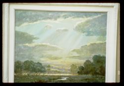
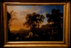
- Description:
- 1/10sec f 1.5
- Subject:
- Sacramento valley in the springtime, Meadows, Valleys, California spring, Light, Cattle, Trees, Grazing, Picture frames, Rivers, and Clouds
- Series:
- 4-68
- Creator:
- Cushman, Charles W., 1896-1972
- Date Created:
- 1968-12-16
- Genre:
- Paintings and Reproductions
- Frame Number:
- 21
- County:
- Sacramento
- Persons Pictured:
- Bierstadt, Albert, 1830-1902
- Abstract:
- Albert Bierstadt Sacramento Va Valley in the Springtime
- Call Number:
- P15694
- Country:
- United States
- State/Province:
- California
- Alternate Identifier:
- 468.21
- Persistent URL:
- http://purl.dlib.indiana.edu/iudl/archives/cushman/P15694
- Holding Location:
- Bloomington - University Archives
Wells Library E460
1320 E 10th St.
Bloomington, IN 47405
Contact at archives@indiana.edu, 812-855-1127
-
- Description:
- 100 f 8 TL
- Subject:
- Hills, San Francisco Bay (Calif.), Bridges, Bays (Bodies of water), Trees, Golden Gate Bridge (San Francisco, Calif.), Coastlines, Clouds, and Houses
- Series:
- 1-69
- Creator:
- Cushman, Charles W., 1896-1972
- Date Created:
- 1969-02-01
- Genre:
- Landscape photographs
- Frame Number:
- 1
- County:
- Marin and San Francisco
- Call Number:
- P15696
- City:
- San Francisco
- Country:
- United States
- State/Province:
- California
- Alternate Identifier:
- 169.1
- Persistent URL:
- http://purl.dlib.indiana.edu/iudl/archives/cushman/P15696
- Holding Location:
- Bloomington - University Archives
Wells Library E460
1320 E 10th St.
Bloomington, IN 47405
Contact at archives@indiana.edu, 812-855-1127
-
- Description:
- 25 f 1.5
- Subject:
- Monuments & memorials, Lincoln Park (San Francisco, Calif.), Jardin du Carrousel (Paris, France), People, Ailsa Mellon Bruce collection, Trees, Californi...
- Series:
- 25-61
- Creator:
- Cushman, Charles W., 1896-1972
- Date Created:
- 1961-07-18
- Genre:
- Paintings and Reproductions
- Frame Number:
- 4
- County:
- San Francisco
- Persons Pictured:
- Pissarro, Camille, 1830-1903
- Abstract:
- Pissarro Place du Carrousel
- Call Number:
- P12607
- City:
- San Francisco
- Country:
- United States
- State/Province:
- California
- Alternate Identifier:
- 2561.4
- Persistent URL:
- http://purl.dlib.indiana.edu/iudl/archives/cushman/P12607
- Holding Location:
- Bloomington - University Archives
Wells Library E460
1320 E 10th St.
Bloomington, IN 47405
Contact at archives@indiana.edu, 812-855-1127
-
- Description:
- f 4 tl
- Subject:
- Domes, Palace of Fine Arts (San Francisco), Hills, Bridges, Golden Gate Bridge (San Francisco, Calif.), Suspension bridges, Clouds, Sunrises & sunsets, C...
- Series:
- 15-59
- Creator:
- Cushman, Charles W., 1896-1972
- Date Created:
- 1959-08-23
- Genre:
- Views
- Frame Number:
- 8
- County:
- San Francisco
- Call Number:
- P10847
- City:
- San Francisco
- Country:
- United States
- State/Province:
- California
- Physical Description:
- Anscochrome film.
- Alternate Identifier:
- 1559.8
- Persistent URL:
- http://purl.dlib.indiana.edu/iudl/archives/cushman/P10847
- Holding Location:
- Bloomington - University Archives
Wells Library E460
1320 E 10th St.
Bloomington, IN 47405
Contact at archives@indiana.edu, 812-855-1127
-
- Description:
- 100 f 5.6 tl
- Subject:
- Mountains, Trees, Trinity River (Calif.), and Clouds
- Series:
- 16-55
- Creator:
- Cushman, Charles W., 1896-1972
- Date Created:
- 1955-06-15
- Genre:
- Landscape photographs
- Frame Number:
- 22
- County:
- Trinity
- Abstract:
- from same spot
- Call Number:
- P08066
- Country:
- United States
- State/Province:
- California
- Alternate Identifier:
- 1655.22
- Persistent URL:
- http://purl.dlib.indiana.edu/iudl/archives/cushman/P08066
- Holding Location:
- Bloomington - University Archives
Wells Library E460
1320 E 10th St.
Bloomington, IN 47405
Contact at archives@indiana.edu, 812-855-1127
-
- Description:
- 25 f 5.6 pola
- Subject:
- Telegraph Hill (San Francisco, Calif.), Cities & towns, Spires, Streets, Skyscrapers, Buildings, Towers, Russian Hill (San Francisco, Calif.), Clouds, Ro...
- Series:
- 10-52
- Creator:
- Cushman, Charles W., 1896-1972
- Date Created:
- 1952-03-12
- Genre:
- Cityscape photographs
- Frame Number:
- 12
- County:
- San Francisco
- Abstract:
- Russian Hill from Tel
- Call Number:
- P05847
- City:
- San Francisco
- Country:
- United States
- State/Province:
- California
- Alternate Identifier:
- 1052.12
- Persistent URL:
- http://purl.dlib.indiana.edu/iudl/archives/cushman/P05847
- Holding Location:
- Bloomington - University Archives
Wells Library E460
1320 E 10th St.
Bloomington, IN 47405
Contact at archives@indiana.edu, 812-855-1127
-
- Description:
- 25 f 2
- Subject:
- Meadows, Hills, Weather, Lincoln Park (San Francisco, Calif.), Trees, California Palace of the Legion of Honor, Picture frames, Clouds, Fine Arts Museums of ...
- Series:
- 28-64
- Creator:
- Cushman, Charles W., 1896-1972
- Date Created:
- 1965-01-29
- Genre:
- Paintings and Reproductions
- Frame Number:
- 20
- County:
- San Francisco
- Persons Pictured:
- Hurd, Peter, 1904-
- Abstract:
- Brandywine Meadows, Chedd's Ford (1927
- Call Number:
- P13862
- City:
- San Francisco
- Country:
- United States
- State/Province:
- California
- Alternate Identifier:
- 2864.20
- Persistent URL:
- http://purl.dlib.indiana.edu/iudl/archives/cushman/P13862
- Holding Location:
- Bloomington - University Archives
Wells Library E460
1320 E 10th St.
Bloomington, IN 47405
Contact at archives@indiana.edu, 812-855-1127
-
- Description:
- 100 f 11 SL
- Subject:
- Meadows, Black Mountain (Marin County, Calif.), Hills, Mountains, Trees, Grazing, and Clouds
- Series:
- 1-63
- Creator:
- Cushman, Charles W., 1896-1972
- Date Created:
- 1963-04-09
- Genre:
- Landscape photographs
- Frame Number:
- 12
- County:
- Marin
- Abstract:
- Black Mtn-
- Call Number:
- P12816
- City:
- Point Reyes Station
- Country:
- United States
- State/Province:
- California
- Alternate Identifier:
- 163.12
- Persistent URL:
- http://purl.dlib.indiana.edu/iudl/archives/cushman/P12816
- Holding Location:
- Bloomington - University Archives
Wells Library E460
1320 E 10th St.
Bloomington, IN 47405
Contact at archives@indiana.edu, 812-855-1127
-
- Description:
- 100 f 8 tl
- Subject:
- Meadows, Shasta, Mount (Calif. : Mountain), Mountains, Trees, and Clouds
- Series:
- 10-56
- Creator:
- Cushman, Charles W., 1896-1972
- Date Created:
- 1956-07-14
- Genre:
- Landscape photographs
- Frame Number:
- 32
- County:
- Siskiyou
- Abstract:
- NW side of Mt. Shasta
- Call Number:
- P08892
- Country:
- United States
- State/Province:
- California
- Alternate Identifier:
- 1056.32
- Persistent URL:
- http://purl.dlib.indiana.edu/iudl/archives/cushman/P08892
- Holding Location:
- Bloomington - University Archives
Wells Library E460
1320 E 10th St.
Bloomington, IN 47405
Contact at archives@indiana.edu, 812-855-1127
-
- Description:
- 25 f 9
- Subject:
- Domes, Cities & towns, Streets, Palace of Fine Arts (San Francisco), Automobiles, San Francisco Bay (Calif.), Bays (Bodies of water), Dwellings, Electric...
- Series:
- 10-52
- Creator:
- Cushman, Charles W., 1896-1972
- Date Created:
- 1952-03-18
- Genre:
- Cityscape photographs
- Frame Number:
- 31
- Street Address:
- Pacific Heights, Broderick Street, and Broadway Street
- County:
- San Francisco
- Abstract:
- The Marina and S.F. Bay seen from Pacific Hts at Broadway & Broderick
- Call Number:
- P05862
- City:
- San Francisco
- Country:
- United States
- State/Province:
- California
- Alternate Identifier:
- 1052.31
- Persistent URL:
- http://purl.dlib.indiana.edu/iudl/archives/cushman/P05862
- Holding Location:
- Bloomington - University Archives
Wells Library E460
1320 E 10th St.
Bloomington, IN 47405
Contact at archives@indiana.edu, 812-855-1127
-
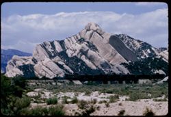
- Description:
- 100 f 6.3 tl
- Subject:
- Railroad bridges, Mountains, Shrubs, Railroads, Cajon Canyon (Calif.), Sandstone, Atchison, Topeka, and Santa Fe Railway Company, Clouds, and Rock formations
- Series:
- 7-57
- Creator:
- Cushman, Charles W., 1896-1972
- Date Created:
- 1957-05-14
- Genre:
- Landscape photographs
- Frame Number:
- 10
- County:
- San Bernardino
- Abstract:
- Great slanting sandstone weeps along AT & SF in Cajon Canyon
- Call Number:
- P09289
- Country:
- United States
- State/Province:
- California
- Alternate Identifier:
- 757.10
- Persistent URL:
- http://purl.dlib.indiana.edu/iudl/archives/cushman/P09289
- Holding Location:
- Bloomington - University Archives
Wells Library E460
1320 E 10th St.
Bloomington, IN 47405
Contact at archives@indiana.edu, 812-855-1127
-
- Description:
- 50 f 3.5
- Subject:
- Bodies of water, Pigeon Point (Santa Clara County, Calif.), Rocks, Clouds, Seas, and Sunrises & sunsets
- Series:
- 17-54
- Creator:
- Cushman, Charles W., 1896-1972
- Date Created:
- 1954-11-19
- Genre:
- Seascapes
- Frame Number:
- 11
- County:
- Santa Clara
- Abstract:
- Same but view SW
- Call Number:
- P07531
- Country:
- United States
- State/Province:
- California
- Physical Description:
- Anscochrome film.
- Alternate Identifier:
- 1754.11
- Persistent URL:
- http://purl.dlib.indiana.edu/iudl/archives/cushman/P07531
- Holding Location:
- Bloomington - University Archives
Wells Library E460
1320 E 10th St.
Bloomington, IN 47405
Contact at archives@indiana.edu, 812-855-1127
-
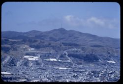
- Description:
- 100 f 5 TL
- Subject:
- Davidson, Mount (Calif.), Cities & towns, Mountains, San Bruno Mountain (Calif.), and Clouds
- Series:
- 23-55
- Creator:
- Cushman, Charles W., 1896-1972
- Date Created:
- 1955-07-17
- Genre:
- Landscape photographs and Cityscape photographs
- Frame Number:
- 13
- County:
- San Francisco and San Mateo
- Abstract:
- San Bruno Mtn. From Mt. Davidson
- Call Number:
- P08302
- Country:
- United States
- State/Province:
- California
- Alternate Identifier:
- 2355.13
- Persistent URL:
- http://purl.dlib.indiana.edu/iudl/archives/cushman/P08302
- Holding Location:
- Bloomington - University Archives
Wells Library E460
1320 E 10th St.
Bloomington, IN 47405
Contact at archives@indiana.edu, 812-855-1127
-
- Description:
- 100 f 5.6 tl
- Subject:
- Pacheco Pass (Calif.), Hills, Mountains, Trees, and Clouds
- Series:
- 2-55
- Creator:
- Cushman, Charles W., 1896-1972
- Date Created:
- 1955-02-25
- Genre:
- Landscape photographs
- Frame Number:
- 1
- County:
- Santa Clara
- Abstract:
- View east from summit of Pacheco Pass
- Call Number:
- P07559
- Country:
- United States
- State/Province:
- California
- Physical Description:
- masked.
- Alternate Identifier:
- 255.1
- Persistent URL:
- http://purl.dlib.indiana.edu/iudl/archives/cushman/P07559
- Holding Location:
- Bloomington - University Archives
Wells Library E460
1320 E 10th St.
Bloomington, IN 47405
Contact at archives@indiana.edu, 812-855-1127
-
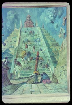
- Description:
- 25 f 2.8
- Subject:
- Walls, Pyramids, Stairways, People, California Palace of the Legion of Honor, Towers, Picture frames, Living and the dead, Clouds, Fine Arts Museums of San F...
- Series:
- 17-59
- Creator:
- Cushman, Charles W., 1896-1972
- Date Created:
- 1959-12-14
- Genre:
- Paintings and Reproductions
- Frame Number:
- 20
- County:
- San Francisco
- Persons Pictured:
- Berman, Eugene, 1899-1972
- Abstract:
- Eugene Berman- Mex. Pyramid
- Call Number:
- P10893
- City:
- San Francisco
- Country:
- United States
- State/Province:
- California
- Physical Description:
- Anscochrome film.
- Alternate Identifier:
- 1759.20
- Persistent URL:
- http://purl.dlib.indiana.edu/iudl/archives/cushman/P10893
- Holding Location:
- Bloomington - University Archives
Wells Library E460
1320 E 10th St.
Bloomington, IN 47405
Contact at archives@indiana.edu, 812-855-1127
-
- Description:
- 50 f 8
- Subject:
- Raker Peak (Calif.), Lassen Peak (Calif.), Lassen Volcanic National Park (Calif.), Volcanic domes, Mountains, Shrubs, Trees, Rocks, Clouds, Volcanoes, Lava d...
- Series:
- 5-54
- Creator:
- Cushman, Charles W., 1896-1972
- Date Created:
- 1954-08-19
- Genre:
- Landscape photographs
- Frame Number:
- 8
- County:
- Shasta
- Abstract:
- South side Raker Mtn (seen in 4)- this time mainly green
- Call Number:
- P07204
- Country:
- United States
- State/Province:
- California
- Physical Description:
- Anscochrome film.
- Alternate Identifier:
- 554.8
- Persistent URL:
- http://purl.dlib.indiana.edu/iudl/archives/cushman/P07204
- Holding Location:
- Bloomington - University Archives
Wells Library E460
1320 E 10th St.
Bloomington, IN 47405
Contact at archives@indiana.edu, 812-855-1127
-

- Description:
- 100 f 5.6 tl
- Subject:
- Clouds
- Series:
- 28-55
- Creator:
- Cushman, Charles W., 1896-1972
- Date Created:
- 1955-10-19
- Genre:
- Views
- Frame Number:
- 26
- Street Address:
- 100 Broderick Street
- County:
- San Francisco
- Abstract:
- Darker cloud S
- Call Number:
- P08480
- City:
- San Francisco
- Country:
- United States
- State/Province:
- California
- Alternate Identifier:
- 2855.26
- Persistent URL:
- http://purl.dlib.indiana.edu/iudl/archives/cushman/P08480
- Holding Location:
- Bloomington - University Archives
Wells Library E460
1320 E 10th St.
Bloomington, IN 47405
Contact at archives@indiana.edu, 812-855-1127
-
- Description:
- 100 f 4.5 or 5.6 tl
- Subject:
- Night, Owens Valley (Calif.), and Clouds
- Series:
- 26-55
- Creator:
- Cushman, Charles W., 1896-1972
- Date Created:
- 1955-09-25
- Genre:
- Night photographs
- Frame Number:
- 28
- County:
- Inyo
- Abstract:
- Evening sky at north end of Owens Valley - from Bishop
- Call Number:
- P08410
- City:
- Bishop
- Country:
- United States
- State/Province:
- California
- Physical Description:
- extremely dense.
- Alternate Identifier:
- 2655.28
- Persistent URL:
- http://purl.dlib.indiana.edu/iudl/archives/cushman/P08410
- Holding Location:
- Bloomington - University Archives
Wells Library E460
1320 E 10th St.
Bloomington, IN 47405
Contact at archives@indiana.edu, 812-855-1127
-
- Description:
- 50 f 6.3 sl
- Subject:
- Floods, Mountains, Trees, Niles Canyon (Alameda County, Calif.), Alameda Creek (Calif.), Clouds, Canyons, and Streams
- Series:
- 1-58
- Creator:
- Cushman, Charles W., 1896-1972
- Date Created:
- 1958-02-20
- Genre:
- Landscape photographs
- Frame Number:
- 25
- County:
- Alameda
- Abstract:
- [Sunol]
- Call Number:
- P09683
- Country:
- United States
- State/Province:
- California
- Alternate Identifier:
- 158.25
- Persistent URL:
- http://purl.dlib.indiana.edu/iudl/archives/cushman/P09683
- Holding Location:
- Bloomington - University Archives
Wells Library E460
1320 E 10th St.
Bloomington, IN 47405
Contact at archives@indiana.edu, 812-855-1127
-
- Description:
- 100 f 5 tl
- Subject:
- Hills, Roads, Mountains, Trees, Buildings, Clouds, and Greenhorn Mountains (Calif.)
- Series:
- 2-55
- Creator:
- Cushman, Charles W., 1896-1972
- Date Created:
- 1955-02-26
- Genre:
- Landscape photographs
- Frame Number:
- 3
- Street Address:
- California State Highway 178
- County:
- Kern
- Abstract:
- From pt. 12 mi E of Bakersfield view east toward Greenhorn Mtns
- Call Number:
- P07561
- City:
- Bakersfield
- Country:
- United States
- State/Province:
- California
- Alternate Identifier:
- 255.3
- Persistent URL:
- http://purl.dlib.indiana.edu/iudl/archives/cushman/P07561
- Holding Location:
- Bloomington - University Archives
Wells Library E460
1320 E 10th St.
Bloomington, IN 47405
Contact at archives@indiana.edu, 812-855-1127
-
- Description:
- 100 f 11
- Subject:
- Lakes & ponds, Black Mountain (Marin County, Calif.), Hills, Mountains, Coastlines, Clouds, and Grasses
- Series:
- 27-65
- Creator:
- Cushman, Charles W., 1896-1972
- Date Created:
- 1965-07-26
- Genre:
- Landscape photographs
- Frame Number:
- 1
- County:
- Marin
- Abstract:
- Hopi Pt. and Black Mtn. Western Marin
- Call Number:
- P14800
- Country:
- United States
- State/Province:
- California
- Alternate Identifier:
- 2765.1
- Persistent URL:
- http://purl.dlib.indiana.edu/iudl/archives/cushman/P14800
- Holding Location:
- Bloomington - University Archives
Wells Library E460
1320 E 10th St.
Bloomington, IN 47405
Contact at archives@indiana.edu, 812-855-1127
-
- Description:
- 100 f 6 tl
- Subject:
- Croplands, Hills, Saint Helena, Mount (Calif.), Mountains, Shrubs, Trees, Plants, and Clouds
- Series:
- 15-55
- Creator:
- Cushman, Charles W., 1896-1972
- Date Created:
- 1955-05-17
- Genre:
- Landscape photographs
- Frame Number:
- 15
- Street Address:
- California State Highway 29
- County:
- Napa
- Abstract:
- Mt. St Helena from Hwy. 29 4 mi. so. of Calistoga
- Call Number:
- P08023
- City:
- Calistoga
- Country:
- United States
- State/Province:
- California
- Alternate Identifier:
- 1555.15
- Persistent URL:
- http://purl.dlib.indiana.edu/iudl/archives/cushman/P08023
- Holding Location:
- Bloomington - University Archives
Wells Library E460
1320 E 10th St.
Bloomington, IN 47405
Contact at archives@indiana.edu, 812-855-1127
-
- Description:
- 100 f 6.3 tl
- Subject:
- Valleys, Mountains, Snow, Clouds, and Panamint Range (Calif.)
- Series:
- 2-55
- Creator:
- Cushman, Charles W., 1896-1972
- Date Created:
- 1955-02-26
- Genre:
- Landscape photographs
- Frame Number:
- 22
- Street Address:
- Trona Road
- County:
- Inyo
- Abstract:
- Panamint Mtns east of rd north from Trona
- Call Number:
- P07580
- Country:
- United States
- State/Province:
- California
- Alternate Identifier:
- 255.22
- Persistent URL:
- http://purl.dlib.indiana.edu/iudl/archives/cushman/P07580
- Holding Location:
- Bloomington - University Archives
Wells Library E460
1320 E 10th St.
Bloomington, IN 47405
Contact at archives@indiana.edu, 812-855-1127
-
- Description:
- 100 f 6.3 TL
- Subject:
- Indio Hacienda (Indio, Calif.), San Jacinto Peak (Calif.), Balconies, Automobiles, Parking lots, Orange trees, Mountains, Public accommodation facilities, Sh...
- Series:
- 24-61
- Creator:
- Cushman, Charles W., 1896-1972
- Date Created:
- 1961-01-01
- Genre:
- Landscape photographs and Views
- Frame Number:
- 34
- County:
- Riverside
- Abstract:
- San Jacinto
- Call Number:
- P12600
- City:
- Indio
- Country:
- United States
- State/Province:
- California
- Alternate Identifier:
- 2461.34
- Persistent URL:
- http://purl.dlib.indiana.edu/iudl/archives/cushman/P12600
- Holding Location:
- Bloomington - University Archives
Wells Library E460
1320 E 10th St.
Bloomington, IN 47405
Contact at archives@indiana.edu, 812-855-1127
-
- Description:
- 100 f 8 TL
- Subject:
- Meadows, Shasta, Mount (Calif. : Mountain), Mountains, Snow, Trees, and Clouds
- Series:
- 10-58
- Creator:
- Cushman, Charles W., 1896-1972
- Date Created:
- 1958-06-13
- Genre:
- Landscape photographs
- Frame Number:
- 16
- Street Address:
- United States Highway 89
- County:
- Shasta
- Abstract:
- Long-distance view of Mount Shasta from US89
- Call Number:
- P09955
- Country:
- United States
- State/Province:
- California
- Alternate Identifier:
- 1058.16
- Persistent URL:
- http://purl.dlib.indiana.edu/iudl/archives/cushman/P09955
- Holding Location:
- Bloomington - University Archives
Wells Library E460
1320 E 10th St.
Bloomington, IN 47405
Contact at archives@indiana.edu, 812-855-1127
-
- Description:
- 100 f 6.3 tl telescope lens
- Subject:
- Cities & towns, Dumbarton Bridge (Calif.), San Francisco Bay (Calif.), Mountains, Clouds, Skeggs Point (Calif.), and Bays (Bodies of water)
- Series:
- 3-57
- Creator:
- Cushman, Charles W., 1896-1972
- Date Created:
- 1957-04-12
- Genre:
- Cityscape photographs
- Frame Number:
- 15
- Street Address:
- Skyline Drive and Highway 5
- County:
- San Mateo
- Abstract:
- Toward Dumbarton Br.
- Call Number:
- P09179
- Country:
- United States
- State/Province:
- California
- Alternate Identifier:
- 357.15
- Persistent URL:
- http://purl.dlib.indiana.edu/iudl/archives/cushman/P09179
- Holding Location:
- Bloomington - University Archives
Wells Library E460
1320 E 10th St.
Bloomington, IN 47405
Contact at archives@indiana.edu, 812-855-1127
-
- Description:
- 1/10 f 2
- Subject:
- Chrysler collection, Flight out of Egypt, Refugees, Trees, California Palace of the Legion of Honor, Picture frames, Clouds, Fine Arts Museums of San Francis...
- Series:
- 8-56
- Creator:
- Cushman, Charles W., 1896-1972
- Date Created:
- 1956-07-05
- Genre:
- Paintings and Reproductions
- Frame Number:
- 21
- County:
- San Francisco
- Persons Pictured:
- Mulier, Pieter, 1637-1701
- Abstract:
- Tempesta 42 Flight out of Egypt
- Call Number:
- P08805
- City:
- San Francisco
- Country:
- United States
- State/Province:
- California
- Alternate Identifier:
- 856.21
- Persistent URL:
- http://purl.dlib.indiana.edu/iudl/archives/cushman/P08805
- Holding Location:
- Bloomington - University Archives
Wells Library E460
1320 E 10th St.
Bloomington, IN 47405
Contact at archives@indiana.edu, 812-855-1127
-
- Description:
- 100 f 8 TL
- Subject:
- Cities & towns, Houses, Mountains, Tamalpais, Mount (Calif.), Buildings, Suspension bridges, Clouds, and Golden Gate Bridge (San Francisco, Calif.)
- Series:
- 6-56
- Creator:
- Cushman, Charles W., 1896-1972
- Date Created:
- 1956-05-07
- Genre:
- Cityscape photographs
- Frame Number:
- 34
- Street Address:
- 100 Broderick Street
- County:
- San Francisco
- Abstract:
- Clouds in northern sky, seen from top of 100 Broderick Mt. Tamalpais and Golden Gate Bridge and dark clouds
- Call Number:
- P08743
- City:
- San Francisco
- Country:
- United States
- State/Province:
- California
- Alternate Identifier:
- 656.34
- Persistent URL:
- http://purl.dlib.indiana.edu/iudl/archives/cushman/P08743
- Holding Location:
- Bloomington - University Archives
Wells Library E460
1320 E 10th St.
Bloomington, IN 47405
Contact at archives@indiana.edu, 812-855-1127
-
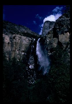
- Description:
- 100 f 8 tl
- Subject:
- National parks & reserves, Bridalveil Fall (Calif.), Cliffs, Yosemite National Park (Calif.), Waterfalls, Trees, Yosemite Valley (Calif.), and Clouds
- Series:
- 22-55
- Creator:
- Cushman, Charles W., 1896-1972
- Date Created:
- 1955-07-09
- Genre:
- Landscape photographs
- Frame Number:
- 15
- County:
- Mariposa
- Abstract:
- 0 Bridal Veil Fall
- Call Number:
- P08268
- Country:
- United States
- State/Province:
- California
- Physical Description:
- Image was originally mounted in a glass enclosure. Before digitization, the image was removed and placed in a Wess Plastic, Inc. brand, 2" x 2", pl...
- Alternate Identifier:
- 2255.15
- Persistent URL:
- http://purl.dlib.indiana.edu/iudl/archives/cushman/P08268
- Holding Location:
- Bloomington - University Archives
Wells Library E460
1320 E 10th St.
Bloomington, IN 47405
Contact at archives@indiana.edu, 812-855-1127
-
- Description:
- 25 f 2.5
- Subject:
- Cliffs, Trees, California Palace of the Legion of Honor, Picture frames, Clouds, Sunrises & sunsets, Landscape with figures, Fine Arts Museums of San Fra...
- Series:
- 14-56
- Creator:
- Cushman, Charles W., 1896-1972
- Date Created:
- 1956-11-02
- Genre:
- Reproductions and Landscape paintings
- Frame Number:
- 13
- County:
- San Francisco
- Persons Pictured:
- Patel, Pierre, 1648-1707
- Abstract:
- Palace of Legion of Honor Pierre Antoine Patel Landscape with figures 1648.1707
- Call Number:
- P09010
- City:
- San Francisco
- Country:
- United States
- State/Province:
- California
- Alternate Identifier:
- 1456.13
- Persistent URL:
- http://purl.dlib.indiana.edu/iudl/archives/cushman/P09010
- Holding Location:
- Bloomington - University Archives
Wells Library E460
1320 E 10th St.
Bloomington, IN 47405
Contact at archives@indiana.edu, 812-855-1127
-
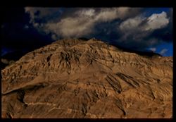
- Description:
- 200 f 5.6 tl
- Subject:
- Valleys, Funeral Mountains (Calif.), Mountains, Death Valley National Park (Calif. and Nev.), Shadows, and Clouds
- Series:
- 3-55
- Creator:
- Cushman, Charles W., 1896-1972
- Date Created:
- 1955-02-27
- Genre:
- Landscape photographs
- Frame Number:
- 10
- County:
- Inyo
- Abstract:
- Funeral Mtns.
- Call Number:
- P07602
- Country:
- United States
- State/Province:
- California
- Alternate Identifier:
- 355.10
- Persistent URL:
- http://purl.dlib.indiana.edu/iudl/archives/cushman/P07602
- Holding Location:
- Bloomington - University Archives
Wells Library E460
1320 E 10th St.
Bloomington, IN 47405
Contact at archives@indiana.edu, 812-855-1127
-
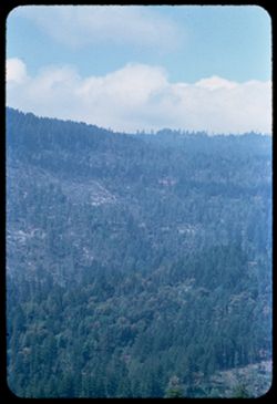
- Description:
- 100 f 4.5 tl
- Subject:
- Redwood Creek (Humboldt County, Calif.), Hills, Roads, Mountains, Trees, Clouds, and Berry Summit (Calif.)
- Series:
- 16-55
- Creator:
- Cushman, Charles W., 1896-1972
- Date Created:
- 1955-06-15
- Genre:
- Landscape photographs
- Frame Number:
- 8
- Street Address:
- United States Highway 299
- County:
- Humboldt
- Abstract:
- 65423 mi. Looking across Redwood Creek Valley from up road toward Berry Summit
- Call Number:
- P08053
- Country:
- United States
- State/Province:
- California
- Alternate Identifier:
- 1655.8
- Persistent URL:
- http://purl.dlib.indiana.edu/iudl/archives/cushman/P08053
- Holding Location:
- Bloomington - University Archives
Wells Library E460
1320 E 10th St.
Bloomington, IN 47405
Contact at archives@indiana.edu, 812-855-1127
-
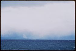
- Description:
- 100 f 4 TL
- Subject:
- Storms, Lakes & ponds, Rain, Tahoe, Lake (Calif. and Nev.), Mountains, and Clouds
- Series:
- 3-62
- Creator:
- Cushman, Charles W., 1896-1972
- Date Created:
- 1962-09-28
- Genre:
- Landscape photographs and Snapshots
- Frame Number:
- 15
- Abstract:
- Gathering storm. Lake Tahoe.
- Call Number:
- P12713
- Country:
- United States
- State/Province:
- California
- Alternate Identifier:
- 362.15
- Persistent URL:
- http://purl.dlib.indiana.edu/iudl/archives/cushman/P12713
- Holding Location:
- Bloomington - University Archives
Wells Library E460
1320 E 10th St.
Bloomington, IN 47405
Contact at archives@indiana.edu, 812-855-1127
-
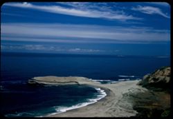
- Description:
- 50 f 6.3 Pola
- Subject:
- Ocean waves, Sand, Pacific Ocean, Pacific Coast (Calif.), Shrubs, Oceans, Coastlines, Beaches, Grasses, Wildflowers, Clouds, and Dunes
- Series:
- 7-53
- Creator:
- Cushman, Charles W., 1896-1972
- Date Created:
- 1953-06-11
- Genre:
- Seascapes
- Frame Number:
- 2
- Street Address:
- California State Highway 1
- County:
- Santa Cruz
- Abstract:
- Pacific Coast along Hwy 1 near Devenport
- Call Number:
- P06727
- City:
- Davenport
- Country:
- United States
- State/Province:
- California
- Alternate Identifier:
- 753.2
- Persistent URL:
- http://purl.dlib.indiana.edu/iudl/archives/cushman/P06727
- Holding Location:
- Bloomington - University Archives
Wells Library E460
1320 E 10th St.
Bloomington, IN 47405
Contact at archives@indiana.edu, 812-855-1127
-
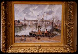
- Description:
- 25 f 2.8
- Subject:
- Harbors, Walls, Lincoln Park (San Francisco, Calif.), Steamboats, People, Boats, California Palace of the Legion of Honor, Harbor at Dieppe, Picture frames, ...
- Series:
- 13-59
- Creator:
- Cushman, Charles W., 1896-1972
- Date Created:
- 1959-06-17
- Genre:
- Paintings and Reproductions
- Frame Number:
- 4
- County:
- San Francisco
- Persons Pictured:
- Pissarro, Camille, 1830-1903
- Abstract:
- Pissarro Harbor at Dieppe
- Call Number:
- P10802
- City:
- San Francisco
- Country:
- United States
- State/Province:
- California
- Alternate Identifier:
- 1359.4
- Persistent URL:
- http://purl.dlib.indiana.edu/iudl/archives/cushman/P10802
- Holding Location:
- Bloomington - University Archives
Wells Library E460
1320 E 10th St.
Bloomington, IN 47405
Contact at archives@indiana.edu, 812-855-1127
-
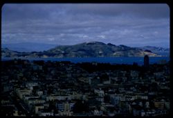
- Description:
- 100 f 5.6 tl
- Subject:
- Bodies of water, Angel Island (Calif.), Trees, Coastlines, Streets, Mountains, Buildings, Clouds, Vehicles, Islands, Dwellings, Hills, and Buena Vista Park (...
- Series:
- 5-55
- Creator:
- Cushman, Charles W., 1896-1972
- Date Created:
- 1955-03-12
- Genre:
- Cityscape photographs
- Frame Number:
- 21
- County:
- San Francisco
- Abstract:
- Toward Angel Island were out too far to left and had to be remounted
- Call Number:
- P07686
- City:
- San Francisco
- Country:
- United States
- State/Province:
- California
- Alternate Identifier:
- 555.21
- Persistent URL:
- http://purl.dlib.indiana.edu/iudl/archives/cushman/P07686
- Holding Location:
- Bloomington - University Archives
Wells Library E460
1320 E 10th St.
Bloomington, IN 47405
Contact at archives@indiana.edu, 812-855-1127
-
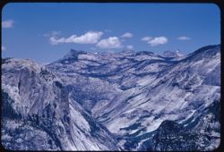
- Description:
- 100 f 8 tl
- Subject:
- Tenaya Peak (Calif.), Yosemite National Park (Calif.), Mountains, National parks & reserves, Clouds, Echo Peaks (Mariposa County, Calif.), Tenaya Canyon ...
- Series:
- 21-55
- Creator:
- Cushman, Charles W., 1896-1972
- Date Created:
- 1955-07-08
- Genre:
- Landscape photographs
- Frame Number:
- 21
- County:
- Mariposa
- Abstract:
- Clouds above Tenaya Peak, , & Echo PKs.
- Call Number:
- P08238
- Country:
- United States
- State/Province:
- California
- Alternate Identifier:
- 2155.21
- Persistent URL:
- http://purl.dlib.indiana.edu/iudl/archives/cushman/P08238
- Holding Location:
- Bloomington - University Archives
Wells Library E460
1320 E 10th St.
Bloomington, IN 47405
Contact at archives@indiana.edu, 812-855-1127
-
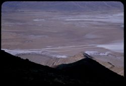
- Description:
- 50 mm lens
- Subject:
- Deserts, Craters, Valleys, Dantes View (Calif.), Mountains, Clouds, Death Valley (Calif. and Nev.), and Black Mountains (Inyo County, Calif.)
- Series:
- 3-55
- Creator:
- Cushman, Charles W., 1896-1972
- Date Created:
- 1955-02-27
- Genre:
- Landscape photographs
- Frame Number:
- 4
- County:
- Inyo
- Abstract:
- West across floor of Death Valley
- Call Number:
- P07597
- Country:
- United States
- State/Province:
- California
- Alternate Identifier:
- 355.4
- Persistent URL:
- http://purl.dlib.indiana.edu/iudl/archives/cushman/P07597
- Holding Location:
- Bloomington - University Archives
Wells Library E460
1320 E 10th St.
Bloomington, IN 47405
Contact at archives@indiana.edu, 812-855-1127
-
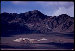
- Description:
- 200 f 4.5 tl
- Subject:
- Mountains, Clouds, Hills, Black Mountains (Inyo County, Calif.), and Death Valley (Calif. and Nev.)
- Series:
- 2-55
- Creator:
- Cushman, Charles W., 1896-1972
- Date Created:
- 1955-02-27
- Genre:
- Landscape photographs
- Frame Number:
- 27
- County:
- Inyo
- Abstract:
- Black Mtns from east
- Call Number:
- P07585
- Country:
- United States
- State/Province:
- California
- Alternate Identifier:
- 255.27
- Persistent URL:
- http://purl.dlib.indiana.edu/iudl/archives/cushman/P07585
- Holding Location:
- Bloomington - University Archives
Wells Library E460
1320 E 10th St.
Bloomington, IN 47405
Contact at archives@indiana.edu, 812-855-1127
-
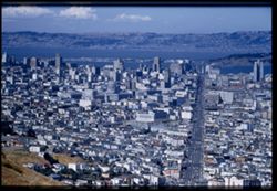
- Description:
- 100 f 6.3 tl
- Subject:
- Vessels, Bodies of water, Twin Peaks (San Francisco County, Calif.), Automobiles, Trees, Signs (Notices), Streets, Mountains, Buildings, Shrubs, Clouds, Busi...
- Series:
- 19-55
- Creator:
- Cushman, Charles W., 1896-1972
- Date Created:
- 1955-07-02
- Genre:
- Cityscape photographs
- Frame Number:
- 6
- Street Address:
- Market Street
- County:
- San Francisco
- Abstract:
- Toward Civic center & business district
- Call Number:
- P08159
- City:
- San Francisco
- Country:
- United States
- State/Province:
- California
- Physical Description:
- Image was originally mounted in a glass enclosure. Before digitization, the image was removed and placed in a Wess Plastic, Inc. brand, 2" x 2", pl...
- Alternate Identifier:
- 1955.6
- Persistent URL:
- http://purl.dlib.indiana.edu/iudl/archives/cushman/P08159
- Holding Location:
- Bloomington - University Archives
Wells Library E460
1320 E 10th St.
Bloomington, IN 47405
Contact at archives@indiana.edu, 812-855-1127
-
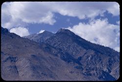
- Description:
- 100 f 6.3 tl
- Subject:
- Mountains, Clouds, and Sierra Nevada (Calif. and Nev.)
- Series:
- 26-55
- Creator:
- Cushman, Charles W., 1896-1972
- Date Created:
- 1955-09-25
- Genre:
- Landscape photographs
- Frame Number:
- 15
- Street Address:
- United States Highway 6 and United States Highway 395
- County:
- Inyo
- Abstract:
- From US 6/395 between Independence & Big Pine - toward a [push?] in the high Sierra
- Call Number:
- P08398
- City:
- Big Pine and Independence
- Country:
- United States
- State/Province:
- California
- Alternate Identifier:
- 2655.15
- Persistent URL:
- http://purl.dlib.indiana.edu/iudl/archives/cushman/P08398
- Holding Location:
- Bloomington - University Archives
Wells Library E460
1320 E 10th St.
Bloomington, IN 47405
Contact at archives@indiana.edu, 812-855-1127
-
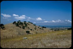
- Description:
- 50 f 5.6 Pola
- Subject:
- Wildflowers, Grasses, Trees, Meadows, Croplands, Fences, Sonoma Mountain (Calif.), Clouds, Hills, and Rocks
- Series:
- 8-53
- Creator:
- Cushman, Charles W., 1896-1972
- Date Created:
- 1953-08-30
- Genre:
- Landscape photographs
- Frame Number:
- 2
- Street Address:
- United States Highway 101 and Roberts Road
- County:
- Marin and Sonoma
- Abstract:
- Drive up 101 to Petaluma - over Sonoma Mtn to Sonoma for lunch, back to Sausalito and home for dinner.
- Call Number:
- P06765
- City:
- Petaluma, Sonoma, and Sausalito
- Country:
- United States
- State/Province:
- California
- Alternate Identifier:
- 853.2
- Persistent URL:
- http://purl.dlib.indiana.edu/iudl/archives/cushman/P06765
- Holding Location:
- Bloomington - University Archives
Wells Library E460
1320 E 10th St.
Bloomington, IN 47405
Contact at archives@indiana.edu, 812-855-1127
-
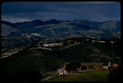
- Description:
- 100 f 8 tl
- Subject:
- Barns, Valleys, Farmhouses, Laureles Grade (Calif.), Outbuildings, Farms, Mountains, Clouds, and Antennas (Electronics)
- Series:
- 5-57
- Creator:
- Cushman, Charles W., 1896-1972
- Date Created:
- 1957-05-09
- Genre:
- Landscape photographs and Views
- Frame Number:
- 35
- County:
- Monterey
- Abstract:
- Mountains to NE from Laureles Grade
- Call Number:
- P09240
- Country:
- United States
- State/Province:
- California
- Alternate Identifier:
- 557.35
- Persistent URL:
- http://purl.dlib.indiana.edu/iudl/archives/cushman/P09240
- Holding Location:
- Bloomington - University Archives
Wells Library E460
1320 E 10th St.
Bloomington, IN 47405
Contact at archives@indiana.edu, 812-855-1127
-
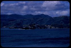
- Description:
- 100 f 8 tl
- Subject:
- Bays (Bodies of water), Fort Barry Military Reservation (Calif.), Cliffs, Lands End (Calif.), Bonita, Point (Calif.), Capes (Coasts), Mountains, Clouds, Wate...
- Series:
- 1-57
- Creator:
- Cushman, Charles W., 1896-1972
- Date Created:
- 1957-03-16
- Genre:
- Landscape photographs
- Frame Number:
- 10
- County:
- San Francisco
- Abstract:
- Point Bonita and Fort Barry with Mt. Tamalpais beyond
- Call Number:
- P09116
- City:
- San Francisco
- Country:
- United States
- State/Province:
- California
- Alternate Identifier:
- 157.10
- Persistent URL:
- http://purl.dlib.indiana.edu/iudl/archives/cushman/P09116
- Holding Location:
- Bloomington - University Archives
Wells Library E460
1320 E 10th St.
Bloomington, IN 47405
Contact at archives@indiana.edu, 812-855-1127
-

- Description:
- 100 f 8 tl
- Subject:
- Clouds
- Series:
- 28-55
- Creator:
- Cushman, Charles W., 1896-1972
- Date Created:
- 1955-10-19
- Genre:
- Views
- Frame Number:
- 25
- Street Address:
- 100 Broderick Street
- County:
- San Francisco
- Abstract:
- From top of 100 Broderick at 3 P.M. clouds in NE sky
- Call Number:
- P08479
- City:
- San Francisco
- Country:
- United States
- State/Province:
- California
- Alternate Identifier:
- 2855.25
- Persistent URL:
- http://purl.dlib.indiana.edu/iudl/archives/cushman/P08479
- Holding Location:
- Bloomington - University Archives
Wells Library E460
1320 E 10th St.
Bloomington, IN 47405
Contact at archives@indiana.edu, 812-855-1127
-
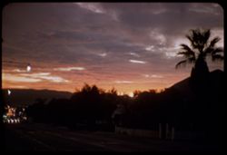
- Description:
- 10 f 1.5
- Subject:
- Streets, Clouds, Sky, Sunrises & sunsets, and Palms
- Series:
- 18-57
- Creator:
- Cushman, Charles W., 1896-1972
- Date Created:
- 1957-11-30
- Genre:
- Landscape photographs and Snapshots
- Frame Number:
- 6
- County:
- San Luis Obispo
- Abstract:
- later Sunset Sky at San Luis Obispo
- Call Number:
- P09629
- City:
- San Luis Obispo
- Country:
- United States
- State/Province:
- California
- Alternate Identifier:
- 1857.6
- Persistent URL:
- http://purl.dlib.indiana.edu/iudl/archives/cushman/P09629
- Holding Location:
- Bloomington - University Archives
Wells Library E460
1320 E 10th St.
Bloomington, IN 47405
Contact at archives@indiana.edu, 812-855-1127
-
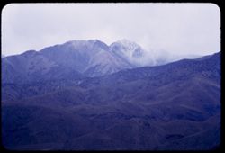
- Description:
- 25 f 4 tl
- Subject:
- Mountains, Clouds, White Mountain Peak (Inyo County, Calif.), and Mists
- Series:
- 26-55
- Creator:
- Cushman, Charles W., 1896-1972
- Date Created:
- 1955-09-25
- Genre:
- Landscape photographs
- Frame Number:
- 24
- Street Address:
- United States Highway 6
- County:
- Inyo
- Abstract:
- From US 6 NE of Bishop: White Mtn. Pk under heavy clouds
- Call Number:
- P08406
- City:
- Bishop
- Country:
- United States
- State/Province:
- California
- Alternate Identifier:
- 2655.24
- Persistent URL:
- http://purl.dlib.indiana.edu/iudl/archives/cushman/P08406
- Holding Location:
- Bloomington - University Archives
Wells Library E460
1320 E 10th St.
Bloomington, IN 47405
Contact at archives@indiana.edu, 812-855-1127
-
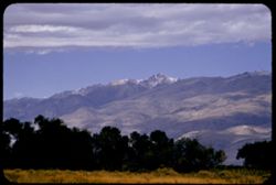
- Description:
- 100 f 5.6 tl
- Subject:
- Grasses, Trees, Mountains, Clouds, and White Mountain Peak (Inyo County, Calif.)
- Series:
- 26-55
- Creator:
- Cushman, Charles W., 1896-1972
- Date Created:
- 1955-09-25
- Genre:
- Landscape photographs
- Frame Number:
- 20
- Street Address:
- East Line Street
- County:
- Inyo
- Abstract:
- White Mtn Pk. from East Line St., Bishop
- Call Number:
- P08403
- City:
- Bishop
- Country:
- United States
- State/Province:
- California
- Alternate Identifier:
- 2655.20
- Persistent URL:
- http://purl.dlib.indiana.edu/iudl/archives/cushman/P08403
- Holding Location:
- Bloomington - University Archives
Wells Library E460
1320 E 10th St.
Bloomington, IN 47405
Contact at archives@indiana.edu, 812-855-1127
-
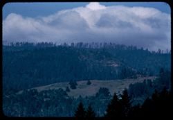
- Description:
- 100 f 5 tl
- Subject:
- Berry Summit (Calif.), Trees, Mountains, Clouds, Hills, and Redwood Creek (Humboldt County, Calif.)
- Series:
- 16-55
- Creator:
- Cushman, Charles W., 1896-1972
- Date Created:
- 1955-06-15
- Genre:
- Landscape photographs
- Frame Number:
- 7
- Street Address:
- United States Highway 299
- County:
- Humboldt
- Abstract:
- 65423 mi. Looking across Redwood Creek Valley from up road toward Berry Summit
- Call Number:
- P08052
- Country:
- United States
- State/Province:
- California
- Alternate Identifier:
- 1655.7
- Persistent URL:
- http://purl.dlib.indiana.edu/iudl/archives/cushman/P08052
- Holding Location:
- Bloomington - University Archives
Wells Library E460
1320 E 10th St.
Bloomington, IN 47405
Contact at archives@indiana.edu, 812-855-1127
-

- Description:
- 100 f 6.3 tl
- Subject:
- Clouds
- Series:
- 29-55
- Creator:
- Cushman, Charles W., 1896-1972
- Date Created:
- 1955-12-03
- Genre:
- Views
- Frame Number:
- 37
- Street Address:
- 100 Broderick Street
- County:
- San Francisco
- Abstract:
- 32-39 incl. (Dec. 3) 2:30 PM clouds in eastern sky from top of 100 Broderick
- Call Number:
- P08528
- City:
- San Francisco
- Country:
- United States
- State/Province:
- California
- Alternate Identifier:
- 2599.37
- Persistent URL:
- http://purl.dlib.indiana.edu/iudl/archives/cushman/P08528
- Holding Location:
- Bloomington - University Archives
Wells Library E460
1320 E 10th St.
Bloomington, IN 47405
Contact at archives@indiana.edu, 812-855-1127
-
- Description:
- 50 f 8
- Subject:
- Cascade Range, Glacial landforms, Trees, Meadows, Castle Crags Wilderness (Calif.), Castle Crags (Calif.), Mountains, Rock formations, Clouds, Mount Shasta (...
- Series:
- 6-54
- Creator:
- Cushman, Charles W., 1896-1972
- Date Created:
- 1954-08-21
- Genre:
- Landscape photographs
- Frame Number:
- 32
- Street Address:
- California State Highway 89
- County:
- Siskiyou
- Abstract:
- Castle crags from Cal 89.
- Call Number:
- P07249
- City:
- Dunsmuir
- Country:
- United States
- State/Province:
- California
- Alternate Identifier:
- 654.32
- Persistent URL:
- http://purl.dlib.indiana.edu/iudl/archives/cushman/P07249
- Holding Location:
- Bloomington - University Archives
Wells Library E460
1320 E 10th St.
Bloomington, IN 47405
Contact at archives@indiana.edu, 812-855-1127