
Search Constraints
You searched for:
Campus
IUB
Remove constraint Campus: IUB
Pages
0-99 pages
Remove constraint Pages: 0-99 pages
Subject
Shrubs
Remove constraint Subject: Shrubs
Subject
Mountains
Remove constraint Subject: Mountains
State/Province
Arizona
Remove constraint State/Province: Arizona
« Previous |
1 - 100 of 241
|
Next »
Search Results
-
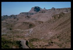
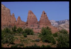
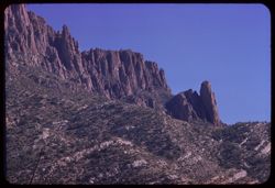
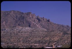
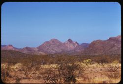
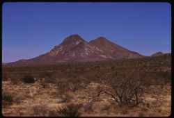
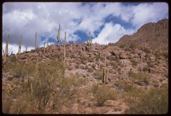
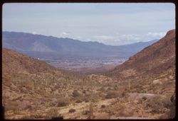
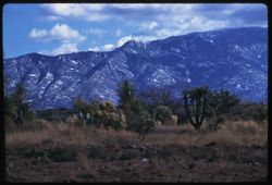
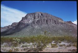
- Description:
- 100 f 11 SL
- Subject:
- Erosion, Cliffs, Mesas, Mountains, Rock formations, Utility poles, Roads, and Shrubs
- Series:
- 5-62
- Creator:
- Cushman, Charles W., 1896-1972
- Date Created:
- 1962-10-07
- Genre:
- Landscape photographs
- Frame Number:
- 22
- Street Address:
- Sitgreaves Pass
- County:
- Mohave
- Abstract:
- West side of Sitgreaves Pass
- Call Number:
- P12789
- Country:
- United States
- State/Province:
- Arizona
- Alternate Identifier:
- 562.22
- Persistent URL:
- http://purl.dlib.indiana.edu/iudl/archives/cushman/P12789
- Holding Location:
- Bloomington - University Archives
Wells Library E460
1320 E 10th St.
Bloomington, IN 47405
Contact at archives@indiana.edu, 812-855-1127
-
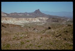
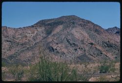
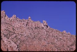
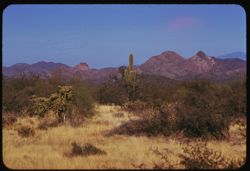
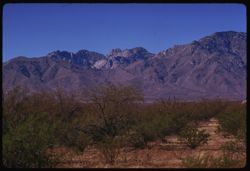
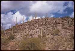
- Description:
- 100 f 11 SL
- Subject:
- Rocks, Erosion, Cliffs, Buttes, Mountains, Rock formations, Hills, and Shrubs
- Series:
- 5-62
- Creator:
- Cushman, Charles W., 1896-1972
- Date Created:
- 1962-10-07
- Genre:
- Landscape photographs
- Frame Number:
- 21
- Street Address:
- Sitgreaves Pass
- County:
- Mohave
- Abstract:
- Expanse
- Call Number:
- P12788
- Country:
- United States
- State/Province:
- Arizona
- Alternate Identifier:
- 562.21
- Persistent URL:
- http://purl.dlib.indiana.edu/iudl/archives/cushman/P12788
- Holding Location:
- Bloomington - University Archives
Wells Library E460
1320 E 10th St.
Bloomington, IN 47405
Contact at archives@indiana.edu, 812-855-1127
-
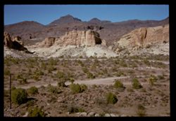
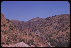
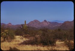
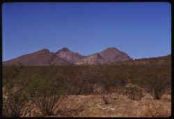
- Description:
- 100 f 11 SL
- Subject:
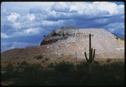
- Rocks, Erosion, Cliffs, Buttes, Mountains, Shrubs, Hills, Roads, and Rock formations
- Series:
- 5-62
- Creator:
- Cushman, Charles W., 1896-1972
- Date Created:
- 1962-10-07
- Genre:
- Landscape photographs
- Frame Number:
- 20
- Street Address:
- Sitgreaves Pass
- County:
- Mohave
- Abstract:
- Light + dark rock
- Call Number:
- P12787
- Country:
- United States
- State/Province:
- Arizona
- Alternate Identifier:
- 562.20
- Persistent URL:
- http://purl.dlib.indiana.edu/iudl/archives/cushman/P12787
- Holding Location:
- Bloomington - University Archives
Wells Library E460
1320 E 10th St.
Bloomington, IN 47405
Contact at archives@indiana.edu, 812-855-1127
-
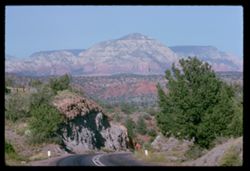
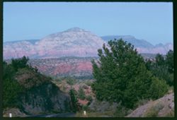
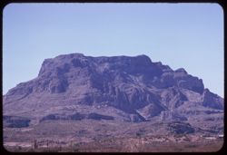
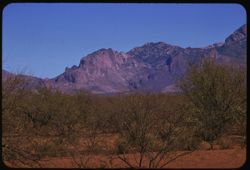
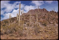
- Description:
- 100 f 9
- Subject:
- Hills, Roads, Cliffs, Mountains, Shrubs, Trees, and Grasses
- Series:
- 5-62
- Creator:
- Cushman, Charles W., 1896-1972
- Date Created:
- 1962-10-05
- Genre:
- Landscape photographs
- Frame Number:
- 17
- County:
- Coconino
- Abstract:
- East from 6 or 7 mi. west of Sedona
- Call Number:
- P12784
- City:
- Sedona
- Country:
- United States
- State/Province:
- Arizona
- Alternate Identifier:
- 562.17
- Persistent URL:
- http://purl.dlib.indiana.edu/iudl/archives/cushman/P12784
- Holding Location:
- Bloomington - University Archives
Wells Library E460
1320 E 10th St.
Bloomington, IN 47405
Contact at archives@indiana.edu, 812-855-1127
-
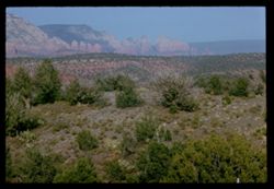
- Description:
- 100 f 11
- Subject:
- Hills, Roads, Cliffs, Mountains, Shrubs, Trees, and Grasses
- Series:
- 5-62
- Creator:
- Cushman, Charles W., 1896-1972
- Date Created:
- 1962-10-05
- Genre:
- Landscape photographs
- Frame Number:
- 16
- County:
- Coconino
- Abstract:
- East from 6 or 7 mi. west of Sedona
- Call Number:
- P12783
- City:
- Sedona
- Country:
- United States
- State/Province:
- Arizona
- Alternate Identifier:
- 562.16
- Persistent URL:
- http://purl.dlib.indiana.edu/iudl/archives/cushman/P12783
- Holding Location:
- Bloomington - University Archives
Wells Library E460
1320 E 10th St.
Bloomington, IN 47405
Contact at archives@indiana.edu, 812-855-1127
-
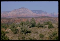
- Description:
- 100 f 13 ?
- Subject:
- Cliffs, Cactus, Trees, Mountains, Shrubs, and Hills
- Series:
- 5-62
- Creator:
- Cushman, Charles W., 1896-1972
- Date Created:
- 1962-10-05
- Genre:
- Landscape photographs
- Frame Number:
- 15
- County:
- Coconino
- Abstract:
- East from 6 or 7 mi west of Sedona
- Call Number:
- P12782
- City:
- Sedona
- Country:
- United States
- State/Province:
- Arizona
- Alternate Identifier:
- 562.15
- Persistent URL:
- http://purl.dlib.indiana.edu/iudl/archives/cushman/P12782
- Holding Location:
- Bloomington - University Archives
Wells Library E460
1320 E 10th St.
Bloomington, IN 47405
Contact at archives@indiana.edu, 812-855-1127
-
- Description:
- 100 f 13 ?
- Subject:
- Cliffs, Cactus, Trees, Mountains, Shrubs, and Hills
- Series:
- 5-62
- Creator:
- Cushman, Charles W., 1896-1972
- Date Created:
- 1962-10-05
- Genre:
- Landscape photographs
- Frame Number:
- 14
- County:
- Coconino
- Abstract:
- East from 6 or 7 mi west of Sedona
- Call Number:
- P12781
- City:
- Sedona
- Country:
- United States
- State/Province:
- Arizona
- Alternate Identifier:
- 562.14
- Persistent URL:
- http://purl.dlib.indiana.edu/iudl/archives/cushman/P12781
- Holding Location:
- Bloomington - University Archives
Wells Library E460
1320 E 10th St.
Bloomington, IN 47405
Contact at archives@indiana.edu, 812-855-1127
-
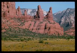
- Description:
- 100 f 11 TL
- Subject:
- Erosion, Cliffs, Buttes, Mountains, Rock formations, Grasses, and Shrubs
- Series:
- 5-62
- Creator:
- Cushman, Charles W., 1896-1972
- Date Created:
- 1962-10-05
- Genre:
- Landscape photographs
- Frame Number:
- 10
- County:
- Coconino
- Abstract:
- Little peaks so. of Sedona from west
- Call Number:
- P12777
- City:
- Sedona
- Country:
- United States
- State/Province:
- Arizona
- Alternate Identifier:
- 562.10
- Persistent URL:
- http://purl.dlib.indiana.edu/iudl/archives/cushman/P12777
- Holding Location:
- Bloomington - University Archives
Wells Library E460
1320 E 10th St.
Bloomington, IN 47405
Contact at archives@indiana.edu, 812-855-1127
-
- Description:
- 100 f 13 TL
- Subject:
- Erosion, Hills, Cliffs, Mountains, Shrubs, Trees, Buttes, and Rock formations
- Series:
- 5-62
- Creator:
- Cushman, Charles W., 1896-1972
- Date Created:
- 1962-10-15
- Genre:
- Landscape photographs
- Frame Number:
- 9
- County:
- Coconino
- Abstract:
- Little peaks so. of Sedona
- Call Number:
- P12776
- City:
- Sedona
- Country:
- United States
- State/Province:
- Arizona
- Alternate Identifier:
- 562.9
- Persistent URL:
- http://purl.dlib.indiana.edu/iudl/archives/cushman/P12776
- Holding Location:
- Bloomington - University Archives
Wells Library E460
1320 E 10th St.
Bloomington, IN 47405
Contact at archives@indiana.edu, 812-855-1127
-
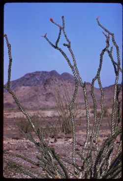
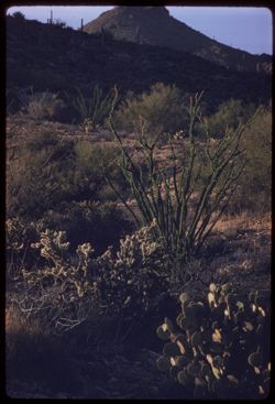
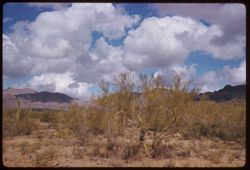
- Description:
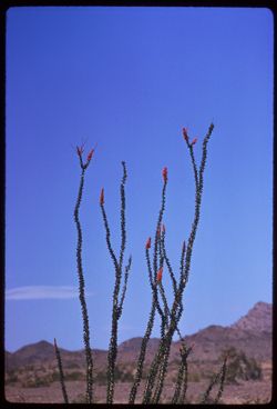
- 250 f 5.6
- Subject:
- Deserts, Flowers, Ocotillo, Mountains, Shrubs, and Clouds
- Series:
- 11-59
- Creator:
- Cushman, Charles W., 1896-1972
- Date Created:
- 1959-03-24
- Genre:
- Identification photographs
- Frame Number:
- 12
- County:
- Yuma and Riverside
- Abstract:
- Our finest ocotillo - 15-20 mi east of Blythe
- Call Number:
- P10737
- City:
- Blythe and Quartzsite
- Country:
- United States
- State/Province:
- Arizona and California
- Alternate Identifier:
- 1159.12
- Persistent URL:
- http://purl.dlib.indiana.edu/iudl/archives/cushman/P10737
- Holding Location:
- Bloomington - University Archives
Wells Library E460
1320 E 10th St.
Bloomington, IN 47405
Contact at archives@indiana.edu, 812-855-1127
-
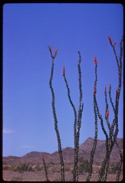
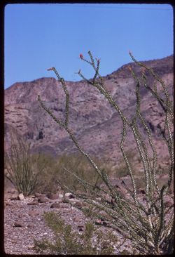
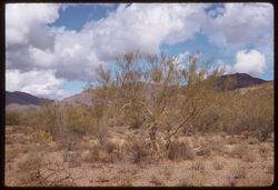
- Description:
- 100 f 8 tl
- Subject:
- Deserts, Flowers, Ocotillo, Mountains, Shrubs, and Clouds
- Series:
- 11-59
- Creator:
- Cushman, Charles W., 1896-1972
- Date Created:
- 1959-03-24
- Genre:
- Identification photographs
- Frame Number:
- 11
- County:
- Yuma and Riverside
- Abstract:
- Our finest ocotillo - 15-20 mi east of Blythe
- Call Number:
- P10736
- City:
- Blythe and Quartzsite
- Country:
- United States
- State/Province:
- Arizona and California
- Alternate Identifier:
- 1159.11
- Persistent URL:
- http://purl.dlib.indiana.edu/iudl/archives/cushman/P10736
- Holding Location:
- Bloomington - University Archives
Wells Library E460
1320 E 10th St.
Bloomington, IN 47405
Contact at archives@indiana.edu, 812-855-1127
-
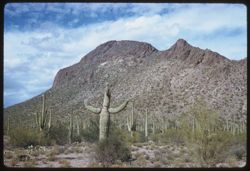
- Description:
- 100 f 8 tl
- Subject:
- Rocks, Cactus, Mountains, Ocotillo, Shrubs, and Saguaro
- Series:
- 11-59
- Creator:
- Cushman, Charles W., 1896-1972
- Date Created:
- 1959-03-24
- Genre:
- Landscape photographs
- Frame Number:
- 7
- County:
- Yuma
- Abstract:
- Ocotillo, Juquar and different mtns.
- Call Number:
- P10732
- City:
- Quartzsite
- Country:
- United States
- State/Province:
- Arizona
- Alternate Identifier:
- 1159.7
- Persistent URL:
- http://purl.dlib.indiana.edu/iudl/archives/cushman/P10732
- Holding Location:
- Bloomington - University Archives
Wells Library E460
1320 E 10th St.
Bloomington, IN 47405
Contact at archives@indiana.edu, 812-855-1127
-
- Description:
- 100 f 8 tl
- Subject:
- Flowers, Mountains, and Shrubs
- Series:
- 11-59
- Creator:
- Cushman, Charles W., 1896-1972
- Date Created:
- 1959-03-24
- Genre:
- Landscape photographs
- Frame Number:
- 6
- County:
- Yuma
- Abstract:
- RM Mtns
- Call Number:
- P10731
- City:
- Quartzsite
- Country:
- United States
- State/Province:
- Arizona
- Alternate Identifier:
- 1159.6
- Persistent URL:
- http://purl.dlib.indiana.edu/iudl/archives/cushman/P10731
- Holding Location:
- Bloomington - University Archives
Wells Library E460
1320 E 10th St.
Bloomington, IN 47405
Contact at archives@indiana.edu, 812-855-1127
-
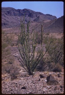
- Description:
- 100 f 8 tl
- Subject:
- Rocks, Flowers, Mountains, Ocotillo, and Shrubs
- Series:
- 11-59
- Creator:
- Cushman, Charles W., 1896-1972
- Date Created:
- 1959-03-24
- Genre:
- Identification photographs
- Frame Number:
- 5
- County:
- Yuma
- Abstract:
- Ocotillo (Quartzsite area)
- Call Number:
- P10730
- City:
- Quartzsite
- Country:
- United States
- State/Province:
- Arizona
- Alternate Identifier:
- 1159.5
- Persistent URL:
- http://purl.dlib.indiana.edu/iudl/archives/cushman/P10730
- Holding Location:
- Bloomington - University Archives
Wells Library E460
1320 E 10th St.
Bloomington, IN 47405
Contact at archives@indiana.edu, 812-855-1127
-
- Description:
- 100 f 8 tl
- Subject:
- Rocks, Flowers, Mountains, Ocotillo, and Shrubs
- Series:
- 11-59
- Creator:
- Cushman, Charles W., 1896-1972
- Date Created:
- 1959-03-24
- Genre:
- Identification photographs
- Frame Number:
- 4
- County:
- Yuma
- Abstract:
- Ocotillo (Quartzsite area)
- Call Number:
- P10729
- City:
- Quartzsite
- Country:
- United States
- State/Province:
- Arizona
- Alternate Identifier:
- 1159.4
- Persistent URL:
- http://purl.dlib.indiana.edu/iudl/archives/cushman/P10729
- Holding Location:
- Bloomington - University Archives
Wells Library E460
1320 E 10th St.
Bloomington, IN 47405
Contact at archives@indiana.edu, 812-855-1127
-
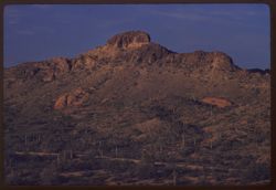
- Description:
- 100 f 6.3 tl
- Subject:
- Cactus, Mountains, Shrubs, and Vulture Mountains (Ariz.)
- Series:
- 11-59
- Creator:
- Cushman, Charles W., 1896-1972
- Date Created:
- 1959-03-23
- Genre:
- Landscape photographs
- Frame Number:
- 3
- County:
- Maricopa
- Abstract:
- The mtn with penthouse late light
- Call Number:
- P10728
- City:
- Wickenburg
- Country:
- United States
- State/Province:
- Arizona
- Alternate Identifier:
- 1159.3
- Persistent URL:
- http://purl.dlib.indiana.edu/iudl/archives/cushman/P10728
- Holding Location:
- Bloomington - University Archives
Wells Library E460
1320 E 10th St.
Bloomington, IN 47405
Contact at archives@indiana.edu, 812-855-1127
-
- Description:
- 100 f 5.6 tl
- Subject:
- Cactus, Flowers, Mountains, Ocotillo, Shrubs, and Vulture Mountains (Ariz.)
- Series:
- 11-59
- Creator:
- Cushman, Charles W., 1896-1972
- Date Created:
- 1959-03-23
- Genre:
- Identification photographs
- Frame Number:
- 1
- County:
- Maricopa
- Abstract:
- Ocotillo
- Call Number:
- P10726
- City:
- Wickenberg
- Country:
- United States
- State/Province:
- Arizona
- Alternate Identifier:
- 1159.1
- Persistent URL:
- http://purl.dlib.indiana.edu/iudl/archives/cushman/P10726
- Holding Location:
- Bloomington - University Archives
Wells Library E460
1320 E 10th St.
Bloomington, IN 47405
Contact at archives@indiana.edu, 812-855-1127
-
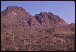
- Description:
- 100 f 6 tl
- Subject:
- Deserts, Cactus, Mountains, Shrubs, and Vulture Mountains (Ariz.)
- Series:
- 10-59
- Creator:
- Cushman, Charles W., 1896-1972
- Date Created:
- 1959-03-23
- Frame Number:
- 37
- County:
- Maricopa
- Abstract:
- Another of 35
- Call Number:
- P10725
- City:
- Wickenburg
- Country:
- United States
- State/Province:
- Arizona
- Alternate Identifier:
- 1059.37
- Persistent URL:
- http://purl.dlib.indiana.edu/iudl/archives/cushman/P10725
- Holding Location:
- Bloomington - University Archives
Wells Library E460
1320 E 10th St.
Bloomington, IN 47405
Contact at archives@indiana.edu, 812-855-1127
-

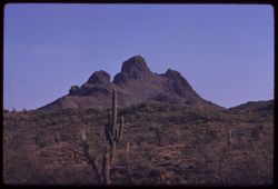
- Description:
- 100 f 8 tl
- Subject:
- Deserts, Cactus, Mountains, Rock formations, Vulture Mountains (Ariz.), and Shrubs
- Series:
- 10-59
- Creator:
- Cushman, Charles W., 1896-1972
- Date Created:
- 1959-03-23
- Frame Number:
- 36
- County:
- Maricopa
- Abstract:
- Mountain with a penthouse
- Call Number:
- P10724
- City:
- Wickenburg
- Country:
- United States
- State/Province:
- Arizona
- Alternate Identifier:
- 1059.36
- Persistent URL:
- http://purl.dlib.indiana.edu/iudl/archives/cushman/P10724
- Holding Location:
- Bloomington - University Archives
Wells Library E460
1320 E 10th St.
Bloomington, IN 47405
Contact at archives@indiana.edu, 812-855-1127
-
- Description:
- 100 f 8 tl
- Subject:
- Deserts, Cactus, Mountains, Shrubs, and Vulture Mountains (Ariz.)
- Series:
- 10-59
- Creator:
- Cushman, Charles W., 1896-1972
- Date Created:
- 1959-03-23
- Frame Number:
- 34
- County:
- Maricopa
- Abstract:
- Mountain like a camel SW of Wittenberg
- Call Number:
- P10722
- City:
- Wickenburg
- Country:
- United States
- State/Province:
- Arizona
- Alternate Identifier:
- 1059.34
- Persistent URL:
- http://purl.dlib.indiana.edu/iudl/archives/cushman/P10722
- Holding Location:
- Bloomington - University Archives
Wells Library E460
1320 E 10th St.
Bloomington, IN 47405
Contact at archives@indiana.edu, 812-855-1127
-
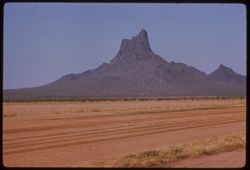
- Description:
- 100 f 8 tl
- Subject:
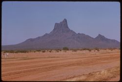
- Dirt roads, Picacho Mountains (Ariz.), Mountains, Fences, and Shrubs
- Series:
- 10-59
- Creator:
- Cushman, Charles W., 1896-1972
- Date Created:
- 1959-03-22
- Genre:
- Landscape photographs
- Frame Number:
- 32
- County:
- Pinal and Pima
- Abstract:
- RM Picacho, near Red Rock
- Call Number:
- P10720
- City:
- Red Rock and Tucson
- Country:
- United States
- State/Province:
- Arizona
- Alternate Identifier:
- 1059.32
- Persistent URL:
- http://purl.dlib.indiana.edu/iudl/archives/cushman/P10720
- Holding Location:
- Bloomington - University Archives
Wells Library E460
1320 E 10th St.
Bloomington, IN 47405
Contact at archives@indiana.edu, 812-855-1127
-
- Description:
- 100 f 8 tl
- Subject:
- Deserts, Mountains, Dirt roads, Shrubs, Picacho Mountains (Ariz.), and Fences
- Series:
- 10-59
- Creator:
- Cushman, Charles W., 1896-1972
- Date Created:
- 1959-03-22
- Genre:
- Landscape photographs
- Frame Number:
- 31
- County:
- Pima and Pinal
- Abstract:
- Picacho, near Red Rock
- Call Number:
- P10719
- City:
- Tucson and Red Rock
- Country:
- United States
- State/Province:
- Arizona
- Alternate Identifier:
- 1059.31
- Persistent URL:
- http://purl.dlib.indiana.edu/iudl/archives/cushman/P10719
- Holding Location:
- Bloomington - University Archives
Wells Library E460
1320 E 10th St.
Bloomington, IN 47405
Contact at archives@indiana.edu, 812-855-1127
-
- Description:
- 50 f 11 sl
- Subject:
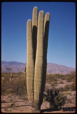
- Deserts, Cactus, Mountains, Shrubs, and Saguaro National Park (Ariz.)
- Series:
- 10-59
- Creator:
- Cushman, Charles W., 1896-1972
- Date Created:
- 1959-03-05
- Genre:
- Identification photographs
- Frame Number:
- 15
- County:
- Pima
- Abstract:
- A 4 in 1 Saguaro
- Call Number:
- P10703
- City:
- Tucson
- Country:
- United States
- State/Province:
- Arizona
- Alternate Identifier:
- 1059.15
- Persistent URL:
- http://purl.dlib.indiana.edu/iudl/archives/cushman/P10703
- Holding Location:
- Bloomington - University Archives
Wells Library E460
1320 E 10th St.
Bloomington, IN 47405
Contact at archives@indiana.edu, 812-855-1127
-
- Description:
- 50 f 11 sl
- Subject:
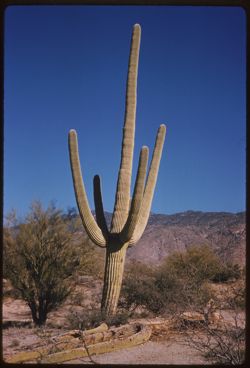
- Deserts, Cactus, Mountains, Shrubs, and Saguaro National Park (Ariz.)
- Series:
- 10-59
- Creator:
- Cushman, Charles W., 1896-1972
- Date Created:
- 1959-03-05
- Genre:
- Identification photographs
- Frame Number:
- 12
- County:
- Pima
- Abstract:
- A giant Saquaro
- Call Number:
- P10700
- City:
- Tucson
- Country:
- United States
- State/Province:
- Arizona
- Alternate Identifier:
- 1059.12
- Persistent URL:
- http://purl.dlib.indiana.edu/iudl/archives/cushman/P10700
- Holding Location:
- Bloomington - University Archives
Wells Library E460
1320 E 10th St.
Bloomington, IN 47405
Contact at archives@indiana.edu, 812-855-1127
-
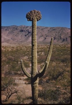
- Description:
- 50 f 11 sl
- Subject:
- Deserts, Cactus, Mountains, Shrubs, and Saguaro National Park (Ariz.)
- Series:
- 10-59
- Creator:
- Cushman, Charles W., 1896-1972
- Date Created:
- 1959-03-05
- Genre:
- Identification photographs
- Frame Number:
- 10
- County:
- Pima
- Abstract:
- A fine cristate
- Call Number:
- P10698
- City:
- Tucson
- Country:
- United States
- State/Province:
- Arizona
- Alternate Identifier:
- 1059.10
- Persistent URL:
- http://purl.dlib.indiana.edu/iudl/archives/cushman/P10698
- Holding Location:
- Bloomington - University Archives
Wells Library E460
1320 E 10th St.
Bloomington, IN 47405
Contact at archives@indiana.edu, 812-855-1127
-
- Description:
- 50 f 11 sl
- Subject:
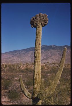
- Deserts, Cristate saguaro, Cactus, Mountains, Shrubs, and Saguaro National Park (Ariz.)
- Series:
- 10-59
- Creator:
- Cushman, Charles W., 1896-1972
- Date Created:
- 1959-03-05
- Genre:
- Identification photographs
- Frame Number:
- 9
- County:
- Pima
- Abstract:
- A fine cristate
- Call Number:
- P10697
- City:
- Tucson
- Country:
- United States
- State/Province:
- Arizona
- Alternate Identifier:
- 1059.9
- Persistent URL:
- http://purl.dlib.indiana.edu/iudl/archives/cushman/P10697
- Holding Location:
- Bloomington - University Archives
Wells Library E460
1320 E 10th St.
Bloomington, IN 47405
Contact at archives@indiana.edu, 812-855-1127
-
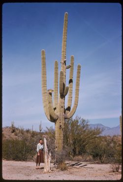
- Description:
- 50 f 11 sl
- Subject:
- Deserts, Cactus, Mountains, Shrubs, Saguaro National Park (Ariz.), and Posing
- Series:
- 10-59
- Creator:
- Cushman, Charles W., 1896-1972
- Date Created:
- 1959-03-03
- Genre:
- Snapshots
- Frame Number:
- 7
- County:
- Pima
- Persons Pictured:
- Cushman, Jean
- Abstract:
- Jean with big fellow
- Call Number:
- P10695
- City:
- Tucson
- Country:
- United States
- State/Province:
- Arizona
- Alternate Identifier:
- 1059.7
- Persistent URL:
- http://purl.dlib.indiana.edu/iudl/archives/cushman/P10695
- Holding Location:
- Bloomington - University Archives
Wells Library E460
1320 E 10th St.
Bloomington, IN 47405
Contact at archives@indiana.edu, 812-855-1127
-
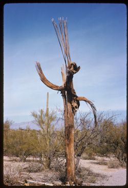
- Description:
- 50 f 9 sl
- Subject:
- Deserts, Deterioration, Cactus, Mountains, Shrubs, and Saguaro National Park (Ariz.)
- Series:
- 10-59
- Creator:
- Cushman, Charles W., 1896-1972
- Date Created:
- 1959-03-03
- Genre:
- Identification photographs
- Frame Number:
- 6
- County:
- Pima
- Abstract:
- A skeleton
- Call Number:
- P10694
- City:
- Tucson
- Country:
- United States
- State/Province:
- Arizona
- Alternate Identifier:
- 1059.6
- Persistent URL:
- http://purl.dlib.indiana.edu/iudl/archives/cushman/P10694
- Holding Location:
- Bloomington - University Archives
Wells Library E460
1320 E 10th St.
Bloomington, IN 47405
Contact at archives@indiana.edu, 812-855-1127
-
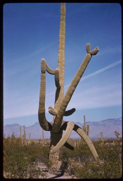
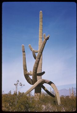
- Description:
- 50 f 11 sl
- Subject:
- Deserts, Mountains, Shrubs, Cactus, and Saguaro National Park (Ariz.)
- Series:
- 10-59
- Creator:
- Cushman, Charles W., 1896-1972
- Date Created:
- 1959-03-03
- Genre:
- Identification photographs
- Frame Number:
- 5
- County:
- Pima
- Abstract:
- Multi-branched Giant Sohuaro
- Call Number:
- P10693
- City:
- Tucson
- Country:
- United States
- State/Province:
- Arizona
- Alternate Identifier:
- 1059.5
- Persistent URL:
- http://purl.dlib.indiana.edu/iudl/archives/cushman/P10693
- Holding Location:
- Bloomington - University Archives
Wells Library E460
1320 E 10th St.
Bloomington, IN 47405
Contact at archives@indiana.edu, 812-855-1127
-
- Description:
- 50 f 9 sl
- Subject:
- Deserts, Cactus, Mountains, Shrubs, and Saguaro National Park (Ariz.)
- Series:
- 10-59
- Creator:
- Cushman, Charles W., 1896-1972
- Date Created:
- 1959-03-03
- Genre:
- Identification photographs
- Frame Number:
- 4
- County:
- Pima
- Abstract:
- Multi-branched Giant Sohuaro
- Call Number:
- P10692
- City:
- Tucson
- Country:
- United States
- State/Province:
- Arizona
- Alternate Identifier:
- 1059.4
- Persistent URL:
- http://purl.dlib.indiana.edu/iudl/archives/cushman/P10692
- Holding Location:
- Bloomington - University Archives
Wells Library E460
1320 E 10th St.
Bloomington, IN 47405
Contact at archives@indiana.edu, 812-855-1127
-
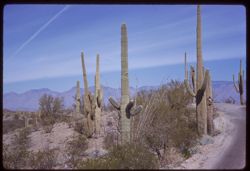
- Description:
- 50 f 11 sl
- Subject:
- Deserts, Roads, Cactus, Mountains, Shrubs, and Saguaro National Park (Ariz.)
- Series:
- 10-59
- Creator:
- Cushman, Charles W., 1896-1972
- Date Created:
- 1959-03-03
- Frame Number:
- 3
- County:
- Pima
- Abstract:
- View north
- Call Number:
- P10691
- City:
- Tucson
- Country:
- United States
- State/Province:
- Arizona
- Alternate Identifier:
- 1059.3
- Persistent URL:
- http://purl.dlib.indiana.edu/iudl/archives/cushman/P10691
- Holding Location:
- Bloomington - University Archives
Wells Library E460
1320 E 10th St.
Bloomington, IN 47405
Contact at archives@indiana.edu, 812-855-1127
-
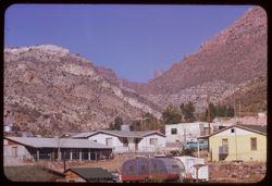
- Description:
- 100 f 8 tl
- Subject:
- Electric lines, Houses, Automobiles, Trees, Mountains, Fences, Shrubs, Dwellings, and People
- Series:
- 9-59
- Creator:
- Cushman, Charles W., 1896-1972
- Date Created:
- 1959-02-27
- Genre:
- Cityscape photographs
- Frame Number:
- 36
- County:
- Pinal
- Abstract:
- View up gap from Superior
- Call Number:
- P10687
- City:
- Superior
- Country:
- United States
- State/Province:
- Arizona
- Alternate Identifier:
- 959.36
- Persistent URL:
- http://purl.dlib.indiana.edu/iudl/archives/cushman/P10687
- Holding Location:
- Bloomington - University Archives
Wells Library E460
1320 E 10th St.
Bloomington, IN 47405
Contact at archives@indiana.edu, 812-855-1127
-
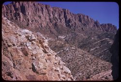
- Description:
- 50 f 11 sl
- Subject:
- Canyons, Queen Creek Canyon (Ariz.), Shrubs, and Mountains
- Series:
- 9-59
- Creator:
- Cushman, Charles W., 1896-1972
- Date Created:
- 1959-02-27
- Genre:
- Landscape photographs
- Frame Number:
- 35
- County:
- Maricopa and Pinal
- Abstract:
- And one southward
- Call Number:
- P10686
- City:
- Queen Creek and Superior
- Country:
- United States
- State/Province:
- Arizona
- Alternate Identifier:
- 959.35
- Persistent URL:
- http://purl.dlib.indiana.edu/iudl/archives/cushman/P10686
- Holding Location:
- Bloomington - University Archives
Wells Library E460
1320 E 10th St.
Bloomington, IN 47405
Contact at archives@indiana.edu, 812-855-1127
-
- Description:
- 100 f 8 tl
- Subject:
- Canyons, Mountains, Queen Creek Canyon (Ariz.), and Shrubs
- Series:
- 9-59
- Creator:
- Cushman, Charles W., 1896-1972
- Date Created:
- 1959-02-27
- Genre:
- Landscape photographs
- Frame Number:
- 34
- County:
- Maricopa and Pinal
- Abstract:
- And one southward
- Call Number:
- P10685
- City:
- Superior and Queen creek
- Country:
- United States
- State/Province:
- Arizona
- Alternate Identifier:
- 959.34
- Persistent URL:
- http://purl.dlib.indiana.edu/iudl/archives/cushman/P10685
- Holding Location:
- Bloomington - University Archives
Wells Library E460
1320 E 10th St.
Bloomington, IN 47405
Contact at archives@indiana.edu, 812-855-1127
-
- Description:
- 100 f 8 tl
- Subject:
- Canyons, Mountains, Shrubs, and Queen Creek Canyon (Ariz.)
- Series:
- 9-59
- Creator:
- Cushman, Charles W., 1896-1972
- Date Created:
- 1959-02-27
- Genre:
- Landscape photographs
- Frame Number:
- 32
- County:
- Pinal
- Abstract:
- From great high Queen Ck. Bridge -3 views estward
- Call Number:
- P10683
- City:
- Superior
- Country:
- United States
- State/Province:
- Arizona
- Alternate Identifier:
- 959.32
- Persistent URL:
- http://purl.dlib.indiana.edu/iudl/archives/cushman/P10683
- Holding Location:
- Bloomington - University Archives
Wells Library E460
1320 E 10th St.
Bloomington, IN 47405
Contact at archives@indiana.edu, 812-855-1127
-

- Description:
- 100 f 8 tl
- Subject:
- Mountains, Shrubs, Smelters, and Trees
- Series:
- 9-59
- Creator:
- Cushman, Charles W., 1896-1972
- Date Created:
- 1959-02-27
- Genre:
- Landscape photographs
- Frame Number:
- 25
- County:
- Gila
- Abstract:
- Mountain + smelter tailings north of Miami
- Call Number:
- P10676
- City:
- Miami
- Country:
- United States
- State/Province:
- Arizona
- Alternate Identifier:
- 959.25
- Persistent URL:
- http://purl.dlib.indiana.edu/iudl/archives/cushman/P10676
- Holding Location:
- Bloomington - University Archives
Wells Library E460
1320 E 10th St.
Bloomington, IN 47405
Contact at archives@indiana.edu, 812-855-1127
-
- Description:
- 100 f 9 tl
- Subject:
- Roads, Automobiles, Mountains, and Shrubs
- Series:
- 9-59
- Creator:
- Cushman, Charles W., 1896-1972
- Date Created:
- 1959-02-27
- Genre:
- Landscape photographs
- Frame Number:
- 22
- Street Address:
- United States Highway 60 and United States Highway 70
- County:
- Pinal and Gila
- Abstract:
- US 60/70 winding eastward over hump from Superior to Miami
- Call Number:
- P10673
- City:
- Superior and Miami
- Country:
- United States
- State/Province:
- Arizona
- Alternate Identifier:
- 959.22
- Persistent URL:
- http://purl.dlib.indiana.edu/iudl/archives/cushman/P10673
- Holding Location:
- Bloomington - University Archives
Wells Library E460
1320 E 10th St.
Bloomington, IN 47405
Contact at archives@indiana.edu, 812-855-1127
-
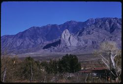
- Description:
- 100 f 5.6 tl
- Subject:
- Mountains, Picketpost Mountain (Ariz.), Electric lines, Dwellings, Shrubs, and Cactus
- Series:
- 9-59
- Creator:
- Cushman, Charles W., 1896-1972
- Date Created:
- 1959-02-27
- Genre:
- Landscape photographs
- Frame Number:
- 21
- County:
- Pinal
- Abstract:
- Mt. (Pickett Post) S.W. of Superior
- Call Number:
- P10672
- City:
- Superior
- Country:
- United States
- State/Province:
- Arizona
- Alternate Identifier:
- 959.21
- Persistent URL:
- http://purl.dlib.indiana.edu/iudl/archives/cushman/P10672
- Holding Location:
- Bloomington - University Archives
Wells Library E460
1320 E 10th St.
Bloomington, IN 47405
Contact at archives@indiana.edu, 812-855-1127
-
- Description:
- 100 f 9 tl
- Subject:
- Chimneys, Mountains, Buildings, and Shrubs
- Series:
- 9-59
- Creator:
- Cushman, Charles W., 1896-1972
- Date Created:
- 1959-02-27
- Genre:
- Landscape photographs
- Frame Number:
- 20
- County:
- Pinal
- Abstract:
- Mtns above Superior
- Call Number:
- P10671
- City:
- Superior
- Country:
- United States
- State/Province:
- Arizona
- Alternate Identifier:
- 959.20
- Persistent URL:
- http://purl.dlib.indiana.edu/iudl/archives/cushman/P10671
- Holding Location:
- Bloomington - University Archives
Wells Library E460
1320 E 10th St.
Bloomington, IN 47405
Contact at archives@indiana.edu, 812-855-1127
-
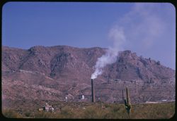
- Description:
- 100 f 8 tl
- Subject:
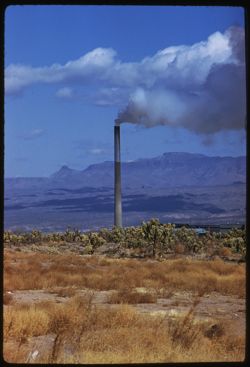
- Smokestacks, Smoke, Mountains, Shrubs, Cactus, and Buildings
- Series:
- 9-59
- Creator:
- Cushman, Charles W., 1896-1972
- Date Created:
- 1959-02-27
- Genre:
- Landscape photographs
- Frame Number:
- 19
- County:
- Pinal
- Abstract:
- Mill + mtn at Superior
- Call Number:
- P10670
- City:
- Superior
- Country:
- United States
- State/Province:
- Arizona
- Alternate Identifier:
- 959.19
- Persistent URL:
- http://purl.dlib.indiana.edu/iudl/archives/cushman/P10670
- Holding Location:
- Bloomington - University Archives
Wells Library E460
1320 E 10th St.
Bloomington, IN 47405
Contact at archives@indiana.edu, 812-855-1127
-
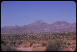
- Description:
- 100 f 9 tl
- Subject:
- Cactus, Mountains, Fences, Shrubs, and Superstition Mountains (Ariz.)
- Series:
- 9-59
- Creator:
- Cushman, Charles W., 1896-1972
- Date Created:
- 1959-02-27
- Genre:
- Landscape photographs
- Frame Number:
- 18
- Street Address:
- United States Highway 60 and United States Highway 70
- County:
- Pinal
- Abstract:
- Superstition Mtns seen from Hwy west of Superior
- Call Number:
- P10669
- City:
- Superior and Florence
- Country:
- United States
- State/Province:
- Arizona
- Alternate Identifier:
- 959.18
- Persistent URL:
- http://purl.dlib.indiana.edu/iudl/archives/cushman/P10669
- Holding Location:
- Bloomington - University Archives
Wells Library E460
1320 E 10th St.
Bloomington, IN 47405
Contact at archives@indiana.edu, 812-855-1127
-
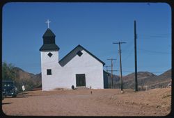
- Description:
- 100 f 9 tl
- Subject:
- Dogs, Crosses, Churches, Automobiles, Mountains, Dirt roads, Shrubs, Electric lines, Trees, Towers, and Masonry
- Series:
- 9-59
- Creator:
- Cushman, Charles W., 1896-1972
- Date Created:
- 1959-02-24
- Genre:
- Architectural photographs
- Frame Number:
- 9
- County:
- Santa Cruz
- Abstract:
- Tubac- old church
- Call Number:
- P10660
- City:
- Tubac
- Country:
- United States
- State/Province:
- Arizona
- Alternate Identifier:
- 959.9
- Persistent URL:
- http://purl.dlib.indiana.edu/iudl/archives/cushman/P10660
- Holding Location:
- Bloomington - University Archives
Wells Library E460
1320 E 10th St.
Bloomington, IN 47405
Contact at archives@indiana.edu, 812-855-1127
-
- Description:
- 100 f 8 tl
- Subject:
- Mountains, Fences, Shrubs, and Roskruge Mountains (Ariz.)
- Series:
- 9-59
- Creator:
- Cushman, Charles W., 1896-1972
- Date Created:
- 1959-02-20
- Genre:
- Landscape photographs
- Frame Number:
- 5
- Street Address:
- Tucson-Ajo Highway and Ajo Way
- County:
- Pima
- Abstract:
- Roskruge Mtns. - from Ajo road
- Call Number:
- P10656
- City:
- Tucson
- Country:
- United States
- State/Province:
- Arizona
- Alternate Identifier:
- 959.5
- Persistent URL:
- http://purl.dlib.indiana.edu/iudl/archives/cushman/P10656
- Holding Location:
- Bloomington - University Archives
Wells Library E460
1320 E 10th St.
Bloomington, IN 47405
Contact at archives@indiana.edu, 812-855-1127
-
- Description:
- 100 f 9 tl
- Subject:
- Cactus, Roskruge Mountains (Ariz.), Shrubs, and Mountains
- Series:
- 9-59
- Creator:
- Cushman, Charles W., 1896-1972
- Date Created:
- 1959-02-20
- Genre:
- Landscape photographs
- Frame Number:
- 4
- Street Address:
- Ajo Way
- County:
- Pima
- Abstract:
- Roskruge Mtns. -from Ajo road
- Call Number:
- P10655
- City:
- Tucson
- Country:
- United States
- State/Province:
- Arizona
- Alternate Identifier:
- 959.4
- Persistent URL:
- http://purl.dlib.indiana.edu/iudl/archives/cushman/P10655
- Holding Location:
- Bloomington - University Archives
Wells Library E460
1320 E 10th St.
Bloomington, IN 47405
Contact at archives@indiana.edu, 812-855-1127
-
- Description:
- 100 f 9 tl
- Subject:
- Cactus, Mountains, Shrubs, and Roskruge Mountains (Ariz.)
- Series:
- 9-59
- Creator:
- Cushman, Charles W., 1896-1972
- Date Created:
- 1959-02-20
- Genre:
- Landscape photographs
- Frame Number:
- 3
- Street Address:
- Ajo Way
- County:
- Pima
- Abstract:
- Roskruge Mtns. -from Ajo road
- Call Number:
- P10654
- City:
- Tucson
- Country:
- United States
- State/Province:
- Arizona
- Alternate Identifier:
- 959.3
- Persistent URL:
- http://purl.dlib.indiana.edu/iudl/archives/cushman/P10654
- Holding Location:
- Bloomington - University Archives
Wells Library E460
1320 E 10th St.
Bloomington, IN 47405
Contact at archives@indiana.edu, 812-855-1127
-
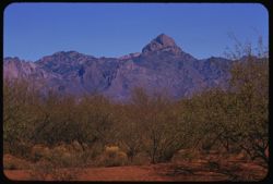
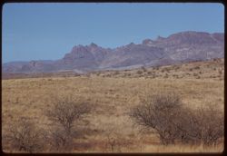
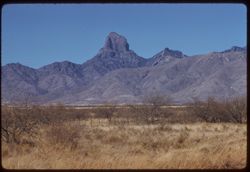
- Description:
- 100 f 9 tl
- Subject:
- Baboquivari Mountains (Ariz.), Baboquivari Peak (Ariz.), Mountains, and Shrubs
- Series:
- 9-59
- Creator:
- Cushman, Charles W., 1896-1972
- Date Created:
- 1959-02-20
- Genre:
- Landscape photographs
- Frame Number:
- 2
- County:
- Pima
- Abstract:
- His neighbor to north
- Call Number:
- P10653
- Country:
- United States
- State/Province:
- Arizona
- Alternate Identifier:
- 959.2
- Persistent URL:
- http://purl.dlib.indiana.edu/iudl/archives/cushman/P10653
- Holding Location:
- Bloomington - University Archives
Wells Library E460
1320 E 10th St.
Bloomington, IN 47405
Contact at archives@indiana.edu, 812-855-1127
-
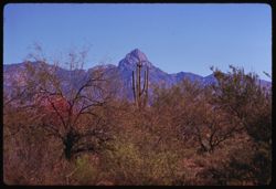
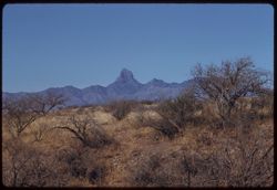
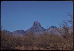
- Description:
- 100 f 9 tl
- Subject:
- Baboquivari Mountains (Ariz.), Baboquivari Peak (Ariz.), Mountains, and Shrubs
- Series:
- 9-59
- Creator:
- Cushman, Charles W., 1896-1972
- Date Created:
- 1959-02-20
- Genre:
- Landscape photographs
- Frame Number:
- 1
- County:
- Pima
- Abstract:
- Baboquivari Mtns. from SW
- Call Number:
- P10652
- Country:
- United States
- State/Province:
- Arizona
- Alternate Identifier:
- 959.1
- Persistent URL:
- http://purl.dlib.indiana.edu/iudl/archives/cushman/P10652
- Holding Location:
- Bloomington - University Archives
Wells Library E460
1320 E 10th St.
Bloomington, IN 47405
Contact at archives@indiana.edu, 812-855-1127
-
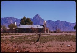
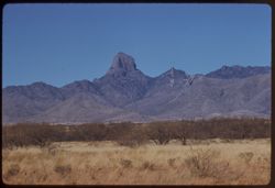
- Description:
- 100 f 8 tl
- Subject:
- Baboquivari Peak (Ariz.), Mountains, Shrubs, Cactus, and Topara
- Series:
- 8-59
- Creator:
- Cushman, Charles W., 1896-1972
- Date Created:
- 1959-02-20
- Genre:
- Landscape photographs
- Frame Number:
- 37
- County:
- Pima
- Abstract:
- Babaoquivari from road south of Topara
- Call Number:
- P10651
- Country:
- United States
- State/Province:
- Arizona
- Alternate Identifier:
- 859.37
- Persistent URL:
- http://purl.dlib.indiana.edu/iudl/archives/cushman/P10651
- Holding Location:
- Bloomington - University Archives
Wells Library E460
1320 E 10th St.
Bloomington, IN 47405
Contact at archives@indiana.edu, 812-855-1127
-
- Description:
- 100 f 6.3 tl
- Subject:
- Domes, Baboquivari Peak (Ariz.), Automobiles, Arches, Roads, Swings, Mountains, Shrubs, Trees, Buildings, Topara, Bell towers, and Fences
- Series:
- 8-59
- Creator:
- Cushman, Charles W., 1896-1972
- Date Created:
- 1959-02-20
- Genre:
- Landscape photographs
- Frame Number:
- 36
- County:
- Pima
- Abstract:
- Baboquivari Pk seen from Topara
- Call Number:
- P10650
- Country:
- United States
- State/Province:
- Arizona
- Alternate Identifier:
- 859.36
- Persistent URL:
- http://purl.dlib.indiana.edu/iudl/archives/cushman/P10650
- Holding Location:
- Bloomington - University Archives
Wells Library E460
1320 E 10th St.
Bloomington, IN 47405
Contact at archives@indiana.edu, 812-855-1127
-
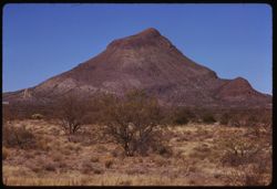
- Description:
- 100 f 9 tl
- Subject:
- Roskruge Mountains (Ariz.), Mountains, and Shrubs
- Series:
- 8-59
- Creator:
- Cushman, Charles W., 1896-1972
- Date Created:
- 1959-02-20
- Genre:
- Landscape photographs
- Frame Number:
- 34
- Street Address:
- Ajo Way
- County:
- Pima
- Abstract:
- A single beauty
- Call Number:
- P10648
- Country:
- United States
- State/Province:
- Arizona
- Alternate Identifier:
- 859.34
- Persistent URL:
- http://purl.dlib.indiana.edu/iudl/archives/cushman/P10648
- Holding Location:
- Bloomington - University Archives
Wells Library E460
1320 E 10th St.
Bloomington, IN 47405
Contact at archives@indiana.edu, 812-855-1127
-
- Description:
- 100 f 9 tl
- Subject:
- Mountains, Shrubs, and Roskruge Mountains (Ariz.)
- Series:
- 8-59
- Creator:
- Cushman, Charles W., 1896-1972
- Date Created:
- 1959-02-20
- Genre:
- Landscape photographs
- Frame Number:
- 33
- Street Address:
- Ajo Way
- County:
- Pima
- Abstract:
- Two Roskruge pyramids from south
- Call Number:
- P10647
- Country:
- United States
- State/Province:
- Arizona
- Alternate Identifier:
- 859.33
- Persistent URL:
- http://purl.dlib.indiana.edu/iudl/archives/cushman/P10647
- Holding Location:
- Bloomington - University Archives
Wells Library E460
1320 E 10th St.
Bloomington, IN 47405
Contact at archives@indiana.edu, 812-855-1127
-
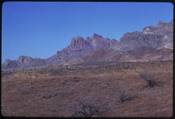
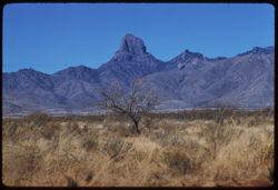
- Description:
- 100 f 8 tl
- Subject:
- Baboquivari Mountains (Ariz.), Mountains, and Shrubs
- Series:
- 8-59
- Creator:
- Cushman, Charles W., 1896-1972
- Date Created:
- 1959-02-20
- Genre:
- Landscape photographs
- Frame Number:
- 32
- Street Address:
- Ajo Way
- County:
- Pima
- Abstract:
- Rugged height of northern Baboquivari range
- Call Number:
- P10646
- Country:
- United States
- State/Province:
- Arizona
- Alternate Identifier:
- 859.32
- Persistent URL:
- http://purl.dlib.indiana.edu/iudl/archives/cushman/P10646
- Holding Location:
- Bloomington - University Archives
Wells Library E460
1320 E 10th St.
Bloomington, IN 47405
Contact at archives@indiana.edu, 812-855-1127
-
- Description:
- 100 f 9 tl
- Subject:
- Roskruge Mountains (Ariz.), Shrubs, and Mountains
- Series:
- 8-59
- Creator:
- Cushman, Charles W., 1896-1972
- Date Created:
- 1959-02-20
- Genre:
- Landscape photographs
- Frame Number:
- 31
- Street Address:
- Ajo Way
- County:
- Pima
- Abstract:
- Clump of Roskruge low peaks from SE
- Call Number:
- P10645
- Country:
- United States
- State/Province:
- Arizona
- Alternate Identifier:
- 859.31
- Persistent URL:
- http://purl.dlib.indiana.edu/iudl/archives/cushman/P10645
- Holding Location:
- Bloomington - University Archives
Wells Library E460
1320 E 10th St.
Bloomington, IN 47405
Contact at archives@indiana.edu, 812-855-1127
-
- Description:
- 50 f 11 sl
- Subject:
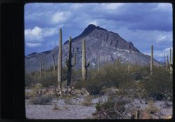
- Cactus, Mountains, Shrubs, Tucson Mountains (Ariz.), Saguaro, and Clouds
- Series:
- 8-59
- Creator:
- Cushman, Charles W., 1896-1972
- Date Created:
- 1959-02-13
- Genre:
- Landscape photographs
- Frame Number:
- 10
- County:
- Pima
- Abstract:
- Sahuaros march up the mountain
- Call Number:
- P10624
- City:
- Tucson
- Country:
- United States
- State/Province:
- Arizona
- Alternate Identifier:
- 859.10
- Persistent URL:
- http://purl.dlib.indiana.edu/iudl/archives/cushman/P10624
- Holding Location:
- Bloomington - University Archives
Wells Library E460
1320 E 10th St.
Bloomington, IN 47405
Contact at archives@indiana.edu, 812-855-1127
-
- Description:
- 50 f 11 sl
- Subject:
- Rocks, Cactus, Mountains, Shrubs, Tucson Mountains (Ariz.), Clouds, Sahuaro, and Saguaro
- Series:
- 8-59
- Creator:
- Cushman, Charles W., 1896-1972
- Date Created:
- 1959-02-13
- Genre:
- Landscape photographs
- Frame Number:
- 9
- County:
- Pima
- Abstract:
- Sahuaros march up the mountain
- Call Number:
- P10623
- City:
- Tucson
- Country:
- United States
- State/Province:
- Arizona
- Alternate Identifier:
- 859.9
- Persistent URL:
- http://purl.dlib.indiana.edu/iudl/archives/cushman/P10623
- Holding Location:
- Bloomington - University Archives
Wells Library E460
1320 E 10th St.
Bloomington, IN 47405
Contact at archives@indiana.edu, 812-855-1127
-
- Description:
- 50 f 11 sl
- Subject:
- Rocks, Cactus, Mountains, Sahuaro, Tucson Mountains (Ariz.), Saguaro, Shrubs, and Clouds
- Series:
- 8-59
- Creator:
- Cushman, Charles W., 1896-1972
- Date Created:
- 1959-02-13
- Genre:
- Landscape photographs
- Frame Number:
- 8
- County:
- Pima
- Abstract:
- Sahuarus march up the mountain
- Call Number:
- P10622
- City:
- Tucson
- Country:
- United States
- State/Province:
- Arizona
- Alternate Identifier:
- 859.8
- Persistent URL:
- http://purl.dlib.indiana.edu/iudl/archives/cushman/P10622
- Holding Location:
- Bloomington - University Archives
Wells Library E460
1320 E 10th St.
Bloomington, IN 47405
Contact at archives@indiana.edu, 812-855-1127
-
- Description:
- 50 f 11 sl
- Subject:
- Palo verde trees, Trees, Mountains, Shrubs, Tucson Mountains (Ariz.), and Clouds
- Series:
- 8-59
- Creator:
- Cushman, Charles W., 1896-1972
- Date Created:
- 1959-02-13
- Genre:
- Landscape photographs
- Frame Number:
- 7
- County:
- Pima
- Abstract:
- Those lovely clouds above the Tucson Mtns.
- Call Number:
- P10621
- City:
- Tucson
- Country:
- United States
- State/Province:
- Arizona
- Alternate Identifier:
- 859.7
- Persistent URL:
- http://purl.dlib.indiana.edu/iudl/archives/cushman/P10621
- Holding Location:
- Bloomington - University Archives
Wells Library E460
1320 E 10th St.
Bloomington, IN 47405
Contact at archives@indiana.edu, 812-855-1127
-
- Description:
- 50 f 9 sl
- Subject:
- Palo verde trees, Trees, Mountains, Shrubs, Tucson Mountains (Ariz.), and Clouds
- Series:
- 8-59
- Creator:
- Cushman, Charles W., 1896-1972
- Date Created:
- 1959-02-13
- Genre:
- Identification photographs
- Frame Number:
- 6
- County:
- Pima
- Abstract:
- Palo Verde back of Tucson Mtns.
- Call Number:
- P10620
- City:
- Tucson
- Country:
- United States
- State/Province:
- Arizona
- Alternate Identifier:
- 859.6
- Persistent URL:
- http://purl.dlib.indiana.edu/iudl/archives/cushman/P10620
- Holding Location:
- Bloomington - University Archives
Wells Library E460
1320 E 10th St.
Bloomington, IN 47405
Contact at archives@indiana.edu, 812-855-1127
-
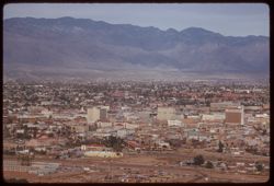
- Description:
- 100 f 6.3 tl
- Subject:
- Electric lines, Automobiles, Trees, Signs (Notices), Streets, Mountains, Buildings, Shrubs, Tucson Mountains (Ariz.), Dwellings, and Parking lots
- Series:
- 8-59
- Creator:
- Cushman, Charles W., 1896-1972
- Date Created:
- 1959-02-11
- Genre:
- Cityscape photographs
- Frame Number:
- 5
- County:
- Pima
- Abstract:
- Tucson from A Mtn.
- Call Number:
- P10619
- City:
- Tucson
- Country:
- United States
- State/Province:
- Arizona
- Alternate Identifier:
- 859.5
- Persistent URL:
- http://purl.dlib.indiana.edu/iudl/archives/cushman/P10619
- Holding Location:
- Bloomington - University Archives
Wells Library E460
1320 E 10th St.
Bloomington, IN 47405
Contact at archives@indiana.edu, 812-855-1127
-
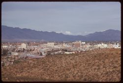
- Description:
- 100 f 6.3 tl
- Subject:
- Domes, Cities & towns, Streets, Automobiles, Mountains, Tucson Mountains (Ariz.), Shrubs, Trees, Buildings, Signs (Notices), Clouds, and Dwellings
- Series:
- 8-59
- Creator:
- Cushman, Charles W., 1896-1972
- Date Created:
- 1959-02-11
- Genre:
- Cityscape photographs
- Frame Number:
- 4
- County:
- Pima
- Abstract:
- Tucson from A Mtn.
- Call Number:
- P10618
- City:
- Tucson
- Country:
- United States
- State/Province:
- Arizona
- Alternate Identifier:
- 859.4
- Persistent URL:
- http://purl.dlib.indiana.edu/iudl/archives/cushman/P10618
- Holding Location:
- Bloomington - University Archives
Wells Library E460
1320 E 10th St.
Bloomington, IN 47405
Contact at archives@indiana.edu, 812-855-1127
-
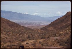
- Description:
- 100 f 6.3 tl
- Subject:
- Roads, Cactus, Cities & towns, Buildings, Gates Pass (Ariz.), Tucson Mountains (Ariz.), Clouds, Dwellings, Mountains, Shrubs, and Traffic signs & sig...
- Series:
- 8-59
- Creator:
- Cushman, Charles W., 1896-1972
- Date Created:
- 1959-02-11
- Genre:
- Cityscape photographs
- Frame Number:
- 3
- County:
- Pima
- Abstract:
- Tucson seen from Gates Pass in Tuscon Mtns.
- Call Number:
- P10617
- City:
- Tucson
- Country:
- United States
- State/Province:
- Arizona
- Alternate Identifier:
- 859.3
- Persistent URL:
- http://purl.dlib.indiana.edu/iudl/archives/cushman/P10617
- Holding Location:
- Bloomington - University Archives
Wells Library E460
1320 E 10th St.
Bloomington, IN 47405
Contact at archives@indiana.edu, 812-855-1127
-
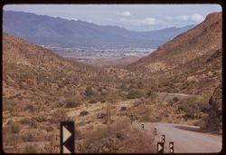
- Description:
- 100 f 6.3 tl
- Subject:
- Rocks, Roads, Cactus, Cities & towns, Buildings, Gates Pass (Ariz.), Traffic signs & signals, Clouds, Dwellings, Mountains, Shrubs, and Tucson Mounta...
- Series:
- 8-59
- Creator:
- Cushman, Charles W., 1896-1972
- Date Created:
- 1959-02-11
- Genre:
- Cityscape photographs
- Frame Number:
- 2
- County:
- Pima
- Abstract:
- Tucson seen from Gates Pass in Tucson Mtns.
- Call Number:
- P10616
- City:
- Tucson
- Country:
- United States
- State/Province:
- Arizona
- Alternate Identifier:
- 859.2
- Persistent URL:
- http://purl.dlib.indiana.edu/iudl/archives/cushman/P10616
- Holding Location:
- Bloomington - University Archives
Wells Library E460
1320 E 10th St.
Bloomington, IN 47405
Contact at archives@indiana.edu, 812-855-1127
-
- Description:
- 100 f 5.6 tl
- Subject:
- Roads, Cactus, Mountains, Buildings, Gates Pass (Ariz.), Tucson Mountains (Ariz.), Clouds, Dwellings, Hills, Cities & towns, Shrubs, and Traffic signs &a...
- Series:
- 8-59
- Creator:
- Cushman, Charles W., 1896-1972
- Date Created:
- 1959-02-11
- Genre:
- Cityscape photographs
- Frame Number:
- 1
- County:
- Pima
- Abstract:
- Tucson seen from Gates Pass in Tucson Mtns.
- Call Number:
- P10615
- City:
- Tucson
- Country:
- United States
- State/Province:
- Arizona
- Alternate Identifier:
- 859.1
- Persistent URL:
- http://purl.dlib.indiana.edu/iudl/archives/cushman/P10615
- Holding Location:
- Bloomington - University Archives
Wells Library E460
1320 E 10th St.
Bloomington, IN 47405
Contact at archives@indiana.edu, 812-855-1127
-
- Description:
- 100 f 8
- Subject:
- Snow, Trees, Mountains, Shrubs, Clouds, and Santa Catalina Mountains (Ariz.)
- Series:
- 7-59
- Creator:
- Cushman, Charles W., 1896-1972
- Date Created:
- 1959-02-09
- Genre:
- Landscape photographs
- Frame Number:
- 37
- County:
- Pima
- Call Number:
- P10613
- City:
- Tucson
- Country:
- United States
- State/Province:
- Arizona
- Alternate Identifier:
- 759.37
- Persistent URL:
- http://purl.dlib.indiana.edu/iudl/archives/cushman/P10613
- Holding Location:
- Bloomington - University Archives
Wells Library E460
1320 E 10th St.
Bloomington, IN 47405
Contact at archives@indiana.edu, 812-855-1127
-
- Description:
- 50 f 9 tl
- Subject:
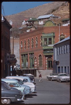
- Streets, Hills, Automobiles, Street lights, Taxicabs, Mountains, People, Dwellings, Electric lines, Buildings, Brewery Gulch (Ariz.), Signs (Notices), and Sh...
- Series:
- 7-59
- Creator:
- Cushman, Charles W., 1896-1972
- Date Created:
- 1959-02-06
- Genre:
- Cityscape photographs
- Frame Number:
- 29
- County:
- Cochise
- Abstract:
- Brewery Gulch
- Call Number:
- P10605
- City:
- Bisbee
- Country:
- United States
- State/Province:
- Arizona
- Alternate Identifier:
- 759.29
- Persistent URL:
- http://purl.dlib.indiana.edu/iudl/archives/cushman/P10605
- Holding Location:
- Bloomington - University Archives
Wells Library E460
1320 E 10th St.
Bloomington, IN 47405
Contact at archives@indiana.edu, 812-855-1127
-
- Description:
- 100 f 8 tl
- Subject:
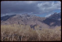
- Snow, Trees, Mountains, Shrubs, Clouds, and Santa Catalina Mountains (Ariz.)
- Series:
- 7-59
- Creator:
- Cushman, Charles W., 1896-1972
- Date Created:
- 1959-02-03
- Genre:
- Landscape photographs
- Frame Number:
- 14
- County:
- Pinal
- Abstract:
- Santa Catalina Mtns
- Call Number:
- P10590
- City:
- Oracle Junction
- Country:
- United States
- State/Province:
- Arizona
- Alternate Identifier:
- 759.14
- Persistent URL:
- http://purl.dlib.indiana.edu/iudl/archives/cushman/P10590
- Holding Location:
- Bloomington - University Archives
Wells Library E460
1320 E 10th St.
Bloomington, IN 47405
Contact at archives@indiana.edu, 812-855-1127
-
- Description:
- 100 f 5.6 tl
- Subject:
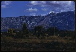
- Snow, Cactus, Trees, Mountains, Shrubs, Clouds, and Santa Catalina Mountains (Ariz.)
- Series:
- 7-59
- Creator:
- Cushman, Charles W., 1896-1972
- Date Created:
- 1959-02-03
- Genre:
- Landscape photographs
- Frame Number:
- 15
- County:
- Pinal
- Abstract:
- Santa Catalina Mtns
- Call Number:
- P10591
- City:
- Oracle Junction
- Country:
- United States
- State/Province:
- Arizona
- Alternate Identifier:
- 759.15
- Persistent URL:
- http://purl.dlib.indiana.edu/iudl/archives/cushman/P10591
- Holding Location:
- Bloomington - University Archives
Wells Library E460
1320 E 10th St.
Bloomington, IN 47405
Contact at archives@indiana.edu, 812-855-1127
-

- Description:
- 100 f 6.3 tl
- Subject:
- Children & adults, Stores & shops, Mothers & children, Trees, Signs (Notices), Streets, Mountains, and Shrubs
- Series:
- 7-59
- Creator:
- Cushman, Charles W., 1896-1972
- Date Created:
- 1959-02-03
- Genre:
- Snapshots
- Frame Number:
- 13
- County:
- Pinal
- Abstract:
- Little girl + mama
- Call Number:
- P10589
- City:
- Mammoth
- Country:
- United States
- State/Province:
- Arizona
- Alternate Identifier:
- 759.13
- Persistent URL:
- http://purl.dlib.indiana.edu/iudl/archives/cushman/P10589
- Holding Location:
- Bloomington - University Archives
Wells Library E460
1320 E 10th St.
Bloomington, IN 47405
Contact at archives@indiana.edu, 812-855-1127
-
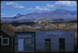
- Description:
- 100 f 6.3 tl
- Subject:
- Stores & shops, Electric lines, Trees, Signs (Notices), Cities & towns, Buildings, Shrubs, Clouds, Windows, Doors & doorways, Galiuro Mountains (...
- Series:
- 7-59
- Creator:
- Cushman, Charles W., 1896-1972
- Date Created:
- 1959-02-03
- Genre:
- Landscape photographs
- Frame Number:
- 12
- County:
- Pinal
- Abstract:
- Galiuro Mtns. From Mammoth Ariz.
- Call Number:
- P10588
- City:
- Mammoth
- Country:
- United States
- State/Province:
- Arizona
- Alternate Identifier:
- 759.12
- Persistent URL:
- http://purl.dlib.indiana.edu/iudl/archives/cushman/P10588
- Holding Location:
- Bloomington - University Archives
Wells Library E460
1320 E 10th St.
Bloomington, IN 47405
Contact at archives@indiana.edu, 812-855-1127
-
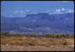
- Description:
- 100 f 6.3
- Subject:
- San Pedro River (Mexico and Ariz.), Galiuro Mountains (Ariz.), Cactus, Mountains, Shrubs, and Clouds
- Series:
- 7-59
- Creator:
- Cushman, Charles W., 1896-1972
- Date Created:
- 1959-02-03
- Genre:
- Landscape photographs
- Frame Number:
- 11
- County:
- Pinal
- Abstract:
- Galiuro Mtns. across San Pedro river from S. Manuel
- Call Number:
- P10587
- City:
- San Manuel
- Country:
- United States
- State/Province:
- Arizona
- Alternate Identifier:
- 759.11
- Persistent URL:
- http://purl.dlib.indiana.edu/iudl/archives/cushman/P10587
- Holding Location:
- Bloomington - University Archives
Wells Library E460
1320 E 10th St.
Bloomington, IN 47405
Contact at archives@indiana.edu, 812-855-1127
-
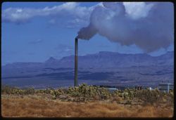
- Description:
- 100 f 8 tl
- Subject:
- Galiuro Mountains (Ariz.), Smokestacks, Mills, Smoke, Magma Copper Company, Mountains, Shrubs, Trees, Buildings, and Clouds
- Series:
- 7-59
- Creator:
- Cushman, Charles W., 1896-1972
- Date Created:
- 1959-02-03
- Genre:
- Landscape photographs
- Frame Number:
- 10
- County:
- Pinal
- Abstract:
- Magma Copper Co. mill at San Manuel
- Call Number:
- P10586
- City:
- San Manuel
- Country:
- United States
- State/Province:
- Arizona
- Alternate Identifier:
- 759.10
- Persistent URL:
- http://purl.dlib.indiana.edu/iudl/archives/cushman/P10586
- Holding Location:
- Bloomington - University Archives
Wells Library E460
1320 E 10th St.
Bloomington, IN 47405
Contact at archives@indiana.edu, 812-855-1127
-
- Description:
- 100 f 8 tl
- Subject:
- Mills, Trees, Smoke, Magma Copper Company, Mountains, Buildings, Shrubs, Clouds, and Smokestacks
- Series:
- 7-59
- Creator:
- Cushman, Charles W., 1896-1972
- Date Created:
- 1959-02-03
- Genre:
- Landscape photographs
- Frame Number:
- 9
- County:
- Pinal
- Abstract:
- Magma Copper Co. mill at San Manuel
- Call Number:
- P10585
- City:
- San Manuel
- Country:
- United States
- State/Province:
- Arizona
- Alternate Identifier:
- 759.9
- Persistent URL:
- http://purl.dlib.indiana.edu/iudl/archives/cushman/P10585
- Holding Location:
- Bloomington - University Archives
Wells Library E460
1320 E 10th St.
Bloomington, IN 47405
Contact at archives@indiana.edu, 812-855-1127
-
- Description:
- 100 f 8 tl
- Subject:
- Rocks, Cactus, Buttes, Mountains, Shrubs, Tucson Mountains (Ariz.), and Clouds
- Series:
- 7-59
- Creator:
- Cushman, Charles W., 1896-1972
- Date Created:
- 1959-02-02
- Genre:
- Landscape photographs
- Frame Number:
- 3
- Street Address:
- Ajo Way
- County:
- Pima
- Abstract:
- A small butte commercialized
- Call Number:
- P10579
- City:
- Tucson
- Country:
- United States
- State/Province:
- Arizona
- Alternate Identifier:
- 759.3
- Persistent URL:
- http://purl.dlib.indiana.edu/iudl/archives/cushman/P10579
- Holding Location:
- Bloomington - University Archives
Wells Library E460
1320 E 10th St.
Bloomington, IN 47405
Contact at archives@indiana.edu, 812-855-1127
-
- Description:
- 100 f 8
- Subject:
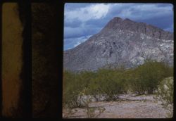
- Mountains, Tucson Mountains (Ariz.), Shrubs, Cactus, and Clouds
- Series:
- 7-59
- Creator:
- Cushman, Charles W., 1896-1972
- Date Created:
- 1959-02-02
- Genre:
- Landscape photographs
- Frame Number:
- 2
- Street Address:
- Ajo Way
- County:
- Pima
- Abstract:
- a Tucson mtn. from SE
- Call Number:
- P10578
- City:
- Tucson
- Country:
- United States
- State/Province:
- Arizona
- Physical Description:
- masked.
- Alternate Identifier:
- 759.2
- Persistent URL:
- http://purl.dlib.indiana.edu/iudl/archives/cushman/P10578
- Holding Location:
- Bloomington - University Archives
Wells Library E460
1320 E 10th St.
Bloomington, IN 47405
Contact at archives@indiana.edu, 812-855-1127
-
- Description:
- 100 f 8 tl
- Subject:
- Mountains, Tucson Mountains (Ariz.), Shrubs, and Clouds
- Series:
- 7-59
- Creator:
- Cushman, Charles W., 1896-1972
- Date Created:
- 1959-02-02
- Genre:
- Landscape photographs
- Frame Number:
- 1
- Street Address:
- Ajo Way
- County:
- Pinal
- Abstract:
- a Tucson mtn.
- Call Number:
- P10577
- City:
- Tucson
- Country:
- United States
- State/Province:
- Arizona
- Physical Description:
- masked.
- Alternate Identifier:
- 759.1
- Persistent URL:
- http://purl.dlib.indiana.edu/iudl/archives/cushman/P10577
- Holding Location:
- Bloomington - University Archives
Wells Library E460
1320 E 10th St.
Bloomington, IN 47405
Contact at archives@indiana.edu, 812-855-1127
-
- Description:
- 50 f 8 sl
- Subject:
- Mountains, Shrubs, Tucson Mountains (Ariz.), Clouds, and Cat Mountain (Ariz.)
- Series:
- 6-59
- Creator:
- Cushman, Charles W., 1896-1972
- Date Created:
- 1959-01-28
- Genre:
- Landscape photographs
- Frame Number:
- 38
- County:
- Pima
- Abstract:
- Cat Mtn from west
- Call Number:
- P10576
- City:
- Tucson
- Country:
- United States
- State/Province:
- Arizona
- Alternate Identifier:
- 659.38
- Persistent URL:
- http://purl.dlib.indiana.edu/iudl/archives/cushman/P10576
- Holding Location:
- Bloomington - University Archives
Wells Library E460
1320 E 10th St.
Bloomington, IN 47405
Contact at archives@indiana.edu, 812-855-1127
-
- Description:
- 50 f 9 sl
- Subject:
- Cactus, Mountains, Shrubs, Tucson Mountains (Ariz.), Clouds, and Cat Mountain (Ariz.)
- Series:
- 6-59
- Creator:
- Cushman, Charles W., 1896-1972
- Date Created:
- 1959-02-02
- Genre:
- Landscape photographs
- Frame Number:
- 37
- County:
- Pima
- Abstract:
- Cat Mtn from S.E.
- Call Number:
- P10575
- City:
- Tucson
- Country:
- United States
- State/Province:
- Arizona
- Alternate Identifier:
- 659.37
- Persistent URL:
- http://purl.dlib.indiana.edu/iudl/archives/cushman/P10575
- Holding Location:
- Bloomington - University Archives
Wells Library E460
1320 E 10th St.
Bloomington, IN 47405
Contact at archives@indiana.edu, 812-855-1127
-
- Description:
- 100 f 8 tl
- Subject:
- Electric lines, Trees, Mountains, Shrubs, Santa Rita Mountains (Ariz.), Dwellings, and Hills
- Series:
- 6-59
- Creator:
- Cushman, Charles W., 1896-1972
- Date Created:
- 1959-01-28
- Genre:
- Landscape photographs
- Frame Number:
- 35
- Street Address:
- Arivara Road
- Abstract:
- Sugarloaf in Santa Rita Mtn foothills - from Arivara rd.
- Call Number:
- P10573
- Country:
- United States
- State/Province:
- Arizona
- Alternate Identifier:
- 659.35
- Persistent URL:
- http://purl.dlib.indiana.edu/iudl/archives/cushman/P10573
- Holding Location:
- Bloomington - University Archives
Wells Library E460
1320 E 10th St.
Bloomington, IN 47405
Contact at archives@indiana.edu, 812-855-1127
-
- Description:
- 100 f 8 tl
- Subject:
- Cerro Colorado Mountains (Ariz.), Mountains, and Shrubs
- Series:
- 6-59
- Creator:
- Cushman, Charles W., 1896-1972
- Date Created:
- 1959-01-28
- Genre:
- Landscape photographs
- Frame Number:
- 34
- County:
- Pima
- Abstract:
- Cerro Colorado from SW farther on
- Call Number:
- P10572
- Country:
- United States
- State/Province:
- Arizona
- Alternate Identifier:
- 659.34
- Persistent URL:
- http://purl.dlib.indiana.edu/iudl/archives/cushman/P10572
- Holding Location:
- Bloomington - University Archives
Wells Library E460
1320 E 10th St.
Bloomington, IN 47405
Contact at archives@indiana.edu, 812-855-1127
-
- Description:
- 100 f 8 tl
- Subject:
- Roads, Cerro Colorado Mountains (Ariz.), Mountains, and Shrubs
- Series:
- 6-59
- Creator:
- Cushman, Charles W., 1896-1972
- Date Created:
- 1959-01-28
- Genre:
- Landscape photographs
- Frame Number:
- 33
- County:
- Pima
- Abstract:
- Cerro Colorado from SW farther on
- Call Number:
- P10571
- Country:
- United States
- State/Province:
- Arizona
- Alternate Identifier:
- 659.33
- Persistent URL:
- http://purl.dlib.indiana.edu/iudl/archives/cushman/P10571
- Holding Location:
- Bloomington - University Archives
Wells Library E460
1320 E 10th St.
Bloomington, IN 47405
Contact at archives@indiana.edu, 812-855-1127
-
- Description:
- 100 f 8 tl
- Subject:
- Rocks, Baboquivari Peak (Ariz.), Mountains, and Shrubs
- Series:
- 6-59
- Creator:
- Cushman, Charles W., 1896-1972
- Date Created:
- 1959-01-28
- Genre:
- Landscape photographs
- Frame Number:
- 32
- County:
- Pima
- Abstract:
- Babo head & shoulders from far
- Call Number:
- P10570
- Country:
- United States
- State/Province:
- Arizona
- Alternate Identifier:
- 659.32
- Persistent URL:
- http://purl.dlib.indiana.edu/iudl/archives/cushman/P10570
- Holding Location:
- Bloomington - University Archives
Wells Library E460
1320 E 10th St.
Bloomington, IN 47405
Contact at archives@indiana.edu, 812-855-1127
-
- Description:
- 100 f 9 tl
- Subject:
- Baboquivari Peak (Ariz.), Mountains, and Shrubs
- Series:
- 6-59
- Creator:
- Cushman, Charles W., 1896-1972
- Date Created:
- 1959-01-28
- Genre:
- Landscape photographs
- Frame Number:
- 31
- County:
- Pima
- Abstract:
- Babo head & shoulders
- Call Number:
- P10569
- Country:
- United States
- State/Province:
- Arizona
- Alternate Identifier:
- 659.31
- Persistent URL:
- http://purl.dlib.indiana.edu/iudl/archives/cushman/P10569
- Holding Location:
- Bloomington - University Archives
Wells Library E460
1320 E 10th St.
Bloomington, IN 47405
Contact at archives@indiana.edu, 812-855-1127
-
- Description:
- 100 f 8 tl
- Subject:
- Baboquivari Peak (Ariz.), Mountains, and Shrubs
- Series:
- 6-59
- Creator:
- Cushman, Charles W., 1896-1972
- Date Created:
- 1959-01-28
- Genre:
- Landscape photographs
- Frame Number:
- 30
- County:
- Pima
- Abstract:
- Babo head & shoulders
- Call Number:
- P10568
- Country:
- United States
- State/Province:
- Arizona
- Alternate Identifier:
- 659.30
- Persistent URL:
- http://purl.dlib.indiana.edu/iudl/archives/cushman/P10568
- Holding Location:
- Bloomington - University Archives
Wells Library E460
1320 E 10th St.
Bloomington, IN 47405
Contact at archives@indiana.edu, 812-855-1127
-
- Description:
- 100 f 8 tl
- Subject:
- Baboquivari Peak (Ariz.), Mountains, Fences, and Shrubs
- Series:
- 6-59
- Creator:
- Cushman, Charles W., 1896-1972
- Date Created:
- 1959-01-28
- Genre:
- Landscape photographs
- Frame Number:
- 29
- County:
- Pima
- Abstract:
- Babo head & shoulders
- Call Number:
- P10567
- Country:
- United States
- State/Province:
- Arizona
- Alternate Identifier:
- 659.29
- Persistent URL:
- http://purl.dlib.indiana.edu/iudl/archives/cushman/P10567
- Holding Location:
- Bloomington - University Archives
Wells Library E460
1320 E 10th St.
Bloomington, IN 47405
Contact at archives@indiana.edu, 812-855-1127
-
- Description:
- 100 f 8 tl
- Subject:
- Baboquivari Peak (Ariz.), Mountains, and Shrubs
- Series:
- 6-59
- Creator:
- Cushman, Charles W., 1896-1972
- Date Created:
- 1959-01-28
- Genre:
- Landscape photographs
- Frame Number:
- 28
- County:
- Pima
- Abstract:
- Babo head & shoulders
- Call Number:
- P10566
- Country:
- United States
- State/Province:
- Arizona
- Alternate Identifier:
- 659.28
- Persistent URL:
- http://purl.dlib.indiana.edu/iudl/archives/cushman/P10566
- Holding Location:
- Bloomington - University Archives
Wells Library E460
1320 E 10th St.
Bloomington, IN 47405
Contact at archives@indiana.edu, 812-855-1127
-
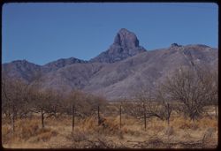
- Description:
- 100 f 8 tl
- Subject:
- Baboquivari Peak (Ariz.), Mountains, Fences, and Shrubs
- Series:
- 6-59
- Creator:
- Cushman, Charles W., 1896-1972
- Date Created:
- 1959-01-28
- Genre:
- Landscape photographs
- Frame Number:
- 27
- County:
- Pima
- Abstract:
- Babo
- Call Number:
- P10565
- Country:
- United States
- State/Province:
- Arizona
- Alternate Identifier:
- 659.27
- Persistent URL:
- http://purl.dlib.indiana.edu/iudl/archives/cushman/P10565
- Holding Location:
- Bloomington - University Archives
Wells Library E460
1320 E 10th St.
Bloomington, IN 47405
Contact at archives@indiana.edu, 812-855-1127
-
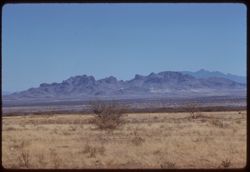
- Description:
- 100 f 8 tl
- Subject:
- Altar River Valley (Mexico), Cerro Colorado Mountains (Ariz.), Mountains, and Shrubs
- Series:
- 6-59
- Creator:
- Cushman, Charles W., 1896-1972
- Date Created:
- 1959-01-28
- Genre:
- Landscape photographs
- Frame Number:
- 26
- County:
- Pima
- Abstract:
- Cerro Colorado Mtns from across Altar valley
- Call Number:
- P10564
- Country:
- United States
- State/Province:
- Arizona
- Alternate Identifier:
- 659.26
- Persistent URL:
- http://purl.dlib.indiana.edu/iudl/archives/cushman/P10564
- Holding Location:
- Bloomington - University Archives
Wells Library E460
1320 E 10th St.
Bloomington, IN 47405
Contact at archives@indiana.edu, 812-855-1127
-
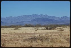
- Description:
- 100 f 8 tl
- Subject:
- Altar River Valley (Mexico), Sierrita Mountains (Ariz.), Mountains, and Shrubs
- Series:
- 6-59
- Creator:
- Cushman, Charles W., 1896-1972
- Date Created:
- 1959-01-28
- Genre:
- Landscape photographs
- Frame Number:
- 25
- County:
- Pima
- Abstract:
- Sierrita Mtns. seen from SW
- Call Number:
- P10563
- Country:
- United States
- State/Province:
- Arizona
- Alternate Identifier:
- 659.25
- Persistent URL:
- http://purl.dlib.indiana.edu/iudl/archives/cushman/P10563
- Holding Location:
- Bloomington - University Archives
Wells Library E460
1320 E 10th St.
Bloomington, IN 47405
Contact at archives@indiana.edu, 812-855-1127
-
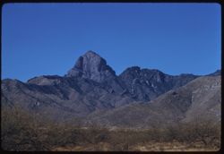
- Description:
- 100 f 8 tl
- Subject:
- Baboquivari Peak (Ariz.), Mountains, and Shrubs
- Series:
- 6-59
- Creator:
- Cushman, Charles W., 1896-1972
- Date Created:
- 1959-01-28
- Genre:
- Landscape photographs
- Frame Number:
- 24
- County:
- Pima
- Abstract:
- Baboquivari from SSE
- Call Number:
- P10562
- Country:
- United States
- State/Province:
- Arizona
- Alternate Identifier:
- 659.24
- Persistent URL:
- http://purl.dlib.indiana.edu/iudl/archives/cushman/P10562
- Holding Location:
- Bloomington - University Archives
Wells Library E460
1320 E 10th St.
Bloomington, IN 47405
Contact at archives@indiana.edu, 812-855-1127
-
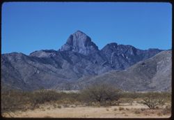
- Description:
- 100 f 6.3 t
- Subject:
- Baboquivari Peak (Ariz.), Mountains, and Shrubs
- Series:
- 6-59
- Creator:
- Cushman, Charles W., 1896-1972
- Date Created:
- 1959-01-28
- Genre:
- Landscape photographs
- Frame Number:
- 23
- County:
- Pima
- Abstract:
- Baboquivari from SSE
- Call Number:
- P10561
- Country:
- United States
- State/Province:
- Arizona
- Alternate Identifier:
- 659.23
- Persistent URL:
- http://purl.dlib.indiana.edu/iudl/archives/cushman/P10561
- Holding Location:
- Bloomington - University Archives
Wells Library E460
1320 E 10th St.
Bloomington, IN 47405
Contact at archives@indiana.edu, 812-855-1127
-
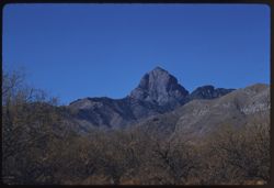
- Description:
- 100 f 8 tl
- Subject:
- Baboquivari Peak (Ariz.), Mountains, and Shrubs
- Series:
- 6-59
- Creator:
- Cushman, Charles W., 1896-1972
- Date Created:
- 1959-01-28
- Genre:
- Landscape photographs
- Frame Number:
- 22
- County:
- Pima
- Abstract:
- Baboquivari from [S] E
- Call Number:
- P10560
- Country:
- United States
- State/Province:
- Arizona
- Alternate Identifier:
- 659.22
- Persistent URL:
- http://purl.dlib.indiana.edu/iudl/archives/cushman/P10560
- Holding Location:
- Bloomington - University Archives
Wells Library E460
1320 E 10th St.
Bloomington, IN 47405
Contact at archives@indiana.edu, 812-855-1127
-
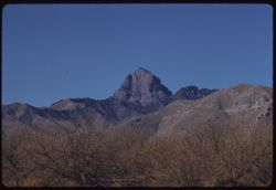
- Description:
- 100 f 8 tl
- Subject:
- Baboquivari Peak (Ariz.), Mountains, and Shrubs
- Series:
- 6-59
- Creator:
- Cushman, Charles W., 1896-1972
- Date Created:
- 1959-01-28
- Genre:
- Landscape photographs
- Frame Number:
- 21
- County:
- Pima
- Abstract:
- Baboquivari from [S] E
- Call Number:
- P10559
- Country:
- United States
- State/Province:
- Arizona
- Alternate Identifier:
- 659.21
- Persistent URL:
- http://purl.dlib.indiana.edu/iudl/archives/cushman/P10559
- Holding Location:
- Bloomington - University Archives
Wells Library E460
1320 E 10th St.
Bloomington, IN 47405
Contact at archives@indiana.edu, 812-855-1127
-
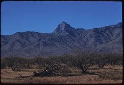
- Description:
- 100 f 8 tl
- Subject:
- Baboquivari Peak (Ariz.), Mountains, and Shrubs
- Series:
- 6-59
- Creator:
- Cushman, Charles W., 1896-1972
- Date Created:
- 1959-01-28
- Genre:
- Landscape photographs
- Frame Number:
- 20
- County:
- Pima
- Abstract:
- Baboquivari
- Call Number:
- P10558
- Country:
- United States
- State/Province:
- Arizona
- Alternate Identifier:
- 659.20
- Persistent URL:
- http://purl.dlib.indiana.edu/iudl/archives/cushman/P10558
- Holding Location:
- Bloomington - University Archives
Wells Library E460
1320 E 10th St.
Bloomington, IN 47405
Contact at archives@indiana.edu, 812-855-1127
-
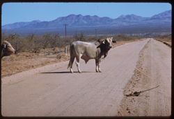
- Description:
- 100 f 6.3 tl
- Subject:
- Channels, Brawley Wash (Ariz.), Roads, Mountains, Shrubs, Electric lines, and Bulls
- Series:
- 6-59
- Creator:
- Cushman, Charles W., 1896-1972
- Date Created:
- 1959-01-28
- Genre:
- Identification photographs
- Frame Number:
- 19
- Street Address:
- Sasabe Road
- County:
- Pima
- Abstract:
- One B B
- Call Number:
- P10557
- Country:
- United States
- State/Province:
- Arizona
- Alternate Identifier:
- 659.19
- Persistent URL:
- http://purl.dlib.indiana.edu/iudl/archives/cushman/P10557
- Holding Location:
- Bloomington - University Archives
Wells Library E460
1320 E 10th St.
Bloomington, IN 47405
Contact at archives@indiana.edu, 812-855-1127
-
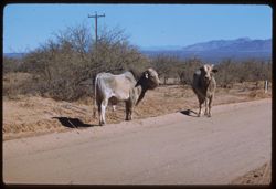
- Description:
- 100 f 6.3 tl
- Subject:
- Channels, Brawley Wash (Ariz.), Roads, Mountains, Shrubs, Electric lines, and Bulls
- Series:
- 6-59
- Creator:
- Cushman, Charles W., 1896-1972
- Date Created:
- 1959-01-28
- Genre:
- Identification photographs
- Frame Number:
- 18
- Street Address:
- Sasabe Road
- County:
- Pima
- Abstract:
- 2 Brahma bulls on Sasabe road
- Call Number:
- P10556
- Country:
- United States
- State/Province:
- Arizona
- Alternate Identifier:
- 659.18
- Persistent URL:
- http://purl.dlib.indiana.edu/iudl/archives/cushman/P10556
- Holding Location:
- Bloomington - University Archives
Wells Library E460
1320 E 10th St.
Bloomington, IN 47405
Contact at archives@indiana.edu, 812-855-1127
-
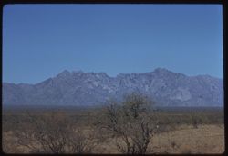
- Description:
- 100 f 9 tl
- Subject:
- Baboquivari Peak (Ariz.), Mountains, Shrubs, and Grasses
- Series:
- 6-59
- Creator:
- Cushman, Charles W., 1896-1972
- Date Created:
- 1959-01-28
- Genre:
- Landscape photographs
- Frame Number:
- 17
- County:
- Pima
- Abstract:
- Broadside view of Babo. range further north of PK.
- Call Number:
- P10555
- Country:
- United States
- State/Province:
- Arizona
- Alternate Identifier:
- 659.17
- Persistent URL:
- http://purl.dlib.indiana.edu/iudl/archives/cushman/P10555
- Holding Location:
- Bloomington - University Archives
Wells Library E460
1320 E 10th St.
Bloomington, IN 47405
Contact at archives@indiana.edu, 812-855-1127
-
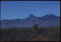
- Description:
- 100 f 8 tl
- Subject:
- Baboquivari Peak (Ariz.), Mountains, and Shrubs
- Series:
- 6-59
- Creator:
- Cushman, Charles W., 1896-1972
- Date Created:
- 1959-01-28
- Genre:
- Landscape photographs
- Frame Number:
- 16
- County:
- Pima
- Abstract:
- Baboquivari from the east, from farther south (7864' elev)
- Call Number:
- P10554
- Country:
- United States
- State/Province:
- Arizona
- Alternate Identifier:
- 659.16
- Persistent URL:
- http://purl.dlib.indiana.edu/iudl/archives/cushman/P10554
- Holding Location:
- Bloomington - University Archives
Wells Library E460
1320 E 10th St.
Bloomington, IN 47405
Contact at archives@indiana.edu, 812-855-1127
-
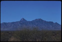
- Description:
- 100 f 8 tl
- Subject:
- Baboquivari Peak (Ariz.), Mountains, and Shrubs
- Series:
- 6-59
- Creator:
- Cushman, Charles W., 1896-1972
- Date Created:
- 1959-01-28
- Genre:
- Landscape photographs
- Frame Number:
- 15
- County:
- Pima
- Abstract:
- Baboquivari from the east
- Call Number:
- P10553
- Country:
- United States
- State/Province:
- Arizona
- Alternate Identifier:
- 659.15
- Persistent URL:
- http://purl.dlib.indiana.edu/iudl/archives/cushman/P10553
- Holding Location:
- Bloomington - University Archives
Wells Library E460
1320 E 10th St.
Bloomington, IN 47405
Contact at archives@indiana.edu, 812-855-1127
-
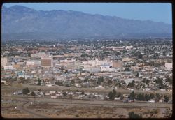
- Description:
- 100 f 6.3 tl
- Subject:
- Automobiles, Trees, Streets, Mountains, Buildings, Shrubs, Dwellings, and Cities & towns
- Series:
- 6-59
- Creator:
- Cushman, Charles W., 1896-1972
- Date Created:
- 1959-01-26
- Genre:
- Cityscape photographs
- Frame Number:
- 14
- County:
- Pima
- Abstract:
- Downtown Tucson seen from A Mountain
- Call Number:
- P10552
- City:
- Tucson
- Country:
- United States
- State/Province:
- Arizona
- Alternate Identifier:
- 659.14
- Persistent URL:
- http://purl.dlib.indiana.edu/iudl/archives/cushman/P10552
- Holding Location:
- Bloomington - University Archives
Wells Library E460
1320 E 10th St.
Bloomington, IN 47405
Contact at archives@indiana.edu, 812-855-1127
-
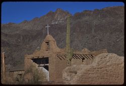
- Description:
- 100 f 9 tl
- Subject:
- Mud, Crosses, Cactus, Adobe buildings, Mountains, Churches, Shrubs, Tucson Mountains (Ariz.), and Walls
- Series:
- 6-59
- Creator:
- Cushman, Charles W., 1896-1972
- Date Created:
- 1959-01-26
- Genre:
- Architectural photographs
- Frame Number:
- 12
- County:
- Pima
- Abstract:
- Old Tucson - Mud Church
- Call Number:
- P10550
- City:
- Tucson
- Country:
- United States
- State/Province:
- Arizona
- Alternate Identifier:
- 659.12
- Persistent URL:
- http://purl.dlib.indiana.edu/iudl/archives/cushman/P10550
- Holding Location:
- Bloomington - University Archives
Wells Library E460
1320 E 10th St.
Bloomington, IN 47405
Contact at archives@indiana.edu, 812-855-1127
- « Previous
- Next »
- 1
- 2
- 3