
Search Constraints
You searched for:
Campus
IUB
Remove constraint Campus: IUB
Pages
0-99 pages
Remove constraint Pages: 0-99 pages
Subject
Shrubs
Remove constraint Subject: Shrubs
Subject
Rocks
Remove constraint Subject: Rocks
Subject
Roads
Remove constraint Subject: Roads
« Previous |
1 - 50 of 122
|
Next »
Search Results
-
- Description:
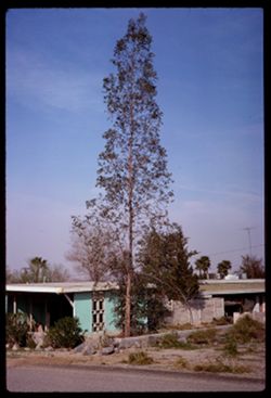
- 100 f 11
- Subject:
- Rocks, Houses, Trees, Shrubs, Porches, Palms, and Roads
- Series:
- 3-69
- Creator:
- Cushman, Charles W., 1896-1972
- Date Created:
- 1969-03-18
- Genre:
- Snapshots
- Frame Number:
- 2
- County:
- Riverside
- Abstract:
- Tall spindly tree
- Call Number:
- P15756
- City:
- Palm Springs
- Country:
- United States
- State/Province:
- California
- Alternate Identifier:
- 369.2
- Persistent URL:
- http://purl.dlib.indiana.edu/iudl/archives/cushman/P15756
-
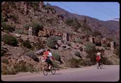
- Description:
- 100 f 11 TL
- Subject:
- Rocks, Families, Children, Valleys, Electric lines, Roads, Trees, Bicycles & tricycles, Palm Canyon (Calif.), Shrubs, and Mountains
- Series:
- 2-69
- Creator:
- Cushman, Charles W., 1896-1972
- Date Created:
- 1969-03-16
- Genre:
- Snapshots
- Frame Number:
- 29
- County:
- Riverside
- Call Number:
- P15746
- Country:
- United States
- State/Province:
- California
- Alternate Identifier:
- 269.29
- Persistent URL:
- http://purl.dlib.indiana.edu/iudl/archives/cushman/P15746
-
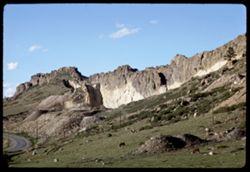
- Description:
- 100 f 11 tl
- Subject:
- Rocks, Cliffs, Grazing, Mining, Cattle, Mountains, Rock formations, Utility poles, Roads, and Shrubs
- Series:
- 9-66
- Creator:
- Cushman, Charles W., 1896-1972
- Date Created:
- 1966-06-14
- Genre:
- Landscape photographs
- Frame Number:
- 22
- Street Address:
- Colorado State Highway 93
- County:
- Jefferson and Boulder
- Call Number:
- P15425
- City:
- Golden and Boulder
- Country:
- United States
- State/Province:
- Colorado
- Alternate Identifier:
- 966.22
- Persistent URL:
- http://purl.dlib.indiana.edu/iudl/archives/cushman/P15425
-

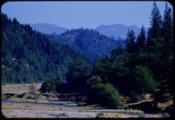
- Description:
- 100 f 13
- Subject:
- Rocks, Grasses, Roads, Mountains, Shrubs, Bridges, Animas River (Colo. and N.M.), and Rivers
- Series:
- 34-65
- Creator:
- Cushman, Charles W., 1896-1972
- Date Created:
- 1965-10-03
- Genre:
- Landscape photographs
- Frame Number:
- 12
- County:
- La Plata
- Abstract:
- Animas river below Durango
- Call Number:
- P15004
- City:
- Durango
- Country:
- United States
- State/Province:
- Colorado
- Alternate Identifier:
- 3465.12
- Persistent URL:
- http://purl.dlib.indiana.edu/iudl/archives/cushman/P15004
-
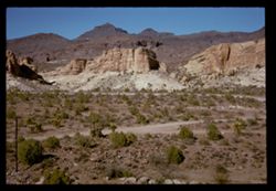
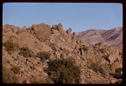
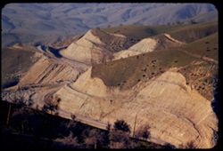
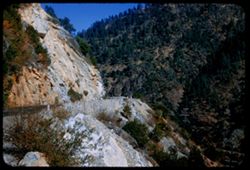
- Description:
- 100 f 11 SL
- Subject:
- Rocks, Erosion, Cliffs, Buttes, Mountains, Shrubs, Hills, Roads, and Rock formations
- Series:
- 5-62
- Creator:
- Cushman, Charles W., 1896-1972
- Date Created:
- 1962-10-07
- Genre:
- Landscape photographs
- Frame Number:
- 20
- Street Address:
- Sitgreaves Pass
- County:
- Mohave
- Abstract:
- Light + dark rock
- Call Number:
- P12787
- Country:
- United States
- State/Province:
- Arizona
- Alternate Identifier:
- 562.20
- Persistent URL:
- http://purl.dlib.indiana.edu/iudl/archives/cushman/P12787
-
- Description:
- 100 f 6.3 TL
- Subject:
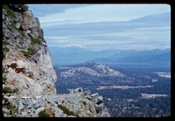
- Rocks, Roads, Trees, Mountains, Shrubs, Lakes & ponds, Clouds, Sierra Nevada (Calif. and Nev.), Forests, Hills, Echo Summit (El Dorado County, Calif.), a...
- Series:
- 3-62
- Creator:
- Cushman, Charles W., 1896-1972
- Date Created:
- 1962-09-28
- Genre:
- Landscape photographs
- Frame Number:
- 11
- Street Address:
- United States Highway 50
- Abstract:
- Toward Lake Tahoe.
- Call Number:
- P12709
- Country:
- United States
- State/Province:
- California
- Alternate Identifier:
- 362.11
- Persistent URL:
- http://purl.dlib.indiana.edu/iudl/archives/cushman/P12709
-
- Description:
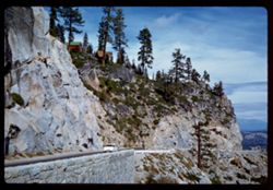
- 100 f 6.3 SL
- Subject:
- Walls, Railings, Roads, Automobiles, Trees, Mountains, Shrubs, Sierra Nevada (Calif. and Nev.), Stone walls, Rocks, Houses, and Echo Summit (El Dorado County...
- Series:
- 3-62
- Creator:
- Cushman, Charles W., 1896-1972
- Date Created:
- 1962-09-28
- Genre:
- Landscape photographs
- Frame Number:
- 7
- Street Address:
- United States Highway 50
- Abstract:
- Wall above US 50.
- Call Number:
- P12705
- Country:
- United States
- State/Province:
- California
- Alternate Identifier:
- 362.7
- Persistent URL:
- http://purl.dlib.indiana.edu/iudl/archives/cushman/P12705
-
- Description:
- 100 f 6.3 TL
- Subject:
- Rocks, Roads, Trees, San Jacinto Mountains (Calif.), San Bernardino National Forest (Calif.), Mountains, Rock formations, and Shrubs
- Series:
- 24-61
- Creator:
- Cushman, Charles W., 1896-1972
- Date Created:
- 1961-12-27
- Genre:
- Landscape photographs
- Frame Number:
- 20
- Street Address:
- California State Highway 74
- County:
- Riverside
- Abstract:
- San Jacinto Mountains in San Bernardino Nat'l Forest and Mtns in San Bernardino Natl Forest - from Cal 74
- Call Number:
- P12586
- Country:
- United States
- State/Province:
- California
- Alternate Identifier:
- 2461.20
- Persistent URL:
- http://purl.dlib.indiana.edu/iudl/archives/cushman/P12586
-
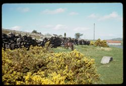
- Description:
- 100 f 5.6
- Subject:
- Rocks, Ponies, Grasses, Dartmoor (England), Grazing, Flowers, Meadows, Buildings, Shrubs, Utility poles, Stone walls, Moors (Wetlands), and Roads
- Series:
- 6-61
- Creator:
- Cushman, Charles W., 1896-1972
- Date Created:
- 1961-05-08
- Genre:
- Snapshots, Views, and Identification photographs
- Frame Number:
- 10
- County:
- Devon
- Abstract:
- Dartmoor Pony
- Call Number:
- P11909
- Country:
- United Kingdom
- State/Province:
- England
- Alternate Identifier:
- 661.10
- Persistent URL:
- http://purl.dlib.indiana.edu/iudl/archives/cushman/P11909
-
- Description:
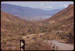
- 100 f 6.3 tl
- Subject:
- Rocks, Roads, Cactus, Cities & towns, Buildings, Gates Pass (Ariz.), Traffic signs & signals, Clouds, Dwellings, Mountains, Shrubs, and Tucson Mounta...
- Series:
- 8-59
- Creator:
- Cushman, Charles W., 1896-1972
- Date Created:
- 1959-02-11
- Genre:
- Cityscape photographs
- Frame Number:
- 2
- County:
- Pima
- Abstract:
- Tucson seen from Gates Pass in Tucson Mtns.
- Call Number:
- P10616
- City:
- Tucson
- Country:
- United States
- State/Province:
- Arizona
- Alternate Identifier:
- 859.2
- Persistent URL:
- http://purl.dlib.indiana.edu/iudl/archives/cushman/P10616
-
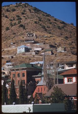
- Description:
- 100 f 6.3 tl
- Subject:
- Walls, Roads, Automobiles, Trees, Buildings, Shrubs, Dwellings, Hills, and Rocks
- Series:
- 7-59
- Creator:
- Cushman, Charles W., 1896-1972
- Date Created:
- 1959-02-06
- Genre:
- Cityscape photographs
- Frame Number:
- 34
- County:
- Cochise
- Abstract:
- Bisbee
- Call Number:
- P10610
- City:
- Bisbee
- Country:
- United States
- State/Province:
- Arizona
- Alternate Identifier:
- 759.34
- Persistent URL:
- http://purl.dlib.indiana.edu/iudl/archives/cushman/P10610
-
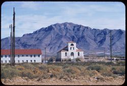
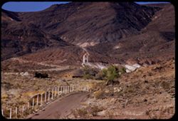
- Description:
- 100 f 8 tl
- Subject:
- Franklin Mountains (Tex. and N.M.), Electric lines, Roads, Arches, Mountains, Buildings, Shrubs, Windows, Utility poles, Doors & doorways, Rocks, and Chu...
- Series:
- 5-59
- Creator:
- Cushman, Charles W., 1896-1972
- Date Created:
- 1959-01-21
- Genre:
- Landscape photographs and Architectural photographs
- Frame Number:
- 11
- County:
- El Paso
- Abstract:
- Little church below Franklin Mts. NW of El Paso
- Call Number:
- P10512
- City:
- El Paso
- Country:
- United States
- State/Province:
- Texas
- Alternate Identifier:
- 559.11
- Persistent URL:
- http://purl.dlib.indiana.edu/iudl/archives/cushman/P10512
-
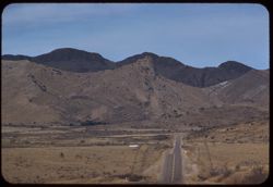
- Description:
- 100 f 6.3 tl
- Subject:
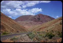
- Rocks, Roads, Davis Mountains (Tex.), Signs (Notices), Mountains, Fences, and Shrubs
- Series:
- 4-59
- Creator:
- Cushman, Charles W., 1896-1972
- Date Created:
- 1959-01-19
- Genre:
- Landscape photographs
- Frame Number:
- 35
- County:
- Jeff Davis and Brewster
- Abstract:
- Toward Davis Mtns.
- Call Number:
- P10499
- City:
- Fort Davis and Alpine
- Country:
- United States
- State/Province:
- Texas
- Alternate Identifier:
- 459.35
- Persistent URL:
- http://purl.dlib.indiana.edu/iudl/archives/cushman/P10499
-
- Description:
- 50 f 8 sl
- Subject:
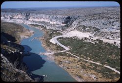
- Rocks, Canyons, Roads, Shrubs, Rivers, and Pecos River (N.M. and Tex.)
- Series:
- 4-59
- Creator:
- Cushman, Charles W., 1896-1972
- Date Created:
- 1959-01-18
- Genre:
- Landscape photographs
- Frame Number:
- 30
- Street Address:
- United States Highway 90
- Abstract:
- Pecos river canyon below Hwy 90 bridge
- Call Number:
- P10494
- Country:
- United States
- State/Province:
- Texas
- Alternate Identifier:
- 459.30
- Persistent URL:
- http://purl.dlib.indiana.edu/iudl/archives/cushman/P10494
-
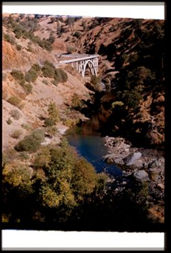
- Description:
- 100 f 6.3 SL
- Subject:
- Rocks, Canyons, Roads, Malheur Canyon (Or.), Volcanic rock, Mountains, Shrubs, and Clouds
- Series:
- 11-58
- Creator:
- Cushman, Charles W., 1896-1972
- Date Created:
- 1958-06-14
- Genre:
- Landscape photographs
- Frame Number:
- 10
- County:
- Malheur and Harney
- Abstract:
- Great red hunk
- Call Number:
- P09985
- City:
- Burns
- Country:
- United States
- State/Province:
- Oregon
- Alternate Identifier:
- 1158.10
- Persistent URL:
- http://purl.dlib.indiana.edu/iudl/archives/cushman/P09985
-
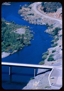
- Description:
- 100 f 5.6 tl
- Subject:
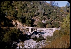
- Roads, Bridges, Shrubs, Trees, Rocks, Feather River (Calif.), and Rivers
- Series:
- 18-55
- Creator:
- Cushman, Charles W., 1896-1972
- Date Created:
- 1955-06-19
- Genre:
- Views
- Frame Number:
- 38
- County:
- Butte
- Abstract:
- Looking down from same pt.
- Call Number:
- P08152
- City:
- Big Bend
- Country:
- United States
- State/Province:
- California
- Alternate Identifier:
- 1855.38
- Persistent URL:
- http://purl.dlib.indiana.edu/iudl/archives/cushman/P08152
-
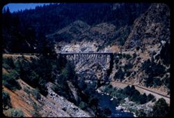
- Description:
- 100 f 6 tl
- Subject:
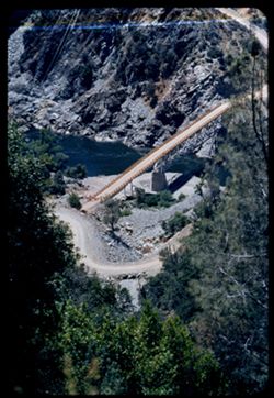
- Rocks, Roads, Feather River (Calif.), Trees, Railroad bridges, Western Pacific Railroad Company, Shrubs, Bridges, Railroad tracks, and Utility poles
- Series:
- 18-55
- Creator:
- Cushman, Charles W., 1896-1972
- Date Created:
- 1955-06-19
- Genre:
- Architectural photographs
- Frame Number:
- 36
- County:
- Butte
- Abstract:
- The twin bridges from south
- Call Number:
- P08150
- City:
- Pulga
- Country:
- United States
- State/Province:
- California
- Alternate Identifier:
- 1855.36
- Persistent URL:
- http://purl.dlib.indiana.edu/iudl/archives/cushman/P08150
-
- Description:
- 100 f 5.6 sl
- Subject:
- Rocks, Roads, Feather River (Calif.), Trees, Railroad bridges, Western Pacific Railroad Company, Mountains, Shrubs, Bridges, Railroad tracks, and Rivers
- Series:
- 18-55
- Creator:
- Cushman, Charles W., 1896-1972
- Date Created:
- 1955-06-19
- Genre:
- Architectural photographs
- Frame Number:
- 35
- Street Address:
- United States Highway 40
- County:
- Butte
- Abstract:
- The real McCoy-near Pulga [66363 mi.]
- Call Number:
- P08149
- City:
- Pulga
- Country:
- United States
- State/Province:
- California
- Alternate Identifier:
- 1855.35
- Persistent URL:
- http://purl.dlib.indiana.edu/iudl/archives/cushman/P08149
-
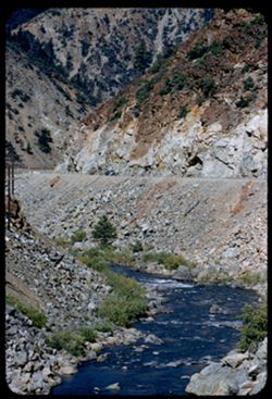
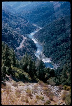
- Description:
- 100 f 5.6 tl
- Subject:
- Rocks, Canyons, Roads, Feather River (Calif.), Automobiles, Mountains, Shrubs, Rapids, and Rivers
- Series:
- 18-55
- Creator:
- Cushman, Charles W., 1896-1972
- Date Created:
- 1955-06-19
- Genre:
- Landscape photographs
- Frame Number:
- 23
- Street Address:
- United States Highway 40
- County:
- Plumas
- Abstract:
- View down canyon on curve
- Call Number:
- P08139
- Country:
- United States
- State/Province:
- California
- Alternate Identifier:
- 1855.23
- Persistent URL:
- http://purl.dlib.indiana.edu/iudl/archives/cushman/P08139
-
- Description:
- 100 f 5.6 tl
- Subject:
- Rocks, Roads, Automobiles, Trees, Shasta Dam (Calif.), Shrubs, Bridges, Facilities, Rivers, and Sacramento River (Calif.)
- Series:
- 17-55
- Creator:
- Cushman, Charles W., 1896-1972
- Date Created:
- 1955-06-16
- Genre:
- Views
- Frame Number:
- 18
- County:
- Shasta
- Abstract:
- Looking down on small bridge across river below dam
- Call Number:
- P08098
- Country:
- United States
- State/Province:
- California
- Alternate Identifier:
- 1755.18
- Persistent URL:
- http://purl.dlib.indiana.edu/iudl/archives/cushman/P08098
-
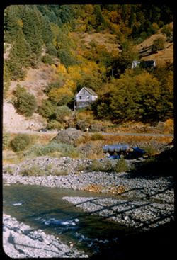
- Description:
- 100 f 5.6 tl
- Subject:
- Trinity River (Calif.), Electric lines, Roads, Trinity Mountains (Calif.), Trees, Mountains, Shrubs, Cabins, Hills, Rivers, Rocks, and Weaver Creek (Trinity ...
- Series:
- 16-55
- Creator:
- Cushman, Charles W., 1896-1972
- Date Created:
- 1955-06-15
- Genre:
- Landscape photographs
- Frame Number:
- 35
- County:
- Trinity
- Abstract:
- View north up Weaver Creek from its mouth at Trinity river
- Call Number:
- P08079
- City:
- Douglas City
- Country:
- United States
- State/Province:
- California
- Alternate Identifier:
- 1655.35
- Persistent URL:
- http://purl.dlib.indiana.edu/iudl/archives/cushman/P08079
-
- Description:
- 100 f 4.5 tl
- Subject:
- Rocks, Roads, Tehachapi Mountains (Calif.), Trails & paths, Trees, Mountains, Shrubs, Railroad tracks, Utility poles, and Southern Pacific Railroad Company
- Series:
- 12-55
- Creator:
- Cushman, Charles W., 1896-1972
- Date Created:
- 1955-03-24
- Genre:
- Landscape photographs
- Frame Number:
- 18
- County:
- Kern
- Abstract:
- S P curves, [cut] and tunnel mouth from same vantage point
- Call Number:
- P07914
- City:
- Keene
- Country:
- United States
- State/Province:
- California
- Alternate Identifier:
- 1255.18
- Persistent URL:
- http://purl.dlib.indiana.edu/iudl/archives/cushman/P07914
-
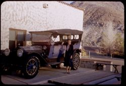
- Subject:
- Rocks, Benches, Roads, Spouses, Automobiles, Trees, Mountains, Shrubs, Scotty's Castle (Calif.), Death Valley (Calif. and Nev.), Castles & palaces, P...
- Series:
- 11-55
- Creator:
- Cushman, Charles W., 1896-1972
- Date Created:
- 1955-03-23
- Genre:
- Portraits and Identification photographs
- Frame Number:
- 37
- County:
- Inyo
- Persons Pictured:
- Cushman, Jean
- Abstract:
- Jean with old Packard touring car
- Call Number:
- P07896
- Country:
- United States
- State/Province:
- California
- Alternate Identifier:
- 1155.37
- Persistent URL:
- http://purl.dlib.indiana.edu/iudl/archives/cushman/P07896
-
- Description:
- 100 f 8 tl
- Subject:
- Towers, Roads, Trees, Mountains, Buildings, Shrubs, Scotty's Castle (Calif.), Death Valley (Calif. and Nev.), Castles & palaces, and Rocks
- Series:
- 11-55
- Creator:
- Cushman, Charles W., 1896-1972
- Date Created:
- 1955-03-23
- Genre:
- Landscape photographs
- Frame Number:
- 27
- County:
- Inyo
- Abstract:
- First view of Scott's Tower
- Call Number:
- P07886
- Country:
- United States
- State/Province:
- California
- Alternate Identifier:
- 1155.27
- Persistent URL:
- http://purl.dlib.indiana.edu/iudl/archives/cushman/P07886
-
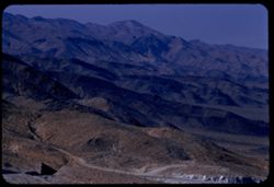
- Description:
- 100 f 8 tl
- Subject:
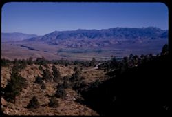
- Rocks, Valleys, Roads, Argus Range (Calif.), Emigrant Pass (Inyo County, Calif.), Mountains, Shrubs, and Panamint Valley (Calif.)
- Series:
- 7-55
- Creator:
- Cushman, Charles W., 1896-1972
- Date Created:
- 1955-03-21
- Genre:
- Landscape photographs
- Frame Number:
- 34
- County:
- Inyo
- Abstract:
- NW along Argus mtns at west side of Panamint Valley from Emigrant pass.
- Call Number:
- P07758
- Country:
- United States
- State/Province:
- California
- Alternate Identifier:
- 755.34
- Persistent URL:
- http://purl.dlib.indiana.edu/iudl/archives/cushman/P07758
-
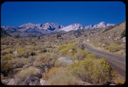
- Description:
- 100 f 6.3 tl
- Subject:
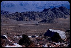
- Rocks, Roads, Trails & paths, Mountains, Shrubs, Alabama Hills (Calif.), and Rock formations
- Series:
- 4-55
- Creator:
- Cushman, Charles W., 1896-1972
- Date Created:
- 1955-02-28
- Genre:
- Landscape photographs
- Frame Number:
- 1
- Street Address:
- Mount Whitney Road
- County:
- Inyo
- Abstract:
- Alabama Hills from Mt Whitney road
- Call Number:
- P07630
- Country:
- United States
- State/Province:
- California
- Alternate Identifier:
- 455.1
- Persistent URL:
- http://purl.dlib.indiana.edu/iudl/archives/cushman/P07630
-
- Description:
- 100 f 5.6 tl
- Subject:
- Isabella Lake (Calif. : Lake), Isabella Main Dam (Calif.), Roads, Bridges, Mountains, Dirt roads, Utility poles, Snow, Trees, Rocks, and Shrubs
- Series:
- 2-55
- Creator:
- Cushman, Charles W., 1896-1972
- Date Created:
- 1955-02-26
- Genre:
- Landscape photographs
- Frame Number:
- 16
- County:
- Kern
- Abstract:
- View S by E from Isabella dam
- Call Number:
- P07574
- Country:
- United States
- State/Province:
- California
- Alternate Identifier:
- 255.16
- Persistent URL:
- http://purl.dlib.indiana.edu/iudl/archives/cushman/P07574
-
- Description:
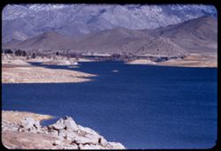
- 100 f 5.6
- Subject:
- Rocks, Reservoirs, Roads, Isabella Lake (Calif. : Lake), Mountains, Shrubs, Sierra Nevada (Calif. and Nev.), and Hills
- Series:
- 2-55
- Creator:
- Cushman, Charles W., 1896-1972
- Date Created:
- 1955-02-26
- Genre:
- Landscape photographs
- Frame Number:
- 15
- County:
- Kern
- Abstract:
- NE across Isabella Reservoir at noon
- Call Number:
- P07573
- Country:
- United States
- State/Province:
- California
- Alternate Identifier:
- 255.15
- Persistent URL:
- http://purl.dlib.indiana.edu/iudl/archives/cushman/P07573
-
- Description:
- 50 f 10
- Subject:
- Rocks, Road cuts, Canyons, Roads, Feather River (Calif.), Trees, Shrubs, and Hills
- Series:
- 15-54
- Creator:
- Cushman, Charles W., 1896-1972
- Date Created:
- 1954-10-11
- Genre:
- Landscape photographs
- Frame Number:
- 6
- Street Address:
- United States Highway 40
- County:
- Butte
- Abstract:
- View No. on US 40 Alt.
- Call Number:
- P07485
- City:
- Pulga
- Country:
- United States
- State/Province:
- California
- Alternate Identifier:
- 1554.6
- Persistent URL:
- http://purl.dlib.indiana.edu/iudl/archives/cushman/P07485
-
- Description:
- 50 f 5.6
- Subject:
- Rocks, Canyons, Roads, Trees, Shrubs, Rapids, Feather River Canyon (Calif.), and Rivers
- Series:
- 15-54
- Creator:
- Cushman, Charles W., 1896-1972
- Date Created:
- 1954-10-11
- Genre:
- Landscape photographs
- Frame Number:
- 3
- County:
- Butte
- Abstract:
- View southward down into canyon a few miles above Big Bend.
- Call Number:
- P07482
- City:
- Big Bend
- Country:
- United States
- State/Province:
- California
- Alternate Identifier:
- 1554.3
- Persistent URL:
- http://purl.dlib.indiana.edu/iudl/archives/cushman/P07482
-
- Description:
- 50 f 8+
- Subject:
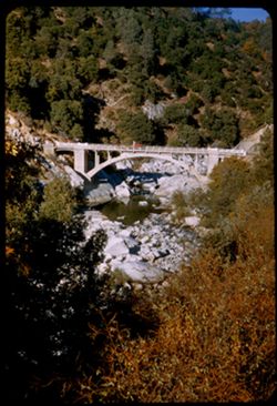
- Concrete, Bridges, Arched, Reflections, Arches, Roads, Bridges, Shrubs, Trees, Rocks, Feather River (Calif.), Rivers, and Road cuts
- Series:
- 14-54
- Creator:
- Cushman, Charles W., 1896-1972
- Date Created:
- 1954-10-11
- Genre:
- Landscape photographs
- Frame Number:
- 38
- Street Address:
- United States Highway 40
- County:
- Butte
- Abstract:
- High concrete arch bridge (from south) across W. Br. Feather nr its mouth.
- Call Number:
- P07478
- Country:
- United States
- State/Province:
- California
- Physical Description:
- gap between film and mount. Image was originally mounted in a glass enclosure. Before digitization, the image was removed and placed in a Wess Plastic, Inc. ...
- Alternate Identifier:
- 1454.38
- Persistent URL:
- http://purl.dlib.indiana.edu/iudl/archives/cushman/P07478
-
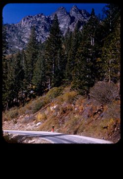
- Description:
- 50 f 8
- Subject:
- Big Springs (Sierra County, Calif.), Roads, People, Shrubs, Walking, Rocks, Sierra Buttes (Calif.), Buttes, Trees, and Pines
- Series:
- 14-54
- Creator:
- Cushman, Charles W., 1896-1972
- Date Created:
- 1954-10-10
- Genre:
- Landscape photographs
- Frame Number:
- 18
- Street Address:
- California State Highway 49
- County:
- Sierra
- Abstract:
- View up toward top of scenic Buttes from along side Big Spring.
- Call Number:
- P07460
- City:
- Sierra City
- Country:
- United States
- State/Province:
- California
- Physical Description:
- masked.
- Alternate Identifier:
- 1454.18
- Persistent URL:
- http://purl.dlib.indiana.edu/iudl/archives/cushman/P07460
-

- Description:
- 50 f 8
- Subject:
- Rocks, Roads, Trees, Buttes, Sierra Buttes (Calif.), and Shrubs
- Series:
- 14-54
- Creator:
- Cushman, Charles W., 1896-1972
- Date Created:
- 1954-10-10
- Genre:
- Landscape photographs
- Frame Number:
- 16
- Street Address:
- California State Highway 49
- County:
- Sierra
- Abstract:
- Top of Sierra Buttes (elev. 8615 ft.) seen from NE.
- Call Number:
- P07458
- City:
- Sierra City
- Country:
- United States
- State/Province:
- California
- Alternate Identifier:
- 1454.16
- Persistent URL:
- http://purl.dlib.indiana.edu/iudl/archives/cushman/P07458
-
- Description:
- 50 f 8
- Subject:
- Rocks, Houses, Automobiles, Trees, Storage tanks, Rock formations, Hills, Yuba River (Calif.), Rivers, Roads, and Shrubs
- Series:
- 14-54
- Creator:
- Cushman, Charles W., 1896-1972
- Date Created:
- 1954-10-10
- Genre:
- Landscape photographs
- Frame Number:
- 10
- County:
- Sierra
- Abstract:
- Yuba river at Downieville.
- Call Number:
- P07452
- City:
- Downieville
- Country:
- United States
- State/Province:
- California
- Alternate Identifier:
- 1454.10
- Persistent URL:
- http://purl.dlib.indiana.edu/iudl/archives/cushman/P07452
-
- Description:
- 50 f 8
- Subject:
- Bridges, Arched, Roads, Automobiles, Trees, Arches, Shrubs, Bridges, Hills, Yuba River (Calif.), Rivers, Rocks, and Concrete
- Series:
- 14-54
- Creator:
- Cushman, Charles W., 1896-1972
- Date Created:
- 1954-10-09
- Genre:
- Architectural photographs
- Frame Number:
- 5
- Street Address:
- California State Highway 49
- County:
- Nevada
- Abstract:
- Concrete arch bridge of Cal 49 over South Yuba NW of Nevada City.
- Call Number:
- P07447
- City:
- Nevada City
- Country:
- United States
- State/Province:
- California
- Alternate Identifier:
- 1454.5
- Persistent URL:
- http://purl.dlib.indiana.edu/iudl/archives/cushman/P07447
-
- Description:
- 50 f 8
- Subject:
- Concrete, Yuba River (Calif.), Bridges, Arched, Hills, Automobiles, Arches, Roads, Bridges, Shrubs, Trees, Rocks, and Rivers
- Series:
- 14-54
- Creator:
- Cushman, Charles W., 1896-1972
- Date Created:
- 1954-10-09
- Genre:
- Architectural photographs
- Frame Number:
- 4
- Street Address:
- California State Highway 49
- County:
- Nevada
- Abstract:
- Concrete arch bridge of Cal 49 over South Yuba NW of Nevada City.
- Call Number:
- P07446
- City:
- Nevada City
- Country:
- United States
- State/Province:
- California
- Alternate Identifier:
- 1454.4
- Persistent URL:
- http://purl.dlib.indiana.edu/iudl/archives/cushman/P07446
-
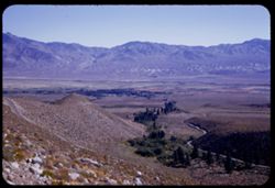
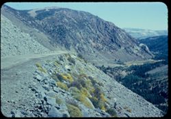
- Description:
- 50 f 11 HF
- Subject:
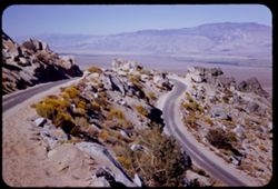
- Valleys, Inyo Mountains (Calif.), Mountains, Owens Valley (Calif.), Deserts, Shrubs, Roads, and Rocks
- Series:
- 12-54
- Creator:
- Cushman, Charles W., 1896-1972
- Date Created:
- 1954-09-18
- Genre:
- Landscape photographs
- Frame Number:
- 27
- Street Address:
- Mt. Whitney Road
- County:
- Inyo
- Abstract:
- Switch-back coming down Mt Whitney rd.
- Call Number:
- P07417
- Country:
- United States
- State/Province:
- California
- Alternate Identifier:
- 1254.27
- Persistent URL:
- http://purl.dlib.indiana.edu/iudl/archives/cushman/P07417
-
- Description:
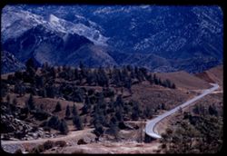
- 50 f 7.5
- Subject:
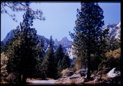
- Roads, Whitney, Mount (Calif.), Mountains, Shrubs, Trees, and Rocks
- Series:
- 12-54
- Creator:
- Cushman, Charles W., 1896-1972
- Date Created:
- 1954-09-18
- Genre:
- Landscape photographs
- Frame Number:
- 23
- Street Address:
- Mt. Whitney Road
- County:
- Inyo
- Abstract:
- Closest to Mt Whitney - backlighted.
- Call Number:
- P07413
- Country:
- United States
- State/Province:
- California
- Physical Description:
- Image was originally mounted in a glass enclosure. Before digitization, the image was removed and placed in a Wess Plastic, Inc. brand, 2" x 2", pl...
- Alternate Identifier:
- 1254.23
- Persistent URL:
- http://purl.dlib.indiana.edu/iudl/archives/cushman/P07413
-
- Description:
- 50 f 8
- Subject:
- Deserts, Valleys, Glacier Lodge (Calif.), Roads, Mountains, Shrubs, Trees, Rocks, and Owens Valley (Calif.)
- Series:
- 12-54
- Creator:
- Cushman, Charles W., 1896-1972
- Date Created:
- 1954-09-18
- Genre:
- Landscape photographs
- Frame Number:
- 12
- Street Address:
- Glacier Lodge Road
- County:
- Inyo
- Abstract:
- Looking down on Big Pine from Glacier Lodge road.
- Call Number:
- P07402
- City:
- Big Pine
- Country:
- United States
- State/Province:
- California
- Alternate Identifier:
- 1254.12
- Persistent URL:
- http://purl.dlib.indiana.edu/iudl/archives/cushman/P07402
-
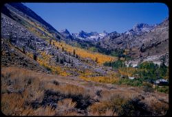
- Description:
- 50 f 9
- Subject:
- Sabrina, Lake (Calif.), Canyons, Roads, Settlements, Mountains, Shrubs, Sierra Nevada (Calif. and Nev.), Trees, Rocks, Bishop Creek Canyon (Calif.), and Dwel...
- Series:
- 11-54
- Creator:
- Cushman, Charles W., 1896-1972
- Date Created:
- 1954-09-17
- Genre:
- Landscape photographs
- Frame Number:
- 17
- County:
- Inyo
- Abstract:
- Back up Bishop Creek canyon in fall color.
- Call Number:
- P07386
- Country:
- United States
- State/Province:
- California
- Alternate Identifier:
- 1154.17
- Persistent URL:
- http://purl.dlib.indiana.edu/iudl/archives/cushman/P07386
-
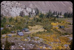
- Description:
- 50 f 8
- Subject:
- Rocks, Canyons, Roads, Settlements, Trees, Shrubs, Dwellings, and Bishop Creek Canyon (Calif.)
- Series:
- 11-54
- Creator:
- Cushman, Charles W., 1896-1972
- Date Created:
- 1954-09-17
- Genre:
- Landscape photographs
- Frame Number:
- 16
- County:
- Inyo
- Abstract:
- Looking down on little old mini settlement.
- Call Number:
- P07385
- City:
- Bishop
- Country:
- United States
- State/Province:
- California
- Alternate Identifier:
- 1154.16
- Persistent URL:
- http://purl.dlib.indiana.edu/iudl/archives/cushman/P07385
-
- Description:
- 50 f 9
- Subject:
- Flowers, Hills, Roads, Mountains, Shrubs, Sierra Nevada (Calif. and Nev.), Trees, Rocks, and Grasses
- Series:
- 11-54
- Creator:
- Cushman, Charles W., 1896-1972
- Date Created:
- 1954-09-17
- Genre:
- Landscape photographs
- Frame Number:
- 5
- Street Address:
- Sabrina Lake Road
- County:
- Inyo
- Abstract:
- High Sierra seen from Sabrina Lake road SW of Bishop.
- Call Number:
- P07374
- City:
- Bishop
- Country:
- United States
- State/Province:
- California
- Alternate Identifier:
- 1154.5
- Persistent URL:
- http://purl.dlib.indiana.edu/iudl/archives/cushman/P07374
-
- Description:
- 50 f 8 Haze F
- Subject:
- Valleys, Rocks, Bishop Peak (Calif.), Mountains, Trees, Owens Valley (Calif.), Shadows, Shrubs, and Roads
- Series:
- 11-54
- Creator:
- Cushman, Charles W., 1896-1972
- Date Created:
- 1954-09-16
- Genre:
- Landscape photographs
- Frame Number:
- 4
- Street Address:
- United States Highway 395, United States Highway 6/395, and California State Highway 14
- County:
- Inyo
- Abstract:
- View south toward Owens valley where Bishop lies.
- Call Number:
- P07373
- Country:
- United States
- State/Province:
- California
- Alternate Identifier:
- 1154.4
- Persistent URL:
- http://purl.dlib.indiana.edu/iudl/archives/cushman/P07373
-
- Description:
- 50 f 8
- Subject:
- Rocks, Valleys, Lee Vining Canyon (Calif.), Roads, Mono Basin (Calif.), Trees, Lee Vining Creek (Calif.), Mountains, Shrubs, and Canyons
- Series:
- 10-54
- Creator:
- Cushman, Charles W., 1896-1972
- Date Created:
- 1954-09-16
- Genre:
- Landscape photographs
- Frame Number:
- 22
- County:
- Mono
- Abstract:
- Another view east down canyon - a little vurther along.
- Call Number:
- P07369
- Country:
- United States
- State/Province:
- California
- Physical Description:
- Anscochrome film.
- Alternate Identifier:
- 1054.22
- Persistent URL:
- http://purl.dlib.indiana.edu/iudl/archives/cushman/P07369
-
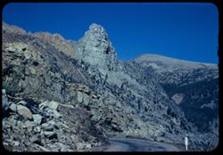
- Description:
- 50 f 9
- Subject:
- Rocks, Roads, Trees, Buttes, Signs (Notices), Tioga Pass (Calif.), Mountains, Rock formations, and Shrubs
- Series:
- 10-54
- Creator:
- Cushman, Charles W., 1896-1972
- Date Created:
- 1954-09-16
- Genre:
- Landscape photographs
- Frame Number:
- 12
- Street Address:
- California State Highway 140 and Tioga Pass Road
- County:
- Mono
- Abstract:
- Granite [pinnacle?] on downgrade of Tioga Pass road.
- Call Number:
- P07359
- Country:
- United States
- State/Province:
- California
- Physical Description:
- Anscochrome film.
- Alternate Identifier:
- 1054.12
- Persistent URL:
- http://purl.dlib.indiana.edu/iudl/archives/cushman/P07359
-
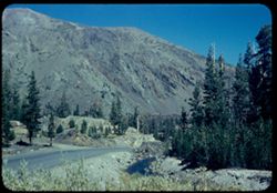
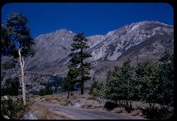
- Description:
- 50 f 8.8
- Subject:
- Yosemite National Park (Calif.), Tioga Peak (Calif.), Mountains, Trees, Streams, Shrubs, Roads, Rocks, and Tioga Pass (Calif.)
- Series:
- 10-54
- Creator:
- Cushman, Charles W., 1896-1972
- Date Created:
- 1954-09-16
- Genre:
- Landscape photographs
- Frame Number:
- 9
- County:
- Mono
- Abstract:
- Great red brown mtn next to Tioga Pk.
- Call Number:
- P07356
- Country:
- United States
- State/Province:
- California
- Physical Description:
- Anscochrome film.
- Alternate Identifier:
- 1054.9
- Persistent URL:
- http://purl.dlib.indiana.edu/iudl/archives/cushman/P07356
-
- Description:
- 50 f 9
- Subject:
- Rocks, Canyons, Grasses, Roads, Yosemite National Park (Calif.), Trees, Pines, Lee Vining Creek (Calif.), Tioga Peak (Calif.), Tioga Pass (Calif.), Mountains...
- Series:
- 9-54
- Creator:
- Cushman, Charles W., 1896-1972
- Date Created:
- 1954-09-16
- Genre:
- Landscape photographs
- Frame Number:
- 30
- Street Address:
- Tioga Pass Road
- County:
- Mono
- Abstract:
- Tioga Peak from east. 11,537 ft.
- Call Number:
- P07341
- Country:
- United States
- State/Province:
- California
- Alternate Identifier:
- 954.30
- Persistent URL:
- http://purl.dlib.indiana.edu/iudl/archives/cushman/P07341
-
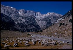
- Description:
- 50 f 10
- Subject:
- Sheep, Lee Vining Creek (Calif.), Deserts, Dana Plateau (Calif.), Roads, Mountains, Yosemite National Park (Calif.), Shrubs, Trees, Rocks, Grazing, Grasses, ...
- Series:
- 9-54
- Creator:
- Cushman, Charles W., 1896-1972
- Date Created:
- 1954-09-16
- Genre:
- Identification photographs
- Frame Number:
- 28
- Street Address:
- Tioga Pass Road
- County:
- Mono
- Abstract:
- Sheep along Tioga Pass road.
- Call Number:
- P07339
- Country:
- United States
- State/Province:
- California
- Physical Description:
- Image was originally mounted in a glass enclosure. Before digitization, the image was removed and placed in a Wess Plastic, Inc. brand, 2" x 2", pl...
- Alternate Identifier:
- 954.28
- Persistent URL:
- http://purl.dlib.indiana.edu/iudl/archives/cushman/P07339
-
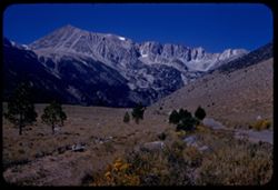
- Description:
- 50 f 10
- Subject:
- Lee Vining Creek (Calif.), Deserts, Flowers, Dana, Mount (Calif.), Dana Plateau (Calif.), Roads, Mountains, Yosemite National Park (Calif.), Shrubs, Trees, R...
- Series:
- 9-54
- Creator:
- Cushman, Charles W., 1896-1972
- Date Created:
- 1954-09-16
- Genre:
- Landscape photographs
- Frame Number:
- 27
- County:
- Mono
- Abstract:
- Great east wall of Mt. Dana.
- Call Number:
- P07338
- Country:
- United States
- State/Province:
- California
- Alternate Identifier:
- 954.27
- Persistent URL:
- http://purl.dlib.indiana.edu/iudl/archives/cushman/P07338
-
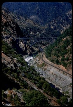
- Description:
- 50 f 6.3
- Subject:
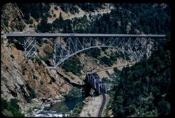
- Rocks, Roads, Feather River (Calif.), Trees, Railroad bridges, Western Pacific Railroad Company, Arches, Shrubs, Truss bridges, Bridges, Railroad tracks, Riv...
- Series:
- 7-54
- Creator:
- Cushman, Charles W., 1896-1972
- Date Created:
- 1954-08-22
- Genre:
- Architectural photographs
- Frame Number:
- 33
- County:
- Butte
- Abstract:
- Arch + RR bridge from farther south.
- Call Number:
- P07288
- City:
- Pulga
- Country:
- United States
- State/Province:
- California
- Alternate Identifier:
- 754.33
- Persistent URL:
- http://purl.dlib.indiana.edu/iudl/archives/cushman/P07288
- « Previous
- Next »
- 1
- 2
- 3