
Search Constraints
You searched for:
Campus
IUB
Remove constraint Campus: IUB
Pages
0-99 pages
Remove constraint Pages: 0-99 pages
Subject
Shrubs
Remove constraint Subject: Shrubs
Search Results
-
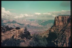
- Subject:
- Rocks, Canyons, Mohave Point (Ariz.), and Shrubs
- Series:
- 9-39
- Creator:
- Cushman, Charles W., 1896-1972
- Date Created:
- 1939-11-30/1939-12-01
- Genre:
- Landscape photographs
- Frame Number:
- 5
- Street Address:
- Pima Drive and Hermit Rim Drive
- County:
- Coconino
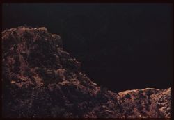
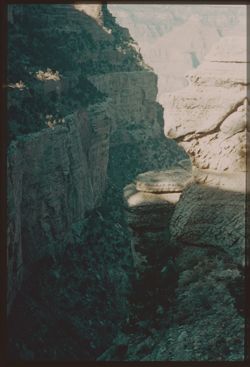
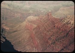
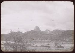
- Abstract:
- S-5: Looking down into Canyon arm from Mohave Pt.
- Call Number:
- P01704
- Country:
- United States
- State/Province:
- Arizona
- Physical Description:
- some dye fading. Image was originally mounted in a glass enclosure. Before digitization, the image was removed and placed in a Wess Plastic, Inc. brand, 2&qu...
- Alternate Identifier:
- 939.5
- Persistent URL:
- http://purl.dlib.indiana.edu/iudl/archives/cushman/P01704
- Holding Location:
- Bloomington - University Archives
Wells Library E460
1320 E 10th St.
Bloomington, IN 47405
Contact at archives@indiana.edu, 812-855-1127
-
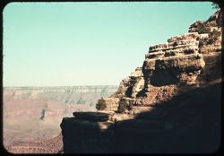
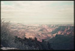
- Subject:
- Canyons, Mohave Point (Ariz.), Grand Canyon National Park (Ariz.), Shadows, Hopi Point (Ariz.), Shrubs, Grand Canyon (Ariz.), and Trees
- Series:
- 9-39
- Creator:
- Cushman, Charles W., 1896-1972
- Date Created:
- 1939-11-30
- Genre:
- Landscape photographs
- Frame Number:
- 3
- County:
- Coconino
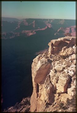
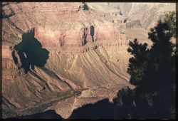
- Abstract:
- S-3: From Mohave Pt. east past Hopi Pt.
- Call Number:
- P01702
- Country:
- United States
- State/Province:
- Arizona
- Physical Description:
- some dye fading. Image was originally mounted in a glass enclosure. Before digitization, the image was removed and placed in a Wess Plastic, Inc. brand, 2&qu...
- Alternate Identifier:
- 939.3
- Persistent URL:
- http://purl.dlib.indiana.edu/iudl/archives/cushman/P01702
- Holding Location:
- Bloomington - University Archives
Wells Library E460
1320 E 10th St.
Bloomington, IN 47405
Contact at archives@indiana.edu, 812-855-1127
-
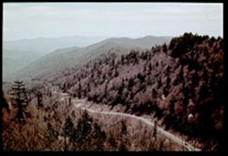
- Subject:
- Canyons, Roads, Shrubs, Trees, Rocks, Trails & paths, and Shadows
- Series:
- 8-39
- Creator:
- Cushman, Charles W., 1896-1972
- Date Created:
- 1939-11-30
- Genre:
- Landscape photographs
- Frame Number:
- 18
- Street Address:
- Burro Road and Bright Angel Trail
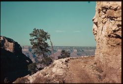
- Abstract:
- R-18: Burro road, Bright Angel Trail.
- Call Number:
- P01699
- Country:
- United States
- State/Province:
- Arizona
- Physical Description:
- some dye fading. Image was originally mounted in a glass enclosure. Before digitization, the image was removed and placed in a Wess Plastic, Inc. brand, 2&qu...
- Alternate Identifier:
- 839.18
- Persistent URL:
- http://purl.dlib.indiana.edu/iudl/archives/cushman/P01699
- Holding Location:
- Bloomington - University Archives
Wells Library E460
1320 E 10th St.
Bloomington, IN 47405
Contact at archives@indiana.edu, 812-855-1127
-
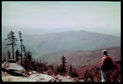
- Subject:
- Trees, Shadows, Shrubs, Grand Canyon (Ariz.), and Rock formations
- Series:
- 8-39
- Creator:
- Cushman, Charles W., 1896-1972
- Date Created:
- 1939-11-30
- Genre:
- Landscape photographs
- Frame Number:
- 17
- Street Address:
- South Rim Drive and Bright Angel Trail
- Abstract:
- R-17: Heights above Bright Angel Trail.
- Call Number:
- P01698
- Country:
- United States
- State/Province:
- Arizona
- Physical Description:
- some dye fading. Image was originally mounted in a glass enclosure. Before digitization, the image was removed and placed in a Wess Plastic, Inc. brand, 2&qu...
- Alternate Identifier:
- 839.17
- Persistent URL:
- http://purl.dlib.indiana.edu/iudl/archives/cushman/P01698
- Holding Location:
- Bloomington - University Archives
Wells Library E460
1320 E 10th St.
Bloomington, IN 47405
Contact at archives@indiana.edu, 812-855-1127
-
- Subject:
- Canyons, Grand Canyon (Ariz.), Shrubs, and Trees
- Series:
- 8-39
- Creator:
- Cushman, Charles W., 1896-1972
- Date Created:
- 1939-11-30
- Genre:
- Landscape photographs
- Frame Number:
- 16
- Street Address:
- Bright Angel Trail
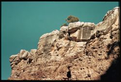
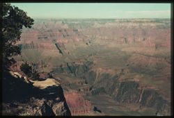
- Abstract:
- R-16: Looking into depths from Bright Angel Trail.
- Call Number:
- P01697
- Country:
- United States
- State/Province:
- Arizona
- Physical Description:
- some dye fading. Image was originally mounted in a glass enclosure. Before digitization, the image was removed and placed in a Wess Plastic, Inc. brand, 2&qu...
- Alternate Identifier:
- 839.16
- Persistent URL:
- http://purl.dlib.indiana.edu/iudl/archives/cushman/P01697
- Holding Location:
- Bloomington - University Archives
Wells Library E460
1320 E 10th St.
Bloomington, IN 47405
Contact at archives@indiana.edu, 812-855-1127
-
- Subject:
- Canyons, Trails & paths, Trees, Shadows, Shrubs, Dwellings, and Grand Canyon (Ariz.)
- Series:
- 8-39
- Creator:
- Cushman, Charles W., 1896-1972
- Date Created:
- 1939-11-30
- Genre:
- Landscape photographs
- Frame Number:
- 15
- Street Address:
- Bright Angel Trail
- Abstract:
- R-15: Looking back up Bright Angel Trail.
- Call Number:
- P01696
- Country:
- United States
- State/Province:
- Arizona
- Physical Description:
- some dye fading.
- Alternate Identifier:
- 839.15
- Persistent URL:
- http://purl.dlib.indiana.edu/iudl/archives/cushman/P01696
- Holding Location:
- Bloomington - University Archives
Wells Library E460
1320 E 10th St.
Bloomington, IN 47405
Contact at archives@indiana.edu, 812-855-1127
-
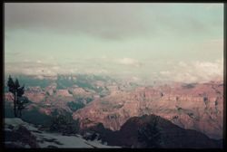
- Subject:
- Rocks, Canyons, Yaki Point (Ariz.), Tree limbs, Shrubs, and Grand Canyon (Ariz.)
- Series:
- 8-39
- Creator:
- Cushman, Charles W., 1896-1972
- Date Created:
- 1939-11-30
- Genre:
- Landscape photographs
- Frame Number:
- 10
- County:
- Coconino
- Abstract:
- R-10= Down and across from Yaki Pt.
- Call Number:
- P01692
- Country:
- United States
- State/Province:
- Arizona
- Physical Description:
- some dye fading.
- Alternate Identifier:
- 839.10
- Persistent URL:
- http://purl.dlib.indiana.edu/iudl/archives/cushman/P01692
- Holding Location:
- Bloomington - University Archives
Wells Library E460
1320 E 10th St.
Bloomington, IN 47405
Contact at archives@indiana.edu, 812-855-1127
-
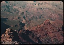
- Subject:
- Rocks, Canyons, Shadows, Yaki Point (Ariz.), Shrubs, and Grand Canyon (Ariz.)
- Series:
- 8-39
- Creator:
- Cushman, Charles W., 1896-1972
- Date Created:
- 1939-11-30
- Genre:
- Views
- Frame Number:
- 9
- County:
- Coconino
- Abstract:
- R-9 Looking down at bottom from Yaki Pt.
- Call Number:
- P01691
- Country:
- United States
- State/Province:
- Arizona
- Physical Description:
- some dye fading. Image was originally mounted in a glass enclosure. Before digitization, the image was removed and placed in a Wess Plastic, Inc. brand, 2&qu...
- Alternate Identifier:
- 839.9
- Persistent URL:
- http://purl.dlib.indiana.edu/iudl/archives/cushman/P01691
- Holding Location:
- Bloomington - University Archives
Wells Library E460
1320 E 10th St.
Bloomington, IN 47405
Contact at archives@indiana.edu, 812-855-1127
-
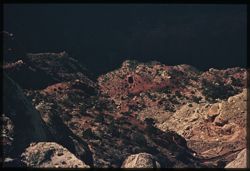
- Subject:
- Canyons, Yaki Point (Ariz.), Shrubs, Yavapai Point (Ariz.), and Trees
- Series:
- 8-39
- Creator:
- Cushman, Charles W., 1896-1972
- Date Created:
- 1939-11-01
- Genre:
- Landscape photographs
- Frame Number:
- 7
- County:
- Coconino
- Abstract:
- R-7: Pink Rock below Rim between Yavapai+ Yaqui.
- Call Number:
- P01689
- Country:
- United States
- State/Province:
- Arizona
- Physical Description:
- some dye fading.
- Alternate Identifier:
- 839.7
- Persistent URL:
- http://purl.dlib.indiana.edu/iudl/archives/cushman/P01689
- Holding Location:
- Bloomington - University Archives
Wells Library E460
1320 E 10th St.
Bloomington, IN 47405
Contact at archives@indiana.edu, 812-855-1127
-
- Subject:
- Canyons, Trees, Shadows, Yavapai Point (Ariz.), and Shrubs
- Series:
- 8-39
- Creator:
- Cushman, Charles W., 1896-1972
- Date Created:
- 1939-11-30
- Genre:
- Landscape photographs
- Frame Number:
- 4
- County:
- Coconino
- Abstract:
- R-4: From Yavapai Pt. View is across + upstream.
- Call Number:
- P01686
- Country:
- United States
- State/Province:
- Arizona
- Physical Description:
- some dye fading. Image was originally mounted in a glass enclosure. Before digitization, the image was removed and placed in a Wess Plastic, Inc. brand, 2&qu...
- Alternate Identifier:
- 839.4
- Persistent URL:
- http://purl.dlib.indiana.edu/iudl/archives/cushman/P01686
- Holding Location:
- Bloomington - University Archives
Wells Library E460
1320 E 10th St.
Bloomington, IN 47405
Contact at archives@indiana.edu, 812-855-1127
-
- Subject:
- Yaki Point (Ariz.), Trees, Canyons, Shadows, Shrubs, Yavapai Point (Ariz.), and Grand Canyon (Ariz.)
- Series:
- 8-39
- Creator:
- Cushman, Charles W., 1896-1972
- Date Created:
- 1939-11-30
- Genre:
- Landscape photographs
- Frame Number:
- 3
- County:
- Coconino
- Abstract:
- R-3: Downstream from Yavapai point.
- Call Number:
- P01685
- Country:
- United States
- State/Province:
- Arizona
- Physical Description:
- some dye fading. Image was originally mounted in a glass enclosure. Before digitization, the image was removed and placed in a Wess Plastic, Inc. brand, 2&qu...
- Alternate Identifier:
- 839.3
- Persistent URL:
- http://purl.dlib.indiana.edu/iudl/archives/cushman/P01685
- Holding Location:
- Bloomington - University Archives
Wells Library E460
1320 E 10th St.
Bloomington, IN 47405
Contact at archives@indiana.edu, 812-855-1127
-
- Subject:
- Canyons, Trees, Shadows, Shrubs, Clouds, and Maricopa Point (Ariz.)
- Series:
- 7-39
- Creator:
- Cushman, Charles W., 1896-1972
- Date Created:
- 1939-11-29
- Genre:
- Landscape photographs
- Frame Number:
- 18
- Street Address:
- South Rim Drive
- County:
- Coconino
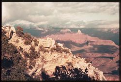
- Abstract:
- Q-18: From South Rim, past Maricopa Pt. Afternoon.
- Call Number:
- P01680
- Country:
- United States
- State/Province:
- Arizona
- Physical Description:
- some dye fading. Image was originally mounted in a glass enclosure. Before digitization, the image was removed and placed in a Wess Plastic, Inc. brand, 2&qu...
- Alternate Identifier:
- 739.18
- Persistent URL:
- http://purl.dlib.indiana.edu/iudl/archives/cushman/P01680
- Holding Location:
- Bloomington - University Archives
Wells Library E460
1320 E 10th St.
Bloomington, IN 47405
Contact at archives@indiana.edu, 812-855-1127
-
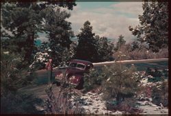
- Subject:
- Snow, Men, Roads, Automobiles, Trees, Shrubs, Clouds, Grand Canyon (Ariz.), and Grandview Point (Ariz.)
- Series:
- 7-39
- Creator:
- Cushman, Charles W., 1896-1972
- Date Created:
- 1939-11-29
- Genre:
- Identification photographs
- Frame Number:
- 16
- County:
- Coconino
- Abstract:
- Grand- View and Q-16: Yesterday's snow clings to Evergreens
- Call Number:
- P01678
- Country:
- United States
- State/Province:
- Arizona
- Physical Description:
- some dye fading. Image was originally mounted in a glass enclosure. Before digitization, the image was removed and placed in a Wess Plastic, Inc. brand, 2&qu...
- Alternate Identifier:
- 739.16
- Persistent URL:
- http://purl.dlib.indiana.edu/iudl/archives/cushman/P01678
- Holding Location:
- Bloomington - University Archives
Wells Library E460
1320 E 10th St.
Bloomington, IN 47405
Contact at archives@indiana.edu, 812-855-1127
-
- Subject:
- Canyons, Moran Point (Ariz.), Grand Canyon (Ariz.), Shrubs, Trees, Shadows, and Clouds
- Series:
- 7-39
- Creator:
- Cushman, Charles W., 1896-1972
- Date Created:
- 1939-11-29
- Genre:
- Landscape photographs
- Frame Number:
- 14
- County:
- Coconino
- Abstract:
- Q-14: Up and across Canyon from Moran Pt.
- Call Number:
- P01676
- Country:
- United States
- State/Province:
- Arizona
- Physical Description:
- some dye fading. Image was originally mounted in a glass enclosure. Before digitization, the image was removed and placed in a Wess Plastic, Inc. brand, 2&qu...
- Alternate Identifier:
- 739.14
- Persistent URL:
- http://purl.dlib.indiana.edu/iudl/archives/cushman/P01676
- Holding Location:
- Bloomington - University Archives
Wells Library E460
1320 E 10th St.
Bloomington, IN 47405
Contact at archives@indiana.edu, 812-855-1127
-
- Subject:
- Snow, Canyons, Marble Canyon (Ariz.), Shrubs, Clouds, Grand Canyon (Ariz.), and Trees
- Series:
- 7-39
- Creator:
- Cushman, Charles W., 1896-1972
- Date Created:
- 1939-11-29
- Genre:
- Landscape photographs
- Frame Number:
- 5
- County:
- Coconino
- Abstract:
- Q-5: Looking up the Canyon from Desert View.
- Call Number:
- P01669
- City:
- Desert View
- Country:
- United States
- State/Province:
- Arizona
- Physical Description:
- some dye fading. Image was originally mounted in a glass enclosure. Before digitization, the image was removed and placed in a Wess Plastic, Inc. brand, 2&qu...
- Alternate Identifier:
- 739.5
- Persistent URL:
- http://purl.dlib.indiana.edu/iudl/archives/cushman/P01669
- Holding Location:
- Bloomington - University Archives
Wells Library E460
1320 E 10th St.
Bloomington, IN 47405
Contact at archives@indiana.edu, 812-855-1127
-
- Subject:
- Snow, Canyons, Trees, Shrubs, Clouds, Grand Canyon (Ariz.), and Desert View Point (Ariz.)
- Series:
- 7-39
- Creator:
- Cushman, Charles W., 1896-1972
- Date Created:
- 1939-11-29
- Genre:
- Landscape photographs
- Frame Number:
- 4
- County:
- Coconino
- Abstract:
- Q-4: Looking down Canyon from Desert View.
- Call Number:
- P01668
- City:
- Desert View
- Country:
- United States
- State/Province:
- Arizona
- Physical Description:
- some dye fading. Image was originally mounted in a glass enclosure. Before digitization, the image was removed and placed in a Wess Plastic, Inc. brand, 2&qu...
- Alternate Identifier:
- 739.4
- Persistent URL:
- http://purl.dlib.indiana.edu/iudl/archives/cushman/P01668
- Holding Location:
- Bloomington - University Archives
Wells Library E460
1320 E 10th St.
Bloomington, IN 47405
Contact at archives@indiana.edu, 812-855-1127
-
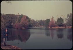
- Subject:
- Lakes & ponds, Reflections, Men, Parks, Shrubs, Trees, Suits (Clothing), West Lagoon (Ill.), and Jackson Park (Chicago, Ill.)
- Series:
- 6-39
- Creator:
- Cushman, Charles W., 1896-1972
- Date Created:
- 1939-10-01
- Genre:
- Landscape photographs
- Frame Number:
- 16
- County:
- Cook
- Persons Pictured:
- Cushman, Charles W. (Charles Weever), 1896-1972
- Abstract:
- P-16: West lagoon, Jackson Park.
- Call Number:
- P01660
- City:
- Chicago
- Country:
- United States
- State/Province:
- Illinois
- Physical Description:
- some dye fading.
- Alternate Identifier:
- 639.16
- Persistent URL:
- http://purl.dlib.indiana.edu/iudl/archives/cushman/P01660
- Holding Location:
- Bloomington - University Archives
Wells Library E460
1320 E 10th St.
Bloomington, IN 47405
Contact at archives@indiana.edu, 812-855-1127
-
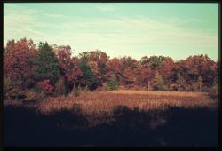
- Subject:
- Evergreens, Maples, Weeds, Oaks, Shrubs, and Clouds
- Series:
- 6-39
- Creator:
- Cushman, Charles W., 1896-1972
- Date Created:
- 1939-10-01
- Genre:
- Identification photographs
- Frame Number:
- 13
- County:
- Dune
- Abstract:
- P-13: Evergreens mingle with oaks and maples - Indiana's dune
- Call Number:
- P01658
- Country:
- United States
- State/Province:
- Indiana
- Physical Description:
- some dye fading. Image was originally mounted in a glass enclosure. Before digitization, the image was removed and placed in a Wess Plastic, Inc. brand, 2&qu...
- Alternate Identifier:
- 639.13
- Persistent URL:
- http://purl.dlib.indiana.edu/iudl/archives/cushman/P01658
- Holding Location:
- Bloomington - University Archives
Wells Library E460
1320 E 10th St.
Bloomington, IN 47405
Contact at archives@indiana.edu, 812-855-1127
-
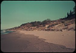
- Subject:
- Lakes & ponds, Michigan, Lake, Weeds, Sand, People, Dwellings, Trees, Beaches, Dunes, Seas, and Shrubs
- Series:
- 6-39
- Creator:
- Cushman, Charles W., 1896-1972
- Date Created:
- 1939-10-01
- Genre:
- Landscape photographs
- Frame Number:
- 12
- County:
- Porter
- Abstract:
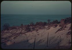
- P-12: Where dune meets Lake.
- Call Number:
- P01657
- Country:
- United States
- State/Province:
- Indiana
- Physical Description:
- some dye fading.
- Alternate Identifier:
- 639.12
- Persistent URL:
- http://purl.dlib.indiana.edu/iudl/archives/cushman/P01657
- Holding Location:
- Bloomington - University Archives
Wells Library E460
1320 E 10th St.
Bloomington, IN 47405
Contact at archives@indiana.edu, 812-855-1127
-
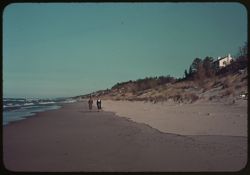
- Subject:
- Seas, Bodies of water, Trees, Dunes, Michigan, Lake, Beaches, Shrubs, Dwellings, People, and Dune Island (Ind.)
- Series:
- 6-39
- Creator:
- Cushman, Charles W., 1896-1972
- Date Created:
- 1939-10-01
- Genre:
- Landscape photographs
- Frame Number:
- 10
- County:
- Porter
- Persons Pictured:
- Reed, Mary, Cushman, Jean, and Reed, Hank
- Abstract:
- P-10: Along duneland's sand shore: Reeds and Jean.
- Call Number:
- P01655
- Country:
- United States
- State/Province:
- Indiana
- Physical Description:
- some dye fading.
- Alternate Identifier:
- 639.10
- Persistent URL:
- http://purl.dlib.indiana.edu/iudl/archives/cushman/P01655
- Holding Location:
- Bloomington - University Archives
Wells Library E460
1320 E 10th St.
Bloomington, IN 47405
Contact at archives@indiana.edu, 812-855-1127
-
- Subject:
- Sand, Trees, Dunes, Michigan, Lake, Shrubs, Lakes & ponds, and Dwellings
- Series:
- 6-39
- Creator:
- Cushman, Charles W., 1896-1972
- Date Created:
- 1939-10-01
- Genre:
- Landscape photographs
- Frame Number:
- 9
- County:
- Porter
- Abstract:
- P-9: Sand dune and swells of blue Lake Michigan.
- Call Number:
- P01654
- City:
- Dune Acres
- Country:
- United States
- State/Province:
- Indiana
- Physical Description:
- some dye fading.
- Alternate Identifier:
- 639.9
- Persistent URL:
- http://purl.dlib.indiana.edu/iudl/archives/cushman/P01654
- Holding Location:
- Bloomington - University Archives
Wells Library E460
1320 E 10th St.
Bloomington, IN 47405
Contact at archives@indiana.edu, 812-855-1127
-
- Subject:
- Trees, Harvesting, Corn shocks, and Shrubs
- Series:
- 6-39
- Creator:
- Cushman, Charles W., 1896-1972
- Date Created:
- 1939-10-01
- Genre:
- Identification photographs
- Frame Number:
- 5
- County:
- Lake
- Abstract:
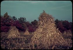
- P-5: Shocks of tall corn, Lake Co., Indiana.
- Call Number:
- P01649
- Country:
- United States
- State/Province:
- Indiana
- Physical Description:
- some dye fading.
- Alternate Identifier:
- 639.5
- Persistent URL:
- http://purl.dlib.indiana.edu/iudl/archives/cushman/P01649
- Holding Location:
- Bloomington - University Archives
Wells Library E460
1320 E 10th St.
Bloomington, IN 47405
Contact at archives@indiana.edu, 812-855-1127
-
- Subject:
- Trees, Indiana Dunes State Park (Ind.), Shrubs, and Clouds
- Series:
- 6-39
- Creator:
- Cushman, Charles W., 1896-1972
- Date Created:
- 1939-10-01
- Frame Number:
- 1
- County:
- Dune
- Abstract:
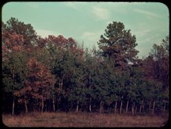
- P-1: Autumn colors in Dune country, Indiana.
- Call Number:
- P01647
- Country:
- United States
- State/Province:
- Indiana
- Physical Description:
- some dye fading.
- Alternate Identifier:
- 639.1
- Persistent URL:
- http://purl.dlib.indiana.edu/iudl/archives/cushman/P01647
- Holding Location:
- Bloomington - University Archives
Wells Library E460
1320 E 10th St.
Bloomington, IN 47405
Contact at archives@indiana.edu, 812-855-1127
-
- Subject:
- Cotton, Trees, Signs (Notices), Commodity exchanges, Sculpture, Shrubs, Windows, Lampposts, East India Cotton Association, and Doors & doorways
- Series:
- 14-39
- Creator:
- Cushman, Charles W., 1896-1972
- Date Created:
- 1939-05-07
- Genre:
- Architectural photographs
- Frame Number:
- 20
- County:
- Chatham
- Abstract:
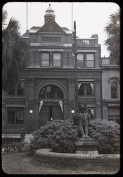
- 39 -P - 20= Savannah, Ga.
- Call Number:
- P01620
- City:
- Savannah
- Country:
- United States
- State/Province:
- Georgia
- Physical Description:
- black & white .
- Alternate Identifier:
- 1439.20
- Persistent URL:
- http://purl.dlib.indiana.edu/iudl/archives/cushman/P01620
- Holding Location:
- Bloomington - University Archives
Wells Library E460
1320 E 10th St.
Bloomington, IN 47405
Contact at archives@indiana.edu, 812-855-1127
-
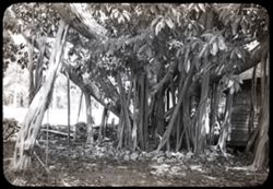
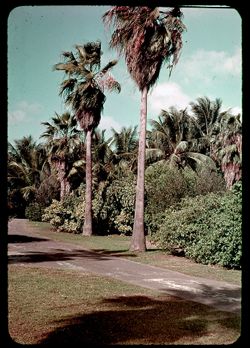
- Subject:
- Shrubs and Banyan trees
- Series:
- 11-39
- Creator:
- Cushman, Charles W., 1896-1972
- Date Created:
- 1939-04-01
- Genre:
- Identification photographs
- Frame Number:
- 34
- County:
- Miami-Dade
- Abstract:
- 39-J-34= Banyan tree in Florida City.
- Call Number:
- P01609
- City:
- Florida City
- Country:
- United States
- State/Province:
- Florida
- Physical Description:
- black & white .
- Alternate Identifier:
- 1139.34
- Persistent URL:
- http://purl.dlib.indiana.edu/iudl/archives/cushman/P01609
- Holding Location:
- Bloomington - University Archives
Wells Library E460
1320 E 10th St.
Bloomington, IN 47405
Contact at archives@indiana.edu, 812-855-1127
-
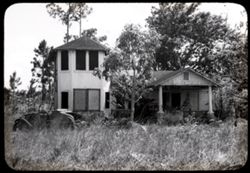
- Subject:
- Automobiles, Trees, Shrubs, Windows, Dwellings, Columns, and Weeds
- Series:
- 11-39
- Creator:
- Cushman, Charles W., 1896-1972
- Date Created:
- 1939-04-01
- Frame Number:
- 33
- County:
- Miami-Dade
- Abstract:
- 39-J-33= Abandone house nr. Fla. City
- Call Number:
- P01608
- City:
- Miami and Florida City
- Country:
- United States
- State/Province:
- Florida
- Physical Description:
- black & white .
- Alternate Identifier:
- 1139.33
- Persistent URL:
- http://purl.dlib.indiana.edu/iudl/archives/cushman/P01608
- Holding Location:
- Bloomington - University Archives
Wells Library E460
1320 E 10th St.
Bloomington, IN 47405
Contact at archives@indiana.edu, 812-855-1127
-
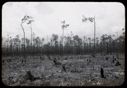
- Subject:
- Trees, Shrubs, and Clearing of land
- Series:
- 11-39
- Creator:
- Cushman, Charles W., 1896-1972
- Date Created:
- 1939-04-01
- Genre:
- Landscape photographs
- Frame Number:
- 32
- County:
- Miami-Dade
- Abstract:
- 39-J-32= Clearing in S.E. Florida.
- Call Number:
- P01607
- City:
- Miami
- Country:
- United States
- State/Province:
- Florida
- Physical Description:
- black & white .
- Alternate Identifier:
- 1139.32
- Persistent URL:
- http://purl.dlib.indiana.edu/iudl/archives/cushman/P01607
- Holding Location:
- Bloomington - University Archives
Wells Library E460
1320 E 10th St.
Bloomington, IN 47405
Contact at archives@indiana.edu, 812-855-1127
-
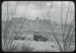
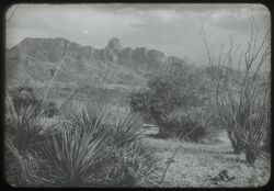
- Subject:
- Baboquivari Peak Wilderness (Ariz.), Mountains, Shrubs, and Clouds
- Series:
- 22-40
- Creator:
- Cushman, Charles W., 1896-1972
- Date Created:
- 1940-05-01
- Genre:
- Landscape photographs
- Frame Number:
- 25
- County:
- Pima
- Abstract:
- 40-F-25= Baboquivari Peak nr. Ariz. - Sonora line
- Call Number:
- P01511
- Country:
- United States and Mexico
- State/Province:
- Arizona and Sonora
- Physical Description:
- black & white .
- Alternate Identifier:
- 2240.25
- Persistent URL:
- http://purl.dlib.indiana.edu/iudl/archives/cushman/P01511
- Holding Location:
- Bloomington - University Archives
Wells Library E460
1320 E 10th St.
Bloomington, IN 47405
Contact at archives@indiana.edu, 812-855-1127
-
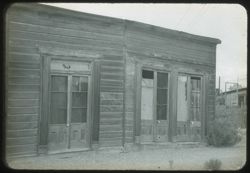
- Subject:
- Trees, Fences, Shrubs, Wooden buildings, and Doors & doorways
- Series:
- 22-40
- Creator:
- Cushman, Charles W., 1896-1972
- Date Created:
- 1940-05-01
- Frame Number:
- 13
- County:
- Cochise
- Abstract:
- 40-F-13= in Tombstone, Ariz.
- Call Number:
- P01508
- City:
- Tombstone
- Country:
- United States
- State/Province:
- Arizona
- Physical Description:
- black & white .
- Alternate Identifier:
- 2240.13
- Persistent URL:
- http://purl.dlib.indiana.edu/iudl/archives/cushman/P01508
- Holding Location:
- Bloomington - University Archives
Wells Library E460
1320 E 10th St.
Bloomington, IN 47405
Contact at archives@indiana.edu, 812-855-1127
-
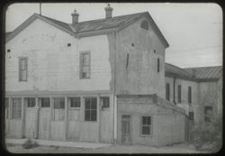
- Subject:
- Schieffelin House (Tombstone, Ariz.), Windows, Sidewalks, Dirt roads, Shrubs, Electric lines, Trees, Buildings, and Doors & doorways
- Series:
- 22-40
- Creator:
- Cushman, Charles W., 1896-1972
- Date Created:
- 1940-05-01
- Genre:
- Architectural photographs
- Frame Number:
- 15
- County:
- Cochise
- Abstract:
- 40-F-15= in Tombstone, Ariz.
- Call Number:
- P01509
- City:
- Tombstone
- Country:
- United States
- State/Province:
- Arizona
- Physical Description:
- black & white .
- Alternate Identifier:
- 2240.15
- Persistent URL:
- http://purl.dlib.indiana.edu/iudl/archives/cushman/P01509
- Holding Location:
- Bloomington - University Archives
Wells Library E460
1320 E 10th St.
Bloomington, IN 47405
Contact at archives@indiana.edu, 812-855-1127
-
- Subject:
- Baboquivari Peak Wilderness (Ariz.), Mountains, and Shrubs
- Series:
- 22-40
- Creator:
- Cushman, Charles W., 1896-1972
- Date Created:
- 1940-04-01
- Genre:
- Landscape photographs
- Frame Number:
- 24
- County:
- Pima
- Abstract:
- 40-F-24 = Baboquivari Peak nr. Ariz.-Sonora line
- Call Number:
- P01510
- Country:
- United States and Mexico
- State/Province:
- Arizona and Sonora
- Physical Description:
- black & white .
- Alternate Identifier:
- 2240.24
- Persistent URL:
- http://purl.dlib.indiana.edu/iudl/archives/cushman/P01510
- Holding Location:
- Bloomington - University Archives
Wells Library E460
1320 E 10th St.
Bloomington, IN 47405
Contact at archives@indiana.edu, 812-855-1127
-
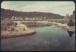
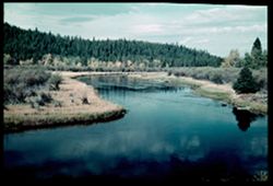
- Subject:
- National parks & reserves, Reflections, Madison River (Wyo. and Mont.), Forests, Shrubs, Trees, Rivers, Yellowstone National Park, Clouds, and Grasses
- Series:
- 6-38
- Creator:
- Cushman, Charles W., 1896-1972
- Date Created:
- 1938-09-29
- Genre:
- Landscape photographs
- Frame Number:
- 9
- Abstract:
- F-9= Madison river in the morning
- Call Number:
- P01496
- Country:
- United States
- State/Province:
- Wyoming and Montana
- Physical Description:
- some dye fading. Image was originally mounted in a glass enclosure. Before digitization, the image was removed and placed in a Wess Plastic, Inc. brand, 2&qu...
- Alternate Identifier:
- 638.9
- Persistent URL:
- http://purl.dlib.indiana.edu/iudl/archives/cushman/P01496
- Holding Location:
- Bloomington - University Archives
Wells Library E460
1320 E 10th St.
Bloomington, IN 47405
Contact at archives@indiana.edu, 812-855-1127
-
- Subject:
- Baboquivari Peak Wilderness (Ariz.), Trees, Mountains, and Shrubs
- Series:
- 22-40
- Creator:
- Cushman, Charles W., 1896-1972
- Date Created:
- 1940-05-01
- Genre:
- Landscape photographs
- Frame Number:
- 9
- County:
- Pima
- Abstract:
- 40 - F - 9 = Baboquivari Peak nr. Ariz. - Sonora line
- Call Number:
- P01506
- Country:
- United States and Mexico
- State/Province:
- Arizona and Sonora
- Physical Description:
- black & white .
- Alternate Identifier:
- 2240.9
- Persistent URL:
- http://purl.dlib.indiana.edu/iudl/archives/cushman/P01506
- Holding Location:
- Bloomington - University Archives
Wells Library E460
1320 E 10th St.
Bloomington, IN 47405
Contact at archives@indiana.edu, 812-855-1127
-
- Subject:
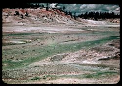
- Valleys, Trees, Signs (Notices), Shrubs, Clouds, Hills, Streams, and Norris Geyser Basin (Wyo.)
- Series:
- 7-38
- Creator:
- Cushman, Charles W., 1896-1972
- Date Created:
- 1938-09-29
- Genre:
- Night photographs and Landscape photographs
- Frame Number:
- 37
- County:
- Park
- Abstract:
- G-37= Panorama (dark) Norris Geyser Basin
- Call Number:
- P15800
- Country:
- United States
- State/Province:
- Wyoming
- Physical Description:
- Color corrected: magenta cast [fading of yellow dye].
- Alternate Identifier:
- 738.37
- Persistent URL:
- http://purl.dlib.indiana.edu/iudl/archives/cushman/P15800
- Holding Location:
- Bloomington - University Archives
Wells Library E460
1320 E 10th St.
Bloomington, IN 47405
Contact at archives@indiana.edu, 812-855-1127
-
- Subject:
- Grasses, Madison River (Wyo. and Mont.), National parks & reserves, Clouds, Forests, Reflections, Rivers, Trees, Shrubs, and Yellowstone National Park
- Series:
- 6-38
- Creator:
- Cushman, Charles W., 1896-1972
- Date Created:
- 1938-09-30
- Genre:
- Landscape photographs
- Frame Number:
- 9
- Abstract:
- F-9= Madison river in the morning
- Call Number:
- P15797
- Country:
- United States
- State/Province:
- Wyoming and Montana
- Physical Description:
- Color corrected: magenta cast [fading of yellow dye]. Image was originally mounted in a glass enclosure. Before digitization, the image was removed and place...
- Alternate Identifier:
- 638.9
- Persistent URL:
- http://purl.dlib.indiana.edu/iudl/archives/cushman/P15797
- Holding Location:
- Bloomington - University Archives
Wells Library E460
1320 E 10th St.
Bloomington, IN 47405
Contact at archives@indiana.edu, 812-855-1127
-
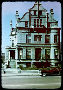
- Description:
- 50 f 5.6
- Subject:
- Bow windows, Balconies, Chimneypieces, Automobiles, Facades, Shrubs, Stonework, Architectural decorations & ornaments, Porches, and Dwellings
- Series:
- 1-51
- Creator:
- Cushman, Charles W., 1896-1972
- Date Created:
- 1951-03-07
- Genre:
- Architectural photographs
- Frame Number:
- 15
- Street Address:
- 2626 South Michigan Avenue
- County:
- Cook
- Abstract:
- Stone mansion at 2626 S. Michigan Av. and Stone Mansion - 2626 Michigan
- Call Number:
- P04936
- City:
- Chicago
- Country:
- United States
- State/Province:
- Illinois
- Physical Description:
- Color corrected: Anscochrome film, magenta cast [fading of yellow dye].
- Alternate Identifier:
- 151.15
- Persistent URL:
- http://purl.dlib.indiana.edu/iudl/archives/cushman/P04936
- Holding Location:
- Bloomington - University Archives
Wells Library E460
1320 E 10th St.
Bloomington, IN 47405
Contact at archives@indiana.edu, 812-855-1127
-
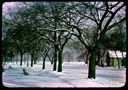
- Description:
- 25 f 9
- Subject:
- Jackson Park (Chicago, Ill.), Streets, Dwellings, Snow, Trees, Shadows, Benches, and Shrubs
- Series:
- 11-50
- Creator:
- Cushman, Charles W., 1896-1972
- Date Created:
- 1950-12-15
- Frame Number:
- 20
- County:
- Cook
- Abstract:
- Drive and path east of Museum under heavy snow. and Jackson Pk snow scenes south & east of Museum
- Call Number:
- P04923
- City:
- Chicago
- Country:
- United States
- State/Province:
- Illinois
- Physical Description:
- Color corrected: Anscochrome film, magenta cast [fading of yellow dye].
- Alternate Identifier:
- 1150.20
- Persistent URL:
- http://purl.dlib.indiana.edu/iudl/archives/cushman/P04923
- Holding Location:
- Bloomington - University Archives
Wells Library E460
1320 E 10th St.
Bloomington, IN 47405
Contact at archives@indiana.edu, 812-855-1127
-
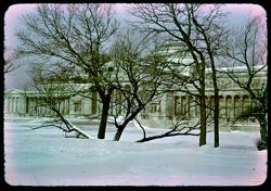
- Description:
- 25 f 9
- Subject:
- Snow, Trees, Buildings, Shrubs, Jackson Park (Chicago, Ill.), Domes, Columns, Galleries & museums, Sculpture, and Museum of Science and Industry (Chicago...
- Series:
- 11-50
- Creator:
- Cushman, Charles W., 1896-1972
- Date Created:
- 1950-12-15
- Genre:
- Architectural photographs
- Frame Number:
- 19
- County:
- Cook
- Abstract:
- View across snow-covered meadow and lagoon to south front of Rosenwald Museum. and Jackson Pk snow scenes south & east of Museum
- Call Number:
- P04922
- City:
- Chicago
- Country:
- United States
- State/Province:
- Illinois
- Physical Description:
- Color corrected: Anscochrome film, magenta cast [fading of yellow dye].
- Alternate Identifier:
- 1150.19
- Persistent URL:
- http://purl.dlib.indiana.edu/iudl/archives/cushman/P04922
- Holding Location:
- Bloomington - University Archives
Wells Library E460
1320 E 10th St.
Bloomington, IN 47405
Contact at archives@indiana.edu, 812-855-1127
-
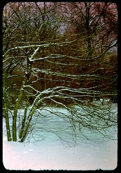
- Description:
- 25 f 8
- Subject:
- Jackson Park (Chicago, Ill.), Tree limbs, Shrubs, Snow, and Shadows
- Series:
- 11-50
- Creator:
- Cushman, Charles W., 1896-1972
- Date Created:
- 1950-12-15
- Frame Number:
- 18
- County:
- Cook
- Abstract:
- Bare shrubbery after heavy snowfall- Jackson Park. and Snow scene - Jksn Pk.
- Call Number:
- P04921
- City:
- Chicago
- Country:
- United States
- State/Province:
- Illinois
- Physical Description:
- Color corrected: Anscochrome film, magenta cast [fading of yellow dye].
- Alternate Identifier:
- 1150.18
- Persistent URL:
- http://purl.dlib.indiana.edu/iudl/archives/cushman/P04921
- Holding Location:
- Bloomington - University Archives
Wells Library E460
1320 E 10th St.
Bloomington, IN 47405
Contact at archives@indiana.edu, 812-855-1127
-
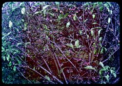
- Description:
- 25 f 8
- Subject:
- Botanical gardens, Morton Arboretum, Fruit, Euonymus, Leaves, and Shrubs
- Series:
- 11-50
- Creator:
- Cushman, Charles W., 1896-1972
- Date Created:
- 1950-10-31
- Genre:
- Identification photographs
- Frame Number:
- 17
- County:
- Du Page
- Abstract:
- Fruit of Euonymus European ALba = Arb W near triangle and Fruit of Euonymous European Alba- Arb. W.
- Call Number:
- P04920
- City:
- Wheaton
- Country:
- United States
- State/Province:
- Illinois
- Physical Description:
- Color corrected: Anscochrome film, magenta cast [fading of yellow dye].
- Alternate Identifier:
- 1150.17
- Persistent URL:
- http://purl.dlib.indiana.edu/iudl/archives/cushman/P04920
- Holding Location:
- Bloomington - University Archives
Wells Library E460
1320 E 10th St.
Bloomington, IN 47405
Contact at archives@indiana.edu, 812-855-1127
-
- Description:
- 25 f 6.3
- Subject:
- Botanical gardens, Morton Arboretum, Tree limbs, Shrubs, Euonymus, Euonymus alata, and Leaves
- Series:
- 11-50
- Creator:
- Cushman, Charles W., 1896-1972
- Date Created:
- 1950-10-31
- Genre:
- Identification photographs
- Frame Number:
- 16
- County:
- Du Page
- Abstract:
- Clump of Euonymus Alata on Thornhill. and Euon. Alata - Thornhill
- Call Number:
- P04919
- City:
- Wheaton
- Country:
- United States
- State/Province:
- Illinois
- Physical Description:
- Color corrected: Anscochrome film, magenta cast [fading of yellow dye].
- Alternate Identifier:
- 1150.16
- Persistent URL:
- http://purl.dlib.indiana.edu/iudl/archives/cushman/P04919
- Holding Location:
- Bloomington - University Archives
Wells Library E460
1320 E 10th St.
Bloomington, IN 47405
Contact at archives@indiana.edu, 812-855-1127
-
- Description:
- 25 f 8
- Subject:
- Botanical gardens, Grasses, Trees, Morton Arboretum, Shrubs, and Nyssa sylvatica
- Series:
- 11-50
- Creator:
- Cushman, Charles W., 1896-1972
- Date Created:
- 1950-10-31
- Genre:
- Identification photographs
- Frame Number:
- 14
- County:
- Du Page
- Abstract:
- Little black gum [Nyssa Sylvatica]- Arb. E. and Nyssa Sylvatica - Arb E
- Call Number:
- P04917
- City:
- Wheaton
- Country:
- United States
- State/Province:
- Illinois
- Physical Description:
- Color corrected: Anscochrome film, magenta cast [fading of yellow dye].
- Alternate Identifier:
- 1150.14
- Persistent URL:
- http://purl.dlib.indiana.edu/iudl/archives/cushman/P04917
- Holding Location:
- Bloomington - University Archives
Wells Library E460
1320 E 10th St.
Bloomington, IN 47405
Contact at archives@indiana.edu, 812-855-1127
-
- Description:
- 25 f 6.3
- Subject:
- Botanical gardens, Trails & paths, Trees, Morton Arboretum, Shadows, and Shrubs
- Series:
- 11-50
- Creator:
- Cushman, Charles W., 1896-1972
- Date Created:
- 1950-10-31
- Frame Number:
- 13
- County:
- Du Page
- Abstract:
- View through the woods- east extreme of Arboretum and Arb E
- Call Number:
- P04916
- City:
- Wheaton
- Country:
- United States
- State/Province:
- Illinois
- Physical Description:
- Color corrected: Anscochrome film, magenta cast [fading of yellow dye].
- Alternate Identifier:
- 1150.13
- Persistent URL:
- http://purl.dlib.indiana.edu/iudl/archives/cushman/P04916
- Holding Location:
- Bloomington - University Archives
Wells Library E460
1320 E 10th St.
Bloomington, IN 47405
Contact at archives@indiana.edu, 812-855-1127
-
- Description:
- 50 f 5.6
- Subject:
- Golf, Maples, Trees, Country clubs, Shrubs, Dwellings, and Flossmoor Country Club (Flossmoor, Ill.)
- Series:
- 11-50
- Creator:
- Cushman, Charles W., 1896-1972
- Date Created:
- 1950-10-30
- Frame Number:
- 11
- County:
- Cook
- Abstract:
- Flossmoor C C yellow maple & tree in green leaf and Fall colors on warm day at Flossmoor Country Club. [85.2 Fahr.]
- Call Number:
- P04914
- City:
- Flossmoor
- Country:
- United States
- State/Province:
- Illinois
- Physical Description:
- Color corrected: Anscochrome film, magenta cast [fading of yellow dye].
- Alternate Identifier:
- 1150.11
- Persistent URL:
- http://purl.dlib.indiana.edu/iudl/archives/cushman/P04914
- Holding Location:
- Bloomington - University Archives
Wells Library E460
1320 E 10th St.
Bloomington, IN 47405
Contact at archives@indiana.edu, 812-855-1127
-

- Description:
- 25 f 9
- Subject:
- Golf, Trees, Country clubs, Shrubs, Flossmoor Country Club (Flossmoor, Ill.), and Shadows
- Series:
- 11-50
- Creator:
- Cushman, Charles W., 1896-1972
- Date Created:
- 1950-10-30
- Frame Number:
- 10
- County:
- Cook
- Abstract:
- Fall colors on warm day at Flossmoor Country Club. [85.2 Fahr.] and Flossmoor Golf Course 85.2 degrees
- Call Number:
- P04913
- City:
- Flossmoor
- Country:
- United States
- State/Province:
- Illinois
- Physical Description:
- Color corrected: Anscochrome film, magenta cast [fading of yellow dye].
- Alternate Identifier:
- 1150.10
- Persistent URL:
- http://purl.dlib.indiana.edu/iudl/archives/cushman/P04913
- Holding Location:
- Bloomington - University Archives
Wells Library E460
1320 E 10th St.
Bloomington, IN 47405
Contact at archives@indiana.edu, 812-855-1127
-
- Description:
- 25 f 6.3
- Subject:
- Forests, Oaks, Shrubs, and Shadows
- Series:
- 11-50
- Creator:
- Cushman, Charles W., 1896-1972
- Date Created:
- 1950-10-29
- Frame Number:
- 8
- Street Address:
- One Hundred Nineteenth Street and United States Highway 45
- Abstract:
- Oak in Forest Preserve- 119 St. nr. US 45. and Oak in For Preserve - 119th near Hwy 45
- Call Number:
- P04911
- Country:
- United States
- State/Province:
- Illinois
- Physical Description:
- Color corrected: Anscochrome film, magenta cast [fading of yellow dye].
- Alternate Identifier:
- 1150.8
- Persistent URL:
- http://purl.dlib.indiana.edu/iudl/archives/cushman/P04911
- Holding Location:
- Bloomington - University Archives
Wells Library E460
1320 E 10th St.
Bloomington, IN 47405
Contact at archives@indiana.edu, 812-855-1127
-
- Description:
- 50 f 2.8
- Subject:
- Leaves, Tree limbs, Bodies of water, Fishing, Shrubs, Families, Shadows, and People
- Series:
- 11-50
- Creator:
- Cushman, Charles W., 1896-1972
- Date Created:
- 1950-10-29
- Frame Number:
- 7
- Street Address:
- Ninety-third Avenue and One Hundred Twenty-third Street
- County:
- Cook
- Abstract:
- Family fishing party- 123 St. + 93 Ave.- Palos Pt. and Fishing = 123rd St & 93rd Ave
- Call Number:
- P04910
- City:
- Palos Park
- Country:
- United States
- State/Province:
- Illinois
- Physical Description:
- Color corrected: Anscochrome film, magenta cast [fading of yellow dye].
- Alternate Identifier:
- 1150.7
- Persistent URL:
- http://purl.dlib.indiana.edu/iudl/archives/cushman/P04910
- Holding Location:
- Bloomington - University Archives
Wells Library E460
1320 E 10th St.
Bloomington, IN 47405
Contact at archives@indiana.edu, 812-855-1127
-
- Description:
- 50 f 6.3
- Subject:
- Houses, Lawns, Shrubs, Trees, Shadows, and Fences
- Series:
- 11-50
- Creator:
- Cushman, Charles W., 1896-1972
- Date Created:
- 1950-10-29
- Frame Number:
- 6
- Street Address:
- One Hundred Twenty-first Street and Eighty-sixth Avenue
- County:
- Cook
- Abstract:
- Suburban home- Palos Pk.- 121 St. w. of 86 Ave. and House on 121 St. Palos Pk w. of 86 Ave
- Call Number:
- P04909
- City:
- Palos Park
- Country:
- United States
- State/Province:
- Illinois
- Physical Description:
- Color corrected: Anscochrome film, magenta cast [fading of yellow dye].
- Alternate Identifier:
- 1150.6
- Persistent URL:
- http://purl.dlib.indiana.edu/iudl/archives/cushman/P04909
- Holding Location:
- Bloomington - University Archives
Wells Library E460
1320 E 10th St.
Bloomington, IN 47405
Contact at archives@indiana.edu, 812-855-1127
-
- Subject:
- Men, Forests, Bitterroot Range (Idaho and Mont.), Mountains, Shrubs, Trees, Wooden fences, Clouds, and Fences
- Series:
- 5-38
- Creator:
- Cushman, Charles W., 1896-1972
- Date Created:
- 1938-09-23
- Genre:
- Portraits and Landscape photographs
- Frame Number:
- 21
- Persons Pictured:
- Cushman, Charles W. (Charles Weever), 1896-1972
- Call Number:
- P04324
- Country:
- United States
- State/Province:
- Idaho
- Physical Description:
- Color corrected: magenta cast [fading of yellow dye], masked.
- Alternate Identifier:
- 538.21
- Persistent URL:
- http://purl.dlib.indiana.edu/iudl/archives/cushman/P04324
- Holding Location:
- Bloomington - University Archives
Wells Library E460
1320 E 10th St.
Bloomington, IN 47405
Contact at archives@indiana.edu, 812-855-1127
-
- Subject:
- Shutters, Windows, Columns, Benches, Trees, Shadows, Hermitage (Hermitage, Tenn.), Doors & doorways, Dwellings, and Shrubs
- Series:
- 5-39
- Creator:
- Cushman, Charles W., 1896-1972
- Date Created:
- 1939-05-01
- Genre:
- Architectural photographs
- Frame Number:
- 20
- County:
- Davidson
- Abstract:
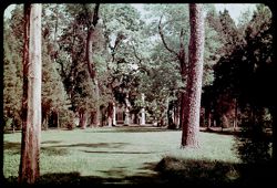
- N-20= Great front lawn of The Hermitage
- Call Number:
- P01646
- City:
- Nashville
- Country:
- United States
- State/Province:
- Tennessee
- Physical Description:
- Color corrected: magenta cast [fading of yellow dye].
- Alternate Identifier:
- 539.20
- Persistent URL:
- http://purl.dlib.indiana.edu/iudl/archives/cushman/P01646
- Holding Location:
- Bloomington - University Archives
Wells Library E460
1320 E 10th St.
Bloomington, IN 47405
Contact at archives@indiana.edu, 812-855-1127
-
- Subject:
- Trees, Flowers, Gardens, Fences, Shrubs, Dwellings, and Hermitage (Hermitage, Tenn.)
- Series:
- 5-39
- Creator:
- Cushman, Charles W., 1896-1972
- Date Created:
- 1939-05-01
- Frame Number:
- 18
- Street Address:
- 4580 Rachel's Lane
- County:
- Davidson
- Persons Pictured:
- Jackson, Andrew, 1767-1845
- Abstract:
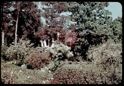
- N-18= Flower garden, The Hermitage
- Call Number:
- P01644
- City:
- Nashville
- Country:
- United States
- State/Province:
- Tennessee
- Physical Description:
- Color corrected: magenta cast [fading of yellow dye].
- Alternate Identifier:
- 539.18
- Persistent URL:
- http://purl.dlib.indiana.edu/iudl/archives/cushman/P01644
- Holding Location:
- Bloomington - University Archives
Wells Library E460
1320 E 10th St.
Bloomington, IN 47405
Contact at archives@indiana.edu, 812-855-1127
-
- Subject:
- Men, Trees, Flowers, Shrubs, Red clover, and Dwellings
- Series:
- 5-39
- Creator:
- Cushman, Charles W., 1896-1972
- Date Created:
- 1939-05-01
- Genre:
- Identification photographs
- Frame Number:
- 17
- County:
- Davidson
- Persons Pictured:
- Cushman, Charles W. (Charles Weever), 1896-1972
- Abstract:
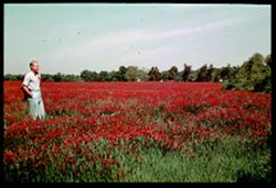
- N-17= Red clover, Sunday morning, near Nashville
- Call Number:
- P01642
- City:
- Nashville
- Country:
- United States
- State/Province:
- Tennessee
- Physical Description:
- Color corrected: magenta cast [fading of yellow dye]. Image was originally mounted in a glass enclosure. Before digitization, the image was removed and place...
- Alternate Identifier:
- 539.17
- Persistent URL:
- http://purl.dlib.indiana.edu/iudl/archives/cushman/P01642
- Holding Location:
- Bloomington - University Archives
Wells Library E460
1320 E 10th St.
Bloomington, IN 47405
Contact at archives@indiana.edu, 812-855-1127
-
- Description:
- 1/5 f 9
- Subject:
- Rain, Trees, Flowers, Meadows, Shrubs, Red clover, Dwellings, and Hills
- Series:
- 5-39
- Creator:
- Cushman, Charles W., 1896-1972
- Date Created:
- 1939-05-01
- Genre:
- Landscape photographs
- Frame Number:
- 15
- County:
- Smith
- Abstract:
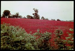
- N-15= Field of red clover in rain, near Carthage, Tenn.
- Call Number:
- P01640
- City:
- Carthage
- Country:
- United States
- State/Province:
- Tennessee
- Physical Description:
- Color corrected: magenta cast [fading of yellow dye]. Image was originally mounted in a glass enclosure. Before digitization, the image was removed and place...
- Alternate Identifier:
- 539.15
- Persistent URL:
- http://purl.dlib.indiana.edu/iudl/archives/cushman/P01640
- Holding Location:
- Bloomington - University Archives
Wells Library E460
1320 E 10th St.
Bloomington, IN 47405
Contact at archives@indiana.edu, 812-855-1127
-
- Description:
- 1/5 f 9
- Subject:
- Rocks, Valleys, Tennessee River Valley, Trees, Flowers, Mountains, Shrubs, and Cumberland Mountains
- Series:
- 5-39
- Creator:
- Cushman, Charles W., 1896-1972
- Date Created:
- 1939-05-01
- Genre:
- Landscape photographs
- Frame Number:
- 14
- Abstract:
- N-14= Looking south into Tennessee river valley from summit of Cumberland Mtns., Tenn.
- Call Number:
- P01639
- Country:
- United States
- State/Province:
- Tennessee
- Physical Description:
- Color corrected: magenta cast [fading of yellow dye]. Image was originally mounted in a glass enclosure. Before digitization, the image was removed and place...
- Alternate Identifier:
- 539.14
- Persistent URL:
- http://purl.dlib.indiana.edu/iudl/archives/cushman/P01639
- Holding Location:
- Bloomington - University Archives
Wells Library E460
1320 E 10th St.
Bloomington, IN 47405
Contact at archives@indiana.edu, 812-855-1127
-
- Subject:
- Clinch River (Va. and Tenn.), Flowers, Hills, Shrubs, Tennessee River, Trees, and Rivers
- Series:
- 5-39
- Creator:
- Cushman, Charles W., 1896-1972
- Date Created:
- 1939-05-01
- Genre:
- Landscape photographs
- Frame Number:
- 13
- Abstract:
- N-13= Junction of Clinch and Tennessee rivers.
- Call Number:
- P01638
- Country:
- United States
- State/Province:
- Virginia and Tennessee
- Physical Description:
- Color corrected: magenta cast [fading of yellow dye], glue on slide.
- Alternate Identifier:
- 539.13
- Persistent URL:
- http://purl.dlib.indiana.edu/iudl/archives/cushman/P01638
- Holding Location:
- Bloomington - University Archives
Wells Library E460
1320 E 10th St.
Bloomington, IN 47405
Contact at archives@indiana.edu, 812-855-1127
-
- Subject:
- Trees, Flowers, Shrubs, and Flowering dogwood
- Series:
- 5-39
- Creator:
- Cushman, Charles W., 1896-1972
- Date Created:
- 1939-05-01
- Genre:
- Identification photographs
- Frame Number:
- 11
- Street Address:
- Newfound Gap
- Abstract:
- N-11= Dogwood near Newfound Gap.
- Call Number:
- P01636
- Country:
- United States
- State/Province:
- Tennessee and North Carolina
- Physical Description:
- Color corrected: magenta cast [fading of yellow dye].
- Alternate Identifier:
- 539.11
- Persistent URL:
- http://purl.dlib.indiana.edu/iudl/archives/cushman/P01636
- Holding Location:
- Bloomington - University Archives
Wells Library E460
1320 E 10th St.
Bloomington, IN 47405
Contact at archives@indiana.edu, 812-855-1127
-
- Subject:
- Men, Roads, Automobiles, Trees, Mountains, Shrubs, Stone walls, and Great Smoky Mountains (N.C. and Tenn.)
- Series:
- 5-39
- Creator:
- Cushman, Charles W., 1896-1972
- Date Created:
- 1939-05-01
- Genre:
- Landscape photographs
- Frame Number:
- 7
- Persons Pictured:
- Cushman, Charles W. (Charles Weever), 1896-1972
- Abstract:
- N-7= Along highway on Tennessee side.
- Call Number:
- P01634
- Country:
- United States
- State/Province:
- Tennessee and North Carolina
- Physical Description:
- Color corrected: magenta cast [fading of yellow dye], masked. Image was originally mounted in a glass enclosure. Before digitization, the image was removed a...
- Alternate Identifier:
- 539.7
- Persistent URL:
- http://purl.dlib.indiana.edu/iudl/archives/cushman/P01634
- Holding Location:
- Bloomington - University Archives
Wells Library E460
1320 E 10th St.
Bloomington, IN 47405
Contact at archives@indiana.edu, 812-855-1127
-
- Description:
- 1/25 f 9
- Subject:
- Roads, Fog, Trees, Newfound Gap (N.C. and Tenn.), Mountains, Shrubs, Great Smoky Mountains (N.C. and Tenn.), and Automobiles
- Series:
- 5-39
- Creator:
- Cushman, Charles W., 1896-1972
- Date Created:
- 1939-05-01
- Genre:
- Landscape photographs
- Frame Number:
- 5
- Abstract:
- N-5= Looking east from Newfound Gap.
- Call Number:
- P01632
- Country:
- United States
- State/Province:
- Tennessee and North Carolina
- Physical Description:
- Color corrected: magenta cast [fading of yellow dye]. Image was originally mounted in a glass enclosure. Before digitization, the image was removed and place...
- Alternate Identifier:
- 539.5
- Persistent URL:
- http://purl.dlib.indiana.edu/iudl/archives/cushman/P01632
- Holding Location:
- Bloomington - University Archives
Wells Library E460
1320 E 10th St.
Bloomington, IN 47405
Contact at archives@indiana.edu, 812-855-1127
-
- Subject:
- Men, Fog, Mountains, Shrubs, Trees, Rocks, Great Smoky Mountains (N.C. and Tenn.), and Farney Ridge
- Series:
- 5-39
- Creator:
- Cushman, Charles W., 1896-1972
- Date Created:
- 1939-05-01
- Genre:
- Landscape photographs
- Frame Number:
- 2
- Persons Pictured:
- Cushman, Charles W. (Charles Weever), 1896-1972
- Abstract:
- N-2= View west from Farney Ridge, Great Smoky Mtns
- Call Number:
- P01629
- Country:
- United States
- State/Province:
- Tennessee and North Carolina
- Physical Description:
- Color corrected: magenta cast [fading of yellow dye]. Image was originally mounted in a glass enclosure. Before digitization, the image was removed and place...
- Alternate Identifier:
- 539.2
- Persistent URL:
- http://purl.dlib.indiana.edu/iudl/archives/cushman/P01629
- Holding Location:
- Bloomington - University Archives
Wells Library E460
1320 E 10th St.
Bloomington, IN 47405
Contact at archives@indiana.edu, 812-855-1127
-
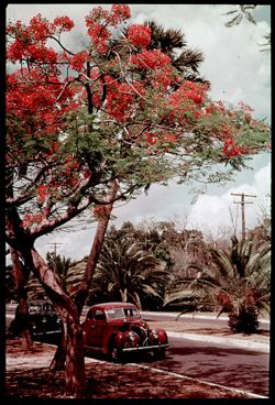
- Subject:
- Royal poincianas, Electric lines, Automobiles, Trees, Flowers, Streets, Shrubs, Clouds, and Utility poles
- Series:
- 4-39
- Creator:
- Cushman, Charles W., 1896-1972
- Date Created:
- 1939-04-01
- Genre:
- Identification photographs
- Frame Number:
- 15
- County:
- Miami-Dade
- Abstract:
- M-15= Royal Poinciana blooms early.
- Call Number:
- P01603
- Country:
- United States
- State/Province:
- Florida
- Physical Description:
- Color corrected: magenta cast [fading of yellow dye].
- Alternate Identifier:
- 439.15
- Persistent URL:
- http://purl.dlib.indiana.edu/iudl/archives/cushman/P01603
- Holding Location:
- Bloomington - University Archives
Wells Library E460
1320 E 10th St.
Bloomington, IN 47405
Contact at archives@indiana.edu, 812-855-1127
-
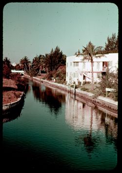
- Subject:
- Canals, Collins Canal (Miami-Dade County, Fla.), Buildings, Trees, Palms, Pancoast, Lake (Fla.), Bridges, Signs (Notices), Reflections, Flowers, and Shrubs
- Series:
- 3-39
- Creator:
- Cushman, Charles W., 1896-1972
- Date Created:
- 1939-03-01
- Frame Number:
- 12
- County:
- Miami-Dade
- Abstract:
- L-12= Collins Canal from Lake Pancoast.
- Call Number:
- P01584
- City:
- Miami Beach
- Country:
- United States
- State/Province:
- Florida
- Physical Description:
- Color corrected: magenta cast [fading of yellow dye].
- Alternate Identifier:
- 339.12
- Persistent URL:
- http://purl.dlib.indiana.edu/iudl/archives/cushman/P01584
- Holding Location:
- Bloomington - University Archives
Wells Library E460
1320 E 10th St.
Bloomington, IN 47405
Contact at archives@indiana.edu, 812-855-1127
-
- Subject:
- Towers, Roney Plaza Hotel (Miami Beach, Fla.), Arches, Flowerpots, Shrubs, Windows, Domes, Lampposts, Palms, Buildings, and Columns
- Series:
- 3-39
- Creator:
- Cushman, Charles W., 1896-1972
- Date Created:
- 1939-03-01
- Genre:
- Architectural photographs
- Frame Number:
- 11
- Street Address:
- Ocean Drive
- County:
- Miami-Dade
- Abstract:
- L-11= Roney Plaza Tower from Ocean Drive.
- Call Number:
- P01583
- City:
- Miami Beach
- Country:
- United States
- State/Province:
- Florida
- Physical Description:
- Color corrected: magenta cast [fading of yellow dye]. Image was originally mounted in a glass enclosure. Before digitization, the image was removed and place...
- Alternate Identifier:
- 339.11
- Persistent URL:
- http://purl.dlib.indiana.edu/iudl/archives/cushman/P01583
- Holding Location:
- Bloomington - University Archives
Wells Library E460
1320 E 10th St.
Bloomington, IN 47405
Contact at archives@indiana.edu, 812-855-1127
-
- Subject:
- Towers, Roney Plaza Hotel (Miami Beach, Fla.), Parks, Trees, Arches, Buildings, Shrubs, Domes, Collins Park, Palms, and Benches
- Series:
- 3-39
- Creator:
- Cushman, Charles W., 1896-1972
- Date Created:
- 1939-03-01
- Genre:
- Architectural photographs
- Frame Number:
- 5
- County:
- Miami-Dade
- Abstract:
- L-5= Collins Park.
- Call Number:
- P01577
- City:
- Miami Beach
- Country:
- United States
- State/Province:
- Florida
- Physical Description:
- Color corrected: magenta cast [fading of yellow dye]. Image was originally mounted in a glass enclosure. Before digitization, the image was removed and place...
- Alternate Identifier:
- 339.5
- Persistent URL:
- http://purl.dlib.indiana.edu/iudl/archives/cushman/P01577
- Holding Location:
- Bloomington - University Archives
Wells Library E460
1320 E 10th St.
Bloomington, IN 47405
Contact at archives@indiana.edu, 812-855-1127
-
- Subject:
- Automobiles, Streets, Tree limbs, Cities & towns, Lawns, Shrubs, Dwellings, Lampposts, Palms, Stone walls, Porticoes (Porches), and Sidewalks
- Series:
- 2-39
- Creator:
- Cushman, Charles W., 1896-1972
- Date Created:
- 1939-03-01
- Genre:
- Cityscape photographs and Architectural photographs
- Frame Number:
- 17
- Street Address:
- South Bayshore Drive
- County:
- Miami-Dade
- Abstract:
- K-17= South Bay Shore Drive, Miami.
- Call Number:
- P01572
- City:
- Miami
- Country:
- United States
- State/Province:
- Florida
- Physical Description:
- Color corrected: magenta cast [fading of yellow dye]. Image was originally mounted in a glass enclosure. Before digitization, the image was removed and place...
- Alternate Identifier:
- 239.17
- Persistent URL:
- http://purl.dlib.indiana.edu/iudl/archives/cushman/P01572
- Holding Location:
- Bloomington - University Archives
Wells Library E460
1320 E 10th St.
Bloomington, IN 47405
Contact at archives@indiana.edu, 812-855-1127
-
- Subject:
- Vessels, Bodies of water, Boats, Shadows, Buildings, Shrubs, Miami Harbor (Fla.), Clouds, Palms, Hoisting machinery, Trees, and Harbors
- Series:
- 1-39
- Creator:
- Cushman, Charles W., 1896-1972
- Date Created:
- 1939-03-01
- Genre:
- Marine photographs
- Frame Number:
- 17
- County:
- Miami-Dade
- Abstract:
- J-17= Miami Harbor.
- Call Number:
- P01554
- City:
- Miami
- Country:
- United States
- State/Province:
- Florida
- Physical Description:
- Color corrected: magenta cast [fading of yellow dye]. Image was originally mounted in a glass enclosure. Before digitization, the image was removed and place...
- Alternate Identifier:
- 139.17
- Persistent URL:
- http://purl.dlib.indiana.edu/iudl/archives/cushman/P01554
- Holding Location:
- Bloomington - University Archives
Wells Library E460
1320 E 10th St.
Bloomington, IN 47405
Contact at archives@indiana.edu, 812-855-1127
-
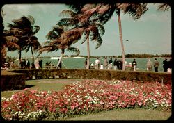
- Subject:
- Bays (Bodies of water), Benches, Parks, Flowers, Walkways, Shrubs, Bayfront Park (Miami, Fla.), Lampposts, Palms, and People
- Series:
- 1-39
- Creator:
- Cushman, Charles W., 1896-1972
- Date Created:
- 1939-03-01
- Frame Number:
- 16
- Street Address:
- Flagler Street
- County:
- Miami-Dade
- Abstract:
- J-16= Bay Front Pk.- foot of Flagler St.
- Call Number:
- P01553
- City:
- Miami
- Country:
- United States
- State/Province:
- Florida
- Physical Description:
- Color corrected: magenta cast [fading of yellow dye].
- Alternate Identifier:
- 139.16
- Persistent URL:
- http://purl.dlib.indiana.edu/iudl/archives/cushman/P01553
- Holding Location:
- Bloomington - University Archives
Wells Library E460
1320 E 10th St.
Bloomington, IN 47405
Contact at archives@indiana.edu, 812-855-1127
-
- Subject:
- Towers, Benches, Parks, Trees, Flowers, Buildings, Shrubs, Bayfront Park (Miami, Fla.), People, Palms, and Lampposts
- Series:
- 1-39
- Creator:
- Cushman, Charles W., 1896-1972
- Date Created:
- 1939-02-01
- Genre:
- Cityscape photographs
- Frame Number:
- 15
- Street Address:
- Flagler Street
- County:
- Miami-Dade
- Abstract:
- J-15= Bay Front Pk.- foot of Flagler St.
- Call Number:
- P01552
- City:
- Miami
- Country:
- United States
- State/Province:
- Florida
- Physical Description:
- Color corrected: magenta cast [fading of yellow dye].
- Alternate Identifier:
- 139.15
- Persistent URL:
- http://purl.dlib.indiana.edu/iudl/archives/cushman/P01552
- Holding Location:
- Bloomington - University Archives
Wells Library E460
1320 E 10th St.
Bloomington, IN 47405
Contact at archives@indiana.edu, 812-855-1127
-
- Subject:
- Flowers, Bayfront Park (Miami, Fla.), Shrubs, and Bougainvillea
- Series:
- 1-39
- Creator:
- Cushman, Charles W., 1896-1972
- Date Created:
- 1939-02-01
- Genre:
- Identification photographs
- Frame Number:
- 13
- County:
- Miami-Dade
- Abstract:
- Bay Front Pk. and J-13= Purple Bougainvillea
- Call Number:
- P01550
- City:
- Miami
- Country:
- United States
- State/Province:
- Florida
- Physical Description:
- Color corrected: magenta cast [fading of yellow dye].
- Alternate Identifier:
- 139.13
- Persistent URL:
- http://purl.dlib.indiana.edu/iudl/archives/cushman/P01550
- Holding Location:
- Bloomington - University Archives
Wells Library E460
1320 E 10th St.
Bloomington, IN 47405
Contact at archives@indiana.edu, 812-855-1127
-
- Subject:
- Trees, Flowers, Shrubs, Bayfront Park (Miami, Fla.), and Palms
- Series:
- 1-39
- Creator:
- Cushman, Charles W., 1896-1972
- Date Created:
- 1939-02-01
- Genre:
- Identification photographs
- Frame Number:
- 5
- County:
- Miami-Dade
- Abstract:
- J-5= Palm trees like wind mills in Bay Front Park
- Call Number:
- P01542
- City:
- Miami
- Country:
- United States
- State/Province:
- Florida
- Physical Description:
- Color corrected: magenta cast [fading of yellow dye]. Image was originally mounted in a glass enclosure. Before digitization, the image was removed and place...
- Alternate Identifier:
- 139.5
- Persistent URL:
- http://purl.dlib.indiana.edu/iudl/archives/cushman/P01542
- Holding Location:
- Bloomington - University Archives
Wells Library E460
1320 E 10th St.
Bloomington, IN 47405
Contact at archives@indiana.edu, 812-855-1127
-
- Subject:
- Bays (Bodies of water), Vessels, Trees, Flowers, Shrubs, Clouds, Bayfront Park (Miami, Fla.), People, Palms, and Benches
- Series:
- 1-39
- Creator:
- Cushman, Charles W., 1896-1972
- Date Created:
- 1939-02-01
- Genre:
- Landscape photographs
- Frame Number:
- 1
- County:
- Miami-Dade
- Abstract:
- J-1= Sunday in Bay Front Park
- Call Number:
- P01538
- City:
- Miami
- Country:
- United States
- State/Province:
- Florida
- Physical Description:
- Color corrected: magenta cast [fading of yellow dye].
- Alternate Identifier:
- 139.1
- Persistent URL:
- http://purl.dlib.indiana.edu/iudl/archives/cushman/P01538
- Holding Location:
- Bloomington - University Archives
Wells Library E460
1320 E 10th St.
Bloomington, IN 47405
Contact at archives@indiana.edu, 812-855-1127
-
- Subject:
- Shadows, Walkways, Shrubs, Clouds, Bayfront Park (Miami, Fla.), and Palms
- Series:
- 1-39
- Creator:
- Cushman, Charles W., 1896-1972
- Date Created:
- 1939-02-01
- Genre:
- Identification photographs
- Frame Number:
- 0
- County:
- Miami-Dade
- Abstract:
- J-0= Palms in Bay Front Park
- Call Number:
- P01537
- City:
- Miami
- Country:
- United States
- State/Province:
- Florida
- Physical Description:
- Color corrected: magenta cast [fading of yellow dye].
- Alternate Identifier:
- 139.0
- Persistent URL:
- http://purl.dlib.indiana.edu/iudl/archives/cushman/P01537
- Holding Location:
- Bloomington - University Archives
Wells Library E460
1320 E 10th St.
Bloomington, IN 47405
Contact at archives@indiana.edu, 812-855-1127
-
- Subject:
- Trees, Meadows, Shrubs, and Clouds
- Series:
- 8-38
- Creator:
- Cushman, Charles W., 1896-1972
- Date Created:
- 1938-11-01
- Genre:
- Landscape photographs
- Frame Number:
- 11
- Street Address:
- Poseyville-New Harmony Road
- County:
- Posey
- Abstract:
- H-11= Field + trees 2 1/2 mi. west of P'ville.
- Call Number:
- P01531
- City:
- New Harmony and Poseyville
- Country:
- United States
- State/Province:
- Indiana
- Physical Description:
- Color corrected: magenta cast [fading of yellow dye].
- Alternate Identifier:
- 838.11
- Persistent URL:
- http://purl.dlib.indiana.edu/iudl/archives/cushman/P01531
- Holding Location:
- Bloomington - University Archives
Wells Library E460
1320 E 10th St.
Bloomington, IN 47405
Contact at archives@indiana.edu, 812-855-1127
-
- Subject:
- Lakes & ponds, National parks & reserves, Norris Geyser Basin (Wyo.), Forests, Nuphar Lake (Wyo.), Shrubs, Trees, Rocks, Clouds, and Yellowstone Nati...
- Series:
- 7-38
- Creator:
- Cushman, Charles W., 1896-1972
- Date Created:
- 1938-09-30
- Genre:
- Landscape photographs
- Frame Number:
- 41
- County:
- Park
- Abstract:
- G-41= Nuphar Lake, near Norris
- Call Number:
- P01522
- Country:
- United States
- State/Province:
- Wyoming
- Physical Description:
- Color corrected: magenta cast [fading of yellow dye], sprockets showing. Image was originally mounted in a glass enclosure. Before digitization, the image wa...
- Alternate Identifier:
- 738.41
- Persistent URL:
- http://purl.dlib.indiana.edu/iudl/archives/cushman/P01522
- Holding Location:
- Bloomington - University Archives
Wells Library E460
1320 E 10th St.
Bloomington, IN 47405
Contact at archives@indiana.edu, 812-855-1127
-
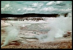
- Subject:
- Minerals, National parks & reserves, Norris Geyser Basin (Wyo.), Valleys, Springs, Forests, Geysers, Shrubs, Trees, Trails & paths, Mineral deposits,...
- Series:
- 7-38
- Creator:
- Cushman, Charles W., 1896-1972
- Date Created:
- 1938-09-30
- Genre:
- Landscape photographs
- Frame Number:
- 39
- County:
- Park
- Abstract:
- G-39= Panorama ( with steam ) NORRIS GEYSER BASIN
- Call Number:
- P01520
- Country:
- United States
- State/Province:
- Wyoming
- Physical Description:
- Color corrected: magenta cast [fading of yellow dye]. Image was originally mounted in a glass enclosure. Before digitization, the image was removed and place...
- Alternate Identifier:
- 738.39
- Persistent URL:
- http://purl.dlib.indiana.edu/iudl/archives/cushman/P01520
- Holding Location:
- Bloomington - University Archives
Wells Library E460
1320 E 10th St.
Bloomington, IN 47405
Contact at archives@indiana.edu, 812-855-1127
-
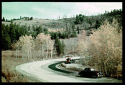
- Subject:
- Construction equipment, Hills, Automobiles, Roads, Shrubs, Trees, Construction workers, Road construction, Beartooth Mountains (Mont. and Wyo.), Tractors, an...
- Series:
- 7-38
- Creator:
- Cushman, Charles W., 1896-1972
- Date Created:
- 1938-10-01
- Genre:
- Landscape photographs
- Frame Number:
- 4
- Street Address:
- Cooke-Red Lodge Highway and Cooke City-Red Lodge Highway
- County:
- Park and Carbon
- Abstract:
- G-4= Cooke - Red Lodge Hwy in Autumn.
- Call Number:
- P01514
- City:
- Red Lodge and Cooke City
- Country:
- United States
- State/Province:
- Montana
- Physical Description:
- Color corrected: magenta cast [fading of yellow dye]. Image was originally mounted in a glass enclosure. Before digitization, the image was removed and place...
- Alternate Identifier:
- 738.4
- Persistent URL:
- http://purl.dlib.indiana.edu/iudl/archives/cushman/P01514
- Holding Location:
- Bloomington - University Archives
Wells Library E460
1320 E 10th St.
Bloomington, IN 47405
Contact at archives@indiana.edu, 812-855-1127
-
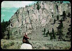
- Subject:
- Rocks, Men, Cliffs, Trees, Boulders, Mountains, Shrubs, and Hills
- Series:
- 7-38
- Creator:
- Cushman, Charles W., 1896-1972
- Date Created:
- 1938-10-01
- Genre:
- Landscape photographs and Portraits
- Frame Number:
- 3
- Street Address:
- Red Lodge Highway and Cooke-Red Lodge Highway
- County:
- Park and Carbon
- Persons Pictured:
- Cushman, Charles W. (Charles Weever), 1896-1972
- Abstract:
- G-3= Roadside scene along Cooke - Red Lodge Hwy.
- Call Number:
- P01513
- City:
- Cooke City and Red Lodge
- Country:
- United States
- State/Province:
- Montana
- Physical Description:
- Color corrected: magenta cast [fading of yellow dye].
- Alternate Identifier:
- 738.3
- Persistent URL:
- http://purl.dlib.indiana.edu/iudl/archives/cushman/P01513
- Holding Location:
- Bloomington - University Archives
Wells Library E460
1320 E 10th St.
Bloomington, IN 47405
Contact at archives@indiana.edu, 812-855-1127
-
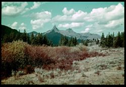
- Subject:
- Trees, Red Lodge (Mont.), Mountains, Index Peak (Wyo.), Clouds, Yellowstone National Park, Pilot Peak (Wyo.), and Shrubs
- Series:
- 7-38
- Creator:
- Cushman, Charles W., 1896-1972
- Date Created:
- 1938-10-01
- Genre:
- Landscape photographs
- Frame Number:
- 2
- Street Address:
- Cooke-Red Lodge Highway
- County:
- Park and Carbon
- Abstract:
- G-2= Index and Pilot Pks. from distance
- Call Number:
- P01512
- City:
- Cooke City
- Country:
- United States
- State/Province:
- Wyoming and Montana
- Physical Description:
- Color corrected: magenta cast [fading of yellow dye]. Image was originally mounted in a glass enclosure. Before digitization, the image was removed and place...
- Alternate Identifier:
- 738.2
- Persistent URL:
- http://purl.dlib.indiana.edu/iudl/archives/cushman/P01512
- Holding Location:
- Bloomington - University Archives
Wells Library E460
1320 E 10th St.
Bloomington, IN 47405
Contact at archives@indiana.edu, 812-855-1127
-
F-15= North across Midway Geyser Basin & Prismatic Lake in foreground. Excelsior Geyser in distance.
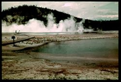
- Subject:
- Steam, Excelsior Geyser (Yellowstone National Park), Midway Geyser Basin (Wyo.), Trails & paths, Trees, Springs, Mountains, Grand Prismatic Spring (Wyo.)...
- Series:
- 6-38
- Creator:
- Cushman, Charles W., 1896-1972
- Date Created:
- 1938-09-29
- Genre:
- Landscape photographs
- Frame Number:
- 15
- County:
- Teton
- Abstract:
- F-15= North past Prismatic Lake Across Mid. Gey. Bsn.
- Call Number:
- P01501
- Country:
- United States
- State/Province:
- Wyoming
- Physical Description:
- Color corrected: magenta cast [fading of yellow dye]. Image was originally mounted in a glass enclosure. Before digitization, the image was removed and place...
- Alternate Identifier:
- 638.15
- Persistent URL:
- http://purl.dlib.indiana.edu/iudl/archives/cushman/P01501
- Holding Location:
- Bloomington - University Archives
Wells Library E460
1320 E 10th St.
Bloomington, IN 47405
Contact at archives@indiana.edu, 812-855-1127
-
- Subject:
- Trees, Glacier National Park (Mont.), Mountains, Shrubs, Lakes & ponds, Clouds, Sunrises & sunsets, Saint Marys Lake (Mont.), and National parks &...
- Series:
- 5-38
- Creator:
- Cushman, Charles W., 1896-1972
- Date Created:
- 1938-09-23/1938-09-24
- Genre:
- Landscape photographs
- Frame Number:
- 42
- County:
- Lake
- Abstract:
- E-42= Peaks at sunset from St Mary's Lake
- Call Number:
- P01492
- Country:
- United States
- State/Province:
- Montana
- Physical Description:
- Color corrected: magenta cast [fading of yellow dye].
- Alternate Identifier:
- 538.42
- Persistent URL:
- http://purl.dlib.indiana.edu/iudl/archives/cushman/P01492
- Holding Location:
- Bloomington - University Archives
Wells Library E460
1320 E 10th St.
Bloomington, IN 47405
Contact at archives@indiana.edu, 812-855-1127
-
E-39 = View from vicinity of Logan Pass back toward mountains along Garden and Glacier walls Cushman
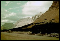
- Subject:
- Cliffs, Trees, Shadows, Glacier National Park (Mont.), Mountains, Shrubs, Clouds, Garden Wall (Mont.), Roads, and National parks & reserves
- Series:
- 5-38
- Creator:
- Cushman, Charles W., 1896-1972
- Date Created:
- 1938-09-24
- Genre:
- Landscape photographs
- Frame Number:
- 39
- Street Address:
- Logan Pass
- Abstract:
- E- 39= Looking North from Logan Pass
- Call Number:
- P01489
- Country:
- United States
- State/Province:
- Montana
- Physical Description:
- Color corrected: magenta cast [fading of yellow dye]. Image was originally mounted in a glass enclosure. Before digitization, the image was removed and place...
- Alternate Identifier:
- 538.39
- Persistent URL:
- http://purl.dlib.indiana.edu/iudl/archives/cushman/P01489
- Holding Location:
- Bloomington - University Archives
Wells Library E460
1320 E 10th St.
Bloomington, IN 47405
Contact at archives@indiana.edu, 812-855-1127
-

- Subject:
- National parks & reserves, Forests, Roads, Mountains, Shrubs, Sun Mountain (Mont.), Shadows, Clouds, Glacier National Park (Mont.), and Trees
- Series:
- 5-38
- Creator:
- Cushman, Charles W., 1896-1972
- Date Created:
- 1938-09-24
- Genre:
- Landscape photographs
- Frame Number:
- 37
- Street Address:
- Logan Pass
- County:
- Cascade
- Abstract:
- E-37= Eastward from Logan Pass Going to the Sun Mtn. At left.
- Call Number:
- P01488
- Country:
- United States
- State/Province:
- Montana
- Physical Description:
- Color corrected: magenta cast [fading of yellow dye]. Image was originally mounted in a glass enclosure. Before digitization, the image was removed and place...
- Alternate Identifier:
- 538.37
- Persistent URL:
- http://purl.dlib.indiana.edu/iudl/archives/cushman/P01488
- Holding Location:
- Bloomington - University Archives
Wells Library E460
1320 E 10th St.
Bloomington, IN 47405
Contact at archives@indiana.edu, 812-855-1127
-
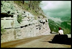
- Subject:
- Walls, Men, Cliffs, Trees, Glacier National Park (Mont.), Mountains, Shrubs, Garden Wall (Mont.), Roads, and National parks & reserves
- Series:
- 5-38
- Creator:
- Cushman, Charles W., 1896-1972
- Date Created:
- 1938-09-24
- Genre:
- Landscape photographs
- Frame Number:
- 34
- Street Address:
- Logan Pass
- Persons Pictured:
- Cushman, Charles W. (Charles Weever), 1896-1972
- Abstract:
- E- 34= Looking up along Garden Wall to mountains near Logan Pass.
- Call Number:
- P01486
- Country:
- United States
- State/Province:
- Montana
- Physical Description:
- Color corrected: magenta cast [fading of yellow dye]. Image was originally mounted in a glass enclosure. Before digitization, the image was removed and place...
- Alternate Identifier:
- 538.34
- Persistent URL:
- http://purl.dlib.indiana.edu/iudl/archives/cushman/P01486
- Holding Location:
- Bloomington - University Archives
Wells Library E460
1320 E 10th St.
Bloomington, IN 47405
Contact at archives@indiana.edu, 812-855-1127
-
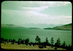
- Subject:
- Rocky Mountains, Trees, Coastlines, Flathead Lake (Mont.), Mountains, Shrubs, Lakes & ponds, and Islands
- Series:
- 5-38
- Creator:
- Cushman, Charles W., 1896-1972
- Date Created:
- 1938-09-23
- Genre:
- Landscape photographs
- Frame Number:
- 27
- County:
- Lake
- Abstract:
- E-27: East across flathead Lake to rugged Rockies.
- Call Number:
- P01479
- Country:
- United States
- State/Province:
- Montana
- Physical Description:
- Color corrected: magenta cast [fading of yellow dye].
- Alternate Identifier:
- 538.27
- Persistent URL:
- http://purl.dlib.indiana.edu/iudl/archives/cushman/P01479
- Holding Location:
- Bloomington - University Archives
Wells Library E460
1320 E 10th St.
Bloomington, IN 47405
Contact at archives@indiana.edu, 812-855-1127
-
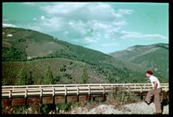
- Subject:
- Men, Bitterroot Range (Idaho and Mont.), Trees, Mountains, Shrubs, Clouds, Forests, and Bridges
- Series:
- 5-38
- Creator:
- Cushman, Charles W., 1896-1972
- Date Created:
- 1938-09-23
- Genre:
- Landscape photographs
- Frame Number:
- 22
- County:
- Shoshone
- Persons Pictured:
- Cushman, Charles W. (Charles Weever), 1896-1972
- Abstract:
- E- 22: Bitterroot Mtns east of Kellogg, Ida.
- Call Number:
- P01475
- City:
- Kellogg
- Country:
- United States
- State/Province:
- Idaho
- Physical Description:
- Color corrected: magenta cast [fading of yellow dye]. Image was originally mounted in a glass enclosure. Before digitization, the image was removed and place...
- Alternate Identifier:
- 538.22
- Persistent URL:
- http://purl.dlib.indiana.edu/iudl/archives/cushman/P01475
- Holding Location:
- Bloomington - University Archives
Wells Library E460
1320 E 10th St.
Bloomington, IN 47405
Contact at archives@indiana.edu, 812-855-1127
-
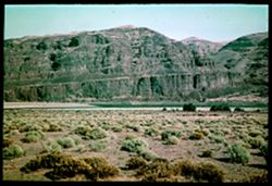
- Subject:
- Columbia River, Cliffs, Trees, Mountains, Shrubs, and Rivers
- Series:
- 4-38
- Creator:
- Cushman, Charles W., 1896-1972
- Date Created:
- 1938-09-22
- Genre:
- Landscape photographs
- Frame Number:
- 45
- Abstract:
- * D-45= Red cliffs of Columbia's west bank.
- Call Number:
- P01474
- Country:
- United States
- State/Province:
- Washington
- Physical Description:
- Color corrected: magenta cast [fading of yellow dye]. Image was originally mounted in a glass enclosure. Before digitization, the image was removed and place...
- Alternate Identifier:
- 438.45
- Persistent URL:
- http://purl.dlib.indiana.edu/iudl/archives/cushman/P01474
- Holding Location:
- Bloomington - University Archives
Wells Library E460
1320 E 10th St.
Bloomington, IN 47405
Contact at archives@indiana.edu, 812-855-1127
-
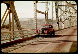
- Subject:
- Columbia River, Roads, Automobiles, Trees, Mountains, Shrubs, Bridges, Rivers, and Mesas
- Series:
- 4-38
- Creator:
- Cushman, Charles W., 1896-1972
- Date Created:
- 1938-09-21/1938-09-22
- Genre:
- Views
- Frame Number:
- 43
- Abstract:
- D-43=Hwy bridge over Columbia , central Washington.
- Call Number:
- P01472
- Country:
- United States
- State/Province:
- Washington
- Physical Description:
- Color corrected: magenta cast [fading of yellow dye].
- Alternate Identifier:
- 438.43
- Persistent URL:
- http://purl.dlib.indiana.edu/iudl/archives/cushman/P01472
- Holding Location:
- Bloomington - University Archives
Wells Library E460
1320 E 10th St.
Bloomington, IN 47405
Contact at archives@indiana.edu, 812-855-1127
-
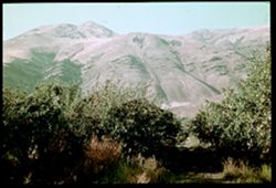
- Subject:
- Mountains, Dirt roads, Shrubs, Apple trees, Grasses, and Apple orchards
- Series:
- 4-38
- Creator:
- Cushman, Charles W., 1896-1972
- Date Created:
- 1938-09-21
- Genre:
- Landscape photographs
- Frame Number:
- 40
- County:
- Yakima
- Abstract:
- D-40= Mtns behind apple orchard
- Call Number:
- P01469
- City:
- Yakima
- Country:
- United States
- State/Province:
- Washington
- Physical Description:
- Color corrected: magenta cast [fading of yellow dye]. Image was originally mounted in a glass enclosure. Before digitization, the image was removed and place...
- Alternate Identifier:
- 438.40
- Persistent URL:
- http://purl.dlib.indiana.edu/iudl/archives/cushman/P01469
- Holding Location:
- Bloomington - University Archives
Wells Library E460
1320 E 10th St.
Bloomington, IN 47405
Contact at archives@indiana.edu, 812-855-1127
-
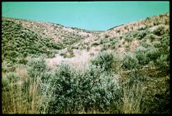
- Subject:
- Grasses, Ginkgo Petrified Forest State Park (Wash.), State parks & reserves, Shrubs, and Hills
- Series:
- 4-38
- Creator:
- Cushman, Charles W., 1896-1972
- Date Created:
- 1938-09-22
- Genre:
- Landscape photographs
- Frame Number:
- 41
- Abstract:
- D-41= In Gingko State Park, Central Washington
- Call Number:
- P01470
- Country:
- United States
- State/Province:
- Washington
- Physical Description:
- Color corrected: magenta cast [fading of yellow dye]. Image was originally mounted in a glass enclosure. Before digitization, the image was removed and place...
- Alternate Identifier:
- 438.41
- Persistent URL:
- http://purl.dlib.indiana.edu/iudl/archives/cushman/P01470
- Holding Location:
- Bloomington - University Archives
Wells Library E460
1320 E 10th St.
Bloomington, IN 47405
Contact at archives@indiana.edu, 812-855-1127
-
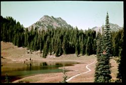
- Subject:
- Roads, Trees, Mountains, Shrubs, Lakes & ponds, Forests, Reflections, Mount Rainier National Park (Wash.), and National parks & reserves
- Series:
- 4-38
- Creator:
- Cushman, Charles W., 1896-1972
- Date Created:
- 1938-09-21/1938-09-22
- Genre:
- Landscape photographs
- Frame Number:
- 37
- Street Address:
- Chinook Pass
- Abstract:
- D-37 = Lake, Evergreens, & Mtns. Westside Chinook Pass
- Call Number:
- P01466
- Country:
- United States
- State/Province:
- Washington
- Physical Description:
- Color corrected: magenta cast [fading of yellow dye]. Image was originally mounted in a glass enclosure. Before digitization, the image was removed and place...
- Alternate Identifier:
- 438.37
- Persistent URL:
- http://purl.dlib.indiana.edu/iudl/archives/cushman/P01466
- Holding Location:
- Bloomington - University Archives
Wells Library E460
1320 E 10th St.
Bloomington, IN 47405
Contact at archives@indiana.edu, 812-855-1127
-
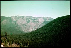
- Subject:
- Rocks, Trees, Flowers, Mountains, National parks & reserves, Passes (Landforms), Mount Rainier National Park (Wash.), and Shrubs
- Series:
- 4-38
- Creator:
- Cushman, Charles W., 1896-1972
- Date Created:
- 1938-09-21/1938-09-22
- Genre:
- Landscape photographs
- Frame Number:
- 38
- Street Address:
- Chinook Pass
- Abstract:
- D-38=East side Chinook Pass.
- Call Number:
- P01467
- Country:
- United States
- State/Province:
- Washington
- Physical Description:
- Color corrected: magenta cast [fading of yellow dye]. Image was originally mounted in a glass enclosure. Before digitization, the image was removed and place...
- Alternate Identifier:
- 438.38
- Persistent URL:
- http://purl.dlib.indiana.edu/iudl/archives/cushman/P01467
- Holding Location:
- Bloomington - University Archives
Wells Library E460
1320 E 10th St.
Bloomington, IN 47405
Contact at archives@indiana.edu, 812-855-1127
-
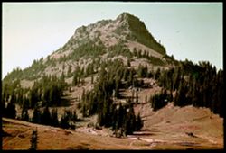
- Subject:
- Mount Rainier National Park (Wash.), National parks & reserves, Forests, Roads, Mountains, Shrubs, Trees, and Rocks
- Series:
- 4-38
- Creator:
- Cushman, Charles W., 1896-1972
- Date Created:
- 1938-09-21/1938-09-22
- Genre:
- Landscape photographs
- Frame Number:
- 36
- Abstract:
- D-36= A mountain east of Rainier
- Call Number:
- P01465
- Country:
- United States
- State/Province:
- Washington
- Physical Description:
- Color corrected: magenta cast [fading of yellow dye]. Image was originally mounted in a glass enclosure. Before digitization, the image was removed and place...
- Alternate Identifier:
- 438.36
- Persistent URL:
- http://purl.dlib.indiana.edu/iudl/archives/cushman/P01465
- Holding Location:
- Bloomington - University Archives
Wells Library E460
1320 E 10th St.
Bloomington, IN 47405
Contact at archives@indiana.edu, 812-855-1127
-
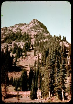
- Subject:
- Mount Rainier National Park (Wash.), National parks & reserves, Automobiles, Forests, Roads, Mountains, Shrubs, Trees, and Rocks
- Series:
- 4-38
- Creator:
- Cushman, Charles W., 1896-1972
- Date Created:
- 1938-09-01
- Genre:
- Landscape photographs
- Frame Number:
- 35
- Abstract:
- D-35=Evergreens on mountain side
- Call Number:
- P01464
- Country:
- United States
- State/Province:
- Washington
- Physical Description:
- Color corrected: magenta cast [fading of yellow dye].
- Alternate Identifier:
- 438.35
- Persistent URL:
- http://purl.dlib.indiana.edu/iudl/archives/cushman/P01464
- Holding Location:
- Bloomington - University Archives
Wells Library E460
1320 E 10th St.
Bloomington, IN 47405
Contact at archives@indiana.edu, 812-855-1127
-
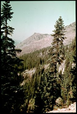
- Subject:
- Mount Rainier National Park (Wash.), National parks & reserves, Forests, Mountains, Shrubs, Trees, and Rocks
- Series:
- 4-38
- Creator:
- Cushman, Charles W., 1896-1972
- Date Created:
- 1938-09-21/1938-09-22
- Genre:
- Landscape photographs
- Frame Number:
- 34
- Abstract:
- D-34= Mountain scene near Chinook Pass.
- Call Number:
- P01463
- Country:
- United States
- State/Province:
- Washington
- Physical Description:
- Color corrected: magenta cast [fading of yellow dye]. Image was originally mounted in a glass enclosure. Before digitization, the image was removed and place...
- Alternate Identifier:
- 438.34
- Persistent URL:
- http://purl.dlib.indiana.edu/iudl/archives/cushman/P01463
- Holding Location:
- Bloomington - University Archives
Wells Library E460
1320 E 10th St.
Bloomington, IN 47405
Contact at archives@indiana.edu, 812-855-1127
-

- Subject:
- Mount Rainier National Park (Wash.), National parks & reserves, Flowers, Mountains, Shrubs, Trees, and Rocks
- Series:
- 4-38
- Creator:
- Cushman, Charles W., 1896-1972
- Date Created:
- 1938-09-21
- Genre:
- Identification photographs
- Frame Number:
- 33
- Abstract:
- D-33=Flowers along mountain road
- Call Number:
- P01462
- Country:
- United States
- State/Province:
- Washington
- Physical Description:
- Color corrected: magenta cast [fading of yellow dye]. Image was originally mounted in a glass enclosure. Before digitization, the image was removed and place...
- Alternate Identifier:
- 438.33
- Persistent URL:
- http://purl.dlib.indiana.edu/iudl/archives/cushman/P01462
- Holding Location:
- Bloomington - University Archives
Wells Library E460
1320 E 10th St.
Bloomington, IN 47405
Contact at archives@indiana.edu, 812-855-1127
-
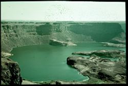
- Subject:
- Craters, Cliffs, Dry Falls Lake (Wash.), State parks & reserves, Shrubs, Lakes & ponds, Sun Lakes State Park (Wash.), and Mesas
- Series:
- 4-38
- Creator:
- Cushman, Charles W., 1896-1972
- Date Created:
- 1938-09-22
- Genre:
- Landscape photographs
- Frame Number:
- 3
- County:
- Grant
- Abstract:
- D-3 * = Great Dry Falls - near Coulee, Wash.
- Call Number:
- P01458
- City:
- Grand Coulee
- Country:
- United States
- State/Province:
- Washington
- Physical Description:
- Color corrected: magenta cast [fading of yellow dye]. Image was originally mounted in a glass enclosure. Before digitization, the image was removed and place...
- Alternate Identifier:
- 438.3
- Persistent URL:
- http://purl.dlib.indiana.edu/iudl/archives/cushman/P01458
- Holding Location:
- Bloomington - University Archives
Wells Library E460
1320 E 10th St.
Bloomington, IN 47405
Contact at archives@indiana.edu, 812-855-1127
-
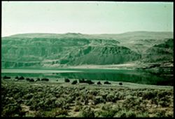
- Subject:
- Columbia River, Cliffs, Mesas, Coastlines, Mountains, Shrubs, Reflections, and Bodies of water
- Series:
- 4-38
- Creator:
- Cushman, Charles W., 1896-1972
- Date Created:
- 1938-09-21/1938-09-22
- Genre:
- Landscape photographs
- Frame Number:
- 1
- Abstract:
- D-1=More of Columbia's left bank (slightly over expo.)
- Call Number:
- P01457
- Country:
- United States
- State/Province:
- Washington
- Physical Description:
- Color corrected: magenta cast [fading of yellow dye]. Image was originally mounted in a glass enclosure. Before digitization, the image was removed and place...
- Alternate Identifier:
- 438.1
- Persistent URL:
- http://purl.dlib.indiana.edu/iudl/archives/cushman/P01457
- Holding Location:
- Bloomington - University Archives
Wells Library E460
1320 E 10th St.
Bloomington, IN 47405
Contact at archives@indiana.edu, 812-855-1127
-
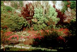
- Subject:
- Trees, Flowers, Walkways, Gardens, Shrubs, and Butchart
- Series:
- 3-38
- Creator:
- Cushman, Charles W., 1896-1972
- Date Created:
- 1938-09-17
- Genre:
- Landscape photographs
- Frame Number:
- 45
- County:
- Vancouver Island
- Abstract:
- * C-45: Scene in Mr. Butchart's Gardens
- Call Number:
- P01456
- City:
- Victoria
- Country:
- Canada
- State/Province:
- British Columbia
- Physical Description:
- Color corrected: magenta cast [fading of yellow dye]. Image was originally mounted in a glass enclosure. Before digitization, the image was removed and place...
- Alternate Identifier:
- 338.45
- Persistent URL:
- http://purl.dlib.indiana.edu/iudl/archives/cushman/P01456
- Holding Location:
- Bloomington - University Archives
Wells Library E460
1320 E 10th St.
Bloomington, IN 47405
Contact at archives@indiana.edu, 812-855-1127
-
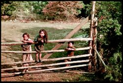
- Subject:
- Trees, Girls, Shrubs, Indians of North America, Boys, Wheels, and Gates
- Series:
- 3-38
- Creator:
- Cushman, Charles W., 1896-1972
- Date Created:
- 1938-09-01
- Genre:
- Portraits and Ethnographic photographs
- Frame Number:
- 44
- County:
- Vancouver Island
- Abstract:
- * C-44: 3 little Indians enjoy Jean's / Iums
- Call Number:
- P01455
- Country:
- Canada
- State/Province:
- British Columbia
- Physical Description:
- Color corrected: magenta cast [fading of yellow dye]. Image was originally mounted in a glass enclosure. Before digitization, the image was removed and place...
- Alternate Identifier:
- 338.44
- Persistent URL:
- http://purl.dlib.indiana.edu/iudl/archives/cushman/P01455
- Holding Location:
- Bloomington - University Archives
Wells Library E460
1320 E 10th St.
Bloomington, IN 47405
Contact at archives@indiana.edu, 812-855-1127
-
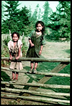
- Subject:
- Indians of North America, Shrubs, Trees, Gates, Girls, and Fences
- Series:
- 3-38
- Creator:
- Cushman, Charles W., 1896-1972
- Date Created:
- 1938-09-01
- Genre:
- Portraits and Ethnographic photographs
- Frame Number:
- 43
- County:
- Vancouver Island
- Abstract:
- * C-43: 3 little Indians enjoy Jean's / Iums
- Call Number:
- P01454
- Country:
- Canada
- State/Province:
- British Columbia
- Physical Description:
- Color corrected: magenta cast [fading of yellow dye]. Image was originally mounted in a glass enclosure. Before digitization, the image was removed and place...
- Alternate Identifier:
- 338.43
- Persistent URL:
- http://purl.dlib.indiana.edu/iudl/archives/cushman/P01454
- Holding Location:
- Bloomington - University Archives
Wells Library E460
1320 E 10th St.
Bloomington, IN 47405
Contact at archives@indiana.edu, 812-855-1127
-
- Subject:
- Flowers, Gardens, and Shrubs
- Series:
- 3-38
- Creator:
- Cushman, Charles W., 1896-1972
- Date Created:
- 1938-09-01
- Genre:
- Identification photographs
- Frame Number:
- 39
- County:
- Vancouver Island
- Abstract:
- C-39= Flowers in garden of c-38
- Call Number:
- P01452
- City:
- Victoria
- Country:
- Canada
- State/Province:
- British Columbia
- Physical Description:
- Color corrected: magenta cast [fading of yellow dye].
- Alternate Identifier:
- 338.39
- Persistent URL:
- http://purl.dlib.indiana.edu/iudl/archives/cushman/P01452
- Holding Location:
- Bloomington - University Archives
Wells Library E460
1320 E 10th St.
Bloomington, IN 47405
Contact at archives@indiana.edu, 812-855-1127