
Search Constraints
You searched for:
Campus
IUB
Remove constraint Campus: IUB
Pages
0-99 pages
Remove constraint Pages: 0-99 pages
State/Province
Arizona
Remove constraint State/Province: Arizona
« Previous |
1 - 100 of 962
|
Next »
Search Results
-
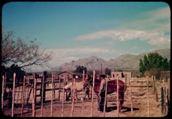
- Subject:
- Men, Horses, Trees, Mountains, Fences, Clouds, Dwellings, and Utility poles
- Series:
- 1-40
- Creator:
- Cushman, Charles W., 1896-1972
- Date Created:
- 1940-01-01
- Genre:
- Landscape photographs and Ethnographic photographs
- Frame Number:
- 6
- County:
- Pima
- Abstract:
- Saddle horses for Eastern Dudes
- Call Number:
- P01743
- City:
- Tucson
- Country:
- United States
- State/Province:
- Arizona
- Alternate Identifier:
- 140.6
- Persistent URL:
- http://purl.dlib.indiana.edu/iudl/archives/cushman/P01743
- Holding Location:
- Bloomington - University Archives
Wells Library E460
1320 E 10th St.
Bloomington, IN 47405
Contact at archives@indiana.edu, 812-855-1127
-
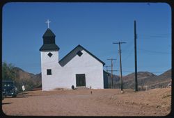
- Description:
- 100 f 9 tl
- Subject:
- Dogs, Crosses, Churches, Automobiles, Mountains, Dirt roads, Shrubs, Electric lines, Trees, Towers, and Masonry
- Series:
- 9-59
- Creator:
- Cushman, Charles W., 1896-1972
- Date Created:
- 1959-02-24
- Genre:
- Architectural photographs
- Frame Number:
- 9
- County:
- Santa Cruz
- Abstract:
- Tubac- old church
- Call Number:
- P10660
- City:
- Tubac
- Country:
- United States
- State/Province:
- Arizona
- Alternate Identifier:
- 959.9
- Persistent URL:
- http://purl.dlib.indiana.edu/iudl/archives/cushman/P10660
- Holding Location:
- Bloomington - University Archives
Wells Library E460
1320 E 10th St.
Bloomington, IN 47405
Contact at archives@indiana.edu, 812-855-1127
-
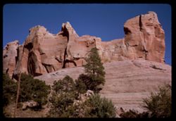
- Description:
- 100 f 16 SL
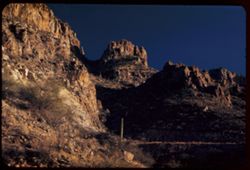
- Subject:
- Rocks, Cliffs, Trees, and Rock formations
- Series:
- 36-65
- Creator:
- Cushman, Charles W., 1896-1972
- Date Created:
- 1965-10-07
- Genre:
- Landscape photographs
- Frame Number:
- 28
- County:
- Apache
- Call Number:
- P15096
- City:
- Window Rock
- Country:
- United States
- State/Province:
- Arizona
- Alternate Identifier:
- 3665.28
- Persistent URL:
- http://purl.dlib.indiana.edu/iudl/archives/cushman/P15096
- Holding Location:
- Bloomington - University Archives
Wells Library E460
1320 E 10th St.
Bloomington, IN 47405
Contact at archives@indiana.edu, 812-855-1127
-
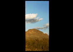
- Subject:
- Mountains, Shrubs, Tucson Mountains (Ariz.), and Clouds
- Series:
- 4-40
- Creator:
- Cushman, Charles W., 1896-1972
- Date Created:
- 1940-04-01
- Genre:
- Landscape photographs
- Frame Number:
- 14
- County:
- Pima
- Abstract:
- Mtn. + cloud near Tucson
- Call Number:
- P01801
- City:
- Tucson
- Country:
- United States
- State/Province:
- Arizona
- Physical Description:
- masked.
- Alternate Identifier:
- 440.14
- Persistent URL:
- http://purl.dlib.indiana.edu/iudl/archives/cushman/P01801
- Holding Location:
- Bloomington - University Archives
Wells Library E460
1320 E 10th St.
Bloomington, IN 47405
Contact at archives@indiana.edu, 812-855-1127
-
- Description:
- 100 f 11 TL
- Subject:
- Cliffs, Buttes, Shrubs, and Rock formations
- Series:
- 38-65
- Creator:
- Cushman, Charles W., 1896-1972
- Date Created:
- 1965-10-12
- Genre:
- Landscape photographs
- Frame Number:
- 36
- County:
- Apache
- Abstract:
- Shape near Round Rock
- Call Number:
- P15179
- City:
- Round Rock
- Country:
- United States
- State/Province:
- Arizona
- Alternate Identifier:
- 3865.36
- Persistent URL:
- http://purl.dlib.indiana.edu/iudl/archives/cushman/P15179
- Holding Location:
- Bloomington - University Archives
Wells Library E460
1320 E 10th St.
Bloomington, IN 47405
Contact at archives@indiana.edu, 812-855-1127
-
- Description:
- 25 f 11
- Subject:
- Canyons, Cliffs, Trees, Mountains, Shrubs, Clouds, Junipers, Rock formations, and Oak Creek Canyon (Ariz.)
- Series:
- 16-52
- Creator:
- Cushman, Charles W., 1896-1972
- Date Created:
- 1952-04-12
- Genre:
- Landscape photographs
- Frame Number:
- 30
- County:
- Coconino
- Abstract:
- Across the Juniper tops toward red
- Call Number:
- P06088
- City:
- Flagstaff
- Country:
- United States
- State/Province:
- Arizona
- Alternate Identifier:
- 1652.30
- Persistent URL:
- http://purl.dlib.indiana.edu/iudl/archives/cushman/P06088
- Holding Location:
- Bloomington - University Archives
Wells Library E460
1320 E 10th St.
Bloomington, IN 47405
Contact at archives@indiana.edu, 812-855-1127
-
- Description:
- 25 f 11
- Subject:
- Canyons, Cliffs, Trees, Mountains, Shrubs, Clouds, Hills, Oak Creek Canyon (Ariz.), and Rock formations
- Series:
- 16-52
- Creator:
- Cushman, Charles W., 1896-1972
- Date Created:
- 1952-04-12
- Genre:
- Landscape photographs
- Frame Number:
- 29
- County:
- Coconino
- Abstract:
- Green pyramid
- Call Number:
- P06087
- Country:
- United States
- State/Province:
- Arizona
- Alternate Identifier:
- 1652.29
- Persistent URL:
- http://purl.dlib.indiana.edu/iudl/archives/cushman/P06087
- Holding Location:
- Bloomington - University Archives
Wells Library E460
1320 E 10th St.
Bloomington, IN 47405
Contact at archives@indiana.edu, 812-855-1127
-
- Description:
- 25 f 10
- Subject:
- Canyons, Trees, Tree limbs, Mountains, Buildings, Rock formations, Hills, and Oak Creek Canyon (Ariz.)
- Series:
- 16-52
- Creator:
- Cushman, Charles W., 1896-1972
- Date Created:
- 1952-04-12
- Genre:
- Landscape photographs
- Frame Number:
- 27
- County:
- Coconino
- Abstract:
- Red monuments Spots
- Call Number:
- P06085
- Country:
- United States
- State/Province:
- Arizona
- Alternate Identifier:
- 1652.27
- Persistent URL:
- http://purl.dlib.indiana.edu/iudl/archives/cushman/P06085
- Holding Location:
- Bloomington - University Archives
Wells Library E460
1320 E 10th St.
Bloomington, IN 47405
Contact at archives@indiana.edu, 812-855-1127
-
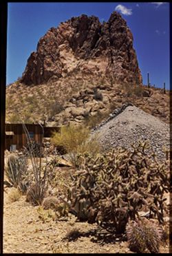
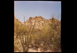
- Subject:
- Rocks, Cactus, Mining, Mountains, Shrubs, Tucson Mountains (Ariz.), Clouds, Facilities, and Rock formations
- Series:
- 5-40
- Creator:
- Cushman, Charles W., 1896-1972
- Date Created:
- 1940-05-01
- Genre:
- Landscape photographs
- Frame Number:
- 2
- County:
- Pima
- Abstract:
- la Tucson Mtn. Foothills. Old mine.
- Call Number:
- P01810
- Country:
- United States
- State/Province:
- Arizona
- Physical Description:
- Image was originally mounted in a glass enclosure. Before digitization, the image was removed and placed in a Wess Plastic, Inc. brand, 2" x 2", pl...
- Alternate Identifier:
- 540.2
- Persistent URL:
- http://purl.dlib.indiana.edu/iudl/archives/cushman/P01810
- Holding Location:
- Bloomington - University Archives
Wells Library E460
1320 E 10th St.
Bloomington, IN 47405
Contact at archives@indiana.edu, 812-855-1127
-
- Subject:
- Flowers, Mountains, Shrubs, and Tucson Mountains (Ariz.)
- Series:
- 5-40
- Creator:
- Cushman, Charles W., 1896-1972
- Date Created:
- 1940-05-01
- Genre:
- Landscape photographs
- Frame Number:
- 0
- County:
- Pima
- Abstract:
- Jagged rocks of Tucson Mtn. Foothills
- Call Number:
- P01808
- Country:
- United States
- State/Province:
- Arizona
- Physical Description:
- masked, creased. Image was originally mounted in a glass enclosure. Before digitization, the image was removed and placed in a Wess Plastic, Inc. brand, 2&qu...
- Alternate Identifier:
- 540.0
- Persistent URL:
- http://purl.dlib.indiana.edu/iudl/archives/cushman/P01808
- Holding Location:
- Bloomington - University Archives
Wells Library E460
1320 E 10th St.
Bloomington, IN 47405
Contact at archives@indiana.edu, 812-855-1127
-
- Description:
- 25 f 6.3 pola
- Subject:
- Rocks, Canyons, Cliffs, Cactus, Sabino Canyon (Ariz.), Mountains, Shrubs, Saguaro, Santa Catalina Mountains (Ariz.), and Rock formations
- Series:
- 5-52
- Creator:
- Cushman, Charles W., 1896-1972
- Date Created:
- 1952-02-04
- Genre:
- Landscape photographs
- Frame Number:
- 24
- County:
- Pima
- Abstract:
- High square castle seen through a gap above Sabino canyon - both
- Call Number:
- P05669
- Country:
- United States
- State/Province:
- Arizona
- Alternate Identifier:
- 552.24
- Persistent URL:
- http://purl.dlib.indiana.edu/iudl/archives/cushman/P05669
- Holding Location:
- Bloomington - University Archives
Wells Library E460
1320 E 10th St.
Bloomington, IN 47405
Contact at archives@indiana.edu, 812-855-1127
-
- Description:
- 100 f 9 TL
- Subject:
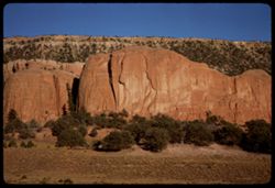
- Boundaries, Cliffs, Trees, Rock formations, and Mesas
- Series:
- 36-65
- Creator:
- Cushman, Charles W., 1896-1972
- Date Created:
- 1965-10-08
- Genre:
- Landscape photographs
- Frame Number:
- 36
- County:
- McKinley
- Abstract:
- Pink slab.
- Call Number:
- P15104
- Country:
- United States
- State/Province:
- Arizona and New Mexico
- Alternate Identifier:
- 3665.36
- Persistent URL:
- http://purl.dlib.indiana.edu/iudl/archives/cushman/P15104
- Holding Location:
- Bloomington - University Archives
Wells Library E460
1320 E 10th St.
Bloomington, IN 47405
Contact at archives@indiana.edu, 812-855-1127
-
- Description:
- 100 f 16 SL
- Subject:
- Boundaries, Grasses, Cliffs, Mesas, Navajo Indian Reservation, Rock formations, Hills, and Trees
- Series:
- 36-65
- Creator:
- Cushman, Charles W., 1896-1972
- Date Created:
- 1965-10-08
- Genre:
- Landscape photographs
- Frame Number:
- 34
- County:
- McKinley
- Abstract:
- [Fade]
- Call Number:
- P15102
- Country:
- United States
- State/Province:
- Arizona and New Mexico
- Alternate Identifier:
- 3665.34
- Persistent URL:
- http://purl.dlib.indiana.edu/iudl/archives/cushman/P15102
- Holding Location:
- Bloomington - University Archives
Wells Library E460
1320 E 10th St.
Bloomington, IN 47405
Contact at archives@indiana.edu, 812-855-1127
-
- Description:
- 100 f 16 TL HF
- Subject:
- Canyons, Erosion, Cliffs, Moran Point (Ariz.), Granite Gorge (Ariz.), Grand Canyon National Park (Ariz.), National parks & reserves, Grand Canyon (Ariz.)...
- Series:
- 2-66
- Creator:
- Cushman, Charles W., 1896-1972
- Date Created:
- 1966-04-23
- Genre:
- Landscape photographs
- Frame Number:
- 14
- County:
- Coconino
- Abstract:
- Moran Pt.
- Call Number:
- P15276
- Country:
- United States
- State/Province:
- Arizona
- Alternate Identifier:
- 266.14
- Persistent URL:
- http://purl.dlib.indiana.edu/iudl/archives/cushman/P15276
- Holding Location:
- Bloomington - University Archives
Wells Library E460
1320 E 10th St.
Bloomington, IN 47405
Contact at archives@indiana.edu, 812-855-1127
-
- Description:
- 100 f 16 TL HF tele lens
- Subject:
- Valleys, Cliffs, Moran Point (Ariz.), Mesas, Colorado River (Colo.-Mexico), Rock formations, Colorado River Valley (Colo.-Mexico), Grand Canyon (Ariz.), Rive...
- Series:
- 2-66
- Creator:
- Cushman, Charles W., 1896-1972
- Date Created:
- 1966-04-23
- Genre:
- Landscape photographs
- Frame Number:
- 13
- County:
- Coconino
- Abstract:
- Moran Pt.
- Call Number:
- P15275
- Country:
- United States
- State/Province:
- Arizona
- Alternate Identifier:
- 266.13
- Persistent URL:
- http://purl.dlib.indiana.edu/iudl/archives/cushman/P15275
- Holding Location:
- Bloomington - University Archives
Wells Library E460
1320 E 10th St.
Bloomington, IN 47405
Contact at archives@indiana.edu, 812-855-1127
-
- Description:
- 50 f 8 sl
- Subject:
- Mission San Xavier del Bac (Tucson, Ariz.), Churches, Flying buttresses, Cactus, Balustrades, Towers, and Cristate saguaro
- Series:
- 10-59
- Creator:
- Cushman, Charles W., 1896-1972
- Date Created:
- 1959-03-18
- Genre:
- Identification photographs
- Frame Number:
- 29
- County:
- Pima
- Abstract:
- The cristate sahuaro
- Call Number:
- P10717
- City:
- Tucson
- Country:
- United States
- State/Province:
- Arizona
- Alternate Identifier:
- 1059.29
- Persistent URL:
- http://purl.dlib.indiana.edu/iudl/archives/cushman/P10717
- Holding Location:
- Bloomington - University Archives
Wells Library E460
1320 E 10th St.
Bloomington, IN 47405
Contact at archives@indiana.edu, 812-855-1127
-

- Subject:
- Mission San Xavier del Bac (Tucson, Ariz.), Mission churches, Religious services, Sidewalks, Tohono O'Odham Indians, and Girls
- Series:
- 3-40
- Creator:
- Cushman, Charles W., 1896-1972
- Date Created:
- 1940-03-10
- Genre:
- Identification photographs
- Frame Number:
- 9
- County:
- Pima
- Abstract:
- Future Papgo squaws?
- Call Number:
- P01780
- City:
- Tucson
- Country:
- United States
- State/Province:
- Arizona
- Alternate Identifier:
- 340.9
- Persistent URL:
- http://purl.dlib.indiana.edu/iudl/archives/cushman/P01780
- Holding Location:
- Bloomington - University Archives
Wells Library E460
1320 E 10th St.
Bloomington, IN 47405
Contact at archives@indiana.edu, 812-855-1127
-
- Description:
- 100 f 11 TL
- Subject:
- Deserts, Blue Mesa (Ariz.), Petrified forests, Petrified Forest National Park (Ariz.), National parks & reserves, Logs, Hills, Erosion, Shadows, and Rock...
- Series:
- 6-63
- Creator:
- Cushman, Charles W., 1896-1972
- Date Created:
- 1963-06-27
- Genre:
- Landscape photographs and Identification photographs
- Frame Number:
- 8
- County:
- Apache and Navajo
- Abstract:
- Distantly Down from Blue Mesa
- Call Number:
- P12961
- City:
- Holbrook
- Country:
- United States
- State/Province:
- Arizona
- Alternate Identifier:
- 663.8
- Persistent URL:
- http://purl.dlib.indiana.edu/iudl/archives/cushman/P12961
- Holding Location:
- Bloomington - University Archives
Wells Library E460
1320 E 10th St.
Bloomington, IN 47405
Contact at archives@indiana.edu, 812-855-1127
-
- Description:
- 100 f 13 TL
- Subject:
- Deserts, Blue Mesa (Ariz.), Valleys, Petrified forests, Mesas, Petrified Forest National Park (Ariz.), National parks & reserves, Hills, and Rivers
- Series:
- 6-63
- Creator:
- Cushman, Charles W., 1896-1972
- Date Created:
- 1963-06-27
- Genre:
- Landscape photographs
- Frame Number:
- 10
- County:
- Apache and Navajo
- Abstract:
- Distantly Down from Blue Mesa
- Call Number:
- P12963
- City:
- Holbrook
- Country:
- United States
- State/Province:
- Arizona
- Alternate Identifier:
- 663.10
- Persistent URL:
- http://purl.dlib.indiana.edu/iudl/archives/cushman/P12963
- Holding Location:
- Bloomington - University Archives
Wells Library E460
1320 E 10th St.
Bloomington, IN 47405
Contact at archives@indiana.edu, 812-855-1127
-
- Description:
- 50 f 9
- Subject:
- Rocks, Grasses, Trees, Boulders, Mountains, Shrubs, and Rock formations
- Series:
- 14-53
- Creator:
- Cushman, Charles W., 1896-1972
- Date Created:
- 1953-11-19
- Genre:
- Landscape photographs and Identification photographs
- Frame Number:
- 19
- Street Address:
- United States Highway 60 and United States Highway 70
- County:
- Pinal and Gila
- Abstract:
- Rock Mass reminissent of 17 yrs. Ago
- Call Number:
- P07015
- City:
- Superior and Miami
- Country:
- United States
- State/Province:
- Arizona
- Alternate Identifier:
- 1453.19
- Persistent URL:
- http://purl.dlib.indiana.edu/iudl/archives/cushman/P07015
- Holding Location:
- Bloomington - University Archives
Wells Library E460
1320 E 10th St.
Bloomington, IN 47405
Contact at archives@indiana.edu, 812-855-1127
-
- Description:
- 50 f 9
- Subject:
- Rock formations, Rocks, Grasses, Automobiles, Cliffs, Roads, and Women
- Series:
- 14-53
- Creator:
- Cushman, Charles W., 1896-1972
- Date Created:
- 1953-11-19
- Genre:
- Identification photographs and Landscape photographs
- Frame Number:
- 25
- Street Address:
- United States Highway 70 and United States Highway 60
- County:
- Pinal
- Abstract:
- Giant rock forms rising from north side US 70 on west slope
- Call Number:
- P07021
- City:
- Superior
- Country:
- United States
- State/Province:
- Arizona
- Physical Description:
- masked.
- Alternate Identifier:
- 1453.25
- Persistent URL:
- http://purl.dlib.indiana.edu/iudl/archives/cushman/P07021
- Holding Location:
- Bloomington - University Archives
Wells Library E460
1320 E 10th St.
Bloomington, IN 47405
Contact at archives@indiana.edu, 812-855-1127
-
- Subject:
- Lakes & ponds, Deserts, Hills, Mead, Lake (Ariz. and Nev.), Coastlines, and Air travel
- Series:
- 1-65
- Creator:
- Cushman, Charles W., 1896-1972
- Date Created:
- 1965-03-30
- Genre:
- Aerial photographs and Landscape photographs
- Frame Number:
- 18
- Call Number:
- P13882
- Country:
- United States
- State/Province:
- Nevada and Arizona
- Alternate Identifier:
- 165.18
- Persistent URL:
- http://purl.dlib.indiana.edu/iudl/archives/cushman/P13882
- Holding Location:
- Bloomington - University Archives
Wells Library E460
1320 E 10th St.
Bloomington, IN 47405
Contact at archives@indiana.edu, 812-855-1127
-
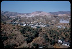
- Subject:
- Mining, Cities & towns, Fences, Shrubs, Clouds, Facilities, and Hills
- Series:
- 5-40
- Creator:
- Cushman, Charles W., 1896-1972
- Date Created:
- 1940-05-01
- Genre:
- Cityscape photographs
- Frame Number:
- 19
- Abstract:
- Zine, Ariz. - an [erstribile] mining town.
- Call Number:
- P01837
- Country:
- United States
- State/Province:
- Arizona
- Alternate Identifier:
- 540.19
- Persistent URL:
- http://purl.dlib.indiana.edu/iudl/archives/cushman/P01837
- Holding Location:
- Bloomington - University Archives
Wells Library E460
1320 E 10th St.
Bloomington, IN 47405
Contact at archives@indiana.edu, 812-855-1127
-
- Description:
- 25 f 11
- Subject:
- Valleys, Cliffs, Trees, Mountains, Buildings, Rock formations, Cottonwood, Hills, and Roads
- Series:
- 16-52
- Creator:
- Cushman, Charles W., 1896-1972
- Date Created:
- 1952-04-12
- Genre:
- Landscape photographs
- Frame Number:
- 34
- County:
- Coconino
- Abstract:
- Green trees in valley from above Sedona
- Call Number:
- P06092
- City:
- Flagstaff and Sedona
- Country:
- United States
- State/Province:
- Arizona
- Alternate Identifier:
- 1652.34
- Persistent URL:
- http://purl.dlib.indiana.edu/iudl/archives/cushman/P06092
- Holding Location:
- Bloomington - University Archives
Wells Library E460
1320 E 10th St.
Bloomington, IN 47405
Contact at archives@indiana.edu, 812-855-1127
-
- Description:
- 25 f 11
- Subject:
- Wildflowers, Mohawk Mountains (Ariz.), Mountains, and Shrubs
- Series:
- 5-52
- Creator:
- Cushman, Charles W., 1896-1972
- Date Created:
- 1952-02-07
- Genre:
- Landscape photographs
- Frame Number:
- 37
- Street Address:
- United States Highway 80
- County:
- Yuma
- Abstract:
- Yellow flowers and mtn along US 80 - Mohawk Mtn 50 mi E of yuma
- Call Number:
- P05682
- Country:
- United States
- State/Province:
- Arizona
- Alternate Identifier:
- 552.37
- Persistent URL:
- http://purl.dlib.indiana.edu/iudl/archives/cushman/P05682
- Holding Location:
- Bloomington - University Archives
Wells Library E460
1320 E 10th St.
Bloomington, IN 47405
Contact at archives@indiana.edu, 812-855-1127
-
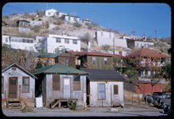
- Description:
- 50 f 8
- Subject:
- Labor housing, Houses, Automobiles, Trees, Streets, Stairways, Cities & towns, Hills, Utility poles, Tree stumps, Doors & doorways, and Tree limbs
- Series:
- 14-53
- Creator:
- Cushman, Charles W., 1896-1972
- Date Created:
- 1953-11-19
- Genre:
- Cityscape photographs and Architectural photographs
- Frame Number:
- 9
- County:
- Gila
- Abstract:
- Miami lower class houses
- Call Number:
- P07005
- City:
- Miami
- Country:
- United States
- State/Province:
- Arizona
- Alternate Identifier:
- 1453.9
- Persistent URL:
- http://purl.dlib.indiana.edu/iudl/archives/cushman/P07005
- Holding Location:
- Bloomington - University Archives
Wells Library E460
1320 E 10th St.
Bloomington, IN 47405
Contact at archives@indiana.edu, 812-855-1127
-
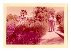
- Subject:
- Outdoor recreation
- Date Created:
- 1955-1964
- Identifier:
- VAD9735-000492
- Abstract:
- Two women are shown standing by a large succulent plant. They are at the Camelback Inn in Arizona. Plants, palm trees, and buildings are visible in the backg...
- Country:
- United States
- State/Province:
- Arizona
- Alternate Identifier:
- RHA_S4_B41_B1_CBI_Img002
- Persistent URL:
- http://purl.dlib.indiana.edu/iudl/media_school/VAD9735/VAD9735-000492
- Holding Location:
- Bloomington - The Media School
Franklin Hall
601 East Kirkwood Ave
Bloomington, IN 47405
Contact at tmsarch@indiana.edu, 812-855-9247
-
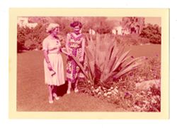
- Subject:
- Resorts
- Date Created:
- 1950-1960
- Identifier:
- VAD9735-000502
- Abstract:
- Three women are shown in a landscaped garden at the Camelback Inn. The woman on the left is partially obscured by flowers and bushes. The two women on the ri...
- Country:
- United States
- State/Province:
- Arizona
- Alternate Identifier:
- RHA_S4_B41_B1_CBI_Img010
- Persistent URL:
- http://purl.dlib.indiana.edu/iudl/media_school/VAD9735/VAD9735-000502
- Holding Location:
- Bloomington - The Media School
Franklin Hall
601 East Kirkwood Ave
Bloomington, IN 47405
Contact at tmsarch@indiana.edu, 812-855-9247
-
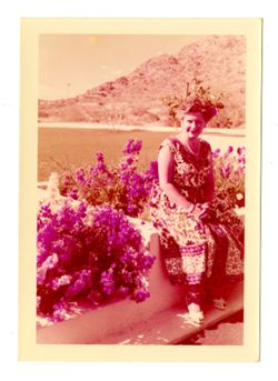
- Subject:
- Portraits
- Date Created:
- 1950-1960
- Identifier:
- VAD9735-000495
- Abstract:
- A colorized photograph shows a woman posing for the camera at the Camelback Inn. She sits on a low wall among flowers. She wears a sleeveless patterned dress...
- Country:
- United States
- State/Province:
- Arizona
- Alternate Identifier:
- RHA_S4_B41_B1_CBI_Img003
- Persistent URL:
- http://purl.dlib.indiana.edu/iudl/media_school/VAD9735/VAD9735-000495
- Holding Location:
- Bloomington - The Media School
Franklin Hall
601 East Kirkwood Ave
Bloomington, IN 47405
Contact at tmsarch@indiana.edu, 812-855-9247
-
- Subject:
- Portraits and Photography of women
- Date Created:
- 1950-1960
- Identifier:
- VAD9735-000501
- Abstract:
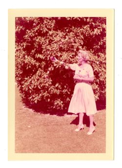
- A colorized photograph shows a woman in front of an orange tree at the Camelback Inn. She holds an orange in her left hand and reaches into the tree with her...
- Country:
- United States
- State/Province:
- Arizona
- Alternate Identifier:
- RHA_S4_B41_B1_CBI_Img009
- Persistent URL:
- http://purl.dlib.indiana.edu/iudl/media_school/VAD9735/VAD9735-000501
- Holding Location:
- Bloomington - The Media School
Franklin Hall
601 East Kirkwood Ave
Bloomington, IN 47405
Contact at tmsarch@indiana.edu, 812-855-9247
-
- Description:
- 100 f 16 SL
- Subject:
- Cliffs, Shrubs, Trees, Signs (Notices), Grasses, and Rock formations
- Series:
- 36-65
- Creator:
- Cushman, Charles W., 1896-1972
- Date Created:
- 1965-10-08
- Genre:
- Landscape photographs
- Frame Number:
- 23
- County:
- Apache
- Abstract:
- Window Rock.
- Call Number:
- P15091
- City:
- Window Rock
- Country:
- United States
- State/Province:
- Arizona
- Alternate Identifier:
- 3665.23
- Persistent URL:
- http://purl.dlib.indiana.edu/iudl/archives/cushman/P15091
- Holding Location:
- Bloomington - University Archives
Wells Library E460
1320 E 10th St.
Bloomington, IN 47405
Contact at archives@indiana.edu, 812-855-1127
-
- Description:
- 100 f 16 SL
- Subject:
- Grasses, Cliffs, Trees, Fences, and Rock formations
- Series:
- 36-65
- Creator:
- Cushman, Charles W., 1896-1972
- Date Created:
- 1965-10-07
- Genre:
- Landscape photographs
- Frame Number:
- 25
- County:
- Apache
- Abstract:
- Window Rock.
- Call Number:
- P15093
- City:
- Window Rock
- Country:
- United States
- State/Province:
- Arizona
- Alternate Identifier:
- 3665.25
- Persistent URL:
- http://purl.dlib.indiana.edu/iudl/archives/cushman/P15093
- Holding Location:
- Bloomington - University Archives
Wells Library E460
1320 E 10th St.
Bloomington, IN 47405
Contact at archives@indiana.edu, 812-855-1127
-
- Description:
- 100 f 16 SL
- Subject:
- Grasses, Cliffs, Trees, and Rock formations
- Series:
- 36-65
- Creator:
- Cushman, Charles W., 1896-1972
- Date Created:
- 1965-10-07
- Genre:
- Landscape photographs
- Frame Number:
- 24
- County:
- Apache
- Abstract:
- Window Rock.
- Call Number:
- P15092
- City:
- Window Rock
- Country:
- United States
- State/Province:
- Arizona
- Alternate Identifier:
- 3665.24
- Persistent URL:
- http://purl.dlib.indiana.edu/iudl/archives/cushman/P15092
- Holding Location:
- Bloomington - University Archives
Wells Library E460
1320 E 10th St.
Bloomington, IN 47405
Contact at archives@indiana.edu, 812-855-1127
-
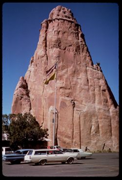
- Description:
- 100 f 16 SL
- Subject:
- Automobiles, Parking lots, Cliffs, Trees, Rock formations, Flags, and Flagpoles
- Series:
- 36-65
- Creator:
- Cushman, Charles W., 1896-1972
- Date Created:
- 1965-10-07
- Genre:
- Landscape photographs and Snapshots
- Frame Number:
- 26
- County:
- Apache
- Abstract:
- Big rock.
- Call Number:
- P15094
- City:
- Window Rock
- Country:
- United States
- State/Province:
- Arizona
- Alternate Identifier:
- 3665.26
- Persistent URL:
- http://purl.dlib.indiana.edu/iudl/archives/cushman/P15094
- Holding Location:
- Bloomington - University Archives
Wells Library E460
1320 E 10th St.
Bloomington, IN 47405
Contact at archives@indiana.edu, 812-855-1127
-
- Description:
- 50 f 6.3
- Subject:
- Mountains, Whitlock Mountains (Ariz.), Clouds, and Hills
- Series:
- 13-53
- Creator:
- Cushman, Charles W., 1896-1972
- Date Created:
- 1953-11-18
- Genre:
- Landscape photographs
- Frame Number:
- 25
- Street Address:
- United States Highway 70
- County:
- Graham and Greenlee
- Abstract:
- Whitlock Mtns under heavy clouds
- Call Number:
- P06982
- City:
- Duncan and Safford
- Country:
- United States
- State/Province:
- Arizona
- Alternate Identifier:
- 1353.25
- Persistent URL:
- http://purl.dlib.indiana.edu/iudl/archives/cushman/P06982
- Holding Location:
- Bloomington - University Archives
Wells Library E460
1320 E 10th St.
Bloomington, IN 47405
Contact at archives@indiana.edu, 812-855-1127
-
- Description:
- 25 f 13
- Subject:
- San Francisco Peaks (Ariz.), Dirt roads, Trees, Shadows, Tree limbs, Mountains, Clouds, Hills, and Roads
- Series:
- 16-52
- Creator:
- Cushman, Charles W., 1896-1972
- Date Created:
- 1952-04-11
- Genre:
- Landscape photographs
- Frame Number:
- 14
- County:
- Coconino
- Abstract:
- White cloud mass covers San Francisco Pks.(from 20 mi away)
- Call Number:
- P06072
- City:
- Flagstaff
- Country:
- United States
- State/Province:
- Arizona
- Alternate Identifier:
- 1652.14
- Persistent URL:
- http://purl.dlib.indiana.edu/iudl/archives/cushman/P06072
- Holding Location:
- Bloomington - University Archives
Wells Library E460
1320 E 10th St.
Bloomington, IN 47405
Contact at archives@indiana.edu, 812-855-1127
-
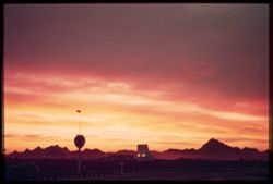
- Subject:
- Mountains, Buildings, Tucson Mountains (Ariz.), Clouds, and Sunrises & sunsets
- Series:
- 1-40
- Creator:
- Cushman, Charles W., 1896-1972
- Date Created:
- 1940-02-01
- Genre:
- Landscape photographs
- Frame Number:
- 4
- County:
- Pima
- Abstract:
- Western sky after sunset over Tucsons
- Call Number:
- P01741
- City:
- Tucson
- Country:
- United States
- State/Province:
- Arizona
- Physical Description:
- Image was originally mounted in a glass enclosure. Before digitization, the image was removed and placed in a Wess Plastic, Inc. brand, 2" x 2", pl...
- Alternate Identifier:
- 140.4
- Persistent URL:
- http://purl.dlib.indiana.edu/iudl/archives/cushman/P01741
- Holding Location:
- Bloomington - University Archives
Wells Library E460
1320 E 10th St.
Bloomington, IN 47405
Contact at archives@indiana.edu, 812-855-1127
-
- Description:
- 100 f 8 tl
- Subject:
- Flowers, Mountains, and Shrubs
- Series:
- 11-59
- Creator:
- Cushman, Charles W., 1896-1972
- Date Created:
- 1959-03-24
- Genre:
- Landscape photographs
- Frame Number:
- 6
- County:
- Yuma
- Abstract:
- RM Mtns
- Call Number:
- P10731
- City:
- Quartzsite
- Country:
- United States
- State/Province:
- Arizona
- Alternate Identifier:
- 1159.6
- Persistent URL:
- http://purl.dlib.indiana.edu/iudl/archives/cushman/P10731
- Holding Location:
- Bloomington - University Archives
Wells Library E460
1320 E 10th St.
Bloomington, IN 47405
Contact at archives@indiana.edu, 812-855-1127
-

- Description:
- 100 f 8 tl
- Subject:
- Domes, Crosses, Mission churches, Arches, Shrubs, Masonry, Trees, Towers, Mission San Xavier del Bac (Tucson, Ariz.), and Stone walls
- Series:
- 6-59
- Creator:
- Cushman, Charles W., 1896-1972
- Date Created:
- 1959-01-24
- Genre:
- Architectural photographs
- Frame Number:
- 2
- County:
- Pima
- Abstract:
- West Tower of church
- Call Number:
- P10540
- City:
- Tucson
- Country:
- United States
- State/Province:
- Arizona
- Alternate Identifier:
- 659.2
- Persistent URL:
- http://purl.dlib.indiana.edu/iudl/archives/cushman/P10540
- Holding Location:
- Bloomington - University Archives
Wells Library E460
1320 E 10th St.
Bloomington, IN 47405
Contact at archives@indiana.edu, 812-855-1127
-
- Description:
- 50 f 11
- Subject:
- Bell towers, Curtain walls, Missions, Stonework, Facades, Mission San Xavier del Bac (Tucson, Ariz.), Towers, Balconies, People, Automobiles, Mission churche...
- Series:
- 5-52
- Creator:
- Cushman, Charles W., 1896-1972
- Date Created:
- 1952-01-29
- Genre:
- Architectural photographs
- Frame Number:
- 3
- County:
- Pima
- Abstract:
- Bell tower (west)
- Call Number:
- P05648
- City:
- Tucson
- Country:
- United States
- State/Province:
- Arizona
- Alternate Identifier:
- 552.3
- Persistent URL:
- http://purl.dlib.indiana.edu/iudl/archives/cushman/P05648
- Holding Location:
- Bloomington - University Archives
Wells Library E460
1320 E 10th St.
Bloomington, IN 47405
Contact at archives@indiana.edu, 812-855-1127
-
- Description:
- 100 f 11 SL
- Subject:
- Erosion, Cliffs, Mesas, Mountains, Rock formations, Utility poles, Roads, and Shrubs
- Series:
- 5-62
- Creator:
- Cushman, Charles W., 1896-1972
- Date Created:
- 1962-10-07
- Genre:
- Landscape photographs
- Frame Number:
- 22
- Street Address:
- Sitgreaves Pass
- County:
- Mohave
- Abstract:
- West side of Sitgreaves Pass
- Call Number:
- P12789
- Country:
- United States
- State/Province:
- Arizona
- Alternate Identifier:
- 562.22
- Persistent URL:
- http://purl.dlib.indiana.edu/iudl/archives/cushman/P12789
- Holding Location:
- Bloomington - University Archives
Wells Library E460
1320 E 10th St.
Bloomington, IN 47405
Contact at archives@indiana.edu, 812-855-1127
-
- Description:
- 100 f 11 TL
- Subject:
- Cliffs, Mesas, Buttes, Shrubs, and Rock formations
- Series:
- 38-65
- Creator:
- Cushman, Charles W., 1896-1972
- Date Created:
- 1965-10-12
- Genre:
- Landscape photographs
- Frame Number:
- 37
- County:
- Apache
- Abstract:
- Large Butte
- Call Number:
- P15180
- City:
- Round Rock
- Country:
- United States
- State/Province:
- Arizona
- Alternate Identifier:
- 3865.37
- Persistent URL:
- http://purl.dlib.indiana.edu/iudl/archives/cushman/P15180
- Holding Location:
- Bloomington - University Archives
Wells Library E460
1320 E 10th St.
Bloomington, IN 47405
Contact at archives@indiana.edu, 812-855-1127
-
- Subject:
- Mountains, Shrubs, Santa Catalina Mountains (Ariz.), and Cactus
- Series:
- 5-40
- Creator:
- Cushman, Charles W., 1896-1972
- Date Created:
- 1940-05-01
- Genre:
- Landscape photographs
- Frame Number:
- 15
- Abstract:
- West end of Catalina mtns.
- Call Number:
- P01833
- Country:
- United States
- State/Province:
- Arizona
- Alternate Identifier:
- 540.15
- Persistent URL:
- http://purl.dlib.indiana.edu/iudl/archives/cushman/P01833
- Holding Location:
- Bloomington - University Archives
Wells Library E460
1320 E 10th St.
Bloomington, IN 47405
Contact at archives@indiana.edu, 812-855-1127
-
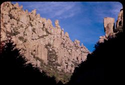
- Description:
- 25 f 9 pola
- Subject:
- Valleys, Rhyolite Canyon (Ariz.), Trees, Mountains, Rock formations, Massai Point (Ariz.), Chiricahua National Monument (Ariz.), Canyons, and National parks ...
- Series:
- 4-52
- Creator:
- Cushman, Charles W., 1896-1972
- Date Created:
- 1952-01-27
- Genre:
- Landscape photographs
- Frame Number:
- 34
- County:
- Cochise
- Abstract:
- West down Rhyolite Canyon from the top (Orientation Pt.)
- Call Number:
- P05640
- Country:
- United States
- State/Province:
- Arizona
- Alternate Identifier:
- 452.34
- Persistent URL:
- http://purl.dlib.indiana.edu/iudl/archives/cushman/P05640
- Holding Location:
- Bloomington - University Archives
Wells Library E460
1320 E 10th St.
Bloomington, IN 47405
Contact at archives@indiana.edu, 812-855-1127
-
- Description:
- 50 f 11
- Subject:
- Towers, Balustrades, Balconies, Facades, Missions, Automobiles, Stonework, Curtain walls, Mission San Xavier del Bac (Tucson, Ariz.), Domes, People, Bell tow...
- Series:
- 5-52
- Creator:
- Cushman, Charles W., 1896-1972
- Date Created:
- 1952-01-29
- Genre:
- Architectural photographs
- Frame Number:
- 2
- County:
- Pima
- Abstract:
- Bell tower (west)
- Call Number:
- P05647
- City:
- Tucson
- Country:
- United States
- State/Province:
- Arizona
- Alternate Identifier:
- 552.2
- Persistent URL:
- http://purl.dlib.indiana.edu/iudl/archives/cushman/P05647
- Holding Location:
- Bloomington - University Archives
Wells Library E460
1320 E 10th St.
Bloomington, IN 47405
Contact at archives@indiana.edu, 812-855-1127
-
- Description:
- 50 f 6.3 pola
- Subject:
- Rocks, Boulders, Mountains, Rock formations, Clouds, Santa Catalina Mountains (Ariz.), and Shrubs
- Series:
- 4-52
- Creator:
- Cushman, Charles W., 1896-1972
- Date Created:
- 1952-01-25
- Genre:
- Landscape photographs
- Frame Number:
- 23
- Street Address:
- Mount Lemmon Road
- Abstract:
- On down road = rock like..cuirass
- Call Number:
- P05629
- Country:
- United States
- State/Province:
- Arizona
- Alternate Identifier:
- 452.23
- Persistent URL:
- http://purl.dlib.indiana.edu/iudl/archives/cushman/P05629
- Holding Location:
- Bloomington - University Archives
Wells Library E460
1320 E 10th St.
Bloomington, IN 47405
Contact at archives@indiana.edu, 812-855-1127
-
- Description:
- 25 f 16
- Subject:
- Rocks, Canyons, Cactus, Waterfalls, Trees, Sabino Canyon (Ariz.), Rock formations, Saguaro, Santa Catalina Mountains (Ariz.), and Shrubs
- Series:
- 5-52
- Creator:
- Cushman, Charles W., 1896-1972
- Date Created:
- 1952-02-05
- Genre:
- Landscape photographs
- Frame Number:
- 31
- County:
- Pima
- Abstract:
- Water fall and candy rocks
- Call Number:
- P05676
- Country:
- United States
- State/Province:
- Arizona
- Alternate Identifier:
- 552.31
- Persistent URL:
- http://purl.dlib.indiana.edu/iudl/archives/cushman/P05676
- Holding Location:
- Bloomington - University Archives
Wells Library E460
1320 E 10th St.
Bloomington, IN 47405
Contact at archives@indiana.edu, 812-855-1127
-
- Description:
- 25 f 16
- Subject:
- Rocks, Canyons, Waterfalls, Trees, Sabino Canyon (Ariz.), Shrubs, Streams, Santa Catalina Mountains (Ariz.), and Rock formations
- Series:
- 5-52
- Creator:
- Cushman, Charles W., 1896-1972
- Date Created:
- 1952-02-05
- Genre:
- Landscape photographs
- Frame Number:
- 30
- County:
- Pima
- Abstract:
- Water fall and candy rocks
- Call Number:
- P05675
- Country:
- United States
- State/Province:
- Arizona
- Alternate Identifier:
- 552.30
- Persistent URL:
- http://purl.dlib.indiana.edu/iudl/archives/cushman/P05675
- Holding Location:
- Bloomington - University Archives
Wells Library E460
1320 E 10th St.
Bloomington, IN 47405
Contact at archives@indiana.edu, 812-855-1127
-
- Description:
- 25 f 13
- Subject:
- Rocks, Canyons, Cliffs, Cactus, Waterfalls, Shrubs, Box Canyon (Ariz.), and Roads
- Series:
- 2-52
- Creator:
- Cushman, Charles W., 1896-1972
- Date Created:
- 1952-01-14
- Genre:
- Landscape photographs, Snapshots, and Identification photographs
- Frame Number:
- 34
- Street Address:
- Box Canyon Road
- County:
- Pima
- Abstract:
- Close-up showing water full.
- Call Number:
- P05564
- Country:
- United States
- State/Province:
- Arizona
- Alternate Identifier:
- 252.34
- Persistent URL:
- http://purl.dlib.indiana.edu/iudl/archives/cushman/P05564
- Holding Location:
- Bloomington - University Archives
Wells Library E460
1320 E 10th St.
Bloomington, IN 47405
Contact at archives@indiana.edu, 812-855-1127
-
- Description:
- 100 f 6 tl
- Subject:
- Deserts, Cactus, Mountains, Shrubs, and Vulture Mountains (Ariz.)
- Series:
- 10-59
- Creator:
- Cushman, Charles W., 1896-1972
- Date Created:
- 1959-03-23
- Frame Number:
- 37
- County:
- Maricopa
- Abstract:
- Another of 35
- Call Number:
- P10725
- City:
- Wickenburg
- Country:
- United States
- State/Province:
- Arizona
- Alternate Identifier:
- 1059.37
- Persistent URL:
- http://purl.dlib.indiana.edu/iudl/archives/cushman/P10725
- Holding Location:
- Bloomington - University Archives
Wells Library E460
1320 E 10th St.
Bloomington, IN 47405
Contact at archives@indiana.edu, 812-855-1127
-
- Description:
- 100 f 6.3 tl
- Subject:
- Deserts, Cactus, Mountains, and Vulture Mountains (Ariz.)
- Series:
- 10-59
- Creator:
- Cushman, Charles W., 1896-1972
- Date Created:
- 1959-03-23
- Frame Number:
- 35
- County:
- Maricopa
- Abstract:
- Not so much like camel closer up
- Call Number:
- P10723
- City:
- Wickenburg
- Country:
- United States
- State/Province:
- Arizona
- Alternate Identifier:
- 1059.35
- Persistent URL:
- http://purl.dlib.indiana.edu/iudl/archives/cushman/P10723
- Holding Location:
- Bloomington - University Archives
Wells Library E460
1320 E 10th St.
Bloomington, IN 47405
Contact at archives@indiana.edu, 812-855-1127
-
- Subject:
- Deserts, Shrubs, Clouds, and Painted Desert (Ariz.)
- Series:
- 13-40
- Creator:
- Cushman, Charles W., 1896-1972
- Date Created:
- 1940-07-17
- Genre:
- Landscape photographs
- Frame Number:
- 16
- County:
- Navajo
- Abstract:
- Another view westerly.
- Call Number:
- P02016
- City:
- Holbrook
- Country:
- United States
- State/Province:
- Arizona
- Physical Description:
- Image was originally mounted in a glass enclosure. Before digitization, the image was removed and placed in a Wess Plastic, Inc. brand, 2" x 2", pl...
- Alternate Identifier:
- 1340.16
- Persistent URL:
- http://purl.dlib.indiana.edu/iudl/archives/cushman/P02016
- Holding Location:
- Bloomington - University Archives
Wells Library E460
1320 E 10th St.
Bloomington, IN 47405
Contact at archives@indiana.edu, 812-855-1127
-
- Description:
- 25 f 11
- Subject:
- Valleys, Trees, Mountains, Rock formations, Massai Point (Ariz.), Chiricahua National Monument (Ariz.), and National parks & reserves
- Series:
- 4-52
- Creator:
- Cushman, Charles W., 1896-1972
- Date Created:
- 1952-01-27
- Genre:
- Landscape photographs
- Frame Number:
- 29
- County:
- Cochise
- Abstract:
- View west from trail around Massai Pt.
- Call Number:
- P05635
- Country:
- United States
- State/Province:
- Arizona
- Alternate Identifier:
- 452.29
- Persistent URL:
- http://purl.dlib.indiana.edu/iudl/archives/cushman/P05635
- Holding Location:
- Bloomington - University Archives
Wells Library E460
1320 E 10th St.
Bloomington, IN 47405
Contact at archives@indiana.edu, 812-855-1127
-
- Description:
- 100 f 11 TL
- Subject:
- Cliffs, Trees, Plains, Rock formations, and Mesas
- Series:
- 38-65
- Creator:
- Cushman, Charles W., 1896-1972
- Date Created:
- 1965-10-11
- Genre:
- Landscape photographs
- Frame Number:
- 24
- County:
- Navajo
- Abstract:
- View west from Kayenta.
- Call Number:
- P15167
- City:
- Kayenta
- Country:
- United States
- State/Province:
- Arizona
- Alternate Identifier:
- 3865.24
- Persistent URL:
- http://purl.dlib.indiana.edu/iudl/archives/cushman/P15167
- Holding Location:
- Bloomington - University Archives
Wells Library E460
1320 E 10th St.
Bloomington, IN 47405
Contact at archives@indiana.edu, 812-855-1127
-
- Description:
- 50 f 10
- Subject:
- Houses, Copper industry, Smoke, Copper mining, Mountains, Buildings, Business districts, Hills, Factories, and Trees
- Series:
- 14-53
- Creator:
- Cushman, Charles W., 1896-1972
- Date Created:
- 1953-11-19
- Genre:
- Cityscape photographs
- Frame Number:
- 6
- County:
- Gila
- Abstract:
- View west across business section of Miami
- Call Number:
- P07002
- City:
- Miami
- Country:
- United States
- State/Province:
- Arizona
- Alternate Identifier:
- 1453.6
- Persistent URL:
- http://purl.dlib.indiana.edu/iudl/archives/cushman/P07002
- Holding Location:
- Bloomington - University Archives
Wells Library E460
1320 E 10th St.
Bloomington, IN 47405
Contact at archives@indiana.edu, 812-855-1127
-
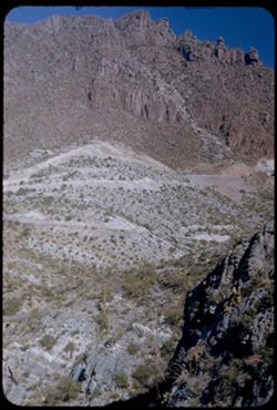
- Description:
- 50 f 9
- Subject:
- National parks & reserves, Cliffs, Shrubs, Trees, Rocks, Chiricahua National Monument (Ariz.), and Rock formations
- Series:
- 4-52
- Creator:
- Cushman, Charles W., 1896-1972
- Date Created:
- 1952-01-22
- Genre:
- Landscape photographs
- Frame Number:
- 2
- County:
- Cochise
- Abstract:
- View up thru gap
- Call Number:
- P05608
- Country:
- United States
- State/Province:
- Arizona
- Alternate Identifier:
- 452.2
- Persistent URL:
- http://purl.dlib.indiana.edu/iudl/archives/cushman/P05608
- Holding Location:
- Bloomington - University Archives
Wells Library E460
1320 E 10th St.
Bloomington, IN 47405
Contact at archives@indiana.edu, 812-855-1127
-
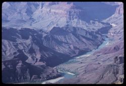
- Description:
- 100 f 16 TL HF
- Subject:
- Erosion, National parks & reserves, Canyons, Valleys, Cliffs, Grand Canyon National Park (Ariz.), Colorado River (Colo.-Mexico), Rock formations, Colorad...
- Series:
- 3-66
- Creator:
- Cushman, Charles W., 1896-1972
- Date Created:
- 1966-04-23
- Genre:
- Landscape photographs
- Frame Number:
- 2
- County:
- Coconino
- Abstract:
- Butte up river
- Call Number:
- P15285
- Country:
- United States
- State/Province:
- Arizona
- Alternate Identifier:
- 366.2
- Persistent URL:
- http://purl.dlib.indiana.edu/iudl/archives/cushman/P15285
- Holding Location:
- Bloomington - University Archives
Wells Library E460
1320 E 10th St.
Bloomington, IN 47405
Contact at archives@indiana.edu, 812-855-1127
-
- Description:
- 50 f 9
- Subject:
- Rocks, Valleys, Grasses, Roads, Queen Creek Bridge (Ariz.), Mountains, Rock formations, Cliffs, and Queen Creek (Ariz.)
- Series:
- 14-53
- Creator:
- Cushman, Charles W., 1896-1972
- Date Created:
- 1953-11-19
- Genre:
- Landscape photographs
- Frame Number:
- 31
- Street Address:
- United States Highway 60 and United States Highway 70
- County:
- Pinal
- Abstract:
- View back up to show curly cues of old US 70 - from new Queen Creek bridge
- Call Number:
- P07027
- City:
- Superior
- Country:
- United States
- State/Province:
- Arizona
- Alternate Identifier:
- 1453.31
- Persistent URL:
- http://purl.dlib.indiana.edu/iudl/archives/cushman/P07027
- Holding Location:
- Bloomington - University Archives
Wells Library E460
1320 E 10th St.
Bloomington, IN 47405
Contact at archives@indiana.edu, 812-855-1127
-
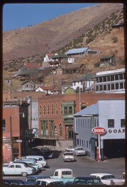
- Description:
- 100 f 6.3 tl
- Subject:
- Brewery Gulch (Ariz.), Electric lines, Automobiles, Signs (Notices), Streets, Cities & towns, Street lights, Shrubs, Dwellings, Hills, People, Valleys, a...
- Series:
- 7-59
- Creator:
- Cushman, Charles W., 1896-1972
- Date Created:
- 1959-02-06
- Genre:
- Cityscape photographs
- Frame Number:
- 35
- County:
- Cochise
- Call Number:
- P10611
- City:
- Bisbee
- Country:
- United States
- State/Province:
- Arizona
- Alternate Identifier:
- 759.35
- Persistent URL:
- http://purl.dlib.indiana.edu/iudl/archives/cushman/P10611
- Holding Location:
- Bloomington - University Archives
Wells Library E460
1320 E 10th St.
Bloomington, IN 47405
Contact at archives@indiana.edu, 812-855-1127
-
- Description:
- 50 6. 3 Pola
- Subject:
- Sierrita Mountains (Ariz.), Mountains, Rock formations, Tucson Mountains (Ariz.), Clouds, Santa Catalina Mountains (Ariz.), and Valleys
- Series:
- 4-52
- Creator:
- Cushman, Charles W., 1896-1972
- Date Created:
- 1952-01-25
- Genre:
- Landscape photographs
- Frame Number:
- 16
- Street Address:
- Mount Lemmon Road
- County:
- Pima
- Abstract:
- View from Tucson Mtns from Mt. Lemmon Rd
- Call Number:
- P05622
- Country:
- United States
- State/Province:
- Arizona
- Alternate Identifier:
- 452.16
- Persistent URL:
- http://purl.dlib.indiana.edu/iudl/archives/cushman/P05622
- Holding Location:
- Bloomington - University Archives
Wells Library E460
1320 E 10th St.
Bloomington, IN 47405
Contact at archives@indiana.edu, 812-855-1127
-
- Description:
- 50 f 4.5 POLA
- Subject:
- Valleys, Mountains, Clouds, Weaver Mountains (Ariz.), and Vulture Mountains (Ariz.)
- Series:
- 15-53
- Creator:
- Cushman, Charles W., 1896-1972
- Date Created:
- 1953-11-20
- Genre:
- Landscape photographs
- Frame Number:
- 1
- County:
- Maricopa
- Abstract:
- From Weaver Mtns. - view south across valley toward Wickenburg, Vulture Mtns., etc.
- Call Number:
- P07035
- City:
- Wickenberg
- Country:
- United States
- State/Province:
- Arizona
- Alternate Identifier:
- 1553.1
- Persistent URL:
- http://purl.dlib.indiana.edu/iudl/archives/cushman/P07035
- Holding Location:
- Bloomington - University Archives
Wells Library E460
1320 E 10th St.
Bloomington, IN 47405
Contact at archives@indiana.edu, 812-855-1127
-
- Description:
- 50 f 3.5 Pola
- Subject:
- Grasses, Storms, Mountains, Shrubs, Whitlock Mountains (Ariz.), Clouds, and Rain
- Series:
- 13-53
- Creator:
- Cushman, Charles W., 1896-1972
- Date Created:
- 1953-11-18
- Genre:
- Landscape photographs
- Frame Number:
- 27
- Street Address:
- United States Highway 70
- County:
- Graham and Greenlee
- Abstract:
- Storm clouds moving from west toward Whitlock Mtn
- Call Number:
- P06984
- City:
- Duncan and Safford
- Country:
- United States
- State/Province:
- Arizona
- Alternate Identifier:
- 1353.27
- Persistent URL:
- http://purl.dlib.indiana.edu/iudl/archives/cushman/P06984
- Holding Location:
- Bloomington - University Archives
Wells Library E460
1320 E 10th St.
Bloomington, IN 47405
Contact at archives@indiana.edu, 812-855-1127
-
- Subject:
- Bright Angel Point (Ariz.), Canyons, Cliffs, Trees, Shadows, Mountains, National parks & reserves, and Grand Canyon (Ariz.)
- Series:
- 12-40
- Creator:
- Cushman, Charles W., 1896-1972
- Date Created:
- 1940-07-13
- Genre:
- Landscape photographs
- Frame Number:
- 15
- County:
- Coconino
- Abstract:
- View south from B.A. Pt. In morning. B.A. canyon at left.
- Call Number:
- P01994
- Country:
- United States
- State/Province:
- Arizona
- Physical Description:
- Image was originally mounted in a glass enclosure. Before digitization, the image was removed and placed in a Wess Plastic, Inc. brand, 2" x 2", pl...
- Alternate Identifier:
- 1240.15
- Persistent URL:
- http://purl.dlib.indiana.edu/iudl/archives/cushman/P01994
- Holding Location:
- Bloomington - University Archives
Wells Library E460
1320 E 10th St.
Bloomington, IN 47405
Contact at archives@indiana.edu, 812-855-1127
-
- Description:
- 50 f 9
- Subject:
- Abandoned buildings, Streets, Ghost towns, Houses, Copper industry, Utility poles, Buildings, Grasses, and Hills
- Series:
- 15-53
- Creator:
- Cushman, Charles W., 1896-1972
- Date Created:
- 1953-11-21
- Genre:
- Cityscape photographs
- Frame Number:
- 10
- County:
- Yavapai
- Abstract:
- View from east
- Call Number:
- P07044
- City:
- Jerome
- Country:
- United States
- State/Province:
- Arizona
- Alternate Identifier:
- 1553.10
- Persistent URL:
- http://purl.dlib.indiana.edu/iudl/archives/cushman/P07044
- Holding Location:
- Bloomington - University Archives
Wells Library E460
1320 E 10th St.
Bloomington, IN 47405
Contact at archives@indiana.edu, 812-855-1127
-
- Description:
- 25 f 13
- Subject:
- National parks & reserves, Cliffs, Massai Point (Ariz.), Mountains, Chiricahua National Monument (Ariz.), and Rock formations
- Series:
- 4-52
- Creator:
- Cushman, Charles W., 1896-1972
- Date Created:
- 1952-01-22
- Genre:
- Landscape photographs
- Frame Number:
- 8
- County:
- Cochise
- Abstract:
- View NW from the Lookout Pt.
- Call Number:
- P05614
- Country:
- United States
- State/Province:
- Arizona
- Alternate Identifier:
- 452.8
- Persistent URL:
- http://purl.dlib.indiana.edu/iudl/archives/cushman/P05614
- Holding Location:
- Bloomington - University Archives
Wells Library E460
1320 E 10th St.
Bloomington, IN 47405
Contact at archives@indiana.edu, 812-855-1127
-
![View northward up Apache Trail [Ariz 88] from US 60-70 near Miami, Ariz.](https://iiif.uits.iu.edu/iiif/2/4t64gn68z%2Ffiles%2F8b7f1c67-b13e-4a94-a15c-638f142e49ee/full/250,/0/default.jpg)
- Description:
- 50 f 5.6 POLA
- Subject:
- Grasses, Trails & paths, Trees, Mountains, and Hills
- Series:
- 14-53
- Creator:
- Cushman, Charles W., 1896-1972
- Date Created:
- 1953-11-19
- Genre:
- Landscape photographs
- Frame Number:
- 3
- Street Address:
- United States Highway 60 and United States Highway 70
- County:
- Gila
- Abstract:
- View up Apache Trail
- Call Number:
- P06999
- City:
- Miami
- Country:
- United States
- State/Province:
- Arizona
- Alternate Identifier:
- 1453.3
- Persistent URL:
- http://purl.dlib.indiana.edu/iudl/archives/cushman/P06999
- Holding Location:
- Bloomington - University Archives
Wells Library E460
1320 E 10th St.
Bloomington, IN 47405
Contact at archives@indiana.edu, 812-855-1127
-
- Description:
- 50 f 8 sl
- Subject:
- Rocks, Cactus, Mountains, Shrubs, Tucson Mountains (Ariz.), and Gates Pass (Ariz.)
- Series:
- 6-59
- Creator:
- Cushman, Charles W., 1896-1972
- Date Created:
- 1959-01-26
- Genre:
- Landscape photographs
- Frame Number:
- 9
- County:
- Pima
- Abstract:
- from Gates Pass northward
- Call Number:
- P10547
- City:
- Tucson
- Country:
- United States
- State/Province:
- Arizona
- Alternate Identifier:
- 659.9
- Persistent URL:
- http://purl.dlib.indiana.edu/iudl/archives/cushman/P10547
- Holding Location:
- Bloomington - University Archives
Wells Library E460
1320 E 10th St.
Bloomington, IN 47405
Contact at archives@indiana.edu, 812-855-1127
-
- Description:
- 50 f 11 sl
- Subject:
- Deserts, Roads, Cactus, Mountains, Shrubs, and Saguaro National Park (Ariz.)
- Series:
- 10-59
- Creator:
- Cushman, Charles W., 1896-1972
- Date Created:
- 1959-03-03
- Frame Number:
- 3
- County:
- Pima
- Abstract:
- View north
- Call Number:
- P10691
- City:
- Tucson
- Country:
- United States
- State/Province:
- Arizona
- Alternate Identifier:
- 1059.3
- Persistent URL:
- http://purl.dlib.indiana.edu/iudl/archives/cushman/P10691
- Holding Location:
- Bloomington - University Archives
Wells Library E460
1320 E 10th St.
Bloomington, IN 47405
Contact at archives@indiana.edu, 812-855-1127
-
- Description:
- 50 f 9
- Subject:
- Grasses, Trees, Dirt, Mountains, Rock formations, and Hills
- Series:
- 15-53
- Creator:
- Cushman, Charles W., 1896-1972
- Date Created:
- 1953-11-21
- Genre:
- Landscape photographs
- Frame Number:
- 27
- County:
- Coconino
- Abstract:
- And these, due north
- Call Number:
- P07060
- City:
- Sedona
- Country:
- United States
- State/Province:
- Arizona
- Alternate Identifier:
- 1553.27
- Persistent URL:
- http://purl.dlib.indiana.edu/iudl/archives/cushman/P07060
- Holding Location:
- Bloomington - University Archives
Wells Library E460
1320 E 10th St.
Bloomington, IN 47405
Contact at archives@indiana.edu, 812-855-1127
-
- Description:
- 100 f 13 TL
- Subject:
- Erosion, Cliffs, Stars, Trees, Signs (Notices), Mountains, Buildings, Rock formations, Motels, Utility poles, and Electric lines
- Series:
- 5-62
- Creator:
- Cushman, Charles W., 1896-1972
- Date Created:
- 1962-10-05
- Genre:
- Landscape photographs
- Frame Number:
- 6
- County:
- Coconino
- Abstract:
- Mtns north of Sedona
- Call Number:
- P12773
- City:
- Sedona
- Country:
- United States
- State/Province:
- Arizona
- Alternate Identifier:
- 562.6
- Persistent URL:
- http://purl.dlib.indiana.edu/iudl/archives/cushman/P12773
- Holding Location:
- Bloomington - University Archives
Wells Library E460
1320 E 10th St.
Bloomington, IN 47405
Contact at archives@indiana.edu, 812-855-1127
-
- Description:
- 50 f 5.6 Pola
- Subject:
- Deserts, Valleys, Hills, Painted Desert (Ariz.), Shrubs, Mesas, and Harvey Inn (Holbrook, Ariz.)
- Series:
- 17-52
- Creator:
- Cushman, Charles W., 1896-1972
- Date Created:
- 1952-04-12
- Genre:
- Landscape photographs
- Frame Number:
- 8
- County:
- Navajo and Coconimo
- Abstract:
- View north from near Fred Harvey Inn
- Call Number:
- P06101
- City:
- Holbrook
- Country:
- United States
- State/Province:
- Arizona
- Alternate Identifier:
- 1752.8
- Persistent URL:
- http://purl.dlib.indiana.edu/iudl/archives/cushman/P06101
- Holding Location:
- Bloomington - University Archives
Wells Library E460
1320 E 10th St.
Bloomington, IN 47405
Contact at archives@indiana.edu, 812-855-1127
-
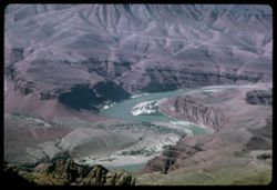
- Description:
- 100 f 16 TL HF
- Subject:
- Valleys, Erosion, Cliffs, Grand Canyon National Park (Ariz.), Colorado River (Colo.-Mexico), Buttes, National parks & reserves, Colorado River Valley (Co...
- Series:
- 2-66
- Creator:
- Cushman, Charles W., 1896-1972
- Date Created:
- 1966-04-23
- Genre:
- Landscape photographs
- Frame Number:
- 15
- County:
- Coconino
- Abstract:
- from Lipan Pt.
- Call Number:
- P15277
- Country:
- United States
- State/Province:
- Arizona
- Alternate Identifier:
- 266.15
- Persistent URL:
- http://purl.dlib.indiana.edu/iudl/archives/cushman/P15277
- Holding Location:
- Bloomington - University Archives
Wells Library E460
1320 E 10th St.
Bloomington, IN 47405
Contact at archives@indiana.edu, 812-855-1127
-
- Description:
- 50 f 6.3 POLA
- Subject:
- Hills, Roads, Mountains, Shrubs, Trees, Clouds, and Mesas
- Series:
- 15-53
- Creator:
- Cushman, Charles W., 1896-1972
- Date Created:
- 1953-11-21
- Genre:
- Landscape photographs
- Frame Number:
- 16
- Street Address:
- United States Highway 89
- County:
- Coconino
- Abstract:
- View north from US 89A 8 mi. sw of Sedona
- Call Number:
- P06990
- City:
- Sedona
- Country:
- United States
- State/Province:
- Arizona
- Alternate Identifier:
- 1553.16
- Persistent URL:
- http://purl.dlib.indiana.edu/iudl/archives/cushman/P06990
- Holding Location:
- Bloomington - University Archives
Wells Library E460
1320 E 10th St.
Bloomington, IN 47405
Contact at archives@indiana.edu, 812-855-1127
-
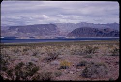
- Description:
- 50 f 11
- Subject:
- Rocks, Mead, Lake (Ariz. and Nev.), Mountains, Shrubs, Lakes & ponds, Islands, and Wildflowers
- Series:
- 16-52
- Creator:
- Cushman, Charles W., 1896-1972
- Date Created:
- 1952-04-10
- Genre:
- Landscape photographs
- Frame Number:
- 2
- Abstract:
- Lake Mead-an arm
- Call Number:
- P06062
- Country:
- United States
- State/Province:
- Arizona and Nevada
- Alternate Identifier:
- 1652.2
- Persistent URL:
- http://purl.dlib.indiana.edu/iudl/archives/cushman/P06062
- Holding Location:
- Bloomington - University Archives
Wells Library E460
1320 E 10th St.
Bloomington, IN 47405
Contact at archives@indiana.edu, 812-855-1127
-
- Description:
- 25 f 13
- Subject:
- Trees, Mountains, Rock formations, Massai Point (Ariz.), Chiricahua National Monument (Ariz.), and National parks & reserves
- Series:
- 4-52
- Creator:
- Cushman, Charles W., 1896-1972
- Date Created:
- 1952-01-27
- Genre:
- Landscape photographs
- Frame Number:
- 30
- County:
- Cochise
- Abstract:
- View NW down into canyon
- Call Number:
- P05636
- Country:
- United States
- State/Province:
- Arizona
- Alternate Identifier:
- 452.30
- Persistent URL:
- http://purl.dlib.indiana.edu/iudl/archives/cushman/P05636
- Holding Location:
- Bloomington - University Archives
Wells Library E460
1320 E 10th St.
Bloomington, IN 47405
Contact at archives@indiana.edu, 812-855-1127
-
- Description:
- 50 f 9
- Subject:
- Whetstone Mountains (Ariz.), Hills, Oaks, Live oak, Trees, and Mountains
- Series:
- 2-52
- Creator:
- Cushman, Charles W., 1896-1972
- Date Created:
- 1952-01-14
- Genre:
- Landscape photographs
- Frame Number:
- 37
- Street Address:
- Arizona State Highway 83
- Abstract:
- Live oak-tow colored valley and distant mtns from Hwy 83.
- Call Number:
- P05567
- Country:
- United States
- State/Province:
- Arizona
- Alternate Identifier:
- 252.37
- Persistent URL:
- http://purl.dlib.indiana.edu/iudl/archives/cushman/P05567
- Holding Location:
- Bloomington - University Archives
Wells Library E460
1320 E 10th St.
Bloomington, IN 47405
Contact at archives@indiana.edu, 812-855-1127
-
- Description:
- 50 f 9
- Subject:
- Rocks, Valleys, Grasses, Cliffs, Queen Creek (Ariz.), Mountains, Rock formations, and Queen Creek Bridge (Ariz.)
- Series:
- 14-53
- Creator:
- Cushman, Charles W., 1896-1972
- Date Created:
- 1953-11-19
- Genre:
- Landscape photographs
- Frame Number:
- 32
- Street Address:
- United States Highway 60 and United States Highway 70
- County:
- Pinal
- Abstract:
- Two views from Queen Ck. Bridge
- Call Number:
- P07028
- City:
- Superior
- Country:
- United States
- State/Province:
- Arizona
- Alternate Identifier:
- 1453.32
- Persistent URL:
- http://purl.dlib.indiana.edu/iudl/archives/cushman/P07028
- Holding Location:
- Bloomington - University Archives
Wells Library E460
1320 E 10th St.
Bloomington, IN 47405
Contact at archives@indiana.edu, 812-855-1127
-
- Description:
- 25 f 9
- Subject:
- Buildings, Cities & towns, Mountains, Trees, Dwellings, Hotels, Streets, Copper Queen Hotel (Bisbee, Ariz.), Automobiles, Shrubs, Churches, Flagpoles, an...
- Series:
- 1-52
- Creator:
- Cushman, Charles W., 1896-1972
- Date Created:
- 1952-01-04
- Genre:
- Views and Cityscape photographs
- Frame Number:
- 30
- County:
- Cochise
- Abstract:
- from higher up. [Bisbee + Mtn from Main st.]
- Call Number:
- P05520
- City:
- Bisbee
- Country:
- United States
- State/Province:
- Arizona
- Alternate Identifier:
- 152.30
- Persistent URL:
- http://purl.dlib.indiana.edu/iudl/archives/cushman/P05520
- Holding Location:
- Bloomington - University Archives
Wells Library E460
1320 E 10th St.
Bloomington, IN 47405
Contact at archives@indiana.edu, 812-855-1127
-
- Subject:
- Trees, Mountains, Shrubs, Clouds, and Dwellings
- Series:
- 5-40
- Creator:
- Cushman, Charles W., 1896-1972
- Date Created:
- 1940-05-01
- Genre:
- Landscape photographs
- Frame Number:
- 14
- Street Address:
- Mount Lemmon Road
- Abstract:
- Arizona's mountains from Mt. Lemmon Road.
- Call Number:
- P01832
- Country:
- United States
- State/Province:
- Arizona
- Physical Description:
- Image was originally mounted in a glass enclosure. Before digitization, the image was removed and placed in a Wess Plastic, Inc. brand, 2" x 2", pl...
- Alternate Identifier:
- 540.14
- Persistent URL:
- http://purl.dlib.indiana.edu/iudl/archives/cushman/P01832
- Holding Location:
- Bloomington - University Archives
Wells Library E460
1320 E 10th St.
Bloomington, IN 47405
Contact at archives@indiana.edu, 812-855-1127
-
- Description:
- 50 f 11
- Subject:
- Deserts, Canyons, Buildings, Clouds, Hills, Painted Desert (Ariz.), and Valleys
- Series:
- 17-52
- Creator:
- Cushman, Charles W., 1896-1972
- Date Created:
- 1952-04-12
- Genre:
- Landscape photographs
- Frame Number:
- 6
- County:
- Navajo and Coconimo
- Abstract:
- View east from inside
- Call Number:
- P06100
- City:
- Holbrook
- Country:
- United States
- State/Province:
- Arizona
- Physical Description:
- Image was originally mounted in a glass enclosure. Before digitization, the image was removed and placed in a Wess Plastic, Inc. brand, 2" x 2", pl...
- Alternate Identifier:
- 1752.6
- Persistent URL:
- http://purl.dlib.indiana.edu/iudl/archives/cushman/P06100
- Holding Location:
- Bloomington - University Archives
Wells Library E460
1320 E 10th St.
Bloomington, IN 47405
Contact at archives@indiana.edu, 812-855-1127
-
- Description:
- 100 f 13 TL
- Subject:
- Erosion, Chimneys, Hardware stores, Sporting goods stores, Cliffs, Mountains, Utility poles, Sherwin-Williams Company, Trees, Television antennas, Signs (Not...
- Series:
- 5-62
- Creator:
- Cushman, Charles W., 1896-1972
- Date Created:
- 1962-10-05
- Genre:
- Landscape photographs and Views
- Frame Number:
- 5
- County:
- Coconino
- Abstract:
- Mtns East from Sedona
- Call Number:
- P12772
- City:
- Sedona
- Country:
- United States
- State/Province:
- Arizona
- Alternate Identifier:
- 562.5
- Persistent URL:
- http://purl.dlib.indiana.edu/iudl/archives/cushman/P12772
- Holding Location:
- Bloomington - University Archives
Wells Library E460
1320 E 10th St.
Bloomington, IN 47405
Contact at archives@indiana.edu, 812-855-1127
-

- Description:
- 100 f 11 TL
- Subject:
- Erosion, Cliffs, Buttes, Tree limbs, and Rock formations
- Series:
- 5-62
- Creator:
- Cushman, Charles W., 1896-1972
- Date Created:
- 1962-10-05
- Genre:
- Landscape photographs
- Frame Number:
- 13
- County:
- Coconino
- Abstract:
- East of Sedona
- Call Number:
- P12780
- City:
- Sedona
- Country:
- United States
- State/Province:
- Arizona
- Alternate Identifier:
- 562.13
- Persistent URL:
- http://purl.dlib.indiana.edu/iudl/archives/cushman/P12780
- Holding Location:
- Bloomington - University Archives
Wells Library E460
1320 E 10th St.
Bloomington, IN 47405
Contact at archives@indiana.edu, 812-855-1127
-
- Description:
- 100 f 11 SL
- Subject:
- Grasses, Cliffs, Outbuildings, Trees, Mountains, Fences, Rock formations, Hills, Erosion, and Houses
- Series:
- 5-62
- Creator:
- Cushman, Charles W., 1896-1972
- Date Created:
- 1962-10-05
- Genre:
- Landscape photographs
- Frame Number:
- 4
- County:
- Coconino
- Abstract:
- Mtns east from Sedona
- Call Number:
- P12771
- City:
- Sedona
- Country:
- United States
- State/Province:
- Arizona
- Alternate Identifier:
- 562.4
- Persistent URL:
- http://purl.dlib.indiana.edu/iudl/archives/cushman/P12771
- Holding Location:
- Bloomington - University Archives
Wells Library E460
1320 E 10th St.
Bloomington, IN 47405
Contact at archives@indiana.edu, 812-855-1127
-
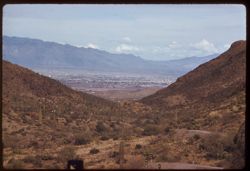
- Description:
- 100 f 6.3 tl
- Subject:
- Roads, Cactus, Cities & towns, Buildings, Gates Pass (Ariz.), Tucson Mountains (Ariz.), Clouds, Dwellings, Mountains, Shrubs, and Traffic signs & sig...
- Series:
- 8-59
- Creator:
- Cushman, Charles W., 1896-1972
- Date Created:
- 1959-02-11
- Genre:
- Cityscape photographs
- Frame Number:
- 3
- County:
- Pima
- Abstract:
- Tucson seen from Gates Pass in Tuscon Mtns.
- Call Number:
- P10617
- City:
- Tucson
- Country:
- United States
- State/Province:
- Arizona
- Alternate Identifier:
- 859.3
- Persistent URL:
- http://purl.dlib.indiana.edu/iudl/archives/cushman/P10617
- Holding Location:
- Bloomington - University Archives
Wells Library E460
1320 E 10th St.
Bloomington, IN 47405
Contact at archives@indiana.edu, 812-855-1127
-
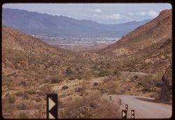
- Description:
- 100 f 6.3 tl
- Subject:
- Rocks, Roads, Cactus, Cities & towns, Buildings, Gates Pass (Ariz.), Traffic signs & signals, Clouds, Dwellings, Mountains, Shrubs, and Tucson Mounta...
- Series:
- 8-59
- Creator:
- Cushman, Charles W., 1896-1972
- Date Created:
- 1959-02-11
- Genre:
- Cityscape photographs
- Frame Number:
- 2
- County:
- Pima
- Abstract:
- Tucson seen from Gates Pass in Tucson Mtns.
- Call Number:
- P10616
- City:
- Tucson
- Country:
- United States
- State/Province:
- Arizona
- Alternate Identifier:
- 859.2
- Persistent URL:
- http://purl.dlib.indiana.edu/iudl/archives/cushman/P10616
- Holding Location:
- Bloomington - University Archives
Wells Library E460
1320 E 10th St.
Bloomington, IN 47405
Contact at archives@indiana.edu, 812-855-1127
-
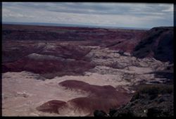
- Subject:
- Deserts, Painted Desert (Ariz.), Shrubs, Shadows, and Clouds
- Series:
- 13-40
- Creator:
- Cushman, Charles W., 1896-1972
- Date Created:
- 1960-07-17
- Genre:
- Landscape photographs
- Frame Number:
- 14
- County:
- Navajo
- Abstract:
- View east across Painted Desert at noon
- Call Number:
- P02014
- City:
- Holbrook
- Country:
- United States
- State/Province:
- Arizona
- Physical Description:
- Image was originally mounted in a glass enclosure. Before digitization, the image was removed and placed in a Wess Plastic, Inc. brand, 2" x 2", pl...
- Alternate Identifier:
- 1340.14
- Persistent URL:
- http://purl.dlib.indiana.edu/iudl/archives/cushman/P02014
- Holding Location:
- Bloomington - University Archives
Wells Library E460
1320 E 10th St.
Bloomington, IN 47405
Contact at archives@indiana.edu, 812-855-1127
-
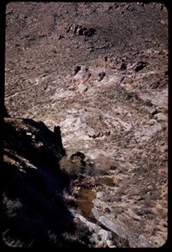
- Description:
- 25 f 13
- Subject:
- Rocks, Canyons, Cliffs, Trees, Sabino Canyon (Ariz.), Mountains, Shrubs, Streams, Santa Catalina Mountains (Ariz.), and Rock formations
- Series:
- 5-52
- Creator:
- Cushman, Charles W., 1896-1972
- Date Created:
- 1952-02-05
- Genre:
- Landscape photographs
- Frame Number:
- 28
- County:
- Pima
- Abstract:
- From higher up - a view of stream at canyon bottom
- Call Number:
- P05673
- Country:
- United States
- State/Province:
- Arizona
- Alternate Identifier:
- 552.28
- Persistent URL:
- http://purl.dlib.indiana.edu/iudl/archives/cushman/P05673
- Holding Location:
- Bloomington - University Archives
Wells Library E460
1320 E 10th St.
Bloomington, IN 47405
Contact at archives@indiana.edu, 812-855-1127
-
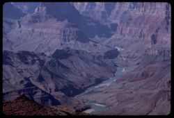
- Description:
- 100 f 16 TL HF
- Subject:
- Canyons, Erosion, Cliffs, Grand Canyon National Park (Ariz.), National parks & reserves, Grand Canyon (Ariz.), Rivers, Valleys, Rock formations, and Dese...
- Series:
- 2-66
- Creator:
- Cushman, Charles W., 1896-1972
- Date Created:
- 1966-04-23
- Genre:
- Landscape photographs
- Frame Number:
- 20
- Street Address:
- East Rim Drive
- County:
- Coconino
- Call Number:
- P15282
- Country:
- United States
- State/Province:
- Arizona
- Alternate Identifier:
- 266.20
- Persistent URL:
- http://purl.dlib.indiana.edu/iudl/archives/cushman/P15282
- Holding Location:
- Bloomington - University Archives
Wells Library E460
1320 E 10th St.
Bloomington, IN 47405
Contact at archives@indiana.edu, 812-855-1127
-
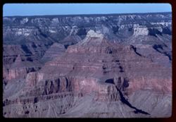
- Description:
- 100 f 8 TL
- Subject:
- Canyons, Erosion, Cliffs, Powell Plateau (Ariz.), Grand Canyon National Park (Ariz.), Buttes, Rock formations, Grand Canyon (Ariz.), Mesas, and National park...
- Series:
- 4-62
- Creator:
- Cushman, Charles W., 1896-1972
- Date Created:
- 1962-10-03
- Genre:
- Landscape photographs
- Frame Number:
- 18
- County:
- Coconino
- Abstract:
- Views across from Powell Memorial.
- Call Number:
- P12747
- Country:
- United States
- State/Province:
- Arizona
- Alternate Identifier:
- 462.18
- Persistent URL:
- http://purl.dlib.indiana.edu/iudl/archives/cushman/P12747
- Holding Location:
- Bloomington - University Archives
Wells Library E460
1320 E 10th St.
Bloomington, IN 47405
Contact at archives@indiana.edu, 812-855-1127
-
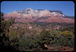
- Description:
- 50 f 9
- Subject:
- Valleys, Houses, Trees, Oak Creek (Ariz.), Rock formations, Hills, Mesas, and Mountains
- Series:
- 15-53
- Creator:
- Cushman, Charles W., 1896-1972
- Date Created:
- 1953-11-21
- Genre:
- Landscape photographs and Cityscape photographs
- Frame Number:
- 33
- County:
- Coconino
- Abstract:
- The great rock wall north of Sedona from across Oak Ck. Valley
- Call Number:
- P07066
- City:
- Sedona
- Country:
- United States
- State/Province:
- Arizona
- Alternate Identifier:
- 1553.33
- Persistent URL:
- http://purl.dlib.indiana.edu/iudl/archives/cushman/P07066
- Holding Location:
- Bloomington - University Archives
Wells Library E460
1320 E 10th St.
Bloomington, IN 47405
Contact at archives@indiana.edu, 812-855-1127
-
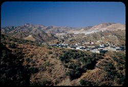
- Description:
- 50 f 5.6 POLA
- Subject:
- Grasses, Factories, Copper industry, Mountains, Buildings, Business districts, and Hills
- Series:
- 14-53
- Creator:
- Cushman, Charles W., 1896-1972
- Date Created:
- 1953-11-19
- Genre:
- Cityscape photographs
- Frame Number:
- 8
- County:
- Gila
- Abstract:
- View s.w. across Miami
- Call Number:
- P07004
- City:
- Miami
- Country:
- United States
- State/Province:
- Arizona
- Alternate Identifier:
- 1453.8
- Persistent URL:
- http://purl.dlib.indiana.edu/iudl/archives/cushman/P07004
- Holding Location:
- Bloomington - University Archives
Wells Library E460
1320 E 10th St.
Bloomington, IN 47405
Contact at archives@indiana.edu, 812-855-1127
-
![View NE into Pinal Mtns. From US 70 west of Miami, Arizona. [Vicinity of Castle Dome mine.]](https://iiif.uits.iu.edu/iiif/2/df65v834d%2Ffiles%2F7e5ee33f-81cc-4721-a786-43c43058207e/full/250,/0/default.jpg)
- Description:
- 50 f 8
- Subject:
- Rocks, Bodies of water, Pinal Mountains (Ariz.), Mining, Mountains, Castle Dome Mine (Gila County, Ariz.), and Clouds
- Series:
- 13-53
- Creator:
- Cushman, Charles W., 1896-1972
- Date Created:
- 1953-11-18
- Genre:
- Landscape photographs
- Frame Number:
- 36
- Street Address:
- United States Highway 70
- County:
- Pinal and Gila
- Abstract:
- View NE into Pinal Mtns. Sunlit pyramid near Castle Dome mine from US 70 between Miami & Superior
- Call Number:
- P06994
- City:
- Superior and Miami
- Country:
- United States
- State/Province:
- Arizona
- Alternate Identifier:
- 1353.36
- Persistent URL:
- http://purl.dlib.indiana.edu/iudl/archives/cushman/P06994
- Holding Location:
- Bloomington - University Archives
Wells Library E460
1320 E 10th St.
Bloomington, IN 47405
Contact at archives@indiana.edu, 812-855-1127
-
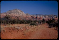
- Description:
- 50 f 6.3 POLA
- Subject:
- Rocks, Grasses, Dirt roads, Trees, Mountains, Rock formations, Hills, and Mesas
- Series:
- 15-53
- Creator:
- Cushman, Charles W., 1896-1972
- Date Created:
- 1953-11-21
- Genre:
- Landscape photographs
- Frame Number:
- 22
- Street Address:
- United States Highway 89A
- County:
- Coconino
- Abstract:
- North from point on US 89A about 5 mi sw of Sedona
- Call Number:
- P07055
- City:
- Sedona
- Country:
- United States
- State/Province:
- Arizona
- Alternate Identifier:
- 1553.22
- Persistent URL:
- http://purl.dlib.indiana.edu/iudl/archives/cushman/P07055
- Holding Location:
- Bloomington - University Archives
Wells Library E460
1320 E 10th St.
Bloomington, IN 47405
Contact at archives@indiana.edu, 812-855-1127
-
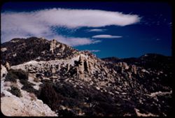
- Description:
- 50 f 8 pola
- Subject:
- Rocks, Bear Canyon (Pima County, Ariz.), Valleys, Roads, Trees, Boulders, Mountains, Shrubs, Clouds, Santa Catalina Mountains (Ariz.), Canyons, and Rock form...
- Series:
- 4-52
- Creator:
- Cushman, Charles W., 1896-1972
- Date Created:
- 1952-01-25
- Genre:
- Landscape photographs
- Frame Number:
- 21
- Street Address:
- Mount Lemmon Road
- Abstract:
- View northeast from mt above Bear Canyon.
- Call Number:
- P05627
- Country:
- United States
- State/Province:
- Arizona
- Alternate Identifier:
- 452.21
- Persistent URL:
- http://purl.dlib.indiana.edu/iudl/archives/cushman/P05627
- Holding Location:
- Bloomington - University Archives
Wells Library E460
1320 E 10th St.
Bloomington, IN 47405
Contact at archives@indiana.edu, 812-855-1127
-
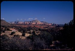
- Description:
- 50 f 6.3 POLA
- Subject:
- Grasses, Cliffs, Trees, Mountains, Shrubs, Hills, Mesas, and Rock formations
- Series:
- 15-53
- Creator:
- Cushman, Charles W., 1896-1972
- Date Created:
- 1953-11-21
- Genre:
- Landscape photographs
- Frame Number:
- 17
- Street Address:
- United States Highway 89A
- County:
- Coconino
- Abstract:
- View NE.
- Call Number:
- P07050
- City:
- Sedona
- Country:
- United States
- State/Province:
- Arizona
- Alternate Identifier:
- 1553.17
- Persistent URL:
- http://purl.dlib.indiana.edu/iudl/archives/cushman/P07050
- Holding Location:
- Bloomington - University Archives
Wells Library E460
1320 E 10th St.
Bloomington, IN 47405
Contact at archives@indiana.edu, 812-855-1127
-
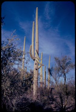
- Description:
- 25 f 11
- Subject:
- Deserts, Organ Pipe Cactus National Monument (Ariz.), Automobiles, Shrubs, Cactus, Trees, and Saguaro
- Series:
- 3-52
- Creator:
- Cushman, Charles W., 1896-1972
- Date Created:
- 1952-01-20
- Genre:
- Identification photographs
- Frame Number:
- 31
- County:
- Pima
- Abstract:
- Tall Sahauros
- Call Number:
- P05600
- City:
- Ajo
- Country:
- United States
- State/Province:
- Arizona
- Alternate Identifier:
- 352.31
- Persistent URL:
- http://purl.dlib.indiana.edu/iudl/archives/cushman/P05600
- Holding Location:
- Bloomington - University Archives
Wells Library E460
1320 E 10th St.
Bloomington, IN 47405
Contact at archives@indiana.edu, 812-855-1127
-
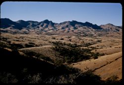
- Description:
- 50 f 8
- Subject:
- Valleys, Trees, Mountains, and Hills
- Series:
- 2-52
- Creator:
- Cushman, Charles W., 1896-1972
- Date Created:
- 1952-01-14
- Genre:
- Landscape photographs
- Frame Number:
- 38
- Street Address:
- United States Highway 80 and Arizona State Highway 83
- Abstract:
- Valley ridges + mtn ridge west from Hwy 83.
- Call Number:
- P05568
- Country:
- United States
- State/Province:
- Arizona
- Alternate Identifier:
- 252.38
- Persistent URL:
- http://purl.dlib.indiana.edu/iudl/archives/cushman/P05568
- Holding Location:
- Bloomington - University Archives
Wells Library E460
1320 E 10th St.
Bloomington, IN 47405
Contact at archives@indiana.edu, 812-855-1127
-
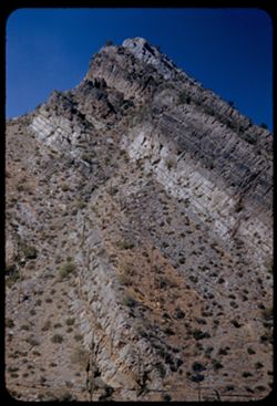
- Description:
- 50 f 11
- Subject:
- Rocks, Grasses, Queen Creek (Ariz.), Mountains, Rock formations, Plants, and Up-thrust peak
- Series:
- 14-53
- Creator:
- Cushman, Charles W., 1896-1972
- Date Created:
- 1953-11-19
- Genre:
- Landscape photographs and Identification photographs
- Frame Number:
- 36
- Street Address:
- United States Highway 60 and United States Highway 70
- County:
- Pinal
- Abstract:
- Up-thrust peak from same spot
- Call Number:
- P07032
- City:
- Superior
- Country:
- United States
- State/Province:
- Arizona
- Alternate Identifier:
- 1453.36
- Persistent URL:
- http://purl.dlib.indiana.edu/iudl/archives/cushman/P07032
- Holding Location:
- Bloomington - University Archives
Wells Library E460
1320 E 10th St.
Bloomington, IN 47405
Contact at archives@indiana.edu, 812-855-1127
-
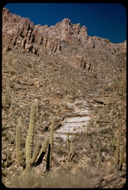
- Description:
- 25 f 13
- Subject:
- Sabino Canyon (Ariz.), Canyons, Saguaro, Cliffs, Mountains, Shrubs, Cactus, Rocks, Rock formations, and Santa Catalina Mountains (Ariz.)
- Series:
- 5-52
- Creator:
- Cushman, Charles W., 1896-1972
- Date Created:
- 1952-02-05
- Genre:
- Landscape photographs
- Frame Number:
- 26
- County:
- Pima
- Abstract:
- Up wall of Sabino Canyon in morning
- Call Number:
- P05671
- Country:
- United States
- State/Province:
- Arizona
- Alternate Identifier:
- 552.26
- Persistent URL:
- http://purl.dlib.indiana.edu/iudl/archives/cushman/P05671
- Holding Location:
- Bloomington - University Archives
Wells Library E460
1320 E 10th St.
Bloomington, IN 47405
Contact at archives@indiana.edu, 812-855-1127
-
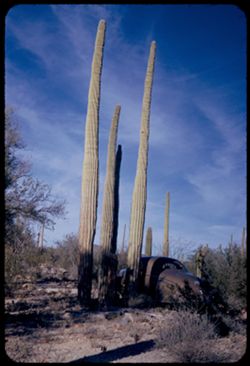
- Description:
- 25 f 11
- Subject:
- Deserts, Cactus, Automobiles, Trees, Organ Pipe Cactus National Monument (Ariz.), Shrubs, and Saguaro
- Series:
- 3-52
- Creator:
- Cushman, Charles W., 1896-1972
- Date Created:
- 1952-01-20
- Genre:
- Identification photographs
- Frame Number:
- 30
- County:
- Pima
- Abstract:
- In Organ Pipe Cactus Natl Mon.
- Call Number:
- P05599
- City:
- Ajo
- Country:
- United States
- State/Province:
- Arizona
- Alternate Identifier:
- 352.30
- Persistent URL:
- http://purl.dlib.indiana.edu/iudl/archives/cushman/P05599
- Holding Location:
- Bloomington - University Archives
Wells Library E460
1320 E 10th St.
Bloomington, IN 47405
Contact at archives@indiana.edu, 812-855-1127
