
Search Constraints
You searched for:
Campus
IUB
Remove constraint Campus: IUB
Subject
Deserts
Remove constraint Subject: Deserts
Subject
Hills
Remove constraint Subject: Hills
1 - 80 of 80
Search Results
-
- Subject:
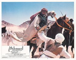
- Horses, Action and adventure films, Motion pictures--Great Britain, Men, Motion pictures--Libya, Muslims in motion pictures, Daggers & swords, Hills, Mot...
- Creator:
- Director: Akkad, Moustapha and Publisher: Tarik Film Distribution
- Language:
- English
- Date Created:
- Date Taken: 1976
- Identifier:
- VAD9191-001827
- Geographic Location:
- Saudi Arabia
- Related URL:
- http://purl.dlib.indiana.edu/iudl/findingaids/bfca/VAD5484
- Call Number:
- Box 9, Folder 11, Item 6
- Country:
- Lebanon, Great Britain, Morocco, Kuwait, and Libya
- Physical Description:
- 1 lobby card : color , 11 x 14 inches
- Alternate Identifier:
- COL 12
- Persistent URL:
- http://purl.dlib.indiana.edu/iudl/bfca/VAD9191/VAD9191-001827
-

- Subject:
- Muslims in motion pictures, War, Wounds & injuries, Motion pictures--Libya, Lobby cards, Daggers & swords, Deserts, Hills, Motion pictures--Kuwait, M...
- Creator:
- Publisher: S.N. Prodis and Director: Akkad, Moustapha
- Language:
- French
- Date Created:
- Date Taken: 1976
- Identifier:
- VAD9191-001790
- Geographic Location:
- Saudi Arabia
- Related URL:
- http://purl.dlib.indiana.edu/iudl/findingaids/bfca/VAD5484
- Abstract:
- Original release title: The Message.
- Call Number:
- Box 9, Folder 10, Item 2
- Country:
- Libya, Lebanon, Great Britain, Kuwait, and Morocco
- Physical Description:
- 1 lobby card : color
- Alternate Identifier:
- COL 12
- Persistent URL:
- http://purl.dlib.indiana.edu/iudl/bfca/VAD9191/VAD9191-001790
-

- Description:
- Original Identifier: S-50
- Subject:
- Film stills, Western films, Photographs, African Americans, Hills, Men, Deserts, Comedy films, and Fiction films
- Date Created:
- Date Taken: Circa 1968 and Publication Date: Circa 1968
- Identifier:
- VAD9192-001023
- Persons Pictured:
- Davis, Ossie
- Related URL:
- http://purl.dlib.indiana.edu/iudl/findingaids/bfca/VAD4347
- Abstract:
- Directed by Sydney Pollack.
- Call Number:
- COL 5 PA 353
- Country:
- United States
- Physical Description:
- 1 photograph : black & white and 8 x 10 in.
- Alternate Identifier:
- COL 5
- Persistent URL:
- http://purl.dlib.indiana.edu/iudl/bfca/VAD9192/VAD9192-001023
- Holding Location:
- Bloomington - Black Film Center & Archive
Herman B Wells Library, Room 044
1320 East Tenth Street
Bloomington, IN 47405
Contact at bfca@indiana.edu, 812-855-6041
-
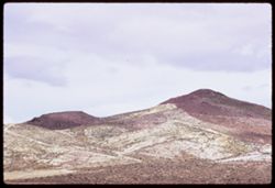
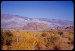
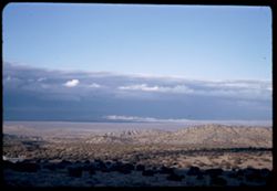
- Description:
- 100 f 9 TL
- Subject:
- Deserts, Mojave Desert (Calif.), Hills, Mountains, and Tehachapi Mountains (Calif.)
- Series:
- 3-69
- Creator:
- Cushman, Charles W., 1896-1972
- Date Created:
- 1969-03-21
- Genre:
- Landscape photographs
- Frame Number:
- 16
- Street Address:
- California State Highway 14
- County:
- Los Angeles and Kern
- Abstract:
- Toward Tehachapi Mtns from Hwy 14
- Call Number:
- P15768
- City:
- Mojave and Lancaster
- Country:
- United States
- State/Province:
- California
- Alternate Identifier:
- 369.16
- Persistent URL:
- http://purl.dlib.indiana.edu/iudl/archives/cushman/P15768
- Holding Location:
- Bloomington - University Archives
Wells Library E460
1320 E 10th St.
Bloomington, IN 47405
Contact at archives@indiana.edu, 812-855-1127
-
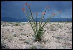
- Description:
- 100 f 12?
- Subject:
- Rocks, Hills, Mountains, Grasses, Ocotillo, Deserts, Storms, Flowers, and Plants
- Series:
- 1-66
- Creator:
- Cushman, Charles W., 1896-1972
- Date Created:
- 1966-04-22
- Genre:
- Identification photographs and Landscape photographs
- Frame Number:
- 8
- Street Address:
- United States Highway 66
- County:
- Mohave
- Abstract:
- Ocotillo along U.S. 66- Mojave county
- Call Number:
- P15249
- Country:
- United States
- State/Province:
- Arizona
- Alternate Identifier:
- 166.8
- Persistent URL:
- http://purl.dlib.indiana.edu/iudl/archives/cushman/P15249
- Holding Location:
- Bloomington - University Archives
Wells Library E460
1320 E 10th St.
Bloomington, IN 47405
Contact at archives@indiana.edu, 812-855-1127
-
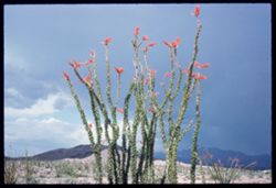
- Description:
- 100 f 13 ?
- Subject:
- Hills, Mountains, Plants, Ocotillo, Deserts, Storms, Flowers, Clouds, and Grasses
- Series:
- 1-66
- Creator:
- Cushman, Charles W., 1896-1972
- Date Created:
- 1966-04-22
- Genre:
- Identification photographs and Landscape photographs
- Frame Number:
- 7
- Street Address:
- United States Highway 66
- County:
- Mohave
- Abstract:
- Ocotillo along U.S. 66- Mojave county
- Call Number:
- P15248
- Country:
- United States
- State/Province:
- Arizona
- Alternate Identifier:
- 166.7
- Persistent URL:
- http://purl.dlib.indiana.edu/iudl/archives/cushman/P15248
- Holding Location:
- Bloomington - University Archives
Wells Library E460
1320 E 10th St.
Bloomington, IN 47405
Contact at archives@indiana.edu, 812-855-1127
-
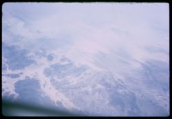
- Subject:
- Deserts, Valleys, Pan American World Airways, inc., Croplands, Air travel, Hills, and Rivers
- Series:
- 1-65
- Creator:
- Cushman, Charles W., 1896-1972
- Date Created:
- 1965-03-30
- Genre:
- Aerial photographs and Landscape photographs
- Frame Number:
- 21
- Call Number:
- P13885
- Country:
- United States
- Alternate Identifier:
- 165.21
- Persistent URL:
- http://purl.dlib.indiana.edu/iudl/archives/cushman/P13885
- Holding Location:
- Bloomington - University Archives
Wells Library E460
1320 E 10th St.
Bloomington, IN 47405
Contact at archives@indiana.edu, 812-855-1127
-
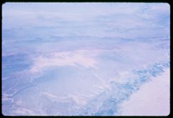
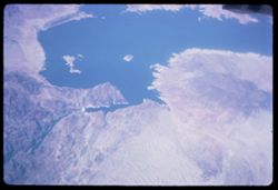
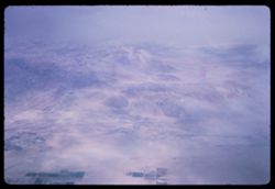
- Subject:
- Lakes & ponds, Deserts, Hills, Mead, Lake (Ariz. and Nev.), Coastlines, and Air travel
- Series:
- 1-65
- Creator:
- Cushman, Charles W., 1896-1972
- Date Created:
- 1965-03-30
- Genre:
- Aerial photographs and Landscape photographs
- Frame Number:
- 18
- Call Number:
- P13882
- Country:
- United States
- State/Province:
- Nevada and Arizona
- Alternate Identifier:
- 165.18
- Persistent URL:
- http://purl.dlib.indiana.edu/iudl/archives/cushman/P13882
- Holding Location:
- Bloomington - University Archives
Wells Library E460
1320 E 10th St.
Bloomington, IN 47405
Contact at archives@indiana.edu, 812-855-1127
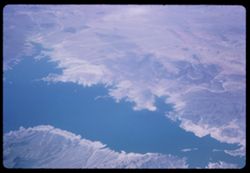
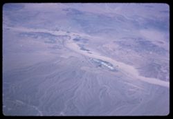
-
- Subject:
- Lakes & ponds, Deserts, Hills, Mead, Lake (Ariz. and Nev.), Coastlines, Rivers, and Air travel
- Series:
- 1-65
- Creator:
- Cushman, Charles W., 1896-1972
- Date Created:
- 1965-03-30
- Genre:
- Aerial photographs and Landscape photographs
- Frame Number:
- 17
- Call Number:
- P13881
- Country:
- United States
- State/Province:
- Nevada and Arizona
- Alternate Identifier:
- 165.17
- Persistent URL:
- http://purl.dlib.indiana.edu/iudl/archives/cushman/P13881
- Holding Location:
- Bloomington - University Archives
Wells Library E460
1320 E 10th St.
Bloomington, IN 47405
Contact at archives@indiana.edu, 812-855-1127
-
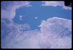
- Description:
- 200 f 8
- Subject:
- Deserts, Mead, Lake (Ariz. and Nev.), Coastlines, Pan American World Airways, inc., Air travel, Lakes & ponds, Hills, and Rivers
- Series:
- 1-65
- Creator:
- Cushman, Charles W., 1896-1972
- Date Created:
- 1965-03-30
- Genre:
- Aerial photographs and Landscape photographs
- Frame Number:
- 16
- Call Number:
- P13880
- Country:
- United States
- State/Province:
- Arizona and Nevada
- Alternate Identifier:
- 165.16
- Persistent URL:
- http://purl.dlib.indiana.edu/iudl/archives/cushman/P13880
- Holding Location:
- Bloomington - University Archives
Wells Library E460
1320 E 10th St.
Bloomington, IN 47405
Contact at archives@indiana.edu, 812-855-1127
-
- Description:
- 200 f 5.6
- Subject:
- Deserts, Air travel, Hills, and Snow
- Series:
- 1-65
- Creator:
- Cushman, Charles W., 1896-1972
- Date Created:
- 1965-03-30
- Genre:
- Aerial photographs and Landscape photographs
- Frame Number:
- 14
- Abstract:
- over high Calif desert and Over high Calif. desert en route to Las Vegas
- Call Number:
- P13878
- Country:
- United States
- State/Province:
- California
- Alternate Identifier:
- 165.14
- Persistent URL:
- http://purl.dlib.indiana.edu/iudl/archives/cushman/P13878
- Holding Location:
- Bloomington - University Archives
Wells Library E460
1320 E 10th St.
Bloomington, IN 47405
Contact at archives@indiana.edu, 812-855-1127
-
- Description:
- 200 f 8
- Subject:
- Deserts, Pan American World Airways, inc., Croplands, Air travel, and Hills
- Series:
- 1-65
- Creator:
- Cushman, Charles W., 1896-1972
- Date Created:
- 1965-03-30
- Genre:
- Aerial photographs and Landscape photographs
- Frame Number:
- 13
- Abstract:
- over high Calif desert and Over high Calif. desert en route to Las Vegas
- Call Number:
- P13877
- Country:
- United States
- State/Province:
- California
- Alternate Identifier:
- 165.13
- Persistent URL:
- http://purl.dlib.indiana.edu/iudl/archives/cushman/P13877
- Holding Location:
- Bloomington - University Archives
Wells Library E460
1320 E 10th St.
Bloomington, IN 47405
Contact at archives@indiana.edu, 812-855-1127
-
- Description:
- 200 f 8
- Subject:
- Deserts, Valleys, Air travel, and Hills
- Series:
- 1-65
- Creator:
- Cushman, Charles W., 1896-1972
- Date Created:
- 1965-03-30
- Genre:
- Aerial photographs and Landscape photographs
- Frame Number:
- 12
- Abstract:
- over high Calif desert and Over high Calif. desert en route to Las Vegas
- Call Number:
- P13876
- Country:
- United States
- State/Province:
- California
- Alternate Identifier:
- 165.12
- Persistent URL:
- http://purl.dlib.indiana.edu/iudl/archives/cushman/P13876
- Holding Location:
- Bloomington - University Archives
Wells Library E460
1320 E 10th St.
Bloomington, IN 47405
Contact at archives@indiana.edu, 812-855-1127
-
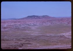
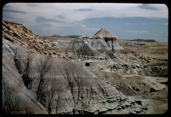
- Description:
- 100 f 13 TL
- Subject:
- Deserts, Petrified forests, Mesas, Petrified Forest National Park (Ariz.), National parks & reserves, Hills, and Painted Desert (Ariz.)
- Series:
- 6-63
- Creator:
- Cushman, Charles W., 1896-1972
- Date Created:
- 1963-06-27
- Genre:
- Landscape photographs
- Frame Number:
- 14
- County:
- Apache and Navajo
- Call Number:
- P12967
- City:
- Holbrook
- Country:
- United States
- State/Province:
- Arizona
- Alternate Identifier:
- 663.14
- Persistent URL:
- http://purl.dlib.indiana.edu/iudl/archives/cushman/P12967
- Holding Location:
- Bloomington - University Archives
Wells Library E460
1320 E 10th St.
Bloomington, IN 47405
Contact at archives@indiana.edu, 812-855-1127
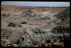
-
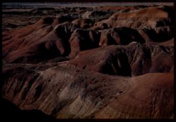
- Description:
- 100 f 11 TL
- Subject:
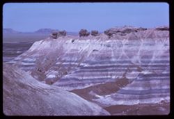
- Deserts, Valleys, Erosion, Petrified Forest National Park (Ariz.), Rock formations, Hills, Painted Desert (Ariz.), Petrified forests, and National parks &...
- Series:
- 6-63
- Creator:
- Cushman, Charles W., 1896-1972
- Date Created:
- 1963-06-27
- Genre:
- Landscape photographs
- Frame Number:
- 13
- County:
- Apache and Navajo
- Abstract:
- Painted Desert from [Casey] pt.
- Call Number:
- P12966
- City:
- Holbrook
- Country:
- United States
- State/Province:
- Arizona
- Alternate Identifier:
- 663.13
- Persistent URL:
- http://purl.dlib.indiana.edu/iudl/archives/cushman/P12966
- Holding Location:
- Bloomington - University Archives
Wells Library E460
1320 E 10th St.
Bloomington, IN 47405
Contact at archives@indiana.edu, 812-855-1127
-
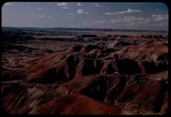
- Description:
- 100 f 11 TL
- Subject:
- Rocks, Petrified forests, Mesas, Petrified Forest National Park (Ariz.), National parks & reserves, Hills, Painted Desert (Ariz.), and Deserts
- Series:
- 6-63
- Creator:
- Cushman, Charles W., 1896-1972
- Date Created:
- 1963-06-27
- Genre:
- Landscape photographs
- Frame Number:
- 12
- County:
- Apache and Navajo
- Abstract:
- Painted Desert from [Casey] pt.
- Call Number:
- P12965
- City:
- Holbrook
- Country:
- United States
- State/Province:
- Arizona
- Alternate Identifier:
- 663.12
- Persistent URL:
- http://purl.dlib.indiana.edu/iudl/archives/cushman/P12965
- Holding Location:
- Bloomington - University Archives
Wells Library E460
1320 E 10th St.
Bloomington, IN 47405
Contact at archives@indiana.edu, 812-855-1127
-
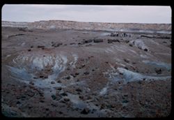
- Description:
- 100 f 11 TL
- Subject:
- Petrified Forest National Park (Ariz.), National parks & reserves, Deserts, Valleys, Hills, Blue Mesa (Ariz.), Rivers, Mesas, Petrified forests, Erosion,...
- Series:
- 6-63
- Creator:
- Cushman, Charles W., 1896-1972
- Date Created:
- 1963-06-27
- Genre:
- Landscape photographs
- Frame Number:
- 11
- County:
- Navajo and Apache
- Abstract:
- Distantly Down from Blue Mesa
- Call Number:
- P12964
- City:
- Holbrook
- Country:
- United States
- State/Province:
- Arizona
- Alternate Identifier:
- 663.11
- Persistent URL:
- http://purl.dlib.indiana.edu/iudl/archives/cushman/P12964
- Holding Location:
- Bloomington - University Archives
Wells Library E460
1320 E 10th St.
Bloomington, IN 47405
Contact at archives@indiana.edu, 812-855-1127
-
- Description:
- 100 f 13 TL
- Subject:
- Deserts, Blue Mesa (Ariz.), Valleys, Petrified forests, Mesas, Petrified Forest National Park (Ariz.), National parks & reserves, Hills, and Rivers
- Series:
- 6-63
- Creator:
- Cushman, Charles W., 1896-1972
- Date Created:
- 1963-06-27
- Genre:
- Landscape photographs
- Frame Number:
- 10
- County:
- Apache and Navajo
- Abstract:
- Distantly Down from Blue Mesa
- Call Number:
- P12963
- City:
- Holbrook
- Country:
- United States
- State/Province:
- Arizona
- Alternate Identifier:
- 663.10
- Persistent URL:
- http://purl.dlib.indiana.edu/iudl/archives/cushman/P12963
- Holding Location:
- Bloomington - University Archives
Wells Library E460
1320 E 10th St.
Bloomington, IN 47405
Contact at archives@indiana.edu, 812-855-1127
-
- Description:
- 100 f 11 TL
- Subject:
- Deserts, Blue Mesa (Ariz.), Valleys, Petrified forests, Mesas, Petrified Forest National Park (Ariz.), Rock formations, Hills, Erosion, and National parks &a...
- Series:
- 6-63
- Creator:
- Cushman, Charles W., 1896-1972
- Date Created:
- 1963-06-27
- Genre:
- Landscape photographs
- Frame Number:
- 9
- County:
- Apache and Navajo
- Abstract:
- Distantly Down from Blue Mesa
- Call Number:
- P12962
- City:
- Holbrook
- Country:
- United States
- State/Province:
- Arizona
- Alternate Identifier:
- 663.9
- Persistent URL:
- http://purl.dlib.indiana.edu/iudl/archives/cushman/P12962
- Holding Location:
- Bloomington - University Archives
Wells Library E460
1320 E 10th St.
Bloomington, IN 47405
Contact at archives@indiana.edu, 812-855-1127
-
- Description:
- 100 f 11 TL
- Subject:
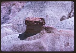
- Deserts, Blue Mesa (Ariz.), Petrified forests, Petrified Forest National Park (Ariz.), National parks & reserves, Logs, Hills, Erosion, Shadows, and Rock...
- Series:
- 6-63
- Creator:
- Cushman, Charles W., 1896-1972
- Date Created:
- 1963-06-27
- Genre:
- Landscape photographs and Identification photographs
- Frame Number:
- 8
- County:
- Apache and Navajo
- Abstract:
- Distantly Down from Blue Mesa
- Call Number:
- P12961
- City:
- Holbrook
- Country:
- United States
- State/Province:
- Arizona
- Alternate Identifier:
- 663.8
- Persistent URL:
- http://purl.dlib.indiana.edu/iudl/archives/cushman/P12961
- Holding Location:
- Bloomington - University Archives
Wells Library E460
1320 E 10th St.
Bloomington, IN 47405
Contact at archives@indiana.edu, 812-855-1127
-
- Description:
- 100 f 11 TL
- Subject:
- Logs, Valleys, Rocks, Blue Mesa (Ariz.), Grasses, National parks & reserves, Deserts, Petrified forests, Petrified Forest National Park (Ariz.), and Hills
- Series:
- 6-63
- Creator:
- Cushman, Charles W., 1896-1972
- Date Created:
- 1963-06-27
- Genre:
- Identification photographs and Landscape photographs
- Frame Number:
- 7
- County:
- Navajo and Apache
- Abstract:
- Distantly Down from Blue Mesa
- Call Number:
- P12960
- City:
- Holbrook
- Country:
- United States
- State/Province:
- Arizona
- Alternate Identifier:
- 663.7
- Persistent URL:
- http://purl.dlib.indiana.edu/iudl/archives/cushman/P12960
- Holding Location:
- Bloomington - University Archives
Wells Library E460
1320 E 10th St.
Bloomington, IN 47405
Contact at archives@indiana.edu, 812-855-1127
-
- Description:
- 100 f 11TL
- Subject:
- Deserts, Blue Mesa (Ariz.), Valleys, Erosion, Mesas, Petrified Forest National Park (Ariz.), National parks & reserves, Hills, and Petrified forests
- Series:
- 6-63
- Creator:
- Cushman, Charles W., 1896-1972
- Date Created:
- 1963-06-27
- Genre:
- Landscape photographs
- Frame Number:
- 6
- County:
- Apache and Navajo
- Abstract:
- Distantly Down from Blue Mesa
- Call Number:
- P12959
- City:
- Holbrook
- Country:
- United States
- State/Province:
- Arizona
- Alternate Identifier:
- 663.6
- Persistent URL:
- http://purl.dlib.indiana.edu/iudl/archives/cushman/P12959
- Holding Location:
- Bloomington - University Archives
Wells Library E460
1320 E 10th St.
Bloomington, IN 47405
Contact at archives@indiana.edu, 812-855-1127
-
- Description:
- 100 f 13 TL
- Subject:
- Erosion, National parks & reserves, Deserts, Valleys, Hills, Cliffs, Blue Mesa (Ariz.), Rock formations, Mesas, Petrified Forest National Park (Ariz.), a...
- Series:
- 6-63
- Creator:
- Cushman, Charles W., 1896-1972
- Date Created:
- 1963-06-27
- Genre:
- Landscape photographs
- Frame Number:
- 1
- County:
- Navajo and Apache
- Abstract:
- Cliff of Blue Mesa
- Call Number:
- P12954
- City:
- Holbrook
- Country:
- United States
- State/Province:
- Arizona
- Alternate Identifier:
- 663.1
- Persistent URL:
- http://purl.dlib.indiana.edu/iudl/archives/cushman/P12954
- Holding Location:
- Bloomington - University Archives
Wells Library E460
1320 E 10th St.
Bloomington, IN 47405
Contact at archives@indiana.edu, 812-855-1127
-
- Description:
- 100 f 11 TL
- Subject:
- Deserts, Petrified forests, Petrified Forest National Park (Ariz.), Rock formations, Hills, Grasses, and National parks & reserves
- Series:
- 5-63
- Creator:
- Cushman, Charles W., 1896-1972
- Date Created:
- 1963-06-27
- Genre:
- Landscape photographs
- Frame Number:
- 36
- County:
- Apache and Navajo
- Abstract:
- Flying ?
- Call Number:
- P12952
- City:
- Holbrook
- Country:
- United States
- State/Province:
- Arizona
- Alternate Identifier:
- 563.36
- Persistent URL:
- http://purl.dlib.indiana.edu/iudl/archives/cushman/P12952
- Holding Location:
- Bloomington - University Archives
Wells Library E460
1320 E 10th St.
Bloomington, IN 47405
Contact at archives@indiana.edu, 812-855-1127
-
- Description:
- 100 f 11 TL
- Subject:
- Petrified forests, National parks & reserves, Deserts, Jasper Forest (Ariz.), Valleys, Quartz, Hills, Rocks, Grasses, and Petrified Forest National Park ...
- Series:
- 5-63
- Creator:
- Cushman, Charles W., 1896-1972
- Date Created:
- 1963-06-27
- Genre:
- Identification photographs and Landscape photographs
- Frame Number:
- 32
- County:
- Navajo and Apache
- Abstract:
- In Jasper forest
- Call Number:
- P12948
- City:
- Holbrook
- Country:
- United States
- State/Province:
- Arizona
- Alternate Identifier:
- 563.32
- Persistent URL:
- http://purl.dlib.indiana.edu/iudl/archives/cushman/P12948
- Holding Location:
- Bloomington - University Archives
Wells Library E460
1320 E 10th St.
Bloomington, IN 47405
Contact at archives@indiana.edu, 812-855-1127
-
- Description:
- 100 f 11 TL
- Subject:
- Deserts, Grasses, Petrified Forest National Park (Ariz.), National parks & reserves, Logs, Hills, and Petrified forests
- Series:
- 5-63
- Creator:
- Cushman, Charles W., 1896-1972
- Date Created:
- 1963-06-27
- Genre:
- Identification photographs
- Frame Number:
- 30
- County:
- Navajo
- Abstract:
- Logs
- Call Number:
- P12946
- City:
- Holbrook
- Country:
- United States
- State/Province:
- Arizona
- Alternate Identifier:
- 563.30
- Persistent URL:
- http://purl.dlib.indiana.edu/iudl/archives/cushman/P12946
- Holding Location:
- Bloomington - University Archives
Wells Library E460
1320 E 10th St.
Bloomington, IN 47405
Contact at archives@indiana.edu, 812-855-1127
-
- Description:
- 100 f 11 TL
- Subject:
- Deserts, Petrified forests, Cliffs, Petrified Forest National Park (Ariz.), Buttes, National parks & reserves, Hills, Rocks, Erosion, and Grasses
- Series:
- 5-63
- Creator:
- Cushman, Charles W., 1896-1972
- Date Created:
- 1963-06-27
- Genre:
- Landscape photographs
- Frame Number:
- 29
- County:
- Apache and Navajo
- Call Number:
- P12945
- City:
- Holbrook
- Country:
- United States
- State/Province:
- Arizona
- Alternate Identifier:
- 563.29
- Persistent URL:
- http://purl.dlib.indiana.edu/iudl/archives/cushman/P12945
- Holding Location:
- Bloomington - University Archives
Wells Library E460
1320 E 10th St.
Bloomington, IN 47405
Contact at archives@indiana.edu, 812-855-1127
-
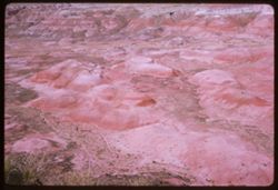
- Description:
- 100 f 13 TL
- Subject:
- Deserts, Valleys, Erosion, Mesas, Petrified Forest National Park (Ariz.), National parks & reserves, Hills, and Painted Desert (Ariz.)
- Series:
- 5-63
- Creator:
- Cushman, Charles W., 1896-1972
- Date Created:
- 1963-06-27
- Genre:
- Landscape photographs
- Frame Number:
- 28
- County:
- Apache and Navajo
- Abstract:
- In Petrified Forest
- Call Number:
- P12944
- City:
- Holbrook
- Country:
- United States
- State/Province:
- Arizona
- Alternate Identifier:
- 563.28
- Persistent URL:
- http://purl.dlib.indiana.edu/iudl/archives/cushman/P12944
- Holding Location:
- Bloomington - University Archives
Wells Library E460
1320 E 10th St.
Bloomington, IN 47405
Contact at archives@indiana.edu, 812-855-1127
-
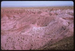
- Description:
- 100 f 11
- Subject:
- Deserts, Valleys, Erosion, Petrified Forest National Park (Ariz.), National parks & reserves, Hills, and Painted Desert (Ariz.)
- Series:
- 5-63
- Creator:
- Cushman, Charles W., 1896-1972
- Date Created:
- 1963-06-26
- Genre:
- Landscape photographs
- Frame Number:
- 27
- County:
- Apache and Navajo
- Abstract:
- Painted Desert near Holbrook, Ariz
- Call Number:
- P12943
- City:
- Holbrook
- Country:
- United States
- State/Province:
- Arizona
- Alternate Identifier:
- 563.27
- Persistent URL:
- http://purl.dlib.indiana.edu/iudl/archives/cushman/P12943
- Holding Location:
- Bloomington - University Archives
Wells Library E460
1320 E 10th St.
Bloomington, IN 47405
Contact at archives@indiana.edu, 812-855-1127
-
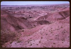
- Description:
- 100 f 9
- Subject:
- Deserts, Valleys, Mesas, Petrified Forest National Park (Ariz.), Shrubs, Hills, Painted Desert (Ariz.), and National parks & reserves
- Series:
- 5-63
- Creator:
- Cushman, Charles W., 1896-1972
- Date Created:
- 1963-06-26
- Genre:
- Landscape photographs
- Frame Number:
- 26
- County:
- Apache and Navajo
- Abstract:
- Painted Desert near Holbrook, Ariz
- Call Number:
- P12942
- City:
- Holbrook
- Country:
- United States
- State/Province:
- Arizona
- Alternate Identifier:
- 523.26
- Persistent URL:
- http://purl.dlib.indiana.edu/iudl/archives/cushman/P12942
- Holding Location:
- Bloomington - University Archives
Wells Library E460
1320 E 10th St.
Bloomington, IN 47405
Contact at archives@indiana.edu, 812-855-1127
-
- Description:
- 100 f 11
- Subject:
- Deserts, Valleys, Petrified Forest National Park (Ariz.), National parks & reserves, Hills, and Painted Desert (Ariz.)
- Series:
- 5-63
- Creator:
- Cushman, Charles W., 1896-1972
- Date Created:
- 1963-06-26
- Genre:
- Landscape photographs
- Frame Number:
- 25
- County:
- Apache and Navajo
- Abstract:
- Painted Desert near Holbrook, Ariz
- Call Number:
- P12941
- City:
- Holbrook
- Country:
- United States
- State/Province:
- Arizona
- Alternate Identifier:
- 563.25
- Persistent URL:
- http://purl.dlib.indiana.edu/iudl/archives/cushman/P12941
- Holding Location:
- Bloomington - University Archives
Wells Library E460
1320 E 10th St.
Bloomington, IN 47405
Contact at archives@indiana.edu, 812-855-1127
-
- Description:
- 100 f 11
- Subject:
- Deserts, Valleys, Erosion, Petrified Forest National Park (Ariz.), National parks & reserves, Hills, and Painted Desert (Ariz.)
- Series:
- 5-63
- Creator:
- Cushman, Charles W., 1896-1972
- Date Created:
- 1963-06-26
- Genre:
- Landscape photographs
- Frame Number:
- 24
- County:
- Apache and Navajo
- Abstract:
- Painted Desert near Holbrook, Ariz
- Call Number:
- P12940
- City:
- Holbrook
- Country:
- United States
- State/Province:
- Arizona
- Alternate Identifier:
- 563.24
- Persistent URL:
- http://purl.dlib.indiana.edu/iudl/archives/cushman/P12940
- Holding Location:
- Bloomington - University Archives
Wells Library E460
1320 E 10th St.
Bloomington, IN 47405
Contact at archives@indiana.edu, 812-855-1127
-
- Description:
- 100 f 8
- Subject:
- Petrified Forest National Park (Ariz.), National parks & reserves, Deserts, Valleys, Hills, Painted Desert (Ariz.), Shrubs, and Mesas
- Series:
- 5-63
- Creator:
- Cushman, Charles W., 1896-1972
- Date Created:
- 1963-06-26
- Genre:
- Landscape photographs
- Frame Number:
- 23
- County:
- Navajo and Apache
- Abstract:
- Painted Desert near Holbrook, Ariz
- Call Number:
- P12939
- City:
- Holbrook
- Country:
- United States
- State/Province:
- Arizona
- Alternate Identifier:
- 563.23
- Persistent URL:
- http://purl.dlib.indiana.edu/iudl/archives/cushman/P12939
- Holding Location:
- Bloomington - University Archives
Wells Library E460
1320 E 10th St.
Bloomington, IN 47405
Contact at archives@indiana.edu, 812-855-1127
-
- Description:
- 100 f 9 TL
- Subject:
- Deserts, Hills, Mountains, Shrubs, Palms, and San Bernardino Desert (Calif.)
- Series:
- 24-61
- Creator:
- Cushman, Charles W., 1896-1972
- Date Created:
- 1961-12-29
- Genre:
- Landscape photographs
- Frame Number:
- 26
- County:
- San Bernardino
- Abstract:
- Panorama north from 12 mi. w. of 29 Palms and Panorama north at 29 Palm S Hwy 7 miles west of 29 Palms San Bernardino Desert
- Call Number:
- P12592
- City:
- Twentynine Palms
- Country:
- United States
- State/Province:
- California
- Alternate Identifier:
- 2461.26
- Persistent URL:
- http://purl.dlib.indiana.edu/iudl/archives/cushman/P12592
- Holding Location:
- Bloomington - University Archives
Wells Library E460
1320 E 10th St.
Bloomington, IN 47405
Contact at archives@indiana.edu, 812-855-1127
-
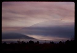
- Description:
- 100 f 4 TL
- Subject:
- Deserts, Trees, Mountains, Clouds, Sunrises & sunsets, and Hills
- Series:
- 23-61
- Creator:
- Cushman, Charles W., 1896-1972
- Date Created:
- 1961-12-23
- Genre:
- Landscape photographs
- Frame Number:
- 36
- County:
- Riverside
- Abstract:
- Desert sunset sky and Near Indio- desert sunset sky
- Call Number:
- P12565
- City:
- Indio
- Country:
- United States
- State/Province:
- California
- Alternate Identifier:
- 2361.36
- Persistent URL:
- http://purl.dlib.indiana.edu/iudl/archives/cushman/P12565
- Holding Location:
- Bloomington - University Archives
Wells Library E460
1320 E 10th St.
Bloomington, IN 47405
Contact at archives@indiana.edu, 812-855-1127
-
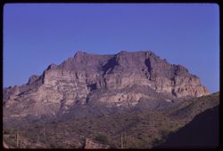
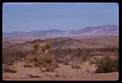
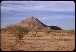
- Description:
- 100 f 8 tl
- Subject:
- Deserts, Hills, Mountains, Picketpost Mountain (Ariz.), and Cactus
- Series:
- 10-59
- Creator:
- Cushman, Charles W., 1896-1972
- Date Created:
- 1959-02-27
- Frame Number:
- 1
- County:
- Pinal
- Abstract:
- Pickett Post Mtn.
- Call Number:
- P10689
- City:
- Superior
- Country:
- United States
- State/Province:
- Arizona
- Alternate Identifier:
- 1059.1
- Persistent URL:
- http://purl.dlib.indiana.edu/iudl/archives/cushman/P10689
- Holding Location:
- Bloomington - University Archives
Wells Library E460
1320 E 10th St.
Bloomington, IN 47405
Contact at archives@indiana.edu, 812-855-1127
-
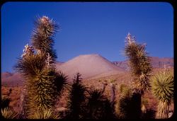
- Description:
- 50 f 8
- Subject:
- Deserts, Mojave Desert (Calif.), Joshua trees, Shrubs, and Hills
- Series:
- 12-54
- Creator:
- Cushman, Charles W., 1896-1972
- Date Created:
- 1954-09-18
- Genre:
- Landscape photographs
- Frame Number:
- 32
- Street Address:
- California State Highway 178 and Walker Pass Road
- County:
- Kern
- Abstract:
- Lone pyramid + Joshua trees along Walker Pass Rd.
- Call Number:
- P07422
- Country:
- United States
- State/Province:
- California
- Alternate Identifier:
- 1254.32
- Persistent URL:
- http://purl.dlib.indiana.edu/iudl/archives/cushman/P07422
- Holding Location:
- Bloomington - University Archives
Wells Library E460
1320 E 10th St.
Bloomington, IN 47405
Contact at archives@indiana.edu, 812-855-1127
-
- Description:
- 50 f 9
- Subject:
- Joshua trees, Deserts, Mojave Desert (Calif.), Hills, and Shrubs
- Series:
- 12-54
- Creator:
- Cushman, Charles W., 1896-1972
- Date Created:
- 1954-09-18
- Genre:
- Landscape photographs
- Frame Number:
- 31
- Street Address:
- California State Highway 178
- County:
- Kern
- Abstract:
- Toward Mojave Desert.
- Call Number:
- P07421
- Country:
- United States
- State/Province:
- California
- Alternate Identifier:
- 1254.31
- Persistent URL:
- http://purl.dlib.indiana.edu/iudl/archives/cushman/P07421
- Holding Location:
- Bloomington - University Archives
Wells Library E460
1320 E 10th St.
Bloomington, IN 47405
Contact at archives@indiana.edu, 812-855-1127
-
- Description:
- 25 f 13
- Subject:
- Deserts, Mojave Desert (Calif.), Walker Pass (Calif.), Joshua trees, Mountains, Shrubs, and Hills
- Series:
- 12-54
- Creator:
- Cushman, Charles W., 1896-1972
- Date Created:
- 1954-09-18
- Genre:
- Identification photographs
- Frame Number:
- 30
- Street Address:
- California State Highway 178 and Walker Pass Road
- County:
- Kern
- Abstract:
- Joshua trees along Walker Pass Rd.
- Call Number:
- P07420
- Country:
- United States
- State/Province:
- California
- Alternate Identifier:
- 1254.30
- Persistent URL:
- http://purl.dlib.indiana.edu/iudl/archives/cushman/P07420
- Holding Location:
- Bloomington - University Archives
Wells Library E460
1320 E 10th St.
Bloomington, IN 47405
Contact at archives@indiana.edu, 812-855-1127
-
- Description:
- 50 f 11 HF
- Subject:
- Deserts, Inyo Mountains (Calif.), Flowers, Mountains, Shrubs, Hills, and Rock formations
- Series:
- 12-54
- Creator:
- Cushman, Charles W., 1896-1972
- Date Created:
- 1954-09-18
- Genre:
- Landscape photographs
- Frame Number:
- 29
- Street Address:
- Mt. Whitney Road
- County:
- Inyo
- Abstract:
- Inyo Mtns beyond one of the Alabama Hills.
- Call Number:
- P07419
- City:
- Alabama Hills and Lone Pine
- Country:
- United States
- State/Province:
- California
- Alternate Identifier:
- 1254.29
- Persistent URL:
- http://purl.dlib.indiana.edu/iudl/archives/cushman/P07419
- Holding Location:
- Bloomington - University Archives
Wells Library E460
1320 E 10th St.
Bloomington, IN 47405
Contact at archives@indiana.edu, 812-855-1127
-
- Description:
- 50 f 11
- Subject:
- Deserts, Valleys, Trees, Flowers, Conway Summit (Calif.), Mountains, Shrubs, and Hills
- Series:
- 9-54
- Creator:
- Cushman, Charles W., 1896-1972
- Date Created:
- 1954-09-16
- Genre:
- Landscape photographs
- Frame Number:
- 21
- Street Address:
- United States Highway 395
- County:
- Mono
- Abstract:
- View north (w.) from US 395, 12 1/2 mi. so of Bridgeport. (19-20-21 were taken less than mile north of Conway Summit)
- Call Number:
- P07332
- City:
- Bridgeport
- Country:
- United States
- State/Province:
- California
- Alternate Identifier:
- 954.21
- Persistent URL:
- http://purl.dlib.indiana.edu/iudl/archives/cushman/P07332
- Holding Location:
- Bloomington - University Archives
Wells Library E460
1320 E 10th St.
Bloomington, IN 47405
Contact at archives@indiana.edu, 812-855-1127
-
- Description:
- 50 f 10
- Subject:
- Deserts, Mojave Desert (Calif.), Grasses, Houses, Mountains, Shrubs, and Hills
- Series:
- 16-53
- Creator:
- Cushman, Charles W., 1896-1972
- Date Created:
- 1953-11-23
- Genre:
- Landscape photographs
- Frame Number:
- 15
- Street Address:
- United States Highway 6
- County:
- Kern
- Abstract:
- Desert mountain in color. Near Rosamond
- Call Number:
- P07087
- City:
- Rosamond
- Country:
- United States
- State/Province:
- California
- Alternate Identifier:
- 1653.15
- Persistent URL:
- http://purl.dlib.indiana.edu/iudl/archives/cushman/P07087
- Holding Location:
- Bloomington - University Archives
Wells Library E460
1320 E 10th St.
Bloomington, IN 47405
Contact at archives@indiana.edu, 812-855-1127
-

- Description:
- 25 f 6.3 Pola
- Subject:
- Deserts, Mining, Mountains, Shrubs, Hills, and Mining equipment
- Series:
- 28-52
- Creator:
- Cushman, Charles W., 1896-1972
- Date Created:
- 1952-11-08
- Genre:
- Landscape photographs
- Frame Number:
- 15
- County:
- Storey
- Abstract:
- Panorama east from Va. City.
- Call Number:
- P06499
- City:
- Virginia City
- Country:
- United States
- State/Province:
- Nevada
- Alternate Identifier:
- 2852.15
- Persistent URL:
- http://purl.dlib.indiana.edu/iudl/archives/cushman/P06499
- Holding Location:
- Bloomington - University Archives
Wells Library E460
1320 E 10th St.
Bloomington, IN 47405
Contact at archives@indiana.edu, 812-855-1127
-
- Description:
- 50 f 9
- Subject:
- National parks & reserves, Deserts, Devils Garden (Grand County, Utah), Hills, Sand, Mountains, Shrubs, Arches National Park (Utah), Wildflowers, Rock fo...
- Series:
- 27-52
- Creator:
- Cushman, Charles W., 1896-1972
- Date Created:
- 1952-11-04
- Genre:
- Landscape photographs
- Frame Number:
- 21
- County:
- Grand
- Abstract:
- En route to Devil's Garden. Sandstone Dunes.
- Call Number:
- P06466
- Country:
- United States
- State/Province:
- Utah
- Alternate Identifier:
- 2752.21
- Persistent URL:
- http://purl.dlib.indiana.edu/iudl/archives/cushman/P06466
- Holding Location:
- Bloomington - University Archives
Wells Library E460
1320 E 10th St.
Bloomington, IN 47405
Contact at archives@indiana.edu, 812-855-1127
-
- Description:
- 25 f 8 pola
- Subject:
- Deserts, Mesas, Harvey Inn (Holbrook, Ariz.), Rock formations, Hills, Painted Desert (Ariz.), and Shrubs
- Series:
- 17-52
- Creator:
- Cushman, Charles W., 1896-1972
- Date Created:
- 1952-04-13
- Genre:
- Landscape photographs
- Frame Number:
- 39
- County:
- Apache and Navajo
- Abstract:
- NW from same pt.
- Call Number:
- P06131
- City:
- Holbrook
- Country:
- United States
- State/Province:
- Arizona
- Alternate Identifier:
- 1752.39
- Persistent URL:
- http://purl.dlib.indiana.edu/iudl/archives/cushman/P06131
- Holding Location:
- Bloomington - University Archives
Wells Library E460
1320 E 10th St.
Bloomington, IN 47405
Contact at archives@indiana.edu, 812-855-1127
-
- Description:
- 25 f 8 pola
- Subject:
- Deserts, Mesas, Harvey Inn (Holbrook, Ariz.), Shrubs, Hills, Painted Desert (Ariz.), and Rock formations
- Series:
- 17-52
- Creator:
- Cushman, Charles W., 1896-1972
- Date Created:
- 1952-04-13
- Genre:
- Landscape photographs
- Frame Number:
- 38
- County:
- Apache and Navajo
- Abstract:
- SE from Harvey Inn
- Call Number:
- P06130
- City:
- Holbrook
- Country:
- United States
- State/Province:
- Arizona
- Physical Description:
- Image was originally mounted in a glass enclosure. Before digitization, the image was removed and placed in a Wess Plastic, Inc. brand, 2" x 2", pl...
- Alternate Identifier:
- 1752.38
- Persistent URL:
- http://purl.dlib.indiana.edu/iudl/archives/cushman/P06130
- Holding Location:
- Bloomington - University Archives
Wells Library E460
1320 E 10th St.
Bloomington, IN 47405
Contact at archives@indiana.edu, 812-855-1127
-
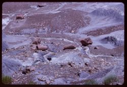
- Description:
- 25 f 11 pola
- Subject:
- Petrified Forest National Park (Ariz.), National parks & reserves, Deserts, Canyons, Hills, Cliffs, Shrubs, Boulders, Rocks, Rock formations, Mesas, Petr...
- Series:
- 17-52
- Creator:
- Cushman, Charles W., 1896-1972
- Date Created:
- 1952-04-13
- Genre:
- Landscape photographs
- Frame Number:
- 36
- County:
- Apache
- Abstract:
- In Blue Forest 113737
- Call Number:
- P06128
- Country:
- United States
- State/Province:
- Arizona
- Alternate Identifier:
- 1752.36
- Persistent URL:
- http://purl.dlib.indiana.edu/iudl/archives/cushman/P06128
- Holding Location:
- Bloomington - University Archives
Wells Library E460
1320 E 10th St.
Bloomington, IN 47405
Contact at archives@indiana.edu, 812-855-1127
-
- Description:
- 25 f 11 pola
- Subject:
- Rocks, Boulders, Petrified Forest National Park (Ariz.), Mountains, Rock formations, Hills, Deserts, and National parks & reserves
- Series:
- 17-52
- Creator:
- Cushman, Charles W., 1896-1972
- Date Created:
- 1952-04-13
- Genre:
- Landscape photographs
- Frame Number:
- 28
- County:
- Apache
- Abstract:
- Bad lands
- Call Number:
- P06120
- City:
- Badlands
- Country:
- United States
- State/Province:
- Arizona
- Alternate Identifier:
- 1752.28
- Persistent URL:
- http://purl.dlib.indiana.edu/iudl/archives/cushman/P06120
- Holding Location:
- Bloomington - University Archives
Wells Library E460
1320 E 10th St.
Bloomington, IN 47405
Contact at archives@indiana.edu, 812-855-1127
-
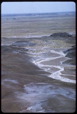
- Description:
- 25 f 11 pola
- Subject:
- Petrified Forest National Park (Ariz.), National parks & reserves, Deserts, Hills, Automobiles, Roads, Boulders, Rocks, Trails & paths, Signs (Notice...
- Series:
- 17-52
- Creator:
- Cushman, Charles W., 1896-1972
- Date Created:
- 1952-04-13
- Genre:
- Landscape photographs
- Frame Number:
- 27
- County:
- Apache
- Abstract:
- Bad lands
- Call Number:
- P06119
- City:
- Badlands
- Country:
- United States
- State/Province:
- Arizona
- Alternate Identifier:
- 1752.27
- Persistent URL:
- http://purl.dlib.indiana.edu/iudl/archives/cushman/P06119
- Holding Location:
- Bloomington - University Archives
Wells Library E460
1320 E 10th St.
Bloomington, IN 47405
Contact at archives@indiana.edu, 812-855-1127
-
- Description:
- 25 f 11 pola
- Subject:
- Rocks, Valleys, Cliffs, Mesas, Boulders, Petrified Forest National Park (Ariz.), National parks & reserves, Hills, and Deserts
- Series:
- 17-52
- Creator:
- Cushman, Charles W., 1896-1972
- Date Created:
- 1952-04-13
- Genre:
- Landscape photographs
- Frame Number:
- 26
- County:
- Apache
- Abstract:
- Bad lands
- Call Number:
- P06118
- City:
- Badlands
- Country:
- United States
- State/Province:
- Arizona
- Alternate Identifier:
- 1752.26
- Persistent URL:
- http://purl.dlib.indiana.edu/iudl/archives/cushman/P06118
- Holding Location:
- Bloomington - University Archives
Wells Library E460
1320 E 10th St.
Bloomington, IN 47405
Contact at archives@indiana.edu, 812-855-1127
-
- Description:
- 25 f 11
- Subject:
- Rocks, Sightseers, Petrified forests, Petrified Forest National Park (Ariz.), National parks & reserves, Logs, Hills, People, Petrified wood, Deserts, an...
- Series:
- 17-52
- Creator:
- Cushman, Charles W., 1896-1972
- Date Created:
- 1952-04-13
- Genre:
- Landscape photographs
- Frame Number:
- 24
- County:
- Apache
- Abstract:
- Panorama with Easter visitors
- Call Number:
- P06117
- Country:
- United States
- State/Province:
- Arizona
- Alternate Identifier:
- 1752.24
- Persistent URL:
- http://purl.dlib.indiana.edu/iudl/archives/cushman/P06117
- Holding Location:
- Bloomington - University Archives
Wells Library E460
1320 E 10th St.
Bloomington, IN 47405
Contact at archives@indiana.edu, 812-855-1127
-
- Description:
- 25 f 16
- Subject:
- Rocks, Boulders, Petrified Forest National Park (Ariz.), Shrubs, Hills, People, Deserts, and National parks & reserves
- Series:
- 17-52
- Creator:
- Cushman, Charles W., 1896-1972
- Date Created:
- 1952-04-13
- Genre:
- Landscape photographs
- Frame Number:
- 22
- County:
- Apache
- Abstract:
- 2 on a rock
- Call Number:
- P06115
- Country:
- United States
- State/Province:
- Arizona
- Alternate Identifier:
- 1752.22
- Persistent URL:
- http://purl.dlib.indiana.edu/iudl/archives/cushman/P06115
- Holding Location:
- Bloomington - University Archives
Wells Library E460
1320 E 10th St.
Bloomington, IN 47405
Contact at archives@indiana.edu, 812-855-1127
-
- Description:
- 25 f 16
- Subject:
- Petrified wood, Petrified forests, Petrified Forest National Park (Ariz.), National parks & reserves, Logs, Hills, Rocks, Deserts, and Fossils
- Series:
- 17-52
- Creator:
- Cushman, Charles W., 1896-1972
- Date Created:
- 1952-04-13
- Genre:
- Landscape photographs
- Frame Number:
- 21
- County:
- Apache
- Abstract:
- Panorama
- Call Number:
- P06114
- Country:
- United States
- State/Province:
- Arizona
- Alternate Identifier:
- 1752.21
- Persistent URL:
- http://purl.dlib.indiana.edu/iudl/archives/cushman/P06114
- Holding Location:
- Bloomington - University Archives
Wells Library E460
1320 E 10th St.
Bloomington, IN 47405
Contact at archives@indiana.edu, 812-855-1127
-
- Description:
- 25 f 9 Pola
- Subject:
- Deserts, Petrified forests, Cliffs, Boulders, Petrified Forest National Park (Ariz.), National parks & reserves, Hills, Rocks, Shrubs, and Rock formations
- Series:
- 17-52
- Creator:
- Cushman, Charles W., 1896-1972
- Date Created:
- 1952-04-13
- Genre:
- Landscape photographs
- Frame Number:
- 10
- County:
- Apache and Navajo
- Abstract:
- Petrified Forest
- Call Number:
- P06103
- City:
- Holbrook
- Country:
- United States
- State/Province:
- Arizona
- Alternate Identifier:
- 1752.10
- Persistent URL:
- http://purl.dlib.indiana.edu/iudl/archives/cushman/P06103
- Holding Location:
- Bloomington - University Archives
Wells Library E460
1320 E 10th St.
Bloomington, IN 47405
Contact at archives@indiana.edu, 812-855-1127
-
- Description:
- 25 f 13
- Subject:
- Deserts, Valleys, Cliffs, Shrubs, Hills, Painted Desert (Ariz.), and Junipers
- Series:
- 17-52
- Creator:
- Cushman, Charles W., 1896-1972
- Date Created:
- 1952-04-12
- Genre:
- Landscape photographs
- Frame Number:
- 9
- County:
- Navajo and Coconimo
- Abstract:
- Junipers above the Painted Desert - same record as 8
- Call Number:
- P06102
- City:
- Holbrook
- Country:
- United States
- State/Province:
- Arizona
- Alternate Identifier:
- 1752.9
- Persistent URL:
- http://purl.dlib.indiana.edu/iudl/archives/cushman/P06102
- Holding Location:
- Bloomington - University Archives
Wells Library E460
1320 E 10th St.
Bloomington, IN 47405
Contact at archives@indiana.edu, 812-855-1127
-
- Description:
- 50 f 5.6 Pola
- Subject:
- Deserts, Valleys, Hills, Painted Desert (Ariz.), Shrubs, Mesas, and Harvey Inn (Holbrook, Ariz.)
- Series:
- 17-52
- Creator:
- Cushman, Charles W., 1896-1972
- Date Created:
- 1952-04-12
- Genre:
- Landscape photographs
- Frame Number:
- 8
- County:
- Navajo and Coconimo
- Abstract:
- View north from near Fred Harvey Inn
- Call Number:
- P06101
- City:
- Holbrook
- Country:
- United States
- State/Province:
- Arizona
- Alternate Identifier:
- 1752.8
- Persistent URL:
- http://purl.dlib.indiana.edu/iudl/archives/cushman/P06101
- Holding Location:
- Bloomington - University Archives
Wells Library E460
1320 E 10th St.
Bloomington, IN 47405
Contact at archives@indiana.edu, 812-855-1127
-
- Description:
- 50 f 11
- Subject:
- Deserts, Canyons, Buildings, Clouds, Hills, Painted Desert (Ariz.), and Valleys
- Series:
- 17-52
- Creator:
- Cushman, Charles W., 1896-1972
- Date Created:
- 1952-04-12
- Genre:
- Landscape photographs
- Frame Number:
- 6
- County:
- Navajo and Coconimo
- Abstract:
- View east from inside
- Call Number:
- P06100
- City:
- Holbrook
- Country:
- United States
- State/Province:
- Arizona
- Physical Description:
- Image was originally mounted in a glass enclosure. Before digitization, the image was removed and placed in a Wess Plastic, Inc. brand, 2" x 2", pl...
- Alternate Identifier:
- 1752.6
- Persistent URL:
- http://purl.dlib.indiana.edu/iudl/archives/cushman/P06100
- Holding Location:
- Bloomington - University Archives
Wells Library E460
1320 E 10th St.
Bloomington, IN 47405
Contact at archives@indiana.edu, 812-855-1127
-
- Description:
- 50 f 6.3 Pola
- Subject:
- Deserts, Valleys, Mesas, Mountains, Shrubs, Hills, and Painted Desert (Ariz.)
- Series:
- 17-52
- Creator:
- Cushman, Charles W., 1896-1972
- Date Created:
- 1952-04-12
- Genre:
- Landscape photographs
- Frame Number:
- 5
- Street Address:
- United States Highway 66
- County:
- Navajo and Coconimo
- Abstract:
- Same
- Call Number:
- P06099
- City:
- Holbrook
- Country:
- United States
- State/Province:
- Arizona
- Alternate Identifier:
- 1752.5
- Persistent URL:
- http://purl.dlib.indiana.edu/iudl/archives/cushman/P06099
- Holding Location:
- Bloomington - University Archives
Wells Library E460
1320 E 10th St.
Bloomington, IN 47405
Contact at archives@indiana.edu, 812-855-1127
-
- Description:
- 50 f 6.3 Pola
- Subject:
- Deserts, Canyons, Trees, Shrubs, Hills, Painted Desert (Ariz.), and Valleys
- Series:
- 17-52
- Creator:
- Cushman, Charles W., 1896-1972
- Date Created:
- 1952-04-12
- Genre:
- Landscape photographs
- Frame Number:
- 4
- County:
- Navajo and Coconimo
- Abstract:
- Same
- Call Number:
- P06098
- City:
- Holbrook
- Country:
- United States
- State/Province:
- Arizona
- Alternate Identifier:
- 1752.4
- Persistent URL:
- http://purl.dlib.indiana.edu/iudl/archives/cushman/P06098
- Holding Location:
- Bloomington - University Archives
Wells Library E460
1320 E 10th St.
Bloomington, IN 47405
Contact at archives@indiana.edu, 812-855-1127
-
- Description:
- 50 f 6.3 Pola
- Subject:
- Deserts, Hills, Cliffs, Mountains, Mesas, and Painted Desert (Ariz.)
- Series:
- 17-52
- Creator:
- Cushman, Charles W., 1896-1972
- Date Created:
- 1952-04-12
- Genre:
- Landscape photographs
- Frame Number:
- 3
- County:
- Navajo and Coconimo
- Call Number:
- P06097
- City:
- Holbrook
- Country:
- United States
- State/Province:
- Arizona
- Physical Description:
- Image was originally mounted in a glass enclosure. Before digitization, the image was removed and placed in a Wess Plastic, Inc. brand, 2" x 2", pl...
- Alternate Identifier:
- 1752.3
- Persistent URL:
- http://purl.dlib.indiana.edu/iudl/archives/cushman/P06097
- Holding Location:
- Bloomington - University Archives
Wells Library E460
1320 E 10th St.
Bloomington, IN 47405
Contact at archives@indiana.edu, 812-855-1127
-
- Description:
- 50 f 6 Pola
- Subject:
- Deserts, Hills, Cliffs, Mountains, Mesas, and Painted Desert (Ariz.)
- Series:
- 17-52
- Creator:
- Cushman, Charles W., 1896-1972
- Date Created:
- 1952-04-12
- Genre:
- Landscape photographs
- Frame Number:
- 2
- County:
- Navajo and Coconimo
- Call Number:
- P06096
- City:
- Holbrook
- Country:
- United States
- State/Province:
- Arizona
- Alternate Identifier:
- 1752.2
- Persistent URL:
- http://purl.dlib.indiana.edu/iudl/archives/cushman/P06096
- Holding Location:
- Bloomington - University Archives
Wells Library E460
1320 E 10th St.
Bloomington, IN 47405
Contact at archives@indiana.edu, 812-855-1127
-
- Description:
- 25 f 8
- Subject:
- Wildflowers, Mead, Lake (Ariz. and Nev.), Mountains, Rock formations, Clouds, Hills, Deserts, Pyramidal mountain, and Shrubs
- Series:
- 15-52
- Creator:
- Cushman, Charles W., 1896-1972
- Date Created:
- 1952-04-10
- Genre:
- Landscape photographs
- Frame Number:
- 41
- County:
- Clark
- Abstract:
- Yellow desert flowers + pyramidal mtn. near Lake Mead.
- Call Number:
- P06060
- Country:
- United States
- State/Province:
- Nevada
- Alternate Identifier:
- 1542.41
- Persistent URL:
- http://purl.dlib.indiana.edu/iudl/archives/cushman/P06060
- Holding Location:
- Bloomington - University Archives
Wells Library E460
1320 E 10th St.
Bloomington, IN 47405
Contact at archives@indiana.edu, 812-855-1127
-
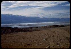
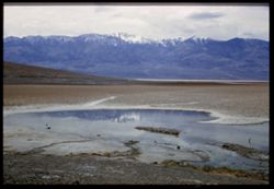
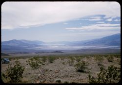
- Description:
- 25 f 16
- Subject:
- Deserts, Valleys, Cliffs, Shadows, Mountains, Rock formations, Death Valley (Calif. and Nev.), and Hills
- Series:
- 15-52
- Creator:
- Cushman, Charles W., 1896-1972
- Date Created:
- 1952-04-09
- Genre:
- Landscape photographs
- Frame Number:
- 39
- Street Address:
- Artists Drive
- Abstract:
- From top of Artists Drive. Kaleidoscopic view.
- Call Number:
- P06058
- Country:
- United States
- State/Province:
- California
- Physical Description:
- Image was originally mounted in a glass enclosure. Before digitization, the image was removed and placed in a Wess Plastic, Inc. brand, 2" x 2", pl...
- Alternate Identifier:
- 1552.39
- Persistent URL:
- http://purl.dlib.indiana.edu/iudl/archives/cushman/P06058
- Holding Location:
- Bloomington - University Archives
Wells Library E460
1320 E 10th St.
Bloomington, IN 47405
Contact at archives@indiana.edu, 812-855-1127
-

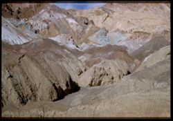
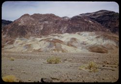
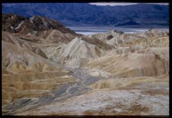
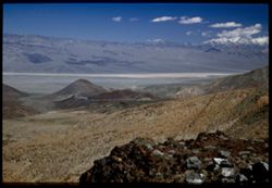
- Description:
- 25 f 13
- Subject:
- Rocks, Colored mountains, Valleys, Cliffs, Mountains, Rock formations, Death Valley (Calif. and Nev.), Deserts, and Hills
- Series:
- 15-52
- Creator:
- Cushman, Charles W., 1896-1972
- Date Created:
- 1952-04-09
- Genre:
- Landscape photographs
- Frame Number:
- 38
- Street Address:
- Artists Drive
- County:
- Inyo
- Abstract:
- From top of Artists Drive. Off Artists Drive.
- Call Number:
- P06057
- Country:
- United States
- State/Province:
- California
- Alternate Identifier:
- 1552.38
- Persistent URL:
- http://purl.dlib.indiana.edu/iudl/archives/cushman/P06057
- Holding Location:
- Bloomington - University Archives
Wells Library E460
1320 E 10th St.
Bloomington, IN 47405
Contact at archives@indiana.edu, 812-855-1127
-
- Description:
- 25 f 8 Pola
- Subject:
- Deserts, Valleys, Hills, Death Valley (Calif. and Nev.), Mountains, Rocks, and Clouds
- Series:
- 15-52
- Creator:
- Cushman, Charles W., 1896-1972
- Date Created:
- 1952-04-09
- Genre:
- Landscape photographs
- Frame Number:
- 35
- Street Address:
- Artists Drive
- County:
- Inyo
- Abstract:
- From top of Artists Drive. Back across valley.
- Call Number:
- P06054
- Country:
- United States
- State/Province:
- California
- Alternate Identifier:
- 1552.35
- Persistent URL:
- http://purl.dlib.indiana.edu/iudl/archives/cushman/P06054
- Holding Location:
- Bloomington - University Archives
Wells Library E460
1320 E 10th St.
Bloomington, IN 47405
Contact at archives@indiana.edu, 812-855-1127
-
- Description:
- 25 f 16
- Subject:
- Deserts, Valleys, Cliffs, Mountains, Hills, and Death Valley (Calif. and Nev.)
- Series:
- 15-52
- Creator:
- Cushman, Charles W., 1896-1972
- Date Created:
- 1952-04-09
- Genre:
- Landscape photographs
- Frame Number:
- 34
- Street Address:
- Artists Drive
- County:
- Inyo
- Abstract:
- From top of Artists Drive. Up.
- Call Number:
- P06053
- Country:
- United States
- State/Province:
- California
- Physical Description:
- Image was originally mounted in a glass enclosure. Before digitization, the image was removed and placed in a Wess Plastic, Inc. brand, 2" x 2", pl...
- Alternate Identifier:
- 1552.34
- Persistent URL:
- http://purl.dlib.indiana.edu/iudl/archives/cushman/P06053
- Holding Location:
- Bloomington - University Archives
Wells Library E460
1320 E 10th St.
Bloomington, IN 47405
Contact at archives@indiana.edu, 812-855-1127
-
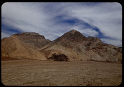
- Description:
- 25 f 13
- Subject:
- Rocks, Colored mountains, Valleys, Cliffs, Boulders, Mountains, Rock formations, Death Valley (Calif. and Nev.), Deserts, and Hills
- Series:
- 15-52
- Creator:
- Cushman, Charles W., 1896-1972
- Date Created:
- 1952-04-09
- Genre:
- Landscape photographs
- Frame Number:
- 33
- Street Address:
- Artists Drive
- County:
- Inyo
- Abstract:
- Colored mtns from Artists Drive.
- Call Number:
- P06052
- Country:
- United States
- State/Province:
- California
- Physical Description:
- Image was originally mounted in a glass enclosure. Before digitization, the image was removed and placed in a Wess Plastic, Inc. brand, 2" x 2", pl...
- Alternate Identifier:
- 1552.33
- Persistent URL:
- http://purl.dlib.indiana.edu/iudl/archives/cushman/P06052
- Holding Location:
- Bloomington - University Archives
Wells Library E460
1320 E 10th St.
Bloomington, IN 47405
Contact at archives@indiana.edu, 812-855-1127
-
- Description:
- 25 f 13
- Subject:
- Deserts, Valleys, Mountains, Hills, Rocks, and Death Valley (Calif. and Nev.)
- Series:
- 15-52
- Creator:
- Cushman, Charles W., 1896-1972
- Date Created:
- 1952-04-09
- Genre:
- Landscape photographs
- Frame Number:
- 31
- Street Address:
- Artists Drive
- County:
- Inyo
- Abstract:
- Mtns from Atrists Drive.
- Call Number:
- P06050
- Country:
- United States
- State/Province:
- California
- Physical Description:
- Image was originally mounted in a glass enclosure. Before digitization, the image was removed and placed in a Wess Plastic, Inc. brand, 2" x 2", pl...
- Alternate Identifier:
- 1552.31
- Persistent URL:
- http://purl.dlib.indiana.edu/iudl/archives/cushman/P06050
- Holding Location:
- Bloomington - University Archives
Wells Library E460
1320 E 10th St.
Bloomington, IN 47405
Contact at archives@indiana.edu, 812-855-1127
-
- Description:
- 25 f 8 Pola
- Subject:
- Bodies of water, Telescope Peak (Inyo County, Calif.), Hills, Mountains, Death Valley (Calif. and Nev.), Deserts, Shrubs, Valleys, and Snow
- Series:
- 15-52
- Creator:
- Cushman, Charles W., 1896-1972
- Date Created:
- 1952-04-09
- Genre:
- Landscape photographs
- Frame Number:
- 25
- County:
- Inyo
- Abstract:
- Telescope Pk. from Bad Water. 280 ft. below sea level.
- Call Number:
- P06045
- City:
- Badwater
- Country:
- United States
- State/Province:
- California
- Physical Description:
- Image was originally mounted in a glass enclosure. Before digitization, the image was removed and placed in a Wess Plastic, Inc. brand, 2" x 2", pl...
- Alternate Identifier:
- 1552.25
- Persistent URL:
- http://purl.dlib.indiana.edu/iudl/archives/cushman/P06045
- Holding Location:
- Bloomington - University Archives
Wells Library E460
1320 E 10th St.
Bloomington, IN 47405
Contact at archives@indiana.edu, 812-855-1127
-
- Description:
- 25 f 9 Pola
- Subject:
- Deserts, Valleys, Salt pools, Mountains, Shrubs, Hills, Black Mountains (Inyo County, Calif.), Rocks, and Death Valley (Calif. and Nev.)
- Series:
- 15-52
- Creator:
- Cushman, Charles W., 1896-1972
- Date Created:
- 1952-04-09
- Genre:
- Landscape photographs
- Frame Number:
- 24
- County:
- Inyo
- Abstract:
- Colored Mtns. The Black Mtns - near Salt Pools this time.
- Call Number:
- P06044
- Country:
- United States
- State/Province:
- California
- Alternate Identifier:
- 1552.24
- Persistent URL:
- http://purl.dlib.indiana.edu/iudl/archives/cushman/P06044
- Holding Location:
- Bloomington - University Archives
Wells Library E460
1320 E 10th St.
Bloomington, IN 47405
Contact at archives@indiana.edu, 812-855-1127
-

- Description:
- 25 f 9 Pola
- Subject:
- Deserts, Valleys, Hills, Death Valley (Calif. and Nev.), Mountains, Colored mountains, Rocks, Rock formations, and Black Mountains (Inyo County, Calif.)
- Series:
- 15-52
- Creator:
- Cushman, Charles W., 1896-1972
- Date Created:
- 1952-04-09
- Genre:
- Landscape photographs
- Frame Number:
- 23
- County:
- Inyo
- Abstract:
- Colored Mtns. The Black Mtns.
- Call Number:
- P06043
- Country:
- United States
- State/Province:
- California
- Alternate Identifier:
- 1552.23
- Persistent URL:
- http://purl.dlib.indiana.edu/iudl/archives/cushman/P06043
- Holding Location:
- Bloomington - University Archives
Wells Library E460
1320 E 10th St.
Bloomington, IN 47405
Contact at archives@indiana.edu, 812-855-1127
-
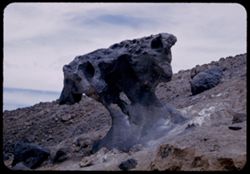
- Description:
- 25 f 10
- Subject:
- Deserts, Mushroom Rock (Inyo County, Calif.), Boulders, Rock formations, Hills, Rocks, Valleys, and Death Valley (Calif. and Nev.)
- Series:
- 15-52
- Creator:
- Cushman, Charles W., 1896-1972
- Date Created:
- 1952-04-09
- Genre:
- Snapshots
- Frame Number:
- 22
- County:
- Inyo
- Abstract:
- Mushroom rock.
- Call Number:
- P06042
- City:
- Furnace Creek
- Country:
- United States
- State/Province:
- California
- Alternate Identifier:
- 1552.22
- Persistent URL:
- http://purl.dlib.indiana.edu/iudl/archives/cushman/P06042
- Holding Location:
- Bloomington - University Archives
Wells Library E460
1320 E 10th St.
Bloomington, IN 47405
Contact at archives@indiana.edu, 812-855-1127
-

- Description:
- 25 f 14
- Subject:
- Deserts, Amargosa Range (Nev. and Calif.), Valleys, Hills, Death Valley (Calif. and Nev.), Cliffs, Mountains, Shrubs, Rocks, Canyons, and Desolation Canyon (...
- Series:
- 15-52
- Creator:
- Cushman, Charles W., 1896-1972
- Date Created:
- 1952-04-09
- Genre:
- Landscape photographs
- Frame Number:
- 21
- Street Address:
- Bad Water Road
- County:
- Inyo
- Abstract:
- Approx. same.
- Call Number:
- P06041
- City:
- Furnace Creek
- Country:
- United States
- State/Province:
- California
- Alternate Identifier:
- 1552.21
- Persistent URL:
- http://purl.dlib.indiana.edu/iudl/archives/cushman/P06041
- Holding Location:
- Bloomington - University Archives
Wells Library E460
1320 E 10th St.
Bloomington, IN 47405
Contact at archives@indiana.edu, 812-855-1127
-
- Description:
- 25 f 9 Pola
- Subject:
- Deserts, Valleys, Mountains, Death Valley (Calif. and Nev.), Canyons, Hills, and Desolation Canyon (Calif.)
- Series:
- 15-52
- Creator:
- Cushman, Charles W., 1896-1972
- Date Created:
- 1952-04-09
- Genre:
- Landscape photographs
- Frame Number:
- 20
- County:
- Inyo
- Abstract:
- From road to Bad Water toward Desolation Canyon.
- Call Number:
- P06040
- City:
- Furnace Creek and Badwater
- Country:
- United States
- State/Province:
- California
- Alternate Identifier:
- 1552.20
- Persistent URL:
- http://purl.dlib.indiana.edu/iudl/archives/cushman/P06040
- Holding Location:
- Bloomington - University Archives
Wells Library E460
1320 E 10th St.
Bloomington, IN 47405
Contact at archives@indiana.edu, 812-855-1127
-
- Description:
- 25 f 9 Pola
- Subject:
- Deserts, Valleys, Cliffs, Mountains, Zabriskie Point (Calif.), Death Valley (Calif. and Nev.), Streams, and Hills
- Series:
- 15-52
- Creator:
- Cushman, Charles W., 1896-1972
- Date Created:
- 1952-04-09
- Genre:
- Landscape photographs
- Frame Number:
- 16
- County:
- Inyo
- Abstract:
- West from Zabriskie Pt.
- Call Number:
- P06036
- City:
- Furnace Creek
- Country:
- United States
- State/Province:
- California
- Physical Description:
- Image was originally mounted in a glass enclosure. Before digitization, the image was removed and placed in a Wess Plastic, Inc. brand, 2" x 2", pl...
- Alternate Identifier:
- 1552.16
- Persistent URL:
- http://purl.dlib.indiana.edu/iudl/archives/cushman/P06036
- Holding Location:
- Bloomington - University Archives
Wells Library E460
1320 E 10th St.
Bloomington, IN 47405
Contact at archives@indiana.edu, 812-855-1127
-
- Description:
- 25 f 6.3 Pola
- Subject:
- Deserts, Valleys, Hills, Automobiles, Death Valley (Calif. and Nev.), Roads, Mountains, Shrubs, and Rocks
- Series:
- 15-52
- Creator:
- Cushman, Charles W., 1896-1972
- Date Created:
- 1952-04-09
- Genre:
- Landscape photographs
- Frame Number:
- 12
- County:
- Inyo
- Abstract:
- Death Valley from north.
- Call Number:
- P06033
- City:
- Beatty Junction
- Country:
- United States
- State/Province:
- California
- Alternate Identifier:
- 1552.12
- Persistent URL:
- http://purl.dlib.indiana.edu/iudl/archives/cushman/P06033
- Holding Location:
- Bloomington - University Archives
Wells Library E460
1320 E 10th St.
Bloomington, IN 47405
Contact at archives@indiana.edu, 812-855-1127
-
- Description:
- 25 f 8 Pola
- Subject:
- Deserts, Valleys, Roads, Mountains, Shrubs, Panamint Valley (Calif.), Hills, Rocks, Panamint Range (Calif.), and Death Valley (Calif. and Nev.)
- Series:
- 15-52
- Creator:
- Cushman, Charles W., 1896-1972
- Date Created:
- 1952-04-08
- Genre:
- Landscape photographs
- Frame Number:
- 6
- County:
- Inyo
- Abstract:
- Road is straight across Panamint Valley.
- Call Number:
- P06027
- Country:
- United States
- State/Province:
- California
- Physical Description:
- Image was originally mounted in a glass enclosure. Before digitization, the image was removed and placed in a Wess Plastic, Inc. brand, 2" x 2", pl...
- Alternate Identifier:
- 1552.6
- Persistent URL:
- http://purl.dlib.indiana.edu/iudl/archives/cushman/P06027
- Holding Location:
- Bloomington - University Archives
Wells Library E460
1320 E 10th St.
Bloomington, IN 47405
Contact at archives@indiana.edu, 812-855-1127
-
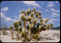
- Description:
- 25 f 11
- Subject:
- Deserts, Mojave Desert (Calif.), Sand, Trees, Joshua trees, Shrubs, Clouds, and Hills
- Series:
- 14-52
- Creator:
- Cushman, Charles W., 1896-1972
- Date Created:
- 1952-04-07
- Genre:
- Identification photographs
- Frame Number:
- 10
- Street Address:
- United States Highway 6
- County:
- Kern
- Abstract:
- Joshua tree near Ricardo.
- Call Number:
- P05994
- City:
- Ricardo
- Country:
- United States
- State/Province:
- California
- Alternate Identifier:
- 1452.10
- Persistent URL:
- http://purl.dlib.indiana.edu/iudl/archives/cushman/P05994
- Holding Location:
- Bloomington - University Archives
Wells Library E460
1320 E 10th St.
Bloomington, IN 47405
Contact at archives@indiana.edu, 812-855-1127
-
- Description:
- 25 f 11
- Subject:
- Deserts, Mojave Desert (Calif.), Mountains, Shrubs, Hills, and San Gabriel Mountains (Calif.)
- Series:
- 6-52
- Creator:
- Cushman, Charles W., 1896-1972
- Date Created:
- 1952-02-17
- Genre:
- Landscape photographs
- Frame Number:
- 10
- Abstract:
- Mohave desert from side of San Gabriel Mtns
- Call Number:
- P05693
- Country:
- United States
- State/Province:
- California
- Alternate Identifier:
- 652.10
- Persistent URL:
- http://purl.dlib.indiana.edu/iudl/archives/cushman/P05693
- Holding Location:
- Bloomington - University Archives
Wells Library E460
1320 E 10th St.
Bloomington, IN 47405
Contact at archives@indiana.edu, 812-855-1127
-
- Description:
- 50 f 8
- Subject:
- Deserts, Trees, Roskruge Mountains (Ariz.), Shrubs, Hills, and Mountains
- Series:
- 2-52
- Creator:
- Cushman, Charles W., 1896-1972
- Date Created:
- 1952-01-09
- Genre:
- Landscape photographs
- Frame Number:
- 13
- Street Address:
- Ajo Way
- County:
- Pima
- Abstract:
- Rounded pyramid with penthouse. One of Roskruge chain nearest Ajo road.
- Call Number:
- P05543
- City:
- Tucson
- Country:
- United States
- State/Province:
- Arizona
- Alternate Identifier:
- 252.13
- Persistent URL:
- http://purl.dlib.indiana.edu/iudl/archives/cushman/P05543
- Holding Location:
- Bloomington - University Archives
Wells Library E460
1320 E 10th St.
Bloomington, IN 47405
Contact at archives@indiana.edu, 812-855-1127
