
Search Constraints
You searched for:
Campus
IUB
Remove constraint Campus: IUB
Subject
Deserts
Remove constraint Subject: Deserts
Search Results
-
- Description:
- 100 f 11 TL
- Subject:
- Petrified Forest National Park (Ariz.), National parks & reserves, Deserts, Valleys, Hills, Blue Mesa (Ariz.), Rivers, Mesas, Petrified forests, Erosion,...
- Series:
- 6-63
- Creator:
- Cushman, Charles W., 1896-1972
- Date Created:
- 1963-06-27
- Genre:
- Landscape photographs
- Frame Number:
- 11
- County:
- Navajo and Apache
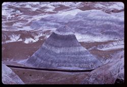
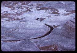
- Abstract:
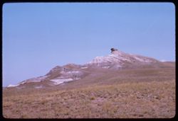
- Distantly Down from Blue Mesa
- Call Number:
- P12964
- City:
- Holbrook
- Country:
- United States
- State/Province:
- Arizona
- Alternate Identifier:
- 663.11
- Persistent URL:
- http://purl.dlib.indiana.edu/iudl/archives/cushman/P12964
- Holding Location:
- Bloomington - University Archives
Wells Library E460
1320 E 10th St.
Bloomington, IN 47405
Contact at archives@indiana.edu, 812-855-1127
-
- Description:
- 100 f 13 TL
- Subject:
- Deserts, Blue Mesa (Ariz.), Valleys, Petrified forests, Mesas, Petrified Forest National Park (Ariz.), National parks & reserves, Hills, and Rivers
- Series:
- 6-63
- Creator:
- Cushman, Charles W., 1896-1972
- Date Created:
- 1963-06-27
- Genre:
- Landscape photographs
- Frame Number:
- 10
- County:
- Apache and Navajo
- Abstract:
- Distantly Down from Blue Mesa
- Call Number:
- P12963
- City:
- Holbrook
- Country:
- United States
- State/Province:
- Arizona
- Alternate Identifier:
- 663.10
- Persistent URL:
- http://purl.dlib.indiana.edu/iudl/archives/cushman/P12963
- Holding Location:
- Bloomington - University Archives
Wells Library E460
1320 E 10th St.
Bloomington, IN 47405
Contact at archives@indiana.edu, 812-855-1127
-
- Description:
- 100 f 11 TL
- Subject:
- Deserts, Blue Mesa (Ariz.), Valleys, Petrified forests, Mesas, Petrified Forest National Park (Ariz.), Rock formations, Hills, Erosion, and National parks &a...
- Series:
- 6-63
- Creator:
- Cushman, Charles W., 1896-1972
- Date Created:
- 1963-06-27
- Genre:
- Landscape photographs
- Frame Number:
- 9
- County:
- Apache and Navajo
- Abstract:
- Distantly Down from Blue Mesa
- Call Number:
- P12962
- City:
- Holbrook
- Country:
- United States
- State/Province:
- Arizona
- Alternate Identifier:
- 663.9
- Persistent URL:
- http://purl.dlib.indiana.edu/iudl/archives/cushman/P12962
- Holding Location:
- Bloomington - University Archives
Wells Library E460
1320 E 10th St.
Bloomington, IN 47405
Contact at archives@indiana.edu, 812-855-1127
-
- Description:
- 100 f 11 TL
- Subject:
- Deserts, Blue Mesa (Ariz.), Petrified forests, Petrified Forest National Park (Ariz.), National parks & reserves, Logs, Hills, Erosion, Shadows, and Rock...
- Series:
- 6-63
- Creator:
- Cushman, Charles W., 1896-1972
- Date Created:
- 1963-06-27
- Genre:
- Landscape photographs and Identification photographs
- Frame Number:
- 8
- County:
- Apache and Navajo
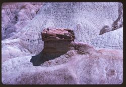
- Abstract:
- Distantly Down from Blue Mesa
- Call Number:
- P12961
- City:
- Holbrook
- Country:
- United States
- State/Province:
- Arizona
- Alternate Identifier:
- 663.8
- Persistent URL:
- http://purl.dlib.indiana.edu/iudl/archives/cushman/P12961
- Holding Location:
- Bloomington - University Archives
Wells Library E460
1320 E 10th St.
Bloomington, IN 47405
Contact at archives@indiana.edu, 812-855-1127
-
- Description:
- 100 f 11 TL
- Subject:
- Logs, Valleys, Rocks, Blue Mesa (Ariz.), Grasses, National parks & reserves, Deserts, Petrified forests, Petrified Forest National Park (Ariz.), and Hills
- Series:
- 6-63
- Creator:
- Cushman, Charles W., 1896-1972
- Date Created:
- 1963-06-27
- Genre:
- Identification photographs and Landscape photographs
- Frame Number:
- 7
- County:
- Navajo and Apache
- Abstract:
- Distantly Down from Blue Mesa
- Call Number:
- P12960
- City:
- Holbrook
- Country:
- United States
- State/Province:
- Arizona
- Alternate Identifier:
- 663.7
- Persistent URL:
- http://purl.dlib.indiana.edu/iudl/archives/cushman/P12960
- Holding Location:
- Bloomington - University Archives
Wells Library E460
1320 E 10th St.
Bloomington, IN 47405
Contact at archives@indiana.edu, 812-855-1127
-
- Description:
- 100 f 11TL
- Subject:
- Deserts, Blue Mesa (Ariz.), Valleys, Erosion, Mesas, Petrified Forest National Park (Ariz.), National parks & reserves, Hills, and Petrified forests
- Series:
- 6-63
- Creator:
- Cushman, Charles W., 1896-1972
- Date Created:
- 1963-06-27
- Genre:
- Landscape photographs
- Frame Number:
- 6
- County:
- Apache and Navajo
- Abstract:
- Distantly Down from Blue Mesa
- Call Number:
- P12959
- City:
- Holbrook
- Country:
- United States
- State/Province:
- Arizona
- Alternate Identifier:
- 663.6
- Persistent URL:
- http://purl.dlib.indiana.edu/iudl/archives/cushman/P12959
- Holding Location:
- Bloomington - University Archives
Wells Library E460
1320 E 10th St.
Bloomington, IN 47405
Contact at archives@indiana.edu, 812-855-1127
-
- Description:
- 100 f 11TL
- Subject:
- Petrified Forest National Park (Ariz.), National parks & reserves, Deserts, Cliffs, Blue Mesa (Ariz.), Rock formations, Mesas, and Petrified forests
- Series:
- 6-63
- Creator:
- Cushman, Charles W., 1896-1972
- Date Created:
- 1963-06-27
- Genre:
- Landscape photographs
- Frame Number:
- 5
- County:
- Navajo and Apache
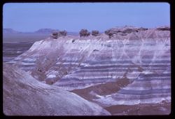
- Abstract:
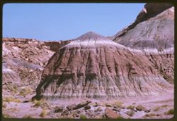
- Down from Blue Mesa
- Call Number:
- P12958
- City:
- Holbrook
- Country:
- United States
- State/Province:
- Arizona
- Alternate Identifier:
- 663.5
- Persistent URL:
- http://purl.dlib.indiana.edu/iudl/archives/cushman/P12958
- Holding Location:
- Bloomington - University Archives
Wells Library E460
1320 E 10th St.
Bloomington, IN 47405
Contact at archives@indiana.edu, 812-855-1127
-
- Description:
- 100 f 11TL
- Subject:
- Deserts, Blue Mesa (Ariz.), Petrified forests, Cliffs, Mesas, Petrified Forest National Park (Ariz.), Rock formations, and National parks & reserves
- Series:
- 6-63
- Creator:
- Cushman, Charles W., 1896-1972
- Date Created:
- 1963-06-27
- Genre:
- Landscape photographs
- Frame Number:
- 4
- County:
- Apache and Navajo
- Abstract:
- Down from Blue Mesa
- Call Number:
- P12957
- City:
- Holbrook
- Country:
- United States
- State/Province:
- Arizona
- Alternate Identifier:
- 663.4
- Persistent URL:
- http://purl.dlib.indiana.edu/iudl/archives/cushman/P12957
- Holding Location:
- Bloomington - University Archives
Wells Library E460
1320 E 10th St.
Bloomington, IN 47405
Contact at archives@indiana.edu, 812-855-1127
-
- Description:
- 100 f 11 TL
- Subject:
- Deserts, Blue Mesa (Ariz.), Petrified forests, Cliffs, Mesas, Petrified Forest National Park (Ariz.), Rock formations, and National parks & reserves
- Series:
- 6-63
- Creator:
- Cushman, Charles W., 1896-1972
- Date Created:
- 1963-06-27
- Genre:
- Landscape photographs
- Frame Number:
- 3
- County:
- Apache and Navajo
- Abstract:
- Down from Blue Mesa
- Call Number:
- P12956
- City:
- Holbrook
- Country:
- United States
- State/Province:
- Arizona
- Alternate Identifier:
- 663.3
- Persistent URL:
- http://purl.dlib.indiana.edu/iudl/archives/cushman/P12956
- Holding Location:
- Bloomington - University Archives
Wells Library E460
1320 E 10th St.
Bloomington, IN 47405
Contact at archives@indiana.edu, 812-855-1127
-
- Description:
- 100 f 13 TL
- Subject:
- Deserts, Blue Mesa (Ariz.), Petrified forests, Cliffs, Mesas, Petrified Forest National Park (Ariz.), Rock formations, Erosion, and National parks & rese...
- Series:
- 6-63
- Creator:
- Cushman, Charles W., 1896-1972
- Date Created:
- 1963-06-27
- Genre:
- Landscape photographs
- Frame Number:
- 2
- County:
- Apache and Navajo
- Abstract:
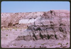
- Cliff of Blue Mesa
- Call Number:
- P12955
- City:
- Holbrook
- Country:
- United States
- State/Province:
- Arizona
- Alternate Identifier:
- 663.2
- Persistent URL:
- http://purl.dlib.indiana.edu/iudl/archives/cushman/P12955
- Holding Location:
- Bloomington - University Archives
Wells Library E460
1320 E 10th St.
Bloomington, IN 47405
Contact at archives@indiana.edu, 812-855-1127
-
- Description:
- 100 f 13 TL
- Subject:
- Erosion, National parks & reserves, Deserts, Valleys, Hills, Cliffs, Blue Mesa (Ariz.), Rock formations, Mesas, Petrified Forest National Park (Ariz.), a...
- Series:
- 6-63
- Creator:
- Cushman, Charles W., 1896-1972
- Date Created:
- 1963-06-27
- Genre:
- Landscape photographs
- Frame Number:
- 1
- County:
- Navajo and Apache
- Abstract:
- Cliff of Blue Mesa
- Call Number:
- P12954
- City:
- Holbrook
- Country:
- United States
- State/Province:
- Arizona
- Alternate Identifier:
- 663.1
- Persistent URL:
- http://purl.dlib.indiana.edu/iudl/archives/cushman/P12954
- Holding Location:
- Bloomington - University Archives
Wells Library E460
1320 E 10th St.
Bloomington, IN 47405
Contact at archives@indiana.edu, 812-855-1127
-
- Description:
- 100 f 11 TL
- Subject:
- Rocks, Blue Mesa (Ariz.), Petrified forests, Mesas, Petrified Forest National Park (Ariz.), Plains, Rock formations, Deserts, and National parks & reserves
- Series:
- 5-63
- Creator:
- Cushman, Charles W., 1896-1972
- Date Created:
- 1963-06-27
- Genre:
- Landscape photographs
- Frame Number:
- 37
- County:
- Apache and Navajo
- Abstract:
- Blue Mesa
- Call Number:
- P12953
- City:
- Holbrook
- Country:
- United States
- State/Province:
- Arizona
- Alternate Identifier:
- 563.37
- Persistent URL:
- http://purl.dlib.indiana.edu/iudl/archives/cushman/P12953
- Holding Location:
- Bloomington - University Archives
Wells Library E460
1320 E 10th St.
Bloomington, IN 47405
Contact at archives@indiana.edu, 812-855-1127
-
- Description:
- 100 f 11 TL
- Subject:
- Deserts, Petrified forests, Petrified Forest National Park (Ariz.), Rock formations, Hills, Grasses, and National parks & reserves
- Series:
- 5-63
- Creator:
- Cushman, Charles W., 1896-1972
- Date Created:
- 1963-06-27
- Genre:
- Landscape photographs
- Frame Number:
- 36
- County:
- Apache and Navajo
- Abstract:
- Flying ?
- Call Number:
- P12952
- City:
- Holbrook
- Country:
- United States
- State/Province:
- Arizona
- Alternate Identifier:
- 563.36
- Persistent URL:
- http://purl.dlib.indiana.edu/iudl/archives/cushman/P12952
- Holding Location:
- Bloomington - University Archives
Wells Library E460
1320 E 10th St.
Bloomington, IN 47405
Contact at archives@indiana.edu, 812-855-1127
-
- Description:
- 100 f 11 TL
- Subject:
- Deserts, Erosion, Petrified Forest National Park (Ariz.), Jasper Forest (Ariz.), Rock formations, Rocks, Petrified forests, Grasses, and National parks &...
- Series:
- 5-63
- Creator:
- Cushman, Charles W., 1896-1972
- Date Created:
- 1963-06-27
- Genre:
- Landscape photographs
- Frame Number:
- 34
- County:
- Apache and Navajo
- Abstract:
- In Jasper forest
- Call Number:
- P12950
- City:
- Holbrook
- Country:
- United States
- State/Province:
- Arizona
- Alternate Identifier:
- 563.34
- Persistent URL:
- http://purl.dlib.indiana.edu/iudl/archives/cushman/P12950
- Holding Location:
- Bloomington - University Archives
Wells Library E460
1320 E 10th St.
Bloomington, IN 47405
Contact at archives@indiana.edu, 812-855-1127
-
- Description:
- 100 f 11 TL
- Subject:
- Deserts, Petrified forests, Petrified Forest National Park (Ariz.), Jasper Forest (Ariz.), National parks & reserves, Mounds (Landforms), Rocks, Erosion,...
- Series:
- 5-63
- Creator:
- Cushman, Charles W., 1896-1972
- Date Created:
- 1963-06-27
- Genre:
- Landscape photographs
- Frame Number:
- 33
- County:
- Apache and Navajo
- Abstract:
- In Jasper forest
- Call Number:
- P12949
- City:
- Holbrook
- Country:
- United States
- State/Province:
- Arizona
- Alternate Identifier:
- 563.33
- Persistent URL:
- http://purl.dlib.indiana.edu/iudl/archives/cushman/P12949
- Holding Location:
- Bloomington - University Archives
Wells Library E460
1320 E 10th St.
Bloomington, IN 47405
Contact at archives@indiana.edu, 812-855-1127
-
- Description:
- 100 f 11 TL
- Subject:
- Petrified forests, National parks & reserves, Deserts, Jasper Forest (Ariz.), Valleys, Quartz, Hills, Rocks, Grasses, and Petrified Forest National Park ...
- Series:
- 5-63
- Creator:
- Cushman, Charles W., 1896-1972
- Date Created:
- 1963-06-27
- Genre:
- Identification photographs and Landscape photographs
- Frame Number:
- 32
- County:
- Navajo and Apache
- Abstract:
- In Jasper forest
- Call Number:
- P12948
- City:
- Holbrook
- Country:
- United States
- State/Province:
- Arizona
- Alternate Identifier:
- 563.32
- Persistent URL:
- http://purl.dlib.indiana.edu/iudl/archives/cushman/P12948
- Holding Location:
- Bloomington - University Archives
Wells Library E460
1320 E 10th St.
Bloomington, IN 47405
Contact at archives@indiana.edu, 812-855-1127
-
- Description:
- 100 f 11 TL
- Subject:
- Rocks, Grasses, Quartz, Jasper Forest (Ariz.), National parks & reserves, Deserts, Petrified forests, Erosion, Petrified Forest National Park (Ariz.), an...
- Series:
- 5-63
- Creator:
- Cushman, Charles W., 1896-1972
- Date Created:
- 1963-06-27
- Genre:
- Landscape photographs
- Frame Number:
- 31
- County:
- Apache and Navajo
- Abstract:
- In Jasper forest
- Call Number:
- P12947
- City:
- Holbrook
- Country:
- United States
- State/Province:
- Arizona
- Alternate Identifier:
- 563.31
- Persistent URL:
- http://purl.dlib.indiana.edu/iudl/archives/cushman/P12947
- Holding Location:
- Bloomington - University Archives
Wells Library E460
1320 E 10th St.
Bloomington, IN 47405
Contact at archives@indiana.edu, 812-855-1127
-
- Description:
- 100 f 11 TL
- Subject:
- Deserts, Grasses, Petrified Forest National Park (Ariz.), National parks & reserves, Logs, Hills, and Petrified forests
- Series:
- 5-63
- Creator:
- Cushman, Charles W., 1896-1972
- Date Created:
- 1963-06-27
- Genre:
- Identification photographs
- Frame Number:
- 30
- County:
- Navajo
- Abstract:
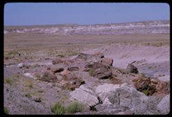
- Logs
- Call Number:
- P12946
- City:
- Holbrook
- Country:
- United States
- State/Province:
- Arizona
- Alternate Identifier:
- 563.30
- Persistent URL:
- http://purl.dlib.indiana.edu/iudl/archives/cushman/P12946
- Holding Location:
- Bloomington - University Archives
Wells Library E460
1320 E 10th St.
Bloomington, IN 47405
Contact at archives@indiana.edu, 812-855-1127
-
- Description:
- 100 f 11 TL
- Subject:
- Deserts, Petrified forests, Cliffs, Petrified Forest National Park (Ariz.), Buttes, National parks & reserves, Hills, Rocks, Erosion, and Grasses
- Series:
- 5-63
- Creator:
- Cushman, Charles W., 1896-1972
- Date Created:
- 1963-06-27
- Genre:
- Landscape photographs
- Frame Number:
- 29
- County:
- Apache and Navajo
- Call Number:
- P12945
- City:
- Holbrook
- Country:
- United States
- State/Province:
- Arizona
- Alternate Identifier:
- 563.29
- Persistent URL:
- http://purl.dlib.indiana.edu/iudl/archives/cushman/P12945
- Holding Location:
- Bloomington - University Archives
Wells Library E460
1320 E 10th St.
Bloomington, IN 47405
Contact at archives@indiana.edu, 812-855-1127
-
- Description:
- 100 f 13 TL
- Subject:
- Deserts, Valleys, Erosion, Mesas, Petrified Forest National Park (Ariz.), National parks & reserves, Hills, and Painted Desert (Ariz.)
- Series:
- 5-63
- Creator:
- Cushman, Charles W., 1896-1972
- Date Created:
- 1963-06-27
- Genre:
- Landscape photographs
- Frame Number:
- 28
- County:
- Apache and Navajo
- Abstract:
- In Petrified Forest
- Call Number:
- P12944
- City:
- Holbrook
- Country:
- United States
- State/Province:
- Arizona
- Alternate Identifier:
- 563.28
- Persistent URL:
- http://purl.dlib.indiana.edu/iudl/archives/cushman/P12944
- Holding Location:
- Bloomington - University Archives
Wells Library E460
1320 E 10th St.
Bloomington, IN 47405
Contact at archives@indiana.edu, 812-855-1127
-
- Description:
- 100 f 11
- Subject:
- Deserts, Valleys, Erosion, Petrified Forest National Park (Ariz.), National parks & reserves, Hills, and Painted Desert (Ariz.)
- Series:
- 5-63
- Creator:
- Cushman, Charles W., 1896-1972
- Date Created:
- 1963-06-26
- Genre:
- Landscape photographs
- Frame Number:
- 27
- County:
- Apache and Navajo
- Abstract:
- Painted Desert near Holbrook, Ariz
- Call Number:
- P12943
- City:
- Holbrook
- Country:
- United States
- State/Province:
- Arizona
- Alternate Identifier:
- 563.27
- Persistent URL:
- http://purl.dlib.indiana.edu/iudl/archives/cushman/P12943
- Holding Location:
- Bloomington - University Archives
Wells Library E460
1320 E 10th St.
Bloomington, IN 47405
Contact at archives@indiana.edu, 812-855-1127
-
- Description:
- 100 f 9
- Subject:
- Deserts, Valleys, Mesas, Petrified Forest National Park (Ariz.), Shrubs, Hills, Painted Desert (Ariz.), and National parks & reserves
- Series:
- 5-63
- Creator:
- Cushman, Charles W., 1896-1972
- Date Created:
- 1963-06-26
- Genre:
- Landscape photographs
- Frame Number:
- 26
- County:
- Apache and Navajo
- Abstract:
- Painted Desert near Holbrook, Ariz
- Call Number:
- P12942
- City:
- Holbrook
- Country:
- United States
- State/Province:
- Arizona
- Alternate Identifier:
- 523.26
- Persistent URL:
- http://purl.dlib.indiana.edu/iudl/archives/cushman/P12942
- Holding Location:
- Bloomington - University Archives
Wells Library E460
1320 E 10th St.
Bloomington, IN 47405
Contact at archives@indiana.edu, 812-855-1127
-
- Description:
- 100 f 11
- Subject:
- Deserts, Valleys, Petrified Forest National Park (Ariz.), National parks & reserves, Hills, and Painted Desert (Ariz.)
- Series:
- 5-63
- Creator:
- Cushman, Charles W., 1896-1972
- Date Created:
- 1963-06-26
- Genre:
- Landscape photographs
- Frame Number:
- 25
- County:
- Apache and Navajo
- Abstract:
- Painted Desert near Holbrook, Ariz
- Call Number:
- P12941
- City:
- Holbrook
- Country:
- United States
- State/Province:
- Arizona
- Alternate Identifier:
- 563.25
- Persistent URL:
- http://purl.dlib.indiana.edu/iudl/archives/cushman/P12941
- Holding Location:
- Bloomington - University Archives
Wells Library E460
1320 E 10th St.
Bloomington, IN 47405
Contact at archives@indiana.edu, 812-855-1127
-
- Description:
- 100 f 11
- Subject:
- Deserts, Valleys, Erosion, Petrified Forest National Park (Ariz.), National parks & reserves, Hills, and Painted Desert (Ariz.)
- Series:
- 5-63
- Creator:
- Cushman, Charles W., 1896-1972
- Date Created:
- 1963-06-26
- Genre:
- Landscape photographs
- Frame Number:
- 24
- County:
- Apache and Navajo
- Abstract:
- Painted Desert near Holbrook, Ariz
- Call Number:
- P12940
- City:
- Holbrook
- Country:
- United States
- State/Province:
- Arizona
- Alternate Identifier:
- 563.24
- Persistent URL:
- http://purl.dlib.indiana.edu/iudl/archives/cushman/P12940
- Holding Location:
- Bloomington - University Archives
Wells Library E460
1320 E 10th St.
Bloomington, IN 47405
Contact at archives@indiana.edu, 812-855-1127
-
- Description:
- 100 f 8
- Subject:
- Petrified Forest National Park (Ariz.), National parks & reserves, Deserts, Valleys, Hills, Painted Desert (Ariz.), Shrubs, and Mesas
- Series:
- 5-63
- Creator:
- Cushman, Charles W., 1896-1972
- Date Created:
- 1963-06-26
- Genre:
- Landscape photographs
- Frame Number:
- 23
- County:
- Navajo and Apache
- Abstract:
- Painted Desert near Holbrook, Ariz
- Call Number:
- P12939
- City:
- Holbrook
- Country:
- United States
- State/Province:
- Arizona
- Alternate Identifier:
- 563.23
- Persistent URL:
- http://purl.dlib.indiana.edu/iudl/archives/cushman/P12939
- Holding Location:
- Bloomington - University Archives
Wells Library E460
1320 E 10th St.
Bloomington, IN 47405
Contact at archives@indiana.edu, 812-855-1127
-
- Description:
- 100 f 11 TL
- Subject:
- Deserts, Mojave Desert (Calif.), Grasses, Cady Mountains (Calif.), Mountains, and Shrubs
- Series:
- 5-62
- Creator:
- Cushman, Charles W., 1896-1972
- Date Created:
- 1962-10-08
- Genre:
- Landscape photographs
- Frame Number:
- 26
- Street Address:
- United States Highway 66
- County:
- San Bernardino
- Abstract:
- Cady Mtns
- Call Number:
- P12793
- City:
- Barstow
- Country:
- United States
- State/Province:
- California
- Alternate Identifier:
- 562.26
- Persistent URL:
- http://purl.dlib.indiana.edu/iudl/archives/cushman/P12793
- Holding Location:
- Bloomington - University Archives
Wells Library E460
1320 E 10th St.
Bloomington, IN 47405
Contact at archives@indiana.edu, 812-855-1127
-
- Description:
- 100 f 11 or 13 TL
- Subject:
- Deserts, Mojave Desert (Calif.), Grasses, Cady Mountains (Calif.), and Mountains
- Series:
- 5-62
- Creator:
- Cushman, Charles W., 1896-1972
- Date Created:
- 1962-10-08
- Genre:
- Landscape photographs
- Frame Number:
- 25
- Street Address:
- United States Highway 66
- County:
- San Bernardino
- Abstract:
- Cady Mtns
- Call Number:
- P12792
- Country:
- United States
- State/Province:
- California
- Alternate Identifier:
- 562.25
- Persistent URL:
- http://purl.dlib.indiana.edu/iudl/archives/cushman/P12792
- Holding Location:
- Bloomington - University Archives
Wells Library E460
1320 E 10th St.
Bloomington, IN 47405
Contact at archives@indiana.edu, 812-855-1127
-
- Description:
- 100 f 8 TL
- Subject:
- Deserts, Grasses, San Bernardino Desert (Calif.), Mountains, and Shrubs
- Series:
- 24-61
- Creator:
- Cushman, Charles W., 1896-1972
- Date Created:
- 1961-12-29
- Genre:
- Landscape photographs
- Frame Number:
- 27
- County:
- San Bernardino
- Abstract:
- Panorama north from 12 mi. w. of 29 Palms and Panorama north of 29 Palm S Hwy 7 miles west of 29 Palms San Bernardino Desert
- Call Number:
- P12593
- City:
- Twentynine Palms
- Country:
- United States
- State/Province:
- California
- Alternate Identifier:
- 2461.27
- Persistent URL:
- http://purl.dlib.indiana.edu/iudl/archives/cushman/P12593
- Holding Location:
- Bloomington - University Archives
Wells Library E460
1320 E 10th St.
Bloomington, IN 47405
Contact at archives@indiana.edu, 812-855-1127
-
- Description:
- 100 f 9 TL
- Subject:
- Deserts, Hills, Mountains, Shrubs, Palms, and San Bernardino Desert (Calif.)
- Series:
- 24-61
- Creator:
- Cushman, Charles W., 1896-1972
- Date Created:
- 1961-12-29
- Genre:
- Landscape photographs
- Frame Number:
- 26
- County:
- San Bernardino
- Abstract:
- Panorama north from 12 mi. w. of 29 Palms and Panorama north at 29 Palm S Hwy 7 miles west of 29 Palms San Bernardino Desert
- Call Number:
- P12592
- City:
- Twentynine Palms
- Country:
- United States
- State/Province:
- California
- Alternate Identifier:
- 2461.26
- Persistent URL:
- http://purl.dlib.indiana.edu/iudl/archives/cushman/P12592
- Holding Location:
- Bloomington - University Archives
Wells Library E460
1320 E 10th St.
Bloomington, IN 47405
Contact at archives@indiana.edu, 812-855-1127
-
- Description:
- 100 f 4 TL
- Subject:
- Deserts, Trees, Mountains, Clouds, Sunrises & sunsets, and Hills
- Series:
- 23-61
- Creator:
- Cushman, Charles W., 1896-1972
- Date Created:
- 1961-12-23
- Genre:
- Landscape photographs
- Frame Number:
- 36
- County:
- Riverside
- Abstract:
- Desert sunset sky and Near Indio- desert sunset sky
- Call Number:
- P12565
- City:
- Indio
- Country:
- United States
- State/Province:
- California
- Alternate Identifier:
- 2361.36
- Persistent URL:
- http://purl.dlib.indiana.edu/iudl/archives/cushman/P12565
- Holding Location:
- Bloomington - University Archives
Wells Library E460
1320 E 10th St.
Bloomington, IN 47405
Contact at archives@indiana.edu, 812-855-1127
-
- Description:
- 25 f 8
- Subject:
- Deserts, Date palm, Shrubs, Trees, and Palms
- Series:
- 26-60
- Creator:
- Cushman, Charles W., 1896-1972
- Date Created:
- 1960-12-25
- Genre:
- Identification photographs
- Frame Number:
- 21
- County:
- Riverside
- Abstract:
- Date Palm grove near Thousand Palms
- Call Number:
- P11743
- City:
- Thousand Palms
- Country:
- United States
- State/Province:
- California
- Alternate Identifier:
- 2660.21
- Persistent URL:
- http://purl.dlib.indiana.edu/iudl/archives/cushman/P11743
- Holding Location:
- Bloomington - University Archives
Wells Library E460
1320 E 10th St.
Bloomington, IN 47405
Contact at archives@indiana.edu, 812-855-1127
-
- Description:
- 25 f 6.3
- Subject:
- Deserts, Trees, Shrubs, Palms, and Date palm
- Series:
- 26-60
- Creator:
- Cushman, Charles W., 1896-1972
- Date Created:
- 1960-12-25
- Genre:
- Identification photographs
- Frame Number:
- 20
- County:
- Riverside
- Call Number:
- P11742
- City:
- Thousand Palms
- Country:
- United States
- State/Province:
- California
- Alternate Identifier:
- 2660.20
- Persistent URL:
- http://purl.dlib.indiana.edu/iudl/archives/cushman/P11742
- Holding Location:
- Bloomington - University Archives
Wells Library E460
1320 E 10th St.
Bloomington, IN 47405
Contact at archives@indiana.edu, 812-855-1127
-
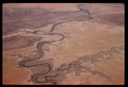
- Subject:
- Deserts, Channels, Air France, Air travel, Land, and Rivers
- Series:
- 3-60
- Creator:
- Cushman, Charles W., 1896-1972
- Date Created:
- 1960-05-07
- Genre:
- Aerial photographs and Landscape photographs
- Frame Number:
- 14
- Abstract:
- River
- Call Number:
- P10974
- Country:
- United States
- Alternate Identifier:
- 360.14
- Persistent URL:
- http://purl.dlib.indiana.edu/iudl/archives/cushman/P10974
- Holding Location:
- Bloomington - University Archives
Wells Library E460
1320 E 10th St.
Bloomington, IN 47405
Contact at archives@indiana.edu, 812-855-1127
-
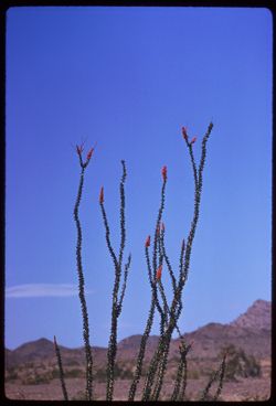
- Description:
- 250 f 5.6
- Subject:
- Deserts, Flowers, Ocotillo, Mountains, Shrubs, and Clouds
- Series:
- 11-59
- Creator:
- Cushman, Charles W., 1896-1972
- Date Created:
- 1959-03-24
- Genre:
- Identification photographs
- Frame Number:
- 12
- County:
- Yuma and Riverside
- Abstract:
- Our finest ocotillo - 15-20 mi east of Blythe
- Call Number:
- P10737
- City:
- Blythe and Quartzsite
- Country:
- United States
- State/Province:
- Arizona and California
- Alternate Identifier:
- 1159.12
- Persistent URL:
- http://purl.dlib.indiana.edu/iudl/archives/cushman/P10737
- Holding Location:
- Bloomington - University Archives
Wells Library E460
1320 E 10th St.
Bloomington, IN 47405
Contact at archives@indiana.edu, 812-855-1127
-
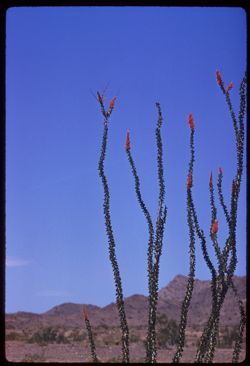
- Description:
- 100 f 8 tl
- Subject:
- Deserts, Flowers, Ocotillo, Mountains, Shrubs, and Clouds
- Series:
- 11-59
- Creator:
- Cushman, Charles W., 1896-1972
- Date Created:
- 1959-03-24
- Genre:
- Identification photographs
- Frame Number:
- 11
- County:
- Yuma and Riverside
- Abstract:
- Our finest ocotillo - 15-20 mi east of Blythe
- Call Number:
- P10736
- City:
- Blythe and Quartzsite
- Country:
- United States
- State/Province:
- Arizona and California
- Alternate Identifier:
- 1159.11
- Persistent URL:
- http://purl.dlib.indiana.edu/iudl/archives/cushman/P10736
- Holding Location:
- Bloomington - University Archives
Wells Library E460
1320 E 10th St.
Bloomington, IN 47405
Contact at archives@indiana.edu, 812-855-1127
-
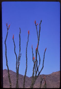
- Description:
- 100 f 8 tl
- Subject:
- Deserts, Flowers, Ocotillo, and Mountains
- Series:
- 11-59
- Creator:
- Cushman, Charles W., 1896-1972
- Date Created:
- 1959-03-24
- Genre:
- Identification photographs
- Frame Number:
- 10
- County:
- Yuma and Riverside
- Abstract:
- RM Our finest ocotillo - is 15-10 mi east of Blythe
- Call Number:
- P10735
- City:
- Blythe and Quartzsite
- Country:
- United States
- State/Province:
- Arizona and California
- Alternate Identifier:
- 1159.10
- Persistent URL:
- http://purl.dlib.indiana.edu/iudl/archives/cushman/P10735
- Holding Location:
- Bloomington - University Archives
Wells Library E460
1320 E 10th St.
Bloomington, IN 47405
Contact at archives@indiana.edu, 812-855-1127
-
- Description:
- 100 f 8 tl
- Subject:
- Deserts and Flowers
- Series:
- 11-59
- Creator:
- Cushman, Charles W., 1896-1972
- Date Created:
- 1959-03-24
- Genre:
- Identification photographs
- Frame Number:
- 9
- County:
- Yuma
- Abstract:
- Flowers of
- Call Number:
- P10734
- City:
- Quartzsite
- Country:
- United States
- State/Province:
- Arizona
- Alternate Identifier:
- 1159.9
- Persistent URL:
- http://purl.dlib.indiana.edu/iudl/archives/cushman/P10734
- Holding Location:
- Bloomington - University Archives
Wells Library E460
1320 E 10th St.
Bloomington, IN 47405
Contact at archives@indiana.edu, 812-855-1127
-
- Description:
- 100 f 8 tl
- Subject:
- Deserts and Flowers
- Series:
- 11-59
- Creator:
- Cushman, Charles W., 1896-1972
- Date Created:
- 1959-03-24
- Genre:
- Identification photographs
- Frame Number:
- 8
- County:
- Yuma
- Abstract:
- Flowers of
- Call Number:
- P10733
- City:
- Quartzsite
- Country:
- United States
- State/Province:
- Arizona
- Alternate Identifier:
- 1159.8
- Persistent URL:
- http://purl.dlib.indiana.edu/iudl/archives/cushman/P10733
- Holding Location:
- Bloomington - University Archives
Wells Library E460
1320 E 10th St.
Bloomington, IN 47405
Contact at archives@indiana.edu, 812-855-1127
-
- Description:
- 100 f 6 tl
- Subject:
- Deserts, Cactus, Mountains, Shrubs, and Vulture Mountains (Ariz.)
- Series:
- 10-59
- Creator:
- Cushman, Charles W., 1896-1972
- Date Created:
- 1959-03-23
- Frame Number:
- 37
- County:
- Maricopa
- Abstract:
- Another of 35
- Call Number:
- P10725
- City:
- Wickenburg
- Country:
- United States
- State/Province:
- Arizona
- Alternate Identifier:
- 1059.37
- Persistent URL:
- http://purl.dlib.indiana.edu/iudl/archives/cushman/P10725
- Holding Location:
- Bloomington - University Archives
Wells Library E460
1320 E 10th St.
Bloomington, IN 47405
Contact at archives@indiana.edu, 812-855-1127
-

- Description:
- 100 f 8 tl
- Subject:
- Deserts, Cactus, Mountains, Rock formations, Vulture Mountains (Ariz.), and Shrubs
- Series:
- 10-59
- Creator:
- Cushman, Charles W., 1896-1972
- Date Created:
- 1959-03-23
- Frame Number:
- 36
- County:
- Maricopa
- Abstract:
- Mountain with a penthouse
- Call Number:
- P10724
- City:
- Wickenburg
- Country:
- United States
- State/Province:
- Arizona
- Alternate Identifier:
- 1059.36
- Persistent URL:
- http://purl.dlib.indiana.edu/iudl/archives/cushman/P10724
- Holding Location:
- Bloomington - University Archives
Wells Library E460
1320 E 10th St.
Bloomington, IN 47405
Contact at archives@indiana.edu, 812-855-1127
-
- Description:
- 100 f 6.3 tl
- Subject:
- Deserts, Cactus, Mountains, and Vulture Mountains (Ariz.)
- Series:
- 10-59
- Creator:
- Cushman, Charles W., 1896-1972
- Date Created:
- 1959-03-23
- Frame Number:
- 35
- County:
- Maricopa
- Abstract:
- Not so much like camel closer up
- Call Number:
- P10723
- City:
- Wickenburg
- Country:
- United States
- State/Province:
- Arizona
- Alternate Identifier:
- 1059.35
- Persistent URL:
- http://purl.dlib.indiana.edu/iudl/archives/cushman/P10723
- Holding Location:
- Bloomington - University Archives
Wells Library E460
1320 E 10th St.
Bloomington, IN 47405
Contact at archives@indiana.edu, 812-855-1127
-
- Description:
- 100 f 8 tl
- Subject:
- Deserts, Cactus, Mountains, Shrubs, and Vulture Mountains (Ariz.)
- Series:
- 10-59
- Creator:
- Cushman, Charles W., 1896-1972
- Date Created:
- 1959-03-23
- Frame Number:
- 34
- County:
- Maricopa
- Abstract:
- Mountain like a camel SW of Wittenberg
- Call Number:
- P10722
- City:
- Wickenburg
- Country:
- United States
- State/Province:
- Arizona
- Alternate Identifier:
- 1059.34
- Persistent URL:
- http://purl.dlib.indiana.edu/iudl/archives/cushman/P10722
- Holding Location:
- Bloomington - University Archives
Wells Library E460
1320 E 10th St.
Bloomington, IN 47405
Contact at archives@indiana.edu, 812-855-1127
-
- Description:
- 100 f 8 tl
- Subject:
- Deserts, Picacho Mountains (Ariz.), Mountains, and Fences
- Series:
- 10-59
- Creator:
- Cushman, Charles W., 1896-1972
- Date Created:
- 1959-03-22
- Frame Number:
- 33
- County:
- Pinal and Pima
- Abstract:
- Closeup
- Call Number:
- P10721
- City:
- Red Rock and Tucson
- Country:
- United States
- State/Province:
- Arizona
- Alternate Identifier:
- 1059.33
- Persistent URL:
- http://purl.dlib.indiana.edu/iudl/archives/cushman/P10721
- Holding Location:
- Bloomington - University Archives
Wells Library E460
1320 E 10th St.
Bloomington, IN 47405
Contact at archives@indiana.edu, 812-855-1127
-
- Description:
- 100 f 8 tl
- Subject:
- Deserts, Mountains, Dirt roads, Shrubs, Picacho Mountains (Ariz.), and Fences
- Series:
- 10-59
- Creator:
- Cushman, Charles W., 1896-1972
- Date Created:
- 1959-03-22
- Genre:
- Landscape photographs
- Frame Number:
- 31
- County:
- Pima and Pinal
- Abstract:
- Picacho, near Red Rock
- Call Number:
- P10719
- City:
- Tucson and Red Rock
- Country:
- United States
- State/Province:
- Arizona
- Alternate Identifier:
- 1059.31
- Persistent URL:
- http://purl.dlib.indiana.edu/iudl/archives/cushman/P10719
- Holding Location:
- Bloomington - University Archives
Wells Library E460
1320 E 10th St.
Bloomington, IN 47405
Contact at archives@indiana.edu, 812-855-1127
-
- Description:
- 50 f 9 sl
- Subject:
- Sabino Canyon (Ariz.), Deserts, Canyons, Bodies of water, Mountains, Cactus, Trees, Rocks, Grasses, and Santa Catalina Mountains (Ariz.)
- Series:
- 10-59
- Creator:
- Cushman, Charles W., 1896-1972
- Date Created:
- 1959-03-13
- Genre:
- Landscape photographs
- Frame Number:
- 21
- County:
- Pima
- Abstract:
- Sabino Canyon
- Call Number:
- P10709
- City:
- Tucson
- Country:
- United States
- State/Province:
- Arizona
- Alternate Identifier:
- 1059.21
- Persistent URL:
- http://purl.dlib.indiana.edu/iudl/archives/cushman/P10709
- Holding Location:
- Bloomington - University Archives
Wells Library E460
1320 E 10th St.
Bloomington, IN 47405
Contact at archives@indiana.edu, 812-855-1127
-
- Description:
- 50 f 11 sl
- Subject:
- Sabino Canyon (Ariz.), Deserts, Canyons, Shrubs, Santa Catalina Mountains (Ariz.), Rocks, Rock formations, and Cactus
- Series:
- 10-59
- Creator:
- Cushman, Charles W., 1896-1972
- Date Created:
- 1959-03-13
- Genre:
- Landscape photographs
- Frame Number:
- 20
- County:
- Pima
- Abstract:
- Sabino Canyon
- Call Number:
- P10708
- City:
- Tucson
- Country:
- United States
- State/Province:
- Arizona
- Alternate Identifier:
- 1059.20
- Persistent URL:
- http://purl.dlib.indiana.edu/iudl/archives/cushman/P10708
- Holding Location:
- Bloomington - University Archives
Wells Library E460
1320 E 10th St.
Bloomington, IN 47405
Contact at archives@indiana.edu, 812-855-1127
-
- Description:
- 50 f 11 sl
- Subject:
- Sabino Canyon (Ariz.), Deserts, Canyons, Mountains, Cactus, Trees, and Santa Catalina Mountains (Ariz.)
- Series:
- 10-59
- Creator:
- Cushman, Charles W., 1896-1972
- Date Created:
- 1959-03-13
- Genre:
- Landscape photographs
- Frame Number:
- 19
- County:
- Pima
- Abstract:
- Sabino Canyon
- Call Number:
- P10707
- City:
- Tucson
- Country:
- United States
- State/Province:
- Arizona
- Alternate Identifier:
- 1059.19
- Persistent URL:
- http://purl.dlib.indiana.edu/iudl/archives/cushman/P10707
- Holding Location:
- Bloomington - University Archives
Wells Library E460
1320 E 10th St.
Bloomington, IN 47405
Contact at archives@indiana.edu, 812-855-1127
-
- Description:
- 50 f 11 sl
- Subject:
- Deserts, Cactus, Boulders, Shrubs, Saguaro National Park (Ariz.), Tanque Verde Observation Point (Ariz.), and Rocks
- Series:
- 10-59
- Creator:
- Cushman, Charles W., 1896-1972
- Date Created:
- 1959-03-05
- Frame Number:
- 16
- County:
- Pima
- Abstract:
- Tilted rock at Tanque verde Observ. pt
- Call Number:
- P10704
- City:
- Tucson
- Country:
- United States
- State/Province:
- Arizona
- Alternate Identifier:
- 1059.16
- Persistent URL:
- http://purl.dlib.indiana.edu/iudl/archives/cushman/P10704
- Holding Location:
- Bloomington - University Archives
Wells Library E460
1320 E 10th St.
Bloomington, IN 47405
Contact at archives@indiana.edu, 812-855-1127
-
- Description:
- 50 f 11 sl
- Subject:
- Deserts, Cactus, Mountains, Shrubs, and Saguaro National Park (Ariz.)
- Series:
- 10-59
- Creator:
- Cushman, Charles W., 1896-1972
- Date Created:
- 1959-03-05
- Genre:
- Identification photographs
- Frame Number:
- 15
- County:
- Pima
- Abstract:
- A 4 in 1 Saguaro
- Call Number:
- P10703
- City:
- Tucson
- Country:
- United States
- State/Province:
- Arizona
- Alternate Identifier:
- 1059.15
- Persistent URL:
- http://purl.dlib.indiana.edu/iudl/archives/cushman/P10703
- Holding Location:
- Bloomington - University Archives
Wells Library E460
1320 E 10th St.
Bloomington, IN 47405
Contact at archives@indiana.edu, 812-855-1127
-
- Description:
- 50 f 8 sl
- Subject:
- Deserts, Trees, Saguaro National Park (Ariz.), and Leaves
- Series:
- 10-59
- Creator:
- Cushman, Charles W., 1896-1972
- Date Created:
- 1959-03-05
- Genre:
- Identification photographs
- Frame Number:
- 14
- County:
- Pima
- Abstract:
- Foliage of Mesquite
- Call Number:
- P10702
- City:
- Tucson
- Country:
- United States
- State/Province:
- Arizona
- Alternate Identifier:
- 1059.14
- Persistent URL:
- http://purl.dlib.indiana.edu/iudl/archives/cushman/P10702
- Holding Location:
- Bloomington - University Archives
Wells Library E460
1320 E 10th St.
Bloomington, IN 47405
Contact at archives@indiana.edu, 812-855-1127
-
- Description:
- 50 f 8 sl
- Subject:
- Deserts, Cactus, Mountains, and Saguaro National Park (Ariz.)
- Series:
- 10-59
- Creator:
- Cushman, Charles W., 1896-1972
- Date Created:
- 1959-03-05
- Genre:
- Identification photographs
- Frame Number:
- 13
- County:
- Pima
- Abstract:
- Cholla resembles a Monkey Puzzle
- Call Number:
- P10701
- City:
- Tucson
- Country:
- United States
- State/Province:
- Arizona
- Alternate Identifier:
- 1059.13
- Persistent URL:
- http://purl.dlib.indiana.edu/iudl/archives/cushman/P10701
- Holding Location:
- Bloomington - University Archives
Wells Library E460
1320 E 10th St.
Bloomington, IN 47405
Contact at archives@indiana.edu, 812-855-1127
-
- Description:
- 50 f 11 sl
- Subject:
- Deserts, Cactus, Mountains, Shrubs, and Saguaro National Park (Ariz.)
- Series:
- 10-59
- Creator:
- Cushman, Charles W., 1896-1972
- Date Created:
- 1959-03-05
- Genre:
- Identification photographs
- Frame Number:
- 12
- County:
- Pima
- Abstract:
- A giant Saquaro
- Call Number:
- P10700
- City:
- Tucson
- Country:
- United States
- State/Province:
- Arizona
- Alternate Identifier:
- 1059.12
- Persistent URL:
- http://purl.dlib.indiana.edu/iudl/archives/cushman/P10700
- Holding Location:
- Bloomington - University Archives
Wells Library E460
1320 E 10th St.
Bloomington, IN 47405
Contact at archives@indiana.edu, 812-855-1127
-
- Description:
- 50 f 8 sl
- Subject:
- Deserts, Saguaro National Park (Ariz.), and Cactus
- Series:
- 10-59
- Creator:
- Cushman, Charles W., 1896-1972
- Date Created:
- 1959-03-05
- Genre:
- Identification photographs
- Frame Number:
- 11
- County:
- Pima
- Abstract:
- Cristate Barrel Cactus
- Call Number:
- P10699
- City:
- Tucson
- Country:
- United States
- State/Province:
- Arizona
- Alternate Identifier:
- 1059.11
- Persistent URL:
- http://purl.dlib.indiana.edu/iudl/archives/cushman/P10699
- Holding Location:
- Bloomington - University Archives
Wells Library E460
1320 E 10th St.
Bloomington, IN 47405
Contact at archives@indiana.edu, 812-855-1127
-
- Description:
- 50 f 11 sl
- Subject:
- Deserts, Cactus, Mountains, Shrubs, and Saguaro National Park (Ariz.)
- Series:
- 10-59
- Creator:
- Cushman, Charles W., 1896-1972
- Date Created:
- 1959-03-05
- Genre:
- Identification photographs
- Frame Number:
- 10
- County:
- Pima
- Abstract:
- A fine cristate
- Call Number:
- P10698
- City:
- Tucson
- Country:
- United States
- State/Province:
- Arizona
- Alternate Identifier:
- 1059.10
- Persistent URL:
- http://purl.dlib.indiana.edu/iudl/archives/cushman/P10698
- Holding Location:
- Bloomington - University Archives
Wells Library E460
1320 E 10th St.
Bloomington, IN 47405
Contact at archives@indiana.edu, 812-855-1127
-
- Description:
- 50 f 11 sl
- Subject:
- Deserts, Cristate saguaro, Cactus, Mountains, Shrubs, and Saguaro National Park (Ariz.)
- Series:
- 10-59
- Creator:
- Cushman, Charles W., 1896-1972
- Date Created:
- 1959-03-05
- Genre:
- Identification photographs
- Frame Number:
- 9
- County:
- Pima
- Abstract:
- A fine cristate
- Call Number:
- P10697
- City:
- Tucson
- Country:
- United States
- State/Province:
- Arizona
- Alternate Identifier:
- 1059.9
- Persistent URL:
- http://purl.dlib.indiana.edu/iudl/archives/cushman/P10697
- Holding Location:
- Bloomington - University Archives
Wells Library E460
1320 E 10th St.
Bloomington, IN 47405
Contact at archives@indiana.edu, 812-855-1127
-
- Description:
- 50 f 11 sl
- Subject:
- Deserts, Deterioration, Cactus, Mountains, and Saguaro National Park (Ariz.)
- Series:
- 10-59
- Creator:
- Cushman, Charles W., 1896-1972
- Date Created:
- 1959-03-03
- Genre:
- Identification photographs
- Frame Number:
- 8
- County:
- Pima
- Abstract:
- Another skeleton
- Call Number:
- P10696
- City:
- Tucson
- Country:
- United States
- State/Province:
- Arizona
- Alternate Identifier:
- 1059.8
- Persistent URL:
- http://purl.dlib.indiana.edu/iudl/archives/cushman/P10696
- Holding Location:
- Bloomington - University Archives
Wells Library E460
1320 E 10th St.
Bloomington, IN 47405
Contact at archives@indiana.edu, 812-855-1127
-
- Description:
- 50 f 11 sl
- Subject:
- Deserts, Cactus, Mountains, Shrubs, Saguaro National Park (Ariz.), and Posing
- Series:
- 10-59
- Creator:
- Cushman, Charles W., 1896-1972
- Date Created:
- 1959-03-03
- Genre:
- Snapshots
- Frame Number:
- 7
- County:
- Pima
- Persons Pictured:
- Cushman, Jean
- Abstract:
- Jean with big fellow
- Call Number:
- P10695
- City:
- Tucson
- Country:
- United States
- State/Province:
- Arizona
- Alternate Identifier:
- 1059.7
- Persistent URL:
- http://purl.dlib.indiana.edu/iudl/archives/cushman/P10695
- Holding Location:
- Bloomington - University Archives
Wells Library E460
1320 E 10th St.
Bloomington, IN 47405
Contact at archives@indiana.edu, 812-855-1127
-
- Description:
- 50 f 9 sl
- Subject:
- Deserts, Deterioration, Cactus, Mountains, Shrubs, and Saguaro National Park (Ariz.)
- Series:
- 10-59
- Creator:
- Cushman, Charles W., 1896-1972
- Date Created:
- 1959-03-03
- Genre:
- Identification photographs
- Frame Number:
- 6
- County:
- Pima
- Abstract:
- A skeleton
- Call Number:
- P10694
- City:
- Tucson
- Country:
- United States
- State/Province:
- Arizona
- Alternate Identifier:
- 1059.6
- Persistent URL:
- http://purl.dlib.indiana.edu/iudl/archives/cushman/P10694
- Holding Location:
- Bloomington - University Archives
Wells Library E460
1320 E 10th St.
Bloomington, IN 47405
Contact at archives@indiana.edu, 812-855-1127
-
- Description:
- 50 f 11 sl
- Subject:
- Deserts, Mountains, Shrubs, Cactus, and Saguaro National Park (Ariz.)
- Series:
- 10-59
- Creator:
- Cushman, Charles W., 1896-1972
- Date Created:
- 1959-03-03
- Genre:
- Identification photographs
- Frame Number:
- 5
- County:
- Pima
- Abstract:
- Multi-branched Giant Sohuaro
- Call Number:
- P10693
- City:
- Tucson
- Country:
- United States
- State/Province:
- Arizona
- Alternate Identifier:
- 1059.5
- Persistent URL:
- http://purl.dlib.indiana.edu/iudl/archives/cushman/P10693
- Holding Location:
- Bloomington - University Archives
Wells Library E460
1320 E 10th St.
Bloomington, IN 47405
Contact at archives@indiana.edu, 812-855-1127
-
- Description:
- 50 f 9 sl
- Subject:
- Deserts, Cactus, Mountains, Shrubs, and Saguaro National Park (Ariz.)
- Series:
- 10-59
- Creator:
- Cushman, Charles W., 1896-1972
- Date Created:
- 1959-03-03
- Genre:
- Identification photographs
- Frame Number:
- 4
- County:
- Pima
- Abstract:
- Multi-branched Giant Sohuaro
- Call Number:
- P10692
- City:
- Tucson
- Country:
- United States
- State/Province:
- Arizona
- Alternate Identifier:
- 1059.4
- Persistent URL:
- http://purl.dlib.indiana.edu/iudl/archives/cushman/P10692
- Holding Location:
- Bloomington - University Archives
Wells Library E460
1320 E 10th St.
Bloomington, IN 47405
Contact at archives@indiana.edu, 812-855-1127
-
- Description:
- 50 f 11 sl
- Subject:
- Deserts, Roads, Cactus, Mountains, Shrubs, and Saguaro National Park (Ariz.)
- Series:
- 10-59
- Creator:
- Cushman, Charles W., 1896-1972
- Date Created:
- 1959-03-03
- Frame Number:
- 3
- County:
- Pima
- Abstract:
- View north
- Call Number:
- P10691
- City:
- Tucson
- Country:
- United States
- State/Province:
- Arizona
- Alternate Identifier:
- 1059.3
- Persistent URL:
- http://purl.dlib.indiana.edu/iudl/archives/cushman/P10691
- Holding Location:
- Bloomington - University Archives
Wells Library E460
1320 E 10th St.
Bloomington, IN 47405
Contact at archives@indiana.edu, 812-855-1127
-
- Description:
- 50 f 11 sl
- Subject:
- Deserts, Cactus, Shrubs, and Saguaro National Park (Ariz.)
- Series:
- 10-59
- Creator:
- Cushman, Charles W., 1896-1972
- Date Created:
- 1959-03-03
- Frame Number:
- 2
- County:
- Pima
- Abstract:
- Lone tree
- Call Number:
- P10690
- City:
- Tucson
- Country:
- United States
- State/Province:
- Arizona
- Alternate Identifier:
- 1059.2
- Persistent URL:
- http://purl.dlib.indiana.edu/iudl/archives/cushman/P10690
- Holding Location:
- Bloomington - University Archives
Wells Library E460
1320 E 10th St.
Bloomington, IN 47405
Contact at archives@indiana.edu, 812-855-1127
-
- Description:
- 100 f 8 tl
- Subject:
- Deserts, Hills, Mountains, Picketpost Mountain (Ariz.), and Cactus
- Series:
- 10-59
- Creator:
- Cushman, Charles W., 1896-1972
- Date Created:
- 1959-02-27
- Frame Number:
- 1
- County:
- Pinal
- Abstract:
- Pickett Post Mtn.
- Call Number:
- P10689
- City:
- Superior
- Country:
- United States
- State/Province:
- Arizona
- Alternate Identifier:
- 1059.1
- Persistent URL:
- http://purl.dlib.indiana.edu/iudl/archives/cushman/P10689
- Holding Location:
- Bloomington - University Archives
Wells Library E460
1320 E 10th St.
Bloomington, IN 47405
Contact at archives@indiana.edu, 812-855-1127
-
- Description:
- 100 f 8 TL HF
- Subject:
- Deserts, Pyramid Lake (Nev.), Mountains, Shrubs, Lakes & ponds, Clouds, and Islands
- Series:
- 12-58
- Creator:
- Cushman, Charles W., 1896-1972
- Date Created:
- 1958-06-18
- Genre:
- Landscape photographs
- Frame Number:
- 36
- Abstract:
- Pyramid Lake
- Call Number:
- P10047
- Country:
- United States
- State/Province:
- Nevada
- Alternate Identifier:
- 1258.36
- Persistent URL:
- http://purl.dlib.indiana.edu/iudl/archives/cushman/P10047
- Holding Location:
- Bloomington - University Archives
Wells Library E460
1320 E 10th St.
Bloomington, IN 47405
Contact at archives@indiana.edu, 812-855-1127
-
- Description:
- 100 f 8 TL HF
- Subject:
- Deserts, Pyramid Lake (Nev.), Mountains, Shrubs, Lakes & ponds, and Islands
- Series:
- 12-58
- Creator:
- Cushman, Charles W., 1896-1972
- Date Created:
- 1958-06-18
- Genre:
- Landscape photographs
- Frame Number:
- 35
- Abstract:
- Pyramid Lake
- Call Number:
- P10046
- Country:
- United States
- State/Province:
- Nevada
- Alternate Identifier:
- 1258.35
- Persistent URL:
- http://purl.dlib.indiana.edu/iudl/archives/cushman/P10046
- Holding Location:
- Bloomington - University Archives
Wells Library E460
1320 E 10th St.
Bloomington, IN 47405
Contact at archives@indiana.edu, 812-855-1127
-
- Description:
- 100 f 8 + t
- Subject:
- Deserts, Spring Mountains (Nev.), Charleston Peak (Nev.), Mountains, Shrubs, and Rock formations
- Series:
- 3-58
- Creator:
- Cushman, Charles W., 1896-1972
- Date Created:
- 1958-04-25
- Genre:
- Landscape photographs
- Frame Number:
- 28
- Street Address:
- United States Highway 95
- County:
- Clark
- Abstract:
- Another view of Charleston Pk from Hwy north of Sloan
- Call Number:
- P09744
- City:
- Sloan
- Country:
- United States
- State/Province:
- Nevada
- Alternate Identifier:
- 358.28
- Persistent URL:
- http://purl.dlib.indiana.edu/iudl/archives/cushman/P09744
- Holding Location:
- Bloomington - University Archives
Wells Library E460
1320 E 10th St.
Bloomington, IN 47405
Contact at archives@indiana.edu, 812-855-1127
-
- Description:
- 100 f 5.6 tl
- Subject:
- Deserts, Mountains, Shrubs, McCullough Range (Nev.), and Wildflowers
- Series:
- 3-58
- Creator:
- Cushman, Charles W., 1896-1972
- Date Created:
- 1958-04-25
- Genre:
- Landscape photographs
- Frame Number:
- 25
- County:
- Clark
- Abstract:
- East toward McCollough Range across carpet of green and orange flowers
- Call Number:
- P09741
- Country:
- United States
- State/Province:
- Nevada
- Alternate Identifier:
- 358.25
- Persistent URL:
- http://purl.dlib.indiana.edu/iudl/archives/cushman/P09741
- Holding Location:
- Bloomington - University Archives
Wells Library E460
1320 E 10th St.
Bloomington, IN 47405
Contact at archives@indiana.edu, 812-855-1127
-
- Description:
- 100 f 6.3 tl
- Subject:
- Wildflowers, Flowers, Mountains, Shrubs, McCullough Range (Nev.), and Deserts
- Series:
- 3-58
- Creator:
- Cushman, Charles W., 1896-1972
- Date Created:
- 1958-04-25
- Genre:
- Landscape photographs
- Frame Number:
- 24
- County:
- Clark
- Abstract:
- East toward McCollough Range across carpet of green and orange flowers
- Call Number:
- P09740
- Country:
- United States
- State/Province:
- Nevada
- Alternate Identifier:
- 358.24
- Persistent URL:
- http://purl.dlib.indiana.edu/iudl/archives/cushman/P09740
- Holding Location:
- Bloomington - University Archives
Wells Library E460
1320 E 10th St.
Bloomington, IN 47405
Contact at archives@indiana.edu, 812-855-1127
-
- Description:
- 100 f 8 tl
- Subject:
- Deserts, Mojave Desert (Calif.), Clark Mountain Range (Calif.), Joshua trees, Mountains, Yucca, and Plants
- Series:
- 3-58
- Creator:
- Cushman, Charles W., 1896-1972
- Date Created:
- 1958-04-25
- Genre:
- Landscape photographs
- Frame Number:
- 23
- County:
- San Bernardino
- Abstract:
- Joshua Trees and Yucca below Clark Mtn
- Call Number:
- P09739
- Country:
- United States
- State/Province:
- California
- Alternate Identifier:
- 358.23
- Persistent URL:
- http://purl.dlib.indiana.edu/iudl/archives/cushman/P09739
- Holding Location:
- Bloomington - University Archives
Wells Library E460
1320 E 10th St.
Bloomington, IN 47405
Contact at archives@indiana.edu, 812-855-1127
-
- Description:
- 100 f 8 tl
- Subject:
- Deserts, Mojave Desert (Calif.), Joshua trees, Mountains, Clark Mountain (San Bernardino County, Calif.), Yucca, and Plants
- Series:
- 3-58
- Creator:
- Cushman, Charles W., 1896-1972
- Date Created:
- 1958-04-25
- Genre:
- Landscape photographs
- Frame Number:
- 22
- County:
- San Bernardino
- Abstract:
- Joshua Trees and Yucca below Clark Mtn
- Call Number:
- P09738
- Country:
- United States
- State/Province:
- California
- Alternate Identifier:
- 358.22
- Persistent URL:
- http://purl.dlib.indiana.edu/iudl/archives/cushman/P09738
- Holding Location:
- Bloomington - University Archives
Wells Library E460
1320 E 10th St.
Bloomington, IN 47405
Contact at archives@indiana.edu, 812-855-1127
-
- Description:
- 100 f 8 tl
- Subject:
- Rocks, Mojave Desert (Calif.), Electricity towers, Cady Mountains (Calif.), Mountains, Shrubs, and Deserts
- Series:
- 3-58
- Creator:
- Cushman, Charles W., 1896-1972
- Date Created:
- 1958-04-25
- Genre:
- Landscape photographs
- Frame Number:
- 20
- Street Address:
- United States Highway 91
- County:
- San Bernardino
- Abstract:
- Cady Mtns. South of Hwy 91 36 mi. east of Barstow
- Call Number:
- P09736
- City:
- Barstow
- Country:
- United States
- State/Province:
- California
- Alternate Identifier:
- 358.20
- Persistent URL:
- http://purl.dlib.indiana.edu/iudl/archives/cushman/P09736
- Holding Location:
- Bloomington - University Archives
Wells Library E460
1320 E 10th St.
Bloomington, IN 47405
Contact at archives@indiana.edu, 812-855-1127
-
- Description:
- 100 f 6.3 t
- Subject:
- Deserts, Mojave Desert (Calif.), Caterpillars, Rocks, and Plants
- Series:
- 3-58
- Creator:
- Cushman, Charles W., 1896-1972
- Date Created:
- 1958-04-25
- Genre:
- Identification photographs
- Frame Number:
- 21
- County:
- San Bernardino
- Abstract:
- Caterpillar
- Call Number:
- P09737
- Country:
- United States
- State/Province:
- California
- Alternate Identifier:
- 358.21
- Persistent URL:
- http://purl.dlib.indiana.edu/iudl/archives/cushman/P09737
- Holding Location:
- Bloomington - University Archives
Wells Library E460
1320 E 10th St.
Bloomington, IN 47405
Contact at archives@indiana.edu, 812-855-1127
-
- Description:
- 100 f 8 t
- Subject:
- Deserts, Mojave Desert (Calif.), Cady Mountains (Calif.), Mountains, Shrubs, and Railroads
- Series:
- 3-58
- Creator:
- Cushman, Charles W., 1896-1972
- Date Created:
- 1958-04-25
- Genre:
- Landscape photographs
- Frame Number:
- 19
- Street Address:
- United States Highway 91
- County:
- San Bernardino
- Abstract:
- Cady Mtns. South of Hwy 91 36 mi. east of Barstow
- Call Number:
- P09735
- City:
- Barstow
- Country:
- United States
- State/Province:
- California
- Alternate Identifier:
- 358.19
- Persistent URL:
- http://purl.dlib.indiana.edu/iudl/archives/cushman/P09735
- Holding Location:
- Bloomington - University Archives
Wells Library E460
1320 E 10th St.
Bloomington, IN 47405
Contact at archives@indiana.edu, 812-855-1127
-
- Description:
- 100 f 8 tl
- Subject:
- Deserts, Mojave Desert (Calif.), Calico Mountains (Calif.), and Mountains
- Series:
- 3-58
- Creator:
- Cushman, Charles W., 1896-1972
- Date Created:
- 1958-04-25
- Genre:
- Landscape photographs
- Frame Number:
- 18
- County:
- San Bernardino
- Abstract:
- Colorful Calico Mtns. near Yermo
- Call Number:
- P09734
- City:
- Yermo and Barstow
- Country:
- United States
- State/Province:
- California
- Alternate Identifier:
- 358.18
- Persistent URL:
- http://purl.dlib.indiana.edu/iudl/archives/cushman/P09734
- Holding Location:
- Bloomington - University Archives
Wells Library E460
1320 E 10th St.
Bloomington, IN 47405
Contact at archives@indiana.edu, 812-855-1127
-
- Description:
- 100 f8 tl
- Subject:
- Deserts, Mojave Desert (Calif.), Mountains, Calico Mountains (Calif.), Plants, and Rock formations
- Series:
- 3-58
- Creator:
- Cushman, Charles W., 1896-1972
- Date Created:
- 1958-04-25
- Genre:
- Landscape photographs
- Frame Number:
- 17
- County:
- San Bernardino
- Abstract:
- Colorful Calico Mtns. near Yermo
- Call Number:
- P09733
- City:
- Barstow and Yermo
- Country:
- United States
- State/Province:
- California
- Alternate Identifier:
- 358.17
- Persistent URL:
- http://purl.dlib.indiana.edu/iudl/archives/cushman/P09733
- Holding Location:
- Bloomington - University Archives
Wells Library E460
1320 E 10th St.
Bloomington, IN 47405
Contact at archives@indiana.edu, 812-855-1127
-
- Description:
- 100 f 8 tl
- Subject:
- Deserts, Mojave Desert (Calif.), Mountains, Calico Mountains (Calif.), Plants, and Rock formations
- Series:
- 3-58
- Creator:
- Cushman, Charles W., 1896-1972
- Date Created:
- 1958-04-25
- Genre:
- Landscape photographs
- Frame Number:
- 16
- County:
- San Bernardino
- Abstract:
- Colorful Calico Mtns. Near Yermo
- Call Number:
- P09732
- City:
- Barstow and Yermo
- Country:
- United States
- State/Province:
- California
- Alternate Identifier:
- 358.16
- Persistent URL:
- http://purl.dlib.indiana.edu/iudl/archives/cushman/P09732
- Holding Location:
- Bloomington - University Archives
Wells Library E460
1320 E 10th St.
Bloomington, IN 47405
Contact at archives@indiana.edu, 812-855-1127
-
- Description:
- 100 f 8 tl
- Subject:
- Deserts, Mojave Desert (Calif.), Joshua trees, Plains, Mountains, Shrubs, and Clouds
- Series:
- 7-57
- Creator:
- Cushman, Charles W., 1896-1972
- Date Created:
- 1957-05-14
- Genre:
- Landscape photographs
- Frame Number:
- 15
- Street Address:
- United States Highway 6
- County:
- Kern
- Abstract:
- Mountains NW of US 6 north of Rosamond
- Call Number:
- P09294
- City:
- Rosamond
- Country:
- United States
- State/Province:
- California
- Alternate Identifier:
- 757.15
- Persistent URL:
- http://purl.dlib.indiana.edu/iudl/archives/cushman/P09294
- Holding Location:
- Bloomington - University Archives
Wells Library E460
1320 E 10th St.
Bloomington, IN 47405
Contact at archives@indiana.edu, 812-855-1127
-
- Description:
- 100 f 9 tl
- Subject:
- Deserts, Mojave Desert (Calif.), Calico Mountains (Calif.), Mountains, Shrubs, and Utility poles
- Series:
- 12-55
- Creator:
- Cushman, Charles W., 1896-1972
- Date Created:
- 1955-03-24
- Genre:
- Landscape photographs
- Frame Number:
- 11
- Street Address:
- United States Highway 91
- County:
- San Bernardino
- Abstract:
- Mauve Calico Mountains along US 91 16 mi. east of Barstow
- Call Number:
- P07907
- City:
- Barstow
- Country:
- United States
- State/Province:
- California
- Alternate Identifier:
- 1255.11
- Persistent URL:
- http://purl.dlib.indiana.edu/iudl/archives/cushman/P07907
- Holding Location:
- Bloomington - University Archives
Wells Library E460
1320 E 10th St.
Bloomington, IN 47405
Contact at archives@indiana.edu, 812-855-1127
-
- Description:
- 100 f 6.3 tl
- Subject:
- Deserts, Mojave Desert (Calif.), Electric lines, Dirt roads, Automobiles, Pines, Signs (Notices), Automobile service stations, Mountains, Buildings, Shrubs, ...
- Series:
- 12-55
- Creator:
- Cushman, Charles W., 1896-1972
- Date Created:
- 1955-03-24
- Genre:
- Cityscape photographs
- Frame Number:
- 10
- County:
- San Bernardino
- Abstract:
- Baker
- Call Number:
- P07906
- City:
- Baker
- Country:
- United States
- State/Province:
- California
- Alternate Identifier:
- 1255.10
- Persistent URL:
- http://purl.dlib.indiana.edu/iudl/archives/cushman/P07906
- Holding Location:
- Bloomington - University Archives
Wells Library E460
1320 E 10th St.
Bloomington, IN 47405
Contact at archives@indiana.edu, 812-855-1127
-
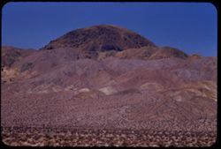
- Description:
- 100 f 6 tl
- Subject:
- Lakes & ponds, Deserts, Reflections, Valleys, Black Mountains (Inyo County, Calif.), Death Valley (Calif. and Nev.), Mountains, and Shrubs
- Series:
- 12-55
- Creator:
- Cushman, Charles W., 1896-1972
- Date Created:
- 1955-03-24
- Genre:
- Landscape photographs
- Frame Number:
- 8
- County:
- Inyo
- Abstract:
- Desert lake near Tecopa - view N.W.
- Call Number:
- P07904
- City:
- Tecopa
- Country:
- United States
- State/Province:
- California
- Alternate Identifier:
- 1255.8
- Persistent URL:
- http://purl.dlib.indiana.edu/iudl/archives/cushman/P07904
- Holding Location:
- Bloomington - University Archives
Wells Library E460
1320 E 10th St.
Bloomington, IN 47405
Contact at archives@indiana.edu, 812-855-1127
-
- Description:
- 100 f 8 tl
- Subject:
- Lakes & ponds, Deserts, Reflections, Valleys, Black Mountains (Inyo County, Calif.), Death Valley (Calif. and Nev.), Mountains, and Shrubs
- Series:
- 12-55
- Creator:
- Cushman, Charles W., 1896-1972
- Date Created:
- 1955-03-24
- Genre:
- Landscape photographs
- Frame Number:
- 7
- County:
- Inyo
- Abstract:
- Desert lake near Tecopa - view N.W.
- Call Number:
- P07903
- City:
- Tecopa
- Country:
- United States
- State/Province:
- California
- Alternate Identifier:
- 1255.7
- Persistent URL:
- http://purl.dlib.indiana.edu/iudl/archives/cushman/P07903
- Holding Location:
- Bloomington - University Archives
Wells Library E460
1320 E 10th St.
Bloomington, IN 47405
Contact at archives@indiana.edu, 812-855-1127
-
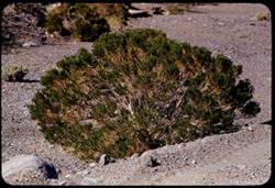
- Description:
- 100 f 6.3 tl 35 ft
- Subject:
- Deserts, Death Valley National Park (Calif. and Nev.), Furnace Creek Wash (Calif.), Shrubs, and Rocks
- Series:
- 10-55
- Creator:
- Cushman, Charles W., 1896-1972
- Date Created:
- 1955-03-23
- Genre:
- Identification photographs
- Frame Number:
- 25
- County:
- Inyo
- Abstract:
- Desert bush
- Call Number:
- P07850
- Country:
- United States
- State/Province:
- California
- Alternate Identifier:
- 1055.25
- Persistent URL:
- http://purl.dlib.indiana.edu/iudl/archives/cushman/P07850
- Holding Location:
- Bloomington - University Archives
Wells Library E460
1320 E 10th St.
Bloomington, IN 47405
Contact at archives@indiana.edu, 812-855-1127
-
- Description:
- 100 f 8 tl
- Subject:
- Deserts, Valleys, Black Mountains (Inyo County, Calif.), Death Valley (Calif. and Nev.), Mountains, Shrubs, and Furnace Creek (Calif.)
- Series:
- 9-55
- Creator:
- Cushman, Charles W., 1896-1972
- Date Created:
- 1955-03-22
- Genre:
- Landscape photographs
- Frame Number:
- 26
- Street Address:
- Furnace Creek-Bad Water Road
- County:
- Mono and Inyo
- Abstract:
- From Bad Water road near exit to Golden Canyon
- Call Number:
- P07817
- City:
- Badwater
- Country:
- United States
- State/Province:
- California
- Alternate Identifier:
- 955.26
- Persistent URL:
- http://purl.dlib.indiana.edu/iudl/archives/cushman/P07817
- Holding Location:
- Bloomington - University Archives
Wells Library E460
1320 E 10th St.
Bloomington, IN 47405
Contact at archives@indiana.edu, 812-855-1127
-
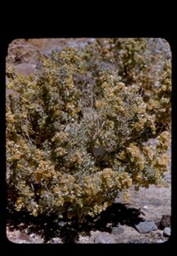
- Description:
- 100 f 8 tl 12 ft.
- Subject:
- Rocks, Holly, Furnace Creek Wash (Calif.), and Deserts
- Series:
- 9-55
- Creator:
- Cushman, Charles W., 1896-1972
- Date Created:
- 1955-03-22
- Genre:
- Identification photographs
- Frame Number:
- 14
- County:
- Inyo
- Abstract:
- Desert holly blooming
- Call Number:
- P07806
- Country:
- United States
- State/Province:
- California
- Physical Description:
- masked.
- Alternate Identifier:
- 955.14
- Persistent URL:
- http://purl.dlib.indiana.edu/iudl/archives/cushman/P07806
- Holding Location:
- Bloomington - University Archives
Wells Library E460
1320 E 10th St.
Bloomington, IN 47405
Contact at archives@indiana.edu, 812-855-1127
-
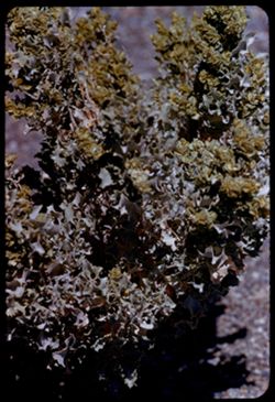
- Description:
- 100 f 8 tl 5 1/2 ft
- Subject:
- Deserts, Holly, and Furnace Creek Wash (Calif.)
- Series:
- 9-55
- Creator:
- Cushman, Charles W., 1896-1972
- Date Created:
- 1955-03-22
- Genre:
- Identification photographs
- Frame Number:
- 6
- County:
- Inyo
- Abstract:
- Desert Holly
- Call Number:
- P07798
- Country:
- United States
- State/Province:
- California
- Alternate Identifier:
- 955.6
- Persistent URL:
- http://purl.dlib.indiana.edu/iudl/archives/cushman/P07798
- Holding Location:
- Bloomington - University Archives
Wells Library E460
1320 E 10th St.
Bloomington, IN 47405
Contact at archives@indiana.edu, 812-855-1127
-
- Description:
- 100 f 8 tl 13'
- Subject:
- Wildflowers, Mojave Desert (Calif.), Shrubs, and Deserts
- Series:
- 7-55
- Creator:
- Cushman, Charles W., 1896-1972
- Date Created:
- 1955-03-21
- Genre:
- Identification photographs
- Frame Number:
- 26
- County:
- San Bernardino
- Abstract:
- Group of yellow flowers from 13 ft.
- Call Number:
- P07750
- Country:
- United States
- State/Province:
- California
- Alternate Identifier:
- 755.26
- Persistent URL:
- http://purl.dlib.indiana.edu/iudl/archives/cushman/P07750
- Holding Location:
- Bloomington - University Archives
Wells Library E460
1320 E 10th St.
Bloomington, IN 47405
Contact at archives@indiana.edu, 812-855-1127
-
- Description:
- 100 f 8 tl 5 1/2 ft
- Subject:
- Deserts, Mojave Desert (Calif.), and Wildflowers
- Series:
- 7-55
- Creator:
- Cushman, Charles W., 1896-1972
- Date Created:
- 1955-03-21
- Genre:
- Identification photographs
- Frame Number:
- 25
- County:
- San Bernardino
- Abstract:
- Tiny blue flowers from 5 1/2 ft
- Call Number:
- P07749
- Country:
- United States
- State/Province:
- California
- Alternate Identifier:
- 755.25
- Persistent URL:
- http://purl.dlib.indiana.edu/iudl/archives/cushman/P07749
- Holding Location:
- Bloomington - University Archives
Wells Library E460
1320 E 10th St.
Bloomington, IN 47405
Contact at archives@indiana.edu, 812-855-1127
-
- Description:
- 200 f 5.6 tl 8 1/2 ft or 5 1/2 ft
- Subject:
- Wildflowers, Mojave Desert (Calif.), and Deserts
- Series:
- 7-55
- Creator:
- Cushman, Charles W., 1896-1972
- Date Created:
- 1955-03-21
- Genre:
- Identification photographs
- Frame Number:
- 24
- County:
- San Bernardino
- Abstract:
- Yellow wild flowers from 8 1/2 feet
- Call Number:
- P07748
- Country:
- United States
- State/Province:
- California
- Alternate Identifier:
- 755.24
- Persistent URL:
- http://purl.dlib.indiana.edu/iudl/archives/cushman/P07748
- Holding Location:
- Bloomington - University Archives
Wells Library E460
1320 E 10th St.
Bloomington, IN 47405
Contact at archives@indiana.edu, 812-855-1127
-
- Description:
- 200 f 5
- Subject:
- Deserts, Funeral Mountains (Calif.), Mountains, Shrubs, Death Valley (Calif. and Nev.), and Rocks
- Series:
- 3-55
- Creator:
- Cushman, Charles W., 1896-1972
- Date Created:
- 1955-02-27
- Genre:
- Landscape photographs
- Frame Number:
- 11
- Abstract:
- Funeral Mtns closer
- Call Number:
- P07603
- Country:
- United States
- State/Province:
- California
- Alternate Identifier:
- 355.11
- Persistent URL:
- http://purl.dlib.indiana.edu/iudl/archives/cushman/P07603
- Holding Location:
- Bloomington - University Archives
Wells Library E460
1320 E 10th St.
Bloomington, IN 47405
Contact at archives@indiana.edu, 812-855-1127
-
- Description:
- 50 mm lens
- Subject:
- Deserts, Craters, Valleys, Dantes View (Calif.), Mountains, Clouds, Death Valley (Calif. and Nev.), and Black Mountains (Inyo County, Calif.)
- Series:
- 3-55
- Creator:
- Cushman, Charles W., 1896-1972
- Date Created:
- 1955-02-27
- Genre:
- Landscape photographs
- Frame Number:
- 4
- County:
- Inyo
- Abstract:
- West across floor of Death Valley
- Call Number:
- P07597
- Country:
- United States
- State/Province:
- California
- Alternate Identifier:
- 355.4
- Persistent URL:
- http://purl.dlib.indiana.edu/iudl/archives/cushman/P07597
- Holding Location:
- Bloomington - University Archives
Wells Library E460
1320 E 10th St.
Bloomington, IN 47405
Contact at archives@indiana.edu, 812-855-1127
-
- Description:
- 50 mm lens
- Subject:
- Deserts, Valleys, Dantes View (Calif.), Mountains, Clouds, and Death Valley (Calif. and Nev.)
- Series:
- 3-55
- Creator:
- Cushman, Charles W., 1896-1972
- Date Created:
- 1955-02-27
- Genre:
- Landscape photographs
- Frame Number:
- 1
- Abstract:
- NW - acorss Death Valley
- Call Number:
- P07595
- Country:
- United States
- State/Province:
- California
- Physical Description:
- Image was originally mounted in a glass enclosure. Before digitization, the image was removed and placed in a Wess Plastic, Inc. brand, 2" x 2", pl...
- Alternate Identifier:
- 355.1
- Persistent URL:
- http://purl.dlib.indiana.edu/iudl/archives/cushman/P07595
- Holding Location:
- Bloomington - University Archives
Wells Library E460
1320 E 10th St.
Bloomington, IN 47405
Contact at archives@indiana.edu, 812-855-1127
-
- Description:
- 50 f 11
- Subject:
- Deserts, Trees, Walker Pass (Calif.), Scodie Mountains (Calif.), Mountains, and Shrubs
- Series:
- 12-54
- Creator:
- Cushman, Charles W., 1896-1972
- Date Created:
- 1954-09-18
- Genre:
- Landscape photographs
- Frame Number:
- 33
- Street Address:
- California State Highway 178 and Walker Pass Road
- County:
- Kern
- Abstract:
- Two view \ Kiavah Mtns eastward from low part of Walker Pass Rd.
- Call Number:
- P07423
- Country:
- United States
- State/Province:
- California
- Alternate Identifier:
- 1254.33
- Persistent URL:
- http://purl.dlib.indiana.edu/iudl/archives/cushman/P07423
- Holding Location:
- Bloomington - University Archives
Wells Library E460
1320 E 10th St.
Bloomington, IN 47405
Contact at archives@indiana.edu, 812-855-1127
-
- Description:
- 50 f 11
- Subject:
- Deserts, Trees, Walker Pass (Calif.), Scodie Mountains (Calif.), Mountains, and Shrubs
- Series:
- 12-54
- Creator:
- Cushman, Charles W., 1896-1972
- Date Created:
- 1954-09-18
- Genre:
- Landscape photographs
- Frame Number:
- 34
- Street Address:
- California State Highway 178 and Walker Pass Road
- County:
- Kern
- Abstract:
- Two view \ Kiavah Mtns eastward from low part of Walker Pass Rd.
- Call Number:
- P07424
- Country:
- United States
- State/Province:
- California
- Alternate Identifier:
- 1254.34
- Persistent URL:
- http://purl.dlib.indiana.edu/iudl/archives/cushman/P07424
- Holding Location:
- Bloomington - University Archives
Wells Library E460
1320 E 10th St.
Bloomington, IN 47405
Contact at archives@indiana.edu, 812-855-1127
-
- Description:
- 50 f 8
- Subject:
- Deserts, Mojave Desert (Calif.), Joshua trees, Shrubs, and Hills
- Series:
- 12-54
- Creator:
- Cushman, Charles W., 1896-1972
- Date Created:
- 1954-09-18
- Genre:
- Landscape photographs
- Frame Number:
- 32
- Street Address:
- California State Highway 178 and Walker Pass Road
- County:
- Kern
- Abstract:
- Lone pyramid + Joshua trees along Walker Pass Rd.
- Call Number:
- P07422
- Country:
- United States
- State/Province:
- California
- Alternate Identifier:
- 1254.32
- Persistent URL:
- http://purl.dlib.indiana.edu/iudl/archives/cushman/P07422
- Holding Location:
- Bloomington - University Archives
Wells Library E460
1320 E 10th St.
Bloomington, IN 47405
Contact at archives@indiana.edu, 812-855-1127
-
- Description:
- 50 f 9
- Subject:
- Joshua trees, Deserts, Mojave Desert (Calif.), Hills, and Shrubs
- Series:
- 12-54
- Creator:
- Cushman, Charles W., 1896-1972
- Date Created:
- 1954-09-18
- Genre:
- Landscape photographs
- Frame Number:
- 31
- Street Address:
- California State Highway 178
- County:
- Kern
- Abstract:
- Toward Mojave Desert.
- Call Number:
- P07421
- Country:
- United States
- State/Province:
- California
- Alternate Identifier:
- 1254.31
- Persistent URL:
- http://purl.dlib.indiana.edu/iudl/archives/cushman/P07421
- Holding Location:
- Bloomington - University Archives
Wells Library E460
1320 E 10th St.
Bloomington, IN 47405
Contact at archives@indiana.edu, 812-855-1127
-
- Description:
- 25 f 13
- Subject:
- Deserts, Mojave Desert (Calif.), Walker Pass (Calif.), Joshua trees, Mountains, Shrubs, and Hills
- Series:
- 12-54
- Creator:
- Cushman, Charles W., 1896-1972
- Date Created:
- 1954-09-18
- Genre:
- Identification photographs
- Frame Number:
- 30
- Street Address:
- California State Highway 178 and Walker Pass Road
- County:
- Kern
- Abstract:
- Joshua trees along Walker Pass Rd.
- Call Number:
- P07420
- Country:
- United States
- State/Province:
- California
- Alternate Identifier:
- 1254.30
- Persistent URL:
- http://purl.dlib.indiana.edu/iudl/archives/cushman/P07420
- Holding Location:
- Bloomington - University Archives
Wells Library E460
1320 E 10th St.
Bloomington, IN 47405
Contact at archives@indiana.edu, 812-855-1127
-
- Description:
- 50 f 11 HF
- Subject:
- Deserts, Inyo Mountains (Calif.), Flowers, Mountains, Shrubs, Hills, and Rock formations
- Series:
- 12-54
- Creator:
- Cushman, Charles W., 1896-1972
- Date Created:
- 1954-09-18
- Genre:
- Landscape photographs
- Frame Number:
- 29
- Street Address:
- Mt. Whitney Road
- County:
- Inyo
- Abstract:
- Inyo Mtns beyond one of the Alabama Hills.
- Call Number:
- P07419
- City:
- Alabama Hills and Lone Pine
- Country:
- United States
- State/Province:
- California
- Alternate Identifier:
- 1254.29
- Persistent URL:
- http://purl.dlib.indiana.edu/iudl/archives/cushman/P07419
- Holding Location:
- Bloomington - University Archives
Wells Library E460
1320 E 10th St.
Bloomington, IN 47405
Contact at archives@indiana.edu, 812-855-1127
-
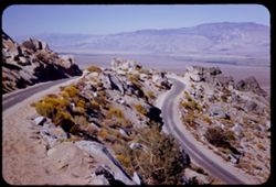
- Description:
- 50 f 11 HF
- Subject:
- Valleys, Inyo Mountains (Calif.), Mountains, Owens Valley (Calif.), Deserts, Shrubs, Roads, and Rocks
- Series:
- 12-54
- Creator:
- Cushman, Charles W., 1896-1972
- Date Created:
- 1954-09-18
- Genre:
- Landscape photographs
- Frame Number:
- 27
- Street Address:
- Mt. Whitney Road
- County:
- Inyo
- Abstract:
- Switch-back coming down Mt Whitney rd.
- Call Number:
- P07417
- Country:
- United States
- State/Province:
- California
- Alternate Identifier:
- 1254.27
- Persistent URL:
- http://purl.dlib.indiana.edu/iudl/archives/cushman/P07417
- Holding Location:
- Bloomington - University Archives
Wells Library E460
1320 E 10th St.
Bloomington, IN 47405
Contact at archives@indiana.edu, 812-855-1127
-
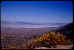
- Description:
- 50 f 12 HF
- Subject:
- Deserts, Valleys, Owens Lake (Inyo County, Calif.), Flowers, Owens Valley (Calif.), Mountains, Shrubs, and Lakes & ponds
- Series:
- 12-54
- Creator:
- Cushman, Charles W., 1896-1972
- Date Created:
- 1954-09-18
- Genre:
- Landscape photographs
- Frame Number:
- 28
- Street Address:
- Mt. Whitney Road
- County:
- Inyo
- Abstract:
- Owens Lake.
- Call Number:
- P07418
- Country:
- United States
- State/Province:
- California
- Alternate Identifier:
- 1254.28
- Persistent URL:
- http://purl.dlib.indiana.edu/iudl/archives/cushman/P07418
- Holding Location:
- Bloomington - University Archives
Wells Library E460
1320 E 10th St.
Bloomington, IN 47405
Contact at archives@indiana.edu, 812-855-1127
-
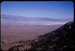
- Description:
- 50 f 12 HF
- Subject:
- Rocks, Valleys, Owens Lake (Inyo County, Calif.), Owens Valley (Calif.), Mountains, Shrubs, Lakes & ponds, Deserts, Trees, and Rock formations
- Series:
- 12-54
- Creator:
- Cushman, Charles W., 1896-1972
- Date Created:
- 1954-09-18
- Genre:
- Landscape photographs
- Frame Number:
- 25
- Street Address:
- Mt. Whitney Road
- County:
- Inyo
- Abstract:
- Owens Dry Lake from high up Mt Whitney rd.
- Call Number:
- P07415
- Country:
- United States
- State/Province:
- California
- Alternate Identifier:
- 1254.25
- Persistent URL:
- http://purl.dlib.indiana.edu/iudl/archives/cushman/P07415
- Holding Location:
- Bloomington - University Archives
Wells Library E460
1320 E 10th St.
Bloomington, IN 47405
Contact at archives@indiana.edu, 812-855-1127