
Search Constraints
You searched for:
Campus
IUB
Remove constraint Campus: IUB
Subject
Flowers
Remove constraint Subject: Flowers
Subject
Mountains
Remove constraint Subject: Mountains
« Previous |
1 - 100 of 104
|
Next »
Search Results
-
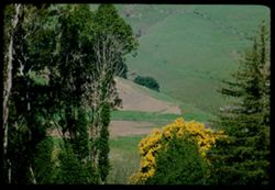
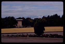
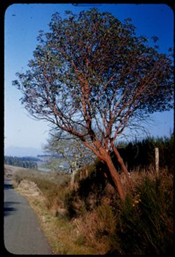
- Description:
- 100 f 8 tl
- Subject:
- Evergreens, Trees, Flowers, Acacia, Mountains, and Hills
- Series:
- 1-68
- Creator:
- Cushman, Charles W., 1896-1972
- Date Created:
- 1968-03-02
- Genre:
- Landscape photographs
- Frame Number:
- 19
- County:
- Marin
- Abstract:
- Acacia & Evergreen at Tocaloma
- Call Number:
- P15614
- City:
- Tocaloma
- Country:
- United States
- State/Province:
- California
- Alternate Identifier:
- 168.19
- Persistent URL:
- http://purl.dlib.indiana.edu/iudl/archives/cushman/P15614
- Holding Location:
- Bloomington - University Archives
Wells Library E460
1320 E 10th St.
Bloomington, IN 47405
Contact at archives@indiana.edu, 812-855-1127
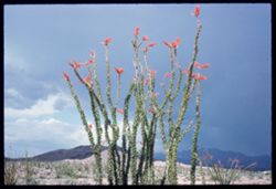
-
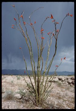
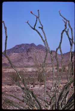
- Description:
- 100 f 13 ?
- Subject:
- Storms, Deserts, Flowers, Ocotillo, Mountains, Rocks, Plants, and Grasses
- Series:
- 1-66
- Creator:
- Cushman, Charles W., 1896-1972
- Date Created:
- 1966-04-22
- Genre:
- Identification photographs and Landscape photographs
- Frame Number:
- 11
- Street Address:
- United States Highway 66
- County:
- Mohave
- Abstract:
- Ocotillo along U.S. 66- Mojave county
- Call Number:
- P15252
- Country:
- United States
- State/Province:
- Arizona
- Alternate Identifier:
- 166.11
- Persistent URL:
- http://purl.dlib.indiana.edu/iudl/archives/cushman/P15252
- Holding Location:
- Bloomington - University Archives
Wells Library E460
1320 E 10th St.
Bloomington, IN 47405
Contact at archives@indiana.edu, 812-855-1127
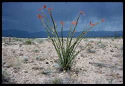
-
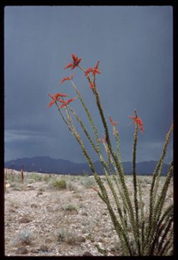
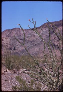
- Description:
- 100 f 13 ?
- Subject:
- Deserts, Flowers, Storms, Mountains, Ocotillo, Plants, and Rocks
- Series:
- 1-66
- Creator:
- Cushman, Charles W., 1896-1972
- Date Created:
- 1966-04-22
- Genre:
- Landscape photographs and Identification photographs
- Frame Number:
- 10
- Street Address:
- United States Highway 66
- County:
- Mohave
- Abstract:
- Ocotillo along U.S. 66- Mojave county
- Call Number:
- P15251
- Country:
- United States
- State/Province:
- Arizona
- Alternate Identifier:
- 166.10
- Persistent URL:
- http://purl.dlib.indiana.edu/iudl/archives/cushman/P15251
- Holding Location:
- Bloomington - University Archives
Wells Library E460
1320 E 10th St.
Bloomington, IN 47405
Contact at archives@indiana.edu, 812-855-1127
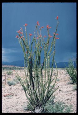
-
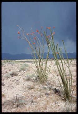
- Description:
- 100 f 12 or 13
- Subject:
- Deserts, Flowers, Storms, Mountains, Ocotillo, Plants, and Rocks
- Series:
- 1-66
- Creator:
- Cushman, Charles W., 1896-1972
- Date Created:
- 1966-04-22
- Genre:
- Landscape photographs and Identification photographs
- Frame Number:
- 9
- Street Address:
- United States Highway 66
- County:
- Mohave
- Abstract:
- Ocotillo along U.S. 66- Mojave county
- Call Number:
- P15250
- Country:
- United States
- State/Province:
- Arizona
- Alternate Identifier:
- 166.9
- Persistent URL:
- http://purl.dlib.indiana.edu/iudl/archives/cushman/P15250
- Holding Location:
- Bloomington - University Archives
Wells Library E460
1320 E 10th St.
Bloomington, IN 47405
Contact at archives@indiana.edu, 812-855-1127
-
- Description:
- 100 f 12?
- Subject:
- Rocks, Hills, Mountains, Grasses, Ocotillo, Deserts, Storms, Flowers, and Plants
- Series:
- 1-66
- Creator:
- Cushman, Charles W., 1896-1972
- Date Created:
- 1966-04-22
- Genre:
- Identification photographs and Landscape photographs
- Frame Number:
- 8
- Street Address:
- United States Highway 66
- County:
- Mohave
- Abstract:
- Ocotillo along U.S. 66- Mojave county
- Call Number:
- P15249
- Country:
- United States
- State/Province:
- Arizona
- Alternate Identifier:
- 166.8
- Persistent URL:
- http://purl.dlib.indiana.edu/iudl/archives/cushman/P15249
- Holding Location:
- Bloomington - University Archives
Wells Library E460
1320 E 10th St.
Bloomington, IN 47405
Contact at archives@indiana.edu, 812-855-1127
-
- Description:
- 100 f 13 ?
- Subject:
- Hills, Mountains, Plants, Ocotillo, Deserts, Storms, Flowers, Clouds, and Grasses
- Series:
- 1-66
- Creator:
- Cushman, Charles W., 1896-1972
- Date Created:
- 1966-04-22
- Genre:
- Identification photographs and Landscape photographs
- Frame Number:
- 7
- Street Address:
- United States Highway 66
- County:
- Mohave
- Abstract:
- Ocotillo along U.S. 66- Mojave county
- Call Number:
- P15248
- Country:
- United States
- State/Province:
- Arizona
- Alternate Identifier:
- 166.7
- Persistent URL:
- http://purl.dlib.indiana.edu/iudl/archives/cushman/P15248
- Holding Location:
- Bloomington - University Archives
Wells Library E460
1320 E 10th St.
Bloomington, IN 47405
Contact at archives@indiana.edu, 812-855-1127
-
- Description:
- 100 f 11 + f 12/13
- Subject:
- Mountains, Plants, Ocotillo, Deserts, Storms, and Flowers
- Series:
- 1-66
- Creator:
- Cushman, Charles W., 1896-1972
- Date Created:
- 1966-04-22
- Genre:
- Identification photographs and Landscape photographs
- Frame Number:
- 6
- Street Address:
- United States Highway 66
- County:
- Mohave
- Abstract:
- Ocotillo along U.S. 66- Mojave county and Little red head and friend at drinking fountain - same in error
- Call Number:
- P15247
- Country:
- United States
- State/Province:
- Arizona
- Alternate Identifier:
- 166.6
- Persistent URL:
- http://purl.dlib.indiana.edu/iudl/archives/cushman/P15247
- Holding Location:
- Bloomington - University Archives
Wells Library E460
1320 E 10th St.
Bloomington, IN 47405
Contact at archives@indiana.edu, 812-855-1127
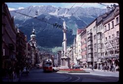
-

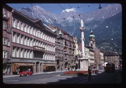
- Description:
- 100 f 8
- Subject:
- Obelisks, Clock towers, Cupolas, Spires, Streets, Pedestrians, Street railroads, Business districts, Mountains, Bay windows, Sculpture, and Flowers
- Series:
- 13-64
- Creator:
- Cushman, Charles W., 1896-1972
- Date Created:
- 1964-06-02
- Genre:
- Cityscape photographs
- Frame Number:
- 32
- Street Address:
- Maria Theresienstrasse
- Call Number:
- P13422
- City:
- Innsbruck
- Country:
- Austria
- State/Province:
- Tyrol
- Alternate Identifier:
- 1364.32
- Persistent URL:
- http://purl.dlib.indiana.edu/iudl/archives/cushman/P13422
- Holding Location:
- Bloomington - University Archives
Wells Library E460
1320 E 10th St.
Bloomington, IN 47405
Contact at archives@indiana.edu, 812-855-1127
-
- Description:
- 100 f 9
- Subject:
- Obelisks, Clock towers, Flowers, Streets, Pedestrians, Street railroads, Business districts, Mountains, Electric lines, Sculpture, Spires, and Scaffolding
- Series:
- 13-64
- Creator:
- Cushman, Charles W., 1896-1972
- Date Created:
- 1964-06-02
- Genre:
- Cityscape photographs
- Frame Number:
- 31
- Street Address:
- Maria Theresienstrasse
- Abstract:
- Innsbruck.
- Call Number:
- P13421
- City:
- Innsbruck
- Country:
- Austria
- State/Province:
- Tyrol
- Alternate Identifier:
- 1364.31
- Persistent URL:
- http://purl.dlib.indiana.edu/iudl/archives/cushman/P13421
- Holding Location:
- Bloomington - University Archives
Wells Library E460
1320 E 10th St.
Bloomington, IN 47405
Contact at archives@indiana.edu, 812-855-1127
-
- Description:
- 100 f 11
- Subject:
- Stores & shops, Electric lines, Automobiles, Flowers, Streets, Cupolas, Mountains, Steeples, Obelisks, Alps, Austrian (Austria), Columns, Clock towers, a...
- Series:
- 16-64
- Creator:
- Cushman, Charles W., 1896-1972
- Date Created:
- 1964-06-07
- Genre:
- Cityscape photographs
- Frame Number:
- 27
- Street Address:
- Maria Theresienstrasse
- Abstract:
- Maria Ther. Str.
- Call Number:
- P13530
- City:
- Innsbruck
- Country:
- Austria
- State/Province:
- Tyrol
- Alternate Identifier:
- 1664.27
- Persistent URL:
- http://purl.dlib.indiana.edu/iudl/archives/cushman/P13530
- Holding Location:
- Bloomington - University Archives
Wells Library E460
1320 E 10th St.
Bloomington, IN 47405
Contact at archives@indiana.edu, 812-855-1127
-
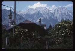
- Description:
- 100 f 11
- Subject:
- Bell towers, Trees, Flowers, Cupolas, Mountains, Churches, Clouds, Steeples, Alps, Austrian (Austria), Utility poles, Spires, and Fences
- Series:
- 16-64
- Creator:
- Cushman, Charles W., 1896-1972
- Date Created:
- 1964-06-05
- Genre:
- Landscape photographs and Cityscape photographs
- Frame Number:
- 15
- Abstract:
- Mts behind Solbad
- Call Number:
- P13518
- City:
- Solbad Hall
- Country:
- Austria
- State/Province:
- Tyrol
- Alternate Identifier:
- 1664.15
- Persistent URL:
- http://purl.dlib.indiana.edu/iudl/archives/cushman/P13518
- Holding Location:
- Bloomington - University Archives
Wells Library E460
1320 E 10th St.
Bloomington, IN 47405
Contact at archives@indiana.edu, 812-855-1127
-
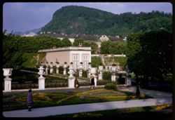
- Description:
- 100 f 6.3
- Subject:
- Pedestrians, Kapuzinerberg (Salzburg, Austria), Trees, Flowers, Walkways, Gardens, Mountains, Fences, Shrubs, Mirabellgarten (Salzburg, Austria), Buildings, ...
- Series:
- 8-64
- Creator:
- Cushman, Charles W., 1896-1972
- Date Created:
- 1964-05-21
- Genre:
- Views and Cityscape photographs
- Frame Number:
- 5
- Abstract:
- Kapuzinerberg from Mirabell Garden
- Call Number:
- P13207
- City:
- Salzburg
- Country:
- Austria
- State/Province:
- Salzburg
- Alternate Identifier:
- 864.5
- Persistent URL:
- http://purl.dlib.indiana.edu/iudl/archives/cushman/P13207
- Holding Location:
- Bloomington - University Archives
Wells Library E460
1320 E 10th St.
Bloomington, IN 47405
Contact at archives@indiana.edu, 812-855-1127
-
- Description:
- 50 f 5.6
- Subject:
- Cafes, Musicians, Flowers, Pedestals, Mountains, Flutes, Shrubs, Trees, Buildings, Towers, Winkler Café (Salzburg, Austria), Sculpture, and Monchsberg (Salzb...
- Series:
- 7-64
- Creator:
- Cushman, Charles W., 1896-1972
- Date Created:
- 1964-05-21
- Genre:
- Views
- Frame Number:
- 30
- Abstract:
- Flute player and Winkler on high
- Call Number:
- P13195
- City:
- Salzburg
- Country:
- Austria
- State/Province:
- Salzburg
- Alternate Identifier:
- 764.30
- Persistent URL:
- http://purl.dlib.indiana.edu/iudl/archives/cushman/P13195
- Holding Location:
- Bloomington - University Archives
Wells Library E460
1320 E 10th St.
Bloomington, IN 47405
Contact at archives@indiana.edu, 812-855-1127
-
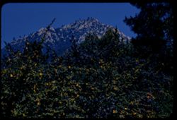
- Description:
- 100 f 8 TL
- Subject:
- Roads, Orange trees, San Gorgonio Mountain (Calif.), Trees, Flowers, Mountains, Buildings, Shrubs, Clouds, and Indio Hacienda (Indio, Calif.)
- Series:
- 24-61
- Creator:
- Cushman, Charles W., 1896-1972
- Date Created:
- 1961-01-01
- Genre:
- Landscape photographs and Views
- Frame Number:
- 33
- County:
- Riverside and San Bernardino
- Abstract:
- San Gorgonio and San Gorgonio from Indio Hacienda
- Call Number:
- P12599
- City:
- Indio
- Country:
- United States
- State/Province:
- California
- Alternate Identifier:
- 2461.33
- Persistent URL:
- http://purl.dlib.indiana.edu/iudl/archives/cushman/P12599
- Holding Location:
- Bloomington - University Archives
Wells Library E460
1320 E 10th St.
Bloomington, IN 47405
Contact at archives@indiana.edu, 812-855-1127
-
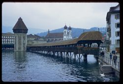
- Description:
- 100 f 5.6
- Subject:
- Towers, Pedestrians, Swans, Flowers, Chapel Bridge (Lucerne, Switzerland), Streets, Reuss River (Switzerland), Mountains, Buildings, Pedestrian bridges, Cove...
- Series:
- 16-60
- Creator:
- Cushman, Charles W., 1896-1972
- Date Created:
- 1960-06-06
- Genre:
- Cityscape photographs and Architectural photographs
- Frame Number:
- 16
- Abstract:
- Old Chapel Bridge
- Call Number:
- P11401
- City:
- Lucerne
- Country:
- Switzerland
- State/Province:
- Lucerne
- Alternate Identifier:
- 1660.16
- Persistent URL:
- http://purl.dlib.indiana.edu/iudl/archives/cushman/P11401
- Holding Location:
- Bloomington - University Archives
Wells Library E460
1320 E 10th St.
Bloomington, IN 47405
Contact at archives@indiana.edu, 812-855-1127
-
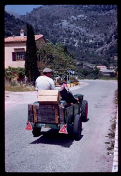
- Description:
- 100 f 6.3 or 8
- Subject:
- Men, Houses, Women, Trees, Flowers, Chimneys, Boxes, Mountains, Tractors, and Roads
- Series:
- 8-60
- Creator:
- Cushman, Charles W., 1896-1972
- Date Created:
- 1960-05-16
- Genre:
- Snapshots
- Frame Number:
- 14
- County:
- Alpes-Maritimes
- Abstract:
- Les Tourettes
- Call Number:
- P11114
- City:
- Tourrette-sur-Loup
- Country:
- France
- State/Province:
- Provence-Alpes-Côte d'Azur
- Alternate Identifier:
- 860.14
- Persistent URL:
- http://purl.dlib.indiana.edu/iudl/archives/cushman/P11114
- Holding Location:
- Bloomington - University Archives
Wells Library E460
1320 E 10th St.
Bloomington, IN 47405
Contact at archives@indiana.edu, 812-855-1127
-
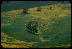
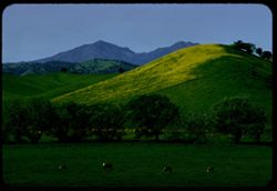
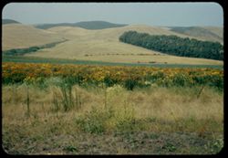
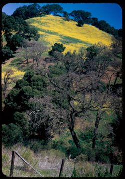
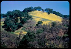
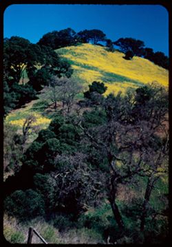
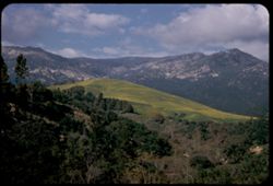
- Description:
- 100 f 8 TL
- Subject:
- Diablo, Mount (Calif.), Meadows, Flowers, Hills, Mustard (Plant), Mountains, Trees, Grasses, and Fences
- Series:
- 2-60
- Creator:
- Cushman, Charles W., 1896-1972
- Date Created:
- 1960-03-25
- Genre:
- Landscape photographs
- Frame Number:
- 28
- County:
- Contra Costa
- Abstract:
- Mustard & grass SE of Clayton
- Call Number:
- P10959
- City:
- Clayton
- Country:
- United States
- State/Province:
- California
- Alternate Identifier:
- 260.28
- Persistent URL:
- http://purl.dlib.indiana.edu/iudl/archives/cushman/P10959
- Holding Location:
- Bloomington - University Archives
Wells Library E460
1320 E 10th St.
Bloomington, IN 47405
Contact at archives@indiana.edu, 812-855-1127
-
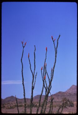
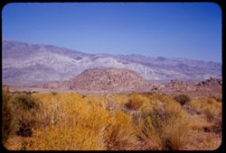
- Description:
- 250 f 5.6
- Subject:
- Deserts, Flowers, Ocotillo, Mountains, Shrubs, and Clouds
- Series:
- 11-59
- Creator:
- Cushman, Charles W., 1896-1972
- Date Created:
- 1959-03-24
- Genre:
- Identification photographs
- Frame Number:
- 12
- County:
- Yuma and Riverside
- Abstract:
- Our finest ocotillo - 15-20 mi east of Blythe
- Call Number:
- P10737
- City:
- Blythe and Quartzsite
- Country:
- United States
- State/Province:
- Arizona and California
- Alternate Identifier:
- 1159.12
- Persistent URL:
- http://purl.dlib.indiana.edu/iudl/archives/cushman/P10737
- Holding Location:
- Bloomington - University Archives
Wells Library E460
1320 E 10th St.
Bloomington, IN 47405
Contact at archives@indiana.edu, 812-855-1127
-
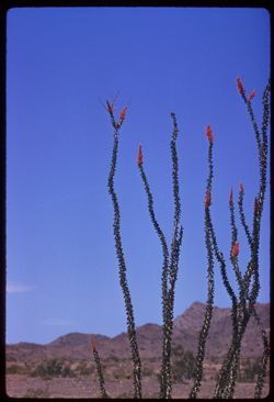
- Description:
- 100 f 8 tl
- Subject:
- Deserts, Flowers, Ocotillo, Mountains, Shrubs, and Clouds
- Series:
- 11-59
- Creator:
- Cushman, Charles W., 1896-1972
- Date Created:
- 1959-03-24
- Genre:
- Identification photographs
- Frame Number:
- 11
- County:
- Yuma and Riverside
- Abstract:
- Our finest ocotillo - 15-20 mi east of Blythe
- Call Number:
- P10736
- City:
- Blythe and Quartzsite
- Country:
- United States
- State/Province:
- Arizona and California
- Alternate Identifier:
- 1159.11
- Persistent URL:
- http://purl.dlib.indiana.edu/iudl/archives/cushman/P10736
- Holding Location:
- Bloomington - University Archives
Wells Library E460
1320 E 10th St.
Bloomington, IN 47405
Contact at archives@indiana.edu, 812-855-1127
-
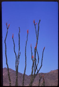
- Description:
- 100 f 8 tl
- Subject:
- Deserts, Flowers, Ocotillo, and Mountains
- Series:
- 11-59
- Creator:
- Cushman, Charles W., 1896-1972
- Date Created:
- 1959-03-24
- Genre:
- Identification photographs
- Frame Number:
- 10
- County:
- Yuma and Riverside
- Abstract:
- RM Our finest ocotillo - is 15-10 mi east of Blythe
- Call Number:
- P10735
- City:
- Blythe and Quartzsite
- Country:
- United States
- State/Province:
- Arizona and California
- Alternate Identifier:
- 1159.10
- Persistent URL:
- http://purl.dlib.indiana.edu/iudl/archives/cushman/P10735
- Holding Location:
- Bloomington - University Archives
Wells Library E460
1320 E 10th St.
Bloomington, IN 47405
Contact at archives@indiana.edu, 812-855-1127
-
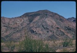
- Description:
- 100 f 8 tl
- Subject:
- Flowers, Mountains, and Shrubs
- Series:
- 11-59
- Creator:
- Cushman, Charles W., 1896-1972
- Date Created:
- 1959-03-24
- Genre:
- Landscape photographs
- Frame Number:
- 6
- County:
- Yuma
- Abstract:
- RM Mtns
- Call Number:
- P10731
- City:
- Quartzsite
- Country:
- United States
- State/Province:
- Arizona
- Alternate Identifier:
- 1159.6
- Persistent URL:
- http://purl.dlib.indiana.edu/iudl/archives/cushman/P10731
- Holding Location:
- Bloomington - University Archives
Wells Library E460
1320 E 10th St.
Bloomington, IN 47405
Contact at archives@indiana.edu, 812-855-1127
-
- Description:
- 100 f 8 tl
- Subject:
- Rocks, Flowers, Mountains, Ocotillo, and Shrubs
- Series:
- 11-59
- Creator:
- Cushman, Charles W., 1896-1972
- Date Created:
- 1959-03-24
- Genre:
- Identification photographs
- Frame Number:
- 5
- County:
- Yuma
- Abstract:
- Ocotillo (Quartzsite area)
- Call Number:
- P10730
- City:
- Quartzsite
- Country:
- United States
- State/Province:
- Arizona
- Alternate Identifier:
- 1159.5
- Persistent URL:
- http://purl.dlib.indiana.edu/iudl/archives/cushman/P10730
- Holding Location:
- Bloomington - University Archives
Wells Library E460
1320 E 10th St.
Bloomington, IN 47405
Contact at archives@indiana.edu, 812-855-1127
-
- Description:
- 100 f 8 tl
- Subject:
- Rocks, Flowers, Mountains, Ocotillo, and Shrubs
- Series:
- 11-59
- Creator:
- Cushman, Charles W., 1896-1972
- Date Created:
- 1959-03-24
- Genre:
- Identification photographs
- Frame Number:
- 4
- County:
- Yuma
- Abstract:
- Ocotillo (Quartzsite area)
- Call Number:
- P10729
- City:
- Quartzsite
- Country:
- United States
- State/Province:
- Arizona
- Alternate Identifier:
- 1159.4
- Persistent URL:
- http://purl.dlib.indiana.edu/iudl/archives/cushman/P10729
- Holding Location:
- Bloomington - University Archives
Wells Library E460
1320 E 10th St.
Bloomington, IN 47405
Contact at archives@indiana.edu, 812-855-1127
-
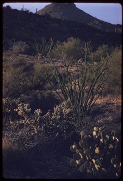
- Description:
- 100 f 5.6 tl
- Subject:
- Cactus, Flowers, Mountains, Ocotillo, Shrubs, and Vulture Mountains (Ariz.)
- Series:
- 11-59
- Creator:
- Cushman, Charles W., 1896-1972
- Date Created:
- 1959-03-23
- Genre:
- Identification photographs
- Frame Number:
- 1
- County:
- Maricopa
- Abstract:
- Ocotillo
- Call Number:
- P10726
- City:
- Wickenberg
- Country:
- United States
- State/Province:
- Arizona
- Alternate Identifier:
- 1159.1
- Persistent URL:
- http://purl.dlib.indiana.edu/iudl/archives/cushman/P10726
- Holding Location:
- Bloomington - University Archives
Wells Library E460
1320 E 10th St.
Bloomington, IN 47405
Contact at archives@indiana.edu, 812-855-1127
-
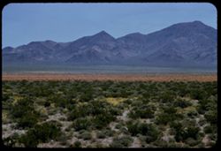
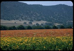
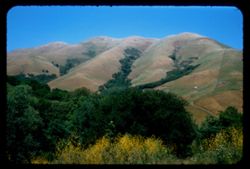
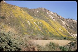
- Description:
- 100 f 6.3 tl
- Subject:
- Wildflowers, Flowers, Mountains, Shrubs, McCullough Range (Nev.), and Deserts
- Series:
- 3-58
- Creator:
- Cushman, Charles W., 1896-1972
- Date Created:
- 1958-04-25
- Genre:
- Landscape photographs
- Frame Number:
- 24
- County:
- Clark
- Abstract:
- East toward McCollough Range across carpet of green and orange flowers
- Call Number:
- P09740
- Country:
- United States
- State/Province:
- Nevada
- Alternate Identifier:
- 358.24
- Persistent URL:
- http://purl.dlib.indiana.edu/iudl/archives/cushman/P09740
- Holding Location:
- Bloomington - University Archives
Wells Library E460
1320 E 10th St.
Bloomington, IN 47405
Contact at archives@indiana.edu, 812-855-1127
-
- Description:
- 100 f 8 tl
- Subject:
- Grazing, Trees, Flowers, Meadows, Mountains, Fences, Cows, Hills, and Diablo Range (Calif.)
- Series:
- 3-58
- Creator:
- Cushman, Charles W., 1896-1972
- Date Created:
- 1958-04-11
- Genre:
- Landscape photographs
- Frame Number:
- 4
- Street Address:
- Vasco Road
- County:
- San Benito
- Abstract:
- Mt Diablo from Vasco Rd.
- Call Number:
- P09720
- Country:
- United States
- State/Province:
- California
- Alternate Identifier:
- 358.4
- Persistent URL:
- http://purl.dlib.indiana.edu/iudl/archives/cushman/P09720
- Holding Location:
- Bloomington - University Archives
Wells Library E460
1320 E 10th St.
Bloomington, IN 47405
Contact at archives@indiana.edu, 812-855-1127
-
- Description:
- 100 f 6.3 tl
- Subject:
- Meadows, Santa Ynez Valley (Calif.), Flowers, Valleys, Mountains, Trees, and Wildflowers
- Series:
- 15-57
- Creator:
- Cushman, Charles W., 1896-1972
- Date Created:
- 1957-09-21
- Genre:
- Landscape photographs
- Frame Number:
- 12
- Street Address:
- California State Highway 150
- County:
- Santa Barbara
- Abstract:
- Flowers on 150 w. of Solvang
- Call Number:
- P09545
- City:
- Solvang
- Country:
- United States
- State/Province:
- California
- Alternate Identifier:
- 1557.12
- Persistent URL:
- http://purl.dlib.indiana.edu/iudl/archives/cushman/P09545
- Holding Location:
- Bloomington - University Archives
Wells Library E460
1320 E 10th St.
Bloomington, IN 47405
Contact at archives@indiana.edu, 812-855-1127
-
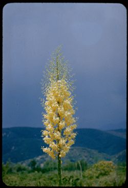
- Description:
- 100 f 5.6 tl
- Subject:
- Cajon Canyon (Calif.), Yucca, Mountains, Flowers, Flowering shrubs, and Shrubs
- Series:
- 6-57
- Creator:
- Cushman, Charles W., 1896-1972
- Date Created:
- 1957-05-14
- Genre:
- Identification photographs
- Frame Number:
- 32
- Street Address:
- United States Highway 395
- County:
- San Bernardino
- Abstract:
- Yucca along US 395 NW of San Bernardino Cajon Canyon
- Call Number:
- P09274
- Country:
- United States
- State/Province:
- California
- Alternate Identifier:
- 657.32
- Persistent URL:
- http://purl.dlib.indiana.edu/iudl/archives/cushman/P09274
- Holding Location:
- Bloomington - University Archives
Wells Library E460
1320 E 10th St.
Bloomington, IN 47405
Contact at archives@indiana.edu, 812-855-1127
-
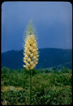
- Description:
- 100 f 6.3 tl
- Subject:
- Cajon Canyon (Calif.), Flowers, Flowering shrubs, Mountains, Shrubs, and Yucca
- Series:
- 6-57
- Creator:
- Cushman, Charles W., 1896-1972
- Date Created:
- 1957-05-14
- Genre:
- Identification photographs
- Frame Number:
- 31
- Street Address:
- United States Highway 395
- County:
- San Bernardino
- Abstract:
- Yucca along US 395 NW of San Bernardino Cajon Canyon
- Call Number:
- P09273
- City:
- San Bernardino
- Country:
- United States
- State/Province:
- California
- Alternate Identifier:
- 657.31
- Persistent URL:
- http://purl.dlib.indiana.edu/iudl/archives/cushman/P09273
- Holding Location:
- Bloomington - University Archives
Wells Library E460
1320 E 10th St.
Bloomington, IN 47405
Contact at archives@indiana.edu, 812-855-1127
-
- Description:
- 100 f 6.3 tl
- Subject:
- Meadows, Cities & towns, Flowers, Monterey Bay (Calif.), Mountains, Waterfronts, Families, Rocks, Coastlines, Ice plant, Walkways, Bays (Bodies of water)...
- Series:
- 4-57
- Creator:
- Cushman, Charles W., 1896-1972
- Date Created:
- 1957-05-08
- Genre:
- Identification photographs, Seascapes, and Views
- Frame Number:
- 21
- County:
- Monterey
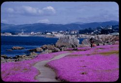
- Abstract:
- Ice plant along Monterey Bay at Pacific Grove
- Call Number:
- P09205
- City:
- Pacific Grove
- Country:
- United States
- State/Province:
- California
- Alternate Identifier:
- 457.21
- Persistent URL:
- http://purl.dlib.indiana.edu/iudl/archives/cushman/P09205
- Holding Location:
- Bloomington - University Archives
Wells Library E460
1320 E 10th St.
Bloomington, IN 47405
Contact at archives@indiana.edu, 812-855-1127
-
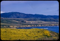
- Description:
- 100 f 6.3 tl
- Subject:
- Pigeon Point (San Mateo County, Calif.), Meadows, Flowers, Hills, Pacific Ocean, Mountains, Pacific Coast (Calif.), Oceans, Coastlines, and Wildflowers
- Series:
- 3-57
- Creator:
- Cushman, Charles W., 1896-1972
- Date Created:
- 1957-04-12
- Genre:
- Landscape photographs
- Frame Number:
- 21
- County:
- San Mateo
- Abstract:
- View from Pigeon Point
- Call Number:
- P09185
- Country:
- United States
- State/Province:
- California
- Alternate Identifier:
- 357.21
- Persistent URL:
- http://purl.dlib.indiana.edu/iudl/archives/cushman/P09185
- Holding Location:
- Bloomington - University Archives
Wells Library E460
1320 E 10th St.
Bloomington, IN 47405
Contact at archives@indiana.edu, 812-855-1127
-

- Description:
- 100 f 8 tl
- Subject:
- Safflower, Flowers, Croplands, Farms, and Mountains
- Series:
- 11-56
- Creator:
- Cushman, Charles W., 1896-1972
- Date Created:
- 1956-07-15
- Genre:
- Landscape photographs
- Frame Number:
- 8
- County:
- Yolo
- Abstract:
- Yolo county fields & mtns - field of safflowers
- Call Number:
- P08906
- Country:
- United States
- State/Province:
- California
- Alternate Identifier:
- 1156.8
- Persistent URL:
- http://purl.dlib.indiana.edu/iudl/archives/cushman/P08906
- Holding Location:
- Bloomington - University Archives
Wells Library E460
1320 E 10th St.
Bloomington, IN 47405
Contact at archives@indiana.edu, 812-855-1127
-
- Description:
- 50 f 8 SL
- Subject:
- Meadows, Flowers, Mountains, Point Reyes Peninsula (Calif.), Fences, Point Reyes (Calif.), and Black Mountain (Sonoma County, Calif.)
- Series:
- 7-56
- Creator:
- Cushman, Charles W., 1896-1972
- Date Created:
- 1956-05-11
- Genre:
- Landscape photographs
- Frame Number:
- 1
- Street Address:
- Point Reyes-Petaluma Road
- County:
- Sonoma and Marin
- Abstract:
- Black Mtn. & pink wild flowers seem from Pt. Reyes - Petaluma road on the east
- Call Number:
- P08748
- City:
- Petaluma
- Country:
- United States
- State/Province:
- California
- Alternate Identifier:
- 756.1
- Persistent URL:
- http://purl.dlib.indiana.edu/iudl/archives/cushman/P08748
- Holding Location:
- Bloomington - University Archives
Wells Library E460
1320 E 10th St.
Bloomington, IN 47405
Contact at archives@indiana.edu, 812-855-1127
-
- Description:
- 100 f 5.6 TL
- Subject:
- San Marcos Pass (Calif.), Grasses, Roads, Mailboxes, Flowers, Mountains, Passes (Landforms), Santa Ynez Mountains (Calif.), Trees, and Hills
- Series:
- 5-56
- Creator:
- Cushman, Charles W., 1896-1972
- Date Created:
- 1956-04-20
- Genre:
- Landscape photographs
- Frame Number:
- 20
- Street Address:
- California State Highway 150
- County:
- Santa Barbara
- Abstract:
- Calif 150 toward San Marcos pass
- Call Number:
- P08693
- Country:
- United States
- State/Province:
- California
- Alternate Identifier:
- 556.20
- Persistent URL:
- http://purl.dlib.indiana.edu/iudl/archives/cushman/P08693
- Holding Location:
- Bloomington - University Archives
Wells Library E460
1320 E 10th St.
Bloomington, IN 47405
Contact at archives@indiana.edu, 812-855-1127
-

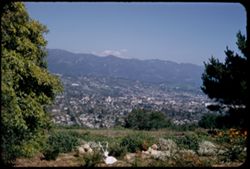
- Description:
- 100 f 8 TL
- Subject:
- Santa Ynez Mountains (Calif.), Trees, Flowers, Meadows, Mountains, Clouds, and Santa Barbara Mission
- Series:
- 5-56
- Creator:
- Cushman, Charles W., 1896-1972
- Date Created:
- 1956-04-20
- Genre:
- Landscape photographs
- Frame Number:
- 5
- County:
- Santa Barbara
- Abstract:
- Clouds above Santa Ynez Mtns
- Call Number:
- P08679
- City:
- Santa Barbara
- Country:
- United States
- State/Province:
- California
- Alternate Identifier:
- 556.5
- Persistent URL:
- http://purl.dlib.indiana.edu/iudl/archives/cushman/P08679
- Holding Location:
- Bloomington - University Archives
Wells Library E460
1320 E 10th St.
Bloomington, IN 47405
Contact at archives@indiana.edu, 812-855-1127
-
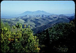
- Description:
- 100 f 8 TL
- Subject:
- Flowers, Santa Barbara Botanic Garden, Mountains, Shrubs, La Cumbre Peak (Calif.), Ceanothus, Botanical gardens, and Plants
- Series:
- 4-56
- Creator:
- Cushman, Charles W., 1896-1972
- Date Created:
- 1956-04-20
- Genre:
- Identification photographs
- Frame Number:
- 32
- County:
- Santa Barbara
- Abstract:
- Ceanothus & La Cumbre Pk Bare Mtn.
- Call Number:
- P08670
- City:
- Santa Barbara
- Country:
- United States
- State/Province:
- California
- Alternate Identifier:
- 456.32
- Persistent URL:
- http://purl.dlib.indiana.edu/iudl/archives/cushman/P08670
- Holding Location:
- Bloomington - University Archives
Wells Library E460
1320 E 10th St.
Bloomington, IN 47405
Contact at archives@indiana.edu, 812-855-1127
-
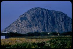
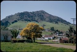
- Description:
- 100 f 8 tl
- Subject:
- Rock formations, Mountains, Plants, Morro Rock (Calif.), and Flowers
- Series:
- 4-56
- Creator:
- Cushman, Charles W., 1896-1972
- Date Created:
- 1956-04-19
- Genre:
- Landscape photographs
- Frame Number:
- 15
- County:
- San Luis Obispo
- Abstract:
- Morro Rock
- Call Number:
- P08654
- Country:
- United States
- State/Province:
- California
- Alternate Identifier:
- 456.15
- Persistent URL:
- http://purl.dlib.indiana.edu/iudl/archives/cushman/P08654
- Holding Location:
- Bloomington - University Archives
Wells Library E460
1320 E 10th St.
Bloomington, IN 47405
Contact at archives@indiana.edu, 812-855-1127
-
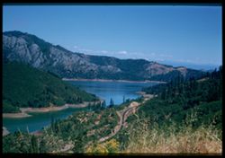
- Description:
- 100 f 5.6 50mm lens
- Subject:
- Shasta Lake (Calif.), Roads, Trees, Flowers, Mountains, Shrubs, Lakes & ponds, and Clouds
- Series:
- 17-55
- Creator:
- Cushman, Charles W., 1896-1972
- Date Created:
- 1955-06-16
- Genre:
- Landscape photographs
- Frame Number:
- 21
- County:
- Shasta
- Abstract:
- from same point
- Call Number:
- P08101
- City:
- Redding
- Country:
- United States
- State/Province:
- California
- Physical Description:
- Image was originally mounted in a glass enclosure. Before digitization, the image was removed and placed in a Wess Plastic, Inc. brand, 2" x 2", pl...
- Alternate Identifier:
- 1755.21
- Persistent URL:
- http://purl.dlib.indiana.edu/iudl/archives/cushman/P08101
- Holding Location:
- Bloomington - University Archives
Wells Library E460
1320 E 10th St.
Bloomington, IN 47405
Contact at archives@indiana.edu, 812-855-1127
-
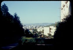
- Description:
- 100 f 6.3 tl
- Subject:
- Potrero Hill (San Francisco, Calif.), Electric lines, Suspension bridges, Trees, Flowers, Signs (Notices), Streets, Mountains, Buildings, Dwellings, Hills, U...
- Series:
- 13-55
- Creator:
- Cushman, Charles W., 1896-1972
- Date Created:
- 1955-04-10
- Genre:
- Cityscape photographs
- Frame Number:
- 37
- Street Address:
- San Bruno Avenue and Twentieth Street
- County:
- San Francisco
- Abstract:
- Toward Tamalpais from Potrero Hill at 20 & San Bruno
- Call Number:
- P07971
- City:
- San Francisco
- Country:
- United States
- State/Province:
- California
- Alternate Identifier:
- 1355.37
- Persistent URL:
- http://purl.dlib.indiana.edu/iudl/archives/cushman/P07971
- Holding Location:
- Bloomington - University Archives
Wells Library E460
1320 E 10th St.
Bloomington, IN 47405
Contact at archives@indiana.edu, 812-855-1127
-
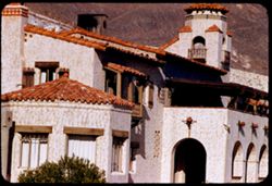
- Description:
- 100 f 8 tl
- Subject:
- Railings, Flowers, Roofs, Arches, Shutters, Mountains, Flowerpots, Shrubs, Arcades (Architectural components), Scotty's Castle (Calif.), Death Valley (Ca...
- Series:
- 11-55
- Creator:
- Cushman, Charles W., 1896-1972
- Date Created:
- 1955-03-23
- Genre:
- Architectural photographs
- Frame Number:
- 32
- County:
- Inyo
- Abstract:
- the Castle
- Call Number:
- P07891
- Country:
- United States
- State/Province:
- California
- Alternate Identifier:
- 1155.32
- Persistent URL:
- http://purl.dlib.indiana.edu/iudl/archives/cushman/P07891
- Holding Location:
- Bloomington - University Archives
Wells Library E460
1320 E 10th St.
Bloomington, IN 47405
Contact at archives@indiana.edu, 812-855-1127
-
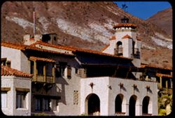
- Description:
- 100 f 8 tl
- Subject:
- Shutters, Balconies, Roofs, Flowers, Flowerpots, Death Valley (Calif. and Nev.), Windows, Scotty's Castle (Calif.), Mountains, Shrubs, Castles & pala...
- Series:
- 11-55
- Creator:
- Cushman, Charles W., 1896-1972
- Date Created:
- 1955-03-23
- Genre:
- Architectural photographs
- Frame Number:
- 31
- County:
- Inyo
- Abstract:
- the Castle
- Call Number:
- P07890
- Country:
- United States
- State/Province:
- California
- Alternate Identifier:
- 1155.31
- Persistent URL:
- http://purl.dlib.indiana.edu/iudl/archives/cushman/P07890
- Holding Location:
- Bloomington - University Archives
Wells Library E460
1320 E 10th St.
Bloomington, IN 47405
Contact at archives@indiana.edu, 812-855-1127
-
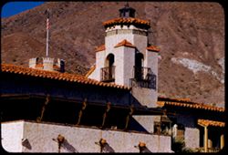
- Description:
- 100 f 8 tl
- Subject:
- Towers, Railings, Flowers, Roofs, Arches, Shutters, Mountains, Flowerpots, Shrubs, Scotty's Castle (Calif.), Death Valley (Calif. and Nev.), Castles &...
- Series:
- 11-55
- Creator:
- Cushman, Charles W., 1896-1972
- Date Created:
- 1955-03-23
- Genre:
- Architectural photographs
- Frame Number:
- 30
- County:
- Inyo
- Abstract:
- the Castle
- Call Number:
- P07889
- Country:
- United States
- State/Province:
- California
- Alternate Identifier:
- 1155.30
- Persistent URL:
- http://purl.dlib.indiana.edu/iudl/archives/cushman/P07889
- Holding Location:
- Bloomington - University Archives
Wells Library E460
1320 E 10th St.
Bloomington, IN 47405
Contact at archives@indiana.edu, 812-855-1127
-
- Description:
- 100 f 8 tl
- Subject:
- Mojave Desert (Calif.), Valleys, Flowers, Mountains, Shrubs, Sierra Nevada (Calif. and Nev.), Hills, Indian Wells Valley (Calif.), and Utility poles
- Series:
- 7-55
- Creator:
- Cushman, Charles W., 1896-1972
- Date Created:
- 1955-03-21
- Genre:
- Landscape photographs
- Frame Number:
- 28
- Street Address:
- Randsburg Road and Trona Road
- County:
- Kern
- Abstract:
- West from just above junction - view across Indiana Wells Valley toward Inyokern and Sierra beyond
- Call Number:
- P07752
- City:
- Inyokern
- Country:
- United States
- State/Province:
- California
- Alternate Identifier:
- 755.28
- Persistent URL:
- http://purl.dlib.indiana.edu/iudl/archives/cushman/P07752
- Holding Location:
- Bloomington - University Archives
Wells Library E460
1320 E 10th St.
Bloomington, IN 47405
Contact at archives@indiana.edu, 812-855-1127
-
- Description:
- 25 f 10
- Subject:
- Grasses, Roads, Madrono, Trees, Flowers, Mountains, Shrubs, Pacific madrone, and Hills
- Series:
- 1-55
- Creator:
- Cushman, Charles W., 1896-1972
- Date Created:
- 1955-01-23
- Genre:
- Identification photographs
- Frame Number:
- 1
- County:
- Sonoma
- Abstract:
- Madrone - Sonoma county north of Bloomfield
- Call Number:
- P07540
- City:
- Bloomfield
- Country:
- United States
- State/Province:
- California
- Alternate Identifier:
- 155.1
- Persistent URL:
- http://purl.dlib.indiana.edu/iudl/archives/cushman/P07540
- Holding Location:
- Bloomington - University Archives
Wells Library E460
1320 E 10th St.
Bloomington, IN 47405
Contact at archives@indiana.edu, 812-855-1127
-
- Description:
- 50 f 8 HF
- Subject:
- Trees, Flowers, Konocti, Mount (Calif.), Mountains, Shrubs, and Hills
- Series:
- 16-54
- Creator:
- Cushman, Charles W., 1896-1972
- Date Created:
- 1954-11-04
- Genre:
- Landscape photographs
- Frame Number:
- 20
- Street Address:
- Hopland-Lakeport Road
- County:
- Mendocino and Lake
- Abstract:
- East toward Konocti.
- Call Number:
- P07519
- City:
- Lakeport and Hopland
- Country:
- United States
- State/Province:
- California
- Physical Description:
- Anscochrome film.
- Alternate Identifier:
- 1654.20
- Persistent URL:
- http://purl.dlib.indiana.edu/iudl/archives/cushman/P07519
- Holding Location:
- Bloomington - University Archives
Wells Library E460
1320 E 10th St.
Bloomington, IN 47405
Contact at archives@indiana.edu, 812-855-1127
-
- Description:
- 50 f 11 HF
- Subject:
- Deserts, Inyo Mountains (Calif.), Flowers, Mountains, Shrubs, Hills, and Rock formations
- Series:
- 12-54
- Creator:
- Cushman, Charles W., 1896-1972
- Date Created:
- 1954-09-18
- Genre:
- Landscape photographs
- Frame Number:
- 29
- Street Address:
- Mt. Whitney Road
- County:
- Inyo
- Abstract:
- Inyo Mtns beyond one of the Alabama Hills.
- Call Number:
- P07419
- City:
- Alabama Hills and Lone Pine
- Country:
- United States
- State/Province:
- California
- Alternate Identifier:
- 1254.29
- Persistent URL:
- http://purl.dlib.indiana.edu/iudl/archives/cushman/P07419
- Holding Location:
- Bloomington - University Archives
Wells Library E460
1320 E 10th St.
Bloomington, IN 47405
Contact at archives@indiana.edu, 812-855-1127
-
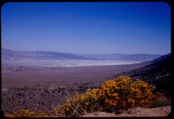
- Description:
- 50 f 12 HF
- Subject:
- Deserts, Valleys, Owens Lake (Inyo County, Calif.), Flowers, Owens Valley (Calif.), Mountains, Shrubs, and Lakes & ponds
- Series:
- 12-54
- Creator:
- Cushman, Charles W., 1896-1972
- Date Created:
- 1954-09-18
- Genre:
- Landscape photographs
- Frame Number:
- 28
- Street Address:
- Mt. Whitney Road
- County:
- Inyo
- Abstract:
- Owens Lake.
- Call Number:
- P07418
- Country:
- United States
- State/Province:
- California
- Alternate Identifier:
- 1254.28
- Persistent URL:
- http://purl.dlib.indiana.edu/iudl/archives/cushman/P07418
- Holding Location:
- Bloomington - University Archives
Wells Library E460
1320 E 10th St.
Bloomington, IN 47405
Contact at archives@indiana.edu, 812-855-1127
-
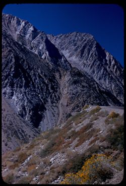
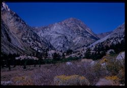
- Description:
- 50 f 9
- Subject:
- Rocks, Grasses, Middle Palisade Glacier (Calif.), Trees, Flowers, Mountains, Shrubs, and Sierra Nevada (Calif. and Nev.)
- Series:
- 12-54
- Creator:
- Cushman, Charles W., 1896-1972
- Date Created:
- 1954-09-18
- Genre:
- Landscape photographs
- Frame Number:
- 10
- County:
- Inyo
- Abstract:
- Again - with yellow.
- Call Number:
- P07400
- City:
- Lone Pine
- Country:
- United States
- State/Province:
- California
- Alternate Identifier:
- 1254.10
- Persistent URL:
- http://purl.dlib.indiana.edu/iudl/archives/cushman/P07400
- Holding Location:
- Bloomington - University Archives
Wells Library E460
1320 E 10th St.
Bloomington, IN 47405
Contact at archives@indiana.edu, 812-855-1127
-
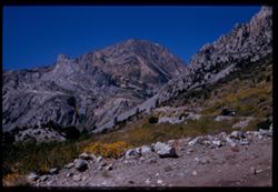
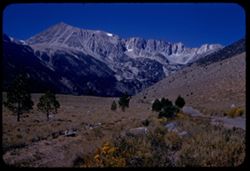
- Description:
- 50 f 11
- Subject:
- Middle Palisade Glacier (Calif.), Trees, Flowers, Mountains, Shrubs, and Sierra Nevada (Calif. and Nev.)
- Series:
- 12-54
- Creator:
- Cushman, Charles W., 1896-1972
- Date Created:
- 1954-09-18
- Genre:
- Landscape photographs
- Frame Number:
- 6
- Street Address:
- Glacier Lodge Road
- County:
- Inyo
- Abstract:
- High Sierra west of Big Pine - from Glacier Lodge road.
- Call Number:
- P07396
- City:
- Big Pine
- Country:
- United States
- State/Province:
- California
- Physical Description:
- film scratched.
- Alternate Identifier:
- 1254.6
- Persistent URL:
- http://purl.dlib.indiana.edu/iudl/archives/cushman/P07396
- Holding Location:
- Bloomington - University Archives
Wells Library E460
1320 E 10th St.
Bloomington, IN 47405
Contact at archives@indiana.edu, 812-855-1127
-
- Description:
- 50 f 8
- Subject:
- Bishop Creek (Inyo County, Calif.), Flowers, Donkeys, Animals, Mountains, Shrubs, Trees, Sagebrush, and Rocks
- Series:
- 11-54
- Creator:
- Cushman, Charles W., 1896-1972
- Date Created:
- 1954-09-17
- Genre:
- Identification photographs
- Frame Number:
- 18
- County:
- Inyo
- Abstract:
- Jennie in the sage brush.
- Call Number:
- P07387
- City:
- Bishop
- Country:
- United States
- State/Province:
- California
- Alternate Identifier:
- 1154.18
- Persistent URL:
- http://purl.dlib.indiana.edu/iudl/archives/cushman/P07387
- Holding Location:
- Bloomington - University Archives
Wells Library E460
1320 E 10th St.
Bloomington, IN 47405
Contact at archives@indiana.edu, 812-855-1127
-
- Description:
- 50 f 9
- Subject:
- Flowers, Hills, Roads, Mountains, Shrubs, Sierra Nevada (Calif. and Nev.), Trees, Rocks, and Grasses
- Series:
- 11-54
- Creator:
- Cushman, Charles W., 1896-1972
- Date Created:
- 1954-09-17
- Genre:
- Landscape photographs
- Frame Number:
- 5
- Street Address:
- Sabrina Lake Road
- County:
- Inyo
- Abstract:
- High Sierra seen from Sabrina Lake road SW of Bishop.
- Call Number:
- P07374
- City:
- Bishop
- Country:
- United States
- State/Province:
- California
- Alternate Identifier:
- 1154.5
- Persistent URL:
- http://purl.dlib.indiana.edu/iudl/archives/cushman/P07374
- Holding Location:
- Bloomington - University Archives
Wells Library E460
1320 E 10th St.
Bloomington, IN 47405
Contact at archives@indiana.edu, 812-855-1127
-
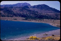
- Description:
- 50 f 6.3
- Subject:
- Bodies of water, Trees, Coastlines, June Lake (Calif.), Shrubs, Lakes & ponds, Flowers, and Mountains
- Series:
- 11-54
- Creator:
- Cushman, Charles W., 1896-1972
- Date Created:
- 1954-09-16
- Genre:
- Landscape photographs
- Frame Number:
- 3
- County:
- Mono
- Abstract:
- June Lake from east side in mid afternoon.
- Call Number:
- P07372
- Country:
- United States
- State/Province:
- California
- Alternate Identifier:
- 1154.3
- Persistent URL:
- http://purl.dlib.indiana.edu/iudl/archives/cushman/P07372
- Holding Location:
- Bloomington - University Archives
Wells Library E460
1320 E 10th St.
Bloomington, IN 47405
Contact at archives@indiana.edu, 812-855-1127
-
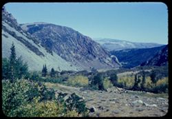
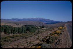
- Description:
- 50 f 9
- Subject:
- Rocks, Canyons, Grasses, Trees, Flowers, Lee Vining Creek (Calif.), Mountains, Shrubs, and Lee Vining Canyon (Calif.)
- Series:
- 10-54
- Creator:
- Cushman, Charles W., 1896-1972
- Date Created:
- 1954-09-16
- Genre:
- Landscape photographs
- Frame Number:
- 21
- County:
- Mono
- Abstract:
- Another view east down canyon.
- Call Number:
- P07368
- Country:
- United States
- State/Province:
- California
- Physical Description:
- Anscochrome film.
- Alternate Identifier:
- 1054.21
- Persistent URL:
- http://purl.dlib.indiana.edu/iudl/archives/cushman/P07368
- Holding Location:
- Bloomington - University Archives
Wells Library E460
1320 E 10th St.
Bloomington, IN 47405
Contact at archives@indiana.edu, 812-855-1127
-
- Description:
- 50 f 10
- Subject:
- Rocks, Yosemite National Park (Calif.), Trees, Flowers, Volcanoes, Tioga Peak (Calif.), Mountains, and Shrubs
- Series:
- 9-54
- Creator:
- Cushman, Charles W., 1896-1972
- Date Created:
- 1954-09-16
- Genre:
- Landscape photographs
- Frame Number:
- 37
- Street Address:
- California State Highway 140
- County:
- Mono
- Abstract:
- Another view up toward Tioga Peak.
- Call Number:
- P07346
- Country:
- United States
- State/Province:
- California
- Physical Description:
- Image was originally mounted in a glass enclosure. Before digitization, the image was removed and placed in a Wess Plastic, Inc. brand, 2" x 2", pl...
- Alternate Identifier:
- 954.37
- Persistent URL:
- http://purl.dlib.indiana.edu/iudl/archives/cushman/P07346
- Holding Location:
- Bloomington - University Archives
Wells Library E460
1320 E 10th St.
Bloomington, IN 47405
Contact at archives@indiana.edu, 812-855-1127
-
- Description:
- 50 f 9
- Subject:
- Passes (Landforms), Rocks, Mountains, Tioga Pass (Calif.), Yosemite Creek (Calif.), Dana Plateau (Calif.), Volcanoes, Shrubs, and Flowers
- Series:
- 9-54
- Creator:
- Cushman, Charles W., 1896-1972
- Date Created:
- 1954-09-16
- Genre:
- Landscape photographs
- Frame Number:
- 36
- County:
- Mono
- Abstract:
- Combs above south wall of Tioga Pass from N.
- Call Number:
- P07345
- Country:
- United States
- State/Province:
- California
- Alternate Identifier:
- 954.36
- Persistent URL:
- http://purl.dlib.indiana.edu/iudl/archives/cushman/P07345
- Holding Location:
- Bloomington - University Archives
Wells Library E460
1320 E 10th St.
Bloomington, IN 47405
Contact at archives@indiana.edu, 812-855-1127
-
- Description:
- 50 f 10
- Subject:
- Lee Vining Creek (Calif.), Passes (Landforms), Flowers, Mountains, Shrubs, Trees, Rocks, and Tioga Pass (Calif.)
- Series:
- 9-54
- Creator:
- Cushman, Charles W., 1896-1972
- Date Created:
- 1954-09-16
- Genre:
- Landscape photographs
- Frame Number:
- 33
- Street Address:
- California State Highway 140
- County:
- Mono
- Abstract:
- Another look up toward Pass.
- Call Number:
- P07343
- Country:
- United States
- State/Province:
- California
- Physical Description:
- Image was originally mounted in a glass enclosure. Before digitization, the image was removed and placed in a Wess Plastic, Inc. brand, 2" x 2", pl...
- Alternate Identifier:
- 954.33
- Persistent URL:
- http://purl.dlib.indiana.edu/iudl/archives/cushman/P07343
- Holding Location:
- Bloomington - University Archives
Wells Library E460
1320 E 10th St.
Bloomington, IN 47405
Contact at archives@indiana.edu, 812-855-1127
-
- Description:
- 50 f 10
- Subject:
- Lee Vining Creek (Calif.), Deserts, Flowers, Dana, Mount (Calif.), Dana Plateau (Calif.), Roads, Mountains, Yosemite National Park (Calif.), Shrubs, Trees, R...
- Series:
- 9-54
- Creator:
- Cushman, Charles W., 1896-1972
- Date Created:
- 1954-09-16
- Genre:
- Landscape photographs
- Frame Number:
- 27
- County:
- Mono
- Abstract:
- Great east wall of Mt. Dana.
- Call Number:
- P07338
- Country:
- United States
- State/Province:
- California
- Alternate Identifier:
- 954.27
- Persistent URL:
- http://purl.dlib.indiana.edu/iudl/archives/cushman/P07338
- Holding Location:
- Bloomington - University Archives
Wells Library E460
1320 E 10th St.
Bloomington, IN 47405
Contact at archives@indiana.edu, 812-855-1127
-
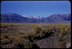
- Description:
- 50 f 11
- Subject:
- Deserts, Valleys, Trees, Flowers, Conway Summit (Calif.), Mountains, Shrubs, and Hills
- Series:
- 9-54
- Creator:
- Cushman, Charles W., 1896-1972
- Date Created:
- 1954-09-16
- Genre:
- Landscape photographs
- Frame Number:
- 21
- Street Address:
- United States Highway 395
- County:
- Mono
- Abstract:
- View north (w.) from US 395, 12 1/2 mi. so of Bridgeport. (19-20-21 were taken less than mile north of Conway Summit)
- Call Number:
- P07332
- City:
- Bridgeport
- Country:
- United States
- State/Province:
- California
- Alternate Identifier:
- 954.21
- Persistent URL:
- http://purl.dlib.indiana.edu/iudl/archives/cushman/P07332
- Holding Location:
- Bloomington - University Archives
Wells Library E460
1320 E 10th St.
Bloomington, IN 47405
Contact at archives@indiana.edu, 812-855-1127
-
- Description:
- 50 f 11
- Subject:
- Sawtooth Ridge (Calif.), Twin Peaks (San Francisco County, Calif.), Dirt roads, Flowers, Matterhorn Peak (Calif.), Mountains, Shrubs, Sierra Nevada (Calif. a...
- Series:
- 9-54
- Creator:
- Cushman, Charles W., 1896-1972
- Date Created:
- 1954-09-16
- Genre:
- Landscape photographs
- Frame Number:
- 17
- Street Address:
- United States Highway 395
- County:
- Mono
- Abstract:
- Matterhorn and Twin Peaks from Hwy 395 to NE (?). Mountains of Sawtooth Ridge, all over, 11,000 ft.
- Call Number:
- P07328
- City:
- Bridgeport
- Country:
- United States
- State/Province:
- California
- Alternate Identifier:
- 954.17
- Persistent URL:
- http://purl.dlib.indiana.edu/iudl/archives/cushman/P07328
- Holding Location:
- Bloomington - University Archives
Wells Library E460
1320 E 10th St.
Bloomington, IN 47405
Contact at archives@indiana.edu, 812-855-1127
-
- Description:
- 50 f 9
- Subject:
- Shasta-Trinity National Forest (Calif.), Glacial landforms, Cascade Range Castle Crags Wilderness (Calif.), Mountains, Castle Crags (Calif.), Trees, Clouds, ...
- Series:
- 6-54
- Creator:
- Cushman, Charles W., 1896-1972
- Date Created:
- 1954-08-20
- Genre:
- Landscape photographs
- Frame Number:
- 18
- Street Address:
- United States Highway 99
- County:
- Siskiyou
- Abstract:
- Castle Crags above Sacramento river 10 mi. south of Dunsmuir.
- Call Number:
- P07236
- City:
- Dunsmuir
- Country:
- United States
- State/Province:
- California
- Alternate Identifier:
- 654.18
- Persistent URL:
- http://purl.dlib.indiana.edu/iudl/archives/cushman/P07236
- Holding Location:
- Bloomington - University Archives
Wells Library E460
1320 E 10th St.
Bloomington, IN 47405
Contact at archives@indiana.edu, 812-855-1127
-
- Description:
- 50 f 9
- Subject:
- Rocks, Cascade Range, Grasses, Trees, Flowers, Lassen Volcanic National Park (Calif.), Mountains, Shrubs, and Lupines
- Series:
- 6-54
- Creator:
- Cushman, Charles W., 1896-1972
- Date Created:
- 1954-08-19
- Genre:
- Landscape photographs
- Frame Number:
- 9
- County:
- Shasta
- Abstract:
- Lupine on slope.
- Call Number:
- P07227
- Country:
- United States
- State/Province:
- California
- Alternate Identifier:
- 654.9
- Persistent URL:
- http://purl.dlib.indiana.edu/iudl/archives/cushman/P07227
- Holding Location:
- Bloomington - University Archives
Wells Library E460
1320 E 10th St.
Bloomington, IN 47405
Contact at archives@indiana.edu, 812-855-1127
-
- Description:
- 50 f 11
- Subject:
- Flowers, Lava domes, Lassen Peak (Calif.), Lassen Volcanic National Park (Calif.), Volcanic domes, Mountains, Shrubs, Snow, Trees, Rocks, Volcanoes, and Lupines
- Series:
- 5-54
- Creator:
- Cushman, Charles W., 1896-1972
- Date Created:
- 1954-08-19
- Genre:
- Landscape photographs
- Frame Number:
- 13
- County:
- Shasta
- Abstract:
- Close-up of South face to show lupine in foreground to dead tress at left
- Call Number:
- P07209
- Country:
- United States
- State/Province:
- California
- Physical Description:
- Anscochrome film.
- Alternate Identifier:
- 554.13
- Persistent URL:
- http://purl.dlib.indiana.edu/iudl/archives/cushman/P07209
- Holding Location:
- Bloomington - University Archives
Wells Library E460
1320 E 10th St.
Bloomington, IN 47405
Contact at archives@indiana.edu, 812-855-1127
-
- Description:
- 50 f 8
- Subject:
- Farms, Trees, Flowers, Meadows, Mountains, Shrubs, and Croplands
- Series:
- 4-54
- Creator:
- Cushman, Charles W., 1896-1972
- Date Created:
- 1954-07-22
- Genre:
- Landscape photographs
- Frame Number:
- 6
- County:
- San Mateo
- Abstract:
- Across brown fields & green toward mtns in distant haze from county road near San Gregorio - yellow flowers in foreground
- Call Number:
- P07180
- City:
- San Gregorio
- Country:
- United States
- State/Province:
- California
- Physical Description:
- Anscochrome film.
- Alternate Identifier:
- 454.6
- Persistent URL:
- http://purl.dlib.indiana.edu/iudl/archives/cushman/P07180
- Holding Location:
- Bloomington - University Archives
Wells Library E460
1320 E 10th St.
Bloomington, IN 47405
Contact at archives@indiana.edu, 812-855-1127
-
- Description:
- 50 f 9
- Subject:
- Straw flowers, Grasses, Trees, Flowers, Meadows, Mountains, Shrubs, and Half Moon Bay (Calif.)
- Series:
- 4-54
- Creator:
- Cushman, Charles W., 1896-1972
- Date Created:
- 1954-07-22
- Genre:
- Landscape photographs
- Frame Number:
- 5
- Street Address:
- California State Highway 1
- County:
- San Mateo
- Abstract:
- Field of straw flowers with mtns in distance - along Hwy 1near Half Moon Bay
- Call Number:
- P07179
- Country:
- United States
- State/Province:
- California
- Physical Description:
- Anscochrome film.
- Alternate Identifier:
- 454.5
- Persistent URL:
- http://purl.dlib.indiana.edu/iudl/archives/cushman/P07179
- Holding Location:
- Bloomington - University Archives
Wells Library E460
1320 E 10th St.
Bloomington, IN 47405
Contact at archives@indiana.edu, 812-855-1127
-
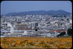
- Description:
- 50 f 8
- Subject:
- Trees, Flowers, St. Joseph's Hospital (San Francisco, Calif.), Mountains, Buildings, Shrubs, Dwellings, and Walkways
- Series:
- 3-54
- Creator:
- Cushman, Charles W., 1896-1972
- Date Created:
- 1954-07-05
- Genre:
- Cityscape photographs
- Frame Number:
- 22
- Street Address:
- Buena Vista Avenue East
- County:
- San Francisco
- Abstract:
- S.F. business district seen from Buena Vista East alongside St. Joseph's Hospital
- Call Number:
- P07173
- City:
- San Francisco
- Country:
- United States
- State/Province:
- California
- Physical Description:
- Anscochrome film.
- Alternate Identifier:
- 254.22
- Persistent URL:
- http://purl.dlib.indiana.edu/iudl/archives/cushman/P07173
- Holding Location:
- Bloomington - University Archives
Wells Library E460
1320 E 10th St.
Bloomington, IN 47405
Contact at archives@indiana.edu, 812-855-1127
-
- Description:
- 50 f 9
- Subject:
- Trees, Flowers, Flowering shrubs, Mountains, Shrubs, Black Mountain (Marin County, Calif.), and Hills
- Series:
- 2-54
- Creator:
- Cushman, Charles W., 1896-1972
- Date Created:
- 1954-05-21
- Genre:
- Landscape photographs
- Frame Number:
- 6
- Street Address:
- Lagunitas Road
- County:
- Marin
- Abstract:
- Black Mtn. Again from Lagunitas Rd. - sw. -
- Call Number:
- P07137
- Country:
- United States
- State/Province:
- California
- Alternate Identifier:
- 254.6
- Persistent URL:
- http://purl.dlib.indiana.edu/iudl/archives/cushman/P07137
- Holding Location:
- Bloomington - University Archives
Wells Library E460
1320 E 10th St.
Bloomington, IN 47405
Contact at archives@indiana.edu, 812-855-1127
-
- Description:
- 50 f 8
- Subject:
- Bays (Bodies of water), Bodies of water, Trees, Flowers, Roofs, Mountains, Cargo ships, Shrubs, Traffic signs & signals, Dwellings, Telegraph Hill (San F...
- Series:
- 2-53
- Creator:
- Cushman, Charles W., 1896-1972
- Date Created:
- 1953-02-09
- Genre:
- Views
- Frame Number:
- 27
- Street Address:
- Union Street and Calhoun Street
- County:
- San Francisco
- Abstract:
- Blossoming tree on shoulder of Telegraph Hill, with view of S.F. Bay.
- Call Number:
- P06561
- City:
- San Francisco
- Country:
- United States
- State/Province:
- California
- Alternate Identifier:
- 253.27
- Persistent URL:
- http://purl.dlib.indiana.edu/iudl/archives/cushman/P06561
- Holding Location:
- Bloomington - University Archives
Wells Library E460
1320 E 10th St.
Bloomington, IN 47405
Contact at archives@indiana.edu, 812-855-1127
-
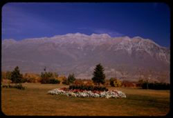
- Description:
- 25 f 6.3 Pola
- Subject:
- Trees, Flowers, Mountains, Lawns, Shrubs, Timpanogos, Mount (Utah), and Utility poles
- Series:
- 27-52
- Creator:
- Cushman, Charles W., 1896-1972
- Date Created:
- 1952-11-05
- Genre:
- Landscape photographs
- Frame Number:
- 38
- County:
- Utah
- Abstract:
- Great rock mtn north of Provo. 11,957 ft.
- Call Number:
- P06483
- City:
- Provo
- Country:
- United States
- State/Province:
- Utah
- Alternate Identifier:
- 2752.38
- Persistent URL:
- http://purl.dlib.indiana.edu/iudl/archives/cushman/P06483
- Holding Location:
- Bloomington - University Archives
Wells Library E460
1320 E 10th St.
Bloomington, IN 47405
Contact at archives@indiana.edu, 812-855-1127
-
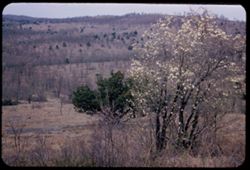
- Description:
- 25 f 9
- Subject:
- Barbed wire, Trees, Flowers, Mountains, Shrubs, Ozark Mountains, Flowering dogwood, and Hills
- Series:
- 18-52
- Creator:
- Cushman, Charles W., 1896-1972
- Date Created:
- 1952-04-18
- Genre:
- Landscape photographs
- Frame Number:
- 35
- Street Address:
- Missouri State Highway 80
- County:
- Taney
- Abstract:
- Dogwood + the Ozarks Mo 80.
- Call Number:
- P06166
- Country:
- United States
- State/Province:
- Missouri
- Alternate Identifier:
- 1852.35
- Persistent URL:
- http://purl.dlib.indiana.edu/iudl/archives/cushman/P06166
- Holding Location:
- Bloomington - University Archives
Wells Library E460
1320 E 10th St.
Bloomington, IN 47405
Contact at archives@indiana.edu, 812-855-1127
-
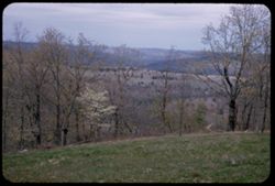
- Description:
- 25 f 11
- Subject:
- Flowers, Hills, Flowering dogwood, Mountains, Trees, Grasses, and Ozark Mountains
- Series:
- 18-52
- Creator:
- Cushman, Charles W., 1896-1972
- Date Created:
- 1952-04-18
- Genre:
- Landscape photographs
- Frame Number:
- 34
- County:
- Taney
- Abstract:
- Dogwood + Ozark panorama. Hwy is near Branson.
- Call Number:
- P06165
- City:
- Branson
- Country:
- United States
- State/Province:
- Missouri
- Alternate Identifier:
- 1852.34
- Persistent URL:
- http://purl.dlib.indiana.edu/iudl/archives/cushman/P06165
- Holding Location:
- Bloomington - University Archives
Wells Library E460
1320 E 10th St.
Bloomington, IN 47405
Contact at archives@indiana.edu, 812-855-1127
-
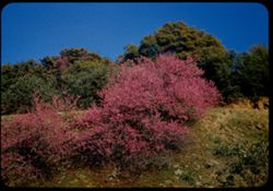
- Description:
- 25 f 11
- Subject:
- Rocks, Sequoia National Park (Calif.), Grasses, Trees, Flowers, Mountains, National parks & reserves, Hills, Redbuds, and Shrubs
- Series:
- 14-52
- Creator:
- Cushman, Charles W., 1896-1972
- Date Created:
- 1952-04-06
- Genre:
- Identification photographs
- Frame Number:
- 6
- County:
- Tulare
- Abstract:
- Red Bud on Mtnside out of Sequoia Park.
- Call Number:
- P05990
- Country:
- United States
- State/Province:
- California
- Alternate Identifier:
- 1452.6
- Persistent URL:
- http://purl.dlib.indiana.edu/iudl/archives/cushman/P05990
- Holding Location:
- Bloomington - University Archives
Wells Library E460
1320 E 10th St.
Bloomington, IN 47405
Contact at archives@indiana.edu, 812-855-1127
-
- Description:
- 25 f 9
- Subject:
- Wildflowers, Trees, Flowers, Mountains, Fences, Hills, and Mustard (Plant)
- Series:
- 10-52
- Creator:
- Cushman, Charles W., 1896-1972
- Date Created:
- 1952-03-09
- Genre:
- Landscape photographs
- Frame Number:
- 3
- Street Address:
- California State Highway 24
- County:
- Alameda and Contra Costa
- Abstract:
- Mustard covered mtn. Side nr. Lafayette on Cal 24
- Call Number:
- P05839
- City:
- Oakland and Lafayette
- Country:
- United States
- State/Province:
- California
- Alternate Identifier:
- 1052.3
- Persistent URL:
- http://purl.dlib.indiana.edu/iudl/archives/cushman/P05839
- Holding Location:
- Bloomington - University Archives
Wells Library E460
1320 E 10th St.
Bloomington, IN 47405
Contact at archives@indiana.edu, 812-855-1127
-
- Description:
- 25 f 9
- Subject:
- Wildflowers, Trees, Flowers, Mountains, Hills, and Mustard (Plant)
- Series:
- 10-52
- Creator:
- Cushman, Charles W., 1896-1972
- Date Created:
- 1952-02-09
- Genre:
- Landscape photographs
- Frame Number:
- 2
- Street Address:
- California State Highway 24
- County:
- Contra Costa
- Abstract:
- Mustard covered mtn. side nr. Lafayette on Cal 24
- Call Number:
- P05838
- City:
- Lafayette
- Country:
- United States
- State/Province:
- California
- Alternate Identifier:
- 1052.2
- Persistent URL:
- http://purl.dlib.indiana.edu/iudl/archives/cushman/P05838
- Holding Location:
- Bloomington - University Archives
Wells Library E460
1320 E 10th St.
Bloomington, IN 47405
Contact at archives@indiana.edu, 812-855-1127
-
- Description:
- 50 f 9 [error]
- Subject:
- Wildflowers, Trees, Flowers, Mountains, Hills, and Mustard (Plant)
- Series:
- 10-52
- Creator:
- Cushman, Charles W., 1896-1972
- Date Created:
- 1952-03-09
- Genre:
- Landscape photographs
- Frame Number:
- 1
- Street Address:
- California State Highway 24
- County:
- Contra Costa
- Abstract:
- Mustard covered Mtn. Side nr. Lafayette on Cal 24
- Call Number:
- P05837
- City:
- Lafayette
- Country:
- United States
- State/Province:
- California
- Alternate Identifier:
- 1052.1
- Persistent URL:
- http://purl.dlib.indiana.edu/iudl/archives/cushman/P05837
- Holding Location:
- Bloomington - University Archives
Wells Library E460
1320 E 10th St.
Bloomington, IN 47405
Contact at archives@indiana.edu, 812-855-1127
-
- Description:
- 50 f 5.6
- Subject:
- Buildings, Hills, Mountains, Grasses, Trees, Utility poles, Acacia, Houses, Flowers, Roads, Automobiles, Electric lines, and Shrubs
- Series:
- 8-52
- Creator:
- Cushman, Charles W., 1896-1972
- Date Created:
- 1952-03-02
- Genre:
- Landscape photographs
- Frame Number:
- 37
- County:
- San Luis Obispo
- Abstract:
- San Luis mtn with acacia below
- Call Number:
- P05796
- City:
- San Luis Obispo
- Country:
- United States
- State/Province:
- California
- Alternate Identifier:
- 852.37
- Persistent URL:
- http://purl.dlib.indiana.edu/iudl/archives/cushman/P05796
- Holding Location:
- Bloomington - University Archives
Wells Library E460
1320 E 10th St.
Bloomington, IN 47405
Contact at archives@indiana.edu, 812-855-1127
-
- Description:
- 25 f 11
- Subject:
- Grasses, Trees, Flowers, Mountains, Hills, and Mustard (Plant)
- Series:
- 8-52
- Creator:
- Cushman, Charles W., 1896-1972
- Date Created:
- 1952-02-28
- Genre:
- Landscape photographs
- Frame Number:
- 18
- County:
- Santa Barbara
- Abstract:
- Mustard covered mtn.
- Call Number:
- P05777
- City:
- Santa Barbara
- Country:
- United States
- State/Province:
- California
- Alternate Identifier:
- 852.18
- Persistent URL:
- http://purl.dlib.indiana.edu/iudl/archives/cushman/P05777
- Holding Location:
- Bloomington - University Archives
Wells Library E460
1320 E 10th St.
Bloomington, IN 47405
Contact at archives@indiana.edu, 812-855-1127
-
- Description:
- 25 f 11
- Subject:
- California poppies, Flowers, Streets, Mountains, Shrubs, Trees, Rocks, La Cumbre Peak (Calif.), Buildings, and Figurines
- Series:
- 8-52
- Creator:
- Cushman, Charles W., 1896-1972
- Date Created:
- 1952-02-28
- Genre:
- Cityscape photographs
- Frame Number:
- 14
- Street Address:
- Kenwood Road
- County:
- Santa Barbara
- Abstract:
- View across Sta Barbara to LaCumbre, Montecito, & other mtns from top of Kenwood Rd.
- Call Number:
- P05773
- City:
- Santa Barbara and Montecito
- Country:
- United States
- State/Province:
- California
- Alternate Identifier:
- 852.14
- Persistent URL:
- http://purl.dlib.indiana.edu/iudl/archives/cushman/P05773
- Holding Location:
- Bloomington - University Archives
Wells Library E460
1320 E 10th St.
Bloomington, IN 47405
Contact at archives@indiana.edu, 812-855-1127
-
- Description:
- 25 f 11
- Subject:
- Flowers, Mustard (Plant), Mountains, Shrubs, and Utility poles
- Series:
- 8-52
- Creator:
- Cushman, Charles W., 1896-1972
- Date Created:
- 1952-02-27
- Genre:
- Landscape photographs
- Frame Number:
- 7
- Street Address:
- United States Highway 101
- County:
- Ventura
- Abstract:
- Mustard on the mountain slope along US 101-5 mi west of Ventura
- Call Number:
- P05766
- City:
- Ventura
- Country:
- United States
- State/Province:
- California
- Alternate Identifier:
- 852.7
- Persistent URL:
- http://purl.dlib.indiana.edu/iudl/archives/cushman/P05766
- Holding Location:
- Bloomington - University Archives
Wells Library E460
1320 E 10th St.
Bloomington, IN 47405
Contact at archives@indiana.edu, 812-855-1127
-
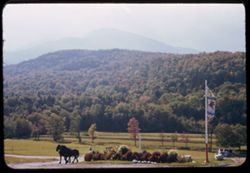
- Subject:
- Washington, Mount (N.H.), White Mountains (N.H. and Me.), Roads, Horses, Trees, Flowers, Shadows, Signs (Notices), Mountains, Shrubs, Mobile Gas Service Corp...
- Series:
- 16-41
- Creator:
- Cushman, Charles W., 1896-1972
- Date Created:
- 1941-09-15
- Genre:
- Landscape photographs
- Frame Number:
- 20
- Abstract:
- Hazy outline of Mt. Washington from east side.
- Call Number:
- P02441
- Country:
- United States
- State/Province:
- New Hampshire
- Alternate Identifier:
- 1641.20
- Persistent URL:
- http://purl.dlib.indiana.edu/iudl/archives/cushman/P02441
- Holding Location:
- Bloomington - University Archives
Wells Library E460
1320 E 10th St.
Bloomington, IN 47405
Contact at archives@indiana.edu, 812-855-1127
-
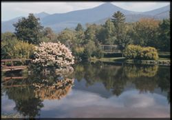
- Subject:
- Franconia Hotel (Franconia, N.H.), Trees, Flowers, Mountains, Fences, Shrubs, Lakes & ponds, Bridges, and Reflections
- Series:
- 16-41
- Creator:
- Cushman, Charles W., 1896-1972
- Date Created:
- 1941-09-15
- Genre:
- Landscape photographs
- Frame Number:
- 15
- County:
- Grafton
- Abstract:
- Reflection of White Mtns. in pool at Franconia Hotel
- Call Number:
- P02436
- City:
- Franconia
- Country:
- United States
- State/Province:
- New Hampshire
- Physical Description:
- Image was originally mounted in a glass enclosure. Before digitization, the image was removed and placed in a Wess Plastic, Inc. brand, 2" x 2", pl...
- Alternate Identifier:
- 1641.15
- Persistent URL:
- http://purl.dlib.indiana.edu/iudl/archives/cushman/P02436
- Holding Location:
- Bloomington - University Archives
Wells Library E460
1320 E 10th St.
Bloomington, IN 47405
Contact at archives@indiana.edu, 812-855-1127
-
From heights above Hapers Ferry junction of 3 states, where the Shenandoah meets the Potomac Cushman
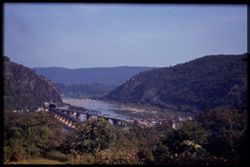
- Subject:
- Trees, Flowers, Shenandoah River (Va. and W. Va.), Potomac River, Mountains, Tunnels, Bridges, Rivers, and Railroad bridges
- Series:
- 16-40
- Creator:
- Cushman, Charles W., 1896-1972
- Date Created:
- 1940-09-16/1940-09-23
- Genre:
- Landscape photographs
- Frame Number:
- 15
- County:
- Jefferson
- Abstract:
- From heights above Harpers Ferry, the junction of 3 states, where Shen. meets Potomac.
- Call Number:
- P02064
- City:
- Harpers Ferry
- Country:
- United States
- State/Province:
- West Virginia
- Physical Description:
- Image was originally mounted in a glass enclosure. Before digitization, the image was removed and placed in a Wess Plastic, Inc. brand, 2" x 2", pl...
- Alternate Identifier:
- 1640.15
- Persistent URL:
- http://purl.dlib.indiana.edu/iudl/archives/cushman/P02064
- Holding Location:
- Bloomington - University Archives
Wells Library E460
1320 E 10th St.
Bloomington, IN 47405
Contact at archives@indiana.edu, 812-855-1127
-
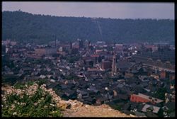
- Subject:
- Roads, Automobiles, Trees, Flowers, Roofs, Mountains, Buildings, Dwellings, Utility poles, and Churches
- Series:
- 14-40
- Creator:
- Cushman, Charles W., 1896-1972
- Date Created:
- 1940-07-26
- Genre:
- Cityscape photographs
- Frame Number:
- 14
- County:
- Cambria
- Abstract:
- Across the roofs of Johnstown, Penna
- Call Number:
- P02032
- City:
- Johnstown
- Country:
- United States
- State/Province:
- Pennsylvania
- Physical Description:
- Image was originally mounted in a glass enclosure. Before digitization, the image was removed and placed in a Wess Plastic, Inc. brand, 2" x 2", pl...
- Alternate Identifier:
- 1440.14
- Persistent URL:
- http://purl.dlib.indiana.edu/iudl/archives/cushman/P02032
- Holding Location:
- Bloomington - University Archives
Wells Library E460
1320 E 10th St.
Bloomington, IN 47405
Contact at archives@indiana.edu, 812-855-1127
-
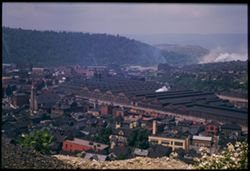
- Subject:
- Roads, Automobiles, Trees, Flowers, Roofs, Mountains, Buildings, Bridges, Facilities, Dwellings, Smoke, and Churches
- Series:
- 14-40
- Creator:
- Cushman, Charles W., 1896-1972
- Date Created:
- 1940-07-26
- Genre:
- Cityscape photographs
- Frame Number:
- 13
- County:
- Cambria
- Abstract:
- Across the roofs of Johnstown, Penna
- Call Number:
- P02031
- City:
- Johnstown
- Country:
- United States
- State/Province:
- Pennsylvania
- Physical Description:
- Image was originally mounted in a glass enclosure. Before digitization, the image was removed and placed in a Wess Plastic, Inc. brand, 2" x 2", pl...
- Alternate Identifier:
- 1440.13
- Persistent URL:
- http://purl.dlib.indiana.edu/iudl/archives/cushman/P02031
- Holding Location:
- Bloomington - University Archives
Wells Library E460
1320 E 10th St.
Bloomington, IN 47405
Contact at archives@indiana.edu, 812-855-1127
-
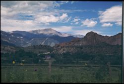
- Subject:
- Trees, Flowers, Shadows, Mountains, Fences, Shrubs, Clouds, Dwellings, and Pikes Peak (Colo.)
- Series:
- 14-40
- Creator:
- Cushman, Charles W., 1896-1972
- Date Created:
- 1940-07-19
- Genre:
- Landscape photographs
- Frame Number:
- 9
- County:
- El Paso
- Abstract:
- Looking across green fields and rugged mountains to towering majesty of Pike's Peak.
- Call Number:
- P02027
- Country:
- United States
- State/Province:
- Colorado
- Physical Description:
- Image was originally mounted in a glass enclosure. Before digitization, the image was removed and placed in a Wess Plastic, Inc. brand, 2" x 2", pl...
- Alternate Identifier:
- 1440.9
- Persistent URL:
- http://purl.dlib.indiana.edu/iudl/archives/cushman/P02027
- Holding Location:
- Bloomington - University Archives
Wells Library E460
1320 E 10th St.
Bloomington, IN 47405
Contact at archives@indiana.edu, 812-855-1127
-
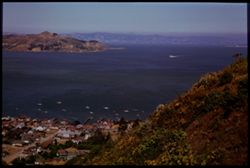
- Subject:
- East Bay Hills (Calif.), Vessels, Islands, Mountains, Angel Island (Calif.), Trees, Dwellings, Bays (Bodies of water), San Francisco Bay (Calif.), Streets, A...
- Series:
- 8-40
- Creator:
- Cushman, Charles W., 1896-1972
- Date Created:
- 1940-07-01
- Genre:
- Views
- Frame Number:
- 17
- County:
- Marin and San Francisco
- Abstract:
- Sausolito, Angel Island, and East Bay Hills.
- Call Number:
- P01900
- City:
- San Francisco and Sausalito
- Country:
- United States
- State/Province:
- California
- Physical Description:
- Image was originally mounted in a glass enclosure. Before digitization, the image was removed and placed in a Wess Plastic, Inc. brand, 2" x 2", pl...
- Alternate Identifier:
- 840.17
- Persistent URL:
- http://purl.dlib.indiana.edu/iudl/archives/cushman/P01900
- Holding Location:
- Bloomington - University Archives
Wells Library E460
1320 E 10th St.
Bloomington, IN 47405
Contact at archives@indiana.edu, 812-855-1127
-
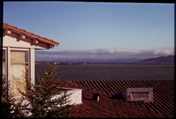
- Subject:
- Bays (Bodies of water), Boats, Flowers, Roofs, Mountains, Buildings, Shrubs, Clouds, Dwellings, and Cities & towns
- Series:
- 8-40
- Creator:
- Cushman, Charles W., 1896-1972
- Date Created:
- 1940-06-01
- Genre:
- Seascapes
- Frame Number:
- 14
- County:
- Contra Costa
- Abstract:
- The bay from Point Richmond.
- Call Number:
- P01897
- City:
- Point Richmond
- Country:
- United States
- State/Province:
- California
- Physical Description:
- Image was originally mounted in a glass enclosure. Before digitization, the image was removed and placed in a Wess Plastic, Inc. brand, 2" x 2", pl...
- Alternate Identifier:
- 840.14
- Persistent URL:
- http://purl.dlib.indiana.edu/iudl/archives/cushman/P01897
- Holding Location:
- Bloomington - University Archives
Wells Library E460
1320 E 10th St.
Bloomington, IN 47405
Contact at archives@indiana.edu, 812-855-1127
-
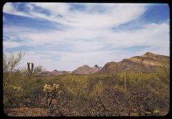
- Subject:
- Cactus, Flowers, Mountains, Shrubs, Clouds, and Roskruge Mountains (Ariz.)
- Series:
- 5-40
- Creator:
- Cushman, Charles W., 1896-1972
- Date Created:
- 1940-05-01
- Genre:
- Landscape photographs
- Frame Number:
- 18
- Street Address:
- Ajo Way
- County:
- Pima
- Abstract:
- Roskruge Mtns. From Ajo road
- Call Number:
- P01836
- Country:
- United States
- State/Province:
- Arizona
- Alternate Identifier:
- 540.18
- Persistent URL:
- http://purl.dlib.indiana.edu/iudl/archives/cushman/P01836
- Holding Location:
- Bloomington - University Archives
Wells Library E460
1320 E 10th St.
Bloomington, IN 47405
Contact at archives@indiana.edu, 812-855-1127
-
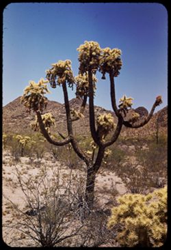
- Subject:
- Cactus, Flowers, Mountains, Shrubs, Tucson Mountains (Ariz.), and Cholla
- Series:
- 5-40
- Creator:
- Cushman, Charles W., 1896-1972
- Date Created:
- 1940-05-01
- Genre:
- Identification photographs
- Frame Number:
- 3
- County:
- Pima
- Abstract:
- Cursed cholla-in Tucson Mtn. Foothills
- Call Number:
- P01811
- Country:
- United States
- State/Province:
- Arizona
- Alternate Identifier:
- 540.3
- Persistent URL:
- http://purl.dlib.indiana.edu/iudl/archives/cushman/P01811
- Holding Location:
- Bloomington - University Archives
Wells Library E460
1320 E 10th St.
Bloomington, IN 47405
Contact at archives@indiana.edu, 812-855-1127
-
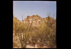
- Subject:
- Flowers, Mountains, Shrubs, and Tucson Mountains (Ariz.)
- Series:
- 5-40
- Creator:
- Cushman, Charles W., 1896-1972
- Date Created:
- 1940-05-01
- Genre:
- Landscape photographs
- Frame Number:
- 0
- County:
- Pima
- Abstract:
- Jagged rocks of Tucson Mtn. Foothills
- Call Number:
- P01808
- Country:
- United States
- State/Province:
- Arizona
- Physical Description:
- masked, creased. Image was originally mounted in a glass enclosure. Before digitization, the image was removed and placed in a Wess Plastic, Inc. brand, 2&qu...
- Alternate Identifier:
- 540.0
- Persistent URL:
- http://purl.dlib.indiana.edu/iudl/archives/cushman/P01808
- Holding Location:
- Bloomington - University Archives
Wells Library E460
1320 E 10th St.
Bloomington, IN 47405
Contact at archives@indiana.edu, 812-855-1127
-
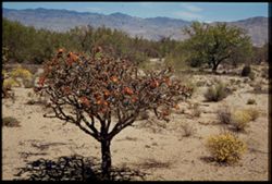
- Subject:
- Rincon Mountains (Ariz.), Trees, Flowers, Mountains, Shrubs, and Cholla
- Series:
- 4-40
- Creator:
- Cushman, Charles W., 1896-1972
- Date Created:
- 1940-04-01
- Genre:
- Landscape photographs
- Frame Number:
- 19
- County:
- Pima
- Abstract:
- Cholla, orange-colored, in Rincon Mtn. Foorhills.
- Call Number:
- P01806
- Country:
- United States
- State/Province:
- Arizona
- Physical Description:
- Image was originally mounted in a glass enclosure. Before digitization, the image was removed and placed in a Wess Plastic, Inc. brand, 2" x 2", pl...
- Alternate Identifier:
- 440.19
- Persistent URL:
- http://purl.dlib.indiana.edu/iudl/archives/cushman/P01806
- Holding Location:
- Bloomington - University Archives
Wells Library E460
1320 E 10th St.
Bloomington, IN 47405
Contact at archives@indiana.edu, 812-855-1127
-
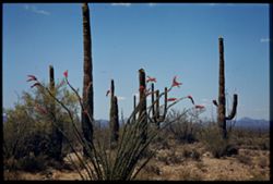
- Subject:
- Deserts, Flowers, Saguaro, Ocotillo, Mountains, Shrubs, Cactus, and Clouds
- Series:
- 4-40
- Creator:
- Cushman, Charles W., 1896-1972
- Date Created:
- 1940-04-01
- Genre:
- Identification photographs
- Frame Number:
- 18
- County:
- Pima
- Abstract:
- Desert blooms: Flaming Ocotillo: Giant Sahuaras
- Call Number:
- P01805
- Country:
- United States
- State/Province:
- Arizona
- Physical Description:
- Image was originally mounted in a glass enclosure. Before digitization, the image was removed and placed in a Wess Plastic, Inc. brand, 2" x 2", pl...
- Alternate Identifier:
- 440.18
- Persistent URL:
- http://purl.dlib.indiana.edu/iudl/archives/cushman/P01805
- Holding Location:
- Bloomington - University Archives
Wells Library E460
1320 E 10th St.
Bloomington, IN 47405
Contact at archives@indiana.edu, 812-855-1127
-
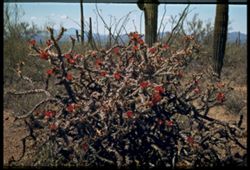
- Subject:
- Cactus, Flowers, Mountains, Shrubs, Clouds, Tucson Mountain Park (Ariz.), Cholla, and Ferocactus
- Series:
- 4-40
- Creator:
- Cushman, Charles W., 1896-1972
- Date Created:
- 1940-04-01
- Genre:
- Identification photographs
- Frame Number:
- 16
- County:
- Pima
- Abstract:
- Cholla in red bloom. Tucson Mtn-Park. Large blooming cholla, barrel cactuss, cursed
- Call Number:
- P01803
- Country:
- United States
- State/Province:
- Arizona
- Physical Description:
- Image was originally mounted in a glass enclosure. Before digitization, the image was removed and placed in a Wess Plastic, Inc. brand, 2" x 2", pl...
- Alternate Identifier:
- 440.16
- Persistent URL:
- http://purl.dlib.indiana.edu/iudl/archives/cushman/P01803
- Holding Location:
- Bloomington - University Archives
Wells Library E460
1320 E 10th St.
Bloomington, IN 47405
Contact at archives@indiana.edu, 812-855-1127
-
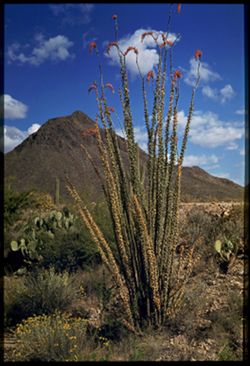
- Subject:
- Cactus, Flowers, Golden Gate Mountain (Ariz.), Mountains, Ocotillo, Shrubs, Clouds, and Plants
- Series:
- 4-40
- Creator:
- Cushman, Charles W., 1896-1972
- Date Created:
- 1940-04-01
- Genre:
- Identification photographs
- Frame Number:
- 10
- County:
- Pima
- Abstract:
- A green leaved Ocotillo in flame before Golden Gate Mtn.
- Call Number:
- P01797
- Country:
- United States
- State/Province:
- Arizona
- Physical Description:
- Image was originally mounted in a glass enclosure. Before digitization, the image was removed and placed in a Wess Plastic, Inc. brand, 2" x 2", pl...
- Alternate Identifier:
- 440.10
- Persistent URL:
- http://purl.dlib.indiana.edu/iudl/archives/cushman/P01797
- Holding Location:
- Bloomington - University Archives
Wells Library E460
1320 E 10th St.
Bloomington, IN 47405
Contact at archives@indiana.edu, 812-855-1127
-
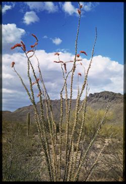
- Subject:
- Cactus, Flowers, Mountains, Ocotillo, Shrubs, Tucson Mountains (Ariz.), and Clouds
- Series:
- 4-40
- Creator:
- Cushman, Charles W., 1896-1972
- Date Created:
- 1940-04-01
- Genre:
- Identification photographs
- Frame Number:
- 9
- County:
- Pima
- Abstract:
- Tall Ocotillo in Tucson Mtns.
- Call Number:
- P01796
- Country:
- United States
- State/Province:
- Arizona
- Physical Description:
- Image was originally mounted in a glass enclosure. Before digitization, the image was removed and placed in a Wess Plastic, Inc. brand, 2" x 2", pl...
- Alternate Identifier:
- 440.9
- Persistent URL:
- http://purl.dlib.indiana.edu/iudl/archives/cushman/P01796
- Holding Location:
- Bloomington - University Archives
Wells Library E460
1320 E 10th St.
Bloomington, IN 47405
Contact at archives@indiana.edu, 812-855-1127
-
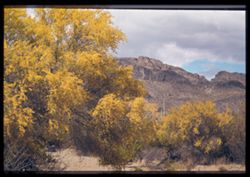
- Subject:
- Palo verde trees, Cactus, Trails & paths, Trees, Flowers, Mountains, Shrubs, Clouds, and Tucson Mountain Park (Ariz.)
- Series:
- 4-40
- Creator:
- Cushman, Charles W., 1896-1972
- Date Created:
- 1940-04-01
- Genre:
- Identification photographs
- Frame Number:
- 7
- County:
- Pima
- Abstract:
- Palos verdes,.large and small
- Call Number:
- P01795
- Country:
- United States
- State/Province:
- Arizona
- Physical Description:
- Image was originally mounted in a glass enclosure. Before digitization, the image was removed and placed in a Wess Plastic, Inc. brand, 2" x 2", pl...
- Alternate Identifier:
- 440.7
- Persistent URL:
- http://purl.dlib.indiana.edu/iudl/archives/cushman/P01795
- Holding Location:
- Bloomington - University Archives
Wells Library E460
1320 E 10th St.
Bloomington, IN 47405
Contact at archives@indiana.edu, 812-855-1127
-
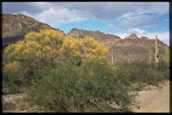
- Subject:
- Palo verde trees, Parks, Cactus, Trails & paths, Flowers, Mountains, Shrubs, Clouds, and Tucson Mountain Park (Ariz.)
- Series:
- 4-40
- Creator:
- Cushman, Charles W., 1896-1972
- Date Created:
- 1940-04-01
- Genre:
- Identification photographs
- Frame Number:
- 5
- County:
- Pima
- Abstract:
- Palo Verde in flower. Tucson Mtn. Park
- Call Number:
- P01793
- Country:
- United States
- State/Province:
- Arizona
- Physical Description:
- Image was originally mounted in a glass enclosure. Before digitization, the image was removed and placed in a Wess Plastic, Inc. brand, 2" x 2", pl...
- Alternate Identifier:
- 440.5
- Persistent URL:
- http://purl.dlib.indiana.edu/iudl/archives/cushman/P01793
- Holding Location:
- Bloomington - University Archives
Wells Library E460
1320 E 10th St.
Bloomington, IN 47405
Contact at archives@indiana.edu, 812-855-1127
-
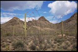
- Subject:
- Cactus, Trails & paths, Flowers, Mountains, Ocotillo, Shrubs, Tucson Mountains (Ariz.), Clouds, Passes (Landforms), and Plants
- Series:
- 4-40
- Creator:
- Cushman, Charles W., 1896-1972
- Date Created:
- 1940-04-01
- Genre:
- Identification photographs
- Frame Number:
- 4
- Street Address:
- Gates Pass
- County:
- Pima
- Abstract:
- Ocotillo in bloom. Gates Pass In back ground
- Call Number:
- P01792
- Country:
- United States
- State/Province:
- Arizona
- Physical Description:
- Image was originally mounted in a glass enclosure. Before digitization, the image was removed and placed in a Wess Plastic, Inc. brand, 2" x 2", pl...
- Alternate Identifier:
- 440.4
- Persistent URL:
- http://purl.dlib.indiana.edu/iudl/archives/cushman/P01792
- Holding Location:
- Bloomington - University Archives
Wells Library E460
1320 E 10th St.
Bloomington, IN 47405
Contact at archives@indiana.edu, 812-855-1127
-
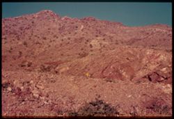
- Subject:
- Rocks, Boulder Dam (Ariz. and Nev.), Flowers, Mountains, Shrubs, and Hoover Dam (Ariz. and Nev.)
- Series:
- 10-39
- Creator:
- Cushman, Charles W., 1896-1972
- Date Created:
- 1939-12-01
- Genre:
- Landscape photographs
- Frame Number:
- 7
- Street Address:
- United States Highway 93
- County:
- Mohave
- Abstract:
- T-7: Characteristic Mountainside from Hwy 93
- Call Number:
- P01723
- Country:
- United States
- State/Province:
- Arizona
- Physical Description:
- some dye fading. Image was originally mounted in a glass enclosure. Before digitization, the image was removed and placed in a Wess Plastic, Inc. brand, 2&qu...
- Alternate Identifier:
- 1039.7
- Persistent URL:
- http://purl.dlib.indiana.edu/iudl/archives/cushman/P01723
- Holding Location:
- Bloomington - University Archives
Wells Library E460
1320 E 10th St.
Bloomington, IN 47405
Contact at archives@indiana.edu, 812-855-1127
-
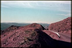
- Subject:
- Roads, Automobiles, Boulder Dam (Ariz. and Nev.), Flowers, Black Mountains (Mohave County, Ariz.), Mountains, Shrubs, Hoover Dam (Ariz. and Nev.), and Shadows
- Series:
- 10-39
- Creator:
- Cushman, Charles W., 1896-1972
- Date Created:
- 1939-12-01
- Genre:
- Landscape photographs
- Frame Number:
- 6
- Street Address:
- United States Highway 93
- County:
- Mohave
- Abstract:
- T-6: Hwy 93 leads through out toward Black Mtns.
- Call Number:
- P01722
- City:
- Kingman
- Country:
- United States
- State/Province:
- Arizona
- Physical Description:
- some dye fading. Image was originally mounted in a glass enclosure. Before digitization, the image was removed and placed in a Wess Plastic, Inc. brand, 2&qu...
- Alternate Identifier:
- 1039.6
- Persistent URL:
- http://purl.dlib.indiana.edu/iudl/archives/cushman/P01722
- Holding Location:
- Bloomington - University Archives
Wells Library E460
1320 E 10th St.
Bloomington, IN 47405
Contact at archives@indiana.edu, 812-855-1127
-
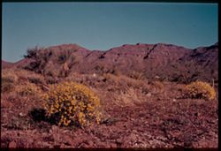
- Subject:
- Deserts, Flowers, Mountains, Shrubs, Trees, Rocks, and Cerbat Mountains (Ariz.)
- Series:
- 10-39
- Creator:
- Cushman, Charles W., 1896-1972
- Date Created:
- 1939-12-01
- Genre:
- Landscape photographs
- Frame Number:
- 5
- County:
- Mohave
- Abstract:
- T-5: Cerbot Mtns behind desert flowers.
- Call Number:
- P01721
- Country:
- United States
- State/Province:
- Arizona
- Physical Description:
- some dye fading. Image was originally mounted in a glass enclosure. Before digitization, the image was removed and placed in a Wess Plastic, Inc. brand, 2&qu...
- Alternate Identifier:
- 1039.5
- Persistent URL:
- http://purl.dlib.indiana.edu/iudl/archives/cushman/P01721
- Holding Location:
- Bloomington - University Archives
Wells Library E460
1320 E 10th St.
Bloomington, IN 47405
Contact at archives@indiana.edu, 812-855-1127