
Search Constraints
You searched for:
Campus
IUB
Remove constraint Campus: IUB
Subject
Hills
Remove constraint Subject: Hills
Subject
Rock formations
Remove constraint Subject: Rock formations
« Previous |
1 - 100 of 200
|
Next »
Search Results
-
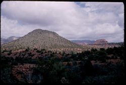
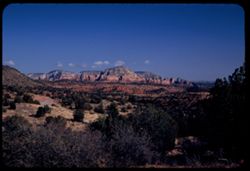
- Description:
- 25 f 11
- Subject:
- Canyons, Cliffs, Trees, Mountains, Shrubs, Clouds, Hills, Oak Creek Canyon (Ariz.), and Rock formations
- Series:
- 16-52
- Creator:
- Cushman, Charles W., 1896-1972
- Date Created:
- 1952-04-12
- Genre:
- Landscape photographs
- Frame Number:
- 29
- County:
- Coconino
- Abstract:
- Green pyramid
- Call Number:
- P06087
- Country:
- United States
- State/Province:
- Arizona
- Alternate Identifier:
- 1652.29
- Persistent URL:
- http://purl.dlib.indiana.edu/iudl/archives/cushman/P06087
- Holding Location:
- Bloomington - University Archives
Wells Library E460
1320 E 10th St.
Bloomington, IN 47405
Contact at archives@indiana.edu, 812-855-1127
-
- Description:
- 25 f 10
- Subject:
- Canyons, Trees, Tree limbs, Mountains, Buildings, Rock formations, Hills, and Oak Creek Canyon (Ariz.)
- Series:
- 16-52
- Creator:
- Cushman, Charles W., 1896-1972
- Date Created:
- 1952-04-12
- Genre:
- Landscape photographs
- Frame Number:
- 27
- County:
- Coconino
- Abstract:
- Red monuments Spots
- Call Number:
- P06085
- Country:
- United States
- State/Province:
- Arizona
- Alternate Identifier:
- 1652.27
- Persistent URL:
- http://purl.dlib.indiana.edu/iudl/archives/cushman/P06085
- Holding Location:
- Bloomington - University Archives
Wells Library E460
1320 E 10th St.
Bloomington, IN 47405
Contact at archives@indiana.edu, 812-855-1127
-
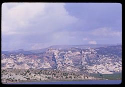
- Description:
- 100 f 16 SL
- Subject:
- Boundaries, Grasses, Cliffs, Mesas, Navajo Indian Reservation, Rock formations, Hills, and Trees
- Series:
- 36-65
- Creator:
- Cushman, Charles W., 1896-1972
- Date Created:
- 1965-10-08
- Genre:
- Landscape photographs
- Frame Number:
- 34
- County:
- McKinley
- Abstract:
- [Fade]
- Call Number:
- P15102
- Country:
- United States
- State/Province:
- Arizona and New Mexico
- Alternate Identifier:
- 3665.34
- Persistent URL:
- http://purl.dlib.indiana.edu/iudl/archives/cushman/P15102
- Holding Location:
- Bloomington - University Archives
Wells Library E460
1320 E 10th St.
Bloomington, IN 47405
Contact at archives@indiana.edu, 812-855-1127
-
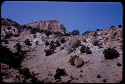
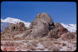
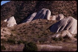
- Description:
- 100 f 8 tl
- Subject:
- Rocks, Boulders, Shrubs, Hills, Alabama Hills (Calif.), and Rock formations
- Series:
- 4-55
- Creator:
- Cushman, Charles W., 1896-1972
- Date Created:
- 1955-02-28
- Genre:
- Landscape photographs
- Frame Number:
- 9
- County:
- Inyo
- Abstract:
- Another odd formation in Alabama Hills
- Call Number:
- P07637
- City:
- Lone Pine
- Country:
- United States
- State/Province:
- California
- Alternate Identifier:
- 455.9
- Persistent URL:
- http://purl.dlib.indiana.edu/iudl/archives/cushman/P07637
- Holding Location:
- Bloomington - University Archives
Wells Library E460
1320 E 10th St.
Bloomington, IN 47405
Contact at archives@indiana.edu, 812-855-1127
-
- Description:
- 250 f 5.6
- Subject:
- Air France, Mountains, Rock formations, Clouds, Hills, Shadows, and Air travel
- Series:
- 3-60
- Creator:
- Cushman, Charles W., 1896-1972
- Date Created:
- 1960-05-07
- Genre:
- Aerial photographs and Landscape photographs
- Frame Number:
- 13
- Abstract:
- [Vemailleisu] & brown
- Call Number:
- P10973
- Country:
- United States
- Alternate Identifier:
- 360.13
- Persistent URL:
- http://purl.dlib.indiana.edu/iudl/archives/cushman/P10973
- Holding Location:
- Bloomington - University Archives
Wells Library E460
1320 E 10th St.
Bloomington, IN 47405
Contact at archives@indiana.edu, 812-855-1127
-
- Description:
- 100 f 11 TL
- Subject:
- Deserts, Blue Mesa (Ariz.), Petrified forests, Petrified Forest National Park (Ariz.), National parks & reserves, Logs, Hills, Erosion, Shadows, and Rock...
- Series:
- 6-63
- Creator:
- Cushman, Charles W., 1896-1972
- Date Created:
- 1963-06-27
- Genre:
- Landscape photographs and Identification photographs
- Frame Number:
- 8
- County:
- Apache and Navajo
- Abstract:
- Distantly Down from Blue Mesa
- Call Number:
- P12961
- City:
- Holbrook
- Country:
- United States
- State/Province:
- Arizona
- Alternate Identifier:
- 663.8
- Persistent URL:
- http://purl.dlib.indiana.edu/iudl/archives/cushman/P12961
- Holding Location:
- Bloomington - University Archives
Wells Library E460
1320 E 10th St.
Bloomington, IN 47405
Contact at archives@indiana.edu, 812-855-1127
-
- Subject:
- Rocks, Trees, Mountains, Rock formations, Pacific Coast Highway, Hills, and Clouds
- Series:
- 3-68
- Creator:
- Cushman, Charles W., 1896-1972
- Date Created:
- 1968-10-01
- Genre:
- Landscape photographs
- Frame Number:
- 21
- Street Address:
- California State Highway 1
- County:
- San Luis Obispo
- Call Number:
- P15673
- City:
- San Luis Obispo
- Country:
- United States
- State/Province:
- California
- Alternate Identifier:
- 368.21
- Persistent URL:
- http://purl.dlib.indiana.edu/iudl/archives/cushman/P15673
- Holding Location:
- Bloomington - University Archives
Wells Library E460
1320 E 10th St.
Bloomington, IN 47405
Contact at archives@indiana.edu, 812-855-1127
-
- Description:
- tl 1/100
- Subject:
- Sandbars, Michigan Bar (Calif.), Trees, Rock formations, Clouds, and Hills
- Series:
- 3-56
- Creator:
- Cushman, Charles W., 1896-1972
- Date Created:
- 1956-04-01
- Genre:
- Landscape photographs
- Frame Number:
- 19
- Street Address:
- California State Highway 16
- County:
- Sacramento
- Abstract:
- near Michigan Bar
- Call Number:
- P08620
- Country:
- United States
- State/Province:
- California
- Alternate Identifier:
- 356.19
- Persistent URL:
- http://purl.dlib.indiana.edu/iudl/archives/cushman/P08620
- Holding Location:
- Bloomington - University Archives
Wells Library E460
1320 E 10th St.
Bloomington, IN 47405
Contact at archives@indiana.edu, 812-855-1127
-
- Description:
- tl 1/100
- Subject:
- Sandbars, Michigan Bar (Calif.), Trees, Rock formations, Clouds, and Hills
- Series:
- 3-56
- Creator:
- Cushman, Charles W., 1896-1972
- Date Created:
- 1956-04-01
- Genre:
- Landscape photographs
- Frame Number:
- 21
- Street Address:
- California State Highway 16
- County:
- Sacramento
- Abstract:
- near Michigan Bar
- Call Number:
- P08622
- Country:
- United States
- State/Province:
- California
- Alternate Identifier:
- 356.21
- Persistent URL:
- http://purl.dlib.indiana.edu/iudl/archives/cushman/P08622
- Holding Location:
- Bloomington - University Archives
Wells Library E460
1320 E 10th St.
Bloomington, IN 47405
Contact at archives@indiana.edu, 812-855-1127
-
- Description:
- 50 f 8
- Subject:
- Rocks, Houses, Automobiles, Trees, Storage tanks, Rock formations, Hills, Yuba River (Calif.), Rivers, Roads, and Shrubs
- Series:
- 14-54
- Creator:
- Cushman, Charles W., 1896-1972
- Date Created:
- 1954-10-10
- Genre:
- Landscape photographs
- Frame Number:
- 10
- County:
- Sierra
- Abstract:
- Yuba river at Downieville.
- Call Number:
- P07452
- City:
- Downieville
- Country:
- United States
- State/Province:
- California
- Alternate Identifier:
- 1454.10
- Persistent URL:
- http://purl.dlib.indiana.edu/iudl/archives/cushman/P07452
- Holding Location:
- Bloomington - University Archives
Wells Library E460
1320 E 10th St.
Bloomington, IN 47405
Contact at archives@indiana.edu, 812-855-1127
-
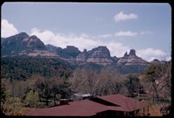
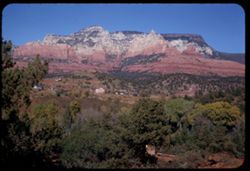
- Description:
- 25 f 11
- Subject:
- Valleys, Cliffs, Trees, Mountains, Buildings, Rock formations, Cottonwood, Hills, and Roads
- Series:
- 16-52
- Creator:
- Cushman, Charles W., 1896-1972
- Date Created:
- 1952-04-12
- Genre:
- Landscape photographs
- Frame Number:
- 34
- County:
- Coconino
- Abstract:
- Green trees in valley from above Sedona
- Call Number:
- P06092
- City:
- Flagstaff and Sedona
- Country:
- United States
- State/Province:
- Arizona
- Alternate Identifier:
- 1652.34
- Persistent URL:
- http://purl.dlib.indiana.edu/iudl/archives/cushman/P06092
- Holding Location:
- Bloomington - University Archives
Wells Library E460
1320 E 10th St.
Bloomington, IN 47405
Contact at archives@indiana.edu, 812-855-1127
-
- Subject:
- Mountains, Rock formations, Clouds, Hills, and Pacific Coast Highway
- Series:
- 3-68
- Creator:
- Cushman, Charles W., 1896-1972
- Date Created:
- 1968-10-01
- Genre:
- Landscape photographs
- Frame Number:
- 18
- Street Address:
- California State Highway 1
- County:
- San Luis Obispo
- Call Number:
- P15670
- City:
- San Luis Obispo
- Country:
- United States
- State/Province:
- California
- Alternate Identifier:
- 368.18
- Persistent URL:
- http://purl.dlib.indiana.edu/iudl/archives/cushman/P15670
- Holding Location:
- Bloomington - University Archives
Wells Library E460
1320 E 10th St.
Bloomington, IN 47405
Contact at archives@indiana.edu, 812-855-1127
-
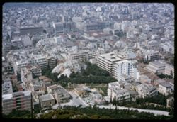
- Description:
- 100 f 16
- Subject:
- Trees, Likavittós (Greece), Streets, Buildings, Rock formations, Dwellings, and Hills
- Series:
- 13-65
- Creator:
- Cushman, Charles W., 1896-1972
- Date Created:
- 1964-04-25
- Genre:
- Cityscape photographs
- Frame Number:
- 22
- County:
- Attica
- Abstract:
- W
- Call Number:
- P14298
- City:
- Athens
- Country:
- Greece
- State/Province:
- Central Greece and Euboea
- Alternate Identifier:
- 1365.22
- Persistent URL:
- http://purl.dlib.indiana.edu/iudl/archives/cushman/P14298
- Holding Location:
- Bloomington - University Archives
Wells Library E460
1320 E 10th St.
Bloomington, IN 47405
Contact at archives@indiana.edu, 812-855-1127
-
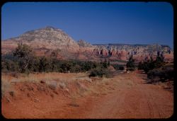
- Description:
- 25 f 16
- Subject:
- National parks & reserves, Canyons, Hills, Cliffs, Mountains, Shrubs, Bandelier National Monument (N.M.), Trees, Rock formations, and Boulders
- Series:
- 18-52
- Creator:
- Cushman, Charles W., 1896-1972
- Date Created:
- 1952-04-15
- Genre:
- Landscape photographs
- Frame Number:
- 27
- Abstract:
- Up again like 24.
- Call Number:
- P06158
- Country:
- United States
- State/Province:
- New Mexico
- Alternate Identifier:
- 1852.27
- Persistent URL:
- http://purl.dlib.indiana.edu/iudl/archives/cushman/P06158
- Holding Location:
- Bloomington - University Archives
Wells Library E460
1320 E 10th St.
Bloomington, IN 47405
Contact at archives@indiana.edu, 812-855-1127
-
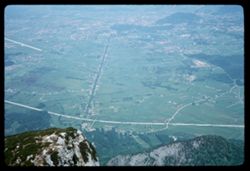
- Description:
- 100 f 6.3
- Subject:
- Hills, Forests, Roads, Cliffs, Mountains, Rock formations, and Untersberg (Austria)
- Series:
- 9-64
- Creator:
- Cushman, Charles W., 1896-1972
- Date Created:
- 1964-05-24
- Genre:
- Cityscape photographs and Views
- Frame Number:
- 13
- Abstract:
- On Untersberg View of Salzburg in distance
- Call Number:
- P13253
- City:
- Salzburg
- Country:
- Austria
- State/Province:
- Salzburg
- Alternate Identifier:
- 964.13
- Persistent URL:
- http://purl.dlib.indiana.edu/iudl/archives/cushman/P13253
- Holding Location:
- Bloomington - University Archives
Wells Library E460
1320 E 10th St.
Bloomington, IN 47405
Contact at archives@indiana.edu, 812-855-1127
-
- Description:
- 25 f 6.3 pola
- Subject:
- Red Rocks Park (Jefferson County, Colo.), Parks, Roads, Cliffs, Mountains, Shrubs, Boulders, Rocks, Buttes, Rock formations, Hills, Buildings, and Clouds
- Series:
- 24-52
- Creator:
- Cushman, Charles W., 1896-1972
- Date Created:
- 1952-10-30
- Genre:
- Landscape photographs
- Frame Number:
- 2
- County:
- Jefferson
- Abstract:
- Red Rock Park west of Denver
- Call Number:
- P06333
- City:
- Morrison
- Country:
- United States
- State/Province:
- Colorado
- Physical Description:
- Image was originally mounted in a glass enclosure. Before digitization, the image was removed and placed in a Wess Plastic, Inc. brand, 2" x 2", pl...
- Alternate Identifier:
- 2452.2
- Persistent URL:
- http://purl.dlib.indiana.edu/iudl/archives/cushman/P06333
- Holding Location:
- Bloomington - University Archives
Wells Library E460
1320 E 10th St.
Bloomington, IN 47405
Contact at archives@indiana.edu, 812-855-1127
-
- Description:
- 25 f 4.5 POLA
- Subject:
- Red Rocks Amphitheatre, Rock formations, Rocks, Red Rocks Park (Jefferson County, Colo.), Hills, Mountains, Shadows, Clouds, Amphitheaters, Parks, and Boulders
- Series:
- 24-52
- Creator:
- Cushman, Charles W., 1896-1972
- Date Created:
- 1952-10-30
- Genre:
- Landscape photographs
- Frame Number:
- 11
- County:
- Jefferson and Denver
- Abstract:
- View SE and down from Red Rocks Amphitheatre
- Call Number:
- P06342
- City:
- Morrison and Denver
- Country:
- United States
- State/Province:
- Colorado
- Alternate Identifier:
- 2452.11
- Persistent URL:
- http://purl.dlib.indiana.edu/iudl/archives/cushman/P06342
- Holding Location:
- Bloomington - University Archives
Wells Library E460
1320 E 10th St.
Bloomington, IN 47405
Contact at archives@indiana.edu, 812-855-1127
-
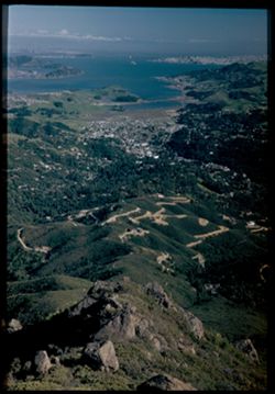
- Description:
- 100 f 11 tl
- Subject:
- Hills, Mountains, Dwellings, Trees, Buildings, Rock formations, Parks, Bays (Bodies of water), and Buena Vista Park (San Francisco, Calif.)
- Series:
- 27-65
- Creator:
- Cushman, Charles W., 1896-1972
- Date Created:
- 1965-07-27
- Genre:
- Cityscape photographs
- Frame Number:
- 19
- County:
- San Francisco
- Abstract:
- South from Buena Vista
- Call Number:
- P14818
- City:
- San Francisco
- Country:
- United States
- State/Province:
- California
- Alternate Identifier:
- 2765.19
- Persistent URL:
- http://purl.dlib.indiana.edu/iudl/archives/cushman/P14818
- Holding Location:
- Bloomington - University Archives
Wells Library E460
1320 E 10th St.
Bloomington, IN 47405
Contact at archives@indiana.edu, 812-855-1127
-
- Description:
- 25 f 6 Pola
- Subject:
- Bays (Bodies of water), Climbing, Cliffs, Mountaineering, Shadows, Mountains, Rock formations, Tamalpais, Mount (Calif.), Hills, People, and San Francisco Ba...
- Series:
- 12-52
- Creator:
- Cushman, Charles W., 1896-1972
- Date Created:
- 1952-03-30
- Genre:
- Landscape photographs and Cityscape photographs
- Frame Number:
- 25
- County:
- San Francisco
- Abstract:
- View past profile rock.
- Call Number:
- P05931
- Country:
- United States
- State/Province:
- California
- Alternate Identifier:
- 1252.25
- Persistent URL:
- http://purl.dlib.indiana.edu/iudl/archives/cushman/P05931
- Holding Location:
- Bloomington - University Archives
Wells Library E460
1320 E 10th St.
Bloomington, IN 47405
Contact at archives@indiana.edu, 812-855-1127
-
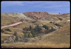
- Description:
- 100 f 8 tl
- Subject:
- Theodore Roosevelt National Park (N.D.), Trees, National parks & reserves, Hills, Badlands (N.D.), and Rock formations
- Series:
- 18-58
- Creator:
- Cushman, Charles W., 1896-1972
- Date Created:
- 1958-08-28
- Genre:
- Landscape photographs
- Frame Number:
- 24
- Abstract:
- Noth into badlands from pt. East of Roosevelt Park (12,000 mi.)
- Call Number:
- P10223
- Country:
- United States
- State/Province:
- North Dakota
- Alternate Identifier:
- 1858.24
- Persistent URL:
- http://purl.dlib.indiana.edu/iudl/archives/cushman/P10223
- Holding Location:
- Bloomington - University Archives
Wells Library E460
1320 E 10th St.
Bloomington, IN 47405
Contact at archives@indiana.edu, 812-855-1127
-
- Description:
- 25 f 11
- Subject:
- Cliffs, Parks, Shadows, Buttes, Mountains, Fences, Rock formations, Red Rocks Park (Jefferson County, Colo.), Hills, Roads, and Shrubs
- Series:
- 24-52
- Creator:
- Cushman, Charles W., 1896-1972
- Date Created:
- 1952-10-30
- Genre:
- Landscape photographs
- Frame Number:
- 7
- County:
- Jefferson
- Abstract:
- NE from Red Rock Park
- Call Number:
- P06338
- City:
- Morrison
- Country:
- United States
- State/Province:
- Colorado
- Alternate Identifier:
- 2452.7
- Persistent URL:
- http://purl.dlib.indiana.edu/iudl/archives/cushman/P06338
- Holding Location:
- Bloomington - University Archives
Wells Library E460
1320 E 10th St.
Bloomington, IN 47405
Contact at archives@indiana.edu, 812-855-1127
-
- Description:
- 50 f 8
- Subject:
- Trees, Tree limbs, Cajon Pass (Calif.), Rock formations, Passes (Landforms), Mountains, and Hills
- Series:
- 16-53
- Creator:
- Cushman, Charles W., 1896-1972
- Date Created:
- 1953-11-23
- Genre:
- Landscape photographs
- Frame Number:
- 12
- County:
- San Bernardino
- Abstract:
- View NE across Cajon Pass
- Call Number:
- P07084
- Country:
- United States
- State/Province:
- California
- Alternate Identifier:
- 1653.12
- Persistent URL:
- http://purl.dlib.indiana.edu/iudl/archives/cushman/P07084
- Holding Location:
- Bloomington - University Archives
Wells Library E460
1320 E 10th St.
Bloomington, IN 47405
Contact at archives@indiana.edu, 812-855-1127
-
- Description:
- 50 f 9
- Subject:
- Grasses, Trees, Dirt, Mountains, Rock formations, and Hills
- Series:
- 15-53
- Creator:
- Cushman, Charles W., 1896-1972
- Date Created:
- 1953-11-21
- Genre:
- Landscape photographs
- Frame Number:
- 27
- County:
- Coconino
- Abstract:
- And these, due north
- Call Number:
- P07060
- City:
- Sedona
- Country:
- United States
- State/Province:
- Arizona
- Alternate Identifier:
- 1553.27
- Persistent URL:
- http://purl.dlib.indiana.edu/iudl/archives/cushman/P07060
- Holding Location:
- Bloomington - University Archives
Wells Library E460
1320 E 10th St.
Bloomington, IN 47405
Contact at archives@indiana.edu, 812-855-1127
-
- Description:
- 100 f 8 tl
- Subject:
- Theodore Roosevelt National Park (N.D.), Grasses, Trees, National parks & reserves, Hills, and Rock formations
- Series:
- 18-58
- Creator:
- Cushman, Charles W., 1896-1972
- Date Created:
- 1958-08-28
- Genre:
- Landscape photographs
- Frame Number:
- 14
- Abstract:
- View E
- Call Number:
- P10213
- Country:
- United States
- State/Province:
- North Dakota
- Alternate Identifier:
- 1858.14
- Persistent URL:
- http://purl.dlib.indiana.edu/iudl/archives/cushman/P10213
- Holding Location:
- Bloomington - University Archives
Wells Library E460
1320 E 10th St.
Bloomington, IN 47405
Contact at archives@indiana.edu, 812-855-1127
-
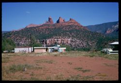
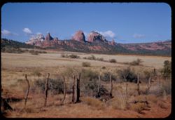
- Description:
- 100 f 11 SL
- Subject:
- Grasses, Cliffs, Outbuildings, Trees, Mountains, Fences, Rock formations, Hills, Erosion, and Houses
- Series:
- 5-62
- Creator:
- Cushman, Charles W., 1896-1972
- Date Created:
- 1962-10-05
- Genre:
- Landscape photographs
- Frame Number:
- 4
- County:
- Coconino
- Abstract:
- Mtns east from Sedona
- Call Number:
- P12771
- City:
- Sedona
- Country:
- United States
- State/Province:
- Arizona
- Alternate Identifier:
- 562.4
- Persistent URL:
- http://purl.dlib.indiana.edu/iudl/archives/cushman/P12771
- Holding Location:
- Bloomington - University Archives
Wells Library E460
1320 E 10th St.
Bloomington, IN 47405
Contact at archives@indiana.edu, 812-855-1127
-
- Description:
- 25 f 6.3 Pola
- Subject:
- National parks & reserves, Hills, Colorado National Monument (Colo.), Cliffs, Mountains, Boulders, Rocks, Buttes, Rock formations, Junipers, and Trees
- Series:
- 25-52
- Creator:
- Cushman, Charles W., 1896-1972
- Date Created:
- 1952-11-03
- Genre:
- Landscape photographs
- Frame Number:
- 38
- County:
- Mesa
- Abstract:
- Across juniper tops.
- Call Number:
- P06407
- City:
- Grand Junction
- Country:
- United States
- State/Province:
- Colorado
- Alternate Identifier:
- 2552.38
- Persistent URL:
- http://purl.dlib.indiana.edu/iudl/archives/cushman/P06407
- Holding Location:
- Bloomington - University Archives
Wells Library E460
1320 E 10th St.
Bloomington, IN 47405
Contact at archives@indiana.edu, 812-855-1127
-
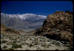
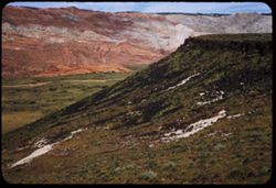
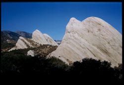
- Description:
- 25 f 8 Pola
- Subject:
- Snow, Valleys, Inyo Mountains (Calif.), Boulders, Owens Valley (Calif.), Mountains, Shrubs, Hills, Rocks, Alabama Hills (Calif.), and Rock formations
- Series:
- 14-52
- Creator:
- Cushman, Charles W., 1896-1972
- Date Created:
- 1952-04-08
- Genre:
- Landscape photographs
- Frame Number:
- 36
- Street Address:
- Mount Whitney Road
- County:
- Inyo
- Abstract:
- View across valley weird rock at it.
- Call Number:
- P06019
- Country:
- United States
- State/Province:
- California
- Alternate Identifier:
- 1452.36
- Persistent URL:
- http://purl.dlib.indiana.edu/iudl/archives/cushman/P06019
- Holding Location:
- Bloomington - University Archives
Wells Library E460
1320 E 10th St.
Bloomington, IN 47405
Contact at archives@indiana.edu, 812-855-1127
-
- Description:
- 100 f 8 tl
- Subject:
- National parks & reserves, Canyons, Hills, Trees, Rock formations, Theodore Roosevelt National Park (N.D.), Land, and Grasses
- Series:
- 18-58
- Creator:
- Cushman, Charles W., 1896-1972
- Date Created:
- 1958-08-28
- Genre:
- Landscape photographs
- Frame Number:
- 18
- Abstract:
- View across canyon
- Call Number:
- P10217
- Country:
- United States
- State/Province:
- North Dakota
- Alternate Identifier:
- 1858.18
- Persistent URL:
- http://purl.dlib.indiana.edu/iudl/archives/cushman/P10217
- Holding Location:
- Bloomington - University Archives
Wells Library E460
1320 E 10th St.
Bloomington, IN 47405
Contact at archives@indiana.edu, 812-855-1127
-
- Description:
- 50 f 9
- Subject:
- Valleys, Houses, Trees, Oak Creek (Ariz.), Rock formations, Hills, Mesas, and Mountains
- Series:
- 15-53
- Creator:
- Cushman, Charles W., 1896-1972
- Date Created:
- 1953-11-21
- Genre:
- Landscape photographs and Cityscape photographs
- Frame Number:
- 33
- County:
- Coconino
- Abstract:
- The great rock wall north of Sedona from across Oak Ck. Valley
- Call Number:
- P07066
- City:
- Sedona
- Country:
- United States
- State/Province:
- Arizona
- Alternate Identifier:
- 1553.33
- Persistent URL:
- http://purl.dlib.indiana.edu/iudl/archives/cushman/P07066
- Holding Location:
- Bloomington - University Archives
Wells Library E460
1320 E 10th St.
Bloomington, IN 47405
Contact at archives@indiana.edu, 812-855-1127
-

- Description:
- 25 f 6 POLA
- Subject:
- Rocks, Roads, Parks, Boulders, Shadows, Buttes, Mountains, Buildings, Rock formations, Clouds, Red Rocks Park (Jefferson County, Colo.), Hills, and Cliffs
- Series:
- 24-52
- Creator:
- Cushman, Charles W., 1896-1972
- Date Created:
- 1952-10-30
- Genre:
- Landscape photographs
- Frame Number:
- 5
- County:
- Jefferson
- Abstract:
- Red Rock Park west of Denver
- Call Number:
- P06336
- City:
- Morrison
- Country:
- United States
- State/Province:
- Colorado
- Alternate Identifier:
- 2452.5
- Persistent URL:
- http://purl.dlib.indiana.edu/iudl/archives/cushman/P06336
- Holding Location:
- Bloomington - University Archives
Wells Library E460
1320 E 10th St.
Bloomington, IN 47405
Contact at archives@indiana.edu, 812-855-1127
-
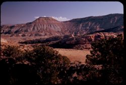
- Description:
- 100 f 6.3 or 8 tl
- Subject:
- Canyons, Cajon Canyon (Calif.), Cliffs, Mountains, Rock formations, Hills, and Cajon Pass (Calif.)
- Series:
- 7-57
- Creator:
- Cushman, Charles W., 1896-1972
- Date Created:
- 1957-05-14
- Genre:
- Landscape photographs
- Frame Number:
- 2
- Street Address:
- United States Highway 66
- County:
- San Bernardino
- Abstract:
- View SW & W from high point on US 66 through Cajon Pass (4255') Down into Cajon Canyon
- Call Number:
- P09281
- Country:
- United States
- State/Province:
- California
- Alternate Identifier:
- 757.2
- Persistent URL:
- http://purl.dlib.indiana.edu/iudl/archives/cushman/P09281
- Holding Location:
- Bloomington - University Archives
Wells Library E460
1320 E 10th St.
Bloomington, IN 47405
Contact at archives@indiana.edu, 812-855-1127
-

- Description:
- 100 f 8 tl
- Subject:
- Hills, Trees, Rocks, Rock formations, State parks & reserves, and Makoshika State Park (Mont.)
- Series:
- 17-58
- Creator:
- Cushman, Charles W., 1896-1972
- Date Created:
- 1958-08-28
- Genre:
- Landscape photographs
- Frame Number:
- 36
- County:
- Dawson
- Abstract:
- Long view west from top of Makoshika
- Call Number:
- P10198
- City:
- Glendive
- Country:
- United States
- State/Province:
- Montana
- Alternate Identifier:
- 1758.36
- Persistent URL:
- http://purl.dlib.indiana.edu/iudl/archives/cushman/P10198
- Holding Location:
- Bloomington - University Archives
Wells Library E460
1320 E 10th St.
Bloomington, IN 47405
Contact at archives@indiana.edu, 812-855-1127
-
- Description:
- 100 f 5.6 tl
- Subject:
- Canyons, Cajon Canyon (Calif.), Mountains, Rock formations, Hills, Valleys, and Cajon Pass (Calif.)
- Series:
- 7-57
- Creator:
- Cushman, Charles W., 1896-1972
- Date Created:
- 1957-05-14
- Genre:
- Landscape photographs
- Frame Number:
- 9
- County:
- San Bernardino
- Abstract:
- View down from 4000 ft. on sw grade of Cajon Pass
- Call Number:
- P09288
- Country:
- United States
- State/Province:
- California
- Alternate Identifier:
- 757.9
- Persistent URL:
- http://purl.dlib.indiana.edu/iudl/archives/cushman/P09288
- Holding Location:
- Bloomington - University Archives
Wells Library E460
1320 E 10th St.
Bloomington, IN 47405
Contact at archives@indiana.edu, 812-855-1127
-
- Description:
- 25 f 6 Pola
- Subject:
- Rocks, Bays (Bodies of water), Roads, Boulders, Shrubs, Tamalpais, Mount (Calif.), Hills, San Francisco Bay (Calif.), and Rock formations
- Series:
- 12-52
- Creator:
- Cushman, Charles W., 1896-1972
- Date Created:
- 1952-03-30
- Genre:
- Landscape photographs and Cityscape photographs
- Frame Number:
- 21
- County:
- San Francisco
- Abstract:
- Down the mtn. side from outlook pt.
- Call Number:
- P05928
- City:
- San Francisco
- Country:
- United States
- State/Province:
- California
- Physical Description:
- Image was originally mounted in a glass enclosure. Before digitization, the image was removed and placed in a Wess Plastic, Inc. brand, 2" x 2", pl...
- Alternate Identifier:
- 1252.21
- Persistent URL:
- http://purl.dlib.indiana.edu/iudl/archives/cushman/P05928
- Holding Location:
- Bloomington - University Archives
Wells Library E460
1320 E 10th St.
Bloomington, IN 47405
Contact at archives@indiana.edu, 812-855-1127
-
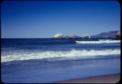
- Description:
- 100 f 6
- Subject:
- Oceans, Seas, Bodies of water, Beaches, Rock formations, Hills, and Ocean Beach (San Francisco, Calif.)
- Series:
- 16-54
- Creator:
- Cushman, Charles W., 1896-1972
- Date Created:
- 1954-10-24
- Genre:
- Seascapes
- Frame Number:
- 12
- County:
- San Francisco
- Abstract:
- Surf without birds at Ocean Beach.
- Call Number:
- P07511
- City:
- San Francisco
- Country:
- United States
- State/Province:
- California
- Physical Description:
- Anscochrome film.
- Alternate Identifier:
- 1654.12
- Persistent URL:
- http://purl.dlib.indiana.edu/iudl/archives/cushman/P07511
- Holding Location:
- Bloomington - University Archives
Wells Library E460
1320 E 10th St.
Bloomington, IN 47405
Contact at archives@indiana.edu, 812-855-1127
-
- Description:
- 100 f 6.3 tl
- Subject:
- Snow, Canyons, Mountains, Rock formations, Hills, Plants, Valleys, and Snow Canyon (Washington County, Utah)
- Series:
- 8-58
- Creator:
- Cushman, Charles W., 1896-1972
- Date Created:
- 1958-04-29
- Genre:
- Landscape photographs
- Frame Number:
- 9
- Street Address:
- Utah State Highway 18
- County:
- Washington
- Abstract:
- View across Snow's Canyon
- Call Number:
- P09897
- City:
- Saint George
- Country:
- United States
- State/Province:
- Utah
- Alternate Identifier:
- 858.9
- Persistent URL:
- http://purl.dlib.indiana.edu/iudl/archives/cushman/P09897
- Holding Location:
- Bloomington - University Archives
Wells Library E460
1320 E 10th St.
Bloomington, IN 47405
Contact at archives@indiana.edu, 812-855-1127
-
- Description:
- 100 f 8 tl
- Subject:
- Theodore Roosevelt National Park (N.D.), Grasses, Roads, Trees, National parks & reserves, Traffic signs & signals, Hills, and Rock formations
- Series:
- 18-58
- Creator:
- Cushman, Charles W., 1896-1972
- Date Created:
- 1958-08-28
- Genre:
- Landscape photographs
- Frame Number:
- 13
- Abstract:
- View NE
- Call Number:
- P10212
- Country:
- United States
- State/Province:
- North Dakota
- Alternate Identifier:
- 1858.13
- Persistent URL:
- http://purl.dlib.indiana.edu/iudl/archives/cushman/P10212
- Holding Location:
- Bloomington - University Archives
Wells Library E460
1320 E 10th St.
Bloomington, IN 47405
Contact at archives@indiana.edu, 812-855-1127
-
- Description:
- 50 f 6.3 POLA
- Subject:
- Rocks, Grasses, Dirt roads, Trees, Mountains, Rock formations, Hills, and Mesas
- Series:
- 15-53
- Creator:
- Cushman, Charles W., 1896-1972
- Date Created:
- 1953-11-21
- Genre:
- Landscape photographs
- Frame Number:
- 22
- Street Address:
- United States Highway 89A
- County:
- Coconino
- Abstract:
- North from point on US 89A about 5 mi sw of Sedona
- Call Number:
- P07055
- City:
- Sedona
- Country:
- United States
- State/Province:
- Arizona
- Alternate Identifier:
- 1553.22
- Persistent URL:
- http://purl.dlib.indiana.edu/iudl/archives/cushman/P07055
- Holding Location:
- Bloomington - University Archives
Wells Library E460
1320 E 10th St.
Bloomington, IN 47405
Contact at archives@indiana.edu, 812-855-1127
-
- Description:
- 50 f 6.3 POLA
- Subject:
- Grasses, Cliffs, Trees, Mountains, Shrubs, Hills, Mesas, and Rock formations
- Series:
- 15-53
- Creator:
- Cushman, Charles W., 1896-1972
- Date Created:
- 1953-11-21
- Genre:
- Landscape photographs
- Frame Number:
- 17
- Street Address:
- United States Highway 89A
- County:
- Coconino
- Abstract:
- View NE.
- Call Number:
- P07050
- City:
- Sedona
- Country:
- United States
- State/Province:
- Arizona
- Alternate Identifier:
- 1553.17
- Persistent URL:
- http://purl.dlib.indiana.edu/iudl/archives/cushman/P07050
- Holding Location:
- Bloomington - University Archives
Wells Library E460
1320 E 10th St.
Bloomington, IN 47405
Contact at archives@indiana.edu, 812-855-1127
-
- Description:
- 100 f 14 tl
- Subject:
- Bodies of water, Coastlines, Mountains, Rock formations, Clouds, Hills, and Uinta Mountains (Utah and Wyo.)
- Series:
- 10-66
- Creator:
- Cushman, Charles W., 1896-1972
- Date Created:
- 1966-06-18
- Genre:
- Landscape photographs
- Frame Number:
- 6
- County:
- Uintah
- Abstract:
- Mtns north of Vernal
- Call Number:
- P15446
- City:
- Vernal
- Country:
- United States
- State/Province:
- Utah
- Alternate Identifier:
- 1066.6
- Persistent URL:
- http://purl.dlib.indiana.edu/iudl/archives/cushman/P15446
- Holding Location:
- Bloomington - University Archives
Wells Library E460
1320 E 10th St.
Bloomington, IN 47405
Contact at archives@indiana.edu, 812-855-1127
-
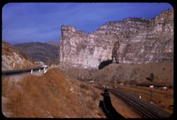
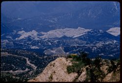
- Description:
- 25 f 9
- Subject:
- Canyons, Roads, Mountains, Denver and Rio Grande Western Railway Company, Rock formations, Railroad tracks, Railroad cars, Coal, Cliffs, Buildings, Price Riv...
- Series:
- 27-52
- Creator:
- Cushman, Charles W., 1896-1972
- Date Created:
- 1952-11-05
- Genre:
- Landscape photographs
- Frame Number:
- 31
- Street Address:
- United States Highway 50
- County:
- Carbon
- Abstract:
- Hwy 50 runs through Price river gorge along with D + RGW at Royal, north of Helper.
- Call Number:
- P06476
- City:
- Royal and Helper
- Country:
- United States
- State/Province:
- Utah
- Alternate Identifier:
- 2752.31
- Persistent URL:
- http://purl.dlib.indiana.edu/iudl/archives/cushman/P06476
- Holding Location:
- Bloomington - University Archives
Wells Library E460
1320 E 10th St.
Bloomington, IN 47405
Contact at archives@indiana.edu, 812-855-1127
-
- Description:
- 100 f 11 TL
- Subject:
- Grasses, Sand, Buttes, Shrubs, Hills, and Rock formations
- Series:
- 2-63
- Creator:
- Cushman, Charles W., 1896-1972
- Date Created:
- 1963-05-10
- Genre:
- Landscape photographs
- Frame Number:
- 15
- County:
- Goshen
- Abstract:
- Two buttes n.r. Hawk Sprgs
- Call Number:
- P12840
- City:
- Hawk Springs
- Country:
- United States
- State/Province:
- Wyoming
- Alternate Identifier:
- 263.15
- Persistent URL:
- http://purl.dlib.indiana.edu/iudl/archives/cushman/P12840
- Holding Location:
- Bloomington - University Archives
Wells Library E460
1320 E 10th St.
Bloomington, IN 47405
Contact at archives@indiana.edu, 812-855-1127
-
- Description:
- 200 f 8
- Subject:
- Delphi (Extinct city), Trees, Buildings, Rock formations, Hills, Utility poles, Rocks, and Towers
- Series:
- 11-65
- Creator:
- Cushman, Charles W., 1896-1972
- Date Created:
- 1965-04-21
- Genre:
- Snapshots
- Frame Number:
- 13
- County:
- Boeotia
- Abstract:
- Tower of [Cruadens]
- Call Number:
- P14214
- Country:
- Greece
- State/Province:
- Central Greece and Euboea
- Alternate Identifier:
- 1165.13
- Persistent URL:
- http://purl.dlib.indiana.edu/iudl/archives/cushman/P14214
- Holding Location:
- Bloomington - University Archives
Wells Library E460
1320 E 10th St.
Bloomington, IN 47405
Contact at archives@indiana.edu, 812-855-1127
-
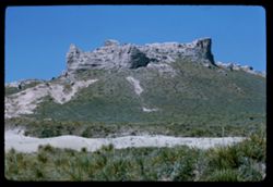
- Description:
- 100 f 11 SL
- Subject:
- Rocks, Erosion, Cliffs, Buttes, Shrubs, Hills, and Rock formations
- Series:
- 5-62
- Creator:
- Cushman, Charles W., 1896-1972
- Date Created:
- 1962-10-07
- Genre:
- Landscape photographs
- Frame Number:
- 19
- Street Address:
- Kingman-Needles Road
- County:
- Mohave and San Bernardino
- Abstract:
- Top- Knot along Kingman- Needles road
- Call Number:
- P12786
- City:
- Kingman and Needles
- Country:
- United States
- State/Province:
- Arizona and California
- Alternate Identifier:
- 562.19
- Persistent URL:
- http://purl.dlib.indiana.edu/iudl/archives/cushman/P12786
- Holding Location:
- Bloomington - University Archives
Wells Library E460
1320 E 10th St.
Bloomington, IN 47405
Contact at archives@indiana.edu, 812-855-1127
-
- Description:
- 50 f 9
- Subject:
- Rocks, Trees, Cajon Pass (Calif.), Rock formations, Hills, Mountains, and Passes (Landforms)
- Series:
- 16-53
- Creator:
- Cushman, Charles W., 1896-1972
- Date Created:
- 1953-11-23
- Genre:
- Landscape photographs
- Frame Number:
- 9
- Street Address:
- California State Highway 138
- County:
- San Bernardino
- Abstract:
- Tilted rocks nw of Cajon along Cal. 138
- Call Number:
- P07081
- Country:
- United States
- State/Province:
- California
- Alternate Identifier:
- 1653.9
- Persistent URL:
- http://purl.dlib.indiana.edu/iudl/archives/cushman/P07081
- Holding Location:
- Bloomington - University Archives
Wells Library E460
1320 E 10th St.
Bloomington, IN 47405
Contact at archives@indiana.edu, 812-855-1127
-
- Description:
- 50 f 8
- Subject:
- Rocks, Trees, Cajon Pass (Calif.), Rock formations, Passes (Landforms), Mountains, and Hills
- Series:
- 16-53
- Creator:
- Cushman, Charles W., 1896-1972
- Date Created:
- 1953-11-23
- Genre:
- Landscape photographs
- Frame Number:
- 8
- Street Address:
- California State Highway 138
- County:
- San Bernardino
- Abstract:
- Tilted rocks along Cal 138 nr. Cajon
- Call Number:
- P07080
- Country:
- United States
- State/Province:
- California
- Alternate Identifier:
- 1653.8
- Persistent URL:
- http://purl.dlib.indiana.edu/iudl/archives/cushman/P07080
- Holding Location:
- Bloomington - University Archives
Wells Library E460
1320 E 10th St.
Bloomington, IN 47405
Contact at archives@indiana.edu, 812-855-1127
-
- Description:
- 100 f 8 TL
- Subject:
- Trees, Mountains, Rock formations, Hills, Pinnacles National Monument (Calif.), and Pinnacle Rocks (Calif.)
- Series:
- 6-56
- Creator:
- Cushman, Charles W., 1896-1972
- Date Created:
- 1956-04-22
- Genre:
- Landscape photographs
- Frame Number:
- 23
- County:
- San Benito
- Abstract:
- The Pinnacles, from a distance
- Call Number:
- P08732
- Country:
- United States
- State/Province:
- California
- Alternate Identifier:
- 656.23
- Persistent URL:
- http://purl.dlib.indiana.edu/iudl/archives/cushman/P08732
- Holding Location:
- Bloomington - University Archives
Wells Library E460
1320 E 10th St.
Bloomington, IN 47405
Contact at archives@indiana.edu, 812-855-1127
-
- Description:
- 100 f 11TL
- Subject:
- Grasses, Mountains, Rock formations, Hills, and Rivers
- Series:
- 6-63
- Creator:
- Cushman, Charles W., 1896-1972
- Date Created:
- 1963-06-28
- Genre:
- Landscape photographs
- Frame Number:
- 15
- County:
- San Bernardino
- Abstract:
- The Needles near Needles Calif
- Call Number:
- P12968
- City:
- Needles
- Country:
- United States
- State/Province:
- California
- Alternate Identifier:
- 663.15
- Persistent URL:
- http://purl.dlib.indiana.edu/iudl/archives/cushman/P12968
- Holding Location:
- Bloomington - University Archives
Wells Library E460
1320 E 10th St.
Bloomington, IN 47405
Contact at archives@indiana.edu, 812-855-1127
-
- Description:
- 100 f 11TL
- Subject:
- Grasses, Mountains, Rock formations, Hills, and Rivers
- Series:
- 6-63
- Creator:
- Cushman, Charles W., 1896-1972
- Date Created:
- 1963-06-28
- Genre:
- Landscape photographs
- Frame Number:
- 16
- County:
- San Bernardino
- Abstract:
- The Needles near Needles Calif
- Call Number:
- P12969
- City:
- Needles
- Country:
- United States
- State/Province:
- California
- Alternate Identifier:
- 663.16
- Persistent URL:
- http://purl.dlib.indiana.edu/iudl/archives/cushman/P12969
- Holding Location:
- Bloomington - University Archives
Wells Library E460
1320 E 10th St.
Bloomington, IN 47405
Contact at archives@indiana.edu, 812-855-1127
-

- Description:
- 25 f 6.3 Pola
- Subject:
- Rocks, Roads, Boulders, Buttes, Mountains, Rock formations, Pikes Peak (Colo.), Hills, Garden of the Gods (Colorado Springs, Colo.), Cliffs, and Shrubs
- Series:
- 22-52
- Creator:
- Cushman, Charles W., 1896-1972
- Date Created:
- 1952-10-27
- Genre:
- Landscape photographs
- Frame Number:
- 2
- County:
- El Paso
- Abstract:
- Pike's Peak through gateway of Garden of Gods
- Call Number:
- P06256
- City:
- Colorado Springs
- Country:
- United States
- State/Province:
- Colorado
- Alternate Identifier:
- 2252.2
- Persistent URL:
- http://purl.dlib.indiana.edu/iudl/archives/cushman/P06256
- Holding Location:
- Bloomington - University Archives
Wells Library E460
1320 E 10th St.
Bloomington, IN 47405
Contact at archives@indiana.edu, 812-855-1127
-

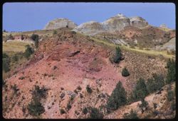
- Description:
- 25 f 9 Pola
- Subject:
- Deserts, Valleys, Hills, Death Valley (Calif. and Nev.), Mountains, Colored mountains, Rocks, Rock formations, and Black Mountains (Inyo County, Calif.)
- Series:
- 15-52
- Creator:
- Cushman, Charles W., 1896-1972
- Date Created:
- 1952-04-09
- Genre:
- Landscape photographs
- Frame Number:
- 23
- County:
- Inyo
- Abstract:
- Colored Mtns. The Black Mtns.
- Call Number:
- P06043
- Country:
- United States
- State/Province:
- California
- Alternate Identifier:
- 1552.23
- Persistent URL:
- http://purl.dlib.indiana.edu/iudl/archives/cushman/P06043
- Holding Location:
- Bloomington - University Archives
Wells Library E460
1320 E 10th St.
Bloomington, IN 47405
Contact at archives@indiana.edu, 812-855-1127
-
- Description:
- 50 f 9
- Subject:
- Ocean Beach (San Francisco, Calif.), Hills, Bodies of water, Cliffs, Cliff House (San Francisco, Calif.), Shrubs, Buildings, Restaurants, Beaches, Rock forma...
- Series:
- 16-54
- Creator:
- Cushman, Charles W., 1896-1972
- Date Created:
- 1954-10-24
- Genre:
- Landscape photographs
- Frame Number:
- 11
- County:
- San Francisco
- Abstract:
- Surf + birds at Ocean Beach.
- Call Number:
- P07510
- City:
- San Francisco
- Country:
- United States
- State/Province:
- California
- Physical Description:
- Anscochrome film.
- Alternate Identifier:
- 1654.11
- Persistent URL:
- http://purl.dlib.indiana.edu/iudl/archives/cushman/P07510
- Holding Location:
- Bloomington - University Archives
Wells Library E460
1320 E 10th St.
Bloomington, IN 47405
Contact at archives@indiana.edu, 812-855-1127
-
- Description:
- 100 f 5.6 tl
- Subject:
- Hills, Mountains, Sierra Nevada (Calif. and Nev.), Alabama Hills (Calif.), Rock formations, and Snow
- Series:
- 4-55
- Creator:
- Cushman, Charles W., 1896-1972
- Date Created:
- 1955-02-28
- Genre:
- Landscape photographs
- Frame Number:
- 4
- County:
- Inyo
- Abstract:
- In alabama Hills
- Call Number:
- P07632
- City:
- Lone Pine
- Country:
- United States
- State/Province:
- California
- Alternate Identifier:
- 455.4
- Persistent URL:
- http://purl.dlib.indiana.edu/iudl/archives/cushman/P07632
- Holding Location:
- Bloomington - University Archives
Wells Library E460
1320 E 10th St.
Bloomington, IN 47405
Contact at archives@indiana.edu, 812-855-1127
-
- Description:
- 25 f 9 Pola
- Subject:
- Barbed wire, Boulders, Croplands, Fences, Rock formations, Taylor, Mount (N.M.), Hills, and Mountains
- Series:
- 18-52
- Creator:
- Cushman, Charles W., 1896-1972
- Date Created:
- 1952-04-14
- Genre:
- Landscape photographs
- Frame Number:
- 8
- Street Address:
- United States Highway 66
- County:
- Cibola
- Abstract:
- Mt. Taylor at distance from 66 east of San Fidel.
- Call Number:
- P06139
- City:
- San Fidel
- Country:
- United States
- State/Province:
- New Mexico
- Alternate Identifier:
- 1852.8
- Persistent URL:
- http://purl.dlib.indiana.edu/iudl/archives/cushman/P06139
- Holding Location:
- Bloomington - University Archives
Wells Library E460
1320 E 10th St.
Bloomington, IN 47405
Contact at archives@indiana.edu, 812-855-1127
-
- Description:
- 100 f 9 t
- Subject:
- Wildflowers, Grasses, Charleston Peak (Nev.), Spring Mountains (Nev.), Mountains, Rock formations, Hills, and Shrubs
- Series:
- 3-58
- Creator:
- Cushman, Charles W., 1896-1972
- Date Created:
- 1958-04-25
- Genre:
- Landscape photographs
- Frame Number:
- 27
- Street Address:
- United States Highway 95
- County:
- Clark
- Abstract:
- Distant view of Spring Mtns (Charleston Peak) from Hwy near Sloan
- Call Number:
- P09743
- City:
- Sloan
- Country:
- United States
- State/Province:
- Nevada
- Alternate Identifier:
- 358.27
- Persistent URL:
- http://purl.dlib.indiana.edu/iudl/archives/cushman/P09743
- Holding Location:
- Bloomington - University Archives
Wells Library E460
1320 E 10th St.
Bloomington, IN 47405
Contact at archives@indiana.edu, 812-855-1127
-
- Description:
- 100 f 5.6 tl
- Subject:
- Cliffs, Trees, Meadows, Tree limbs, Mountains, Rock formations, and Hills
- Series:
- 3-57
- Creator:
- Cushman, Charles W., 1896-1972
- Date Created:
- 1957-04-09
- Genre:
- Landscape photographs and Identification photographs
- Frame Number:
- 11
- Street Address:
- California State Highway 128
- County:
- Mendocino
- Abstract:
- Along 128 Mendocino co. - mountain side with dead tree
- Call Number:
- P09175
- Country:
- United States
- State/Province:
- California
- Alternate Identifier:
- 357.11
- Persistent URL:
- http://purl.dlib.indiana.edu/iudl/archives/cushman/P09175
- Holding Location:
- Bloomington - University Archives
Wells Library E460
1320 E 10th St.
Bloomington, IN 47405
Contact at archives@indiana.edu, 812-855-1127
-
- Description:
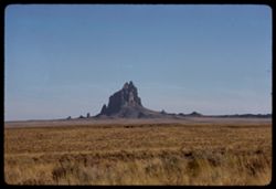
- 100 f 16 tl
- Subject:
- Grasses, Cliffs, Ship Rock (N.M.), Rock formations, Hills, and Plains
- Series:
- 32-65
- Creator:
- Cushman, Charles W., 1896-1972
- Date Created:
- 1965-10-01
- Genre:
- Landscape photographs
- Frame Number:
- 13
- Street Address:
- United States Highway 666
- County:
- San Juan
- Abstract:
- Ship rock
- Call Number:
- P14931
- Country:
- United States
- State/Province:
- New Mexico
- Alternate Identifier:
- 3265.13
- Persistent URL:
- http://purl.dlib.indiana.edu/iudl/archives/cushman/P14931
- Holding Location:
- Bloomington - University Archives
Wells Library E460
1320 E 10th St.
Bloomington, IN 47405
Contact at archives@indiana.edu, 812-855-1127
-
- Description:
- 100 f 9 TL
- Subject:
- Erosion, Cliffs, Trees, Buttes, Mountains, Rock formations, and Hills
- Series:
- 5-62
- Creator:
- Cushman, Charles W., 1896-1972
- Date Created:
- 1962-10-05
- Genre:
- Landscape photographs
- Frame Number:
- 12
- County:
- Coconino
- Abstract:
- Serried ridge s.e. of Sedona
- Call Number:
- P12779
- City:
- Sedona
- Country:
- United States
- State/Province:
- Arizona
- Alternate Identifier:
- 562.12
- Persistent URL:
- http://purl.dlib.indiana.edu/iudl/archives/cushman/P12779
- Holding Location:
- Bloomington - University Archives
Wells Library E460
1320 E 10th St.
Bloomington, IN 47405
Contact at archives@indiana.edu, 812-855-1127
-
- Description:
- 100 f 11 TL
- Subject:
- Erosion, Cliffs, Trees, Buttes, Mountains, Rock formations, and Hills
- Series:
- 5-62
- Creator:
- Cushman, Charles W., 1896-1972
- Date Created:
- 1962-10-05
- Genre:
- Landscape photographs
- Frame Number:
- 11
- County:
- Coconino
- Abstract:
- Serried ridge s.e. of Sedona
- Call Number:
- P12778
- City:
- Sedona
- Country:
- United States
- State/Province:
- Arizona
- Alternate Identifier:
- 562.11
- Persistent URL:
- http://purl.dlib.indiana.edu/iudl/archives/cushman/P12778
- Holding Location:
- Bloomington - University Archives
Wells Library E460
1320 E 10th St.
Bloomington, IN 47405
Contact at archives@indiana.edu, 812-855-1127
-
- Description:
- 25 f 13
- Subject:
- Roads, Buttes, Mountains, Rock formations, Sentinel Rock (Colo.), Hills, Garden of the Gods (Colorado Springs, Colo.), Cliffs, and Shrubs
- Series:
- 21-52
- Creator:
- Cushman, Charles W., 1896-1972
- Date Created:
- 1952-10-27
- Genre:
- Landscape photographs
- Frame Number:
- 20
- County:
- El Paso
- Abstract:
- Sentinel Rock again
- Call Number:
- P06251
- City:
- Colorado Springs
- Country:
- United States
- State/Province:
- Colorado
- Alternate Identifier:
- 2152.20
- Persistent URL:
- http://purl.dlib.indiana.edu/iudl/archives/cushman/P06251
- Holding Location:
- Bloomington - University Archives
Wells Library E460
1320 E 10th St.
Bloomington, IN 47405
Contact at archives@indiana.edu, 812-855-1127
-
- Description:
- 25 f 13
- Subject:
- Cliffs, Buttes, Rock formations, Sentinel Rock (Colo.), Hills, Garden of the Gods (Colorado Springs, Colo.), Roads, and Shrubs
- Series:
- 21-52
- Creator:
- Cushman, Charles W., 1896-1972
- Date Created:
- 1952-10-27
- Genre:
- Identification photographs
- Frame Number:
- 23
- County:
- El Paso
- Abstract:
- Sent. Rock closer
- Call Number:
- P06254
- City:
- Colorado Springs
- Country:
- United States
- State/Province:
- Colorado
- Alternate Identifier:
- 2152.23
- Persistent URL:
- http://purl.dlib.indiana.edu/iudl/archives/cushman/P06254
- Holding Location:
- Bloomington - University Archives
Wells Library E460
1320 E 10th St.
Bloomington, IN 47405
Contact at archives@indiana.edu, 812-855-1127
-
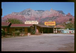
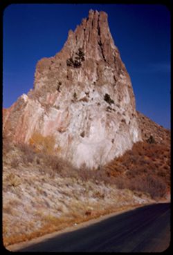
- Description:
- 100 f 11 SL
- Subject:
- Stores & shops, Canyons, Erosion, Cliffs, Dirt roads, Signs (Notices), Hitching Post Real Estate (Sedona, Ariz.), Fences, Rock formations, Hills, Rollie&...
- Series:
- 5-62
- Creator:
- Cushman, Charles W., 1896-1972
- Date Created:
- 1962-10-05
- Genre:
- Landscape photographs and Cityscape photographs
- Frame Number:
- 3
- County:
- Coconino
- Abstract:
- Sedona - re visit
- Call Number:
- P12770
- City:
- Sedona
- Country:
- United States
- State/Province:
- Arizona
- Alternate Identifier:
- 562.3
- Persistent URL:
- http://purl.dlib.indiana.edu/iudl/archives/cushman/P12770
- Holding Location:
- Bloomington - University Archives
Wells Library E460
1320 E 10th St.
Bloomington, IN 47405
Contact at archives@indiana.edu, 812-855-1127
-
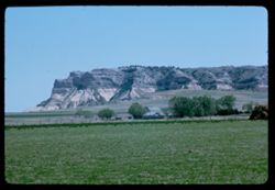
- Description:
- 100 f 11 TL
- Subject:
- Croplands, National parks & reserves, Plains, Houses, Cliffs, Trees, Scotts Bluff National Monument (Neb.), Buttes, Rock formations, and Hills
- Series:
- 2-63
- Creator:
- Cushman, Charles W., 1896-1972
- Date Created:
- 1963-05-10
- Genre:
- Landscape photographs
- Frame Number:
- 16
- County:
- Scotts Bluff
- Abstract:
- Scotts Bluff Nat'l Mon't
- Call Number:
- P12841
- Country:
- United States
- State/Province:
- Nebraska
- Alternate Identifier:
- 263.16
- Persistent URL:
- http://purl.dlib.indiana.edu/iudl/archives/cushman/P12841
- Holding Location:
- Bloomington - University Archives
Wells Library E460
1320 E 10th St.
Bloomington, IN 47405
Contact at archives@indiana.edu, 812-855-1127
-
- Description:
- 25 f 11
- Subject:
- Grasses, Cliffs, Trees, Mountains, Buildings, Rock formations, Hills, Garden of the Gods (Colorado Springs, Colo.), Houses, and Shrubs
- Series:
- 23-52
- Creator:
- Cushman, Charles W., 1896-1972
- Date Created:
- 1952-10-29
- Genre:
- Landscape photographs
- Frame Number:
- 23
- County:
- El Paso
- Abstract:
- Rocks north of Garden of the Gods
- Call Number:
- P06315
- City:
- Colorado Springs
- Country:
- United States
- State/Province:
- Colorado
- Alternate Identifier:
- 2352.23
- Persistent URL:
- http://purl.dlib.indiana.edu/iudl/archives/cushman/P06315
- Holding Location:
- Bloomington - University Archives
Wells Library E460
1320 E 10th St.
Bloomington, IN 47405
Contact at archives@indiana.edu, 812-855-1127
-
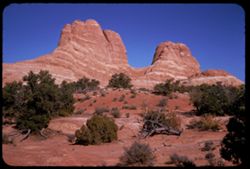
- Description:
- 25 f 6.3 Pola
- Subject:
- National parks & reserves, Hills, Shrubs, Sandstone, Rock formations, Wildflowers, Arches National Park (Utah), and Dunes
- Series:
- 27-52
- Creator:
- Cushman, Charles W., 1896-1972
- Date Created:
- 1952-11-04
- Genre:
- Landscape photographs
- Frame Number:
- 29
- County:
- Grand
- Abstract:
- Sulfurous green mounds sandstone.
- Call Number:
- P06474
- Country:
- United States
- State/Province:
- Utah
- Alternate Identifier:
- 2752.29
- Persistent URL:
- http://purl.dlib.indiana.edu/iudl/archives/cushman/P06474
- Holding Location:
- Bloomington - University Archives
Wells Library E460
1320 E 10th St.
Bloomington, IN 47405
Contact at archives@indiana.edu, 812-855-1127
-
- Description:
- 50 f 9
- Subject:
- National parks & reserves, Deserts, Devils Garden (Grand County, Utah), Hills, Sand, Mountains, Shrubs, Arches National Park (Utah), Wildflowers, Rock fo...
- Series:
- 27-52
- Creator:
- Cushman, Charles W., 1896-1972
- Date Created:
- 1952-11-04
- Genre:
- Landscape photographs
- Frame Number:
- 21
- County:
- Grand
- Abstract:
- En route to Devil's Garden. Sandstone Dunes.
- Call Number:
- P06466
- Country:
- United States
- State/Province:
- Utah
- Alternate Identifier:
- 2752.21
- Persistent URL:
- http://purl.dlib.indiana.edu/iudl/archives/cushman/P06466
- Holding Location:
- Bloomington - University Archives
Wells Library E460
1320 E 10th St.
Bloomington, IN 47405
Contact at archives@indiana.edu, 812-855-1127
-
- Description:
- 50 f 11
- Subject:
- Grasses, Cliffs, Trees, Mountains, Rock formations, and Hills
- Series:
- 15-53
- Creator:
- Cushman, Charles W., 1896-1972
- Date Created:
- 1953-11-21
- Genre:
- Landscape photographs
- Frame Number:
- 36
- County:
- Coconino
- Abstract:
- Same rock 35 from south
- Call Number:
- P07069
- City:
- Sedona
- Country:
- United States
- State/Province:
- Arizona
- Alternate Identifier:
- 1553.36
- Persistent URL:
- http://purl.dlib.indiana.edu/iudl/archives/cushman/P07069
- Holding Location:
- Bloomington - University Archives
Wells Library E460
1320 E 10th St.
Bloomington, IN 47405
Contact at archives@indiana.edu, 812-855-1127
-
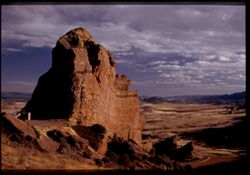
- Description:
- 200 f 11 TL
- Subject:
- Cliffs, Buttes, Rock formations, and Hills
- Series:
- 36-65
- Creator:
- Cushman, Charles W., 1896-1972
- Date Created:
- 1965-10-07
- Genre:
- Landscape photographs
- Frame Number:
- 14
- County:
- San Juan
- Abstract:
- 14/15 - Shiprock from NW and NNW.
- Call Number:
- P15082
- City:
- Ship Rock
- Country:
- United States
- State/Province:
- New Mexico
- Alternate Identifier:
- 3665.14
- Persistent URL:
- http://purl.dlib.indiana.edu/iudl/archives/cushman/P15082
- Holding Location:
- Bloomington - University Archives
Wells Library E460
1320 E 10th St.
Bloomington, IN 47405
Contact at archives@indiana.edu, 812-855-1127
-
- Description:
- 200 f 11 TL
- Subject:
- Grasses, Buttes, Plains, Rock formations, and Hills
- Series:
- 36-65
- Creator:
- Cushman, Charles W., 1896-1972
- Date Created:
- 1965-10-07
- Genre:
- Landscape photographs
- Frame Number:
- 15
- County:
- San Juan
- Abstract:
- 14/15 - Shiprock from NW and NNW.
- Call Number:
- P15083
- City:
- Ship Rock
- Country:
- United States
- State/Province:
- New Mexico
- Alternate Identifier:
- 3665.15
- Persistent URL:
- http://purl.dlib.indiana.edu/iudl/archives/cushman/P15083
- Holding Location:
- Bloomington - University Archives
Wells Library E460
1320 E 10th St.
Bloomington, IN 47405
Contact at archives@indiana.edu, 812-855-1127
-
- Description:
- 100 f 8 tl
- Subject:
- Theodore Roosevelt National Park (N.D.), Grasses, Trees, Rock formations, Hills, and National parks & reserves
- Series:
- 18-58
- Creator:
- Cushman, Charles W., 1896-1972
- Date Created:
- 1958-08-28
- Genre:
- Landscape photographs
- Frame Number:
- 12
- Abstract:
- Landscape eastward in Roosevelt Mem Park
- Call Number:
- P10211
- Country:
- United States
- State/Province:
- North Dakota
- Alternate Identifier:
- 1858.12
- Persistent URL:
- http://purl.dlib.indiana.edu/iudl/archives/cushman/P10211
- Holding Location:
- Bloomington - University Archives
Wells Library E460
1320 E 10th St.
Bloomington, IN 47405
Contact at archives@indiana.edu, 812-855-1127
-
- Description:
- 100 f 8 tl
- Subject:
- Theodore Roosevelt National Park (N.D.), Hills, Trees, Rock formations, National parks & reserves, and Grasses
- Series:
- 18-58
- Creator:
- Cushman, Charles W., 1896-1972
- Date Created:
- 1958-08-28
- Genre:
- Landscape photographs
- Frame Number:
- 20
- Abstract:
- View across canyon, farther
- Call Number:
- P10219
- Country:
- United States
- State/Province:
- North Dakota
- Alternate Identifier:
- 1858.20
- Persistent URL:
- http://purl.dlib.indiana.edu/iudl/archives/cushman/P10219
- Holding Location:
- Bloomington - University Archives
Wells Library E460
1320 E 10th St.
Bloomington, IN 47405
Contact at archives@indiana.edu, 812-855-1127
-
- Description:
- 100 f 8 tl
- Subject:
- Theodore Roosevelt National Park (N.D.), Grasses, Rock formations, Clouds, Hills, and National parks & reserves
- Series:
- 18-58
- Creator:
- Cushman, Charles W., 1896-1972
- Date Created:
- 1958-08-28
- Genre:
- Landscape photographs
- Frame Number:
- 22
- Abstract:
- Outbound at Praire Dog Town
- Call Number:
- P10221
- Country:
- United States
- State/Province:
- North Dakota
- Alternate Identifier:
- 1858.22
- Persistent URL:
- http://purl.dlib.indiana.edu/iudl/archives/cushman/P10221
- Holding Location:
- Bloomington - University Archives
Wells Library E460
1320 E 10th St.
Bloomington, IN 47405
Contact at archives@indiana.edu, 812-855-1127
-
- Description:
- 100 f 5.6 tl
- Subject:
- Hills, Trees, and Rock formations
- Series:
- 22-55
- Creator:
- Cushman, Charles W., 1896-1972
- Date Created:
- 1955-07-10
- Frame Number:
- 32
- Street Address:
- California State Highway 140
- County:
- Mariposa
- Abstract:
- View along Hwy 140 five miles west of Mariposa
- Call Number:
- P08285
- City:
- Mariposa
- Country:
- United States
- State/Province:
- California
- Alternate Identifier:
- 2255.32
- Persistent URL:
- http://purl.dlib.indiana.edu/iudl/archives/cushman/P08285
- Holding Location:
- Bloomington - University Archives
Wells Library E460
1320 E 10th St.
Bloomington, IN 47405
Contact at archives@indiana.edu, 812-855-1127
-
- Description:
- 100 f 11
- Subject:
- Rock formations, Rocks, Forests, Hills, Trees, Likavittós (Greece), and Roads
- Series:
- 13-65
- Creator:
- Cushman, Charles W., 1896-1972
- Date Created:
- 1965-04-25
- Genre:
- Landscape photographs and Cityscape photographs
- Frame Number:
- 25
- County:
- Attica
- Abstract:
- Rocky hill at east
- Call Number:
- P14301
- City:
- Athens
- Country:
- Greece
- State/Province:
- Central Greece and Euboea
- Alternate Identifier:
- 1365.25
- Persistent URL:
- http://purl.dlib.indiana.edu/iudl/archives/cushman/P14301
- Holding Location:
- Bloomington - University Archives
Wells Library E460
1320 E 10th St.
Bloomington, IN 47405
Contact at archives@indiana.edu, 812-855-1127
-
- Description:
- 25 f 11
- Subject:
- Rocky Mountains, Hills, Barbed wire, Mountains, Boulders, Rock formations, Fences, Trees, and Grasses
- Series:
- 22-52
- Creator:
- Cushman, Charles W., 1896-1972
- Date Created:
- 1952-10-27
- Genre:
- Landscape photographs
- Frame Number:
- 23
- Street Address:
- Colorado State Highway 143
- County:
- Teller
- Abstract:
- And to the left, this scene-the Rock is truly overlapped
- Call Number:
- P06277
- City:
- Cripple Creek and Florissant
- Country:
- United States
- State/Province:
- Colorado
- Physical Description:
- masked.
- Alternate Identifier:
- 2252.23
- Persistent URL:
- http://purl.dlib.indiana.edu/iudl/archives/cushman/P06277
- Holding Location:
- Bloomington - University Archives
Wells Library E460
1320 E 10th St.
Bloomington, IN 47405
Contact at archives@indiana.edu, 812-855-1127
-
- Description:
- 50 f 9
- Subject:
- Hills, Mountains, Shrubs, Sierra Nevada (Calif. and Nev.), Boulders, Rocks, Rock formations, Snow, and Alabama Hills (Calif.)
- Series:
- 14-52
- Creator:
- Cushman, Charles W., 1896-1972
- Date Created:
- 1952-04-08
- Genre:
- Landscape photographs
- Frame Number:
- 20
- County:
- Inyo
- Abstract:
- Big bad rocks of Alabama hills.
- Call Number:
- P06004
- City:
- Lone Pine
- Country:
- United States
- State/Province:
- California
- Alternate Identifier:
- 1452.20
- Persistent URL:
- http://purl.dlib.indiana.edu/iudl/archives/cushman/P06004
- Holding Location:
- Bloomington - University Archives
Wells Library E460
1320 E 10th St.
Bloomington, IN 47405
Contact at archives@indiana.edu, 812-855-1127
-
- Description:
- 100 f 9 TL
- Subject:
- Passes (Landforms), Hills, Cajon Pass (Calif.), Shrubs, Trees, Rock formations, Mountains, and Grasses
- Series:
- 2-69
- Creator:
- Cushman, Charles W., 1896-1972
- Date Created:
- 1969-03-14
- Genre:
- Landscape photographs
- Frame Number:
- 17
- County:
- San Bernardino
- Abstract:
- Cajon Pass
- Call Number:
- P15734
- Country:
- United States
- State/Province:
- California
- Alternate Identifier:
- 269.17
- Persistent URL:
- http://purl.dlib.indiana.edu/iudl/archives/cushman/P15734
- Holding Location:
- Bloomington - University Archives
Wells Library E460
1320 E 10th St.
Bloomington, IN 47405
Contact at archives@indiana.edu, 812-855-1127
-
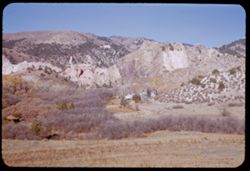
- Description:
- 50 f 9
- Subject:
- Passes (Landforms), Rocks, Tilted rock, Hills, Mountains, Trees, Rock formations, and Cajon Pass (Calif.)
- Series:
- 16-53
- Creator:
- Cushman, Charles W., 1896-1972
- Date Created:
- 1953-11-23
- Genre:
- Identification photographs and Landscape photographs
- Frame Number:
- 10
- Street Address:
- California State Highway 138
- County:
- San Bernardino
- Abstract:
- Closer to them
- Call Number:
- P07082
- Country:
- United States
- State/Province:
- California
- Physical Description:
- Image was originally mounted in a glass enclosure. Before digitization, the image was removed and placed in a Wess Plastic, Inc. brand, 2" x 2", pl...
- Alternate Identifier:
- 1653.10
- Persistent URL:
- http://purl.dlib.indiana.edu/iudl/archives/cushman/P07082
- Holding Location:
- Bloomington - University Archives
Wells Library E460
1320 E 10th St.
Bloomington, IN 47405
Contact at archives@indiana.edu, 812-855-1127
-
- Description:
- 50 f 9
- Subject:
- Cliffs, Trees, Buttes, National parks & reserves, Arches National Park (Utah), Hills, Shrubs, Rock formations, and Devils Garden (Grand County, Utah)
- Series:
- 27-52
- Creator:
- Cushman, Charles W., 1896-1972
- Date Created:
- 1952-11-04
- Genre:
- Landscape photographs
- Frame Number:
- 23
- County:
- Grand
- Abstract:
- Almost at the Devils Garden.
- Call Number:
- P06468
- Country:
- United States
- State/Province:
- Utah
- Alternate Identifier:
- 2752.23
- Persistent URL:
- http://purl.dlib.indiana.edu/iudl/archives/cushman/P06468
- Holding Location:
- Bloomington - University Archives
Wells Library E460
1320 E 10th St.
Bloomington, IN 47405
Contact at archives@indiana.edu, 812-855-1127
-
- Description:
- 50 f 11
- Subject:
- Meadows, Hills, Shrubs, Grasses, Fences, Clouds, and Rock formations
- Series:
- 15-53
- Creator:
- Cushman, Charles W., 1896-1972
- Date Created:
- 1953-11-21
- Genre:
- Landscape photographs
- Frame Number:
- 26
- County:
- Coconino
- Abstract:
- Rock forms NW from Sedona
- Call Number:
- P07059
- City:
- Sedona
- Country:
- United States
- State/Province:
- Arizona
- Alternate Identifier:
- 1553.26
- Persistent URL:
- http://purl.dlib.indiana.edu/iudl/archives/cushman/P07059
- Holding Location:
- Bloomington - University Archives
Wells Library E460
1320 E 10th St.
Bloomington, IN 47405
Contact at archives@indiana.edu, 812-855-1127
-
- Description:
- 50 f 8
- Subject:
- Snow, Dirt roads, Trees, Mountains, Rock formations, Hills, and Oak Creek (Ariz.)
- Series:
- 15-53
- Creator:
- Cushman, Charles W., 1896-1972
- Date Created:
- 1953-11-21
- Genre:
- Landscape photographs
- Frame Number:
- 31
- County:
- Coconino
- Abstract:
- A little to the left
- Call Number:
- P07064
- City:
- Sedona
- Country:
- United States
- State/Province:
- Arizona
- Physical Description:
- Image was originally mounted in a glass enclosure. Before digitization, the image was removed and placed in a Wess Plastic, Inc. brand, 2" x 2", pl...
- Alternate Identifier:
- 1553.31
- Persistent URL:
- http://purl.dlib.indiana.edu/iudl/archives/cushman/P07064
- Holding Location:
- Bloomington - University Archives
Wells Library E460
1320 E 10th St.
Bloomington, IN 47405
Contact at archives@indiana.edu, 812-855-1127
-
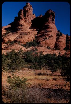
- Description:
- 50 f 9
- Subject:
- Grasses, Cliffs, Trees, Mountains, Rock formations, and Hills
- Series:
- 15-53
- Creator:
- Cushman, Charles W., 1896-1972
- Date Created:
- 1953-11-21
- Genre:
- Landscape photographs
- Frame Number:
- 35
- County:
- Coconino
- Abstract:
- Red double turret 6 mi. s of Sedona
- Call Number:
- P07068
- City:
- Sedona
- Country:
- United States
- State/Province:
- Arizona
- Alternate Identifier:
- 1553.35
- Persistent URL:
- http://purl.dlib.indiana.edu/iudl/archives/cushman/P07068
- Holding Location:
- Bloomington - University Archives
Wells Library E460
1320 E 10th St.
Bloomington, IN 47405
Contact at archives@indiana.edu, 812-855-1127
-
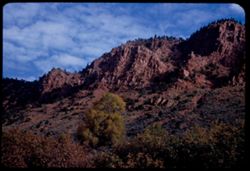
- Description:
- 50 f 8
- Subject:
- Canyons, Grasses, Cliffs, Trees, Red Canyon (Garfield County, Colo.), Tree limbs, Mountains, Rock formations, Clouds, and Hills
- Series:
- 9-53
- Creator:
- Cushman, Charles W., 1896-1972
- Date Created:
- 1953-10-13
- Genre:
- Landscape photographs
- Frame Number:
- 38
- County:
- Garfield
- Abstract:
- Red Canyon, south of Glenwood Spgs.
- Call Number:
- P06839
- City:
- Glenwood Springs
- Country:
- United States
- State/Province:
- Colorado
- Alternate Identifier:
- 953.38
- Persistent URL:
- http://purl.dlib.indiana.edu/iudl/archives/cushman/P06839
- Holding Location:
- Bloomington - University Archives
Wells Library E460
1320 E 10th St.
Bloomington, IN 47405
Contact at archives@indiana.edu, 812-855-1127
-
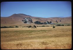
- Description:
- 100 f 5.6 sl hf
- Subject:
- Ranches, Trees, Meadows, Morro Bay (Calif.), Rock formations, Hills, and Hollister Peak (Calif.)
- Series:
- 14-58
- Creator:
- Cushman, Charles W., 1896-1972
- Date Created:
- 1958-07-28
- Genre:
- Landscape photographs
- Frame Number:
- 18
- County:
- San Luis Obispo
- Abstract:
- Ranch nearby
- Call Number:
- P10103
- City:
- San Luis Obispo
- Country:
- United States
- State/Province:
- California
- Alternate Identifier:
- 1458.18
- Persistent URL:
- http://purl.dlib.indiana.edu/iudl/archives/cushman/P10103
- Holding Location:
- Bloomington - University Archives
Wells Library E460
1320 E 10th St.
Bloomington, IN 47405
Contact at archives@indiana.edu, 812-855-1127
-
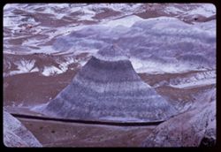
- Description:
- 100 f 11 TL
- Subject:
- Petrified Forest National Park (Ariz.), National parks & reserves, Deserts, Valleys, Hills, Blue Mesa (Ariz.), Rivers, Mesas, Petrified forests, Erosion,...
- Series:
- 6-63
- Creator:
- Cushman, Charles W., 1896-1972
- Date Created:
- 1963-06-27
- Genre:
- Landscape photographs
- Frame Number:
- 11
- County:
- Navajo and Apache
- Abstract:
- Distantly Down from Blue Mesa
- Call Number:
- P12964
- City:
- Holbrook
- Country:
- United States
- State/Province:
- Arizona
- Alternate Identifier:
- 663.11
- Persistent URL:
- http://purl.dlib.indiana.edu/iudl/archives/cushman/P12964
- Holding Location:
- Bloomington - University Archives
Wells Library E460
1320 E 10th St.
Bloomington, IN 47405
Contact at archives@indiana.edu, 812-855-1127
-
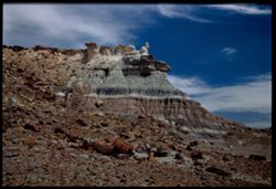
- Description:
- 25 f 9 pola
- Subject:
- Petrified wood, Petrified forests, National parks & reserves, Hills, Cliffs, Rocks, Fossils, Rock formations, and Petrified Forest National Park (Ariz.)
- Series:
- 17-52
- Creator:
- Cushman, Charles W., 1896-1972
- Date Created:
- 1952-04-13
- Genre:
- Landscape photographs
- Frame Number:
- 33
- County:
- Apache
- Abstract:
- Easter Bunny in First Forest
- Call Number:
- P06125
- Country:
- United States
- State/Province:
- Arizona
- Physical Description:
- Image was originally mounted in a glass enclosure. Before digitization, the image was removed and placed in a Wess Plastic, Inc. brand, 2" x 2", pl...
- Alternate Identifier:
- 1752.33
- Persistent URL:
- http://purl.dlib.indiana.edu/iudl/archives/cushman/P06125
- Holding Location:
- Bloomington - University Archives
Wells Library E460
1320 E 10th St.
Bloomington, IN 47405
Contact at archives@indiana.edu, 812-855-1127
-
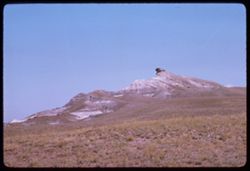
- Description:
- 100 f 11 TL
- Subject:
- Deserts, Petrified forests, Petrified Forest National Park (Ariz.), Rock formations, Hills, Grasses, and National parks & reserves
- Series:
- 5-63
- Creator:
- Cushman, Charles W., 1896-1972
- Date Created:
- 1963-06-27
- Genre:
- Landscape photographs
- Frame Number:
- 36
- County:
- Apache and Navajo
- Abstract:
- Flying ?
- Call Number:
- P12952
- City:
- Holbrook
- Country:
- United States
- State/Province:
- Arizona
- Alternate Identifier:
- 563.36
- Persistent URL:
- http://purl.dlib.indiana.edu/iudl/archives/cushman/P12952
- Holding Location:
- Bloomington - University Archives
Wells Library E460
1320 E 10th St.
Bloomington, IN 47405
Contact at archives@indiana.edu, 812-855-1127
-
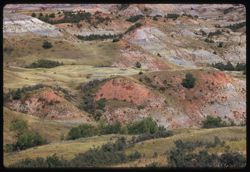
- Description:
- 100 f 8 tl
- Subject:
- Theodore Roosevelt National Park (N.D.), Hills, Trees, Grasses, National parks & reserves, and Rock formations
- Series:
- 18-58
- Creator:
- Cushman, Charles W., 1896-1972
- Date Created:
- 1958-08-28
- Genre:
- Landscape photographs
- Frame Number:
- 23
- Street Address:
- United States Highway 10
- Abstract:
- Parting shot from US 10
- Call Number:
- P10222
- Country:
- United States
- State/Province:
- North Dakota
- Alternate Identifier:
- 1858.23
- Persistent URL:
- http://purl.dlib.indiana.edu/iudl/archives/cushman/P10222
- Holding Location:
- Bloomington - University Archives
Wells Library E460
1320 E 10th St.
Bloomington, IN 47405
Contact at archives@indiana.edu, 812-855-1127
-
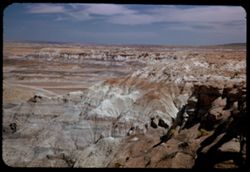
- Description:
- 25 f 11 pola
- Subject:
- Blue Mesa (Ariz.), Canyons, Petrified forests, Cliffs, Mesas, Shadows, Mountains, Rock formations, Hills, Petrified Forest National Park (Ariz.), National pa...
- Series:
- 17-52
- Creator:
- Cushman, Charles W., 1896-1972
- Date Created:
- 1952-04-13
- Genre:
- Landscape photographs
- Frame Number:
- 35
- County:
- Apache
- Abstract:
- In Blue Forest 113737
- Call Number:
- P06127
- Country:
- United States
- State/Province:
- Arizona
- Alternate Identifier:
- 1752.35
- Persistent URL:
- http://purl.dlib.indiana.edu/iudl/archives/cushman/P06127
- Holding Location:
- Bloomington - University Archives
Wells Library E460
1320 E 10th St.
Bloomington, IN 47405
Contact at archives@indiana.edu, 812-855-1127
-
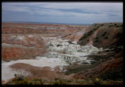
- Description:
- 25 f 8 pola
- Subject:
- Deserts, Mesas, Harvey Inn (Holbrook, Ariz.), Shrubs, Hills, Painted Desert (Ariz.), and Rock formations
- Series:
- 17-52
- Creator:
- Cushman, Charles W., 1896-1972
- Date Created:
- 1952-04-13
- Genre:
- Landscape photographs
- Frame Number:
- 38
- County:
- Apache and Navajo
- Abstract:
- SE from Harvey Inn
- Call Number:
- P06130
- City:
- Holbrook
- Country:
- United States
- State/Province:
- Arizona
- Physical Description:
- Image was originally mounted in a glass enclosure. Before digitization, the image was removed and placed in a Wess Plastic, Inc. brand, 2" x 2", pl...
- Alternate Identifier:
- 1752.38
- Persistent URL:
- http://purl.dlib.indiana.edu/iudl/archives/cushman/P06130
- Holding Location:
- Bloomington - University Archives
Wells Library E460
1320 E 10th St.
Bloomington, IN 47405
Contact at archives@indiana.edu, 812-855-1127
-
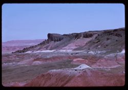
- Description:
- 100 f 11 TL
- Subject:
- Deserts, Valleys, Erosion, Petrified Forest National Park (Ariz.), Rock formations, Hills, Painted Desert (Ariz.), Petrified forests, and National parks &...
- Series:
- 6-63
- Creator:
- Cushman, Charles W., 1896-1972
- Date Created:
- 1963-06-27
- Genre:
- Landscape photographs
- Frame Number:
- 13
- County:
- Apache and Navajo
- Abstract:
- Painted Desert from [Casey] pt.
- Call Number:
- P12966
- City:
- Holbrook
- Country:
- United States
- State/Province:
- Arizona
- Alternate Identifier:
- 663.13
- Persistent URL:
- http://purl.dlib.indiana.edu/iudl/archives/cushman/P12966
- Holding Location:
- Bloomington - University Archives
Wells Library E460
1320 E 10th St.
Bloomington, IN 47405
Contact at archives@indiana.edu, 812-855-1127
-
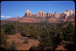
- Description:
- 50 f 9
- Subject:
- Hills, Cliffs, Mountains, Trees, Rocks, and Rock formations
- Series:
- 15-53
- Creator:
- Cushman, Charles W., 1896-1972
- Date Created:
- 1953-11-21
- Genre:
- Landscape photographs
- Frame Number:
- 39
- County:
- Coconino
- Abstract:
- Last look at rocks near Sedona
- Call Number:
- P07072
- City:
- Sedona
- Country:
- United States
- State/Province:
- Arizona
- Alternate Identifier:
- 1553.39
- Persistent URL:
- http://purl.dlib.indiana.edu/iudl/archives/cushman/P07072
- Holding Location:
- Bloomington - University Archives
Wells Library E460
1320 E 10th St.
Bloomington, IN 47405
Contact at archives@indiana.edu, 812-855-1127
-
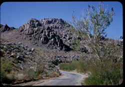
- Description:
- 50 f 8
- Subject:
- Rocks, Roads, Trees, Boulders, Alabama Hills (Calif.), Whitney, Mount (Calif.), Hills, Shrubs, and Rock formations
- Series:
- 14-52
- Creator:
- Cushman, Charles W., 1896-1972
- Date Created:
- 1952-04-08
- Genre:
- Landscape photographs
- Frame Number:
- 19
- Street Address:
- Mount Whitney Road
- County:
- Inyo
- Abstract:
- One of the Alabama Hills on Mt. Whitney Rd.
- Call Number:
- P06003
- City:
- Lone Pine
- Country:
- United States
- State/Province:
- California
- Alternate Identifier:
- 1452.19
- Persistent URL:
- http://purl.dlib.indiana.edu/iudl/archives/cushman/P06003
- Holding Location:
- Bloomington - University Archives
Wells Library E460
1320 E 10th St.
Bloomington, IN 47405
Contact at archives@indiana.edu, 812-855-1127
-
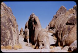
- Description:
- 100 f 6.3 tl
- Subject:
- Shrubs, Hills, Alabama Hills (Calif.), and Rock formations
- Series:
- 4-55
- Creator:
- Cushman, Charles W., 1896-1972
- Date Created:
- 1955-02-28
- Genre:
- Landscape photographs
- Frame Number:
- 7
- County:
- Inyo
- Abstract:
- Inside the Alabama Hills
- Call Number:
- P07635
- Country:
- United States
- State/Province:
- California
- Alternate Identifier:
- 455.7
- Persistent URL:
- http://purl.dlib.indiana.edu/iudl/archives/cushman/P07635
- Holding Location:
- Bloomington - University Archives
Wells Library E460
1320 E 10th St.
Bloomington, IN 47405
Contact at archives@indiana.edu, 812-855-1127
-
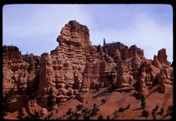
- Description:
- 100 f 6.3 tl
- Subject:
- Canyons, Hills, Red Canyon (Garfield County, Utah), Bryce Canyon (Utah), Trees, and Rock formations
- Series:
- 5-58
- Creator:
- Cushman, Charles W., 1896-1972
- Date Created:
- 1958-04-27
- Genre:
- Landscape photographs
- Frame Number:
- 34
- County:
- Garfield
- Abstract:
- Nearing Red canyon
- Call Number:
- P09818
- Country:
- United States
- State/Province:
- Utah
- Alternate Identifier:
- 558.34
- Persistent URL:
- http://purl.dlib.indiana.edu/iudl/archives/cushman/P09818
- Holding Location:
- Bloomington - University Archives
Wells Library E460
1320 E 10th St.
Bloomington, IN 47405
Contact at archives@indiana.edu, 812-855-1127
-
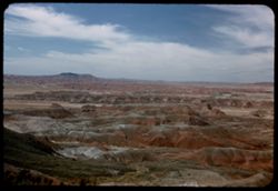
- Description:
- 25 f 8 pola
- Subject:
- Deserts, Mesas, Harvey Inn (Holbrook, Ariz.), Rock formations, Hills, Painted Desert (Ariz.), and Shrubs
- Series:
- 17-52
- Creator:
- Cushman, Charles W., 1896-1972
- Date Created:
- 1952-04-13
- Genre:
- Landscape photographs
- Frame Number:
- 39
- County:
- Apache and Navajo
- Abstract:
- NW from same pt.
- Call Number:
- P06131
- City:
- Holbrook
- Country:
- United States
- State/Province:
- Arizona
- Alternate Identifier:
- 1752.39
- Persistent URL:
- http://purl.dlib.indiana.edu/iudl/archives/cushman/P06131
- Holding Location:
- Bloomington - University Archives
Wells Library E460
1320 E 10th St.
Bloomington, IN 47405
Contact at archives@indiana.edu, 812-855-1127
-
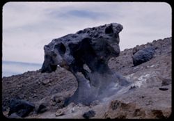
- Description:
- 25 f 10
- Subject:
- Deserts, Mushroom Rock (Inyo County, Calif.), Boulders, Rock formations, Hills, Rocks, Valleys, and Death Valley (Calif. and Nev.)
- Series:
- 15-52
- Creator:
- Cushman, Charles W., 1896-1972
- Date Created:
- 1952-04-09
- Genre:
- Snapshots
- Frame Number:
- 22
- County:
- Inyo
- Abstract:
- Mushroom rock.
- Call Number:
- P06042
- City:
- Furnace Creek
- Country:
- United States
- State/Province:
- California
- Alternate Identifier:
- 1552.22
- Persistent URL:
- http://purl.dlib.indiana.edu/iudl/archives/cushman/P06042
- Holding Location:
- Bloomington - University Archives
Wells Library E460
1320 E 10th St.
Bloomington, IN 47405
Contact at archives@indiana.edu, 812-855-1127
-
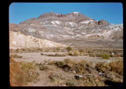
- Description:
- 50 f 9 SL
- Subject:
- Hills, Mountains, Rock formations, and Grasses
- Series:
- 4-62
- Creator:
- Cushman, Charles W., 1896-1972
- Date Created:
- 1962-09-30
- Genre:
- Landscape photographs
- Frame Number:
- 7
- County:
- Nye
- Abstract:
- Beatty, Nevada.
- Call Number:
- P12736
- City:
- Beatty
- Country:
- United States
- State/Province:
- Nevada
- Physical Description:
- masked.
- Alternate Identifier:
- 462.7
- Persistent URL:
- http://purl.dlib.indiana.edu/iudl/archives/cushman/P12736
- Holding Location:
- Bloomington - University Archives
Wells Library E460
1320 E 10th St.
Bloomington, IN 47405
Contact at archives@indiana.edu, 812-855-1127
-
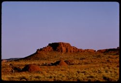
- Description:
- 100 f 8 TL
- Subject:
- Valleys, Grasses, Mitchell Butte (Ariz.), Mesas, Buttes, Fences, Rock formations, Mounds (Landforms), Vehicles, Hills, and Monument Valley (Ariz. and Utah)
- Series:
- 37-65
- Creator:
- Cushman, Charles W., 1896-1972
- Date Created:
- 1965-10-09
- Genre:
- Landscape photographs
- Frame Number:
- 26
- County:
- Navajo
- Abstract:
- Mitchell Butte @ 72,269 mi.
- Call Number:
- P15132
- Country:
- United States
- State/Province:
- Arizona
- Alternate Identifier:
- 3765.26
- Persistent URL:
- http://purl.dlib.indiana.edu/iudl/archives/cushman/P15132
- Holding Location:
- Bloomington - University Archives
Wells Library E460
1320 E 10th St.
Bloomington, IN 47405
Contact at archives@indiana.edu, 812-855-1127
-
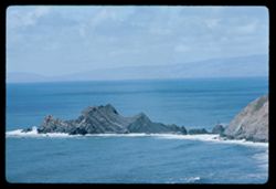
- Description:
- 100f 8 TL
- Subject:
- Rocks, Oceans, Coastlines, Capes (Coasts), Point Montara (Calif.), Rock formations, and Hills
- Series:
- 1-63
- Creator:
- Cushman, Charles W., 1896-1972
- Date Created:
- 1963-04-15
- Genre:
- Seascapes
- Frame Number:
- 21
- County:
- San Mateo
- Call Number:
- P12825
- Country:
- United States
- State/Province:
- California
- Alternate Identifier:
- 163.21
- Persistent URL:
- http://purl.dlib.indiana.edu/iudl/archives/cushman/P12825
- Holding Location:
- Bloomington - University Archives
Wells Library E460
1320 E 10th St.
Bloomington, IN 47405
Contact at archives@indiana.edu, 812-855-1127