
Search Constraints
You searched for:
Campus
IUB
Remove constraint Campus: IUB
Subject
Hills
Remove constraint Subject: Hills
Subject
Shrubs
Remove constraint Subject: Shrubs
« Previous |
1 - 100 of 624
|
Next »
Search Results
-
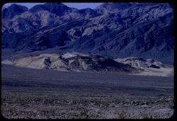
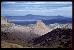
- Description:
- 100 f 8 tl
- Subject:
- Hills, Funeral Mountains (Calif.), Funeral Mountains Wilderness (Calif.), Mountains, Shrubs, Furnace Creek (Calif.), Rocks, and Clouds
- Series:
- 2-55
- Creator:
- Cushman, Charles W., 1896-1972
- Date Created:
- 1955-02-27
- Genre:
- Landscape photographs
- Frame Number:
- 29
- Street Address:
- Furance Creek-Death Valley Junction Road
- County:
- Mono and Inyo
- Abstract:
- North toward Funeral Mtns
- Call Number:
- P07586
- City:
- Death Valley Junction
- Country:
- United States
- State/Province:
- California
- Alternate Identifier:
- 255.29
- Persistent URL:
- http://purl.dlib.indiana.edu/iudl/archives/cushman/P07586
- Holding Location:
- Bloomington - University Archives
Wells Library E460
1320 E 10th St.
Bloomington, IN 47405
Contact at archives@indiana.edu, 812-855-1127
-
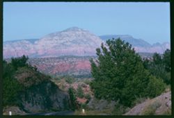
- Description:
- 50 f 11
- Subject:
- Meadows, Hills, Shrubs, Grasses, Fences, Clouds, and Rock formations
- Series:
- 15-53
- Creator:
- Cushman, Charles W., 1896-1972
- Date Created:
- 1953-11-21
- Genre:
- Landscape photographs
- Frame Number:
- 26
- County:
- Coconino
- Abstract:
- Rock forms NW from Sedona
- Call Number:
- P07059
- City:
- Sedona
- Country:
- United States
- State/Province:
- Arizona
- Alternate Identifier:
- 1553.26
- Persistent URL:
- http://purl.dlib.indiana.edu/iudl/archives/cushman/P07059
- Holding Location:
- Bloomington - University Archives
Wells Library E460
1320 E 10th St.
Bloomington, IN 47405
Contact at archives@indiana.edu, 812-855-1127
-
- Description:
- 50 f 8
- Subject:
- Stone walls, Flowers, Hills, Bridges, Snake River (Wyo.-Wash.), Shrubs, Electric lines, Trees, Buildings, Retaining walls, Rivers, and Clouds
- Series:
- 24-60
- Creator:
- Cushman, Charles W., 1896-1972
- Date Created:
- 1960-09-23
- Genre:
- Landscape photographs, Cityscape photographs, and Views
- Frame Number:
- 38
- County:
- Nez Perce and Asotin
- Abstract:
- Lewiston from Clarkston across Snake
- Call Number:
- P11689
- City:
- Lewiston and Clarkston
- Country:
- United States
- State/Province:
- Idaho and Washington
- Alternate Identifier:
- 2460.38
- Persistent URL:
- http://purl.dlib.indiana.edu/iudl/archives/cushman/P11689
- Holding Location:
- Bloomington - University Archives
Wells Library E460
1320 E 10th St.
Bloomington, IN 47405
Contact at archives@indiana.edu, 812-855-1127
-
- Description:
- 50 f 8 sl
- Subject:
- Croplands, Tree limbs, Roofs, Flowers, Hills, Railroad bridges, Snake River (Wyo.-Wash.), Shrubs, Trees, Shadows, Clouds, and Buildings
- Series:
- 24-60
- Creator:
- Cushman, Charles W., 1896-1972
- Date Created:
- 1960-09-23
- Genre:
- Landscape photographs and Views
- Frame Number:
- 37
- County:
- Nez Perce and Asotin
- Abstract:
- Lewiston
- Call Number:
- P11688
- City:
- Lewiston and Clarkston
- Country:
- United States
- State/Province:
- Idaho and Washington
- Alternate Identifier:
- 2460.37
- Persistent URL:
- http://purl.dlib.indiana.edu/iudl/archives/cushman/P11688
- Holding Location:
- Bloomington - University Archives
Wells Library E460
1320 E 10th St.
Bloomington, IN 47405
Contact at archives@indiana.edu, 812-855-1127
-
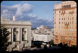
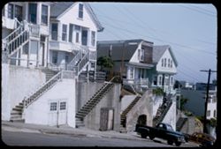
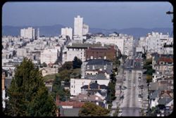
- Description:
- 25 f 11
- Subject:
- Streets, Hills, Street lights, Windows, Columns, Dwellings, Trees, Buildings, Lafayette Square (San Francisco, Calif.), Russian Hill (San Francisco, Calif.),...
- Series:
- 1-53
- Creator:
- Cushman, Charles W., 1896-1972
- Date Created:
- 1953-01-20
- Genre:
- Cityscape photographs
- Frame Number:
- 17
- County:
- San Francisco
- Abstract:
- View NE from Lafayette Pk. - Russian Hill between Spreekels Mansion + Apt. Bldg.
- Call Number:
- P06530
- City:
- San Francisco
- Country:
- United States
- State/Province:
- California
- Alternate Identifier:
- 153.17
- Persistent URL:
- http://purl.dlib.indiana.edu/iudl/archives/cushman/P06530
- Holding Location:
- Bloomington - University Archives
Wells Library E460
1320 E 10th St.
Bloomington, IN 47405
Contact at archives@indiana.edu, 812-855-1127
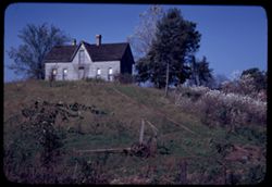
-
- Subject:
- Flowers, Hills, Farmhouses, Agricultural machinery & implements, Shrubs, Trees, Trails & paths, and Wabash River
- Series:
- 8-45
- Creator:
- Cushman, Charles W., 1896-1972
- Date Created:
- 1945-10-11
- Genre:
- Architectural photographs
- Frame Number:
- 12
- County:
- Vermillion
- Abstract:
- Little gray home perched atop hill above Hwy near Hillsdale, Ind.
- Call Number:
- P03024
- City:
- Hillsdale
- Country:
- United States
- State/Province:
- Indiana
- Alternate Identifier:
- 845.12
- Persistent URL:
- http://purl.dlib.indiana.edu/iudl/archives/cushman/P03024
- Holding Location:
- Bloomington - University Archives
Wells Library E460
1320 E 10th St.
Bloomington, IN 47405
Contact at archives@indiana.edu, 812-855-1127
-
- Description:
- 50 f 11
- Subject:
- Hills, Mountains, Shrubs, Trees, Buttes, and Fences
- Series:
- 18-52
- Creator:
- Cushman, Charles W., 1896-1972
- Date Created:
- 1952-04-15
- Genre:
- Landscape photographs
- Frame Number:
- 29
- Street Address:
- Los Alamos Road
- County:
- Santa Fe
- Abstract:
- View west from same pt as 27.
- Call Number:
- P06160
- City:
- Santa Fe
- Country:
- United States
- State/Province:
- New Mexico
- Alternate Identifier:
- 1852.29
- Persistent URL:
- http://purl.dlib.indiana.edu/iudl/archives/cushman/P06160
- Holding Location:
- Bloomington - University Archives
Wells Library E460
1320 E 10th St.
Bloomington, IN 47405
Contact at archives@indiana.edu, 812-855-1127
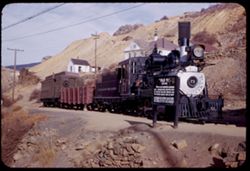
-
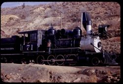
- Description:
- 25 f 8
- Subject:
- Houses, Railroad cars, Colorado and Southern Railway, Shrubs, Railroad locomotives, Retaining walls, Signs (Notices), Hills, Outbuildings, Utility poles, and...
- Series:
- 24-52
- Creator:
- Cushman, Charles W., 1896-1972
- Date Created:
- 1952-10-31
- Genre:
- Snapshots
- Frame Number:
- 29
- County:
- Gilpin and Denver
- Abstract:
- Old 71. Colorado's Southern Ry Co. service between Denver + Central City, 1872-1941.
- Call Number:
- P06360
- City:
- Denver and Central City
- Country:
- United States
- State/Province:
- Colorado
- Alternate Identifier:
- 2452.29
- Persistent URL:
- http://purl.dlib.indiana.edu/iudl/archives/cushman/P06360
- Holding Location:
- Bloomington - University Archives
Wells Library E460
1320 E 10th St.
Bloomington, IN 47405
Contact at archives@indiana.edu, 812-855-1127
-
- Description:
- 100 f 5.6 tl
- Subject:
- Lilacs, Hills, Shrubs, Trees, and Fences
- Series:
- 13-55
- Creator:
- Cushman, Charles W., 1896-1972
- Date Created:
- 1955-04-08
- Genre:
- Identification photographs
- Frame Number:
- 21
- Street Address:
- Palomares Road
- County:
- Alameda
- Abstract:
- Wild lilac on distant slope
- Call Number:
- P07955
- Country:
- United States
- State/Province:
- California
- Alternate Identifier:
- 1355.21
- Persistent URL:
- http://purl.dlib.indiana.edu/iudl/archives/cushman/P07955
- Holding Location:
- Bloomington - University Archives
Wells Library E460
1320 E 10th St.
Bloomington, IN 47405
Contact at archives@indiana.edu, 812-855-1127
-
- Description:
- 50 f 7 Pola
- Subject:
- Sangre de Cristo Mountains (Colo. and N.M.), Hills, Barbed wire, Cliffs, Mountains, Shrubs, Snow, and Fences
- Series:
- 18-52
- Creator:
- Cushman, Charles W., 1896-1972
- Date Created:
- 1952-04-15
- Genre:
- Landscape photographs
- Frame Number:
- 31
- Street Address:
- Highway 84
- County:
- Santa Fe
- Abstract:
- Again - from Hwy 84.
- Call Number:
- P06162
- City:
- Santa Fe
- Country:
- United States
- State/Province:
- New Mexico
- Alternate Identifier:
- 1852.31
- Persistent URL:
- http://purl.dlib.indiana.edu/iudl/archives/cushman/P06162
- Holding Location:
- Bloomington - University Archives
Wells Library E460
1320 E 10th St.
Bloomington, IN 47405
Contact at archives@indiana.edu, 812-855-1127
-
- Description:
- 100 f 5.6 tl
- Subject:
- Storage tanks, Hills, Automobiles, Roads, Bridges, Shrubs, Trees, Facilities, Valleys, Dwellings, and Utility poles
- Series:
- 4-55
- Creator:
- Cushman, Charles W., 1896-1972
- Date Created:
- 1955-03-01
- Genre:
- Cityscape photographs
- Frame Number:
- 28
- Street Address:
- California State Highway 33
- County:
- Fresno
- Abstract:
- Valley north of Coalinga
- Call Number:
- P07655
- City:
- Coalinga
- Country:
- United States
- State/Province:
- California
- Alternate Identifier:
- 455.28
- Persistent URL:
- http://purl.dlib.indiana.edu/iudl/archives/cushman/P07655
- Holding Location:
- Bloomington - University Archives
Wells Library E460
1320 E 10th St.
Bloomington, IN 47405
Contact at archives@indiana.edu, 812-855-1127
-
- Description:
- 25 f 6.3
- Subject:
- Hills, Mountains, Shrubs, Colorado River (Colo.-Mexico), and Rivers
- Series:
- 25-52
- Creator:
- Cushman, Charles W., 1896-1972
- Date Created:
- 1952-11-02
- Genre:
- Landscape photographs
- Frame Number:
- 28
- County:
- Garfield
- Abstract:
- Colorado river 16 mi. east of Glenwood Springs.
- Call Number:
- P06397
- City:
- Glenwood Springs
- Country:
- United States
- State/Province:
- Colorado
- Alternate Identifier:
- 2552.28
- Persistent URL:
- http://purl.dlib.indiana.edu/iudl/archives/cushman/P06397
- Holding Location:
- Bloomington - University Archives
Wells Library E460
1320 E 10th St.
Bloomington, IN 47405
Contact at archives@indiana.edu, 812-855-1127
-
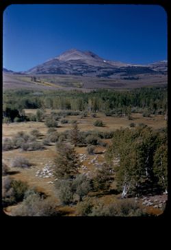
- Description:
- 50 f 9
- Subject:
- Sheep, Hills, Mountains, Shrubs, Sierra Nevada (Calif. and Nev.), Trees, Grazing, Grasses, and Dunderberg Peak (Calif.)
- Series:
- 9-54
- Creator:
- Cushman, Charles W., 1896-1972
- Date Created:
- 1954-09-16
- Genre:
- Landscape photographs
- Frame Number:
- 20
- Street Address:
- United States Highway 395
- County:
- Mono
- Abstract:
- Sheep below - looking toward Dunderberg Pk. (19-20-21 were taken less than mile north of Conway Summit)
- Call Number:
- P07331
- City:
- Bridgeport
- Country:
- United States
- State/Province:
- California
- Physical Description:
- masked.
- Alternate Identifier:
- 954.20
- Persistent URL:
- http://purl.dlib.indiana.edu/iudl/archives/cushman/P07331
- Holding Location:
- Bloomington - University Archives
Wells Library E460
1320 E 10th St.
Bloomington, IN 47405
Contact at archives@indiana.edu, 812-855-1127
-
- Description:
- 50 f 8
- Subject:
- Hills, Roads, Franklin Mountains (Tex. and N.M.), Mountains, Shrubs, Shadows, and Clouds
- Series:
- 17-51
- Creator:
- Cushman, Charles W., 1896-1972
- Date Created:
- 1952-01-01
- Genre:
- Landscape photographs
- Frame Number:
- 30
- County:
- El Paso
- Abstract:
- Whorls on a Mtn. side = Franklin Mtns.
- Call Number:
- P05481
- City:
- El Paso
- Country:
- United States
- State/Province:
- Texas
- Alternate Identifier:
- 1751.30
- Persistent URL:
- http://purl.dlib.indiana.edu/iudl/archives/cushman/P05481
- Holding Location:
- Bloomington - University Archives
Wells Library E460
1320 E 10th St.
Bloomington, IN 47405
Contact at archives@indiana.edu, 812-855-1127
-
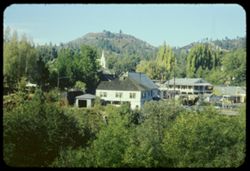
- Description:
- 25 f 9
- Subject:
- Cities & towns, Churches, Hills, Shrubs, Trees, Buildings, and Dwellings
- Series:
- 13-54
- Creator:
- Cushman, Charles W., 1896-1972
- Date Created:
- 1954-10-09
- Genre:
- Cityscape photographs
- Frame Number:
- 16
- County:
- Nevada
- Abstract:
- Looking down into Nevada City - white clouds.
- Call Number:
- P07438
- City:
- Nevada City
- Country:
- United States
- State/Province:
- California
- Alternate Identifier:
- 1354.16
- Persistent URL:
- http://purl.dlib.indiana.edu/iudl/archives/cushman/P07438
- Holding Location:
- Bloomington - University Archives
Wells Library E460
1320 E 10th St.
Bloomington, IN 47405
Contact at archives@indiana.edu, 812-855-1127
-
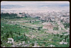
- Subject:
- Acropolis (Athens, Greece), Cities & towns, Churches, Archaeological sites, Agora (Athens, Greece), Markets, Shrubs, Trees, Greek temples, Hills, Colonna...
- Series:
- 8-65
- Creator:
- Cushman, Charles W., 1896-1972
- Date Created:
- 1965-04-11
- Genre:
- Cityscape photographs
- Frame Number:
- 22
- County:
- Attica
- Abstract:
- Sunday morning walk thru streets of Athens from hotel to north side of Acropolis, thence up to N.W. corner via back alleys-views across city to Likavitos and...
- Call Number:
- P14112
- City:
- Athens
- Country:
- Greece
- State/Province:
- Central Greece and Euboea
- Alternate Identifier:
- 865.22
- Persistent URL:
- http://purl.dlib.indiana.edu/iudl/archives/cushman/P14112
- Holding Location:
- Bloomington - University Archives
Wells Library E460
1320 E 10th St.
Bloomington, IN 47405
Contact at archives@indiana.edu, 812-855-1127
-
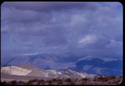
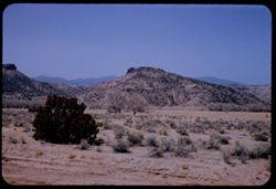
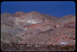
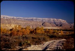
- Description:
- 100 f 6.3 tl
- Subject:
- Valleys, Black Mountains (Inyo County, Calif.), Death Valley (Calif. and Nev.), Mountains, Shrubs, and Hills
- Series:
- 8-55
- Creator:
- Cushman, Charles W., 1896-1972
- Date Created:
- 1955-03-22
- Genre:
- Landscape photographs
- Frame Number:
- 20
- Street Address:
- California State Highway 190
- County:
- Inyo
- Abstract:
- From 18 mi out - west toward Black Mtns - colored rock in valley
- Call Number:
- P07778
- Country:
- United States
- State/Province:
- California
- Alternate Identifier:
- 855.20
- Persistent URL:
- http://purl.dlib.indiana.edu/iudl/archives/cushman/P07778
- Holding Location:
- Bloomington - University Archives
Wells Library E460
1320 E 10th St.
Bloomington, IN 47405
Contact at archives@indiana.edu, 812-855-1127
-

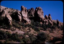
- Description:
- 25 f 11
- Subject:
- Hills, Mountains, Shrubs, Boulders, Rocks, Rock formations, and Crazy rocks
- Series:
- 14-52
- Creator:
- Cushman, Charles W., 1896-1972
- Date Created:
- 1952-04-08
- Genre:
- Landscape photographs
- Frame Number:
- 33
- Street Address:
- Mount Whitney Road
- County:
- Inyo
- Abstract:
- Crazy rocks along lower Mt. Whitney rd.
- Call Number:
- P06016
- City:
- Lone Pine
- Country:
- United States
- State/Province:
- California
- Alternate Identifier:
- 1452.33
- Persistent URL:
- http://purl.dlib.indiana.edu/iudl/archives/cushman/P06016
- Holding Location:
- Bloomington - University Archives
Wells Library E460
1320 E 10th St.
Bloomington, IN 47405
Contact at archives@indiana.edu, 812-855-1127
-
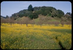
- Description:
- 50 f 8
- Subject:
- Meadows, Flowers, Hills, Mustard (Plant), Shrubs, Trees, and Grasses
- Series:
- 1-54
- Creator:
- Cushman, Charles W., 1896-1972
- Date Created:
- 1954-02-21
- Genre:
- Landscape photographs
- Frame Number:
- 4
- County:
- Marin
- Abstract:
- Mustard in a field near Novato
- Call Number:
- P07114
- City:
- Novato
- Country:
- United States
- State/Province:
- California
- Alternate Identifier:
- 154.4
- Persistent URL:
- http://purl.dlib.indiana.edu/iudl/archives/cushman/P07114
- Holding Location:
- Bloomington - University Archives
Wells Library E460
1320 E 10th St.
Bloomington, IN 47405
Contact at archives@indiana.edu, 812-855-1127
-
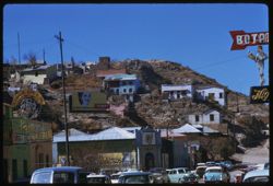
- Description:
- 50 f 9 tl
- Subject:
- Streets, Hills, Automobiles, People, Shrubs, Electric lines, Trees, Buildings, Signs (Notices), Houses, and Stores & shops
- Series:
- 7-59
- Creator:
- Cushman, Charles W., 1896-1972
- Date Created:
- 1959-02-04
- Genre:
- Cityscape photographs
- Frame Number:
- 18
- Abstract:
- Hillside houses
- Call Number:
- P10594
- City:
- Heroica Nogales
- Country:
- Mexico
- State/Province:
- Sonora
- Alternate Identifier:
- 759.18
- Persistent URL:
- http://purl.dlib.indiana.edu/iudl/archives/cushman/P10594
- Holding Location:
- Bloomington - University Archives
Wells Library E460
1320 E 10th St.
Bloomington, IN 47405
Contact at archives@indiana.edu, 812-855-1127
-
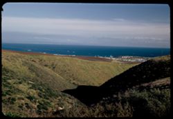
- Description:
- 25 f 6.3 Pola
- Subject:
- Buildings, Hills, Oceans, San Pedro Hill (Los Angeles County, Calif.), Shadows, Pacific Coast (Calif.), Shrubs, and Pacific Ocean
- Series:
- 7-52
- Creator:
- Cushman, Charles W., 1896-1972
- Date Created:
- 1952-02-21
- Genre:
- Landscape photographs and Cityscape photographs
- Frame Number:
- 7
- Street Address:
- San Pedro and Crest Road
- County:
- Los Angeles
- Abstract:
- View over San Pedro from Crest Road in San Pedro Hills
- Call Number:
- P05728
- City:
- Los Angeles
- Country:
- United States
- State/Province:
- California
- Alternate Identifier:
- 752.7
- Persistent URL:
- http://purl.dlib.indiana.edu/iudl/archives/cushman/P05728
- Holding Location:
- Bloomington - University Archives
Wells Library E460
1320 E 10th St.
Bloomington, IN 47405
Contact at archives@indiana.edu, 812-855-1127
-
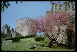
- Subject:
- Forts & fortifications, Hills, Castles & palaces, Battlements, Redbuds, Leaves, and Shrubs
- Series:
- 21-65
- Creator:
- Cushman, Charles W., 1896-1972
- Date Created:
- 1965-05-14
- Genre:
- Architectural photographs
- Frame Number:
- 32
- County:
- Istanbul
- Call Number:
- P14610
- City:
- Rumeli Hisari
- Country:
- Turkey
- State/Province:
- Marmara
- Alternate Identifier:
- 2165.32
- Persistent URL:
- http://purl.dlib.indiana.edu/iudl/archives/cushman/P14610
- Holding Location:
- Bloomington - University Archives
Wells Library E460
1320 E 10th St.
Bloomington, IN 47405
Contact at archives@indiana.edu, 812-855-1127
-
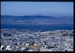
- Description:
- 100 f 6.3 tel. Lens
- Subject:
- Diablo, Mount (Calif.), Vessels, Streets, Hills, Bodies of water, Mountains, Dwellings, Trees, Buildings, Twin Peaks (San Francisco County, Calif.), Automobi...
- Series:
- 19-55
- Creator:
- Cushman, Charles W., 1896-1972
- Date Created:
- 1955-07-02
- Genre:
- Cityscape photographs
- Frame Number:
- 1
- County:
- San Francisco
- Abstract:
- Mt. Diablo from Twin Peaks
- Call Number:
- P08154
- City:
- San Francisco
- Country:
- United States
- State/Province:
- California
- Physical Description:
- Image was originally mounted in a glass enclosure. Before digitization, the image was removed and placed in a Wess Plastic, Inc. brand, 2" x 2", pl...
- Alternate Identifier:
- 1955.1
- Persistent URL:
- http://purl.dlib.indiana.edu/iudl/archives/cushman/P08154
- Holding Location:
- Bloomington - University Archives
Wells Library E460
1320 E 10th St.
Bloomington, IN 47405
Contact at archives@indiana.edu, 812-855-1127
-
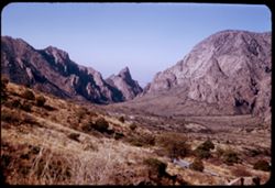
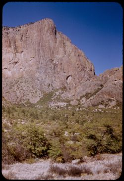
- Description:
- 50 f 8
- Subject:
- Valleys, Hills, Mountains, Lost Mine Trail (Big Bend National Park (Tex.)), Trees, Canyons, National parks & reserves, Big Bend National Park (Tex.), Cli...
- Series:
- 16-51
- Creator:
- Cushman, Charles W., 1896-1972
- Date Created:
- 1951-12-27
- Genre:
- Landscape photographs
- Frame Number:
- 11
- County:
- Brewster
- Abstract:
- Road winds down to The Basin
- Call Number:
- P05430
- Country:
- United States
- State/Province:
- Texas
- Alternate Identifier:
- 1651.11
- Persistent URL:
- http://purl.dlib.indiana.edu/iudl/archives/cushman/P05430
- Holding Location:
- Bloomington - University Archives
Wells Library E460
1320 E 10th St.
Bloomington, IN 47405
Contact at archives@indiana.edu, 812-855-1127
-
- Description:
- 100 f 5.6 tl
- Subject:
- Valleys, Facilities, Hills, Mountains, Storage tanks, Oil wells, Temblor Range (Calif.), Electric lines, Shrubs, Roads, and Utility poles
- Series:
- 4-55
- Creator:
- Cushman, Charles W., 1896-1972
- Date Created:
- 1955-03-01
- Genre:
- Views
- Frame Number:
- 23
- County:
- Kern
- Abstract:
- View west from Fellows
- Call Number:
- P07650
- City:
- Fellows
- Country:
- United States
- State/Province:
- California
- Alternate Identifier:
- 455.23
- Persistent URL:
- http://purl.dlib.indiana.edu/iudl/archives/cushman/P07650
- Holding Location:
- Bloomington - University Archives
Wells Library E460
1320 E 10th St.
Bloomington, IN 47405
Contact at archives@indiana.edu, 812-855-1127
-
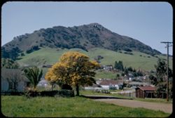
- Description:
- 50 f 5.6
- Subject:
- Buildings, Hills, Mountains, Grasses, Trees, Utility poles, Acacia, Houses, Flowers, Roads, Automobiles, Electric lines, and Shrubs
- Series:
- 8-52
- Creator:
- Cushman, Charles W., 1896-1972
- Date Created:
- 1952-03-02
- Genre:
- Landscape photographs
- Frame Number:
- 37
- County:
- San Luis Obispo
- Abstract:
- San Luis mtn with acacia below
- Call Number:
- P05796
- City:
- San Luis Obispo
- Country:
- United States
- State/Province:
- California
- Alternate Identifier:
- 852.37
- Persistent URL:
- http://purl.dlib.indiana.edu/iudl/archives/cushman/P05796
- Holding Location:
- Bloomington - University Archives
Wells Library E460
1320 E 10th St.
Bloomington, IN 47405
Contact at archives@indiana.edu, 812-855-1127
-
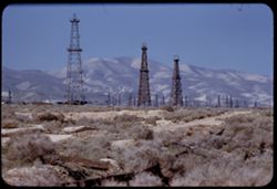
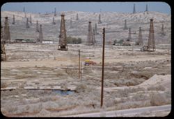
- Description:
- 100 f 5.6 tl
- Subject:
- Oil wells, Storage tanks, Hills, Mountains, Dirt roads, Shrubs, Oil well drilling rigs, and Facilities
- Series:
- 4-55
- Creator:
- Cushman, Charles W., 1896-1972
- Date Created:
- 1955-03-01
- Genre:
- Views
- Frame Number:
- 22
- County:
- Kern
- Abstract:
- 3 derricks with folded hills in background (Hazy)
- Call Number:
- P07649
- City:
- Taft
- Country:
- United States
- State/Province:
- California
- Alternate Identifier:
- 455.22
- Persistent URL:
- http://purl.dlib.indiana.edu/iudl/archives/cushman/P07649
- Holding Location:
- Bloomington - University Archives
Wells Library E460
1320 E 10th St.
Bloomington, IN 47405
Contact at archives@indiana.edu, 812-855-1127
-
- Description:
- 100 f 8
- Subject:
- Rock formations, Hills, Mountains, Untersberg (Austria), Shrubs, Roads, Airports, and Cliffs
- Series:
- 9-64
- Creator:
- Cushman, Charles W., 1896-1972
- Date Created:
- 1964-05-24
- Genre:
- Landscape photographs
- Frame Number:
- 17
- Abstract:
- On Untersberg Toward Salzburg
- Call Number:
- P13257
- City:
- Salzburg
- Country:
- Austria
- State/Province:
- Salzburg
- Alternate Identifier:
- 964.17
- Persistent URL:
- http://purl.dlib.indiana.edu/iudl/archives/cushman/P13257
- Holding Location:
- Bloomington - University Archives
Wells Library E460
1320 E 10th St.
Bloomington, IN 47405
Contact at archives@indiana.edu, 812-855-1127
-
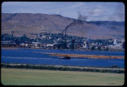
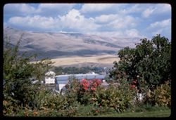
- Description:
- 100 f 6.3 tl
- Subject:
- Bodies of water, Buildings, Facilities, Hills, Trees, Dwellings, Automobiles, Shrubs, Smoke, Clouds, Boats, and Smokestacks
- Series:
- 18-55
- Creator:
- Cushman, Charles W., 1896-1972
- Date Created:
- 1955-06-17
- Genre:
- Cityscape photographs
- Frame Number:
- 3
- Street Address:
- United States Highway 97
- County:
- Klamath
- Abstract:
- Klamath Falls from Hwy on south
- Call Number:
- P08120
- City:
- Klamath Falls
- Country:
- United States
- State/Province:
- Oregon
- Alternate Identifier:
- 1855.3
- Persistent URL:
- http://purl.dlib.indiana.edu/iudl/archives/cushman/P08120
- Holding Location:
- Bloomington - University Archives
Wells Library E460
1320 E 10th St.
Bloomington, IN 47405
Contact at archives@indiana.edu, 812-855-1127
-
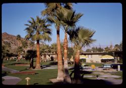
- Description:
- 50 f 9 SL
- Subject:
- Buildings, Tennis, Hills, Palms, Sports & recreation facilities, Palm Springs Tennis Club, Shrubs, Tables, Walkways, Umbrellas, and Chairs
- Series:
- 24-61
- Creator:
- Cushman, Charles W., 1896-1972
- Date Created:
- 1961-12-26
- Genre:
- Views
- Frame Number:
- 5
- County:
- Riverside
- Abstract:
- Palm Spr. Tennis Club and at Palm Springs Tennis Club
- Call Number:
- P12571
- City:
- Palm Springs
- Country:
- United States
- State/Province:
- California
- Alternate Identifier:
- 2461.5
- Persistent URL:
- http://purl.dlib.indiana.edu/iudl/archives/cushman/P12571
- Holding Location:
- Bloomington - University Archives
Wells Library E460
1320 E 10th St.
Bloomington, IN 47405
Contact at archives@indiana.edu, 812-855-1127
-
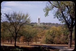
- Description:
- 50 f 8
- Subject:
- Bell towers, Universities & colleges, Hills, Tree limbs, Trees, Towers, Lawns, University of Kansas, Shrubs, Roads, Sidewalks, and Tree trunks
- Series:
- 11-53
- Creator:
- Cushman, Charles W., 1896-1972
- Date Created:
- 1953-10-18
- Genre:
- Architectural photographs
- Frame Number:
- 23
- County:
- Douglas
- Abstract:
- Campanile Tower in Kansas Univ. campus
- Call Number:
- P06902
- City:
- Lawrence
- Country:
- United States
- State/Province:
- Kansas
- Alternate Identifier:
- 1153.23
- Persistent URL:
- http://purl.dlib.indiana.edu/iudl/archives/cushman/P06902
- Holding Location:
- Bloomington - University Archives
Wells Library E460
1320 E 10th St.
Bloomington, IN 47405
Contact at archives@indiana.edu, 812-855-1127
-
- Description:
- 50 f 8
- Subject:
- National parks & reserves, Thumbs and fingers, Hills, Roads, Cliffs, Big Bend National Park (Tex.), Shrubs, Trees, Buttes, Southwest Texas, and Rock form...
- Series:
- 16-51
- Creator:
- Cushman, Charles W., 1896-1972
- Date Created:
- 1951-12-27
- Genre:
- Landscape photographs
- Frame Number:
- 10
- County:
- Brewster
- Abstract:
- Up at Thumbs & fingers
- Call Number:
- P05429
- Country:
- United States
- State/Province:
- Texas
- Alternate Identifier:
- 1651.10
- Persistent URL:
- http://purl.dlib.indiana.edu/iudl/archives/cushman/P05429
- Holding Location:
- Bloomington - University Archives
Wells Library E460
1320 E 10th St.
Bloomington, IN 47405
Contact at archives@indiana.edu, 812-855-1127
-
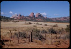
- Description:
- 100 f 11
- Subject:
- Hills, Roads, Cliffs, Mountains, Shrubs, Trees, and Grasses
- Series:
- 5-62
- Creator:
- Cushman, Charles W., 1896-1972
- Date Created:
- 1962-10-05
- Genre:
- Landscape photographs
- Frame Number:
- 16
- County:
- Coconino
- Abstract:
- East from 6 or 7 mi. west of Sedona
- Call Number:
- P12783
- City:
- Sedona
- Country:
- United States
- State/Province:
- Arizona
- Alternate Identifier:
- 562.16
- Persistent URL:
- http://purl.dlib.indiana.edu/iudl/archives/cushman/P12783
- Holding Location:
- Bloomington - University Archives
Wells Library E460
1320 E 10th St.
Bloomington, IN 47405
Contact at archives@indiana.edu, 812-855-1127
-
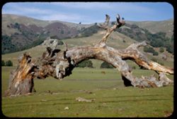
- Description:
- 25 f 11
- Subject:
- Meadows, Horses, Hills, Shrubs, Trees, Grazing, Grasses, and Fences
- Series:
- 2-53
- Creator:
- Cushman, Charles W., 1896-1972
- Date Created:
- 1953-01-29
- Genre:
- Landscape photographs
- Frame Number:
- 10
- County:
- Marin
- Abstract:
- Fallen tree in meadow.
- Call Number:
- P06544
- Country:
- United States
- State/Province:
- California
- Alternate Identifier:
- 253.10
- Persistent URL:
- http://purl.dlib.indiana.edu/iudl/archives/cushman/P06544
- Holding Location:
- Bloomington - University Archives
Wells Library E460
1320 E 10th St.
Bloomington, IN 47405
Contact at archives@indiana.edu, 812-855-1127
-
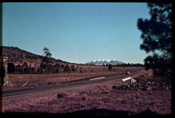
- Subject:
- San Francisco Peaks (Ariz.), Hills, Automobiles, Roads, Bridges, Mountains, Grand Canyon Junction (Ariz.), Shrubs, Snow, Trees, Rocks, Fences, and Masonry
- Series:
- 10-39
- Creator:
- Cushman, Charles W., 1896-1972
- Date Created:
- 1939-12-01
- Genre:
- Landscape photographs
- Frame Number:
- 3
- County:
- Coconino
- Abstract:
- T-3: San Franciscos Pk. from Grand Canyon Junction
- Call Number:
- P01719
- City:
- Flagstaff
- Country:
- United States
- State/Province:
- Arizona
- Physical Description:
- some dye fading. Image was originally mounted in a glass enclosure. Before digitization, the image was removed and placed in a Wess Plastic, Inc. brand, 2&qu...
- Alternate Identifier:
- 1039.3
- Persistent URL:
- http://purl.dlib.indiana.edu/iudl/archives/cushman/P01719
- Holding Location:
- Bloomington - University Archives
Wells Library E460
1320 E 10th St.
Bloomington, IN 47405
Contact at archives@indiana.edu, 812-855-1127
-
- Description:
- 25 f 9
- Subject:
- Plains, Hills, Mountains, Shrubs, Sawtooth Mountain (Tex.), and Davis Mountains State Park (Tex.)
- Series:
- 17-51
- Creator:
- Cushman, Charles W., 1896-1972
- Date Created:
- 1951-12-29
- Genre:
- Landscape photographs
- Frame Number:
- 5
- Street Address:
- Texas State Highway 166 and Loop Texas State Highway 166
- County:
- Jeff Davis
- Abstract:
- Sawtooth Mtn. from SW.
- Call Number:
- P05462
- Country:
- United States
- State/Province:
- Texas
- Alternate Identifier:
- 1751.5
- Persistent URL:
- http://purl.dlib.indiana.edu/iudl/archives/cushman/P05462
- Holding Location:
- Bloomington - University Archives
Wells Library E460
1320 E 10th St.
Bloomington, IN 47405
Contact at archives@indiana.edu, 812-855-1127
-
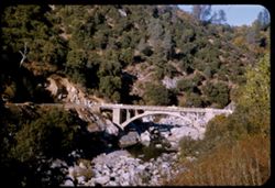
- Description:
- 50 f 8
- Subject:
- Concrete, Yuba River (Calif.), Bridges, Arched, Hills, Automobiles, Arches, Roads, Bridges, Shrubs, Trees, Rocks, and Rivers
- Series:
- 14-54
- Creator:
- Cushman, Charles W., 1896-1972
- Date Created:
- 1954-10-09
- Genre:
- Architectural photographs
- Frame Number:
- 4
- Street Address:
- California State Highway 49
- County:
- Nevada
- Abstract:
- Concrete arch bridge of Cal 49 over South Yuba NW of Nevada City.
- Call Number:
- P07446
- City:
- Nevada City
- Country:
- United States
- State/Province:
- California
- Alternate Identifier:
- 1454.4
- Persistent URL:
- http://purl.dlib.indiana.edu/iudl/archives/cushman/P07446
- Holding Location:
- Bloomington - University Archives
Wells Library E460
1320 E 10th St.
Bloomington, IN 47405
Contact at archives@indiana.edu, 812-855-1127
-
- Description:
- 100 f 6.3 tl
- Subject:
- Hills, Bodies of water, Mountains, Shrubs, Snow, Trees, Clouds, Fences, Shasta, Mount (Calif. : Mountain), and Grasses
- Series:
- 18-55
- Creator:
- Cushman, Charles W., 1896-1972
- Date Created:
- 1955-06-17
- Genre:
- Landscape photographs
- Frame Number:
- 2
- County:
- Siskiyou
- Abstract:
- Mt. Shasta at 2:35 from road east of Grenada
- Call Number:
- P08119
- City:
- Grenada
- Country:
- United States
- State/Province:
- California
- Alternate Identifier:
- 1855.2
- Persistent URL:
- http://purl.dlib.indiana.edu/iudl/archives/cushman/P08119
- Holding Location:
- Bloomington - University Archives
Wells Library E460
1320 E 10th St.
Bloomington, IN 47405
Contact at archives@indiana.edu, 812-855-1127
-
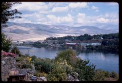
- Description:
- 100 f 6.3 tl
- Subject:
- Cities & towns, Upper Klamath Lake (Or.), Hills, Bodies of water, Roads, Dwellings, Trees, Buildings, Fences, and Shrubs
- Series:
- 18-55
- Creator:
- Cushman, Charles W., 1896-1972
- Date Created:
- 1955-06-17
- Genre:
- Cityscape photographs
- Frame Number:
- 5
- County:
- Klamath
- Abstract:
- View across Klamath Lake toward city of Klamath Falls from west
- Call Number:
- P08122
- City:
- Klamath Falls
- Country:
- United States
- State/Province:
- Oregon
- Alternate Identifier:
- 1855.5
- Persistent URL:
- http://purl.dlib.indiana.edu/iudl/archives/cushman/P08122
- Holding Location:
- Bloomington - University Archives
Wells Library E460
1320 E 10th St.
Bloomington, IN 47405
Contact at archives@indiana.edu, 812-855-1127
-
- Description:
- 50 f 8
- Subject:
- Yuba River (Calif.), Hills, Shrubs, Trees, Rocks, Buttes, and Shadows
- Series:
- 14-54
- Creator:
- Cushman, Charles W., 1896-1972
- Date Created:
- 1954-10-10
- Genre:
- Landscape photographs
- Frame Number:
- 19
- Street Address:
- California State Highway 49
- County:
- Sierra
- Abstract:
- View NE up Yuba river.
- Call Number:
- P07461
- City:
- Sierra City
- Country:
- United States
- State/Province:
- California
- Alternate Identifier:
- 1454.19
- Persistent URL:
- http://purl.dlib.indiana.edu/iudl/archives/cushman/P07461
- Holding Location:
- Bloomington - University Archives
Wells Library E460
1320 E 10th St.
Bloomington, IN 47405
Contact at archives@indiana.edu, 812-855-1127
-
- Description:
- 100 f 9 TL
- Subject:
- Passes (Landforms), Hills, Cajon Pass (Calif.), Shrubs, Trees, Rock formations, Mountains, and Grasses
- Series:
- 2-69
- Creator:
- Cushman, Charles W., 1896-1972
- Date Created:
- 1969-03-14
- Genre:
- Landscape photographs
- Frame Number:
- 17
- County:
- San Bernardino
- Abstract:
- Cajon Pass
- Call Number:
- P15734
- Country:
- United States
- State/Province:
- California
- Alternate Identifier:
- 269.17
- Persistent URL:
- http://purl.dlib.indiana.edu/iudl/archives/cushman/P15734
- Holding Location:
- Bloomington - University Archives
Wells Library E460
1320 E 10th St.
Bloomington, IN 47405
Contact at archives@indiana.edu, 812-855-1127
-
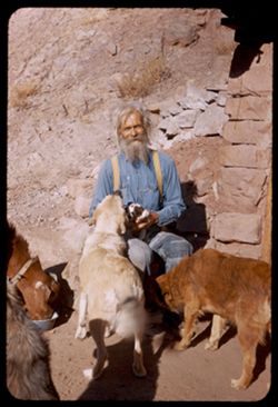
- Subject:
- Dogs, Stone walls, Puppies, Men, Hills, Shrubs, Families, Rocks, Bowls (Tableware), Goats, and Shadows
- Series:
- 26-52
- Creator:
- Cushman, Charles W., 1896-1972
- Date Created:
- 1952-11-04
- Genre:
- Portraits
- Frame Number:
- 39
- County:
- Grand
- Persons Pictured:
- Holley, Jack W.
- Abstract:
- Jack W. Holley and family. Dandy, 3 dogs + 1 puppy.
- Call Number:
- P06445
- City:
- Moab
- Country:
- United States
- State/Province:
- Utah
- Alternate Identifier:
- 2652.39
- Persistent URL:
- http://purl.dlib.indiana.edu/iudl/archives/cushman/P06445
- Holding Location:
- Bloomington - University Archives
Wells Library E460
1320 E 10th St.
Bloomington, IN 47405
Contact at archives@indiana.edu, 812-855-1127
-
- Description:
- 50 f 9
- Subject:
- National parks & reserves, Deserts, Devils Garden (Grand County, Utah), Hills, Sand, Mountains, Shrubs, Arches National Park (Utah), Wildflowers, Rock fo...
- Series:
- 27-52
- Creator:
- Cushman, Charles W., 1896-1972
- Date Created:
- 1952-11-04
- Genre:
- Landscape photographs
- Frame Number:
- 21
- County:
- Grand
- Abstract:
- En route to Devil's Garden. Sandstone Dunes.
- Call Number:
- P06466
- Country:
- United States
- State/Province:
- Utah
- Alternate Identifier:
- 2752.21
- Persistent URL:
- http://purl.dlib.indiana.edu/iudl/archives/cushman/P06466
- Holding Location:
- Bloomington - University Archives
Wells Library E460
1320 E 10th St.
Bloomington, IN 47405
Contact at archives@indiana.edu, 812-855-1127
-
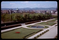
- Description:
- 100 f 8
- Subject:
- Domes, Lakes & ponds, Flowers, Hedges (Plants), Hills, Galleries & museums, Shrubs, Österreichische Galerie Belvedere, Castles & palaces, Walkway...
- Series:
- 3-64
- Creator:
- Cushman, Charles W., 1896-1972
- Date Created:
- 1964-05-06
- Genre:
- Cityscape photographs
- Frame Number:
- 29
- Abstract:
- From upper story
- Call Number:
- P13042
- City:
- Vienna
- Country:
- Austria
- State/Province:
- Vienna
- Alternate Identifier:
- 364.29
- Persistent URL:
- http://purl.dlib.indiana.edu/iudl/archives/cushman/P13042
- Holding Location:
- Bloomington - University Archives
Wells Library E460
1320 E 10th St.
Bloomington, IN 47405
Contact at archives@indiana.edu, 812-855-1127
-
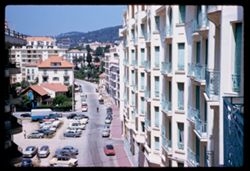
- Subject:
- Hotels, Balconies, Streets, Hills, Automobiles, Windows, Hotel Martinez (Cannes, France), Sidewalks, Shrubs, Trees, Buildings, Palms, and Mountains
- Series:
- 7-60
- Creator:
- Cushman, Charles W., 1896-1972
- Date Created:
- 1960-05-15
- Genre:
- Cityscape photographs
- Frame Number:
- 27
- County:
- Alpes-Maritimes
- Abstract:
- View north alongside hotel Martinez
- Call Number:
- P11091
- City:
- Cannes
- Country:
- France
- State/Province:
- Provence-Alpes-Côte d'Azur
- Alternate Identifier:
- 760.27
- Persistent URL:
- http://purl.dlib.indiana.edu/iudl/archives/cushman/P11091
- Holding Location:
- Bloomington - University Archives
Wells Library E460
1320 E 10th St.
Bloomington, IN 47405
Contact at archives@indiana.edu, 812-855-1127
-

- Description:
- 50 f 8
- Subject:
- Roofs, Hills, Dwellings, Trees, Buildings, Grasses, Corona Heights (San Francisco, Calif.), and Shrubs
- Series:
- 3-54
- Creator:
- Cushman, Charles W., 1896-1972
- Date Created:
- 1954-07-03
- Genre:
- Cityscape photographs
- Frame Number:
- 21
- Street Address:
- Roosevelt Way
- County:
- San Francisco
- Abstract:
- Corona Heights from SW. along Roosevelt Way
- Call Number:
- P07172
- City:
- San Francisco
- Country:
- United States
- State/Province:
- California
- Physical Description:
- Anscochrome film.
- Alternate Identifier:
- 354.21
- Persistent URL:
- http://purl.dlib.indiana.edu/iudl/archives/cushman/P07172
- Holding Location:
- Bloomington - University Archives
Wells Library E460
1320 E 10th St.
Bloomington, IN 47405
Contact at archives@indiana.edu, 812-855-1127
-
- Description:
- 100 f 5.6 tl
- Subject:
- Hills, Roads, Shrubs, Trees, Buttes, Clouds, Fences, and Grasses
- Series:
- 5-59
- Creator:
- Cushman, Charles W., 1896-1972
- Date Created:
- 1959-01-19
- Genre:
- Landscape photographs
- Frame Number:
- 3
- County:
- Jeff Davis and Culberson
- Abstract:
- A butte on road to Kent
- Call Number:
- P10504
- City:
- Kent and Fort Davis
- Country:
- United States
- State/Province:
- Texas
- Alternate Identifier:
- 559.3
- Persistent URL:
- http://purl.dlib.indiana.edu/iudl/archives/cushman/P10504
- Holding Location:
- Bloomington - University Archives
Wells Library E460
1320 E 10th St.
Bloomington, IN 47405
Contact at archives@indiana.edu, 812-855-1127
-
- Description:
- 100 f 6.3 tl
- Subject:
- Lakes & ponds, Cities & towns, Hills, Roads, Mountains, Shrubs, Trees, Buildings, Plants, Houses, and Lake Elsinore (Calif.)
- Series:
- 11-59
- Creator:
- Cushman, Charles W., 1896-1972
- Date Created:
- 1959-03-25
- Genre:
- Aerial photographs
- Frame Number:
- 22
- County:
- Riverside
- Abstract:
- L. Elsinore from above
- Call Number:
- P10747
- City:
- Elsinore
- Country:
- United States
- State/Province:
- California
- Alternate Identifier:
- 1159.22
- Persistent URL:
- http://purl.dlib.indiana.edu/iudl/archives/cushman/P10747
- Holding Location:
- Bloomington - University Archives
Wells Library E460
1320 E 10th St.
Bloomington, IN 47405
Contact at archives@indiana.edu, 812-855-1127
-
- Description:
- 100 f 8 TL
- Subject:
- Domes, Streets, Hills, Skyscrapers, Roads, Mountains, Shrubs, Buildings, Grasses, Houses, and Dwellings
- Series:
- 12-59
- Creator:
- Cushman, Charles W., 1896-1972
- Date Created:
- 1959-05-10
- Genre:
- Cityscape photographs
- Frame Number:
- 36
- Street Address:
- Clipper Street
- County:
- San Francisco
- Abstract:
- From top of Clipper St.
- Call Number:
- P10798
- City:
- San Francisco
- Country:
- United States
- State/Province:
- California
- Alternate Identifier:
- 1259.36
- Persistent URL:
- http://purl.dlib.indiana.edu/iudl/archives/cushman/P10798
- Holding Location:
- Bloomington - University Archives
Wells Library E460
1320 E 10th St.
Bloomington, IN 47405
Contact at archives@indiana.edu, 812-855-1127
-
- Description:
- 100 f 9 tl
- Subject:
- San Jacinto Peak (Calif.), Hills, San Gorgonio Mountain (Calif.), Sand, Mountains, Shrubs, and Snow
- Series:
- 11-59
- Creator:
- Cushman, Charles W., 1896-1972
- Date Created:
- 1959-03-25
- Genre:
- Landscape photographs
- Frame Number:
- 16
- County:
- Riverside
- Abstract:
- San Jacinto mtn thru watch in bown foothills
- Call Number:
- P10741
- Country:
- United States
- State/Province:
- California
- Alternate Identifier:
- 1159.16
- Persistent URL:
- http://purl.dlib.indiana.edu/iudl/archives/cushman/P10741
- Holding Location:
- Bloomington - University Archives
Wells Library E460
1320 E 10th St.
Bloomington, IN 47405
Contact at archives@indiana.edu, 812-855-1127
-
- Description:
- 50 f 8
- Subject:
- Houses, Windows, Sidewalks, People, Shrubs, Electric lines, Trees, Vehicles, Doors & doorways, Hills, Potrero Hill (San Francisco, Calif.), and Utility p...
- Series:
- 2-54
- Creator:
- Cushman, Charles W., 1896-1972
- Date Created:
- 1954-05-17
- Genre:
- Architectural photographs
- Frame Number:
- 1
- Street Address:
- De Haro Street, Twenty-third Street, and Twenty-second Street
- County:
- San Francisco
- Abstract:
- Houses on east side of De Haro St. - about 1051-9
- Call Number:
- P07132
- City:
- San Francisco
- Country:
- United States
- State/Province:
- California
- Alternate Identifier:
- 254.1
- Persistent URL:
- http://purl.dlib.indiana.edu/iudl/archives/cushman/P07132
- Holding Location:
- Bloomington - University Archives
Wells Library E460
1320 E 10th St.
Bloomington, IN 47405
Contact at archives@indiana.edu, 812-855-1127
-

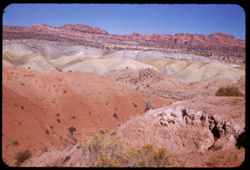
- Description:
- 25 f 14
- Subject:
- Deserts, Amargosa Range (Nev. and Calif.), Valleys, Hills, Death Valley (Calif. and Nev.), Cliffs, Mountains, Shrubs, Rocks, Canyons, and Desolation Canyon (...
- Series:
- 15-52
- Creator:
- Cushman, Charles W., 1896-1972
- Date Created:
- 1952-04-09
- Genre:
- Landscape photographs
- Frame Number:
- 21
- Street Address:
- Bad Water Road
- County:
- Inyo
- Abstract:
- Approx. same.
- Call Number:
- P06041
- City:
- Furnace Creek
- Country:
- United States
- State/Province:
- California
- Alternate Identifier:
- 1552.21
- Persistent URL:
- http://purl.dlib.indiana.edu/iudl/archives/cushman/P06041
- Holding Location:
- Bloomington - University Archives
Wells Library E460
1320 E 10th St.
Bloomington, IN 47405
Contact at archives@indiana.edu, 812-855-1127
-
- Description:
- 25 f 11
- Subject:
- Noon, National parks & reserves, Pulliam Peak (Tex.), Canyons, Valleys, Hills, Cliffs, Big Bend National Park (Tex.), Mountains, Shrubs, Trees, Basin (Bi...
- Series:
- 16-51
- Creator:
- Cushman, Charles W., 1896-1972
- Date Created:
- 1951-12-27
- Genre:
- Landscape photographs
- Frame Number:
- 5
- County:
- Brewster
- Abstract:
- Great bold front of Pulliam Pk. From Green gulch from south
- Call Number:
- P05424
- Country:
- United States
- State/Province:
- Texas
- Alternate Identifier:
- 1651.5
- Persistent URL:
- http://purl.dlib.indiana.edu/iudl/archives/cushman/P05424
- Holding Location:
- Bloomington - University Archives
Wells Library E460
1320 E 10th St.
Bloomington, IN 47405
Contact at archives@indiana.edu, 812-855-1127
-
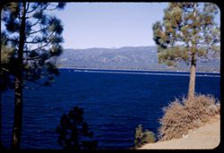
- Description:
- 50 f 6.3
- Subject:
- Lakes & ponds, Tree limbs, Hills, Forests, Mountains, Shrubs, Piers & wharves, and Tahoe, Lake (Calif. and Nev.)
- Series:
- 28-52
- Creator:
- Cushman, Charles W., 1896-1972
- Date Created:
- 1952-11-08
- Genre:
- Landscape photographs
- Frame Number:
- 21
- Abstract:
- Lake Tahoe.
- Call Number:
- P06505
- Country:
- United States
- State/Province:
- Nevada and California
- Alternate Identifier:
- 2852.21
- Persistent URL:
- http://purl.dlib.indiana.edu/iudl/archives/cushman/P06505
- Holding Location:
- Bloomington - University Archives
Wells Library E460
1320 E 10th St.
Bloomington, IN 47405
Contact at archives@indiana.edu, 812-855-1127
-
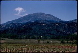
- Description:
- 100 f 6 tl
- Subject:
- Croplands, Hills, Saint Helena, Mount (Calif.), Mountains, Shrubs, Trees, Plants, and Clouds
- Series:
- 15-55
- Creator:
- Cushman, Charles W., 1896-1972
- Date Created:
- 1955-05-17
- Genre:
- Landscape photographs
- Frame Number:
- 15
- Street Address:
- California State Highway 29
- County:
- Napa
- Abstract:
- Mt. St Helena from Hwy. 29 4 mi. so. of Calistoga
- Call Number:
- P08023
- City:
- Calistoga
- Country:
- United States
- State/Province:
- California
- Alternate Identifier:
- 1555.15
- Persistent URL:
- http://purl.dlib.indiana.edu/iudl/archives/cushman/P08023
- Holding Location:
- Bloomington - University Archives
Wells Library E460
1320 E 10th St.
Bloomington, IN 47405
Contact at archives@indiana.edu, 812-855-1127
-
- Description:
- 25 f 16
- Subject:
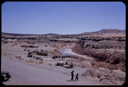
- Indians of North America, Hills, Automobiles, Barbed wire, Women, Children, Pueblos, Streams, Adobe buildings, Fences, Dirt roads, and Shrubs
- Series:
- 18-52
- Creator:
- Cushman, Charles W., 1896-1972
- Date Created:
- 1952-04-14
- Genre:
- Landscape photographs and Views
- Frame Number:
- 11
- County:
- Cibola
- Abstract:
- At Laguna Pueblo.
- Call Number:
- P06142
- City:
- Laguna
- Country:
- United States
- State/Province:
- New Mexico
- Alternate Identifier:
- 1852.11
- Persistent URL:
- http://purl.dlib.indiana.edu/iudl/archives/cushman/P06142
- Holding Location:
- Bloomington - University Archives
Wells Library E460
1320 E 10th St.
Bloomington, IN 47405
Contact at archives@indiana.edu, 812-855-1127
-
- Description:
- 100 f 8 tl
- Subject:
- Red Hill (Kern County, Calif.), Hills, Mountains, Shrubs, Sierra Nevada (Calif. and Nev.), Rocks, Jawbone Canyon (Calif.), Wagon Wheel Mountain (Calif.), and...
- Series:
- 7-55
- Creator:
- Cushman, Charles W., 1896-1972
- Date Created:
- 1955-03-21
- Genre:
- Landscape photographs
- Frame Number:
- 14
- Street Address:
- Randsburg Road and United States Highway 6
- County:
- Kern
- Abstract:
- Colorful mtns along US 6 2 mi. south of Wagon Wheel at turn off to Randsburg west of Red Hill
- Call Number:
- P07738
- Country:
- United States
- State/Province:
- California
- Alternate Identifier:
- 755.14
- Persistent URL:
- http://purl.dlib.indiana.edu/iudl/archives/cushman/P07738
- Holding Location:
- Bloomington - University Archives
Wells Library E460
1320 E 10th St.
Bloomington, IN 47405
Contact at archives@indiana.edu, 812-855-1127
-
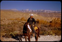
- Description:
- 125 f 4.5
- Subject:
- Horseback riding, Guards, Horses, Men, Hills, Border patrols, Boquillas Canyon (Big Bend National Park (Tex.)), Cliffs, Mountains, Shrubs, Cactus, Mounted po...
- Series:
- 16-51
- Creator:
- Cushman, Charles W., 1896-1972
- Date Created:
- 1951-12-27
- Genre:
- Portraits
- Frame Number:
- 17
- County:
- Brewster
- Abstract:
- Border patrol near Boquillas.
- Call Number:
- P05436
- Country:
- United States
- State/Province:
- Texas
- Alternate Identifier:
- 1651.17
- Persistent URL:
- http://purl.dlib.indiana.edu/iudl/archives/cushman/P05436
- Holding Location:
- Bloomington - University Archives
Wells Library E460
1320 E 10th St.
Bloomington, IN 47405
Contact at archives@indiana.edu, 812-855-1127
-
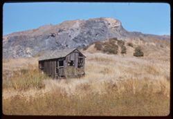
- Description:
- 100 f 6.3 TL
- Subject:
- Abandoned buildings, Houses, Greenbrae Shake Mill (Green Brae, Calif.), Shrubs, Building deterioration, Rocks, Grasses, and Hills
- Series:
- 22-61
- Creator:
- Cushman, Charles W., 1896-1972
- Date Created:
- 1961-10-06
- Genre:
- Landscape photographs
- Frame Number:
- 4
- County:
- Marin
- Abstract:
- Marin county near San Quentin- hill back of old Greenbrae Shake Mill and Near old greenbrae Shake Mill dwt San Quentin was
- Call Number:
- P12495
- City:
- Green Brae and San Quentin
- Country:
- United States
- State/Province:
- California
- Alternate Identifier:
- 2261.4
- Persistent URL:
- http://purl.dlib.indiana.edu/iudl/archives/cushman/P12495
- Holding Location:
- Bloomington - University Archives
Wells Library E460
1320 E 10th St.
Bloomington, IN 47405
Contact at archives@indiana.edu, 812-855-1127
-
- Description:
- 100 f 8
- Subject:
- Petrified Forest National Park (Ariz.), National parks & reserves, Deserts, Valleys, Hills, Painted Desert (Ariz.), Shrubs, and Mesas
- Series:
- 5-63
- Creator:
- Cushman, Charles W., 1896-1972
- Date Created:
- 1963-06-26
- Genre:
- Landscape photographs
- Frame Number:
- 23
- County:
- Navajo and Apache
- Abstract:
- Painted Desert near Holbrook, Ariz
- Call Number:
- P12939
- City:
- Holbrook
- Country:
- United States
- State/Province:
- Arizona
- Alternate Identifier:
- 563.23
- Persistent URL:
- http://purl.dlib.indiana.edu/iudl/archives/cushman/P12939
- Holding Location:
- Bloomington - University Archives
Wells Library E460
1320 E 10th St.
Bloomington, IN 47405
Contact at archives@indiana.edu, 812-855-1127
-
- Description:
- 50 f 9
- Subject:
- Flowers, Hills, Roads, Mountains, Shrubs, Sierra Nevada (Calif. and Nev.), Trees, Rocks, and Grasses
- Series:
- 11-54
- Creator:
- Cushman, Charles W., 1896-1972
- Date Created:
- 1954-09-17
- Genre:
- Landscape photographs
- Frame Number:
- 5
- Street Address:
- Sabrina Lake Road
- County:
- Inyo
- Abstract:
- High Sierra seen from Sabrina Lake road SW of Bishop.
- Call Number:
- P07374
- City:
- Bishop
- Country:
- United States
- State/Province:
- California
- Alternate Identifier:
- 1154.5
- Persistent URL:
- http://purl.dlib.indiana.edu/iudl/archives/cushman/P07374
- Holding Location:
- Bloomington - University Archives
Wells Library E460
1320 E 10th St.
Bloomington, IN 47405
Contact at archives@indiana.edu, 812-855-1127
-
- Description:
- 25 f 11
- Subject:
- Churches, Streets, Houses, Picnic grounds, Utility poles, Electric lines, Trees, Buildings, Fences, Hills, and Shrubs
- Series:
- 22-52
- Creator:
- Cushman, Charles W., 1896-1972
- Date Created:
- 1952-10-27
- Genre:
- Cityscape photographs
- Frame Number:
- 13
- County:
- Teller
- Abstract:
- Cripple Creek
- Call Number:
- P06267
- City:
- Cripple Creek
- Country:
- United States
- State/Province:
- Colorado
- Alternate Identifier:
- 2252.13
- Persistent URL:
- http://purl.dlib.indiana.edu/iudl/archives/cushman/P06267
- Holding Location:
- Bloomington - University Archives
Wells Library E460
1320 E 10th St.
Bloomington, IN 47405
Contact at archives@indiana.edu, 812-855-1127
-
- Description:
- 25 f 11
- Subject:
- Noon, Hills, Cliffs, Franklin Mountains (Tex. and N.M.), Mountains, and Shrubs
- Series:
- 17-51
- Creator:
- Cushman, Charles W., 1896-1972
- Date Created:
- 1952-01-01
- Genre:
- Landscape photographs
- Frame Number:
- 28
- County:
- El Paso
- Abstract:
- Mtns. at noon.
- Call Number:
- P05479
- City:
- El Paso
- Country:
- United States
- State/Province:
- Texas
- Alternate Identifier:
- 1751.28
- Persistent URL:
- http://purl.dlib.indiana.edu/iudl/archives/cushman/P05479
- Holding Location:
- Bloomington - University Archives
Wells Library E460
1320 E 10th St.
Bloomington, IN 47405
Contact at archives@indiana.edu, 812-855-1127
-
- Description:
- 100 f 5.3 tl
- Subject:
- Oil wells, Trucks, Hills, Bodies of water, Roads, Shrubs, Trees, Oil well drilling rigs, Facilities, Pipes (Conduits), Utility poles, and Petroleum workers
- Series:
- 4-55
- Creator:
- Cushman, Charles W., 1896-1972
- Date Created:
- 1955-03-01
- Genre:
- Views
- Frame Number:
- 21
- County:
- Kern
- Abstract:
- Oil derricks north of Ford City
- Call Number:
- P07648
- City:
- Ford City and Taft
- Country:
- United States
- State/Province:
- California
- Alternate Identifier:
- 455.21
- Persistent URL:
- http://purl.dlib.indiana.edu/iudl/archives/cushman/P07648
- Holding Location:
- Bloomington - University Archives
Wells Library E460
1320 E 10th St.
Bloomington, IN 47405
Contact at archives@indiana.edu, 812-855-1127
-
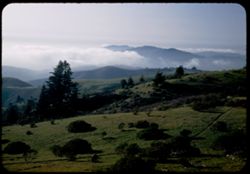
- Description:
- 25 f 6 Pola
- Subject:
- Hills, Fog, Pacific Ocean, Mountains, Pacific Coast (Calif.), Shrubs, Trees, and Grasses
- Series:
- 12-52
- Creator:
- Cushman, Charles W., 1896-1972
- Date Created:
- 1952-03-28
- Genre:
- Landscape photographs
- Frame Number:
- 13
- Street Address:
- Skyline Drive
- County:
- San Francisco and San Mateo
- Abstract:
- Fog bank moving in across mtns. South of S.F. = view is NW from Skyline Dr. above San Mateo.
- Call Number:
- P05920
- City:
- San Francisco and San Mateo
- Country:
- United States
- State/Province:
- California
- Alternate Identifier:
- 1252.13
- Persistent URL:
- http://purl.dlib.indiana.edu/iudl/archives/cushman/P05920
- Holding Location:
- Bloomington - University Archives
Wells Library E460
1320 E 10th St.
Bloomington, IN 47405
Contact at archives@indiana.edu, 812-855-1127
-
- Description:
- 50 f 4 TL
- Subject:
- Tree limbs, Hills, Windows, Silver City (Nev.), Shrubs, Trees, Rocks, Grasses, Doors & doorways, and Buildings
- Series:
- 3-62
- Creator:
- Cushman, Charles W., 1896-1972
- Date Created:
- 1962-09-28
- Genre:
- Snapshots and Architectural photographs
- Frame Number:
- 17
- County:
- Storey
- Abstract:
- Silver City.
- Call Number:
- P12715
- City:
- Virginia City
- Country:
- United States
- State/Province:
- Nevada
- Alternate Identifier:
- 362.17
- Persistent URL:
- http://purl.dlib.indiana.edu/iudl/archives/cushman/P12715
- Holding Location:
- Bloomington - University Archives
Wells Library E460
1320 E 10th St.
Bloomington, IN 47405
Contact at archives@indiana.edu, 812-855-1127
-
- Description:
- 100 f 5.6
- Subject:
- Kern River Valley (Calif.), Hills, Shrubs, Trees, Rocks, and Rock formations
- Series:
- 2-55
- Creator:
- Cushman, Charles W., 1896-1972
- Date Created:
- 1955-02-26
- Genre:
- Landscape photographs
- Frame Number:
- 9
- County:
- Kern
- Abstract:
- High up on right bank
- Call Number:
- P07567
- Country:
- United States
- State/Province:
- California
- Alternate Identifier:
- 255.9
- Persistent URL:
- http://purl.dlib.indiana.edu/iudl/archives/cushman/P07567
- Holding Location:
- Bloomington - University Archives
Wells Library E460
1320 E 10th St.
Bloomington, IN 47405
Contact at archives@indiana.edu, 812-855-1127
-

- Description:
- 50 f 9
- Subject:
- Hills, Roads, Whitney, Mount (Calif.), Mountains, Shrubs, Sierra Nevada (Calif. and Nev.), Trees, Rocks, Fences, Snow, Boulders, and Buildings
- Series:
- 14-52
- Creator:
- Cushman, Charles W., 1896-1972
- Date Created:
- 1952-04-08
- Genre:
- Landscape photographs
- Frame Number:
- 18
- County:
- Inyo
- Abstract:
- Mt. Whitney at dead center.
- Call Number:
- P06002
- Country:
- United States
- State/Province:
- California
- Alternate Identifier:
- 1452.18
- Persistent URL:
- http://purl.dlib.indiana.edu/iudl/archives/cushman/P06002
- Holding Location:
- Bloomington - University Archives
Wells Library E460
1320 E 10th St.
Bloomington, IN 47405
Contact at archives@indiana.edu, 812-855-1127
-
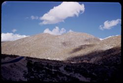
- Description:
- 100 f 8 TL
- Subject:
- Hills, Mountains, Shrubs, and Clouds
- Series:
- 3-62
- Creator:
- Cushman, Charles W., 1896-1972
- Date Created:
- 1962-09-28
- Genre:
- Landscape photographs
- Frame Number:
- 20
- County:
- Storey
- Abstract:
- View east from Va. Cy.
- Call Number:
- P12718
- City:
- Virginia City
- Country:
- United States
- State/Province:
- Nevada
- Alternate Identifier:
- 362.20
- Persistent URL:
- http://purl.dlib.indiana.edu/iudl/archives/cushman/P12718
- Holding Location:
- Bloomington - University Archives
Wells Library E460
1320 E 10th St.
Bloomington, IN 47405
Contact at archives@indiana.edu, 812-855-1127
-
- Description:
- 25 f 6.3
- Subject:
- Hills, Colorado and Southern Railway, Shrubs, Railroad locomotives, Rocks, and Retaining walls
- Series:
- 24-52
- Creator:
- Cushman, Charles W., 1896-1972
- Date Created:
- 1952-10-31
- Genre:
- Snapshots
- Frame Number:
- 30
- County:
- Gilpin and Denver
- Abstract:
- Old 71. Colorado's Southern Ry Co. service between Denver + Central City, 1872-1941.
- Call Number:
- P06361
- City:
- Denver and Central City
- Country:
- United States
- State/Province:
- Colorado
- Alternate Identifier:
- 2452.30
- Persistent URL:
- http://purl.dlib.indiana.edu/iudl/archives/cushman/P06361
- Holding Location:
- Bloomington - University Archives
Wells Library E460
1320 E 10th St.
Bloomington, IN 47405
Contact at archives@indiana.edu, 812-855-1127
-
- Description:
- 100 f 6.3 TL
- Subject:
- Capitals (Columns), Demolition, Balconies, Hills, Arches, Columns, Bridges, Shrubs, Building deterioration, Buildings, Dirt, and Utility poles
- Series:
- 12-59
- Creator:
- Cushman, Charles W., 1896-1972
- Date Created:
- 1959-03-29
- Genre:
- Cityscape photographs and Architectural photographs
- Frame Number:
- 2
- Street Address:
- Bunker Hill, Second Street, and Bunker Hill Avenue
- County:
- Los Angeles
- Abstract:
- Right in the middle of L.A. (from 2nd & Bunk Hil)
- Call Number:
- P10764
- City:
- Los Angeles
- Country:
- United States
- State/Province:
- California
- Alternate Identifier:
- 1259.2
- Persistent URL:
- http://purl.dlib.indiana.edu/iudl/archives/cushman/P10764
- Holding Location:
- Bloomington - University Archives
Wells Library E460
1320 E 10th St.
Bloomington, IN 47405
Contact at archives@indiana.edu, 812-855-1127
-
- Description:
- 25 f 9
- Subject:
- Boundaries, Automobiles, Trees, Pacific Ocean, Mexican border, Mountains, Buildings, Shrubs, Water tanks, Hills, Utility poles, Mexican-American Border Regio...
- Series:
- 6-52
- Creator:
- Cushman, Charles W., 1896-1972
- Date Created:
- 1952-02-10
- Genre:
- Landscape photographs
- Frame Number:
- 7
- County:
- San Diego
- Abstract:
- Green mountain side on US side Mexican border a mile or two from ocean
- Call Number:
- P05690
- Country:
- United States
- State/Province:
- California
- Alternate Identifier:
- 652.7
- Persistent URL:
- http://purl.dlib.indiana.edu/iudl/archives/cushman/P05690
- Holding Location:
- Bloomington - University Archives
Wells Library E460
1320 E 10th St.
Bloomington, IN 47405
Contact at archives@indiana.edu, 812-855-1127
-
- Description:
- 100 f 6 + tl
- Subject:
- Electric lines, Automobiles, Trees, Roofs, Streets, Sidewalks, Shrubs, Hills, Utility poles, and Buildings
- Series:
- 15-55
- Creator:
- Cushman, Charles W., 1896-1972
- Date Created:
- 1955-05-15
- Genre:
- Cityscape photographs
- Frame Number:
- 2
- Street Address:
- Divisadero Street and Broadway Street
- County:
- San Francisco
- Abstract:
- View east from Broadway at Divisadero
- Call Number:
- P08010
- City:
- San Francisco
- Country:
- United States
- State/Province:
- California
- Alternate Identifier:
- 1555.2
- Persistent URL:
- http://purl.dlib.indiana.edu/iudl/archives/cushman/P08010
- Holding Location:
- Bloomington - University Archives
Wells Library E460
1320 E 10th St.
Bloomington, IN 47405
Contact at archives@indiana.edu, 812-855-1127
-
- Description:
- 25 f 6.3 Pola
- Subject:
- Reserva de la Biosfera Santa Elena-Sierra del Carmen (Mexico), Cliffs, Dirt roads, Trails & paths, Trees, Mountains, National parks & reserves, Hills...
- Series:
- 16-51
- Creator:
- Cushman, Charles W., 1896-1972
- Date Created:
- 1951-12-27
- Genre:
- Landscape photographs
- Frame Number:
- 19
- County:
- Brewster
- Abstract:
- Across to Boquillas.
- Call Number:
- P05438
- Country:
- United States and Mexico
- State/Province:
- Texas
- Alternate Identifier:
- 1651.19
- Persistent URL:
- http://purl.dlib.indiana.edu/iudl/archives/cushman/P05438
- Holding Location:
- Bloomington - University Archives
Wells Library E460
1320 E 10th St.
Bloomington, IN 47405
Contact at archives@indiana.edu, 812-855-1127
-
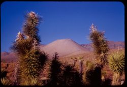
- Description:
- 25 f 13
- Subject:
- Deserts, Mojave Desert (Calif.), Walker Pass (Calif.), Joshua trees, Mountains, Shrubs, and Hills
- Series:
- 12-54
- Creator:
- Cushman, Charles W., 1896-1972
- Date Created:
- 1954-09-18
- Genre:
- Identification photographs
- Frame Number:
- 30
- Street Address:
- California State Highway 178 and Walker Pass Road
- County:
- Kern
- Abstract:
- Joshua trees along Walker Pass Rd.
- Call Number:
- P07420
- Country:
- United States
- State/Province:
- California
- Alternate Identifier:
- 1254.30
- Persistent URL:
- http://purl.dlib.indiana.edu/iudl/archives/cushman/P07420
- Holding Location:
- Bloomington - University Archives
Wells Library E460
1320 E 10th St.
Bloomington, IN 47405
Contact at archives@indiana.edu, 812-855-1127
-
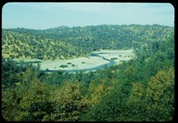
- Description:
- 50 f 8+
- Subject:
- Valleys, Trees, Shrubs, Hills, Yuba River (Calif.), and Rivers
- Series:
- 13-54
- Creator:
- Cushman, Charles W., 1896-1972
- Date Created:
- 1954-10-09
- Genre:
- Landscape photographs
- Frame Number:
- 13
- Street Address:
- California State Highway 20
- County:
- Yuba
- Abstract:
- View down on S curve of Yuba river a mile or so above Cal 20 bridge.
- Call Number:
- P07436
- Country:
- United States
- State/Province:
- California
- Alternate Identifier:
- 1354.13
- Persistent URL:
- http://purl.dlib.indiana.edu/iudl/archives/cushman/P07436
- Holding Location:
- Bloomington - University Archives
Wells Library E460
1320 E 10th St.
Bloomington, IN 47405
Contact at archives@indiana.edu, 812-855-1127
-
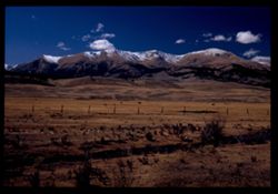
- Description:
- 50 f 9 Pola
- Subject:
- Snow, Grasses, Grazing, Meadows, Cattle, Mountains, Fences, Shrubs, Clouds, Hills, and Elbert, Mount (Colo.)
- Series:
- 11-53
- Creator:
- Cushman, Charles W., 1896-1972
- Date Created:
- 1953-10-15
- Genre:
- Landscape photographs
- Frame Number:
- 5
- County:
- Lake
- Abstract:
- Mt. Elbert from east
- Call Number:
- P06884
- City:
- Leadville
- Country:
- United States
- State/Province:
- Colorado
- Physical Description:
- Image was originally mounted in a glass enclosure. Before digitization, the image was removed and placed in a Wess Plastic, Inc. brand, 2" x 2", pl...
- Alternate Identifier:
- 1153.5
- Persistent URL:
- http://purl.dlib.indiana.edu/iudl/archives/cushman/P06884
- Holding Location:
- Bloomington - University Archives
Wells Library E460
1320 E 10th St.
Bloomington, IN 47405
Contact at archives@indiana.edu, 812-855-1127
-
- Description:
- 50 f 5.6 Pola
- Subject:
- Grasses, Trees, Mountains, Fences, Shrubs, Clouds, and Hills
- Series:
- 9-53
- Creator:
- Cushman, Charles W., 1896-1972
- Date Created:
- 1953-10-11
- Genre:
- Landscape photographs
- Frame Number:
- 14
- Street Address:
- United States Highway 50
- County:
- Utah
- Abstract:
- From US 50 6 mi w of Thistle.
- Call Number:
- P06815
- City:
- Thistle
- Country:
- United States
- State/Province:
- Utah
- Alternate Identifier:
- 953.14
- Persistent URL:
- http://purl.dlib.indiana.edu/iudl/archives/cushman/P06815
- Holding Location:
- Bloomington - University Archives
Wells Library E460
1320 E 10th St.
Bloomington, IN 47405
Contact at archives@indiana.edu, 812-855-1127
-
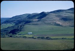
- Description:
- 100 f 5.6 tl
- Subject:
- Farms, Croplands, Shrubs, Hills, and Agricultural facilities
- Series:
- 17-57
- Creator:
- Cushman, Charles W., 1896-1972
- Date Created:
- 1957-11-21
- Genre:
- Landscape photographs and Views
- Frame Number:
- 5
- County:
- San Mateo
- Abstract:
- Cultivated slopes near San Gregorio
- Call Number:
- P09607
- City:
- San Gregorio
- Country:
- United States
- State/Province:
- California
- Alternate Identifier:
- 1757.5
- Persistent URL:
- http://purl.dlib.indiana.edu/iudl/archives/cushman/P09607
- Holding Location:
- Bloomington - University Archives
Wells Library E460
1320 E 10th St.
Bloomington, IN 47405
Contact at archives@indiana.edu, 812-855-1127
-
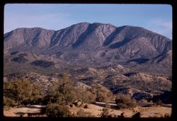
- Description:
- 100 f 5.6 TL
- Subject:
- Rocks, Trees, San Jacinto Mountains (Calif.), San Bernardino National Forest (Calif.), Mountains, Shrubs, Forests, Hills, and National parks & reserves
- Series:
- 24-61
- Creator:
- Cushman, Charles W., 1896-1972
- Date Created:
- 1961-12-27
- Genre:
- Landscape photographs
- Frame Number:
- 18
- County:
- Riverside
- Abstract:
- San Jacinto Mountains in San Bernardino Nat'l Forest and Mtns in San Bernardino Natl Forest - from Cal 74
- Call Number:
- P12584
- Country:
- United States
- State/Province:
- California
- Alternate Identifier:
- 2461.18
- Persistent URL:
- http://purl.dlib.indiana.edu/iudl/archives/cushman/P12584
- Holding Location:
- Bloomington - University Archives
Wells Library E460
1320 E 10th St.
Bloomington, IN 47405
Contact at archives@indiana.edu, 812-855-1127
-
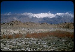
- Description:
- 25 f 8 Pola
- Subject:
- Rocks, Inyo Mountains (Calif.), Boulders, Owens Valley (Calif.), Mountains, Shrubs, Hills, and Snow
- Series:
- 14-52
- Creator:
- Cushman, Charles W., 1896-1972
- Date Created:
- 1952-04-08
- Genre:
- Landscape photographs
- Frame Number:
- 32
- Street Address:
- Mount Whitney Road
- County:
- Inyo
- Abstract:
- Across Owens Valley to Inyo Mtns.
- Call Number:
- P06015
- City:
- Lone Pine
- Country:
- United States
- State/Province:
- California
- Alternate Identifier:
- 1452.32
- Persistent URL:
- http://purl.dlib.indiana.edu/iudl/archives/cushman/P06015
- Holding Location:
- Bloomington - University Archives
Wells Library E460
1320 E 10th St.
Bloomington, IN 47405
Contact at archives@indiana.edu, 812-855-1127
-
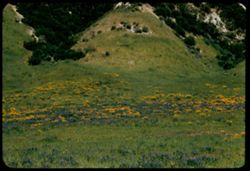
- Description:
- 100 f 7 TL
- Subject:
- Valleys, Grasses, Poppies, Flowers, Becker Valley (Calif.), Shrubs, Hills, and Meadows
- Series:
- 6-56
- Creator:
- Cushman, Charles W., 1896-1972
- Date Created:
- 1956-04-22
- Genre:
- Landscape photographs
- Frame Number:
- 10
- County:
- San Benito
- Call Number:
- P08720
- Country:
- United States
- State/Province:
- California
- Alternate Identifier:
- 656.10
- Persistent URL:
- http://purl.dlib.indiana.edu/iudl/archives/cushman/P08720
- Holding Location:
- Bloomington - University Archives
Wells Library E460
1320 E 10th St.
Bloomington, IN 47405
Contact at archives@indiana.edu, 812-855-1127
-
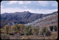
- Description:
- 50 f 8
- Subject:
- Grasses, Trees, Mountains, Shrubs, Clouds, and Hills
- Series:
- 9-53
- Creator:
- Cushman, Charles W., 1896-1972
- Date Created:
- 1953-10-11
- Genre:
- Landscape photographs
- Frame Number:
- 21
- County:
- Utah
- Abstract:
- Looking back from 1 mile east of Thistle.
- Call Number:
- P06822
- City:
- Thistle
- Country:
- United States
- State/Province:
- Utah
- Alternate Identifier:
- 953.21
- Persistent URL:
- http://purl.dlib.indiana.edu/iudl/archives/cushman/P06822
- Holding Location:
- Bloomington - University Archives
Wells Library E460
1320 E 10th St.
Bloomington, IN 47405
Contact at archives@indiana.edu, 812-855-1127
-
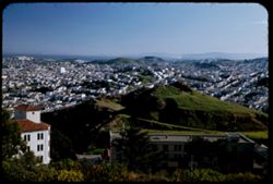
- Description:
- 50 f 4 Pola
- Subject:
- Trees, Roofs, Streets, Buildings, Shrubs, Dwellings, Hills, and Buena Vista Park (San Francisco, Calif.)
- Series:
- 2-53
- Creator:
- Cushman, Charles W., 1896-1972
- Date Created:
- 1953-02-08
- Genre:
- Cityscape photographs
- Frame Number:
- 21
- County:
- San Francisco
- Abstract:
- View SE from Buena Vista.
- Call Number:
- P06555
- City:
- San Francisco
- Country:
- United States
- State/Province:
- California
- Alternate Identifier:
- 253.21
- Persistent URL:
- http://purl.dlib.indiana.edu/iudl/archives/cushman/P06555
- Holding Location:
- Bloomington - University Archives
Wells Library E460
1320 E 10th St.
Bloomington, IN 47405
Contact at archives@indiana.edu, 812-855-1127
-
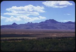
- Description:
- 100 f 6.7 TL
- Subject:
- Plains, Mountains, Shrubs, Clouds, and Hills
- Series:
- 12-58
- Creator:
- Cushman, Charles W., 1896-1972
- Date Created:
- 1958-06-17
- Genre:
- Landscape photographs
- Frame Number:
- 28
- County:
- Elko
- Abstract:
- Fine saw-tooth ridge to the SE (near Contact)
- Call Number:
- P10040
- City:
- Contact
- Country:
- United States
- State/Province:
- Nevada
- Alternate Identifier:
- 1258.28
- Persistent URL:
- http://purl.dlib.indiana.edu/iudl/archives/cushman/P10040
- Holding Location:
- Bloomington - University Archives
Wells Library E460
1320 E 10th St.
Bloomington, IN 47405
Contact at archives@indiana.edu, 812-855-1127
-
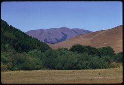
- Description:
- 100 f 6.3 TL
- Subject:
- Trees, Shrubs, Black Mountain (Marin County, Calif.), and Hills
- Series:
- 13-58
- Creator:
- Cushman, Charles W., 1896-1972
- Date Created:
- 1958-07-18
- Genre:
- Landscape photographs
- Frame Number:
- 13
- County:
- Marin
- Abstract:
- Black Mtn. From road near Nicasio
- Call Number:
- P10061
- City:
- Nicasio
- Country:
- United States
- State/Province:
- California
- Alternate Identifier:
- 1358.13
- Persistent URL:
- http://purl.dlib.indiana.edu/iudl/archives/cushman/P10061
- Holding Location:
- Bloomington - University Archives
Wells Library E460
1320 E 10th St.
Bloomington, IN 47405
Contact at archives@indiana.edu, 812-855-1127
-
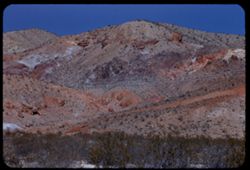
- Description:
- 100 f 8 tl
- Subject:
- Rocks, Electric lines, Wagon Wheel Mountain (Calif.), Mountains, Shrubs, Sierra Nevada (Calif. and Nev.), Hills, Red Hill (Kern County, Calif.), and Jawbone ...
- Series:
- 7-55
- Creator:
- Cushman, Charles W., 1896-1972
- Date Created:
- 1955-03-21
- Genre:
- Landscape photographs
- Frame Number:
- 15
- Street Address:
- United States Highway 6 and Randsburg Road
- County:
- Kern
- Abstract:
- Colorful mtns along US 6 2 mi. south of Wagon Wheel at turn off to Randsburg west of Red Hill
- Call Number:
- P07739
- Country:
- United States
- State/Province:
- California
- Alternate Identifier:
- 755.15
- Persistent URL:
- http://purl.dlib.indiana.edu/iudl/archives/cushman/P07739
- Holding Location:
- Bloomington - University Archives
Wells Library E460
1320 E 10th St.
Bloomington, IN 47405
Contact at archives@indiana.edu, 812-855-1127
-
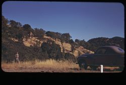
- Subject:
- Women, Automobiles, Weeds, Atascadero Valley (Calif.), Shrubs, Hills, and Trees
- Series:
- 7-40
- Creator:
- Cushman, Charles W., 1896-1972
- Date Created:
- 1940-06-20
- Genre:
- Landscape photographs
- Frame Number:
- 5
- Street Address:
- Atascadero Road
- County:
- San Luis Obispo
- Abstract:
- Tree-covered hillside. The Morro Bay- Atascadero road
- Call Number:
- P01863
- City:
- Atascadero
- Country:
- United States
- State/Province:
- California
- Physical Description:
- masked.
- Alternate Identifier:
- 740.5
- Persistent URL:
- http://purl.dlib.indiana.edu/iudl/archives/cushman/P01863
- Holding Location:
- Bloomington - University Archives
Wells Library E460
1320 E 10th St.
Bloomington, IN 47405
Contact at archives@indiana.edu, 812-855-1127
-
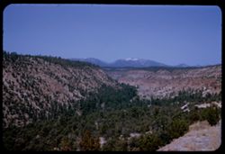
- Description:
- 25 f 13
- Subject:
- Valleys, Polvadera Peak (N.M.), Mesas, Mountains, Shrubs, Hills, Canyons, Trees, and Frijoles Canyon (Colo. and N.M.)
- Series:
- 18-52
- Creator:
- Cushman, Charles W., 1896-1972
- Date Created:
- 1952-04-15
- Genre:
- Landscape photographs
- Frame Number:
- 23
- County:
- Rio Arriba
- Abstract:
- View north down Frijoles Canyon.
- Call Number:
- P06153
- Country:
- United States
- State/Province:
- New Mexico
- Alternate Identifier:
- 1852.23
- Persistent URL:
- http://purl.dlib.indiana.edu/iudl/archives/cushman/P06153
- Holding Location:
- Bloomington - University Archives
Wells Library E460
1320 E 10th St.
Bloomington, IN 47405
Contact at archives@indiana.edu, 812-855-1127
-
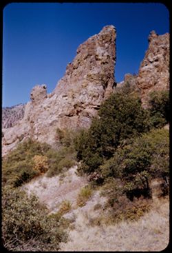
- Description:
- 50 f 8
- Subject:
- Grasses, Cliffs, Trees, National parks & reserves, Hills, Big Bend National Park (Tex.), Shrubs, and Rock formations
- Series:
- 16-51
- Creator:
- Cushman, Charles W., 1896-1972
- Date Created:
- 1951-12-27
- Genre:
- Landscape photographs
- Frame Number:
- 9
- County:
- Brewster
- Abstract:
- Up at jagged crevice
- Call Number:
- P05428
- Country:
- United States
- State/Province:
- Texas
- Alternate Identifier:
- 1651.9
- Persistent URL:
- http://purl.dlib.indiana.edu/iudl/archives/cushman/P05428
- Holding Location:
- Bloomington - University Archives
Wells Library E460
1320 E 10th St.
Bloomington, IN 47405
Contact at archives@indiana.edu, 812-855-1127
-
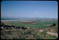
- Description:
- 50 f 5.6 Pola
- Subject:
- Bays (Bodies of water), Seas, Black Mountain Lookout (San Luis Obispo County, Calif.), Trees, Coastlines, Pacific Ocean, Black Mountain (San Luis Obispo Coun...
- Series:
- 9-52
- Creator:
- Cushman, Charles W., 1896-1972
- Date Created:
- 1952-03-02
- Genre:
- Landscape photographs
- Frame Number:
- 5
- County:
- San Luis Obispo
- Abstract:
- From Black Mtn Lookout - view up coast of Estero Bay
- Call Number:
- P05803
- City:
- Morro Bay
- Country:
- United States
- State/Province:
- California
- Alternate Identifier:
- 952.5
- Persistent URL:
- http://purl.dlib.indiana.edu/iudl/archives/cushman/P05803
- Holding Location:
- Bloomington - University Archives
Wells Library E460
1320 E 10th St.
Bloomington, IN 47405
Contact at archives@indiana.edu, 812-855-1127
-
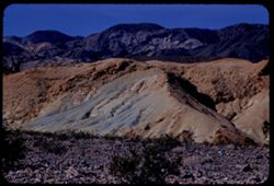
- Description:
- 100 f 8 tl
- Subject:
- Rocks, Valleys, Mountains, Shrubs, Death Valley (Calif. and Nev.), Black Mountains (Inyo County, Calif.), and Hills
- Series:
- 8-55
- Creator:
- Cushman, Charles W., 1896-1972
- Date Created:
- 1955-03-22
- Genre:
- Landscape photographs
- Frame Number:
- 22
- Street Address:
- Dante's View Road
- County:
- Inyo
- Abstract:
- colored rock in valley from closer (along Dante's V. rd.
- Call Number:
- P07780
- Country:
- United States
- State/Province:
- California
- Alternate Identifier:
- 855.22
- Persistent URL:
- http://purl.dlib.indiana.edu/iudl/archives/cushman/P07780
- Holding Location:
- Bloomington - University Archives
Wells Library E460
1320 E 10th St.
Bloomington, IN 47405
Contact at archives@indiana.edu, 812-855-1127
-
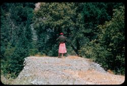
- Description:
- 100 f 5.6 tl
- Subject:
- Rocks, Electric lines, Spouses, Women, Trees, Shrubs, Hills, and Trinity River (Calif.)
- Series:
- 16-55
- Creator:
- Cushman, Charles W., 1896-1972
- Date Created:
- 1955-06-15
- Genre:
- Portraits and Identification photographs
- Frame Number:
- 20
- Street Address:
- United States Highway 299
- County:
- Trinity
- Persons Pictured:
- Cushman, Jean
- Abstract:
- from same spot Jean
- Call Number:
- P08064
- Country:
- United States
- State/Province:
- California
- Alternate Identifier:
- 1655.20
- Persistent URL:
- http://purl.dlib.indiana.edu/iudl/archives/cushman/P08064
- Holding Location:
- Bloomington - University Archives
Wells Library E460
1320 E 10th St.
Bloomington, IN 47405
Contact at archives@indiana.edu, 812-855-1127
-
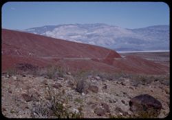
- Description:
- 25 f 13
- Subject:
- Rocks, Valleys, Panamint Range (Calif.), Panamint Mountains (Calif.), Argus Range (Calif.), Boulders, Mountains, Rock Candy Mountain (Calif.), Shrubs, Panami...
- Series:
- 15-52
- Creator:
- Cushman, Charles W., 1896-1972
- Date Created:
- 1952-04-08
- Genre:
- Landscape photographs
- Frame Number:
- 7
- Street Address:
- California State Highway 190
- County:
- Inyo
- Abstract:
- Red earth at Rock Candy mtn. (Panamint).
- Call Number:
- P06028
- City:
- Panamint
- Country:
- United States
- State/Province:
- California
- Alternate Identifier:
- 1552.7
- Persistent URL:
- http://purl.dlib.indiana.edu/iudl/archives/cushman/P06028
- Holding Location:
- Bloomington - University Archives
Wells Library E460
1320 E 10th St.
Bloomington, IN 47405
Contact at archives@indiana.edu, 812-855-1127
-
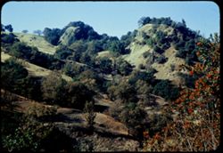
- Description:
- 50 f 6.3
- Subject:
- Russian River (Calif.), Trees, Flowers, Shrubs, and Hills
- Series:
- 16-54
- Creator:
- Cushman, Charles W., 1896-1972
- Date Created:
- 1954-11-04
- Genre:
- Landscape photographs
- Frame Number:
- 18
- County:
- Sonoma
- Abstract:
- Camel back above Russian river north of Cloverdale. 6 or 7.
- Call Number:
- P07517
- City:
- Cloverdale
- Country:
- United States
- State/Province:
- California
- Physical Description:
- Anscochrome film.
- Alternate Identifier:
- 1654.18
- Persistent URL:
- http://purl.dlib.indiana.edu/iudl/archives/cushman/P07517
- Holding Location:
- Bloomington - University Archives
Wells Library E460
1320 E 10th St.
Bloomington, IN 47405
Contact at archives@indiana.edu, 812-855-1127
-
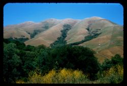
- Description:
- 50 f 9
- Subject:
- Trees, Flowers, Flowering shrubs, Mountains, Shrubs, Black Mountain (Marin County, Calif.), and Hills
- Series:
- 2-54
- Creator:
- Cushman, Charles W., 1896-1972
- Date Created:
- 1954-05-21
- Genre:
- Landscape photographs
- Frame Number:
- 6
- Street Address:
- Lagunitas Road
- County:
- Marin
- Abstract:
- Black Mtn. Again from Lagunitas Rd. - sw. -
- Call Number:
- P07137
- Country:
- United States
- State/Province:
- California
- Alternate Identifier:
- 254.6
- Persistent URL:
- http://purl.dlib.indiana.edu/iudl/archives/cushman/P07137
- Holding Location:
- Bloomington - University Archives
Wells Library E460
1320 E 10th St.
Bloomington, IN 47405
Contact at archives@indiana.edu, 812-855-1127
-
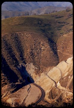
- Description:
- 100 f 4.5 tl
- Subject:
- Roads, Tehachapi Mountains (Calif.), Southern Pacific Tunnel, Trees, Mountains, Tunnels, Railroad tracks, Hills, Utility poles, and Shrubs
- Series:
- 12-55
- Creator:
- Cushman, Charles W., 1896-1972
- Date Created:
- 1955-03-24
- Genre:
- Landscape photographs
- Frame Number:
- 17
- Street Address:
- United States Highway 466
- County:
- Kern
- Abstract:
- S P curves, [cut] and tunnel mouth from same vantage point
- Call Number:
- P07913
- City:
- Keene
- Country:
- United States
- State/Province:
- California
- Alternate Identifier:
- 1255.17
- Persistent URL:
- http://purl.dlib.indiana.edu/iudl/archives/cushman/P07913
- Holding Location:
- Bloomington - University Archives
Wells Library E460
1320 E 10th St.
Bloomington, IN 47405
Contact at archives@indiana.edu, 812-855-1127
-
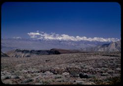
- Description:
- 25 f 8 Pola
- Subject:
- Snow, Panamint Range (Calif.), Mountains, Shrubs, Clouds, Hills, and Rocks
- Series:
- 15-52
- Creator:
- Cushman, Charles W., 1896-1972
- Date Created:
- 1952-04-08
- Genre:
- Landscape photographs
- Frame Number:
- 2
- Street Address:
- California State Highway 190
- County:
- Inyo
- Abstract:
- Snow-covered Panamints from Hwy 190 40 mi. from Lone Pine.
- Call Number:
- P06023
- City:
- Lone Pine
- Country:
- United States
- State/Province:
- California
- Alternate Identifier:
- 1552.2
- Persistent URL:
- http://purl.dlib.indiana.edu/iudl/archives/cushman/P06023
- Holding Location:
- Bloomington - University Archives
Wells Library E460
1320 E 10th St.
Bloomington, IN 47405
Contact at archives@indiana.edu, 812-855-1127
-
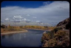
- Description:
- 50 f 8 Pola
- Subject:
- Rocks, Canyons, Grasses, Roads, Automobiles, Mesas, Colorado River (Colo.-Mexico), Mountains, Shrubs, Clouds, Hills, Rivers, and Trees
- Series:
- 9-53
- Creator:
- Cushman, Charles W., 1896-1972
- Date Created:
- 1953-10-12
- Genre:
- Landscape photographs
- Frame Number:
- 34
- County:
- Mesa
- Abstract:
- View north up river around bend
- Call Number:
- P06835
- City:
- Grand Junction
- Country:
- United States
- State/Province:
- Colorado
- Alternate Identifier:
- 953.34
- Persistent URL:
- http://purl.dlib.indiana.edu/iudl/archives/cushman/P06835
- Holding Location:
- Bloomington - University Archives
Wells Library E460
1320 E 10th St.
Bloomington, IN 47405
Contact at archives@indiana.edu, 812-855-1127
-
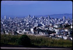
- Description:
- 100 f 8 TL
- Subject:
- Grasses, Houses, Skyscrapers, Streets, Mountains, Buildings, Shrubs, Dwellings, Domes, Roads, and Hills
- Series:
- 12-59
- Creator:
- Cushman, Charles W., 1896-1972
- Date Created:
- 1959-05-10
- Genre:
- Cityscape photographs
- Frame Number:
- 35
- Street Address:
- Clipper Street
- County:
- San Francisco
- Abstract:
- From top of Clipper St.
- Call Number:
- P10797
- City:
- San Francisco
- Country:
- United States
- State/Province:
- California
- Alternate Identifier:
- 1259.35
- Persistent URL:
- http://purl.dlib.indiana.edu/iudl/archives/cushman/P10797
- Holding Location:
- Bloomington - University Archives
Wells Library E460
1320 E 10th St.
Bloomington, IN 47405
Contact at archives@indiana.edu, 812-855-1127