
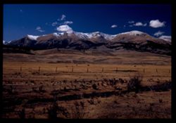
Search Constraints
You searched for:
Campus
IUB
Remove constraint Campus: IUB
Subject
Hills
Remove constraint Subject: Hills
State/Province
Colorado
Remove constraint State/Province: Colorado
« Previous |
1 - 100 of 112
|
Next »
Search Results
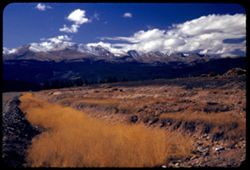
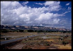
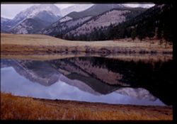
-
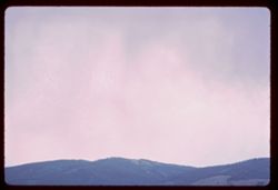
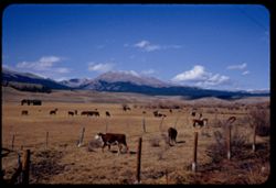
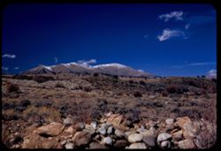
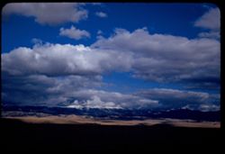
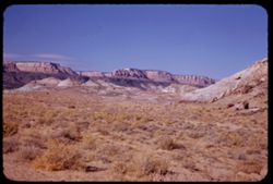
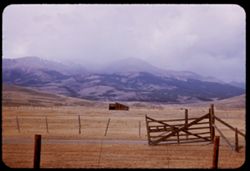
- Description:
- 100 f 4.5
- Subject:
- Rocky Mountains, Mountains, Clouds, and Hills
- Series:
- 9-66
- Creator:
- Cushman, Charles W., 1896-1972
- Date Created:
- 1966-06-15
- Genre:
- Landscape photographs
- Frame Number:
- 29
- County:
- Grand
- Call Number:
- P15432
- City:
- Granby
- Country:
- United States
- State/Province:
- Colorado
- Physical Description:
- fingerprint.
- Alternate Identifier:
- 966.29
- Persistent URL:
- http://purl.dlib.indiana.edu/iudl/archives/cushman/P15432
- Holding Location:
- Bloomington - University Archives
Wells Library E460
1320 E 10th St.
Bloomington, IN 47405
Contact at archives@indiana.edu, 812-855-1127
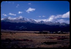
-
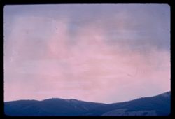
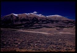
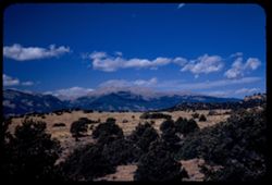
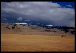
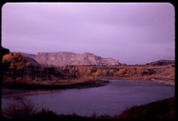
- Description:
- 100 f 5.6
- Subject:
- Rocky Mountains, Mountains, Clouds, and Hills
- Series:
- 9-66
- Creator:
- Cushman, Charles W., 1896-1972
- Date Created:
- 1966-06-15
- Genre:
- Landscape photographs
- Frame Number:
- 28
- County:
- Grand
- Call Number:
- P15431
- City:
- Granby
- Country:
- United States
- State/Province:
- Colorado
- Alternate Identifier:
- 966.28
- Persistent URL:
- http://purl.dlib.indiana.edu/iudl/archives/cushman/P15431
- Holding Location:
- Bloomington - University Archives
Wells Library E460
1320 E 10th St.
Bloomington, IN 47405
Contact at archives@indiana.edu, 812-855-1127
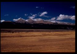
-
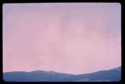
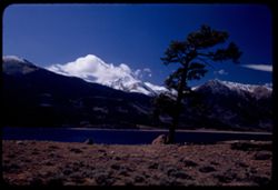
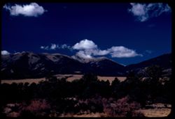
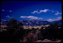
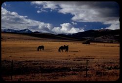
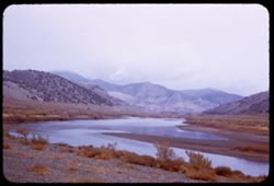
- Description:
- 100 f 4
- Subject:
- Rocky Mountains, Hills, and Mountains
- Series:
- 9-66
- Creator:
- Cushman, Charles W., 1896-1972
- Date Created:
- 1966-06-15
- Genre:
- Landscape photographs
- Frame Number:
- 27
- County:
- Grand
- Call Number:
- P15430
- City:
- Granby
- Country:
- United States
- State/Province:
- Colorado
- Alternate Identifier:
- 966.27
- Persistent URL:
- http://purl.dlib.indiana.edu/iudl/archives/cushman/P15430
- Holding Location:
- Bloomington - University Archives
Wells Library E460
1320 E 10th St.
Bloomington, IN 47405
Contact at archives@indiana.edu, 812-855-1127
-
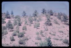
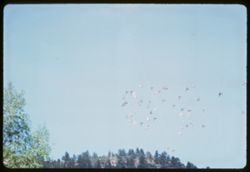
- Description:
- 100 f 11 tl
- Subject:
- Trees, Flying, Hills, and Magpies
- Series:
- 8-66
- Creator:
- Cushman, Charles W., 1896-1972
- Date Created:
- 1966-06-13
- Genre:
- Snapshots
- Frame Number:
- 35
- County:
- Clear Creek
- Call Number:
- P15401
- City:
- Idaho Springs
- Country:
- United States
- State/Province:
- Colorado
- Alternate Identifier:
- 866.35
- Persistent URL:
- http://purl.dlib.indiana.edu/iudl/archives/cushman/P15401
- Holding Location:
- Bloomington - University Archives
Wells Library E460
1320 E 10th St.
Bloomington, IN 47405
Contact at archives@indiana.edu, 812-855-1127
-
- Description:
- 100 f 11 tl
- Subject:
- Trees, Flying, Hills, and Magpies
- Series:
- 8-66
- Creator:
- Cushman, Charles W., 1896-1972
- Date Created:
- 1966-06-13
- Genre:
- Snapshots
- Frame Number:
- 36
- County:
- Clear Creek
- Call Number:
- P15402
- City:
- Idaho Springs
- Country:
- United States
- State/Province:
- Colorado
- Alternate Identifier:
- 866.36
- Persistent URL:
- http://purl.dlib.indiana.edu/iudl/archives/cushman/P15402
- Holding Location:
- Bloomington - University Archives
Wells Library E460
1320 E 10th St.
Bloomington, IN 47405
Contact at archives@indiana.edu, 812-855-1127
-
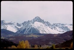
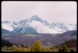
- Description:
- 100 f ? TL
- Subject:
- Hills, Sneffels, Mount (Colo.), Forests, San Juan Mountains (Colo. and N.M.), Mountains, Snow, and Trees
- Series:
- 35-65
- Creator:
- Cushman, Charles W., 1896-1972
- Date Created:
- 1965-10-05
- Genre:
- Landscape photographs
- Frame Number:
- 38
- County:
- Ouray
- Call Number:
- P15068
- Country:
- United States
- State/Province:
- Colorado
- Alternate Identifier:
- 3565.38
- Persistent URL:
- http://purl.dlib.indiana.edu/iudl/archives/cushman/P15068
- Holding Location:
- Bloomington - University Archives
Wells Library E460
1320 E 10th St.
Bloomington, IN 47405
Contact at archives@indiana.edu, 812-855-1127
-
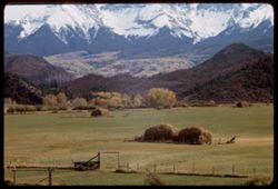
- Description:
- 100 f ? TL
- Subject:
- Meadows, Valleys, Hills, Forests, San Juan Mountains (Colo. and N.M.), Mountains, Hay, Trees, Fences, and Snow
- Series:
- 35-65
- Creator:
- Cushman, Charles W., 1896-1972
- Date Created:
- 1965-10-05
- Genre:
- Landscape photographs
- Frame Number:
- 37
- County:
- Ouray
- Call Number:
- P15067
- Country:
- United States
- State/Province:
- Colorado
- Alternate Identifier:
- 3565.37
- Persistent URL:
- http://purl.dlib.indiana.edu/iudl/archives/cushman/P15067
- Holding Location:
- Bloomington - University Archives
Wells Library E460
1320 E 10th St.
Bloomington, IN 47405
Contact at archives@indiana.edu, 812-855-1127
-
- Description:
- 100 f ? TL
- Subject:
- Valleys, Hills, Sneffels, Mount (Colo.), Forests, San Juan Mountains (Colo. and N.M.), Mountains, Snow, and Trees
- Series:
- 35-65
- Creator:
- Cushman, Charles W., 1896-1972
- Date Created:
- 1965-10-05
- Genre:
- Landscape photographs
- Frame Number:
- 36
- Street Address:
- Colorado State Highway 62
- County:
- Ouray
- Call Number:
- P15066
- Country:
- United States
- State/Province:
- Colorado
- Alternate Identifier:
- 3565.36
- Persistent URL:
- http://purl.dlib.indiana.edu/iudl/archives/cushman/P15066
- Holding Location:
- Bloomington - University Archives
Wells Library E460
1320 E 10th St.
Bloomington, IN 47405
Contact at archives@indiana.edu, 812-855-1127
-
- Description:
- 100 f ? TL
- Subject:
- Valleys, Trees, Tree limbs, Mountains, Hills, and Autumn
- Series:
- 35-65
- Creator:
- Cushman, Charles W., 1896-1972
- Date Created:
- 1965-10-05
- Genre:
- Landscape photographs
- Frame Number:
- 35
- Street Address:
- Colorado State Highway 62
- County:
- Ouray
- Call Number:
- P15065
- City:
- Ouray
- Country:
- United States
- State/Province:
- Colorado
- Alternate Identifier:
- 3565.35
- Persistent URL:
- http://purl.dlib.indiana.edu/iudl/archives/cushman/P15065
- Holding Location:
- Bloomington - University Archives
Wells Library E460
1320 E 10th St.
Bloomington, IN 47405
Contact at archives@indiana.edu, 812-855-1127
-
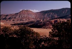
- Description:
- 100 f ? TL
- Subject:
- Valleys, Hills, Sneffels, Mount (Colo.), Forests, San Juan Mountains (Colo. and N.M.), Mountains, Hay, Trees, and Snow
- Series:
- 35-65
- Creator:
- Cushman, Charles W., 1896-1972
- Date Created:
- 1965-10-05
- Genre:
- Landscape photographs
- Frame Number:
- 34
- Street Address:
- Colorado State Highway 62
- County:
- Ouray
- Abstract:
- Mt. Sneffels (14,150') seen from Colo. Hwy 62 NW of Ouray.
- Call Number:
- P15064
- City:
- Ouray
- Country:
- United States
- State/Province:
- Colorado
- Alternate Identifier:
- 3565.34
- Persistent URL:
- http://purl.dlib.indiana.edu/iudl/archives/cushman/P15064
- Holding Location:
- Bloomington - University Archives
Wells Library E460
1320 E 10th St.
Bloomington, IN 47405
Contact at archives@indiana.edu, 812-855-1127
-
- Description:
- 100 f 13 tl
- Subject:
- Firs, Traffic signs & signals, Hills, Forests, and Trees
- Series:
- 32-65
- Creator:
- Cushman, Charles W., 1896-1972
- Date Created:
- 1965-10-02
- Genre:
- Landscape photographs
- Frame Number:
- 28
- Street Address:
- United States Highway 550
- County:
- La Plata and San Juan
- Abstract:
- Cliffs & fall colors
- Call Number:
- P14946
- City:
- Silverton and Durango
- Country:
- United States
- State/Province:
- Colorado
- Alternate Identifier:
- 3265.28
- Persistent URL:
- http://purl.dlib.indiana.edu/iudl/archives/cushman/P14946
- Holding Location:
- Bloomington - University Archives
Wells Library E460
1320 E 10th St.
Bloomington, IN 47405
Contact at archives@indiana.edu, 812-855-1127
-
- Description:
- 100 f 11
- Subject:
- Rocks, Grasses, Houses, Trees, Mountains, and Hills
- Series:
- 32-65
- Creator:
- Cushman, Charles W., 1896-1972
- Date Created:
- 1965-10-02
- Genre:
- Landscape photographs
- Frame Number:
- 20
- Street Address:
- United States Highway 550
- County:
- La Plata
- Abstract:
- few miles north of Durango
- Call Number:
- P14938
- City:
- Durango
- Country:
- United States
- State/Province:
- Colorado
- Alternate Identifier:
- 3265.20
- Persistent URL:
- http://purl.dlib.indiana.edu/iudl/archives/cushman/P14938
- Holding Location:
- Bloomington - University Archives
Wells Library E460
1320 E 10th St.
Bloomington, IN 47405
Contact at archives@indiana.edu, 812-855-1127
-
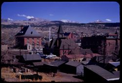
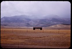
- Description:
- 50 f 11
- Subject:
- Fuelwood, Steeples, Roofs, Churches, Hills, Automobiles, Mountains, Sheds, Buildings, Chimneys, Houses, and Utility poles
- Series:
- 11-53
- Creator:
- Cushman, Charles W., 1896-1972
- Date Created:
- 1953-10-15
- Genre:
- Cityscape photographs
- Frame Number:
- 15
- County:
- Lake
- Abstract:
- Leadville
- Call Number:
- P06894
- City:
- Leadville
- Country:
- United States
- State/Province:
- Colorado
- Alternate Identifier:
- 1153.15
- Persistent URL:
- http://purl.dlib.indiana.edu/iudl/archives/cushman/P06894
- Holding Location:
- Bloomington - University Archives
Wells Library E460
1320 E 10th St.
Bloomington, IN 47405
Contact at archives@indiana.edu, 812-855-1127
-
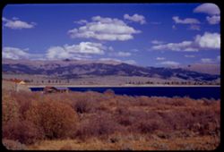
- Description:
- 50 f 11
- Subject:
- Reservoirs, Houses, Trees, Mountains, Shrubs, Lakes & ponds, Clouds, Twin Lakes Reservoir (Lake County, Colo.), Hills, Grasses, and Waterfronts
- Series:
- 11-53
- Creator:
- Cushman, Charles W., 1896-1972
- Date Created:
- 1953-10-15
- Genre:
- Landscape photographs
- Frame Number:
- 16
- County:
- Lake
- Abstract:
- The bigger Twin Lakes
- Call Number:
- P06895
- City:
- Leadville
- Country:
- United States
- State/Province:
- Colorado
- Alternate Identifier:
- 1153.16
- Persistent URL:
- http://purl.dlib.indiana.edu/iudl/archives/cushman/P06895
- Holding Location:
- Bloomington - University Archives
Wells Library E460
1320 E 10th St.
Bloomington, IN 47405
Contact at archives@indiana.edu, 812-855-1127
-
- Description:
- 50 f 9
- Subject:
- Steeples, Chimneys, Churches, Streets, Houses, Automobiles, Mountains, Utility poles, Buildings, Roofs, Hills, and Sheds
- Series:
- 11-53
- Creator:
- Cushman, Charles W., 1896-1972
- Date Created:
- 1953-10-15
- Genre:
- Cityscape photographs
- Frame Number:
- 14
- County:
- Lake
- Abstract:
- Leadville
- Call Number:
- P06893
- City:
- Leadville
- Country:
- United States
- State/Province:
- Colorado
- Alternate Identifier:
- 1153.14
- Persistent URL:
- http://purl.dlib.indiana.edu/iudl/archives/cushman/P06893
- Holding Location:
- Bloomington - University Archives
Wells Library E460
1320 E 10th St.
Bloomington, IN 47405
Contact at archives@indiana.edu, 812-855-1127
-
- Description:
- 50 f 9
- Subject:
- Grasses, Houses, Dirt roads, Fuelwood, Mountains, Massive, Mount (Colo.), Clotheslines, Huts, Suburbs, Hills, Suburban life, Clouds, and Laundry
- Series:
- 11-53
- Creator:
- Cushman, Charles W., 1896-1972
- Date Created:
- 1953-10-15
- Genre:
- Views and Cityscape photographs
- Frame Number:
- 11
- County:
- Lake
- Abstract:
- Mt. Massive above suburb of Stringtown
- Call Number:
- P06890
- City:
- Stringtown and Leadville
- Country:
- United States
- State/Province:
- Colorado
- Alternate Identifier:
- 1153.11
- Persistent URL:
- http://purl.dlib.indiana.edu/iudl/archives/cushman/P06890
- Holding Location:
- Bloomington - University Archives
Wells Library E460
1320 E 10th St.
Bloomington, IN 47405
Contact at archives@indiana.edu, 812-855-1127
-
- Description:
- 50 f 6.3 Pola
- Subject:
- Rocks, Grasses, Roads, Trees, Mountains, Massive, Mount (Colo.), Clouds, Suburbs, and Hills
- Series:
- 11-53
- Creator:
- Cushman, Charles W., 1896-1972
- Date Created:
- 1953-10-15
- Genre:
- Landscape photographs
- Frame Number:
- 10
- County:
- Lake
- Abstract:
- Mt Massive form Stringtown
- Call Number:
- P06889
- City:
- Stringtown and Leadville
- Country:
- United States
- State/Province:
- Colorado
- Alternate Identifier:
- 1153.10
- Persistent URL:
- http://purl.dlib.indiana.edu/iudl/archives/cushman/P06889
- Holding Location:
- Bloomington - University Archives
Wells Library E460
1320 E 10th St.
Bloomington, IN 47405
Contact at archives@indiana.edu, 812-855-1127
-
- Description:
- 50 f 11
- Subject:
- Grasses, Houses, Dirt, Meadows, Mountains, Massive, Mount (Colo.), Shrubs, Clouds, Hills, and Fences
- Series:
- 11-53
- Creator:
- Cushman, Charles W., 1896-1972
- Date Created:
- 1953-10-15
- Genre:
- Landscape photographs
- Frame Number:
- 7
- Street Address:
- United States Highway 24
- County:
- Lake
- Abstract:
- Mt. Massive 14, 418 from US 24 just South of Leadville, Colorado
- Call Number:
- P06886
- City:
- Leadville
- Country:
- United States
- State/Province:
- Colorado
- Alternate Identifier:
- 1153.7
- Persistent URL:
- http://purl.dlib.indiana.edu/iudl/archives/cushman/P06886
- Holding Location:
- Bloomington - University Archives
Wells Library E460
1320 E 10th St.
Bloomington, IN 47405
Contact at archives@indiana.edu, 812-855-1127
-
- Description:
- 59 f 8 Pola
- Subject:
- Grasses, Grazing, Meadows, Cattle, Mountains, Massive, Mount (Colo.), Clouds, and Hills
- Series:
- 11-53
- Creator:
- Cushman, Charles W., 1896-1972
- Date Created:
- 1953-10-15
- Genre:
- Landscape photographs
- Frame Number:
- 6
- County:
- Lake
- Abstract:
- Mt Massive from east
- Call Number:
- P06885
- City:
- Leadville
- Country:
- United States
- State/Province:
- Colorado
- Physical Description:
- Image was originally mounted in a glass enclosure. Before digitization, the image was removed and placed in a Wess Plastic, Inc. brand, 2" x 2", pl...
- Alternate Identifier:
- 1153.6
- Persistent URL:
- http://purl.dlib.indiana.edu/iudl/archives/cushman/P06885
- Holding Location:
- Bloomington - University Archives
Wells Library E460
1320 E 10th St.
Bloomington, IN 47405
Contact at archives@indiana.edu, 812-855-1127
-
- Description:
- 50 f 9 Pola
- Subject:
- Snow, Grasses, Grazing, Meadows, Cattle, Mountains, Fences, Shrubs, Clouds, Hills, and Elbert, Mount (Colo.)
- Series:
- 11-53
- Creator:
- Cushman, Charles W., 1896-1972
- Date Created:
- 1953-10-15
- Genre:
- Landscape photographs
- Frame Number:
- 5
- County:
- Lake
- Abstract:
- Mt. Elbert from east
- Call Number:
- P06884
- City:
- Leadville
- Country:
- United States
- State/Province:
- Colorado
- Physical Description:
- Image was originally mounted in a glass enclosure. Before digitization, the image was removed and placed in a Wess Plastic, Inc. brand, 2" x 2", pl...
- Alternate Identifier:
- 1153.5
- Persistent URL:
- http://purl.dlib.indiana.edu/iudl/archives/cushman/P06884
- Holding Location:
- Bloomington - University Archives
Wells Library E460
1320 E 10th St.
Bloomington, IN 47405
Contact at archives@indiana.edu, 812-855-1127
-
- Description:
- 50 f 11
- Subject:
- Meadows, Hills, Mountains, Shrubs, Grazing, Barns, Clouds, Fences, Cattle, Massive, Mount (Colo.), and Grasses
- Series:
- 11-53
- Creator:
- Cushman, Charles W., 1896-1972
- Date Created:
- 1953-10-15
- Genre:
- Views
- Frame Number:
- 4
- County:
- Lake
- Abstract:
- Mt. Massive from SE
- Call Number:
- P06883
- City:
- Leadville
- Country:
- United States
- State/Province:
- Colorado
- Alternate Identifier:
- 1153.4
- Persistent URL:
- http://purl.dlib.indiana.edu/iudl/archives/cushman/P06883
- Holding Location:
- Bloomington - University Archives
Wells Library E460
1320 E 10th St.
Bloomington, IN 47405
Contact at archives@indiana.edu, 812-855-1127
-
- Description:
- 50 f 8 Pola
- Subject:
- Snow, Grasses, Roads, Meadows, Mountains, Lakes & ponds, Twin Lakes Reservoir (Lake County, Colo.), Hills, and Elbert, Mount (Colo.)
- Series:
- 11-53
- Creator:
- Cushman, Charles W., 1896-1972
- Date Created:
- 1953-10-15
- Genre:
- Landscape photographs
- Frame Number:
- 2
- County:
- Lake
- Abstract:
- Mt. Elbert form Twin Lakes Res.
- Call Number:
- P06881
- City:
- Leadville
- Country:
- United States
- State/Province:
- Colorado
- Physical Description:
- Image was originally mounted in a glass enclosure. Before digitization, the image was removed and placed in a Wess Plastic, Inc. brand, 2" x 2", pl...
- Alternate Identifier:
- 1153.2
- Persistent URL:
- http://purl.dlib.indiana.edu/iudl/archives/cushman/P06881
- Holding Location:
- Bloomington - University Archives
Wells Library E460
1320 E 10th St.
Bloomington, IN 47405
Contact at archives@indiana.edu, 812-855-1127
-
- Description:
- 50 f 6.3 Pola
- Subject:
- Snow, La Plata Mountains (Colo.), Grasses, Trees, Shadows, Mountains, Lakes & ponds, Clouds, Twin Lakes Reservoir (Lake County, Colo.), Hills, Rocks, and...
- Series:
- 11-53
- Creator:
- Cushman, Charles W., 1896-1972
- Date Created:
- 1953-10-15
- Genre:
- Landscape photographs
- Frame Number:
- 1
- County:
- Lake
- Abstract:
- Mt La Plata across Twi Lakes Reservoir
- Call Number:
- P06880
- City:
- Leadville
- Country:
- United States
- State/Province:
- Colorado
- Alternate Identifier:
- 1153.1
- Persistent URL:
- http://purl.dlib.indiana.edu/iudl/archives/cushman/P06880
- Holding Location:
- Bloomington - University Archives
Wells Library E460
1320 E 10th St.
Bloomington, IN 47405
Contact at archives@indiana.edu, 812-855-1127
-
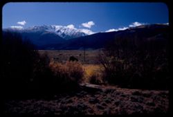
- Description:
- 50 f 7 Pola
- Subject:
- Harvard, Mount (Colo.), Meadows, Hills, Mountains, Shrubs, Snow, Trees, Shadows, Trails & paths, Clouds, Utility poles, and Grasses
- Series:
- 10-53
- Creator:
- Cushman, Charles W., 1896-1972
- Date Created:
- 1953-10-15
- Genre:
- Landscape photographs
- Frame Number:
- 38
- Street Address:
- United States Highway 24
- County:
- Pitkin
- Abstract:
- Snow crowned Mount Harvard from the Aspen road
- Call Number:
- P06878
- City:
- Aspen
- Country:
- United States
- State/Province:
- Colorado
- Alternate Identifier:
- 1053.38
- Persistent URL:
- http://purl.dlib.indiana.edu/iudl/archives/cushman/P06878
- Holding Location:
- Bloomington - University Archives
Wells Library E460
1320 E 10th St.
Bloomington, IN 47405
Contact at archives@indiana.edu, 812-855-1127
-
- Description:
- 50 f 8 Pola
- Subject:
- Rocks, Grasses, Mountains, Shrubs, Clouds, Elbert, Mount (Colo.), and Hills
- Series:
- 10-53
- Creator:
- Cushman, Charles W., 1896-1972
- Date Created:
- 1953-10-15
- Genre:
- Landscape photographs
- Frame Number:
- 37
- Street Address:
- United States Highway 24
- County:
- Chaffee
- Abstract:
- Mt. Elbert from US 24 north of Granite
- Call Number:
- P06877
- City:
- Granite
- Country:
- United States
- State/Province:
- Colorado
- Alternate Identifier:
- 1053.37
- Persistent URL:
- http://purl.dlib.indiana.edu/iudl/archives/cushman/P06877
- Holding Location:
- Bloomington - University Archives
Wells Library E460
1320 E 10th St.
Bloomington, IN 47405
Contact at archives@indiana.edu, 812-855-1127
-
- Description:
- 50 f 8 Pola
- Subject:
- Trees, Meadows, Mountains, Clouds, Hills, and Harvard, Mount (Colo.)
- Series:
- 10-53
- Creator:
- Cushman, Charles W., 1896-1972
- Date Created:
- 1953-10-15
- Genre:
- Landscape photographs
- Frame Number:
- 34
- Street Address:
- United States Highway 24
- County:
- Chaffee
- Abstract:
- Mt. Harvard
- Call Number:
- P06874
- Country:
- United States
- State/Province:
- Colorado
- Alternate Identifier:
- 1053.34
- Persistent URL:
- http://purl.dlib.indiana.edu/iudl/archives/cushman/P06874
- Holding Location:
- Bloomington - University Archives
Wells Library E460
1320 E 10th St.
Bloomington, IN 47405
Contact at archives@indiana.edu, 812-855-1127
-
- Description:
- 50 f 7 Pola
- Subject:
- Grasses, Trees, Meadows, Mountains, Shrubs, Clouds, Hills, and Yale, Mount (Colo.)
- Series:
- 10-53
- Creator:
- Cushman, Charles W., 1896-1972
- Date Created:
- 1953-10-15
- Genre:
- Landscape photographs
- Frame Number:
- 36
- Street Address:
- United States Highway 24
- County:
- Chaffee
- Abstract:
- Mt Yale form US 24 north of Buena Vista
- Call Number:
- P06876
- City:
- Buena Vista
- Country:
- United States
- State/Province:
- Colorado
- Alternate Identifier:
- 1053.36
- Persistent URL:
- http://purl.dlib.indiana.edu/iudl/archives/cushman/P06876
- Holding Location:
- Bloomington - University Archives
Wells Library E460
1320 E 10th St.
Bloomington, IN 47405
Contact at archives@indiana.edu, 812-855-1127
-
- Description:
- 50 f 8 Pola
- Subject:
- Grasses, Trees, Meadows, Mountains, Shrubs, Clouds, Hills, and Yale, Mount (Colo.)
- Series:
- 10-53
- Creator:
- Cushman, Charles W., 1896-1972
- Date Created:
- 1953-10-15
- Genre:
- Landscape photographs
- Frame Number:
- 33
- Street Address:
- United States Highway 24
- County:
- Chaffee
- Abstract:
- Mt. Yale
- Call Number:
- P06873
- Country:
- United States
- State/Province:
- Colorado
- Alternate Identifier:
- 1053.33
- Persistent URL:
- http://purl.dlib.indiana.edu/iudl/archives/cushman/P06873
- Holding Location:
- Bloomington - University Archives
Wells Library E460
1320 E 10th St.
Bloomington, IN 47405
Contact at archives@indiana.edu, 812-855-1127
-
- Description:
- 50 f 6.3 Pola
- Subject:
- Snow, Antero, Mount (Colo.), Grasses, Trees, Meadows, Mountains, Passes (Landforms), Trout Creek Pass (Colo.), Rocks, and Hills
- Series:
- 10-53
- Creator:
- Cushman, Charles W., 1896-1972
- Date Created:
- 1953-10-15
- Genre:
- Landscape photographs
- Frame Number:
- 31
- County:
- Chaffee
- Abstract:
- Mt. Antero from Trout Creek Pass
- Call Number:
- P06871
- Country:
- United States
- State/Province:
- Colorado
- Alternate Identifier:
- 1053.31
- Persistent URL:
- http://purl.dlib.indiana.edu/iudl/archives/cushman/P06871
- Holding Location:
- Bloomington - University Archives
Wells Library E460
1320 E 10th St.
Bloomington, IN 47405
Contact at archives@indiana.edu, 812-855-1127
-
- Description:
- 50 f 8 Pola
- Subject:
- Railings, Grasses, Roads, Trees, Meadows, Mountains, Shrubs, Clouds, Passes (Landforms), Trout Creek Pass (Colo.), Princeton, Mount (Colo.), and Hills
- Series:
- 10-53
- Creator:
- Cushman, Charles W., 1896-1972
- Date Created:
- 1953-10-15
- Genre:
- Landscape photographs
- Frame Number:
- 32
- Street Address:
- United States Highway 24
- County:
- Chaffee
- Abstract:
- Mt. Princeton
- Call Number:
- P06872
- Country:
- United States
- State/Province:
- Colorado
- Physical Description:
- Image was originally mounted in a glass enclosure. Before digitization, the image was removed and placed in a Wess Plastic, Inc. brand, 2" x 2", pl...
- Alternate Identifier:
- 1053.32
- Persistent URL:
- http://purl.dlib.indiana.edu/iudl/archives/cushman/P06872
- Holding Location:
- Bloomington - University Archives
Wells Library E460
1320 E 10th St.
Bloomington, IN 47405
Contact at archives@indiana.edu, 812-855-1127
-
- Description:
- 50 f 7 Pola
- Subject:
- Rocks, Grasses, Roads, Trees, Shadows, Mountains, Princeton, Mount (Colo.), Clouds, Passes (Landforms), Trout Creek Pass (Colo.), and Hills
- Series:
- 10-53
- Creator:
- Cushman, Charles W., 1896-1972
- Date Created:
- 1953-10-15
- Genre:
- Landscape photographs
- Frame Number:
- 30
- County:
- Chaffee
- Abstract:
- Mt. Princeton from Trout Creek Pass but nearer
- Call Number:
- P06870
- Country:
- United States
- State/Province:
- Colorado
- Alternate Identifier:
- 1053.30
- Persistent URL:
- http://purl.dlib.indiana.edu/iudl/archives/cushman/P06870
- Holding Location:
- Bloomington - University Archives
Wells Library E460
1320 E 10th St.
Bloomington, IN 47405
Contact at archives@indiana.edu, 812-855-1127
-
- Description:
- 50 f 8 Pola
- Subject:
- Rocks, Grasses, Roads, Trees, Mountains, Princeton, Mount (Colo.), Clouds, Hills, Trout Creek Pass (Colo.), and Passes (Landforms)
- Series:
- 10-53
- Creator:
- Cushman, Charles W., 1896-1972
- Date Created:
- 1953-10-15
- Genre:
- Landscape photographs
- Frame Number:
- 29
- County:
- Chaffee
- Abstract:
- Mt. Princeton from Trout Creek Pass
- Call Number:
- P06869
- Country:
- United States
- State/Province:
- Colorado
- Alternate Identifier:
- 1053.29
- Persistent URL:
- http://purl.dlib.indiana.edu/iudl/archives/cushman/P06869
- Holding Location:
- Bloomington - University Archives
Wells Library E460
1320 E 10th St.
Bloomington, IN 47405
Contact at archives@indiana.edu, 812-855-1127
-
- Description:
- 50 f 8 Pola
- Subject:
- Snow, Shadows, Meadows, Mountains, Clouds, and Hills
- Series:
- 10-53
- Creator:
- Cushman, Charles W., 1896-1972
- Date Created:
- 1953-10-14
- Genre:
- Landscape photographs
- Frame Number:
- 27
- Street Address:
- Colorado State Highway 285
- County:
- Park
- Abstract:
- NE from 285-Between Jefferson & Fairplay
- Call Number:
- P06867
- City:
- Jefferson and Fairplay
- Country:
- United States
- State/Province:
- Colorado
- Alternate Identifier:
- 1053.27
- Persistent URL:
- http://purl.dlib.indiana.edu/iudl/archives/cushman/P06867
- Holding Location:
- Bloomington - University Archives
Wells Library E460
1320 E 10th St.
Bloomington, IN 47405
Contact at archives@indiana.edu, 812-855-1127
-
- Description:
- 50 f 8
- Subject:
- Snow, Grays Peak (Colo.), Meadows, Mountains, Evans, Mount (Colo.), Clouds, Hills, and Haystacks
- Series:
- 10-53
- Creator:
- Cushman, Charles W., 1896-1972
- Date Created:
- 1953-10-14
- Genre:
- Landscape photographs
- Frame Number:
- 26
- County:
- Park
- Abstract:
- NE from scene near Jefferson
- Call Number:
- P06866
- City:
- Jefferson
- Country:
- United States
- State/Province:
- Colorado
- Physical Description:
- Image was originally mounted in a glass enclosure. Before digitization, the image was removed and placed in a Wess Plastic, Inc. brand, 2" x 2", pl...
- Alternate Identifier:
- 1053.26
- Persistent URL:
- http://purl.dlib.indiana.edu/iudl/archives/cushman/P06866
- Holding Location:
- Bloomington - University Archives
Wells Library E460
1320 E 10th St.
Bloomington, IN 47405
Contact at archives@indiana.edu, 812-855-1127
-
- Description:
- 50 f 8 Pola
- Subject:
- Snow, Valleys, Grasses, Grazing, Horses, Meadows, Kenosha Mountains (Colo.), Kenosha Pass (Colo.), Mountains, Fences, Clouds, and Hills
- Series:
- 10-53
- Creator:
- Cushman, Charles W., 1896-1972
- Date Created:
- 1953-10-14
- Genre:
- Landscape photographs
- Frame Number:
- 25
- County:
- Park
- Abstract:
- NW from valley below Kenosha Pass
- Call Number:
- P06865
- Country:
- United States
- State/Province:
- Colorado
- Alternate Identifier:
- 1053.25
- Persistent URL:
- http://purl.dlib.indiana.edu/iudl/archives/cushman/P06865
- Holding Location:
- Bloomington - University Archives
Wells Library E460
1320 E 10th St.
Bloomington, IN 47405
Contact at archives@indiana.edu, 812-855-1127
-
- Description:
- 50 f 8 Pola
- Subject:
- Snow, Railings, Valleys, Grasses, Roads, Trees, Shadows, Meadows, Kenosha Mountains (Colo.), Kenosha Pass (Colo.), Mountains, Clouds, and Hills
- Series:
- 10-53
- Creator:
- Cushman, Charles W., 1896-1972
- Date Created:
- 1953-10-14
- Genre:
- Landscape photographs
- Frame Number:
- 24
- County:
- Park
- Abstract:
- West from Kenosha Pass-SW slope
- Call Number:
- P06864
- Country:
- United States
- State/Province:
- Colorado
- Alternate Identifier:
- 1053.24
- Persistent URL:
- http://purl.dlib.indiana.edu/iudl/archives/cushman/P06864
- Holding Location:
- Bloomington - University Archives
Wells Library E460
1320 E 10th St.
Bloomington, IN 47405
Contact at archives@indiana.edu, 812-855-1127
-
- Description:
- 50 f 6.3 Pola
- Subject:
- Grasses, Ranches, Trees, Shadows, Meadows, Mountains, Fences, Long Meadow Ranch, Clouds, and Hills
- Series:
- 10-53
- Creator:
- Cushman, Charles W., 1896-1972
- Date Created:
- 1953-10-14
- Genre:
- Landscape photographs
- Frame Number:
- 20
- Street Address:
- Colorado State Highway 285
- County:
- Park
- Abstract:
- Long Meadow ranch few miles west of Bailey, Colo on Hwy 285-Santa Maria
- Call Number:
- P06860
- City:
- Bailey
- Country:
- United States
- State/Province:
- Colorado
- Alternate Identifier:
- 1053.20
- Persistent URL:
- http://purl.dlib.indiana.edu/iudl/archives/cushman/P06860
- Holding Location:
- Bloomington - University Archives
Wells Library E460
1320 E 10th St.
Bloomington, IN 47405
Contact at archives@indiana.edu, 812-855-1127
-
- Description:
- 50 f 4.5
- Subject:
- Valleys, Grasses, Roads, Trees, Mountains, Bridges, Hills, Utility poles, Railroads, Rivers, Bodies of water, and Eagle River (Colo.)
- Series:
- 10-53
- Creator:
- Cushman, Charles W., 1896-1972
- Date Created:
- 1953-10-13
- Genre:
- Landscape photographs
- Frame Number:
- 8
- Street Address:
- United States Highway 6
- County:
- Eagle
- Abstract:
- Mtns along Eagle river below Minturn & Gilman(overcast), from higher
- Call Number:
- P06848
- City:
- Minturn and Gilman
- Country:
- United States
- State/Province:
- Colorado
- Alternate Identifier:
- 1053.8
- Persistent URL:
- http://purl.dlib.indiana.edu/iudl/archives/cushman/P06848
- Holding Location:
- Bloomington - University Archives
Wells Library E460
1320 E 10th St.
Bloomington, IN 47405
Contact at archives@indiana.edu, 812-855-1127
-
- Description:
- 50 f 8
- Subject:
- Houses, Dirt, Mountains, Shrubs, Trees, Rocks, Colorado River (Colo.-Mexico), Rivers, Fences, Hills, and Grasses
- Series:
- 10-53
- Creator:
- Cushman, Charles W., 1896-1972
- Date Created:
- 1953-10-13
- Genre:
- Landscape photographs
- Frame Number:
- 4
- County:
- Eagle
- Abstract:
- Colorado river near Dotsero
- Call Number:
- P06844
- City:
- Dotsero
- Country:
- United States
- State/Province:
- Colorado
- Alternate Identifier:
- 1053.4
- Persistent URL:
- http://purl.dlib.indiana.edu/iudl/archives/cushman/P06844
- Holding Location:
- Bloomington - University Archives
Wells Library E460
1320 E 10th St.
Bloomington, IN 47405
Contact at archives@indiana.edu, 812-855-1127
-
- Description:
- 50 f 8
- Subject:
- Canyons, Grasses, Cliffs, Trees, Red Canyon (Garfield County, Colo.), Tree limbs, Mountains, Rock formations, Clouds, and Hills
- Series:
- 9-53
- Creator:
- Cushman, Charles W., 1896-1972
- Date Created:
- 1953-10-13
- Genre:
- Landscape photographs
- Frame Number:
- 38
- County:
- Garfield
- Abstract:
- Red Canyon, south of Glenwood Spgs.
- Call Number:
- P06839
- City:
- Glenwood Springs
- Country:
- United States
- State/Province:
- Colorado
- Alternate Identifier:
- 953.38
- Persistent URL:
- http://purl.dlib.indiana.edu/iudl/archives/cushman/P06839
- Holding Location:
- Bloomington - University Archives
Wells Library E460
1320 E 10th St.
Bloomington, IN 47405
Contact at archives@indiana.edu, 812-855-1127
-
- Description:
- 50 f 5.6 Pola
- Subject:
- Sopris, Mount (Colo.), Trees, Shadows, Log cabins, Mountains, Clouds, Sunrises & sunsets, and Hills
- Series:
- 9-53
- Creator:
- Cushman, Charles W., 1896-1972
- Date Created:
- 1953-10-12
- Genre:
- Landscape photographs
- Frame Number:
- 37
- Street Address:
- Colorado State Highway 82
- County:
- Garfield and Pitkin
- Abstract:
- Sopris Pk.-capped with cloud -from Colo 82 Glenwood Spgs to Aspen
- Call Number:
- P06838
- City:
- Aspen and Glenwood Springs
- Country:
- United States
- State/Province:
- Colorado
- Alternate Identifier:
- 953.37
- Persistent URL:
- http://purl.dlib.indiana.edu/iudl/archives/cushman/P06838
- Holding Location:
- Bloomington - University Archives
Wells Library E460
1320 E 10th St.
Bloomington, IN 47405
Contact at archives@indiana.edu, 812-855-1127
-
- Description:
- 50 f 6.3 Pola
- Subject:
- Valleys, Hills, Mountains, Shrubs, Grasses, and Clouds
- Series:
- 9-53
- Creator:
- Cushman, Charles W., 1896-1972
- Date Created:
- 1953-10-12
- Genre:
- Landscape photographs
- Frame Number:
- 36
- County:
- Garfield
- Abstract:
- Looking south across Grand Valley at 2:10
- Call Number:
- P06837
- City:
- Parachute
- Country:
- United States
- State/Province:
- Colorado
- Alternate Identifier:
- 953.36
- Persistent URL:
- http://purl.dlib.indiana.edu/iudl/archives/cushman/P06837
- Holding Location:
- Bloomington - University Archives
Wells Library E460
1320 E 10th St.
Bloomington, IN 47405
Contact at archives@indiana.edu, 812-855-1127
-
- Description:
- 50 f 11
- Subject:
- Grasses, Roads, Trees, Mountains, Fences, Shrubs, Clouds, Hills, Cliffs, and Bridges
- Series:
- 9-53
- Creator:
- Cushman, Charles W., 1896-1972
- Date Created:
- 1953-10-12
- Genre:
- Landscape photographs
- Frame Number:
- 35
- County:
- Mesa
- Abstract:
- Mtns near De Beque
- Call Number:
- P06836
- City:
- De Beque
- Country:
- United States
- State/Province:
- Colorado
- Alternate Identifier:
- 953.35
- Persistent URL:
- http://purl.dlib.indiana.edu/iudl/archives/cushman/P06836
- Holding Location:
- Bloomington - University Archives
Wells Library E460
1320 E 10th St.
Bloomington, IN 47405
Contact at archives@indiana.edu, 812-855-1127
-
- Description:
- 50 f 8 Pola
- Subject:
- Rocks, Canyons, Grasses, Roads, Automobiles, Mesas, Colorado River (Colo.-Mexico), Mountains, Shrubs, Clouds, Hills, Rivers, and Trees
- Series:
- 9-53
- Creator:
- Cushman, Charles W., 1896-1972
- Date Created:
- 1953-10-12
- Genre:
- Landscape photographs
- Frame Number:
- 34
- County:
- Mesa
- Abstract:
- View north up river around bend
- Call Number:
- P06835
- City:
- Grand Junction
- Country:
- United States
- State/Province:
- Colorado
- Alternate Identifier:
- 953.34
- Persistent URL:
- http://purl.dlib.indiana.edu/iudl/archives/cushman/P06835
- Holding Location:
- Bloomington - University Archives
Wells Library E460
1320 E 10th St.
Bloomington, IN 47405
Contact at archives@indiana.edu, 812-855-1127
-
- Description:
- 50 f 11
- Subject:
- Canyons, Hills, Roads, Mountains, Shrubs, Rocks, Colorado River (Colo.-Mexico), Grasses, Mesas, Horseshoe Canyon (Colo.), Clouds, and Rivers
- Series:
- 9-53
- Creator:
- Cushman, Charles W., 1896-1972
- Date Created:
- 1953-10-12
- Genre:
- Landscape photographs
- Frame Number:
- 33
- County:
- Mesa
- Abstract:
- Colorado river in Horseshoe Canyon
- Call Number:
- P06834
- City:
- Grand Junction
- Country:
- United States
- State/Province:
- Colorado
- Alternate Identifier:
- 953.33
- Persistent URL:
- http://purl.dlib.indiana.edu/iudl/archives/cushman/P06834
- Holding Location:
- Bloomington - University Archives
Wells Library E460
1320 E 10th St.
Bloomington, IN 47405
Contact at archives@indiana.edu, 812-855-1127
-
- Description:
- 50 f 11
- Subject:
- Rocks, Canyons, Grasses, Colorado River (Colo.-Mexico), Horseshoe Canyon (Colo.), Mountains, Shrubs, Clouds, Hills, and Rivers
- Series:
- 9-53
- Creator:
- Cushman, Charles W., 1896-1972
- Date Created:
- 1953-10-12
- Genre:
- Landscape photographs
- Frame Number:
- 29
- County:
- Mesa
- Abstract:
- Up and [?]on the Colorado river from top of horseshoe canyon on curve 28 miles east of Grand Junction
- Call Number:
- P06830
- City:
- Grand Junction
- Country:
- United States
- State/Province:
- Colorado
- Alternate Identifier:
- 953.29
- Persistent URL:
- http://purl.dlib.indiana.edu/iudl/archives/cushman/P06830
- Holding Location:
- Bloomington - University Archives
Wells Library E460
1320 E 10th St.
Bloomington, IN 47405
Contact at archives@indiana.edu, 812-855-1127
-
- Description:
- 50 f 6.3 Pola
- Subject:
- Grasses, Mesas, Mountains, Fences, Clouds, Hills, Erosion, and Trees
- Series:
- 9-53
- Creator:
- Cushman, Charles W., 1896-1972
- Date Created:
- 1953-10-12
- Genre:
- Landscape photographs
- Frame Number:
- 25
- Street Address:
- United States Highway 6
- County:
- Mesa
- Abstract:
- Mountain wall east of Grand Jnctn from US 6.
- Call Number:
- P06826
- City:
- Grand Junction
- Country:
- United States
- State/Province:
- Colorado
- Alternate Identifier:
- 953.25
- Persistent URL:
- http://purl.dlib.indiana.edu/iudl/archives/cushman/P06826
- Holding Location:
- Bloomington - University Archives
Wells Library E460
1320 E 10th St.
Bloomington, IN 47405
Contact at archives@indiana.edu, 812-855-1127
-
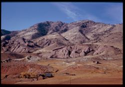
- Description:
- 50 f 8 Pola
- Subject:
- Erosion, Colorado National Monument (Colo.), Buttes, Plains, Mountains, Shrubs, Clouds, Hills, and Grasses
- Series:
- 9-53
- Creator:
- Cushman, Charles W., 1896-1972
- Date Created:
- 1953-10-12
- Genre:
- Landscape photographs
- Frame Number:
- 24
- County:
- Mesa
- Abstract:
- Buttes near Colo National Mon.
- Call Number:
- P06825
- City:
- Grand Junction
- Country:
- United States
- State/Province:
- Colorado
- Physical Description:
- Image was originally mounted in a glass enclosure. Before digitization, the image was removed and placed in a Wess Plastic, Inc. brand, 2" x 2", pl...
- Alternate Identifier:
- 953.24
- Persistent URL:
- http://purl.dlib.indiana.edu/iudl/archives/cushman/P06825
- Holding Location:
- Bloomington - University Archives
Wells Library E460
1320 E 10th St.
Bloomington, IN 47405
Contact at archives@indiana.edu, 812-855-1127
-
- Description:
- 50 f 6.3 Pola
- Subject:
- Grasses, Roads, Colorado National Monument (Colo.), Automobiles, Trees, Plains, Mountains, Shrubs, Traffic signs & signals, Clouds, Hills, and Mesas
- Series:
- 9-53
- Creator:
- Cushman, Charles W., 1896-1972
- Date Created:
- 1953-10-12
- Genre:
- Landscape photographs
- Frame Number:
- 23
- Street Address:
- United States Highway 50
- County:
- Mesa
- Abstract:
- View west from Grand Junction toward Colo Nat'l Mon.
- Call Number:
- P06824
- City:
- Grand Junction
- Country:
- United States
- State/Province:
- Colorado
- Physical Description:
- Image was originally mounted in a glass enclosure. Before digitization, the image was removed and placed in a Wess Plastic, Inc. brand, 2" x 2", pl...
- Alternate Identifier:
- 953.23
- Persistent URL:
- http://purl.dlib.indiana.edu/iudl/archives/cushman/P06824
- Holding Location:
- Bloomington - University Archives
Wells Library E460
1320 E 10th St.
Bloomington, IN 47405
Contact at archives@indiana.edu, 812-855-1127
-
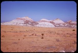
- Description:
- 25 f 6.3 Pola
- Subject:
- National parks & reserves, Hills, Colorado National Monument (Colo.), Cliffs, Mountains, Boulders, Rocks, Buttes, Rock formations, Junipers, and Trees
- Series:
- 25-52
- Creator:
- Cushman, Charles W., 1896-1972
- Date Created:
- 1952-11-03
- Genre:
- Landscape photographs
- Frame Number:
- 38
- County:
- Mesa
- Abstract:
- Across juniper tops.
- Call Number:
- P06407
- City:
- Grand Junction
- Country:
- United States
- State/Province:
- Colorado
- Alternate Identifier:
- 2552.38
- Persistent URL:
- http://purl.dlib.indiana.edu/iudl/archives/cushman/P06407
- Holding Location:
- Bloomington - University Archives
Wells Library E460
1320 E 10th St.
Bloomington, IN 47405
Contact at archives@indiana.edu, 812-855-1127
-
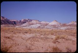
- Description:
- 25 f 12
- Subject:
- Valleys, Colorado National Monument (Colo.), Buttes, Mountains, National parks & reserves, Hills, Meadows, and Shrubs
- Series:
- 25-52
- Creator:
- Cushman, Charles W., 1896-1972
- Date Created:
- 1952-11-03
- Genre:
- Landscape photographs
- Frame Number:
- 37
- County:
- Mesa
- Abstract:
- Buttes again.
- Call Number:
- P06406
- City:
- Grand Junction
- Country:
- United States
- State/Province:
- Colorado
- Alternate Identifier:
- 2552.37
- Persistent URL:
- http://purl.dlib.indiana.edu/iudl/archives/cushman/P06406
- Holding Location:
- Bloomington - University Archives
Wells Library E460
1320 E 10th St.
Bloomington, IN 47405
Contact at archives@indiana.edu, 812-855-1127
-
- Description:
- 25 f 13
- Subject:
- Colorado National Monument (Colo.), Mesas, Buttes, Mountains, Shrubs, Hills, Meadows, and National parks & reserves
- Series:
- 25-52
- Creator:
- Cushman, Charles W., 1896-1972
- Date Created:
- 1952-11-03
- Genre:
- Landscape photographs
- Frame Number:
- 36
- County:
- Mesa
- Call Number:
- P06405
- City:
- Grand Junction
- Country:
- United States
- State/Province:
- Colorado
- Alternate Identifier:
- 2552.36
- Persistent URL:
- http://purl.dlib.indiana.edu/iudl/archives/cushman/P06405
- Holding Location:
- Bloomington - University Archives
Wells Library E460
1320 E 10th St.
Bloomington, IN 47405
Contact at archives@indiana.edu, 812-855-1127
-
- Description:
- 25 f 12
- Subject:
- Rocks, Colorado National Monument (Colo.), Mesas, Boulders, Buttes, Mountains, Shrubs, Hills, Meadows, and National parks & reserves
- Series:
- 25-52
- Creator:
- Cushman, Charles W., 1896-1972
- Date Created:
- 1952-11-03
- Genre:
- Landscape photographs
- Frame Number:
- 35
- County:
- Mesa
- Call Number:
- P06404
- City:
- Grand Junction
- Country:
- United States
- State/Province:
- Colorado
- Alternate Identifier:
- 2552.35
- Persistent URL:
- http://purl.dlib.indiana.edu/iudl/archives/cushman/P06404
- Holding Location:
- Bloomington - University Archives
Wells Library E460
1320 E 10th St.
Bloomington, IN 47405
Contact at archives@indiana.edu, 812-855-1127
-
- Description:
- 25 f 8
- Subject:
- Cliffs, Mesas, Colorado River (Colo.-Mexico), Mountains, Shrubs, Hills, Utility poles, Rivers, and Trees
- Series:
- 25-52
- Creator:
- Cushman, Charles W., 1896-1972
- Date Created:
- 1952-11-02
- Genre:
- Landscape photographs
- Frame Number:
- 32
- County:
- Mesa
- Abstract:
- The Colorado river 14 miles east of Grand Junction.
- Call Number:
- P06401
- City:
- Grand Junction
- Country:
- United States
- State/Province:
- Colorado
- Alternate Identifier:
- 2552.32
- Persistent URL:
- http://purl.dlib.indiana.edu/iudl/archives/cushman/P06401
- Holding Location:
- Bloomington - University Archives
Wells Library E460
1320 E 10th St.
Bloomington, IN 47405
Contact at archives@indiana.edu, 812-855-1127
-
- Description:
- 25 f 6.3
- Subject:
- Hills, Mountains, Shrubs, Colorado River (Colo.-Mexico), and Rivers
- Series:
- 25-52
- Creator:
- Cushman, Charles W., 1896-1972
- Date Created:
- 1952-11-02
- Genre:
- Landscape photographs
- Frame Number:
- 28
- County:
- Garfield
- Abstract:
- Colorado river 16 mi. east of Glenwood Springs.
- Call Number:
- P06397
- City:
- Glenwood Springs
- Country:
- United States
- State/Province:
- Colorado
- Alternate Identifier:
- 2552.28
- Persistent URL:
- http://purl.dlib.indiana.edu/iudl/archives/cushman/P06397
- Holding Location:
- Bloomington - University Archives
Wells Library E460
1320 E 10th St.
Bloomington, IN 47405
Contact at archives@indiana.edu, 812-855-1127
-
- Description:
- 25 f 6.3 Pola
- Subject:
- Rocky Mountains, Dirt roads, Barbed wire, Meadows, Mountains, Fences, Clouds, Hills, Animal housing, and Elbert, Mount (Colo.)
- Series:
- 25-52
- Creator:
- Cushman, Charles W., 1896-1972
- Date Created:
- 1952-11-02
- Genre:
- Landscape photographs
- Frame Number:
- 23
- Abstract:
- Mt. Elbert from east. 14431 ft.
- Call Number:
- P06392
- Country:
- United States
- State/Province:
- Colorado
- Alternate Identifier:
- 2552.23
- Persistent URL:
- http://purl.dlib.indiana.edu/iudl/archives/cushman/P06392
- Holding Location:
- Bloomington - University Archives
Wells Library E460
1320 E 10th St.
Bloomington, IN 47405
Contact at archives@indiana.edu, 812-855-1127
-
- Description:
- 25 f 5.6 Pola
- Subject:
- Rocky Mountains, Roads, Barbed wire, Meadows, Mountains, Fences, Clouds, Hills, Animal housing, and Elbert, Mount (Colo.)
- Series:
- 25-52
- Creator:
- Cushman, Charles W., 1896-1972
- Date Created:
- 1952-11-02
- Genre:
- Landscape photographs
- Frame Number:
- 22
- Abstract:
- Mt. Elbert - top in shroud. 14431 ft.
- Call Number:
- P06391
- Country:
- United States
- State/Province:
- Colorado
- Alternate Identifier:
- 2552.22
- Persistent URL:
- http://purl.dlib.indiana.edu/iudl/archives/cushman/P06391
- Holding Location:
- Bloomington - University Archives
Wells Library E460
1320 E 10th St.
Bloomington, IN 47405
Contact at archives@indiana.edu, 812-855-1127
-
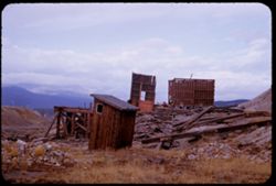
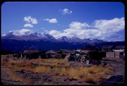
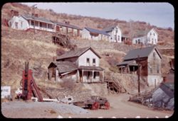
- Description:
- 25 f 6.3
- Subject:
- Rocks, Grasses, Abandoned buildings, Mountains, Hills, Building deterioration, and Ruins
- Series:
- 25-52
- Creator:
- Cushman, Charles W., 1896-1972
- Date Created:
- 1952-11-02
- Genre:
- Snapshots
- Frame Number:
- 18
- County:
- Lake
- Abstract:
- Ruins atop hill at east of Leadville.
- Call Number:
- P06387
- City:
- Leadville
- Country:
- United States
- State/Province:
- Colorado
- Alternate Identifier:
- 2552.18
- Persistent URL:
- http://purl.dlib.indiana.edu/iudl/archives/cushman/P06387
- Holding Location:
- Bloomington - University Archives
Wells Library E460
1320 E 10th St.
Bloomington, IN 47405
Contact at archives@indiana.edu, 812-855-1127
-
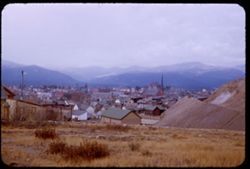
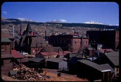
- Description:
- 25 f 6.3
- Subject:
- Rocks, Grasses, Houses, Streets, Mountains, Churches, Shrubs, Hotels, Hills, Cities & towns, and Buildings
- Series:
- 25-52
- Creator:
- Cushman, Charles W., 1896-1972
- Date Created:
- 1952-11-02
- Genre:
- Cityscape photographs
- Frame Number:
- 19
- County:
- Lake
- Abstract:
- Leadville from [?] SE.
- Call Number:
- P06388
- City:
- Leadville
- Country:
- United States
- State/Province:
- Colorado
- Alternate Identifier:
- 2552.19
- Persistent URL:
- http://purl.dlib.indiana.edu/iudl/archives/cushman/P06388
- Holding Location:
- Bloomington - University Archives
Wells Library E460
1320 E 10th St.
Bloomington, IN 47405
Contact at archives@indiana.edu, 812-855-1127
-
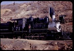
- Description:
- 25 f 6.3
- Subject:
- Hills, Colorado and Southern Railway, Shrubs, Railroad locomotives, Rocks, and Retaining walls
- Series:
- 24-52
- Creator:
- Cushman, Charles W., 1896-1972
- Date Created:
- 1952-10-31
- Genre:
- Snapshots
- Frame Number:
- 30
- County:
- Gilpin and Denver
- Abstract:
- Old 71. Colorado's Southern Ry Co. service between Denver + Central City, 1872-1941.
- Call Number:
- P06361
- City:
- Denver and Central City
- Country:
- United States
- State/Province:
- Colorado
- Alternate Identifier:
- 2452.30
- Persistent URL:
- http://purl.dlib.indiana.edu/iudl/archives/cushman/P06361
- Holding Location:
- Bloomington - University Archives
Wells Library E460
1320 E 10th St.
Bloomington, IN 47405
Contact at archives@indiana.edu, 812-855-1127
-
- Description:
- 25 f 8
- Subject:
- Houses, Railroad cars, Colorado and Southern Railway, Shrubs, Railroad locomotives, Retaining walls, Signs (Notices), Hills, Outbuildings, Utility poles, and...
- Series:
- 24-52
- Creator:
- Cushman, Charles W., 1896-1972
- Date Created:
- 1952-10-31
- Genre:
- Snapshots
- Frame Number:
- 29
- County:
- Gilpin and Denver
- Abstract:
- Old 71. Colorado's Southern Ry Co. service between Denver + Central City, 1872-1941.
- Call Number:
- P06360
- City:
- Denver and Central City
- Country:
- United States
- State/Province:
- Colorado
- Alternate Identifier:
- 2452.29
- Persistent URL:
- http://purl.dlib.indiana.edu/iudl/archives/cushman/P06360
- Holding Location:
- Bloomington - University Archives
Wells Library E460
1320 E 10th St.
Bloomington, IN 47405
Contact at archives@indiana.edu, 812-855-1127
-
- Description:
- 25 f 8
- Subject:
- Pedestrians, Automobiles, Shadows, Signs (Notices), Streets, Cities & towns, Sidewalks, Hotels, Mercantile facilities, Hills, Electric signs, and Bars
- Series:
- 24-52
- Creator:
- Cushman, Charles W., 1896-1972
- Date Created:
- 1952-10-31
- Genre:
- Views
- Frame Number:
- 28
- County:
- Gilpin
- Abstract:
- Russell Gulch.
- Call Number:
- P06359
- City:
- Central City and Russell Gulch
- Country:
- United States
- State/Province:
- Colorado
- Alternate Identifier:
- 2452.28
- Persistent URL:
- http://purl.dlib.indiana.edu/iudl/archives/cushman/P06359
- Holding Location:
- Bloomington - University Archives
Wells Library E460
1320 E 10th St.
Bloomington, IN 47405
Contact at archives@indiana.edu, 812-855-1127
-
- Description:
- 25 f 3
- Subject:
- Henry Peeck (Central City, Colo.), Abandoned buildings, Hills, Mining, Cliffs, Dirt roads, Utility poles, Building deterioration, Retaining walls, Stables, S...
- Series:
- 24-52
- Creator:
- Cushman, Charles W., 1896-1972
- Date Created:
- 1952-10-31
- Genre:
- Architectural photographs
- Frame Number:
- 31
- County:
- Gilpin
- Abstract:
- Henry Peeck.
- Call Number:
- P06362
- City:
- Central City
- Country:
- United States
- State/Province:
- Colorado
- Alternate Identifier:
- 2452.31
- Persistent URL:
- http://purl.dlib.indiana.edu/iudl/archives/cushman/P06362
- Holding Location:
- Bloomington - University Archives
Wells Library E460
1320 E 10th St.
Bloomington, IN 47405
Contact at archives@indiana.edu, 812-855-1127
-
- Description:
- 25 f 9
- Subject:
- Railings, Houses, Dirt roads, Trees, Walkways, Retaining walls, Churches, Snowplows, Hills, and Buildings
- Series:
- 24-52
- Creator:
- Cushman, Charles W., 1896-1972
- Date Created:
- 1952-10-31
- Genre:
- Views
- Frame Number:
- 27
- County:
- Gilpin
- Abstract:
- SW section.
- Call Number:
- P06358
- City:
- Central City
- Country:
- United States
- State/Province:
- Colorado
- Alternate Identifier:
- 2452.27
- Persistent URL:
- http://purl.dlib.indiana.edu/iudl/archives/cushman/P06358
- Holding Location:
- Bloomington - University Archives
Wells Library E460
1320 E 10th St.
Bloomington, IN 47405
Contact at archives@indiana.edu, 812-855-1127
-
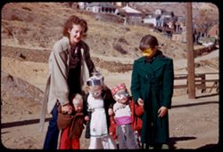
- Description:
- 25 f 10
- Subject:
- Railings, Houses, Dirt roads, Mothers & children, Costumes, Retaining walls, Shrubs, Halloween, Hills, Utility poles, Halloween costumes, Children, and W...
- Series:
- 24-52
- Creator:
- Cushman, Charles W., 1896-1972
- Date Created:
- 1952-10-31
- Genre:
- Portraits
- Frame Number:
- 26
- County:
- Gilpin
- Abstract:
- Halloween party.
- Call Number:
- P06357
- City:
- Central City
- Country:
- United States
- State/Province:
- Colorado
- Alternate Identifier:
- 2452.26
- Persistent URL:
- http://purl.dlib.indiana.edu/iudl/archives/cushman/P06357
- Holding Location:
- Bloomington - University Archives
Wells Library E460
1320 E 10th St.
Bloomington, IN 47405
Contact at archives@indiana.edu, 812-855-1127
-
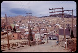
- Description:
- 25 f 11
- Subject:
- Railings, Electric lines, Houses, Dirt roads, Trees, Streets, Retaining walls, Cities & towns, Sidewalks, Hills, Utility poles, and Buildings
- Series:
- 24-52
- Creator:
- Cushman, Charles W., 1896-1972
- Date Created:
- 1952-10-31
- Genre:
- Cityscape photographs
- Frame Number:
- 24
- County:
- Gilpin
- Abstract:
- Two views from south elevation.
- Call Number:
- P06355
- City:
- Central City
- Country:
- United States
- State/Province:
- Colorado
- Alternate Identifier:
- 2452.24
- Persistent URL:
- http://purl.dlib.indiana.edu/iudl/archives/cushman/P06355
- Holding Location:
- Bloomington - University Archives
Wells Library E460
1320 E 10th St.
Bloomington, IN 47405
Contact at archives@indiana.edu, 812-855-1127
-
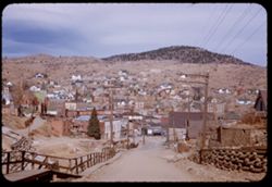
- Description:
- 25 f 11
- Subject:
- Cities & towns, Streets, Houses, Mountains, Dirt roads, Utility poles, Electric lines, Trees, Buildings, Retaining walls, Signs (Notices), and Hills
- Series:
- 24-52
- Creator:
- Cushman, Charles W., 1896-1972
- Date Created:
- 1952-10-31
- Genre:
- Cityscape photographs
- Frame Number:
- 25
- County:
- Gilpin
- Abstract:
- Two views from south elevation.
- Call Number:
- P06356
- City:
- Central City
- Country:
- United States
- State/Province:
- Colorado
- Alternate Identifier:
- 2452.25
- Persistent URL:
- http://purl.dlib.indiana.edu/iudl/archives/cushman/P06356
- Holding Location:
- Bloomington - University Archives
Wells Library E460
1320 E 10th St.
Bloomington, IN 47405
Contact at archives@indiana.edu, 812-855-1127
-
- Description:
- 25 f 11
- Subject:
- Electric lines, Houses, Trees, Streets, Retaining walls, Cities & towns, Buildings, Shrubs, Traffic signs & signals, Hills, Utility poles, and Mountains
- Series:
- 24-52
- Creator:
- Cushman, Charles W., 1896-1972
- Date Created:
- 1952-10-31
- Genre:
- Cityscape photographs
- Frame Number:
- 23
- County:
- Gilpin
- Abstract:
- from south.
- Call Number:
- P06354
- City:
- Central City
- Country:
- United States
- State/Province:
- Colorado
- Alternate Identifier:
- 2452.23
- Persistent URL:
- http://purl.dlib.indiana.edu/iudl/archives/cushman/P06354
- Holding Location:
- Bloomington - University Archives
Wells Library E460
1320 E 10th St.
Bloomington, IN 47405
Contact at archives@indiana.edu, 812-855-1127
-
- Description:
- 25 f 9
- Subject:
- Electric lines, Houses, Streets, Abandoned buildings, Cities & towns, Buildings, Hills, Utility poles, and Building deterioration
- Series:
- 24-52
- Creator:
- Cushman, Charles W., 1896-1972
- Date Created:
- 1952-10-31
- Genre:
- Views
- Frame Number:
- 21
- County:
- Gilpin
- Abstract:
- The upper outskirts of Blackhawk.
- Call Number:
- P06352
- City:
- Blackhawk
- Country:
- United States
- State/Province:
- Colorado
- Alternate Identifier:
- 2452.21
- Persistent URL:
- http://purl.dlib.indiana.edu/iudl/archives/cushman/P06352
- Holding Location:
- Bloomington - University Archives
Wells Library E460
1320 E 10th St.
Bloomington, IN 47405
Contact at archives@indiana.edu, 812-855-1127
-
- Description:
- 25 f 9
- Subject:
- Electric lines, Houses, Automobiles, Trees, Streets, Retaining walls, Cities & towns, Fences, Shrubs, Hills, Utility poles, and Mountains
- Series:
- 24-52
- Creator:
- Cushman, Charles W., 1896-1972
- Date Created:
- 1952-10-31
- Genre:
- Views
- Frame Number:
- 22
- County:
- Gilpin
- Abstract:
- Central City from west height (8572 el).
- Call Number:
- P06353
- City:
- Central City
- Country:
- United States
- State/Province:
- Colorado
- Alternate Identifier:
- 2452.22
- Persistent URL:
- http://purl.dlib.indiana.edu/iudl/archives/cushman/P06353
- Holding Location:
- Bloomington - University Archives
Wells Library E460
1320 E 10th St.
Bloomington, IN 47405
Contact at archives@indiana.edu, 812-855-1127
-
- Description:
- 25 f 9
- Subject:
- Rocks, Automobiles, Trees, Mountains, Buildings, Shrubs, Hills, and Utility poles
- Series:
- 24-52
- Creator:
- Cushman, Charles W., 1896-1972
- Date Created:
- 1952-10-31
- Genre:
- Cityscape photographs
- Frame Number:
- 17
- County:
- Gilpin
- Abstract:
- Blackhawk, Colorado.
- Call Number:
- P06348
- City:
- Blackhawk
- Country:
- United States
- State/Province:
- Colorado
- Alternate Identifier:
- 2452.17
- Persistent URL:
- http://purl.dlib.indiana.edu/iudl/archives/cushman/P06348
- Holding Location:
- Bloomington - University Archives
Wells Library E460
1320 E 10th St.
Bloomington, IN 47405
Contact at archives@indiana.edu, 812-855-1127
-
- Description:
- 25 f 9
- Subject:
- Electric lines, Cliffs, Retaining walls, Cities & towns, Bells, Shrubs, Hills, Gold Ore Souvenirs (Blackhawk, Colo.), Souvenir shops, Houses, Buildings, ...
- Series:
- 24-52
- Creator:
- Cushman, Charles W., 1896-1972
- Date Created:
- 1952-10-31
- Genre:
- Views
- Frame Number:
- 19
- County:
- Gilpin
- Abstract:
- Blackhawk, Colorado. Houses on cliff side = Blackhawk.
- Call Number:
- P06350
- City:
- Blackhawk
- Country:
- United States
- State/Province:
- Colorado
- Alternate Identifier:
- 2452.19
- Persistent URL:
- http://purl.dlib.indiana.edu/iudl/archives/cushman/P06350
- Holding Location:
- Bloomington - University Archives
Wells Library E460
1320 E 10th St.
Bloomington, IN 47405
Contact at archives@indiana.edu, 812-855-1127
-
- Description:
- 25 f 9
- Subject:
- Houses, Dirt roads, Carts & wagons, Signs (Notices), Retaining walls, Stairways, Fences, Shrubs, Hills, Utility poles, Machinery, and Porches
- Series:
- 24-52
- Creator:
- Cushman, Charles W., 1896-1972
- Date Created:
- 1952-10-31
- Genre:
- Views
- Frame Number:
- 18
- County:
- Gilpin
- Abstract:
- Blackhawk, Colorado.
- Call Number:
- P06349
- City:
- Blackhawk
- Country:
- United States
- State/Province:
- Colorado
- Alternate Identifier:
- 2452.18
- Persistent URL:
- http://purl.dlib.indiana.edu/iudl/archives/cushman/P06349
- Holding Location:
- Bloomington - University Archives
Wells Library E460
1320 E 10th St.
Bloomington, IN 47405
Contact at archives@indiana.edu, 812-855-1127
-
- Description:
- 25 f 5.6
- Subject:
- Rocky Mountains, Trees, Mummy Range (Colo.), Meadows, Mummy Mountain (Colo.), Mountains, National parks & reserves, Lakes & ponds, Hills, Reflections...
- Series:
- 24-52
- Creator:
- Cushman, Charles W., 1896-1972
- Date Created:
- 1952-11-01
- Genre:
- Landscape photographs
- Frame Number:
- 35
- County:
- Larimer
- Abstract:
- Mummy Mtns reflected in Sheep Lake (east side of Pk)
- Call Number:
- P06366
- City:
- Estes Park
- Country:
- United States
- State/Province:
- Colorado
- Physical Description:
- Image was originally mounted in a glass enclosure. Before digitization, the image was removed and placed in a Wess Plastic, Inc. brand, 2" x 2", pl...
- Alternate Identifier:
- 2452.35
- Persistent URL:
- http://purl.dlib.indiana.edu/iudl/archives/cushman/P06366
- Holding Location:
- Bloomington - University Archives
Wells Library E460
1320 E 10th St.
Bloomington, IN 47405
Contact at archives@indiana.edu, 812-855-1127
-
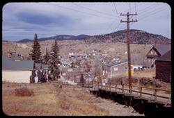
- Description:
- 25 f 9
- Subject:
- Lakes & ponds, Meadows, Hills, Roads, Outbuildings, Mountains, Trees, Shadows, Grasses, Fences, and Houses
- Series:
- 24-52
- Creator:
- Cushman, Charles W., 1896-1972
- Date Created:
- 1952-10-31
- Genre:
- Landscape photographs
- Frame Number:
- 32
- County:
- Boulder
- Abstract:
- Little mountain lake at Nederland.
- Call Number:
- P06363
- City:
- Nederland
- Country:
- United States
- State/Province:
- Colorado
- Alternate Identifier:
- 2452.32
- Persistent URL:
- http://purl.dlib.indiana.edu/iudl/archives/cushman/P06363
- Holding Location:
- Bloomington - University Archives
Wells Library E460
1320 E 10th St.
Bloomington, IN 47405
Contact at archives@indiana.edu, 812-855-1127
-
- Description:
- 25 f 11
- Subject:
- Croplands, Red Rocks Park (Jefferson County, Colo.), Rocky Mountains, Houses, Outbuildings, Mountains, Trees, Rock formations, Fences, Red Rocks Amphitheatre...
- Series:
- 24-52
- Creator:
- Cushman, Charles W., 1896-1972
- Date Created:
- 1952-10-31
- Genre:
- Landscape photographs
- Frame Number:
- 15
- Street Address:
- Colorado State Highway 74
- County:
- Jefferson
- Abstract:
- Along Colo 74 - mtn side near Red Rocks theatre.
- Call Number:
- P06346
- City:
- Morrison
- Country:
- United States
- State/Province:
- Colorado
- Physical Description:
- Image was originally mounted in a glass enclosure. Before digitization, the image was removed and placed in a Wess Plastic, Inc. brand, 2" x 2", pl...
- Alternate Identifier:
- 2452.15
- Persistent URL:
- http://purl.dlib.indiana.edu/iudl/archives/cushman/P06346
- Holding Location:
- Bloomington - University Archives
Wells Library E460
1320 E 10th St.
Bloomington, IN 47405
Contact at archives@indiana.edu, 812-855-1127
-
- Description:
- 25 f 4.5 POLA
- Subject:
- Red Rocks Amphitheatre, Rock formations, Rocks, Red Rocks Park (Jefferson County, Colo.), Hills, Mountains, Shadows, Clouds, Amphitheaters, Parks, and Boulders
- Series:
- 24-52
- Creator:
- Cushman, Charles W., 1896-1972
- Date Created:
- 1952-10-30
- Genre:
- Landscape photographs
- Frame Number:
- 11
- County:
- Jefferson and Denver
- Abstract:
- View SE and down from Red Rocks Amphitheatre
- Call Number:
- P06342
- City:
- Morrison and Denver
- Country:
- United States
- State/Province:
- Colorado
- Alternate Identifier:
- 2452.11
- Persistent URL:
- http://purl.dlib.indiana.edu/iudl/archives/cushman/P06342
- Holding Location:
- Bloomington - University Archives
Wells Library E460
1320 E 10th St.
Bloomington, IN 47405
Contact at archives@indiana.edu, 812-855-1127
-
- Description:
- 25 f 11
- Subject:
- Cliffs, Parks, Shadows, Buttes, Mountains, Fences, Rock formations, Red Rocks Park (Jefferson County, Colo.), Hills, Roads, and Shrubs
- Series:
- 24-52
- Creator:
- Cushman, Charles W., 1896-1972
- Date Created:
- 1952-10-30
- Genre:
- Landscape photographs
- Frame Number:
- 7
- County:
- Jefferson
- Abstract:
- NE from Red Rock Park
- Call Number:
- P06338
- City:
- Morrison
- Country:
- United States
- State/Province:
- Colorado
- Alternate Identifier:
- 2452.7
- Persistent URL:
- http://purl.dlib.indiana.edu/iudl/archives/cushman/P06338
- Holding Location:
- Bloomington - University Archives
Wells Library E460
1320 E 10th St.
Bloomington, IN 47405
Contact at archives@indiana.edu, 812-855-1127
-

- Description:
- 25 f 6 POLA
- Subject:
- Rocks, Roads, Parks, Boulders, Shadows, Buttes, Mountains, Buildings, Rock formations, Clouds, Red Rocks Park (Jefferson County, Colo.), Hills, and Cliffs
- Series:
- 24-52
- Creator:
- Cushman, Charles W., 1896-1972
- Date Created:
- 1952-10-30
- Genre:
- Landscape photographs
- Frame Number:
- 5
- County:
- Jefferson
- Abstract:
- Red Rock Park west of Denver
- Call Number:
- P06336
- City:
- Morrison
- Country:
- United States
- State/Province:
- Colorado
- Alternate Identifier:
- 2452.5
- Persistent URL:
- http://purl.dlib.indiana.edu/iudl/archives/cushman/P06336
- Holding Location:
- Bloomington - University Archives
Wells Library E460
1320 E 10th St.
Bloomington, IN 47405
Contact at archives@indiana.edu, 812-855-1127
-
- Description:
- 25 f 6.3 pola
- Subject:
- Red Rocks Park (Jefferson County, Colo.), Parks, Roads, Cliffs, Mountains, Shrubs, Boulders, Rocks, Buttes, Rock formations, Hills, Buildings, and Clouds
- Series:
- 24-52
- Creator:
- Cushman, Charles W., 1896-1972
- Date Created:
- 1952-10-30
- Genre:
- Landscape photographs
- Frame Number:
- 2
- County:
- Jefferson
- Abstract:
- Red Rock Park west of Denver
- Call Number:
- P06333
- City:
- Morrison
- Country:
- United States
- State/Province:
- Colorado
- Physical Description:
- Image was originally mounted in a glass enclosure. Before digitization, the image was removed and placed in a Wess Plastic, Inc. brand, 2" x 2", pl...
- Alternate Identifier:
- 2452.2
- Persistent URL:
- http://purl.dlib.indiana.edu/iudl/archives/cushman/P06333
- Holding Location:
- Bloomington - University Archives
Wells Library E460
1320 E 10th St.
Bloomington, IN 47405
Contact at archives@indiana.edu, 812-855-1127
-
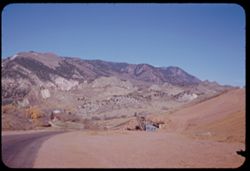
- Description:
- 25 f 11
- Subject:
- Houses, Mine buildings, Trees, Mining, Mountains, Hills, Garden of the Gods (Colorado Springs, Colo.), Mining equipment, and Roads
- Series:
- 23-52
- Creator:
- Cushman, Charles W., 1896-1972
- Date Created:
- 1952-10-29
- Genre:
- Landscape photographs
- Frame Number:
- 33
- Street Address:
- Mesa Road
- County:
- El Paso
- Abstract:
- Old mine and mountains ne of Garden of Gods-from Mesa Rd.
- Call Number:
- P06325
- City:
- Colorado Springs
- Country:
- United States
- State/Province:
- Colorado
- Alternate Identifier:
- 2352.33
- Persistent URL:
- http://purl.dlib.indiana.edu/iudl/archives/cushman/P06325
- Holding Location:
- Bloomington - University Archives
Wells Library E460
1320 E 10th St.
Bloomington, IN 47405
Contact at archives@indiana.edu, 812-855-1127
-
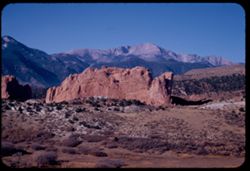
- Description:
- 25 f 11
- Subject:
- Cliffs, Trees, Buttes, Mountains, Shrubs, Pikes Peak (Colo.), Hills, Garden of the Gods (Colorado Springs, Colo.), and Rock formations
- Series:
- 23-52
- Creator:
- Cushman, Charles W., 1896-1972
- Date Created:
- 1952-10-29
- Genre:
- Landscape photographs
- Frame Number:
- 32
- County:
- El Paso
- Abstract:
- Farewell to Pike's Peak
- Call Number:
- P06324
- City:
- Colorado Springs
- Country:
- United States
- State/Province:
- Colorado
- Alternate Identifier:
- 2352.32
- Persistent URL:
- http://purl.dlib.indiana.edu/iudl/archives/cushman/P06324
- Holding Location:
- Bloomington - University Archives
Wells Library E460
1320 E 10th St.
Bloomington, IN 47405
Contact at archives@indiana.edu, 812-855-1127
-
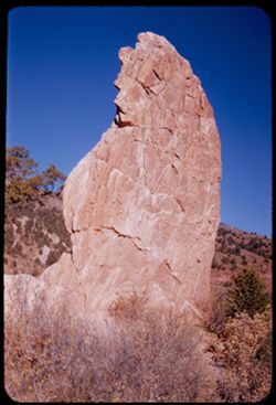
- Description:
- 25 f 11
- Subject:
- Cliffs, Trees, Shrubs, Hills, Garden of the Gods (Colorado Springs, Colo.), and Rock formations
- Series:
- 23-52
- Creator:
- Cushman, Charles W., 1896-1972
- Date Created:
- 1952-10-29
- Genre:
- Identification photographs
- Frame Number:
- 31
- County:
- El Paso
- Abstract:
- Face of same slab
- Call Number:
- P06323
- City:
- Colorado Springs
- Country:
- United States
- State/Province:
- Colorado
- Alternate Identifier:
- 2352.31
- Persistent URL:
- http://purl.dlib.indiana.edu/iudl/archives/cushman/P06323
- Holding Location:
- Bloomington - University Archives
Wells Library E460
1320 E 10th St.
Bloomington, IN 47405
Contact at archives@indiana.edu, 812-855-1127
-
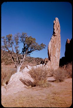
- Description:
- 25 f 11
- Subject:
- Grasses, Cliffs, Trees, Pines, Buttes, Rock formations, Hills, Garden of the Gods (Colorado Springs, Colo.), and Shrubs
- Series:
- 23-52
- Creator:
- Cushman, Charles W., 1896-1972
- Date Created:
- 1952-10-29
- Genre:
- Identification photographs
- Frame Number:
- 30
- County:
- El Paso
- Abstract:
- Pine & Chip
- Call Number:
- P06322
- City:
- Colorado Springs
- Country:
- United States
- State/Province:
- Colorado
- Alternate Identifier:
- 2352.30
- Persistent URL:
- http://purl.dlib.indiana.edu/iudl/archives/cushman/P06322
- Holding Location:
- Bloomington - University Archives
Wells Library E460
1320 E 10th St.
Bloomington, IN 47405
Contact at archives@indiana.edu, 812-855-1127
-
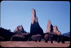
- Description:
- 25 f 9
- Subject:
- Crosses, Cliffs, Trees, Shadows, Buttes, Mountains, Rock formations, Hills, Garden of the Gods (Colorado Springs, Colo.), Meadows, and Shrubs
- Series:
- 23-52
- Creator:
- Cushman, Charles W., 1896-1972
- Date Created:
- 1952-10-29
- Genre:
- Landscape photographs
- Frame Number:
- 26
- County:
- El Paso
- Abstract:
- In Garden of Gods
- Call Number:
- P06318
- City:
- Colorado Springs
- Country:
- United States
- State/Province:
- Colorado
- Alternate Identifier:
- 2352.26
- Persistent URL:
- http://purl.dlib.indiana.edu/iudl/archives/cushman/P06318
- Holding Location:
- Bloomington - University Archives
Wells Library E460
1320 E 10th St.
Bloomington, IN 47405
Contact at archives@indiana.edu, 812-855-1127
-
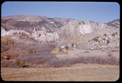
- Description:
- 25 f 11
- Subject:
- Grasses, Cliffs, Trees, Mountains, Buildings, Rock formations, Hills, Garden of the Gods (Colorado Springs, Colo.), Houses, and Shrubs
- Series:
- 23-52
- Creator:
- Cushman, Charles W., 1896-1972
- Date Created:
- 1952-10-29
- Genre:
- Landscape photographs
- Frame Number:
- 23
- County:
- El Paso
- Abstract:
- Rocks north of Garden of the Gods
- Call Number:
- P06315
- City:
- Colorado Springs
- Country:
- United States
- State/Province:
- Colorado
- Alternate Identifier:
- 2352.23
- Persistent URL:
- http://purl.dlib.indiana.edu/iudl/archives/cushman/P06315
- Holding Location:
- Bloomington - University Archives
Wells Library E460
1320 E 10th St.
Bloomington, IN 47405
Contact at archives@indiana.edu, 812-855-1127
-
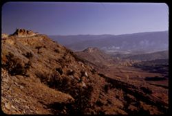
- Description:
- 25 f 5.6 Pola
- Subject:
- Rocks, Valleys, Roads, Trees, Boulders, Mountains, Shrubs, and Hills
- Series:
- 23-52
- Creator:
- Cushman, Charles W., 1896-1972
- Date Created:
- 1952-10-28
- Genre:
- Landscape photographs
- Frame Number:
- 20
- Street Address:
- Skyline Drive
- County:
- Fremont
- Abstract:
- View south from Skyline Drive
- Call Number:
- P06312
- City:
- Canon City
- Country:
- United States
- State/Province:
- Colorado
- Alternate Identifier:
- 2352.20
- Persistent URL:
- http://purl.dlib.indiana.edu/iudl/archives/cushman/P06312
- Holding Location:
- Bloomington - University Archives
Wells Library E460
1320 E 10th St.
Bloomington, IN 47405
Contact at archives@indiana.edu, 812-855-1127
-
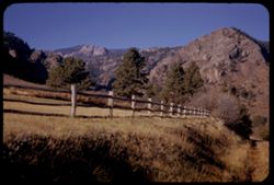
- Description:
- 25 f 9
- Subject:
- Rocky Mountains, Grasses, Trails & paths, Trees, Meadows, Mountains, Fences, Shrubs, and Hills
- Series:
- 22-52
- Creator:
- Cushman, Charles W., 1896-1972
- Date Created:
- 1952-10-28
- Genre:
- Landscape photographs
- Frame Number:
- 31
- County:
- El Paso
- Abstract:
- Mtns above & west of Broadmoor
- Call Number:
- P06285
- City:
- Broadmoor
- Country:
- United States
- State/Province:
- Colorado
- Alternate Identifier:
- 2252.31
- Persistent URL:
- http://purl.dlib.indiana.edu/iudl/archives/cushman/P06285
- Holding Location:
- Bloomington - University Archives
Wells Library E460
1320 E 10th St.
Bloomington, IN 47405
Contact at archives@indiana.edu, 812-855-1127
-
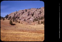
- Description:
- 25 f 11
- Subject:
- Rocky Mountains, Hills, Barbed wire, Mountains, Boulders, Rock formations, Fences, Trees, and Grasses
- Series:
- 22-52
- Creator:
- Cushman, Charles W., 1896-1972
- Date Created:
- 1952-10-27
- Genre:
- Landscape photographs
- Frame Number:
- 23
- Street Address:
- Colorado State Highway 143
- County:
- Teller
- Abstract:
- And to the left, this scene-the Rock is truly overlapped
- Call Number:
- P06277
- City:
- Cripple Creek and Florissant
- Country:
- United States
- State/Province:
- Colorado
- Physical Description:
- masked.
- Alternate Identifier:
- 2252.23
- Persistent URL:
- http://purl.dlib.indiana.edu/iudl/archives/cushman/P06277
- Holding Location:
- Bloomington - University Archives
Wells Library E460
1320 E 10th St.
Bloomington, IN 47405
Contact at archives@indiana.edu, 812-855-1127
-
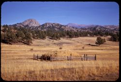
- Description:
- 25 f 11
- Subject:
- Rocky Mountains, Trees, Mountains, Fences, Hay, Pikes Peak (Colo.), Hills, and Haystacks
- Series:
- 22-52
- Creator:
- Cushman, Charles W., 1896-1972
- Date Created:
- 1952-10-27
- Genre:
- Landscape photographs
- Frame Number:
- 22
- Street Address:
- Colorado State Highway 143
- County:
- Teller
- Abstract:
- Pike's Pk & the Rockies from Colo 143 between Cripple Crk & Florissant
- Call Number:
- P06276
- City:
- Florissant and Cripple Creek
- Country:
- United States
- State/Province:
- Colorado
- Alternate Identifier:
- 2252.22
- Persistent URL:
- http://purl.dlib.indiana.edu/iudl/archives/cushman/P06276
- Holding Location:
- Bloomington - University Archives
Wells Library E460
1320 E 10th St.
Bloomington, IN 47405
Contact at archives@indiana.edu, 812-855-1127
-
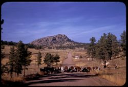
- Description:
- 25 f 11
- Subject:
- Grasses, Roads, Cowboys, Trees, Signs (Notices), Mountains, Rock formations, Cows, and Hills
- Series:
- 22-52
- Creator:
- Cushman, Charles W., 1896-1972
- Date Created:
- 1952-10-27
- Genre:
- Landscape photographs
- Frame Number:
- 21
- Street Address:
- Colorado State Highway 143
- County:
- Teller
- Abstract:
- Cows-lots of them-on Colo. 143
- Call Number:
- P06275
- City:
- Florissant and Cripple Creek
- Country:
- United States
- State/Province:
- Colorado
- Alternate Identifier:
- 2252.21
- Persistent URL:
- http://purl.dlib.indiana.edu/iudl/archives/cushman/P06275
- Holding Location:
- Bloomington - University Archives
Wells Library E460
1320 E 10th St.
Bloomington, IN 47405
Contact at archives@indiana.edu, 812-855-1127
-
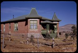
- Description:
- 25 f 11
- Subject:
- Rocks, Grasses, Houses, Trees, Brick houses, Stairways, Fences, Chairs, Windows, Hills, Columns, Porches, and Utility poles
- Series:
- 22-52
- Creator:
- Cushman, Charles W., 1896-1972
- Date Created:
- 1952-10-27
- Genre:
- Architectural photographs
- Frame Number:
- 18
- County:
- Teller
- Abstract:
- Brick house on west edge of Crip Crk (Elev. 9800)
- Call Number:
- P06272
- City:
- Cripple Creek
- Country:
- United States
- State/Province:
- Colorado
- Alternate Identifier:
- 2252.18
- Persistent URL:
- http://purl.dlib.indiana.edu/iudl/archives/cushman/P06272
- Holding Location:
- Bloomington - University Archives
Wells Library E460
1320 E 10th St.
Bloomington, IN 47405
Contact at archives@indiana.edu, 812-855-1127
-
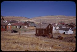
- Description:
- 25 f 11
- Subject:
- Rocks, Electric lines, Houses, Automobiles, Trees, Streets, Cities & towns, Fences, Shrubs, Hills, Utility poles, and Grasses
- Series:
- 22-52
- Creator:
- Cushman, Charles W., 1896-1972
- Date Created:
- 1952-10-27
- Genre:
- Views
- Frame Number:
- 17
- County:
- Teller
- Abstract:
- Cripple Creek=NE sec.
- Call Number:
- P06271
- City:
- Cripple Creek
- Country:
- United States
- State/Province:
- Colorado
- Alternate Identifier:
- 2252.17
- Persistent URL:
- http://purl.dlib.indiana.edu/iudl/archives/cushman/P06271
- Holding Location:
- Bloomington - University Archives
Wells Library E460
1320 E 10th St.
Bloomington, IN 47405
Contact at archives@indiana.edu, 812-855-1127
-
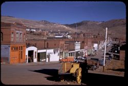
- Description:
- 25 f 11
- Subject:
- Electric lines, Automobiles, Carts & wagons, Taverns (Inns), Streets, Cities & towns, Buildings, Trucks, Mercantile facilities, Hills, Utility poles,...
- Series:
- 22-52
- Creator:
- Cushman, Charles W., 1896-1972
- Date Created:
- 1952-10-27
- Genre:
- Cityscape photographs
- Frame Number:
- 16
- County:
- Teller
- Abstract:
- Cripple Creek
- Call Number:
- P06270
- City:
- Cripple Creek
- Country:
- United States
- State/Province:
- Colorado
- Alternate Identifier:
- 2252.16
- Persistent URL:
- http://purl.dlib.indiana.edu/iudl/archives/cushman/P06270
- Holding Location:
- Bloomington - University Archives
Wells Library E460
1320 E 10th St.
Bloomington, IN 47405
Contact at archives@indiana.edu, 812-855-1127
-
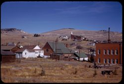
- Description:
- 25 f 11
- Subject:
- Churches, Streets, Houses, Picnic grounds, Utility poles, Electric lines, Trees, Buildings, Fences, Hills, and Shrubs
- Series:
- 22-52
- Creator:
- Cushman, Charles W., 1896-1972
- Date Created:
- 1952-10-27
- Genre:
- Cityscape photographs
- Frame Number:
- 13
- County:
- Teller
- Abstract:
- Cripple Creek
- Call Number:
- P06267
- City:
- Cripple Creek
- Country:
- United States
- State/Province:
- Colorado
- Alternate Identifier:
- 2252.13
- Persistent URL:
- http://purl.dlib.indiana.edu/iudl/archives/cushman/P06267
- Holding Location:
- Bloomington - University Archives
Wells Library E460
1320 E 10th St.
Bloomington, IN 47405
Contact at archives@indiana.edu, 812-855-1127
-
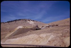
- Description:
- 25 f 11
- Subject:
- Railings, Roads, Mine buildings, Trees, Hills, and Mining equipment
- Series:
- 22-52
- Creator:
- Cushman, Charles W., 1896-1972
- Date Created:
- 1952-10-27
- Genre:
- Views
- Frame Number:
- 12
- County:
- Teller
- Abstract:
- Another old mine north of Crip Crk
- Call Number:
- P06266
- City:
- Cripple Creek
- Country:
- United States
- State/Province:
- Colorado
- Alternate Identifier:
- 2252.12
- Persistent URL:
- http://purl.dlib.indiana.edu/iudl/archives/cushman/P06266
- Holding Location:
- Bloomington - University Archives
Wells Library E460
1320 E 10th St.
Bloomington, IN 47405
Contact at archives@indiana.edu, 812-855-1127
-
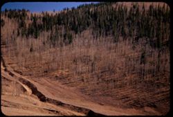
- Description:
- 25 f 5.6 Pola
- Subject:
- Canyons, Trees, Birches, and Hills
- Series:
- 22-52
- Creator:
- Cushman, Charles W., 1896-1972
- Date Created:
- 1952-10-27
- Genre:
- Landscape photographs
- Frame Number:
- 11
- County:
- Teller
- Abstract:
- Stand of birch in canyon above Cripple Creek
- Call Number:
- P06265
- City:
- Cripple Creek
- Country:
- United States
- State/Province:
- Colorado
- Alternate Identifier:
- 2252.11
- Persistent URL:
- http://purl.dlib.indiana.edu/iudl/archives/cushman/P06265
- Holding Location:
- Bloomington - University Archives
Wells Library E460
1320 E 10th St.
Bloomington, IN 47405
Contact at archives@indiana.edu, 812-855-1127
-
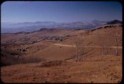
- Description:
- 25 f 7 Pola
- Subject:
- Rocks, Valleys, Roads, Trees, Mountains, and Hills
- Series:
- 22-52
- Creator:
- Cushman, Charles W., 1896-1972
- Date Created:
- 1952-10-27
- Genre:
- Landscape photographs and Cityscape photographs
- Frame Number:
- 10
- County:
- Teller
- Abstract:
- Working down on Cripple Creek from NE
- Call Number:
- P06264
- City:
- Cripple Creek
- Country:
- United States
- State/Province:
- Colorado
- Alternate Identifier:
- 2252.10
- Persistent URL:
- http://purl.dlib.indiana.edu/iudl/archives/cushman/P06264
- Holding Location:
- Bloomington - University Archives
Wells Library E460
1320 E 10th St.
Bloomington, IN 47405
Contact at archives@indiana.edu, 812-855-1127
-
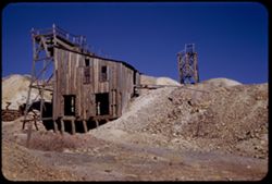
- Description:
- 25 f 11
- Subject:
- Mining equipment, Hills, Shrubs, Rocks, and Mine buildings
- Series:
- 22-52
- Creator:
- Cushman, Charles W., 1896-1972
- Date Created:
- 1952-10-27
- Genre:
- Architectural photographs
- Frame Number:
- 9
- County:
- Teller
- Abstract:
- Old mine above Cripple Creek
- Call Number:
- P06263
- City:
- Cripple Creek
- Country:
- United States
- State/Province:
- Colorado
- Alternate Identifier:
- 2252.9
- Persistent URL:
- http://purl.dlib.indiana.edu/iudl/archives/cushman/P06263
- Holding Location:
- Bloomington - University Archives
Wells Library E460
1320 E 10th St.
Bloomington, IN 47405
Contact at archives@indiana.edu, 812-855-1127
-
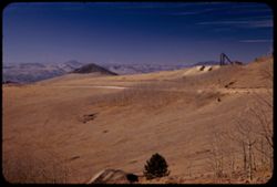
- Description:
- 25 f 8 Pola
- Subject:
- Hoisting machinery, Roads, Mine buildings, Trees, Tree limbs, Mountains, Fences, Hills, and Mining equipment
- Series:
- 22-52
- Creator:
- Cushman, Charles W., 1896-1972
- Date Created:
- 1952-10-27
- Genre:
- Landscape photographs
- Frame Number:
- 7
- County:
- Teller
- Abstract:
- From road above Cripple Creek - SW
- Call Number:
- P06261
- City:
- Cripple Creek
- Country:
- United States
- State/Province:
- Colorado
- Alternate Identifier:
- 2252.7
- Persistent URL:
- http://purl.dlib.indiana.edu/iudl/archives/cushman/P06261
- Holding Location:
- Bloomington - University Archives
Wells Library E460
1320 E 10th St.
Bloomington, IN 47405
Contact at archives@indiana.edu, 812-855-1127