
Search Constraints
You searched for:
Campus
IUB
Remove constraint Campus: IUB
Subject
Mountains
Remove constraint Subject: Mountains
Subject
Trees
Remove constraint Subject: Trees
« Previous |
1 - 100 of 1,796
|
Next »
Search Results
-
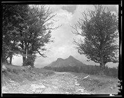
- Subject:
- 4x5, Mountains, Dirt roads, and Trees
- Series:
- 4x5
- Date Created:
- 1938-08-25
- Identifier:
- Hoh004.023.0032
- Genre:
- Landscape photographs
- Geographic Location:
- Linville (N.C.) and Grandfather Mountain (N.C.)
- Call Number:
- 4x5, Box 23, Item 32
- Physical Description:
- 4x5
- Persistent URL:
- http://purl.dlib.indiana.edu/iudl/lilly/hohenberger/Hoh004.023.0032
- Holding Location:
- Bloomington - Lilly Library
1200 E. Seventh St
Bloomington, IN 47405
Contact at liblilly@indiana.edu, 812-855-2452
-
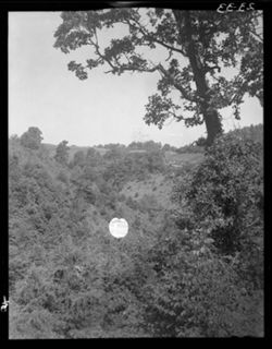
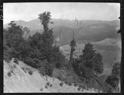
- Subject:
- Trees, Mountains, 4x5, and Signs (Notices)
- Series:
- 4x5
- Date Created:
- 1938-08-26
- Identifier:
- Hoh004.023.0033
- Genre:
- Landscape photographs
- Geographic Location:
- Cumberland Gap (Ky. and Va.) and Appalachian Region
- Call Number:
- 4x5, Box 23, Item 33
- Physical Description:
- 4x5
- Persistent URL:
- http://purl.dlib.indiana.edu/iudl/lilly/hohenberger/Hoh004.023.0033
- Holding Location:
- Bloomington - Lilly Library
1200 E. Seventh St
Bloomington, IN 47405
Contact at liblilly@indiana.edu, 812-855-2452
-
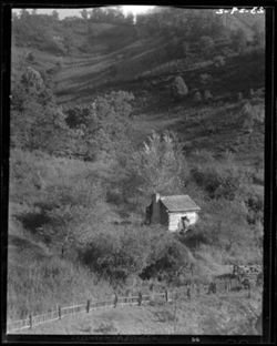
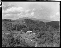
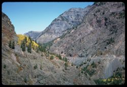
- Subject:
- 4x5, Log cabins, Mountains, and Trees
- Series:
- 4x5
- Date Created:
- 1938-08-25
- Identifier:
- Hoh004.023.0029.2
- Genre:
- Landscape photographs
- Geographic Location:
- Great Smoky Mountains (N.C. and Tenn.), Appalachian Region, and Tennessee
- Call Number:
- 4x5, Box 23, Item 29.2
- Physical Description:
- 4x5
- Persistent URL:
- http://purl.dlib.indiana.edu/iudl/lilly/hohenberger/Hoh004.023.0029.2
- Holding Location:
- Bloomington - Lilly Library
1200 E. Seventh St
Bloomington, IN 47405
Contact at liblilly@indiana.edu, 812-855-2452
-
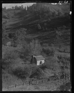
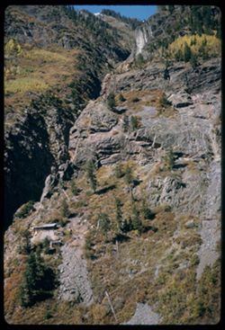
- Subject:
- Log cabins, 4x5, Trees, and Mountains
- Series:
- 4x5
- Date Created:
- 1938-08-25
- Identifier:
- Hoh004.023.0029.1
- Genre:
- Landscape photographs
- Geographic Location:
- Great Smoky Mountains (N.C. and Tenn.), Tennessee, and Appalachian Region
- Call Number:
- 4x5, Box 23, Item 29.1
- Physical Description:
- 4x5
- Persistent URL:
- http://purl.dlib.indiana.edu/iudl/lilly/hohenberger/Hoh004.023.0029.1
- Holding Location:
- Bloomington - Lilly Library
1200 E. Seventh St
Bloomington, IN 47405
Contact at liblilly@indiana.edu, 812-855-2452
-
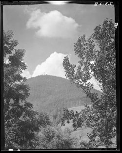
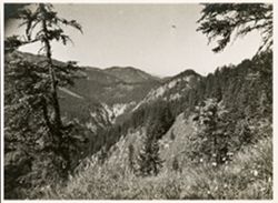
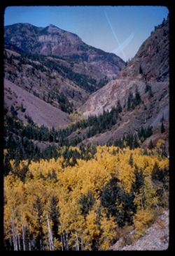
- Subject:
- Mountains, Clouds, 4x5, and Trees
- Series:
- 4x5
- Date Created:
- 1938-08-25
- Identifier:
- Hoh004.023.0028
- Genre:
- Landscape photographs
- Geographic Location:
- North Carolina
- Call Number:
- 4x5, Box 23, Item 28
- Physical Description:
- 4x5
- Persistent URL:
- http://purl.dlib.indiana.edu/iudl/lilly/hohenberger/Hoh004.023.0028
- Holding Location:
- Bloomington - Lilly Library
1200 E. Seventh St
Bloomington, IN 47405
Contact at liblilly@indiana.edu, 812-855-2452
-
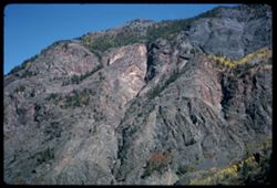
- Subject:
- Mountains, Trees, and 4x5
- Series:
- 4x5
- Identifier:
- Hoh004.022.0037
- Genre:
- Landscape photographs
- Geographic Location:
- Virginia
- Call Number:
- 4x5, Box 22, Item 37
- Physical Description:
- 4x5
- Persistent URL:
- http://purl.dlib.indiana.edu/iudl/lilly/hohenberger/Hoh004.022.0037
- Holding Location:
- Bloomington - Lilly Library
1200 E. Seventh St
Bloomington, IN 47405
Contact at liblilly@indiana.edu, 812-855-2452
-
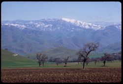
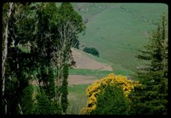
- Subject:
- Trees, Mountains, 4x5, and Farms
- Series:
- 4x5
- Date Created:
- 1934-06
- Identifier:
- Hoh004.019.0022
- Genre:
- Landscape photographs
- Geographic Location:
- North Carolina
- Call Number:
- 4x5, Box 19, Item 22
- Physical Description:
- 4x5
- Persistent URL:
- http://purl.dlib.indiana.edu/iudl/lilly/hohenberger/Hoh004.019.0022
- Holding Location:
- Bloomington - Lilly Library
1200 E. Seventh St
Bloomington, IN 47405
Contact at liblilly@indiana.edu, 812-855-2452
-
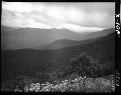
- Subject:
- Trees, 3x4, Clouds, and Mountains
- Series:
- 3x4
- Identifier:
- Hoh001.000.1272
- Genre:
- Landscape photographs
- Geographic Location:
- Pisgah National Forest (N.C.)
- Call Number:
- 3x4, Item 1272
- Physical Description:
- 3x4
- Persistent URL:
- http://purl.dlib.indiana.edu/iudl/lilly/hohenberger/Hoh001.000.1272
- Holding Location:
- Bloomington - Lilly Library
1200 E. Seventh St
Bloomington, IN 47405
Contact at liblilly@indiana.edu, 812-855-2452
-
- Description:
- Event Name: World War II
- Subject:
- Trees and Mountains
- Series:
- Groups. Subseries: Roll X. Folder: Book 8.
- Creator:
- Fleming, Malcolm L.
- Date Created:
- 1945-07-15
- Identifier:
- VAD2888-000362
- Geographic Location:
- Wildbad Kreuth
- Call Number:
- 2014/095
- Caption:
- Fleming's caption typed on reverse side of image reads, in full: "Not unlike Oregon country in general appearance, and much of the vegetation is fa...
- Copyright Holder:
- Indiana University
- Country:
- Germany
- State/Province:
- Kreuth
- Alternate Identifier:
- X-15
- Persistent URL:
- http://purl.dlib.indiana.edu/iudl/archives/VAD2888/VAD2888-000362
-
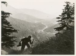
- Description:
- Event Name: World War II
- Subject:
- Hiking, Mountains, Trees, and Rivers
- Series:
- Groups. Subseries: Roll X. Folder: Book 8.
- Creator:
- Fleming, Malcolm L.
- Date Created:
- 1945-07-15
- Identifier:
- VAD2888-000361
- Geographic Location:
- Wildbad Kreuth
- Persons Pictured:
- Nemeth
- Call Number:
- 2014/095
- Caption:
- Fleming's caption typed on reverse side of image reads, in full: "Nemeth is overdoing it a bit, but the climb is a stiff one. Wildbad Kreuth, Ger ...
- Copyright Holder:
- Indiana University
- Country:
- Germany
- State/Province:
- Kreuth
- Alternate Identifier:
- X-14
- Persistent URL:
- http://purl.dlib.indiana.edu/iudl/archives/VAD2888/VAD2888-000361
-
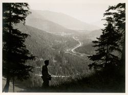
- Description:
- Event Name: World War II
- Subject:
- Mountains, Rivers, and Trees
- Series:
- Groups. Subseries: Roll X. Folder: Book 8.
- Creator:
- Fleming, Malcolm L.
- Date Created:
- 1945-07-15
- Identifier:
- VAD2888-000360
- Geographic Location:
- Wildbad Kreuth
- Call Number:
- 2014/095
- Caption:
- Fleming's caption typed on reverse side of image reads, in full: "View from a mountain slope nearby the Company. On down the river is Lake Tegernse...
- Copyright Holder:
- Indiana University
- Country:
- Germany
- State/Province:
- Kreuth
- Alternate Identifier:
- X-13
- Persistent URL:
- http://purl.dlib.indiana.edu/iudl/archives/VAD2888/VAD2888-000360
-
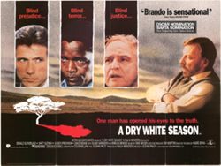
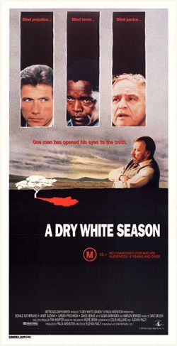
- Subject:
- Afrikaners in motion pictures, Mountains, Fiction films, Meadows, Trees, South Africans in motion pictures, Whites in motion pictures, and Motion picture pos...
- Creator:
- Publisher: United International Pictures and Director: Palcy, Euzhan
- Language:
- English
- Date Created:
- Date Taken: 1989 and Publication Date: 1989
- Identifier:
- VAD9191-000197
- Geographic Location:
- South Africa
- Persons Pictured:
- Marlon Brando, Jürgen Prochnow, Zakes Mokae, and Donald Sutherland
- Related URL:
- http://purl.dlib.indiana.edu/iudl/findingaids/bfca/VAD5484
- Call Number:
- COL 12 POS 195
- Caption:
- One man has opened his eyes to the truth.
- Country:
- United States
- Physical Description:
- 1 poster , 30 x 40 inches
- Alternate Identifier:
- COL 12
- Persistent URL:
- http://purl.dlib.indiana.edu/iudl/bfca/VAD9191/VAD9191-000197
-
- Subject:
- Fiction films, Mountains, Men, South Africans in motion pictures, Trees, Afrikaners in motion pictures, Clouds, Motion pictures--United States, Whites in mot...
- Creator:
- Director: Palcy, Euzhan and Publisher: Metro Goldwyn Mayer Pictures, Inc.
- Language:
- English
- Date Created:
- Date Taken: 1989 and Publication Date: 1989
- Identifier:
- VAD9191-000021
- Geographic Location:
- South Africa
- Persons Pictured:
- Marlon Brando, Jürgen Prochnow, Zakes Mokae, and Donald Sutherland
- Related URL:
- http://purl.dlib.indiana.edu/iudl/findingaids/bfca/VAD5484
- Call Number:
- COL 12 POS 19
- Caption:
- One man opened his eyes to the truth.
- Country:
- United States
- Physical Description:
- 1 poster , 25.75 x 13.25 inches
- Alternate Identifier:
- COL 12
- Persistent URL:
- http://purl.dlib.indiana.edu/iudl/bfca/VAD9191/VAD9191-000021
-
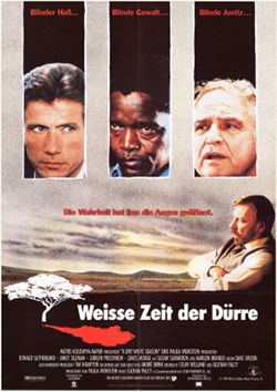
- Subject:
- South Africans in motion pictures, Fiction films, Whites in motion pictures, Motion pictures--United States, Men, Clouds, Motion picture posters, Trees, Afri...
- Creator:
- Director: Palcy, Euzhan and Publisher: Metro Goldwyn Mayer Pictures, Inc.
- Language:
- German
- Date Created:
- Publication Date: 1989 and Date Taken: 1989
- Identifier:
- VAD9191-000022
- Geographic Location:
- South Africa
- Persons Pictured:
- Zakes Mokae, Marlon Brando, Donald Sutherland, and Jürgen Prochnow
- Related URL:
- http://purl.dlib.indiana.edu/iudl/findingaids/bfca/VAD5484
- Abstract:
- Original release title: A Dry White Season.
- Call Number:
- COL 12 POS 20
- Caption:
- Blinder Haß... Blinde Gewalt... Blinde Justiz... Die Wahrheit hat ihm die Augen geöffnet.
- Country:
- United States
- Physical Description:
- 1 poster , 33 x 23.5 inches
- Alternate Identifier:
- COL 12
- Persistent URL:
- http://purl.dlib.indiana.edu/iudl/bfca/VAD9191/VAD9191-000022
-
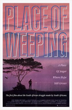
- Subject:
- Men, Trees, Motion pictures--South Africa, Fiction films, Motion picture posters, South Africans in motion pictures, and Mountains
- Creator:
- Director: Roodt, Darrell and Publisher: New World Pictures
- Language:
- English
- Date Created:
- Publication Date: 1986 and Date Taken: 1986
- Identifier:
- VAD9191-000217
- Geographic Location:
- South Africa
- Related URL:
- http://purl.dlib.indiana.edu/iudl/findingaids/bfca/VAD5484
- Call Number:
- COL 12 POS 215
- Caption:
- A place of anger where hope still grows. The first film about the South African struggle made by South Africans.
- Country:
- South Africa
- Physical Description:
- 1 poster , 41 x 27 inches
- Alternate Identifier:
- COL 12
- Persistent URL:
- http://purl.dlib.indiana.edu/iudl/bfca/VAD9191/VAD9191-000217
-
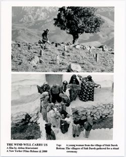
- Subject:
- Motion pictures--Iran, Women, Fiction films, Film stills, Rocks, Photographs, Trees, Iranians in motion pictures, Mountains, Rites & ceremonies, and Ceme...
- Creator:
- Publisher: New Yorker Films and Director: Kiarostami, Abbas
- Language:
- English
- Date Created:
- Publication Date: 2000 and Date Taken: 1999
- Identifier:
- VAD9191-001134
- Geographic Location:
- Iran
- Related URL:
- http://purl.dlib.indiana.edu/iudl/findingaids/bfca/VAD5484
- Abstract:
- Original title: Bad ma ra khahad bord.
- Call Number:
- COL 12 PA 211
- Caption:
- Top: A young woman from the village of Siah Dareh. Bottom: The villagers of Siah Dareh gathered for a ritual ceremony.
- Country:
- Iran
- Physical Description:
- 1 photograph : black & white , 8 x 10 inches
- Alternate Identifier:
- COL 12
- Persistent URL:
- http://purl.dlib.indiana.edu/iudl/bfca/VAD9191/VAD9191-001134
-
- Description:
- 50 f 8
- Subject:
- Trestles, Feather River (Calif.), Trees, Mountains, Shrubs, Bridges, and Rivers
- Series:
- 14-54
- Creator:
- Cushman, Charles W., 1896-1972
- Date Created:
- 1954-10-10
- Genre:
- Landscape photographs
- Frame Number:
- 24
- County:
- Plumas
- Abstract:
- View north from rd above Feather river 6 mi SW of Portola.
- Call Number:
- P15806
- City:
- Portola
- Country:
- United States
- State/Province:
- California
- Alternate Identifier:
- 1454.24
- Persistent URL:
- http://purl.dlib.indiana.edu/iudl/archives/cushman/P15806
-
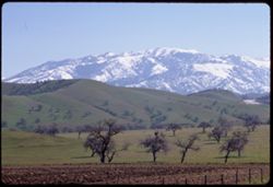
- Description:
- 100 f 5.6
- Subject:
- Croplands, Meadows, Hills, Mountains, and Trees
- Series:
- 3-69
- Creator:
- Cushman, Charles W., 1896-1972
- Date Created:
- 1969-03-21
- Genre:
- Landscape photographs
- Frame Number:
- 20
- Street Address:
- California State Highway 58
- County:
- Kern
- Abstract:
- Yellow fields Green hills Hwy 58
- Call Number:
- P15772
- City:
- Tehachapi and Bakersfield
- Country:
- United States
- State/Province:
- California
- Alternate Identifier:
- 369.20
- Persistent URL:
- http://purl.dlib.indiana.edu/iudl/archives/cushman/P15772
-
- Description:
- 100 f 11 TL
- Subject:
- Tree limbs, Mountains, and Trees
- Series:
- 2-69
- Creator:
- Cushman, Charles W., 1896-1972
- Date Created:
- 1969-03-17
- Genre:
- Landscape photographs
- Frame Number:
- 33
- County:
- Riverside
- Abstract:
- near Hemet
- Call Number:
- P15750
- City:
- Hemet
- Country:
- United States
- State/Province:
- California
- Alternate Identifier:
- 269.33
- Persistent URL:
- http://purl.dlib.indiana.edu/iudl/archives/cushman/P15750
-
- Description:
- 100 f TL
- Subject:
- Trees, Tree limbs, and Mountains
- Series:
- 2-69
- Creator:
- Cushman, Charles W., 1896-1972
- Date Created:
- 1969-03-17
- Genre:
- Landscape photographs
- Frame Number:
- 32
- County:
- Riverside
- Abstract:
- near Hemet
- Call Number:
- P15749
- City:
- Hemet
- Country:
- United States
- State/Province:
- California
- Alternate Identifier:
- 269.32
- Persistent URL:
- http://purl.dlib.indiana.edu/iudl/archives/cushman/P15749
-
- Description:
- 100 f 9 TL
- Subject:
- Tree limbs, Mountains, and Trees
- Series:
- 2-69
- Creator:
- Cushman, Charles W., 1896-1972
- Date Created:
- 1969-03-17
- Genre:
- Landscape photographs
- Frame Number:
- 31
- County:
- Riverside
- Abstract:
- near Hemet
- Call Number:
- P15748
- City:
- Hemet
- Country:
- United States
- State/Province:
- California
- Alternate Identifier:
- 269.31
- Persistent URL:
- http://purl.dlib.indiana.edu/iudl/archives/cushman/P15748
-
- Description:
- 100 f 11 TL
- Subject:
- Rocks, Families, Children, Valleys, Electric lines, Roads, Trees, Bicycles & tricycles, Palm Canyon (Calif.), Shrubs, and Mountains
- Series:
- 2-69
- Creator:
- Cushman, Charles W., 1896-1972
- Date Created:
- 1969-03-16
- Genre:
- Snapshots
- Frame Number:
- 29
- County:
- Riverside
- Call Number:
- P15746
- Country:
- United States
- State/Province:
- California
- Alternate Identifier:
- 269.29
- Persistent URL:
- http://purl.dlib.indiana.edu/iudl/archives/cushman/P15746
-
- Description:
- 100 f 9 TL
- Subject:
- San Jacinto Peak (Calif.), Mountains, Snow, Trees, and Buildings
- Series:
- 2-69
- Creator:
- Cushman, Charles W., 1896-1972
- Date Created:
- 1969-03-16
- Genre:
- Landscape photographs
- Frame Number:
- 26
- County:
- Riverside
- Abstract:
- China berry Mt. San Jacinto near Palm springs
- Call Number:
- P15743
- City:
- Palm Springs
- Country:
- United States
- State/Province:
- California
- Alternate Identifier:
- 269.26
- Persistent URL:
- http://purl.dlib.indiana.edu/iudl/archives/cushman/P15743
-
- Description:
- 100 f 9 TL
- Subject:
- Passes (Landforms), Hills, Cajon Pass (Calif.), Shrubs, Trees, Rock formations, Mountains, and Grasses
- Series:
- 2-69
- Creator:
- Cushman, Charles W., 1896-1972
- Date Created:
- 1969-03-14
- Genre:
- Landscape photographs
- Frame Number:
- 17
- County:
- San Bernardino
- Abstract:
- Cajon Pass
- Call Number:
- P15734
- Country:
- United States
- State/Province:
- California
- Alternate Identifier:
- 269.17
- Persistent URL:
- http://purl.dlib.indiana.edu/iudl/archives/cushman/P15734
-
- Description:
- 100 f 9 TL
- Subject:
- Trees, Mountains, Shrubs, and Hills
- Series:
- 2-69
- Creator:
- Cushman, Charles W., 1896-1972
- Date Created:
- 1969-03-14
- Genre:
- Landscape photographs
- Frame Number:
- 15
- Street Address:
- California State Highway 14
- County:
- Kern
- Abstract:
- Views NW from Hwy 14 south of Mojave
- Call Number:
- P15732
- City:
- Mojave
- Country:
- United States
- State/Province:
- California
- Alternate Identifier:
- 269.15
- Persistent URL:
- http://purl.dlib.indiana.edu/iudl/archives/cushman/P15732
-
- Description:
- 100 f 9 TL
- Subject:
- Snow, Trees, Plains, Mountains, Shrubs, and Hills
- Series:
- 2-69
- Creator:
- Cushman, Charles W., 1896-1972
- Date Created:
- 1969-03-14
- Genre:
- Landscape photographs
- Frame Number:
- 14
- County:
- Kern
- Abstract:
- Views NW from Hwy 14 south of Mojave
- Call Number:
- P15731
- City:
- Mojave
- Country:
- United States
- State/Province:
- California
- Alternate Identifier:
- 269.14
- Persistent URL:
- http://purl.dlib.indiana.edu/iudl/archives/cushman/P15731
-
- Description:
- 100 f 9 TL
- Subject:
- Snow, Tehachapi Mountains (Calif.), Trees, Tree limbs, Mountains, and Hills
- Series:
- 2-69
- Creator:
- Cushman, Charles W., 1896-1972
- Date Created:
- 1969-03-14
- Genre:
- Landscape photographs
- Frame Number:
- 13
- County:
- Kern
- Abstract:
- Tehachapi foothills east of Bakersville
- Call Number:
- P15730
- City:
- Bakersfield
- Country:
- United States
- State/Province:
- California
- Alternate Identifier:
- 269.13
- Persistent URL:
- http://purl.dlib.indiana.edu/iudl/archives/cushman/P15730
-
- Description:
- 100 f 9TL
- Subject:
- Snow, Tehachapi Mountains (Calif.), Trees, Mountains, and Hills
- Series:
- 2-69
- Creator:
- Cushman, Charles W., 1896-1972
- Date Created:
- 1969-03-14
- Genre:
- Landscape photographs
- Frame Number:
- 12
- County:
- Kern
- Abstract:
- Tehachapi foothills east of Bakersville
- Call Number:
- P15729
- City:
- Tehachapi and Bakersfield
- Country:
- United States
- State/Province:
- California
- Alternate Identifier:
- 269.12
- Persistent URL:
- http://purl.dlib.indiana.edu/iudl/archives/cushman/P15729
-
- Description:
- 100 f 8 TL
- Subject:
- Snow, Valleys, Tehachapi Mountains (Calif.), Trees, Mountains, Fences, Hills, and Croplands
- Series:
- 2-69
- Creator:
- Cushman, Charles W., 1896-1972
- Date Created:
- 1969-03-14
- Genre:
- Landscape photographs
- Frame Number:
- 11
- County:
- Kern
- Abstract:
- Tehachapi foothills east of Bakersville
- Call Number:
- P15728
- City:
- Bakersfield
- Country:
- United States
- State/Province:
- California
- Alternate Identifier:
- 269.11
- Persistent URL:
- http://purl.dlib.indiana.edu/iudl/archives/cushman/P15728
-
- Description:
- 100 f 8 TL
- Subject:
- Snow, Valleys, Tehachapi Mountains (Calif.), Trees, Croplands, Hills, and Mountains
- Series:
- 2-69
- Creator:
- Cushman, Charles W., 1896-1972
- Date Created:
- 1969-03-14
- Genre:
- Landscape photographs
- Frame Number:
- 10
- County:
- Kern
- Abstract:
- Tehachapi foothills east of Bakersville
- Call Number:
- P15727
- City:
- Bakersfield
- Country:
- United States
- State/Province:
- California
- Alternate Identifier:
- 269.10
- Persistent URL:
- http://purl.dlib.indiana.edu/iudl/archives/cushman/P15727
-
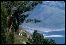
- Subject:
- Rocks, Trees, Mountains, Rock formations, Pacific Coast Highway, Hills, and Clouds
- Series:
- 3-68
- Creator:
- Cushman, Charles W., 1896-1972
- Date Created:
- 1968-10-01
- Genre:
- Landscape photographs
- Frame Number:
- 21
- Street Address:
- California State Highway 1
- County:
- San Luis Obispo
- Call Number:
- P15673
- City:
- San Luis Obispo
- Country:
- United States
- State/Province:
- California
- Alternate Identifier:
- 368.21
- Persistent URL:
- http://purl.dlib.indiana.edu/iudl/archives/cushman/P15673
-
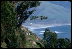
- Subject:
- Trees, Morro Bay (Calif.), Mountains, and Rock formations
- Series:
- 3-68
- Creator:
- Cushman, Charles W., 1896-1972
- Date Created:
- 1968-10-01
- Genre:
- Landscape photographs
- Frame Number:
- 19
- County:
- San Luis Obispo
- Call Number:
- P15671
- City:
- San Luis Obispo
- Country:
- United States
- State/Province:
- California
- Alternate Identifier:
- 368.19
- Persistent URL:
- http://purl.dlib.indiana.edu/iudl/archives/cushman/P15671
-
- Description:
- 100 f 8
- Subject:
- Roads, Stilt houses, Trees, Tree limbs, Mountains, Fences, Lakes & ponds, and Hills
- Series:
- 1-68
- Creator:
- Cushman, Charles W., 1896-1972
- Date Created:
- 1968-03-20
- Genre:
- Views
- Frame Number:
- 34
- County:
- Marin
- Abstract:
- Across Bolinas lagoon
- Call Number:
- P15628
- City:
- Bolinas
- Country:
- United States
- State/Province:
- California
- Alternate Identifier:
- 168.34
- Persistent URL:
- http://purl.dlib.indiana.edu/iudl/archives/cushman/P15628
-
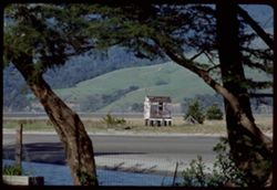
- Description:
- 100 f 8
- Subject:
- Houses, Bolinas Lagoon (Calif.), Trees, Coastlines, Mountains, Beaches, Lakes & ponds, Forests, and Hills
- Series:
- 1-68
- Creator:
- Cushman, Charles W., 1896-1972
- Date Created:
- 1968-03-20
- Genre:
- Landscape photographs
- Frame Number:
- 32
- County:
- Marin
- Abstract:
- Across Bolinas lagoon (east) from Bolinas beach
- Call Number:
- P15626
- City:
- Bolinas
- Country:
- United States
- State/Province:
- California
- Alternate Identifier:
- 168.32
- Persistent URL:
- http://purl.dlib.indiana.edu/iudl/archives/cushman/P15626
-
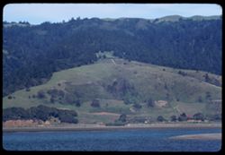
- Subject:
- Trees, Mountains, Tamalpais, Mount (Calif.), and Hills
- Series:
- 1-68
- Creator:
- Cushman, Charles W., 1896-1972
- Date Created:
- 1968-03-20
- Genre:
- Landscape photographs
- Frame Number:
- 31
- County:
- Marin
- Abstract:
- Toward Tamalpais from Bolinas
- Call Number:
- P15625
- City:
- Bolinas
- Country:
- United States
- State/Province:
- California
- Alternate Identifier:
- 168.31
- Persistent URL:
- http://purl.dlib.indiana.edu/iudl/archives/cushman/P15625
-
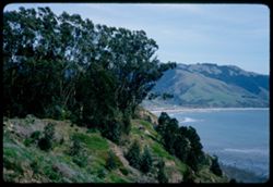
- Description:
- 100 f 8
- Subject:
- Bays (Bodies of water), Grasses, Cliffs, Trees, Coastlines, Bolinas Bay (Calif.), Mountains, Beaches, Shrubs, and Hills
- Series:
- 1-68
- Creator:
- Cushman, Charles W., 1896-1972
- Date Created:
- 1968-03-20
- Genre:
- Landscape photographs and Seascapes
- Frame Number:
- 29
- County:
- Marin
- Abstract:
- Across Bolinas Bay
- Call Number:
- P15623
- City:
- Bolinas
- Country:
- United States
- State/Province:
- California
- Alternate Identifier:
- 168.29
- Persistent URL:
- http://purl.dlib.indiana.edu/iudl/archives/cushman/P15623
-
- Description:
- 100 f 8 tl
- Subject:
- Evergreens, Trees, Flowers, Acacia, Mountains, and Hills
- Series:
- 1-68
- Creator:
- Cushman, Charles W., 1896-1972
- Date Created:
- 1968-03-02
- Genre:
- Landscape photographs
- Frame Number:
- 19
- County:
- Marin
- Abstract:
- Acacia & Evergreen at Tocaloma
- Call Number:
- P15614
- City:
- Tocaloma
- Country:
- United States
- State/Province:
- California
- Alternate Identifier:
- 168.19
- Persistent URL:
- http://purl.dlib.indiana.edu/iudl/archives/cushman/P15614
-
- Description:
- 100 f 8 tl
- Subject:
- Bays (Bodies of water), Oceans, Seas, Cliffs, Trees, Coastlines, Bolinas Bay (Calif.), Tree limbs, Mountains, Beaches, Hills, and People
- Series:
- 1-68
- Creator:
- Cushman, Charles W., 1896-1972
- Date Created:
- 1968-03-02
- Genre:
- Landscape photographs and Seascapes
- Frame Number:
- 18
- County:
- Marin
- Abstract:
- at Bolinas
- Call Number:
- P15613
- City:
- Bolinas
- Country:
- United States
- State/Province:
- California
- Alternate Identifier:
- 168.18
- Persistent URL:
- http://purl.dlib.indiana.edu/iudl/archives/cushman/P15613
-
- Description:
- 100 f 8 tl
- Subject:
- Bays (Bodies of water), Oceans, Seas, Cliffs, Trees, Coastlines, Bolinas Bay (Calif.), Tree limbs, Mountains, Beaches, Hills, and People
- Series:
- 1-68
- Creator:
- Cushman, Charles W., 1896-1972
- Date Created:
- 1968-03-02
- Genre:
- Landscape photographs and Seascapes
- Frame Number:
- 16
- County:
- Marin
- Abstract:
- at Bolinas
- Call Number:
- P15611
- City:
- Bolinas
- Country:
- United States
- State/Province:
- California
- Alternate Identifier:
- 168.16
- Persistent URL:
- http://purl.dlib.indiana.edu/iudl/archives/cushman/P15611
-
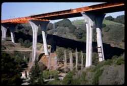
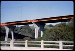
- Description:
- 100 f 11
- Subject:
- Valleys, Houses, Trees, Bridge construction, Mountains, Bridges, Utility poles, Canyons, and Roads
- Series:
- 1-67
- Creator:
- Cushman, Charles W., 1896-1972
- Date Created:
- 1967-03-07
- Genre:
- Architectural photographs
- Frame Number:
- 2
- Street Address:
- California State Highway 280 and Junipero Serra Freeway
- County:
- San Francisco
- Abstract:
- New high bridge over canyon
- Call Number:
- P15479
- City:
- San Francisco
- Country:
- United States
- State/Province:
- California
- Alternate Identifier:
- 167.2
- Persistent URL:
- http://purl.dlib.indiana.edu/iudl/archives/cushman/P15479
-
- Description:
- 100 f 11
- Subject:
- Railings, Canyons, Roads, Trees, Bridge construction, Mountains, Bridges, and Valleys
- Series:
- 1-67
- Creator:
- Cushman, Charles W., 1896-1972
- Date Created:
- 1967-03-07
- Genre:
- Architectural photographs
- Frame Number:
- 1
- Street Address:
- California State Highway 280 and Junipero Serra Freeway
- County:
- San Francisco
- Abstract:
- New high bridge over canyon
- Call Number:
- P15478
- City:
- San Francisco
- Country:
- United States
- State/Province:
- California
- Alternate Identifier:
- 167.1
- Persistent URL:
- http://purl.dlib.indiana.edu/iudl/archives/cushman/P15478
-

- Description:
- 100 f 11 TL
- Subject:
- Erosion, Trees, Buttes, Mountains, and Uinta Mountains (Utah and Wyo.)
- Series:
- 10-66
- Creator:
- Cushman, Charles W., 1896-1972
- Date Created:
- 1966-06-18
- Genre:
- Landscape photographs
- Frame Number:
- 9
- County:
- Uintah
- Abstract:
- Red Buttes
- Call Number:
- P15449
- City:
- Vernal
- Country:
- United States
- State/Province:
- Utah
- Alternate Identifier:
- 1066.9
- Persistent URL:
- http://purl.dlib.indiana.edu/iudl/archives/cushman/P15449
-
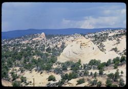
- Description:
- 100 f 14 TL
- Subject:
- Trees, Mountains, Rock formations, Sandstone, and Clouds
- Series:
- 10-66
- Creator:
- Cushman, Charles W., 1896-1972
- Date Created:
- 1966-06-18
- Genre:
- Landscape photographs
- Frame Number:
- 7
- County:
- Uintah
- Abstract:
- Bee hive
- Call Number:
- P15447
- City:
- Vernal
- Country:
- United States
- State/Province:
- Utah
- Alternate Identifier:
- 1066.7
- Persistent URL:
- http://purl.dlib.indiana.edu/iudl/archives/cushman/P15447
-
- Description:
- 100 f 11 tl
- Subject:
- Rocks, Cliffs, Grazing, Trees, Mining, Cattle, Mountains, Rock formations, Clouds, Utility poles, and Roads
- Series:
- 9-66
- Creator:
- Cushman, Charles W., 1896-1972
- Date Created:
- 1966-06-14
- Genre:
- Landscape photographs
- Frame Number:
- 23
- Street Address:
- Colorado State Highway 93
- County:
- Jefferson and Boulder
- Call Number:
- P15426
- City:
- Golden and Boulder
- Country:
- United States
- State/Province:
- Colorado
- Alternate Identifier:
- 966.23
- Persistent URL:
- http://purl.dlib.indiana.edu/iudl/archives/cushman/P15426
-
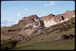
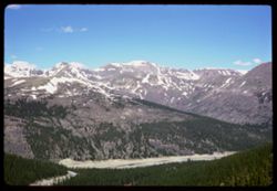
- Subject:
- Snow, Roads, Trees, Mountains, Clouds, Forests, Passes (Landforms), and Loveland Pass (Colo.)
- Series:
- 9-66
- Creator:
- Cushman, Charles W., 1896-1972
- Date Created:
- 1966-06-14
- Genre:
- Landscape photographs
- Frame Number:
- 17
- County:
- Larimer
- Call Number:
- P15420
- Country:
- United States
- State/Province:
- Colorado
- Alternate Identifier:
- 966.17
- Persistent URL:
- http://purl.dlib.indiana.edu/iudl/archives/cushman/P15420
-
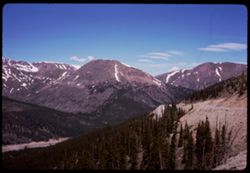
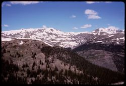
- Subject:
- Snow, Valleys, Trees, Mountains, Forests, Passes (Landforms), and Loveland Pass (Colo.)
- Series:
- 9-66
- Creator:
- Cushman, Charles W., 1896-1972
- Date Created:
- 1966-06-14
- Genre:
- Landscape photographs
- Frame Number:
- 16
- County:
- Larimer
- Call Number:
- P15419
- Country:
- United States
- State/Province:
- Colorado
- Alternate Identifier:
- 966.16
- Persistent URL:
- http://purl.dlib.indiana.edu/iudl/archives/cushman/P15419
-
- Subject:
- Passes (Landforms), Forests, Mountains, Snow, Trees, Clouds, and Loveland Pass (Colo.)
- Series:
- 9-66
- Creator:
- Cushman, Charles W., 1896-1972
- Date Created:
- 1966-06-14
- Genre:
- Landscape photographs
- Frame Number:
- 15
- County:
- Larimer
- Call Number:
- P15418
- Country:
- United States
- State/Province:
- Colorado
- Alternate Identifier:
- 966.15
- Persistent URL:
- http://purl.dlib.indiana.edu/iudl/archives/cushman/P15418
-
- Description:
- 100 f 5.6
- Subject:
- Rocks, Grasses, Houses, Trees, Roofs, Mountains, and Buildings
- Series:
- 9-66
- Creator:
- Cushman, Charles W., 1896-1972
- Date Created:
- 1966-06-13
- Genre:
- Landscape photographs and Cityscape photographs
- Frame Number:
- 11
- County:
- Clear Creek
- Call Number:
- P15414
- City:
- Georgetown
- Country:
- United States
- State/Province:
- Colorado
- Alternate Identifier:
- 966.11
- Persistent URL:
- http://purl.dlib.indiana.edu/iudl/archives/cushman/P15414
-
- Description:
- 100 f 11
- Subject:
- Houses, Trees, Chimneys, Mountains, Storage tanks, Trucks, Forests, and Utility poles
- Series:
- 9-66
- Creator:
- Cushman, Charles W., 1896-1972
- Date Created:
- 1966-06-13
- Genre:
- Landscape photographs and Cityscape photographs
- Frame Number:
- 6
- County:
- Clear Creek
- Call Number:
- P15409
- City:
- Georgetown
- Country:
- United States
- State/Province:
- Colorado
- Alternate Identifier:
- 966.6
- Persistent URL:
- http://purl.dlib.indiana.edu/iudl/archives/cushman/P15409
-
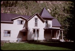
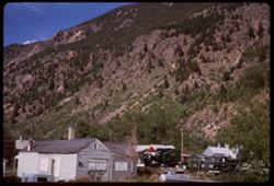
- Description:
- 100 f 11
- Subject:
- Cans, Windows, Mountains, Lawns, Trees, Rocks, Porches, Doors & doorways, Houses, and Shadows
- Series:
- 8-66
- Creator:
- Cushman, Charles W., 1896-1972
- Date Created:
- 1966-06-13
- Genre:
- Architectural photographs
- Frame Number:
- 37
- County:
- Clear Creek
- Call Number:
- P15403
- City:
- Georgetown
- Country:
- United States
- State/Province:
- Colorado
- Alternate Identifier:
- 866.37
- Persistent URL:
- http://purl.dlib.indiana.edu/iudl/archives/cushman/P15403
-
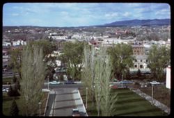
- Description:
- 100 f 11
- Subject:
- Cities & towns, Streets, Hills, Automobiles, Mountains, Lawns, Dwellings, Trees, Buildings, and Clouds
- Series:
- 3-66
- Creator:
- Cushman, Charles W., 1896-1972
- Date Created:
- 1966-04-25
- Genre:
- Cityscape photographs
- Frame Number:
- 10
- County:
- Santa Fe
- Abstract:
- Santa Fe from tower of Capitol
- Call Number:
- P15293
- City:
- Santa Fe
- Country:
- United States
- State/Province:
- New Mexico
- Alternate Identifier:
- 366.10
- Persistent URL:
- http://purl.dlib.indiana.edu/iudl/archives/cushman/P15293
-
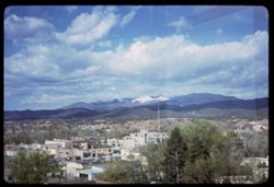
- Description:
- 100 f 11
- Subject:
- Trees, Mountains, Buildings, Clouds, Dwellings, Hills, Broadcasting, and Cities & towns
- Series:
- 3-66
- Creator:
- Cushman, Charles W., 1896-1972
- Date Created:
- 1966-04-25
- Genre:
- Landscape photographs and Cityscape photographs
- Frame Number:
- 9
- County:
- Santa Fe
- Abstract:
- Santa Fe from tower of Capitol
- Call Number:
- P15292
- City:
- Santa Fe
- Country:
- United States
- State/Province:
- New Mexico
- Alternate Identifier:
- 366.9
- Persistent URL:
- http://purl.dlib.indiana.edu/iudl/archives/cushman/P15292
-
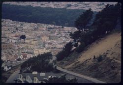
- Description:
- 100 f 5.6 or 4
- Subject:
- Houses, Trees, Chimneys, Roofs, Mountains, Hills, and Roads
- Series:
- 40-65
- Creator:
- Cushman, Charles W., 1896-1972
- Date Created:
- 1965-11-11
- Genre:
- Cityscape photographs
- Frame Number:
- 30
- Street Address:
- Golden Gate Heights
- County:
- San Francisco
- Abstract:
- From Golden Gate Heights- down and westward
- Call Number:
- P15232
- City:
- San Francisco
- Country:
- United States
- State/Province:
- California
- Alternate Identifier:
- 4065.30
- Persistent URL:
- http://purl.dlib.indiana.edu/iudl/archives/cushman/P15232
-
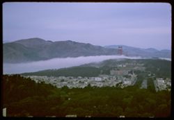
- Description:
- 100 f 5.6 or 4
- Subject:
- Channels, Houses, Golden Gate Bridge (San Francisco, Calif.), Suspension bridges, Trees, Mountains, Hills, Golden Gate Channel (Calif.), and Fog
- Series:
- 40-65
- Creator:
- Cushman, Charles W., 1896-1972
- Date Created:
- 1965-11-11
- Genre:
- Landscape photographs and Cityscape photographs
- Frame Number:
- 29
- Street Address:
- Golden Gate Heights
- County:
- San Francisco
- Abstract:
- From Golden Gate Heights- down and westward
- Call Number:
- P15231
- City:
- San Francisco
- Country:
- United States
- State/Province:
- California
- Alternate Identifier:
- 4065.29
- Persistent URL:
- http://purl.dlib.indiana.edu/iudl/archives/cushman/P15231
-
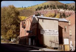
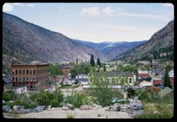
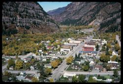
- Description:
- 100 f 11 SL
- Subject:
- Trees, Signs (Notices), Mountains, Sidewalks, Electric signs, Opera houses, and Buildings
- Series:
- 36-65
- Creator:
- Cushman, Charles W., 1896-1972
- Date Created:
- 1965-10-05
- Genre:
- Cityscape photographs
- Frame Number:
- 7
- County:
- San Miguel
- Abstract:
- Telluride.
- Call Number:
- P15075
- City:
- Telluride
- Country:
- United States
- State/Province:
- Colorado
- Alternate Identifier:
- 3665.7
- Persistent URL:
- http://purl.dlib.indiana.edu/iudl/archives/cushman/P15075
-
- Description:
- 100 f 11 TL
- Subject:
- Forests, Cliffs, San Juan Mountains (Colo. and N.M.), Mountains, Trees, and Rock formations
- Series:
- 36-65
- Creator:
- Cushman, Charles W., 1896-1972
- Date Created:
- 1965-10-05
- Genre:
- Landscape photographs
- Frame Number:
- 5
- County:
- San Miguel
- Abstract:
- Up from Telluride.
- Call Number:
- P15073
- City:
- Telluride
- Country:
- United States
- State/Province:
- Colorado
- Alternate Identifier:
- 3665.5
- Persistent URL:
- http://purl.dlib.indiana.edu/iudl/archives/cushman/P15073
-
- Description:
- 100 f 11 TL
- Subject:
- Canyons, Forests, Roads, Cliffs, Mountains, Trees, and San Miguel River (Colo.)
- Series:
- 36-65
- Creator:
- Cushman, Charles W., 1896-1972
- Date Created:
- 1965-10-05
- Genre:
- Landscape photographs
- Frame Number:
- 3
- Street Address:
- Colorado State Highway 145
- County:
- San Miguel
- Abstract:
- Rd to Telluride, Colo. Hwy 45.
- Call Number:
- P15071
- City:
- Telluride
- Country:
- United States
- State/Province:
- Colorado
- Alternate Identifier:
- 3665.3
- Persistent URL:
- http://purl.dlib.indiana.edu/iudl/archives/cushman/P15071
-
- Description:
- 100 f 11 TL
- Subject:
- Uncompahgre National Forest (Colo.), Forests, Mountains, Snow, and Trees
- Series:
- 36-65
- Creator:
- Cushman, Charles W., 1896-1972
- Date Created:
- 1965-10-05
- Genre:
- Landscape photographs
- Frame Number:
- 2
- Street Address:
- Colorado State Highway 62
- County:
- Ouray and San Miguel
- Abstract:
- Nr. Mt Sneffels (14150') from Colo. Hwy 62, San Miguel county.
- Call Number:
- P15070
- Country:
- United States
- State/Province:
- Colorado
- Alternate Identifier:
- 3665.2
- Persistent URL:
- http://purl.dlib.indiana.edu/iudl/archives/cushman/P15070
-
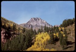
- Description:
- 100 f 11 TL
- Subject:
- Snow, Sneffels, Mount (Colo.), Trees, Mountains, Shrubs, Forests, San Juan Mountains (Colo. and N.M.), and Uncompahgre National Forest (Colo.)
- Series:
- 36-65
- Creator:
- Cushman, Charles W., 1896-1972
- Date Created:
- 1965-10-05
- Genre:
- Landscape photographs
- Frame Number:
- 1
- Street Address:
- Colorado State Highway 62
- County:
- San Miguel
- Abstract:
- Nr. Mt Sneffels (14150') from Colo. Hwy 62, San Miguel county.
- Call Number:
- P15069
- Country:
- United States
- State/Province:
- Colorado
- Alternate Identifier:
- 3665.1
- Persistent URL:
- http://purl.dlib.indiana.edu/iudl/archives/cushman/P15069
-
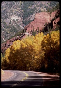
- Description:
- 100 f ? TL
- Subject:
- Hills, Sneffels, Mount (Colo.), Forests, San Juan Mountains (Colo. and N.M.), Mountains, Snow, and Trees
- Series:
- 35-65
- Creator:
- Cushman, Charles W., 1896-1972
- Date Created:
- 1965-10-05
- Genre:
- Landscape photographs
- Frame Number:
- 38
- County:
- Ouray
- Call Number:
- P15068
- Country:
- United States
- State/Province:
- Colorado
- Alternate Identifier:
- 3565.38
- Persistent URL:
- http://purl.dlib.indiana.edu/iudl/archives/cushman/P15068
-
- Description:
- 100 f ? TL
- Subject:
- Meadows, Valleys, Hills, Forests, San Juan Mountains (Colo. and N.M.), Mountains, Hay, Trees, Fences, and Snow
- Series:
- 35-65
- Creator:
- Cushman, Charles W., 1896-1972
- Date Created:
- 1965-10-05
- Genre:
- Landscape photographs
- Frame Number:
- 37
- County:
- Ouray
- Call Number:
- P15067
- Country:
- United States
- State/Province:
- Colorado
- Alternate Identifier:
- 3565.37
- Persistent URL:
- http://purl.dlib.indiana.edu/iudl/archives/cushman/P15067
-
- Description:
- 100 f ? TL
- Subject:
- Valleys, Hills, Sneffels, Mount (Colo.), Forests, San Juan Mountains (Colo. and N.M.), Mountains, Snow, and Trees
- Series:
- 35-65
- Creator:
- Cushman, Charles W., 1896-1972
- Date Created:
- 1965-10-05
- Genre:
- Landscape photographs
- Frame Number:
- 36
- Street Address:
- Colorado State Highway 62
- County:
- Ouray
- Call Number:
- P15066
- Country:
- United States
- State/Province:
- Colorado
- Alternate Identifier:
- 3565.36
- Persistent URL:
- http://purl.dlib.indiana.edu/iudl/archives/cushman/P15066
-
- Description:
- 100 f ? TL
- Subject:
- Valleys, Trees, Tree limbs, Mountains, Hills, and Autumn
- Series:
- 35-65
- Creator:
- Cushman, Charles W., 1896-1972
- Date Created:
- 1965-10-05
- Genre:
- Landscape photographs
- Frame Number:
- 35
- Street Address:
- Colorado State Highway 62
- County:
- Ouray
- Call Number:
- P15065
- City:
- Ouray
- Country:
- United States
- State/Province:
- Colorado
- Alternate Identifier:
- 3565.35
- Persistent URL:
- http://purl.dlib.indiana.edu/iudl/archives/cushman/P15065
-
- Description:
- 100 f ? TL
- Subject:
- Valleys, Hills, Sneffels, Mount (Colo.), Forests, San Juan Mountains (Colo. and N.M.), Mountains, Hay, Trees, and Snow
- Series:
- 35-65
- Creator:
- Cushman, Charles W., 1896-1972
- Date Created:
- 1965-10-05
- Genre:
- Landscape photographs
- Frame Number:
- 34
- Street Address:
- Colorado State Highway 62
- County:
- Ouray
- Abstract:
- Mt. Sneffels (14,150') seen from Colo. Hwy 62 NW of Ouray.
- Call Number:
- P15064
- City:
- Ouray
- Country:
- United States
- State/Province:
- Colorado
- Alternate Identifier:
- 3565.34
- Persistent URL:
- http://purl.dlib.indiana.edu/iudl/archives/cushman/P15064
-
- Description:
- 100 f 11
- Subject:
- Trees, Tree limbs, Mountains, Autumn, and Leaves
- Series:
- 35-65
- Creator:
- Cushman, Charles W., 1896-1972
- Date Created:
- 1965-10-05
- Genre:
- Landscape photographs
- Frame Number:
- 33
- Street Address:
- Colorado State Highway 62
- County:
- San Miguel and Ouray
- Abstract:
- Colo 62. Mt Sneffels + vicinity.
- Call Number:
- P15063
- Country:
- United States
- State/Province:
- Colorado
- Alternate Identifier:
- 3565.33
- Persistent URL:
- http://purl.dlib.indiana.edu/iudl/archives/cushman/P15063
-
- Description:
- 100 f 11
- Subject:
- Leaves, Tree limbs, Autumn, Mountains, and Trees
- Series:
- 35-65
- Creator:
- Cushman, Charles W., 1896-1972
- Date Created:
- 1965-10-05
- Genre:
- Landscape photographs
- Frame Number:
- 32
- Street Address:
- Colorado State Highway 62
- County:
- Ouray
- Abstract:
- Yellow leaves.
- Call Number:
- P15062
- City:
- Ouray
- Country:
- United States
- State/Province:
- Colorado
- Alternate Identifier:
- 3565.32
- Persistent URL:
- http://purl.dlib.indiana.edu/iudl/archives/cushman/P15062
-
- Description:
- 100 f 8 TL
- Subject:
- Uncompahgre National Forest (Colo.), Valleys, San Juan Mountains (Colo. and N.M.), Mountains, Snow, Trees, and Clouds
- Series:
- 35-65
- Creator:
- Cushman, Charles W., 1896-1972
- Date Created:
- 1965-10-05
- Genre:
- Landscape photographs
- Frame Number:
- 31
- County:
- Montrose
- Abstract:
- Yellow leaves.
- Call Number:
- P15061
- City:
- Montrose
- Country:
- United States
- State/Province:
- Colorado
- Alternate Identifier:
- 3565.31
- Persistent URL:
- http://purl.dlib.indiana.edu/iudl/archives/cushman/P15061
-
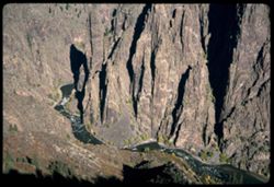
- Description:
- 100 f 11
- Subject:
- Canyons, Cliffs, Black Canyon of the Gunnison National Park (Colo.), Trees, Mountains, National parks & reserves, Black Canyon of the Gunnison (Colo.), R...
- Series:
- 35-65
- Creator:
- Cushman, Charles W., 1896-1972
- Date Created:
- 1965-10-05
- Genre:
- Landscape photographs
- Frame Number:
- 9
- County:
- Montrose
- Abstract:
- Black Canyon of the Gunnison.
- Call Number:
- P15039
- Country:
- United States
- State/Province:
- Colorado
- Alternate Identifier:
- 3565.9
- Persistent URL:
- http://purl.dlib.indiana.edu/iudl/archives/cushman/P15039
-
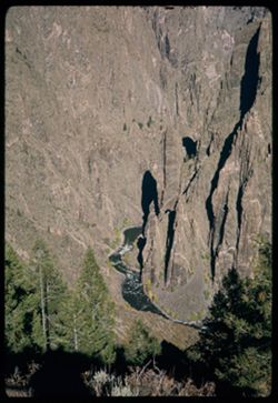
- Description:
- 200 f 11
- Subject:
- Canyons, Cliffs, Black Canyon of the Gunnison National Park (Colo.), Trees, Mountains, Rock formations, Black Canyon of the Gunnison (Colo.), and Rivers
- Series:
- 35-65
- Creator:
- Cushman, Charles W., 1896-1972
- Date Created:
- 1965-10-05
- Genre:
- Landscape photographs
- Frame Number:
- 7
- County:
- Montrose
- Abstract:
- Black Canyon of the Gunnison.
- Call Number:
- P15037
- Country:
- United States
- State/Province:
- Colorado
- Alternate Identifier:
- 3565.7
- Persistent URL:
- http://purl.dlib.indiana.edu/iudl/archives/cushman/P15037
-
- Description:
- 200 f 8
- Subject:
- Tree limbs, Houses, Forests, Cliffs, Mountains, and Trees
- Series:
- 35-65
- Creator:
- Cushman, Charles W., 1896-1972
- Date Created:
- 1965-10-04
- Genre:
- Landscape photographs
- Frame Number:
- 3
- County:
- Ouray
- Abstract:
- Ouray = cliff NW.
- Call Number:
- P15033
- City:
- Ouray
- Country:
- United States
- State/Province:
- Colorado
- Alternate Identifier:
- 3565.3
- Persistent URL:
- http://purl.dlib.indiana.edu/iudl/archives/cushman/P15033
-
- Description:
- 100 f 11
- Subject:
- Cliffs, Trees, Cities & towns, Buildings, Forests, Roads, Houses, and Mountains
- Series:
- 35-65
- Creator:
- Cushman, Charles W., 1896-1972
- Date Created:
- 1965-10-04
- Genre:
- Landscape photographs and Cityscape photographs
- Frame Number:
- 2
- County:
- Ouray
- Abstract:
- Ouray = cliff NW.
- Call Number:
- P15032
- City:
- Ouray
- Country:
- United States
- State/Province:
- Colorado
- Alternate Identifier:
- 3565.2
- Persistent URL:
- http://purl.dlib.indiana.edu/iudl/archives/cushman/P15032
-
- Description:
- 100 f 8
- Subject:
- Rocks, Roads, Trees, Mountains, and Forests
- Series:
- 35-65
- Creator:
- Cushman, Charles W., 1896-1972
- Date Created:
- 1965-10-04
- Genre:
- Landscape photographs
- Frame Number:
- 1
- County:
- Ouray
- Abstract:
- Ouray - road west.
- Call Number:
- P15031
- City:
- Ouray
- Country:
- United States
- State/Province:
- Colorado
- Alternate Identifier:
- 3565.1
- Persistent URL:
- http://purl.dlib.indiana.edu/iudl/archives/cushman/P15031
-
- Description:
- 200 f 6.3
- Subject:
- Valleys, Houses, Trees, Streets, Mountains, Buildings, and Cities & towns
- Series:
- 34-65
- Creator:
- Cushman, Charles W., 1896-1972
- Date Created:
- 1965-10-04
- Genre:
- Cityscape photographs
- Frame Number:
- 38
- County:
- Ouray
- Abstract:
- Ouray.
- Call Number:
- P15030
- City:
- Ouray
- Country:
- United States
- State/Province:
- Colorado
- Alternate Identifier:
- 3465.38
- Persistent URL:
- http://purl.dlib.indiana.edu/iudl/archives/cushman/P15030
-
- Description:
- 200 f 6.3
- Subject:
- Rocks, Roads, Trees, Mountains, Forests, and Cliffs
- Series:
- 34-65
- Creator:
- Cushman, Charles W., 1896-1972
- Date Created:
- 1965-10-04
- Genre:
- Landscape photographs
- Frame Number:
- 37
- County:
- Ouray
- Abstract:
- SW
- Call Number:
- P15029
- City:
- Ouray
- Country:
- United States
- State/Province:
- Colorado
- Alternate Identifier:
- 3465.37
- Persistent URL:
- http://purl.dlib.indiana.edu/iudl/archives/cushman/P15029
-
- Description:
- 200 f 8
- Subject:
- Cliffs, Trees, Mountains, and Forests
- Series:
- 34-65
- Creator:
- Cushman, Charles W., 1896-1972
- Date Created:
- 1965-10-04
- Genre:
- Landscape photographs
- Frame Number:
- 36
- County:
- Ouray
- Abstract:
- W
- Call Number:
- P15028
- City:
- Ouray
- Country:
- United States
- State/Province:
- Colorado
- Alternate Identifier:
- 3465.36
- Persistent URL:
- http://purl.dlib.indiana.edu/iudl/archives/cushman/P15028
-
- Description:
- 200 f 8
- Subject:
- Cliffs, Trees, Mountains, and Forests
- Series:
- 34-65
- Creator:
- Cushman, Charles W., 1896-1972
- Date Created:
- 1965-10-04
- Genre:
- Landscape photographs
- Frame Number:
- 35
- County:
- Ouray
- Abstract:
- Mtnside.
- Call Number:
- P15027
- City:
- Ouray
- Country:
- United States
- State/Province:
- Colorado
- Alternate Identifier:
- 3465.35
- Persistent URL:
- http://purl.dlib.indiana.edu/iudl/archives/cushman/P15027
-
- Description:
- 200 f 9
- Subject:
- Valleys, Houses, Automobiles, Trees, Streets, Cities & towns, Buildings, and Mountains
- Series:
- 34-65
- Creator:
- Cushman, Charles W., 1896-1972
- Date Created:
- 1965-10-04
- Genre:
- Cityscape photographs
- Frame Number:
- 34
- County:
- Ouray
- Abstract:
- Town.
- Call Number:
- P15026
- City:
- Ouray
- Country:
- United States
- State/Province:
- Colorado
- Alternate Identifier:
- 3465.34
- Persistent URL:
- http://purl.dlib.indiana.edu/iudl/archives/cushman/P15026
-
- Description:
- 200 f 9
- Subject:
- Valleys, Houses, Automobiles, Trees, Streets, Cities & towns, Buildings, and Mountains
- Series:
- 34-65
- Creator:
- Cushman, Charles W., 1896-1972
- Date Created:
- 1965-10-04
- Genre:
- Cityscape photographs
- Frame Number:
- 33
- County:
- Ouray
- Abstract:
- Town.
- Call Number:
- P15025
- City:
- Ouray
- Country:
- United States
- State/Province:
- Colorado
- Alternate Identifier:
- 3465.33
- Persistent URL:
- http://purl.dlib.indiana.edu/iudl/archives/cushman/P15025
-
- Description:
- 100 f 11
- Subject:
- Cliffs, Trees, Mountains, National parks & reserves, and Forests
- Series:
- 34-65
- Creator:
- Cushman, Charles W., 1896-1972
- Date Created:
- 1965-10-04
- Genre:
- Landscape photographs
- Frame Number:
- 32
- County:
- Ouray
- Abstract:
- Top Knot [+ flounces].
- Call Number:
- P15024
- City:
- Ouray
- Country:
- United States
- State/Province:
- Colorado
- Alternate Identifier:
- 3465.32
- Persistent URL:
- http://purl.dlib.indiana.edu/iudl/archives/cushman/P15024
-
- Description:
- 100 f 11
- Subject:
- Canyons, Poplars, Trees, Aspen, Uncompahgre Valley (Colo.), Mountains, National parks & reserves, Forests, and Uncompahgre National Forest (Colo.)
- Series:
- 34-65
- Creator:
- Cushman, Charles W., 1896-1972
- Date Created:
- 1965-10-04
- Genre:
- Landscape photographs
- Frame Number:
- 31
- County:
- Ouray
- Abstract:
- Aspen below.
- Call Number:
- P15023
- City:
- Ouray
- Country:
- United States
- State/Province:
- Colorado
- Alternate Identifier:
- 3465.31
- Persistent URL:
- http://purl.dlib.indiana.edu/iudl/archives/cushman/P15023
-
- Description:
- 100 f 11
- Subject:
- Canyons, Roads, Trees, Uncompahgre Valley (Colo.), Mountains, Forests, and Uncompahgre National Forest (Colo.)
- Series:
- 34-65
- Creator:
- Cushman, Charles W., 1896-1972
- Date Created:
- 1965-10-04
- Genre:
- Landscape photographs
- Frame Number:
- 30
- County:
- Ouray
- Call Number:
- P15022
- City:
- Ouray
- Country:
- United States
- State/Province:
- Colorado
- Alternate Identifier:
- 3465.30
- Persistent URL:
- http://purl.dlib.indiana.edu/iudl/archives/cushman/P15022
-
- Description:
- 100 f 11
- Subject:
- Canyons, Poplars, Roads, Trees, Aspen, Uncompahgre Valley (Colo.), Mountains, National parks & reserves, Forests, and Uncompahgre National Forest (Colo.)
- Series:
- 34-65
- Creator:
- Cushman, Charles W., 1896-1972
- Date Created:
- 1965-10-04
- Genre:
- Landscape photographs
- Frame Number:
- 29
- Street Address:
- United States Highway 550
- County:
- Ouray
- Abstract:
- Canyon.
- Call Number:
- P15021
- City:
- Ouray
- Country:
- United States
- State/Province:
- Colorado
- Alternate Identifier:
- 3465.29
- Persistent URL:
- http://purl.dlib.indiana.edu/iudl/archives/cushman/P15021
-
- Description:
- 100 or 200 f 11
- Subject:
- Rocks, Canyons, Trees, Mountains, and Forests
- Series:
- 34-65
- Creator:
- Cushman, Charles W., 1896-1972
- Date Created:
- 1965-10-04
- Genre:
- Landscape photographs
- Frame Number:
- 28
- Street Address:
- United States Highway 550
- County:
- Ouray
- Abstract:
- Canyon wall.
- Call Number:
- P15020
- City:
- Ouray
- Country:
- United States
- State/Province:
- Colorado
- Alternate Identifier:
- 3465.28
- Persistent URL:
- http://purl.dlib.indiana.edu/iudl/archives/cushman/P15020
-
- Description:
- 100 f 11
- Subject:
- Canyons, Roads, Trees, Mountains, and Uncompahgre River (Colo.)
- Series:
- 34-65
- Creator:
- Cushman, Charles W., 1896-1972
- Date Created:
- 1965-10-04
- Genre:
- Landscape photographs
- Frame Number:
- 27
- Street Address:
- United States Highway 550
- County:
- Ouray
- Call Number:
- P15019
- City:
- Ouray
- Country:
- United States
- State/Province:
- Colorado
- Alternate Identifier:
- 3465.27
- Persistent URL:
- http://purl.dlib.indiana.edu/iudl/archives/cushman/P15019
-
- Description:
- 100 f 11
- Subject:
- Rocks, Canyons, Erosion, Trees, Mountains, and Forests
- Series:
- 34-65
- Creator:
- Cushman, Charles W., 1896-1972
- Date Created:
- 1965-10-04
- Genre:
- Landscape photographs
- Frame Number:
- 26
- County:
- Ouray
- Abstract:
- Canyon.
- Call Number:
- P15018
- City:
- Ouray
- Country:
- United States
- State/Province:
- Colorado
- Alternate Identifier:
- 3465.26
- Persistent URL:
- http://purl.dlib.indiana.edu/iudl/archives/cushman/P15018
-
- Description:
- 100 f 11
- Subject:
- Canyons, Erosion, Trees, Mountains, Rapids, Forests, Rivers, and Uncompahgre River (Colo.)
- Series:
- 34-65
- Creator:
- Cushman, Charles W., 1896-1972
- Date Created:
- 1965-10-04
- Genre:
- Landscape photographs
- Frame Number:
- 25
- County:
- Ouray
- Abstract:
- Canyon.
- Call Number:
- P15017
- City:
- Ouray
- Country:
- United States
- State/Province:
- Colorado
- Alternate Identifier:
- 3465.25
- Persistent URL:
- http://purl.dlib.indiana.edu/iudl/archives/cushman/P15017
-
- Description:
- 100 f 11
- Subject:
- Rocks, Canyons, Erosion, Roads, Trees, Mountains, Rapids, Forests, Rivers, and Uncompahgre River (Colo.)
- Series:
- 34-65
- Creator:
- Cushman, Charles W., 1896-1972
- Date Created:
- 1965-10-04
- Genre:
- Landscape photographs
- Frame Number:
- 23
- Street Address:
- United States Highway 550
- County:
- Ouray
- Abstract:
- Canyon.
- Call Number:
- P15015
- Country:
- United States
- State/Province:
- Colorado
- Alternate Identifier:
- 3465.23
- Persistent URL:
- http://purl.dlib.indiana.edu/iudl/archives/cushman/P15015
-
- Description:
- 100 f 11
- Subject:
- Canyons, Roads, Trees, Mountains, and Forests
- Series:
- 34-65
- Creator:
- Cushman, Charles W., 1896-1972
- Date Created:
- 1965-10-04
- Genre:
- Landscape photographs
- Frame Number:
- 21
- Street Address:
- United States Highway 550
- County:
- San Juan and Ouray
- Abstract:
- Canyon
- Call Number:
- P15013
- City:
- Silverton and Ouray
- Country:
- United States
- State/Province:
- Colorado
- Alternate Identifier:
- 3465.21
- Persistent URL:
- http://purl.dlib.indiana.edu/iudl/archives/cushman/P15013
-
- Description:
- 100 f 11
- Subject:
- Rocks, Uncompahgre River (Colo.), Grasses, Roads, Trees, Mountains, Rapids, Rivers, Canyons, Erosion, and Ouray (Colo.)
- Series:
- 34-65
- Creator:
- Cushman, Charles W., 1896-1972
- Date Created:
- 1965-10-04
- Genre:
- Landscape photographs
- Frame Number:
- 22
- Street Address:
- United States Highway 550
- County:
- San Juan and Ouray
- Abstract:
- Canyon
- Call Number:
- P15014
- City:
- Silverton and Ouray
- Country:
- United States
- State/Province:
- Colorado
- Alternate Identifier:
- 3465.22
- Persistent URL:
- http://purl.dlib.indiana.edu/iudl/archives/cushman/P15014
-
- Description:
- 100 f 11
- Subject:
- Erosion, Trees, Mountains, Forests, and Grasses
- Series:
- 34-65
- Creator:
- Cushman, Charles W., 1896-1972
- Date Created:
- 1965-10-04
- Genre:
- Landscape photographs
- Frame Number:
- 20
- County:
- San Juan
- Abstract:
- Nearby mtnside
- Call Number:
- P15012
- City:
- Silverton
- Country:
- United States
- State/Province:
- Colorado
- Alternate Identifier:
- 3465.20
- Persistent URL:
- http://purl.dlib.indiana.edu/iudl/archives/cushman/P15012
-
- Description:
- 200 f 9 tl
- Subject:
- San Juan National Forest (Colo.), Trees, Mountains, and Forests
- Series:
- 34-65
- Creator:
- Cushman, Charles W., 1896-1972
- Date Created:
- 1965-10-03
- Genre:
- Landscape photographs
- Frame Number:
- 17
- Street Address:
- United States Highway 160
- County:
- La Plata and Montezuma
- Abstract:
- Mtn side seen from Hwy 160 on leaving San Juan Nat'l Forest
- Call Number:
- P15009
- City:
- Mancos and Durango
- Country:
- United States
- State/Province:
- Colorado
- Alternate Identifier:
- 3465.17
- Persistent URL:
- http://purl.dlib.indiana.edu/iudl/archives/cushman/P15009
-
- Description:
- 100 f 11 tl
- Subject:
- San Juan National Forest (Colo.), Trees, Mountains, National parks & reserves, and Forests
- Series:
- 34-65
- Creator:
- Cushman, Charles W., 1896-1972
- Date Created:
- 1965-10-03
- Genre:
- Landscape photographs
- Frame Number:
- 16
- Street Address:
- United States Highway 160
- County:
- La Plata and Montezuma
- Abstract:
- Mtn side seen from Hwy 160 on leaving San Juan Nat'l Forest
- Call Number:
- P15008
- City:
- Mancos and Durango
- Country:
- United States
- State/Province:
- Colorado
- Alternate Identifier:
- 3465.16
- Persistent URL:
- http://purl.dlib.indiana.edu/iudl/archives/cushman/P15008
-
- Description:
- 100 f 13 sl
- Subject:
- Trees, Mountains, Rock formations, and Shrubs
- Series:
- 34-65
- Creator:
- Cushman, Charles W., 1896-1972
- Date Created:
- 1965-10-03
- Genre:
- Landscape photographs
- Frame Number:
- 15
- County:
- La Plata
- Abstract:
- 2 truncated pyramids w. of Durango
- Call Number:
- P15007
- City:
- Durango
- Country:
- United States
- State/Province:
- Colorado
- Alternate Identifier:
- 3465.15
- Persistent URL:
- http://purl.dlib.indiana.edu/iudl/archives/cushman/P15007
-
- Description:
- 100 f 13 sl
- Subject:
- Grasses, Trees, Mountains, Fences, Shrubs, and Rock formations
- Series:
- 34-65
- Creator:
- Cushman, Charles W., 1896-1972
- Date Created:
- 1965-10-03
- Genre:
- Landscape photographs
- Frame Number:
- 14
- County:
- La Plata
- Abstract:
- 2 truncated pyramids w. of Durango
- Call Number:
- P15006
- City:
- Durango
- Country:
- United States
- State/Province:
- Colorado
- Alternate Identifier:
- 3465.14
- Persistent URL:
- http://purl.dlib.indiana.edu/iudl/archives/cushman/P15006
-
- Description:
- 100 f 11
- Subject:
- Snow, Trees, Mountains, Lakes & ponds, and Forests
- Series:
- 33-65
- Creator:
- Cushman, Charles W., 1896-1972
- Date Created:
- 1965-10-02
- Genre:
- Landscape photographs
- Frame Number:
- 32
- Street Address:
- United States Highway 550 and Molas Pass
- County:
- San Juan and La Plata
- Abstract:
- Mtn near Molas Summit
- Call Number:
- P14987
- City:
- Durango and Silverton
- Country:
- United States
- State/Province:
- Colorado
- Alternate Identifier:
- 3365.32
- Persistent URL:
- http://purl.dlib.indiana.edu/iudl/archives/cushman/P14987
-
- Description:
- 100 f 13
- Subject:
- Houses, Trees, Roofs, Mountains, Rock formations, Dormers, and Cliffs
- Series:
- 33-65
- Creator:
- Cushman, Charles W., 1896-1972
- Date Created:
- 1965-10-02
- Genre:
- Landscape photographs
- Frame Number:
- 31
- Street Address:
- Molas Pass
- County:
- San Juan and La Plata
- Abstract:
- Looking up
- Call Number:
- P14986
- City:
- Durango
- Country:
- United States
- State/Province:
- Colorado
- Alternate Identifier:
- 3365.31
- Persistent URL:
- http://purl.dlib.indiana.edu/iudl/archives/cushman/P14986
-
- Description:
- 100 f 11 sl
- Subject:
- Snow, Trees, Mountains, and Forests
- Series:
- 33-65
- Creator:
- Cushman, Charles W., 1896-1972
- Date Created:
- 1965-10-02
- Genre:
- Landscape photographs
- Frame Number:
- 30
- Street Address:
- United States Highway 550
- County:
- La Plata and Ouray
- Call Number:
- P14985
- City:
- Durango and Ouray
- Country:
- United States
- State/Province:
- Colorado
- Alternate Identifier:
- 3365.30
- Persistent URL:
- http://purl.dlib.indiana.edu/iudl/archives/cushman/P14985
-
- Description:
- 100 f 11 sl
- Subject:
- Snow, Trees, Mountains, and Forests
- Series:
- 33-65
- Creator:
- Cushman, Charles W., 1896-1972
- Date Created:
- 1965-10-02
- Genre:
- Landscape photographs
- Frame Number:
- 29
- Street Address:
- United States Highway 550
- County:
- La Plata and Ouray
- Abstract:
- Snowy pyramid thru trees
- Call Number:
- P14984
- City:
- Durango and Ouray
- Country:
- United States
- State/Province:
- Colorado
- Alternate Identifier:
- 3365.29
- Persistent URL:
- http://purl.dlib.indiana.edu/iudl/archives/cushman/P14984
-
- Description:
- 100 f 11 sl
- Subject:
- Cliffs, Trees, Tree limbs, Mountains, Rock formations, and Forests
- Series:
- 33-65
- Creator:
- Cushman, Charles W., 1896-1972
- Date Created:
- 1965-10-02
- Genre:
- Landscape photographs
- Frame Number:
- 28
- Street Address:
- United States Highway 550
- County:
- La Plata and Ouray
- Abstract:
- Pink [mountain]
- Call Number:
- P14983
- City:
- Durango and Ouray
- Country:
- United States
- State/Province:
- Colorado
- Alternate Identifier:
- 3365.28
- Persistent URL:
- http://purl.dlib.indiana.edu/iudl/archives/cushman/P14983
-
- Description:
- 100 f 16 sl
- Subject:
- Snow, Houses, Outbuildings, Trees, Mountains, Forests, and Roads
- Series:
- 33-65
- Creator:
- Cushman, Charles W., 1896-1972
- Date Created:
- 1965-10-02
- Genre:
- Landscape photographs
- Frame Number:
- 27
- Street Address:
- United States Highway 550
- County:
- San Juan and Ouray
- Abstract:
- Red snowy Mtns.
- Call Number:
- P14982
- City:
- Silverton and Ouray
- Country:
- United States
- State/Province:
- Colorado
- Alternate Identifier:
- 3365.27
- Persistent URL:
- http://purl.dlib.indiana.edu/iudl/archives/cushman/P14982
