
Search Constraints
You searched for:
Campus
IUB
Remove constraint Campus: IUB
Subject
Roads
Remove constraint Subject: Roads
State/Province
Colorado
Remove constraint State/Province: Colorado
1 - 97 of 97
Search Results
-
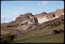
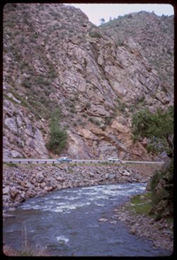
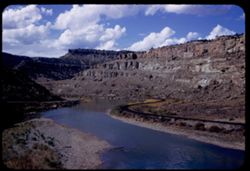
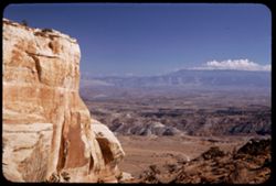
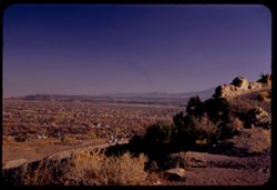
- Description:
- 100 f 11 tl
- Subject:
- Rocks, Cliffs, Grazing, Trees, Mining, Cattle, Mountains, Rock formations, Clouds, Utility poles, and Roads
- Series:
- 9-66
- Creator:
- Cushman, Charles W., 1896-1972
- Date Created:
- 1966-06-14
- Genre:
- Landscape photographs
- Frame Number:
- 23
- Street Address:
- Colorado State Highway 93
- County:
- Jefferson and Boulder
- Call Number:
- P15426
- City:
- Golden and Boulder
- Country:
- United States
- State/Province:
- Colorado
- Alternate Identifier:
- 966.23
- Persistent URL:
- http://purl.dlib.indiana.edu/iudl/archives/cushman/P15426
- Holding Location:
- Bloomington - University Archives
Wells Library E460
1320 E 10th St.
Bloomington, IN 47405
Contact at archives@indiana.edu, 812-855-1127
-
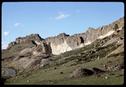
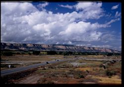
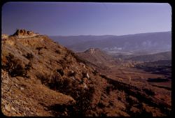
- Description:
- 100 f 11 tl
- Subject:
- Rocks, Cliffs, Grazing, Mining, Cattle, Mountains, Rock formations, Utility poles, Roads, and Shrubs
- Series:
- 9-66
- Creator:
- Cushman, Charles W., 1896-1972
- Date Created:
- 1966-06-14
- Genre:
- Landscape photographs
- Frame Number:
- 22
- Street Address:
- Colorado State Highway 93
- County:
- Jefferson and Boulder
- Call Number:
- P15425
- City:
- Golden and Boulder
- Country:
- United States
- State/Province:
- Colorado
- Alternate Identifier:
- 966.22
- Persistent URL:
- http://purl.dlib.indiana.edu/iudl/archives/cushman/P15425
- Holding Location:
- Bloomington - University Archives
Wells Library E460
1320 E 10th St.
Bloomington, IN 47405
Contact at archives@indiana.edu, 812-855-1127
-
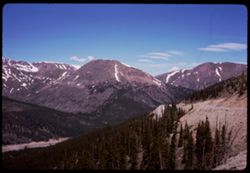
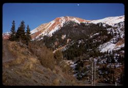
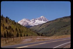
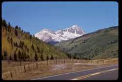
- Subject:
- Snow, Roads, Trees, Mountains, Clouds, Forests, Passes (Landforms), and Loveland Pass (Colo.)
- Series:
- 9-66
- Creator:
- Cushman, Charles W., 1896-1972
- Date Created:
- 1966-06-14
- Genre:
- Landscape photographs
- Frame Number:
- 17
- County:
- Larimer
- Call Number:
- P15420
- Country:
- United States
- State/Province:
- Colorado
- Alternate Identifier:
- 966.17
- Persistent URL:
- http://purl.dlib.indiana.edu/iudl/archives/cushman/P15420
- Holding Location:
- Bloomington - University Archives
Wells Library E460
1320 E 10th St.
Bloomington, IN 47405
Contact at archives@indiana.edu, 812-855-1127
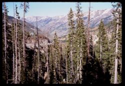
-
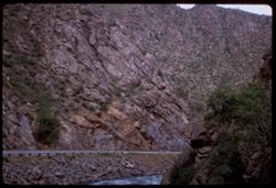
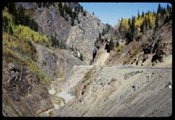
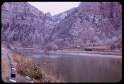
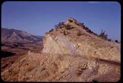
- Description:
- 100 f 4.5
- Subject:
- Canyons, Roads, Cliffs, Trees, Rocks, Clear Creek (Clear Creek County, Colo.), Rivers, Clear Creek Canyon (Colo.), and Rock formations
- Series:
- 9-66
- Creator:
- Cushman, Charles W., 1896-1972
- Date Created:
- 1966-06-13
- Genre:
- Landscape photographs
- Frame Number:
- 14
- County:
- Clear Creek
- Call Number:
- P15417
- Country:
- United States
- State/Province:
- Colorado
- Alternate Identifier:
- 966.14
- Persistent URL:
- http://purl.dlib.indiana.edu/iudl/archives/cushman/P15417
- Holding Location:
- Bloomington - University Archives
Wells Library E460
1320 E 10th St.
Bloomington, IN 47405
Contact at archives@indiana.edu, 812-855-1127
-
- Description:
- 100 f 4
- Subject:
- Canyons, Automobiles, Roads, Cliffs, Trees, Rocks, Clear Creek (Clear Creek County, Colo.), Grasses, Clear Creek Canyon (Colo.), and Rivers
- Series:
- 9-66
- Creator:
- Cushman, Charles W., 1896-1972
- Date Created:
- 1966-06-13
- Genre:
- Landscape photographs
- Frame Number:
- 13
- County:
- Clear Creek
- Call Number:
- P15416
- Country:
- United States
- State/Province:
- Colorado
- Alternate Identifier:
- 966.13
- Persistent URL:
- http://purl.dlib.indiana.edu/iudl/archives/cushman/P15416
- Holding Location:
- Bloomington - University Archives
Wells Library E460
1320 E 10th St.
Bloomington, IN 47405
Contact at archives@indiana.edu, 812-855-1127
-
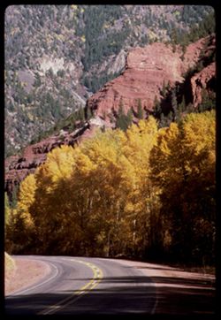
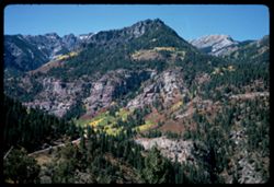
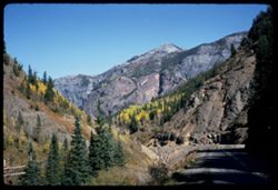
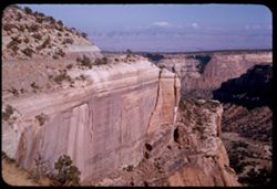
- Description:
- 100 f 11 TL
- Subject:
- Canyons, Forests, Roads, Cliffs, Mountains, Trees, and San Miguel River (Colo.)
- Series:
- 36-65
- Creator:
- Cushman, Charles W., 1896-1972
- Date Created:
- 1965-10-05
- Genre:
- Landscape photographs
- Frame Number:
- 3
- Street Address:
- Colorado State Highway 145
- County:
- San Miguel
- Abstract:
- Rd to Telluride, Colo. Hwy 45.
- Call Number:
- P15071
- City:
- Telluride
- Country:
- United States
- State/Province:
- Colorado
- Alternate Identifier:
- 3665.3
- Persistent URL:
- http://purl.dlib.indiana.edu/iudl/archives/cushman/P15071
- Holding Location:
- Bloomington - University Archives
Wells Library E460
1320 E 10th St.
Bloomington, IN 47405
Contact at archives@indiana.edu, 812-855-1127
-
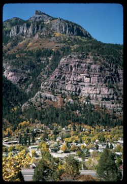
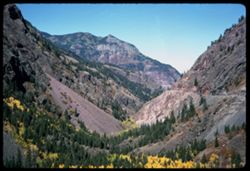
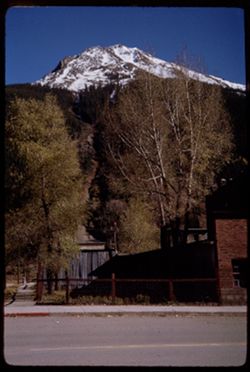
- Description:
- 100 f 11
- Subject:
- Cliffs, Trees, Cities & towns, Buildings, Forests, Roads, Houses, and Mountains
- Series:
- 35-65
- Creator:
- Cushman, Charles W., 1896-1972
- Date Created:
- 1965-10-04
- Genre:
- Landscape photographs and Cityscape photographs
- Frame Number:
- 2
- County:
- Ouray
- Abstract:
- Ouray = cliff NW.
- Call Number:
- P15032
- City:
- Ouray
- Country:
- United States
- State/Province:
- Colorado
- Alternate Identifier:
- 3565.2
- Persistent URL:
- http://purl.dlib.indiana.edu/iudl/archives/cushman/P15032
- Holding Location:
- Bloomington - University Archives
Wells Library E460
1320 E 10th St.
Bloomington, IN 47405
Contact at archives@indiana.edu, 812-855-1127
-
- Description:
- 100 f 8
- Subject:
- Rocks, Roads, Trees, Mountains, and Forests
- Series:
- 35-65
- Creator:
- Cushman, Charles W., 1896-1972
- Date Created:
- 1965-10-04
- Genre:
- Landscape photographs
- Frame Number:
- 1
- County:
- Ouray
- Abstract:
- Ouray - road west.
- Call Number:
- P15031
- City:
- Ouray
- Country:
- United States
- State/Province:
- Colorado
- Alternate Identifier:
- 3565.1
- Persistent URL:
- http://purl.dlib.indiana.edu/iudl/archives/cushman/P15031
- Holding Location:
- Bloomington - University Archives
Wells Library E460
1320 E 10th St.
Bloomington, IN 47405
Contact at archives@indiana.edu, 812-855-1127
-
- Description:
- 200 f 6.3
- Subject:
- Rocks, Roads, Trees, Mountains, Forests, and Cliffs
- Series:
- 34-65
- Creator:
- Cushman, Charles W., 1896-1972
- Date Created:
- 1965-10-04
- Genre:
- Landscape photographs
- Frame Number:
- 37
- County:
- Ouray
- Abstract:
- SW
- Call Number:
- P15029
- City:
- Ouray
- Country:
- United States
- State/Province:
- Colorado
- Alternate Identifier:
- 3465.37
- Persistent URL:
- http://purl.dlib.indiana.edu/iudl/archives/cushman/P15029
- Holding Location:
- Bloomington - University Archives
Wells Library E460
1320 E 10th St.
Bloomington, IN 47405
Contact at archives@indiana.edu, 812-855-1127
-
- Description:
- 100 f 11
- Subject:
- Canyons, Roads, Trees, Uncompahgre Valley (Colo.), Mountains, Forests, and Uncompahgre National Forest (Colo.)
- Series:
- 34-65
- Creator:
- Cushman, Charles W., 1896-1972
- Date Created:
- 1965-10-04
- Genre:
- Landscape photographs
- Frame Number:
- 30
- County:
- Ouray
- Call Number:
- P15022
- City:
- Ouray
- Country:
- United States
- State/Province:
- Colorado
- Alternate Identifier:
- 3465.30
- Persistent URL:
- http://purl.dlib.indiana.edu/iudl/archives/cushman/P15022
- Holding Location:
- Bloomington - University Archives
Wells Library E460
1320 E 10th St.
Bloomington, IN 47405
Contact at archives@indiana.edu, 812-855-1127
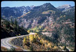
-
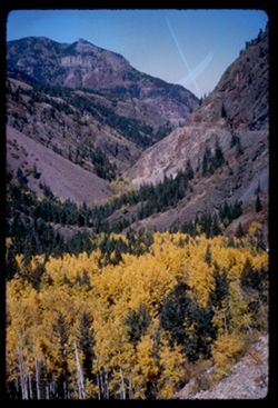
- Description:
- 100 f 11
- Subject:
- Canyons, Poplars, Roads, Trees, Aspen, Uncompahgre Valley (Colo.), Mountains, National parks & reserves, Forests, and Uncompahgre National Forest (Colo.)
- Series:
- 34-65
- Creator:
- Cushman, Charles W., 1896-1972
- Date Created:
- 1965-10-04
- Genre:
- Landscape photographs
- Frame Number:
- 29
- Street Address:
- United States Highway 550
- County:
- Ouray
- Abstract:
- Canyon.
- Call Number:
- P15021
- City:
- Ouray
- Country:
- United States
- State/Province:
- Colorado
- Alternate Identifier:
- 3465.29
- Persistent URL:
- http://purl.dlib.indiana.edu/iudl/archives/cushman/P15021
- Holding Location:
- Bloomington - University Archives
Wells Library E460
1320 E 10th St.
Bloomington, IN 47405
Contact at archives@indiana.edu, 812-855-1127
-
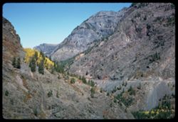
- Description:
- 100 f 11
- Subject:
- Canyons, Roads, Trees, Mountains, and Uncompahgre River (Colo.)
- Series:
- 34-65
- Creator:
- Cushman, Charles W., 1896-1972
- Date Created:
- 1965-10-04
- Genre:
- Landscape photographs
- Frame Number:
- 27
- Street Address:
- United States Highway 550
- County:
- Ouray
- Call Number:
- P15019
- City:
- Ouray
- Country:
- United States
- State/Province:
- Colorado
- Alternate Identifier:
- 3465.27
- Persistent URL:
- http://purl.dlib.indiana.edu/iudl/archives/cushman/P15019
- Holding Location:
- Bloomington - University Archives
Wells Library E460
1320 E 10th St.
Bloomington, IN 47405
Contact at archives@indiana.edu, 812-855-1127
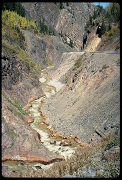
-
- Description:
- 100 f 11
- Subject:
- Rocks, Canyons, Erosion, Roads, Trees, Mountains, Rapids, Forests, Rivers, and Uncompahgre River (Colo.)
- Series:
- 34-65
- Creator:
- Cushman, Charles W., 1896-1972
- Date Created:
- 1965-10-04
- Genre:
- Landscape photographs
- Frame Number:
- 23
- Street Address:
- United States Highway 550
- County:
- Ouray
- Abstract:
- Canyon.
- Call Number:
- P15015
- Country:
- United States
- State/Province:
- Colorado
- Alternate Identifier:
- 3465.23
- Persistent URL:
- http://purl.dlib.indiana.edu/iudl/archives/cushman/P15015
- Holding Location:
- Bloomington - University Archives
Wells Library E460
1320 E 10th St.
Bloomington, IN 47405
Contact at archives@indiana.edu, 812-855-1127
-
- Description:
- 100 f 11
- Subject:
- Canyons, Roads, Trees, Mountains, and Forests
- Series:
- 34-65
- Creator:
- Cushman, Charles W., 1896-1972
- Date Created:
- 1965-10-04
- Genre:
- Landscape photographs
- Frame Number:
- 21
- Street Address:
- United States Highway 550
- County:
- San Juan and Ouray
- Abstract:
- Canyon
- Call Number:
- P15013
- City:
- Silverton and Ouray
- Country:
- United States
- State/Province:
- Colorado
- Alternate Identifier:
- 3465.21
- Persistent URL:
- http://purl.dlib.indiana.edu/iudl/archives/cushman/P15013
- Holding Location:
- Bloomington - University Archives
Wells Library E460
1320 E 10th St.
Bloomington, IN 47405
Contact at archives@indiana.edu, 812-855-1127
-
- Description:
- 100 f 11
- Subject:
- Rocks, Uncompahgre River (Colo.), Grasses, Roads, Trees, Mountains, Rapids, Rivers, Canyons, Erosion, and Ouray (Colo.)
- Series:
- 34-65
- Creator:
- Cushman, Charles W., 1896-1972
- Date Created:
- 1965-10-04
- Genre:
- Landscape photographs
- Frame Number:
- 22
- Street Address:
- United States Highway 550
- County:
- San Juan and Ouray
- Abstract:
- Canyon
- Call Number:
- P15014
- City:
- Silverton and Ouray
- Country:
- United States
- State/Province:
- Colorado
- Alternate Identifier:
- 3465.22
- Persistent URL:
- http://purl.dlib.indiana.edu/iudl/archives/cushman/P15014
- Holding Location:
- Bloomington - University Archives
Wells Library E460
1320 E 10th St.
Bloomington, IN 47405
Contact at archives@indiana.edu, 812-855-1127
-

- Description:
- 100 f 13
- Subject:
- Rocks, Grasses, Roads, Mountains, Shrubs, Bridges, Animas River (Colo. and N.M.), and Rivers
- Series:
- 34-65
- Creator:
- Cushman, Charles W., 1896-1972
- Date Created:
- 1965-10-03
- Genre:
- Landscape photographs
- Frame Number:
- 12
- County:
- La Plata
- Abstract:
- Animas river below Durango
- Call Number:
- P15004
- City:
- Durango
- Country:
- United States
- State/Province:
- Colorado
- Alternate Identifier:
- 3465.12
- Persistent URL:
- http://purl.dlib.indiana.edu/iudl/archives/cushman/P15004
- Holding Location:
- Bloomington - University Archives
Wells Library E460
1320 E 10th St.
Bloomington, IN 47405
Contact at archives@indiana.edu, 812-855-1127
-
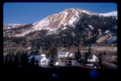
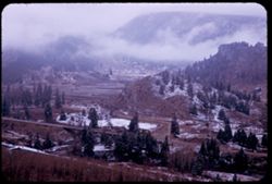
- Description:
- 100 f 16 sl
- Subject:
- Snow, Houses, Outbuildings, Trees, Mountains, Forests, and Roads
- Series:
- 33-65
- Creator:
- Cushman, Charles W., 1896-1972
- Date Created:
- 1965-10-02
- Genre:
- Landscape photographs
- Frame Number:
- 27
- Street Address:
- United States Highway 550
- County:
- San Juan and Ouray
- Abstract:
- Red snowy Mtns.
- Call Number:
- P14982
- City:
- Silverton and Ouray
- Country:
- United States
- State/Province:
- Colorado
- Alternate Identifier:
- 3365.27
- Persistent URL:
- http://purl.dlib.indiana.edu/iudl/archives/cushman/P14982
- Holding Location:
- Bloomington - University Archives
Wells Library E460
1320 E 10th St.
Bloomington, IN 47405
Contact at archives@indiana.edu, 812-855-1127
-
- Description:
- 100 f 16 sl
- Subject:
- Snow, Grasses, Roads, Trails & paths, Trees, Mountains, Forests, and Passes (Landforms)
- Series:
- 33-65
- Creator:
- Cushman, Charles W., 1896-1972
- Date Created:
- 1965-10-02
- Genre:
- Landscape photographs
- Frame Number:
- 24
- Street Address:
- United States Highway 550 and Red Mountain Pass
- County:
- San Juan
- Abstract:
- View east
- Call Number:
- P14979
- City:
- Silverton
- Country:
- United States
- State/Province:
- Colorado
- Alternate Identifier:
- 3365.24
- Persistent URL:
- http://purl.dlib.indiana.edu/iudl/archives/cushman/P14979
- Holding Location:
- Bloomington - University Archives
Wells Library E460
1320 E 10th St.
Bloomington, IN 47405
Contact at archives@indiana.edu, 812-855-1127
-
- Description:
- 100 f 11 sl
- Subject:
- Snow, Roads, Trees, Mountains, Forests, and Passes (Landforms)
- Series:
- 33-65
- Creator:
- Cushman, Charles W., 1896-1972
- Date Created:
- 1965-10-02
- Genre:
- Landscape photographs
- Frame Number:
- 19
- Street Address:
- United States Highway 550 and Red Mountain Pass
- County:
- San Juan and Ouray
- Abstract:
- Near Summit
- Call Number:
- P14974
- City:
- Silverton and Ouray
- Country:
- United States
- State/Province:
- Colorado
- Alternate Identifier:
- 3365.19
- Persistent URL:
- http://purl.dlib.indiana.edu/iudl/archives/cushman/P14974
- Holding Location:
- Bloomington - University Archives
Wells Library E460
1320 E 10th St.
Bloomington, IN 47405
Contact at archives@indiana.edu, 812-855-1127
-
- Description:
- 100 f 16 sl
- Subject:
- Snow, Kendall Mountain (Colo.), Trees, Mountains, Fences, Roads, Buildings, and Sidewalks
- Series:
- 33-65
- Creator:
- Cushman, Charles W., 1896-1972
- Date Created:
- 1965-10-02
- Genre:
- Landscape photographs
- Frame Number:
- 17
- County:
- San Juan
- Abstract:
- Mtn. above town
- Call Number:
- P14972
- City:
- Silverton
- Country:
- United States
- State/Province:
- Colorado
- Alternate Identifier:
- 3365.17
- Persistent URL:
- http://purl.dlib.indiana.edu/iudl/archives/cushman/P14972
- Holding Location:
- Bloomington - University Archives
Wells Library E460
1320 E 10th St.
Bloomington, IN 47405
Contact at archives@indiana.edu, 812-855-1127
-
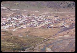
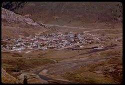
- Description:
- 100 f 12 tl
- Subject:
- Roads, Mountains, Buildings, Animas River (Colo. and N.M.), Rivers, and Houses
- Series:
- 33-65
- Creator:
- Cushman, Charles W., 1896-1972
- Date Created:
- 1965-10-02
- Genre:
- Cityscape photographs
- Frame Number:
- 10
- County:
- San Juan
- Abstract:
- Silverton
- Call Number:
- P14965
- City:
- Silverton
- Country:
- United States
- State/Province:
- Colorado
- Alternate Identifier:
- 3365.10
- Persistent URL:
- http://purl.dlib.indiana.edu/iudl/archives/cushman/P14965
- Holding Location:
- Bloomington - University Archives
Wells Library E460
1320 E 10th St.
Bloomington, IN 47405
Contact at archives@indiana.edu, 812-855-1127
-
- Description:
- 100 f 13 tl
- Subject:
- Houses, Trees, Mountains, Buildings, Animas River (Colo. and N.M.), Rivers, and Roads
- Series:
- 33-65
- Creator:
- Cushman, Charles W., 1896-1972
- Date Created:
- 1965-10-02
- Genre:
- Cityscape photographs
- Frame Number:
- 8
- County:
- San Juan
- Call Number:
- P14963
- City:
- Silverton
- Country:
- United States
- State/Province:
- Colorado
- Alternate Identifier:
- 3365.8
- Persistent URL:
- http://purl.dlib.indiana.edu/iudl/archives/cushman/P14963
- Holding Location:
- Bloomington - University Archives
Wells Library E460
1320 E 10th St.
Bloomington, IN 47405
Contact at archives@indiana.edu, 812-855-1127
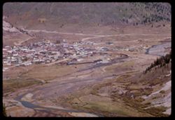
-
- Description:
- 100 f 13 tl
- Subject:
- Houses, Trees, Mountains, Buildings, Animas River (Colo. and N.M.), Railroads, Rivers, and Roads
- Series:
- 33-65
- Creator:
- Cushman, Charles W., 1896-1972
- Date Created:
- 1965-10-02
- Genre:
- Cityscape photographs
- Frame Number:
- 7
- County:
- San Juan
- Call Number:
- P14962
- City:
- Silverton
- Country:
- United States
- State/Province:
- Colorado
- Alternate Identifier:
- 3365.7
- Persistent URL:
- http://purl.dlib.indiana.edu/iudl/archives/cushman/P14962
- Holding Location:
- Bloomington - University Archives
Wells Library E460
1320 E 10th St.
Bloomington, IN 47405
Contact at archives@indiana.edu, 812-855-1127
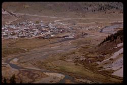
-
- Description:
- 100 f 16 tl
- Subject:
- Roads, Trees, Mountains, Buildings, Animas River (Colo. and N.M.), Railroads, Rivers, and Houses
- Series:
- 33-65
- Creator:
- Cushman, Charles W., 1896-1972
- Date Created:
- 1965-10-02
- Genre:
- Cityscape photographs
- Frame Number:
- 6
- County:
- San Juan
- Call Number:
- P14961
- City:
- Silverton
- Country:
- United States
- State/Province:
- Colorado
- Alternate Identifier:
- 3365.6
- Persistent URL:
- http://purl.dlib.indiana.edu/iudl/archives/cushman/P14961
- Holding Location:
- Bloomington - University Archives
Wells Library E460
1320 E 10th St.
Bloomington, IN 47405
Contact at archives@indiana.edu, 812-855-1127
-
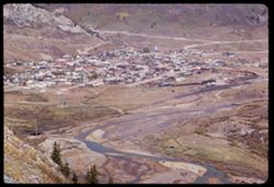
- Description:
- 100 f 16 tl
- Subject:
- Valleys, Houses, Trees, Mountains, Buildings, Railroads, Rivers, and Roads
- Series:
- 33-65
- Creator:
- Cushman, Charles W., 1896-1972
- Date Created:
- 1965-10-02
- Genre:
- Cityscape photographs
- Frame Number:
- 5
- County:
- San Juan
- Abstract:
- Silverton below
- Call Number:
- P14960
- City:
- Silverton
- Country:
- United States
- State/Province:
- Colorado
- Alternate Identifier:
- 3365.5
- Persistent URL:
- http://purl.dlib.indiana.edu/iudl/archives/cushman/P14960
- Holding Location:
- Bloomington - University Archives
Wells Library E460
1320 E 10th St.
Bloomington, IN 47405
Contact at archives@indiana.edu, 812-855-1127
-
- Description:
- 200 f 11
- Subject:
- Uncompahgre National Forest (Colo.), Forests, Roads, Mountains, Utility poles, Snow, Trees, Grasses, and Fences
- Series:
- 33-65
- Creator:
- Cushman, Charles W., 1896-1972
- Date Created:
- 1965-10-02
- Genre:
- Landscape photographs
- Frame Number:
- 4
- Street Address:
- United States Highway 550
- County:
- San Juan
- Abstract:
- Snow covered Mtn
- Call Number:
- P14959
- Country:
- United States
- State/Province:
- Colorado
- Alternate Identifier:
- 3365.4
- Persistent URL:
- http://purl.dlib.indiana.edu/iudl/archives/cushman/P14959
- Holding Location:
- Bloomington - University Archives
Wells Library E460
1320 E 10th St.
Bloomington, IN 47405
Contact at archives@indiana.edu, 812-855-1127
-
- Description:
- 100 f 16
- Subject:
- Forests, Roads, Mountains, Snow, Trees, Grasses, and Fences
- Series:
- 33-65
- Creator:
- Cushman, Charles W., 1896-1972
- Date Created:
- 1965-10-02
- Genre:
- Landscape photographs
- Frame Number:
- 3
- Street Address:
- United States Highway 550
- County:
- La Plata and San Juan
- Abstract:
- Snow covered Mtn
- Call Number:
- P14958
- City:
- Silverton and Durango
- Country:
- United States
- State/Province:
- Colorado
- Alternate Identifier:
- 3365.3
- Persistent URL:
- http://purl.dlib.indiana.edu/iudl/archives/cushman/P14958
- Holding Location:
- Bloomington - University Archives
Wells Library E460
1320 E 10th St.
Bloomington, IN 47405
Contact at archives@indiana.edu, 812-855-1127
-
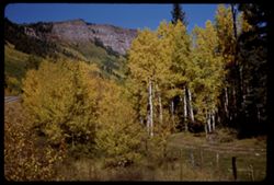
- Description:
- 100 f 15 sl
- Subject:
- Aspen, Roads, Cliffs, Mountains, Trees, Poplars, and Fences
- Series:
- 33-65
- Creator:
- Cushman, Charles W., 1896-1972
- Date Created:
- 1965-10-02
- Genre:
- Landscape photographs
- Frame Number:
- 1
- Street Address:
- United States Highway 550
- County:
- La Plata and San Juan
- Abstract:
- Aspen and cliffs
- Call Number:
- P14956
- City:
- Silverton and Durango
- Country:
- United States
- State/Province:
- Colorado
- Alternate Identifier:
- 3365.1
- Persistent URL:
- http://purl.dlib.indiana.edu/iudl/archives/cushman/P14956
- Holding Location:
- Bloomington - University Archives
Wells Library E460
1320 E 10th St.
Bloomington, IN 47405
Contact at archives@indiana.edu, 812-855-1127
-
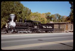
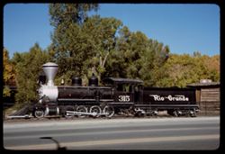
- Description:
- 100 f 11
- Subject:
- Log buildings, Roads, Railroad locomotives, Trees, Stairways, Windows, Railroad cars, Doors & doorways, and Rio Grande and Southwestern Railroad Company
- Series:
- 32-65
- Creator:
- Cushman, Charles W., 1896-1972
- Date Created:
- 1965-10-02
- Genre:
- Identification photographs
- Frame Number:
- 17
- County:
- La Plata
- Abstract:
- Old Rio Grande locomotive
- Call Number:
- P14935
- City:
- Durango
- Country:
- United States
- State/Province:
- Colorado
- Alternate Identifier:
- 3265.17
- Persistent URL:
- http://purl.dlib.indiana.edu/iudl/archives/cushman/P14935
- Holding Location:
- Bloomington - University Archives
Wells Library E460
1320 E 10th St.
Bloomington, IN 47405
Contact at archives@indiana.edu, 812-855-1127
-
- Description:
- 100 f 11
- Subject:
- Rio Grande and Southwestern Railroad Company, Streets, Roads, Railroad cars, Railroad locomotives, Railroads, Log buildings, and Fences
- Series:
- 32-65
- Creator:
- Cushman, Charles W., 1896-1972
- Date Created:
- 1965-10-02
- Genre:
- Identification photographs
- Frame Number:
- 16
- County:
- La Plata
- Abstract:
- Old Rio Grande locomotive
- Call Number:
- P14934
- City:
- Durango
- Country:
- United States
- State/Province:
- Colorado
- Alternate Identifier:
- 3265.16
- Persistent URL:
- http://purl.dlib.indiana.edu/iudl/archives/cushman/P14934
- Holding Location:
- Bloomington - University Archives
Wells Library E460
1320 E 10th St.
Bloomington, IN 47405
Contact at archives@indiana.edu, 812-855-1127
-
- Description:
- 100 f 11
- Subject:
- Roads, Trees, Chimneys, Roofs, Sidewalks, Shrubs, Houses, and Hedges (Plants)
- Series:
- 32-65
- Creator:
- Cushman, Charles W., 1896-1972
- Date Created:
- 1965-10-02
- Genre:
- Views
- Frame Number:
- 15
- County:
- La Plata
- Abstract:
- Tree nearby
- Call Number:
- P14933
- City:
- Durango
- Country:
- United States
- State/Province:
- Colorado
- Alternate Identifier:
- 3265.15
- Persistent URL:
- http://purl.dlib.indiana.edu/iudl/archives/cushman/P14933
- Holding Location:
- Bloomington - University Archives
Wells Library E460
1320 E 10th St.
Bloomington, IN 47405
Contact at archives@indiana.edu, 812-855-1127
-
- Description:
- 50 f 6.3 Pola
- Subject:
- Rocks, Grasses, Roads, Trees, Mountains, Massive, Mount (Colo.), Clouds, Suburbs, and Hills
- Series:
- 11-53
- Creator:
- Cushman, Charles W., 1896-1972
- Date Created:
- 1953-10-15
- Genre:
- Landscape photographs
- Frame Number:
- 10
- County:
- Lake
- Abstract:
- Mt Massive form Stringtown
- Call Number:
- P06889
- City:
- Stringtown and Leadville
- Country:
- United States
- State/Province:
- Colorado
- Alternate Identifier:
- 1153.10
- Persistent URL:
- http://purl.dlib.indiana.edu/iudl/archives/cushman/P06889
- Holding Location:
- Bloomington - University Archives
Wells Library E460
1320 E 10th St.
Bloomington, IN 47405
Contact at archives@indiana.edu, 812-855-1127
-
- Description:
- 50 f 8 Pola
- Subject:
- Snow, Grasses, Roads, Meadows, Mountains, Lakes & ponds, Twin Lakes Reservoir (Lake County, Colo.), Hills, and Elbert, Mount (Colo.)
- Series:
- 11-53
- Creator:
- Cushman, Charles W., 1896-1972
- Date Created:
- 1953-10-15
- Genre:
- Landscape photographs
- Frame Number:
- 2
- County:
- Lake
- Abstract:
- Mt. Elbert form Twin Lakes Res.
- Call Number:
- P06881
- City:
- Leadville
- Country:
- United States
- State/Province:
- Colorado
- Physical Description:
- Image was originally mounted in a glass enclosure. Before digitization, the image was removed and placed in a Wess Plastic, Inc. brand, 2" x 2", pl...
- Alternate Identifier:
- 1153.2
- Persistent URL:
- http://purl.dlib.indiana.edu/iudl/archives/cushman/P06881
- Holding Location:
- Bloomington - University Archives
Wells Library E460
1320 E 10th St.
Bloomington, IN 47405
Contact at archives@indiana.edu, 812-855-1127
-
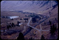
- Description:
- 50 f 8 Pola
- Subject:
- Railings, Grasses, Roads, Trees, Meadows, Mountains, Shrubs, Clouds, Passes (Landforms), Trout Creek Pass (Colo.), Princeton, Mount (Colo.), and Hills
- Series:
- 10-53
- Creator:
- Cushman, Charles W., 1896-1972
- Date Created:
- 1953-10-15
- Genre:
- Landscape photographs
- Frame Number:
- 32
- Street Address:
- United States Highway 24
- County:
- Chaffee
- Abstract:
- Mt. Princeton
- Call Number:
- P06872
- Country:
- United States
- State/Province:
- Colorado
- Physical Description:
- Image was originally mounted in a glass enclosure. Before digitization, the image was removed and placed in a Wess Plastic, Inc. brand, 2" x 2", pl...
- Alternate Identifier:
- 1053.32
- Persistent URL:
- http://purl.dlib.indiana.edu/iudl/archives/cushman/P06872
- Holding Location:
- Bloomington - University Archives
Wells Library E460
1320 E 10th St.
Bloomington, IN 47405
Contact at archives@indiana.edu, 812-855-1127
-
- Description:
- 50 f 7 Pola
- Subject:
- Rocks, Grasses, Roads, Trees, Shadows, Mountains, Princeton, Mount (Colo.), Clouds, Passes (Landforms), Trout Creek Pass (Colo.), and Hills
- Series:
- 10-53
- Creator:
- Cushman, Charles W., 1896-1972
- Date Created:
- 1953-10-15
- Genre:
- Landscape photographs
- Frame Number:
- 30
- County:
- Chaffee
- Abstract:
- Mt. Princeton from Trout Creek Pass but nearer
- Call Number:
- P06870
- Country:
- United States
- State/Province:
- Colorado
- Alternate Identifier:
- 1053.30
- Persistent URL:
- http://purl.dlib.indiana.edu/iudl/archives/cushman/P06870
- Holding Location:
- Bloomington - University Archives
Wells Library E460
1320 E 10th St.
Bloomington, IN 47405
Contact at archives@indiana.edu, 812-855-1127
-
- Description:
- 50 f 8 Pola
- Subject:
- Rocks, Grasses, Roads, Trees, Mountains, Princeton, Mount (Colo.), Clouds, Hills, Trout Creek Pass (Colo.), and Passes (Landforms)
- Series:
- 10-53
- Creator:
- Cushman, Charles W., 1896-1972
- Date Created:
- 1953-10-15
- Genre:
- Landscape photographs
- Frame Number:
- 29
- County:
- Chaffee
- Abstract:
- Mt. Princeton from Trout Creek Pass
- Call Number:
- P06869
- Country:
- United States
- State/Province:
- Colorado
- Alternate Identifier:
- 1053.29
- Persistent URL:
- http://purl.dlib.indiana.edu/iudl/archives/cushman/P06869
- Holding Location:
- Bloomington - University Archives
Wells Library E460
1320 E 10th St.
Bloomington, IN 47405
Contact at archives@indiana.edu, 812-855-1127
-
- Description:
- 50 6.3 Pola
- Subject:
- Railings, Grasses, Roads, Trees, Mountains, Pikes Peak (Colo.), and Clouds
- Series:
- 10-53
- Creator:
- Cushman, Charles W., 1896-1972
- Date Created:
- 1953-10-15
- Genre:
- Landscape photographs
- Frame Number:
- 28
- Street Address:
- United States Highway 24
- County:
- Teller
- Abstract:
- Pikes Peak in morning from near Woodland Pk
- Call Number:
- P06868
- City:
- Woodland Park
- Country:
- United States
- State/Province:
- Colorado
- Alternate Identifier:
- 1053.28
- Persistent URL:
- http://purl.dlib.indiana.edu/iudl/archives/cushman/P06868
- Holding Location:
- Bloomington - University Archives
Wells Library E460
1320 E 10th St.
Bloomington, IN 47405
Contact at archives@indiana.edu, 812-855-1127
-
- Description:
- 50 f 8 Pola
- Subject:
- Snow, Railings, Valleys, Grasses, Roads, Trees, Shadows, Meadows, Kenosha Mountains (Colo.), Kenosha Pass (Colo.), Mountains, Clouds, and Hills
- Series:
- 10-53
- Creator:
- Cushman, Charles W., 1896-1972
- Date Created:
- 1953-10-14
- Genre:
- Landscape photographs
- Frame Number:
- 24
- County:
- Park
- Abstract:
- West from Kenosha Pass-SW slope
- Call Number:
- P06864
- Country:
- United States
- State/Province:
- Colorado
- Alternate Identifier:
- 1053.24
- Persistent URL:
- http://purl.dlib.indiana.edu/iudl/archives/cushman/P06864
- Holding Location:
- Bloomington - University Archives
Wells Library E460
1320 E 10th St.
Bloomington, IN 47405
Contact at archives@indiana.edu, 812-855-1127
-
- Description:
- 50 f 8 Pola
- Subject:
- Snow, Railings, Roads, Trees, Kenosha Mountains (Colo.), Kenosha Pass (Colo.), Mountains, Clouds, Passes (Landforms), and Rocks
- Series:
- 10-53
- Creator:
- Cushman, Charles W., 1896-1972
- Date Created:
- 1953-10-14
- Genre:
- Landscape photographs
- Frame Number:
- 23
- County:
- Park
- Abstract:
- Clouds over high Rockies NE of Kenosha Pass
- Call Number:
- P06863
- Country:
- United States
- State/Province:
- Colorado
- Physical Description:
- Image was originally mounted in a glass enclosure. Before digitization, the image was removed and placed in a Wess Plastic, Inc. brand, 2" x 2", pl...
- Alternate Identifier:
- 1053.23
- Persistent URL:
- http://purl.dlib.indiana.edu/iudl/archives/cushman/P06863
- Holding Location:
- Bloomington - University Archives
Wells Library E460
1320 E 10th St.
Bloomington, IN 47405
Contact at archives@indiana.edu, 812-855-1127
-
- Description:
- 50 f 8 Pola
- Subject:
- Passes (Landforms), Roads, Mountains, Shrubs, Snow, Trees, Rocks, Kenosha Pass (Colo.), Railings, Kenosha Mountains (Colo.), and Clouds
- Series:
- 10-53
- Creator:
- Cushman, Charles W., 1896-1972
- Date Created:
- 1953-10-14
- Genre:
- Landscape photographs
- Frame Number:
- 22
- County:
- Park
- Abstract:
- NE from Kenosha Pass
- Call Number:
- P06862
- Country:
- United States
- State/Province:
- Colorado
- Alternate Identifier:
- 1053.22
- Persistent URL:
- http://purl.dlib.indiana.edu/iudl/archives/cushman/P06862
- Holding Location:
- Bloomington - University Archives
Wells Library E460
1320 E 10th St.
Bloomington, IN 47405
Contact at archives@indiana.edu, 812-855-1127
-
- Description:
- 50 f 8 Pola
- Subject:
- Snow, Railings, Roads, Trees, Kenosha Mountains (Colo.), Kenosha Pass (Colo.), Mountains, Shrubs, Clouds, Passes (Landforms), and Rocks
- Series:
- 10-53
- Creator:
- Cushman, Charles W., 1896-1972
- Date Created:
- 1953-10-14
- Genre:
- Landscape photographs
- Frame Number:
- 21
- County:
- Park
- Abstract:
- NE from Kenosha Pass
- Call Number:
- P06861
- Country:
- United States
- State/Province:
- Colorado
- Alternate Identifier:
- 1053.21
- Persistent URL:
- http://purl.dlib.indiana.edu/iudl/archives/cushman/P06861
- Holding Location:
- Bloomington - University Archives
Wells Library E460
1320 E 10th St.
Bloomington, IN 47405
Contact at archives@indiana.edu, 812-855-1127
-
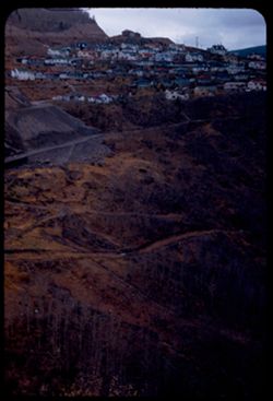
- Description:
- 50 f 5.6
- Subject:
- Grasses, Houses, Trees, Tree limbs, Mountains, Utility poles, and Roads
- Series:
- 10-53
- Creator:
- Cushman, Charles W., 1896-1972
- Date Created:
- 1953-10-13
- Genre:
- Cityscape photographs
- Frame Number:
- 10
- Street Address:
- United States Highway 6
- County:
- Eagle
- Abstract:
- Gilman from above
- Call Number:
- P06850
- City:
- Gilman
- Country:
- United States
- State/Province:
- Colorado
- Alternate Identifier:
- 1053.10
- Persistent URL:
- http://purl.dlib.indiana.edu/iudl/archives/cushman/P06850
- Holding Location:
- Bloomington - University Archives
Wells Library E460
1320 E 10th St.
Bloomington, IN 47405
Contact at archives@indiana.edu, 812-855-1127
-
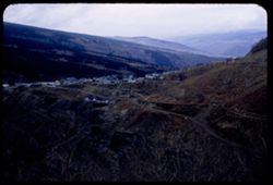
- Description:
- 50 f 5.6
- Subject:
- Rocks, Grasses, Roads, Dirt, Mountains, Eagle River (Colo.), Rivers, and Houses
- Series:
- 10-53
- Creator:
- Cushman, Charles W., 1896-1972
- Date Created:
- 1953-10-13
- Genre:
- Cityscape photographs
- Frame Number:
- 9
- County:
- Eagle
- Abstract:
- Gilman
- Call Number:
- P06849
- City:
- Gilman
- Country:
- United States
- State/Province:
- Colorado
- Alternate Identifier:
- 1053.9
- Persistent URL:
- http://purl.dlib.indiana.edu/iudl/archives/cushman/P06849
- Holding Location:
- Bloomington - University Archives
Wells Library E460
1320 E 10th St.
Bloomington, IN 47405
Contact at archives@indiana.edu, 812-855-1127
-
- Description:
- 50 f 4.5
- Subject:
- Valleys, Grasses, Roads, Trees, Mountains, Bridges, Hills, Utility poles, Railroads, Rivers, Bodies of water, and Eagle River (Colo.)
- Series:
- 10-53
- Creator:
- Cushman, Charles W., 1896-1972
- Date Created:
- 1953-10-13
- Genre:
- Landscape photographs
- Frame Number:
- 8
- Street Address:
- United States Highway 6
- County:
- Eagle
- Abstract:
- Mtns along Eagle river below Minturn & Gilman(overcast), from higher
- Call Number:
- P06848
- City:
- Minturn and Gilman
- Country:
- United States
- State/Province:
- Colorado
- Alternate Identifier:
- 1053.8
- Persistent URL:
- http://purl.dlib.indiana.edu/iudl/archives/cushman/P06848
- Holding Location:
- Bloomington - University Archives
Wells Library E460
1320 E 10th St.
Bloomington, IN 47405
Contact at archives@indiana.edu, 812-855-1127
-
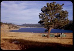
- Description:
- 50 5.6
- Subject:
- Glenwood Canyon (Colo.), Railings, Canyons, Grasses, Roads, Shoshone Lake (Colo.), Trees, Colorado River (Colo.-Mexico), Buildings, Lakes & ponds, Utilit...
- Series:
- 10-53
- Creator:
- Cushman, Charles W., 1896-1972
- Date Created:
- 1953-10-13
- Genre:
- Landscape photographs
- Frame Number:
- 1
- County:
- Garfield
- Abstract:
- Shoshone lake in Glenwood canyon
- Call Number:
- P06841
- City:
- Shoshone
- Country:
- United States
- State/Province:
- Colorado
- Alternate Identifier:
- 1053.1
- Persistent URL:
- http://purl.dlib.indiana.edu/iudl/archives/cushman/P06841
- Holding Location:
- Bloomington - University Archives
Wells Library E460
1320 E 10th St.
Bloomington, IN 47405
Contact at archives@indiana.edu, 812-855-1127
-
- Description:
- 50 f 11
- Subject:
- Grasses, Roads, Trees, Mountains, Fences, Shrubs, Clouds, Hills, Cliffs, and Bridges
- Series:
- 9-53
- Creator:
- Cushman, Charles W., 1896-1972
- Date Created:
- 1953-10-12
- Genre:
- Landscape photographs
- Frame Number:
- 35
- County:
- Mesa
- Abstract:
- Mtns near De Beque
- Call Number:
- P06836
- City:
- De Beque
- Country:
- United States
- State/Province:
- Colorado
- Alternate Identifier:
- 953.35
- Persistent URL:
- http://purl.dlib.indiana.edu/iudl/archives/cushman/P06836
- Holding Location:
- Bloomington - University Archives
Wells Library E460
1320 E 10th St.
Bloomington, IN 47405
Contact at archives@indiana.edu, 812-855-1127
-
- Description:
- 50 f 8 Pola
- Subject:
- Rocks, Canyons, Grasses, Roads, Automobiles, Mesas, Colorado River (Colo.-Mexico), Mountains, Shrubs, Clouds, Hills, Rivers, and Trees
- Series:
- 9-53
- Creator:
- Cushman, Charles W., 1896-1972
- Date Created:
- 1953-10-12
- Genre:
- Landscape photographs
- Frame Number:
- 34
- County:
- Mesa
- Abstract:
- View north up river around bend
- Call Number:
- P06835
- City:
- Grand Junction
- Country:
- United States
- State/Province:
- Colorado
- Alternate Identifier:
- 953.34
- Persistent URL:
- http://purl.dlib.indiana.edu/iudl/archives/cushman/P06835
- Holding Location:
- Bloomington - University Archives
Wells Library E460
1320 E 10th St.
Bloomington, IN 47405
Contact at archives@indiana.edu, 812-855-1127
-
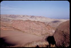
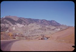
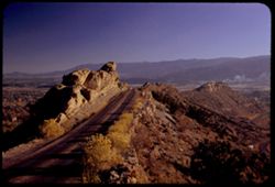
- Description:
- 50 f 11
- Subject:
- Canyons, Hills, Roads, Mountains, Shrubs, Rocks, Colorado River (Colo.-Mexico), Grasses, Mesas, Horseshoe Canyon (Colo.), Clouds, and Rivers
- Series:
- 9-53
- Creator:
- Cushman, Charles W., 1896-1972
- Date Created:
- 1953-10-12
- Genre:
- Landscape photographs
- Frame Number:
- 33
- County:
- Mesa
- Abstract:
- Colorado river in Horseshoe Canyon
- Call Number:
- P06834
- City:
- Grand Junction
- Country:
- United States
- State/Province:
- Colorado
- Alternate Identifier:
- 953.33
- Persistent URL:
- http://purl.dlib.indiana.edu/iudl/archives/cushman/P06834
- Holding Location:
- Bloomington - University Archives
Wells Library E460
1320 E 10th St.
Bloomington, IN 47405
Contact at archives@indiana.edu, 812-855-1127
-
- Description:
- 50 f 11
- Subject:
- Erosion, Canyons, Valleys, Denver and Rio Grande Western Railway Company, Roads, Cliffs, Rocks, Colorado River (Colo.-Mexico), Rivers, Horseshoe Canyon (Colo...
- Series:
- 9-53
- Creator:
- Cushman, Charles W., 1896-1972
- Date Created:
- 1953-10-12
- Genre:
- Snapshots
- Frame Number:
- 32
- County:
- Mesa
- Abstract:
- Freight train in curve
- Call Number:
- P06833
- City:
- Grand Junction
- Country:
- United States
- State/Province:
- Colorado
- Alternate Identifier:
- 953.32
- Persistent URL:
- http://purl.dlib.indiana.edu/iudl/archives/cushman/P06833
- Holding Location:
- Bloomington - University Archives
Wells Library E460
1320 E 10th St.
Bloomington, IN 47405
Contact at archives@indiana.edu, 812-855-1127
-
- Description:
- 50 f 11
- Subject:
- Rocks, Canyons, Grasses, Roads, Colorado River (Colo.-Mexico), Horseshoe Canyon (Colo.), Clouds, Railroads, Rivers, Valleys, and Cliffs
- Series:
- 9-53
- Creator:
- Cushman, Charles W., 1896-1972
- Date Created:
- 1953-10-12
- Genre:
- Landscape photographs
- Frame Number:
- 30
- County:
- Mesa
- Abstract:
- Up and [?]on the Colorado river from top of horseshoe canyon on curve 28 miles east of Grand Junction
- Call Number:
- P06831
- City:
- Grand Junction
- Country:
- United States
- State/Province:
- Colorado
- Alternate Identifier:
- 953.30
- Persistent URL:
- http://purl.dlib.indiana.edu/iudl/archives/cushman/P06831
- Holding Location:
- Bloomington - University Archives
Wells Library E460
1320 E 10th St.
Bloomington, IN 47405
Contact at archives@indiana.edu, 812-855-1127
-
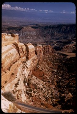
- Description:
- 50 f 6.3 Pola
- Subject:
- Grasses, Roads, Colorado National Monument (Colo.), Automobiles, Trees, Plains, Mountains, Shrubs, Traffic signs & signals, Clouds, Hills, and Mesas
- Series:
- 9-53
- Creator:
- Cushman, Charles W., 1896-1972
- Date Created:
- 1953-10-12
- Genre:
- Landscape photographs
- Frame Number:
- 23
- Street Address:
- United States Highway 50
- County:
- Mesa
- Abstract:
- View west from Grand Junction toward Colo Nat'l Mon.
- Call Number:
- P06824
- City:
- Grand Junction
- Country:
- United States
- State/Province:
- Colorado
- Physical Description:
- Image was originally mounted in a glass enclosure. Before digitization, the image was removed and placed in a Wess Plastic, Inc. brand, 2" x 2", pl...
- Alternate Identifier:
- 953.23
- Persistent URL:
- http://purl.dlib.indiana.edu/iudl/archives/cushman/P06824
- Holding Location:
- Bloomington - University Archives
Wells Library E460
1320 E 10th St.
Bloomington, IN 47405
Contact at archives@indiana.edu, 812-855-1127
-
- Description:
- 25 f 12
- Subject:
- Canyons, Cliffs, Colorado National Monument (Colo.), Mesas, Shadows, Mountains, Rock formations, Roads, National parks & reserves, and Shrubs
- Series:
- 26-52
- Creator:
- Cushman, Charles W., 1896-1972
- Date Created:
- 1952-11-03
- Genre:
- Landscape photographs
- Frame Number:
- 12
- County:
- Mesa
- Abstract:
- Grand shelves.
- Call Number:
- P06419
- City:
- Grand Junction
- Country:
- United States
- State/Province:
- Colorado
- Alternate Identifier:
- 2652.12
- Persistent URL:
- http://purl.dlib.indiana.edu/iudl/archives/cushman/P06419
- Holding Location:
- Bloomington - University Archives
Wells Library E460
1320 E 10th St.
Bloomington, IN 47405
Contact at archives@indiana.edu, 812-855-1127
-
- Description:
- 25 f 6.3 Pola
- Subject:
- Roads, Colorado National Monument (Colo.), Mesas, Mountains, Shrubs, Cliffs, and National parks & reserves
- Series:
- 26-52
- Creator:
- Cushman, Charles W., 1896-1972
- Date Created:
- 1952-11-03
- Genre:
- Landscape photographs
- Frame Number:
- 7
- Abstract:
- Down along 1st rock wall.
- Call Number:
- P06414
- Country:
- United States
- State/Province:
- Colorado
- Alternate Identifier:
- 2652.7
- Persistent URL:
- http://purl.dlib.indiana.edu/iudl/archives/cushman/P06414
- Holding Location:
- Bloomington - University Archives
Wells Library E460
1320 E 10th St.
Bloomington, IN 47405
Contact at archives@indiana.edu, 812-855-1127
-
- Description:
- 25 f 6.3 Pola
- Subject:
- Deserts, Cliffs, Colorado National Monument (Colo.), Mesas, Buttes, Mountains, Shrubs, Clouds, Roads, Trees, and National parks & reserves
- Series:
- 26-52
- Creator:
- Cushman, Charles W., 1896-1972
- Date Created:
- 1952-11-03
- Genre:
- Landscape photographs
- Frame Number:
- 5
- County:
- Mesa
- Abstract:
- View over Grnd Juctn.
- Call Number:
- P06412
- City:
- Grand Junction
- Country:
- United States
- State/Province:
- Colorado
- Alternate Identifier:
- 2652.5
- Persistent URL:
- http://purl.dlib.indiana.edu/iudl/archives/cushman/P06412
- Holding Location:
- Bloomington - University Archives
Wells Library E460
1320 E 10th St.
Bloomington, IN 47405
Contact at archives@indiana.edu, 812-855-1127
-
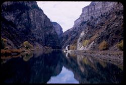
- Description:
- 25 f 2.8
- Subject:
- Canyons, Glenwood Canyon (Colo.), Roads, Cliffs, Railroad tracks, Mountains, Shrubs, Trees, Buildings, Colorado River (Colo.-Mexico), Rivers, Railroad cars, ...
- Series:
- 25-52
- Creator:
- Cushman, Charles W., 1896-1972
- Date Created:
- 1952-11-02
- Genre:
- Landscape photographs
- Frame Number:
- 30
- County:
- Garfield
- Abstract:
- Dark in Glenwood Canyon.
- Call Number:
- P06399
- City:
- Glenwood Springs
- Country:
- United States
- State/Province:
- Colorado
- Alternate Identifier:
- 2552.30
- Persistent URL:
- http://purl.dlib.indiana.edu/iudl/archives/cushman/P06399
- Holding Location:
- Bloomington - University Archives
Wells Library E460
1320 E 10th St.
Bloomington, IN 47405
Contact at archives@indiana.edu, 812-855-1127
-
- Description:
- 25 f 6.3
- Subject:
- Snow, Canyons, Houses, Outbuildings, Trees, Mountains, Bridges, Eagle River (Colo.), Rivers, Roads, and Clouds
- Series:
- 25-52
- Creator:
- Cushman, Charles W., 1896-1972
- Date Created:
- 1952-11-02
- Genre:
- Landscape photographs
- Frame Number:
- 27
- Street Address:
- United States Highway 6
- County:
- Eagle
- Abstract:
- Canyon of Eagle river near Minturn (US 6).
- Call Number:
- P06396
- City:
- Minturn
- Country:
- United States
- State/Province:
- Colorado
- Alternate Identifier:
- 2552.27
- Persistent URL:
- http://purl.dlib.indiana.edu/iudl/archives/cushman/P06396
- Holding Location:
- Bloomington - University Archives
Wells Library E460
1320 E 10th St.
Bloomington, IN 47405
Contact at archives@indiana.edu, 812-855-1127
-
- Description:
- 25 f 5.6 Pola
- Subject:
- Rocky Mountains, Roads, Barbed wire, Meadows, Mountains, Fences, Clouds, Hills, Animal housing, and Elbert, Mount (Colo.)
- Series:
- 25-52
- Creator:
- Cushman, Charles W., 1896-1972
- Date Created:
- 1952-11-02
- Genre:
- Landscape photographs
- Frame Number:
- 22
- Abstract:
- Mt. Elbert - top in shroud. 14431 ft.
- Call Number:
- P06391
- Country:
- United States
- State/Province:
- Colorado
- Alternate Identifier:
- 2552.22
- Persistent URL:
- http://purl.dlib.indiana.edu/iudl/archives/cushman/P06391
- Holding Location:
- Bloomington - University Archives
Wells Library E460
1320 E 10th St.
Bloomington, IN 47405
Contact at archives@indiana.edu, 812-855-1127
-
- Description:
- 25 f 4
- Subject:
- Rocks, Valleys, Roads, Trees, Mountains, Clouds, Forests, Passes (Landforms), and Loveland Pass (Colo.)
- Series:
- 25-52
- Creator:
- Cushman, Charles W., 1896-1972
- Date Created:
- 1952-11-01
- Genre:
- Landscape photographs
- Frame Number:
- 14
- Abstract:
- North from Loveland Pass.
- Call Number:
- P06383
- Country:
- United States
- State/Province:
- Colorado
- Alternate Identifier:
- 2552.14
- Persistent URL:
- http://purl.dlib.indiana.edu/iudl/archives/cushman/P06383
- Holding Location:
- Bloomington - University Archives
Wells Library E460
1320 E 10th St.
Bloomington, IN 47405
Contact at archives@indiana.edu, 812-855-1127
-
- Description:
- 25 f 3.5
- Subject:
- Passes (Landforms), Valleys, Forests, Roads, Mountains, Shrubs, Arapahoe Basin (Colo.), and Loveland Pass (Colo.)
- Series:
- 25-52
- Creator:
- Cushman, Charles W., 1896-1972
- Date Created:
- 1952-11-01
- Genre:
- Landscape photographs
- Frame Number:
- 13
- Abstract:
- From Loveland Pass 11,992 ft. - across Arapahoe Basin.
- Call Number:
- P06382
- Country:
- United States
- State/Province:
- Colorado
- Physical Description:
- Image was originally mounted in a glass enclosure. Before digitization, the image was removed and placed in a Wess Plastic, Inc. brand, 2" x 2", pl...
- Alternate Identifier:
- 2552.13
- Persistent URL:
- http://purl.dlib.indiana.edu/iudl/archives/cushman/P06382
- Holding Location:
- Bloomington - University Archives
Wells Library E460
1320 E 10th St.
Bloomington, IN 47405
Contact at archives@indiana.edu, 812-855-1127
-
- Description:
- 25 f 4
- Subject:
- Rocks, Rocky Mountains, Valleys, Houses, Trees, Mountains, Buildings, Shrubs, Utility poles, Roads, and Cliffs
- Series:
- 25-52
- Creator:
- Cushman, Charles W., 1896-1972
- Date Created:
- 1952-11-01
- Genre:
- Cityscape photographs
- Frame Number:
- 12
- County:
- Clear Creek
- Abstract:
- Georgetown.
- Call Number:
- P06381
- City:
- Georgetown
- Country:
- United States
- State/Province:
- Colorado
- Alternate Identifier:
- 2552.12
- Persistent URL:
- http://purl.dlib.indiana.edu/iudl/archives/cushman/P06381
- Holding Location:
- Bloomington - University Archives
Wells Library E460
1320 E 10th St.
Bloomington, IN 47405
Contact at archives@indiana.edu, 812-855-1127
-
- Description:
- 50 f 6
- Subject:
- National parks & reserves, Rocky Mountains, Valleys, Rocky Mountain National Park (Colo.), Forests, Roads, Mountains, Trees, and Mists
- Series:
- 25-52
- Creator:
- Cushman, Charles W., 1896-1972
- Date Created:
- 1952-11-01
- Genre:
- Landscape photographs
- Frame Number:
- 11
- Abstract:
- Down into valley.
- Call Number:
- P06380
- Country:
- United States
- State/Province:
- Colorado
- Alternate Identifier:
- 2552.11
- Persistent URL:
- http://purl.dlib.indiana.edu/iudl/archives/cushman/P06380
- Holding Location:
- Bloomington - University Archives
Wells Library E460
1320 E 10th St.
Bloomington, IN 47405
Contact at archives@indiana.edu, 812-855-1127
-
- Description:
- 50 f 8
- Subject:
- National parks & reserves, Rocky Mountains, Passes (Landforms), Rocky Mountain National Park (Colo.), Forests, Roads, Cliffs, Mountains, Rocks, and Clouds
- Series:
- 25-52
- Creator:
- Cushman, Charles W., 1896-1972
- Date Created:
- 1952-11-01
- Genre:
- Landscape photographs
- Frame Number:
- 6
- Abstract:
- View west from pass of 12,110 ft elev.
- Call Number:
- P06375
- Country:
- United States
- State/Province:
- Colorado
- Physical Description:
- Image was originally mounted in a glass enclosure. Before digitization, the image was removed and placed in a Wess Plastic, Inc. brand, 2" x 2", pl...
- Alternate Identifier:
- 2552.6
- Persistent URL:
- http://purl.dlib.indiana.edu/iudl/archives/cushman/P06375
- Holding Location:
- Bloomington - University Archives
Wells Library E460
1320 E 10th St.
Bloomington, IN 47405
Contact at archives@indiana.edu, 812-855-1127
-
- Description:
- 50 f 8
- Subject:
- Rocks, Rocky Mountains, Forest fires, Roads, Trees, Tree limbs, Mountains, National parks & reserves, Forests, Rocky Mountain National Park (Colo.), and ...
- Series:
- 25-52
- Creator:
- Cushman, Charles W., 1896-1972
- Date Created:
- 1952-11-02
- Genre:
- Landscape photographs
- Frame Number:
- 2
- Abstract:
- Desolation - this forest burned many years ago.
- Call Number:
- P06371
- Country:
- United States
- State/Province:
- Colorado
- Alternate Identifier:
- 2552.2
- Persistent URL:
- http://purl.dlib.indiana.edu/iudl/archives/cushman/P06371
- Holding Location:
- Bloomington - University Archives
Wells Library E460
1320 E 10th St.
Bloomington, IN 47405
Contact at archives@indiana.edu, 812-855-1127
-
- Description:
- 25 f 8
- Subject:
- Rocky Mountains, Valleys, Roads, Fall River Valley, Trees, Mountains, National parks & reserves, Rocky Mountain National Park (Colo.), and Rivers
- Series:
- 24-52
- Creator:
- Cushman, Charles W., 1896-1972
- Date Created:
- 1952-11-01
- Genre:
- Landscape photographs
- Frame Number:
- 38
- Abstract:
- Looking down into fall river valley.
- Call Number:
- P06369
- Country:
- United States
- State/Province:
- Colorado
- Alternate Identifier:
- 2452.38
- Persistent URL:
- http://purl.dlib.indiana.edu/iudl/archives/cushman/P06369
- Holding Location:
- Bloomington - University Archives
Wells Library E460
1320 E 10th St.
Bloomington, IN 47405
Contact at archives@indiana.edu, 812-855-1127
-
- Description:
- 25 f 9
- Subject:
- Rocky Mountains, Roads, Trees, Mummy Range (Colo.), Tree limbs, Mountains, National parks & reserves, Clouds, Forests, Rocky Mountain National Park (Colo...
- Series:
- 24-52
- Creator:
- Cushman, Charles W., 1896-1972
- Date Created:
- 1952-11-01
- Genre:
- Landscape photographs
- Frame Number:
- 37
- County:
- Larimer
- Abstract:
- Mummy Mtns to NW of Hwy.
- Call Number:
- P06368
- Country:
- United States
- State/Province:
- Colorado
- Alternate Identifier:
- 2452.37
- Persistent URL:
- http://purl.dlib.indiana.edu/iudl/archives/cushman/P06368
- Holding Location:
- Bloomington - University Archives
Wells Library E460
1320 E 10th St.
Bloomington, IN 47405
Contact at archives@indiana.edu, 812-855-1127
-
- Description:
- 25 f 9
- Subject:
- Rocks, Rocky Mountains, Roads, Trees, Mountains, Buildings, Shrubs, and Clouds
- Series:
- 24-52
- Creator:
- Cushman, Charles W., 1896-1972
- Date Created:
- 1952-11-01
- Genre:
- Landscape photographs
- Frame Number:
- 33
- County:
- Larimer
- Abstract:
- Mtns north of Estes Pk.
- Call Number:
- P06364
- City:
- Estes Park
- Country:
- United States
- State/Province:
- Colorado
- Alternate Identifier:
- 2452.33
- Persistent URL:
- http://purl.dlib.indiana.edu/iudl/archives/cushman/P06364
- Holding Location:
- Bloomington - University Archives
Wells Library E460
1320 E 10th St.
Bloomington, IN 47405
Contact at archives@indiana.edu, 812-855-1127
-
- Description:
- 25 f 9
- Subject:
- Lakes & ponds, Meadows, Hills, Roads, Outbuildings, Mountains, Trees, Shadows, Grasses, Fences, and Houses
- Series:
- 24-52
- Creator:
- Cushman, Charles W., 1896-1972
- Date Created:
- 1952-10-31
- Genre:
- Landscape photographs
- Frame Number:
- 32
- County:
- Boulder
- Abstract:
- Little mountain lake at Nederland.
- Call Number:
- P06363
- City:
- Nederland
- Country:
- United States
- State/Province:
- Colorado
- Alternate Identifier:
- 2452.32
- Persistent URL:
- http://purl.dlib.indiana.edu/iudl/archives/cushman/P06363
- Holding Location:
- Bloomington - University Archives
Wells Library E460
1320 E 10th St.
Bloomington, IN 47405
Contact at archives@indiana.edu, 812-855-1127
-
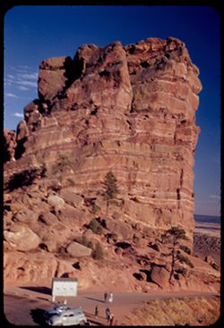
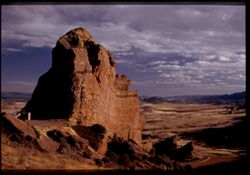
- Description:
- 25 f 11
- Subject:
- Cliffs, Parks, Shadows, Buttes, Mountains, Fences, Rock formations, Red Rocks Park (Jefferson County, Colo.), Hills, Roads, and Shrubs
- Series:
- 24-52
- Creator:
- Cushman, Charles W., 1896-1972
- Date Created:
- 1952-10-30
- Genre:
- Landscape photographs
- Frame Number:
- 7
- County:
- Jefferson
- Abstract:
- NE from Red Rock Park
- Call Number:
- P06338
- City:
- Morrison
- Country:
- United States
- State/Province:
- Colorado
- Alternate Identifier:
- 2452.7
- Persistent URL:
- http://purl.dlib.indiana.edu/iudl/archives/cushman/P06338
- Holding Location:
- Bloomington - University Archives
Wells Library E460
1320 E 10th St.
Bloomington, IN 47405
Contact at archives@indiana.edu, 812-855-1127
-

- Description:
- 25 f 6 POLA
- Subject:
- Rocks, Roads, Parks, Boulders, Shadows, Buttes, Mountains, Buildings, Rock formations, Clouds, Red Rocks Park (Jefferson County, Colo.), Hills, and Cliffs
- Series:
- 24-52
- Creator:
- Cushman, Charles W., 1896-1972
- Date Created:
- 1952-10-30
- Genre:
- Landscape photographs
- Frame Number:
- 5
- County:
- Jefferson
- Abstract:
- Red Rock Park west of Denver
- Call Number:
- P06336
- City:
- Morrison
- Country:
- United States
- State/Province:
- Colorado
- Alternate Identifier:
- 2452.5
- Persistent URL:
- http://purl.dlib.indiana.edu/iudl/archives/cushman/P06336
- Holding Location:
- Bloomington - University Archives
Wells Library E460
1320 E 10th St.
Bloomington, IN 47405
Contact at archives@indiana.edu, 812-855-1127
-
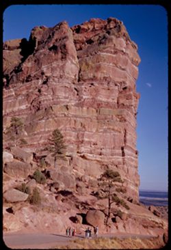
- Description:
- 25 f 6 Pola
- Subject:
- Red Rocks Park (Jefferson County, Colo.), Automobiles, Red beds, Parking lots, Cliffs, People, Shrubs, Boulders, Buildings, Buttes, Rock formations, Roads, T...
- Series:
- 24-52
- Creator:
- Cushman, Charles W., 1896-1972
- Date Created:
- 1952-10-30
- Genre:
- Landscape photographs
- Frame Number:
- 4
- County:
- Jefferson
- Abstract:
- Great Tall red rock
- Call Number:
- P06335
- City:
- Morrison
- Country:
- United States
- State/Province:
- Colorado
- Alternate Identifier:
- 2452.4
- Persistent URL:
- http://purl.dlib.indiana.edu/iudl/archives/cushman/P06335
- Holding Location:
- Bloomington - University Archives
Wells Library E460
1320 E 10th St.
Bloomington, IN 47405
Contact at archives@indiana.edu, 812-855-1127
-
- Description:
- 25 f 9
- Subject:
- Rocks, Roads, Parks, Trees, Boulders, Buttes, Shrubs, Red Rocks Park (Jefferson County, Colo.), People, Cliffs, Rock formations, and Red beds
- Series:
- 24-52
- Creator:
- Cushman, Charles W., 1896-1972
- Date Created:
- 1952-10-30
- Genre:
- Landscape photographs
- Frame Number:
- 3
- County:
- Jefferson
- Persons Pictured:
- Cushman, Charles W. (Charles Weever), 1896-1972
- Abstract:
- Great Tall red rock
- Call Number:
- P06334
- City:
- Morrison
- Country:
- United States
- State/Province:
- Colorado
- Alternate Identifier:
- 2452.3
- Persistent URL:
- http://purl.dlib.indiana.edu/iudl/archives/cushman/P06334
- Holding Location:
- Bloomington - University Archives
Wells Library E460
1320 E 10th St.
Bloomington, IN 47405
Contact at archives@indiana.edu, 812-855-1127
-
- Description:
- 25 f 6.3 pola
- Subject:
- Red Rocks Park (Jefferson County, Colo.), Parks, Roads, Cliffs, Mountains, Shrubs, Boulders, Rocks, Buttes, Rock formations, Hills, Buildings, and Clouds
- Series:
- 24-52
- Creator:
- Cushman, Charles W., 1896-1972
- Date Created:
- 1952-10-30
- Genre:
- Landscape photographs
- Frame Number:
- 2
- County:
- Jefferson
- Abstract:
- Red Rock Park west of Denver
- Call Number:
- P06333
- City:
- Morrison
- Country:
- United States
- State/Province:
- Colorado
- Physical Description:
- Image was originally mounted in a glass enclosure. Before digitization, the image was removed and placed in a Wess Plastic, Inc. brand, 2" x 2", pl...
- Alternate Identifier:
- 2452.2
- Persistent URL:
- http://purl.dlib.indiana.edu/iudl/archives/cushman/P06333
- Holding Location:
- Bloomington - University Archives
Wells Library E460
1320 E 10th St.
Bloomington, IN 47405
Contact at archives@indiana.edu, 812-855-1127
-

- Description:
- 25 f 11
- Subject:
- Cheesman Park (Denver, Colo.), Roads, Parks, Maples, Trees, Lawns, and Shrubs
- Series:
- 24-52
- Creator:
- Cushman, Charles W., 1896-1972
- Date Created:
- 1952-10-30
- Genre:
- Landscape photographs
- Frame Number:
- 1
- County:
- Denver
- Abstract:
- Lovely Maple in Cheesman Pk.
- Call Number:
- P06332
- City:
- Denver
- Country:
- United States
- State/Province:
- Colorado
- Alternate Identifier:
- 2452.1
- Persistent URL:
- http://purl.dlib.indiana.edu/iudl/archives/cushman/P06332
- Holding Location:
- Bloomington - University Archives
Wells Library E460
1320 E 10th St.
Bloomington, IN 47405
Contact at archives@indiana.edu, 812-855-1127
-
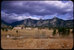
- Description:
- 25 f 11
- Subject:
- Houses, Mine buildings, Trees, Mining, Mountains, Hills, Garden of the Gods (Colorado Springs, Colo.), Mining equipment, and Roads
- Series:
- 23-52
- Creator:
- Cushman, Charles W., 1896-1972
- Date Created:
- 1952-10-29
- Genre:
- Landscape photographs
- Frame Number:
- 33
- Street Address:
- Mesa Road
- County:
- El Paso
- Abstract:
- Old mine and mountains ne of Garden of Gods-from Mesa Rd.
- Call Number:
- P06325
- City:
- Colorado Springs
- Country:
- United States
- State/Province:
- Colorado
- Alternate Identifier:
- 2352.33
- Persistent URL:
- http://purl.dlib.indiana.edu/iudl/archives/cushman/P06325
- Holding Location:
- Bloomington - University Archives
Wells Library E460
1320 E 10th St.
Bloomington, IN 47405
Contact at archives@indiana.edu, 812-855-1127
-
- Description:
- 25 f 6.3 Pola
- Subject:
- Roads, Mountains, Shrubs, Trees, Rocks, Rock formations, Boulders, and Buildings
- Series:
- 23-52
- Creator:
- Cushman, Charles W., 1896-1972
- Date Created:
- 1952-10-28
- Genre:
- Landscape photographs
- Frame Number:
- 22
- Street Address:
- Skyline Drive
- County:
- Fremont
- Abstract:
- Atop the comb of Skyline Dr.
- Call Number:
- P06314
- City:
- Canon City
- Country:
- United States
- State/Province:
- Colorado
- Alternate Identifier:
- 2352.22
- Persistent URL:
- http://purl.dlib.indiana.edu/iudl/archives/cushman/P06314
- Holding Location:
- Bloomington - University Archives
Wells Library E460
1320 E 10th St.
Bloomington, IN 47405
Contact at archives@indiana.edu, 812-855-1127
-
- Description:
- 25 f 5.6 Pola
- Subject:
- Rocks, Roads, Trees, Boulders, Mountains, Buildings, and Shrubs
- Series:
- 23-52
- Creator:
- Cushman, Charles W., 1896-1972
- Date Created:
- 1952-01-01
- Genre:
- Landscape photographs
- Frame Number:
- 21
- Street Address:
- Skyline Drive
- County:
- Fremont
- Abstract:
- Across Canon City form Skyline Drive
- Call Number:
- P06313
- City:
- Canon City
- Country:
- United States
- State/Province:
- Colorado
- Alternate Identifier:
- 2352.21
- Persistent URL:
- http://purl.dlib.indiana.edu/iudl/archives/cushman/P06313
- Holding Location:
- Bloomington - University Archives
Wells Library E460
1320 E 10th St.
Bloomington, IN 47405
Contact at archives@indiana.edu, 812-855-1127
-
- Description:
- 25 f 5.6 Pola
- Subject:
- Rocks, Valleys, Roads, Trees, Boulders, Mountains, Shrubs, and Hills
- Series:
- 23-52
- Creator:
- Cushman, Charles W., 1896-1972
- Date Created:
- 1952-10-28
- Genre:
- Landscape photographs
- Frame Number:
- 20
- Street Address:
- Skyline Drive
- County:
- Fremont
- Abstract:
- View south from Skyline Drive
- Call Number:
- P06312
- City:
- Canon City
- Country:
- United States
- State/Province:
- Colorado
- Alternate Identifier:
- 2352.20
- Persistent URL:
- http://purl.dlib.indiana.edu/iudl/archives/cushman/P06312
- Holding Location:
- Bloomington - University Archives
Wells Library E460
1320 E 10th St.
Bloomington, IN 47405
Contact at archives@indiana.edu, 812-855-1127
-
- Description:
- 25 f 11
- Subject:
- Rocks, Valleys, Roads, Trails & paths, Mountains, Shrubs, and Rock formations
- Series:
- 23-52
- Creator:
- Cushman, Charles W., 1896-1972
- Date Created:
- 1952-10-28
- Genre:
- Landscape photographs
- Frame Number:
- 19
- Street Address:
- Skyline Drive
- County:
- Fremont
- Abstract:
- Uptilted rock along skyline drive above Canon City
- Call Number:
- P06311
- City:
- Canon City
- Country:
- United States
- State/Province:
- Colorado
- Alternate Identifier:
- 2352.19
- Persistent URL:
- http://purl.dlib.indiana.edu/iudl/archives/cushman/P06311
- Holding Location:
- Bloomington - University Archives
Wells Library E460
1320 E 10th St.
Bloomington, IN 47405
Contact at archives@indiana.edu, 812-855-1127
-
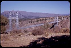
- Description:
- 25 f 11
- Subject:
- Canyons, Roads, Cliffs, Mountains, Shrubs, Trees, Shadows, Towers, Suspension bridges, Royal Gorge (Colo.), Buildings, and Flags
- Series:
- 23-52
- Creator:
- Cushman, Charles W., 1896-1972
- Date Created:
- 1952-10-28
- Genre:
- Landscape photographs
- Frame Number:
- 9
- County:
- Fremont
- Abstract:
- Suspension bridge from top of right bank
- Call Number:
- P06301
- Country:
- United States
- State/Province:
- Colorado
- Alternate Identifier:
- 2352.9
- Persistent URL:
- http://purl.dlib.indiana.edu/iudl/archives/cushman/P06301
- Holding Location:
- Bloomington - University Archives
Wells Library E460
1320 E 10th St.
Bloomington, IN 47405
Contact at archives@indiana.edu, 812-855-1127
-
- Description:
- 25 f 11
- Subject:
- Canyons, Roads, Cliffs, Point Sublime (Colo.), Mountains, Shrubs, Boulders, Rocks, Scenic overlooks, Royal Gorge (Colo.), Trees, and Buildings
- Series:
- 23-52
- Creator:
- Cushman, Charles W., 1896-1972
- Date Created:
- 1952-10-28
- Genre:
- Landscape photographs
- Frame Number:
- 7
- County:
- Fremont
- Abstract:
- Rocks at top-Pt. Sublime
- Call Number:
- P06299
- Country:
- United States
- State/Province:
- Colorado
- Alternate Identifier:
- 2352.7
- Persistent URL:
- http://purl.dlib.indiana.edu/iudl/archives/cushman/P06299
- Holding Location:
- Bloomington - University Archives
Wells Library E460
1320 E 10th St.
Bloomington, IN 47405
Contact at archives@indiana.edu, 812-855-1127
-
- Description:
- 25 f 9
- Subject:
- Roads, Cliffs, Garden of the Gods (Colorado Springs, Colo.), Shrubs, Boulders, Rocks, Buttes, and Rock formations
- Series:
- 22-52
- Creator:
- Cushman, Charles W., 1896-1972
- Date Created:
- 1952-10-27
- Genre:
- Landscape photographs
- Frame Number:
- 28
- County:
- El Paso
- Call Number:
- P06282
- City:
- Colorado Springs
- Country:
- United States
- State/Province:
- Colorado
- Alternate Identifier:
- 2252.28
- Persistent URL:
- http://purl.dlib.indiana.edu/iudl/archives/cushman/P06282
- Holding Location:
- Bloomington - University Archives
Wells Library E460
1320 E 10th St.
Bloomington, IN 47405
Contact at archives@indiana.edu, 812-855-1127
-
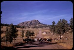
- Description:
- 25 f 11
- Subject:
- Grasses, Roads, Cowboys, Trees, Signs (Notices), Mountains, Rock formations, Cows, and Hills
- Series:
- 22-52
- Creator:
- Cushman, Charles W., 1896-1972
- Date Created:
- 1952-10-27
- Genre:
- Landscape photographs
- Frame Number:
- 21
- Street Address:
- Colorado State Highway 143
- County:
- Teller
- Abstract:
- Cows-lots of them-on Colo. 143
- Call Number:
- P06275
- City:
- Florissant and Cripple Creek
- Country:
- United States
- State/Province:
- Colorado
- Alternate Identifier:
- 2252.21
- Persistent URL:
- http://purl.dlib.indiana.edu/iudl/archives/cushman/P06275
- Holding Location:
- Bloomington - University Archives
Wells Library E460
1320 E 10th St.
Bloomington, IN 47405
Contact at archives@indiana.edu, 812-855-1127
-
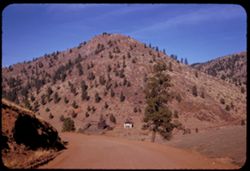
- Description:
- 25 f 11
- Subject:
- Houses, Ranches, Roads, Outbuildings, Mountains, and Trees
- Series:
- 22-52
- Creator:
- Cushman, Charles W., 1896-1972
- Date Created:
- 1952-10-27
- Genre:
- Landscape photographs
- Frame Number:
- 19
- County:
- Teller
- Abstract:
- Pink house 2 mi west of Cripple Creek
- Call Number:
- P06273
- City:
- Cripple Creek
- Country:
- United States
- State/Province:
- Colorado
- Alternate Identifier:
- 2252.19
- Persistent URL:
- http://purl.dlib.indiana.edu/iudl/archives/cushman/P06273
- Holding Location:
- Bloomington - University Archives
Wells Library E460
1320 E 10th St.
Bloomington, IN 47405
Contact at archives@indiana.edu, 812-855-1127
-
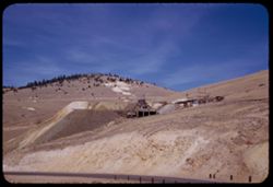
- Description:
- 25 f 11
- Subject:
- Railings, Roads, Mine buildings, Trees, Hills, and Mining equipment
- Series:
- 22-52
- Creator:
- Cushman, Charles W., 1896-1972
- Date Created:
- 1952-10-27
- Genre:
- Views
- Frame Number:
- 12
- County:
- Teller
- Abstract:
- Another old mine north of Crip Crk
- Call Number:
- P06266
- City:
- Cripple Creek
- Country:
- United States
- State/Province:
- Colorado
- Alternate Identifier:
- 2252.12
- Persistent URL:
- http://purl.dlib.indiana.edu/iudl/archives/cushman/P06266
- Holding Location:
- Bloomington - University Archives
Wells Library E460
1320 E 10th St.
Bloomington, IN 47405
Contact at archives@indiana.edu, 812-855-1127
-
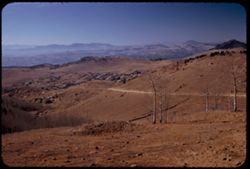
- Description:
- 25 f 7 Pola
- Subject:
- Rocks, Valleys, Roads, Trees, Mountains, and Hills
- Series:
- 22-52
- Creator:
- Cushman, Charles W., 1896-1972
- Date Created:
- 1952-10-27
- Genre:
- Landscape photographs and Cityscape photographs
- Frame Number:
- 10
- County:
- Teller
- Abstract:
- Working down on Cripple Creek from NE
- Call Number:
- P06264
- City:
- Cripple Creek
- Country:
- United States
- State/Province:
- Colorado
- Alternate Identifier:
- 2252.10
- Persistent URL:
- http://purl.dlib.indiana.edu/iudl/archives/cushman/P06264
- Holding Location:
- Bloomington - University Archives
Wells Library E460
1320 E 10th St.
Bloomington, IN 47405
Contact at archives@indiana.edu, 812-855-1127
-
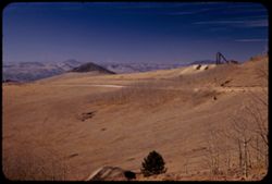
- Description:
- 25 f 8 Pola
- Subject:
- Hoisting machinery, Roads, Mine buildings, Trees, Tree limbs, Mountains, Fences, Hills, and Mining equipment
- Series:
- 22-52
- Creator:
- Cushman, Charles W., 1896-1972
- Date Created:
- 1952-10-27
- Genre:
- Landscape photographs
- Frame Number:
- 7
- County:
- Teller
- Abstract:
- From road above Cripple Creek - SW
- Call Number:
- P06261
- City:
- Cripple Creek
- Country:
- United States
- State/Province:
- Colorado
- Alternate Identifier:
- 2252.7
- Persistent URL:
- http://purl.dlib.indiana.edu/iudl/archives/cushman/P06261
- Holding Location:
- Bloomington - University Archives
Wells Library E460
1320 E 10th St.
Bloomington, IN 47405
Contact at archives@indiana.edu, 812-855-1127
-
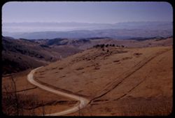
- Description:
- 25 f 6.3 Pola
- Subject:
- Tree limbs, Rocky Mountains, Valleys, Hills, Roads, Mountains, and Trees
- Series:
- 22-52
- Creator:
- Cushman, Charles W., 1896-1972
- Date Created:
- 1952-10-27
- Genre:
- Landscape photographs
- Frame Number:
- 6
- County:
- Teller
- Abstract:
- From road above Cripple Creek, view SSW (from elev, over 10,000)
- Call Number:
- P06260
- City:
- Cripple Creek
- Country:
- United States
- State/Province:
- Colorado
- Alternate Identifier:
- 2252.6
- Persistent URL:
- http://purl.dlib.indiana.edu/iudl/archives/cushman/P06260
- Holding Location:
- Bloomington - University Archives
Wells Library E460
1320 E 10th St.
Bloomington, IN 47405
Contact at archives@indiana.edu, 812-855-1127
-
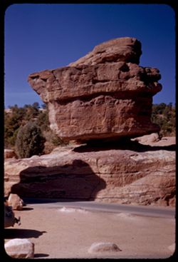
- Description:
- 25 f 9
- Subject:
- Rocks, Cliffs, Balanced Rock (Colo.), Trees, Boulders, Shadows, Rock formations, Hills, Garden of the Gods (Colorado Springs, Colo.), and Roads
- Series:
- 22-52
- Creator:
- Cushman, Charles W., 1896-1972
- Date Created:
- 1952-10-27
- Genre:
- Identification photographs
- Frame Number:
- 4
- County:
- El Paso
- Abstract:
- Balanced Rock
- Call Number:
- P06258
- City:
- Colorado Springs
- Country:
- United States
- State/Province:
- Colorado
- Alternate Identifier:
- 2252.4
- Persistent URL:
- http://purl.dlib.indiana.edu/iudl/archives/cushman/P06258
- Holding Location:
- Bloomington - University Archives
Wells Library E460
1320 E 10th St.
Bloomington, IN 47405
Contact at archives@indiana.edu, 812-855-1127
-

- Description:
- 25 f 6.3 Pola
- Subject:
- Rocks, Roads, Boulders, Buttes, Mountains, Rock formations, Pikes Peak (Colo.), Hills, Garden of the Gods (Colorado Springs, Colo.), Cliffs, and Shrubs
- Series:
- 22-52
- Creator:
- Cushman, Charles W., 1896-1972
- Date Created:
- 1952-10-27
- Genre:
- Landscape photographs
- Frame Number:
- 2
- County:
- El Paso
- Abstract:
- Pike's Peak through gateway of Garden of Gods
- Call Number:
- P06256
- City:
- Colorado Springs
- Country:
- United States
- State/Province:
- Colorado
- Alternate Identifier:
- 2252.2
- Persistent URL:
- http://purl.dlib.indiana.edu/iudl/archives/cushman/P06256
- Holding Location:
- Bloomington - University Archives
Wells Library E460
1320 E 10th St.
Bloomington, IN 47405
Contact at archives@indiana.edu, 812-855-1127
-
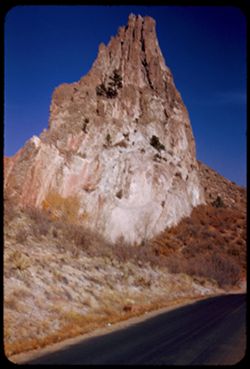
- Description:
- 25 f 13
- Subject:
- Cliffs, Buttes, Rock formations, Sentinel Rock (Colo.), Hills, Garden of the Gods (Colorado Springs, Colo.), Roads, and Shrubs
- Series:
- 21-52
- Creator:
- Cushman, Charles W., 1896-1972
- Date Created:
- 1952-10-27
- Genre:
- Identification photographs
- Frame Number:
- 23
- County:
- El Paso
- Abstract:
- Sent. Rock closer
- Call Number:
- P06254
- City:
- Colorado Springs
- Country:
- United States
- State/Province:
- Colorado
- Alternate Identifier:
- 2152.23
- Persistent URL:
- http://purl.dlib.indiana.edu/iudl/archives/cushman/P06254
- Holding Location:
- Bloomington - University Archives
Wells Library E460
1320 E 10th St.
Bloomington, IN 47405
Contact at archives@indiana.edu, 812-855-1127
-
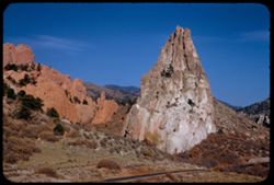
- Description:
- 25 f 13
- Subject:
- Roads, Buttes, Mountains, Rock formations, Sentinel Rock (Colo.), Hills, Garden of the Gods (Colorado Springs, Colo.), Cliffs, and Shrubs
- Series:
- 21-52
- Creator:
- Cushman, Charles W., 1896-1972
- Date Created:
- 1952-10-27
- Genre:
- Landscape photographs
- Frame Number:
- 20
- County:
- El Paso
- Abstract:
- Sentinel Rock again
- Call Number:
- P06251
- City:
- Colorado Springs
- Country:
- United States
- State/Province:
- Colorado
- Alternate Identifier:
- 2152.20
- Persistent URL:
- http://purl.dlib.indiana.edu/iudl/archives/cushman/P06251
- Holding Location:
- Bloomington - University Archives
Wells Library E460
1320 E 10th St.
Bloomington, IN 47405
Contact at archives@indiana.edu, 812-855-1127
-
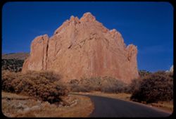
- Description:
- 25 f 11
- Subject:
- Hills, Roads, Garden of the Gods (Colorado Springs, Colo.), Shrubs, Trees, Buttes, and Rock formations
- Series:
- 21-52
- Creator:
- Cushman, Charles W., 1896-1972
- Date Created:
- 1952-10-27
- Genre:
- Landscape photographs
- Frame Number:
- 17
- County:
- El Paso
- Abstract:
- Giant palm shaped rock
- Call Number:
- P06248
- City:
- Colorado Springs
- Country:
- United States
- State/Province:
- Colorado
- Alternate Identifier:
- 2152.17
- Persistent URL:
- http://purl.dlib.indiana.edu/iudl/archives/cushman/P06248
- Holding Location:
- Bloomington - University Archives
Wells Library E460
1320 E 10th St.
Bloomington, IN 47405
Contact at archives@indiana.edu, 812-855-1127
-
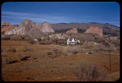
- Description:
- 25 f 12
- Subject:
- Meadows, Hills, Ranches, Roads, Bridges, Mountains, Utility poles, Trees, Buttes, Grasses, White House Ranch (Colorado Springs, Colo.), Houses, Garden of the...
- Series:
- 21-52
- Creator:
- Cushman, Charles W., 1896-1972
- Date Created:
- 1952-10-27
- Genre:
- Landscape photographs
- Frame Number:
- 14
- County:
- El Paso
- Abstract:
- Across White House Ranch to Garden of Gods
- Call Number:
- P06245
- City:
- Colorado Springs
- Country:
- United States
- State/Province:
- Colorado
- Alternate Identifier:
- 2152.14
- Persistent URL:
- http://purl.dlib.indiana.edu/iudl/archives/cushman/P06245
- Holding Location:
- Bloomington - University Archives
Wells Library E460
1320 E 10th St.
Bloomington, IN 47405
Contact at archives@indiana.edu, 812-855-1127
-
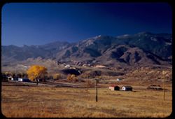
- Description:
- 25 f 6.3 Pola
- Subject:
- Grasses, Roads, Trees, Meadows, Mountains, Pikes Peak (Colo.), Hills, Utility poles, Garden of the Gods (Colorado Springs, Colo.), and Houses
- Series:
- 21-52
- Creator:
- Cushman, Charles W., 1896-1972
- Date Created:
- 1952-10-27
- Genre:
- Landscape photographs
- Frame Number:
- 13
- County:
- El Paso
- Abstract:
- Low Mtns east of Pikes Pk. In early morning light
- Call Number:
- P06244
- City:
- Colorado Springs
- Country:
- United States
- State/Province:
- Colorado
- Alternate Identifier:
- 2152.13
- Persistent URL:
- http://purl.dlib.indiana.edu/iudl/archives/cushman/P06244
- Holding Location:
- Bloomington - University Archives
Wells Library E460
1320 E 10th St.
Bloomington, IN 47405
Contact at archives@indiana.edu, 812-855-1127
-
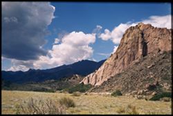
- Subject:
- Rocks, Roads, Trees, Shadows, Mountains, Shrubs, and Clouds
- Series:
- 14-40
- Creator:
- Cushman, Charles W., 1896-1972
- Date Created:
- 1940-07-19
- Genre:
- Landscape photographs
- Frame Number:
- 8
- County:
- El Paso
- Abstract:
- Clouds and mountains near Colorado Springs.
- Call Number:
- P02026
- City:
- Colorado Springs
- Country:
- United States
- State/Province:
- Colorado
- Physical Description:
- Image was originally mounted in a glass enclosure. Before digitization, the image was removed and placed in a Wess Plastic, Inc. brand, 2" x 2", pl...
- Alternate Identifier:
- 1440.8
- Persistent URL:
- http://purl.dlib.indiana.edu/iudl/archives/cushman/P02026
- Holding Location:
- Bloomington - University Archives
Wells Library E460
1320 E 10th St.
Bloomington, IN 47405
Contact at archives@indiana.edu, 812-855-1127
-
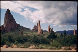
- Subject:
- Rocks, Roads, Trees, Shadows, Mountains, Shrubs, Clouds, Garden of the Gods (Colorado Springs, Colo.), and Rock formations
- Series:
- 14-40
- Creator:
- Cushman, Charles W., 1896-1972
- Date Created:
- 1940-07-19
- Genre:
- Landscape photographs
- Frame Number:
- 7
- County:
- El Paso
- Abstract:
- Strange rock formations = Garden of the Gods.
- Call Number:
- P02025
- City:
- Colorado Springs
- Country:
- United States
- State/Province:
- Colorado
- Physical Description:
- Image was originally mounted in a glass enclosure. Before digitization, the image was removed and placed in a Wess Plastic, Inc. brand, 2" x 2", pl...
- Alternate Identifier:
- 1440.7
- Persistent URL:
- http://purl.dlib.indiana.edu/iudl/archives/cushman/P02025
- Holding Location:
- Bloomington - University Archives
Wells Library E460
1320 E 10th St.
Bloomington, IN 47405
Contact at archives@indiana.edu, 812-855-1127
-
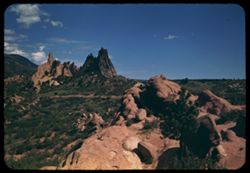
- Subject:
- Hills, Automobiles, Roads, Mountains, Shrubs, Trees, Buildings, Signs (Notices), Wildflowers, Garden of the Gods (Colorado Springs, Colo.), and Dwellings
- Series:
- 14-40
- Creator:
- Cushman, Charles W., 1896-1972
- Date Created:
- 1940-07-19
- Genre:
- Cityscape photographs
- Frame Number:
- 2
- County:
- El Paso
- Abstract:
- In the Garden of the Gods- near Colo. Spgs.
- Call Number:
- P01820
- City:
- Colorado Springs
- Country:
- United States
- State/Province:
- Colorado
- Alternate Identifier:
- 1440.2
- Persistent URL:
- http://purl.dlib.indiana.edu/iudl/archives/cushman/P01820
- Holding Location:
- Bloomington - University Archives
Wells Library E460
1320 E 10th St.
Bloomington, IN 47405
Contact at archives@indiana.edu, 812-855-1127