
Search Constraints
You searched for:
Campus
IUB
Remove constraint Campus: IUB
Subject
Shrubs
Remove constraint Subject: Shrubs
Subject
Roads
Remove constraint Subject: Roads
« Previous |
1 - 100 of 384
|
Next »
Search Results
-
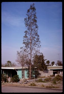
- Description:
- 100 f 11
- Subject:
- Rocks, Houses, Trees, Shrubs, Porches, Palms, and Roads
- Series:
- 3-69
- Creator:
- Cushman, Charles W., 1896-1972
- Date Created:
- 1969-03-18
- Genre:
- Snapshots
- Frame Number:
- 2
- County:
- Riverside
- Abstract:
- Tall spindly tree
- Call Number:
- P15756
- City:
- Palm Springs
- Country:
- United States
- State/Province:
- California
- Alternate Identifier:
- 369.2
- Persistent URL:
- http://purl.dlib.indiana.edu/iudl/archives/cushman/P15756
- Holding Location:
- Bloomington - University Archives
Wells Library E460
1320 E 10th St.
Bloomington, IN 47405
Contact at archives@indiana.edu, 812-855-1127
-
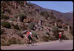
- Description:
- 100 f 11 TL
- Subject:
- Rocks, Families, Children, Valleys, Electric lines, Roads, Trees, Bicycles & tricycles, Palm Canyon (Calif.), Shrubs, and Mountains
- Series:
- 2-69
- Creator:
- Cushman, Charles W., 1896-1972
- Date Created:
- 1969-03-16
- Genre:
- Snapshots
- Frame Number:
- 29
- County:
- Riverside
- Call Number:
- P15746
- Country:
- United States
- State/Province:
- California
- Alternate Identifier:
- 269.29
- Persistent URL:
- http://purl.dlib.indiana.edu/iudl/archives/cushman/P15746
- Holding Location:
- Bloomington - University Archives
Wells Library E460
1320 E 10th St.
Bloomington, IN 47405
Contact at archives@indiana.edu, 812-855-1127
-
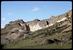
- Description:
- 100 f 11 tl
- Subject:
- Rocks, Cliffs, Grazing, Mining, Cattle, Mountains, Rock formations, Utility poles, Roads, and Shrubs
- Series:
- 9-66
- Creator:
- Cushman, Charles W., 1896-1972
- Date Created:
- 1966-06-14
- Genre:
- Landscape photographs
- Frame Number:
- 22
- Street Address:
- Colorado State Highway 93
- County:
- Jefferson and Boulder
- Call Number:
- P15425
- City:
- Golden and Boulder
- Country:
- United States
- State/Province:
- Colorado
- Alternate Identifier:
- 966.22
- Persistent URL:
- http://purl.dlib.indiana.edu/iudl/archives/cushman/P15425
- Holding Location:
- Bloomington - University Archives
Wells Library E460
1320 E 10th St.
Bloomington, IN 47405
Contact at archives@indiana.edu, 812-855-1127
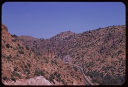
-

- Description:
- 100 f 13
- Subject:
- Rocks, Grasses, Roads, Mountains, Shrubs, Bridges, Animas River (Colo. and N.M.), and Rivers
- Series:
- 34-65
- Creator:
- Cushman, Charles W., 1896-1972
- Date Created:
- 1965-10-03
- Genre:
- Landscape photographs
- Frame Number:
- 12
- County:
- La Plata
- Abstract:
- Animas river below Durango
- Call Number:
- P15004
- City:
- Durango
- Country:
- United States
- State/Province:
- Colorado
- Alternate Identifier:
- 3465.12
- Persistent URL:
- http://purl.dlib.indiana.edu/iudl/archives/cushman/P15004
- Holding Location:
- Bloomington - University Archives
Wells Library E460
1320 E 10th St.
Bloomington, IN 47405
Contact at archives@indiana.edu, 812-855-1127
-
- Description:
- 100 f 11
- Subject:
- Roads, Trees, Chimneys, Roofs, Sidewalks, Shrubs, Houses, and Hedges (Plants)
- Series:
- 32-65
- Creator:
- Cushman, Charles W., 1896-1972
- Date Created:
- 1965-10-02
- Genre:
- Views
- Frame Number:
- 15
- County:
- La Plata
- Abstract:
- Tree nearby
- Call Number:
- P14933
- City:
- Durango
- Country:
- United States
- State/Province:
- Colorado
- Alternate Identifier:
- 3265.15
- Persistent URL:
- http://purl.dlib.indiana.edu/iudl/archives/cushman/P14933
- Holding Location:
- Bloomington - University Archives
Wells Library E460
1320 E 10th St.
Bloomington, IN 47405
Contact at archives@indiana.edu, 812-855-1127
-
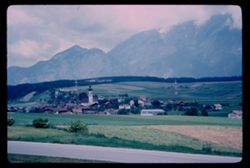
- Description:
- 100 f 5.6
- Subject:
- Towers, Spires, Valleys, Roads, Cities & towns, Churches, Shrubs, Stubay Valley (Austria), Dwellings, Hills, Mountains, and Croplands
- Series:
- 17-64
- Creator:
- Cushman, Charles W., 1896-1972
- Date Created:
- 1964-06-09
- Genre:
- Landscape photographs and Cityscape photographs
- Frame Number:
- 4
- Abstract:
- Mutters
- Call Number:
- P13545
- City:
- Innsbruck and Mutters
- Country:
- Austria
- State/Province:
- Tyrol
- Alternate Identifier:
- 1764.4
- Persistent URL:
- http://purl.dlib.indiana.edu/iudl/archives/cushman/P13545
- Holding Location:
- Bloomington - University Archives
Wells Library E460
1320 E 10th St.
Bloomington, IN 47405
Contact at archives@indiana.edu, 812-855-1127
-
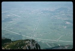
- Description:
- 100 f 8
- Subject:
- Rock formations, Hills, Mountains, Untersberg (Austria), Shrubs, Roads, Airports, and Cliffs
- Series:
- 9-64
- Creator:
- Cushman, Charles W., 1896-1972
- Date Created:
- 1964-05-24
- Genre:
- Landscape photographs
- Frame Number:
- 17
- Abstract:
- On Untersberg Toward Salzburg
- Call Number:
- P13257
- City:
- Salzburg
- Country:
- Austria
- State/Province:
- Salzburg
- Alternate Identifier:
- 964.17
- Persistent URL:
- http://purl.dlib.indiana.edu/iudl/archives/cushman/P13257
- Holding Location:
- Bloomington - University Archives
Wells Library E460
1320 E 10th St.
Bloomington, IN 47405
Contact at archives@indiana.edu, 812-855-1127
-
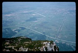
- Description:
- 100 f 8
- Subject:
- Airports, Forests, Roads, Untersberg (Austria), Mountains, Shrubs, and Rock formations
- Series:
- 9-64
- Creator:
- Cushman, Charles W., 1896-1972
- Date Created:
- 1964-05-24
- Genre:
- Cityscape photographs and Views
- Frame Number:
- 14
- Abstract:
- On Untersberg Airport
- Call Number:
- P13254
- City:
- Salzburg
- Country:
- Austria
- State/Province:
- Salzburg
- Alternate Identifier:
- 964.14
- Persistent URL:
- http://purl.dlib.indiana.edu/iudl/archives/cushman/P13254
- Holding Location:
- Bloomington - University Archives
Wells Library E460
1320 E 10th St.
Bloomington, IN 47405
Contact at archives@indiana.edu, 812-855-1127
-
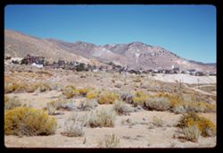
- Description:
- 100 f 6.3 SL
- Subject:
- Grasses, Houses, Churches, Shrubs, Hills, Utility poles, Roads, and Buildings
- Series:
- 3-62
- Creator:
- Cushman, Charles W., 1896-1972
- Date Created:
- 1962-09-29
- Genre:
- Landscape photographs and Cityscape photographs
- Frame Number:
- 24
- County:
- Storey
- Abstract:
- Virginia Cy.
- Call Number:
- P12881
- City:
- Virginia City
- Country:
- United States
- State/Province:
- Nevada
- Alternate Identifier:
- 362.24
- Persistent URL:
- http://purl.dlib.indiana.edu/iudl/archives/cushman/P12881
- Holding Location:
- Bloomington - University Archives
Wells Library E460
1320 E 10th St.
Bloomington, IN 47405
Contact at archives@indiana.edu, 812-855-1127
-
- Description:
- 100 f 11 SL
- Subject:
- Erosion, Cliffs, Mesas, Mountains, Rock formations, Utility poles, Roads, and Shrubs
- Series:
- 5-62
- Creator:
- Cushman, Charles W., 1896-1972
- Date Created:
- 1962-10-07
- Genre:
- Landscape photographs
- Frame Number:
- 22
- Street Address:
- Sitgreaves Pass
- County:
- Mohave
- Abstract:
- West side of Sitgreaves Pass
- Call Number:
- P12789
- Country:
- United States
- State/Province:
- Arizona
- Alternate Identifier:
- 562.22
- Persistent URL:
- http://purl.dlib.indiana.edu/iudl/archives/cushman/P12789
- Holding Location:
- Bloomington - University Archives
Wells Library E460
1320 E 10th St.
Bloomington, IN 47405
Contact at archives@indiana.edu, 812-855-1127
-
- Description:
- 100 f 11 SL
- Subject:
- Rocks, Erosion, Cliffs, Buttes, Mountains, Shrubs, Hills, Roads, and Rock formations
- Series:
- 5-62
- Creator:
- Cushman, Charles W., 1896-1972
- Date Created:
- 1962-10-07
- Genre:
- Landscape photographs
- Frame Number:
- 20
- Street Address:
- Sitgreaves Pass
- County:
- Mohave
- Abstract:
- Light + dark rock
- Call Number:
- P12787
- Country:
- United States
- State/Province:
- Arizona
- Alternate Identifier:
- 562.20
- Persistent URL:
- http://purl.dlib.indiana.edu/iudl/archives/cushman/P12787
- Holding Location:
- Bloomington - University Archives
Wells Library E460
1320 E 10th St.
Bloomington, IN 47405
Contact at archives@indiana.edu, 812-855-1127
-
- Description:
- 100 f 9
- Subject:
- Hills, Roads, Cliffs, Mountains, Shrubs, Trees, and Grasses
- Series:
- 5-62
- Creator:
- Cushman, Charles W., 1896-1972
- Date Created:
- 1962-10-05
- Genre:
- Landscape photographs
- Frame Number:
- 17
- County:
- Coconino
- Abstract:
- East from 6 or 7 mi. west of Sedona
- Call Number:
- P12784
- City:
- Sedona
- Country:
- United States
- State/Province:
- Arizona
- Alternate Identifier:
- 562.17
- Persistent URL:
- http://purl.dlib.indiana.edu/iudl/archives/cushman/P12784
- Holding Location:
- Bloomington - University Archives
Wells Library E460
1320 E 10th St.
Bloomington, IN 47405
Contact at archives@indiana.edu, 812-855-1127
-
- Description:
- 100 f 11
- Subject:
- Hills, Roads, Cliffs, Mountains, Shrubs, Trees, and Grasses
- Series:
- 5-62
- Creator:
- Cushman, Charles W., 1896-1972
- Date Created:
- 1962-10-05
- Genre:
- Landscape photographs
- Frame Number:
- 16
- County:
- Coconino
- Abstract:
- East from 6 or 7 mi. west of Sedona
- Call Number:
- P12783
- City:
- Sedona
- Country:
- United States
- State/Province:
- Arizona
- Alternate Identifier:
- 562.16
- Persistent URL:
- http://purl.dlib.indiana.edu/iudl/archives/cushman/P12783
- Holding Location:
- Bloomington - University Archives
Wells Library E460
1320 E 10th St.
Bloomington, IN 47405
Contact at archives@indiana.edu, 812-855-1127
-
- Description:
- 100 f 6.3 TL
- Subject:
- Roads, Mountains, Shrubs, Clouds, Hills, and Utility poles
- Series:
- 3-62
- Creator:
- Cushman, Charles W., 1896-1972
- Date Created:
- 1962-09-28
- Genre:
- Landscape photographs
- Frame Number:
- 19
- County:
- Storey
- Abstract:
- View east from Va. Cy.
- Call Number:
- P12717
- City:
- Virginia City
- Country:
- United States
- State/Province:
- Nevada
- Alternate Identifier:
- 362.19
- Persistent URL:
- http://purl.dlib.indiana.edu/iudl/archives/cushman/P12717
- Holding Location:
- Bloomington - University Archives
Wells Library E460
1320 E 10th St.
Bloomington, IN 47405
Contact at archives@indiana.edu, 812-855-1127
-
- Description:
- 100 f 6.3 TL
- Subject:
- Rocks, Roads, Trees, Mountains, Shrubs, Lakes & ponds, Clouds, Sierra Nevada (Calif. and Nev.), Forests, Hills, Echo Summit (El Dorado County, Calif.), a...
- Series:
- 3-62
- Creator:
- Cushman, Charles W., 1896-1972
- Date Created:
- 1962-09-28
- Genre:
- Landscape photographs
- Frame Number:
- 11
- Street Address:
- United States Highway 50
- Abstract:
- Toward Lake Tahoe.
- Call Number:
- P12709
- Country:
- United States
- State/Province:
- California
- Alternate Identifier:
- 362.11
- Persistent URL:
- http://purl.dlib.indiana.edu/iudl/archives/cushman/P12709
- Holding Location:
- Bloomington - University Archives
Wells Library E460
1320 E 10th St.
Bloomington, IN 47405
Contact at archives@indiana.edu, 812-855-1127
-
- Description:
- 100 f 6.3 SL
- Subject:
- Walls, Railings, Roads, Automobiles, Trees, Mountains, Shrubs, Sierra Nevada (Calif. and Nev.), Stone walls, Rocks, Houses, and Echo Summit (El Dorado County...
- Series:
- 3-62
- Creator:
- Cushman, Charles W., 1896-1972
- Date Created:
- 1962-09-28
- Genre:
- Landscape photographs
- Frame Number:
- 7
- Street Address:
- United States Highway 50
- Abstract:
- Wall above US 50.
- Call Number:
- P12705
- Country:
- United States
- State/Province:
- California
- Alternate Identifier:
- 362.7
- Persistent URL:
- http://purl.dlib.indiana.edu/iudl/archives/cushman/P12705
- Holding Location:
- Bloomington - University Archives
Wells Library E460
1320 E 10th St.
Bloomington, IN 47405
Contact at archives@indiana.edu, 812-855-1127
-
- Description:
- 100 f 8 TL
- Subject:
- Roads, Orange trees, San Gorgonio Mountain (Calif.), Trees, Flowers, Mountains, Buildings, Shrubs, Clouds, and Indio Hacienda (Indio, Calif.)
- Series:
- 24-61
- Creator:
- Cushman, Charles W., 1896-1972
- Date Created:
- 1961-01-01
- Genre:
- Landscape photographs and Views
- Frame Number:
- 33
- County:
- Riverside and San Bernardino
- Abstract:
- San Gorgonio and San Gorgonio from Indio Hacienda
- Call Number:
- P12599
- City:
- Indio
- Country:
- United States
- State/Province:
- California
- Alternate Identifier:
- 2461.33
- Persistent URL:
- http://purl.dlib.indiana.edu/iudl/archives/cushman/P12599
- Holding Location:
- Bloomington - University Archives
Wells Library E460
1320 E 10th St.
Bloomington, IN 47405
Contact at archives@indiana.edu, 812-855-1127
-
- Description:
- 100 f 6.3 TL
- Subject:
- Rocks, Roads, Trees, San Jacinto Mountains (Calif.), San Bernardino National Forest (Calif.), Mountains, Rock formations, and Shrubs
- Series:
- 24-61
- Creator:
- Cushman, Charles W., 1896-1972
- Date Created:
- 1961-12-27
- Genre:
- Landscape photographs
- Frame Number:
- 20
- Street Address:
- California State Highway 74
- County:
- Riverside
- Abstract:
- San Jacinto Mountains in San Bernardino Nat'l Forest and Mtns in San Bernardino Natl Forest - from Cal 74
- Call Number:
- P12586
- Country:
- United States
- State/Province:
- California
- Alternate Identifier:
- 2461.20
- Persistent URL:
- http://purl.dlib.indiana.edu/iudl/archives/cushman/P12586
- Holding Location:
- Bloomington - University Archives
Wells Library E460
1320 E 10th St.
Bloomington, IN 47405
Contact at archives@indiana.edu, 812-855-1127
-
- Description:
- 100 f 6.3 TL
- Subject:
- Stores & shops, Roads, Markets, San Jacinto Peak (Calif.), Signs (Notices), Mountains, Shrubs, Utility poles, and Palms
- Series:
- 24-61
- Creator:
- Cushman, Charles W., 1896-1972
- Date Created:
- 1961-12-25
- Genre:
- Landscape photographs
- Frame Number:
- 3
- County:
- Riverside
- Abstract:
- San Jacinto
- Call Number:
- P12569
- Country:
- United States
- State/Province:
- California
- Alternate Identifier:
- 2461.3
- Persistent URL:
- http://purl.dlib.indiana.edu/iudl/archives/cushman/P12569
- Holding Location:
- Bloomington - University Archives
Wells Library E460
1320 E 10th St.
Bloomington, IN 47405
Contact at archives@indiana.edu, 812-855-1127
-
- Description:
- 100 f 6.3 TL
- Subject:
- San Gorgonio Mountain (Calif.), Mountains, Utility poles, Palms, Shrubs, Roads, and Dwellings
- Series:
- 24-61
- Creator:
- Cushman, Charles W., 1896-1972
- Date Created:
- 1961-12-25
- Genre:
- Landscape photographs
- Frame Number:
- 2
- County:
- San Bernardino
- Abstract:
- Mr San Gorgonio and Mt. San Gorgonio
- Call Number:
- P12568
- City:
- Palm Desert
- Country:
- United States
- State/Province:
- California
- Alternate Identifier:
- 2461.2
- Persistent URL:
- http://purl.dlib.indiana.edu/iudl/archives/cushman/P12568
- Holding Location:
- Bloomington - University Archives
Wells Library E460
1320 E 10th St.
Bloomington, IN 47405
Contact at archives@indiana.edu, 812-855-1127
-
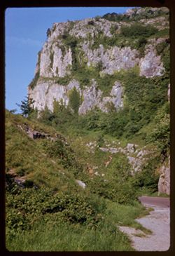
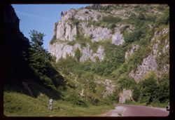
- Description:
- 50 f 6.3
- Subject:
- Canyons, Cliffs, Cheddar Gorge (England), Shrubs, and Roads
- Series:
- 7-61
- Creator:
- Cushman, Charles W., 1896-1972
- Date Created:
- 1961-05-11
- Genre:
- Landscape photographs
- Frame Number:
- 22
- County:
- Somerset
- Abstract:
- Cheddar Gorge
- Call Number:
- P11959
- City:
- Cheddar
- Country:
- United Kingdom
- State/Province:
- England
- Alternate Identifier:
- 761.22
- Persistent URL:
- http://purl.dlib.indiana.edu/iudl/archives/cushman/P11959
- Holding Location:
- Bloomington - University Archives
Wells Library E460
1320 E 10th St.
Bloomington, IN 47405
Contact at archives@indiana.edu, 812-855-1127
-
- Description:
- 50 f 6.3
- Subject:
- Canyons, Roads, Cheddar Gorge (England), Trees, Shadows, Shrubs, Boys, and Cliffs
- Series:
- 7-61
- Creator:
- Cushman, Charles W., 1896-1972
- Date Created:
- 1961-05-11
- Genre:
- Landscape photographs
- Frame Number:
- 21
- County:
- Somerset
- Abstract:
- Cheddar Gorge
- Call Number:
- P11958
- City:
- Cheddar
- Country:
- United Kingdom
- State/Province:
- England
- Alternate Identifier:
- 761.21
- Persistent URL:
- http://purl.dlib.indiana.edu/iudl/archives/cushman/P11958
- Holding Location:
- Bloomington - University Archives
Wells Library E460
1320 E 10th St.
Bloomington, IN 47405
Contact at archives@indiana.edu, 812-855-1127
-
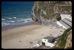
- Description:
- 100 f 8 ?
- Subject:
- Oceans, Seas, Cliffs, Roofs, Buildings, Shrubs, Atlantic Ocean, People, Sunbathing, Roads, and Beaches
- Series:
- 7-61
- Creator:
- Cushman, Charles W., 1896-1972
- Date Created:
- 1961-05-10
- Genre:
- Seascapes and Views
- Frame Number:
- 2
- County:
- Cornwall
- Abstract:
- Sea
- Call Number:
- P11939
- City:
- Newquay
- Country:
- United Kingdom
- State/Province:
- England
- Alternate Identifier:
- 761.2
- Persistent URL:
- http://purl.dlib.indiana.edu/iudl/archives/cushman/P11939
- Holding Location:
- Bloomington - University Archives
Wells Library E460
1320 E 10th St.
Bloomington, IN 47405
Contact at archives@indiana.edu, 812-855-1127
-
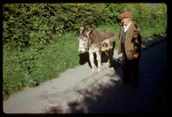
- Description:
- 50 f 6.3
- Subject:
- Men, Grasses, Roads, Shadows, Shrubs, Donkeys, and City & town life
- Series:
- 6-61
- Creator:
- Cushman, Charles W., 1896-1972
- Date Created:
- 1961-05-09
- Genre:
- Snapshots and Portraits
- Frame Number:
- 29
- County:
- Devon
- Abstract:
- Paul, burro
- Call Number:
- P11928
- City:
- Clovelly
- Country:
- United Kingdom
- State/Province:
- England
- Alternate Identifier:
- 661.29
- Persistent URL:
- http://purl.dlib.indiana.edu/iudl/archives/cushman/P11928
- Holding Location:
- Bloomington - University Archives
Wells Library E460
1320 E 10th St.
Bloomington, IN 47405
Contact at archives@indiana.edu, 812-855-1127
-
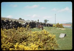
- Description:
- 100 f 5.6
- Subject:
- Rocks, Ponies, Grasses, Dartmoor (England), Grazing, Flowers, Meadows, Buildings, Shrubs, Utility poles, Stone walls, Moors (Wetlands), and Roads
- Series:
- 6-61
- Creator:
- Cushman, Charles W., 1896-1972
- Date Created:
- 1961-05-08
- Genre:
- Snapshots, Views, and Identification photographs
- Frame Number:
- 10
- County:
- Devon
- Abstract:
- Dartmoor Pony
- Call Number:
- P11909
- Country:
- United Kingdom
- State/Province:
- England
- Alternate Identifier:
- 661.10
- Persistent URL:
- http://purl.dlib.indiana.edu/iudl/archives/cushman/P11909
- Holding Location:
- Bloomington - University Archives
Wells Library E460
1320 E 10th St.
Bloomington, IN 47405
Contact at archives@indiana.edu, 812-855-1127
-
- Description:
- 50 f 8
- Subject:
- Grasses, Roads, Grazing, Barbed wire, Livestock, Mountains, Fences, Shrubs, Hills, and Utility poles
- Series:
- 27-60
- Creator:
- Cushman, Charles W., 1896-1972
- Date Created:
- 1960-12-29
- Genre:
- Landscape photographs
- Frame Number:
- 6
- County:
- Santa Barbara
- Abstract:
- Hills north of Gaviota
- Call Number:
- P11748
- City:
- Gaviota
- Country:
- United States
- State/Province:
- California
- Alternate Identifier:
- 2760.6
- Persistent URL:
- http://purl.dlib.indiana.edu/iudl/archives/cushman/P11748
- Holding Location:
- Bloomington - University Archives
Wells Library E460
1320 E 10th St.
Bloomington, IN 47405
Contact at archives@indiana.edu, 812-855-1127
-
- Description:
- 100 f 11 tl
- Subject:
- Forests, Roads, Dirt, Mountains, Shrubs, Snow, Trees, and Hood, Mount (Or.)
- Series:
- 24-60
- Creator:
- Cushman, Charles W., 1896-1972
- Date Created:
- 1960-09-17
- Genre:
- Landscape photographs
- Frame Number:
- 4
- County:
- Clackamas
- Abstract:
- Mt. Hood from south
- Call Number:
- P11659
- Country:
- United States
- State/Province:
- Oregon
- Alternate Identifier:
- 2460.4
- Persistent URL:
- http://purl.dlib.indiana.edu/iudl/archives/cushman/P11659
- Holding Location:
- Bloomington - University Archives
Wells Library E460
1320 E 10th St.
Bloomington, IN 47405
Contact at archives@indiana.edu, 812-855-1127
-
- Description:
- 100 f 4.5 TL
- Subject:
- Flowers, Roads, Cherry trees, Flowering cherries, Utility poles, Trees, Buildings, Fences, and Shrubs
- Series:
- 2-60
- Creator:
- Cushman, Charles W., 1896-1972
- Date Created:
- 1960-03-29
- Genre:
- Landscape photographs
- Frame Number:
- 31
- County:
- Marin
- Abstract:
- Flowering cherry on hts above S. Rafael
- Call Number:
- P10962
- City:
- San Rafael
- Country:
- United States
- State/Province:
- California
- Alternate Identifier:
- 260.31
- Persistent URL:
- http://purl.dlib.indiana.edu/iudl/archives/cushman/P10962
- Holding Location:
- Bloomington - University Archives
Wells Library E460
1320 E 10th St.
Bloomington, IN 47405
Contact at archives@indiana.edu, 812-855-1127
-
- Description:
- 100 f 8 TL
- Subject:
- Roads, Mailboxes, Flowers, Acacia, Tree limbs, Shrubs, and Trees
- Series:
- 2-60
- Creator:
- Cushman, Charles W., 1896-1972
- Date Created:
- 1960-03-08
- Genre:
- Identification photographs
- Frame Number:
- 13
- County:
- Marin
- Abstract:
- Acacia
- Call Number:
- P10944
- City:
- San Rafael
- Country:
- United States
- State/Province:
- California
- Alternate Identifier:
- 260.13
- Persistent URL:
- http://purl.dlib.indiana.edu/iudl/archives/cushman/P10944
- Holding Location:
- Bloomington - University Archives
Wells Library E460
1320 E 10th St.
Bloomington, IN 47405
Contact at archives@indiana.edu, 812-855-1127
-
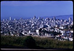
- Description:
- 100 f 8 TL
- Subject:
- Domes, Streets, Hills, Skyscrapers, Roads, Mountains, Shrubs, Buildings, Grasses, Houses, and Dwellings
- Series:
- 12-59
- Creator:
- Cushman, Charles W., 1896-1972
- Date Created:
- 1959-05-10
- Genre:
- Cityscape photographs
- Frame Number:
- 36
- Street Address:
- Clipper Street
- County:
- San Francisco
- Abstract:
- From top of Clipper St.
- Call Number:
- P10798
- City:
- San Francisco
- Country:
- United States
- State/Province:
- California
- Alternate Identifier:
- 1259.36
- Persistent URL:
- http://purl.dlib.indiana.edu/iudl/archives/cushman/P10798
- Holding Location:
- Bloomington - University Archives
Wells Library E460
1320 E 10th St.
Bloomington, IN 47405
Contact at archives@indiana.edu, 812-855-1127
-
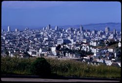
- Description:
- 100 f 8 TL
- Subject:
- Grasses, Houses, Skyscrapers, Streets, Mountains, Buildings, Shrubs, Dwellings, Domes, Roads, and Hills
- Series:
- 12-59
- Creator:
- Cushman, Charles W., 1896-1972
- Date Created:
- 1959-05-10
- Genre:
- Cityscape photographs
- Frame Number:
- 35
- Street Address:
- Clipper Street
- County:
- San Francisco
- Abstract:
- From top of Clipper St.
- Call Number:
- P10797
- City:
- San Francisco
- Country:
- United States
- State/Province:
- California
- Alternate Identifier:
- 1259.35
- Persistent URL:
- http://purl.dlib.indiana.edu/iudl/archives/cushman/P10797
- Holding Location:
- Bloomington - University Archives
Wells Library E460
1320 E 10th St.
Bloomington, IN 47405
Contact at archives@indiana.edu, 812-855-1127
-
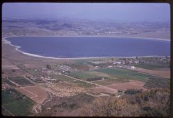
- Description:
- 100 f 6.3 tl
- Subject:
- Lakes & ponds, Cities & towns, Hills, Roads, Mountains, Shrubs, Trees, Buildings, Plants, Houses, and Lake Elsinore (Calif.)
- Series:
- 11-59
- Creator:
- Cushman, Charles W., 1896-1972
- Date Created:
- 1959-03-25
- Genre:
- Aerial photographs
- Frame Number:
- 22
- County:
- Riverside
- Abstract:
- L. Elsinore from above
- Call Number:
- P10747
- City:
- Elsinore
- Country:
- United States
- State/Province:
- California
- Alternate Identifier:
- 1159.22
- Persistent URL:
- http://purl.dlib.indiana.edu/iudl/archives/cushman/P10747
- Holding Location:
- Bloomington - University Archives
Wells Library E460
1320 E 10th St.
Bloomington, IN 47405
Contact at archives@indiana.edu, 812-855-1127
-
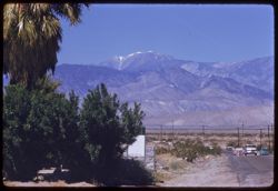
- Description:
- 100 f 8 tl
- Subject:
- Snow, Electric lines, Roads, San Gorgonio Mountain (Calif.), Automobiles, Trees, San Jacinto Peak (Calif.), Mountains, Shrubs, Utility poles, and Palms
- Series:
- 11-59
- Creator:
- Cushman, Charles W., 1896-1972
- Date Created:
- 1959-03-25
- Genre:
- Landscape photographs
- Frame Number:
- 18
- County:
- Riverside
- Abstract:
- Mt. San Gorgonio from road north of Palm Springs
- Call Number:
- P10743
- City:
- Palm Springs
- Country:
- United States
- State/Province:
- California
- Alternate Identifier:
- 1159.18
- Persistent URL:
- http://purl.dlib.indiana.edu/iudl/archives/cushman/P10743
- Holding Location:
- Bloomington - University Archives
Wells Library E460
1320 E 10th St.
Bloomington, IN 47405
Contact at archives@indiana.edu, 812-855-1127
-
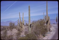
- Description:
- 50 f 11 sl
- Subject:
- Deserts, Roads, Cactus, Mountains, Shrubs, and Saguaro National Park (Ariz.)
- Series:
- 10-59
- Creator:
- Cushman, Charles W., 1896-1972
- Date Created:
- 1959-03-03
- Frame Number:
- 3
- County:
- Pima
- Abstract:
- View north
- Call Number:
- P10691
- City:
- Tucson
- Country:
- United States
- State/Province:
- Arizona
- Alternate Identifier:
- 1059.3
- Persistent URL:
- http://purl.dlib.indiana.edu/iudl/archives/cushman/P10691
- Holding Location:
- Bloomington - University Archives
Wells Library E460
1320 E 10th St.
Bloomington, IN 47405
Contact at archives@indiana.edu, 812-855-1127
-
- Description:
- 100 f 9 tl
- Subject:
- Roads, Automobiles, Mountains, and Shrubs
- Series:
- 9-59
- Creator:
- Cushman, Charles W., 1896-1972
- Date Created:
- 1959-02-27
- Genre:
- Landscape photographs
- Frame Number:
- 22
- Street Address:
- United States Highway 60 and United States Highway 70
- County:
- Pinal and Gila
- Abstract:
- US 60/70 winding eastward over hump from Superior to Miami
- Call Number:
- P10673
- City:
- Superior and Miami
- Country:
- United States
- State/Province:
- Arizona
- Alternate Identifier:
- 959.22
- Persistent URL:
- http://purl.dlib.indiana.edu/iudl/archives/cushman/P10673
- Holding Location:
- Bloomington - University Archives
Wells Library E460
1320 E 10th St.
Bloomington, IN 47405
Contact at archives@indiana.edu, 812-855-1127
-
- Description:
- 100 f 6.3 tl
- Subject:
- Domes, Baboquivari Peak (Ariz.), Automobiles, Arches, Roads, Swings, Mountains, Shrubs, Trees, Buildings, Topara, Bell towers, and Fences
- Series:
- 8-59
- Creator:
- Cushman, Charles W., 1896-1972
- Date Created:
- 1959-02-20
- Genre:
- Landscape photographs
- Frame Number:
- 36
- County:
- Pima
- Abstract:
- Baboquivari Pk seen from Topara
- Call Number:
- P10650
- Country:
- United States
- State/Province:
- Arizona
- Alternate Identifier:
- 859.36
- Persistent URL:
- http://purl.dlib.indiana.edu/iudl/archives/cushman/P10650
- Holding Location:
- Bloomington - University Archives
Wells Library E460
1320 E 10th St.
Bloomington, IN 47405
Contact at archives@indiana.edu, 812-855-1127
-
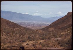
- Description:
- 100 f 6.3 tl
- Subject:
- Roads, Cactus, Cities & towns, Buildings, Gates Pass (Ariz.), Tucson Mountains (Ariz.), Clouds, Dwellings, Mountains, Shrubs, and Traffic signs & sig...
- Series:
- 8-59
- Creator:
- Cushman, Charles W., 1896-1972
- Date Created:
- 1959-02-11
- Genre:
- Cityscape photographs
- Frame Number:
- 3
- County:
- Pima
- Abstract:
- Tucson seen from Gates Pass in Tuscon Mtns.
- Call Number:
- P10617
- City:
- Tucson
- Country:
- United States
- State/Province:
- Arizona
- Alternate Identifier:
- 859.3
- Persistent URL:
- http://purl.dlib.indiana.edu/iudl/archives/cushman/P10617
- Holding Location:
- Bloomington - University Archives
Wells Library E460
1320 E 10th St.
Bloomington, IN 47405
Contact at archives@indiana.edu, 812-855-1127
-
- Description:
- 100 f 6.3 tl
- Subject:
- Rocks, Roads, Cactus, Cities & towns, Buildings, Gates Pass (Ariz.), Traffic signs & signals, Clouds, Dwellings, Mountains, Shrubs, and Tucson Mounta...
- Series:
- 8-59
- Creator:
- Cushman, Charles W., 1896-1972
- Date Created:
- 1959-02-11
- Genre:
- Cityscape photographs
- Frame Number:
- 2
- County:
- Pima
- Abstract:
- Tucson seen from Gates Pass in Tucson Mtns.
- Call Number:
- P10616
- City:
- Tucson
- Country:
- United States
- State/Province:
- Arizona
- Alternate Identifier:
- 859.2
- Persistent URL:
- http://purl.dlib.indiana.edu/iudl/archives/cushman/P10616
- Holding Location:
- Bloomington - University Archives
Wells Library E460
1320 E 10th St.
Bloomington, IN 47405
Contact at archives@indiana.edu, 812-855-1127
-
- Description:
- 100 f 5.6 tl
- Subject:
- Roads, Cactus, Mountains, Buildings, Gates Pass (Ariz.), Tucson Mountains (Ariz.), Clouds, Dwellings, Hills, Cities & towns, Shrubs, and Traffic signs &a...
- Series:
- 8-59
- Creator:
- Cushman, Charles W., 1896-1972
- Date Created:
- 1959-02-11
- Genre:
- Cityscape photographs
- Frame Number:
- 1
- County:
- Pima
- Abstract:
- Tucson seen from Gates Pass in Tucson Mtns.
- Call Number:
- P10615
- City:
- Tucson
- Country:
- United States
- State/Province:
- Arizona
- Alternate Identifier:
- 859.1
- Persistent URL:
- http://purl.dlib.indiana.edu/iudl/archives/cushman/P10615
- Holding Location:
- Bloomington - University Archives
Wells Library E460
1320 E 10th St.
Bloomington, IN 47405
Contact at archives@indiana.edu, 812-855-1127
-
- Description:
- 100 f 6.3 tl
- Subject:
- Walls, Roads, Automobiles, Trees, Buildings, Shrubs, Dwellings, Hills, and Rocks
- Series:
- 7-59
- Creator:
- Cushman, Charles W., 1896-1972
- Date Created:
- 1959-02-06
- Genre:
- Cityscape photographs
- Frame Number:
- 34
- County:
- Cochise
- Abstract:
- Bisbee
- Call Number:
- P10610
- City:
- Bisbee
- Country:
- United States
- State/Province:
- Arizona
- Alternate Identifier:
- 759.34
- Persistent URL:
- http://purl.dlib.indiana.edu/iudl/archives/cushman/P10610
- Holding Location:
- Bloomington - University Archives
Wells Library E460
1320 E 10th St.
Bloomington, IN 47405
Contact at archives@indiana.edu, 812-855-1127
-
- Description:
- 100 f 8 tl
- Subject:
- Roads, Cerro Colorado Mountains (Ariz.), Mountains, and Shrubs
- Series:
- 6-59
- Creator:
- Cushman, Charles W., 1896-1972
- Date Created:
- 1959-01-28
- Genre:
- Landscape photographs
- Frame Number:
- 33
- County:
- Pima
- Abstract:
- Cerro Colorado from SW farther on
- Call Number:
- P10571
- Country:
- United States
- State/Province:
- Arizona
- Alternate Identifier:
- 659.33
- Persistent URL:
- http://purl.dlib.indiana.edu/iudl/archives/cushman/P10571
- Holding Location:
- Bloomington - University Archives
Wells Library E460
1320 E 10th St.
Bloomington, IN 47405
Contact at archives@indiana.edu, 812-855-1127
-
- Description:
- 100 f 6.3 tl
- Subject:
- Channels, Brawley Wash (Ariz.), Roads, Mountains, Shrubs, Electric lines, and Bulls
- Series:
- 6-59
- Creator:
- Cushman, Charles W., 1896-1972
- Date Created:
- 1959-01-28
- Genre:
- Identification photographs
- Frame Number:
- 19
- Street Address:
- Sasabe Road
- County:
- Pima
- Abstract:
- One B B
- Call Number:
- P10557
- Country:
- United States
- State/Province:
- Arizona
- Alternate Identifier:
- 659.19
- Persistent URL:
- http://purl.dlib.indiana.edu/iudl/archives/cushman/P10557
- Holding Location:
- Bloomington - University Archives
Wells Library E460
1320 E 10th St.
Bloomington, IN 47405
Contact at archives@indiana.edu, 812-855-1127
-
- Description:
- 100 f 6.3 tl
- Subject:
- Channels, Brawley Wash (Ariz.), Roads, Mountains, Shrubs, Electric lines, and Bulls
- Series:
- 6-59
- Creator:
- Cushman, Charles W., 1896-1972
- Date Created:
- 1959-01-28
- Genre:
- Identification photographs
- Frame Number:
- 18
- Street Address:
- Sasabe Road
- County:
- Pima
- Abstract:
- 2 Brahma bulls on Sasabe road
- Call Number:
- P10556
- Country:
- United States
- State/Province:
- Arizona
- Alternate Identifier:
- 659.18
- Persistent URL:
- http://purl.dlib.indiana.edu/iudl/archives/cushman/P10556
- Holding Location:
- Bloomington - University Archives
Wells Library E460
1320 E 10th St.
Bloomington, IN 47405
Contact at archives@indiana.edu, 812-855-1127
-
- Description:
- 100 f 8 tl
- Subject:
- Franklin Mountains (Tex. and N.M.), Electric lines, Roads, Arches, Mountains, Buildings, Shrubs, Windows, Utility poles, Doors & doorways, Rocks, and Chu...
- Series:
- 5-59
- Creator:
- Cushman, Charles W., 1896-1972
- Date Created:
- 1959-01-21
- Genre:
- Landscape photographs and Architectural photographs
- Frame Number:
- 11
- County:
- El Paso
- Abstract:
- Little church below Franklin Mts. NW of El Paso
- Call Number:
- P10512
- City:
- El Paso
- Country:
- United States
- State/Province:
- Texas
- Alternate Identifier:
- 559.11
- Persistent URL:
- http://purl.dlib.indiana.edu/iudl/archives/cushman/P10512
- Holding Location:
- Bloomington - University Archives
Wells Library E460
1320 E 10th St.
Bloomington, IN 47405
Contact at archives@indiana.edu, 812-855-1127
-
- Description:
- 50 f 8 tl
- Subject:
- Apartment houses, Roads, Trees, Shrubs, Masonry, Dwellings, Columns, Stone walls, and Clotheslines
- Series:
- 5-59
- Creator:
- Cushman, Charles W., 1896-1972
- Date Created:
- 1959-01-21
- Genre:
- Architectural photographs
- Frame Number:
- 5
- Street Address:
- Stevens Street and Pera Street
- County:
- El Paso
- Abstract:
- Washing on lines - Apt. house (?) at corner of Pera St and Stevens
- Call Number:
- P10506
- City:
- El Paso
- Country:
- United States
- State/Province:
- Texas
- Alternate Identifier:
- 559.5
- Persistent URL:
- http://purl.dlib.indiana.edu/iudl/archives/cushman/P10506
- Holding Location:
- Bloomington - University Archives
Wells Library E460
1320 E 10th St.
Bloomington, IN 47405
Contact at archives@indiana.edu, 812-855-1127
-
- Description:
- 100 f 5.6 tl
- Subject:
- Hills, Roads, Shrubs, Trees, Buttes, Clouds, Fences, and Grasses
- Series:
- 5-59
- Creator:
- Cushman, Charles W., 1896-1972
- Date Created:
- 1959-01-19
- Genre:
- Landscape photographs
- Frame Number:
- 3
- County:
- Jeff Davis and Culberson
- Abstract:
- A butte on road to Kent
- Call Number:
- P10504
- City:
- Kent and Fort Davis
- Country:
- United States
- State/Province:
- Texas
- Alternate Identifier:
- 559.3
- Persistent URL:
- http://purl.dlib.indiana.edu/iudl/archives/cushman/P10504
- Holding Location:
- Bloomington - University Archives
Wells Library E460
1320 E 10th St.
Bloomington, IN 47405
Contact at archives@indiana.edu, 812-855-1127
-
- Description:
- 100 f 6.3 tl
- Subject:
- Rocks, Roads, Davis Mountains (Tex.), Signs (Notices), Mountains, Fences, and Shrubs
- Series:
- 4-59
- Creator:
- Cushman, Charles W., 1896-1972
- Date Created:
- 1959-01-19
- Genre:
- Landscape photographs
- Frame Number:
- 35
- County:
- Jeff Davis and Brewster
- Abstract:
- Toward Davis Mtns.
- Call Number:
- P10499
- City:
- Fort Davis and Alpine
- Country:
- United States
- State/Province:
- Texas
- Alternate Identifier:
- 459.35
- Persistent URL:
- http://purl.dlib.indiana.edu/iudl/archives/cushman/P10499
- Holding Location:
- Bloomington - University Archives
Wells Library E460
1320 E 10th St.
Bloomington, IN 47405
Contact at archives@indiana.edu, 812-855-1127
-
- Description:
- 50 f 8 sl
- Subject:
- Rocks, Canyons, Roads, Shrubs, Rivers, and Pecos River (N.M. and Tex.)
- Series:
- 4-59
- Creator:
- Cushman, Charles W., 1896-1972
- Date Created:
- 1959-01-18
- Genre:
- Landscape photographs
- Frame Number:
- 30
- Street Address:
- United States Highway 90
- Abstract:
- Pecos river canyon below Hwy 90 bridge
- Call Number:
- P10494
- Country:
- United States
- State/Province:
- Texas
- Alternate Identifier:
- 459.30
- Persistent URL:
- http://purl.dlib.indiana.edu/iudl/archives/cushman/P10494
- Holding Location:
- Bloomington - University Archives
Wells Library E460
1320 E 10th St.
Bloomington, IN 47405
Contact at archives@indiana.edu, 812-855-1127
-

- Description:
- 100 f 5.6 TL
- Subject:
- Roads, Mountains, Shrubs, Snow, Trees, Clouds, and East Humboldt Range (Nev.)
- Series:
- 12-58
- Creator:
- Cushman, Charles W., 1896-1972
- Date Created:
- 1958-06-17
- Genre:
- Landscape photographs
- Frame Number:
- 31
- County:
- Elko
- Abstract:
- Large snow-covered ridge west of pt. 7105 mi. (on 93 - 10 mi n. of Wells)
- Call Number:
- P10042
- City:
- Wells
- Country:
- United States
- State/Province:
- Nevada
- Alternate Identifier:
- 1258.31
- Persistent URL:
- http://purl.dlib.indiana.edu/iudl/archives/cushman/P10042
- Holding Location:
- Bloomington - University Archives
Wells Library E460
1320 E 10th St.
Bloomington, IN 47405
Contact at archives@indiana.edu, 812-855-1127
-
- Description:
- 100 f 6.3 SL
- Subject:
- Rocks, Canyons, Roads, Malheur Canyon (Or.), Volcanic rock, Mountains, Shrubs, and Clouds
- Series:
- 11-58
- Creator:
- Cushman, Charles W., 1896-1972
- Date Created:
- 1958-06-14
- Genre:
- Landscape photographs
- Frame Number:
- 10
- County:
- Malheur and Harney
- Abstract:
- Great red hunk
- Call Number:
- P09985
- City:
- Burns
- Country:
- United States
- State/Province:
- Oregon
- Alternate Identifier:
- 1158.10
- Persistent URL:
- http://purl.dlib.indiana.edu/iudl/archives/cushman/P09985
- Holding Location:
- Bloomington - University Archives
Wells Library E460
1320 E 10th St.
Bloomington, IN 47405
Contact at archives@indiana.edu, 812-855-1127
-
- Description:
- 100 f 8 TL
- Subject:
- Canyons, Roads, Shrubs, Trees, and Malheur River (Or.)
- Series:
- 11-58
- Creator:
- Cushman, Charles W., 1896-1972
- Date Created:
- 1958-06-14
- Genre:
- Landscape photographs
- Frame Number:
- 4
- County:
- Malheur
- Abstract:
- View back up Malheur
- Call Number:
- P09979
- Country:
- United States
- State/Province:
- Oregon
- Alternate Identifier:
- 1158.4
- Persistent URL:
- http://purl.dlib.indiana.edu/iudl/archives/cushman/P09979
- Holding Location:
- Bloomington - University Archives
Wells Library E460
1320 E 10th St.
Bloomington, IN 47405
Contact at archives@indiana.edu, 812-855-1127
-
- Description:
- 50 f 8 sl
- Subject:
- Canyons, Roads, Women, Automobiles, Trees, Niles Canyon (Alameda County, Calif.), Shrubs, and Fairlane automobile
- Series:
- 1-58
- Creator:
- Cushman, Charles W., 1896-1972
- Date Created:
- 1958-02-20
- Genre:
- Landscape photographs, Views, and Portraits
- Frame Number:
- 21
- County:
- Alameda
- Persons Pictured:
- Cushman, Jean
- Abstract:
- New Ford in Niles Canyon
- Call Number:
- P09680
- Country:
- United States
- State/Province:
- California
- Alternate Identifier:
- 158.21
- Persistent URL:
- http://purl.dlib.indiana.edu/iudl/archives/cushman/P09680
- Holding Location:
- Bloomington - University Archives
Wells Library E460
1320 E 10th St.
Bloomington, IN 47405
Contact at archives@indiana.edu, 812-855-1127
-
- Description:
- 100 f 5.6 tl
- Subject:
- Roads, Farms, Trees, Croplands, Shrubs, Hills, and Agricultural facilities
- Series:
- 17-57
- Creator:
- Cushman, Charles W., 1896-1972
- Date Created:
- 1957-11-21
- Genre:
- Landscape photographs and Views
- Frame Number:
- 4
- County:
- San Mateo
- Abstract:
- Cultivated slopes near San Gregorio
- Call Number:
- P09606
- City:
- San Gregorio
- Country:
- United States
- State/Province:
- California
- Alternate Identifier:
- 1757.4
- Persistent URL:
- http://purl.dlib.indiana.edu/iudl/archives/cushman/P09606
- Holding Location:
- Bloomington - University Archives
Wells Library E460
1320 E 10th St.
Bloomington, IN 47405
Contact at archives@indiana.edu, 812-855-1127
-
- Description:
- 100 f 4 tl
- Subject:
- San Marcos Pass (Calif.), Santa Ynez Mountains (Calif.), Roads, Mountains, Shrubs, Passes (Landforms), and Hills
- Series:
- 15-57
- Creator:
- Cushman, Charles W., 1896-1972
- Date Created:
- 1957-09-20
- Genre:
- Landscape photographs
- Frame Number:
- 7
- Street Address:
- San Marcos Pass Road
- County:
- San Diego
- Abstract:
- View up toward San marcos pass
- Call Number:
- P09542
- Country:
- United States
- State/Province:
- California
- Alternate Identifier:
- 1557.7
- Persistent URL:
- http://purl.dlib.indiana.edu/iudl/archives/cushman/P09542
- Holding Location:
- Bloomington - University Archives
Wells Library E460
1320 E 10th St.
Bloomington, IN 47405
Contact at archives@indiana.edu, 812-855-1127
-
- Description:
- 100 f 5.6
- Subject:
- Canyons, Roads, Feather River (Calif.), Trees, Shrubs, Trucks, Forests, Rivers, Cliffs, and Feather River Canyon (Calif.)
- Series:
- 12-57
- Creator:
- Cushman, Charles W., 1896-1972
- Date Created:
- 1957-07-26
- Genre:
- Landscape photographs
- Frame Number:
- 20
- County:
- Plumas
- Abstract:
- Feather river canyon below Virgilia
- Call Number:
- P09465
- City:
- Virgilia
- Country:
- United States
- State/Province:
- California
- Alternate Identifier:
- 1257.20
- Persistent URL:
- http://purl.dlib.indiana.edu/iudl/archives/cushman/P09465
- Holding Location:
- Bloomington - University Archives
Wells Library E460
1320 E 10th St.
Bloomington, IN 47405
Contact at archives@indiana.edu, 812-855-1127
-
- Description:
- 100 f 8 tl
- Subject:
- Croplands, Roads, Cattle, Shrubs, Grazing, and Grasses
- Series:
- 13-56
- Creator:
- Cushman, Charles W., 1896-1972
- Date Created:
- 1956-10-22
- Genre:
- Landscape photographs
- Frame Number:
- 7
- County:
- San Mateo
- Abstract:
- Cattle in a nearby field
- Call Number:
- P08980
- City:
- San Gregorio and Pescadero
- Country:
- United States
- State/Province:
- California
- Alternate Identifier:
- 1356.7
- Persistent URL:
- http://purl.dlib.indiana.edu/iudl/archives/cushman/P08980
- Holding Location:
- Bloomington - University Archives
Wells Library E460
1320 E 10th St.
Bloomington, IN 47405
Contact at archives@indiana.edu, 812-855-1127
-
- Description:
- 100 f 8 tl
- Subject:
- Roads, Trees, Morro Bay (Calif.), Mountains, Shrubs, Morro Creek (San Luis Obispo County, Calif.), and Hills
- Series:
- 4-56
- Creator:
- Cushman, Charles W., 1896-1972
- Date Created:
- 1956-04-19
- Genre:
- Landscape photographs
- Frame Number:
- 11
- County:
- San Luis Obispo
- Abstract:
- Along creek near Morro Bay (75888 mi.) View west-hazy over ocean
- Call Number:
- P08650
- Country:
- United States
- State/Province:
- California
- Alternate Identifier:
- 456.11
- Persistent URL:
- http://purl.dlib.indiana.edu/iudl/archives/cushman/P08650
- Holding Location:
- Bloomington - University Archives
Wells Library E460
1320 E 10th St.
Bloomington, IN 47405
Contact at archives@indiana.edu, 812-855-1127
-
- Description:
- 100 f 5.6 TL
- Subject:
- Valleys, Echo Summit (El Dorado County, Calif.), Trees, Shrubs, and Roads
- Series:
- 25-55
- Creator:
- Cushman, Charles W., 1896-1972
- Date Created:
- 1955-09-24
- Genre:
- Views
- Frame Number:
- 7
- County:
- Placer
- Abstract:
- Looking far down into the valley at right (east)
- Call Number:
- P08355
- Country:
- United States
- State/Province:
- California
- Alternate Identifier:
- 2555.7
- Persistent URL:
- http://purl.dlib.indiana.edu/iudl/archives/cushman/P08355
- Holding Location:
- Bloomington - University Archives
Wells Library E460
1320 E 10th St.
Bloomington, IN 47405
Contact at archives@indiana.edu, 812-855-1127
-
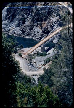
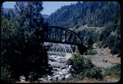
- Description:
- 100 f 5.6 tl
- Subject:
- Roads, Bridges, Shrubs, Trees, Rocks, Feather River (Calif.), and Rivers
- Series:
- 18-55
- Creator:
- Cushman, Charles W., 1896-1972
- Date Created:
- 1955-06-19
- Genre:
- Views
- Frame Number:
- 38
- County:
- Butte
- Abstract:
- Looking down from same pt.
- Call Number:
- P08152
- City:
- Big Bend
- Country:
- United States
- State/Province:
- California
- Alternate Identifier:
- 1855.38
- Persistent URL:
- http://purl.dlib.indiana.edu/iudl/archives/cushman/P08152
- Holding Location:
- Bloomington - University Archives
Wells Library E460
1320 E 10th St.
Bloomington, IN 47405
Contact at archives@indiana.edu, 812-855-1127
-
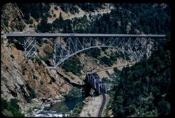
- Description:
- 100 f 6 tl
- Subject:
- Rocks, Roads, Feather River (Calif.), Trees, Railroad bridges, Western Pacific Railroad Company, Shrubs, Bridges, Railroad tracks, and Utility poles
- Series:
- 18-55
- Creator:
- Cushman, Charles W., 1896-1972
- Date Created:
- 1955-06-19
- Genre:
- Architectural photographs
- Frame Number:
- 36
- County:
- Butte
- Abstract:
- The twin bridges from south
- Call Number:
- P08150
- City:
- Pulga
- Country:
- United States
- State/Province:
- California
- Alternate Identifier:
- 1855.36
- Persistent URL:
- http://purl.dlib.indiana.edu/iudl/archives/cushman/P08150
- Holding Location:
- Bloomington - University Archives
Wells Library E460
1320 E 10th St.
Bloomington, IN 47405
Contact at archives@indiana.edu, 812-855-1127
-
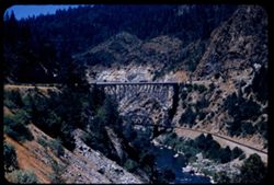
- Description:
- 100 f 5.6 sl
- Subject:
- Rocks, Roads, Feather River (Calif.), Trees, Railroad bridges, Western Pacific Railroad Company, Mountains, Shrubs, Bridges, Railroad tracks, and Rivers
- Series:
- 18-55
- Creator:
- Cushman, Charles W., 1896-1972
- Date Created:
- 1955-06-19
- Genre:
- Architectural photographs
- Frame Number:
- 35
- Street Address:
- United States Highway 40
- County:
- Butte
- Abstract:
- The real McCoy-near Pulga [66363 mi.]
- Call Number:
- P08149
- City:
- Pulga
- Country:
- United States
- State/Province:
- California
- Alternate Identifier:
- 1855.35
- Persistent URL:
- http://purl.dlib.indiana.edu/iudl/archives/cushman/P08149
- Holding Location:
- Bloomington - University Archives
Wells Library E460
1320 E 10th St.
Bloomington, IN 47405
Contact at archives@indiana.edu, 812-855-1127
-
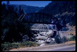
- Description:
- 100 f 5.6 sl
- Subject:
- Roads, Feather River (Calif.), Trails & paths, Trees, Boulders, Western Pacific Railroad Company, Shrubs, Bridges, Rivers, and Railroad bridges
- Series:
- 18-55
- Creator:
- Cushman, Charles W., 1896-1972
- Date Created:
- 1955-06-19
- Genre:
- Architectural photographs
- Frame Number:
- 32
- Street Address:
- United States Highway 40
- County:
- Plumas
- Abstract:
- Another view [L]
- Call Number:
- P08146
- City:
- Tobin
- Country:
- United States
- State/Province:
- California
- Alternate Identifier:
- 1855.32
- Persistent URL:
- http://purl.dlib.indiana.edu/iudl/archives/cushman/P08146
- Holding Location:
- Bloomington - University Archives
Wells Library E460
1320 E 10th St.
Bloomington, IN 47405
Contact at archives@indiana.edu, 812-855-1127
-
- Description:
- 50 f 8 sl 50 mm lens
- Subject:
- Roads, Feather River (Calif.), Trails & paths, Trees, Boulders, Western Pacific Railroad Company, Shrubs, Bridges, Rivers, Automobiles, and Railroad bridges
- Series:
- 18-55
- Creator:
- Cushman, Charles W., 1896-1972
- Date Created:
- 1955-06-19
- Genre:
- Architectural photographs
- Frame Number:
- 31
- Street Address:
- United States Highway 40
- County:
- Plumas
- Abstract:
- Another view [L]
- Call Number:
- P08145
- City:
- Tobin
- Country:
- United States
- State/Province:
- California
- Alternate Identifier:
- 1855.31
- Persistent URL:
- http://purl.dlib.indiana.edu/iudl/archives/cushman/P08145
- Holding Location:
- Bloomington - University Archives
Wells Library E460
1320 E 10th St.
Bloomington, IN 47405
Contact at archives@indiana.edu, 812-855-1127
-
- Description:
- 100 f 5.6
- Subject:
- Roads, Feather River (Calif.), Trees, Railroad bridges, Western Pacific Railroad Company, Shrubs, Bridges, Rivers, and Boulders
- Series:
- 18-55
- Creator:
- Cushman, Charles W., 1896-1972
- Date Created:
- 1955-06-19
- Genre:
- Architectural photographs
- Frame Number:
- 29
- Street Address:
- United States Highway 40
- County:
- Plumas
- Abstract:
- Twin Bridges at Tobin [66309 mi] [from upstream] [P]
- Call Number:
- P08144
- City:
- Tobin
- Country:
- United States
- State/Province:
- California
- Alternate Identifier:
- 1855.29
- Persistent URL:
- http://purl.dlib.indiana.edu/iudl/archives/cushman/P08144
- Holding Location:
- Bloomington - University Archives
Wells Library E460
1320 E 10th St.
Bloomington, IN 47405
Contact at archives@indiana.edu, 812-855-1127
-
- Description:
- 100 f 5.6 tl
- Subject:
- Roads, Feather River (Calif.), Trees, Boulders, Western Pacific Railroad Company, Shrubs, Bridges, Rivers, and Railroad bridges
- Series:
- 18-55
- Creator:
- Cushman, Charles W., 1896-1972
- Date Created:
- 1955-06-19
- Genre:
- Architectural photographs
- Frame Number:
- 28
- Street Address:
- United States Highway 40
- County:
- Plumas
- Abstract:
- Twin Bridges at Tobin [66309 mi] [from upstream]
- Call Number:
- P08143
- City:
- Tobin
- Country:
- United States
- State/Province:
- California
- Alternate Identifier:
- 1855.28
- Persistent URL:
- http://purl.dlib.indiana.edu/iudl/archives/cushman/P08143
- Holding Location:
- Bloomington - University Archives
Wells Library E460
1320 E 10th St.
Bloomington, IN 47405
Contact at archives@indiana.edu, 812-855-1127
-
- Description:
- 100 f 5.6 tl
- Subject:
- Rocks, Canyons, Roads, Feather River (Calif.), Automobiles, Mountains, Shrubs, Rapids, and Rivers
- Series:
- 18-55
- Creator:
- Cushman, Charles W., 1896-1972
- Date Created:
- 1955-06-19
- Genre:
- Landscape photographs
- Frame Number:
- 23
- Street Address:
- United States Highway 40
- County:
- Plumas
- Abstract:
- View down canyon on curve
- Call Number:
- P08139
- Country:
- United States
- State/Province:
- California
- Alternate Identifier:
- 1855.23
- Persistent URL:
- http://purl.dlib.indiana.edu/iudl/archives/cushman/P08139
- Holding Location:
- Bloomington - University Archives
Wells Library E460
1320 E 10th St.
Bloomington, IN 47405
Contact at archives@indiana.edu, 812-855-1127
-
- Description:
- 100 f 6.3 tl
- Subject:
- Cities & towns, Upper Klamath Lake (Or.), Hills, Bodies of water, Roads, Dwellings, Trees, Buildings, Fences, and Shrubs
- Series:
- 18-55
- Creator:
- Cushman, Charles W., 1896-1972
- Date Created:
- 1955-06-17
- Genre:
- Cityscape photographs
- Frame Number:
- 5
- County:
- Klamath
- Abstract:
- View across Klamath Lake toward city of Klamath Falls from west
- Call Number:
- P08122
- City:
- Klamath Falls
- Country:
- United States
- State/Province:
- Oregon
- Alternate Identifier:
- 1855.5
- Persistent URL:
- http://purl.dlib.indiana.edu/iudl/archives/cushman/P08122
- Holding Location:
- Bloomington - University Archives
Wells Library E460
1320 E 10th St.
Bloomington, IN 47405
Contact at archives@indiana.edu, 812-855-1127
-
- Description:
- 100 f 5.6 50mm lens
- Subject:
- Shasta Lake (Calif.), Roads, Trees, Flowers, Mountains, Shrubs, Lakes & ponds, and Clouds
- Series:
- 17-55
- Creator:
- Cushman, Charles W., 1896-1972
- Date Created:
- 1955-06-16
- Genre:
- Landscape photographs
- Frame Number:
- 21
- County:
- Shasta
- Abstract:
- from same point
- Call Number:
- P08101
- City:
- Redding
- Country:
- United States
- State/Province:
- California
- Physical Description:
- Image was originally mounted in a glass enclosure. Before digitization, the image was removed and placed in a Wess Plastic, Inc. brand, 2" x 2", pl...
- Alternate Identifier:
- 1755.21
- Persistent URL:
- http://purl.dlib.indiana.edu/iudl/archives/cushman/P08101
- Holding Location:
- Bloomington - University Archives
Wells Library E460
1320 E 10th St.
Bloomington, IN 47405
Contact at archives@indiana.edu, 812-855-1127
-
- Description:
- 100 f 6.3 tl
- Subject:
- Lakes & ponds, Roads, Mountains, Shrubs, Trees, and Shasta Lake (Calif.)
- Series:
- 17-55
- Creator:
- Cushman, Charles W., 1896-1972
- Date Created:
- 1955-06-16
- Genre:
- Landscape photographs
- Frame Number:
- 19
- County:
- Shasta
- Abstract:
- A bit of Shasta Lake 17 mi north of Redding 65636
- Call Number:
- P08099
- City:
- Redding
- Country:
- United States
- State/Province:
- California
- Alternate Identifier:
- 1755.19
- Persistent URL:
- http://purl.dlib.indiana.edu/iudl/archives/cushman/P08099
- Holding Location:
- Bloomington - University Archives
Wells Library E460
1320 E 10th St.
Bloomington, IN 47405
Contact at archives@indiana.edu, 812-855-1127
-
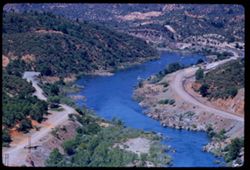
- Description:
- 100 f 5.6 tl
- Subject:
- Rocks, Roads, Automobiles, Trees, Shasta Dam (Calif.), Shrubs, Bridges, Facilities, Rivers, and Sacramento River (Calif.)
- Series:
- 17-55
- Creator:
- Cushman, Charles W., 1896-1972
- Date Created:
- 1955-06-16
- Genre:
- Views
- Frame Number:
- 18
- County:
- Shasta
- Abstract:
- Looking down on small bridge across river below dam
- Call Number:
- P08098
- Country:
- United States
- State/Province:
- California
- Alternate Identifier:
- 1755.18
- Persistent URL:
- http://purl.dlib.indiana.edu/iudl/archives/cushman/P08098
- Holding Location:
- Bloomington - University Archives
Wells Library E460
1320 E 10th St.
Bloomington, IN 47405
Contact at archives@indiana.edu, 812-855-1127
-
- Description:
- 100 f 5.6 tl
- Subject:
- Roads, Trees, Shasta Dam (Calif.), Shrubs, Sacramento River (Calif.), Facilities, Hills, Utility poles, and Rivers
- Series:
- 17-55
- Creator:
- Cushman, Charles W., 1896-1972
- Date Created:
- 1955-06-16
- Genre:
- Landscape photographs
- Frame Number:
- 16
- County:
- Shasta
- Abstract:
- Sacramento river from top of Shasta Dam
- Call Number:
- P08096
- Country:
- United States
- State/Province:
- California
- Alternate Identifier:
- 1755.16
- Persistent URL:
- http://purl.dlib.indiana.edu/iudl/archives/cushman/P08096
- Holding Location:
- Bloomington - University Archives
Wells Library E460
1320 E 10th St.
Bloomington, IN 47405
Contact at archives@indiana.edu, 812-855-1127
-
- Description:
- 100 f 5.6 tl
- Subject:
- Roads, Trees, Shasta Dam (Calif.), Mountains, Buildings, Shrubs, Sacramento River (Calif.), Vehicles, and Rivers
- Series:
- 17-55
- Creator:
- Cushman, Charles W., 1896-1972
- Date Created:
- 1955-06-16
- Genre:
- Landscape photographs
- Frame Number:
- 14
- County:
- Shasta
- Abstract:
- Sacramento river below dam
- Call Number:
- P08094
- Country:
- United States
- State/Province:
- California
- Physical Description:
- Image was originally mounted in a glass enclosure. Before digitization, the image was removed and placed in a Wess Plastic, Inc. brand, 2" x 2", pl...
- Alternate Identifier:
- 1755.14
- Persistent URL:
- http://purl.dlib.indiana.edu/iudl/archives/cushman/P08094
- Holding Location:
- Bloomington - University Archives
Wells Library E460
1320 E 10th St.
Bloomington, IN 47405
Contact at archives@indiana.edu, 812-855-1127
-
- Description:
- 100 f 6.3 sl
- Subject:
- Roads, Mountains, Shrubs, Trees, and Shasta Dam (Calif.)
- Series:
- 17-55
- Creator:
- Cushman, Charles W., 1896-1972
- Date Created:
- 1955-06-16
- Genre:
- Landscape photographs
- Frame Number:
- 13
- County:
- Shasta
- Abstract:
- Mtns NW of dam
- Call Number:
- P08093
- Country:
- United States
- State/Province:
- California
- Alternate Identifier:
- 1755.13
- Persistent URL:
- http://purl.dlib.indiana.edu/iudl/archives/cushman/P08093
- Holding Location:
- Bloomington - University Archives
Wells Library E460
1320 E 10th St.
Bloomington, IN 47405
Contact at archives@indiana.edu, 812-855-1127
-
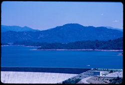
- Description:
- 100 f 6.3 50mm lens
- Subject:
- Shasta Lake (Calif.), Roads, Shasta, Mount (Calif. : Mountain), Trees, Shasta Dam (Calif.), Electrical apparatus, Mountains, Buildings, Shrubs, Lakes & p...
- Series:
- 17-55
- Creator:
- Cushman, Charles W., 1896-1972
- Date Created:
- 1955-06-16
- Genre:
- Landscape photographs
- Frame Number:
- 12
- County:
- Shasta
- Abstract:
- Shasta Dam
- Call Number:
- P08092
- Country:
- United States
- State/Province:
- California
- Physical Description:
- Image was originally mounted in a glass enclosure. Before digitization, the image was removed and placed in a Wess Plastic, Inc. brand, 2" x 2", pl...
- Alternate Identifier:
- 1755.12
- Persistent URL:
- http://purl.dlib.indiana.edu/iudl/archives/cushman/P08092
- Holding Location:
- Bloomington - University Archives
Wells Library E460
1320 E 10th St.
Bloomington, IN 47405
Contact at archives@indiana.edu, 812-855-1127
-
- Description:
- 100 f 6.3 tl
- Subject:
- Lakes & ponds, Dams, Hills, Automobiles, Roads, Mountains, Shrubs, Trees, Buildings, Shasta Dam (Calif.), Parking lots, Boats, and Shasta Lake (Calif.)
- Series:
- 17-55
- Creator:
- Cushman, Charles W., 1896-1972
- Date Created:
- 1955-06-16
- Genre:
- Landscape photographs
- Frame Number:
- 9
- County:
- Shasta
- Abstract:
- at Shasta Dam Shasta Lake behind dam
- Call Number:
- P08090
- Country:
- United States
- State/Province:
- California
- Alternate Identifier:
- 1755.9
- Persistent URL:
- http://purl.dlib.indiana.edu/iudl/archives/cushman/P08090
- Holding Location:
- Bloomington - University Archives
Wells Library E460
1320 E 10th St.
Bloomington, IN 47405
Contact at archives@indiana.edu, 812-855-1127
-
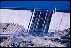
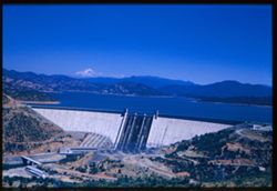
- Description:
- 100 f 6.3 tl
- Subject:
- Shasta Dam (Calif.), Electrical apparatus, Dams, Shrubs, and Roads
- Series:
- 17-55
- Creator:
- Cushman, Charles W., 1896-1972
- Date Created:
- 1955-06-16
- Genre:
- Architectural photographs
- Frame Number:
- 8
- County:
- Shasta
- Abstract:
- at Shasta Dam Face of Shasta Dam
- Call Number:
- P08089
- Country:
- United States
- State/Province:
- California
- Alternate Identifier:
- 1755.8
- Persistent URL:
- http://purl.dlib.indiana.edu/iudl/archives/cushman/P08089
- Holding Location:
- Bloomington - University Archives
Wells Library E460
1320 E 10th St.
Bloomington, IN 47405
Contact at archives@indiana.edu, 812-855-1127
-
- Description:
- 100 f 5.6 tl
- Subject:
- Trinity River (Calif.), Electric lines, Roads, Trinity Mountains (Calif.), Trees, Mountains, Shrubs, Cabins, Hills, Rivers, Rocks, and Weaver Creek (Trinity ...
- Series:
- 16-55
- Creator:
- Cushman, Charles W., 1896-1972
- Date Created:
- 1955-06-15
- Genre:
- Landscape photographs
- Frame Number:
- 35
- County:
- Trinity
- Abstract:
- View north up Weaver Creek from its mouth at Trinity river
- Call Number:
- P08079
- City:
- Douglas City
- Country:
- United States
- State/Province:
- California
- Alternate Identifier:
- 1655.35
- Persistent URL:
- http://purl.dlib.indiana.edu/iudl/archives/cushman/P08079
- Holding Location:
- Bloomington - University Archives
Wells Library E460
1320 E 10th St.
Bloomington, IN 47405
Contact at archives@indiana.edu, 812-855-1127
-
- Description:
- 50 f 8 sl
- Subject:
- Trucks, Oregon Mountain Summit (Calif.), Roads, Mountains, Shrubs, Trees, and Clouds
- Series:
- 16-55
- Creator:
- Cushman, Charles W., 1896-1972
- Date Created:
- 1955-06-15
- Genre:
- Landscape photographs
- Frame Number:
- 30
- County:
- Trinity
- Abstract:
- Oregon Mtn. Summit 65509 mi.
- Call Number:
- P08074
- City:
- Weaverville
- Country:
- United States
- State/Province:
- California
- Alternate Identifier:
- 1655.30
- Persistent URL:
- http://purl.dlib.indiana.edu/iudl/archives/cushman/P08074
- Holding Location:
- Bloomington - University Archives
Wells Library E460
1320 E 10th St.
Bloomington, IN 47405
Contact at archives@indiana.edu, 812-855-1127
-
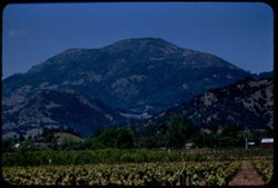
- Description:
- 100 f 6.3 tl
- Subject:
- Roads, Trees, Saint Helena, Mount (Calif.), Mountains, Shrubs, Dwellings, Hills, Agricultural facilities, Plants, and Croplands
- Series:
- 15-55
- Creator:
- Cushman, Charles W., 1896-1972
- Date Created:
- 1955-05-17
- Genre:
- Landscape photographs
- Frame Number:
- 16
- County:
- Napa
- Abstract:
- Mt St Helena from a mile south of Calistoga
- Call Number:
- P08024
- City:
- Calistoga
- Country:
- United States
- State/Province:
- California
- Alternate Identifier:
- 1555.16
- Persistent URL:
- http://purl.dlib.indiana.edu/iudl/archives/cushman/P08024
- Holding Location:
- Bloomington - University Archives
Wells Library E460
1320 E 10th St.
Bloomington, IN 47405
Contact at archives@indiana.edu, 812-855-1127
-
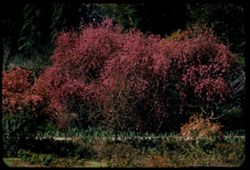
- Description:
- 100 f 5.6 tl 300'
- Subject:
- Strybing Arboretum and Botanical Gardens, Roads, Golden Gate Park (San Francisco, Calif.), Trees, Flowers, Shrubs, and Purple crab
- Series:
- 13-55
- Creator:
- Cushman, Charles W., 1896-1972
- Date Created:
- 1955-03-31
- Genre:
- Identification photographs
- Frame Number:
- 4
- County:
- San Francisco
- Abstract:
- Group of purple crabs
- Call Number:
- P07938
- City:
- San Francisco
- Country:
- United States
- State/Province:
- California
- Alternate Identifier:
- 1355.4
- Persistent URL:
- http://purl.dlib.indiana.edu/iudl/archives/cushman/P07938
- Holding Location:
- Bloomington - University Archives
Wells Library E460
1320 E 10th St.
Bloomington, IN 47405
Contact at archives@indiana.edu, 812-855-1127
-
- Description:
- 100 f 5.6 tl
- Subject:
- Valleys, Roads, Trees, Cholame Hills (Calif.), Shrubs, Hills, Utility poles, and Houses
- Series:
- 12-55
- Creator:
- Cushman, Charles W., 1896-1972
- Date Created:
- 1955-03-25
- Genre:
- Landscape photographs
- Frame Number:
- 26
- Street Address:
- United States Highway 466
- County:
- San Luis Obispo
- Abstract:
- View north from end of US 466 Mileage 62222 (88.8)
- Call Number:
- P07922
- City:
- Shandon
- Country:
- United States
- State/Province:
- California
- Alternate Identifier:
- 1255.26
- Persistent URL:
- http://purl.dlib.indiana.edu/iudl/archives/cushman/P07922
- Holding Location:
- Bloomington - University Archives
Wells Library E460
1320 E 10th St.
Bloomington, IN 47405
Contact at archives@indiana.edu, 812-855-1127
-
- Description:
- 100 f 4.5 tl
- Subject:
- Rocks, Roads, Tehachapi Mountains (Calif.), Trails & paths, Trees, Mountains, Shrubs, Railroad tracks, Utility poles, and Southern Pacific Railroad Company
- Series:
- 12-55
- Creator:
- Cushman, Charles W., 1896-1972
- Date Created:
- 1955-03-24
- Genre:
- Landscape photographs
- Frame Number:
- 18
- County:
- Kern
- Abstract:
- S P curves, [cut] and tunnel mouth from same vantage point
- Call Number:
- P07914
- City:
- Keene
- Country:
- United States
- State/Province:
- California
- Alternate Identifier:
- 1255.18
- Persistent URL:
- http://purl.dlib.indiana.edu/iudl/archives/cushman/P07914
- Holding Location:
- Bloomington - University Archives
Wells Library E460
1320 E 10th St.
Bloomington, IN 47405
Contact at archives@indiana.edu, 812-855-1127
-
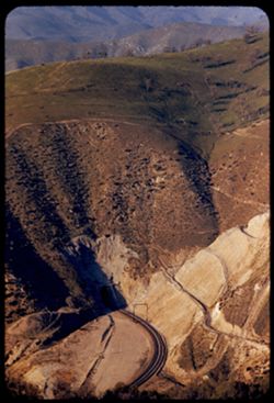
- Description:
- 100 f 4.5 tl
- Subject:
- Roads, Tehachapi Mountains (Calif.), Southern Pacific Tunnel, Trees, Mountains, Tunnels, Railroad tracks, Hills, Utility poles, and Shrubs
- Series:
- 12-55
- Creator:
- Cushman, Charles W., 1896-1972
- Date Created:
- 1955-03-24
- Genre:
- Landscape photographs
- Frame Number:
- 17
- Street Address:
- United States Highway 466
- County:
- Kern
- Abstract:
- S P curves, [cut] and tunnel mouth from same vantage point
- Call Number:
- P07913
- City:
- Keene
- Country:
- United States
- State/Province:
- California
- Alternate Identifier:
- 1255.17
- Persistent URL:
- http://purl.dlib.indiana.edu/iudl/archives/cushman/P07913
- Holding Location:
- Bloomington - University Archives
Wells Library E460
1320 E 10th St.
Bloomington, IN 47405
Contact at archives@indiana.edu, 812-855-1127
-
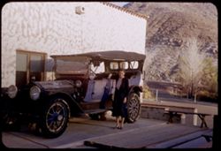
- Subject:
- Rocks, Benches, Roads, Spouses, Automobiles, Trees, Mountains, Shrubs, Scotty's Castle (Calif.), Death Valley (Calif. and Nev.), Castles & palaces, P...
- Series:
- 11-55
- Creator:
- Cushman, Charles W., 1896-1972
- Date Created:
- 1955-03-23
- Genre:
- Portraits and Identification photographs
- Frame Number:
- 37
- County:
- Inyo
- Persons Pictured:
- Cushman, Jean
- Abstract:
- Jean with old Packard touring car
- Call Number:
- P07896
- Country:
- United States
- State/Province:
- California
- Alternate Identifier:
- 1155.37
- Persistent URL:
- http://purl.dlib.indiana.edu/iudl/archives/cushman/P07896
- Holding Location:
- Bloomington - University Archives
Wells Library E460
1320 E 10th St.
Bloomington, IN 47405
Contact at archives@indiana.edu, 812-855-1127
-
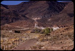
- Description:
- 100 f 8 tl
- Subject:
- Towers, Roads, Trees, Mountains, Buildings, Shrubs, Scotty's Castle (Calif.), Death Valley (Calif. and Nev.), Castles & palaces, and Rocks
- Series:
- 11-55
- Creator:
- Cushman, Charles W., 1896-1972
- Date Created:
- 1955-03-23
- Genre:
- Landscape photographs
- Frame Number:
- 27
- County:
- Inyo
- Abstract:
- First view of Scott's Tower
- Call Number:
- P07886
- Country:
- United States
- State/Province:
- California
- Alternate Identifier:
- 1155.27
- Persistent URL:
- http://purl.dlib.indiana.edu/iudl/archives/cushman/P07886
- Holding Location:
- Bloomington - University Archives
Wells Library E460
1320 E 10th St.
Bloomington, IN 47405
Contact at archives@indiana.edu, 812-855-1127
-
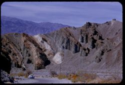
- Description:
- 100 f 6.3 tl
- Subject:
- Roads, Automobiles, Trees, Mountains, Buildings, Furnace Creek Inn (Death Valley Junction, Calif.), Traffic signs & signals, Death Valley (Calif. and Nev...
- Series:
- 9-55
- Creator:
- Cushman, Charles W., 1896-1972
- Date Created:
- 1955-03-22
- Genre:
- Landscape photographs
- Frame Number:
- 13
- County:
- Inyo
- Abstract:
- Green rocks nr. Furnace Creek Inn
- Call Number:
- P07805
- City:
- Death Valley Junction
- Country:
- United States
- State/Province:
- California
- Alternate Identifier:
- 955.13
- Persistent URL:
- http://purl.dlib.indiana.edu/iudl/archives/cushman/P07805
- Holding Location:
- Bloomington - University Archives
Wells Library E460
1320 E 10th St.
Bloomington, IN 47405
Contact at archives@indiana.edu, 812-855-1127
-
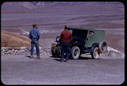
- Description:
- 100 f 6.3 tl
- Subject:
- Valleys, Roads, Automobiles, Shrubs, Indigenous peoples, Masonry, Zabriskie Point (Calif.), and Hills
- Series:
- 9-55
- Creator:
- Cushman, Charles W., 1896-1972
- Date Created:
- 1955-03-22
- Genre:
- Identification photographs
- Frame Number:
- 10
- County:
- Inyo
- Abstract:
- A couple of natives and a jeep
- Call Number:
- P07802
- Country:
- United States
- State/Province:
- California
- Alternate Identifier:
- 955.10
- Persistent URL:
- http://purl.dlib.indiana.edu/iudl/archives/cushman/P07802
- Holding Location:
- Bloomington - University Archives
Wells Library E460
1320 E 10th St.
Bloomington, IN 47405
Contact at archives@indiana.edu, 812-855-1127
-
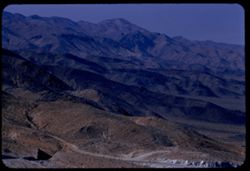
- Description:
- 100 f 8 tl
- Subject:
- Rocks, Valleys, Roads, Argus Range (Calif.), Emigrant Pass (Inyo County, Calif.), Mountains, Shrubs, and Panamint Valley (Calif.)
- Series:
- 7-55
- Creator:
- Cushman, Charles W., 1896-1972
- Date Created:
- 1955-03-21
- Genre:
- Landscape photographs
- Frame Number:
- 34
- County:
- Inyo
- Abstract:
- NW along Argus mtns at west side of Panamint Valley from Emigrant pass.
- Call Number:
- P07758
- Country:
- United States
- State/Province:
- California
- Alternate Identifier:
- 755.34
- Persistent URL:
- http://purl.dlib.indiana.edu/iudl/archives/cushman/P07758
- Holding Location:
- Bloomington - University Archives
Wells Library E460
1320 E 10th St.
Bloomington, IN 47405
Contact at archives@indiana.edu, 812-855-1127
-
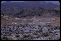
- Description:
- 100 f 8 tl
- Subject:
- Valleys, Roads, Mountains, Shrubs, and Hills
- Series:
- 7-55
- Creator:
- Cushman, Charles W., 1896-1972
- Date Created:
- 1955-03-21
- Genre:
- Landscape photographs
- Frame Number:
- 22
- Street Address:
- Johannesburg Road and Trona Road
- County:
- Kern and San Bernardino
- Abstract:
- Bad Lands west of J - T road
- Call Number:
- P07746
- City:
- Randsburg
- Country:
- United States
- State/Province:
- California
- Alternate Identifier:
- 755.22
- Persistent URL:
- http://purl.dlib.indiana.edu/iudl/archives/cushman/P07746
- Holding Location:
- Bloomington - University Archives
Wells Library E460
1320 E 10th St.
Bloomington, IN 47405
Contact at archives@indiana.edu, 812-855-1127
-
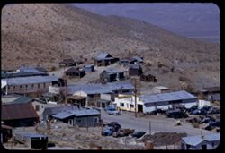
- Description:
- 100 f 6.3 tl
- Subject:
- Valleys, Hills, Roads, Utility poles, Electric lines, Stores & shops, Buildings, Vehicles, Signs (Notices), Automobile service stations, and Shrubs
- Series:
- 7-55
- Creator:
- Cushman, Charles W., 1896-1972
- Date Created:
- 1955-03-21
- Genre:
- Cityscape photographs
- Frame Number:
- 19
- County:
- Kern
- Abstract:
- East part of Randsburg from near bus section
- Call Number:
- P07743
- City:
- Randsburg
- Country:
- United States
- State/Province:
- California
- Alternate Identifier:
- 755.19
- Persistent URL:
- http://purl.dlib.indiana.edu/iudl/archives/cushman/P07743
- Holding Location:
- Bloomington - University Archives
Wells Library E460
1320 E 10th St.
Bloomington, IN 47405
Contact at archives@indiana.edu, 812-855-1127
-
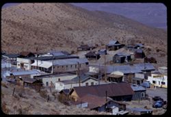
- Description:
- 100 f 6.3 tl
- Subject:
- Stores & shops, Valleys, Electric lines, Roads, School House Hill, Automobile service stations, Buildings, Shrubs, Vehicles, Hills, Utility poles, Signs ...
- Series:
- 7-55
- Creator:
- Cushman, Charles W., 1896-1972
- Date Created:
- 1955-03-21
- Genre:
- Cityscape photographs
- Frame Number:
- 17
- County:
- Kern
- Abstract:
- Looking down on business section of Randsburg from hts. of school
- Call Number:
- P07741
- City:
- Randsburg
- Country:
- United States
- State/Province:
- California
- Alternate Identifier:
- 755.17
- Persistent URL:
- http://purl.dlib.indiana.edu/iudl/archives/cushman/P07741
- Holding Location:
- Bloomington - University Archives
Wells Library E460
1320 E 10th St.
Bloomington, IN 47405
Contact at archives@indiana.edu, 812-855-1127
-
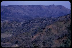
- Description:
- 100 f 5.6 tl
- Subject:
- Valleys, Hills, Diablo Range (Calif.), Roads, Mountains, Shrubs, and Trees
- Series:
- 7-55
- Creator:
- Cushman, Charles W., 1896-1972
- Date Created:
- 1955-03-20
- Genre:
- Landscape photographs
- Frame Number:
- 13
- Street Address:
- California State Highway 198 and Coalinga Road
- County:
- Monterey and Fresno
- Abstract:
- Eastward from summit of San Lucas Coalinga road 198 toward Diablo Range
- Call Number:
- P07737
- City:
- San Lucas
- Country:
- United States
- State/Province:
- California
- Alternate Identifier:
- 755.13
- Persistent URL:
- http://purl.dlib.indiana.edu/iudl/archives/cushman/P07737
- Holding Location:
- Bloomington - University Archives
Wells Library E460
1320 E 10th St.
Bloomington, IN 47405
Contact at archives@indiana.edu, 812-855-1127
-
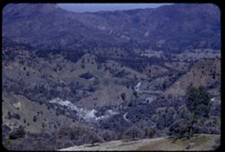
- Description:
- 100 f 5.6 tl
- Subject:
- Valleys, Roads, Diablo Range (Calif.), Mountains, Shrubs, Hills, and Trees
- Series:
- 7-55
- Creator:
- Cushman, Charles W., 1896-1972
- Date Created:
- 1955-03-20
- Genre:
- Landscape photographs
- Frame Number:
- 12
- Street Address:
- California State Highway 198 and Coalinga Road
- County:
- Fresno
- Abstract:
- Eastward from summit of San Lucas Coalinga road 198 toward Diablo Range
- Call Number:
- P07736
- Country:
- United States
- State/Province:
- California
- Alternate Identifier:
- 755.12
- Persistent URL:
- http://purl.dlib.indiana.edu/iudl/archives/cushman/P07736
- Holding Location:
- Bloomington - University Archives
Wells Library E460
1320 E 10th St.
Bloomington, IN 47405
Contact at archives@indiana.edu, 812-855-1127
-
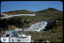
- Description:
- 200 f 4+ tl
- Subject:
- Trailers, Roads, Automobiles, Trees, Flowers, Signs (Notices), Buildings, Shrubs, Dwellings, Hills, Utility poles, and Twin Peaks (San Francisco County, Calif.)
- Series:
- 5-55
- Creator:
- Cushman, Charles W., 1896-1972
- Date Created:
- 1955-03-14
- Genre:
- Landscape photographs
- Frame Number:
- 37
- Street Address:
- Marietta Drive and O'Shaunessy Drive
- County:
- San Francisco
- Abstract:
- Toward Twin Pks from south (at Marietta & Aroyo) across deep valley (O'Shaunessy Dr.) showing new housing developments all out too far to left opene...
- Call Number:
- P07701
- City:
- San Francisco
- Country:
- United States
- State/Province:
- California
- Alternate Identifier:
- 555.37
- Persistent URL:
- http://purl.dlib.indiana.edu/iudl/archives/cushman/P07701
- Holding Location:
- Bloomington - University Archives
Wells Library E460
1320 E 10th St.
Bloomington, IN 47405
Contact at archives@indiana.edu, 812-855-1127
-
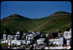
- Description:
- 100 f 6 tl
- Subject:
- Valleys, Roads, Trees, Buildings, Shrubs, Dwellings, Hills, Utility poles, and Twin Peaks (San Francisco County, Calif.)
- Series:
- 5-55
- Creator:
- Cushman, Charles W., 1896-1972
- Date Created:
- 1955-03-14
- Genre:
- Cityscape photographs
- Frame Number:
- 35
- Street Address:
- Twenty-second Street and Collingwood Street
- County:
- San Francisco
- Abstract:
- Twin Peaks from top of Collingwood near end all out too far to left opened redimounted
- Call Number:
- P07699
- City:
- San Francisco
- Country:
- United States
- State/Province:
- California
- Alternate Identifier:
- 555.35
- Persistent URL:
- http://purl.dlib.indiana.edu/iudl/archives/cushman/P07699
- Holding Location:
- Bloomington - University Archives
Wells Library E460
1320 E 10th St.
Bloomington, IN 47405
Contact at archives@indiana.edu, 812-855-1127
-
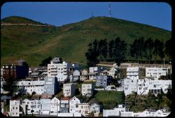
- Description:
- 100 f 5.6 tl
- Subject:
- Twin Peaks (San Francisco County, Calif.), Hills, Automobiles, Roads, Utility poles, Trees, Buildings, Trails & paths, Dwellings, and Shrubs
- Series:
- 5-55
- Creator:
- Cushman, Charles W., 1896-1972
- Date Created:
- 1955-03-14
- Genre:
- Cityscape photographs
- Frame Number:
- 32
- Street Address:
- Twenty-second Street and Collingwood Street
- County:
- San Francisco
- Abstract:
- Toward Twin Peaks from Ht at 22 & Collingwood all out too far to left opened redimounted
- Call Number:
- P07696
- City:
- San Francisco
- Country:
- United States
- State/Province:
- California
- Alternate Identifier:
- 555.32
- Persistent URL:
- http://purl.dlib.indiana.edu/iudl/archives/cushman/P07696
- Holding Location:
- Bloomington - University Archives
Wells Library E460
1320 E 10th St.
Bloomington, IN 47405
Contact at archives@indiana.edu, 812-855-1127
-
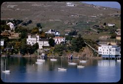
- Description:
- 100 f 5.6 tl
- Subject:
- Harbors, Hills, Bodies of water, Roads, Utility poles, Trees, Buildings, Coastlines, Construction, Boats, Dwellings, and Shrubs
- Series:
- 5-55
- Creator:
- Cushman, Charles W., 1896-1972
- Date Created:
- 1955-03-10
- Genre:
- Cityscape photographs
- Frame Number:
- 14
- County:
- Marin
- Abstract:
- From Belvedere - toward sails of Tiburon
- Call Number:
- P07679
- City:
- Belvedere and Tiburon
- Country:
- United States
- State/Province:
- California
- Alternate Identifier:
- 555.14
- Persistent URL:
- http://purl.dlib.indiana.edu/iudl/archives/cushman/P07679
- Holding Location:
- Bloomington - University Archives
Wells Library E460
1320 E 10th St.
Bloomington, IN 47405
Contact at archives@indiana.edu, 812-855-1127
-
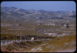
- Description:
- 100 f 5.6 tl
- Subject:
- Storage tanks, Hills, Automobiles, Roads, Bridges, Shrubs, Trees, Facilities, Valleys, Dwellings, and Utility poles
- Series:
- 4-55
- Creator:
- Cushman, Charles W., 1896-1972
- Date Created:
- 1955-03-01
- Genre:
- Cityscape photographs
- Frame Number:
- 28
- Street Address:
- California State Highway 33
- County:
- Fresno
- Abstract:
- Valley north of Coalinga
- Call Number:
- P07655
- City:
- Coalinga
- Country:
- United States
- State/Province:
- California
- Alternate Identifier:
- 455.28
- Persistent URL:
- http://purl.dlib.indiana.edu/iudl/archives/cushman/P07655
- Holding Location:
- Bloomington - University Archives
Wells Library E460
1320 E 10th St.
Bloomington, IN 47405
Contact at archives@indiana.edu, 812-855-1127
-
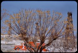
- Description:
- 100 f 5.4
- Subject:
- Petroleum workers, Midway Oil Camp (Calif.), Trees, Oil well drilling rigs, Shrubs, Roads, Trucks, Chinaberry trees, and Oil wells
- Series:
- 4-55
- Creator:
- Cushman, Charles W., 1896-1972
- Date Created:
- 1955-03-01
- Genre:
- Identification photographs
- Frame Number:
- 25
- County:
- Kern
- Abstract:
- Chinaberry & oil truck North of Fellows in Midway Field Kern County
- Call Number:
- P07652
- City:
- Fellows
- Country:
- United States
- State/Province:
- California
- Alternate Identifier:
- 455.25
- Persistent URL:
- http://purl.dlib.indiana.edu/iudl/archives/cushman/P07652
- Holding Location:
- Bloomington - University Archives
Wells Library E460
1320 E 10th St.
Bloomington, IN 47405
Contact at archives@indiana.edu, 812-855-1127
-
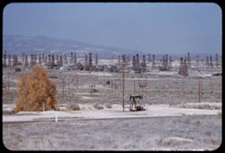
- Description:
- 100 f 5.2
- Subject:
- Oil well drilling rigs, Roads, Trees, Mountains, Shrubs, Facilities, Midway Oil Camp (Calif.), Utility poles, and Oil wells
- Series:
- 4-55
- Creator:
- Cushman, Charles W., 1896-1972
- Date Created:
- 1955-03-01
- Genre:
- Views
- Frame Number:
- 24
- County:
- Kern
- Abstract:
- Distant derrick forest north of Fellows
- Call Number:
- P07651
- City:
- Fellows
- Country:
- United States
- State/Province:
- California
- Alternate Identifier:
- 455.24
- Persistent URL:
- http://purl.dlib.indiana.edu/iudl/archives/cushman/P07651
- Holding Location:
- Bloomington - University Archives
Wells Library E460
1320 E 10th St.
Bloomington, IN 47405
Contact at archives@indiana.edu, 812-855-1127
- « Previous
- Next »
- 1
- 2
- 3
- 4