
Search Constraints
You searched for:
Campus
IUB
Remove constraint Campus: IUB
Subject
Valleys
Remove constraint Subject: Valleys
« Previous |
1 - 100 of 754
|
Next »
Search Results
-
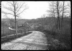
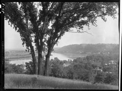
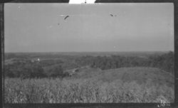
- Subject:
- 5x7, Dirt roads, and Valleys
- Series:
- 5x7
- Date Created:
- 1928-05-07
- Identifier:
- Hoh006.081.0043
- Genre:
- Landscape photographs
- Geographic Location:
- Popcorn (Ind.)
- Call Number:
- 5x7, Box 81, Item 43
- Physical Description:
- 5x7
- Persistent URL:
- http://purl.dlib.indiana.edu/iudl/lilly/hohenberger/Hoh006.081.0043
- Holding Location:
- Bloomington - Lilly Library
1200 E. Seventh St
Bloomington, IN 47405
Contact at liblilly@indiana.edu, 812-855-2452
-
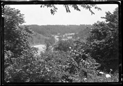
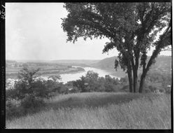
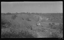
- Subject:
- 5x7, Scenic overlooks, Valleys, and Hills
- Series:
- 5x7
- Date Created:
- 1927-07-09
- Identifier:
- Hoh006.071.0010
- Genre:
- Landscape photographs
- Geographic Location:
- Morgan County (Ind.)
- Call Number:
- 5x7, Box 71, Item 10
- Physical Description:
- 5x7
- Persistent URL:
- http://purl.dlib.indiana.edu/iudl/lilly/hohenberger/Hoh006.071.0010
- Holding Location:
- Bloomington - Lilly Library
1200 E. Seventh St
Bloomington, IN 47405
Contact at liblilly@indiana.edu, 812-855-2452
-
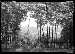
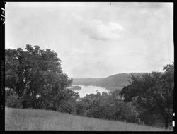
- Subject:
- Valleys and 5x7
- Series:
- 5x7
- Date Created:
- 1947-06-12
- Identifier:
- Hoh006.009.0016
- Genre:
- Landscape photographs
- Call Number:
- 5x7, Box 9, Item 16
- Physical Description:
- 5x7
- Persistent URL:
- http://purl.dlib.indiana.edu/iudl/lilly/hohenberger/Hoh006.009.0016
- Holding Location:
- Bloomington - Lilly Library
1200 E. Seventh St
Bloomington, IN 47405
Contact at liblilly@indiana.edu, 812-855-2452
-
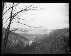
- Subject:
- Valleys, Winter, and 4x5
- Series:
- 4x5
- Date Created:
- 1929-01-28
- Identifier:
- Hoh004.009.0033
- Geographic Location:
- Madison (Ind.)
- Call Number:
- 4x5, Box 9, Item 33
- Physical Description:
- 4x5
- Persistent URL:
- http://purl.dlib.indiana.edu/iudl/lilly/hohenberger/Hoh004.009.0033
- Holding Location:
- Bloomington - Lilly Library
1200 E. Seventh St
Bloomington, IN 47405
Contact at liblilly@indiana.edu, 812-855-2452
-
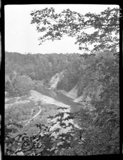
- Subject:
- Valleys, Rivers, and 4x5
- Series:
- 4x5
- Date Created:
- 1926-06-22
- Identifier:
- Hoh004.001.0026
- Geographic Location:
- Ohio River and Aurora (Ind.)
- Call Number:
- 4x5, Box 1, Item 26
- Physical Description:
- 4x5
- Persistent URL:
- http://purl.dlib.indiana.edu/iudl/lilly/hohenberger/Hoh004.001.0026
- Holding Location:
- Bloomington - Lilly Library
1200 E. Seventh St
Bloomington, IN 47405
Contact at liblilly@indiana.edu, 812-855-2452
-
- Subject:
- Rivers, Valleys, and 4x5
- Series:
- 4x5
- Date Created:
- 1926-06-22
- Identifier:
- Hoh004.001.0024
- Genre:
- Landscape photographs
- Geographic Location:
- Aurora (Ind.) and Ohio River
- Call Number:
- 4x5, Box 1, Item 24
- Physical Description:
- 4x5
- Persistent URL:
- http://purl.dlib.indiana.edu/iudl/lilly/hohenberger/Hoh004.001.0024
- Holding Location:
- Bloomington - Lilly Library
1200 E. Seventh St
Bloomington, IN 47405
Contact at liblilly@indiana.edu, 812-855-2452
-
- Subject:
- 4x5 and Valleys
- Series:
- 4x5
- Date Created:
- 1926-06-22
- Identifier:
- Hoh004.001.0012
- Genre:
- Landscape photographs
- Geographic Location:
- Aurora (Ind.) and Ohio River
- Call Number:
- 4x5, Box 1, Item 12
- Physical Description:
- 4x5
- Persistent URL:
- http://purl.dlib.indiana.edu/iudl/lilly/hohenberger/Hoh004.001.0012
- Holding Location:
- Bloomington - Lilly Library
1200 E. Seventh St
Bloomington, IN 47405
Contact at liblilly@indiana.edu, 812-855-2452
-
- Subject:
- Rivers, Valleys, and 3x4
- Series:
- 3x4
- Identifier:
- Hoh001.000.0448
- Call Number:
- 3x4, Item 448
- Physical Description:
- 3x4
- Persistent URL:
- http://purl.dlib.indiana.edu/iudl/lilly/hohenberger/Hoh001.000.0448
- Holding Location:
- Bloomington - Lilly Library
1200 E. Seventh St
Bloomington, IN 47405
Contact at liblilly@indiana.edu, 812-855-2452
-
- Subject:
- 3x4 and Valleys
- Series:
- 3x4
- Identifier:
- Hoh001.000.0236
- Genre:
- Landscape photographs
- Geographic Location:
- Hamblen (Ind. : Township)
- Call Number:
- 3x4, Item 236
- Physical Description:
- 3x4
- Persistent URL:
- http://purl.dlib.indiana.edu/iudl/lilly/hohenberger/Hoh001.000.0236
- Holding Location:
- Bloomington - Lilly Library
1200 E. Seventh St
Bloomington, IN 47405
Contact at liblilly@indiana.edu, 812-855-2452
-
- Subject:
- Valleys and 3x4
- Series:
- 3x4
- Identifier:
- Hoh001.000.0230
- Genre:
- Landscape photographs
- Geographic Location:
- Hamblen (Ind. : Township)
- Call Number:
- 3x4, Item 230
- Physical Description:
- 3x4
- Persistent URL:
- http://purl.dlib.indiana.edu/iudl/lilly/hohenberger/Hoh001.000.0230
- Holding Location:
- Bloomington - Lilly Library
1200 E. Seventh St
Bloomington, IN 47405
Contact at liblilly@indiana.edu, 812-855-2452
-

- Subject:
- Motion pictures--Morocco, Fiction films, Men, Moroccans in motion pictures, Immigrants in motion pictures, Roads, Motion picture posters, Women, Valleys, and...
- Creator:
- Director: Legzouli, Hassan and Publisher: Pierre Grise Distribution
- Language:
- French
- Date Created:
- Date Taken: 2004 and Publication Date: Circa 2004
- Identifier:
- VAD9191-000535
- Geographic Location:
- France
- Related URL:
- http://purl.dlib.indiana.edu/iudl/findingaids/bfca/VAD5484
- Abstract:
- Original release title: Ten'ja and English release title: Testament.
- Call Number:
- COL 12 POS 535
- Country:
- France and Morocco
- Physical Description:
- 1 poster , 21.5 x 15.75 inches
- Alternate Identifier:
- COL 12
- Persistent URL:
- http://purl.dlib.indiana.edu/iudl/bfca/VAD9191/VAD9191-000535
-
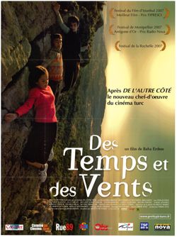
- Subject:
- Children, Turks in motion pictures, Valleys, Girls, Motion picture posters, Mountains, Fiction films, Boys, and Motion pictures--Turkey
- Creator:
- Director: Erdem, Reha and Publisher: Pretty Pictures
- Language:
- French
- Date Created:
- Date Taken: 2006 and Publication Date: Circa 2007
- Identifier:
- VAD9191-000088
- Geographic Location:
- Turkey
- Related URL:
- http://purl.dlib.indiana.edu/iudl/findingaids/bfca/VAD5484
- Abstract:
- Original release title: Bes Vakit. English release title: Times and Winds.
- Call Number:
- COL 12 POS 86
- Country:
- Turkey
- Physical Description:
- 1 poster , 62.5 x 46.5 inches
- Alternate Identifier:
- COL 12
- Persistent URL:
- http://purl.dlib.indiana.edu/iudl/bfca/VAD9191/VAD9191-000088
-
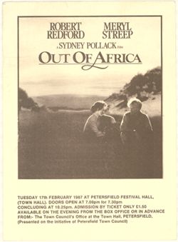
- Subject:
- Meadows, Immigrants in motion pictures, Fliers (Printed matter), Couples, Men, Valleys, Whites in motion pictures, Fiction films, Motion pictures--United Sta...
- Creator:
- Publisher: British screening at IBM South Hampshire Club. and Director: Pollack, Sydney
- Language:
- English
- Date Created:
- Publication Date: Circa 1987-02-17 and Date Taken: 1987
- Identifier:
- VAD9191-002269
- Geographic Location:
- Kenya
- Related URL:
- http://purl.dlib.indiana.edu/iudl/findingaids/bfca/VAD5484
- Abstract:
- Additional images and text on back.
- Caption:
- Tuesday 17th February 1987 at Petersfield Festival Hall, (Town Hall). Doors open at 7.00pm for 7.30pm concluding at 10.25pm. Admission by ticket only £1.50 a...
- Country:
- United States and Great Britain
- Physical Description:
- 1 item : black & white , 11.75 x 8.25 inches
- Alternate Identifier:
- COL 12
- Persistent URL:
- http://purl.dlib.indiana.edu/iudl/bfca/VAD9191/VAD9191-002269
-
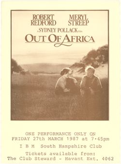
- Subject:
- Motion pictures--United States, Hills, Whites in motion pictures, Valleys, Europeans--Kenya, Immigrants in motion pictures, Men, Women, Fliers (Printed matte...
- Creator:
- Director: Pollack, Sydney
- Language:
- English
- Date Created:
- Publication Date: Circa 1987-03-27 and Date Taken: 1985
- Identifier:
- VAD9191-002268
- Geographic Location:
- Kenya
- Related URL:
- http://purl.dlib.indiana.edu/iudl/findingaids/bfca/VAD5484
- Abstract:
- Additional images and text on back. Flier for British screening at Petersfield Festival Hall.
- Caption:
- One performance only on Friday 27th March 1987 at 7.45pm IBM South Hampshire Club Tickets available from: The Club Steward - Havant Ext. 4062
- Country:
- Great Britain and United States
- Physical Description:
- 1 item : black & white , 11.75 x 8.25 inches
- Alternate Identifier:
- COL 12
- Persistent URL:
- http://purl.dlib.indiana.edu/iudl/bfca/VAD9191/VAD9191-002268
-
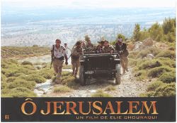
- Subject:
- Firearms, Lobby cards, Fiction films, Valleys, Men, Israelis in motion pictures, Jeep automobiles, Women, and Bloody shirt
- Creator:
- Director: Chouraqui, Elie and Publisher: Haut et Court
- Language:
- French
- Date Created:
- Date Taken: 2006
- Identifier:
- VAD9191-001865
- Geographic Location:
- Israel
- Related URL:
- http://purl.dlib.indiana.edu/iudl/findingaids/bfca/VAD5484
- Call Number:
- Box 10, Folder 1, Item 18
- Country:
- France, Greece, Israel, United States, Great Britain, and Italy
- Physical Description:
- 1 lobby card : color
- Alternate Identifier:
- COL 12
- Persistent URL:
- http://purl.dlib.indiana.edu/iudl/bfca/VAD9191/VAD9191-001865
-

- Subject:
- Couples, Romance films, Meadows, Fiction films, Whites in motion pictures, Women, Europeans--Kenya, Motion pictures--United States, Immigrants in motion pict...
- Creator:
- Publisher: UIP and Director: Pollack, Sydney
- Language:
- English
- Date Created:
- Date Taken: 1985 and Publication Date: 1986
- Identifier:
- VAD9191-000003
- Geographic Location:
- Kenya
- Persons Pictured:
- Robert Redford and Meryl Streep
- Related URL:
- http://purl.dlib.indiana.edu/iudl/findingaids/bfca/VAD5484
- Call Number:
- COL 12 POS 1
- Country:
- United States and Great Britain
- Physical Description:
- 1 poster , 16 x 11.25 inches
- Alternate Identifier:
- COL 12
- Persistent URL:
- http://purl.dlib.indiana.edu/iudl/bfca/VAD9191/VAD9191-000003
-
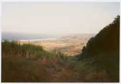
- Subject:
- Photographs, Valleys, and Beaches
- Creator:
- Photographer: [Indiana University, Bloomington. Black Film Center/Archive?]
- Date Created:
- Publication Date: 1994
- Identifier:
- VAE0371-000873
- Call Number:
- PA 210.7
- Country:
- Caribbean
- Physical Description:
- 1 photograph : color and 6 x 4 inches
- Alternate Identifier:
- GEN
- Persistent URL:
- http://purl.dlib.indiana.edu/iudl/bfca/VAE0371/VAE0371-000873
- Holding Location:
- Bloomington - Black Film Center & Archive
Herman B Wells Library, Room 044
1320 East Tenth Street
Bloomington, IN 47405
Contact at bfca@indiana.edu, 812-855-6041
-
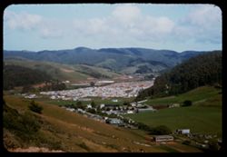
- Description:
- 50 f 8
- Subject:
- Barns, Valleys, Automobiles, Trees, San Pedro, Point (San Mateo County, Calif.), Signs (Notices), Streets, Fences, Shrubs, Clouds, Facilities, Dwellings, and...
- Series:
- 14-55
- Creator:
- Cushman, Charles W., 1896-1972
- Date Created:
- 1955-04-22
- Genre:
- Cityscape photographs
- Frame Number:
- 9
- County:
- San Mateo
- Abstract:
- New town of Linda Mar (part of it) near Pedro Pt., San Mateo co.
- Call Number:
- P15807
- City:
- Linda Mar
- Country:
- United States
- State/Province:
- California
- Alternate Identifier:
- 1455.9
- Persistent URL:
- http://purl.dlib.indiana.edu/iudl/archives/cushman/P15807
- Holding Location:
- Bloomington - University Archives
Wells Library E460
1320 E 10th St.
Bloomington, IN 47405
Contact at archives@indiana.edu, 812-855-1127
-
- Description:
- 100 f 4 TL
- Subject:
- Rocks, Valleys, Roads, Tehachapi Mountains (Calif.), Mountains, and Hills
- Series:
- 3-69
- Creator:
- Cushman, Charles W., 1896-1972
- Date Created:
- 1969-03-21
- Genre:
- Landscape photographs
- Frame Number:
- 22
- Street Address:
- California State Highway 58
- County:
- Kern
- Abstract:
- Lower along Hwy 58
- Call Number:
- P15774
- City:
- Tehachapi and Bakersfield
- Country:
- United States
- State/Province:
- California
- Alternate Identifier:
- 369.22
- Persistent URL:
- http://purl.dlib.indiana.edu/iudl/archives/cushman/P15774
- Holding Location:
- Bloomington - University Archives
Wells Library E460
1320 E 10th St.
Bloomington, IN 47405
Contact at archives@indiana.edu, 812-855-1127
-
- Description:
- 100 f 11 TL
- Subject:
- Palm Canyon (Calif.), Tree limbs, Valleys, Shrubs, Trees, and Parkinsonia aculeata
- Series:
- 2-69
- Creator:
- Cushman, Charles W., 1896-1972
- Date Created:
- 1969-03-16
- Genre:
- Identification photographs and Landscape photographs
- Frame Number:
- 30
- County:
- Riverside
- Call Number:
- P15747
- Country:
- United States
- State/Province:
- California
- Alternate Identifier:
- 269.30
- Persistent URL:
- http://purl.dlib.indiana.edu/iudl/archives/cushman/P15747
- Holding Location:
- Bloomington - University Archives
Wells Library E460
1320 E 10th St.
Bloomington, IN 47405
Contact at archives@indiana.edu, 812-855-1127
-
- Description:
- 100 f 11 TL
- Subject:
- Rocks, Families, Children, Valleys, Electric lines, Roads, Trees, Bicycles & tricycles, Palm Canyon (Calif.), Shrubs, and Mountains
- Series:
- 2-69
- Creator:
- Cushman, Charles W., 1896-1972
- Date Created:
- 1969-03-16
- Genre:
- Snapshots
- Frame Number:
- 29
- County:
- Riverside
- Call Number:
- P15746
- Country:
- United States
- State/Province:
- California
- Alternate Identifier:
- 269.29
- Persistent URL:
- http://purl.dlib.indiana.edu/iudl/archives/cushman/P15746
- Holding Location:
- Bloomington - University Archives
Wells Library E460
1320 E 10th St.
Bloomington, IN 47405
Contact at archives@indiana.edu, 812-855-1127
-
- Description:
- 100 f 11 TL
- Subject:
- Rocks, Families, Children, Valleys, Bicycles & tricycles, Palm Canyon (Calif.), and Shrubs
- Series:
- 2-69
- Creator:
- Cushman, Charles W., 1896-1972
- Date Created:
- 1969-03-16
- Genre:
- Snapshots and Portraits
- Frame Number:
- 28
- County:
- Riverside
- Call Number:
- P15745
- Country:
- United States
- State/Province:
- California
- Alternate Identifier:
- 269.28
- Persistent URL:
- http://purl.dlib.indiana.edu/iudl/archives/cushman/P15745
- Holding Location:
- Bloomington - University Archives
Wells Library E460
1320 E 10th St.
Bloomington, IN 47405
Contact at archives@indiana.edu, 812-855-1127
-
- Description:
- 100 f 11 TL
- Subject:
- Palm Canyon (Calif.), Valleys, Bicycles & tricycles, Shrubs, Families, Rocks, and Children
- Series:
- 2-69
- Creator:
- Cushman, Charles W., 1896-1972
- Date Created:
- 1969-03-16
- Genre:
- Portraits and Snapshots
- Frame Number:
- 27
- County:
- Riverside
- Call Number:
- P15744
- Country:
- United States
- State/Province:
- California
- Alternate Identifier:
- 269.27
- Persistent URL:
- http://purl.dlib.indiana.edu/iudl/archives/cushman/P15744
- Holding Location:
- Bloomington - University Archives
Wells Library E460
1320 E 10th St.
Bloomington, IN 47405
Contact at archives@indiana.edu, 812-855-1127
-
- Description:
- 100 f 8 TL
- Subject:
- Snow, Valleys, Tehachapi Mountains (Calif.), Trees, Mountains, Fences, Hills, and Croplands
- Series:
- 2-69
- Creator:
- Cushman, Charles W., 1896-1972
- Date Created:
- 1969-03-14
- Genre:
- Landscape photographs
- Frame Number:
- 11
- County:
- Kern
- Abstract:
- Tehachapi foothills east of Bakersville
- Call Number:
- P15728
- City:
- Bakersfield
- Country:
- United States
- State/Province:
- California
- Alternate Identifier:
- 269.11
- Persistent URL:
- http://purl.dlib.indiana.edu/iudl/archives/cushman/P15728
- Holding Location:
- Bloomington - University Archives
Wells Library E460
1320 E 10th St.
Bloomington, IN 47405
Contact at archives@indiana.edu, 812-855-1127
-
- Description:
- 100 f 8 TL
- Subject:
- Snow, Valleys, Tehachapi Mountains (Calif.), Trees, Croplands, Hills, and Mountains
- Series:
- 2-69
- Creator:
- Cushman, Charles W., 1896-1972
- Date Created:
- 1969-03-14
- Genre:
- Landscape photographs
- Frame Number:
- 10
- County:
- Kern
- Abstract:
- Tehachapi foothills east of Bakersville
- Call Number:
- P15727
- City:
- Bakersfield
- Country:
- United States
- State/Province:
- California
- Alternate Identifier:
- 269.10
- Persistent URL:
- http://purl.dlib.indiana.edu/iudl/archives/cushman/P15727
- Holding Location:
- Bloomington - University Archives
Wells Library E460
1320 E 10th St.
Bloomington, IN 47405
Contact at archives@indiana.edu, 812-855-1127
-
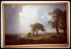
- Description:
- 1/10sec f 1.5
- Subject:
- Sacramento valley in the springtime, Meadows, Valleys, California spring, Light, Cattle, Trees, Grazing, Picture frames, Rivers, and Clouds
- Series:
- 4-68
- Creator:
- Cushman, Charles W., 1896-1972
- Date Created:
- 1968-12-16
- Genre:
- Paintings and Reproductions
- Frame Number:
- 21
- County:
- Sacramento
- Persons Pictured:
- Bierstadt, Albert, 1830-1902
- Abstract:
- Albert Bierstadt Sacramento Va Valley in the Springtime
- Call Number:
- P15694
- Country:
- United States
- State/Province:
- California
- Alternate Identifier:
- 468.21
- Persistent URL:
- http://purl.dlib.indiana.edu/iudl/archives/cushman/P15694
- Holding Location:
- Bloomington - University Archives
Wells Library E460
1320 E 10th St.
Bloomington, IN 47405
Contact at archives@indiana.edu, 812-855-1127
-
- Description:
- 100 f 8
- Subject:
- Valleys, Trees, Meadows, Hills, and Willows
- Series:
- 4-68
- Creator:
- Cushman, Charles W., 1896-1972
- Date Created:
- 1968-12-04
- Genre:
- Landscape photographs
- Frame Number:
- 7
- Street Address:
- Petaluma-Point Reyes Station Road
- County:
- Marin
- Call Number:
- P15680
- Country:
- United States
- State/Province:
- California
- Alternate Identifier:
- 468.7
- Persistent URL:
- http://purl.dlib.indiana.edu/iudl/archives/cushman/P15680
- Holding Location:
- Bloomington - University Archives
Wells Library E460
1320 E 10th St.
Bloomington, IN 47405
Contact at archives@indiana.edu, 812-855-1127
-
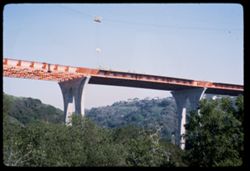
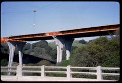
- Description:
- 100 f 8
- Subject:
- Canyons, Houses, Trees, Bridge construction, Bridges, Hills, and Valleys
- Series:
- 1-67
- Creator:
- Cushman, Charles W., 1896-1972
- Date Created:
- 1967-03-07
- Genre:
- Snapshots and Architectural photographs
- Frame Number:
- 4
- Street Address:
- California State Highway 280 and Junipero Serra Freeway
- County:
- San Francisco
- Abstract:
- New high bridge over canyon
- Call Number:
- P15481
- City:
- San Francisco
- Country:
- United States
- State/Province:
- California
- Alternate Identifier:
- 167.4
- Persistent URL:
- http://purl.dlib.indiana.edu/iudl/archives/cushman/P15481
- Holding Location:
- Bloomington - University Archives
Wells Library E460
1320 E 10th St.
Bloomington, IN 47405
Contact at archives@indiana.edu, 812-855-1127
-
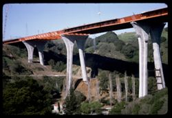
- Description:
- 100 f 11
- Subject:
- Valleys, Hoisting machinery, Roads, Trees, Bridge construction, Bridges, Utility poles, Canyons, and Houses
- Series:
- 1-67
- Creator:
- Cushman, Charles W., 1896-1972
- Date Created:
- 1967-03-07
- Genre:
- Architectural photographs
- Frame Number:
- 3
- Street Address:
- California State Highway 280 and Junipero Serra Freeway
- County:
- San Francisco
- Abstract:
- New high bridge over canyon
- Call Number:
- P15480
- City:
- San Francisco
- Country:
- United States
- State/Province:
- California
- Alternate Identifier:
- 167.3
- Persistent URL:
- http://purl.dlib.indiana.edu/iudl/archives/cushman/P15480
- Holding Location:
- Bloomington - University Archives
Wells Library E460
1320 E 10th St.
Bloomington, IN 47405
Contact at archives@indiana.edu, 812-855-1127
-
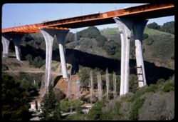
- Description:
- 100 f 11
- Subject:
- Valleys, Houses, Trees, Bridge construction, Mountains, Bridges, Utility poles, Canyons, and Roads
- Series:
- 1-67
- Creator:
- Cushman, Charles W., 1896-1972
- Date Created:
- 1967-03-07
- Genre:
- Architectural photographs
- Frame Number:
- 2
- Street Address:
- California State Highway 280 and Junipero Serra Freeway
- County:
- San Francisco
- Abstract:
- New high bridge over canyon
- Call Number:
- P15479
- City:
- San Francisco
- Country:
- United States
- State/Province:
- California
- Alternate Identifier:
- 167.2
- Persistent URL:
- http://purl.dlib.indiana.edu/iudl/archives/cushman/P15479
- Holding Location:
- Bloomington - University Archives
Wells Library E460
1320 E 10th St.
Bloomington, IN 47405
Contact at archives@indiana.edu, 812-855-1127
-
- Description:
- 100 f 11
- Subject:
- Railings, Canyons, Roads, Trees, Bridge construction, Mountains, Bridges, and Valleys
- Series:
- 1-67
- Creator:
- Cushman, Charles W., 1896-1972
- Date Created:
- 1967-03-07
- Genre:
- Architectural photographs
- Frame Number:
- 1
- Street Address:
- California State Highway 280 and Junipero Serra Freeway
- County:
- San Francisco
- Abstract:
- New high bridge over canyon
- Call Number:
- P15478
- City:
- San Francisco
- Country:
- United States
- State/Province:
- California
- Alternate Identifier:
- 167.1
- Persistent URL:
- http://purl.dlib.indiana.edu/iudl/archives/cushman/P15478
- Holding Location:
- Bloomington - University Archives
Wells Library E460
1320 E 10th St.
Bloomington, IN 47405
Contact at archives@indiana.edu, 812-855-1127
-
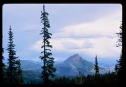
- Description:
- 100 f 11 tl
- Subject:
- Rabbit Ears Pass (Colo.), Firs, Passes (Landforms), Valleys, Forests, Mountains, and Clouds
- Series:
- 9-66
- Creator:
- Cushman, Charles W., 1896-1972
- Date Created:
- 1966-06-15
- Genre:
- Landscape photographs
- Frame Number:
- 30
- Street Address:
- United States Highway 40
- Call Number:
- P15433
- Country:
- United States
- State/Province:
- Colorado
- Alternate Identifier:
- 966.30
- Persistent URL:
- http://purl.dlib.indiana.edu/iudl/archives/cushman/P15433
- Holding Location:
- Bloomington - University Archives
Wells Library E460
1320 E 10th St.
Bloomington, IN 47405
Contact at archives@indiana.edu, 812-855-1127
-
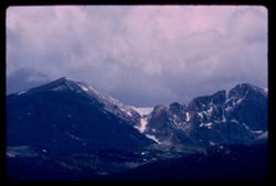
- Description:
- 100 f 14 tl
- Subject:
- Snow, Valleys, Longs Peak (Colo.), Mountains, Clouds, and Forests
- Series:
- 9-66
- Creator:
- Cushman, Charles W., 1896-1972
- Date Created:
- 1966-06-15
- Genre:
- Landscape photographs
- Frame Number:
- 25
- County:
- Boulder
- Call Number:
- P15428
- Country:
- United States
- State/Province:
- Colorado
- Alternate Identifier:
- 966.25
- Persistent URL:
- http://purl.dlib.indiana.edu/iudl/archives/cushman/P15428
- Holding Location:
- Bloomington - University Archives
Wells Library E460
1320 E 10th St.
Bloomington, IN 47405
Contact at archives@indiana.edu, 812-855-1127
-
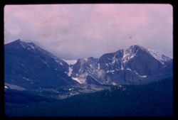
- Description:
- 100 f 11 tl
- Subject:
- Snow, Valleys, Longs Peak (Colo.), Mountains, and Forests
- Series:
- 9-66
- Creator:
- Cushman, Charles W., 1896-1972
- Date Created:
- 1966-06-15
- Genre:
- Landscape photographs
- Frame Number:
- 24
- County:
- Boulder
- Call Number:
- P15427
- Country:
- United States
- State/Province:
- Colorado
- Alternate Identifier:
- 966.24
- Persistent URL:
- http://purl.dlib.indiana.edu/iudl/archives/cushman/P15427
- Holding Location:
- Bloomington - University Archives
Wells Library E460
1320 E 10th St.
Bloomington, IN 47405
Contact at archives@indiana.edu, 812-855-1127
-
- Subject:
- Snow, Valleys, Trees, Mountains, Forests, Passes (Landforms), and Loveland Pass (Colo.)
- Series:
- 9-66
- Creator:
- Cushman, Charles W., 1896-1972
- Date Created:
- 1966-06-14
- Genre:
- Landscape photographs
- Frame Number:
- 16
- County:
- Larimer
- Call Number:
- P15419
- Country:
- United States
- State/Province:
- Colorado
- Alternate Identifier:
- 966.16
- Persistent URL:
- http://purl.dlib.indiana.edu/iudl/archives/cushman/P15419
- Holding Location:
- Bloomington - University Archives
Wells Library E460
1320 E 10th St.
Bloomington, IN 47405
Contact at archives@indiana.edu, 812-855-1127
-
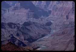
- Description:
- 100 f 16 TL
- Subject:
- Rocks, Valleys, Cliffs, Grand Canyon National Park (Ariz.), Colorado River (Colo.-Mexico), Buttes, Shrubs, Colorado River Valley (Colo.-Mexico), Grand Canyon...
- Series:
- 3-66
- Creator:
- Cushman, Charles W., 1896-1972
- Date Created:
- 1966-04-23
- Genre:
- Landscape photographs
- Frame Number:
- 4
- County:
- Coconino
- Abstract:
- Butte up river
- Call Number:
- P15287
- Country:
- United States
- State/Province:
- Arizona
- Alternate Identifier:
- 366.4
- Persistent URL:
- http://purl.dlib.indiana.edu/iudl/archives/cushman/P15287
- Holding Location:
- Bloomington - University Archives
Wells Library E460
1320 E 10th St.
Bloomington, IN 47405
Contact at archives@indiana.edu, 812-855-1127
-
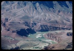
- Description:
- 100 f 16 TL HF
- Subject:
- Desert View Point (Ariz.), Canyons, Valleys, Grand Canyon (Ariz.), Grand Canyon National Park (Ariz.), Colorado River (Colo.-Mexico), Buttes, Rivers, Nationa...
- Series:
- 3-66
- Creator:
- Cushman, Charles W., 1896-1972
- Date Created:
- 1966-04-23
- Genre:
- Landscape photographs
- Frame Number:
- 3
- County:
- Coconino
- Abstract:
- Butte up river
- Call Number:
- P15286
- Country:
- United States
- State/Province:
- Arizona
- Alternate Identifier:
- 366.3
- Persistent URL:
- http://purl.dlib.indiana.edu/iudl/archives/cushman/P15286
- Holding Location:
- Bloomington - University Archives
Wells Library E460
1320 E 10th St.
Bloomington, IN 47405
Contact at archives@indiana.edu, 812-855-1127
-
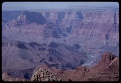
- Description:
- 100 f 16 TL HF
- Subject:
- Erosion, National parks & reserves, Canyons, Valleys, Cliffs, Grand Canyon National Park (Ariz.), Colorado River (Colo.-Mexico), Rock formations, Colorad...
- Series:
- 3-66
- Creator:
- Cushman, Charles W., 1896-1972
- Date Created:
- 1966-04-23
- Genre:
- Landscape photographs
- Frame Number:
- 2
- County:
- Coconino
- Abstract:
- Butte up river
- Call Number:
- P15285
- Country:
- United States
- State/Province:
- Arizona
- Alternate Identifier:
- 366.2
- Persistent URL:
- http://purl.dlib.indiana.edu/iudl/archives/cushman/P15285
- Holding Location:
- Bloomington - University Archives
Wells Library E460
1320 E 10th St.
Bloomington, IN 47405
Contact at archives@indiana.edu, 812-855-1127
-
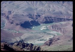
- Description:
- 100 f 16 TL HF
- Subject:
- Canyons, Erosion, Cliffs, Grand Canyon National Park (Ariz.), National parks & reserves, Grand Canyon (Ariz.), Rivers, Valleys, Rock formations, and Dese...
- Series:
- 2-66
- Creator:
- Cushman, Charles W., 1896-1972
- Date Created:
- 1966-04-23
- Genre:
- Landscape photographs
- Frame Number:
- 20
- Street Address:
- East Rim Drive
- County:
- Coconino
- Call Number:
- P15282
- Country:
- United States
- State/Province:
- Arizona
- Alternate Identifier:
- 266.20
- Persistent URL:
- http://purl.dlib.indiana.edu/iudl/archives/cushman/P15282
- Holding Location:
- Bloomington - University Archives
Wells Library E460
1320 E 10th St.
Bloomington, IN 47405
Contact at archives@indiana.edu, 812-855-1127
-
- Description:
- 100 f 18 TL HF
- Subject:
- Colorado River Valley (Colo.-Mexico), National parks & reserves, Canyons, Valleys, Cliffs, Grand Canyon National Park (Ariz.), Colorado River (Colo.-Mexi...
- Series:
- 2-66
- Creator:
- Cushman, Charles W., 1896-1972
- Date Created:
- 1966-04-23
- Genre:
- Landscape photographs
- Frame Number:
- 19
- County:
- Coconino
- Abstract:
- from Lipan Pt.
- Call Number:
- P15281
- Country:
- United States
- State/Province:
- Arizona
- Alternate Identifier:
- 266.19
- Persistent URL:
- http://purl.dlib.indiana.edu/iudl/archives/cushman/P15281
- Holding Location:
- Bloomington - University Archives
Wells Library E460
1320 E 10th St.
Bloomington, IN 47405
Contact at archives@indiana.edu, 812-855-1127
-
- Description:
- 100 f 16 TL HF
- Subject:
- Erosion, National parks & reserves, Canyons, Valleys, Grand Canyon (Ariz.), Grand Canyon National Park (Ariz.), Colorado River (Colo.-Mexico), Lipan Poin...
- Series:
- 2-66
- Creator:
- Cushman, Charles W., 1896-1972
- Date Created:
- 1966-04-23
- Genre:
- Landscape photographs
- Frame Number:
- 18
- Street Address:
- East Rim Drive
- County:
- Coconino
- Abstract:
- from Lipan Pt.
- Call Number:
- P15280
- Country:
- United States
- State/Province:
- Arizona
- Alternate Identifier:
- 266.18
- Persistent URL:
- http://purl.dlib.indiana.edu/iudl/archives/cushman/P15280
- Holding Location:
- Bloomington - University Archives
Wells Library E460
1320 E 10th St.
Bloomington, IN 47405
Contact at archives@indiana.edu, 812-855-1127
-
- Description:
- 100 f 16 TL HF
- Subject:
- Colorado River Valley (Colo.-Mexico), National parks & reserves, Canyons, Valleys, Cliffs, Grand Canyon National Park (Ariz.), Colorado River (Colo.-Mexi...
- Series:
- 2-66
- Creator:
- Cushman, Charles W., 1896-1972
- Date Created:
- 1966-04-23
- Genre:
- Landscape photographs
- Frame Number:
- 17
- County:
- Coconino
- Abstract:
- from Lipan Pt.
- Call Number:
- P15279
- Country:
- United States
- State/Province:
- Arizona
- Alternate Identifier:
- 266.17
- Persistent URL:
- http://purl.dlib.indiana.edu/iudl/archives/cushman/P15279
- Holding Location:
- Bloomington - University Archives
Wells Library E460
1320 E 10th St.
Bloomington, IN 47405
Contact at archives@indiana.edu, 812-855-1127
-
- Description:
- 100 f 16 TL HF
- Subject:
- Canyons, Erosion, Cliffs, Grand Canyon National Park (Ariz.), Colorado River (Colo.-Mexico), National parks & reserves, Colorado River Valley (Colo.-Mexi...
- Series:
- 2-66
- Creator:
- Cushman, Charles W., 1896-1972
- Date Created:
- 1966-04-23
- Genre:
- Landscape photographs
- Frame Number:
- 16
- County:
- Coconino
- Abstract:
- from Lipan Pt.
- Call Number:
- P15278
- Country:
- United States
- State/Province:
- Arizona
- Alternate Identifier:
- 266.16
- Persistent URL:
- http://purl.dlib.indiana.edu/iudl/archives/cushman/P15278
- Holding Location:
- Bloomington - University Archives
Wells Library E460
1320 E 10th St.
Bloomington, IN 47405
Contact at archives@indiana.edu, 812-855-1127
-
- Description:
- 100 f 16 TL HF
- Subject:
- Valleys, Erosion, Cliffs, Grand Canyon National Park (Ariz.), Colorado River (Colo.-Mexico), Buttes, National parks & reserves, Colorado River Valley (Co...
- Series:
- 2-66
- Creator:
- Cushman, Charles W., 1896-1972
- Date Created:
- 1966-04-23
- Genre:
- Landscape photographs
- Frame Number:
- 15
- County:
- Coconino
- Abstract:
- from Lipan Pt.
- Call Number:
- P15277
- Country:
- United States
- State/Province:
- Arizona
- Alternate Identifier:
- 266.15
- Persistent URL:
- http://purl.dlib.indiana.edu/iudl/archives/cushman/P15277
- Holding Location:
- Bloomington - University Archives
Wells Library E460
1320 E 10th St.
Bloomington, IN 47405
Contact at archives@indiana.edu, 812-855-1127
-
- Description:
- 100 f 16 TL HF tele lens
- Subject:
- Valleys, Cliffs, Moran Point (Ariz.), Mesas, Colorado River (Colo.-Mexico), Rock formations, Colorado River Valley (Colo.-Mexico), Grand Canyon (Ariz.), Rive...
- Series:
- 2-66
- Creator:
- Cushman, Charles W., 1896-1972
- Date Created:
- 1966-04-23
- Genre:
- Landscape photographs
- Frame Number:
- 13
- County:
- Coconino
- Abstract:
- Moran Pt.
- Call Number:
- P15275
- Country:
- United States
- State/Province:
- Arizona
- Alternate Identifier:
- 266.13
- Persistent URL:
- http://purl.dlib.indiana.edu/iudl/archives/cushman/P15275
- Holding Location:
- Bloomington - University Archives
Wells Library E460
1320 E 10th St.
Bloomington, IN 47405
Contact at archives@indiana.edu, 812-855-1127
-
- Description:
- 100 f 16 TL HF
- Subject:
- Valleys, Cliffs, Moran Point (Ariz.), Grand Canyon National Park (Ariz.), Colorado River (Colo.-Mexico), National parks & reserves, Colorado River Valley...
- Series:
- 2-66
- Creator:
- Cushman, Charles W., 1896-1972
- Date Created:
- 1966-04-23
- Genre:
- Landscape photographs
- Frame Number:
- 12
- County:
- Coconino
- Abstract:
- Moran Pt.
- Call Number:
- P15274
- Country:
- United States
- State/Province:
- Arizona
- Alternate Identifier:
- 266.12
- Persistent URL:
- http://purl.dlib.indiana.edu/iudl/archives/cushman/P15274
- Holding Location:
- Bloomington - University Archives
Wells Library E460
1320 E 10th St.
Bloomington, IN 47405
Contact at archives@indiana.edu, 812-855-1127
-
- Description:
- 100 f 11 or 13 TL
- Subject:
- Valleys, Erosion, Cliffs, Buttes, Rock formations, and Hills
- Series:
- 39-65
- Creator:
- Cushman, Charles W., 1896-1972
- Date Created:
- 1965-10-12
- Genre:
- Landscape photographs
- Frame Number:
- 8
- County:
- Apache
- Abstract:
- Butte west of Round Rock
- Call Number:
- P15189
- City:
- Round Rock
- Country:
- United States
- State/Province:
- Arizona
- Alternate Identifier:
- 3965.8
- Persistent URL:
- http://purl.dlib.indiana.edu/iudl/archives/cushman/P15189
- Holding Location:
- Bloomington - University Archives
Wells Library E460
1320 E 10th St.
Bloomington, IN 47405
Contact at archives@indiana.edu, 812-855-1127
-

- Description:
- 100 f 11 or 13 TL
- Subject:
- Valleys, Erosion, Buttes, and Hills
- Series:
- 39-65
- Creator:
- Cushman, Charles W., 1896-1972
- Date Created:
- 1965-10-12
- Genre:
- Landscape photographs
- Frame Number:
- 7
- County:
- Apache
- Abstract:
- Butte west of Round Rock
- Call Number:
- P15188
- City:
- Round Rock
- Country:
- United States
- State/Province:
- Arizona
- Alternate Identifier:
- 3865.7
- Persistent URL:
- http://purl.dlib.indiana.edu/iudl/archives/cushman/P15188
- Holding Location:
- Bloomington - University Archives
Wells Library E460
1320 E 10th St.
Bloomington, IN 47405
Contact at archives@indiana.edu, 812-855-1127
-
- Description:
- 100 f 11 or 13 TL
- Subject:
- Valleys, Erosion, Buttes, and Hills
- Series:
- 39-65
- Creator:
- Cushman, Charles W., 1896-1972
- Date Created:
- 1965-10-12
- Genre:
- Landscape photographs
- Frame Number:
- 6
- County:
- Apache
- Abstract:
- Butte west of Round Rock
- Call Number:
- P15187
- City:
- Round Rock
- Country:
- United States
- State/Province:
- Arizona
- Alternate Identifier:
- 3965.6
- Persistent URL:
- http://purl.dlib.indiana.edu/iudl/archives/cushman/P15187
- Holding Location:
- Bloomington - University Archives
Wells Library E460
1320 E 10th St.
Bloomington, IN 47405
Contact at archives@indiana.edu, 812-855-1127
-
- Description:
- 100 f 11 or 13 TL
- Subject:
- Valleys, Erosion, Cliffs, Buttes, Rock formations, and Hills
- Series:
- 39-65
- Creator:
- Cushman, Charles W., 1896-1972
- Date Created:
- 1965-10-12
- Genre:
- Landscape photographs
- Frame Number:
- 5
- County:
- Apache
- Abstract:
- Butte west of Round Rock
- Call Number:
- P15186
- City:
- Round Rock
- Country:
- United States
- State/Province:
- Arizona
- Alternate Identifier:
- 3965.5
- Persistent URL:
- http://purl.dlib.indiana.edu/iudl/archives/cushman/P15186
- Holding Location:
- Bloomington - University Archives
Wells Library E460
1320 E 10th St.
Bloomington, IN 47405
Contact at archives@indiana.edu, 812-855-1127
-
- Description:
- 100 f 11 or 13 TL
- Subject:
- Valleys, Cliffs, Buttes, Rock formations, and Hills
- Series:
- 39-65
- Creator:
- Cushman, Charles W., 1896-1972
- Date Created:
- 1965-10-12
- Genre:
- Landscape photographs and Snapshots
- Frame Number:
- 4
- County:
- Apache
- Abstract:
- Butte west of Round Rock
- Call Number:
- P15185
- City:
- Round Rock
- Country:
- United States
- State/Province:
- Arizona
- Alternate Identifier:
- 3965.4
- Persistent URL:
- http://purl.dlib.indiana.edu/iudl/archives/cushman/P15185
- Holding Location:
- Bloomington - University Archives
Wells Library E460
1320 E 10th St.
Bloomington, IN 47405
Contact at archives@indiana.edu, 812-855-1127
-
- Description:
- 100 f 11 or 13 TL
- Subject:
- Valleys, Erosion, Roads, Mesas, Buttes, and Hills
- Series:
- 39-65
- Creator:
- Cushman, Charles W., 1896-1972
- Date Created:
- 1965-10-12
- Genre:
- Landscape photographs
- Frame Number:
- 3
- County:
- Apache
- Abstract:
- Butte west of Round Rock
- Call Number:
- P15184
- City:
- Round Rock
- Country:
- United States
- State/Province:
- Arizona
- Alternate Identifier:
- 3965.3
- Persistent URL:
- http://purl.dlib.indiana.edu/iudl/archives/cushman/P15184
- Holding Location:
- Bloomington - University Archives
Wells Library E460
1320 E 10th St.
Bloomington, IN 47405
Contact at archives@indiana.edu, 812-855-1127
-
- Description:
- 100 f 13 TL
- Subject:
- Valleys, Cliffs, Mesas, Plains, Mounds (Landforms), and Monument Valley (Ariz. and Utah)
- Series:
- 38-65
- Creator:
- Cushman, Charles W., 1896-1972
- Date Created:
- 1965-10-11
- Genre:
- Landscape photographs
- Frame Number:
- 35
- County:
- Navajo
- Abstract:
- Little mound in a green sea of east Monument Valley
- Call Number:
- P15178
- Country:
- United States
- State/Province:
- Arizona
- Alternate Identifier:
- 3865.35
- Persistent URL:
- http://purl.dlib.indiana.edu/iudl/archives/cushman/P15178
- Holding Location:
- Bloomington - University Archives
Wells Library E460
1320 E 10th St.
Bloomington, IN 47405
Contact at archives@indiana.edu, 812-855-1127
-
- Description:
- 100 f 11 TL
- Subject:
- Boundaries, Grasses, Cliffs, Buttes, Plains, Rock formations, Monument Valley (Ariz. and Utah), Brigham's Tomb (Utah), Valleys, and Roads
- Series:
- 38-65
- Creator:
- Cushman, Charles W., 1896-1972
- Date Created:
- 1965-10-10
- Genre:
- Landscape photographs
- Frame Number:
- 23
- Street Address:
- United States Highway 464
- County:
- San Juan
- Abstract:
- Brigham's Tomb.
- Call Number:
- P15166
- Country:
- United States
- State/Province:
- Utah
- Alternate Identifier:
- 3865.23
- Persistent URL:
- http://purl.dlib.indiana.edu/iudl/archives/cushman/P15166
- Holding Location:
- Bloomington - University Archives
Wells Library E460
1320 E 10th St.
Bloomington, IN 47405
Contact at archives@indiana.edu, 812-855-1127
-
- Description:
- 100 f 11 TL
- Subject:
- Brigham's Tomb (Utah), Grasses, Roads, Buttes, Plains, Rock formations, Castle Butte (San Juan County, Utah), King-on-his-Throne (Utah), Valleys, Cliffs,...
- Series:
- 38-65
- Creator:
- Cushman, Charles W., 1896-1972
- Date Created:
- 1965-10-10
- Genre:
- Landscape photographs
- Frame Number:
- 22
- County:
- San Juan
- Abstract:
- King on a throne.
- Call Number:
- P15165
- Country:
- United States
- State/Province:
- Utah
- Alternate Identifier:
- 3865.22
- Persistent URL:
- http://purl.dlib.indiana.edu/iudl/archives/cushman/P15165
- Holding Location:
- Bloomington - University Archives
Wells Library E460
1320 E 10th St.
Bloomington, IN 47405
Contact at archives@indiana.edu, 812-855-1127
-

- Description:
- 100 f 11 TL
- Subject:
- Stagecoach (Utah), Valleys, Grasses, Cliffs, Bear and Rabbit Summit (Utah), Buttes, Plains, Rock formations, Castle Butte (San Juan County, Utah), and Monume...
- Series:
- 38-65
- Creator:
- Cushman, Charles W., 1896-1972
- Date Created:
- 1965-10-10
- Genre:
- Landscape photographs
- Frame Number:
- 21
- County:
- San Juan
- Abstract:
- Castle Butte, Bear + Rabbit, and Stage coach.
- Call Number:
- P15164
- Country:
- United States
- State/Province:
- Utah
- Alternate Identifier:
- 3865.21
- Persistent URL:
- http://purl.dlib.indiana.edu/iudl/archives/cushman/P15164
- Holding Location:
- Bloomington - University Archives
Wells Library E460
1320 E 10th St.
Bloomington, IN 47405
Contact at archives@indiana.edu, 812-855-1127
-
- Description:
- 100 f 11 TL
- Subject:
- Valleys, Grasses, Trees, Monument Valley (Ariz. and Utah), Big Indian (Utah), Cliffs, Buttes, Rock formations, and Plains
- Series:
- 38-65
- Creator:
- Cushman, Charles W., 1896-1972
- Date Created:
- 1965-10-10
- Genre:
- Landscape photographs
- Frame Number:
- 20
- County:
- San Juan
- Abstract:
- Big Indian.
- Call Number:
- P15163
- Country:
- United States
- State/Province:
- Utah
- Alternate Identifier:
- 3865.20
- Persistent URL:
- http://purl.dlib.indiana.edu/iudl/archives/cushman/P15163
- Holding Location:
- Bloomington - University Archives
Wells Library E460
1320 E 10th St.
Bloomington, IN 47405
Contact at archives@indiana.edu, 812-855-1127
-
- Description:
- 100 f 11 SL
- Subject:
- Plains, Valleys, Parks, Cliffs, Mitten Peak (Ariz.), Monument Valley (Ariz. and Utah), Buttes, and Rock formations
- Series:
- 38-65
- Creator:
- Cushman, Charles W., 1896-1972
- Date Created:
- 1965-10-10
- Genre:
- Landscape photographs
- Frame Number:
- 19
- County:
- Navajo
- Abstract:
- Mitten et al
- Call Number:
- P15162
- Country:
- United States
- State/Province:
- Arizona
- Alternate Identifier:
- 3865.19
- Persistent URL:
- http://purl.dlib.indiana.edu/iudl/archives/cushman/P15162
- Holding Location:
- Bloomington - University Archives
Wells Library E460
1320 E 10th St.
Bloomington, IN 47405
Contact at archives@indiana.edu, 812-855-1127
-
- Description:
- 100 f 11 SL
- Subject:
- Valleys, Cliffs, Parks, Buttes, Plains, Rock formations, Monument Valley (Ariz. and Utah), and Mitten Peak (Ariz.)
- Series:
- 38-65
- Creator:
- Cushman, Charles W., 1896-1972
- Date Created:
- 1965-10-10
- Genre:
- Landscape photographs
- Frame Number:
- 18
- County:
- Navajo
- Abstract:
- Mitten et al
- Call Number:
- P15161
- Country:
- United States
- State/Province:
- Arizona
- Alternate Identifier:
- 3865.18
- Persistent URL:
- http://purl.dlib.indiana.edu/iudl/archives/cushman/P15161
- Holding Location:
- Bloomington - University Archives
Wells Library E460
1320 E 10th St.
Bloomington, IN 47405
Contact at archives@indiana.edu, 812-855-1127
-
- Description:
- 200 f 8 TL
- Subject:
- Plains, Valleys, Parks, Cliffs, Monument Valley (Ariz. and Utah), Buttes, and Rock formations
- Series:
- 38-65
- Creator:
- Cushman, Charles W., 1896-1972
- Date Created:
- 1965-10-10
- Genre:
- Landscape photographs
- Frame Number:
- 16
- County:
- Navajo
- Abstract:
- Mitten et al
- Call Number:
- P15159
- Country:
- United States
- State/Province:
- Arizona
- Alternate Identifier:
- 3865.16
- Persistent URL:
- http://purl.dlib.indiana.edu/iudl/archives/cushman/P15159
- Holding Location:
- Bloomington - University Archives
Wells Library E460
1320 E 10th St.
Bloomington, IN 47405
Contact at archives@indiana.edu, 812-855-1127
-
- Description:
- 200 f 8 TL
- Subject:
- Valleys, Cliffs, Parks, Buttes, Plains, Rock formations, Monument Valley (Ariz. and Utah), and Mitten Peak (Ariz.)
- Series:
- 38-65
- Creator:
- Cushman, Charles W., 1896-1972
- Date Created:
- 1965-10-10
- Genre:
- Landscape photographs
- Frame Number:
- 15
- County:
- Navajo
- Abstract:
- Mitten et al
- Call Number:
- P15158
- Country:
- United States
- State/Province:
- Arizona
- Alternate Identifier:
- 3865.15
- Persistent URL:
- http://purl.dlib.indiana.edu/iudl/archives/cushman/P15158
- Holding Location:
- Bloomington - University Archives
Wells Library E460
1320 E 10th St.
Bloomington, IN 47405
Contact at archives@indiana.edu, 812-855-1127
-
- Description:
- 200 f 8 TL
- Subject:
- Valleys, Parks, Cliffs, Mitten Peak (Ariz.), Monument Valley (Ariz. and Utah), Buttes, and Rock formations
- Series:
- 38-65
- Creator:
- Cushman, Charles W., 1896-1972
- Date Created:
- 1965-10-10
- Genre:
- Landscape photographs
- Frame Number:
- 14
- County:
- Navajo
- Abstract:
- Mitten et al
- Call Number:
- P15157
- Country:
- United States
- State/Province:
- Arizona
- Alternate Identifier:
- 3865.14
- Persistent URL:
- http://purl.dlib.indiana.edu/iudl/archives/cushman/P15157
- Holding Location:
- Bloomington - University Archives
Wells Library E460
1320 E 10th St.
Bloomington, IN 47405
Contact at archives@indiana.edu, 812-855-1127
-
- Description:
- 200 f 8 TL
- Subject:
- Valleys, Cliffs, Parks, Buttes, Plains, Rock formations, Monument Valley (Ariz. and Utah), and Mitten Peak (Ariz.)
- Series:
- 38-65
- Creator:
- Cushman, Charles W., 1896-1972
- Date Created:
- 1965-10-10
- Genre:
- Landscape photographs
- Frame Number:
- 13
- County:
- Navajo
- Abstract:
- Mitten et al
- Call Number:
- P15156
- Country:
- United States
- State/Province:
- Arizona
- Alternate Identifier:
- 3865.13
- Persistent URL:
- http://purl.dlib.indiana.edu/iudl/archives/cushman/P15156
- Holding Location:
- Bloomington - University Archives
Wells Library E460
1320 E 10th St.
Bloomington, IN 47405
Contact at archives@indiana.edu, 812-855-1127
-
Monument Valley. Kingon throne=Castle Butte=Bear + Rabbit=Stage Coach=Big Indian=all in Navajo Park=
- Description:
- 200 f 8 TL
- Subject:
- Stagecoach (Utah), Valleys, Grasses, Cliffs, Parks, Bear and Rabbit Summit (Utah), Buttes, Plains, Big Indian (Utah), Rock formations, Castle Butte (San Juan...
- Series:
- 38-65
- Creator:
- Cushman, Charles W., 1896-1972
- Date Created:
- 1965-10-10
- Genre:
- Landscape photographs
- Frame Number:
- 12
- County:
- San Juan
- Abstract:
- Navajo Tribal Park.
- Call Number:
- P15155
- Country:
- United States
- State/Province:
- Utah
- Alternate Identifier:
- 3865.12
- Persistent URL:
- http://purl.dlib.indiana.edu/iudl/archives/cushman/P15155
- Holding Location:
- Bloomington - University Archives
Wells Library E460
1320 E 10th St.
Bloomington, IN 47405
Contact at archives@indiana.edu, 812-855-1127
-
- Description:
- 200 f 8 TL
- Subject:
- Boundaries, Grasses, Cliffs, Buttes, Plains, Rock formations, Monument Valley (Ariz. and Utah), Brigham's Tomb (Utah), Valleys, and King-on-his-Throne (U...
- Series:
- 38-65
- Creator:
- Cushman, Charles W., 1896-1972
- Date Created:
- 1965-10-10
- Genre:
- Landscape photographs
- Frame Number:
- 11
- County:
- San Juan
- Abstract:
- near Utah border.
- Call Number:
- P15154
- Country:
- United States
- State/Province:
- Utah
- Alternate Identifier:
- 3865.11
- Persistent URL:
- http://purl.dlib.indiana.edu/iudl/archives/cushman/P15154
- Holding Location:
- Bloomington - University Archives
Wells Library E460
1320 E 10th St.
Bloomington, IN 47405
Contact at archives@indiana.edu, 812-855-1127
-
- Description:
- 200 f 8 TL
- Subject:
- Stagecoach (Utah), Valleys, Grasses, Cliffs, Parks, Bear and Rabbit Summit (Utah), Buttes, Plains, Big Indian (Utah), Rock formations, Castle Butte (San Juan...
- Series:
- 38-65
- Creator:
- Cushman, Charles W., 1896-1972
- Date Created:
- 1965-10-10
- Genre:
- Landscape photographs
- Frame Number:
- 10
- County:
- San Juan
- Abstract:
- near Utah border.
- Call Number:
- P15153
- Country:
- United States
- State/Province:
- Utah
- Alternate Identifier:
- 3865.10
- Persistent URL:
- http://purl.dlib.indiana.edu/iudl/archives/cushman/P15153
- Holding Location:
- Bloomington - University Archives
Wells Library E460
1320 E 10th St.
Bloomington, IN 47405
Contact at archives@indiana.edu, 812-855-1127
-
- Description:
- 200 f 8 TL
- Subject:
- Valleys, Castle Butte (San Juan County, Utah), Big Indian (Utah), Cliffs, Trees, Monument Valley (Ariz. and Utah), Buttes, Rock formations, Bear and Rabbit S...
- Series:
- 38-65
- Creator:
- Cushman, Charles W., 1896-1972
- Date Created:
- 1965-10-10
- Genre:
- Landscape photographs
- Frame Number:
- 9
- County:
- San Juan
- Abstract:
- Shapes.
- Call Number:
- P15152
- Country:
- United States
- State/Province:
- Utah
- Alternate Identifier:
- 3865.9
- Persistent URL:
- http://purl.dlib.indiana.edu/iudl/archives/cushman/P15152
- Holding Location:
- Bloomington - University Archives
Wells Library E460
1320 E 10th St.
Bloomington, IN 47405
Contact at archives@indiana.edu, 812-855-1127
-
- Description:
- 100 f 11 TL
- Subject:
- Boundaries, Grasses, Cliffs, Buttes, Plains, Rock formations, Monument Valley (Ariz. and Utah), Valleys, and Eagle Mesa (Utah)
- Series:
- 38-65
- Creator:
- Cushman, Charles W., 1896-1972
- Date Created:
- 1965-10-10
- Genre:
- Landscape photographs
- Frame Number:
- 6
- County:
- San Juan
- Abstract:
- Eagle Mesa.
- Call Number:
- P15149
- Country:
- United States
- State/Province:
- Arizona and Utah
- Alternate Identifier:
- 3865.6
- Persistent URL:
- http://purl.dlib.indiana.edu/iudl/archives/cushman/P15149
- Holding Location:
- Bloomington - University Archives
Wells Library E460
1320 E 10th St.
Bloomington, IN 47405
Contact at archives@indiana.edu, 812-855-1127
-
- Description:
- 200 f 8
- Subject:
- Boundaries, Plains, Valleys, Houses, Cliffs, Monument Valley (Ariz. and Utah), Buttes, and Rock formations
- Series:
- 38-65
- Creator:
- Cushman, Charles W., 1896-1972
- Date Created:
- 1965-10-10
- Genre:
- Landscape photographs
- Frame Number:
- 5
- Abstract:
- At border.
- Call Number:
- P15148
- Country:
- United States
- State/Province:
- Arizona and Utah
- Alternate Identifier:
- 3865.5
- Persistent URL:
- http://purl.dlib.indiana.edu/iudl/archives/cushman/P15148
- Holding Location:
- Bloomington - University Archives
Wells Library E460
1320 E 10th St.
Bloomington, IN 47405
Contact at archives@indiana.edu, 812-855-1127
-
- Description:
- 100 f 11 TL
- Subject:
- Valleys, Grasses, Cliffs, Buttes, Plains, Rock formations, Monument Valley (Ariz. and Utah), and Boundaries
- Series:
- 38-65
- Creator:
- Cushman, Charles W., 1896-1972
- Date Created:
- 1965-10-10
- Genre:
- Landscape photographs
- Frame Number:
- 4
- Abstract:
- Nearby.
- Call Number:
- P15147
- Country:
- United States
- State/Province:
- Arizona and Utah
- Alternate Identifier:
- 3865.4
- Persistent URL:
- http://purl.dlib.indiana.edu/iudl/archives/cushman/P15147
- Holding Location:
- Bloomington - University Archives
Wells Library E460
1320 E 10th St.
Bloomington, IN 47405
Contact at archives@indiana.edu, 812-855-1127
-
- Description:
- 100 f 11 TL
- Subject:
- Valleys, Grasses, Cliffs, Buttes, Plains, Rock formations, Monument Valley (Ariz. and Utah), and Boundaries
- Series:
- 38-65
- Creator:
- Cushman, Charles W., 1896-1972
- Date Created:
- 1965-10-10
- Genre:
- Landscape photographs
- Frame Number:
- 3
- County:
- Piute
- Abstract:
- Temples 24 mi. N of Junction.
- Call Number:
- P15146
- City:
- Junction
- Country:
- United States
- State/Province:
- Arizona and Utah
- Alternate Identifier:
- 3865.3
- Persistent URL:
- http://purl.dlib.indiana.edu/iudl/archives/cushman/P15146
- Holding Location:
- Bloomington - University Archives
Wells Library E460
1320 E 10th St.
Bloomington, IN 47405
Contact at archives@indiana.edu, 812-855-1127
-
- Description:
- 100 f 11 TL
- Subject:
- Erosion, Plains, Valleys, Cliffs, Monument Valley (Ariz. and Utah), Buttes, Grasses, and Rock formations
- Series:
- 38-65
- Creator:
- Cushman, Charles W., 1896-1972
- Date Created:
- 1965-10-10
- Genre:
- Landscape photographs
- Frame Number:
- 1
- Street Address:
- United States Highway 464
- County:
- Navajo
- Abstract:
- Big Sq. Butte (12 mi. N)
- Call Number:
- P15144
- City:
- Kayenta
- Country:
- United States
- State/Province:
- Arizona
- Alternate Identifier:
- 3865.1
- Persistent URL:
- http://purl.dlib.indiana.edu/iudl/archives/cushman/P15144
- Holding Location:
- Bloomington - University Archives
Wells Library E460
1320 E 10th St.
Bloomington, IN 47405
Contact at archives@indiana.edu, 812-855-1127
-
- Description:
- 100 f 11 TL
- Subject:
- Boundaries, Plains, Valleys, Cliffs, Monument Valley (Ariz. and Utah), Buttes, Rock formations, and Grasses
- Series:
- 38-65
- Creator:
- Cushman, Charles W., 1896-1972
- Date Created:
- 1965-10-10
- Genre:
- Landscape photographs
- Frame Number:
- 2
- County:
- Navajo
- Abstract:
- Temples 24 mi. N of Junction.
- Call Number:
- P15145
- City:
- Kayenta
- Country:
- United States
- State/Province:
- Arizona
- Alternate Identifier:
- 3865.2
- Persistent URL:
- http://purl.dlib.indiana.edu/iudl/archives/cushman/P15145
- Holding Location:
- Bloomington - University Archives
Wells Library E460
1320 E 10th St.
Bloomington, IN 47405
Contact at archives@indiana.edu, 812-855-1127
-
- Description:
- 100 f 11 TL
- Subject:
- Valleys, Roads, Mesas, Buttes, Plains, Hills, Monument Valley (Ariz. and Utah), and Cliffs
- Series:
- 37-65
- Creator:
- Cushman, Charles W., 1896-1972
- Date Created:
- 1965-10-10
- Genre:
- Landscape photographs
- Frame Number:
- 35
- Abstract:
- Sq. Butte.
- Call Number:
- P15141
- Country:
- United States
- State/Province:
- Arizona
- Alternate Identifier:
- 3765.35
- Persistent URL:
- http://purl.dlib.indiana.edu/iudl/archives/cushman/P15141
- Holding Location:
- Bloomington - University Archives
Wells Library E460
1320 E 10th St.
Bloomington, IN 47405
Contact at archives@indiana.edu, 812-855-1127
-
- Description:
- 100 f 11 TL
- Subject:
- Erosion, Valleys, Cliffs, Monument Valley (Ariz. and Utah), Buttes, Rock formations, Mesas, and Grasses
- Series:
- 37-65
- Creator:
- Cushman, Charles W., 1896-1972
- Date Created:
- 1965-10-10
- Genre:
- Landscape photographs
- Frame Number:
- 32
- Call Number:
- P15138
- Country:
- United States
- State/Province:
- Arizona
- Alternate Identifier:
- 3765.32
- Persistent URL:
- http://purl.dlib.indiana.edu/iudl/archives/cushman/P15138
- Holding Location:
- Bloomington - University Archives
Wells Library E460
1320 E 10th St.
Bloomington, IN 47405
Contact at archives@indiana.edu, 812-855-1127
-
- Description:
- 100 f 8 TL
- Subject:
- Valleys, Grasses, Mitchell Butte (Ariz.), Mesas, Buttes, Fences, Rock formations, Mounds (Landforms), Vehicles, Hills, and Monument Valley (Ariz. and Utah)
- Series:
- 37-65
- Creator:
- Cushman, Charles W., 1896-1972
- Date Created:
- 1965-10-09
- Genre:
- Landscape photographs
- Frame Number:
- 26
- County:
- Navajo
- Abstract:
- Mitchell Butte @ 72,269 mi.
- Call Number:
- P15132
- Country:
- United States
- State/Province:
- Arizona
- Alternate Identifier:
- 3765.26
- Persistent URL:
- http://purl.dlib.indiana.edu/iudl/archives/cushman/P15132
- Holding Location:
- Bloomington - University Archives
Wells Library E460
1320 E 10th St.
Bloomington, IN 47405
Contact at archives@indiana.edu, 812-855-1127
-
- Subject:
- Boundaries, Plains, Valleys, Cliffs, Monument Valley (Ariz. and Utah), Buttes, Rock formations, and Mesas
- Series:
- 37-65
- Creator:
- Cushman, Charles W., 1896-1972
- Date Created:
- 1965-10-09
- Genre:
- Landscape photographs
- Frame Number:
- 25
- Abstract:
- In Monument Valley near Utah-Arizona border.
- Call Number:
- P15131
- Country:
- United States
- State/Province:
- Arizona and Utah
- Alternate Identifier:
- 3765.25
- Persistent URL:
- http://purl.dlib.indiana.edu/iudl/archives/cushman/P15131
- Holding Location:
- Bloomington - University Archives
Wells Library E460
1320 E 10th St.
Bloomington, IN 47405
Contact at archives@indiana.edu, 812-855-1127
-
- Description:
- 100 f 11 TL
- Subject:
- Boundaries, Plains, Valleys, Cliffs, Monument Valley (Ariz. and Utah), Rock formations, and Mesas
- Series:
- 37-65
- Creator:
- Cushman, Charles W., 1896-1972
- Date Created:
- 1965-10-09
- Genre:
- Landscape photographs
- Frame Number:
- 23
- Abstract:
- In Monument Valley near Utah-Arizona border.
- Call Number:
- P15129
- Country:
- United States
- State/Province:
- Arizona and Utah
- Alternate Identifier:
- 3765.23
- Persistent URL:
- http://purl.dlib.indiana.edu/iudl/archives/cushman/P15129
- Holding Location:
- Bloomington - University Archives
Wells Library E460
1320 E 10th St.
Bloomington, IN 47405
Contact at archives@indiana.edu, 812-855-1127
-
- Description:
- 100 f 11 TL
- Subject:
- Boundaries, Grasses, Mesas, Rock formations, Monument Valley (Ariz. and Utah), and Valleys
- Series:
- 37-65
- Creator:
- Cushman, Charles W., 1896-1972
- Date Created:
- 1965-10-09
- Genre:
- Landscape photographs
- Frame Number:
- 22
- Abstract:
- In Monument Valley near Utah-Arizona border.
- Call Number:
- P15128
- Country:
- United States
- State/Province:
- Arizona and Utah
- Alternate Identifier:
- 3765.22
- Persistent URL:
- http://purl.dlib.indiana.edu/iudl/archives/cushman/P15128
- Holding Location:
- Bloomington - University Archives
Wells Library E460
1320 E 10th St.
Bloomington, IN 47405
Contact at archives@indiana.edu, 812-855-1127
-
- Description:
- 100 f 11 TL
- Subject:
- Boundaries, Cliffs, Mesas, Buttes, Plains, Rock formations, Monument Valley (Ariz. and Utah), and Valleys
- Series:
- 37-65
- Creator:
- Cushman, Charles W., 1896-1972
- Date Created:
- 1965-10-09
- Genre:
- Landscape photographs
- Frame Number:
- 21
- Abstract:
- In Monument Valley near Utah-Arizona border.
- Call Number:
- P15127
- Country:
- United States
- State/Province:
- Arizona and Utah
- Alternate Identifier:
- 3765.21
- Persistent URL:
- http://purl.dlib.indiana.edu/iudl/archives/cushman/P15127
- Holding Location:
- Bloomington - University Archives
Wells Library E460
1320 E 10th St.
Bloomington, IN 47405
Contact at archives@indiana.edu, 812-855-1127
-
- Description:
- 100 f 11 TL
- Subject:
- Boundaries, Plains, Valleys, Cliffs, Monument Valley (Ariz. and Utah), Buttes, Rock formations, and Mesas
- Series:
- 37-65
- Creator:
- Cushman, Charles W., 1896-1972
- Date Created:
- 1965-10-09
- Genre:
- Landscape photographs
- Frame Number:
- 20
- Call Number:
- P15126
- Country:
- United States
- State/Province:
- Arizona and Utah
- Alternate Identifier:
- 3765.20
- Persistent URL:
- http://purl.dlib.indiana.edu/iudl/archives/cushman/P15126
- Holding Location:
- Bloomington - University Archives
Wells Library E460
1320 E 10th St.
Bloomington, IN 47405
Contact at archives@indiana.edu, 812-855-1127
-
- Description:
- 100 f 11
- Subject:
- Valleys, Cliffs, Agathla Peak (Ariz.), Buttes, Rock formations, and Monument Valley (Ariz. and Utah)
- Series:
- 37-65
- Creator:
- Cushman, Charles W., 1896-1972
- Date Created:
- 1965-10-09
- Genre:
- Landscape photographs
- Frame Number:
- 19
- County:
- Navajo
- Abstract:
- El Capitan? Agathlan.
- Call Number:
- P15125
- Country:
- United States
- State/Province:
- Arizona
- Alternate Identifier:
- 3765.19
- Persistent URL:
- http://purl.dlib.indiana.edu/iudl/archives/cushman/P15125
- Holding Location:
- Bloomington - University Archives
Wells Library E460
1320 E 10th St.
Bloomington, IN 47405
Contact at archives@indiana.edu, 812-855-1127
-
- Description:
- 100 f 9
- Subject:
- Valleys, Buttes, Rock formations, and Monument Valley (Ariz. and Utah)
- Series:
- 37-65
- Creator:
- Cushman, Charles W., 1896-1972
- Date Created:
- 1965-10-09
- Genre:
- Landscape photographs
- Frame Number:
- 17
- Abstract:
- The Owl.
- Call Number:
- P15123
- Country:
- United States
- State/Province:
- Arizona
- Alternate Identifier:
- 3765.17
- Persistent URL:
- http://purl.dlib.indiana.edu/iudl/archives/cushman/P15123
- Holding Location:
- Bloomington - University Archives
Wells Library E460
1320 E 10th St.
Bloomington, IN 47405
Contact at archives@indiana.edu, 812-855-1127
-
- Description:
- 100 f 11
- Subject:
- Valleys, Cliffs, Buttes, Plains, Rock formations, Chaistla Butte (Ariz.), and Monument Valley (Ariz. and Utah)
- Series:
- 37-65
- Creator:
- Cushman, Charles W., 1896-1972
- Date Created:
- 1965-10-09
- Genre:
- Landscape photographs
- Frame Number:
- 16
- County:
- Navajo
- Abstract:
- Chaistla Butte?
- Call Number:
- P15122
- Country:
- United States
- State/Province:
- Arizona
- Alternate Identifier:
- 3765.16
- Persistent URL:
- http://purl.dlib.indiana.edu/iudl/archives/cushman/P15122
- Holding Location:
- Bloomington - University Archives
Wells Library E460
1320 E 10th St.
Bloomington, IN 47405
Contact at archives@indiana.edu, 812-855-1127
-
- Description:
- 100 f 11
- Subject:
- Valleys, Cliffs, Buttes, Plains, Rock formations, Chaistla Butte (Ariz.), Monument Valley (Ariz. and Utah), and Roads
- Series:
- 37-65
- Creator:
- Cushman, Charles W., 1896-1972
- Date Created:
- 1965-10-09
- Genre:
- Landscape photographs
- Frame Number:
- 15
- County:
- Navajo
- Abstract:
- In Monument Valley.
- Call Number:
- P15121
- Country:
- United States
- State/Province:
- Arizona
- Alternate Identifier:
- 3765.15
- Persistent URL:
- http://purl.dlib.indiana.edu/iudl/archives/cushman/P15121
- Holding Location:
- Bloomington - University Archives
Wells Library E460
1320 E 10th St.
Bloomington, IN 47405
Contact at archives@indiana.edu, 812-855-1127
-
- Description:
- 100 f 11 TL
- Subject:
- Deserts, Valleys, Buttes, Rock formations, and Monument Valley (Ariz. and Utah)
- Series:
- 37-65
- Creator:
- Cushman, Charles W., 1896-1972
- Date Created:
- 1965-10-09
- Genre:
- Landscape photographs
- Frame Number:
- 14
- County:
- Navajo
- Abstract:
- Church Rock.
- Call Number:
- P15120
- Country:
- United States
- State/Province:
- Arizona
- Alternate Identifier:
- 3765.14
- Persistent URL:
- http://purl.dlib.indiana.edu/iudl/archives/cushman/P15120
- Holding Location:
- Bloomington - University Archives
Wells Library E460
1320 E 10th St.
Bloomington, IN 47405
Contact at archives@indiana.edu, 812-855-1127
-
- Description:
- 100 f 11 SL
- Subject:
- Valleys, Grasses, Monument Valley (Ariz. and Utah), Deserts, Cliffs, Rock formations, and Shrubs
- Series:
- 37-65
- Creator:
- Cushman, Charles W., 1896-1972
- Date Created:
- 1965-10-09
- Genre:
- Landscape photographs
- Frame Number:
- 9
- Street Address:
- Arizona State Highway 64 and Navajo Trail
- County:
- Navajo
- Abstract:
- Red stone.
- Call Number:
- P15115
- City:
- Kayenta
- Country:
- United States
- State/Province:
- Arizona
- Alternate Identifier:
- 3765.9
- Persistent URL:
- http://purl.dlib.indiana.edu/iudl/archives/cushman/P15115
- Holding Location:
- Bloomington - University Archives
Wells Library E460
1320 E 10th St.
Bloomington, IN 47405
Contact at archives@indiana.edu, 812-855-1127
-
- Description:
- 100 f ? TL
- Subject:
- Meadows, Valleys, Hills, Forests, San Juan Mountains (Colo. and N.M.), Mountains, Hay, Trees, Fences, and Snow
- Series:
- 35-65
- Creator:
- Cushman, Charles W., 1896-1972
- Date Created:
- 1965-10-05
- Genre:
- Landscape photographs
- Frame Number:
- 37
- County:
- Ouray
- Call Number:
- P15067
- Country:
- United States
- State/Province:
- Colorado
- Alternate Identifier:
- 3565.37
- Persistent URL:
- http://purl.dlib.indiana.edu/iudl/archives/cushman/P15067
- Holding Location:
- Bloomington - University Archives
Wells Library E460
1320 E 10th St.
Bloomington, IN 47405
Contact at archives@indiana.edu, 812-855-1127
-
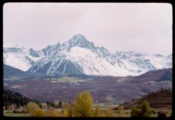
- Description:
- 100 f ? TL
- Subject:
- Valleys, Hills, Sneffels, Mount (Colo.), Forests, San Juan Mountains (Colo. and N.M.), Mountains, Snow, and Trees
- Series:
- 35-65
- Creator:
- Cushman, Charles W., 1896-1972
- Date Created:
- 1965-10-05
- Genre:
- Landscape photographs
- Frame Number:
- 36
- Street Address:
- Colorado State Highway 62
- County:
- Ouray
- Call Number:
- P15066
- Country:
- United States
- State/Province:
- Colorado
- Alternate Identifier:
- 3565.36
- Persistent URL:
- http://purl.dlib.indiana.edu/iudl/archives/cushman/P15066
- Holding Location:
- Bloomington - University Archives
Wells Library E460
1320 E 10th St.
Bloomington, IN 47405
Contact at archives@indiana.edu, 812-855-1127
-
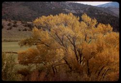
- Description:
- 100 f ? TL
- Subject:
- Valleys, Trees, Tree limbs, Mountains, Hills, and Autumn
- Series:
- 35-65
- Creator:
- Cushman, Charles W., 1896-1972
- Date Created:
- 1965-10-05
- Genre:
- Landscape photographs
- Frame Number:
- 35
- Street Address:
- Colorado State Highway 62
- County:
- Ouray
- Call Number:
- P15065
- City:
- Ouray
- Country:
- United States
- State/Province:
- Colorado
- Alternate Identifier:
- 3565.35
- Persistent URL:
- http://purl.dlib.indiana.edu/iudl/archives/cushman/P15065
- Holding Location:
- Bloomington - University Archives
Wells Library E460
1320 E 10th St.
Bloomington, IN 47405
Contact at archives@indiana.edu, 812-855-1127
-
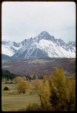
- Description:
- 100 f ? TL
- Subject:
- Valleys, Hills, Sneffels, Mount (Colo.), Forests, San Juan Mountains (Colo. and N.M.), Mountains, Hay, Trees, and Snow
- Series:
- 35-65
- Creator:
- Cushman, Charles W., 1896-1972
- Date Created:
- 1965-10-05
- Genre:
- Landscape photographs
- Frame Number:
- 34
- Street Address:
- Colorado State Highway 62
- County:
- Ouray
- Abstract:
- Mt. Sneffels (14,150') seen from Colo. Hwy 62 NW of Ouray.
- Call Number:
- P15064
- City:
- Ouray
- Country:
- United States
- State/Province:
- Colorado
- Alternate Identifier:
- 3565.34
- Persistent URL:
- http://purl.dlib.indiana.edu/iudl/archives/cushman/P15064
- Holding Location:
- Bloomington - University Archives
Wells Library E460
1320 E 10th St.
Bloomington, IN 47405
Contact at archives@indiana.edu, 812-855-1127
-
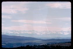
- Description:
- 100 f 8 TL
- Subject:
- Uncompahgre National Forest (Colo.), Valleys, San Juan Mountains (Colo. and N.M.), Mountains, Snow, Trees, and Clouds
- Series:
- 35-65
- Creator:
- Cushman, Charles W., 1896-1972
- Date Created:
- 1965-10-05
- Genre:
- Landscape photographs
- Frame Number:
- 31
- County:
- Montrose
- Abstract:
- Yellow leaves.
- Call Number:
- P15061
- City:
- Montrose
- Country:
- United States
- State/Province:
- Colorado
- Alternate Identifier:
- 3565.31
- Persistent URL:
- http://purl.dlib.indiana.edu/iudl/archives/cushman/P15061
- Holding Location:
- Bloomington - University Archives
Wells Library E460
1320 E 10th St.
Bloomington, IN 47405
Contact at archives@indiana.edu, 812-855-1127
-
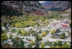
- Description:
- 200 f 6.3
- Subject:
- Valleys, Houses, Trees, Streets, Mountains, Buildings, and Cities & towns
- Series:
- 34-65
- Creator:
- Cushman, Charles W., 1896-1972
- Date Created:
- 1965-10-04
- Genre:
- Cityscape photographs
- Frame Number:
- 38
- County:
- Ouray
- Abstract:
- Ouray.
- Call Number:
- P15030
- City:
- Ouray
- Country:
- United States
- State/Province:
- Colorado
- Alternate Identifier:
- 3465.38
- Persistent URL:
- http://purl.dlib.indiana.edu/iudl/archives/cushman/P15030
- Holding Location:
- Bloomington - University Archives
Wells Library E460
1320 E 10th St.
Bloomington, IN 47405
Contact at archives@indiana.edu, 812-855-1127
-
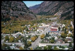
- Description:
- 200 f 9
- Subject:
- Valleys, Houses, Automobiles, Trees, Streets, Cities & towns, Buildings, and Mountains
- Series:
- 34-65
- Creator:
- Cushman, Charles W., 1896-1972
- Date Created:
- 1965-10-04
- Genre:
- Cityscape photographs
- Frame Number:
- 34
- County:
- Ouray
- Abstract:
- Town.
- Call Number:
- P15026
- City:
- Ouray
- Country:
- United States
- State/Province:
- Colorado
- Alternate Identifier:
- 3465.34
- Persistent URL:
- http://purl.dlib.indiana.edu/iudl/archives/cushman/P15026
- Holding Location:
- Bloomington - University Archives
Wells Library E460
1320 E 10th St.
Bloomington, IN 47405
Contact at archives@indiana.edu, 812-855-1127
-
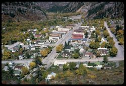
- Description:
- 200 f 9
- Subject:
- Valleys, Houses, Automobiles, Trees, Streets, Cities & towns, Buildings, and Mountains
- Series:
- 34-65
- Creator:
- Cushman, Charles W., 1896-1972
- Date Created:
- 1965-10-04
- Genre:
- Cityscape photographs
- Frame Number:
- 33
- County:
- Ouray
- Abstract:
- Town.
- Call Number:
- P15025
- City:
- Ouray
- Country:
- United States
- State/Province:
- Colorado
- Alternate Identifier:
- 3465.33
- Persistent URL:
- http://purl.dlib.indiana.edu/iudl/archives/cushman/P15025
- Holding Location:
- Bloomington - University Archives
Wells Library E460
1320 E 10th St.
Bloomington, IN 47405
Contact at archives@indiana.edu, 812-855-1127
-
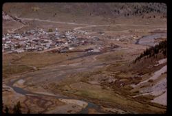
- Description:
- 100 f 16 tl
- Subject:
- Valleys, Houses, Trees, Mountains, Buildings, Railroads, Rivers, and Roads
- Series:
- 33-65
- Creator:
- Cushman, Charles W., 1896-1972
- Date Created:
- 1965-10-02
- Genre:
- Cityscape photographs
- Frame Number:
- 5
- County:
- San Juan
- Abstract:
- Silverton below
- Call Number:
- P14960
- City:
- Silverton
- Country:
- United States
- State/Province:
- Colorado
- Alternate Identifier:
- 3365.5
- Persistent URL:
- http://purl.dlib.indiana.edu/iudl/archives/cushman/P14960
- Holding Location:
- Bloomington - University Archives
Wells Library E460
1320 E 10th St.
Bloomington, IN 47405
Contact at archives@indiana.edu, 812-855-1127
-
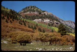
- Description:
- 100 f 11 sl
- Subject:
- Rocks, Valleys, Cliffs, Trees, Mountains, Fences, Rock formations, and Forests
- Series:
- 32-65
- Creator:
- Cushman, Charles W., 1896-1972
- Date Created:
- 1965-10-02
- Genre:
- Landscape photographs
- Frame Number:
- 37
- Street Address:
- United States Highway 550
- County:
- San Juan and La Plata
- Abstract:
- Maybe [Hernora] cliffs
- Call Number:
- P14955
- City:
- Durango and Silverton
- Country:
- United States
- State/Province:
- Colorado
- Alternate Identifier:
- 3265.37
- Persistent URL:
- http://purl.dlib.indiana.edu/iudl/archives/cushman/P14955
- Holding Location:
- Bloomington - University Archives
Wells Library E460
1320 E 10th St.
Bloomington, IN 47405
Contact at archives@indiana.edu, 812-855-1127
-
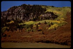
- Description:
- 100 f 11 sl
- Subject:
- Valleys, Cliffs, Trees, Mountains, Rock formations, and Forests
- Series:
- 32-65
- Creator:
- Cushman, Charles W., 1896-1972
- Date Created:
- 1965-10-02
- Genre:
- Landscape photographs
- Frame Number:
- 36
- Street Address:
- United States Highway 550
- County:
- San Juan and La Plata
- Abstract:
- Cliffs and fall colors
- Call Number:
- P14954
- City:
- Durango and Silverton
- Country:
- United States
- State/Province:
- Colorado
- Alternate Identifier:
- 3265.36
- Persistent URL:
- http://purl.dlib.indiana.edu/iudl/archives/cushman/P14954
- Holding Location:
- Bloomington - University Archives
Wells Library E460
1320 E 10th St.
Bloomington, IN 47405
Contact at archives@indiana.edu, 812-855-1127
-
- Subject:
- Valleys, Mountains, Air travel, Forests, and Hills
- Series:
- 26-65
- Creator:
- Cushman, Charles W., 1896-1972
- Date Created:
- 1965-06-02
- Genre:
- Aerial photographs and Landscape photographs
- Frame Number:
- 15
- Call Number:
- P14776
- Country:
- United States
- Alternate Identifier:
- 2665.15
- Persistent URL:
- http://purl.dlib.indiana.edu/iudl/archives/cushman/P14776
- Holding Location:
- Bloomington - University Archives
Wells Library E460
1320 E 10th St.
Bloomington, IN 47405
Contact at archives@indiana.edu, 812-855-1127
-
- Description:
- 200 f 8
- Subject:
- Valleys, Mountains, Air travel, Windows, and Hills
- Series:
- 26-65
- Creator:
- Cushman, Charles W., 1896-1972
- Date Created:
- 1965-06-02
- Genre:
- Aerial photographs and Landscape photographs
- Frame Number:
- 12
- Call Number:
- P14773
- Country:
- United States
- Alternate Identifier:
- 2665.12
- Persistent URL:
- http://purl.dlib.indiana.edu/iudl/archives/cushman/P14773
- Holding Location:
- Bloomington - University Archives
Wells Library E460
1320 E 10th St.
Bloomington, IN 47405
Contact at archives@indiana.edu, 812-855-1127
