Indiana University
Indiana University
IU
Skip to Content
Digital Collections
Toggle navigation
Digital
Collections
Switch language
English
Switch language
Deutsch
English
Español
Français
Italiano
Português do Brasil
中文
Login
Home
About
Contact
Search Digital Collections
Go
×
Search Constraints
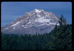
Start Over
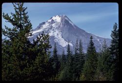
You searched for:
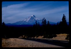
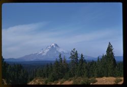
Country
United States
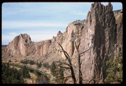
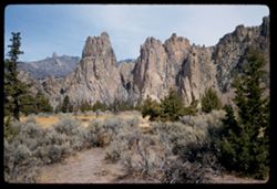
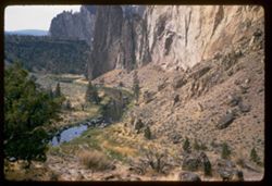
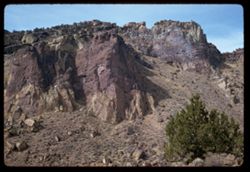
Remove constraint Country: United States
State/Province
Oregon
Remove constraint State/Province: Oregon
« Previous |
1
-
100
of
163
|
Next »
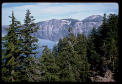
Sort by relevance ▼
relevance ▼
recently updated
title ▲
title ▼
date created ▲
date created ▼
pages ▲
pages ▼
collection size ▲
collection size ▼
Number of results to display per page
100 per page
10
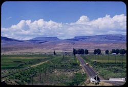
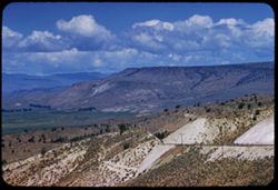
per page
20
per page
50
per page
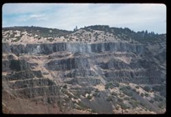
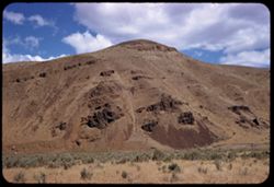
100
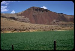
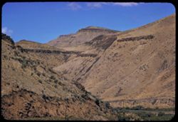
per page
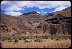
View results as:
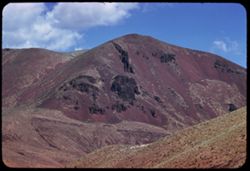
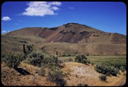
List
Gallery
Masonry
Search Results
1.
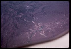
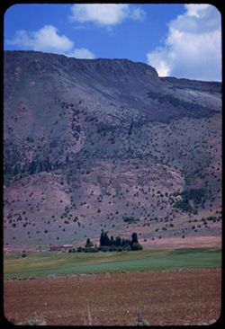
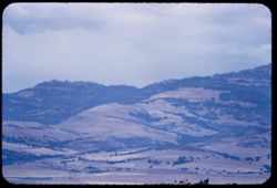
Over Malheur Co. Oregon?
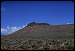
2.
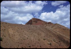
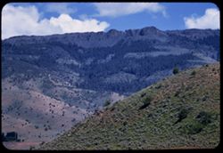
Over Malheur County Oregon?
3.
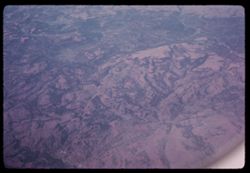
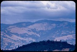
NE Oregon?
4.
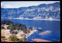
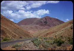
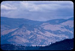
Rock bluff above Rogue river north of Medford, Oregon
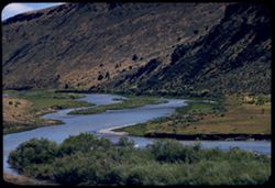
5.
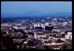
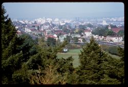
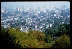
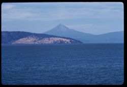
View across Portland, Oregon toward Mount Saint Helen's
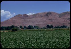
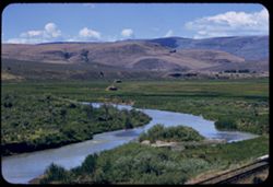
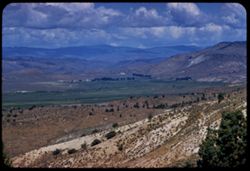
6.
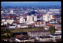
Portland, Oregon City center, Broadway bridge, + Union Depot
7.
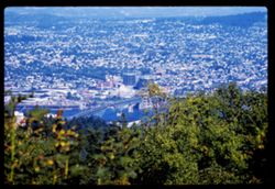
Portland, Oregon view N.E. across Williamette river
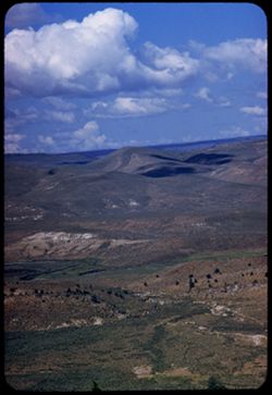
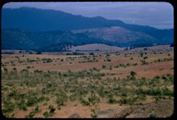
8.
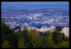
Williamette river in Portland from Council Crest Drive
9.
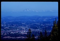
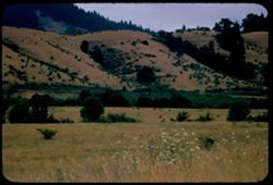
Toward Mt. Hood from Council Crest Drive, Portland
10.
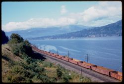
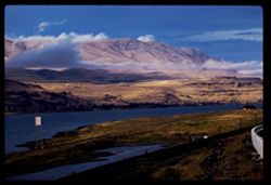
Union Pacific along Columbia river 16 mi. west of Hood River, Oregon
11.
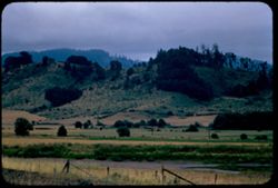
Columbia river 12 miles west of Hood River, Oregon
12.
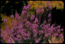
Columbia river from Meredith Gorge Motel near Hood River Oregon
13.
Columbia river below Meredith Gorge Motel from height above Hood River, Oregon
14.
Columbia river from Meredith Gorge Motel at Hood River, Ore.
15.
View up Columbia river from west of Biggs, Oregon after rain
16.
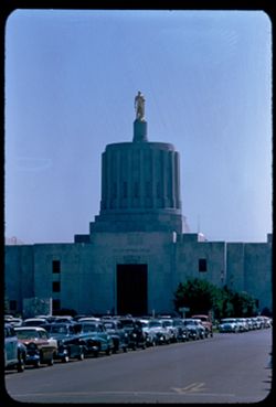
Columbia river near Rufus, Oregon View up river after rain in afternoon
17.
Columbia river near Rufus, Oregon
18.
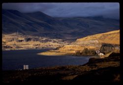
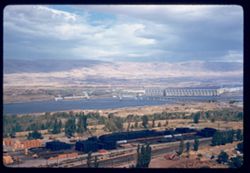
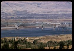
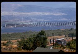
Columbia river bridge at The Dalles dam
19.
Columbia river bridge at The Dalles dam
20.
Columbia river dam The Dalles, Oregon
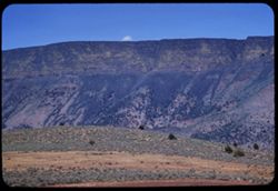
21.
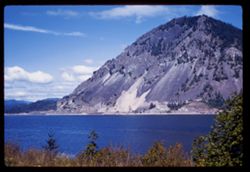
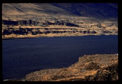
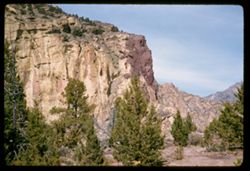
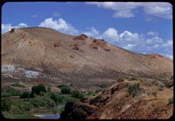
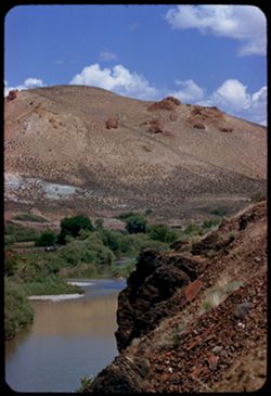
Columbia river palisades near Rowena, Oregon
22.
Palisades on right bank of Columbia river across from Rowena Oregon
23.
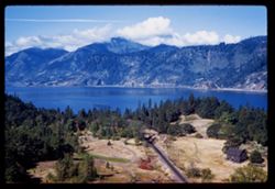
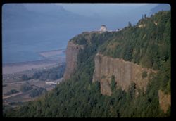
Crown Point above Columbia river view from west
24.
View NNE toward downtown Portland, Oregon
25.
Portland, Oregon from height SW
26.
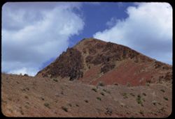
Mount Hood from southwest
27.
Mount Hood
28.
Mount Hill from south
29.
Mount Hood from south
30.
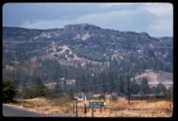
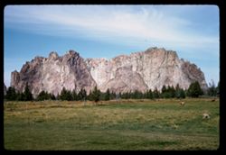
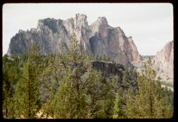
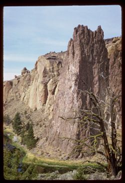
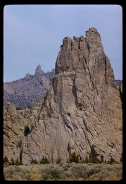
Smith Rock OREGON
31.
Smith Rock Oregon
32.
Smith Rock near Terrebonne Oregon
33.
Smith Rock Oregon
34.
Smith Rocks above Crooked river Oregon
35.
Smith Rock, Oregon
36.
Smith rock, Oregon
37.
Smith rock Oregon
38.
Smith rocks near Terrebonne, Ore.
39.
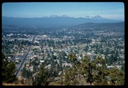
View west from top of Pilot Butte
40.
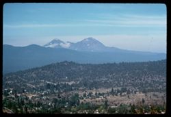
View west across Bend, Oregon toward Cascade peaks
41.
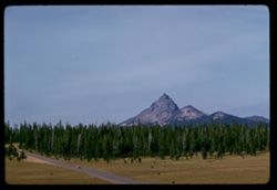
Mount Thiesen north of Crater Lake, Oregon
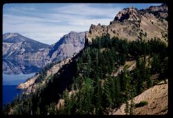
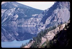
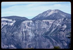
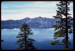
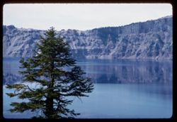
42.
Crater Lake
43.
Crater Lake
44.
Crater Lake
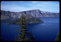
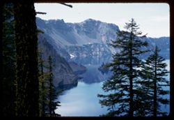
45.
Crater Lake Wizard Island
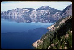
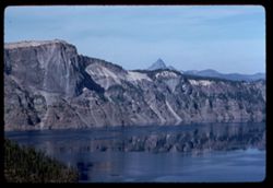
46.
SE across Crater Lake from west rim
47.
Crater Lake view SE from west rim
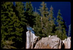
48.
Blue Jay on stump Crater Lake Oregon
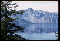
49.
Crater lake from west room Mt. Thielsein in distance
50.
Crater Lake
51.
Crater Lake from Kerr Notch
52.
Crater Lake from Kerr Notch
53.
Crater Lake from Kerr Notch
54.
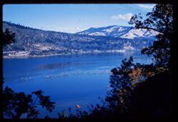
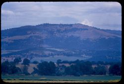
Mt. McLoughlin from east shore of Klamath Lake OREGON
55.
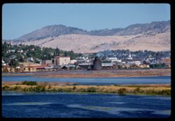
Klamath Falls, Oregon from south
56.
Along US 20 east of Vale, Malheur county, Oregon
57.
along US 20 east of Vale, Malheur county OREGON
58.
Ridge above Vale, Oregon
59.
Malheur river 88 mi. east of Burns. Oregon's Malheur County
60.
Malheur river 88 mi. east of Burns. Oregon's Malheur co.
61.
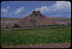
Close-up of 11-58.11 Top of lava rock above Malheur river. In Malheur county, Oregon -- Confer 11-58.11 --
62.
Dark red cliff in canyon of Malheur river over 80 miles east of Burns, Oregon. A close-up of 11-58.10 confer 11-58.10
63.
Rock tip above Malheur river 80 - odd miles east of Burns, Oregon (see # 13 for close-up) -- confer 11-58.13 --
64.
Great reddish rock of lava origin Malheur canyon 82 mi. east of Burns Oregon See # 12 for close up confer
65.
Along US 20 in Malheur county 82 miles east of Burns, Oregon
66.
Along US 20 82 miles east of Burns Oregon - in Malheur county
67.
Along US 20 in Malheur county OREGON
68.
along US 20 in Malheur county OREGON
69.
Malheur county, Oregon along US 20
70.
Canyon of Malheur river, Malheur county OREGON
71.
Lava butte above Malheur river along US 20, Malheur county, OREGON
72.
Lava rock above right bank Malheur river in Malheur county, OREGON
73.
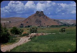
Lava butte above Malheur river gorge east of Juntura
74.
Lava headland above Malheur river -Malheur county OREGON
75.
West down US 20 toward Juntura, Malheur county OREGON
76.
Malheur river - view downstream near Juntura, Ore.
77.
North fork Malheur river near Juntura Malheur county, OREGON
78.
Malheur river valley along US 20 east of Burns
79.
Malheur river valley Harney county, Oregon along US 20 east of Burns
80.
Malheur river valley seen from east on US 20 east of Burns Harney county
81.
A cute butte above Malheur river along US 20 Malheur county Oregon
82.
Yellow on dark lava ridge Lake county
83.
Ranch below lava ridge Lake county, Oregon
84.
Hill and lava ridge Lake County, Oregon
85.
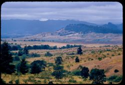
Siskiyou Mtns. seen from US 99 in Jackson county Oregon, near California line.
86.
Siskiyou mountains in southern Jackson county, Oregon
87.
Mountains north of Ashland, Oregon
88.
Farms and mountain seen from US 99 near Phoenix. Jackson county Oregon
89.
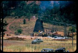
Small saw mill at Wolf Creek Josephine county Oregon
90.
Country west of Oakland, Douglas county Oregon
91.
Fireweed - Epilobium Augustifolium near Oakland in Douglas county Oregon
92.
County northwest of Oakland, Douglas county Oregon
93.
Scene near Yoncalla, Douglas county, Oregon along US 99.
94.
View from US 99 near Yoncalla Douglas county, Oregon
95.
Hill along US 99 near Yoncalla Douglas co., Oregon
96.
US 99 south of Anlauf, Douglas co. Oregon
97.
Patterns in greens - growing crops along US 99 in Linn county, Oregon
98.
Oregon farm scene along US 99 north of Albany. Linn county
99.
North (front) elevation Oregon capitol Salem, Oregon
100.
Old college building Willamette Univ. founded 1842 Salem, Oregon
« Previous
Next »
1
2
Toggle facets
Limit your search
Type
Image
163
Creator
Cushman, Charles W., 1896-1972
163
Subject
Trees
88
Mountains
65
Hills
46
Shrubs
45
Clouds
41
Cliffs
31
Rivers
27
Rock formations
21
Buildings
20
Flowers
20
more
Subjects
»
Date Created
1958-06-14
26
1956-07-10
16
1956-07-12
16
1960-09-16
15
1960-09-17
15
1938-09-10
14
1956-07-11
13
1956-07-13
12
1960-09-25
10
1960-09-19
5
more
Date Createds
»
Pages
0-99 pages
163
Collections
Charles W. Cushman Kodachrome Slides
163
State
deposited
163
Campus
IUB
163
Frame Number
7
8
8
8
10
7
11
7
12
7
13
7
14
7
15
7
6
7
9
7
County
Malheur
25
Multnomah
23
Klamath
22
Curry
16
Coos
13
Deschutes
11
Harney
9
Douglas
7
Lincoln
7
Marion
6
Series
9-56
38
23-60
24
10-56
19
11-58
18
2-38
15
24-60
14
25-60
14
10-58
11
18-55
7
26-65
3
City
Portland
22
Bandon
13
Burns
9
Klamath Falls
8
Salem
7
Brookings
6
Gold Beach
6
Burnt Woods
5
Hood River
5
Juntura
4
Country
United States
[remove]
163
State/Province
Oregon
[remove]
163
Holding Location
B-ARCHIVES
163