
Image
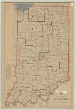
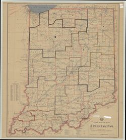
Post route map : Indiana Público Deposited
- Genre
- Thematic maps
- Location
- Coordinates: W0880700 W0840500 N0414500 N0375200
- Related URL
- Abstract
- "Includes index to counties of Indiana." "Published by order of Postmaster General Arthur E. Summerfield." "September 3, 1957."
- Call Number
- G4091.P8 1957 .U6
- Caption
- Imprint: [Washington, D.C.] : Dept., 1957
- Filename
- VAC3073-M-01024
- Subject
- Geographic Subject: Indiana
- Topical Subject: Postal service
- Title
- Post route map : Indiana
- Producer
- United States. Post Office Department
- Physical Description
- Dimensions: 104 x 66 cm
- Scale: 1:443,520
- Item Identifiers
- Title Control Number: CBC1071BB
- Persistent Identifier
- Campus
- IU Bloomington
- Date Created
- 1957
- Publisher
- United States. Post Office Department
Relationships
Relaciones
- En Collection:
Items
Show Item Images
| Miniatura | Título | Fecha de subida | Visibilidad | Acciones |
|---|---|---|---|---|
|
VAC3073-M-01024.jp2 | 2023-09-27 | Público |
|
|
VAC3073-00906.jp2 | 2023-09-27 | Público |
|