
Image
Distribution, structure, and mined areas of coals in Spencer County, Indiana Public Deposited
- Genre
- Mine maps
- Thematic maps
- Location
- Coordinates: W0871600 W0844600 N0381200 N0374700
- Related URL
- Abstract
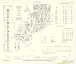
- "Preliminary Coal Map no. 8". Includes 2 geologic cross sections, location map, geologic column, index of mines, tables, and diagram of township sections.
- Call Number
- G4093.S5H9 1959 .H8
- Caption
- Imprint: Bloomington, Ind. : Indiana Department of Conservation, Geological Survey, 1959.
- Filename
- VAC3073-M-00222
- Subject
- Geographic Subject: Spencer County (Ind.)
- Topical Subject: Coal mines and mining
- Topical Subject: Coal
- Title
- Distribution, structure, and mined areas of coals in Spencer County, Indiana
- Producer
- Hutchison, Harold C. (Harold Christy), 1925-
- Physical Description
- Dimensions: 55 x 65 cm
- Scale: 1:126,720
- Item Identifiers
- Title Control Number: a5389271
- Persistent Identifier
- Campus
- IU Bloomington
- Date Created
- 1959
- Publisher
- Indiana. Geological Survey
Relationships
Relationships
- In Collection:
Items
Show Item Images
| Thumbnail | Title | Date Uploaded | Visibility | Actions |
|---|---|---|---|---|
|
VAC3073-M-00222.jp2 | 2023-09-22 | Public |
|