
Image
General highway and transportation map of Henry County, Indiana Público Deposited
- Genre
- Road maps
- Location
- Coordinates: W0853600 W0852500 N0400500 N0394700
- Related URL
- Abstract
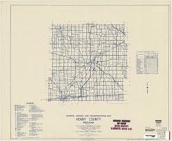
- Blueline. "State roads revised to January 1, 1949." "Data obtained from Statewide Highway Planning Survey." Includes chart "Culture in unincorporated places" and location map. "33."
- Call Number
- G4093.H6P2 1949 .I53
- Caption
- Imprint: [Indianapolis?] : State Highway Commission of Indiana, 1949.
- Filename
- VAC3073-M-00688
- Subject
- Topical Subject: Roads
- Geographic Subject: Henry County (Ind.)
- Title
- General highway and transportation map of Henry County, Indiana
- Producer
- Indiana. State Highway Commission (1919-1953)
- Physical Description
- Scale: 1:130,000
- Dimensions: 89 x 105 cm
- Item Identifiers
- Title Control Number: a5706069
- Persistent Identifier
- Campus
- IU Bloomington
- Date Created
- 1949
- Publisher
- State Highway Commission of Indiana
Relationships
Relaciones
- En Collection:
Items
Show Item Images
| Miniatura | Título | Fecha de subida | Visibilidad | Acciones |
|---|---|---|---|---|
|
VAC3073-M-00688.jp2 | 2023-09-25 | Público |
|