
Image
New Sectional Map of Illinois Public Deposited
- Series
- GLOVE - Local and Regional Maps
- Abstract
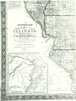
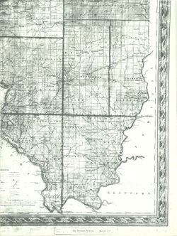
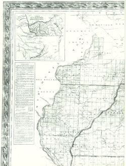
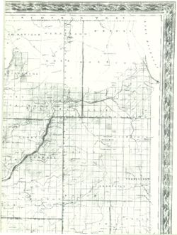
- New Sectional Map of the State of Illinois. Compiled from the United States Surveys. Also exhibiting the Internal Improvements, distances between Towns, Villages, Post Offices, the outlines of the Prairies, Woodlands. By J.M. Peck and John Messinger, published by J.H. Cohen & Co., New York 1836. Engraved by S. Stiles & Co., N. York.
- Call Number
- GLV166
- Copyright Holder
- Public Domain
- Country
- United States
- Source Identifier
- VAD5944-000053
- Subject
- Illinois
- American Indians
- United States--Maps
- Indians of North America
- Holding Location
- Bloomington - Indiana University Museum of Archaeology and Anthropology
416 North Indiana Avenue
Bloomington, IN 47408
Contact at iumaa@indiana.edu, 812-855-6873
- Bloomington - Indiana University Museum of Archaeology and Anthropology
- Campus
- IU Bloomington
- Source Metadata Identifier
- Title
- New Sectional Map of Illinois
- Creator
- Peck, John Mason
- Date Created
- 1836
- Physical Description
- Scale of 10 Miles to the Inch
- Persistent URL
Relationships
Relationships
Items
Show Item Images
| Thumbnail | Title | Date Uploaded | Visibility | Actions |
|---|---|---|---|---|
|
VAD5944-000053.tif | 2023-04-18 | Public |
|
|
VAD5944-U-00033.tif | 2023-04-18 | Public |
|
|
VAD5944-U-00034.tif | 2023-04-18 | Public |
|
|
VAD5944-U-00035.tif | 2023-04-18 | Public |
|