
Image
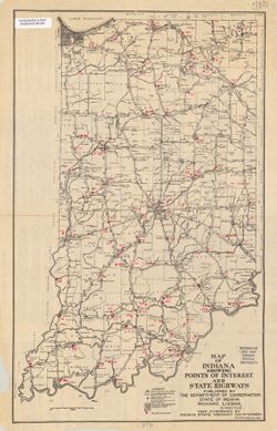
Map of Indiana showing points of interest and state highways Public Deposited
- Genre
- Road maps
- Location
- Coordinates: W0880700 W0844500 N0414500 N0375200
- Related URL
- Abstract
- "Map furnished by Indiana State Highway Commission." "Information on hotels, trains and accommodations in state parks compiled by Chas. Sauers"--Map panel. Includes text and index to points of interest on verso.
- Call Number
- G4091 .E653 1923 .I5
- Caption
- Imprint: [Indianapolis] : Dept. of Conservation, State of Indiana, 1923.
- Filename
- VAC3073-M-00760
- Subject
- Geographic Subject: Indiana
- Topical Subject: Roads
- Title
- Map of Indiana showing points of interest and state highways
- Producer
- Pickens, R. F.
- Physical Description
- Scale: 1:963,000
- Dimensions: 49 x 30 cm
- Item Identifiers
- Title Control Number: a5021431
- Persistent Identifier
- Campus
- IU Bloomington
- Date Created
- 1923
- Publisher
- Indiana. Department of Conservation
Relationships
Relationships
- In Collection:
Items
Show Item Images
| Thumbnail | Title | Date Uploaded | Visibility | Actions |
|---|---|---|---|---|
|
VAC3073-M-00760.jp2 | 2023-09-27 | Public |
|