
Image
State of Indiana Public Deposited
- Genre
- Maps
- Location
- Coordinates: W0880700 W0844500 N0414500 N0375200
- Related URL
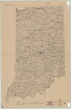
- Abstract
- "Compiled in 1909-1910." Stamped in upper margin: "Advance sheet. Subject to correction." Includes diagram showing the "Relation of the state of Indiana to sheets of the International Map of the World on the scale of 1:1,000,000."
- Call Number
- G4090 1910 .G4
- Caption
- Imprint: [Washington, D.C.] : U.S. Geological Survey, [1912?]
- Filename
- VAC3073-M-01292
- Subject
- Geographic Subject: Indiana
- Title
- State of Indiana
- Producer
- Geological Survey (U.S.)
- Physical Description
- Dimensions: 92 x 60 cm
- Scale: 1:500,000
- Persistent Identifier
- Campus
- IU Bloomington
- Date Created
- Circa 1912
- Publisher
- Geological Survey (U.S.)
Relationships
Relationships
- In Collection:
Items
Show Item Images
| Thumbnail | Title | Date Uploaded | Visibility | Actions |
|---|---|---|---|---|
|
VAC3073-M-01292.jp2 | 2023-09-28 | Public |
|