
Search Constraints
You searched for:
Provenance
Army Map Service Library, OMAHA, Library of Congress Geography & Map Division
Remove constraint Provenance: Army Map Service Library, OMAHA, Library of Congress Geography & Map Division
« Previous |
1 - 100 of 351
|
Next »
Search Results
-
- Subject:
- Topical Subject: Soviet Union, Topical Subject: Maps, and Geographic Subject: Nyasvizh
- Publisher:
- Генеральный штаб РККА
- Language:
- Russian
- Identifier:
- VAC9619-000666
- Genre:
- Topographic Maps and Military Maps
- Geographic Location:
- Coordinates: 53.167, 26.5, 53.333, 26.75
- Related URL:
- Download GeoTIFF: https://drive.google.com/open?id=1XewdZr1VRKhhsXkyvgsl4gUNCdd5S13Y and Catalog URL: http://iucat.iu.edu/catalog/5020131
- Abstract:
- Modern area represented: Nyasvizh, Minsk oblast, Belarus
- Call Number:
- G7000 s50 .S68 sheet N-35-96-A
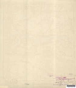
- Caption:
- Не подлежит оглашению,Captured map
- City:
- Несьвеж (Nesvezh)
- Copyright Holder:
- No Copyright - United States
- Country:
- Польша (Poland)
- Physical Description:
- Scale: 1:50,000
- Persistent URL:
- http://purl.dlib.indiana.edu/iudl/images/VAC9619/VAC9619-000666
- Provenance:
- Army Map Service Library, OMAHA, Library of Congress Geography & Map Division
-
- Description:
- 1936
- Subject:
- Geographic Subject: Цялуша (Tsyalusha), Topical Subject: Maps, and Topical Subject: Soviet Union
- Publisher:
- Управление военных топографов РККА
- Language:
- Russian
- Identifier:
- VAC9619-000688
- Genre:
- Military Maps and Topographic Maps
- Geographic Location:
- Coordinates: 53, 29.25, 53.167, 29.5
- Related URL:
- Catalog URL: http://iucat.iu.edu/catalog/5020131 and Download GeoTIFF: https://drive.google.com/open?id=1nvaI2IHl54oUqJlue5iSNA0IS1qXVbeG
- Abstract:
- Modern area represented: Цялуша (Tsyalusha), Mogilev oblast, Belarus
- Call Number:
- G7000 s50 .S68 sheet N-35-107-D
- Caption:
- Не подлежит оглашению and Captured map
- City:
- Телуша (Telusha)
- Copyright Holder:
- No Copyright - United States
- Country:
- СССР (USSR)
- State/Province:
- Белорусская ССР (Byelorussian Soviet Socialist Republic)
- Physical Description:
- Scale: 1:50,000
- Persistent URL:
- http://purl.dlib.indiana.edu/iudl/images/VAC9619/VAC9619-000688
- Provenance:
- Army Map Service Library, OMAHA, Library of Congress Geography & Map Division
-
- Subject:
- Topical Subject: Maps, Geographic Subject: Ciechanów, and Topical Subject: Soviet Union
- Publisher:
- Генеральный штаб Красной Армии
- Language:
- Russian
- Date Created:
- 1941
- Identifier:
- VAC9619-000378
- Genre:
- Military Maps and Topographic Maps
- Geographic Location:
- Coordinates: 52.8333, 20.5, 53, 20.75
- Related URL:
- Download GeoTIFF: https://drive.google.com/open?id=19NZpMB0LLhTETWhRYs6IvVgTW8lNhNOq and Catalog URL: http://iucat.iu.edu/catalog/5020131
- Abstract:
- Modern area represented: Ciechanów, Poland
- Call Number:
- G7000 s50 .S68 sheet N-34-114-A
- Caption:
- Captured map
- City:
- Цеханув
- Copyright Holder:
- No Copyright - United States
- Country:
- Область государственных интересов Германии (Region of German state interest)
- Physical Description:
- Scale: 1:50,000
- Persistent URL:
- http://purl.dlib.indiana.edu/iudl/images/VAC9619/VAC9619-000378
- Provenance:
- Army Map Service Library, OMAHA, Library of Congress Geography & Map Division
-
- Subject:
- Topical Subject: Soviet Union, Geographic Subject: Bogate, and Topical Subject: Maps
- Publisher:
- Генеральный штаб Красной Армии
- Language:
- Russian
- Date Created:
- 1941
- Identifier:
- VAC9619-000379
- Genre:
- Topographic Maps and Military Maps
- Geographic Location:
- Coordinates: 52.8333, 20.75, 53, 21
- Related URL:
- Download GeoTIFF: https://drive.google.com/open?id=1OYtTAtvkxii-vu8ffUIJ7Tr13jXX4SK3 and Catalog URL: http://iucat.iu.edu/catalog/5020131
- Abstract:
- Modern area represented: Bogate, Poland
- Call Number:
- G7000 s50 .S68 sheet N-34-114-B
- Caption:
- Captured map
- City:
- Богате (Bogate)
- Copyright Holder:
- No Copyright - United States
- Country:
- Область государственных интересов Германии (Region of German state interest)
- Physical Description:
- Scale: 1:50,000
- Persistent URL:
- http://purl.dlib.indiana.edu/iudl/images/VAC9619/VAC9619-000379
- Provenance:
- Army Map Service Library, OMAHA, Library of Congress Geography & Map Division
-
- Subject:
- Topical Subject: Maps, Topical Subject: Soviet Union, and Geographic Subject: Gołymin-Ośrodek
- Publisher:
- Генеральный штаб Красной Армии
- Language:
- Russian
- Date Created:
- 1941
- Identifier:
- VAC9619-000380
- Genre:
- Topographic Maps and Military Maps
- Geographic Location:
- Coordinates: 52.6667, 20.75, 52.8333, 21
- Related URL:
- Download GeoTIFF: https://drive.google.com/open?id=1TK2aF8RMGAbdEVm4XuSX3vzj2tJntdbW and Catalog URL: http://iucat.iu.edu/catalog/5020131
- Abstract:
- Modern area represented: Gołymin-Ośrodek, Poland
- Call Number:
- G7000 s50 .S68 sheet N-114-D
- Caption:
- Captured map
- City:
- Голымин Стары
- Copyright Holder:
- No Copyright - United States
- Country:
- Область государственных интересов Германии (Region of German state interest)
- Physical Description:
- Scale: 1:50,000
- Persistent URL:
- http://purl.dlib.indiana.edu/iudl/images/VAC9619/VAC9619-000380
- Provenance:
- Army Map Service Library, OMAHA, Library of Congress Geography & Map Division
-
- Subject:
- Geographic Subject: Maków Mazowiecki, Topical Subject: Maps, and Topical Subject: Soviet Union
- Publisher:
- Генеральный штаб Красной Армии
- Language:
- Russian
- Date Created:
- 1941
- Identifier:
- VAC9619-000363
- Genre:
- Topographic Maps and Military Maps
- Geographic Location:
- Coordinates: 52.8333, 21, 53, 21.25
- Related URL:
- Download GeoTIFF: https://drive.google.com/open?id=1UttvJpJWpIyx_fyNwX6e794CJbRv2oKu and Catalog URL: http://iucat.iu.edu/catalog/5020131
- Abstract:
- Modern area represented: Maków Mazowiecki, Poland
- Call Number:
- G7000 s50 .S68 sheet N-34-115-A
- Caption:
- Captured map
- City:
- Макув (Maków)
- Copyright Holder:
- No Copyright - United States
- Country:
- Область государственных интересов Германии (Region of German state interest)
- Physical Description:
- Scale: 1:50,000
- Persistent URL:
- http://purl.dlib.indiana.edu/iudl/images/VAC9619/VAC9619-000363
- Provenance:
- Army Map Service Library, OMAHA, Library of Congress Geography & Map Division
-
- Subject:
- Topical Subject: Soviet Union, Geographic Subject: Różan, and Topical Subject: Maps
- Publisher:
- Генеральный штаб Красной Армии
- Language:
- Russian
- Date Created:
- 1941
- Identifier:
- VAC9619-000373
- Genre:
- Military Maps and Topographic Maps
- Geographic Location:
- Coordinates: 52.8333, 21.25, 53, 21.5
- Related URL:
- Catalog URL: http://iucat.iu.edu/catalog/5020131 and Download GeoTIFF: https://drive.google.com/open?id=1JKYAMQraaYyBFcArKBpbqCb1sNSqgNAQ
- Abstract:
- Modern area represented: Różan, Poland
- Call Number:
- G7000 s50 .S68 sheet N-34-115-B
- Caption:
- Captured map
- City:
- Рожан (Różan)
- Copyright Holder:
- No Copyright - United States
- Country:
- Область государственных интересов Германии (Region of German state interest)
- Physical Description:
- Scale: 1:50,000
- Persistent URL:
- http://purl.dlib.indiana.edu/iudl/images/VAC9619/VAC9619-000373
- Provenance:
- Army Map Service Library, OMAHA, Library of Congress Geography & Map Division
-
- Subject:
- Geographic Subject: Nowe Miasto, Topical Subject: Soviet Union, and Topical Subject: Maps
- Publisher:
- Генеральный штаб Красной Армии
- Language:
- Russian
- Date Created:
- 1941
- Identifier:
- VAC9619-000342
- Genre:
- Topographic Maps and Military Maps
- Geographic Location:
- Coordinates: 52.5, 20.5, 52.6667, 20.75
- Related URL:
- Catalog URL: http://iucat.iu.edu/catalog/5020131 and Download GeoTIFF: https://drive.google.com/open?id=1ouJacKa7i_4QxBSo2r2IGNaMv3GUrRS9
- Abstract:
- Modern area represented: Nowe Miasto, Poland
- Call Number:
- G7000 s50 .S68 sheet N-34-126-A
- Caption:
- Captured map
- City:
- Нове-Място (Nowe Miasto)
- Copyright Holder:
- No Copyright - United States
- Country:
- Область государственных интересов Германии (Region of German state interest)
- Physical Description:
- Scale: 1:50,000
- Persistent URL:
- http://purl.dlib.indiana.edu/iudl/images/VAC9619/VAC9619-000342
- Provenance:
- Army Map Service Library, OMAHA, Library of Congress Geography & Map Division
-

- Subject:
- Geographic Subject: Nasielsk, Topical Subject: Soviet Union, and Topical Subject: Maps
- Publisher:
- Генеральный штаб Красной Армии
- Language:
- Russian
- Date Created:
- 1941
- Identifier:
- VAC9619-000350
- Genre:
- Military Maps and Topographic Maps
- Geographic Location:
- Coordinates: 52.5, 20.75, 52.666667, 21.0
- Related URL:
- Download GeoTIFF: https://drive.google.com/open?id=1j4KIcDQOqpPMkMy-n2Pr6cSGIWrGggEl and Catalog URL: http://iucat.iu.edu/catalog/5020131
- Abstract:
- Modern area represented: Nasielsk, Poland
- Call Number:
- G7000 s50 .S68 sheet N-34-126-B
- Caption:
- Captured map
- City:
- Насельск (Nasielsk)
- Copyright Holder:
- No Copyright - United States
- Country:
- Область государственных интересов Германии (Region of German state interest)
- Physical Description:
- Scale: 1:50,000
- Persistent URL:
- http://purl.dlib.indiana.edu/iudl/images/VAC9619/VAC9619-000350
- Provenance:
- Army Map Service Library, OMAHA, Library of Congress Geography & Map Division
-
- Subject:
- Topical Subject: Soviet Union, Topical Subject: Maps, and Geographic Subject: Nowy Dwór Mazowiecki
- Publisher:
- Генеральный штаб Красной Армии
- Language:
- Russian
- Date Created:
- 1941
- Identifier:
- VAC9619-000146
- Genre:
- Military Maps and Topographic Maps
- Geographic Location:
- Coordinates: 52.3333, 20.5, 52.5, 20.6667
- Related URL:
- Download GeoTIFF: https://drive.google.com/open?id=1jjJwHRaXBPCIZUG-msLmfYa5McZJk4Zs and Catalog URL: http://iucat.iu.edu/catalog/5020131
- Abstract:
- Modern area represented: Nowy Dwór Mazowiecki, Poland
- Call Number:
- G7000 s50 .S68 sheet N-34-126-C
- Caption:
- Captured map
- City:
- Модлин (Modlin)
- Copyright Holder:
- No Copyright - United States
- Country:
- Область государственных интересов Германии (Region of German state interest)
- Physical Description:
- Scale: 1:50,000
- Persistent URL:
- http://purl.dlib.indiana.edu/iudl/images/VAC9619/VAC9619-000146
- Provenance:
- Army Map Service Library, OMAHA, Library of Congress Geography & Map Division
-
- Subject:
- Topical Subject: Maps, Geographic Subject: Serock, and Topical Subject: Soviet Union
- Publisher:
- Генеральный штаб Красной Армии
- Language:
- Russian
- Date Created:
- 1941
- Identifier:
- VAC9619-000249
- Genre:
- Topographic Maps and Military Maps
- Geographic Location:
- Coordinates: 52.5, 21, 52.6667, 21.25
- Related URL:
- Download GeoTIFF: https://drive.google.com/open?id=1zmaIapDKshRIbecCsXdRX8CDSofQi6bF and Catalog URL: http://iucat.iu.edu/catalog/5020131
- Abstract:
- Modern area represented: Serock, Poland
- Call Number:
- G7000 s50 .S68 sheet N-34-127-A
- Caption:
- Captured map
- City:
- Сероцк (Serock)
- Copyright Holder:
- No Copyright - United States
- Country:
- Область государственных интересов Германии (Region of German state interest)
- Physical Description:
- Scale: 1:50,000
- Persistent URL:
- http://purl.dlib.indiana.edu/iudl/images/VAC9619/VAC9619-000249
- Provenance:
- Army Map Service Library, OMAHA, Library of Congress Geography & Map Division
-
- Subject:
- Topical Subject: Soviet Union, Geographic Subject: Tłuszcz, and Topical Subject: Maps
- Publisher:
- Генеральный штаб Красной Армии
- Language:
- Russian
- Date Created:
- 1941
- Identifier:
- VAC9619-000280
- Genre:
- Military Maps and Topographic Maps
- Geographic Location:
- Coordinates: 52.333, 21.25, 52.5, 21.5
- Related URL:
- Catalog URL: http://iucat.iu.edu/catalog/5020131 and Download GeoTIFF: https://drive.google.com/open?id=18vCbBpU1qxQdLWjkLuUK1m4FdjzBvC5c
- Abstract:
- Modern area represented: Tłuszcz, Poland
- Call Number:
- G7000 s50 .S68 sheet N-34-127-D
- Caption:
- Captured map
- City:
- Тлущ (Tłuszcz)
- Copyright Holder:
- No Copyright - United States
- Country:
- Область государственных интересов Германии (Region of German state interest)
- Physical Description:
- Scale: 1:50,000
- Persistent URL:
- http://purl.dlib.indiana.edu/iudl/images/VAC9619/VAC9619-000280
- Provenance:
- Army Map Service Library, OMAHA, Library of Congress Geography & Map Division
-
- Subject:
- Geographic Subject: Jadów, Topical Subject: Maps, and Topical Subject: Soviet Union
- Publisher:
- Генеральный штаб Красной Армии
- Language:
- Russian
- Date Created:
- 1941
- Identifier:
- VAC9619-000293
- Genre:
- Topographic Maps and Military Maps
- Geographic Location:
- Coordinates: 52.333, 21.5, 52.5, 21.75
- Related URL:
- Download GeoTIFF: https://drive.google.com/open?id=1hiVAYx8ZS4EwSw7_0KGYsUZ270Lxmfee and Catalog URL: http://iucat.iu.edu/catalog/5020131
- Abstract:
- Modern area represented: Jadów, Poland
- Call Number:
- G7000 s50 .S68 sheet N-34-128-C
- Caption:
- Captured map
- City:
- Ядув (Jadów)
- Copyright Holder:
- No Copyright - United States
- Country:
- Область государственных интересов Германии (Region of German state interest)
- Physical Description:
- Scale: 1:50,000
- Persistent URL:
- http://purl.dlib.indiana.edu/iudl/images/VAC9619/VAC9619-000293
- Provenance:
- Army Map Service Library, OMAHA, Library of Congress Geography & Map Division
-
- Subject:
- Topical Subject: Soviet Union, Geographic Subject: Liw, and Topical Subject: Maps
- Publisher:
- Генеральный штаб Красной Армии
- Language:
- Russian
- Date Created:
- 1941
- Identifier:
- VAC9619-000298
- Genre:
- Military Maps and Topographic Maps
- Geographic Location:
- Coordinates: 52.333, 21.75, 52.5, 22
- Related URL:
- Catalog URL: http://iucat.iu.edu/catalog/5020131 and Download GeoTIFF: https://drive.google.com/open?id=1tTJRJFHV-T1fp6A9J33XfIr0xLA9Crv7
- Abstract:
- Modern area represented: Liw, Poland
- Call Number:
- G7000 s50 .S68 sheet N-34-128-D
- Caption:
- Captured map
- City:
- Лив (Liw)
- Copyright Holder:
- No Copyright - United States
- Country:
- Область государственных интересов Германии (Region of German state interest)
- Physical Description:
- Scale: 1:50,000
- Persistent URL:
- http://purl.dlib.indiana.edu/iudl/images/VAC9619/VAC9619-000298
- Provenance:
- Army Map Service Library, OMAHA, Library of Congress Geography & Map Division
-
- Subject:
- Geographic Subject: Kosów Lacki, Topical Subject: Maps, and Topical Subject: Soviet Union
- Publisher:
- Генеральный штаб Красной Армии
- Language:
- Russian
- Date Created:
- 1941
- Identifier:
- VAC9619-000300
- Genre:
- Military Maps and Topographic Maps
- Geographic Location:
- Coordinates: 52.5, 22, 52.667, 22.25
- Related URL:
- Download GeoTIFF: https://drive.google.com/open?id=1RbDJ2uN84rX-cIfifoA_mSEM0R8L6Jgd and Catalog URL: http://iucat.iu.edu/catalog/5020131
- Abstract:
- Modern area represented: Kosów Lacki, Poland
- Call Number:
- G7000 s50 .S68 sheet N-34-129-A
- Caption:
- Captured map
- City:
- Коссув (Kosów)
- Copyright Holder:
- No Copyright - United States
- Country:
- Область государственных интересов Германии (Region of German state interest)
- Physical Description:
- Scale: 1:50,000
- Persistent URL:
- http://purl.dlib.indiana.edu/iudl/images/VAC9619/VAC9619-000300
- Provenance:
- Army Map Service Library, OMAHA, Library of Congress Geography & Map Division
-
- Subject:
- Topical Subject: Maps, Geographic Subject: Węgrów, and Topical Subject: Soviet Union
- Publisher:
- Генеральный штаб Красной Армии
- Language:
- Russian
- Date Created:
- 1941
- Identifier:
- VAC9619-000301
- Genre:
- Topographic Maps and Military Maps
- Geographic Location:
- Coordinates: 52.333, 22, 52.5, 22.25
- Related URL:
- https://drive.google.com/open?id=1AstHWpyMNvTtx5Ctj4KwLBTAmsNWn4dd, Catalog URL: http://iucat.iu.edu/catalog/5020131, and Download GeoTIFF: https://drive.goo...
- Abstract:
- Modern area represented: Węgrów, Poland
- Call Number:
- G7000 s50 .S68 sheet N-34-129-C
- Caption:
- Captured map
- City:
- Венгров (Węgrów)
- Copyright Holder:
- No Copyright - United States
- Country:
- Область государственных интересов Германии (Region of German state interest)
- Physical Description:
- Scale: 1:50,000
- Persistent URL:
- http://purl.dlib.indiana.edu/iudl/images/VAC9619/VAC9619-000301
- Provenance:
- Army Map Service Library, OMAHA, Library of Congress Geography & Map Division
-
- Subject:
- Geographic Subject: Sokołów Podlaski, Topical Subject: Soviet Union, and Topical Subject: Maps
- Publisher:
- Генеральный штаб Красной Армии
- Language:
- Russian
- Date Created:
- 1941
- Identifier:
- VAC9619-000302
- Genre:
- Topographic Maps and Military Maps
- Geographic Location:
- Coordinates: 52.333, 22.25, 52.5.22.5
- Related URL:
- Download GeoTIFF: https://drive.google.com/open?id=1IQGL8qQCdXA5kVofXrVFcb5Qq0EEZVsx and Catalog URL: http://iucat.iu.edu/catalog/5020131
- Abstract:
- Modern area represented: Sokołów Podlaski, Poland
- Call Number:
- G7000 s50 .S68 sheet N-34-129-D
- Caption:
- Captured map
- City:
- Соколув Подляски (Sokołów Podlaski)
- Copyright Holder:
- No Copyright - United States
- Country:
- Область государственных интересов Германии (Region of German state interest)
- Physical Description:
- Scale: 1:50,000
- Persistent URL:
- http://purl.dlib.indiana.edu/iudl/images/VAC9619/VAC9619-000302
- Provenance:
- Army Map Service Library, OMAHA, Library of Congress Geography & Map Division
-
- Subject:
- Geographic Subject: Włochy, Topical Subject: Soviet Union, and Topical Subject: Maps
- Publisher:
- Генеральный штаб Красной Армии
- Language:
- Russian
- Date Created:
- 1941
- Identifier:
- VAC9619-000307
- Genre:
- Military Maps and Topographic Maps
- Geographic Location:
- Coordinates: 52.167, 20.75, 52.333, 21
- Related URL:
- Catalog URL: http://iucat.iu.edu/catalog/5020131 and Download GeoTIFF: https://drive.google.com/open?id=14C8fA7ssMrS5fiNf1B-23TndSJGF1Gt_
- Abstract:
- Modern area represented: Włochy, Warszawa district, Poland
- Call Number:
- G7000 s50 .S68 sheet N-34-138-B
- Caption:
- Captured map
- City:
- Влохы (Włochy)
- Copyright Holder:
- No Copyright - United States
- Country:
- Область государственных интересов Германии (Region of German state interest)
- Physical Description:
- Scale: 1:50,000
- Persistent URL:
- http://purl.dlib.indiana.edu/iudl/images/VAC9619/VAC9619-000307
- Provenance:
- Army Map Service Library, OMAHA, Library of Congress Geography & Map Division
-
- Subject:
- Geographic Subject: Pruszków, Topical Subject: Soviet Union, and Topical Subject: Maps
- Publisher:
- Генеральный штаб Красной Армии
- Language:
- Russian
- Date Created:
- 1941
- Identifier:
- VAC9619-000319
- Genre:
- Military Maps and Topographic Maps
- Geographic Location:
- Coordinates: 52.0, 20.75, 52.166667, 21.0
- Related URL:
- Catalog URL: http://iucat.iu.edu/catalog/5020131 and Download GeoTIFF: https://drive.google.com/open?id=1RhrUOPS54pH5r4qpvpPZid2tgwjiqAKe
- Abstract:
- Modern area represented: Pruszków, Poland
- Call Number:
- G7000 s50 .S68 sheet N-34-138-D
- Caption:
- Captured map
- City:
- Прушкув (Pruszków)
- Copyright Holder:
- No Copyright - United States
- Country:
- Область государственных интересов Германии (Region of German state interest)
- Physical Description:
- Scale: 1:50,000
- Persistent URL:
- http://purl.dlib.indiana.edu/iudl/images/VAC9619/VAC9619-000319
- Provenance:
- Army Map Service Library, OMAHA, Library of Congress Geography & Map Division
-
- Subject:
- Topical Subject: Soviet Union, Geographic Subject: Okuniew, and Topical Subject: Maps
- Publisher:
- Генеральный штаб Красной Армии
- Language:
- Russian
- Date Created:
- 1941
- Identifier:
- VAC9619-000328
- Genre:
- Military Maps and Topographic Maps
- Geographic Location:
- Coordinates: 52.166667, 21.25, 52.333333, 21.5
- Related URL:
- Catalog URL: http://iucat.iu.edu/catalog/5020131 and Download GeoTIFF: https://drive.google.com/open?id=1Eb2daHA4eMeqlCMLjI2TOtyftg5RuEM5
- Abstract:
- Modern area represented: Okuniew, Poland
- Call Number:
- G7000 s50 .S68 sheet N-34-139-B
- Caption:
- Captured map
- City:
- Окунев (Okuniew)
- Copyright Holder:
- No Copyright - United States
- Country:
- Область государственных интересов Германии (Region of German state interest)
- Physical Description:
- Scale: 1:50,000
- Persistent URL:
- http://purl.dlib.indiana.edu/iudl/images/VAC9619/VAC9619-000328
- Provenance:
- Army Map Service Library, OMAHA, Library of Congress Geography & Map Division
-
- Subject:
- Geographic Subject: Otwock, Topical Subject: Maps, and Topical Subject: Soviet Union
- Publisher:
- Генеральный штаб Красной Армии
- Language:
- Russian
- Date Created:
- 1941
- Identifier:
- VAC9619-000334
- Genre:
- Military Maps and Topographic Maps
- Geographic Location:
- Coordinates: 52.0, 21.25, 52.166667, 21.5
- Related URL:
- Download GeoTIFF: https://drive.google.com/open?id=1tzxGHRI-6ocIi24fLP8Jt-gY1ypldrg9 and Catalog URL: http://iucat.iu.edu/catalog/5020131
- Abstract:
- Modern area represented: Otwock, Poland
- Call Number:
- G7000 s50 .S68 sheet N-34-139-D
- Caption:
- Captured map
- City:
- Отвоцк (Otwock)
- Copyright Holder:
- No Copyright - United States
- Country:
- Область государственных интересов Германии (Region of German state interest)
- Physical Description:
- Scale: 1:50,000
- Persistent URL:
- http://purl.dlib.indiana.edu/iudl/images/VAC9619/VAC9619-000334
- Provenance:
- Army Map Service Library, OMAHA, Library of Congress Geography & Map Division
-
- Subject:
- Topical Subject: Soviet Union, Topical Subject: Maps, and Geographic Subject: Kałuszyn
- Publisher:
- Генеральный штаб Красной Армии
- Language:
- Russian
- Date Created:
- 1941
- Identifier:
- VAC9619-000335
- Genre:
- Military Maps and Topographic Maps
- Geographic Location:
- Coordinates: 52.166667, 21.75, 52.333333, 22.0
- Related URL:
- Download GeoTIFF: https://drive.google.com/open?id=1Sb-EziIgk9d7S9DVnzeYYee0wU_oK9Q9 and Catalog URL: http://iucat.iu.edu/catalog/5020131
- Abstract:
- Modern area represented: Kałuszyn, Poland
- Call Number:
- G7000 s50 .S68 sheet N-34-140-B
- Caption:
- Captured map
- City:
- Калушин (Kałuszyn)
- Copyright Holder:
- No Copyright - United States
- Country:
- Область государственных интересов Германии (Region of German state interest)
- Physical Description:
- Scale: 1:50,000
- Persistent URL:
- http://purl.dlib.indiana.edu/iudl/images/VAC9619/VAC9619-000335
- Provenance:
- Army Map Service Library, OMAHA, Library of Congress Geography & Map Division
-
- Subject:
- Geographic Subject: Cegłów, Topical Subject: Soviet Union, and Topical Subject: Maps
- Publisher:
- Генеральный штаб Красной Армии
- Language:
- Russian
- Date Created:
- 1941
- Identifier:
- VAC9619-000336
- Genre:
- Military Maps and Topographic Maps
- Geographic Location:
- Coordinates: 52, 21.5, 52.167, 21.75
- Related URL:
- Download GeoTIFF: https://drive.google.com/open?id=1EwlXwAYp5zAgkg8DJ__OMlHFwctYLxzf and Catalog URL: http://iucat.iu.edu/catalog/5020131
- Abstract:
- Modern area represented: Cegłów, Poland
- Call Number:
- G7000 s50 .S68 sheet N-34-140-C
- Caption:
- Captured map
- City:
- Цеглув (Cegłów)
- Copyright Holder:
- No Copyright - United States
- Country:
- Область государственных интересов Германии (Region of German state interest)
- Physical Description:
- Scale: 1:50,000
- Persistent URL:
- http://purl.dlib.indiana.edu/iudl/images/VAC9619/VAC9619-000336
- Provenance:
- Army Map Service Library, OMAHA, Library of Congress Geography & Map Division
-
- Subject:
- Geographic Subject: Latowicz, Topical Subject: Soviet Union, and Topical Subject: Maps
- Publisher:
- Генеральный штаб Красной Армии
- Language:
- Russian
- Date Created:
- 1941
- Identifier:
- VAC9619-000340
- Genre:
- Topographic Maps and Military Maps
- Geographic Location:
- Coordinates: 52.0, 21.75, 52.166667, 22.0
- Related URL:
- Download GeoTIFF: https://drive.google.com/open?id=1ifVCloGvj7k8gskS3r87hxY43z_qtROX and Catalog URL: http://iucat.iu.edu/catalog/5020131
- Abstract:
- Modern area represented: Latowicz, Poland
- Call Number:
- G7000 s50 .S68 sheet N-34-140-D
- Caption:
- Captured map
- City:
- Лятович (Latowicz)
- Copyright Holder:
- No Copyright - United States
- Country:
- Область государственных интересов Германии (Region of German state interest)
- Physical Description:
- Scale: 1:50,000
- Persistent URL:
- http://purl.dlib.indiana.edu/iudl/images/VAC9619/VAC9619-000340
- Provenance:
- Army Map Service Library, OMAHA, Library of Congress Geography & Map Division
-
- Subject:
- Topical Subject: Maps, Topical Subject: Soviet Union, and Geographic Subject: Mokobody
- Publisher:
- Генеральный штаб Красной Армии
- Language:
- Russian
- Date Created:
- 1941
- Identifier:
- VAC9619-000381
- Genre:
- Topographic Maps and Military Maps
- Geographic Location:
- Coordinates: 52.1667, 22, 52.3333, 22.25
- Related URL:
- Catalog URL: http://iucat.iu.edu/catalog/5020131 and Download GeoTIFF: https://drive.google.com/open?id=1ouJ804ACOTOR3T2kEqiiASXr2R4REZAh
- Abstract:
- Modern area represented: Mokobody, Poland
- Call Number:
- G7000 s50 .S68 sheet N-34-141-A
- Caption:
- Captured map
- City:
- Мокободы (Mokobody)
- Copyright Holder:
- No Copyright - United States
- Country:
- Область государственных интересов Германии (Region of German state interest)
- Physical Description:
- Scale: 1:50,000
- Persistent URL:
- http://purl.dlib.indiana.edu/iudl/images/VAC9619/VAC9619-000381
- Provenance:
- Army Map Service Library, OMAHA, Library of Congress Geography & Map Division
-
- Subject:
- Geographic Subject: Pruszyn, Topical Subject: Maps, and Topical Subject: Soviet Union
- Publisher:
- Генеральный штаб Красной Армии
- Language:
- Russian
- Date Created:
- 1941
- Identifier:
- VAC9619-000382
- Genre:
- Military Maps and Topographic Maps
- Geographic Location:
- Coordinates: 52.1667, 22.25, 52.3333, 22.5
- Related URL:
- Download GeoTIFF: https://drive.google.com/open?id=15b5hrAJ9da_wcemnEC0AhFb8-lwLrq4y and Catalog URL: http://iucat.iu.edu/catalog/5020131
- Abstract:
- Modern area represented: Pruszyn, Poland
- Call Number:
- G7000 s50 .S68 sheet N-34-141-B
- Caption:
- Captured map
- City:
- Прушин (Pruszyn)
- Copyright Holder:
- No Copyright - United States
- Country:
- Область государственных интересов Германии (Region of German state interest)
- Physical Description:
- Scale: 1:50,000
- Persistent URL:
- http://purl.dlib.indiana.edu/iudl/images/VAC9619/VAC9619-000382
- Provenance:
- Army Map Service Library, OMAHA, Library of Congress Geography & Map Division
-

- Subject:
- Geographic Subject: Biała Podlaska, Topical Subject: Soviet Union, and Topical Subject: Maps
- Publisher:
- Генеральный штаб Красной Армии
- Language:
- Russian
- Date Created:
- 1941
- Identifier:
- VAC9619-000386
- Genre:
- Topographic Maps and Military Maps
- Geographic Location:
- Coordinates: 52, 23, 52.1667, 23.25
- Related URL:
- Catalog URL: http://iucat.iu.edu/catalog/5020131 and Download GeoTIFF: https://drive.google.com/open?id=1j9Jb2zoApXKgz_weAAHXPhklR1FYCcmb
- Abstract:
- Modern area represented: Biała Podlaska, Poland
- Call Number:
- G7000 s50 .S68 sheet N-34-143-C
- City:
- Бяла Подляска (Biała Podlaska)
- Copyright Holder:
- No Copyright - United States
- Country:
- Область государственных интересов Германии (Region of German state interest)
- Physical Description:
- Scale: 1:50,000
- Persistent URL:
- http://purl.dlib.indiana.edu/iudl/images/VAC9619/VAC9619-000386
- Provenance:
- Army Map Service Library, OMAHA, Library of Congress Geography & Map Division
-
- Subject:
- Geographic Subject: Dreverna, Topical Subject: Maps, and Topical Subject: Soviet Union
- Publisher:
- Генеральный штаб Красной Армии
- Language:
- Russian
- Date Created:
- 1940
- Identifier:
- VAC9619-003577
- Genre:
- Military Maps and Topographic Maps
- Geographic Location:
- Coordinates: 55.5, 21.125, 55.583, 21.25
- Related URL:
- Catalog URL: https://iucat.iu.edu/catalog/14701157 and Download GeoTIFF: https://drive.google.com/file/d/1t--UqCTLvcXofV5DbLqBw7zRs0hEU_no/view?usp=sharing
- Abstract:
- Modern area represented: Dreverna, Lithuania
- Call Number:
- G7063.K2 s25 .S6 sheet N-34-19-A-d
- Caption:
- Captured map
- City:
- Дравэнен (Dravenen)
- Copyright Holder:
- No Copyright - United States
- Country:
- Германия (Восточная Пруссия) (Germany (East Prussia))
- Physical Description:
- Scale: 1:25,000
- Persistent URL:
- http://purl.dlib.indiana.edu/iudl/images/VAC9619/VAC9619-003577
- Provenance:
- Army Map Service Library, OMAHA, Library of Congress Geography & Map Division
-
- Description:
- 1914
- Subject:
- Topical Subject: Soviet Union, Geographic Subject: Slavsk, and Topical Subject: Maps
- Publisher:
- Генеральный штаб Красной Армии
- Language:
- Russian
- Date Created:
- 1941
- Identifier:
- VAC9619-003609
- Genre:
- Topographic Maps and Military Maps
- Geographic Location:
- Coordinates: 55, 21.625, 55.083, 21.75
- Related URL:
- Catalog URL: https://iucat.iu.edu/catalog/14701157 and Download GeoTIFF: https://drive.google.com/file/d/1x1VgR8u3f03mn6RvyevTmWFYrkMbCafa/view?usp=sharing
- Abstract:
- Modern area represented: Славск (Slavsk), Kaliningradskaya oblast, Russia
- Call Number:
- G7063.K2 s25 .S6 sheet N-34-32-C-d
- City:
- Хайнрихсвальде (Heinrichswalde)
- Copyright Holder:
- No Copyright - United States
- Country:
- Германия (Восточная Пруссия) (Germany (East Prussia))
- Physical Description:
- Scale: 1:25,000
- Persistent URL:
- http://purl.dlib.indiana.edu/iudl/images/VAC9619/VAC9619-003609
- Provenance:
- Army Map Service Library, OMAHA, Library of Congress Geography & Map Division
-
- Subject:
- Topical Subject: Soviet Union, Topical Subject: Maps, and Geographic Subject: Sovetsk
- Publisher:
- Генеральный штаб Красной Армии
- Language:
- Russian
- Date Created:
- 1941
- Identifier:
- VAC9619-003612
- Genre:
- Topographic Maps and Military Maps
- Geographic Location:
- Coordinates: 55, 21.75, 55.083, 21.875
- Related URL:
- Catalog URL: https://iucat.iu.edu/catalog/14701157 and Download GeoTIFF: https://drive.google.com/file/d/1MwJmdfU00Lf0C3tS02cRELDVpHaVOqxb/view?usp=sharing
- Abstract:
- Modern area represented: currently a part of Sovetsk, Kaliningradskaya oblst, Russia
- Call Number:
- G7063.K2 s25 .S6 sheet N-34-32-D-c
- City:
- Бендиглаукен (Bendiglaucken)
- Copyright Holder:
- No Copyright - United States
- Country:
- Германия (Восточная Пруссия) (Germany (East Prussia))
- Physical Description:
- Scale: 1:25,000
- Persistent URL:
- http://purl.dlib.indiana.edu/iudl/images/VAC9619/VAC9619-003612
- Provenance:
- Army Map Service Library, OMAHA, Library of Congress Geography & Map Division
-
- Subject:
- Topical Subject: Soviet Union, Geographic Subject: Žygaičiai, and Topical Subject: Maps
- Publisher:
- Генеральный штаб Красной Армии
- Language:
- Russian
- Date Created:
- 1941
- Identifier:
- VAC9619-003614
- Genre:
- Topographic Maps and Military Maps
- Geographic Location:
- Coordinates: 55.25, 22, 55.333, 22.125
- Related URL:
- Catalog URL: https://iucat.iu.edu/catalog/14701157 and Download GeoTIFF: https://drive.google.com/file/d/1AfnFUQTWFntXQE9JPCrFqh4wZvi9INAa/view?usp=sharing
- Abstract:
- Modern area represented: Žygaičiai, Lithuania
- Call Number:
- G7063.K2 s25 .S6 sheet N-34-33-A-а
- Caption:
- Секретно
- City:
- Жигайце (Zhigaytse)
- Copyright Holder:
- No Copyright - United States
- Country:
- СССР (USSR)
- State/Province:
- Литовская ССР (Lithuanian Soviet Socialist Republic)
- Physical Description:
- Scale: 1:25,000
- Persistent URL:
- http://purl.dlib.indiana.edu/iudl/images/VAC9619/VAC9619-003614
- Provenance:
- Army Map Service Library, OMAHA, Library of Congress Geography & Map Division
-
- Subject:
- Topical Subject: Maps, Topical Subject: Soviet Union, and Geographic Subject: Bol’shoye Selo
- Publisher:
- Генеральный штаб Красной Армии
- Language:
- Russian
- Date Created:
- 1941
- Identifier:
- VAC9619-003619
- Genre:
- Topographic Maps and Military Maps
- Geographic Location:
- Coordinates: 55, 22.125, 55.085, 22.25
- Related URL:
- Download GeoTIFF: https://drive.google.com/file/d/1G8e-s8D70JK64IS6uGWaOkSCJ_W2ACgw/view?usp=sharing and Catalog URL: https://iucat.iu.edu/catalog/14701157
- Abstract:
- Modern area represented: Большое Село (Bol’shoye Selo), Kaliningradskaya oblast, Russia
- Call Number:
- G7063.K2 s25 .S6 sheet N-34-33-C-d
- City:
- Гросс Ленкенингкен (Gross Lenkeningken)
- Copyright Holder:
- No Copyright - United States
- Country:
- Германия (Восточная Пруссия) (Germany (East Prussia))
- Physical Description:
- Scale: 1:25,000
- Persistent URL:
- http://purl.dlib.indiana.edu/iudl/images/VAC9619/VAC9619-003619
- Provenance:
- Army Map Service Library, OMAHA, Library of Congress Geography & Map Division
-
- Subject:
- Topical Subject: Soviet Union, Geographic Subject: Tauragė, and Topical Subject: Maps
- Publisher:
- Генеральный штаб Красной Армии
- Language:
- Russian
- Date Created:
- 1941
- Identifier:
- VAC9619-003615
- Genre:
- Military Maps and Topographic Maps
- Geographic Location:
- Coordinates: 55.167, 22.25, 55.25, 22.375
- Related URL:
- Download GeoTIFF: https://drive.google.com/file/d/1rqMG2xruzqBw1-llWxCFtWPRkGv-kaFA/view?usp=sharing and Catalog URL: https://iucat.iu.edu/catalog/14701157
- Abstract:
- Modern area represented: Tauragė, Lithuania
- Call Number:
- G7063.K2 s25 .S6 sheet N-34-33-B-c
- Caption:
- Секретно
- City:
- Таураге (Tauragė)
- Copyright Holder:
- No Copyright - United States
- Country:
- СССР (USSR)
- State/Province:
- Литовская ССР (Lithuanian Soviet Socialist Republic)
- Physical Description:
- Scale: 1:25,000
- Persistent URL:
- http://purl.dlib.indiana.edu/iudl/images/VAC9619/VAC9619-003615
- Provenance:
- Army Map Service Library, OMAHA, Library of Congress Geography & Map Division
-
- Subject:
- Topical Subject: Soviet Union, Topical Subject: Maps, and Geographic Subject: Viešvilė
- Publisher:
- Генеральный штаб Красной Армии
- Language:
- Russian
- Date Created:
- 1941
- Identifier:
- VAC9619-003621
- Genre:
- Military Maps and Topographic Maps
- Geographic Location:
- Coordinates: 55, 22.375, 55.083, 22.5
- Related URL:
- Catalog URL: https://iucat.iu.edu/catalog/14701157 and Download GeoTIFF: https://drive.google.com/file/d/1O1k_CVehwHDFdfHIlpINaO0hxDw_fwx3/view?usp=sharing
- Abstract:
- Modern area represented: Viešvilė, Lithuania
- Call Number:
- G7063.K2 s25 .S6 sheet N-34-33-D-d
- City:
- Вишвилл (Wischwill)
- Copyright Holder:
- No Copyright - United States
- Country:
- Германия (Восточная Пруссия) (Germany (East Prussia))
- Physical Description:
- Scale: 1:25,000
- Persistent URL:
- http://purl.dlib.indiana.edu/iudl/images/VAC9619/VAC9619-003621
- Provenance:
- Army Map Service Library, OMAHA, Library of Congress Geography & Map Division
-
- Subject:
- Geographic Subject: Pelutava, Topical Subject: Maps, and Topical Subject: Soviet Union
- Publisher:
- Генеральный штаб Красной Армии
- Language:
- Russian
- Date Created:
- 1941
- Identifier:
- VAC9619-003625
- Genre:
- Military Maps and Topographic Maps
- Geographic Location:
- Coordinates: 55.25, 23.625, 55.333, 23.75
- Related URL:
- Catalog URL: https://iucat.iu.edu/catalog/14701157 and Download GeoTIFF: https://drive.google.com/file/d/1DMT_ZPZTJ973RotaZTW0Kg8NpHoTRTsK/view?usp=sharing
- Abstract:
- Modern area represented: Pelutava, Lithuania
- Call Number:
- G7063.K2 s25 .S6 sheet N-34-36-A-b
- Caption:
- Секретно
- City:
- Пелутово (Pelutovo)
- Copyright Holder:
- No Copyright - United States
- Country:
- СССР (USSR)
- State/Province:
- Литовская ССР (Lithuanian Soviet Socialist Republic)
- Physical Description:
- Scale: 1:25,000
- Persistent URL:
- http://purl.dlib.indiana.edu/iudl/images/VAC9619/VAC9619-003625
- Provenance:
- Army Map Service Library, OMAHA, Library of Congress Geography & Map Division
-
- Subject:
- Topical Subject: Soviet Union, Topical Subject: Maps, and Geographic Subject: Rugėnai
- Publisher:
- Генеральный штаб Красной Армии
- Language:
- Russian
- Date Created:
- 1940
- Identifier:
- VAC9619-003626
- Genre:
- Topographic Maps and Military Maps
- Geographic Location:
- Coordinates: 55.1667, 23.625, 55.25, 23.75
- Related URL:
- Catalog URL: https://iucat.iu.edu/catalog/14701157 and Download GeoTIFF: https://drive.google.com/file/d/17B7GRYPqAsYzQVoyLT1DzMceCqi0OZtz/view?usp=sharing
- Abstract:
- Modern area represented: Rugėnai, Lithuania
- Call Number:
- G7063.K2 s25 .S6 sheet N-34-36-A-d
- Caption:
- Секретно
- City:
- Ругяны (Rugyany)
- Copyright Holder:
- No Copyright - United States
- Country:
- СССР (USSR)
- State/Province:
- Литовская ССР (Lithuanian Soviet Socialist Republic)
- Physical Description:
- Scale: 1:25,000
- Persistent URL:
- http://purl.dlib.indiana.edu/iudl/images/VAC9619/VAC9619-003626
- Provenance:
- Army Map Service Library, OMAHA, Library of Congress Geography & Map Division
-
- Subject:
- Topical Subject: Soviet Union, Geographic Subject: Lipliūnai, and Topical Subject: Maps
- Publisher:
- Генеральный штаб Красной Армии
- Language:
- Russian
- Date Created:
- 1941
- Identifier:
- VAC9619-003627
- Genre:
- Military Maps and Topographic Maps
- Geographic Location:
- Coordinates: 55.25, 23.75, 55.333, 23.875
- Related URL:
- Download GeoTIFF: https://drive.google.com/file/d/1BZPo9BwKtJMeOdSG5Ejl5_llnhkhws6R/view?usp=sharing and Catalog URL: https://iucat.iu.edu/catalog/14701157
- Abstract:
- Modern area represented: Lipliūnai, Lithuania
- Call Number:
- G7063.K2 s25 .S6 sheet N-34-36-B-a
- Caption:
- Секретно
- City:
- Липлюны (Liplyuny)
- Copyright Holder:
- No Copyright - United States
- Country:
- СССР (USSR)
- State/Province:
- Литовская ССР (Lithuanian Soviet Socialist Republic)
- Physical Description:
- Scale: 1:25,000
- Persistent URL:
- http://purl.dlib.indiana.edu/iudl/images/VAC9619/VAC9619-003627
- Provenance:
- Army Map Service Library, OMAHA, Library of Congress Geography & Map Division
-
- Subject:
- Geographic Subject: Vandžiogala, Topical Subject: Maps, and Topical Subject: Soviet Union
- Publisher:
- Генеральный штаб Красной Армии
- Language:
- Russian
- Date Created:
- 1941
- Identifier:
- VAC9619-003633
- Genre:
- Military Maps and Topographic Maps
- Geographic Location:
- Coordinates: 55.083, 23.875, 55.167, 24
- Related URL:
- Download GeoTIFF: https://drive.google.com/file/d/1jez3epliSZuAdHduiRdhlj5YaBdJeuhP/view?usp=sharing and Catalog URL: https://iucat.iu.edu/catalog/14701157
- Abstract:
- Modern area represented: Vandžiogala, Lithuania
- Call Number:
- G7063.K2 s25 .S6 sheet N-34-36-D-b
- Caption:
- Секретно
- City:
- Вендзягола (Vendzyagola)
- Copyright Holder:
- No Copyright - United States
- Country:
- СССР (USSR)
- State/Province:
- Литовская ССР (Lithuanian Soviet Socialist Republic)
- Physical Description:
- Scale: 1:25,000
- Persistent URL:
- http://purl.dlib.indiana.edu/iudl/images/VAC9619/VAC9619-003633
- Provenance:
- Army Map Service Library, OMAHA, Library of Congress Geography & Map Division
-
- Subject:
- Topical Subject: Soviet Union, Geographic Subject: Urochishche Rakitino, and Topical Subject: Maps
- Publisher:
- Генеральный штаб РККА
- Language:
- Russian
- Date Created:
- 1940
- Identifier:
- VAC9619-003638
- Genre:
- Topographic Maps and Military Maps
- Geographic Location:
- Coordinates: 54.75, 19.875, 54.833, 20
- Related URL:
- Catalog URL: https://iucat.iu.edu/catalog/14701157 and Download GeoTIFF: https://drive.google.com/file/d/1FEk7tYmp_00J8YHN6z2jA8d3qQ8A9xzA/view?usp=sharing
- Abstract:
- Modern area represented: Урочище Ракитино (Urochishche Rakitino), Kaliningradskaya oblast, Russia
- Call Number:
- G7063.K2 s25 .S6 sheet N-34-40-D-b
- City:
- Ротенен (Rothenen)
- Copyright Holder:
- No Copyright - United States
- Country:
- Германия (Восточная Пруссия) (Germany (East Prussia))
- Physical Description:
- Scale: 1:25,000
- Persistent URL:
- http://purl.dlib.indiana.edu/iudl/images/VAC9619/VAC9619-003638
- Provenance:
- Army Map Service Library, OMAHA, Library of Congress Geography & Map Division
-
- Subject:
- Geographic Subject: Mechnikov, Topical Subject: Maps, and Topical Subject: Soviet Union
- Publisher:
- Генеральный штаб РККА
- Language:
- Russian
- Date Created:
- 1940
- Identifier:
- VAC9619-003639
- Genre:
- Military Maps and Topographic Maps
- Geographic Location:
- Coordinates: 54.667, 19.875, 54.75, 20
- Related URL:
- Catalog URL: https://iucat.iu.edu/catalog/14701157 and Download GeoTIFF: https://drive.google.com/file/d/1qmu3bPyfFDSAJy-L6UJx3ttRnxj3oi-3/view?usp=sharing
- Abstract:
- Modern area represented: Мечников (Mechnikov), Kaliningradskaya oblast, Russia
- Call Number:
- G7063.K2 s25 .S6 sheet N-34-40-D-d
- City:
- Нойхойзер (Neuhäuser)
- Copyright Holder:
- No Copyright - United States
- Country:
- Германия (Восточная Пруссия) (Germany (East Prussia))
- Physical Description:
- Scale: 1:25,000
- Persistent URL:
- http://purl.dlib.indiana.edu/iudl/images/VAC9619/VAC9619-003639
- Provenance:
- Army Map Service Library, OMAHA, Library of Congress Geography & Map Division
-
- Subject:
- Topical Subject: Soviet Union, Topical Subject: Maps, and Geographic Subject: Russkoye
- Publisher:
- Генеральный штаб РККА
- Language:
- Russian
- Date Created:
- 1940
- Identifier:
- VAC9619-003642
- Genre:
- Topographic Maps and Military Maps
- Geographic Location:
- Coordinates: 54.833, 20, 54.913, 20.125
- Related URL:
- Catalog URL: https://iucat.iu.edu/catalog/14701157 and Download GeoTIFF: https://drive.google.com/file/d/1VSSF7XSIhoqBE57vgJGRWH9RFFpiQ7nb/view?usp=sharing
- Abstract:
- Modern area represented: Русское (Russkoye), Kaliningradskaya oblast, Russia
- Call Number:
- G7063.K2 s25 .S6 sheet N-34-41-A-c
- City:
- Гермау (Germau)
- Copyright Holder:
- No Copyright - United States
- Country:
- Германия (Восточная Пруссия) (Germany (East Prussia))
- Physical Description:
- Scale: 1:25,000
- Persistent URL:
- http://purl.dlib.indiana.edu/iudl/images/VAC9619/VAC9619-003642
- Provenance:
- Army Map Service Library, OMAHA, Library of Congress Geography & Map Division
-
- Subject:
- Topical Subject: Maps, Geographic Subject: Severnaya Gora, Kaliningrad, and Topical Subject: Soviet Union
- Publisher:
- Генеральный штаб РККА
- Language:
- Russian
- Date Created:
- 1940
- Identifier:
- VAC9619-003662
- Genre:
- Military Maps and Topographic Maps
- Geographic Location:
- Coordinates: 54.75, 20.5, 54.833, 20.625
- Related URL:
- Catalog URL: https://iucat.iu.edu/catalog/14701157 and Download GeoTIFF: https://drive.google.com/file/d/1nHV9aASnnHjpiIcBJImOVw4pB_wEUBJR/view?usp=sharing
- Abstract:
- Modern area represented: Северная Гора (Severnaya Gora), part of the Leningradskiy District in northern Kaliningrad, Russia
- Call Number:
- G7063.K2 s25 .S6 sheet N-34-42-C-а
- City:
- Кведнау (Quednau)
- Copyright Holder:
- No Copyright - United States
- Country:
- Германия (Восточная Пруссия) (Germany (East Prussia))
- Physical Description:
- Scale: 1:25,000
- Persistent URL:
- http://purl.dlib.indiana.edu/iudl/images/VAC9619/VAC9619-003662
- Provenance:
- Army Map Service Library, OMAHA, Library of Congress Geography & Map Division
-
- Subject:
- Topical Subject: Soviet Union, Geographic Subject: Zalivnoye, and Topical Subject: Maps
- Publisher:
- Генеральный штаб РККА
- Language:
- Russian
- Date Created:
- 1940
- Identifier:
- VAC9619-003660
- Genre:
- Military Maps and Topographic Maps
- Geographic Location:
- Coordinates: 54.833, 20.75, 54.913, 20.875
- Related URL:
- Catalog URL: https://iucat.iu.edu/catalog/14701157 and Download GeoTIFF: https://drive.google.com/file/d/1xH82dsY0fzs2LsfQM3IduqqoYKbdHXmu/view?usp=sharing
- Abstract:
- Modern area represented: Заливное (Zalivnoye), Kaliningradskaya oblast, Russia
- Call Number:
- G7063.K2 s25 .S6 sheet N-34-42-B-c
- City:
- Постниккен (Postincken)
- Copyright Holder:
- No Copyright - United States
- Country:
- Германия (Восточная Пруссия) (Germany (East Prussia))
- Physical Description:
- Scale: 1:25,000
- Persistent URL:
- http://purl.dlib.indiana.edu/iudl/images/VAC9619/VAC9619-003660
- Provenance:
- Army Map Service Library, OMAHA, Library of Congress Geography & Map Division
-
- Subject:
- Geographic Subject: Slavyanskoye, Topical Subject: Maps, and Topical Subject: Soviet Union
- Publisher:
- Генеральный штаб РККА
- Language:
- Russian
- Date Created:
- 1940
- Identifier:
- VAC9619-003661
- Genre:
- Military Maps and Topographic Maps
- Geographic Location:
- Coordinates: 54.833, 20.875, 54.913, 21
- Related URL:
- Catalog URL: https://iucat.iu.edu/catalog/14701157 and Download GeoTIFF: https://drive.google.com/file/d/1hmGFtWaXxCFPMIUWkMgz2-ZQHdgKpdXw/view?usp=sharing
- Abstract:
- Modern area represented: Славянское (Slavyanskoye), Kaliningradskaya oblast, Russia
- Call Number:
- G7063.K2 s25 .S6 sheet N-34-42-B-d
- City:
- Прониттен (Pronitten)
- Copyright Holder:
- No Copyright - United States
- Country:
- Германия (Восточная Пруссия) (Germany (East Prussia))
- Physical Description:
- Scale: 1:25,000
- Persistent URL:
- http://purl.dlib.indiana.edu/iudl/images/VAC9619/VAC9619-003661
- Provenance:
- Army Map Service Library, OMAHA, Library of Congress Geography & Map Division
-
- Subject:
- Topical Subject: Soviet Union and Topical Subject: Maps
- Publisher:
- Генеральный штаб Красной Армии
- Language:
- Russian
- Date Created:
- 1941
- Identifier:
- VAC9619-003737
- Genre:
- Military Maps and Topographic Maps
- Geographic Location:
- Coordinates: 54.416667, 20.0, 54.5, 20.125
- Related URL:
- Catalog URL: https://iucat.iu.edu/catalog/14701157 and Download GeoTIFF: https://drive.google.com/file/d/1YBEwdtaknnykDxqK-lttsE_-E601DrkQ/view?usp=sharing
- Abstract:
- the nearest populated place Пограничный (Pogranichnyy), Kaliningradskaya oblast, Russia and Modern area represented: Дойч Тирау (Deutsch Thierau) border cros...
- Call Number:
- G7063.K2 s25 .S6 sheet N-34-53-C-а
- Caption:
- Captured map
- City:
- Дойч Тирау (Deutsch Thierau)
- Copyright Holder:
- No Copyright - United States
- Country:
- Германия (Восточная Пруссия) (Germany (East Prussia))
- Physical Description:
- Scale: 1:25,000
- Persistent URL:
- http://purl.dlib.indiana.edu/iudl/images/VAC9619/VAC9619-003737
- Provenance:
- Army Map Service Library, OMAHA, Library of Congress Geography & Map Division
-
- Description:
- 1912
- Subject:
- Topical Subject: Maps, Topical Subject: Soviet Union, and Geographic Subject: Krasnoznamenskoye
- Publisher:
- Генеральный штаб Красной Армии
- Language:
- Russian
- Date Created:
- 1941
- Identifier:
- VAC9619-003743
- Genre:
- Topographic Maps and Military Maps
- Geographic Location:
- Coordinates: 54.416667, 20.5, 54.5, 20.625
- Related URL:
- Download GeoTIFF: https://drive.google.com/file/d/1FGXMGXgSfgvNdiTpYyHnPa7vrEh5w-tY/view?usp=sharing and Catalog URL: https://iucat.iu.edu/catalog/14701157
- Abstract:
- Modern area represented: Краснознаменское (Krasnoznamenskoye), Kaliningradskaya oblast, Russia
- Call Number:
- G7063.K2 s25 .S6 sheet N-34-54-C-а
- Caption:
- Captured map
- City:
- Дольштедт (Dollstädt)
- Copyright Holder:
- No Copyright - United States
- Country:
- Германия (Восточная Пруссия) (Germany (East Prussia))
- Physical Description:
- Scale: 1:25,000
- Persistent URL:
- http://purl.dlib.indiana.edu/iudl/images/VAC9619/VAC9619-003743
- Provenance:
- Army Map Service Library, OMAHA, Library of Congress Geography & Map Division
-
- Subject:
- Topical Subject: Soviet Union, Geographic Subject: Nagornoye, and Topical Subject: Maps
- Publisher:
- Генеральный штаб Красной Армии
- Language:
- Russian
- Date Created:
- 1941
- Identifier:
- VAC9619-003745
- Genre:
- Military Maps and Topographic Maps
- Geographic Location:
- Coordinates: 54.3333, 20.5, 54.416667, 20.625
- Related URL:
- Download GeoTIFF: https://drive.google.com/file/d/1AJHgmiHL8gwoVBDYy89Kz43O0_yfHgIc/view?usp=sharing and Catalog URL: https://iucat.iu.edu/catalog/14701157
- Abstract:
- Modern area represented: Нагорное (Nagornoye), Kaliningradskaya oblast, Russia
- Call Number:
- G7063.K2 s25 .S6 sheet N-34-54-C-c
- Caption:
- Captured map
- City:
- Родиттен (Roditten)
- Copyright Holder:
- No Copyright - United States
- Country:
- Германия (Восточная Пруссия) (Germany (East Prussia))
- Physical Description:
- Scale: 1:25,000
- Persistent URL:
- http://purl.dlib.indiana.edu/iudl/images/VAC9619/VAC9619-003745
- Provenance:
- Army Map Service Library, OMAHA, Library of Congress Geography & Map Division
-
- Subject:
- Geographic Subject: Bagrationovsk, Topical Subject: Maps, and Topical Subject: Soviet Union
- Publisher:
- Генеральный штаб Красной Армии
- Language:
- Russian
- Date Created:
- 1941
- Identifier:
- VAC9619-003746
- Genre:
- Military Maps and Topographic Maps
- Geographic Location:
- Coordinates: 54.3333, 20.625, 54.416667, 20.75
- Related URL:
- Download GeoTIFF: https://drive.google.com/file/d/1_09K1x3iGG35_Uo2XQW8nQtB_a94SkR8/view?usp=sharing and Catalog URL: https://iucat.iu.edu/catalog/14701157
- Abstract:
- Modern area represented: Bagrationovsk, Kaliningrad oblast, Russia
- Call Number:
- G7063.K2 s25 .S6 sheet N-34-54-C-d
- Caption:
- Captured map
- City:
- Прейсиш-Айлау (Preussisch-Eylau)
- Copyright Holder:
- No Copyright - United States
- Country:
- Восточная Пруссия (East Prussia) and Германия (Germany)
- Physical Description:
- Scale: 1:25,000
- Persistent URL:
- http://purl.dlib.indiana.edu/iudl/images/VAC9619/VAC9619-003746
- Provenance:
- Army Map Service Library, OMAHA, Library of Congress Geography & Map Division
-
- Subject:
- Geographic Subject: Zapovednik Ozerskiy, Topical Subject: Maps, and Topical Subject: Soviet Union
- Publisher:
- Генеральный штаб РККА
- Language:
- Russian
- Date Created:
- 1940
- Identifier:
- VAC9619-003742
- Genre:
- Military Maps and Topographic Maps
- Geographic Location:
- Coordinates: 54.5, 20.875, 54.583333, 21.0
- Related URL:
- Catalog URL: https://iucat.iu.edu/catalog/14701157 and Download GeoTIFF: https://drive.google.com/file/d/1SQM97nR68S5YmMH2vmlUBuQhWpn55DgJ/view?usp=sharing
- Abstract:
- Modern area represented: Заповедник Озёрский (Zapovednik Ozerskiy), Kaliningradskaya oblast, Russia
- Call Number:
- G7063.K2 s25 .S6 sheet N-34-54-B-d
- Caption:
- Captured map
- City:
- Заповедник Целяу-Брух (Zapovednik Zehlau-Bruch)
- Copyright Holder:
- No Copyright - United States
- Country:
- Германия (Восточная Пруссия) (Germany (East Prussia))
- Physical Description:
- Scale: 1:25,000
- Persistent URL:
- http://purl.dlib.indiana.edu/iudl/images/VAC9619/VAC9619-003742
- Provenance:
- Army Map Service Library, OMAHA, Library of Congress Geography & Map Division
-
- Subject:
- Geographic Subject: Domnovo, Topical Subject: Maps, and Topical Subject: Soviet Union
- Publisher:
- Генеральный штаб Красной Армии
- Language:
- Russian
- Date Created:
- 1941
- Identifier:
- VAC9619-003747
- Genre:
- Topographic Maps and Military Maps
- Geographic Location:
- Coordinates: 54.416667, 20.75, 54.5, 20.875
- Related URL:
- Catalog URL: https://iucat.iu.edu/catalog/14701157 and Download GeoTIFF: https://drive.google.com/file/d/1FXYRFaRuy6Q__6keoLqGz-KxlGJZbCMv/view?usp=sharing
- Abstract:
- Modern area represented: Домново (Domnovo), Kaliningradskaya oblast, Russia
- Call Number:
- G7063.K2 s25 .S6 sheet N-34-54-D-а
- City:
- Домнау (Domnau)
- Copyright Holder:
- No Copyright - United States
- Country:
- Германия (Восточная Пруссия) (Germany (East Prussia))
- Physical Description:
- Scale: 1:25,000
- Persistent URL:
- http://purl.dlib.indiana.edu/iudl/images/VAC9619/VAC9619-003747
- Provenance:
- Army Map Service Library, OMAHA, Library of Congress Geography & Map Division
-
- Subject:
- Geographic Subject: Posłusze, Topical Subject: Soviet Union, and Topical Subject: Maps
- Publisher:
- Генеральный штаб Красной Армии
- Language:
- Russian
- Date Created:
- 1941
- Identifier:
- VAC9619-003749
- Genre:
- Topographic Maps and Military Maps
- Geographic Location:
- Coordinates: 54.3333, 20.75, 54.416667, 20.875
- Related URL:
- Download GeoTIFF: https://drive.google.com/file/d/1fmdY5ajz3oIaFFUXQSeWw2xshjvIRyiJ/view?usp=sharing and Catalog URL: https://iucat.iu.edu/catalog/14701157
- Abstract:
- Modern area represented: Posłusze, Poland
- Call Number:
- G7063.K2 s25 .S6 sheet N-34-54-D-c
- Caption:
- Captured map
- City:
- Пошлошен (Poschloschen)
- Copyright Holder:
- No Copyright - United States
- Country:
- Германия (Восточная Пруссия) (Germany (East Prussia))
- Physical Description:
- Scale: 1:25,000
- Persistent URL:
- http://purl.dlib.indiana.edu/iudl/images/VAC9619/VAC9619-003749
- Provenance:
- Army Map Service Library, OMAHA, Library of Congress Geography & Map Division
-

- Subject:
- Geographic Subject: Gvardeysk, Topical Subject: Soviet Union, and Topical Subject: Maps
- Publisher:
- Генеральный штаб РККА
- Language:
- Russian
- Date Created:
- 1940
- Identifier:
- VAC9619-003751
- Genre:
- Topographic Maps and Military Maps
- Geographic Location:
- Coordinates: 54.58333, 21.0, 54.6667, 21.125
- Related URL:
- Download GeoTIFF: https://drive.google.com/file/d/1e74kGDF5qBgQZxesWsztwpgEImRgJpYi/view?usp=sharing and Catalog URL: https://iucat.iu.edu/catalog/14701157
- Abstract:
- Modern area represented: Гвардейск (Gvardeysk), Kaliningradskaya oblast, Russia
- Call Number:
- G7063.K2 s25 .S6 sheet N-34-55-A-а
- City:
- Тапиау (Tapiau)
- Copyright Holder:
- No Copyright - United States
- Country:
- Германия (Восточная Пруссия) (Germany (East Prussia))
- Physical Description:
- Scale: 1:25,000
- Persistent URL:
- http://purl.dlib.indiana.edu/iudl/images/VAC9619/VAC9619-003751
- Provenance:
- Army Map Service Library, OMAHA, Library of Congress Geography & Map Division
-
- Subject:
- Geographic Subject: Sevskoye, Topical Subject: Maps, and Topical Subject: Soviet Union
- Publisher:
- Генеральный штаб РККА
- Language:
- Russian
- Date Created:
- 1940
- Identifier:
- VAC9619-003761
- Genre:
- Military Maps and Topographic Maps
- Geographic Location:
- Coordinates: 54.33333, 21.0, 54.416667, 21.125
- Related URL:
- Download GeoTIFF: https://drive.google.com/file/d/1njT50SJERmJ9Vc0pRyiX8Kpf7mFuNjxz/view?usp=sharing and Catalog URL: https://iucat.iu.edu/catalog/14701157
- Abstract:
- Modern area represented: Севское (Sevskoye), Kaliningradskaya oblast, Russia
- Call Number:
- G7063.K2 s25 .S6 sheet N-34-55-C-c
- City:
- Бетхерсдорф (Böttchersdorf)
- Copyright Holder:
- No Copyright - United States
- Country:
- Германия (Восточная Пруссия) (Germany (East Prussia))
- Physical Description:
- Scale: 1:25,000
- Persistent URL:
- http://purl.dlib.indiana.edu/iudl/images/VAC9619/VAC9619-003761
- Provenance:
- Army Map Service Library, OMAHA, Library of Congress Geography & Map Division
-
- Subject:
- Topical Subject: Soviet Union, Geographic Subject: Pushkarevo, and Topical Subject: Maps
- Publisher:
- Генеральный штаб РККА
- Language:
- Russian
- Date Created:
- 1940
- Identifier:
- VAC9619-003755
- Genre:
- Topographic Maps and Military Maps
- Geographic Location:
- Coordinates: 54.583333, 21.25, 54.66667, 21.375
- Related URL:
- Catalog URL: https://iucat.iu.edu/catalog/14701157 and Download GeoTIFF: https://drive.google.com/file/d/1qr5bim-YtnPvFyD8-kJ1ZfXlK1vH1t45/view?usp=sharing
- Abstract:
- Modern area represented: Пушкарево (Pushkarevo), Kaliningradskaya oblast, Russia
- Call Number:
- G7063.K2 s25 .S6 sheet N-34-55-B-а
- City:
- Пушдорф (Puschdorf)
- Copyright Holder:
- No Copyright - United States
- Country:
- Германия (Восточная Пруссия) (Germany (East Prussia))
- Physical Description:
- Scale: 1:25,000
- Persistent URL:
- http://purl.dlib.indiana.edu/iudl/images/VAC9619/VAC9619-003755
- Provenance:
- Army Map Service Library, OMAHA, Library of Congress Geography & Map Division
-

- Subject:
- Geographic Subject: Sukhodol’ye, Topical Subject: Soviet Union, and Topical Subject: Maps
- Publisher:
- Генеральный штаб РККА
- Language:
- Russian
- Date Created:
- 1940
- Identifier:
- VAC9619-003757
- Genre:
- Topographic Maps and Military Maps
- Geographic Location:
- Coordinates: 54.5, 21.25, 54.583333, 21.375
- Related URL:
- Download GeoTIFF: https://drive.google.com/file/d/14jGcncKoDrk02oM3Vjf7feRtsNIx-vFJ/view?usp=sharing and Catalog URL: https://iucat.iu.edu/catalog/14701157
- Abstract:
- Modern area represented: Суходолье (Sukhodol’ye), Kaliningradskaya oblast, Russia
- Call Number:
- G7063.K2 s25 .S6 sheet N-34-55-B-c
- City:
- Клайн Нур (Klein Nuhr)
- Copyright Holder:
- No Copyright - United States
- Country:
- Германия (Восточная Пруссия) (Germany (East Prussia))
- Physical Description:
- Scale: 1:25,000
- Persistent URL:
- http://purl.dlib.indiana.edu/iudl/images/VAC9619/VAC9619-003757
- Provenance:
- Army Map Service Library, OMAHA, Library of Congress Geography & Map Division
-

- Subject:
- Topical Subject: Soviet Union, Topical Subject: Maps, and Geographic Subject: Novo-Biyskoye
- Publisher:
- Генеральный штаб РККА
- Language:
- Russian
- Date Created:
- 1940
- Identifier:
- VAC9619-003763
- Genre:
- Military Maps and Topographic Maps
- Geographic Location:
- Coordinates: 54.416667, 21.25, 54.5, 21.375
- Related URL:
- Download GeoTIFF: https://drive.google.com/file/d/12ADQ-KwvRsbz_NrkgrhOE6_uEKunq8Ac/view?usp=sharing and Catalog URL: https://iucat.iu.edu/catalog/14701157
- Abstract:
- Modern area represented: Ново-Бийское (Novo-Biyskoye), Kaliningradskaya oblast, Russia
- Call Number:
- G7063.K2 s25 .S6 sheet N-34-55-D-а
- Caption:
- Captured map
- City:
- Фридрихсвальде (Friedrichswalde)
- Copyright Holder:
- No Copyright - United States
- Country:
- Германия (Восточная Пруссия) (Germany (East Prussia))
- Physical Description:
- Scale: 1:25,000
- Persistent URL:
- http://purl.dlib.indiana.edu/iudl/images/VAC9619/VAC9619-003763
- Provenance:
- Army Map Service Library, OMAHA, Library of Congress Geography & Map Division
-
- Subject:
- Topical Subject: Soviet Union, Topical Subject: Maps, and Geographic Subject: Skocze
- Publisher:
- Генеральный штаб Красной Армии
- Language:
- Russian
- Date Created:
- 1940
- Identifier:
- VAC9619-003815
- Genre:
- Topographic Maps and Military Maps
- Geographic Location:
- Coordinates: 54.25, 22.125, 54.333, 22.25
- Related URL:
- Catalog URL: https://iucat.iu.edu/catalog/14701157 and Download GeoTIFF: https://drive.google.com/file/d/1ccC3Z_HJ_4W-axdqdzBrgM8g2-JDllgf/view?usp=sharing
- Abstract:
- Modern area represented: Skocze, Poland
- Call Number:
- G7063.K2 s25 .S6 sheet N-34-69-A-b
- City:
- Скетшен (Skötschen)
- Copyright Holder:
- No Copyright - United States
- Country:
- Германия (Восточная Пруссия) (Germany (East Prussia))
- Physical Description:
- Scale: 1:25,000
- Persistent URL:
- http://purl.dlib.indiana.edu/iudl/images/VAC9619/VAC9619-003815
- Provenance:
- Army Map Service Library, OMAHA, Library of Congress Geography & Map Division
-
- Subject:
- Topical Subject: Maps, Geographic Subject: Dubeninki, and Topical Subject: Soviet Union
- Publisher:
- Генеральный штаб Красной Армии
- Language:
- Russian
- Date Created:
- 1941
- Identifier:
- VAC9619-003818
- Genre:
- Topographic Maps and Military Maps
- Geographic Location:
- Coordinates: 54.25, 22.5, 54.333, 22.625
- Related URL:
- Catalog URL: https://iucat.iu.edu/catalog/14701157 and Download GeoTIFF: https://drive.google.com/file/d/19AcnhuhWm1XPNSHbDJOLdHiW_ecq-eVm/view?usp=sharing
- Abstract:
- Modern area represented: Dubeninki, Poland
- Call Number:
- G7063.K2 s25 .S6 sheet N-34-70-A-а
- City:
- Дубенингкен (Dubeningken)
- Copyright Holder:
- No Copyright - United States
- Country:
- Область государственных интересов Германии (Region of German state interest) and Германия (Восточная Пруссия) (Germany (East Prussia))
- Physical Description:
- Scale: 1:25,000
- Persistent URL:
- http://purl.dlib.indiana.edu/iudl/images/VAC9619/VAC9619-003818
- Provenance:
- Army Map Service Library, OMAHA, Library of Congress Geography & Map Division
-
- Subject:
- Geographic Subject: Hańcza, Topical Subject: Soviet Union, and Topical Subject: Maps
- Publisher:
- Генеральный штаб Красной Армии
- Language:
- Russian
- Date Created:
- 1941
- Identifier:
- VAC9619-003820
- Genre:
- Military Maps and Topographic Maps
- Geographic Location:
- Coordinates: 54.25, 22.75, 54.333, 22.875
- Related URL:
- Download GeoTIFF: https://drive.google.com/file/d/1th8Iaf_12VIyaDIU0NaPb09nIh7q0PuH/view?usp=sharing and Catalog URL: https://iucat.iu.edu/catalog/14701157
- Abstract:
- Modern area represented: Hańcza, Poland
- Call Number:
- G7063.K2 s25 .S6 sheet N-34-70-B-а
- City:
- Ганьча (Hańcza)
- Copyright Holder:
- No Copyright - United States
- Country:
- Область государственных интересов Германии (Region of German state interest) and Германия (Восточная Пруссия) (Germany (East Prussia))
- Physical Description:
- Scale: 1:25,000
- Persistent URL:
- http://purl.dlib.indiana.edu/iudl/images/VAC9619/VAC9619-003820
- Provenance:
- Army Map Service Library, OMAHA, Library of Congress Geography & Map Division
-
- Subject:
- Topical Subject: Maps, Topical Subject: Soviet Union, and Geographic Subject: Pawłówka
- Publisher:
- Генеральный штаб Красной Армии
- Language:
- Russian
- Date Created:
- 1941
- Identifier:
- VAC9619-003822
- Genre:
- Military Maps and Topographic Maps
- Geographic Location:
- Coordinates: 54.167, 22.75, 54.25, 22.875
- Related URL:
- Catalog URL: https://iucat.iu.edu/catalog/14701157 and Download GeoTIFF: https://drive.google.com/file/d/1WRVcmyICQCx4nadbxhYZPXA6F1g-zvXj/view?usp=sharing
- Abstract:
- Modern area represented: Nowa Pawłówka and Stara Pawłówka, Poland
- Call Number:
- G7063.K2 s25 .S6 sheet N-34-70-B-c
- City:
- Павлувка (Pawłówka)
- Copyright Holder:
- No Copyright - United States
- Country:
- Область государственных интересов Германии (Region of German state interest)
- Physical Description:
- Scale: 1:25,000
- Persistent URL:
- http://purl.dlib.indiana.edu/iudl/images/VAC9619/VAC9619-003822
- Provenance:
- Army Map Service Library, OMAHA, Library of Congress Geography & Map Division
-
- Subject:
- Geographic Subject: Jeleniewo, Topical Subject: Soviet Union, and Topical Subject: Maps
- Publisher:
- Генеральный штаб Красной Армии
- Language:
- Russian
- Date Created:
- 1941
- Identifier:
- VAC9619-003823
- Genre:
- Topographic Maps and Military Maps
- Geographic Location:
- Coordinates: 54.167, 22.875, 54.25, 23
- Related URL:
- Catalog URL: https://iucat.iu.edu/catalog/14701157 and Download GeoTIFF: https://drive.google.com/file/d/1IEXOWeBs29cvuQxpP53jjDmEVm_UF20C/view?usp=sharing
- Abstract:
- Modern area represented: Jeleniewo, Poland
- Call Number:
- G7063.K2 s25 .S6 sheet N-34-70-B-d
- City:
- Еленево (Jeleniewo)
- Copyright Holder:
- No Copyright - United States
- Country:
- Область государственных интересов Германии (Region of German state interest)
- Physical Description:
- Scale: 1:25,000
- Persistent URL:
- http://purl.dlib.indiana.edu/iudl/images/VAC9619/VAC9619-003823
- Provenance:
- Army Map Service Library, OMAHA, Library of Congress Geography & Map Division
-
- Subject:
- Topical Subject: Maps, Geographic Subject: Dubowo Pierwsze, and Topical Subject: Soviet Union
- Publisher:
- Генеральный штаб Красной Армии
- Language:
- Russian
- Date Created:
- 1941
- Identifier:
- VAC9619-003826
- Genre:
- Topographic Maps and Military Maps
- Geographic Location:
- Coordinates: 54, 22.875, 54.083, 23
- Related URL:
- Download GeoTIFF: https://drive.google.com/file/d/14r-fQyH7mOY4p-2FsBrew0kTqdalqLS9/view?usp=sharing and Catalog URL: https://iucat.iu.edu/catalog/14701157
- Abstract:
- Modern area represented: Dubowo Pierwsze, Poland
- Call Number:
- G7063.K2 s25 .S6 sheet N-34-70-D-d
- City:
- Дубово 1-ое (Dubowo Pierwsze)
- Copyright Holder:
- No Copyright - United States
- Country:
- Область государственных интересов Германии (Region of German state interest)
- Physical Description:
- Scale: 1:25,000
- Persistent URL:
- http://purl.dlib.indiana.edu/iudl/images/VAC9619/VAC9619-003826
- Provenance:
- Army Map Service Library, OMAHA, Library of Congress Geography & Map Division
-
- Subject:
- Topical Subject: Maps, Topical Subject: Soviet Union, and Geographic Subject: Tarda
- Publisher:
- Генеральный штаб Красной Армии
- Language:
- Russian
- Date Created:
- 1941
- Identifier:
- VAC9619-003827
- Genre:
- Topographic Maps and Military Maps
- Geographic Location:
- Coordinates: 53.75, 19.875, 53.833, 20
- Related URL:
- Catalog URL: https://iucat.iu.edu/catalog/14701157 and Download GeoTIFF: https://drive.google.com/file/d/1jl4lb0tGIrYt6WstCnyjI61fpo0zA9Pt/view?usp=sharing
- Abstract:
- Modern area represented: Tarda, Poland
- Call Number:
- G7063.K2 s25 .S6 sheet N-34-76-D-b
- City:
- Тарден (Tharden)
- Copyright Holder:
- No Copyright - United States
- Country:
- Германия (Восточная Пруссия) (Germany (East Prussia))
- Physical Description:
- Scale: 1:25,000
- Persistent URL:
- http://purl.dlib.indiana.edu/iudl/images/VAC9619/VAC9619-003827
- Provenance:
- Army Map Service Library, OMAHA, Library of Congress Geography & Map Division
-
- Subject:
- Topical Subject: Maps, Topical Subject: Soviet Union, and Geographic Subject: Liwa
- Publisher:
- Генеральный штаб Красной Армии
- Language:
- Russian
- Date Created:
- 1941
- Identifier:
- VAC9619-003828
- Genre:
- Topographic Maps and Military Maps
- Geographic Location:
- Coordinates: 53.667, 19.75, 53.75, 19.875
- Related URL:
- Download GeoTIFF: https://drive.google.com/file/d/1TAbLYjldKUciV0MCN_UTUgVYtusWkbpv/view?usp=sharing and Catalog URL: https://iucat.iu.edu/catalog/14701157
- Abstract:
- Modern area represented: Liwa, Poland
- Call Number:
- G7063.K2 s25 .S6 sheet N-34-76-D-c
- City:
- Биберсвальде (Bieberswalde)
- Copyright Holder:
- No Copyright - United States
- Country:
- Германия (Восточная Пруссия) (Germany (East Prussia))
- Physical Description:
- Scale: 1:25,000
- Persistent URL:
- http://purl.dlib.indiana.edu/iudl/images/VAC9619/VAC9619-003828
- Provenance:
- Army Map Service Library, OMAHA, Library of Congress Geography & Map Division
-
- Subject:
- Topical Subject: Soviet Union, Topical Subject: Maps, and Geographic Subject: Ostróda
- Publisher:
- Генеральный штаб Красной Армии
- Language:
- Russian
- Date Created:
- 1941
- Identifier:
- VAC9619-003829
- Genre:
- Topographic Maps and Military Maps
- Geographic Location:
- Coordinates: 53.667, 19.875, 53.75, 20
- Related URL:
- Catalog URL: https://iucat.iu.edu/catalog/14701157 and Download GeoTIFF: https://drive.google.com/file/d/1Tg9H2arcre2rZtbfoCZ89T3Kh5Hlu150/view?usp=sharing
- Abstract:
- Modern area represented: Ostróda, Poland
- Call Number:
- G7063.K2 s25 .S6 sheet N-34-76-D-d
- City:
- Остероде (Osterode)
- Copyright Holder:
- No Copyright - United States
- Country:
- Германия (Восточная Пруссия) (Germany (East Prussia))
- Physical Description:
- Scale: 1:25,000
- Persistent URL:
- http://purl.dlib.indiana.edu/iudl/images/VAC9619/VAC9619-003829
- Provenance:
- Army Map Service Library, OMAHA, Library of Congress Geography & Map Division
-
- Subject:
- Topical Subject: Maps, Geographic Subject: Łukta, and Topical Subject: Soviet Union
- Publisher:
- Генеральный штаб Красной Армии
- Language:
- Russian
- Date Created:
- 1941
- Identifier:
- VAC9619-003835
- Genre:
- Topographic Maps and Military Maps
- Geographic Location:
- Coordinates: 53.75, 20, 53.833, 20.125
- Related URL:
- Catalog URL: https://iucat.iu.edu/catalog/14701157 and Download GeoTIFF: https://drive.google.com/file/d/1RMQFiLGo82zBnmzUltma7v8vaWu1bK2W/view?usp=sharing
- Abstract:
- Modern area represented: Łukta, Poland
- Call Number:
- G7063.K2 s25 .S6 sheet N-34-77-C-а
- City:
- Локен (Locken)
- Copyright Holder:
- No Copyright - United States
- Country:
- Германия (Восточная Пруссия) (Germany (East Prussia))
- Physical Description:
- Scale: 1:25,000
- Persistent URL:
- http://purl.dlib.indiana.edu/iudl/images/VAC9619/VAC9619-003835
- Provenance:
- Army Map Service Library, OMAHA, Library of Congress Geography & Map Division
-
- Subject:
- Topical Subject: Maps, Topical Subject: Soviet Union, and Geographic Subject: Pelnik
- Publisher:
- Генеральный штаб Красной Армии
- Language:
- Russian
- Date Created:
- 1941
- Identifier:
- VAC9619-003836
- Genre:
- Military Maps and Topographic Maps
- Geographic Location:
- Coordinates: 53.75, 20.125, 53.833, 20.25
- Related URL:
- Catalog URL: https://iucat.iu.edu/catalog/14701157 and Download GeoTIFF: https://drive.google.com/file/d/1jVwRgwqIfZbjaehTVFLgP6JmD4mcSsws/view?usp=sharing
- Abstract:
- Modern area represented: Pelnik, Poland
- Call Number:
- G7063.K2 s25 .S6 sheet N-34-77-C-b
- City:
- Пульфник (Pulfnick)
- Copyright Holder:
- No Copyright - United States
- Country:
- Германия (Восточная Пруссия) (Germany (East Prussia))
- Physical Description:
- Scale: 1:25,000
- Persistent URL:
- http://purl.dlib.indiana.edu/iudl/images/VAC9619/VAC9619-003836
- Provenance:
- Army Map Service Library, OMAHA, Library of Congress Geography & Map Division
-
- Subject:
- Topical Subject: Maps, Geographic Subject: Idzbark, and Topical Subject: Soviet Union
- Publisher:
- Генеральный штаб Красной Армии
- Language:
- Russian
- Date Created:
- 1941
- Identifier:
- VAC9619-003837
- Genre:
- Topographic Maps and Military Maps
- Geographic Location:
- Coordinates: 53.667, 20, 53.75, 20.125
- Related URL:
- Catalog URL: https://iucat.iu.edu/catalog/14701157 and Download GeoTIFF: https://drive.google.com/file/d/1PqpOrMFedfDTqX5QI2tgTTq0DyCXg94f/view?usp=sharing
- Abstract:
- Modern area represented: Idzbark, Poland
- Call Number:
- G7063.K2 s25 .S6 sheet N-34-77-C-c
- City:
- Гиршберг (Hirschberg)
- Copyright Holder:
- No Copyright - United States
- Country:
- Германия (Восточная Пруссия) (Germany (East Prussia))
- Physical Description:
- Scale: 1:25,000
- Persistent URL:
- http://purl.dlib.indiana.edu/iudl/images/VAC9619/VAC9619-003837
- Provenance:
- Army Map Service Library, OMAHA, Library of Congress Geography & Map Division
-
- Subject:
- Topical Subject: Soviet Union, Topical Subject: Maps, and Geographic Subject: Dobre Miasto
- Publisher:
- Генеральный штаб Красной Армии
- Language:
- Russian
- Date Created:
- 1941
- Identifier:
- VAC9619-003833
- Genre:
- Topographic Maps and Military Maps
- Geographic Location:
- Coordinates: 53.913, 20.375, 54, 20.5
- Related URL:
- Catalog URL: https://iucat.iu.edu/catalog/14701157 and Download GeoTIFF: https://drive.google.com/file/d/1fxNTBBm9eAytXoa_Hrm21lZFfs-5kAEZ/view?usp=sharing
- Abstract:
- Modern area represented: Dobre Miasto, Poland
- Call Number:
- G7063.K2 s25 .S6 sheet N-34-77-B-b
- City:
- Гутштадт (Guttstadt)
- Copyright Holder:
- No Copyright - United States
- Country:
- Германия (Восточная Пруссия) (Germany (East Prussia))
- Physical Description:
- Scale: 1:25,000
- Persistent URL:
- http://purl.dlib.indiana.edu/iudl/images/VAC9619/VAC9619-003833
- Provenance:
- Army Map Service Library, OMAHA, Library of Congress Geography & Map Division
-
- Subject:
- Topical Subject: Soviet Union, Geographic Subject: Jonkowo, and Topical Subject: Maps
- Publisher:
- Генеральный штаб Красной Армии
- Language:
- Russian
- Date Created:
- 1941
- Identifier:
- VAC9619-003839
- Genre:
- Topographic Maps and Military Maps
- Geographic Location:
- Coordinates: 53.75, 20.25, 53.833, 20.375
- Related URL:
- Download GeoTIFF: https://drive.google.com/file/d/1g3sxaVqrYRrajuHqvWERy69v1uHLd7LC/view?usp=sharing and Catalog URL: https://iucat.iu.edu/catalog/14701157
- Abstract:
- Modern area represented: Jonkowo, Poland
- Call Number:
- G7063.K2 s25 .S6 sheet N-34-77-D-а
- City:
- Йокендорф (Jonkendorf)
- Copyright Holder:
- No Copyright - United States
- Country:
- Германия (Восточная Пруссия) (Germany (East Prussia))
- Physical Description:
- Scale: 1:25,000
- Persistent URL:
- http://purl.dlib.indiana.edu/iudl/images/VAC9619/VAC9619-003839
- Provenance:
- Army Map Service Library, OMAHA, Library of Congress Geography & Map Division
-
- Subject:
- Topical Subject: Maps, Topical Subject: Soviet Union, and Geographic Subject: Bartąg
- Publisher:
- Генеральный штаб Красной Армии
- Language:
- Russian
- Date Created:
- 1941
- Identifier:
- VAC9619-003841
- Genre:
- Topographic Maps and Military Maps
- Geographic Location:
- Coordinates: 53.667, 20.375, 53.75, 20.5
- Related URL:
- Catalog URL: https://iucat.iu.edu/catalog/14701157 and Download GeoTIFF: https://drive.google.com/file/d/1WqR5LD2-Xg0o_vwwCyYI4QcDwq26aY7c/view?usp=sharing
- Abstract:
- Modern area represented: Bartąg, Poland
- Call Number:
- G7063.K2 s25 .S6 sheet N-34-77-D-d
- City:
- Гросс Бертунг (Gross Bertung)
- Copyright Holder:
- No Copyright - United States
- Country:
- Германия (Восточная Пруссия) (Germany (East Prussia))
- Physical Description:
- Scale: 1:25,000
- Persistent URL:
- http://purl.dlib.indiana.edu/iudl/images/VAC9619/VAC9619-003841
- Provenance:
- Army Map Service Library, OMAHA, Library of Congress Geography & Map Division
-
- Subject:
- Topical Subject: Maps, Topical Subject: Soviet Union, and Geographic Subject: Barczewko
- Publisher:
- Генеральный штаб Красной Армии
- Language:
- Russian
- Date Created:
- 1941
- Identifier:
- VAC9619-003844
- Genre:
- Topographic Maps and Military Maps
- Geographic Location:
- Coordinates: 53.833, 20.5, 53.913, 20.625
- Related URL:
- Catalog URL: https://iucat.iu.edu/catalog/14701157 and Download GeoTIFF: https://drive.google.com/file/d/1TOFj8Y7-YFpcDSj-mMadZFq5HPdDau76/view?usp=sharing
- Abstract:
- Modern area represented: Barczewko, Poland
- Call Number:
- G7063.K2 s25 .S6 sheet N-34-78-A-c
- City:
- Альт Вартенбург (Alt Wartenburg)
- Copyright Holder:
- No Copyright - United States
- Country:
- Германия (Восточная Пруссия) (Germany (East Prussia))
- Physical Description:
- Scale: 1:25,000
- Persistent URL:
- http://purl.dlib.indiana.edu/iudl/images/VAC9619/VAC9619-003844
- Provenance:
- Army Map Service Library, OMAHA, Library of Congress Geography & Map Division
-
- Subject:
- Topical Subject: Maps, Topical Subject: Soviet Union, and Geographic Subject: Ruszajny
- Publisher:
- Генеральный штаб Красной Армии
- Language:
- Russian
- Date Created:
- 1941
- Identifier:
- VAC9619-003845
- Genre:
- Military Maps and Topographic Maps
- Geographic Location:
- Coordinates: 53.833, 20.625, 53.913, 20.75
- Related URL:
- Catalog URL: https://iucat.iu.edu/catalog/14701157 and Download GeoTIFF: https://drive.google.com/file/d/1UTwgGHVK2kIxV06XJJoGQznCwFNhZ9qB/view?usp=sharing
- Abstract:
- Modern area represented: Ruszajny, Poland
- Call Number:
- G7063.K2 s25 .S6 sheet N-34-78-A-d
- City:
- Ройшгаген (Reuschhagen)
- Copyright Holder:
- No Copyright - United States
- Country:
- Германия (Восточная Пруссия) (Germany (East Prussia))
- Physical Description:
- Scale: 1:25,000
- Persistent URL:
- http://purl.dlib.indiana.edu/iudl/images/VAC9619/VAC9619-003845
- Provenance:
- Army Map Service Library, OMAHA, Library of Congress Geography & Map Division
-
- Subject:
- Topical Subject: Soviet Union, Topical Subject: Maps, and Geographic Subject: Klebark Wielki
- Publisher:
- Генеральный штаб Красной Армии
- Language:
- Russian
- Date Created:
- 1941
- Identifier:
- VAC9619-003850
- Genre:
- Topographic Maps and Military Maps
- Geographic Location:
- Coordinates: 53.75, 20.5, 53.833, 20.625
- Related URL:
- Catalog URL: https://iucat.iu.edu/catalog/14701157 and Download GeoTIFF: https://drive.google.com/file/d/1SKN4W4sw7LuNukzFteqWEUZXLrlmCpBv/view?usp=sharing
- Abstract:
- Modern area represented: Klebark Wielki, Poland
- Call Number:
- G7063.K2 s25 .S6 sheet N-34-78-C-а
- City:
- Гросс Клееберг (Gross Kleeberg)
- Copyright Holder:
- No Copyright - United States
- Country:
- Германия (Восточная Пруссия) (Germany (East Prussia))
- Physical Description:
- Scale: 1:25,000
- Persistent URL:
- http://purl.dlib.indiana.edu/iudl/images/VAC9619/VAC9619-003850
- Provenance:
- Army Map Service Library, OMAHA, Library of Congress Geography & Map Division
-
- Subject:
- Topical Subject: Soviet Union, Topical Subject: Maps, and Geographic Subject: Barczewo
- Publisher:
- Генеральный штаб Красной Армии
- Language:
- Russian
- Date Created:
- 1941
- Identifier:
- VAC9619-003851
- Genre:
- Military Maps and Topographic Maps
- Geographic Location:
- Coordinates: 53.75, 20.625, 53.833, 20.75
- Related URL:
- Catalog URL: https://iucat.iu.edu/catalog/14701157 and Download GeoTIFF: https://drive.google.com/file/d/1qZDnTeGOS2_kUhEoyXcdprDKgWIp0boO/view?usp=sharing
- Abstract:
- Modern area represented: Barczewo, Poland
- Call Number:
- G7063.K2 s25 .S6 sheet N-34-78-C-b
- City:
- Вартенбург (Wartenburg)
- Copyright Holder:
- No Copyright - United States
- Country:
- Германия (Восточная Пруссия) (Germany (East Prussia))
- Physical Description:
- Scale: 1:25,000
- Persistent URL:
- http://purl.dlib.indiana.edu/iudl/images/VAC9619/VAC9619-003851
- Provenance:
- Army Map Service Library, OMAHA, Library of Congress Geography & Map Division
-
- Subject:
- Topical Subject: Soviet Union, Geographic Subject: Klewki, and Topical Subject: Maps
- Publisher:
- Генеральный штаб Красной Армии
- Language:
- Russian
- Date Created:
- 1941
- Identifier:
- VAC9619-003852
- Genre:
- Topographic Maps and Military Maps
- Geographic Location:
- Coordinates: 53.667, 20.5, 53.75, 20.625
- Related URL:
- Catalog URL: https://iucat.iu.edu/catalog/14701157 and Download GeoTIFF: https://drive.google.com/file/d/1UZOUulmfPwT51hSED3aArz2teyl9TZpM/view?usp=sharing
- Abstract:
- Modern area represented: Klewki, Poland
- Call Number:
- G7063.K2 s25 .S6 sheet N-34-78-C-c
- City:
- Клаукендорф (Klaukendorf)
- Copyright Holder:
- No Copyright - United States
- Country:
- Германия (Восточная Пруссия) (Germany (East Prussia))
- Physical Description:
- Scale: 1:25,000
- Persistent URL:
- http://purl.dlib.indiana.edu/iudl/images/VAC9619/VAC9619-003852
- Provenance:
- Army Map Service Library, OMAHA, Library of Congress Geography & Map Division
-
- Subject:
- Topical Subject: Soviet Union, Topical Subject: Maps, and Geographic Subject: Miejska Wieś
- Publisher:
- Генеральный штаб Красной Армии
- Language:
- Russian
- Date Created:
- 1940
- Identifier:
- VAC9619-003846
- Genre:
- Topographic Maps and Military Maps
- Geographic Location:
- Coordinates: 53.913, 20.75, 54, 20.875
- Related URL:
- Catalog URL: https://iucat.iu.edu/catalog/14701157 and Download GeoTIFF: https://drive.google.com/file/d/1WqkOKwlyd7YOTSbtD8mkzjtOpQ3Qs4Dy/view?usp=sharing
- Abstract:
- Modern area represented: Miejska Wieś, Poland
- Call Number:
- G7063.K2 s25 .S6 sheet N-34-78-B-а
- City:
- Бюргерсдорф (Bürgerdorf)
- Copyright Holder:
- No Copyright - United States
- Country:
- Германия (Восточная Пруссия) (Germany (East Prussia))
- Physical Description:
- Scale: 1:25,000
- Persistent URL:
- http://purl.dlib.indiana.edu/iudl/images/VAC9619/VAC9619-003846
- Provenance:
- Army Map Service Library, OMAHA, Library of Congress Geography & Map Division
-
- Subject:
- Topical Subject: Soviet Union, Topical Subject: Maps, and Geographic Subject: Kolno
- Publisher:
- Генеральный штаб Красной Армии
- Language:
- Russian
- Date Created:
- 1940
- Identifier:
- VAC9619-003847
- Genre:
- Military Maps and Topographic Maps
- Geographic Location:
- Coordinates: 53.913, 20.875, 54, 21
- Related URL:
- Download GeoTIFF: https://drive.google.com/file/d/1uStdeTNr1-57qca3X-EimLVaT_kNL9eV/view?usp=sharing and Catalog URL: https://iucat.iu.edu/catalog/14701157
- Abstract:
- Modern area represented: Kolno, Poland
- Call Number:
- G7063.K2 s25 .S6 sheet N-34-78-B-b
- City:
- Гросс Кёллен (Gross Köllen)
- Copyright Holder:
- No Copyright - United States
- Country:
- Германия (Восточная Пруссия) (Germany (East Prussia))
- Physical Description:
- Scale: 1:25,000
- Persistent URL:
- http://purl.dlib.indiana.edu/iudl/images/VAC9619/VAC9619-003847
- Provenance:
- Army Map Service Library, OMAHA, Library of Congress Geography & Map Division
-
- Subject:
- Topical Subject: Maps, Topical Subject: Soviet Union, and Geographic Subject: Wipsowo
- Publisher:
- Генеральный штаб Красной Армии
- Language:
- Russian
- Date Created:
- 1940
- Identifier:
- VAC9619-003848
- Genre:
- Topographic Maps and Military Maps
- Geographic Location:
- Coordinates: 53.833, 20.75, 53.913, 20.875
- Related URL:
- Download GeoTIFF: https://drive.google.com/file/d/1JhRBqsg1tIs_iMj_4P7lUuGTmiI3bTuM/view?usp=sharing and Catalog URL: https://iucat.iu.edu/catalog/14701157
- Abstract:
- Modern area represented: Wipsowo, Poland
- Call Number:
- G7063.K2 s25 .S6 sheet N-34-78-B-c
- City:
- Випс (Wieps)
- Copyright Holder:
- No Copyright - United States
- Country:
- Германия (Восточная Пруссия) (Germany (East Prussia))
- Physical Description:
- Scale: 1:25,000
- Persistent URL:
- http://purl.dlib.indiana.edu/iudl/images/VAC9619/VAC9619-003848
- Provenance:
- Army Map Service Library, OMAHA, Library of Congress Geography & Map Division
-
- Subject:
- Topical Subject: Soviet Union, Topical Subject: Maps, and Geographic Subject: Biskupiec
- Publisher:
- Генеральный штаб Красной Армии
- Language:
- Russian
- Date Created:
- 1941
- Identifier:
- VAC9619-003849
- Genre:
- Topographic Maps and Military Maps
- Geographic Location:
- Coordinates: 53.833, 20.875, 53.913, 21
- Related URL:
- Download GeoTIFF: https://drive.google.com/file/d/1lkchlLdgO50gEDXB1dQFZtZbb1kLWXVC/view?usp=sharing and Catalog URL: https://iucat.iu.edu/catalog/14701157
- Abstract:
- Modern area represented: Biskupiec, Poland
- Call Number:
- G7063.K2 s25 .S6 sheet N-34-78-B-d
- City:
- Бишофсбург (Bischofsburg)
- Copyright Holder:
- No Copyright - United States
- Country:
- Германия (Восточная Пруссия) (Germany (East Prussia))
- Physical Description:
- Scale: 1:25,000
- Persistent URL:
- http://purl.dlib.indiana.edu/iudl/images/VAC9619/VAC9619-003849
- Provenance:
- Army Map Service Library, OMAHA, Library of Congress Geography & Map Division
-
- Subject:
- Topical Subject: Soviet Union, Topical Subject: Maps, and Geographic Subject: Miętkie
- Publisher:
- Генеральный штаб Красной Армии
- Language:
- Russian
- Date Created:
- 1941
- Identifier:
- VAC9619-003855
- Genre:
- Topographic Maps and Military Maps
- Geographic Location:
- Coordinates: 53.667, 21, 53.75, 21.125
- Related URL:
- Catalog URL: https://iucat.iu.edu/catalog/14701157 and Download GeoTIFF: https://drive.google.com/file/d/1Wi7I5u_8Rs7lmHpRzqUX9LxNvpBApDGN/view?usp=sharing
- Abstract:
- Modern area represented: Miętkie, Poland
- Call Number:
- G7063.K2 s25 .S6 sheet N-34-79-C-c
- City:
- Мингфен (Mingfen)
- Copyright Holder:
- No Copyright - United States
- Country:
- Германия (Восточная Пруссия) (Germany (East Prussia))
- Physical Description:
- Scale: 1:25,000
- Persistent URL:
- http://purl.dlib.indiana.edu/iudl/images/VAC9619/VAC9619-003855
- Provenance:
- Army Map Service Library, OMAHA, Library of Congress Geography & Map Division
-
- Subject:
- Geographic Subject: Kończewo, Topical Subject: Soviet Union, and Topical Subject: Maps
- Publisher:
- Генеральный штаб Красной Армии
- Language:
- Russian
- Date Created:
- 1940
- Identifier:
- VAC9619-003856
- Genre:
- Topographic Maps and Military Maps
- Geographic Location:
- Coordinates: 53.667, 21.625, 53.75, 21.75
- Related URL:
- Download GeoTIFF: https://drive.google.com/file/d/10WYl3LeYylpld-D2biULY2h0Uh5DUgX2/view?usp=sharing and Catalog URL: https://iucat.iu.edu/catalog/14701157
- Abstract:
- Modern area represented: Kończewo, Poland
- Call Number:
- G7063.K2 s25 .S6 sheet N-34-80-C-d
- City:
- Концевен (Konzewen)
- Copyright Holder:
- No Copyright - United States
- Country:
- Германия (Восточная Пруссия) (Germany (East Prussia))
- Physical Description:
- Scale: 1:25,000
- Persistent URL:
- http://purl.dlib.indiana.edu/iudl/images/VAC9619/VAC9619-003856
- Provenance:
- Army Map Service Library, OMAHA, Library of Congress Geography & Map Division
-
- Subject:
- Topical Subject: Soviet Union, Geographic Subject: Nowe Guty, and Topical Subject: Maps
- Publisher:
- Генеральный штаб Красной Армии
- Language:
- Russian
- Date Created:
- 1940
- Identifier:
- VAC9619-003857
- Genre:
- Military Maps and Topographic Maps
- Geographic Location:
- Coordinates: 53.75, 21.75, 53.833, 21.875
- Related URL:
- Download GeoTIFF: https://drive.google.com/file/d/1nohtqUhVA4hP49Mh0l7EVQ0FlO1TrBZ0/view?usp=sharing and Catalog URL: https://iucat.iu.edu/catalog/14701157
- Abstract:
- Modern area represented: Nowe Guty, Poland
- Call Number:
- G7063.K2 s25 .S6 sheet N-34-80-D-а
- City:
- Гуттен (Gutten)
- Copyright Holder:
- No Copyright - United States
- Country:
- Германия (Восточная Пруссия) (Germany (East Prussia))
- Physical Description:
- Scale: 1:25,000
- Persistent URL:
- http://purl.dlib.indiana.edu/iudl/images/VAC9619/VAC9619-003857
- Provenance:
- Army Map Service Library, OMAHA, Library of Congress Geography & Map Division
-
- Subject:
- Topical Subject: Maps, Geographic Subject: Orzysz, and Topical Subject: Soviet Union
- Publisher:
- Генеральный штаб Красной Армии
- Language:
- Russian
- Date Created:
- 1940
- Identifier:
- VAC9619-003858
- Genre:
- Topographic Maps and Military Maps
- Geographic Location:
- Coordinates: 53.75, 21.875, 53.833, 22
- Related URL:
- Catalog URL: https://iucat.iu.edu/catalog/14701157 and Download GeoTIFF: https://drive.google.com/file/d/12PE6RX05z8YGlzrGpbj7YcJ0nBkBp4GB/view?usp=sharing
- Abstract:
- Modern area represented: Orzysz, Poland
- Call Number:
- G7063.K2 s25 .S6 sheet N-34-80-D-b
- City:
- Арис (Arys)
- Copyright Holder:
- No Copyright - United States
- Country:
- Германия (Восточная Пруссия) (Germany (East Prussia))
- Physical Description:
- Scale: 1:25,000
- Persistent URL:
- http://purl.dlib.indiana.edu/iudl/images/VAC9619/VAC9619-003858
- Provenance:
- Army Map Service Library, OMAHA, Library of Congress Geography & Map Division
-
- Subject:
- Geographic Subject: Zdory, Topical Subject: Maps, and Topical Subject: Soviet Union
- Publisher:
- Генеральный штаб Красной Армии
- Language:
- Russian
- Date Created:
- 1941
- Identifier:
- VAC9619-003859
- Genre:
- Military Maps and Topographic Maps
- Geographic Location:
- Coordinates: 53.667, 21.75, 53.75, 21.875
- Related URL:
- Download GeoTIFF: https://drive.google.com/file/d/158IB6S1p9WiJDU5Y1Y8WAm_0tt_taBKa/view?usp=sharing and Catalog URL: https://iucat.iu.edu/catalog/14701157
- Abstract:
- Modern area represented: Zdory, Poland
- Call Number:
- G7063.K2 s25 .S6 sheet N-34-80-D-c
- City:
- Здоррен (Sdorren)
- Copyright Holder:
- No Copyright - United States
- Country:
- Германия (Восточная Пруссия) (Germany (East Prussia))
- Physical Description:
- Scale: 1:25,000
- Persistent URL:
- http://purl.dlib.indiana.edu/iudl/images/VAC9619/VAC9619-003859
- Provenance:
- Army Map Service Library, OMAHA, Library of Congress Geography & Map Division
-
- Subject:
- Geographic Subject: Stare Juchy, Topical Subject: Soviet Union, and Topical Subject: Maps
- Publisher:
- Генеральный штаб Красной Армии
- Language:
- Russian
- Date Created:
- 1940
- Identifier:
- VAC9619-003863
- Genre:
- Topographic Maps and Military Maps
- Geographic Location:
- Coordinates: 53.917, 22.125, 54, 22.25
- Related URL:
- Download GeoTIFF: https://drive.google.com/file/d/12cnyPKgpZthYCmmj9nW5JXZbsH_4sU9Z/view?usp=sharing and Catalog URL: https://iucat.iu.edu/catalog/14701157
- Abstract:
- Modern area represented: Stare Juchy, Poland
- Call Number:
- G7063.K2 s25 .S6 sheet N-34-81-A-b
- City:
- Юха (Jucha)
- Copyright Holder:
- No Copyright - United States
- Country:
- Германия (Восточная Пруссия) (Germany (East Prussia))
- Physical Description:
- Scale: 1:25,000
- Persistent URL:
- http://purl.dlib.indiana.edu/iudl/images/VAC9619/VAC9619-003863
- Provenance:
- Army Map Service Library, OMAHA, Library of Congress Geography & Map Division
-
- Subject:
- Topical Subject: Soviet Union, Topical Subject: Maps, and Geographic Subject: Skomack Wielki
- Publisher:
- Генеральный штаб Красной Армии
- Language:
- Russian
- Date Created:
- 1940
- Identifier:
- VAC9619-003862
- Genre:
- Military Maps and Topographic Maps
- Geographic Location:
- Coordinates: 53.833, 22, 53.917, 22.125
- Related URL:
- Download GeoTIFF: https://drive.google.com/file/d/1q8gEM7NNijYQySvuZhs9PiqcGXxDDMvs/view?usp=sharing and Catalog URL: https://iucat.iu.edu/catalog/14701157
- Abstract:
- Modern area represented: Skomack Wielki, Poland
- Call Number:
- G7063.K2 s25 .S6 sheet N-34-81-A-c
- City:
- Скоматцко (Skomatzko)
- Copyright Holder:
- No Copyright - United States
- Country:
- Германия (Восточная Пруссия) (Germany (East Prussia))
- Physical Description:
- Scale: 1:25,000
- Persistent URL:
- http://purl.dlib.indiana.edu/iudl/images/VAC9619/VAC9619-003862
- Provenance:
- Army Map Service Library, OMAHA, Library of Congress Geography & Map Division
-
- Subject:
- Topical Subject: Maps, Geographic Subject: Grabnik, and Topical Subject: Soviet Union
- Publisher:
- Генеральный штаб Красной Армии
- Language:
- Russian
- Date Created:
- 1941
- Identifier:
- VAC9619-003864
- Genre:
- Military Maps and Topographic Maps
- Geographic Location:
- Coordinates: 53.833, 22.125, 53.917, 22.25
- Related URL:
- Catalog URL: https://iucat.iu.edu/catalog/14701157 and Download GeoTIFF: https://drive.google.com/file/d/1dqiIb0H3Fm4WqZc2KmBvWjKxfuivh1T0/view?usp=sharing
- Abstract:
- Modern area represented: Grabnik, Poland
- Call Number:
- G7063.K2 s25 .S6 sheet N-34-81-A-d
- City:
- Грабник (Grabnick)
- Copyright Holder:
- No Copyright - United States
- Country:
- Германия (Восточная Пруссия) (Germany (East Prussia))
- Physical Description:
- Scale: 1:25,000
- Persistent URL:
- http://purl.dlib.indiana.edu/iudl/images/VAC9619/VAC9619-003864
- Provenance:
- Army Map Service Library, OMAHA, Library of Congress Geography & Map Division
-
- Description:
- 1937
- Subject:
- Geographic Subject: Rasony, Topical Subject: Soviet Union, and Topical Subject: Maps
- Publisher:
- Генеральный штаб РККА
- Language:
- Russian
- Identifier:
- VAC9619-000421
- Genre:
- Topographic Maps and Military Maps
- Geographic Location:
- Coordinates: 55.833, 28.75, 56, 29
- Related URL:
- Catalog URL: http://iucat.iu.edu/catalog/5020131 and Download GeoTIFF: https://drive.google.com/open?id=1UDh7PVaAfA36BDI3q9RzDpHQrc2og3Oe
- Abstract:
- Modern area represented: Rasony, Vitebsk oblast, Belarus
- Call Number:
- G7000 s50 .S68 sheet N-35-10-B
- Caption:
- Не подлежит оглашению
- City:
- Станиславово (Stanislavovo)
- Copyright Holder:
- No Copyright - United States
- Country:
- СССР (USSR)
- State/Province:
- Калининская область (Kalinin oblast), Белорусская ССР (Byelorussian Soviet Socialist Republic), РСФСР (RSFSR), and Витебская область (Vitebsk oblast)
- Physical Description:
- Scale: 1:50,000
- Persistent URL:
- http://purl.dlib.indiana.edu/iudl/images/VAC9619/VAC9619-000421
- Provenance:
- Army Map Service Library, OMAHA, Library of Congress Geography & Map Division
-
- Description:
- 1937
- Subject:
- Topical Subject: Maps, Topical Subject: Soviet Union, and Geographic Subject: Sakalishcha
- Publisher:
- Генеральный штаб РККА
- Language:
- Russian
- Identifier:
- VAC9619-000422
- Genre:
- Military Maps and Topographic Maps
- Geographic Location:
- Coordinates: 55.667, 28.5, 55.833, 28.75
- Related URL:
- Catalog URL: http://iucat.iu.edu/catalog/5020131 and Download GeoTIFF: https://drive.google.com/open?id=1DOwYc4lY8SeBKz1Mts6ItDaQcxncviLo
- Abstract:
- Modern area represented: Sakalishcha, Vitebsk oblast, Belarus
- Call Number:
- G7000 s50 .S68 sheet N-35-10-C
- Caption:
- Не подлежит оглашению
- City:
- Соколище (Sokolishche)
- Copyright Holder:
- No Copyright - United States
- Country:
- СССР (USSR)
- State/Province:
- Витебская область (Vitebsk oblast) and Белорусская ССР (Byelorussian Soviet Socialist Republic)
- Physical Description:
- Scale: 1:50,000
- Persistent URL:
- http://purl.dlib.indiana.edu/iudl/images/VAC9619/VAC9619-000422
- Provenance:
- Army Map Service Library, OMAHA, Library of Congress Geography & Map Division
-

- Description:
- 1937
- Subject:
- Topical Subject: Maps, Geographic Subject: Syalyavshchyna, and Topical Subject: Soviet Union
- Publisher:
- Генеральный штаб РККА
- Language:
- Russian
- Identifier:
- VAC9619-000001
- Genre:
- Military Maps and Topographic Maps
- Geographic Location:
- Coordinates: 55.667, 28.75, 55.833, 29
- Related URL:
- Catalog URL: http://iucat.iu.edu/catalog/5020131 and Download GeoTIFF: https://drive.google.com/open?id=1LarCODxCTXT1xYHmS-NVc0j6X-P4hk6s
- Abstract:
- Modern area represented: Syalyavshchyna, Vitebsk oblast, Belarus
- Call Number:
- G7000 s50 .S68 sheet N-35-10-D
- Caption:
- Не подлежит оглашению
- City:
- Селявщина (Seliavshchina)
- Copyright Holder:
- No Copyright - United States
- Country:
- СССР (USSR)
- State/Province:
- Витебская область (Vitebsk oblast) and Белорусская ССР (Byelorussian Soviet Socialist Republic)
- Physical Description:
- Scale: 1:50,000
- Persistent URL:
- http://purl.dlib.indiana.edu/iudl/images/VAC9619/VAC9619-000001
- Provenance:
- Army Map Service Library, OMAHA, Library of Congress Geography & Map Division
-
- Description:
- 1937
- Subject:
- Topical Subject: Soviet Union, Geographic Subject: Syalyavshchyna, and Topical Subject: Maps
- Publisher:
- Генеральный штаб РККА
- Language:
- Russian
- Identifier:
- VAC9619-000423
- Genre:
- Military Maps and Topographic Maps
- Geographic Location:
- Coordinates: 55.66667, 28.75, 55.83333, 29.0
- Related URL:
- Download GeoTIFF: https://drive.google.com/file/d/1IS88GZ93228KizwcVCYJWyuuBZZsXBqW/view?usp=sharing and Catalog URL: http://iucat.iu.edu/catalog/5020131
- Abstract:
- Modern area represented: Syalyavshchyna, Vitebsk oblast, Belarus
- Call Number:
- G7000 s50 .S68 sheet N-35-10-D
- Caption:
- Не подлежит оглашению
- City:
- Селявщина (Seliavshchina)
- Copyright Holder:
- No Copyright - United States
- Country:
- СССР (USSR)
- State/Province:
- Витебская область (Vitebsk oblast) and Белорусская ССР (Byelorussian Soviet Socialist Republic)
- Physical Description:
- Scale: 1:50,000
- Persistent URL:
- http://purl.dlib.indiana.edu/iudl/images/VAC9619/VAC9619-000423
- Provenance:
- Army Map Service Library, OMAHA, Library of Congress Geography & Map Division
-
- Subject:
- Geographic Subject: Babownya, Topical Subject: Maps, and Topical Subject: Soviet Union
- Publisher:
- Генеральный штаб РККА
- Language:
- Russian
- Identifier:
- VAC9619-000667
- Genre:
- Military Maps and Topographic Maps
- Geographic Location:
- Coordinates: 53.167, 26.75, 53.333, 27
- Related URL:
- Catalog URL: http://iucat.iu.edu/catalog/5020131 and Download GeoTIFF: https://drive.google.com/open?id=1HFbDzNJY93-mkryevFkpFGMwXqDu8NKA
- Abstract:
- Modern area represented: Babownya, Minsk oblast, Belarus
- Call Number:
- G7000 s50 .S68 sheet N-35-102-B
- Caption:
- Не подлежит оглашению
- City:
- Бобовня (Bobovnya)
- Copyright Holder:
- No Copyright - United States
- Country:
- СССР (USSR) and Польша (Poland)
- State/Province:
- Белорусская ССР (Byelorussian Soviet Socialist Republic)
- Physical Description:
- Scale: 1:50,000
- Persistent URL:
- http://purl.dlib.indiana.edu/iudl/images/VAC9619/VAC9619-000667
- Provenance:
- Army Map Service Library, OMAHA, Library of Congress Geography & Map Division
-
- Subject:
- Topical Subject: Soviet Union, Topical Subject: Maps, and Geographic Subject: Kletsk
- Publisher:
- Генеральный штаб РККА
- Language:
- Russian
- Identifier:
- VAC9619-000668
- Genre:
- Topographic Maps and Military Maps
- Geographic Location:
- Coordinates: 53, 26.5, 53.167, 26.75
- Related URL:
- Catalog URL: http://iucat.iu.edu/catalog/5020131 and Download GeoTIFF: https://drive.google.com/open?id=1n93dA9MRczhaVNwTKlF3WN8MOSBmXOz9
- Abstract:
- Modern area represented: Kletsk, Minsk oblast, Belarus
- Call Number:
- G7000 s50 .S68 sheet N-35-102-C
- Caption:
- Не подлежит оглашению,Captured map
- City:
- Клецк (Kletsk)
- Copyright Holder:
- No Copyright - United States
- Country:
- Польша (Poland)
- Physical Description:
- Scale: 1:50,000
- Persistent URL:
- http://purl.dlib.indiana.edu/iudl/images/VAC9619/VAC9619-000668
- Provenance:
- Army Map Service Library, OMAHA, Library of Congress Geography & Map Division
-
- Description:
- 1936
- Subject:
- Topical Subject: Soviet Union, Geographic Subject: Tsimkavichy, and Topical Subject: Maps
- Publisher:
- Генеральный штаб РККА
- Language:
- Russian
- Identifier:
- VAC9619-000669
- Genre:
- Military Maps and Topographic Maps
- Geographic Location:
- Coordinates: 53, 26.75, 53.167, 27
- Related URL:
- Catalog URL: http://iucat.iu.edu/catalog/5020131 and Download GeoTIFF: https://drive.google.com/open?id=17zOdNx5te2QhnepqIJmpKQVXmmS9xH2t
- Abstract:
- Modern area represented: Tsimkavichy, Minsk oblast, Belarus
- Call Number:
- G7000 s50 .S68 sheet N-35-102-D
- Caption:
- Не подлежит оглашению
- City:
- Тимковичи (Timkovichi)
- Copyright Holder:
- No Copyright - United States
- Country:
- СССР (USSR) and Польша (Poland)
- State/Province:
- Белорусская ССР (Byelorussian Soviet Socialist Republic)
- Physical Description:
- Scale: 1:50,000
- Persistent URL:
- http://purl.dlib.indiana.edu/iudl/images/VAC9619/VAC9619-000669
- Provenance:
- Army Map Service Library, OMAHA, Library of Congress Geography & Map Division
-
- Description:
- 1936
- Subject:
- Topical Subject: Maps, Topical Subject: Soviet Union, and Geographic Subject: Slabada-Kuchynka
- Publisher:
- Управление военных топографов РККА
- Language:
- Russian
- Identifier:
- VAC9619-000670
- Genre:
- Topographic Maps and Military Maps
- Geographic Location:
- Coordinates: 53.167, 27, 53.333, 27.25
- Related URL:
- Catalog URL: http://iucat.iu.edu/catalog/5020131 and Download GeoTIFF: https://drive.google.com/open?id=15vsj_ejtFce5QVSUL8kLuC_iZaPslMWB
- Abstract:
- Modern area represented: Slabada-Kuchynka, Minsk oblast, Belarus
- Call Number:
- G7000 s50 .S68 sheet N-35-103-A
- Caption:
- Не подлежит оглашению,Captured map
- City:
- Слобода Кучинка (Sloboda-Kuchynka)
- Copyright Holder:
- No Copyright - United States
- Country:
- СССР (USSR)
- State/Province:
- Белорусская ССР (Byelorussian Soviet Socialist Republic)
- Physical Description:
- Scale: 1:50,000
- Persistent URL:
- http://purl.dlib.indiana.edu/iudl/images/VAC9619/VAC9619-000670
- Provenance:
- Army Map Service Library, OMAHA, Library of Congress Geography & Map Division
-
- Description:
- 1936
- Subject:
- Topical Subject: Soviet Union, Topical Subject: Maps, and Geographic Subject: Hrozava
- Publisher:
- Генеральный штаб РККА
- Language:
- Russian
- Identifier:
- VAC9619-000671
- Genre:
- Topographic Maps and Military Maps
- Geographic Location:
- Coordinates: 53.167, 27.25, 53.333, 27.5
- Related URL:
- Catalog URL: http://iucat.iu.edu/catalog/5020131 and Download GeoTIFF: https://drive.google.com/open?id=1oyOMmj30n6WUchMZAeZKQJXDXLh4ds58
- Abstract:
- Modern area represented: Hrozava, Minsk oblast, Belarus
- Call Number:
- G7000 s50 .S68 sheet N-35-103-B
- Caption:
- Не подлежит оглашению
- City:
- Грозов (Grozov)
- Copyright Holder:
- No Copyright - United States
- Country:
- Польша (Poland) and СССР (USSR)
- State/Province:
- Белорусская ССР (Byelorussian Soviet Socialist Republic)
- Physical Description:
- Scale: 1:50,000
- Persistent URL:
- http://purl.dlib.indiana.edu/iudl/images/VAC9619/VAC9619-000671
- Provenance:
- Army Map Service Library, OMAHA, Library of Congress Geography & Map Division
-
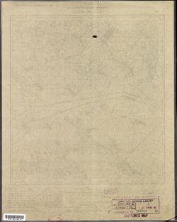
- Description:
- 1936
- Subject:
- Topical Subject: Maps, Topical Subject: Soviet Union, and Geographic Subject: Kapyl
- Publisher:
- Управление военных топографов РККА
- Language:
- Russian
- Identifier:
- VAC9619-000672
- Genre:
- Military Maps and Topographic Maps
- Geographic Location:
- Coordinates: 53, 27, 53.167, 27.25
- Related URL:
- Download GeoTIFF: https://drive.google.com/open?id=11e2ZtLH9wfsEGtZPrIJ-krRFzvy9CV4X and Catalog URL: http://iucat.iu.edu/catalog/5020131
- Abstract:
- Modern area represented: Kapyl, Minsk oblast, Belarus
- Call Number:
- G7000 s50 .S68 sheet N-35-103-С
- Caption:
- Не подлежит оглашению,Captured map
- City:
- Копыль (Kopylʹ)
- Copyright Holder:
- No Copyright - United States
- Country:
- СССР (USSR)
- State/Province:
- Белорусская ССР (Byelorussian Soviet Socialist Republic)
- Physical Description:
- Scale: 1:50,000
- Persistent URL:
- http://purl.dlib.indiana.edu/iudl/images/VAC9619/VAC9619-000672
- Provenance:
- Army Map Service Library, OMAHA, Library of Congress Geography & Map Division
-
- Description:
- 1936
- Subject:
- Topical Subject: Soviet Union, Topical Subject: Maps, and Geographic Subject: Hresk
- Publisher:
- Управление военных топографов РККА
- Language:
- Russian
- Identifier:
- VAC9619-000673
- Genre:
- Military Maps and Topographic Maps
- Geographic Location:
- Coordinates: 53, 27.25, 53.167, 27.5
- Related URL:
- Catalog URL: http://iucat.iu.edu/catalog/5020131 and Download GeoTIFF: https://drive.google.com/open?id=1AUeDJftVYQKpFX1C5u1ggJz4Ad98R15P
- Abstract:
- Modern area represented: Hresk, Minsk oblast, Belarus
- Call Number:
- G7000 s50 .S68 sheet N-35-103-D
- Caption:
- Не подлежит оглашению
- City:
- Греск (Gresk)
- Copyright Holder:
- No Copyright - United States
- Country:
- СССР (USSR)
- State/Province:
- Белорусская ССР (Byelorussian Soviet Socialist Republic)
- Physical Description:
- Scale: 1:50,000
- Persistent URL:
- http://purl.dlib.indiana.edu/iudl/images/VAC9619/VAC9619-000673
- Provenance:
- Army Map Service Library, OMAHA, Library of Congress Geography & Map Division
-
- Description:
- 1936
- Subject:
- Topical Subject: Maps, Topical Subject: Soviet Union, and Geographic Subject: Shyshchytsy
- Publisher:
- Управление военных топографов РККА
- Language:
- Russian
- Identifier:
- VAC9619-000674
- Genre:
- Military Maps and Topographic Maps
- Geographic Location:
- Coordinates: 53.167, 27.5, 53.333, 27.75
- Related URL:
- Catalog URL: http://iucat.iu.edu/catalog/5020131 and Download GeoTIFF: https://drive.google.com/open?id=1Oa5MHTg9Dt0KYKBFQsi5HfsnmXyg4W63
- Abstract:
- Modern area represented: Shyshchytsy, Minsk oblast, Belarus
- Call Number:
- G7000 s50 .S68 sheet N-35-104-A
- Caption:
- Не подлежит оглашению
- City:
- Шищицы (Shishchitsy)
- Copyright Holder:
- No Copyright - United States
- Country:
- СССР (USSR)
- State/Province:
- Белорусская ССР (Byelorussian Soviet Socialist Republic)
- Physical Description:
- Scale: 1:50,000
- Persistent URL:
- http://purl.dlib.indiana.edu/iudl/images/VAC9619/VAC9619-000674
- Provenance:
- Army Map Service Library, OMAHA, Library of Congress Geography & Map Division

- « Previous
- Next »
- 1
- 2
- 3
- 4