
Search Constraints
You searched for:
Provenance
CIA Map Branch -- Received
Remove constraint Provenance: CIA Map Branch -- Received
« Previous |
1 - 100 of 148
|
Next »
Search Results
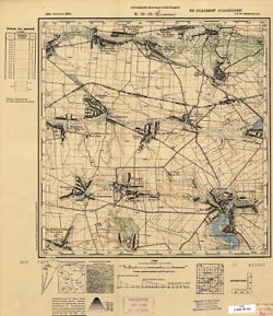
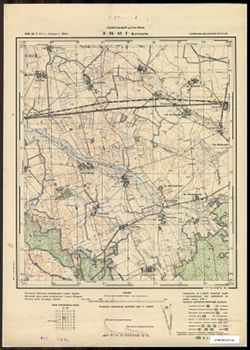
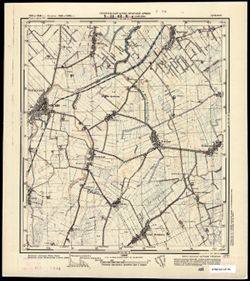
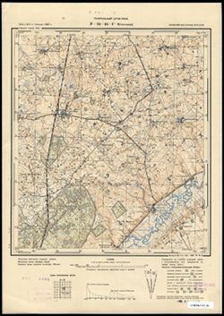
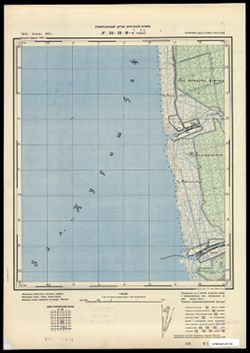
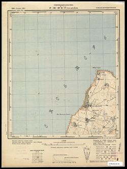
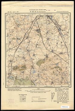
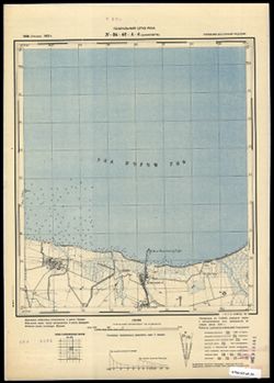
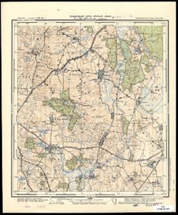
-

- Subject:
- Geographic Subject: Pravdino, Topical Subject: Maps, and Topical Subject: Soviet Union
- Publisher:
- Генеральный штаб Красной Армии
- Language:
- Russian
- Date Created:
- 1940
- Identifier:
- VAC9619-003716
- Genre:
- Military Maps and Topographic Maps
- Geographic Location:
- Coordinates: 54.833, 22.5, 54.913, 22.625
- Related URL:
- Download GeoTIFF: https://drive.google.com/file/d/1Pj1DR5fQarxZS6xEnJBWhxqS5OgD1i5X/view?usp=sharing and Catalog URL: https://iucat.iu.edu/catalog/14701157
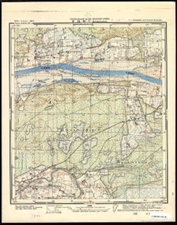
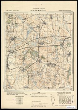
- Abstract:
- Modern area represented: Правдино (Pravdino), Kaliningradskaya oblast, Russia
- Call Number:
- G7063.K2 s25 .S6 sheet N-34-46-A-c
- City:
- Грумбковсфельде (Grumbkowsfelde)
- Copyright Holder:
- No Copyright - United States
- Country:
- Германия (Восточная Пруссия) (Germany (East Prussia))
- Physical Description:
- Scale: 1:25,000
- Persistent URL:
- http://purl.dlib.indiana.edu/iudl/images/VAC9619/VAC9619-003716
- Provenance:
- CIA Map Branch -- Received
-
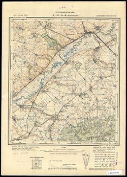
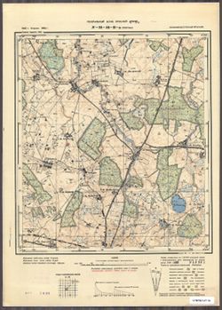
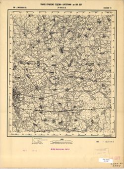
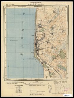
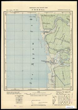
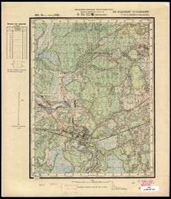
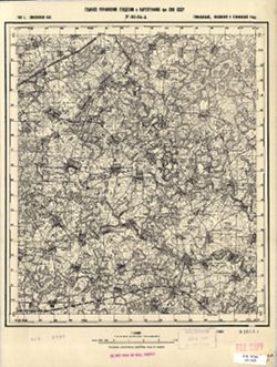
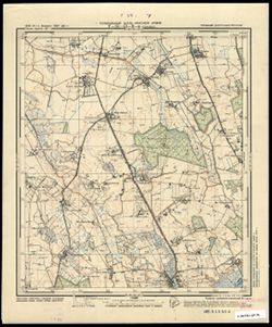
- Subject:
- Topical Subject: Soviet Union, Geographic Subject: Iskrovo, and Topical Subject: Maps
- Publisher:
- Генеральный штаб Красной Армии
- Language:
- Russian
- Date Created:
- 1941
- Identifier:
- VAC9619-003679
- Genre:
- Military Maps and Topographic Maps
- Geographic Location:
- Coordinates: 54.75, 21.375, 54.833, 21.5
- Related URL:
- Download GeoTIFF: https://drive.google.com/file/d/1yu7MH4jFLldg0pLFCOFpgBlt6_SbUA89/view?usp=sharing and Catalog URL: https://iucat.iu.edu/catalog/14701157
- Abstract:
- Modern area represented: part of Искрово (Iskrovo), Kaliningradskaya oblast, Russia
- Call Number:
- G7063.K2 s25 .S6 sheet N-34-43-D-b
- City:
- Паннауген
- Copyright Holder:
- No Copyright - United States
- Country:
- Германия (Восточная Пруссия) (Germany (East Prussia))
- Physical Description:
- Scale: 1:25,000
- Persistent URL:
- http://purl.dlib.indiana.edu/iudl/images/VAC9619/VAC9619-003679
- Provenance:
- CIA Map Branch -- Received
-
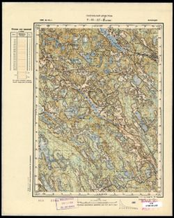
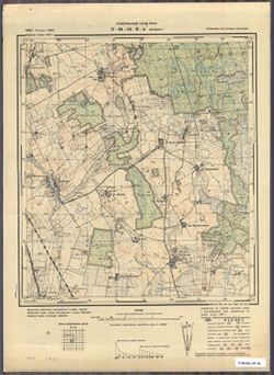
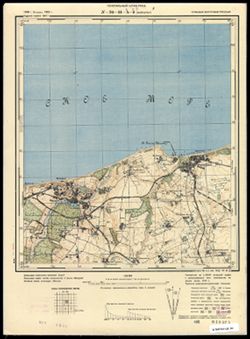
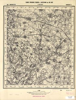
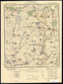
- Subject:
- Geographic Subject: Zaostrov’ye, Topical Subject: Soviet Union, and Topical Subject: Maps
- Publisher:
- Генеральный штаб РККА
- Language:
- Russian
- Date Created:
- 1940
- Identifier:
- VAC9619-003644
- Genre:
- Military Maps and Topographic Maps
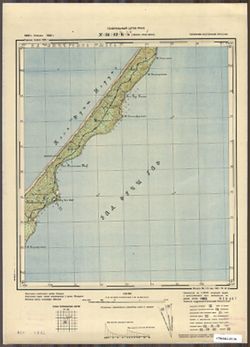
- Geographic Location:
- Coordinates: 54.913, 20.25, 55, 20.375
- Related URL:
- Download GeoTIFF: https://drive.google.com/file/d/1_Rfi01p_uZbHxyLfwbvN0caeO3xUwMzh/view?usp=sharing and Catalog URL: https://iucat.iu.edu/catalog/14701157
- Abstract:
- Modern area represented: Заостровье (Zaostrov’ye), Kaliningradskaya oblast, Russia
- Call Number:
- G7063.K2 s25 .S6 sheet N-34-41-B-a
- City:
- Рантау (Rantau)
- Copyright Holder:
- No Copyright - United States
- Country:
- Германия (Восточная Пруссия) (Germany (East Prussia))
- Physical Description:
- Scale: 1:25,000
- Persistent URL:
- http://purl.dlib.indiana.edu/iudl/images/VAC9619/VAC9619-003644
- Provenance:
- CIA Map Branch -- Received
-
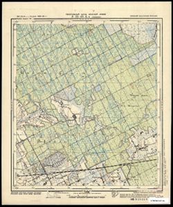
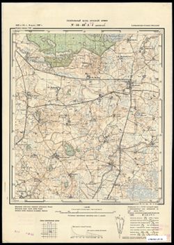
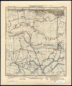
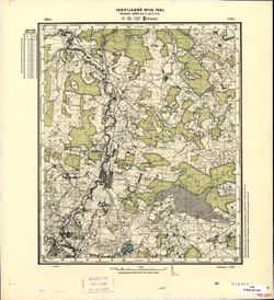
- Subject:
- Topical Subject: Soviet Union, Topical Subject: Maps, and Geographic Subject: Dorozhnyy
- Publisher:
- Генеральный штаб РККА
- Language:
- Russian
- Date Created:
- 1940
- Identifier:
- VAC9619-003653
- Genre:
- Military Maps and Topographic Maps
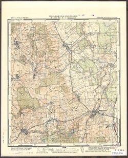
- Geographic Location:
- Coordinates: 54.75, 20.375, 54.833, 20.5
- Related URL:
- Download GeoTIFF: https://drive.google.com/file/d/1O9LWLzbW4TC8Jmx1-arl8hWMH0L5TBPK/view?usp=sharing and Catalog URL: https://iucat.iu.edu/catalog/14701157
- Abstract:
- Modern area represented: Дорожный (Dorozhnyy), Kaliningradskaya oblast, Russia
- Call Number:
- G7063.K2 s25 .S6 sheet N-34-41-D-b
- City:
- Нойхоф (Neuhof)
- Copyright Holder:
- No Copyright - United States
- Country:
- Германия (Восточная Пруссия) (Germany (East Prussia))
- Physical Description:
- Scale: 1:25,000
- Persistent URL:
- http://purl.dlib.indiana.edu/iudl/images/VAC9619/VAC9619-003653
- Provenance:
- CIA Map Branch -- Received
-
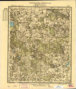
- Description:
- 1899
- Subject:
- Topical Subject: Soviet Union, Geographic Subject: Turba, and Topical Subject: Maps
- Publisher:
- Генеральный штаб РККА
- Language:
- Russian
- Identifier:
- VAC9619-001820
- Genre:
- Topographic Maps and Military Maps
- Geographic Location:
- Coordinates: 59, 24, 59.167, 24.25
- Related URL:
- Catalog URL: http://iucat.iu.edu/catalog/5020131 and Download GeoTIFF: https://drive.google.com/open?id=1LfKTAvo4nuJR0vvkSYl3zBq-IEeS1AQ7
- Abstract:
- Modern area represented: Turba, Harju county, Estonia
- Call Number:
- G7000 s50 .S68 sheet O-35-25-C
- City:
- Турба (Turba)
- Copyright Holder:
- No Copyright - United States
- Country:
- Эстония (Estonia)
- Physical Description:
- Scale: 1:50,000
- Persistent URL:
- http://purl.dlib.indiana.edu/iudl/images/VAC9619/VAC9619-001820
- Provenance:
- CIA Map Branch -- Received
-
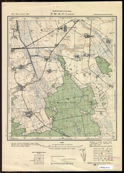
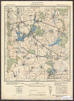
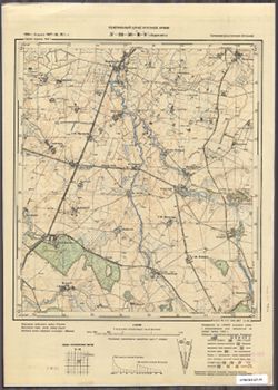
- Subject:
- Geographic Subject: Galiny, Topical Subject: Soviet Union, and Topical Subject: Maps
- Publisher:
- Генеральный штаб Красной Армии
- Language:
- Russian
- Date Created:
- 1941
- Identifier:
- VAC9619-003814
- Genre:
- Military Maps and Topographic Maps
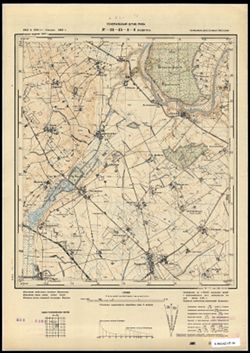
- Geographic Location:
- Coordinates: 54.083, 20.75, 54.1667, 20.875
- Related URL:
- Download GeoTIFF: https://drive.google.com/file/d/1uq3LcNUQMze4weSSvkbDPn_sSpKayldj/view?usp=sharing and Catalog URL: https://iucat.iu.edu/catalog/14701157
- Abstract:
- Modern area represented: Galiny, Poland
- Call Number:
- G7063.K2 s25 .S6 sheet N-34-66-D-а
- City:
- Галлинген (Gallingen)
- Copyright Holder:
- No Copyright - United States
- Country:
- Германия (Восточная Пруссия) (Germany (East Prussia))
- Physical Description:
- Scale: 1:25,000
- Persistent URL:
- http://purl.dlib.indiana.edu/iudl/images/VAC9619/VAC9619-003814
- Provenance:
- CIA Map Branch -- Received
-
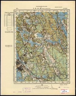
- Description:
- 1886
- Subject:
- Geographic Subject: Andreyevskoye, Topical Subject: Soviet Union, and Topical Subject: Maps
- Publisher:
- Генеральный штаб РККА
- Language:
- Russian
- Identifier:
- VAC9619-002977
- Genre:
- Military Maps and Topographic Maps
- Geographic Location:
- Coordinates: 60.667, 28, 60.833, 28.25
- Related URL:
- Download GeoTIFF: https://drive.google.com/file/d/1pjx5GJi78IdCdZ8imI06i0-nB-8b0IN9/view?usp=sharing and Catalog URL: http://iucat.iu.edu/catalog/5020131
- Abstract:
- Modern area represented: Андреевское (Andreyevskoye), Leningradskaya oblast, Russia
- Call Number:
- GM G7000 s50 .S68 sheet P-35-117-C
- Caption:
- Временное издание
- City:
- Лавола (Lavola)
- Copyright Holder:
- No Copyright - United States
- Country:
- Финляндия (Finland)
- Physical Description:
- Scale: 1:50,000
- Persistent URL:
- http://purl.dlib.indiana.edu/iudl/images/VAC9619/VAC9619-002977
- Provenance:
- CIA Map Branch -- Received
-
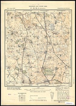
- Subject:
- Topical Subject: Soviet Union, Topical Subject: Maps, and Geographic Subject: Levoberezhnoye
- Publisher:
- Генеральный штаб Красной Армии
- Language:
- Russian
- Date Created:
- 1940
- Identifier:
- VAC9619-003596
- Genre:
- Military Maps and Topographic Maps
- Geographic Location:
- Coordinates: 55.167, 21.375, 55.25, 21.5
- Related URL:
- Download GeoTIFF: https://drive.google.com/file/d/1dvlY0f2u3s9DuxAwvSM6kSiwi08WRsQD/view?usp=sharing and Catalog URL: https://iucat.iu.edu/catalog/14701157
- Abstract:
- Modern area represented: Левобережное (Levoberezhnoye), Kaliningradskaya oblast, Russia
- Call Number:
- G7063.K2 s25 .S6 sheet N-34-31-B-d
- City:
- Шакунен (Shakunen)
- Copyright Holder:
- No Copyright - United States
- Country:
- Германия (Восточная Пруссия) (Germany (East Prussia))
- Physical Description:
- Scale: 1:25,000
- Persistent URL:
- http://purl.dlib.indiana.edu/iudl/images/VAC9619/VAC9619-003596
- Provenance:
- CIA Map Branch -- Received
-
- Subject:
- Geographic Subject: Wiśniewo, Topical Subject: Maps, and Topical Subject: Soviet Union
- Publisher:
- Генеральный штаб Красной Армии
- Language:
- Russian
- Date Created:
- 1941
- Identifier:
- VAC9619-003788
- Genre:
- Military Maps and Topographic Maps
- Geographic Location:
- Coordinates: 54, 19.375, 54.083, 19.5
- Related URL:
- Download GeoTIFF: https://drive.google.com/file/d/16NZ1NRScSw4F_OGCO8IPtf9cCXYXCzmN/view?usp=sharing and Catalog URL: https://iucat.iu.edu/catalog/14701157
- Abstract:
- Modern area represented: Wiśniewo, Poland
- Call Number:
- G7063.K2 s25 .S6 sheet N-34-63-D-d
- City:
- Аугуствальде (Augustwalde)
- Copyright Holder:
- No Copyright - United States
- Country:
- Германия (Восточная Пруссия) (Germany (East Prussia))
- Physical Description:
- Scale: 1:25,000
- Persistent URL:
- http://purl.dlib.indiana.edu/iudl/images/VAC9619/VAC9619-003788
- Provenance:
- CIA Map Branch -- Received
-
- Subject:
- Topical Subject: Maps, Topical Subject: Soviet Union, and Geographic Subject: Pavoloch
- Publisher:
- Управление военных топографов
- Language:
- Russian
- Identifier:
- VAC9619-000848
- Genre:
- Military Maps and Topographic Maps
- Geographic Location:
- Coordinates: 49.8333, 29.25, 50, 29.5
- Related URL:
- Download GeoTIFF: https://drive.google.com/open?id=1rClY9QwrPg534wZKiLiyAW-wSoq55sEd and Catalog URL: http://iucat.iu.edu/catalog/5020131
- Abstract:
- Modern area represented: Pavoloch, Zhytomyr oblast, Ukraine
- Call Number:
- G7000 s50 .S68 sheet M-35-83-B
- Caption:
- Не подлежит оглашению
- City:
- Паволочь (Pavoloch)
- Copyright Holder:
- No Copyright - United States
- Country:
- СССР (USSR)
- State/Province:
- Украинская ССР (Ukrainian Soviet Socialist Republic) and Киевская область (Kyiv oblast)
- Physical Description:
- Scale: 1:50,000
- Persistent URL:
- http://purl.dlib.indiana.edu/iudl/images/VAC9619/VAC9619-000848
- Provenance:
- CIA Map Branch -- Received
-
- Subject:
- Topical Subject: Maps, Topical Subject: Soviet Union, and Geographic Subject: Lunino
- Publisher:
- Генеральный штаб Красной Армии
- Language:
- Russian
- Date Created:
- 1940
- Identifier:
- VAC9619-003699
- Genre:
- Military Maps and Topographic Maps
- Geographic Location:
- Coordinates: 54.913, 22, 55, 22.125
- Related URL:
- Download GeoTIFF: https://drive.google.com/file/d/1bHNg9FqA6f7LENY0S9sIpet530SECyBY/view?usp=sharing and Catalog URL: https://iucat.iu.edu/catalog/14701157
- Abstract:
- Modern area represented: Лунино (Lunino), Kaliningradskaya oblast, Russia
- Call Number:
- G7063.K2 s25 .S6 sheet N-34-45-A-а
- City:
- Ленгветен (Lengwethen)
- Copyright Holder:
- No Copyright - United States
- Country:
- Германия (Восточная Пруссия) (Germany (East Prussia))
- Physical Description:
- Scale: 1:25,000
- Persistent URL:
- http://purl.dlib.indiana.edu/iudl/images/VAC9619/VAC9619-003699
- Provenance:
- CIA Map Branch -- Received
-
- Description:
- 1929
- Subject:
- Geographic Subject: Azarychy, Topical Subject: Maps, and Topical Subject: Soviet Union
- Publisher:
- Управление военных топографов
- Language:
- Russian
- Identifier:
- VAC9619-000790
- Genre:
- Military Maps and Topographic Maps
- Geographic Location:
- Coordinates: 52.333, 29.25, 52.5, 29.5
- Related URL:
- Download GeoTIFF: https://drive.google.com/open?id=1Uqe7-WXNazdS1P1xaQVm59gXsGcZNwg- and Catalog URL: http://iucat.iu.edu/catalog/5020131
- Abstract:
- Modern area represented: Azarychy, Homyel oblast, Belarus
- Call Number:
- G7000 s50 .s68 sheet N-35-131-D
- Caption:
- Не подлежит оглашению
- City:
- Озаричи (Ozarichi)
- Copyright Holder:
- No Copyright - United States
- Country:
- СССР (USSR)
- State/Province:
- Белорусская ССР (Byelorussian Soviet Socialist Republic)
- Physical Description:
- Scale: 1:50,000
- Persistent URL:
- http://purl.dlib.indiana.edu/iudl/images/VAC9619/VAC9619-000790
- Provenance:
- CIA Map Branch -- Received
-
- Description:
- 1875
- Subject:
- Geographic Subject: Ezere, Topical Subject: Maps, and Topical Subject: Soviet Union
- Publisher:
- Управление военных топографов РККА
- Language:
- Russian
- Date Created:
- 1897
- Identifier:
- VAC9619-001739
- Genre:
- Topographic Maps and Military Maps
- Geographic Location:
- Coordinates: 56.333, 22.25, 56.5, 22.5
- Related URL:
- Download GeoTIFF: https://drive.google.com/open?id=1AO8npJGWadw_B5dNv1KXCXPz7ERhNbt6 and Catalog URL: http://iucat.iu.edu/catalog/5020131
- Abstract:
- Modern area represented: Ezere, Latvia
- Call Number:
- G7000 s50 .S68 sheet O-34-129-D
- City:
- Эзерэ (Ezere)
- Copyright Holder:
- No Copyright - United States
- Country:
- Литва (Lithuania) and Латвия (Latvia)
- Physical Description:
- Scale: 1:50,000
- Persistent URL:
- http://purl.dlib.indiana.edu/iudl/images/VAC9619/VAC9619-001739
- Provenance:
- CIA Map Branch -- Received
-
- Subject:
- Topical Subject: Soviet Union, Geographic Subject: Kłębowo, and Topical Subject: Maps
- Publisher:
- Генеральный штаб Красной Армии
- Language:
- Russian
- Date Created:
- 1941
- Identifier:
- VAC9619-003812
- Genre:
- Topographic Maps and Military Maps
- Geographic Location:
- Coordinates: 54, 20.5, 54.083, 20.625
- Related URL:
- Download GeoTIFF: https://drive.google.com/file/d/1XgTFZHiM82btNnNy2kZm1YCq1_uyTWD2/view?usp=sharing and Catalog URL: https://iucat.iu.edu/catalog/14701157
- Abstract:
- Modern area represented: Kłębowo, Poland
- Call Number:
- G7063.K2 s25 .S6 sheet N-34-66-C-c
- City:
- Вернегиттен (Wernegitten)
- Copyright Holder:
- No Copyright - United States
- Country:
- Германия (Восточная Пруссия) (Germany (East Prussia))
- Physical Description:
- Scale: 1:25,000
- Persistent URL:
- http://purl.dlib.indiana.edu/iudl/images/VAC9619/VAC9619-003812
- Provenance:
- CIA Map Branch -- Received
-
- Subject:
- Topical Subject: Maps, Geographic Subject: Камянець-Подільський (Kamianets-Podilskyi), and Topical Subject: Soviet Union
- Publisher:
- Управление военных топографов
- Language:
- Russian
- Identifier:
- VAC9619-000878
- Genre:
- Military Maps and Topographic Maps
- Geographic Location:
- Coordinates: 48.6667, 26.5, 48.8333, 26.75
- Related URL:
- Download GeoTIFF: https://drive.google.com/open?id=1d9zmDF1aOMAqfbDt_Z1j4-1yPA9Wetkx and Catalog URL: http://iucat.iu.edu/catalog/5020131
- Abstract:
- Modern area represented: Камянець-Подільський (Kamianets-Podilskyi), Khmelnytskyi Oblast, Ukraine
- Call Number:
- G7000 s50 .S68 sheet M-35-114-C
- Caption:
- Не подлежит оглашению
- City:
- Каменец-Подольск (Kamenets-Podol’sk)
- Copyright Holder:
- No Copyright - United States
- Country:
- СССР (USSR)
- State/Province:
- Украинская ССР (Ukrainian Soviet Socialist Republic) and Винницкая область (Vinnytsia oblast)
- Physical Description:
- Scale: 1:50,000
- Persistent URL:
- http://purl.dlib.indiana.edu/iudl/images/VAC9619/VAC9619-000878
- Provenance:
- CIA Map Branch -- Received
-
- Subject:
- Topical Subject: Maps, Topical Subject: Soviet Union, and Geographic Subject: Veshchevo
- Publisher:
- Генеральный штаб РККА
- Language:
- Russian
- Identifier:
- VAC9619-002985
- Genre:
- Military Maps and Topographic Maps
- Geographic Location:
- Coordinates: 60.667, 29, 60.833, 29.25
- Related URL:
- Download GeoTIFF: https://drive.google.com/file/d/14u_OYPWFAci95DmrsmcD5pAEe7EgJZ0f/view?usp=sharing and Catalog URL: http://iucat.iu.edu/catalog/5020131
- Abstract:
- Modern area represented: Вещево (Veshchevo), Leningradskaya oblast, Russia
- Call Number:
- G7000 s50 .S68 sheet P-35-119-C
- City:
- Хейньоки (Heinjoki)
- Copyright Holder:
- No Copyright - United States
- Country:
- Финляндия (Finland)
- Physical Description:
- Scale: 1:50,000
- Persistent URL:
- http://purl.dlib.indiana.edu/iudl/images/VAC9619/VAC9619-002985
- Provenance:
- CIA Map Branch -- Received
-
- Description:
- 1903
- Subject:
- Topical Subject: Soviet Union, Geographic Subject: Lõupõllu, and Topical Subject: Maps
- Publisher:
- Управление военных топографов
- Language:
- Russian
- Identifier:
- VAC9619-001716
- Genre:
- Military Maps and Topographic Maps
- Geographic Location:
- Coordinates: 58, 22, 58.167, 22.25
- Related URL:
- Catalog URL: http://iucat.iu.edu/catalog/5020131 and Download GeoTIFF: https://drive.google.com/open?id=11lJfJHVkbZq4tdtFpuMRnRt9Le89XSLS
- Abstract:
- Modern area represented: Lõupõllu, Saare county, Estonia
- Call Number:
- G7000 s50 .S68 sheet O-34-69-C
- City:
- Леопелло (Lõupõllu)
- Copyright Holder:
- No Copyright - United States
- Country:
- Эстония (Estonia)
- Physical Description:
- Scale: 1:50,000
- Persistent URL:
- http://purl.dlib.indiana.edu/iudl/images/VAC9619/VAC9619-001716
- Provenance:
- CIA Map Branch -- Received
-
- Description:
- 1899
- Subject:
- Geographic Subject: Riisipere, Topical Subject: Soviet Union, and Topical Subject: Maps
- Publisher:
- Генеральный штаб РККА
- Language:
- Russian
- Identifier:
- VAC9619-001821
- Genre:
- Topographic Maps and Military Maps
- Geographic Location:
- Coordinates: 59, 24.25, 59.167, 24.5
- Related URL:
- Download GeoTIFF: https://drive.google.com/open?id=1i7rc2srQUp9e33D0MLgKLyv9JlCao_17 and Catalog URL: http://iucat.iu.edu/catalog/5020131
- Abstract:
- Modern area represented: Riisipere, Harju county, Estonia
- Call Number:
- G7000 s50 .S68 sheet O-35-25-D
- City:
- Рийзипэре (Riisipere)
- Copyright Holder:
- No Copyright - United States
- Country:
- Эстония (Estonia)
- Physical Description:
- Scale: 1:50,000
- Persistent URL:
- http://purl.dlib.indiana.edu/iudl/images/VAC9619/VAC9619-001821
- Provenance:
- CIA Map Branch -- Received
-
- Subject:
- Topical Subject: Soviet Union, Geographic Subject: Lumpėnai, and Topical Subject: Maps
- Publisher:
- Генеральный штаб Красной Армии
- Language:
- Russian
- Date Created:
- 1941
- Identifier:
- VAC9619-003616
- Genre:
- Military Maps and Topographic Maps
- Geographic Location:
- Coordinates: 55.083, 22, 55.167, 22.125
- Related URL:
- Download GeoTIFF: https://drive.google.com/file/d/1H-qzINzofk5ibSFHQiNxqSBuohJdWXGO/view?usp=sharing and Catalog URL: https://iucat.iu.edu/catalog/14701157
- Abstract:
- Modern area represented: Lumpėnai, Lithuania
- Call Number:
- G7063.K2 s25 .S6 sheet N-34-33-C-a
- City:
- Ломпёнен (Lompenen)
- Copyright Holder:
- No Copyright - United States
- Country:
- Германия (Восточная Пруссия) (Germany (East Prussia))
- Physical Description:
- Scale: 1:25,000
- Persistent URL:
- http://purl.dlib.indiana.edu/iudl/images/VAC9619/VAC9619-003616
- Provenance:
- CIA Map Branch -- Received
-
- Description:
- 1905
- Subject:
- Topical Subject: Maps, Topical Subject: Soviet Union, and Geographic Subject: Audla
- Publisher:
- Управление военных топографов
- Language:
- Russian
- Identifier:
- VAC9619-001705
- Genre:
- Topographic Maps and Military Maps
- Geographic Location:
- Coordinates: 58.333, 23, 58.5, 23.25
- Related URL:
- Download GeoTIFF: https://drive.google.com/open?id=1JuXvZ3izZp7jsvaFWmo0ubcbnFcrSvvD and Catalog URL: http://iucat.iu.edu/catalog/5020131
- Abstract:
- Modern area represented: Audla, Saare county, Estonia
- Call Number:
- G7000 s50 .S68 sheet O-34-59-C
- City:
- Аудла (Audla)
- Copyright Holder:
- No Copyright - United States
- Country:
- Эстония (Estonia)
- Physical Description:
- Scale: 1:50,000
- Persistent URL:
- http://purl.dlib.indiana.edu/iudl/images/VAC9619/VAC9619-001705
- Provenance:
- CIA Map Branch -- Received
-
- Subject:
- Topical Subject: Soviet Union, Topical Subject: Maps, and Geographic Subject: Vozrozhdeniye
- Publisher:
- Генеральный штаб РККА
- Language:
- Russian
- Identifier:
- VAC9619-002980
- Genre:
- Military Maps and Topographic Maps
- Geographic Location:
- Coordinates: 60.833, 28.75, 61, 29
- Related URL:
- Download GeoTIFF: https://drive.google.com/file/d/1VlEGnc9t3XsCLiZA6_zfy3oX8MxVx260/view?usp=sharing and Catalog URL: http://iucat.iu.edu/catalog/5020131
- Abstract:
- Modern area represented: Возрождение (Vozrozhdeniye), Leningradskaya oblast, Russia
- Call Number:
- GM G7000 s50 .S68 sheet P-35-118-B
- City:
- Кавантсаари (Kavantsaari)
- Copyright Holder:
- No Copyright - United States
- Country:
- Финляндия (Finland)
- Physical Description:
- Scale: 1:50,000
- Persistent URL:
- http://purl.dlib.indiana.edu/iudl/images/VAC9619/VAC9619-002980
- Provenance:
- CIA Map Branch -- Received
-
- Subject:
- Geographic Subject: Nikol’skoye, Topical Subject: Maps, and Topical Subject: Soviet Union
- Publisher:
- Генеральный штаб Красной Армии
- Language:
- Russian
- Date Created:
- 1941
- Identifier:
- VAC9619-003620
- Genre:
- Topographic Maps and Military Maps
- Geographic Location:
- Coordinates: 55, 22.25, 55.085, 22.375
- Related URL:
- Download GeoTIFF: https://drive.google.com/file/d/1RCiWalJv_0lzFatAUvHYnfCBTUbYJRms/view?usp=sharing and Catalog URL: https://iucat.iu.edu/catalog/14701157
- Abstract:
- Modern area represented: Никольское (Nikol’skoye), Kaliningradskaya oblast, Russia
- Call Number:
- G7063.K2 s25 .S6 sheet N-34-33-D-c
- City:
- Гиверлаукен (Giewerlauken)
- Copyright Holder:
- No Copyright - United States
- Country:
- Германия (Восточная Пруссия) (Germany (East Prussia))
- Physical Description:
- Scale: 1:25,000
- Persistent URL:
- http://purl.dlib.indiana.edu/iudl/images/VAC9619/VAC9619-003620
- Provenance:
- CIA Map Branch -- Received
-
- Subject:
- Topical Subject: Maps, Geographic Subject: Ul'yanovo, and Topical Subject: Soviet Union
- Publisher:
- Генеральный штаб РККА
- Language:
- Russian
- Date Created:
- 1940
- Identifier:
- VAC9619-003707
- Genre:
- Topographic Maps and Military Maps
- Geographic Location:
- Coordinates: 54.75, 22, 54.667, 22.125
- Related URL:
- Catalog URL: https://iucat.iu.edu/catalog/14701157 and Download GeoTIFF: https://drive.google.com/file/d/1qWWDG_2LfmQlhTcUx_rkIBWRT1IzZDhT/view?usp=sharing
- Abstract:
- Modern area represented: Ульяново (Ul'yanovo), Kaliningradskaya oblast, Russia
- Call Number:
- G7063.K2 s25 .S6 sheet N-34-45-C-a
- City:
- Краупишкен (Kraupischken)
- Copyright Holder:
- No Copyright - United States
- Country:
- Германия (Восточная Пруссия) (Germany (East Prussia))
- Physical Description:
- Scale: 1:25,000
- Persistent URL:
- http://purl.dlib.indiana.edu/iudl/images/VAC9619/VAC9619-003707
- Provenance:
- CIA Map Branch -- Received
-
- Subject:
- Topical Subject: Soviet Union, Topical Subject: Maps, and Geographic Subject: Luzhayka
- Publisher:
- Генеральный штаб РККА
- Language:
- Russian
- Identifier:
- VAC9619-002978
- Genre:
- Military Maps and Topographic Maps
- Geographic Location:
- Coordinates: 60.667, 28.25, 60.833, 28.5
- Related URL:
- Download GeoTIFF: https://drive.google.com/file/d/16bDEPCv81JD6vF9DRK11agFuduBGMJ2o/view?usp=sharing and Catalog URL: http://iucat.iu.edu/catalog/5020131
- Abstract:
- Modern area represented: Лужайка (Luzhayka), Leningradskaya oblast, Russia
- Call Number:
- GM G7000 s50 .S68 sheet P-35-117-D
- City:
- Нурми (Nurmi)
- Copyright Holder:
- No Copyright - United States
- Country:
- Финляндия (Finland)
- Physical Description:
- Scale: 1:50,000
- Persistent URL:
- http://purl.dlib.indiana.edu/iudl/images/VAC9619/VAC9619-002978
- Provenance:
- CIA Map Branch -- Received
-
- Subject:
- Topical Subject: Maps, Geographic Subject: Zapovedniki, and Topical Subject: Soviet Union
- Publisher:
- Генеральный штаб Красной Армии
- Language:
- Russian
- Date Created:
- 1941
- Identifier:
- VAC9619-003673
- Genre:
- Military Maps and Topographic Maps
- Geographic Location:
- Coordinates: 54.833, 21.25, 54.913, 21.375
- Related URL:
- Catalog URL: https://iucat.iu.edu/catalog/14701157 and Download GeoTIFF: https://drive.google.com/file/d/1ws3NOY_-v6h9pH8mZP7Nj84w53Em5B8d/view?usp=sharing
- Abstract:
- Modern area represented: Заповедники (Zapovedniki), Kaliningradskaya oblast, Russia
- Call Number:
- G7063.K2 s25 .S6 sheet N-34-43-B-c
- City:
- Люкноен (Lucknojen)
- Copyright Holder:
- No Copyright - United States
- Country:
- Германия (Восточная Пруссия) (Germany (East Prussia))
- Physical Description:
- Scale: 1:25,000
- Persistent URL:
- http://purl.dlib.indiana.edu/iudl/images/VAC9619/VAC9619-003673
- Provenance:
- CIA Map Branch -- Received
-
- Subject:
- Geographic Subject: Antonovka, Topical Subject: Soviet Union, and Topical Subject: Maps
- Publisher:
- Генеральный штаб РККА
- Language:
- Russian
- Date Created:
- 1940
- Identifier:
- VAC9619-003665
- Genre:
- Topographic Maps and Military Maps
- Geographic Location:
- Coordinates: 54.75, 20.75, 54.833, 20.875
- Related URL:
- Download GeoTIFF: https://drive.google.com/file/d/1lFS1j0naiFdHz1U8_1wl3dLK_vlNVIQy/view?usp=sharing and Catalog URL: https://iucat.iu.edu/catalog/14701157
- Abstract:
- Modern area represented: Антоновка (Antonovka), Kaliningradskaya oblast, Russia
- Call Number:
- G7063.K2 s25 .S6 sheet N-34-42-D-а
- City:
- Брасдорф (Brasdorf)
- Copyright Holder:
- No Copyright - United States
- Country:
- Германия (Восточная Пруссия) (Germany (East Prussia))
- Physical Description:
- Scale: 1:25,000
- Persistent URL:
- http://purl.dlib.indiana.edu/iudl/images/VAC9619/VAC9619-003665
- Provenance:
- CIA Map Branch -- Received
-
- Description:
- 1929
- Subject:
- Topical Subject: Maps, Geographic Subject: Rus'ka Polyana, and Topical Subject: Soviet Union
- Publisher:
- Военно-топографическое управление
- Language:
- Russian
- Identifier:
- VAC9619-001030
- Genre:
- Topographic Maps and Military Maps
- Geographic Location:
- Coordinates: 49.3333, 31.75, 49.5, 32
- Related URL:
- Catalog URL: http://iucat.iu.edu/catalog/5020131 and Download GeoTIFF: https://drive.google.com/open?id=108WMIp9ytlRzYQrRA6s08SRq3Vc1FLc4
- Abstract:
- Modern area represented: Руська Поляна (Rus'ka Polyana), Cherkasy oblast, Ukraine
- Call Number:
- G7000 s50 .S68 sheet M-36-88-D
- Caption:
- Секретно (crossed out) and Рассекречено
- City:
- Русская Поляна (Russkaya Polyana)
- Copyright Holder:
- No Copyright - United States
- Country:
- СССР (USSR)
- State/Province:
- Шевченковский округ (Shevchenko district) and Украинская ССР (Ukrainian Soviet Socialist Republic)
- Physical Description:
- Scale: 1:50,000
- Persistent URL:
- http://purl.dlib.indiana.edu/iudl/images/VAC9619/VAC9619-001030
- Provenance:
- CIA Map Branch -- Received
-
- Subject:
- Geographic Subject: Kamenka, Topical Subject: Maps, and Topical Subject: Soviet Union
- Publisher:
- Генеральный штаб Красной Армии
- Language:
- Russian
- Date Created:
- 1940
- Identifier:
- VAC9619-003770
- Genre:
- Topographic Maps and Military Maps
- Geographic Location:
- Coordinates: 54.33333, 21.5, 54.416667, 21.625
- Related URL:
- Catalog URL: https://iucat.iu.edu/catalog/14701157 and Download GeoTIFF: https://drive.google.com/file/d/1usUnzt3AGpv7Pz8LkjduEMpZKCa8qPp3/view?usp=sharing
- Abstract:
- Modern area represented: Каменка (Kamenka), Kaliningradskaya oblast, Russia
- Call Number:
- G7063.K2 s25 .S6 sheet N-34-56-C-c
- City:
- Пентлак (Pentlack)
- Copyright Holder:
- No Copyright - United States
- Country:
- Германия (Восточная Пруссия) (Germany (East Prussia))
- Physical Description:
- Scale: 1:25,000
- Persistent URL:
- http://purl.dlib.indiana.edu/iudl/images/VAC9619/VAC9619-003770
- Provenance:
- CIA Map Branch -- Received
-
- Subject:
- Geographic Subject: Frisching, Topical Subject: Maps, and Topical Subject: Soviet Union
- Publisher:
- Генеральный штаб РККА
- Language:
- Russian
- Date Created:
- 1940
- Identifier:
- VAC9619-003741
- Genre:
- Topographic Maps and Military Maps
- Geographic Location:
- Coordinates: 54.5, 20.75, 54.583333, 20.875
- Related URL:
- Catalog URL: https://iucat.iu.edu/catalog/14701157 and Download GeoTIFF: https://drive.google.com/file/d/1V-qCC4a4icVgtr4t_cpkrqY8FYD9sX8o/view?usp=sharing
- Abstract:
- Modern area represented: Фрисчинг (Frisching), Kaliningradskaya oblast, Russia
- Call Number:
- G7063.K2 s25 .S6 sheet N-34-54-B-c
- City:
- Фришинг (Frisching)
- Copyright Holder:
- No Copyright - United States
- Country:
- Германия (Восточная Пруссия) (Germany (East Prussia))
- Physical Description:
- Scale: 1:25,000
- Persistent URL:
- http://purl.dlib.indiana.edu/iudl/images/VAC9619/VAC9619-003741
- Provenance:
- CIA Map Branch -- Received
-
- Subject:
- Topical Subject: Soviet Union, Geographic Subject: Nowy Staw, and Topical Subject: Maps
- Publisher:
- Генеральный штаб Красной Армии
- Language:
- Russian
- Date Created:
- 1941
- Identifier:
- VAC9619-003784
- Genre:
- Topographic Maps and Military Maps
- Geographic Location:
- Coordinates: 54.083, 19, 54.167, 19.125
- Related URL:
- Download GeoTIFF: https://drive.google.com/file/d/1Sq9fVMvDmaoAlre3-zP3AuGktROnmii9/view?usp=sharing and Catalog URL: https://iucat.iu.edu/catalog/14701157
- Abstract:
- Modern area represented: Nowy Staw, Poland
- Call Number:
- G7063.K2 s25 .S6 sheet N-34-63-C-а
- City:
- Нойтайх (Neuteich)
- Copyright Holder:
- No Copyright - United States
- Country:
- Германия (Germany)
- Physical Description:
- Scale: 1:25,000
- Persistent URL:
- http://purl.dlib.indiana.edu/iudl/images/VAC9619/VAC9619-003784
- Provenance:
- CIA Map Branch -- Received
-
- Description:
- 1939
- Subject:
- Topical Subject: Maps, Topical Subject: Soviet Union, and Geographic Subject: Gagarin
- Publisher:
- Главное Управление Геодезии и Картографии при СНК СССР
- Language:
- Russian
- Identifier:
- VAC9619-001250
- Genre:
- Military Maps and Topographic Maps
- Geographic Location:
- Coordinates: 55.5, 35, 55.667, 35.25
- Related URL:
- Catalog URL: http://iucat.iu.edu/catalog/5020131 and Download GeoTIFF: https://drive.google.com/open?id=14xt8ZsLjrbcMlLXbp_0N2WGRru2MAmmh
- Abstract:
- Modern area represented: Gagarin, Smolensk oblast, Russia
- Call Number:
- GM G7000 S50 .S68 N-36-23-A
- Copyright Holder:
- No Copyright - United States
- Country:
- СССР (USSR)
- State/Province:
- РСФСР (RSFSR) and Смоленская область (Smolensk oblast)
- Physical Description:
- Scale: 1:50,000
- Persistent URL:
- http://purl.dlib.indiana.edu/iudl/images/VAC9619/VAC9619-001250
- Provenance:
- CIA Map Branch -- Received
-
- Description:
- 1923
- Subject:
- Topical Subject: Soviet Union, Geographic Subject: Korsun'-Shevchenkivs'kyy, and Topical Subject: Maps
- Publisher:
- Управление военных топографов
- Language:
- Russian
- Identifier:
- VAC9619-001026
- Genre:
- Topographic Maps and Military Maps
- Geographic Location:
- Coordinates: 49.3333, 31.25, 49.5, 31.5
- Related URL:
- Catalog URL: http://iucat.iu.edu/catalog/5020131 and Download GeoTIFF: https://drive.google.com/file/d/1tpjCabPoferIfj2wowz3CktJhClrRFi-/view?usp=sharing
- Abstract:
- Modern area represented: Корсунь-Шевченківський (Korsun'-Shevchenkivs'kyy), Cherkasy oblast, Ukraine
- Call Number:
- G7000 s50 .S68 sheet M-36-87-D
- Caption:
- Не подлежит оглашению
- City:
- Корсунь (Korsun')
- Copyright Holder:
- No Copyright - United States
- Country:
- СССР (USSR)
- State/Province:
- Украинская ССР (Ukrainian Soviet Socialist Republic)
- Physical Description:
- Scale: 1:50,000
- Persistent URL:
- http://purl.dlib.indiana.edu/iudl/images/VAC9619/VAC9619-001026
- Provenance:
- CIA Map Branch -- Received
-
- Subject:
- Geographic Subject: Veselovka, Topical Subject: Soviet Union, and Topical Subject: Maps
- Publisher:
- Генеральный штаб РККА
- Language:
- Russian
- Date Created:
- 1940
- Identifier:
- VAC9619-003666
- Genre:
- Topographic Maps and Military Maps
- Geographic Location:
- Coordinates: 54.75, 20.875, 54.833, 21
- Related URL:
- Download GeoTIFF: https://drive.google.com/file/d/1rKAxO0Igu6EVLfN0w2VaKzw7M7Fcn6jn/view?usp=sharing and Catalog URL: https://iucat.iu.edu/catalog/14701157
- Abstract:
- Modern area represented: Веселовка (Veselovka), Kaliningradskaya oblast, Russia
- Call Number:
- G7063.K2 s25 .S6 sheet N-34-42-D-b
- City:
- Зилькайм (Sielkeim)
- Copyright Holder:
- No Copyright - United States
- Country:
- Германия (Восточная Пруссия) (Germany (East Prussia))
- Physical Description:
- Scale: 1:25,000
- Persistent URL:
- http://purl.dlib.indiana.edu/iudl/images/VAC9619/VAC9619-003666
- Provenance:
- CIA Map Branch -- Received
-
- Description:
- 1906
- Subject:
- Geographic Subject: Yaroslavskoye, Topical Subject: Soviet Union, and Topical Subject: Maps
- Publisher:
- Генеральный штаб РККА
- Language:
- Russian
- Date Created:
- 1940
- Identifier:
- VAC9619-003663
- Genre:
- Military Maps and Topographic Maps
- Geographic Location:
- Coordinates: 54.75, 20.625, 54.833, 20.75
- Related URL:
- Download GeoTIFF: https://drive.google.com/file/d/1YeGowRcHa49rLHsO_nQibeGwRRzDeFMr/view?usp=sharing and Catalog URL: https://iucat.iu.edu/catalog/14701157
- Abstract:
- Modern area represented: Ярославское (Yaroslavskoye), Kaliningradskaya oblast, Russia
- Call Number:
- G7063.K2 s25 .S6 sheet N-34-42-C-b
- City:
- Шенвальде (Schönwalde)
- Copyright Holder:
- No Copyright - United States
- Country:
- Германия (Восточная Пруссия) (Germany (East Prussia))
- Physical Description:
- Scale: 1:25,000
- Persistent URL:
- http://purl.dlib.indiana.edu/iudl/images/VAC9619/VAC9619-003663
- Provenance:
- CIA Map Branch -- Received
-
- Subject:
- Topical Subject: Soviet Union, Geographic Subject: Mys Razmytyy, and Topical Subject: Maps
- Publisher:
- Генеральный штаб РККА
- Language:
- Russian
- Date Created:
- 1940
- Identifier:
- VAC9619-003729
- Genre:
- Military Maps and Topographic Maps
- Geographic Location:
- Coordinates: 54.5, 19.75, 54.583333, 19.875
- Related URL:
- Download GeoTIFF: https://drive.google.com/file/d/1Bh4-LJKH2083waWhggb59KrbB2_SPV7l/view?usp=sharing and Catalog URL: https://iucat.iu.edu/catalog/14701157
- Abstract:
- Modern area represented: probably Мыс Размытый (Mys Razmytyy), Kaliningradskaya oblast, Russia
- Call Number:
- G7063.K2 s25 .S6 sheet N-34-52-B-c
- City:
- Гросс Брух (Gross Bruch)
- Copyright Holder:
- No Copyright - United States
- Country:
- Германия (Восточная Пруссия) (Germany (East Prussia))
- Physical Description:
- Scale: 1:25,000
- Persistent URL:
- http://purl.dlib.indiana.edu/iudl/images/VAC9619/VAC9619-003729
- Provenance:
- CIA Map Branch -- Received
-
- Subject:
- Topical Subject: Maps, Topical Subject: Soviet Union, and Geographic Subject: Młynary
- Publisher:
- Генеральный штаб Красной Армии
- Language:
- Russian
- Date Created:
- 1941
- Identifier:
- VAC9619-003790
- Genre:
- Military Maps and Topographic Maps
- Geographic Location:
- Coordinates: 54.166667, 19.625, 54.25, 19.75
- Related URL:
- Catalog URL: https://iucat.iu.edu/catalog/14701157 and Download GeoTIFF: https://drive.google.com/file/d/1b1TWYqPW0FdmUOU1Q7PVRb9LBaodXuC2/view?usp=sharing
- Abstract:
- Modern area represented: Młynary, Poland
- Call Number:
- G7063.K2 s25 .S6 sheet N-34-64-A-d
- City:
- Мюльхаузен (Mühlhausen)
- Copyright Holder:
- No Copyright - United States
- Country:
- Германия (Восточная Пруссия) (Germany (East Prussia))
- Physical Description:
- Scale: 1:25,000
- Persistent URL:
- http://purl.dlib.indiana.edu/iudl/images/VAC9619/VAC9619-003790
- Provenance:
- CIA Map Branch -- Received
-
- Subject:
- Geographic Subject: Malomozhayskoye, Topical Subject: Maps, and Topical Subject: Soviet Union
- Publisher:
- Генеральный штаб РККА
- Language:
- Russian
- Date Created:
- 1940
- Identifier:
- VAC9619-003700
- Genre:
- Topographic Maps and Military Maps
- Geographic Location:
- Coordinates: 54.913, 22.125, 55, 22.25
- Related URL:
- Catalog URL: https://iucat.iu.edu/catalog/14701157 and Download GeoTIFF: https://drive.google.com/file/d/1uBNWzrMJZHFMv0W18hvNg7shZoRmvoV8/view?usp=sharing
- Abstract:
- Modern area represented: Маломожайское (Malomozhayskoye), Kaliningradskaya oblast, Russia
- Call Number:
- G7063.K2 s25 .S6 sheet N-34-45-A-b
- City:
- Будветен (Budwethen)
- Copyright Holder:
- No Copyright - United States
- Country:
- Германия (Восточная Пруссия) (Germany (East Prussia))
- Physical Description:
- Scale: 1:25,000
- Persistent URL:
- http://purl.dlib.indiana.edu/iudl/images/VAC9619/VAC9619-003700
- Provenance:
- CIA Map Branch -- Received
-
- Subject:
- Topical Subject: Soviet Union, Topical Subject: Maps, and Geographic Subject: Kaluzhskoye
- Publisher:
- Генеральный штаб РККА
- Language:
- Russian
- Date Created:
- 1940
- Identifier:
- VAC9619-003696
- Genre:
- Military Maps and Topographic Maps
- Geographic Location:
- Coordinates: 54.75, 21.875, 54.833, 22
- Related URL:
- Catalog URL: https://iucat.iu.edu/catalog/14701157 and Download GeoTIFF: https://drive.google.com/file/d/1P6I1E5UqLLew7VpkyAFlAFJMd1WFVSLk/view?usp=sharing
- Abstract:
- Modern area represented: Калужское (Kaluzhskoye), Kaliningradskaya oblast, Russia
- Call Number:
- G7063.K2 s25 .S6 sheet N-34-44-D-b
- City:
- Грюнхайде (Grünheide)
- Copyright Holder:
- No Copyright - United States
- Country:
- Германия (Восточная Пруссия) (Germany (East Prussia))
- Physical Description:
- Scale: 1:25,000
- Persistent URL:
- http://purl.dlib.indiana.edu/iudl/images/VAC9619/VAC9619-003696
- Provenance:
- CIA Map Branch -- Received
-
- Subject:
- Topical Subject: Maps, Geographic Subject: Jantarnyj, and Topical Subject: Soviet Union
- Publisher:
- Генеральный штаб РККА
- Language:
- Russian
- Date Created:
- 1940
- Identifier:
- VAC9619-003637
- Genre:
- Military Maps and Topographic Maps
- Geographic Location:
- Coordinates: 54.833, 19.875, 54.917, 20
- Related URL:
- Download GeoTIFF: https://drive.google.com/file/d/1e9F6YSPWMO03ATpPj5mzzwMl34SommdS/view?usp=sharing and Catalog URL: https://iucat.iu.edu/catalog/14701157
- Abstract:
- Modern area represented: Янтарный (Jantarnyj), Kaliningradskaya oblast, Russia
- Call Number:
- G7063.K2 s25 .S6 sheet N-34-40-B-d
- City:
- Кракстепеллен (Kraxtepellen)
- Copyright Holder:
- No Copyright - United States
- Country:
- Германия (Восточная Пруссия) (Germany (East Prussia))
- Physical Description:
- Scale: 1:25,000
- Persistent URL:
- http://purl.dlib.indiana.edu/iudl/images/VAC9619/VAC9619-003637
- Provenance:
- CIA Map Branch -- Received
-
- Subject:
- Geographic Subject: Pereslavskoye, Topical Subject: Soviet Union, and Topical Subject: Maps
- Publisher:
- Генеральный штаб РККА
- Language:
- Russian
- Date Created:
- 1940
- Identifier:
- VAC9619-003652
- Genre:
- Military Maps and Topographic Maps
- Geographic Location:
- Coordinates: 54.75, 20.25, 54.833, 20.375
- Related URL:
- Download GeoTIFF: https://drive.google.com/file/d/1LfaWmL2ijvkDtgRW4XQtS_4nFJIghbiH/view?usp=sharing and Catalog URL: https://iucat.iu.edu/catalog/14701157
- Abstract:
- Modern area represented: Переславское (Pereslavskoye), Kaliningradskaya oblast, Russia
- Call Number:
- G7063.K2 s25 .S6 sheet N-34-41-D-a
- City:
- Другенен (Drugenen)
- Copyright Holder:
- No Copyright - United States
- Country:
- Германия (Восточная Пруссия) (Germany (East Prussia))
- Physical Description:
- Scale: 1:25,000
- Persistent URL:
- http://purl.dlib.indiana.edu/iudl/images/VAC9619/VAC9619-003652
- Provenance:
- CIA Map Branch -- Received
-
- Description:
- 1894
- Subject:
- Topical Subject: Soviet Union, Topical Subject: Maps, and Geographic Subject: Prigorod Kor’yala
- Publisher:
- Генеральный штаб РККА
- Language:
- Russian
- Identifier:
- VAC9619-002982
- Genre:
- Military Maps and Topographic Maps
- Geographic Location:
- Coordinates: 60.667, 28.75, 60.833, 29
- Related URL:
- Catalog URL: http://iucat.iu.edu/catalog/5020131 and Download GeoTIFF: https://drive.google.com/file/d/1GRsex98W8FgGoVdzi0ax1DjiJgaNZffb/view?usp=sharing
- Abstract:
- Modern area represented: Пригород Корьяла (Prigorod Kor’yala), Leningradskaya oblast, Russia
- Call Number:
- GM G7000 s50 .S68 sheet P-35-118-D
- Caption:
- Временное издание
- City:
- Карьялан Есикаупунки (Karjalan Esikaupunki)
- Copyright Holder:
- No Copyright - United States
- Country:
- Финляндия (Finland)
- Physical Description:
- Scale: 1:50,000
- Persistent URL:
- http://purl.dlib.indiana.edu/iudl/images/VAC9619/VAC9619-002982
- Provenance:
- CIA Map Branch -- Received
-
- Subject:
- Topical Subject: Soviet Union, Topical Subject: Maps, and Geographic Subject: Matrosovo
- Publisher:
- Генеральный штаб Красной Армии
- Language:
- Russian
- Date Created:
- 1940
- Identifier:
- VAC9619-003598
- Genre:
- Military Maps and Topographic Maps
- Geographic Location:
- Coordinates: 55, 21.125, 55.083, 21.25
- Related URL:
- Catalog URL: https://iucat.iu.edu/catalog/14701157 and Download GeoTIFF: https://drive.google.com/file/d/1rwe-_4oNUllweT_eesVHOWv3Q0E5Yzd0/view?usp=sharing
- Abstract:
- Modern area represented: Матросово (Matrosovo), Kaliningradskaya oblast, Russia
- Call Number:
- G7063.K2 s25 .S6 sheet N-34-31-C-d
- City:
- Гильге (Gil’ge)
- Copyright Holder:
- No Copyright - United States
- Country:
- Германия (Восточная Пруссия) (Germany (East Prussia))
- Physical Description:
- Scale: 1:25,000
- Persistent URL:
- http://purl.dlib.indiana.edu/iudl/images/VAC9619/VAC9619-003598
- Provenance:
- CIA Map Branch -- Received
-
- Subject:
- Topical Subject: Soviet Union and Topical Subject: Maps
- Publisher:
- Генеральный штаб Красной Армии
- Language:
- Russian
- Date Created:
- 1940
- Identifier:
- VAC9619-003597
- Genre:
- Topographic Maps and Military Maps
- Geographic Location:
- Coordinates: 55.083, 21.125, 55.167, 21.25
- Related URL:
- Catalog URL: https://iucat.iu.edu/catalog/14701157 and Download GeoTIFF: https://drive.google.com/file/d/1GeMuz8uwDX2KTJSBeHIw0XqR__da7cgu/view?usp=sharing
- Abstract:
- Modern area represented: Урочище Рыбачье (Urochishche Rybach’ye), Kaliningradskaya oblast, Russia
- Call Number:
- G7063.K2 s25 .S6 sheet N-34-31-C-b
- City:
- Лойе (Loye)
- Copyright Holder:
- No Copyright - United States
- Country:
- Германия (Восточная Пруссия) (Germany (East Prussia))
- Physical Description:
- Scale: 1:25,000
- Persistent URL:
- http://purl.dlib.indiana.edu/iudl/images/VAC9619/VAC9619-003597
- Provenance:
- CIA Map Branch -- Received
-
- Description:
- 1927
- Subject:
- Geographic Subject: Teleshovo, Topical Subject: Maps, and Topical Subject: Soviet Union
- Publisher:
- Управление военных топографов
- Language:
- Russian
- Identifier:
- VAC9619-000430
- Genre:
- Topographic Maps and Military Maps
- Geographic Location:
- Coordinates: 55.8333, 29.75, 56.0, 30.0
- Related URL:
- Download GeoTIFF: https://drive.google.com/open?id=1rMUqxQMTSTl4Rlj1TMoJ9VJzjjFAkCQZ and Catalog URL: http://iucat.iu.edu/catalog/5020131
- Abstract:
- Modern area represented: Teleshovo, Pskov oblast, Russia
- Call Number:
- G7000 s50 .S68 sheet N-35-12-B
- Caption:
- Не подлежит оглашению
- City:
- Телешово (Teleshovo)
- Copyright Holder:
- No Copyright - United States
- Country:
- СССР (USSR)
- State/Province:
- Западная область (Western oblast), Белорусская ССР (Byelorussian Soviet Socialist Republic), and РСФСР (RSFSR)
- Physical Description:
- Scale: 1:50,000
- Persistent URL:
- http://purl.dlib.indiana.edu/iudl/images/VAC9619/VAC9619-000430
- Provenance:
- CIA Map Branch -- Received
-
- Subject:
- Topical Subject: Soviet Union, Geographic Subject: Vzmor'ye, and Topical Subject: Maps
- Publisher:
- Генеральный штаб РККА
- Language:
- Russian
- Date Created:
- 1940
- Identifier:
- VAC9619-003651
- Genre:
- Topographic Maps and Military Maps
- Geographic Location:
- Coordinates: 54.667, 20.125, 54.75, 20.25
- Related URL:
- Download GeoTIFF: https://drive.google.com/file/d/1ruA4NnmT5iyE_wOjoTTiyhdKfrmcu36X/view?usp=sharing and Catalog URL: https://iucat.iu.edu/catalog/14701157
- Abstract:
- Modern area represented: Взморье (Vzmor'ye), Kaliningradskaya oblast, Russia
- Call Number:
- G7063.K2 s25 .S6 sheet N-34-41-C-d
- City:
- Гросс Хайдекруг (Gross-Heydekrug)
- Copyright Holder:
- No Copyright - United States
- Country:
- Германия (Восточная Пруссия) (Germany (East Prussia))
- Physical Description:
- Scale: 1:25,000
- Persistent URL:
- http://purl.dlib.indiana.edu/iudl/images/VAC9619/VAC9619-003651
- Provenance:
- CIA Map Branch -- Received
-
- Subject:
- Topical Subject: Maps, Geographic Subject: Donskoye, and Topical Subject: Soviet Union
- Publisher:
- Генеральный штаб РККА
- Language:
- Russian
- Date Created:
- 1940
- Identifier:
- VAC9619-003636
- Genre:
- Topographic Maps and Military Maps
- Geographic Location:
- Coordinates: 54.917, 19.875, 55, 20
- Related URL:
- Catalog URL: https://iucat.iu.edu/catalog/14701157 and Download GeoTIFF: https://drive.google.com/file/d/10LUWuO7qK1I4WXJrqzCbHutrdyUuSgZM/view?usp=sharing
- Abstract:
- Modern area represented: Донское (Donskoye), Kaliningradskaya oblast, Russia
- Call Number:
- G7063.K2 s25 .S6 sheet N-34-40-B-b
- City:
- Гросс Диршкайм (Gross Dirshkaym)
- Copyright Holder:
- No Copyright - United States
- Country:
- Германия (Восточная Пруссия) (Germany (East Prussia))
- Physical Description:
- Scale: 1:25,000
- Persistent URL:
- http://purl.dlib.indiana.edu/iudl/images/VAC9619/VAC9619-003636
- Provenance:
- CIA Map Branch -- Received
-
- Description:
- 1892
- Subject:
- Topical Subject: Soviet Union, Geographic Subject: Kingisepp, and Topical Subject: Maps
- Publisher:
- Управление военных топографов РККА
- Language:
- Russian
- Date Created:
- 1930
- Identifier:
- VAC9619-000016
- Genre:
- Military Maps and Topographic Maps
- Geographic Location:
- Coordinates: 59.333, 28.5, 59.5, 28.75
- Related URL:
- Download GeoTIFF: https://drive.google.com/open?id=1jLqweQ9ryZwy-nklS3ZZS7eN4uTTcbxg and Catalog URL: http://iucat.iu.edu/catalog/5020131
- Abstract:
- Modern area represented: Kingisepp, Leningrad oblast, Russia
- Call Number:
- G7000 s50 .S68 and zsheet O-35-22-C
- Caption:
- Не подлежит оглашению
- City:
- Кингисепп (Kingisepp)
- Copyright Holder:
- No Copyright - United States
- Country:
- СССР (USSR)
- State/Province:
- РСФСР (RSFSR) and Ленинградская область (Leningrad oblast)
- Physical Description:
- Scale: 1:50,000
- Persistent URL:
- http://purl.dlib.indiana.edu/iudl/images/VAC9619/VAC9619-000016
- Provenance:
- CIA Map Branch -- Received
-
- Description:
- 1908
- Subject:
- Topical Subject: Maps, Topical Subject: Soviet Union, and Geographic Subject: Pionerskiy
- Publisher:
- Генеральный штаб РККА
- Language:
- Russian
- Date Created:
- 1940
- Identifier:
- VAC9619-003641
- Genre:
- Military Maps and Topographic Maps
- Geographic Location:
- Coordinates: 54.917, 20.125, 55, 20.25
- Related URL:
- Download GeoTIFF: https://drive.google.com/file/d/1SwmYdFIcLuUzTtx9HSU8IIpW0wMPOpjh/view?usp=sharing and Catalog URL: https://iucat.iu.edu/catalog/14701157
- Abstract:
- Modern area represented: Пионерский (Pionerskiy), Kaliningradskaya oblast, Russia
- Call Number:
- G7063.K2 s25 .S6 sheet N-34-41-A-b
- City:
- Нойкурен (Neukuhren)
- Copyright Holder:
- No Copyright - United States
- Country:
- Германия (Восточная Пруссия) (Germany (East Prussia))
- Physical Description:
- Scale: 1:25,000
- Persistent URL:
- http://purl.dlib.indiana.edu/iudl/images/VAC9619/VAC9619-003641
- Provenance:
- CIA Map Branch -- Received
-
- Subject:
- Topical Subject: Soviet Union, Geographic Subject: Pobedino, and Topical Subject: Maps
- Publisher:
- Генеральный штаб Красной Армии
- Language:
- Russian
- Date Created:
- 1940
- Identifier:
- VAC9619-003717
- Genre:
- Military Maps and Topographic Maps
- Geographic Location:
- Coordinates: 54.833, 22.625, 54.913, 22.75
- Related URL:
- Catalog URL: https://iucat.iu.edu/catalog/14701157 and Download GeoTIFF: https://drive.google.com/file/d/1eZliDExLHc8viauYwIIMZeK7IS6hl_C1/view?usp=sharing
- Abstract:
- Modern area represented: Победино (Pobedino), Kaliningradskaya oblast, Russia
- Call Number:
- G7063.K2 s25 .S6 sheet N-34-46-A-d
- City:
- Шилленен (Schillehnen)
- Copyright Holder:
- No Copyright - United States
- Country:
- Германия (Восточная Пруссия) (Germany (East Prussia))
- Physical Description:
- Scale: 1:25,000
- Persistent URL:
- http://purl.dlib.indiana.edu/iudl/images/VAC9619/VAC9619-003717
- Provenance:
- CIA Map Branch -- Received
-
- Subject:
- Topical Subject: Maps, Geographic Subject: Krasnoyarskoye, and Topical Subject: Soviet Union
- Publisher:
- Генеральный штаб РККА
- Language:
- Russian
- Date Created:
- 1940
- Identifier:
- VAC9619-003767
- Genre:
- Military Maps and Topographic Maps
- Geographic Location:
- Coordinates: 54.5, 21.875, 54.583333, 22.0
- Related URL:
- Download GeoTIFF: https://drive.google.com/file/d/1gDoR4a09I9AGczRACMqkhG73rEy1xji5/view?usp=sharing and Catalog URL: https://iucat.iu.edu/catalog/14701157
- Abstract:
- Modern area represented: Красноярское (Krasnoyarskoye), Kaliningradskaya oblast, Russia
- Call Number:
- G7063.K2 s25 .S6 sheet N-34-56-B-d
- City:
- Зоденен (Sodehnen)
- Copyright Holder:
- No Copyright - United States
- Country:
- Германия (Восточная Пруссия) (Germany (East Prussia))
- Physical Description:
- Scale: 1:25,000
- Persistent URL:
- http://purl.dlib.indiana.edu/iudl/images/VAC9619/VAC9619-003767
- Provenance:
- CIA Map Branch -- Received
-
- Subject:
- Topical Subject: Soviet Union, Geographic Subject: Berezovka, and Topical Subject: Maps
- Publisher:
- Генеральный штаб РККА
- Language:
- Russian
- Date Created:
- 1940
- Identifier:
- VAC9619-003702
- Genre:
- Military Maps and Topographic Maps
- Geographic Location:
- Coordinates: 54.833, 22.125, 54.913, 22.25
- Related URL:
- Catalog URL: https://iucat.iu.edu/catalog/14701157 and Download GeoTIFF: https://drive.google.com/file/d/1Na6dz6k3pV4O9Fcj-zkaDo7VKOOZvr4h/view?usp=sharing
- Abstract:
- Modern area represented: Березовка (Berezovka), Kaliningradskaya oblast, Russia
- Call Number:
- G7063.K2 s25 .S6 sheet N-34-45-A-d
- City:
- Науйенингкен (Naujeningken)
- Copyright Holder:
- No Copyright - United States
- Country:
- Германия (Восточная Пруссия) (Germany (East Prussia))
- Physical Description:
- Scale: 1:25,000
- Persistent URL:
- http://purl.dlib.indiana.edu/iudl/images/VAC9619/VAC9619-003702
- Provenance:
- CIA Map Branch -- Received
-
- Description:
- 1917
- Subject:
- Topical Subject: Maps, Topical Subject: Soviet Union, and Geographic Subject: Мілевічы (Milyevichy)
- Publisher:
- Управление военных топографов
- Language:
- Russian
- Identifier:
- VAC9619-000765
- Genre:
- Military Maps and Topographic Maps
- Geographic Location:
- Coordinates: 52.333, 27.5, 52.5, 27.75
- Related URL:
- Download GeoTIFF: https://drive.google.com/open?id=1o9Pl55U2sZKnUlKMuxkxIQUvah8dZ5V2 and Catalog URL: http://iucat.iu.edu/catalog/5020131
- Abstract:
- Modern area represented: Мілевічы (Milyevichy), Homyel' oblast, Belarus
- Call Number:
- G7000 s50 .s68 sheet N-35-128-C
- Caption:
- Не подлежит оглашению
- City:
- Милевичи (Milevichi)
- Copyright Holder:
- No Copyright - United States
- Country:
- СССР (USSR) and Польша (Poland)
- State/Province:
- Белорусская ССР (Byelorussian Soviet Socialist Republic)
- Physical Description:
- Scale: 1:50,000
- Persistent URL:
- http://purl.dlib.indiana.edu/iudl/images/VAC9619/VAC9619-000765
- Provenance:
- CIA Map Branch -- Received
-
- Description:
- 1927
- Subject:
- Topical Subject: Soviet Union, Topical Subject: Maps, and Geographic Subject: Rudnya
- Publisher:
- Военно-топографическое управление
- Language:
- Russian
- Date Created:
- 1931
- Identifier:
- VAC9619-003497
- Genre:
- Military Maps and Topographic Maps
- Geographic Location:
- Coordinates: 56.0, 32.0, 56.16667, 32.25
- Related URL:
- Download GeoTIFF: https://drive.google.com/file/d/16Iw_-iilBMElN1C8ra9TPxFfDoK8zl3z/view?usp=sharing and Catalog URL: http://iucat.iu.edu/catalog/5020131
- Abstract:
- Modern area represented: Рудня (Rudnya), Tverskaya oblast, Russia
- Call Number:
- G7000 s50 .S68 sheet O-36-137-C
- Caption:
- Секретно
- City:
- Рудня (Rudnya)
- Copyright Holder:
- No Copyright - United States
- Country:
- СССР (USSR)
- State/Province:
- Западная область (Western oblast) and РСФСР (RSFSR)
- Physical Description:
- Scale: 1:50,000
- Persistent URL:
- http://purl.dlib.indiana.edu/iudl/images/VAC9619/VAC9619-003497
- Provenance:
- CIA Map Branch -- Received
-
- Subject:
- Geographic Subject: Gusev, Topical Subject: Maps, and Topical Subject: Soviet Union
- Publisher:
- Генеральный штаб Красной Армии
- Language:
- Russian
- Date Created:
- 1940
- Identifier:
- VAC9619-003777
- Genre:
- Topographic Maps and Military Maps
- Geographic Location:
- Coordinates: 54.5, 22.125, 54.583333, 22.25
- Related URL:
- Catalog URL: https://iucat.iu.edu/catalog/14701157 and Download GeoTIFF: https://drive.google.com/file/d/1NiINW2Xz0KCnGUo8EkN-qSLfafA7z5eK/view?usp=sharing
- Abstract:
- Modern area represented: part of Gusev, Kaliningradskaya oblast, Russia
- Call Number:
- G7063.K2 s25 .S6 sheet N-34-57-A-d
- City:
- Норутшатшен (Norutschatschen)
- Copyright Holder:
- No Copyright - United States
- Country:
- Германия (Восточная Пруссия) (Germany (East Prussia))
- Physical Description:
- Scale: 1:25,000
- Persistent URL:
- http://purl.dlib.indiana.edu/iudl/images/VAC9619/VAC9619-003777
- Provenance:
- CIA Map Branch -- Received
-
- Description:
- 1939
- Subject:
- Topical Subject: Soviet Union, Topical Subject: Maps, and Geographic Subject: Bolshaya Azarovka
- Publisher:
- Главное Управление Геодезии и Картографии при СНК СССР
- Language:
- Russian
- Identifier:
- VAC9619-001283
- Genre:
- Topographic Maps and Military Maps
- Geographic Location:
- Coordinates: 55.1667, 34.5, 55.3333, 34.75
- Related URL:
- Catalog URL: http://iucat.iu.edu/catalog/5020131 and Download GeoTIFF: https://drive.google.com/open?id=14zIkYmsyFQgk6tEwJ78Cgwaue062mPCU
- Abstract:
- Modern area represented: Bolshaya Azarovka, Smolensk oblast, Russia
- Call Number:
- GM G7000 S50 .S68 N-36-34-A
- Copyright Holder:
- No Copyright - United States
- Country:
- СССР (USSR)
- State/Province:
- РСФСР (RSFSR) and Смоленская область (Smolensk oblast)
- Physical Description:
- Scale: 1:50,000
- Persistent URL:
- http://purl.dlib.indiana.edu/iudl/images/VAC9619/VAC9619-001283
- Provenance:
- CIA Map Branch -- Received
-
- Description:
- 1939
- Subject:
- Geographic Subject: Karpovo, Topical Subject: Maps, and Topical Subject: Soviet Union
- Publisher:
- Главное Управление Геодезии и Картографии при СНК СССР
- Language:
- Russian
- Identifier:
- VAC9619-001286
- Genre:
- Military Maps and Topographic Maps
- Geographic Location:
- Coordinates: 55, 34.75, 55.1667, 35
- Related URL:
- Catalog URL: http://iucat.iu.edu/catalog/5020131 and Download GeoTIFF: https://drive.google.com/open?id=1XlcQMtIZuRcF57Sk2_h1eNuLbc0cVF3m
- Abstract:
- Modern area represented: Karpovo, Smolensk oblast, Russia
- Call Number:
- GM G7000 S50 .S68 N-36-34-Г
- Copyright Holder:
- No Copyright - United States
- Country:
- СССР (USSR)
- State/Province:
- Смоленская область (Smolensk oblast) and РСФСР (RSFSR)
- Physical Description:
- Scale: 1:50,000
- Persistent URL:
- http://purl.dlib.indiana.edu/iudl/images/VAC9619/VAC9619-001286
- Provenance:
- CIA Map Branch -- Received
-
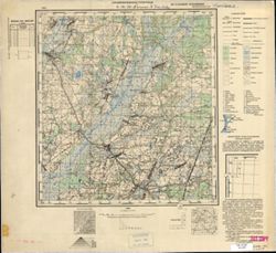
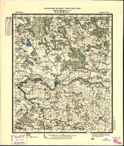
- Subject:
- Topical Subject: Soviet Union, Topical Subject: Maps, and Geographic Subject: Stegna
- Publisher:
- Генеральный штаб Красной Армии
- Language:
- Russian
- Date Created:
- 1941
- Identifier:
- VAC9619-003779
- Genre:
- Military Maps and Topographic Maps
- Geographic Location:
- Coordinates: 54.25, 19, 54.333, 19.125
- Related URL:
- Download GeoTIFF: https://drive.google.com/file/d/1OFTh9I5r9YumGdP0hxH4-EX_CYTQVLfu/view?usp=sharing and Catalog URL: https://iucat.iu.edu/catalog/14701157
- Abstract:
- Modern area represented: Stegna, Poland
- Call Number:
- G7063.K2 s25 .S6 sheet N-34-63-A-а
- City:
- Штееген (Steegen)
- Copyright Holder:
- No Copyright - United States
- Country:
- Германия (Germany)
- Physical Description:
- Scale: 1:25,000
- Persistent URL:
- http://purl.dlib.indiana.edu/iudl/images/VAC9619/VAC9619-003779
- Provenance:
- CIA Map Branch -- Received
-
- Subject:
- Topical Subject: Soviet Union, Topical Subject: Maps, and Geographic Subject: Kashirskoye
- Publisher:
- Генеральный штаб РККА
- Language:
- Russian
- Date Created:
- 1940
- Identifier:
- VAC9619-003656
- Genre:
- Topographic Maps and Military Maps
- Geographic Location:
- Coordinates: 54.913, 20.625, 55, 20.75
- Related URL:
- Download GeoTIFF: https://drive.google.com/file/d/1Im9AnczT-6LGBjCUKV6iTJa5LgmB8Hg7/view?usp=sharing and Catalog URL: https://iucat.iu.edu/catalog/14701157
- Abstract:
- Modern area represented: Каширское (Kashirskoye), Kaliningradskaya oblast, Russia
- Call Number:
- G7063.K2 s25 .S6 sheet N-34-42-A-b
- City:
- Шааксвите (Schaakswitte)
- Copyright Holder:
- No Copyright - United States
- Country:
- Германия (Восточная Пруссия) (Germany (East Prussia))
- Physical Description:
- Scale: 1:25,000
- Persistent URL:
- http://purl.dlib.indiana.edu/iudl/images/VAC9619/VAC9619-003656
- Provenance:
- CIA Map Branch -- Received
-
- Subject:
- Topical Subject: Soviet Union, Geographic Subject: Slavinsk, and Topical Subject: Maps
- Publisher:
- Генеральный штаб Красной Армии
- Language:
- Russian
- Date Created:
- 1941
- Identifier:
- VAC9619-003674
- Genre:
- Military Maps and Topographic Maps
- Geographic Location:
- Coordinates: 54.75, 21, 54.833, 21.125
- Related URL:
- Download GeoTIFF: https://drive.google.com/file/d/1VOhw2tMHYExxAWPjQKNFJ7D50eBJiiJm/view?usp=sharing and Catalog URL: https://iucat.iu.edu/catalog/14701157
- Abstract:
- Modern area represented: Славинск (Slavinsk), Kaliningradskaya oblast, Russia
- Call Number:
- G7063.K2 s25 .S6 sheet N-34-43-C-а
- City:
- Гольдбах (Goldbach)
- Copyright Holder:
- No Copyright - United States
- Country:
- Германия (Восточная Пруссия) (Germany (East Prussia))
- Physical Description:
- Scale: 1:25,000
- Persistent URL:
- http://purl.dlib.indiana.edu/iudl/images/VAC9619/VAC9619-003674
- Provenance:
- CIA Map Branch -- Received
-
- Description:
- 1873
- Subject:
- Topical Subject: Maps, Geographic Subject: Latvia, and Topical Subject: Soviet Union
- Publisher:
- Управление военных топографов РККА
- Language:
- Russian
- Date Created:
- 1911
- Identifier:
- VAC9619-001742
- Genre:
- Topographic Maps and Military Maps
- Geographic Location:
- Coordinates: 56.5, 23, 56.667, 23.25
- Related URL:
- Catalog URL: http://iucat.iu.edu/catalog/5020131 and Download GeoTIFF: https://drive.google.com/open?id=1YMeeAM99JchcvN2yFK5eKaTZIf34nzsP
- Abstract:
- Modern area represented: Latvia
- Call Number:
- G7000 s50 .S68 sheet 34-131-A
- City:
- Яунсэсавас (Jaunszsavas)
- Copyright Holder:
- No Copyright - United States
- Country:
- Латвия (Latvia)
- Physical Description:
- Scale: 1:50,000
- Persistent URL:
- http://purl.dlib.indiana.edu/iudl/images/VAC9619/VAC9619-001742
- Provenance:
- CIA Map Branch -- Received
-
- Subject:
- Topical Subject: Maps, Topical Subject: Soviet Union, and Geographic Subject: Volodarovka
- Publisher:
- Генеральный штаб Красной Армии
- Language:
- Russian
- Date Created:
- 1940
- Identifier:
- VAC9619-003769
- Genre:
- Military Maps and Topographic Maps
- Geographic Location:
- Coordinates: 54.416667, 21.625, 54.5, 21.75
- Related URL:
- Catalog URL: https://iucat.iu.edu/catalog/14701157 and Download GeoTIFF: https://drive.google.com/file/d/1HsQVfue3DKYKEO1n4kswkseAKxcDnGMI/view?usp=sharing
- Abstract:
- Modern area represented: Володаровка (Volodarovka), Kaliningradskaya oblast, Russia
- Call Number:
- G7063.K2 s25 .S6 sheet N-34-56-C-b
- City:
- Йодлаукен (Jodlauken)
- Copyright Holder:
- No Copyright - United States
- Country:
- Германия (Восточная Пруссия) (Germany (East Prussia))
- Physical Description:
- Scale: 1:25,000
- Persistent URL:
- http://purl.dlib.indiana.edu/iudl/images/VAC9619/VAC9619-003769
- Provenance:
- CIA Map Branch -- Received
-
- Subject:
- Topical Subject: Maps, Topical Subject: Soviet Union, and Geographic Subject: Piasty Wielkie
- Publisher:
- Генеральный штаб Красной Армии
- Language:
- Russian
- Date Created:
- 1941
- Identifier:
- VAC9619-003803
- Genre:
- Military Maps and Topographic Maps
- Geographic Location:
- Coordinates: 54.25, 20.5, 54.333, 20.625
- Related URL:
- Download GeoTIFF: https://drive.google.com/file/d/1FSOtOsv2Jn6MeknZzhKIDWNmtC1mn-ok/view?usp=sharing and Catalog URL: https://iucat.iu.edu/catalog/14701157
- Abstract:
- Modern area represented: Piasty Wielkie, Poland
- Call Number:
- G7063.K2 s25 .S6 sheet N-34-66-A-а
- City:
- Пайстен (Peisten)
- Copyright Holder:
- No Copyright - United States
- Country:
- Германия (Восточная Пруссия) (Germany (East Prussia))
- Physical Description:
- Scale: 1:25,000
- Persistent URL:
- http://purl.dlib.indiana.edu/iudl/images/VAC9619/VAC9619-003803
- Provenance:
- CIA Map Branch -- Received
-
- Subject:
- Geographic Subject: Romanovo, Topical Subject: Soviet Union, and Topical Subject: Maps
- Publisher:
- Генеральный штаб РККА
- Language:
- Russian
- Date Created:
- 1940
- Identifier:
- VAC9619-003646
- Genre:
- Topographic Maps and Military Maps
- Geographic Location:
- Coordinates: 54.833, 20.25, 54.913, 20.375
- Related URL:
- Download GeoTIFF: https://drive.google.com/file/d/1pG2MBjIwl3kfUiuEHwPdXIGFiepfZO5p/view?usp=sharing and Catalog URL: https://iucat.iu.edu/catalog/14701157
- Abstract:
- Modern area represented: Романово (Romanovo), Kaliningradskaya oblast, Russia
- Call Number:
- G7063.K2 s25 .S6 sheet N-34-41-B-c
- City:
- Побетен (Pobeten)
- Copyright Holder:
- No Copyright - United States
- Country:
- Германия (Восточная Пруссия) (Germany (East Prussia))
- Physical Description:
- Scale: 1:25,000
- Persistent URL:
- http://purl.dlib.indiana.edu/iudl/images/VAC9619/VAC9619-003646
- Provenance:
- CIA Map Branch -- Received
-
- Subject:
- Geographic Subject: Urochishche Yasnovka, Topical Subject: Maps, and Topical Subject: Soviet Union
- Publisher:
- Генеральный штаб РККА
- Language:
- Russian
- Date Created:
- 1940
- Identifier:
- VAC9619-003643
- Genre:
- Topographic Maps and Military Maps
- Geographic Location:
- Coordinates: 54.833, 20.125, 54.913, 20.25
- Related URL:
- Download GeoTIFF: https://drive.google.com/file/d/15fKiI5C-ivmpkcJn3339tIWghSYUqeln/view?usp=sharing and Catalog URL: https://iucat.iu.edu/catalog/14701157
- Abstract:
- Modern area represented: Урочище Ясновка (Urochishche Yasnovka), Kaliningradskaya oblast, Russia
- Call Number:
- G7063.K2 s25 .S6 sheet N-34-41-A-d
- City:
- Гросс Лядткайм (Gross Lyadtkaym)
- Copyright Holder:
- No Copyright - United States
- Country:
- Германия (Восточная Пруссия) (Germany (East Prussia))
- Physical Description:
- Scale: 1:25,000
- Persistent URL:
- http://purl.dlib.indiana.edu/iudl/images/VAC9619/VAC9619-003643
- Provenance:
- CIA Map Branch -- Received
-
- Description:
- 1896
- Subject:
- Geographic Subject: Tryškiai, Topical Subject: Maps, and Topical Subject: Soviet Union
- Publisher:
- Генеральный штаб РККА
- Language:
- Russian
- Identifier:
- VAC9619-001761
- Genre:
- Topographic Maps and Military Maps
- Geographic Location:
- Coordinates: 56, 22.5, 56.167, 22.75
- Related URL:
- Download GeoTIFF: https://drive.google.com/open?id=16EH38MJae5tJJ1eIWfmOOWsDjrJ0Wac6 and Catalog URL: http://iucat.iu.edu/catalog/5020131
- Abstract:
- Modern area represented: Tryškiai, Telšiai district, Lithuania
- Call Number:
- G7000 s50 .S68 sheet O-34-142-C
- City:
- Тришки (Tryškiai)
- Copyright Holder:
- No Copyright - United States
- Country:
- Литва (Lithuania)
- Physical Description:
- Scale: 1:50,000
- Persistent URL:
- http://purl.dlib.indiana.edu/iudl/images/VAC9619/VAC9619-001761
- Provenance:
- CIA Map Branch -- Received
-
- Subject:
- Topical Subject: Maps and Topical Subject: Soviet Union
- Publisher:
- Генеральный штаб Красной Армии
- Language:
- Russian
- Date Created:
- 1940
- Identifier:
- VAC9619-003712
- Genre:
- Military Maps and Topographic Maps
- Geographic Location:
- Coordinates: 54.75, 22.375, 54.833, 22.5
- Related URL:
- Catalog URL: https://iucat.iu.edu/catalog/14701157 and Download GeoTIFF: https://drive.google.com/file/d/13rm7soV4CVv82p9-ZvRbiEbCsrsK8e7H/view?usp=sharing
- Abstract:
- Modern area represented: abandoned populated place, not marked on the map. The nearest populated place: Желанное (Zhelannoye), former Хенскишкен (Henskischken).
- Call Number:
- G7063.K2 s25 .S6 sheet N-34-45-D-b
- City:
- Гросс Туллен
- Copyright Holder:
- No Copyright - United States
- Country:
- Германия (Восточная Пруссия) (Germany (East Prussia))
- Physical Description:
- Scale: 1:25,000
- Persistent URL:
- http://purl.dlib.indiana.edu/iudl/images/VAC9619/VAC9619-003712
- Provenance:
- CIA Map Branch -- Received
-
- Description:
- 1931
- Subject:
- Topical Subject: Soviet Union, Topical Subject: Maps, and Geographic Subject: Obolon'
- Publisher:
- Управление военных топографов РККА
- Language:
- Russian
- Identifier:
- VAC9619-001036
- Genre:
- Topographic Maps and Military Maps
- Geographic Location:
- Coordinates: 49.5, 32.75, 49.6667, 33
- Related URL:
- Download GeoTIFF: https://drive.google.com/open?id=1c6vWO-QnTPlzEZD-lAPeC4UlbEwoJtuf and Catalog URL: http://iucat.iu.edu/catalog/5020131
- Abstract:
- Modern area represented: Оболонь (Obolon'), Poltava oblast, Ukraine
- Call Number:
- G7000 s50 .S68 sheet M-36-90-B
- Caption:
- Не подлежит оглашению (crossed out) and Рассекречено
- City:
- Оболонь (Obolon')
- Copyright Holder:
- No Copyright - United States
- Country:
- СССР (USSR)
- State/Province:
- Украинская ССР (Ukrainian Soviet Socialist Republic), Харьковская область (Kharkiv oblast), and Киевская область (Kyiv oblast)
- Physical Description:
- Scale: 1:50,000
- Persistent URL:
- http://purl.dlib.indiana.edu/iudl/images/VAC9619/VAC9619-001036
- Provenance:
- CIA Map Branch -- Received
-
- Subject:
- Topical Subject: Maps, Geographic Subject: Shepetovka, and Topical Subject: Soviet Union
- Publisher:
- Генеральный штаб РККА
- Language:
- Russian
- Date Created:
- 1940
- Identifier:
- VAC9619-003684
- Genre:
- Military Maps and Topographic Maps
- Geographic Location:
- Coordinates: 54.913, 21.675, 55, 21.75
- Related URL:
- Catalog URL: https://iucat.iu.edu/catalog/14701157 and Download GeoTIFF: https://drive.google.com/file/d/1vwGncl0aVX5xD2i0QQPzheOMmGdf-Et_/view?usp=sharing
- Abstract:
- Modern area represented: Шепетовка (Shepetovka), Kaliningradskaya oblast, Russia
- Call Number:
- G7063.K2 s25 .S6 sheet N-34-44-A-b
- City:
- Шиллкойен (Schillkojen)
- Copyright Holder:
- No Copyright - United States
- Country:
- Германия (Восточная Пруссия) (Germany (East Prussia))
- Physical Description:
- Scale: 1:25,000
- Persistent URL:
- http://purl.dlib.indiana.edu/iudl/images/VAC9619/VAC9619-003684
- Provenance:
- CIA Map Branch -- Received
-
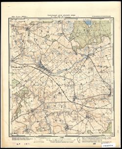
- Subject:
- Topical Subject: Soviet Union, Geographic Subject: Bażyny, and Topical Subject: Maps
- Publisher:
- Генеральный штаб Красной Армии
- Language:
- Russian
- Date Created:
- 1941
- Identifier:
- VAC9619-003800
- Genre:
- Military Maps and Topographic Maps
- Geographic Location:
- Coordinates: 54.083333, 20.0, 54.166667, 20.125
- Related URL:
- Download GeoTIFF: https://drive.google.com/file/d/1HC7czg75GZgT6SCM0YxTEbLEIvKXwdwW/view?usp=sharing and Catalog URL: https://iucat.iu.edu/catalog/14701157
- Abstract:
- Modern area represented: Bażyny, Poland
- Call Number:
- G7063.K2 s25 .S6 sheet N-34-65-C-а
- City:
- Базен (Basien)
- Copyright Holder:
- No Copyright - United States
- Country:
- Германия (Восточная Пруссия) (Germany (East Prussia))
- Physical Description:
- Scale: 1:25,000
- Persistent URL:
- http://purl.dlib.indiana.edu/iudl/images/VAC9619/VAC9619-003800
- Provenance:
- CIA Map Branch -- Received
-
- Description:
- 1925
- Subject:
- Topical Subject: Soviet Union, Geographic Subject: Kulsarina Pervaya, and Topical Subject: Maps
- Publisher:
- Главное геодезическое управление
- Language:
- Russian
- Identifier:
- VAC9619-001659
- Genre:
- Topographic Maps and Military Maps
- Geographic Location:
- Coordinates: 55.1667, 60.25, 55.3333, 60.5
- Related URL:
- Catalog URL: http://iucat.iu.edu/catalog/5020131 and Download GeoTIFF: https://drive.google.com/open?id=11vMOT0lrCLs1mmisQScunwOndh9U1_Pl
- Abstract:
- Modern area represented: Kulsarina Pervaya, Chelyabinsk oblast, Russia
- Call Number:
- G7000 s50 .S68 sheet N-40-25-Б
- City:
- Кулсарина (Kulsarina)
- Copyright Holder:
- No Copyright - United States
- Country:
- СССР (USSR)
- State/Province:
- Челябинская область (Chelyabinsk oblast) and РСФСР (RSFSR)
- Physical Description:
- Scale: 1:50,000
- Persistent URL:
- http://purl.dlib.indiana.edu/iudl/images/VAC9619/VAC9619-001659
- Provenance:
- CIA Map Branch -- Received
-
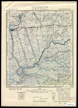
- Subject:
- Topical Subject: Maps, Geographic Subject: Zapovednoye, and Topical Subject: Soviet Union
- Publisher:
- Генеральный штаб Красной Армии
- Language:
- Russian
- Date Created:
- 1940
- Identifier:
- VAC9619-003601
- Genre:
- Topographic Maps and Military Maps
- Geographic Location:
- Coordinates: 55, 21.375, 55.083, 21.5
- Related URL:
- Catalog URL: https://iucat.iu.edu/catalog/14701157 and Download GeoTIFF: https://drive.google.com/file/d/1uWl3M4zomjvWzOFer3t5m-O91SNgcmJO/view?usp=sharing
- Abstract:
- Modern area represented: Заповедное (Zapovednoye), Kaliningradskaya oblast, Russia
- Call Number:
- G7063.K2 s25 .S6 sheet N-34-31-D-d
- City:
- Зекенбург (Zekenburg)
- Copyright Holder:
- No Copyright - United States
- Country:
- Германия (Восточная Пруссия) (Germany (East Prussia))
- Physical Description:
- Scale: 1:25,000
- Persistent URL:
- http://purl.dlib.indiana.edu/iudl/images/VAC9619/VAC9619-003601
- Provenance:
- CIA Map Branch -- Received
-
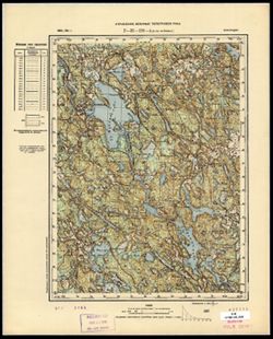
- Description:
- 1890
- Subject:
- Topical Subject: Maps, Geographic Subject: Nuijamaa, and Topical Subject: Soviet Union
- Publisher:
- Управление военных топографов РККА
- Language:
- Russian
- Identifier:
- VAC9619-002979
- Genre:
- Topographic Maps and Military Maps
- Geographic Location:
- Coordinates: 60.833, 28.5, 61, 28.75
- Related URL:
- Download GeoTIFF: https://drive.google.com/file/d/1xyUVOncfV0cc6SBv-hfIlA1dxPGWl-OZ/view?usp=sharing and Catalog URL: http://iucat.iu.edu/catalog/5020131
- Call Number:
- GM G7000 s50 .S68 sheet P-35-118-A
- City:
- Нуйямаа (Nuijamaa)
- Copyright Holder:
- No Copyright - United States
- Country:
- Финляндия (Finland)
- Physical Description:
- Scale: 1:50,000
- Persistent URL:
- http://purl.dlib.indiana.edu/iudl/images/VAC9619/VAC9619-002979
- Provenance:
- CIA Map Branch -- Received
-
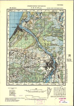
- Description:
- 1894
- Subject:
- Topical Subject: Soviet Union, Topical Subject: Maps, and Geographic Subject: Narva
- Publisher:
- Управление военных топографов РККА
- Language:
- Russian
- Date Created:
- 1926
- Identifier:
- VAC9619-000013
- Genre:
- Topographic Maps and Military Maps
- Geographic Location:
- Coordinates: 59.333, 28, 59.5, 28.25
- Related URL:
- Download GeoTIFF: https://drive.google.com/open?id=1vHEQND9C0ATLRufWnLeiyfSgVzxDsLgm and Catalog URL: http://iucat.iu.edu/catalog/5020131
- Abstract:
- Modern area represented: Narva, Estonia
- Call Number:
- G7000 s50 .S68 and zsheet O-35-21-C
- Caption:
- Секретно
- City:
- Нарва (Narva)
- Copyright Holder:
- No Copyright - United States
- Country:
- СССР (USSR) and Эстония (Estonia)
- State/Province:
- РСФСР (RSFSR) and Ленинградская область (Leningrad oblast)
- Physical Description:
- Scale: 1:50,000
- Persistent URL:
- http://purl.dlib.indiana.edu/iudl/images/VAC9619/VAC9619-000013
- Provenance:
- CIA Map Branch -- Received
-
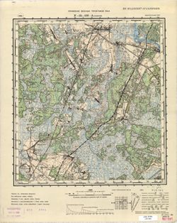
- Description:
- 1936
- Subject:
- Topical Subject: Soviet Union, Topical Subject: Maps, and Geographic Subject: Svyetlahorsk
- Publisher:
- Управление военных топографов РККА
- Language:
- Russian
- Identifier:
- VAC9619-000791
- Genre:
- Military Maps and Topographic Maps
- Geographic Location:
- Coordinates: 52.5, 29.5, 52.667, 29.75
- Related URL:
- Catalog URL: http://iucat.iu.edu/catalog/5020131 and Download GeoTIFF: https://drive.google.com/open?id=1QD_dQBmgXuDPGhIYtv7Kz1HcoR6y7Awq
- Abstract:
- Modern area represented: Svyetlahorsk, Homyel oblast, Belarus
- Call Number:
- G7000 s50 .s68 sheet N-35-132-A
- Caption:
- Не подлежит оглашению
- City:
- Шацилки (Shatsilki)
- Copyright Holder:
- No Copyright - United States
- Country:
- СССР (USSR)
- State/Province:
- Белорусская ССР (Byelorussian Soviet Socialist Republic)
- Physical Description:
- Scale: 1:50,000
- Persistent URL:
- http://purl.dlib.indiana.edu/iudl/images/VAC9619/VAC9619-000791
- Provenance:
- CIA Map Branch -- Received
-
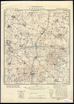
- Subject:
- Topical Subject: Maps, Topical Subject: Soviet Union, and Geographic Subject: Kubanovka
- Publisher:
- Генеральный штаб РККА
- Language:
- Russian
- Date Created:
- 1940
- Identifier:
- VAC9619-003713
- Genre:
- Topographic Maps and Military Maps
- Geographic Location:
- Coordinates: 54.667, 22.25, 54.75, 22.375
- Related URL:
- Catalog URL: https://iucat.iu.edu/catalog/14701157 and Download GeoTIFF: https://drive.google.com/file/d/1TQK3eugaK-z4PkI7tLgqFj_4bxhQYoK2/view?usp=sharing
- Abstract:
- Modern area represented: Кубановка (Kubanovka), Kaliningradskaya oblast, Russia
- Call Number:
- G7063.K2 s25 .S6 sheet N-34-45-D-c
- City:
- Бракупенен (Brakupënen)
- Copyright Holder:
- No Copyright - United States
- Country:
- Германия (Восточная Пруссия) (Germany (East Prussia))
- Physical Description:
- Scale: 1:25,000
- Persistent URL:
- http://purl.dlib.indiana.edu/iudl/images/VAC9619/VAC9619-003713
- Provenance:
- CIA Map Branch -- Received
-
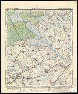
- Subject:
- Topical Subject: Soviet Union, Geographic Subject: Zales’ye, and Topical Subject: Maps
- Publisher:
- Генеральный штаб Красной Армии
- Language:
- Russian
- Date Created:
- 1941
- Identifier:
- VAC9619-003685
- Genre:
- Military Maps and Topographic Maps
- Geographic Location:
- Coordinates: 54.833, 21.5, 54.913, 21.675
- Related URL:
- Download GeoTIFF: https://drive.google.com/file/d/1vY_9CWwvB31nO-LrsYQILd5Py7ISsJGb/view?usp=sharing and Catalog URL: https://iucat.iu.edu/catalog/14701157
- Abstract:
- Modern area represented: Залесье (Zales’ye), Kaliningradskaya oblast, Russia
- Call Number:
- G7063.K2 s25 .S6 sheet N-34-44-A-c
- City:
- Меляукен (Mehlauken)
- Copyright Holder:
- No Copyright - United States
- Country:
- Германия (Восточная Пруссия) (Germany (East Prussia))
- Physical Description:
- Scale: 1:25,000
- Persistent URL:
- http://purl.dlib.indiana.edu/iudl/images/VAC9619/VAC9619-003685
- Provenance:
- CIA Map Branch -- Received
-
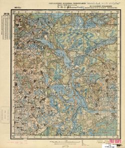
- Subject:
- Geographic Subject: Krashuty, Topical Subject: Maps, and Topical Subject: Soviet Union
- Publisher:
- Управление военных топографов
- Language:
- Russian
- Identifier:
- VAC9619-000426
- Genre:
- Topographic Maps and Military Maps
- Geographic Location:
- Coordinates: 55.8333, 29.25, 56, 29.5
- Related URL:
- Catalog URL: http://iucat.iu.edu/catalog/5020131 and Download GeoTIFF: https://drive.google.com/open?id=1tf9RB0iuVFHq_Psx2Ej0269uQJfaccpo
- Abstract:
- Modern area represented: Krashuty, Vitebsk oblast, Belarus
- Call Number:
- G7000 s50 .S68 sheet N-35-11-B
- Caption:
- Не подлежит оглашению
- City:
- Крашуты (Krashuty)
- Copyright Holder:
- No Copyright - United States
- Country:
- СССР (USSR)
- State/Province:
- РСФСР (RSFSR), Белорусская ССР (Byelorussian Soviet Socialist Republic), and Западная область (Western oblast)
- Physical Description:
- Scale: 1:50,000
- Persistent URL:
- http://purl.dlib.indiana.edu/iudl/images/VAC9619/VAC9619-000426
- Provenance:
- CIA Map Branch -- Received
-
- Description:
- 1929
- Subject:
- Topical Subject: Maps, Topical Subject: Soviet Union, and Geographic Subject: Cherkasy
- Publisher:
- Управление военных топографов РККА
- Language:
- Russian
- Identifier:
- VAC9619-001033
- Genre:
- Military Maps and Topographic Maps
- Geographic Location:
- Coordinates: 49.5, 32.25, 49.6667, 32.5
- Related URL:
- Catalog URL: http://iucat.iu.edu/catalog/5020131 and Download GeoTIFF: https://iu.box.com/s/jsxdj9zj7x35g4c7tvc2xvnv5a83vgeg
- Abstract:
- Modern area represented: Черкаси (Cherkasy), Cherkasy oblast, Ukraine
- Call Number:
- G7000 s50 .S68 sheet M-36-89-С
- Caption:
- Не подлежит оглашению (crossed out) and Рассекречено
- City:
- Черкассы (Cherkassy)
- Copyright Holder:
- No Copyright - United States
- Country:
- СССР (USSR)
- State/Province:
- Киевская область (Kyiv oblast) and Украинская ССР (Ukrainian Soviet Socialist Republic)
- Physical Description:
- Scale: 1:50,000
- Persistent URL:
- http://purl.dlib.indiana.edu/iudl/images/VAC9619/VAC9619-001033
- Provenance:
- CIA Map Branch -- Received
-
- Subject:
- Geographic Subject: Josvainiai, Topical Subject: Soviet Union, and Topical Subject: Maps
- Publisher:
- Генеральный штаб Красной Армии
- Language:
- Russian
- Date Created:
- 1941
- Identifier:
- VAC9619-003629
- Genre:
- Military Maps and Topographic Maps
- Geographic Location:
- Coordinates: 55.1667, 23.75, 55.25, 23.875
- Related URL:
- Download GeoTIFF: https://drive.google.com/file/d/11gxy_KWyhz427N3OQcYDS8zohKaHLxW2/view?usp=sharing and Catalog URL: https://iucat.iu.edu/catalog/14701157
- Abstract:
- Modern area represented: Josvainiai, Lithuania
- Call Number:
- G7063.K2 s25 .S6 sheet N-34-36-B-c
- Caption:
- Секретно
- City:
- Ясвойни (Yasvoyni)
- Copyright Holder:
- No Copyright - United States
- Country:
- СССР (USSR)
- State/Province:
- Литовская ССР (Lithuanian Soviet Socialist Republic)
- Physical Description:
- Scale: 1:25,000
- Persistent URL:
- http://purl.dlib.indiana.edu/iudl/images/VAC9619/VAC9619-003629
- Provenance:
- CIA Map Branch -- Received
-
- Subject:
- Topical Subject: Soviet Union, Topical Subject: Maps, and Geographic Subject: Sovetsk
- Publisher:
- Генеральный штаб Красной Армии
- Language:
- Russian
- Date Created:
- 1941
- Identifier:
- VAC9619-003613
- Genre:
- Topographic Maps and Military Maps
- Geographic Location:
- Coordinates: 55, 21.875, 55.083, 22
- Related URL:
- Catalog URL: https://iucat.iu.edu/catalog/14701157 and Download GeoTIFF: https://drive.google.com/file/d/1NspHOlIQf6UrpIEeJ47GyW6Bp9wvdtzr/view?usp=sharing
- Abstract:
- Modern area represented: Советск (Sovetsk), Kaliningradskaya oblst, Russia
- Call Number:
- G7063.K2 s25 .S6 sheet N-34-32-D-d
- City:
- Тильзит (Tilsit)
- Copyright Holder:
- No Copyright - United States
- Country:
- Германия (Восточная Пруссия) (Germany (East Prussia))
- Physical Description:
- Scale: 1:25,000
- Persistent URL:
- http://purl.dlib.indiana.edu/iudl/images/VAC9619/VAC9619-003613
- Provenance:
- CIA Map Branch -- Received
-
- Subject:
- Geographic Subject: Мотовилівка (Motovylivka), Topical Subject: Maps, and Topical Subject: Soviet Union
- Publisher:
- Управление военных топографов
- Language:
- Russian
- Identifier:
- VAC9619-000838
- Genre:
- Military Maps and Topographic Maps
- Geographic Location:
- Coordinates: 49.667, 27.75, 49.833, 28
- Related URL:
- Download GeoTIFF: https://drive.google.com/open?id=13HQYDFufOqxSafbpvbBdW8sSY3nvKDTC and Catalog URL: http://iucat.iu.edu/catalog/5020131
- Abstract:
- Modern area represented: Мотовилівка (Motovylivka), Zhytomyr Oblast, Ukraine
- Call Number:
- G7000 s50 .S68 sheet M-35-80-D
- Caption:
- Не подлежит оглашению
- City:
- Мотовыливка (Motovylivka)
- Copyright Holder:
- No Copyright - United States
- Country:
- СССР (USSR)
- State/Province:
- Киевская область (Kyiv oblast) and Украинская ССР (Ukrainian Soviet Socialist Republic)
- Physical Description:
- Scale: 1:50,000
- Persistent URL:
- http://purl.dlib.indiana.edu/iudl/images/VAC9619/VAC9619-000838
- Provenance:
- CIA Map Branch -- Received
-
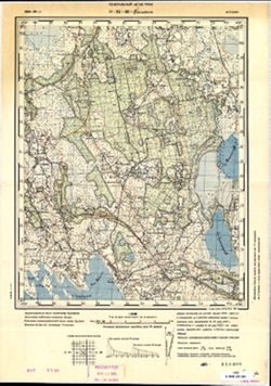
- Description:
- 1904
- Subject:
- Geographic Subject: Ees-Vaiste, Topical Subject: Soviet Union, and Topical Subject: Maps
- Publisher:
- Генеральный штаб РККА
- Language:
- Russian
- Date Created:
- 1905
- Identifier:
- VAC9619-001712
- Genre:
- Topographic Maps and Military Maps
- Geographic Location:
- Coordinates: 58.333, 23.75, 58.5, 24
- Related URL:
- Download GeoTIFF: https://drive.google.com/open?id=1jrrKdjkgsHXPPe4o_0v1soNLjtkgWTmL and Catalog URL: http://iucat.iu.edu/catalog/5020131
- Abstract:
- Modern area represented: Ees-Vaiste, Pärnumaa, Estonia
- Call Number:
- G7000 s50 .S68 sheet O-34-60-D
- City:
- Эс-Вайсте (Ees-Vaiste)
- Copyright Holder:
- No Copyright - United States
- Country:
- Эстония (Estonia)
- Physical Description:
- Scale: 1:50,000
- Persistent URL:
- http://purl.dlib.indiana.edu/iudl/images/VAC9619/VAC9619-001712
- Provenance:
- CIA Map Branch -- Received
-
- Description:
- 1931
- Subject:
- Topical Subject: Soviet Union, Geographic Subject: Nova Praha, and Topical Subject: Maps
- Publisher:
- Управление военных топографов
- Language:
- Russian
- Identifier:
- VAC9619-001133
- Genre:
- Topographic Maps and Military Maps
- Geographic Location:
- Coordinates: 48.5, 32.75, 48.66667, 33.0
- Related URL:
- Catalog URL: http://iucat.iu.edu/catalog/5020131 and Download GeoTIFF: https://drive.google.com/open?id=1GIEy8GZRNc09Ygd1LlGbd6P_gELBgtQ7
- Abstract:
- Modern area represented: Nova Praha, Kirovohrad oblast, Ukraine
- Call Number:
- G7000 s50 .S68 sheet M-36-126-Б
- Caption:
- Не подлежит оглашению
- City:
- Новая Прага (Novaya Praha)
- Copyright Holder:
- No Copyright - United States
- Country:
- СССР (USSR)
- State/Province:
- Украинская ССР (Ukrainian Soviet Socialist Republic)
- Physical Description:
- Scale: 1:50,000
- Persistent URL:
- http://purl.dlib.indiana.edu/iudl/images/VAC9619/VAC9619-001133
- Provenance:
- CIA Map Branch -- Received
-
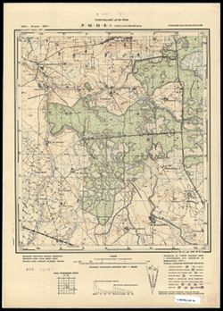
- Subject:
- Topical Subject: Maps, Topical Subject: Soviet Union, and Geographic Subject: Belkino
- Publisher:
- Генеральный штаб РККА
- Language:
- Russian
- Date Created:
- 1940
- Identifier:
- VAC9619-003706
- Genre:
- Military Maps and Topographic Maps
- Geographic Location:
- Coordinates: 54.833, 22.375, 54.913, 22.5
- Related URL:
- Catalog URL: https://iucat.iu.edu/catalog/14701157 and Download GeoTIFF: https://drive.google.com/file/d/1MhH0q8wU3hYp-FMIauSRO4xUyI8AFd94/view?usp=sharing
- Abstract:
- Modern area represented: Белкино (Belkino), Kaliningradskaya oblast, Russia
- Call Number:
- G7063.K2 s25 .S6 sheet N-34-45-B-d
- City:
- Гросс Версменингкен (Gross Versmeningken)
- Copyright Holder:
- No Copyright - United States
- Country:
- Германия (Восточная Пруссия) (Germany (East Prussia))
- Physical Description:
- Scale: 1:25,000
- Persistent URL:
- http://purl.dlib.indiana.edu/iudl/images/VAC9619/VAC9619-003706
- Provenance:
- CIA Map Branch -- Received
-
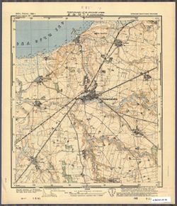
- Subject:
- Topical Subject: Maps, Geographic Subject: Mamonovo, and Topical Subject: Soviet Union
- Publisher:
- Генеральный штаб Красной Армии
- Language:
- Russian
- Date Created:
- 1941
- Identifier:
- VAC9619-003733
- Genre:
- Military Maps and Topographic Maps
- Geographic Location:
- Coordinates: 54.416667, 19.875, 54.5, 20.0
- Related URL:
- Catalog URL: https://iucat.iu.edu/catalog/14701157 and Download GeoTIFF: https://drive.google.com/file/d/1c46kl1UZJUchPkndd3VUHfGqFAWB6OVO/view?usp=sharing
- Abstract:
- Modern area represented: Мамоново (Mamonovo), Kaliningradskaya oblast, Russia
- Call Number:
- G7063.K2 s25 .S6 sheet N-34-52-D-b
- City:
- Хайлигенбайль
- Copyright Holder:
- No Copyright - United States
- Country:
- Германия (Восточная Пруссия) (Germany (East Prussia))
- Physical Description:
- Scale: 1:25,000
- Persistent URL:
- http://purl.dlib.indiana.edu/iudl/images/VAC9619/VAC9619-003733
- Provenance:
- CIA Map Branch -- Received
-
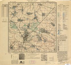
- Subject:
- Topical Subject: Maps, Geographic Subject: Kozyatyn, and Topical Subject: Soviet Union
- Publisher:
- Управление военных топографов
- Language:
- Russian
- Identifier:
- VAC9619-000846
- Genre:
- Topographic Maps and Military Maps
- Geographic Location:
- Coordinates: 49.667, 28.75, 49.833, 29
- Related URL:
- Catalog URL: http://iucat.iu.edu/catalog/5020131 and Download GeoTIFF: https://drive.google.com/open?id=19ZlZ9z0x8P1X_v4ENEztjxEt-scOFP3W
- Abstract:
- Modern area represented: Kozyatyn, Vinnytsia oblast, Ukraine
- Call Number:
- G7000 s50 .S68 sheet M-35-82-D
- Caption:
- Не подлежит оглашению
- City:
- Казатин (Kazatin)
- Copyright Holder:
- No Copyright - United States
- Country:
- СССР (USSR)
- State/Province:
- Винницкая область (Vinnytsia oblast), Украинская ССР (Ukrainian Soviet Socialist Republic), and Киевская область (Kyiv oblast)
- Physical Description:
- Scale: 1:50,000
- Persistent URL:
- http://purl.dlib.indiana.edu/iudl/images/VAC9619/VAC9619-000846
- Provenance:
- CIA Map Branch -- Received
-
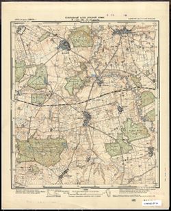
- Subject:
- Topical Subject: Maps, Topical Subject: Soviet Union, and Geographic Subject: Dobry
- Publisher:
- Генеральный штаб Красной Армии
- Language:
- Russian
- Date Created:
- 1941
- Identifier:
- VAC9619-003796
- Genre:
- Topographic Maps and Military Maps
- Geographic Location:
- Coordinates: 54.083333, 19.875, 54.166667, 20.0
- Related URL:
- Catalog URL: https://iucat.iu.edu/catalog/14701157 and Download GeoTIFF: https://drive.google.com/file/d/12mswHo8LN9pNWBiX-zlGvKCdp4wm7bvZ/view?usp=sharing
- Abstract:
- Modern area represented: Dobry, Poland
- Call Number:
- G7063.K2 s25 .S6 sheet N-34-64-D-b
- City:
- Деберн (Döbern)
- Copyright Holder:
- No Copyright - United States
- Country:
- Германия (Восточная Пруссия) (Germany (East Prussia))
- Physical Description:
- Scale: 1:25,000
- Persistent URL:
- http://purl.dlib.indiana.edu/iudl/images/VAC9619/VAC9619-003796
- Provenance:
- CIA Map Branch -- Received
-
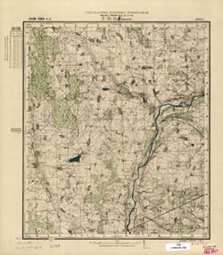
- Subject:
- Topical Subject: Soviet Union, Topical Subject: Maps, and Geographic Subject: Kavarskas
- Publisher:
- Управление военных топографов
- Language:
- Russian
- Identifier:
- VAC9619-000439
- Genre:
- Topographic Maps and Military Maps
- Geographic Location:
- Coordinates: 55.3333, 24.75, 55.5, 25
- Related URL:
- Catalog URL: http://iucat.iu.edu/catalog/5020131 and Download GeoTIFF: https://drive.google.com/open?id=1X2Ii7uo03lTJUWLrMugsFO_e-PUv-W1l
- Abstract:
- Modern area represented: Kavarskas, Lithuania
- Call Number:
- G7000 s50 .S68 sheet N-35-14-D
- City:
- Коварск (Kovarsk)
- Copyright Holder:
- No Copyright - United States
- Country:
- Литва (Lithuania)
- Physical Description:
- Scale: 1:50,000
- Persistent URL:
- http://purl.dlib.indiana.edu/iudl/images/VAC9619/VAC9619-000439
- Provenance:
- CIA Map Branch -- Received
-
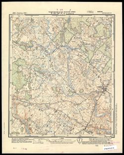
- Subject:
- Topical Subject: Maps, Geographic Subject: Vainutas, and Topical Subject: Soviet Union
- Publisher:
- Генеральный штаб Красной Армии
- Language:
- Russian
- Date Created:
- 1941
- Identifier:
- VAC9619-003582
- Genre:
- Military Maps and Topographic Maps
- Geographic Location:
- Coordinates: 55.333, 21.75.55.417, 21.875
- Related URL:
- Catalog URL: https://iucat.iu.edu/catalog/14701157 and Download GeoTIFF: https://drive.google.com/file/d/1aErZ1E3URLkUL0l3JLJBTc4Fn8K13Dpn/view?usp=sharing
- Abstract:
- Modern area represented: Vainutas, Lithuania
- Call Number:
- G7063.K2 s25 .S6 sheet N-34-20-D-c
- Caption:
- Секретно
- City:
- Войнуты (Voinuty)
- Copyright Holder:
- No Copyright - United States
- Country:
- СССР (USSR)
- State/Province:
- Литовская ССР (Lithuanian Soviet Socialist Republic)
- Physical Description:
- Scale: 1:25,000
- Persistent URL:
- http://purl.dlib.indiana.edu/iudl/images/VAC9619/VAC9619-003582
- Provenance:
- CIA Map Branch -- Received
-
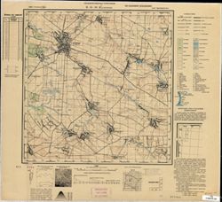
- Subject:
- Geographic Subject: Старий Остропіль (Staryy Ostropil’), Topical Subject: Maps, and Topical Subject: Soviet Union
- Publisher:
- Управление военных топографов
- Language:
- Russian
- Identifier:
- VAC9619-000837
- Genre:
- Military Maps and Topographic Maps
- Geographic Location:
- Coordinates: 49.667, 27.5, 49.833, 27.75
- Related URL:
- Download GeoTIFF: https://drive.google.com/open?id=14wAwOlKqK1HWUQmWU-hz_ig-RQCU4h4r and Catalog URL: http://iucat.iu.edu/catalog/5020131
- Abstract:
- Modern area represented: Старий Остропіль (Staryy Ostropil’), Khmelnytskyi Oblast, Ukraine
- Call Number:
- G7000 s50 .S68 sheet M-35-80-C
- Caption:
- Не подлежит оглашению
- City:
- Остропиль (Ostropil')
- Copyright Holder:
- No Copyright - United States
- Country:
- СССР (USSR)
- State/Province:
- Украинская ССР (Ukrainian Soviet Socialist Republic) and Винницкая область (Vinnytsia oblast)
- Physical Description:
- Scale: 1:50,000
- Persistent URL:
- http://purl.dlib.indiana.edu/iudl/images/VAC9619/VAC9619-000837
- Provenance:
- CIA Map Branch -- Received
-
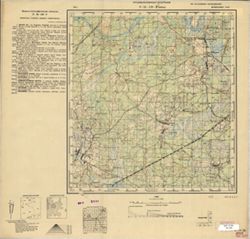
- Description:
- 1931
- Subject:
- Topical Subject: Soviet Union, Topical Subject: Maps, and Geographic Subject: Бобрик (Bobrik)
- Publisher:
- Управление военных топографов
- Language:
- Russian
- Identifier:
- VAC9619-000778
- Genre:
- Topographic Maps and Military Maps
- Geographic Location:
- Coordinates: 52.333, 28.25, 52.5, 28.5
- Related URL:
- Download GeoTIFF: https://drive.google.com/open?id=1VftynkkjJf7xweda6eAqcLNwvn2WkHOP and Catalog URL: http://iucat.iu.edu/catalog/5020131
- Abstract:
- Modern area represented: Бобрик (Bobrik), Homyel' oblast, Belarus
- Call Number:
- G7000 s50 .s68 sheet N-35-129-D
- Caption:
- Не подлежит оглашению
- City:
- Бобрик (Bobrik)
- Copyright Holder:
- No Copyright - United States
- Country:
- СССР (USSR)
- State/Province:
- Белорусская ССР (Byelorussian Soviet Socialist Republic)
- Physical Description:
- Scale: 1:50,000
- Persistent URL:
- http://purl.dlib.indiana.edu/iudl/images/VAC9619/VAC9619-000778
- Provenance:
- CIA Map Branch -- Received
-
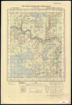
- Description:
- 1938
- Subject:
- Topical Subject: Soviet Union, Geographic Subject: Devkino, and Topical Subject: Maps
- Publisher:
- Главное управление государственной съемки и картографии НКВД СССР
- Language:
- Russian
- Identifier:
- VAC9619-003370
- Genre:
- Military Maps and Topographic Maps
- Geographic Location:
- Coordinates: 58.5, 32, 58.667, 32.25
- Related URL:
- Catalog URL: http://iucat.iu.edu/catalog/5020131 and Download GeoTIFF: https://drive.google.com/file/d/1K-lk3plzKwkzJPOvkW9iMufZRDqPaBNr/view?usp=sharing
- Abstract:
- Modern area represented: Девкино (Devkino), Novgorodskaya oblast, Russia
- Call Number:
- G7000 s50 .S68 sheet O-36-53-A
- Caption:
- Для служебного пользования
- City:
- Девкино (Devkino)
- Copyright Holder:
- No Copyright - United States
- Country:
- СССР (USSR)
- State/Province:
- Новгородский район (Novgorod district), Ленинградская область (Leningrad oblast), Маловишерский район (Malovishersky district), and Крестецкий район (Krestet...
- Physical Description:
- Scale: 1:50,000
- Persistent URL:
- http://purl.dlib.indiana.edu/iudl/images/VAC9619/VAC9619-003370
- Provenance:
- CIA Map Branch -- Received
-
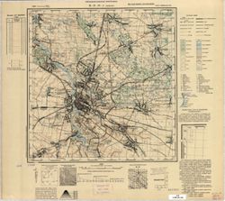
- Subject:
- Geographic Subject: Berdychiv, Topical Subject: Soviet Union, and Topical Subject: Maps
- Publisher:
- Управление военных топографов
- Language:
- Russian
- Identifier:
- VAC9619-000843
- Genre:
- Topographic Maps and Military Maps
- Geographic Location:
- Coordinates: 49.833, 28.5, 50, 28.75
- Related URL:
- Catalog URL: http://iucat.iu.edu/catalog/5020131 and Download GeoTIFF: https://drive.google.com/open?id=1R6PbpTgx2gBWT7HFAf-lzGDP_0Ul7Zvx
- Abstract:
- Modern area represented: Berdychiv, Zhytomyr oblast, Ukraine
- Call Number:
- G7000 s50 .S68 sheet M-35-82-A
- Caption:
- Не подлежит оглашению
- City:
- Бердичев (Berdichev)
- Copyright Holder:
- No Copyright - United States
- Country:
- СССР (USSR)
- State/Province:
- Украинская ССР (Ukrainian Soviet Socialist Republic) and Киевская область (Kyiv oblast)
- Physical Description:
- Scale: 1:50,000
- Persistent URL:
- http://purl.dlib.indiana.edu/iudl/images/VAC9619/VAC9619-000843
- Provenance:
- CIA Map Branch -- Received
-
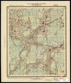
- Description:
- 1927
- Subject:
- Topical Subject: Maps, Geographic Subject: Kostino, and Topical Subject: Soviet Union
- Publisher:
- Военно-топографическое управление
- Language:
- Russian
- Date Created:
- 1931
- Identifier:
- VAC9619-003496
- Genre:
- Military Maps and Topographic Maps
- Geographic Location:
- Coordinates: 56.16667, 32.25, 56.3333, 32.5
- Related URL:
- Catalog URL: http://iucat.iu.edu/catalog/5020131 and Download GeoTIFF: https://drive.google.com/file/d/1GYX8MG1pr7HLk6E4vDVjIph0M1NGD7w_/view?usp=sharing
- Abstract:
- Modern area represented: Костино (Kostino), Tverskaya oblast, Russia
- Call Number:
- G7000 s50 .S68 sheet O-36-137-B
- Caption:
- Секретно
- City:
- Костино (Kostino)
- Copyright Holder:
- No Copyright - United States
- Country:
- СССР (USSR)
- State/Province:
- Западная область (Western oblast) and РСФСР (RSFSR)
- Physical Description:
- Scale: 1:50,000
- Persistent URL:
- http://purl.dlib.indiana.edu/iudl/images/VAC9619/VAC9619-003496
- Provenance:
- CIA Map Branch -- Received
-
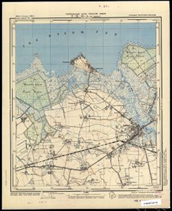
- Subject:
- Topical Subject: Soviet Union, Topical Subject: Maps, and Geographic Subject: Polessk
- Publisher:
- Генеральный штаб Красной Армии
- Language:
- Russian
- Date Created:
- 1941
- Identifier:
- VAC9619-003670
- Genre:
- Military Maps and Topographic Maps
- Geographic Location:
- Coordinates: 54.833, 21, 54.913, 21.125
- Related URL:
- Download GeoTIFF: https://drive.google.com/file/d/1TkBziKumLBaO2K7YI6J5_idIv2mAVIUh/view?usp=sharing and Catalog URL: https://iucat.iu.edu/catalog/14701157
- Abstract:
- Modern area represented: Полесск (Polessk), Kaliningradskaya oblast, Russia
- Call Number:
- G7063.K2 s25 .S6 sheet N-34-43-A-c
- City:
- Лабиау (Labiau)
- Copyright Holder:
- No Copyright - United States
- Country:
- Германия (Восточная Пруссия) (Germany (East Prussia))
- Physical Description:
- Scale: 1:25,000
- Persistent URL:
- http://purl.dlib.indiana.edu/iudl/images/VAC9619/VAC9619-003670
- Provenance:
- CIA Map Branch -- Received
-
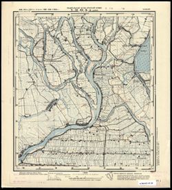
- Subject:
- Topical Subject: Maps, Geographic Subject: Kępki, and Topical Subject: Soviet Union
- Publisher:
- Генеральный штаб Красной Армии
- Language:
- Russian
- Date Created:
- 1941
- Identifier:
- VAC9619-003782
- Genre:
- Military Maps and Topographic Maps
- Geographic Location:
- Coordinates: 54.167, 19.25, 54.25, 19.375
- Related URL:
- Catalog URL: https://iucat.iu.edu/catalog/14701157 and Download GeoTIFF: https://drive.google.com/file/d/1SrLG238zrF6AKeHeXm0-yTy5GoRnwpno/view?usp=sharing
- Abstract:
- Modern area represented: Kępki, Poland
- Call Number:
- G7063.K2 s25 .S6 sheet N-34-63-B-c
- City:
- Цайер (Zeyer)
- Copyright Holder:
- No Copyright - United States
- Country:
- Германия (Germany)
- Physical Description:
- Scale: 1:25,000
- Persistent URL:
- http://purl.dlib.indiana.edu/iudl/images/VAC9619/VAC9619-003782
- Provenance:
- CIA Map Branch -- Received
-
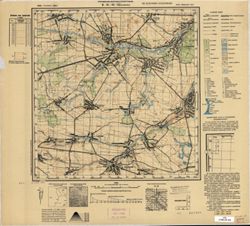
- Subject:
- Topical Subject: Soviet Union, Geographic Subject: Chervone, and Topical Subject: Maps
- Publisher:
- Управление военных топографов
- Language:
- Russian
- Identifier:
- VAC9619-000844
- Genre:
- Military Maps and Topographic Maps
- Geographic Location:
- Coordinates: 49.833, 28.75, 50, 29
- Related URL:
- Download GeoTIFF: https://drive.google.com/open?id=1GvOvUlz4kOAb_-j2kL93PqpFsVA9gsFw and Catalog URL: http://iucat.iu.edu/catalog/5020131
- Abstract:
- Modern area represented: Chervone, Zhytomyr oblast, Ukraine
- Call Number:
- G7000 s50 .S68 sheet M-35-82-B
- Caption:
- Не подлежит оглашению
- City:
- Червоное (Chervonoye)
- Copyright Holder:
- No Copyright - United States
- Country:
- СССР (USSR)
- State/Province:
- Украинская ССР (Ukrainian Soviet Socialist Republic) and Киевская область (Kyiv oblast)
- Physical Description:
- Scale: 1:50,000
- Persistent URL:
- http://purl.dlib.indiana.edu/iudl/images/VAC9619/VAC9619-000844
- Provenance:
- CIA Map Branch -- Received
-
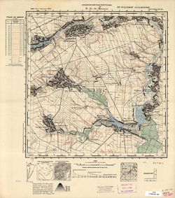
- Subject:
- Topical Subject: Maps, Topical Subject: Soviet Union, and Geographic Subject: Trylisy
- Publisher:
- Управление военных топографов
- Language:
- Russian
- Identifier:
- VAC9619-000851
- Genre:
- Military Maps and Topographic Maps
- Geographic Location:
- Coordinates: 49.8333, 29.75, 50, 30
- Related URL:
- Download GeoTIFF: https://drive.google.com/open?id=1P9bNifqUPQ36msrnTWVhjlGQLg2S3IYA and Catalog URL: http://iucat.iu.edu/catalog/5020131
- Abstract:
- Modern area represented: Trylisy, Kyiv oblast, Ukraine
- Call Number:
- G7000 s50 .S68 sheet M-35-84-B
- Caption:
- Не подлежит оглашению
- City:
- Трылисы (Trylisy)
- Copyright Holder:
- No Copyright - United States
- Country:
- СССР (USSR)
- State/Province:
- Украинская ССР (Ukrainian Soviet Socialist Republic) and Киевская область (Kyiv oblast)
- Physical Description:
- Scale: 1:50,000
- Persistent URL:
- http://purl.dlib.indiana.edu/iudl/images/VAC9619/VAC9619-000851
- Provenance:
- CIA Map Branch -- Received
-
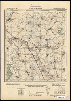
- Description:
- 1913
- Subject:
- Topical Subject: Soviet Union, Topical Subject: Maps, and Geographic Subject: Mezhdurech’ye
- Publisher:
- Генеральный штаб РККА
- Language:
- Russian
- Date Created:
- 1940
- Identifier:
- VAC9619-003708
- Genre:
- Military Maps and Topographic Maps
- Geographic Location:
- Coordinates: 54.75, 22.125, 54.833, 22.25
- Related URL:
- Catalog URL: https://iucat.iu.edu/catalog/14701157 and Download GeoTIFF: https://drive.google.com/file/d/1XeRPkmXa9OfF3szX5UnGYWB4ZfoTucQ0/view?usp=sharing
- Abstract:
- Modern area represented: Междуречье (Mezhdurech’ye), Kaliningradskaya oblast, Russia
- Call Number:
- G7063.K2 s25 .S6 sheet N-34-45-C-b
- City:
- Каушен (Kauschen)
- Copyright Holder:
- No Copyright - United States
- Country:
- Германия (Восточная Пруссия) (Germany (East Prussia))
- Physical Description:
- Scale: 1:25,000
- Persistent URL:
- http://purl.dlib.indiana.edu/iudl/images/VAC9619/VAC9619-003708
- Provenance:
- CIA Map Branch -- Received
-
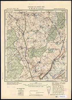
- Subject:
- Topical Subject: Maps, Topical Subject: Soviet Union, and Geographic Subject: Perelesnoye
- Publisher:
- Генеральный штаб Красной Армии
- Language:
- Russian
- Date Created:
- 1941
- Identifier:
- VAC9619-003697
- Genre:
- Military Maps and Topographic Maps
- Geographic Location:
- Coordinates: 54.66667, 21.75, 54.75, 21.875
- Related URL:
- Catalog URL: https://iucat.iu.edu/catalog/14701157 and Download GeoTIFF: https://drive.google.com/file/d/1eFPJ2BeVW_6W-gMGIgU65wUIvAq3MVem/view?usp=sharing
- Abstract:
- Modern area represented: not marked on the map. The nearest populated place: Перелесное (Perelesnoye), Kaliningradskaya oblast, Russia
- Call Number:
- G7063.K2 s25 .S6 sheet N-34-44-D-c
- City:
- Хорштенау (Horstenau)
- Copyright Holder:
- No Copyright - United States
- Country:
- Германия (Восточная Пруссия) (Germany (East Prussia))
- Physical Description:
- Scale: 1:25,000
- Persistent URL:
- http://purl.dlib.indiana.edu/iudl/images/VAC9619/VAC9619-003697
- Provenance:
- CIA Map Branch -- Received
