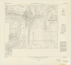
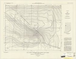
Topical Subject: Vegetation mapping, Geographic Subject: Saint Joseph County (Mich.), Geographic Subject: Cass County (Mich.), and Geographic Subject: Elkhar...
Creator:
Michigan. State Highway Department and Geological Survey (U.S.)
Publisher:
Geological Survey (U.S.)
Date Created:
1973
Identifier:
VAC3073-M-01507
Genre:
15 minute topographic maps, Quadrangle maps, and Topographic maps
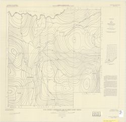
Mapped, edited, and published by the Geological Survey. Filing title: Vandalia, Mich.-Ind. Standard map series designation: AMS (Series) V762 3867 IV. [Editi...
Mapped, edited, and published by the Geological Survey. Filing title: Vandalia, Mich.-Ind. Standard map series designation: AMS (Series) V762 3867 IV. [Editi...
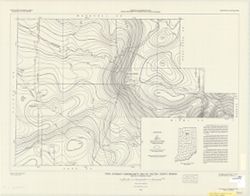
Geographic Subject: Saint Joseph County (Mich.), Geographic Subject: Cass County (Mich.), Topical Subject: Vegetation mapping, and Geographic Subject: Elkhar...
Creator:
Geological Survey (U.S.) and Michigan. State Highway Department
Publisher:
Geological Survey (U.S.)
Date Created:
1959
Identifier:
VAC3073-M-01337
Genre:
15 minute topographic maps, Topographic maps, and Quadrangle maps
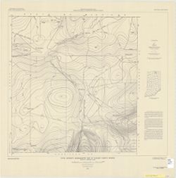
Mapped, edited, and published by the Geological Survey. Filing title: Vandalia, Mich.-Ind. Standard map series designation: AMS (Series) V762 3867 IV. [Editi...
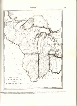
Relief shown by hachures. Prime meridians: London and Philadelphia. Reprint of: The Upper territories of the United States. In General atlas of the world and...
Call Number:
QH75 .A4 No. 1200-IN
Caption:
Imprint: [Reston, Va.] : [The Survey], [1988]
Physical Description:
Dimensions: 29 cm or less and Scale: Indeterminable
Alternate Identifier:
Title Control Number: a18416533 and Alternate ID: 358171IP

![Vandalia quadrangle, Michigan-Indiana : 15 minute series (topographic) [1973 reprint with vegetation]](https://iiif.uits.iu.edu/iiif/2/0g355j55q%2Ffiles%2F59353208-0771-4acc-8e57-7c989a623800/full/250,/0/default.jpg)

![Vandalia quadrangle, Michigan-Indiana : 15 minute series (topographic) [1959 reprint without vegetation]](https://iiif.uits.iu.edu/iiif/2/9593vz28s%2Ffiles%2F4f6d2df8-a9b9-45fc-993f-1949cda1ffbb/full/250,/0/default.jpg)
![Vandalia quadrangle, Michigan-Indiana : 15 minute series (topographic) [1959 reprint with vegetation]](https://iiif.uits.iu.edu/iiif/2/9019t543m%2Ffiles%2Fd71ad7ee-44b6-4efe-9cbc-388b2c880604/full/250,/0/default.jpg)