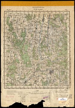
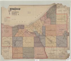
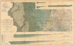
Relief shown by spot heights. Includes map showing the location of coal locations, coal features, and railroads, as well as geological cross sections for sev...
Call Number:
G4093.S8H9 1898 .A84
Caption:
Imprint: Indianapolis, Ind. : Wm. B. Burford, [1899]
Physical Description:
Scale: Approximately 1:126,720. 2 miles = 1 inch. Vertical scale approximately 1:4,800. 1 inch = 400 feet and Dimensions: 48 x 78 cm
Alternate Identifier:
Alternate ID: 390726IP and Title Control Number: a18265344
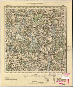
Relief shown by spot heights. Includes map showing coal locations and features, and quarries as well as vertical cross-sections through center of Township 3 ...
Call Number:
G4093.P4H9 1898 .A84
Caption:
Imprint: Indianapolis : Burford, [1899]
Physical Description:
Dimensions: 48 x 78 cm and Scale: Approximately 1:126,720. 1 inch = 2 miles. Vertical scale approximately 1:4,800. 1 inch = 400 feet
Alternate Identifier:
Title Control Number: a18175917 and Alternate ID: 390726IP