Geographic Subject: Gibson County (Ind.), Geographic Subject: Wabash County (Ill.), Geographic Subject: Lawrence County (Ill.), and Geographic Subject: Knox ...
Creator:
Marshall, R. B. (Robert Bradford), 1867-1949, Geological Survey (U.S.), Tweedy, Frank, 1854-1937, United States. Army. Corps of Engineers, Illinois State Geo...
Publisher:
Geological Survey (U.S.)
Date Created:
1944
Identifier:
VAC3073-M-01508
Genre:
Topographic maps, 15 minute topographic maps, and Quadrangle maps
Engraved Mar. 1903 by U.S.G.S. , Jno. H. Renshawe, geographer in charge , control by Geo. T. Hawkins , topography by Chas. W. Goodlove. Relief shown by conto...
Call Number:
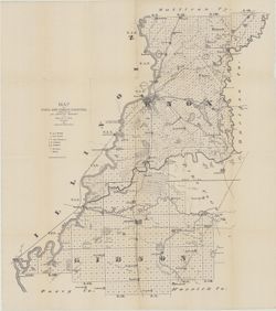
G4090 s62 .G4 Haubstadt 1903 R1935
Caption:
Imprint: [Washington, D.C.] : U.S. Geological Survey, 1935
Physical Description:
Dimensions: 45 x 42 cm or smaller and Scale: 1:62,500
Geographic Subject: Gibson County (Ind.), Geographic Subject: Knox County (Ind.), Geographic Subject: Wabash County (Ill.), and Topical Subject: Vegetation m...
Creator:
Geological Survey (U.S.), United States. Army Map Service, and Illinois State Geological Survey
Publisher:
Geological Survey (U.S.)
Date Created:
1965
Identifier:
VAC3073-M-01504
Genre:
Topographic maps, 15 minute topographic maps, and Quadrangle maps
Mapped, edited and published by the Geological Survey , Illinois area mapped in cooperation with State of Illinois Geological Survey. Filing title: Princeton...
Mapped, edited and published by the Geological Survey , Illinois area mapped in cooperation with State of Illinois Geological Survey. Filing title: Princeton...
Geographic Subject: Posey County (Ind.), Geographic Subject: Gibson County (Ind.), Geographic Subject: White County (Ill.), Geographic Subject: Vanderburgh C...
Creator:
Hawkins, Geo. T. (George T.), Geological Survey (U.S.), Renshawe, John H., and Goodlove, C. W.
Publisher:
Geological Survey (U.S.)
Date Created:
1921
Identifier:
VAC3073-M-01419
Genre:
30 minute topographic maps, Topographic maps, and Quadrangle maps
Jno. H. Renshawe, geographer in charge , control by Geo. T. Hawkins , topography by Chas. W. Goodlove , engraved June 1903 by U.S.G.S. Relief shown by contou...
Call Number:
G4090 s125 .G4 Patoka 1903 rep1921
Caption:
Imprint: [Washington, D.C.] : U.S. Geological Survey, 1921
Geographic Subject: White County (Ill.), Geographic Subject: Edwards County (Ill.), Geographic Subject: Knox County (Ind.), Geographic Subject: Posey County ...
Creator:
Goodlove, C. W., Hawkins, Geo. T. (George T.), Geological Survey (U.S.), and Renshawe, John H.
Publisher:
Geological Survey (U.S.)
Date Created:
1903
Identifier:
VAC3073-M-01418
Genre:
30 minute topographic maps, Quadrangle maps, and Topographic maps
Jno. H. Renshawe, geographer in charge , control by Geo. T. Hawkins , topography by Chas. W. Goodlove , engraved June 1903 by U.S.G.S. Relief shown by contou...
Call Number:
G4090 s125 .G4 Patoka 1903
Caption:
Imprint: [Washington, D.C.] : U.S. Geological Survey, [1903]
Indiana, 30 minute series (topographic). Filing title: Ditney, Ind. Jno. H. Renshawe, geographer in charge , topography by H.B. Blair, R.C. McKinney, and Cha...
Indiana, 30 minute series (topographic). Filing title: Ditney, Ind. Jno. H. Renshawe, geographer in charge , topography by H.B. Blair, R.C. McKinney, and Cha...
Geographic Subject: Wabash County (Ill.), Topical Subject: Vegetation mapping, Geographic Subject: Lawrence County (Ill.), Geographic Subject: Gibson County ...
Creator:
Geological Survey (U.S.)
Publisher:
Geological Survey (U.S.)
Date Created:
1958
Identifier:
VAC3073-M-01412
Genre:
Quadrangle maps, Topographic maps, and 15 minute topographic maps

![Indiana-Illinois, Vincennes quadrangle : topography [1944 printing without vegetation]](https://iiif.uits.iu.edu/iiif/2/5425mf004%2Ffiles%2Fed25173c-f2ac-49e5-986c-99cf4220f9c3/full/250,/0/default.jpg)
![Indiana Haubstadt quadrangle [1935 reprint]](https://iiif.uits.iu.edu/iiif/2/1544cr71r%2Ffiles%2F5aabf650-fa83-48d4-bdcd-7579f3c6501a/full/250,/0/default.jpg)
![Princeton quadrangle, Indiana-Illinois : 15 minute series (topographic) [1965 reprint with vegetation]](https://iiif.uits.iu.edu/iiif/2/7m01cp47j%2Ffiles%2Fdc826735-24b7-4c3f-9d9b-87ad67efd7e8/full/250,/0/default.jpg)
![Princeton quadrangle, Indiana-Illinois : 15 minute series (topographic) [1965 printing without vegetation]](https://iiif.uits.iu.edu/iiif/2/70796d47m%2Ffiles%2Fedc5c6d4-9f41-4b7c-9447-a370bfe906e0/full/250,/0/default.jpg)
![Indiana-Illinois Patoka quadrangle [1921 reprint]](https://iiif.uits.iu.edu/iiif/2/t435hg288%2Ffiles%2F74c3c556-9b7b-4cea-8524-77cc4573da67/full/250,/0/default.jpg)
![Indiana-Illinois Patoka quadrangle [1903 print]](https://iiif.uits.iu.edu/iiif/2/697004346%2Ffiles%2Fa8ce9ba2-6345-47f5-8aa5-e6adddaad8fd/full/250,/0/default.jpg)
![Indiana, Ditney quadrangle [1936 reprint]](https://iiif.uits.iu.edu/iiif/2/6108wd72k%2Ffiles%2Fb445f2c6-cbee-44ef-907e-13b38773b333/full/250,/0/default.jpg)
![Indiana, Ditney quadrangle [1902 printing]](https://iiif.uits.iu.edu/iiif/2/pr76g7157%2Ffiles%2F6b2150ed-f127-4bd5-ab33-87b0e9707424/full/250,/0/default.jpg)
![Indiana-Illinois, Vincennes quadrangle : topography [1958 reprint with vegetation]](https://iiif.uits.iu.edu/iiif/2/bv73d371v%2Ffiles%2Fd8eeacfe-4380-4ba5-814d-cbf9ec40a053/full/250,/0/default.jpg)
