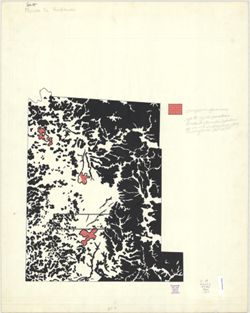
Geographic Subject: Greene County (Ind.), Topical Subject: Vegetation mapping, Geographic Subject: Martin County (Ind.), Geographic Subject: Monroe County (I...
Creator:
McKinley, W. K. (William Klett), 1891-1964 and Geological Survey (U.S.)
Publisher:
Geological Survey (U.S.)
Date Created:
1960
Identifier:
VAC3073-M-01372
Genre:
15 minute topographic maps, Quadrangle maps, and Topographic maps
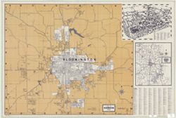
Title on wrapper: Bloomington, including Monroe County and Indiana University. Insets: Map of Monroe County, Indiana -- [Map of Indiana University]. ...
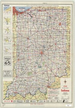
Panel title: 1960 Indiana official highway map. Includes 5 local route maps. Includes index, U.S. distance map, mileage chart, color illustrations, index and...
Call Number:
G4091.P2 1960 .I53
Caption:
Imprint: [Indianapolis] : State Highway Department of Indiana, [1960]
Physical Description:
Scale: Approximately 1:633,600 and Dimensions: 94 x 59 cm


![Indiana Oolitic quadrangle : 15-minute series [1960 reprint with vegetation]](https://iiif.uits.iu.edu/iiif/2/r207vs27b%2Ffiles%2F9aee9db3-93e4-41e1-9ed6-b3a8d5c9e95c/full/250,/0/default.jpg)

![Van Buren Township, [Monroe County, Indiana]](https://iiif.uits.iu.edu/iiif/2/t148gk22c%2Ffiles%2F0702bb5b-5263-4741-9365-b7eacb14395d/full/250,/0/default.jpg)
![Geology [Monroe County, Ind.]](https://iiif.uits.iu.edu/iiif/2/qv33t0191%2Ffiles%2F7a237c59-b869-4ad6-928c-c058aa8367af/full/250,/0/default.jpg)