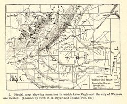
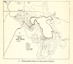
Caption title: Glacial map showing moraines in which Lake Eagle and the city of Warsaw are located. Relief shown by profile. Includes geological profile of r...
Call Number:
QE109 .A2 1903
Caption:
Imprint: [Indianapolis] : [Wm. B. Burford], [1904] and Imprint: [Indianapolis] : [Indiana Department of Geology and Natural Resources], [1904]
Physical Description:
Dimensions: 8 x 11 cm and Scale: Approximately 1:2,476,000. Vertical scale indeterminable
Alternate Identifier:
Alternate ID: 390726IP and Title Control Number: a18418361
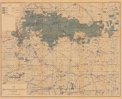
"January 1, 1904." Shows good, fair, and light oil territory, gas territory, dry or salt water territory, and pumping stations. Detached from: T...
Call Number:
G4091.H8 1903 .B5
Caption:
Imprint: [Indianapolis] : Department of Geology and Natural Resources of Indiana,[1904] and Imprint: Indianapolis, Ind. : Wm. B. Burford, [1904]
Physical Description:
Dimensions: 53 x 67 cm, folded to 22 x 12 cm and Scale: Approximately Scale 1:126,720. 2 miles = 1 in.
Alternate Identifier:
Alternate ID: 390726IP and Title Control Number: a16077757
Topical Subject: Classification, Topical Subject: Soils, and Geographic Subject: Scott County (Ind.)
Creator:
Mangum, A. W.
Publisher:
United States. Bureau of Soils
Date Created:
1904
Identifier:
VAC3073-M-00998
Genre:
Thematic maps
Geographic Location:
Coordinates: W0855400 W0853400 N0385000 N0383400
Related URL:
Catalog URL: https://iucat.iu.edu/catalog/2874180
Abstract:
Shows soil types classification by colors and symbols. "Field Operations, Bureau of Soils, 1904." "Andrew B. Graham Co. Lithographers Washingt...
Call Number:
G4093 .S3J3 1904 .M36
Caption:
Imprint: [Washington, D.C.?] : The Bureau, [1904?]
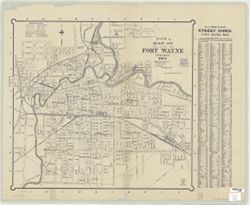
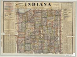
Shows county boundaries. Title supplied by cataloger. Place of publication from U.S. Copyright Office. Catalogue of title entries of books and other articl...
Call Number:
G4091 .A1 1904 .C64
Caption:
Imprint: [Salem, Ind.?] : Lotus D. Coffman, [1904]
Physical Description:
Scale: Scale not given. and Dimensions: 33 x 24 cm
Topical Subject: Soils, Geographic Subject: Spencer County (Ind.), Geographic Subject: Warrick County (Ind.), Geographic Subject: Boonville (Ind.), and Topic...
Creator:
Mangum, A. W.
Publisher:
United States. Bureau of Soils
Date Created:
1904
Identifier:
VAC3073-M-00804
Genre:
Thematic maps
Geographic Location:
Coordinates: W0871000 W0870000 N0380500 N0374600
Related URL:
Catalog URL: https://iucat.iu.edu/catalog/2874208
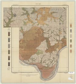
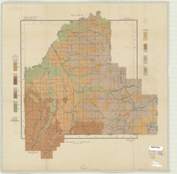
Abstract:
Relief shown by contours. Map covers portions of Spencer and Warrick Counties in Indiana. Shows soil types classification by colors and symbols. "Field ...
Call Number:
G4093 .S5J3 1904 .M36
Caption:
Imprint: [Washington, D.C.?] : The Bureau, [1904?]


![[Indiana]](https://iiif.uits.iu.edu/iiif/2/0c484n78s%2Ffiles%2F65958835-c3fd-42a1-9953-47d4a5e4e300/full/250,/0/default.jpg)