Indiana University
Indiana University
IU
Skip to Content
Digital Collections
Toggle navigation
Digital
Collections
Switch language
English
Switch language
Deutsch
English
Español
Français
Italiano
Português do Brasil
中文
Login
Home
About
Contact
Search Digital Collections
Go
×
Search Constraints
Start Over
You searched for:
Date Created
1958
Remove constraint Date Created: 1958
Holding Location
B-WELLS
Remove constraint Holding Location: B-WELLS
« Previous |
1
-
10
of
12
|
Next »
Sort by relevance ▼
relevance ▼
recently updated
title ▲
title ▼
date created ▲
date created ▼
pages ▲
pages ▼
collection size ▲
collection size ▼
Number of results to display per page
10 per page
10
per page
20
per page
50
per page
100
per page
View results as:
List
Gallery
Masonry
Search Results
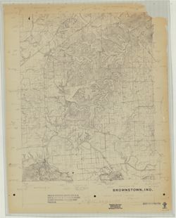
Brownstown, Ind. [Advance printing]
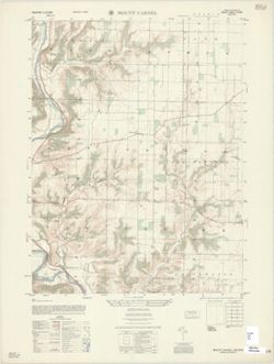
Mount Carmel : Indiana 1:25,000
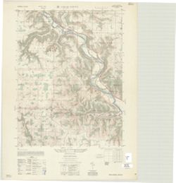
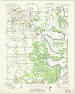
Cedar Grove : Indiana 1:25,000
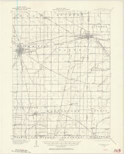
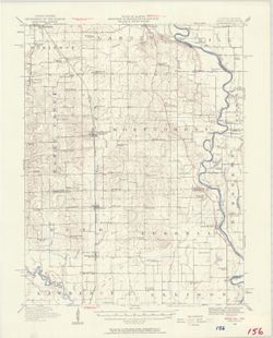
Indiana-Ohio, Winchester Quadrangle [1958 reprint]
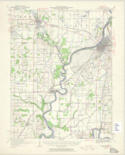
Indiana-Illinois, Vincennes quadrangle : topography [1958 reprint with vegetation]
Indiana, 15 minute series (topographic), New Haven quadrangle [1958 printing with vege...
Illinois-Indiana Birds quadrangle : topography [1958 reprint]
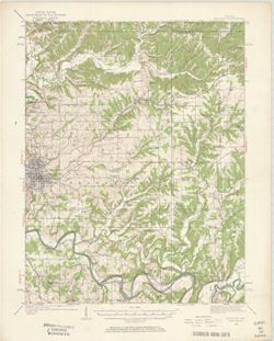
Indiana Bedford quadrangle [1958 reprint with vegetation]
Indiana University Bloomington campus
Official thoroughfare plan for Marion County, Indiana
« Previous
Next »
1
2
Toggle facets
Limit your search
Type
Image
12
Creator
Geological Survey (U.S.)
5
Herron, W. H. (William Harrison), 1865-
2
United States. Army Map Service
2
EROS Data Center
1
Ellis, J. R. (Topographer)
1
Graff, Fred, Jr.
1
Harrison, R. L. (Topographer)
1
Illinois State Geological Survey
1
Kilmartin, J. O. (Jerome O'Farrell), 1900-1979
1
Mahone, Geo. W.
1
more
Creators
»
Subject
Topical Subject: Vegetation mapping
3
Geographic Subject: Franklin County (Ind.)
2
Geographic Subject: Jackson County (Ind.)
2
Geographic Subject: Knox County (Ind.)
2
Geographic Subject: Washington County (Ind.)
2
Geographic Subject: Bloomington (Ind.)
1
Geographic Subject: Crawford County (Ill.)
1
Geographic Subject: Darke County (Ohio)
1
Geographic Subject: Dearborn County (Ind.)
1
Geographic Subject: Gallatin County (Ill.)
1
more
Subjects
»
Publisher
Geological Survey (U.S.)
5
United States. Army Map Service
2
EROS Data Center
1
Indiana. Geological Survey
1
Marion County (Ind.). Metropolitan Planning Department
1
United States. Forest Service
1
[Indiana University?]
1
Date Created
1958
[remove]
12
Pages
0-99 pages
12
Collections
Indiana Historic Maps
12
State
deposited
12
Campus
IUB
12
Holding Location
B-WELLS
[remove]
12
Provenance
Part of Geological Survey (U.S.). Indiana 1:62,500.
5
Part of United States. Army Map Service, Indiana 1:25,000.
2