Geographic Subject: Johnson County (Ind.), Geographic Subject: Shelby County (Ind.), Geographic Subject: Bartholomew County (Ind.), and Topical Subject: Vege...
Creator:
Geological Survey (U.S.) and United States. Army. Corps of Engineers
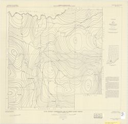
Filing title: Franklin, Ind. Mapped, edited, and published by Geological Survey. Edition of 1950. Polyconic projection. Relief shown by contours and spot hei...
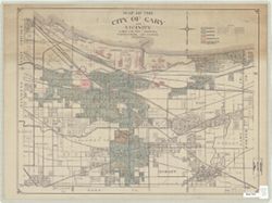
Geographic Subject: Lake County (Ind.), Topical Subject: Land use, Geographic Subject: Gary (Ind.), and Geographic Subject: Gary Region (Ind.)
Creator:
Guiney, Donald
Publisher:
[publisher not identified]
Date Created:
1950
Identifier:
VAC3073-M-00712
Genre:
Thematic maps
Geographic Location:
Coordinates: W0872601 W0871319 N0413919 N0413118
Related URL:
Catalog URL: https://iucat.iu.edu/catalog/7314939
Abstract:
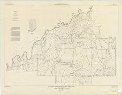
Title supplied by cataloger. Produced as a class project in the Indiana University, Geography Department. Land use hand colored in colored pencil. Base map: ...
Call Number:
G4094.G2G4 1950 .G85
Caption:
Imprint: [Place of publication not identified]: [publisher not identified], [195-?]

![Edinburg Quadrangle Indiana : 15 minute series (topographic) [1950 printing with vegetation]](https://iiif.uits.iu.edu/iiif/2/4b29c880r%2Ffiles%2F58f84ee1-c680-40d2-9a78-baf3613c076f/full/250,/0/default.jpg)

![Franklin Quadrangle Indiana : 15 minute series (topographic) [1950 printing without vegetation]](https://iiif.uits.iu.edu/iiif/2/gq67kv050%2Ffiles%2F1b2dc3c9-fa67-4787-9ad0-8c7dd5aad08b/full/250,/0/default.jpg)
![Indiana Porter quadrangle [1950 reprint]](https://iiif.uits.iu.edu/iiif/2/v692v944q%2Ffiles%2Fb084bc69-a329-42a5-a2f8-741c2958c149/full/250,/0/default.jpg)