
Search Constraints
« Previous |
1 - 10 of 36
|
Next »
Search Results
-
- Subject:
- Topical Subject: IGS Annual Reports, Topical Subject: Road materials, Topical Subject: Gravel, Topical Subject: Quarries and quarrying, and Geographic Subjec...
- Publisher:
- Indiana. Department of Geology and Natural Resources
- Date Created:
- 1906
- Identifier:
- VAC3073-M-01589
- Genre:
- Thematic maps
- Geographic Location:
- Coordinates: W0864109 W0861450 N0393801 N0392020
- Related URL:
- Catalog URL: https://iucat.iu.edu/catalog/18299115
- Abstract:
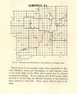
- Alternate title: Morgan Co. Title from caption. At head of title: Fig. 45. Detached from: The roads and road materials of a portion of southwestern Indian...
- Call Number:
- G4093.M9H5 1905 .M67
- Caption:
- Imprint: [Indianapolis] : [Indiana Dept. of Geology and Natural Resources], [1906]
- Physical Description:
- Scale: Approximately 1:366,300 and Dimensions: on sheet 17 x 14 cm
- Alternate Identifier:
- Alternate ID: 390726IP and Title Control Number: a18299115
- Persistent URL:
- https://purl.dlib.indiana.edu/iudl/images/VAC3073/VAC3073-M-01589
- Provenance:
- 30th Annual Report (1905) / Indiana. Department of Geology and Natural Resources.
-
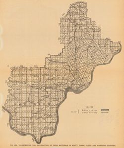
- Subject:
- Topical Subject: IGS Annual Reports, Topical Subject: Mines and mineral resources, Topical Subject: Road materials, and Geographic Subject: Monroe County (Ind.)
- Publisher:
- Indiana. Department of Geology and Natural Resources
- Date Created:
- 1906
- Identifier:
- VAC3073-M-01160
- Genre:
- Geological maps
- Geographic Location:
- Coordinates: W0864107 W0861903 N0392122 N0385936
- Related URL:
- Catalog URL: https://iucat.iu.edu/catalog/18299087
- Abstract:
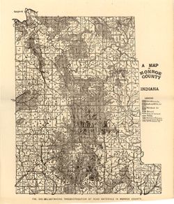
- Alternate title: Illustrating the distribution of road materials in Monroe County. At head of alternate title: Fig. 53B. Shows roads, limestone, gravel, sand...
- Call Number:
- G4093.M7H5 1905 .M3
- Caption:
- Imprint: [Indianapolis] : [Indiana Dept. of Geology and Natural Resources], [1906]
- Physical Description:
- Scale: Approximately 1:171,000 and Dimensions: 26 x 22 cm
- Alternate Identifier:
- Alternate ID: 390726IP and Title Control Number: a18299087
- Persistent URL:
- https://purl.dlib.indiana.edu/iudl/images/VAC3073/VAC3073-M-01160
- Provenance:
- 30th Annual Report (1905) / Indiana. Department of Geology and Natural Resources.
-
- Subject:
- Geographic Subject: Washington County (Ind.), Topical Subject: Quarries and quarrying, Geographic Subject: Orange County (Ind.), Topical Subject: Road materi...
- Publisher:
- Indiana. Department of Geology and Natural Resources
- Date Created:
- 1906
- Identifier:
- VAC3073-M-01140
- Genre:
- Maps
- Geographic Location:
- Coordinates: W0864102 W0854203 N0384710 N0382349
- Related URL:
- Catalog URL: https://iucat.iu.edu/catalog/18299120
- Abstract:
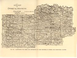
- Alternate title: Illustrating the roads and distribution of road materials in Orange and Washington counties. At head of title: Fig. 53A. Shows macadam quarr...
- Call Number:
- G4093.O6P2 1905 .R6
- Caption:
- Imprint: [Indianapolis] : [Indiana Dept. of Geology and Natural Resources], [1906]
- Physical Description:
- Dimensions: 16 x26 cm and Scale: Approximately 1:288,000
- Alternate Identifier:
- Alternate ID: 390726IP and Title Control Number: a18299120
- Persistent URL:
- https://purl.dlib.indiana.edu/iudl/images/VAC3073/VAC3073-M-01140
- Provenance:
- 30th Annual Report (1905) / Indiana. Department of Geology and Natural Resources.
-
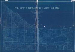
- Subject:
- Geographic Subject: Lake County (Ind.)
- Creator:
- F.L. Knight & Sons
- Publisher:
- F.L. Knight & Sons
- Date Created:
- 1906
- Identifier:
- VAC3073-M-01029
- Genre:
- Maps
- Geographic Location:
- Coordinates: W0873200 W0871300 N0414200 N0411000
- Related URL:
- Catalog URL: https://iucat.iu.edu/catalog/6080984
- Abstract:
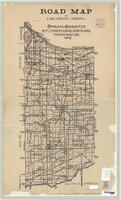
- "Small figures represent rural routes."
- Call Number:
- G4093.L3 1906 .F576
- Caption:
- Imprint: Crown Point, Ind. : F.L. Knight & Sons, [1906]
- Physical Description:
- Scale: 1:130,000 and Dimensions: 49 x 21 cm, on sheet 56 x 34 cm
- Alternate Identifier:
- Title Control Number: a6080984
- Persistent URL:
- https://purl.dlib.indiana.edu/iudl/images/VAC3073/VAC3073-M-01029
-
- Subject:
- Geographic Subject: Lake County (Ind.), Geographic Subject: Calumet Region (Ill. and Ind.), Topical Subject: Landowners, Topical Subject: Real property, and ...
- Creator:
- F.L. Knight & Sons
- Publisher:
- F.L. Knight & Sons
- Date Created:
- 1906
- Identifier:
- VAC3073-M-00938
- Genre:
- Cadastral maps
- Geographic Location:
- Coordinates: W0873014 W0871640 N0414147 N0413236
- Related URL:
- Catalog URL: https://iucat.iu.edu/catalog/4896961
- Abstract:
- Cadastral map showing landowners.
- Call Number:
- G4093 .L3G46 1906 .F575
- Caption:
- Imprint: Crown Point, Ind. : F. L. Knight & Sons, 1906.
- Physical Description:
- Scale: 1:19,800 and Dimensions: 91 x 136 cm
- Alternate Identifier:
- Title Control Number: a4896961
- Persistent URL:
- https://purl.dlib.indiana.edu/iudl/images/VAC3073/VAC3073-M-00938
-
- Subject:
- Geographic Subject: Scott County (Ind.), Geographic Subject: Harrison County (Ind.), Topical Subject: Geology, Topical Subject: IGS Annual Reports, Geographi...
- Publisher:
- Indiana. Department of Geology and Natural Resources
- Date Created:
- 1906
- Identifier:
- VAC3073-M-00911
- Genre:
- Thematic maps
- Geographic Location:
- Coordinates: W0861948 W0852403 N0384955 N0375700
- Related URL:
- Catalog URL: https://iucat.iu.edu/catalog/18299034
- Abstract:
- Shows gravel locations. At head of title: Fig. 49A. Detached from: The roads and road materials of a portion of southwestern Indiana / A.E. Taylor. In Ind...
- Call Number:
- G4093.S3H5 1905 .I4
- Caption:
- Imprint: [Indianapolis] : [Indiana Dept. of Geology and Natural Resources], [1906]
- Physical Description:
- Scale: Approximately 1:371,000 and Dimensions: on sheet 27 x 23 cm
- Alternate Identifier:
- Alternate ID: 390726IP and Title Control Number: a18299034
- Persistent URL:
- https://purl.dlib.indiana.edu/iudl/images/VAC3073/VAC3073-M-00911
- Provenance:
- 30th Annual Report (1905) / Indiana. Department of Geology and Natural Resources.
-
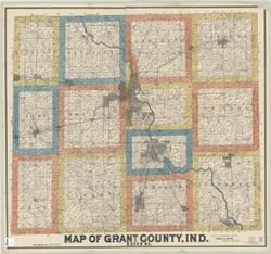
- Subject:
- Geographic Subject: Grant County (Ind.), Topical Subject: Real property, and Topical Subject: Landowners
- Creator:
- Smith, Ansel R.
- Publisher:
- Smith, Ansel R.
- Date Created:
- 1906
- Identifier:
- VAC3073-M-00872
- Genre:
- Cadastral maps
- Geographic Location:
- Coordinates: W0855153 W0852639 N0403913 N0402242
- Related URL:
- Catalog URL: https://iucat.iu.edu/catalog/7065595
- Abstract:
- Cadastral map showing landowners. "F.W. White, draftsman."
- Call Number:
- G4093.G6G46 1906 .S65
- Caption:
- Imprint: Marion, Ind. : Ansel R. Smith, 1906.
- Physical Description:
- Dimensions: 105 x 115 cm and Scale: 1:31,680
- Alternate Identifier:
- Title Control Number: a7065595
- Persistent URL:
- https://purl.dlib.indiana.edu/iudl/images/VAC3073/VAC3073-M-00872
-
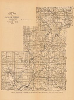
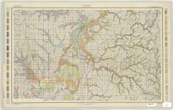
- Subject:
- Geographic Subject: Owen County (Ind.), Topical Subject: Macadam roads, Geographic Subject: Greene County (Ind.), Topical Subject: IGS Annual Reports, Topica...
- Publisher:
- Indiana. Department of Geology and Natural Resources
- Date Created:
- 1906
- Identifier:
- VAC3073-M-00739
- Genre:
- Geological maps and Thematic maps
- Geographic Location:
- Coordinates: W0871431 W0863820 N0392826 N0385418
- Related URL:
- Catalog URL: https://iucat.iu.edu/catalog/18299126
- Abstract:
- Alternate title: Illustrating the roads and distribution of road materials in Owen and Greene counties. At head of alternate title: Fig. 51A. Shows macadam q...
- Call Number:
- G4093.O8P2 1905 .R6
- Caption:
- Imprint: [Indianapolis] : [Indiana Dept. of Geology and Natural Resources], [1906]
- Physical Description:
- Dimensions: 30 x 26 cm and Scale: Approximately 1:216,000
- Alternate Identifier:
- Alternate ID: 390726IP and Title Control Number: a18299126
- Persistent URL:
- https://purl.dlib.indiana.edu/iudl/images/VAC3073/VAC3073-M-00739
- Provenance:
- 30th Annual Report (1905) / Indiana. Department of Geology and Natural Resources.
-
- Subject:
- Geographic Subject: Greene County (Ind.), Topical Subject: Classification, and Topical Subject: Soils
- Creator:
- Tharp, W. E. (William Edgar)
- Publisher:
- United States. Bureau of Soils
- Date Created:
- 1906
- Identifier:
- VAC3073-M-00708
- Genre:
- Thematic maps
- Geographic Location:
- Coordinates: W0871427 W0864055 N0391018 N0385408
- Related URL:
- Catalog URL: https://iucat.iu.edu/catalog/2870411
- Abstract:
- Shows soil types by colors and symbols.
- Call Number:
- G4093 .G7J3 1906 .T4
- Caption:
- Imprint: [Washington, D.C.?] : The Bureau, [1906?]
- Physical Description:
- Scale: 1:63,360 and Dimensions: 49 x 77 cm
- Alternate Identifier:
- Title Control Number: CAY3035BB
- Persistent URL:
- https://purl.dlib.indiana.edu/iudl/images/VAC3073/VAC3073-M-00708
-
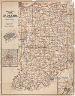
- Subject:
- Geographic Subject: Indiana and Topical Subject: Roads
- Creator:
- C.S. Mendenhall (Firm)
- Publisher:
- C.S. Mendenhall (Firm)
- Date Created:
- 1906
- Identifier:
- VAC3073-M-00687
- Genre:
- Road maps
- Geographic Location:
- Coordinates: W0880700 W0844500 N0414500 N0375200
- Related URL:
- Catalog URL: https://iucat.iu.edu/catalog/4662041
- Abstract:
- Insets: Marion County, Ind.--New Albany, Jeffersonville and louisville District. Includes 20 p. text describing 163 different tour routes.
- Call Number:
- G4091.P2 1906 .C74
- Caption:
- Imprint: Cincinnati : C.S. Mendenhall, [1906]
- Physical Description:
- Scale: 1:550,000 and Dimensions: 89 x 68 cm
- Alternate Identifier:
- Title Control Number: CAG9468BB
- Persistent URL:
- https://purl.dlib.indiana.edu/iudl/images/VAC3073/VAC3073-M-00687

- « Previous
- Next »
- 1
- 2
- 3
- 4