Topical Subject: Vegetation mapping, Geographic Subject: Saint Joseph County (Mich.), Geographic Subject: Cass County (Mich.), and Geographic Subject: Elkhar...
Creator:
Michigan. State Highway Department and Geological Survey (U.S.)
Publisher:
Geological Survey (U.S.)
Date Created:
1973
Identifier:
VAC3073-M-01507
Genre:
15 minute topographic maps, Quadrangle maps, and Topographic maps
Mapped, edited, and published by the Geological Survey. Filing title: Vandalia, Mich.-Ind. Standard map series designation: AMS (Series) V762 3867 IV. [Editi...
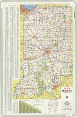
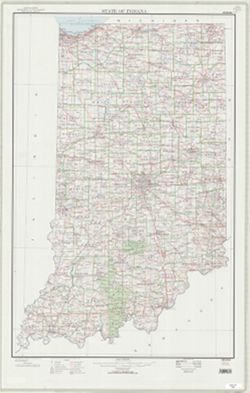
Panel title: 1973-74 Indiana official highway map. Relief shown by spot heights. Includes index of cities and towns, mileage chart, and text. On verso: index...
Call Number:
G1403 .S7 1973-1974
Caption:
Imprint: [Indianapolis] : State Highway Commission, [1973]
Physical Description:
Scale: Approximately 1:633,600 and Dimensions: 94 x 59 cm
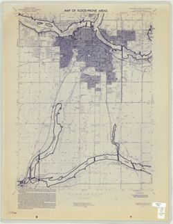
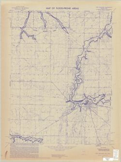
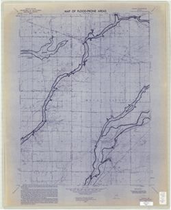
Geographic Subject: Madison County (Ind.), Topical Subject: Floodplains, Geographic Subject: Anderson Region (Ind.), Topical Subject: Floods, and Topical Sub...
Creator:
Geological Survey (U.S.)
Publisher:
Geological Survey (U.S.)
Date Created:
1973
Identifier:
VAC3073-M-01007
Genre:
Topographic maps, Quadrangle maps, and 7.5 minute topographic maps
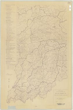
Filing title: Anderson South, Ind. Relief shown by contours and spot heights. Contour interval 10 feet. Includes quadrangle location map. Flood prone areas a...
Filing title: Gilman, Ind. Relief shown by contours and spot heights. Contour interval 10 feet. Shows portions of Delaware and Madison counties, Indiana. Flo...
Compiled in 1970. Includes population key. Source data U.S. Dept. of the Interior - Geological Survey topographic maps. U.S. Dept of the Army - Corps of Engi...
Call Number:
G4091.C2 1973 .G4
Caption:
Imprint: [Reston, Va.] : U.S. Geological Survey, 1973

![Vandalia quadrangle, Michigan-Indiana : 15 minute series (topographic) [1973 reprint with vegetation]](https://iiif.uits.iu.edu/iiif/2/0g355j55q%2Ffiles%2F59353208-0771-4acc-8e57-7c989a623800/full/250,/0/default.jpg)